Forillon National Park is a stunningly beautiful park in Québec’s Gaspésie region, where the mountains plunge directly into the St Lawrence Gulf. The park includes a rich variety of ecosystems including dense forests, sea cliffs, mountains, wetlands and marshes. The park also marks the Appalachians’ northernmost (and easternmost) tip of continental North America. Forillon is renowned for its beautiful hiking and walking trails, sea kayaking and wildlife viewing. Below we will present our list of the Best Hiking Trails and Activities in Forillon National Park. Regarding the hiking trails, we will focus on day hikes that we believe maximize the effort-to-reward ratio.
Disclosure: This page (Best Hiking Trails and Activities in Forillon National Park) may contain product affiliate links. At no additional cost to you, we may receive a commission for purchases made through these links. More details can be found on our disclosure and policies page.
You might also be interested in these pages:
Gaspésie Best Attractions and Road Trip Itinerary
10 Awesome Hiking Trails to Discover in Gaspésie
Best Things to See and Do Percé
Gaspésie’s Most Beautiful Lighthouses


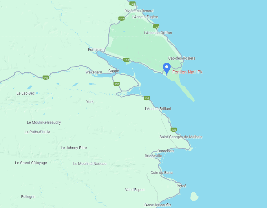
Forillon National Park Location
Forillon National Park is located at the northeastern tip of the Gaspé Peninsula, roughly 100km north of the town of Percé. Forillon National Park is a must-visit destination as part of any Gapésie Road Trip Itinerary.
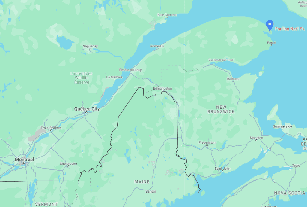
The national park is about 900 km from Montreal, about a 10-hour drive away. It’s just under 700 km from Québec city, about a 7h30 drive away.
An alternative way to get close to the national park is to take a bus with Orléans Express from either Montreal, Ottawa or Québec City to the nearby town of Gaspé, Gaspésie’s largest town with a population of about 15,000. However, you’ll be limited in your ability to visit Forillon National Park afterwards if you don’t rent a car, as the area is best explored with your own or rented vehicle. Public transportation options in Gaspésie are limited and infrequent given the region’s low population density.
If you need to book a rental vehicle, we highly recommend using Discover Cars to get the best rates on your rental in Montreal.
We also highly recommend Airalo (eSIM card) for your connectivity needs when travelling abroad. Airalo is the world’s first and largest eSIM store with eSIM plans for 200+ countries and regions worldwide.
You can also fly directly from Québe City to Gaspé Airport (YGP). Montreal only has direct flights to Bonaventure Airport, which is about 3 hours from Gaspé.
Gas Stations
Though there are no gas stations in Forillon National Park, there are several of them just outside of the park limits. You are at most a 25-minute drive from a gas station from any road within the national park.
About Forillon National Park
Forillon National Park is one of 42 Canadian National Parks and is located at the outer tip of the Gaspé Peninsula of Quebec, covering 244 km2 (94 sq mi).
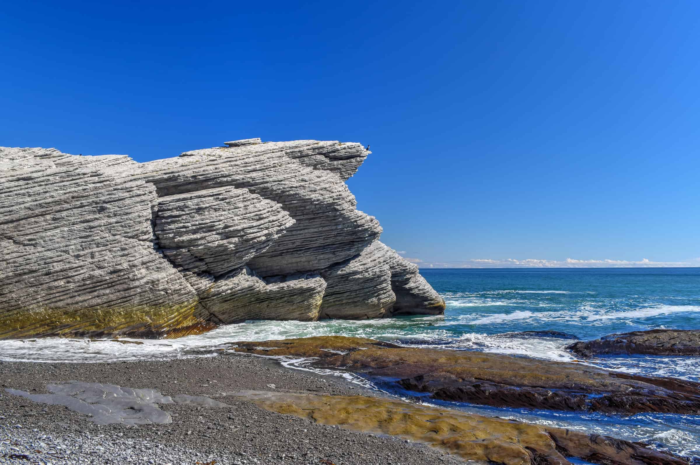
Created in 1970, Forillon was the first Canadian National Park in Quebec. The park includes forests, sea coast, salt marshes, cliffs, and the Eastern End of the Appalachians. The word “Forillon” is thought to have referred to a flowerpot island or sea stack which used to be a landmark in the area, but has since collapsed into the ocean due to erosion.
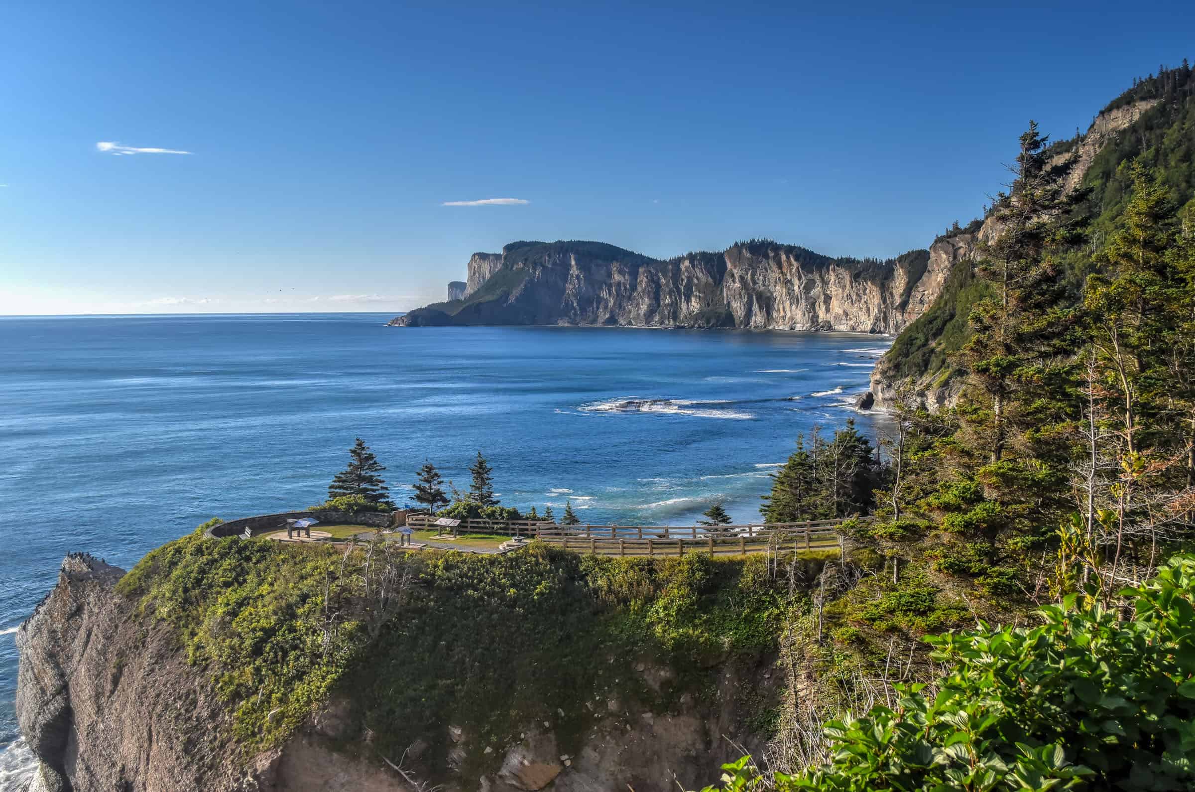
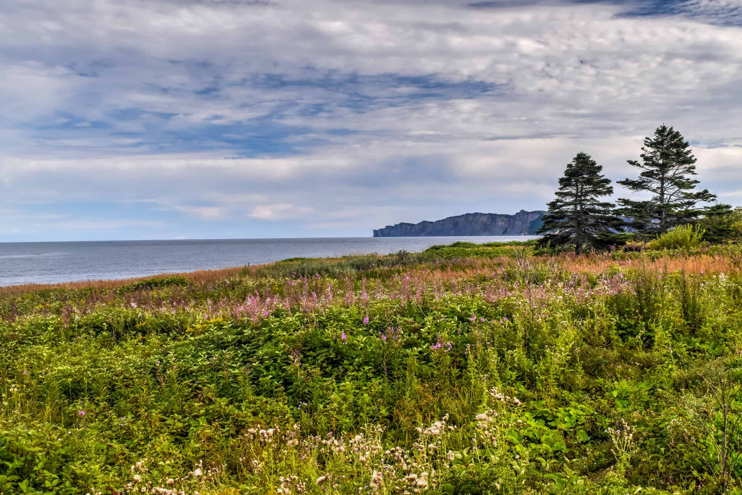
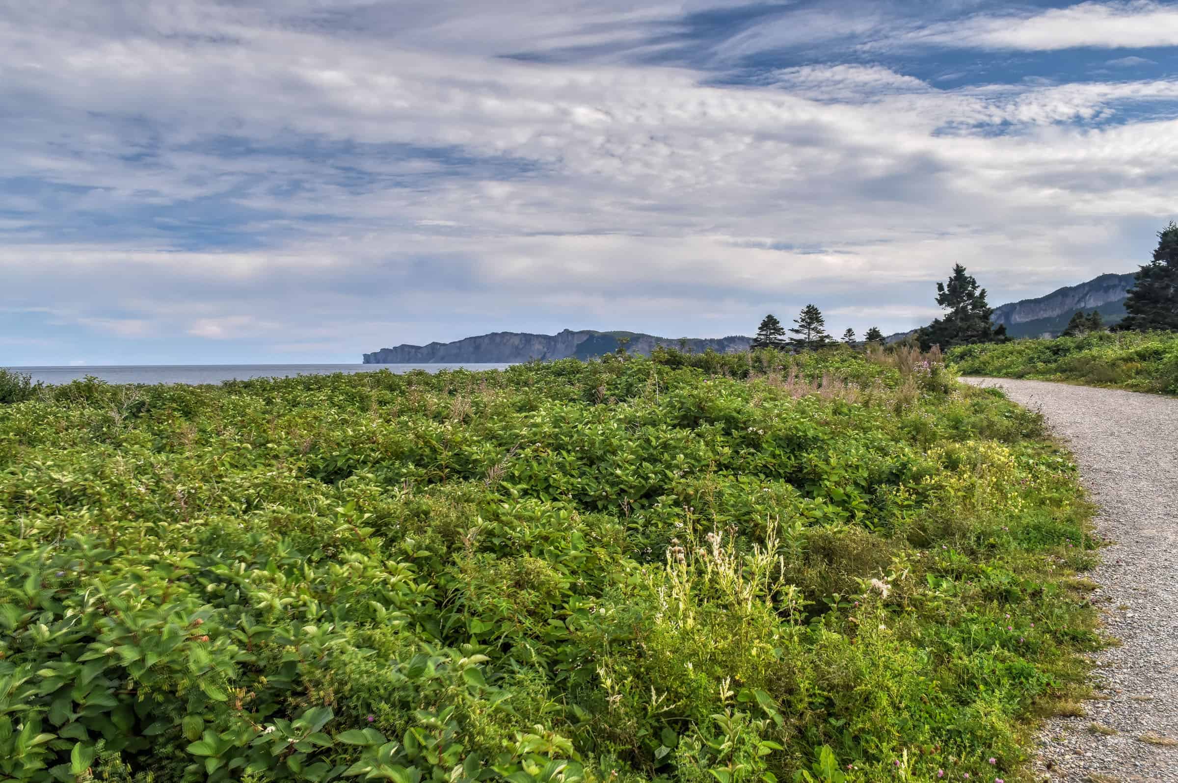
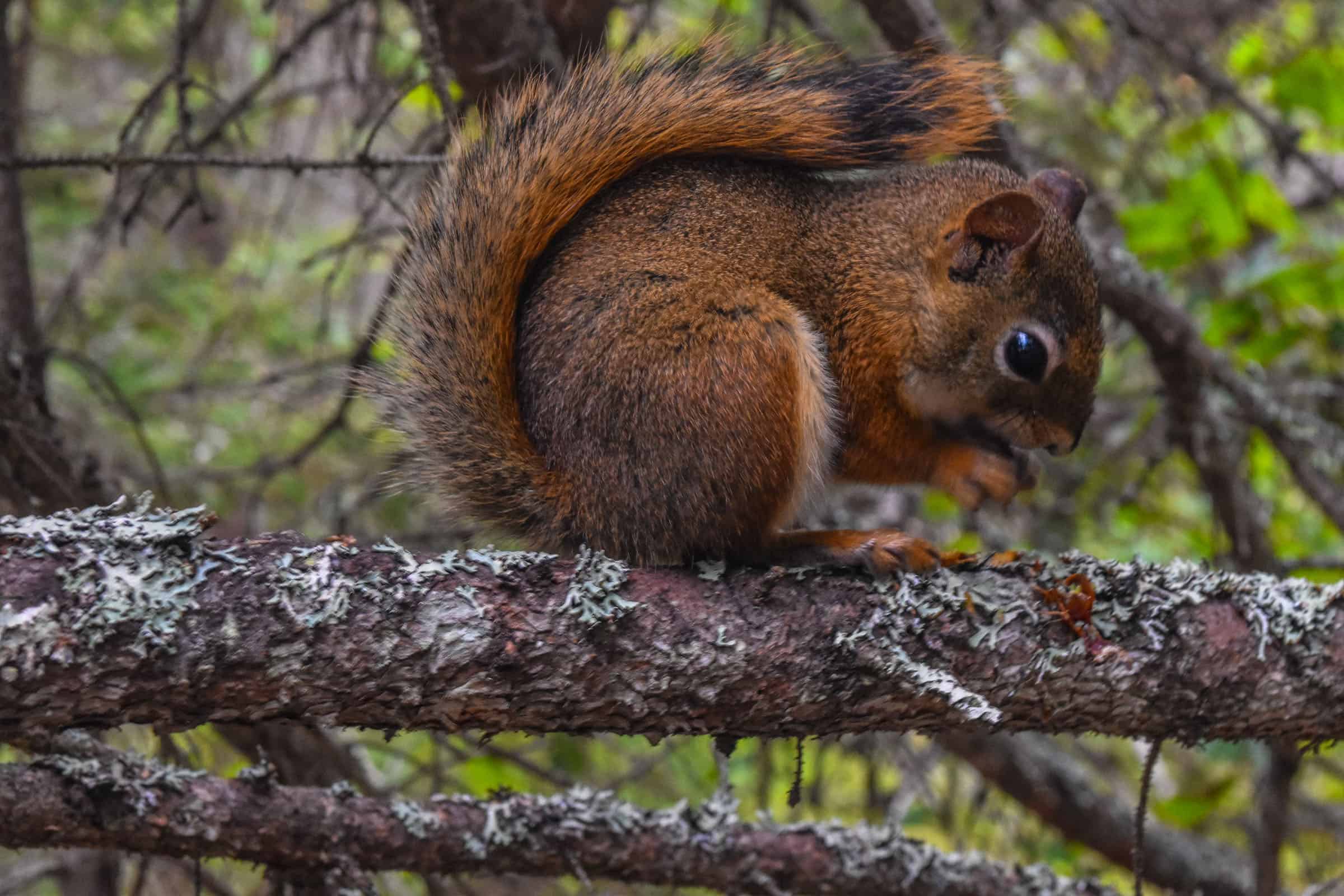
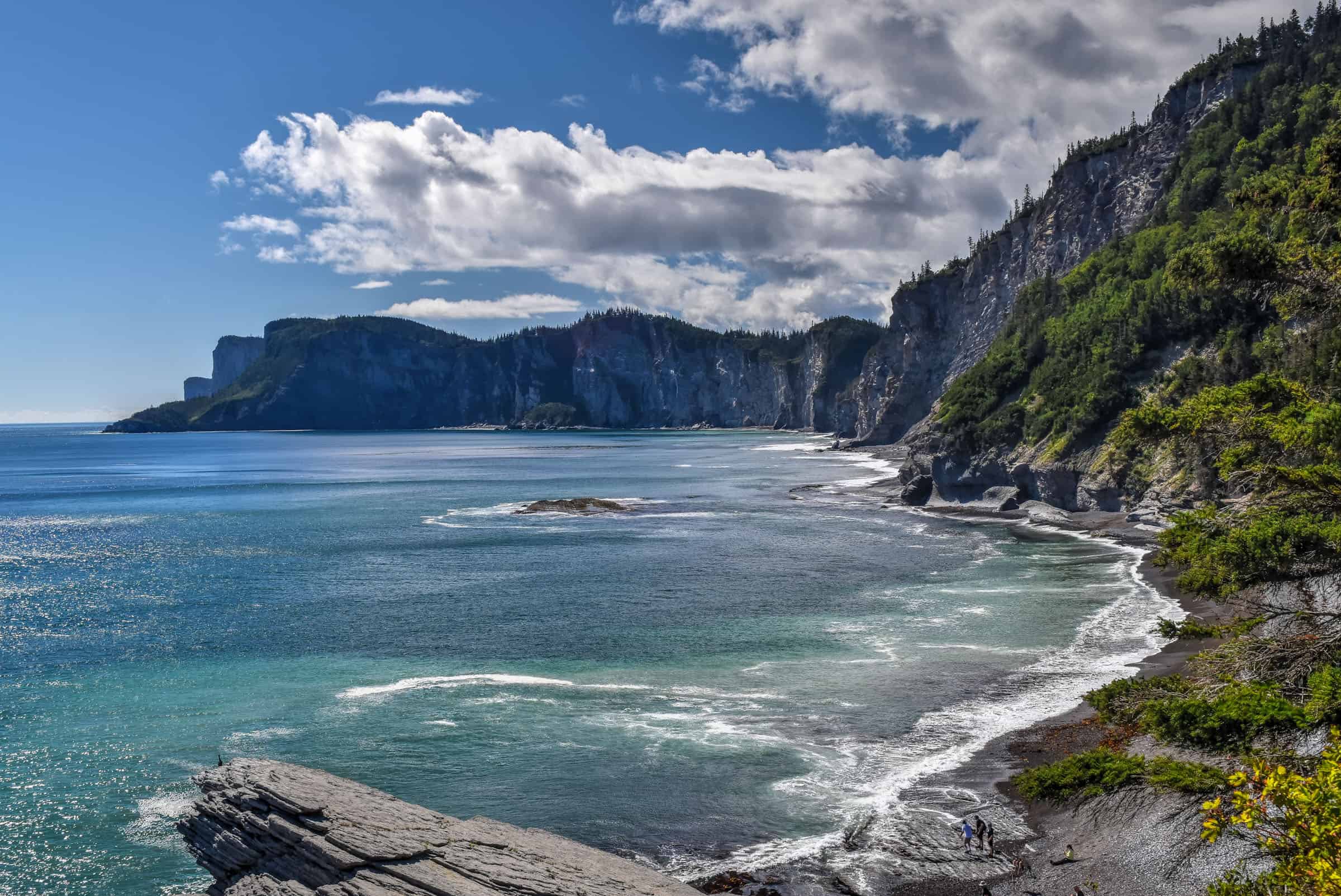
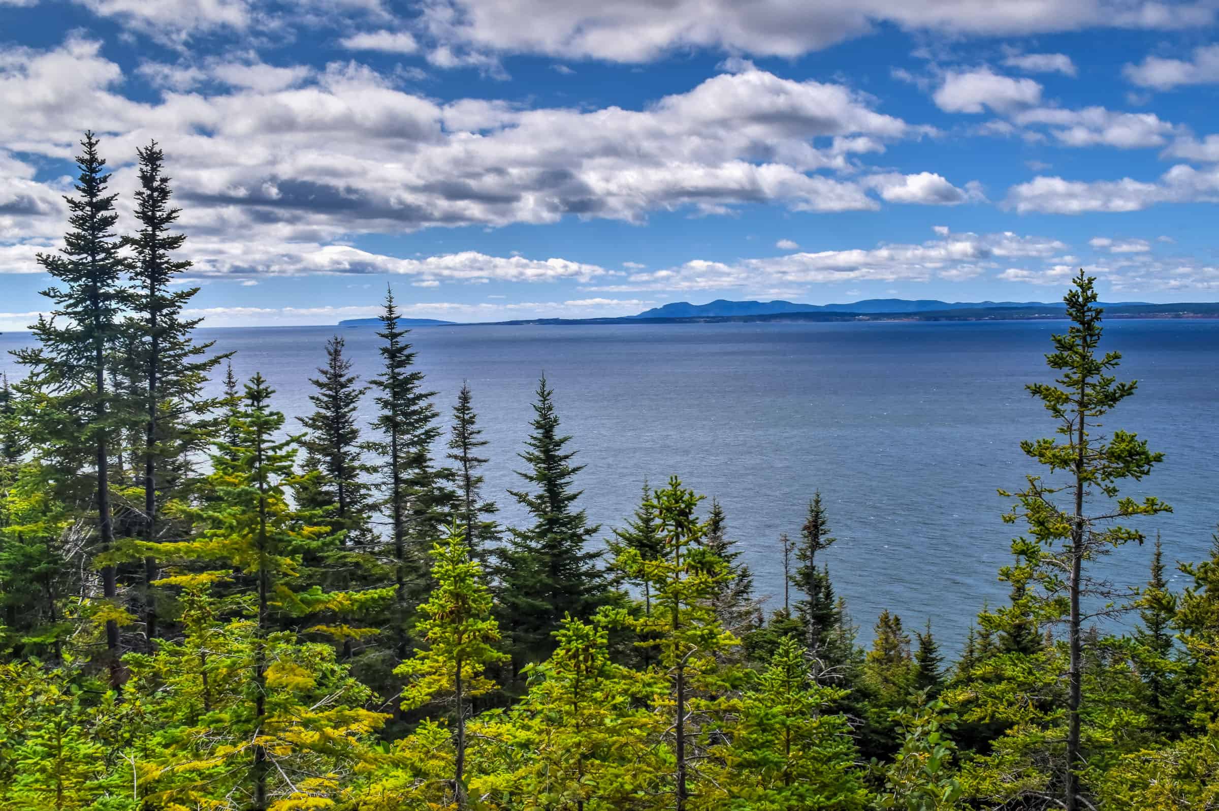
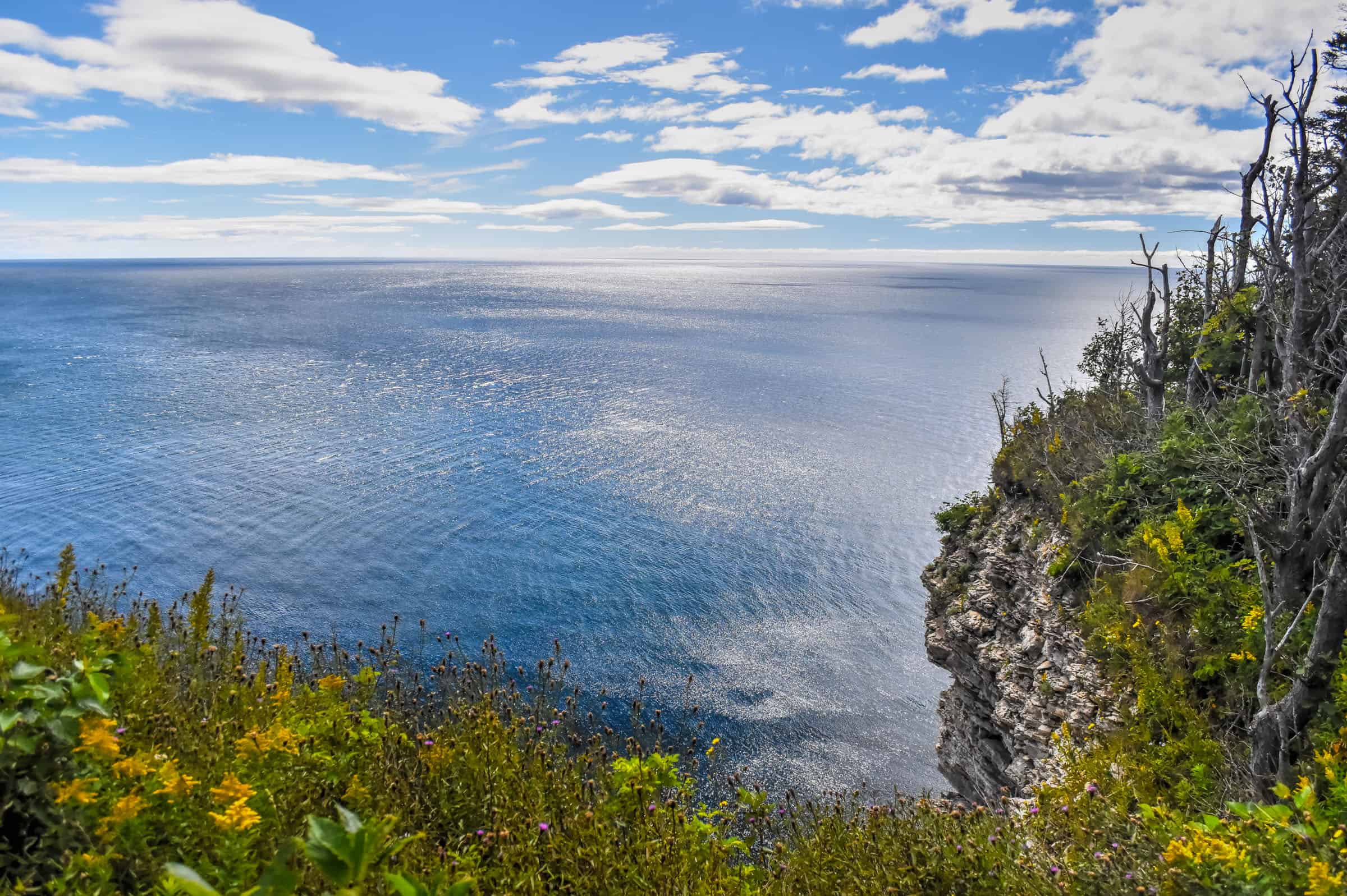
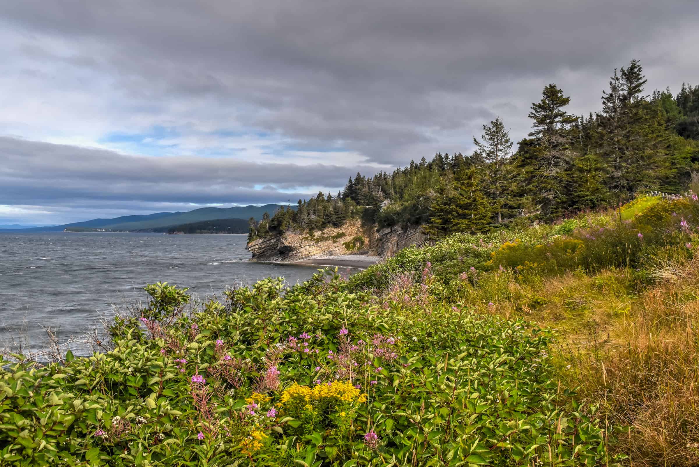
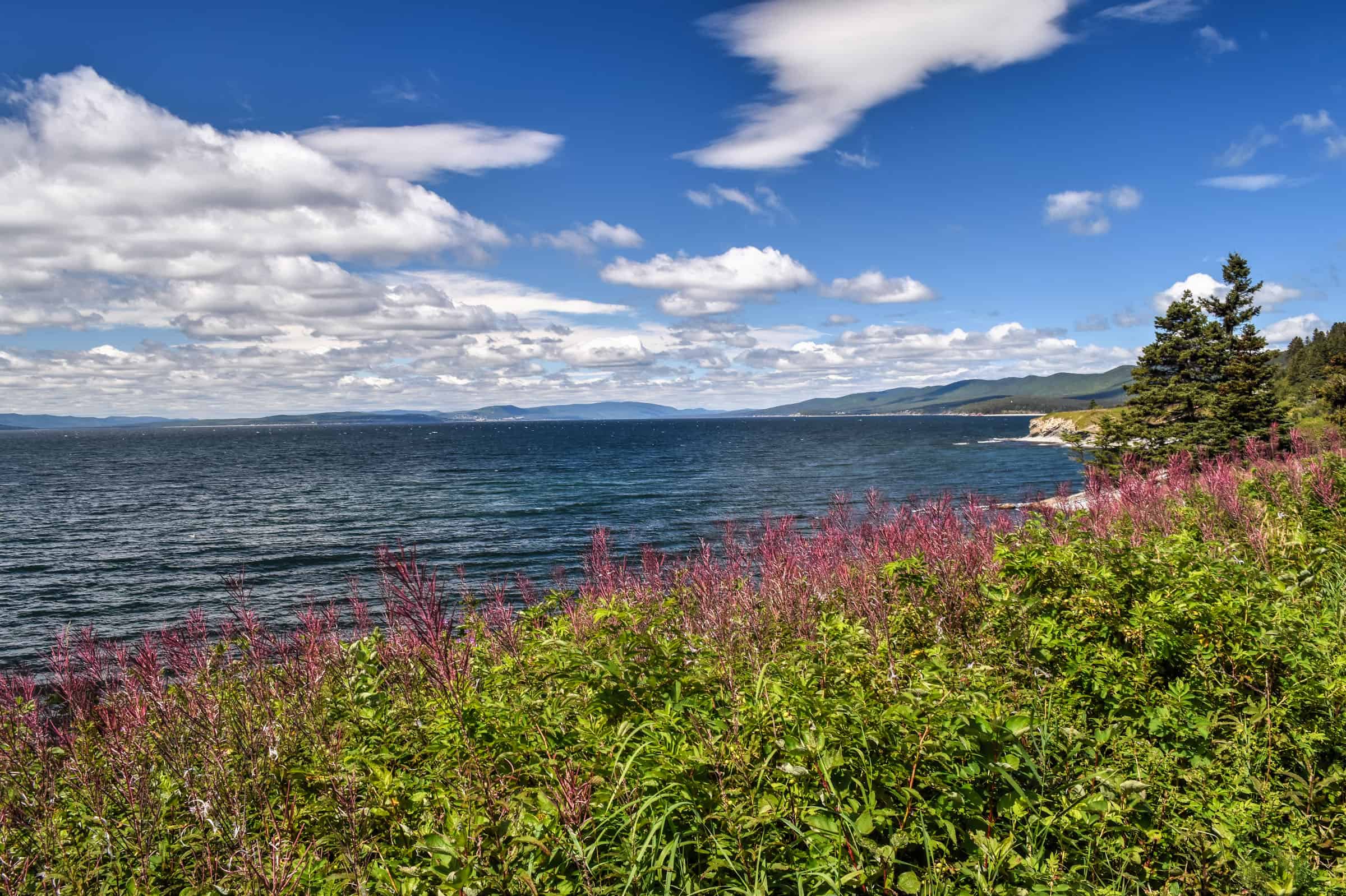
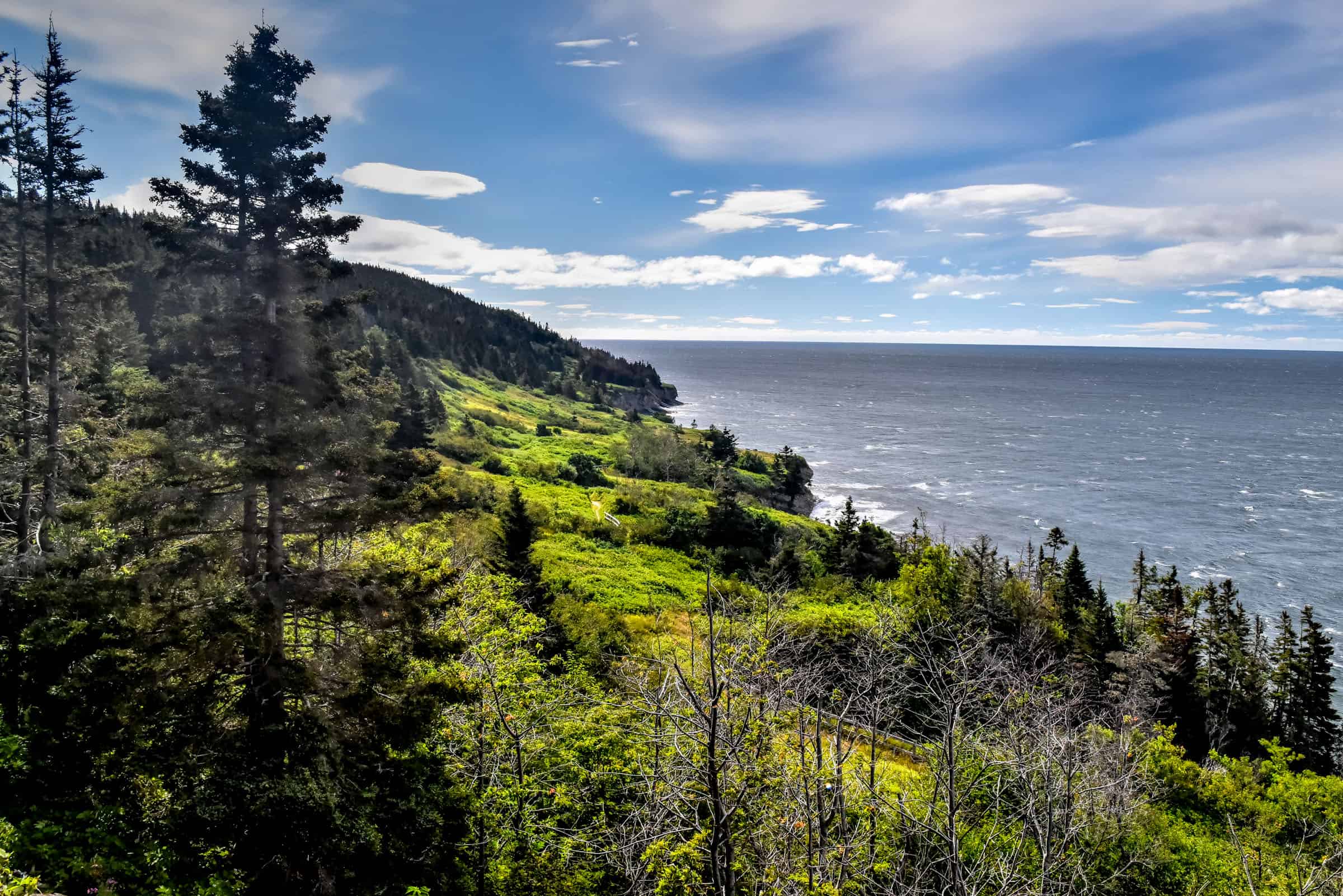
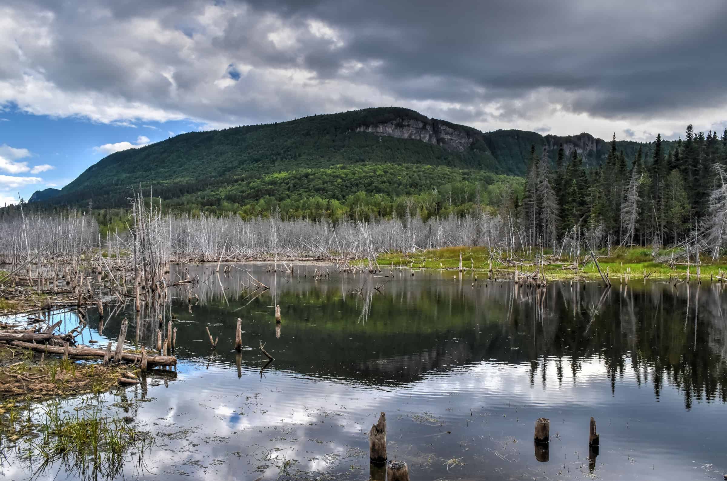
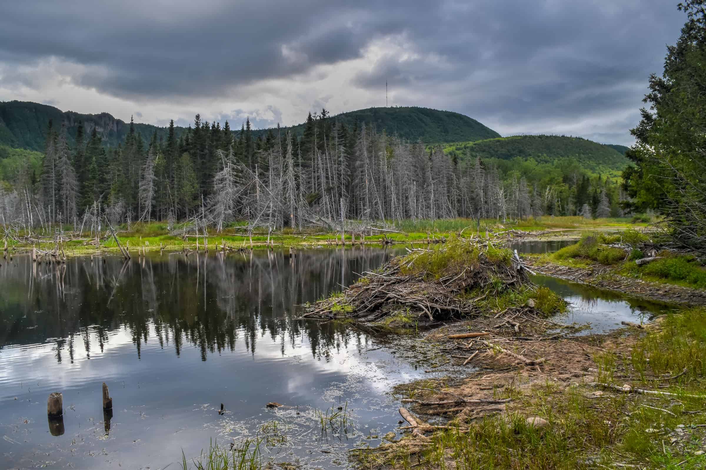
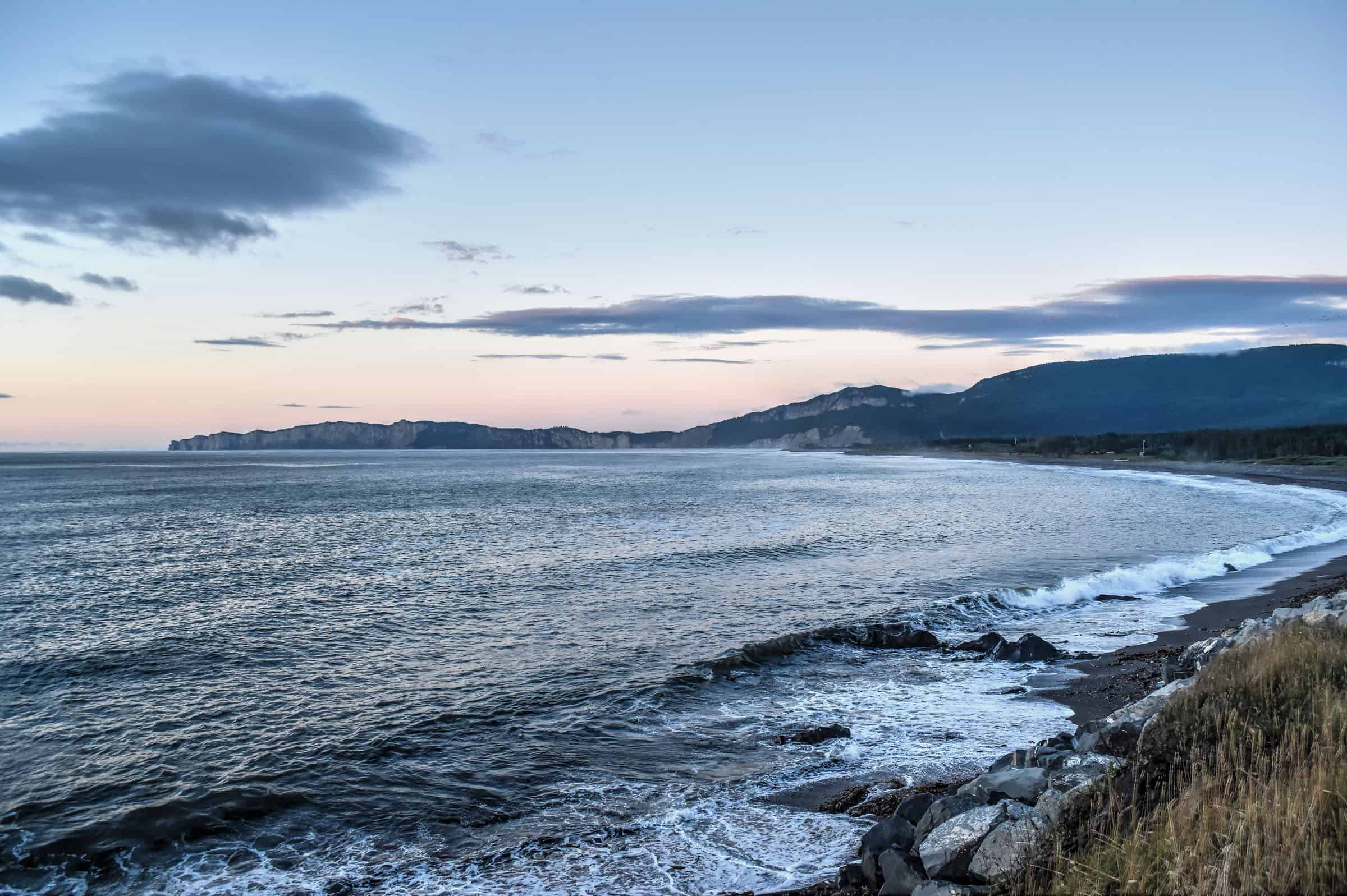
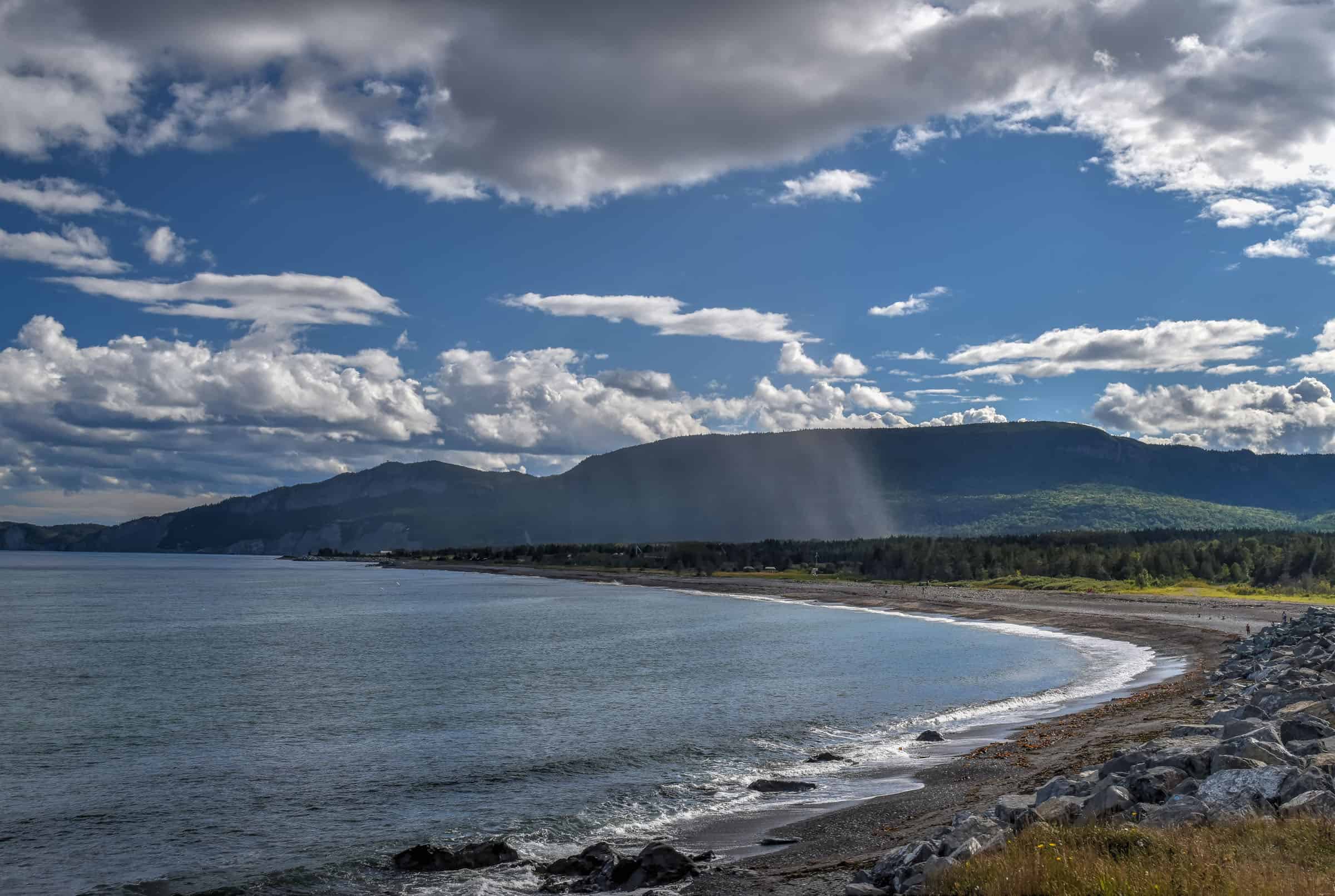
Much of the park is defined by the meeting of mountain wilderness meets the sea along a rugged coastline. Here you will find beautiful and scenic hiking trails that skirt seaside cliff edges interspersed with some idyllic pebble beaches in quiet coves. And, depending on your perspective, Forillon marks either the beginning or the end of the Canadian portion of the International Appalachian Trail. Forillon National Park also includes fantastic wildlife viewing activities. Here you will find nesting colonies of sea birds, whales off the shore and seals along the shoreline, as well as several woodland mammalian species such as the red fox, black bear, moose, lynx, coyote, woodchuck, porcupine, snowshoe hare, beaver. During our time in the park, we didn’t see any of these mammals (aside from many squirrels and chipmunks) but we did see lots of coastal and marine wildlife, including several types of seabirds, grey and harbour seals, and whales in the distance. You are also very likely to see several raptor species that inhabit the park, such as peregrine falcons and bald eagles.
Forillon National Park is also sandwiched between two other important and historic landmarks: at the northeastern end of the park is where you’ll find Canada’s tallest lighthouse, and near the southwestern end, you’ll find a World War II Fort that you can visit. We will cover both of these attractions in greater detail below.
Forillon National Park Schedule and Access Fees
Park Schedule
Open year-round (but with limited services and access to certain roads during the off-season (mid-October to the end of May)).
Entry fees (2024):
Peak season (June 25th to September 2nd)
$9/day (adults; discount for seniors and free for children)
Shoulder Season (May 31- June 24; September 3 – October 14)
$6.50/day (adults; discount for seniors and free for children)
Forillon Seasonal Pass (valid from May 31 to October 14)
$43.50 (adults; discount for seniors and free for children)
*Great idea if you plan to spend 5 days or more during the high season; 7 days or more during the shoulder season.
Winter Season (October 15 – May 30)
Free, but trails and infrastructures are not maintained during the off-season. Several park roads are likely to be closed.
Parks Canada Discovery Pass
$75 (adults; discount for seniors and free for children) for a Discovery Pass valid for 12 months after the date of purchase, which can be purchased online here (includes access to all Canadian National Parks).
Forillon National Park Layout
The park is divided into three areas or sectors and has two visitor centers, one in the North Area and one in the Penouille Area.
Most of the mountain and coastal hiking trails are in the North and South Areas. The Penouille Area has one hiking trail in a completely different environment: salt marshes and sand dunes.
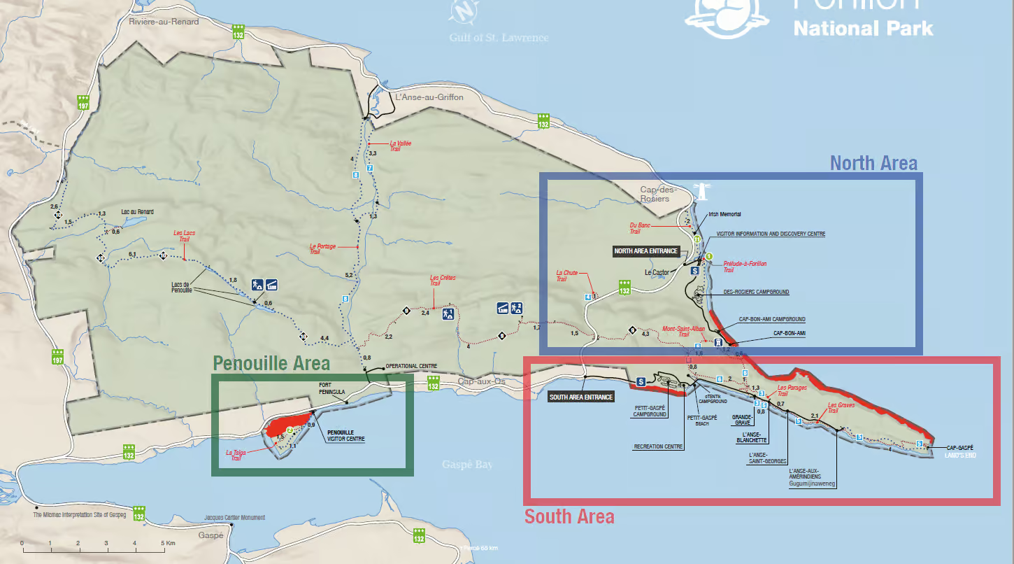
Several car parks are scattered around the National Park, typically near the start of trailheads. The most important ones will be highlighted below.
The best time to visit Forillon National Park
The main summer season is fairly short, so there is no wrong time to visit. In our opinion, however, the best time to visit is late August or early September for the best combination of good weather with fewer mosquitoes (which peak in numbers from mid-May to mid-July) and fewer tourists (which peak in numbers from early July to mid-August).
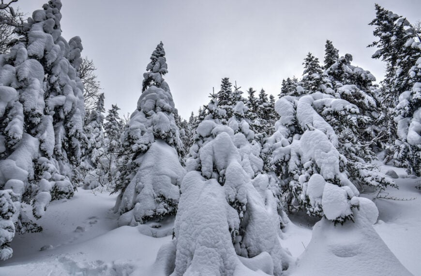
Forillon in Winter
Only the Penouille Area is accessible during winter with your vehicle, because the visitor center there is just off the main road that goes through the park. The roads servicing the northern and southern sectors will be closed, including the Discovery Visitor Center near the northern entrance. That being said, there is still plenty to do in winter at Forillon. There are a half dozen cross-country ski trails (trailheads start at the Le Portage parking area near Penouille, La Vallée parking area at L’Anse-au-Griffon, and Le Castor parking area near Cap-des-Rosiers), three off-trail ski areas, and a half dozen snow-shoeing trails with equipment for rent at the Penouille Visitor Centre.
Best Forillon National Park Trails
Our list of favorite trails will include some that are considered easy, moderate and moderately challenging – none of those covered here wouldn’t be considered very challenging or technical. There are however three long-distance trails (20+ km) in the park (Les Lacs, Les Crèetes and Le Portage Trails) that we won’t cover in this guide focused on rewarding day hikes.
Du Banc Trail (easy)
The Du Banc Trail, sandwiched between Canada’s tallest lighthouse to the North and the magnificent Forillon cliffs to the south, is a straightforward trail with very little elevation gain but with beautiful and quaint views along the coast. It was the first trail we did after arriving in the area (the trailhead is across the street from the Le Motel du Haut Phare) and was a great introduction to the park.
The trail is very wide and flat, suitable for strollers and bicycles as well, making it one of the park’s most accessible trails. The trail alternates between a flattened gravel surface and a wooden boardwalk. There is also a two-story observation tower placed along the trail.


Distance: 4.2 km
Route Type: Out & back
Elevation gain: 13 m (cumulative elevation gain: 31 m)
Start point: Cap-des-Rosiers parking lot or Visitor Information and Discovery Centre (North Area)
AllTrails rating: (4.5, 66 ratings (2024))
Duration: Most people complete the trail in around 45-60 minutes
Access Fees: Parks Canada daily rate
La Taïga Trail (easy)
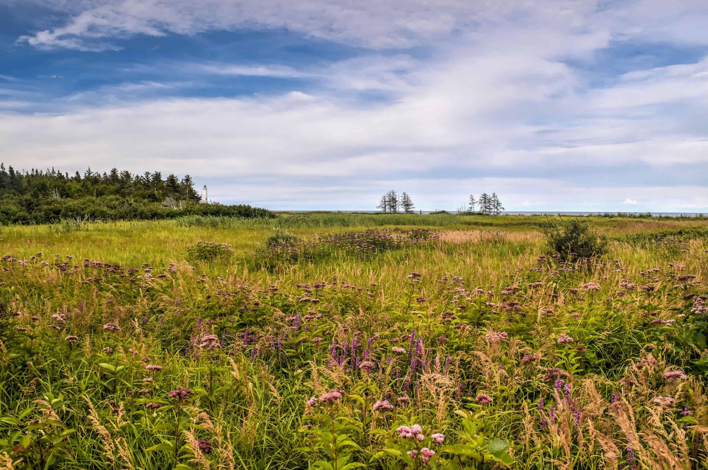
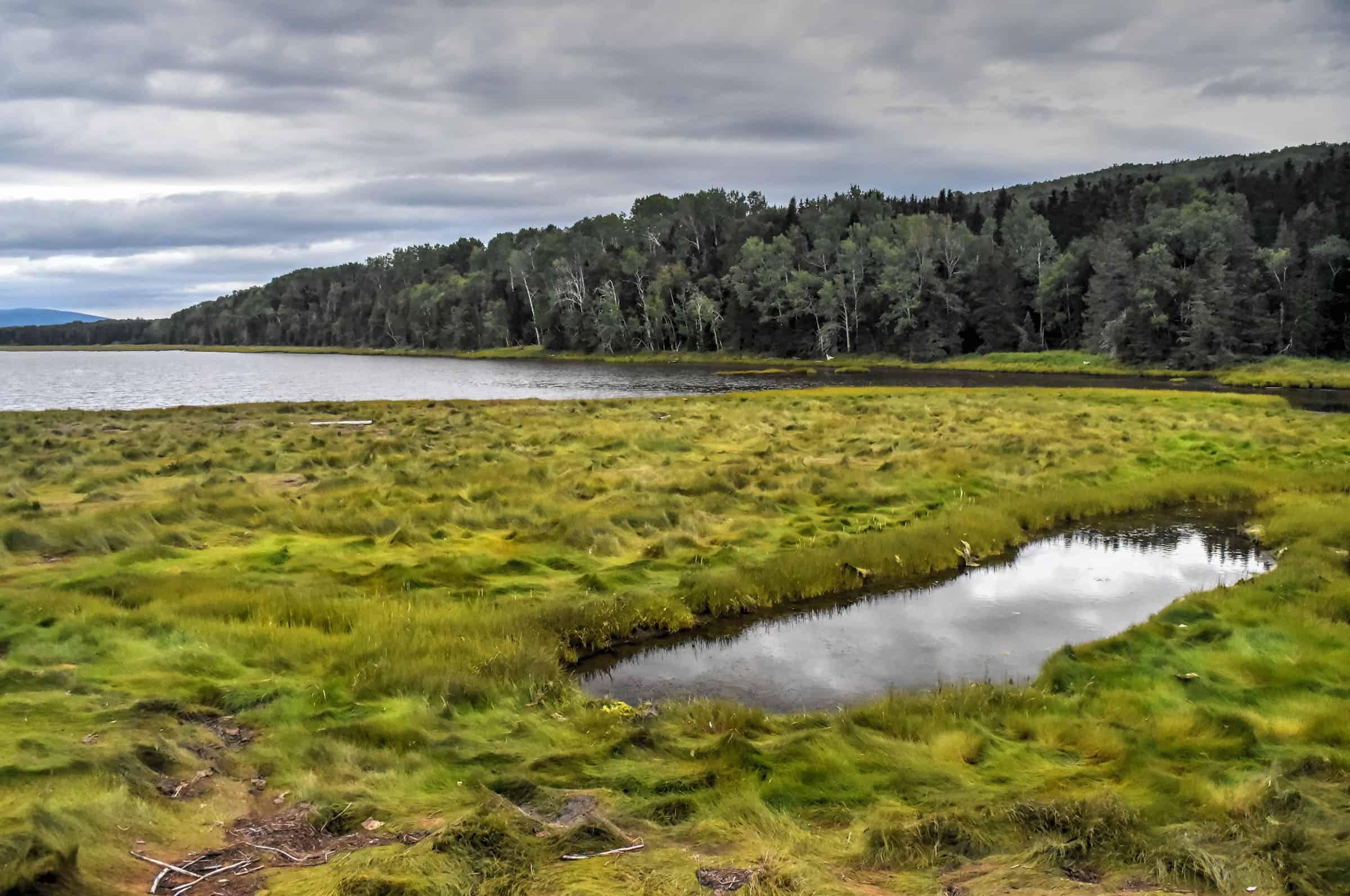
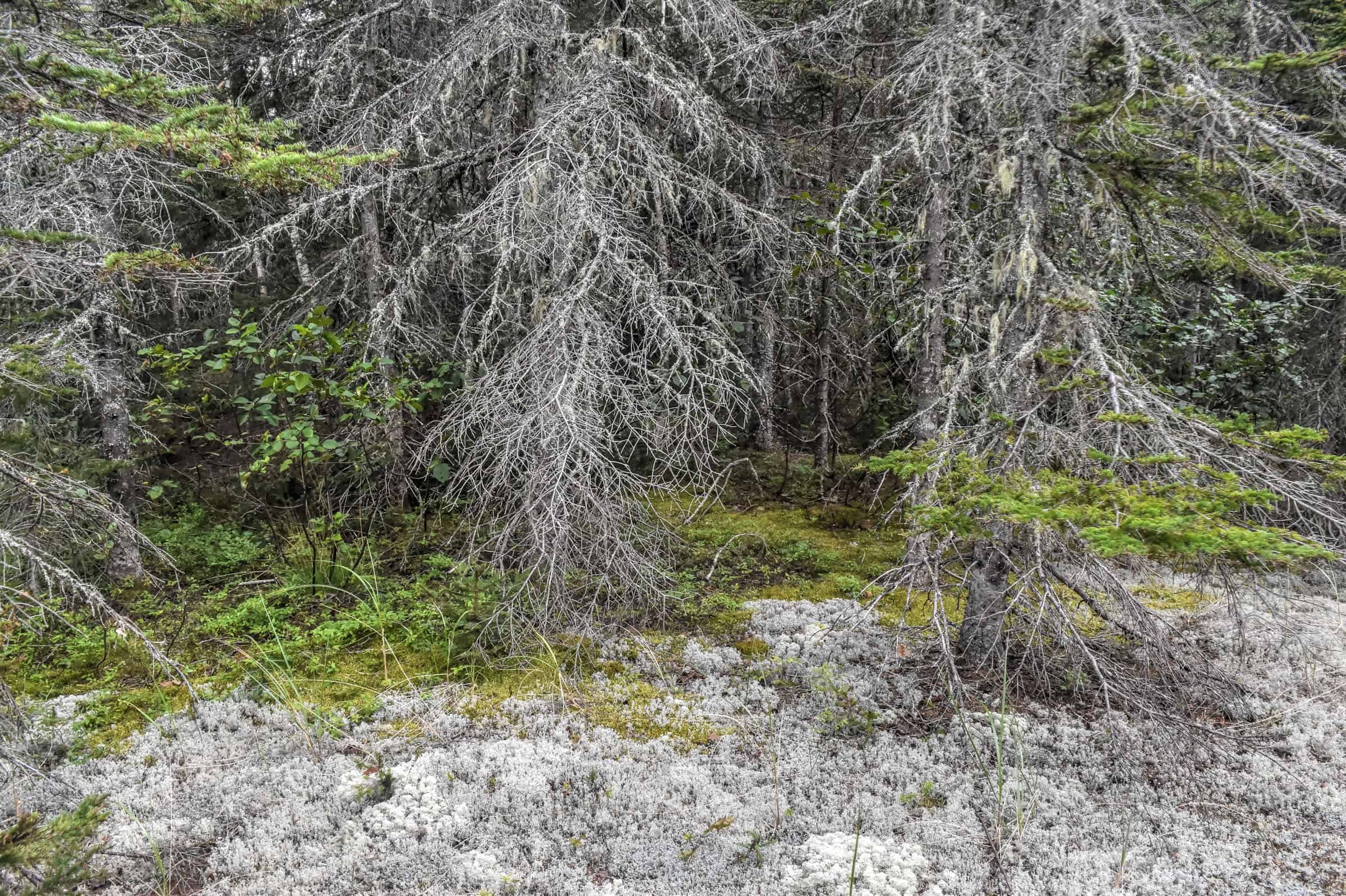
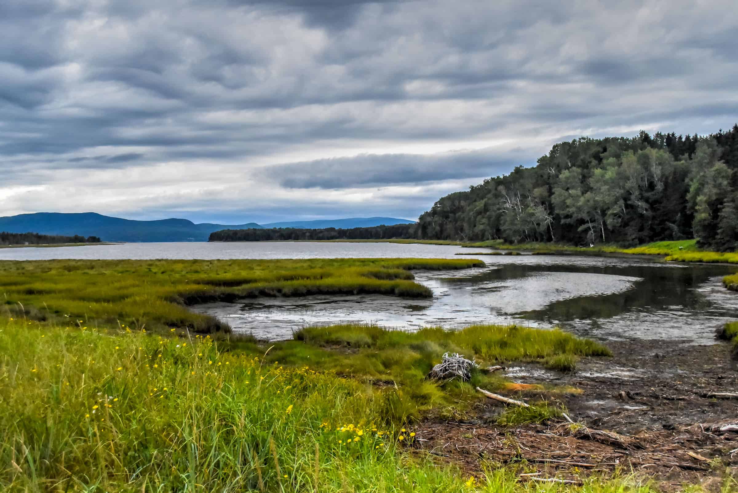
This is a very family-friendly trail and one of the most unique trails in the Park. It starts with a walk along a wide boardwalk that follows the Penouille sandbar on the south side of the Gaspé peninsula, with a saltwater marsh on one side and a sand beach on the other. Eventually, you veer off into the unique taiga ecosystem, a biome characterized by coniferous forests consisting mostly of pines, spruces, and larches.
Like the previous trail, a portion of the trail consists of a long wooden boardwalk built over marshlands.


Distance: 4.7 km
Route Type: Out & back
Elevation gain: 13 m (cumulative elevation gain: 31 m)
Start point: Penouille parking lot
AllTrails rating: (4.3, 96 ratings (2024))
Duration: Most people complete the trail in around 45-60 minutes
Access Fees: Parks Canada daily rate
Not an AllTrails member yet? We highly recommend signing up for either their free or paid membership plans. The free plan allows you to find new trails and plan routes but it can only be used while hiking if you have access to mobile data. The paid membership plan (AllTrails+) allows you to download trail maps for offline use and provides live progress updates and off-route notifications.
If you are still uncertain – you should know that the All Trails mobile application was voted the 2023 iPhone App of the Year by Apple.
We find that AllTrails is a great tool to have when hiking, particularly for assisting with navigation when the trail is hard to locate and to help monitor your progress along the trail, which helps estimate how much time you’ll need to complete the trail.
La chute (easy)
One of Forillon National Park’s hidden treasures, the La Chute trail will reward you with a modest yet spectacular waterfall. Follow the winding boardwalk and wooden stairs down through the forest to a lovely 17-metre-high waterfall. After the falls there are a few levels of stairs to climb to make your way back to the parking lot.


Distance: 1.3 km
Route Type: Loop
Elevation gain: 45 m (cumulative elevation gain: 57 m)
Start point: Sentier des chutes parking lot
AllTrails rating: (4.5, 222 ratings (2024))
Duration: Most people complete the trail in around 25-30 minutes
Access Fees: Parks Canada daily rate
Cap Bon Ami (very easy)
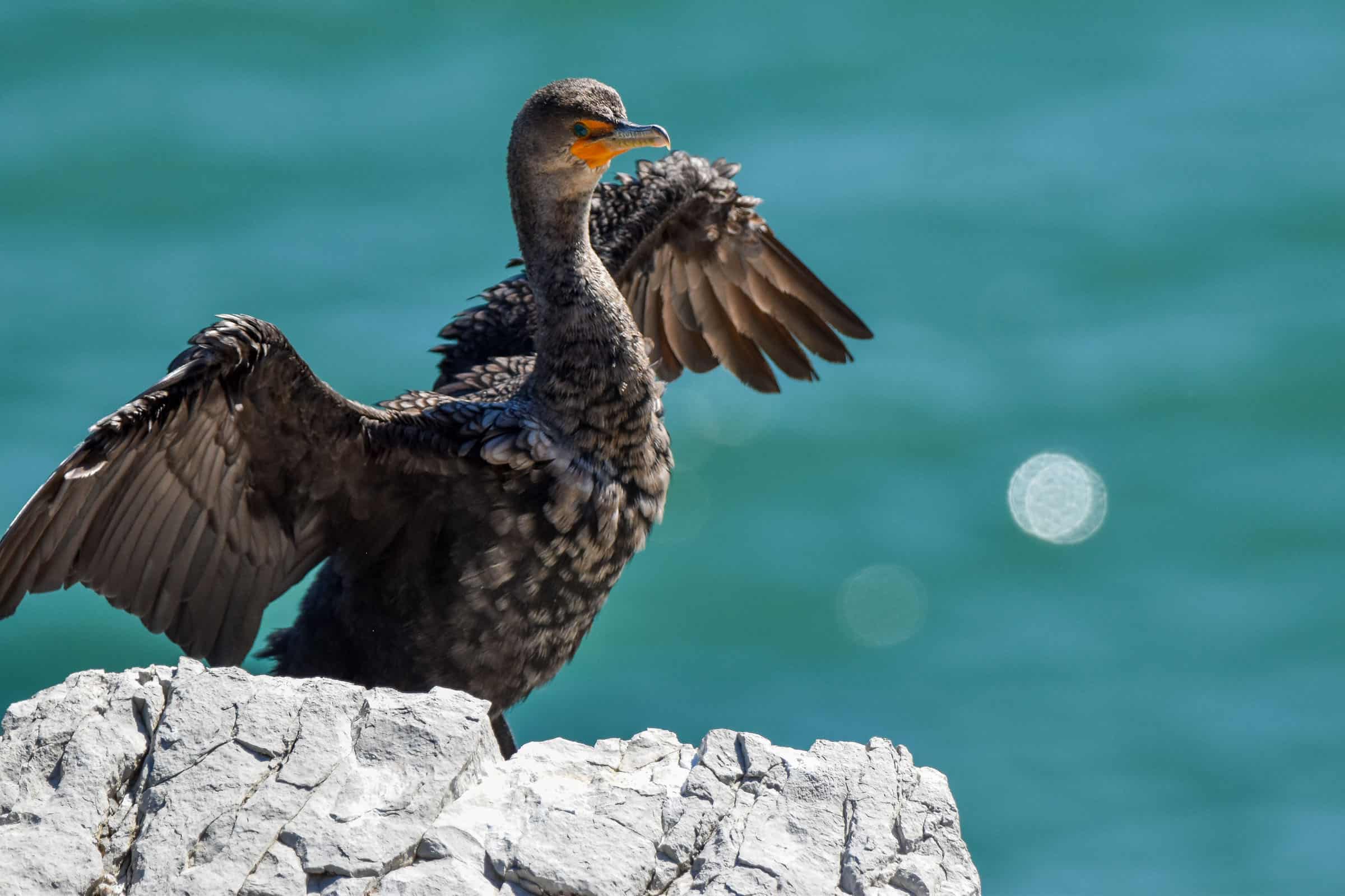
This isn’t really a hike but rather a beautiful viewpoint and the starting point of the park’s trail with the highest elevation gain (see Mont Saint-Alban trail below). It’s a beautiful spot that only requires going down (and then back up) a few flights of stairs down to the beach. It’s also a great spot to see some double-crested cormorants.


Distance: 0.5 km
Route Type: Out & back
Start point: Cap Bon Ami car park
AllTrails rating: N/A
Duration: Most people complete the trail in around 10-15 minutes
Access Fees: Parks Canada daily rate
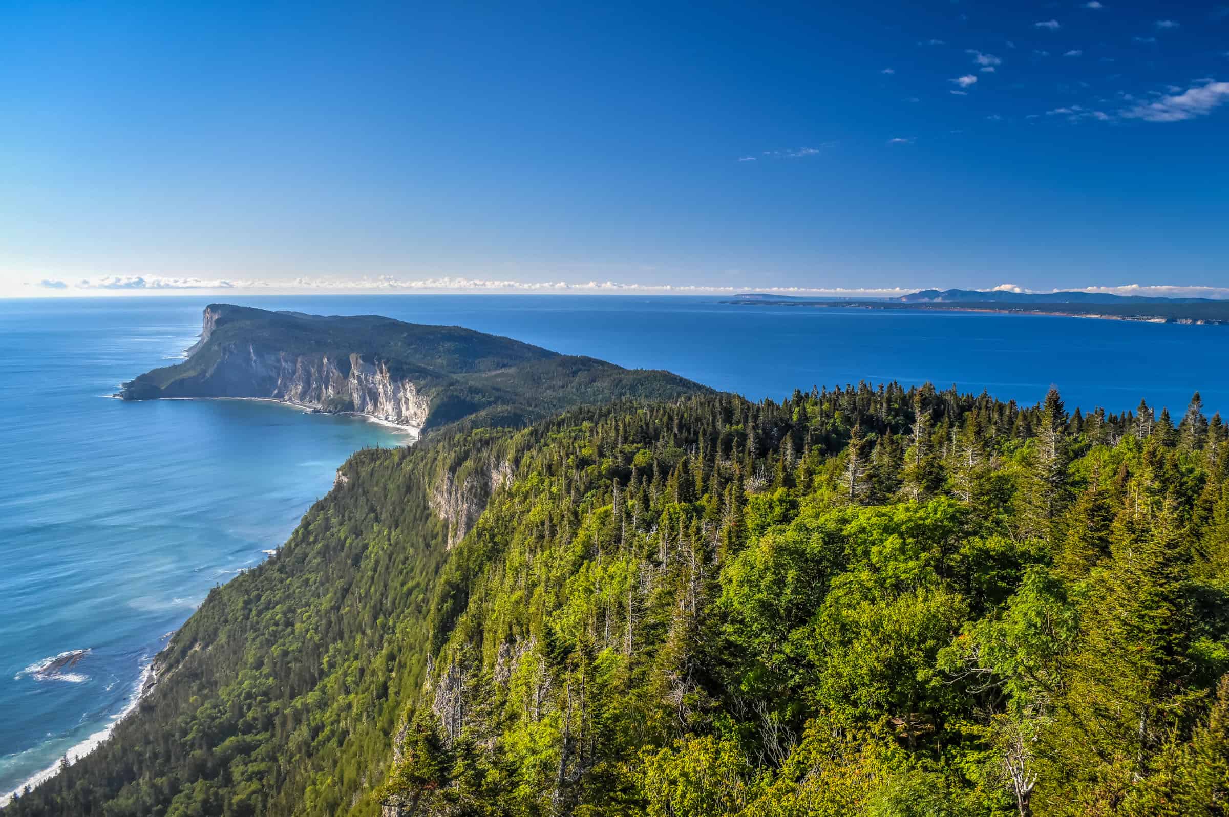
Les Graves Trail (moderately challenging)
Although the trail has some ups and downs, the main challenge here is the distance (16 km). However, there is an option to cut the length in half by starting at the midway point (more on the specifics further below).
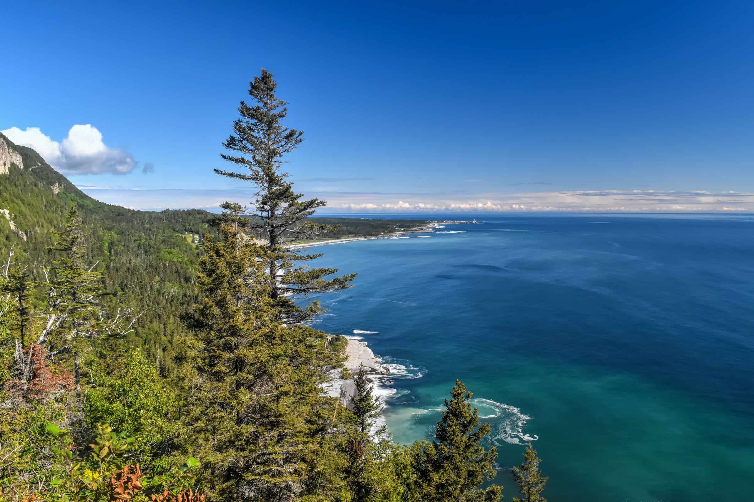
This is such a beautiful trail that meanders along the coast through pretty meadows with breathtaking views of Gaspé Bay. If you are lucky, you might see whales and dolphins swimming by you.


After a short but intense final climb, you can choose to end your hike at Cap-Gaspé, where a lighthouse sits atop a 95-meter cliff.


Alternatively, you can continue along a final 0.3km section of the trail where you’ll drop down to nearly sea level to reach Land’s End, where you are very likely to see loads of marine and coastal wildlife.


Note that the trail overall has several up-and-down sections, meaning that the total cumulative elevation gain (see below) is much greater than the actual elevation difference listed on the park website. But this trail’s main challenge is its length.
Distance: 16.1 km
Route Type: Out & back
Elevation gain: 90 m (cumulative elevation gain: 377 m)
Start point: Grande Grève parking lot
AllTrails rating: (4.7, 257 ratings (2024))
Duration: Most people complete the trail in around 4h-5h
Access Fees: Parks Canada daily rate
Note: Many stop at the lighthouse and picnic tables about 0.3km from the end of the trail (the area known as Gap Gaspé). If you continue on to the very end (to the point referred to as Land’s end), you’ll climb down nearly 100m (along a steep section of trail) to get close to sea level (and you’ll have to climb that back up again), nearly doubling your elevation gain for the trail. If you chose not to go down, the total cumulative elevation gain for the whole trail would be closer to 300 m.
Alternative half-trail: You can reduce the hike’s distance by nearly half starting at the L’anse-aux-Améridiens parking lot.
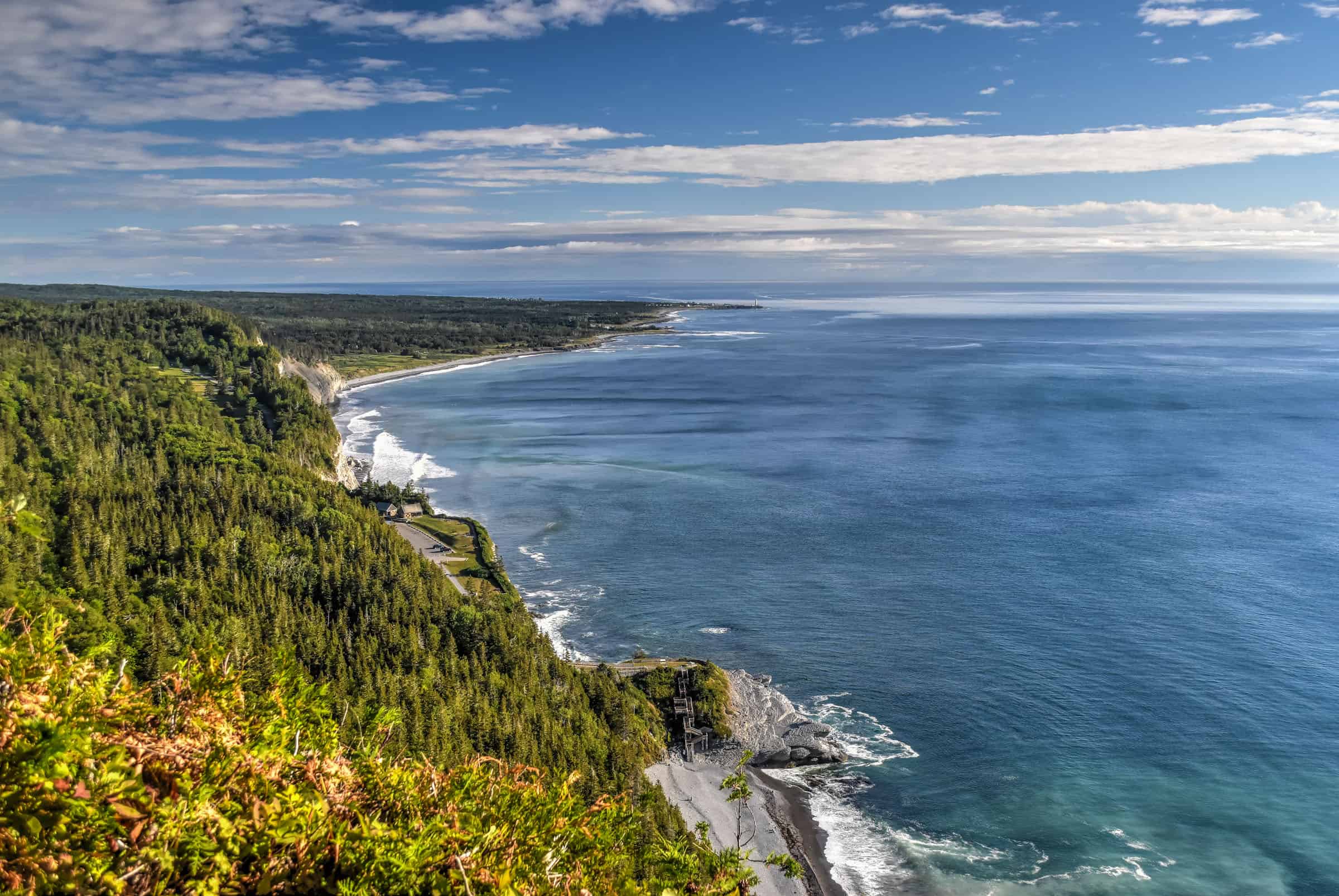
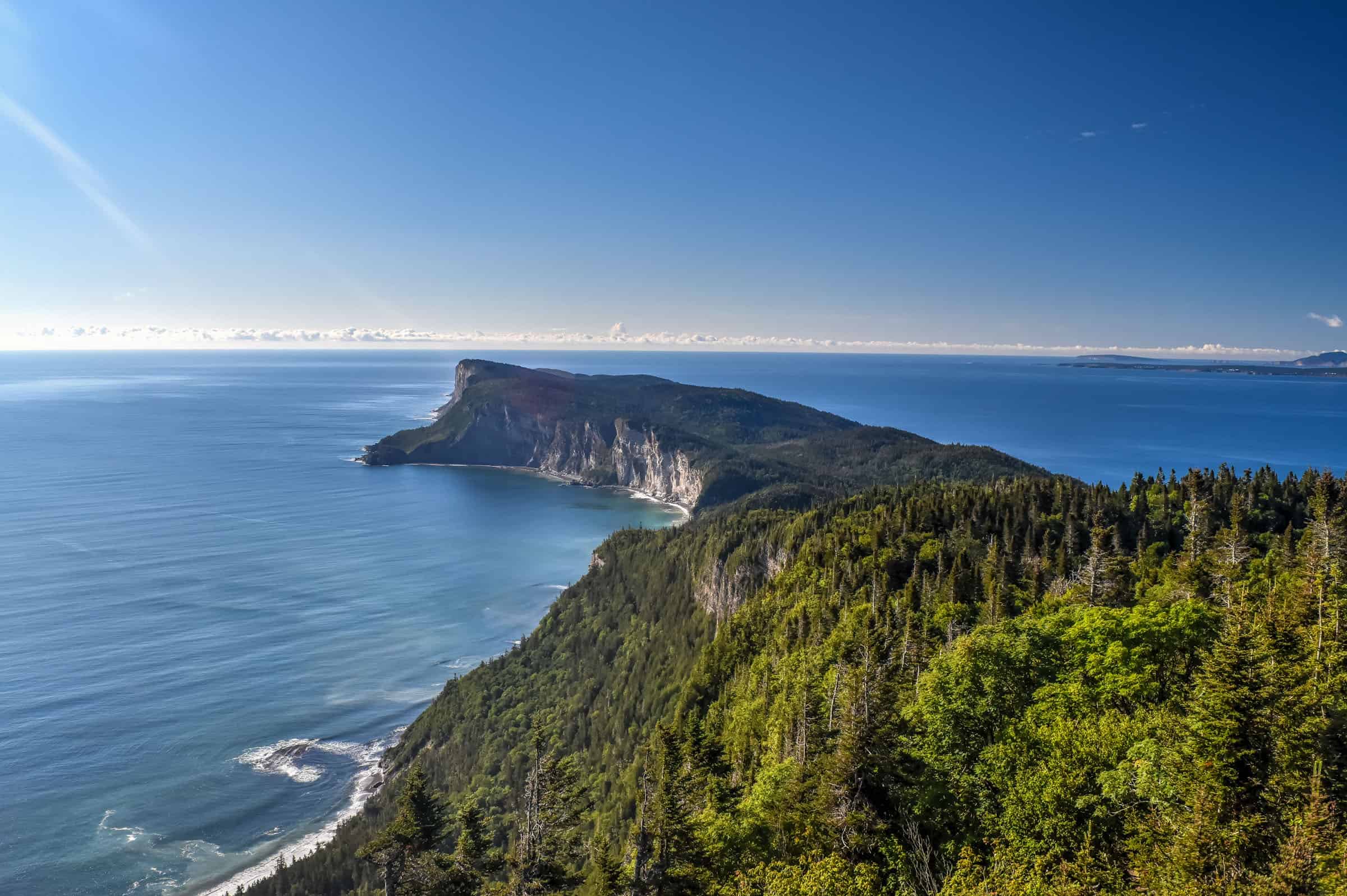
Mont Saint-Alban (moderate)
This is the most rewarding trail of the park in terms of sweeping grand views of the beautiful Forillon coastline, stretching out to Cap Gaspé and Land’s End. It is also probably the most difficult trail in terms of steep ascending sections, particularly the very first section up from Cap-Bon-Ami where you will gain just under 300 m in the first 2 km. But once you get through that first section, the trail is pretty easygoing with mostly flat and downhill sections.
The main draw here is the observation tower built near the mountain’s summit, which offers a fantastic 360-degree panoramic view of the surrounding area.


Distance: 7.9 km
Route Type: Out & back
Elevation gain: 260 m (cumulative elevation gain: 434 m)
Start point: Cap Bon-Ami Parking Lot
AllTrails rating: (4.6, 687 ratings (2024))
Duration: Most people complete the trail in around 2h45-3h
Access Fees: Parks Canada daily rate
Alternative options: If you are short on time, you can do an Out & Back shortened version that takes you to the viewing platform and back. You can also combine this trail with the Les Graves trail highlighted just above, as the midpoint of the Mont Saint-Alban trail is near the Les Graves trailhead. You can also start the trail from the car park by the Les Graves trailhead.
Hiking Packing List
All Trails subscription – This comes in really handy for areas with little or no cell reception, as the annual subscription allows you to download trail maps for offline use.
External Battery – If you are using your phone to track your progress along the trail or to help with navigation, you certainly don’t want your phone to die on you. That’s especially true in the unlikely event that you might get hurt or need assistance.
Hiking poles – These can be particularly useful in steep trails or muddy/boggy trail conditions.
Water Filter Bottle – The Life Straw bottle is an advanced water bottle with a filter that not only improves water taste but more importantly filters out bacteria and parasites, chemicals and microplastics.
Headlamp – very practical and a smart choice if you plan to start your hike before sunrise or finish it after sunset.
Forillon National Park Trail Tips
–Mosquitoes and black flies can be a nuisance at certain times during the year. The exact dates vary from year to year, but they are generally most present from mid-May to mid-July. Regardless of when you come, it’s always a good idea to carry some bug spray with you, just in case.
–Bear safety: Avoid hiking along, as this is black bear country. Try to make your presence known while hiking by talking as much as possible. Don’t wear headphones.
-Stick to the designated path to protect the surrounding environment.
Other Activities in or near Forillon National Park
Wildlife viewing at Forillon National Park
There are excellent wildlife viewing opportunities at Forillon National Park. Although forty-three species of land mammals inhabit the park, including black bears, moose and beavers, the main draw here is the coastal wildlife, including seals, whales and double-crested Cormorants.
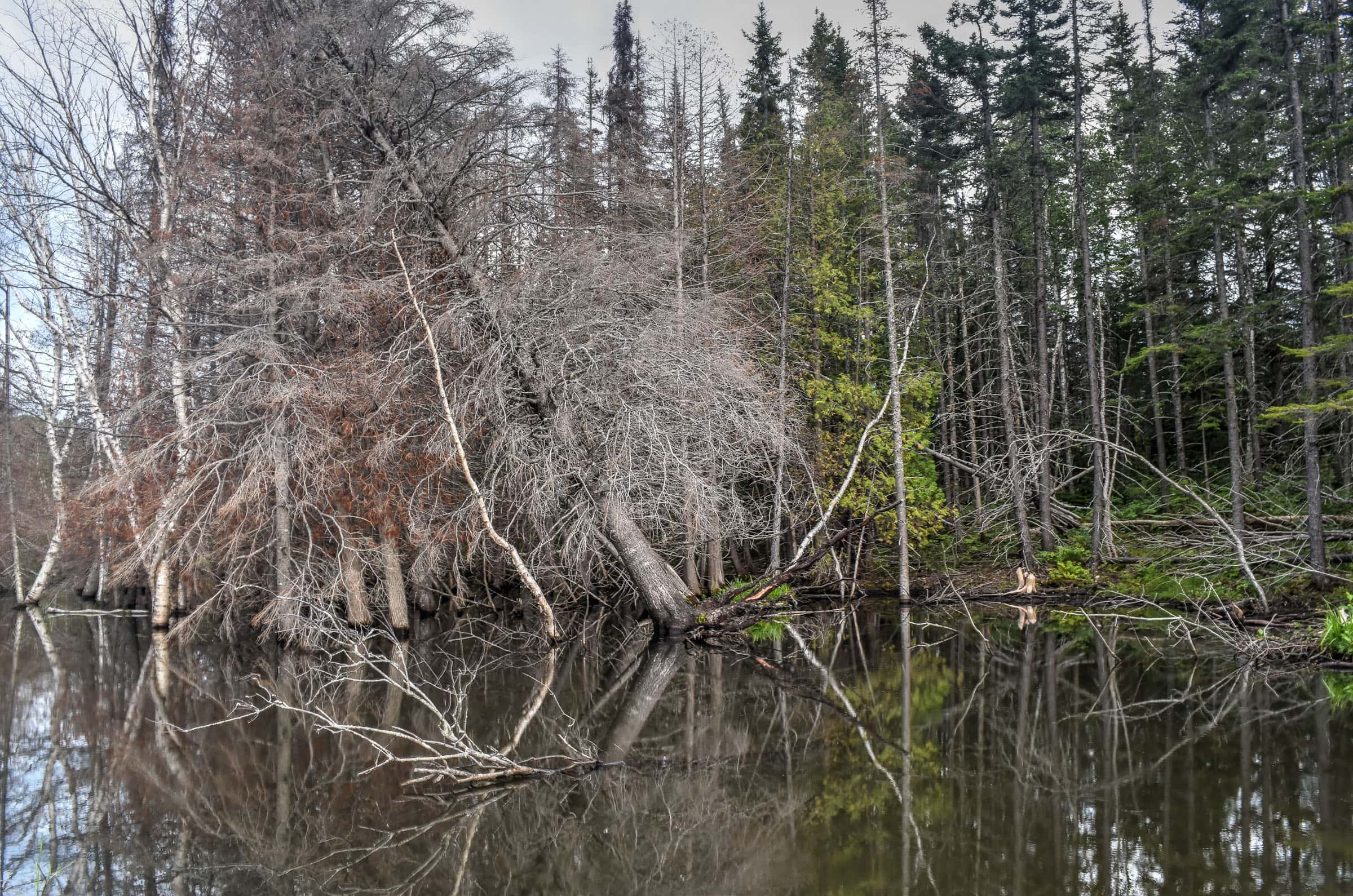
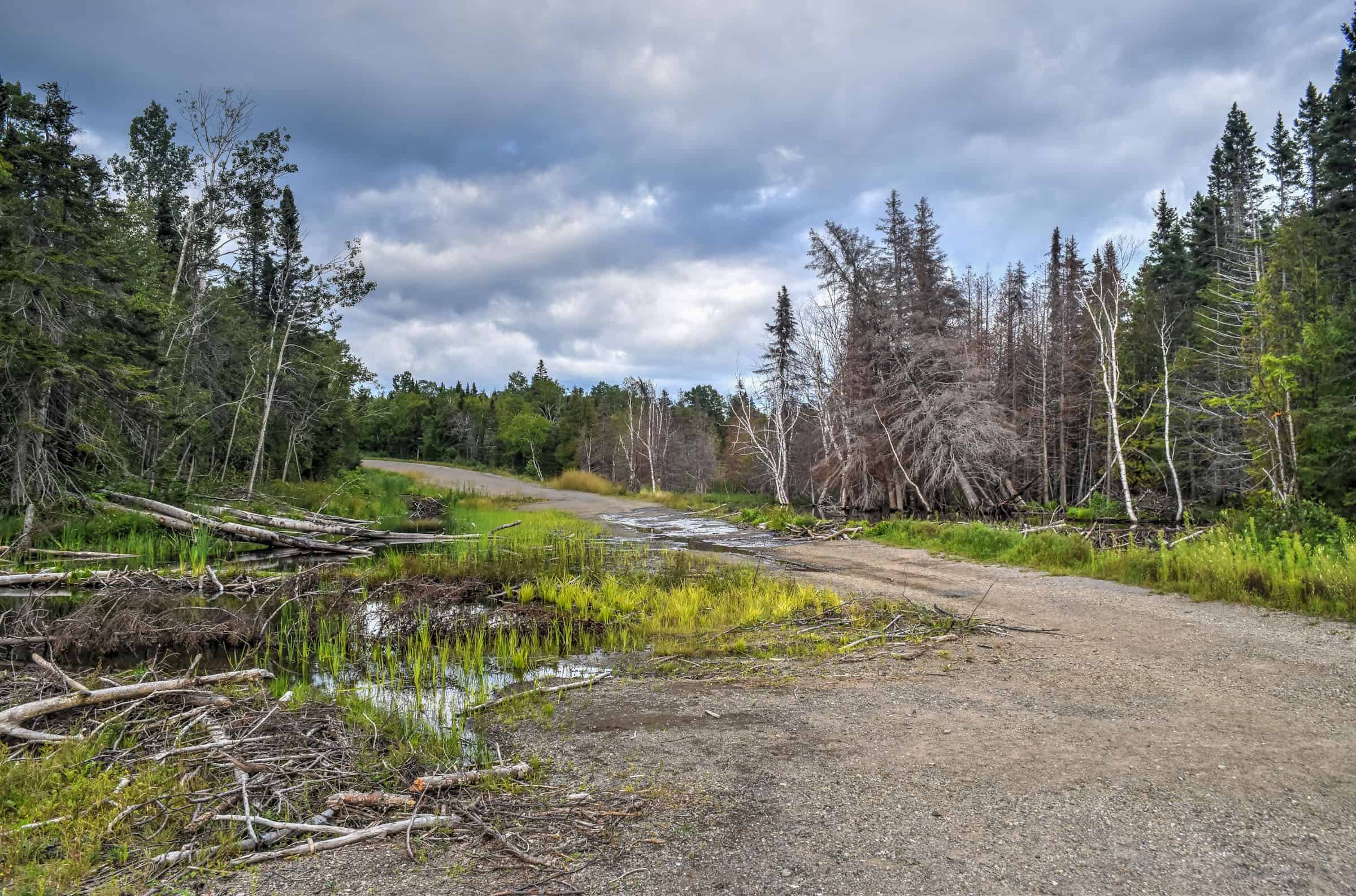
Beaver Pond: From the Beaver Pond parking lot, you can take a light stroll to visit beavers in their natural habitat. Unfortunately, we didn’t get to see any around as they are primarily nocturnal animals, but it was still very interesting to see their lodges. Your best chance to see them is around dusk or dawn.


Double-crested Cormorants at Cap Bon Ami: There are lots of beautiful coastal birds to gawk at in Forillon National Park, but one of our favorites was the double-crested cormorant. There loads of them just along the coast by the Cap Bon Ami car park.

Grey and Habour Seals: You are likely to see them pretty much anywhere around the southern rocky coastline of the national park. There were two spots in particular where we saw several of them. One of them is from Land’s end, the endpoint of the Les Graves hiking trail highlighted above. Another is from a viewing platform a short walk from this parking lot, near St Peter’s Church.


The Grey Seals typically arrive at Forillon in the spring and leave in autumn. The Harbour Seal breeds and lives here year-round.
We also saw some ruffed grouses on our way to the seal viewing platform.


Sea Activities
Sea kayaking: This is a great opportunity to see some of the sea wildlife up close, particularly the seals. At Cap Aventure Forillon you rent your own paddleboard or kayak or go on guided kayak excursions along the coast. Rates and schedules vary depending on your preferred activity.
Boat Tours: Croisiere Forillon offers 2h30 boat cruises along the coast of Forillon National Park. You’re likely to see a bunch of seals and seabirds along the way. There are three departures per day, from mid-June to early September. (2024) $60 per adult with reduced rates for Children.
Whale-watching tours: Two different boats are available (47 passengers or 12 passengers) for whale-watching tours. Each boat has 2/3 departures per day, from early June until mid-October) 2024 rates are $98 per adult with reduced fares for children. See Baleines Forillon for the detailed schedule and reservations.
Visit Historic Heritage Sites
There are several historic sites to visit within Forillon National Park. You can see most of these near or along the Les Graves hiking trail described above.
Hyman General Store – Museum: This historic general store occupies the ground floor of the original home built by William Hyman in 1864. You’ll discover the typical operations of the “company stores” operated by the major fish merchants and their huge inventory, including canned products, patent medicines, china dinner services, farming equipment, fishing tackle, clothing,
La Maison Dolbel-Roberts: Here you’ll find an exhibit entitled: “Gaspesians from Land’s End”, which will help you discover the life of the people who once inhabited the Forillon peninsula
Maison Blanchette: Here you’ll find a typical fishing family home, along with the barn, fish shed, woodshed and various structures used by the family to dry cod. Costumed interpreters are often on hand to answer your questions and provide you with additional background.
St Peter’s Church: Construction of St. Peter’s Church began in 1864 and was completed in 1885. The church adopted a unique late 19th-century Protestant church architectural style: the classical vernacular – there are only a few such examples in the province of Québec. The Anglican faithful of the southern coast of the Forillon Peninsula have been gathering every Sunday in Petit-Gaspé since the 1840s. Several founding families of Grande-Grave attended St. Peter’s Church, including the Dolbels, Roberts, Bartletts and Gaveys.
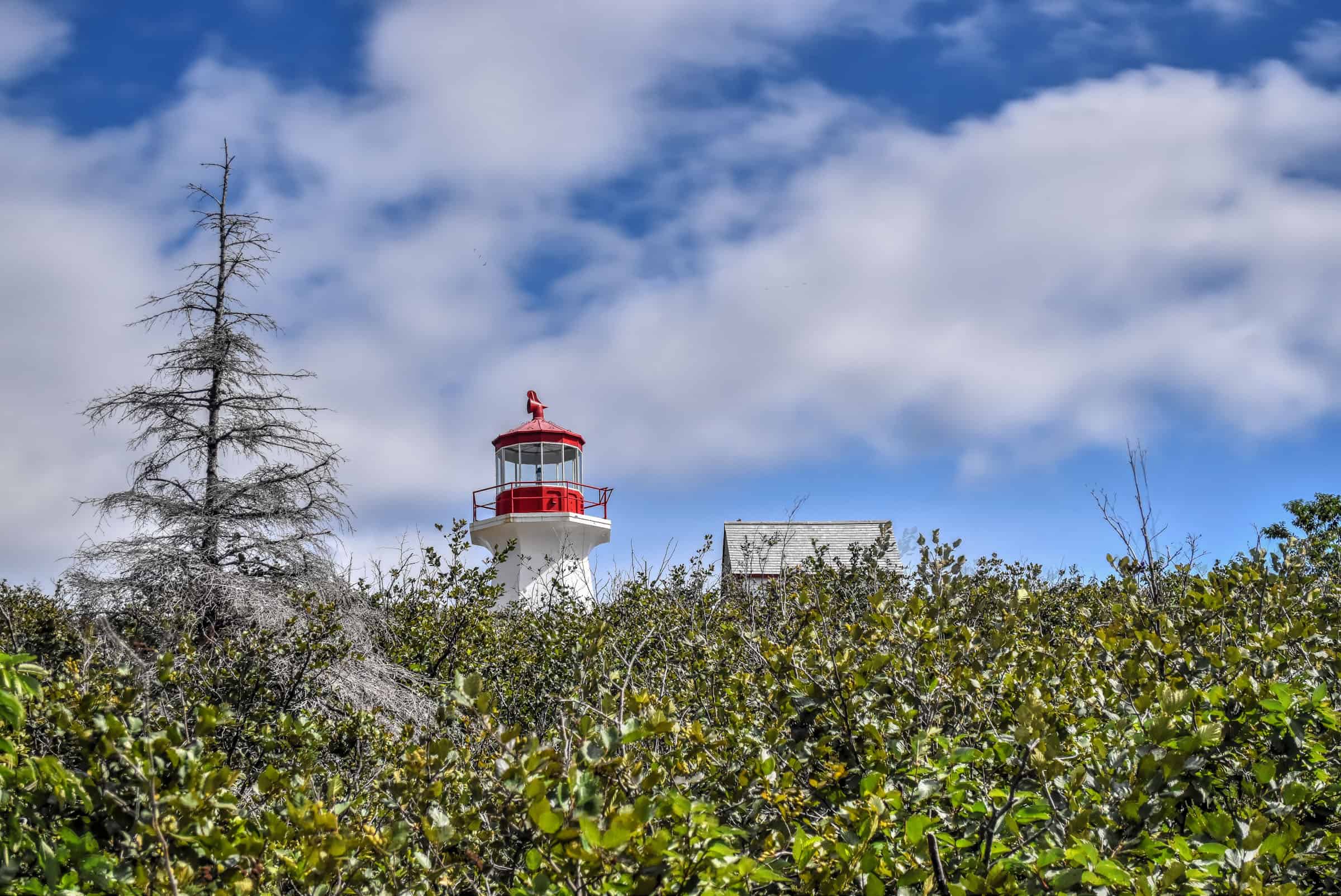
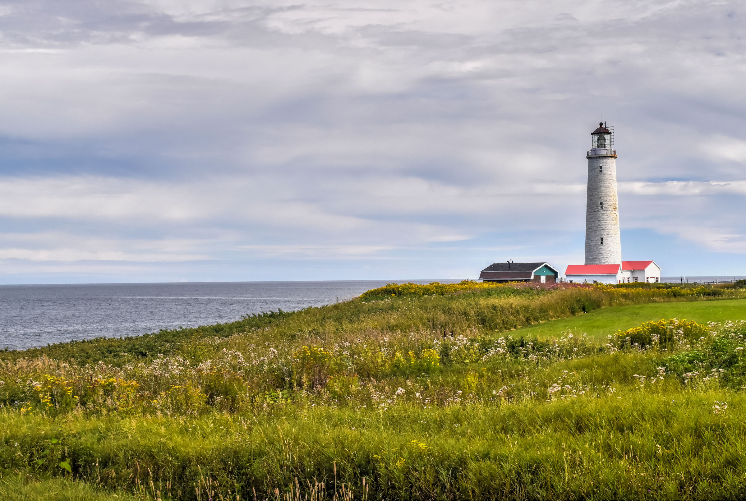
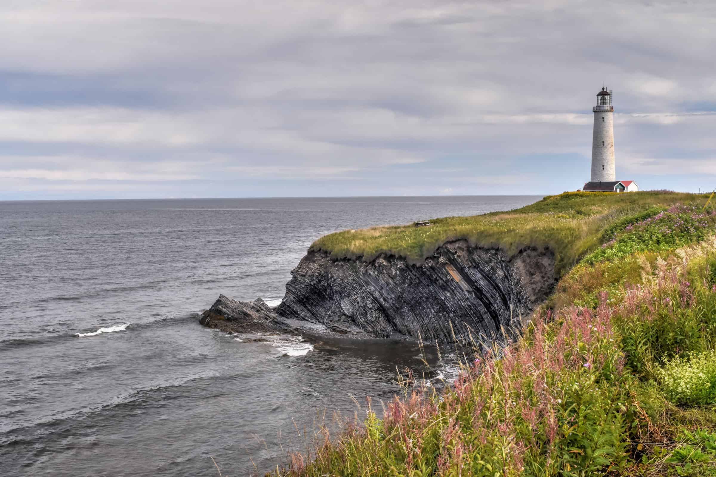
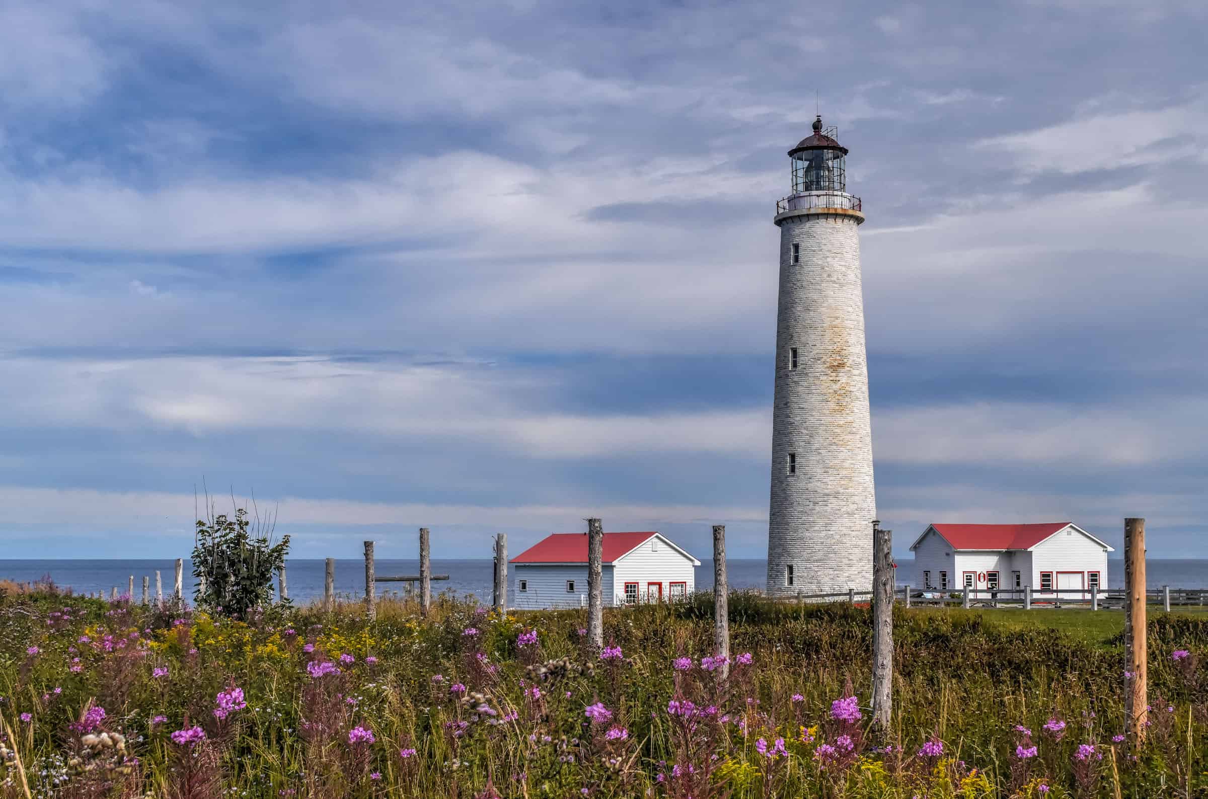
Visit Canada’s tallest lighthouse
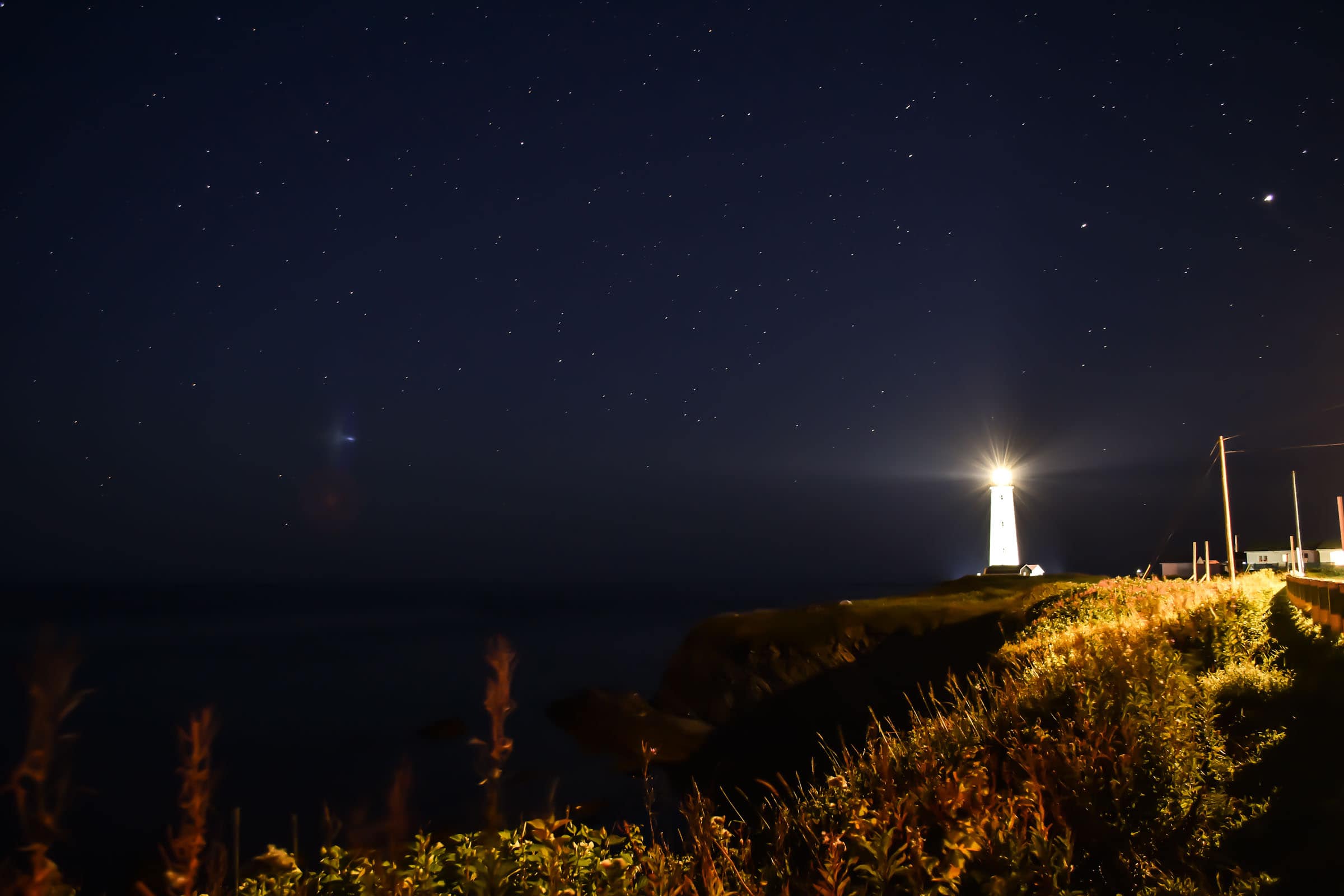
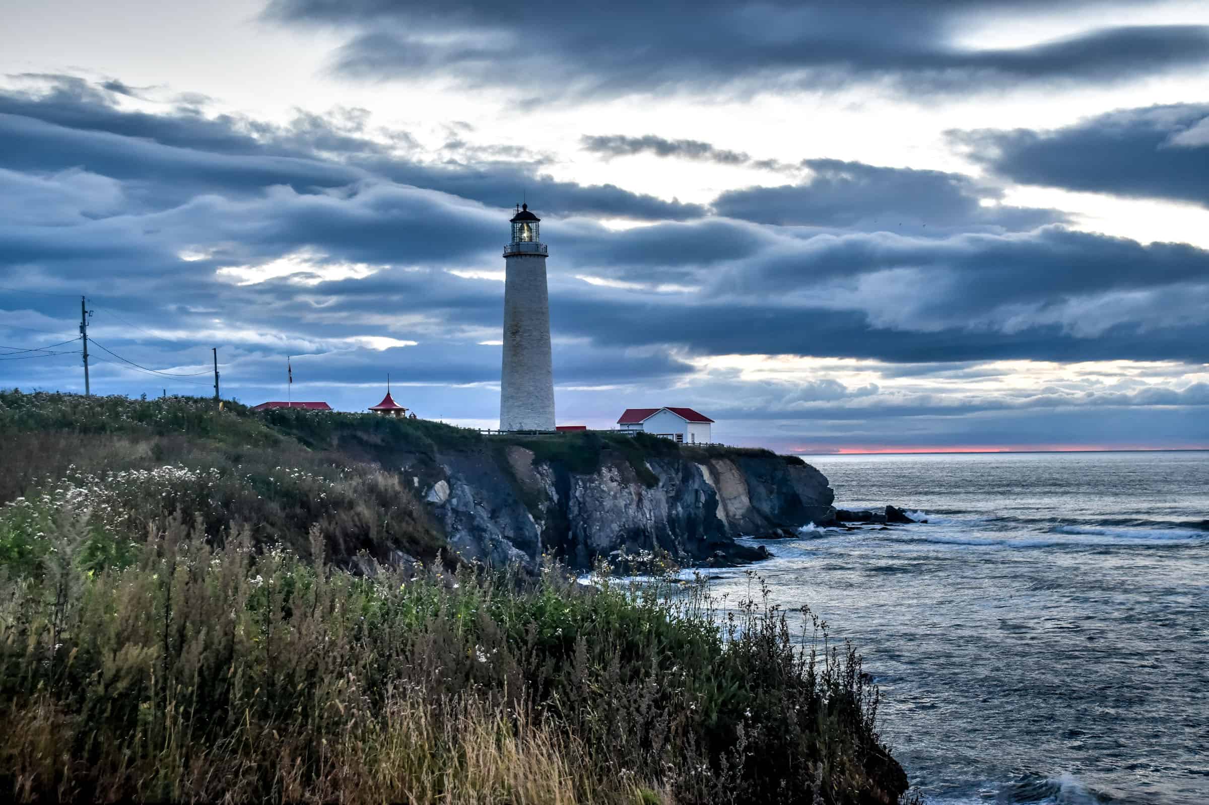
Immediately north of Forillon National Park lies the Cap-des-Rosiers Lighthouse, which at 34 metres (112 feet) high, is the tallest in Canada. You can actually walk to the lighthouse from Forillon’s Du Banc trailhead car park.
The lighthouse was declared a national historic site in 1974, and the tower itself was designated a Classified Federal Heritage Building in 1994 — the lighthouse is one of just seven in Canada to hold this double classification.


Guided tours of the lighthouse are offered from June 24th until the beginning of September.
If you are curious about other lighthouses in the area, check out our guide on visiting Gaspésie’s Most Beautiful Lighthouses.
Discover the Town of Gaspé
Gaspé is both the administrative capital and the largest town of the Gaspé Peninsula and can provide a worthwhile stop between Forillon National Park and Percé. Although we chose to base ourselves in Cap-des-Rosiers for visiting Forillon due to its proximity to the national park, Gaspé could be a great alternative for those preferring to stay in a larger and more lively town.
There’s a lovely waterfront promenade and a well-regarded history museum on its eastern end, and a short walk from the promenade, you will find the only wooden cathedral in North America.


Dive into the History of WWII Peninsula Fort
Fort Peninsula is the only World War II shore battery that has been completely preserved and that is open to the public in Quebec. It’s actually located within Forillon National Park, near the Penouille visitor center and is free to visit if you pay your park entrance fee.


From 1942 to 1944, German “U-boats” (submarines) entered the St. Lawrence Gulf and River to disrupt critical supply routes between Canada and the Allied forces in Europe, where they sank 23 ships during what has become known as the Battle of the St. Lawrence. In response to this danger, Canadian Navy strategists chose this site as a naval base to defend the St. Lawrence Gulf and River.
Visit the famous Percé Rock
The Percé Rock is a huge sheer rock formation in the Gulf of Saint Lawrence on the tip of the Gaspé Peninsula, located roughly 100km south of Forillon National Park. It is one of the world’s largest natural arches located in water and is considered a geologically and historically rich natural icon of Quebec.


For more tips on visiting the Percé Rock, check out our page on the top things to see and do in Percé, where we also highlight several hiking trails and other things to do while in the area.


Visit Bonaventure Island National Park and the Northern Gannet Colony
Bonaventure Island is, without a doubt, one of the gems of the Gaspé Peninsula. Despite its relatively small size, the island is home to the largest migratory bird refuge in North America. Its colony of 110,000 northern gannets is the most accessible in the world – you can almost walk right up to them. It is estimated that a total of 300,000 seabirds nest on the island, including razor-billed auks, gulls, kittiwakes, murres, and cormorants.


Bonaventure Island also offers four hiking trails, one of which is a heritage trail that reflects the island’s historic past. In fact, you have to hike one of the trails (any one of them) to reach the Northern Gannet viewing areas. The shortest trails take less than an hour to reach the Gannets, but there are also longer and more scenic trails.


The only way to reach the island is by boat, and overnight stays are not permitted. The island is only open to visitors from early June to mid-October. For more information on visiting this spectacular island, check out our Île-Bonaventure National Park and Gannet Travel Guide.
Where to Stay Near Forillon National Park
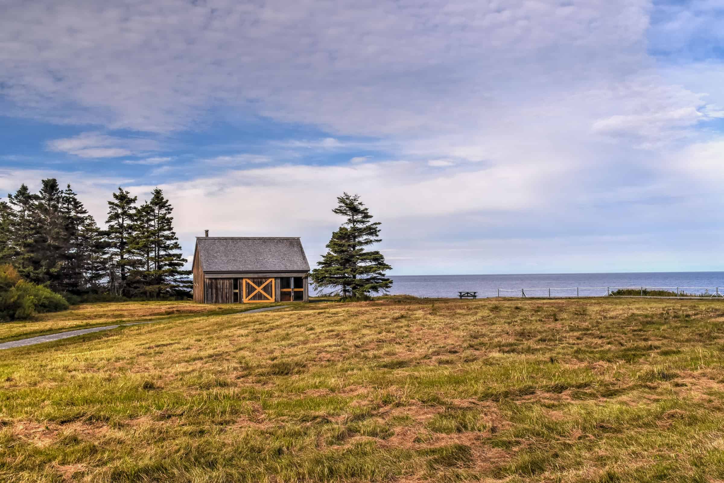
The park has several options for those who like to spend the night in a more rustic setting, including front-country and backcountry campgrounds, yurts and a few different glamping and cabin options.
For those that prefer a slightly more urban option, the town of Gaspé is less than 30 minutes away with several hotels and various accommodation options.
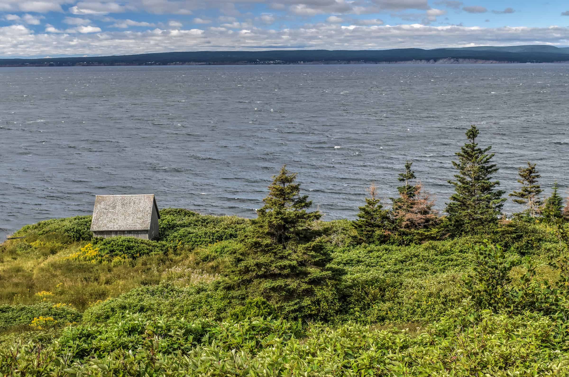
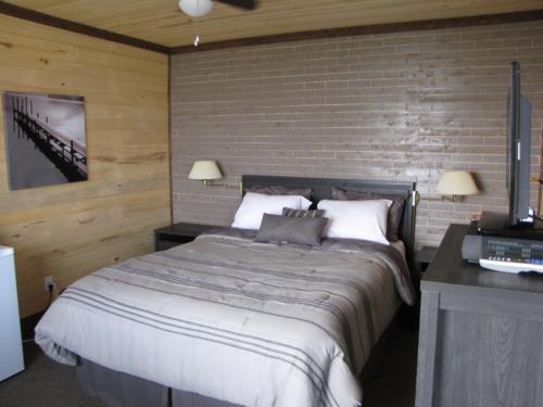
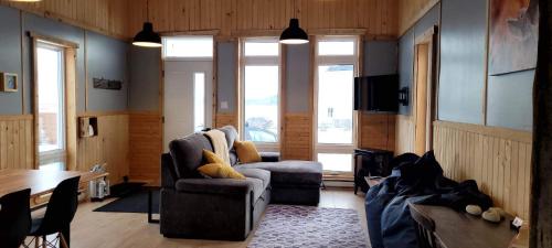
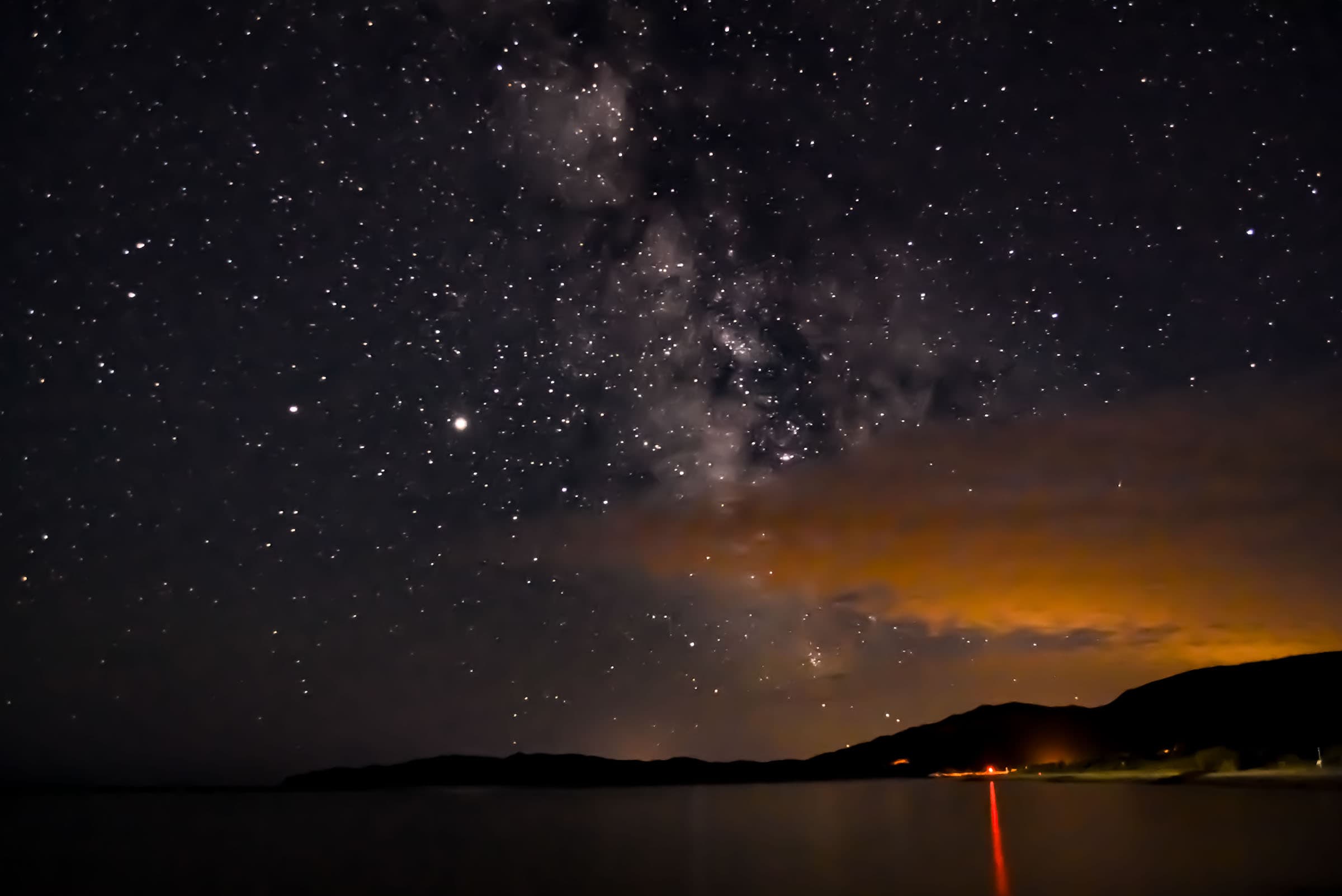
We prefer something in between, a standard room just on the outskirts of the national park. We can definitely recommend staying at Le Motel du Haut Phare, in Cap-des-Rosiers, which is nothing more than a tiny little village on the outskirts of the national park. Although the rooms are nice but basic, the location is simply phenomenal and the views across the bay from our room and its front porch are spectacular.
All the pictures below were taken less than 50 feet from the motel – and some from directly from the porch.


And just walking two minutes from the hotel, you can get even more great views of the coastline and the lighthouse.


Where to Eat Around Forillon National Park
Being in a National park, one of the best options is to bring your own food and enjoy a picnic. There are several picnic areas scattered throughout the park, some with and some without shelters.
If you don’t want to lug your food around with you, there are a few other options near the park:
Café Desrosiers: A coffee shop () at the Visitor and Discovery Center in the park’s northern section.
Petit Café de la Traverse: Another Forillon coffee shop at the Penouille Visitor Center.
(both coffee shops are typically only open from mid-June to mid-September)
Peppino Pizza: One place we particularly enjoyed one evening was this nice local pizzeria located between the South and Penouille Sectors of the park. They have a large outdoor seating area.
La Molliere: This great snack bar is open all summer in Cap-des-Rosiers, located right by the lighthouse. They also have soft-serve ice cream.
Café de L’Anse: If you are willing to drive a bit further out towards L’Anse-au-Griffon Nord village, this very well-rated restaurant is about 10 minutes from the lighthouse.
Gaspé: The town is a 30-40 minute drive away depending on where you are in the park, but if you are spending the night in Gaspé, you might as well eat there. The town has several good restaurants and we can particularly recommend the Bise-Brise bistro bar.
Planning a trip to Gaspésie?
You might be interested in these pages (coming soon):
Gaspésie Best Attractions and Road Trip Itinerary
10 Awesome Hiking Trails to Discover in Gaspésie
Gaspésie’s Most Beautiful Lighthouses
We also highly recommend these guidebooks:
Lonely Planet Best Road Trips Ontario & Quebec
Gaspé the Romantique ‘Revisited’: A Road Trip Guide to the History, Legends and Attractions
Want to Discover More Quebec Hiking Trails?
You might be interested in these pages (coming soon):
Best National Parks for Hiking Near Montreal
Best Hiking Trails in the Laurentians
Best Hiking Trails in the Eastern Townships
Photography Gear
If you like our photography, you might be interested in some of the gear we use to shoot our travel and hiking destinations.
Camera Body – Nikon Z 6ii Fx-series Mirrorless Body
Main Lens – NIKON 24-120mm F/4G ED VR AF-S
Zoom Lens – Sigma 745-306 150-600mm f/5-6.3
Polarizing filters – Urth Circular Polarizing (CPL)
Camera Tripod – K&F Concept 64-inch Camera Tripod
Mini-tripod – Lammcou Flexible Camera Tripod
Camera/hiking backpack – Vanguard Alta Rise 48 Backpack
Universal Travel Adapter – VYLEE Universal International Power Travel Plug
Other Travel Essentials
Travel Insurance
SafetyWing is a travel insurance company that offers comprehensive coverage for travellers. Includes Medical Insurance and Travel Insurance. Primarily geared towards long-term travellers, digital nomads, and expats.
e-Sim cards
Airalo is the world’s first and largest eSIM store with eSIM plans for 200+ countries and regions worldwide. With Airalo eSIMs, travellers can get connected the moment they land at their destination and avoid nasty data roaming charges
eSIMS are a sustainable alternative to single-use SIM cards – they are 100% digital, require less energy to produce and be re-used rather than disposed of.
Car Rentals
Discover Cars is our go-to website for car rentals. We almost always find our preferred rate there.
Transfer from Airport
Welcome Pickups is our favourite private transfer service, which you can pre-book at a fixed price. Currently available in 220 cities all over the world (mostly in Europe, but with several major cities in Asia, the Middle East and the US).
Kiwitaxi is another private transfer service – we haven’t tried it yet, but it’s currently available in a few more countries (102 as of 2024).
Hotels and Accommodations (coming soon)
Photography Prints
If you found this blog useful, you can help support our blog by purchasing low-cost digital prints. Printed physical prints are also available for purchase.


—–
Well, that wraps it up! We hope you enjoyed our Best Hiking Trails in Forillon National Park and that it will prove useful for planning your trip in the Gaspésie region of Québec.
—–
You might also be interested in these related pages: