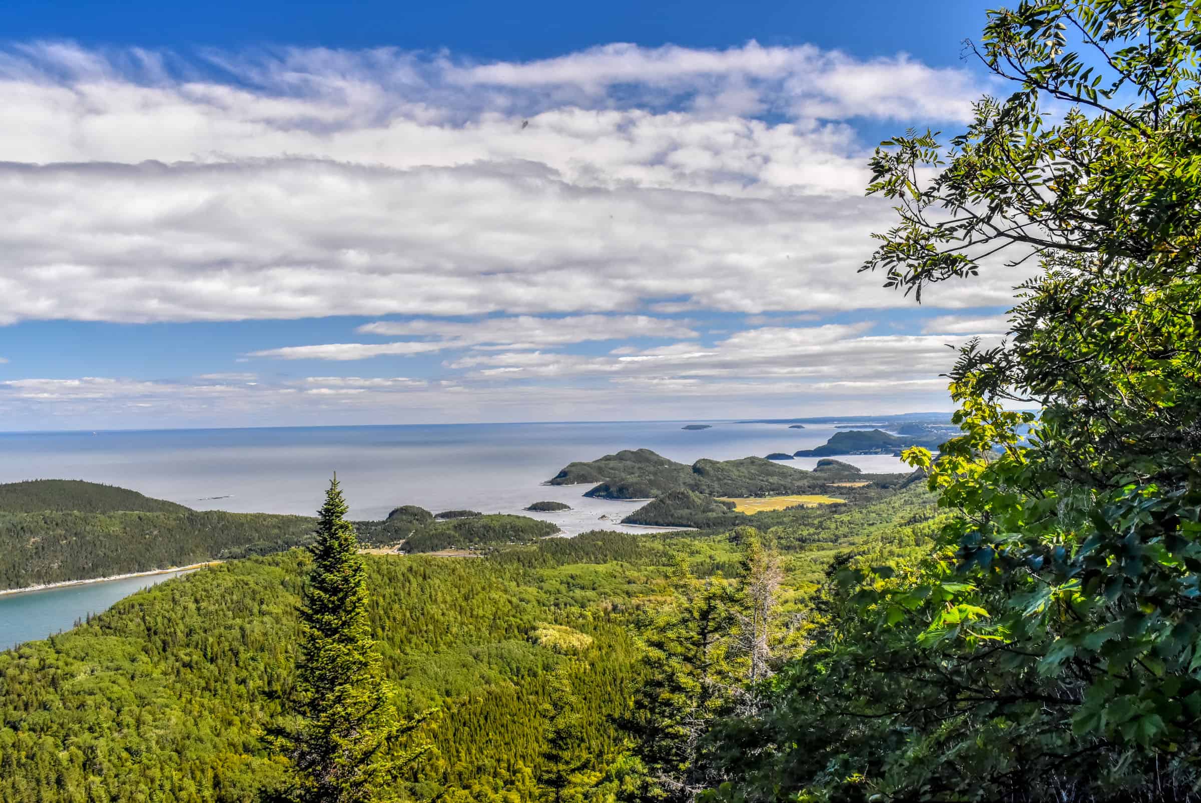
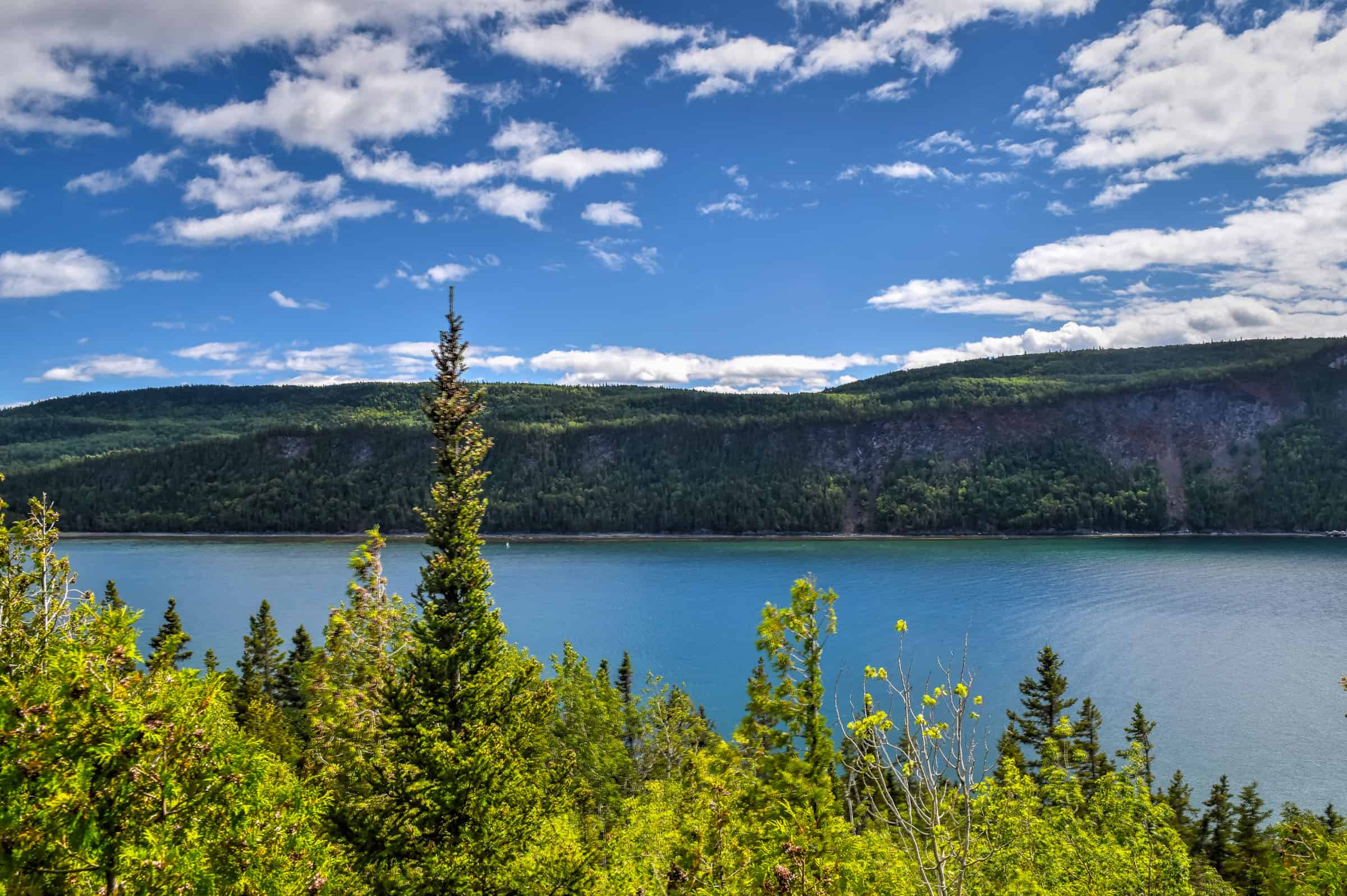
Located in the Bas-Saint-Laurent region, near Rimouski, roughly midway between Québec City and the heart of the beautiful Gaspésie region, BIC National Park is a unique coastal environment where you will find scenic hiking trails among capes, bays, coves, islands, salt marshes and steep peaks. Here the tides play a role, as several trails are only accessible during low tide. It’s also a great park for marine wildlife sightings the many harbour and grey seals that frequent the waters of the park. To help you plan your outdoor adventure, we put together this guide on the Best Hiking Trails in BIC National Park, focusing on those we believe best maximize the effort-to-reward ratio.
Disclosure: This page (Best Hiking Trails in BIC National Park) may contain product affiliate links. At no additional cost to you, we may receive a commission for purchases made through these links. More details can be found on our disclosure and policies page.
You might also be interested in these pages:
Gaspésie Best Attractions and Road Trip Itinerary
10 Awesome Hiking Trails to Discover in Gaspésie
Best Things to See and Do Percé
Gaspésie’s Most Beautiful Lighthouses


BIC National Park Location
BIC National Park (blue pin on the the map below) is located about 300km from Québec city (3h dive time), 400km from Gaspé (Gaspésie) (4h30 drive time), 515km from Montreal (5hr drive time).
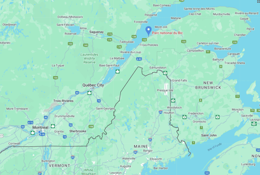
The closest medium-sized city to BIC National Park is Rimouski (pop. 50,000), which is a short 20-minute drive away. The towns of Matane, Rivière-du-Loup and Trois-Pistole are also relatively near the park.
If you need to book a rental vehicle, we highly recommend using Discover Cars to get the best rates on your rental in Montreal.
We also highly recommend Airalo (eSIM card) for your connectivity needs when travelling abroad. Airalo is the world’s first and largest eSIM store with eSIM plans for 200+ countries and regions worldwide.
The BIC National Park also makes a great stop (ideally for a few days) for those making a roadtrip to Gaspésie from the south. Gaspésie National Park is only a 2h30 drive away. We decided to spend a few days in the BIC/Rimouski area after a two-week roadtrip to Gaspésie from Montréal.
About BIC National Park and its trails
BIC National Park, which was founded in 1984, is one of 28 Quebec National Parks, the majority of which are administered by the Société des établissements de plein air du Québec (SÉPAQ) (Nunavik Parks administer the others). Although all provincial parks in Quebec have used the term “national park” since 2002, there is no connection to the federal national park system, administered by Parks Canada.
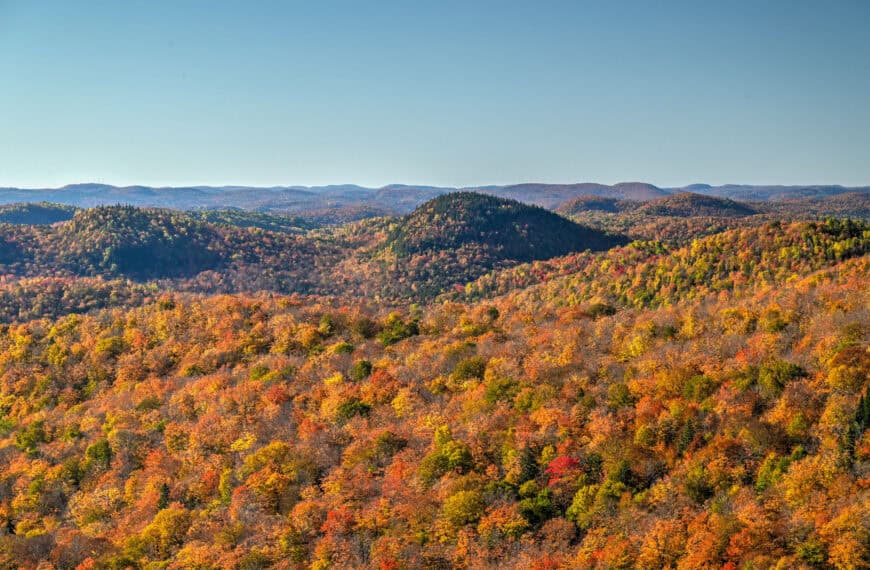
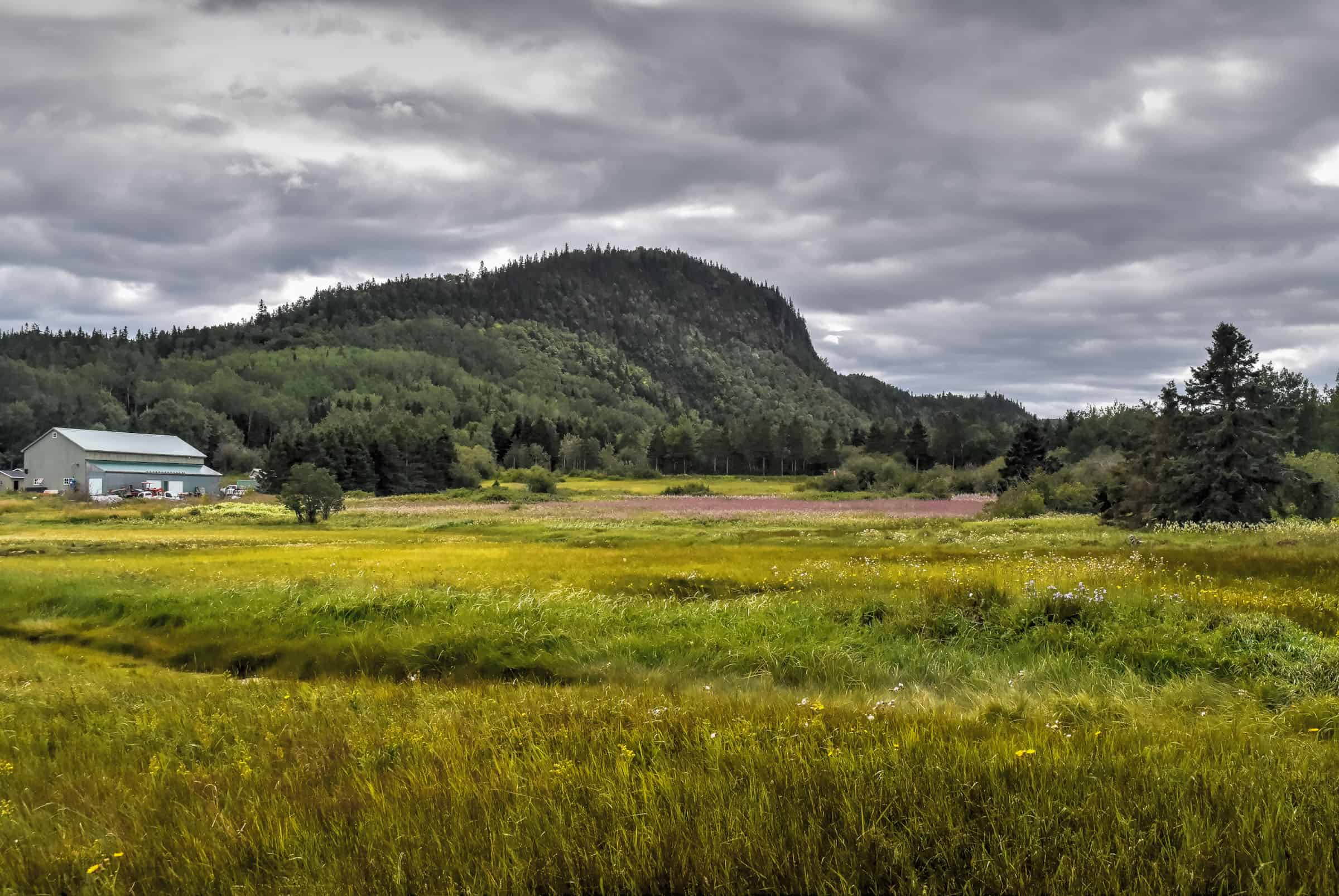
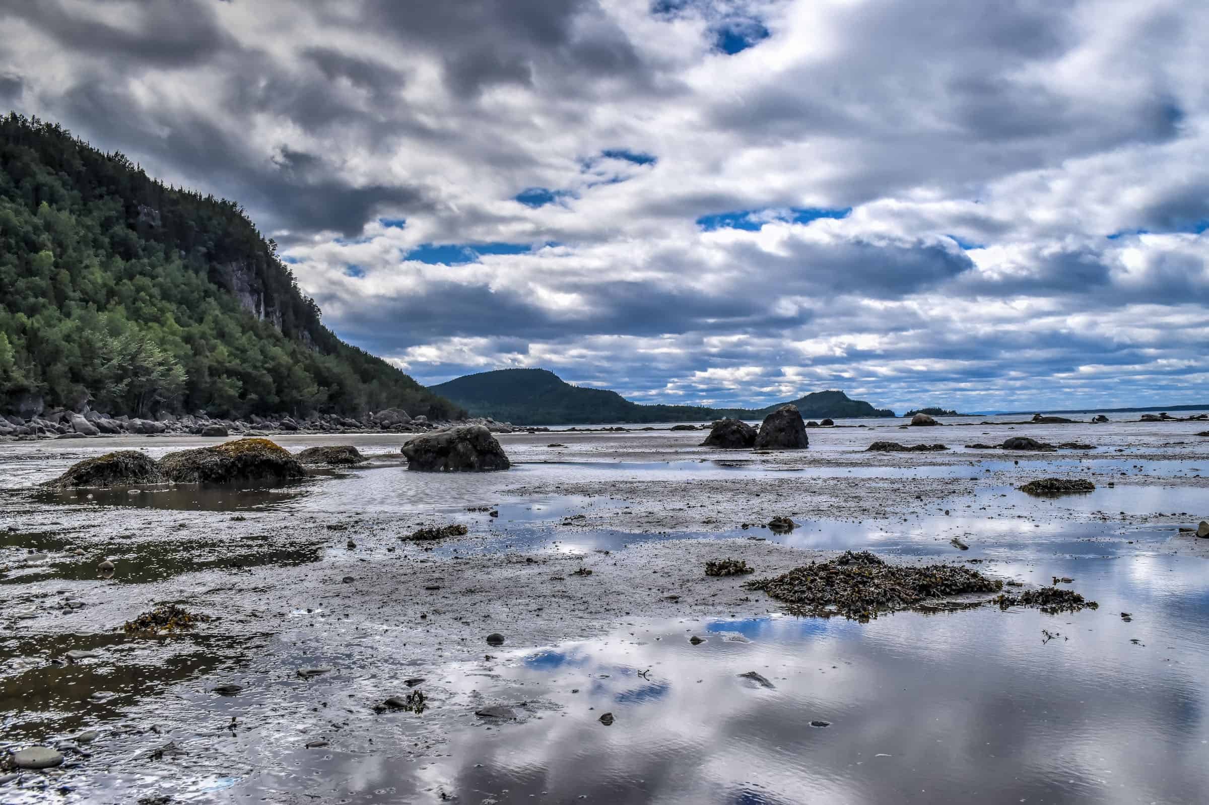
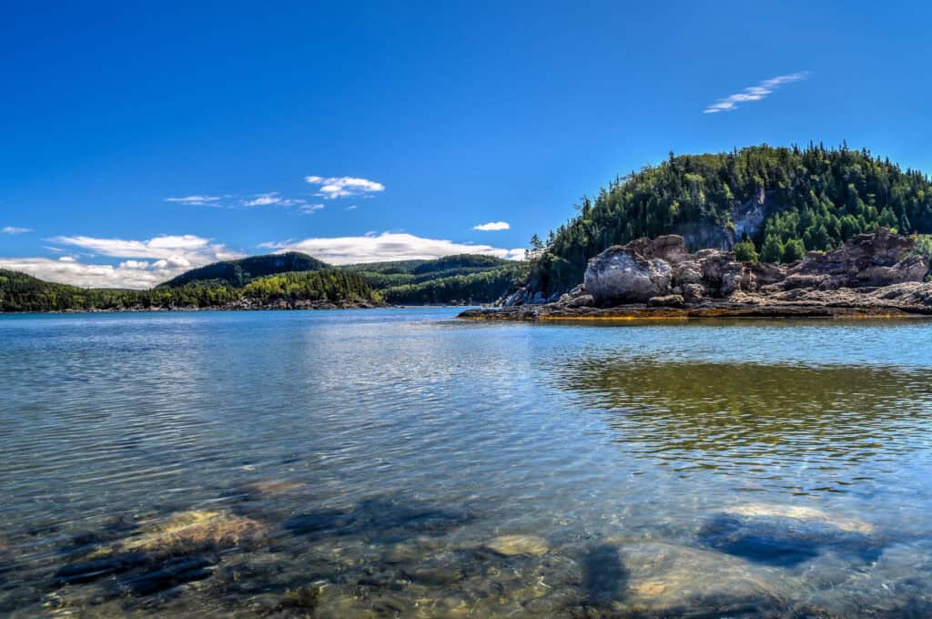
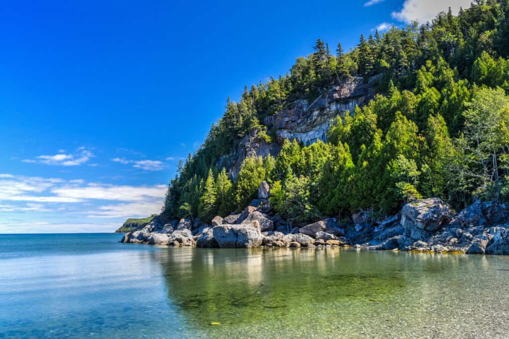
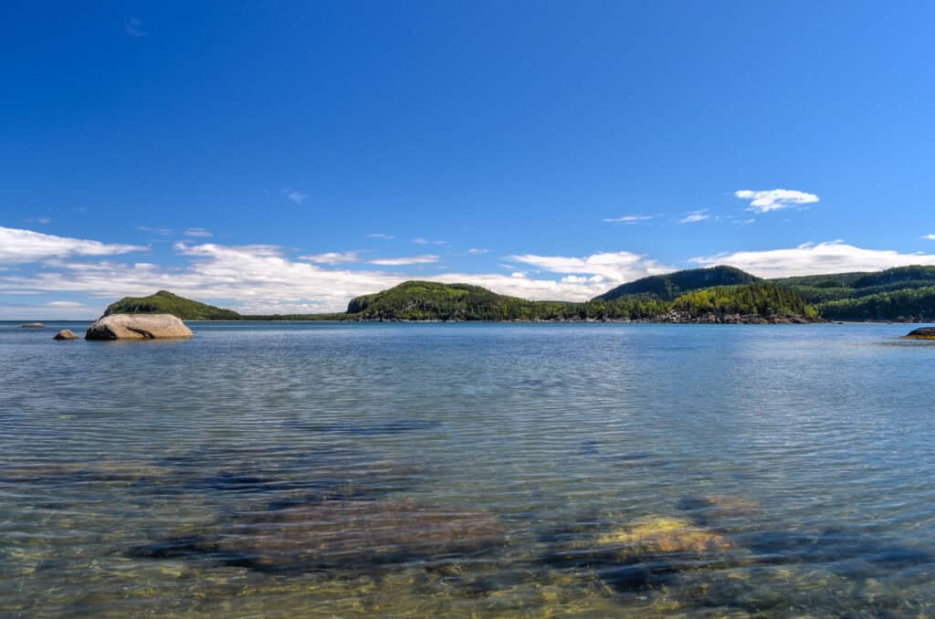
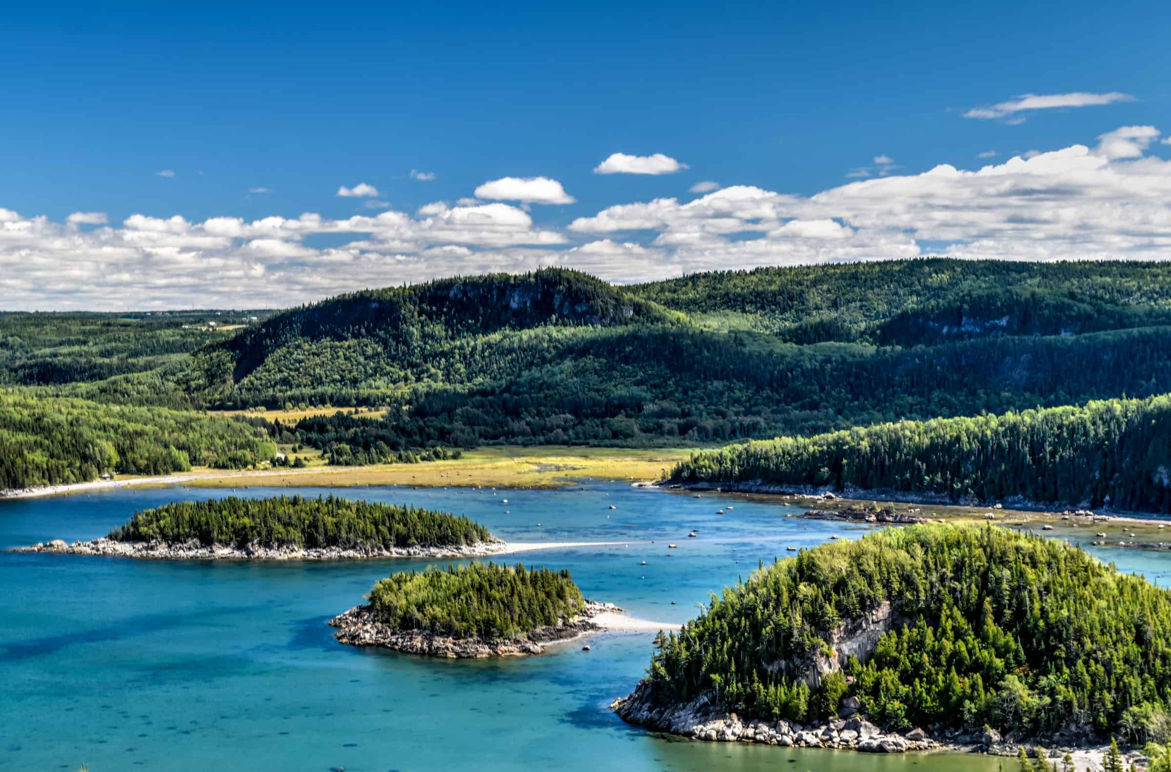
The park’s coast is more jagged than the rest of the shoreline and its mountainous massifs are higher than all others in the region. The park contains 12 named mountains, the highest and most prominent of which is Pic Champlain (348 m/1,142 ft). Slightly less than half of the park is a coastal marine environment and is home to large populations of harbour seals and grey seals.
The peaks in Bic National Park are part of a subrange of the Canadian Appalachians, which in turn are a subrange of the Appalachian Mountains that extend from the northern part of the US state of Alabama to the northern tip of Newfoundland. Most of the park is covered by mixed-wood forests providing a great flora diversity, as the region is part of a wider transition zone between boreal and deciduous forests.
The wildlife is also rich and diversified. Harbour seals, annual residents of the estuary, and grey seals, which come to visit for the summer, attract a large number of visitors. The reefs and sheltered coves are ideal protected spots for the seals, and the many scattered boulders allow them to stretch out in the sun to promote moulting.

The help you visit this unique environment of the Saint Lawrence Estuary, the park has created over 50 km of laid-out hiking trails, in addition to 30 km of bike paths. The trails are open from sunrise to sunset, year-round (with only the low-tide accessible trails being closed off during winter). Come winter, snow-shoeing and cross-country skiing are popular activities in addition to hiking. Guided Kayak tours are also popular during the summer months.
All Quebec National Parks (including the BIC) charge the same access fees and you can buy an annual pass that allows unlimited access to all parks.
Daily access fees and Annual passes
Quebec National Parks are managed by the SÉPAQ, a government agency that manages all provincial parks and wildlife preserves in Québec.
There is a limit to the number of visitors that can enter any Québec SÉPAQ National Park on any given day. It is therefore strongly recommended that you purchase your daily right of access online before a visit or that you acquire an annual pass.
The daily pass ($9.85 (2024)) can be purchased here up to 30 days before a visit.
The annual pass can be purchased here either for unlimited access to a single national park ($49.25 (2024)) or for unlimited access to all SÉPAQ national parks ($88.50 (2024)). Even if you have an annual pass, we still recommend arriving early in the morning or mid-to-late afternoon to avoid showing up to a filled parking lot.
Best BIC National Park hiking trails
L’ile-aux-Amours Trail (easy – low tide only)
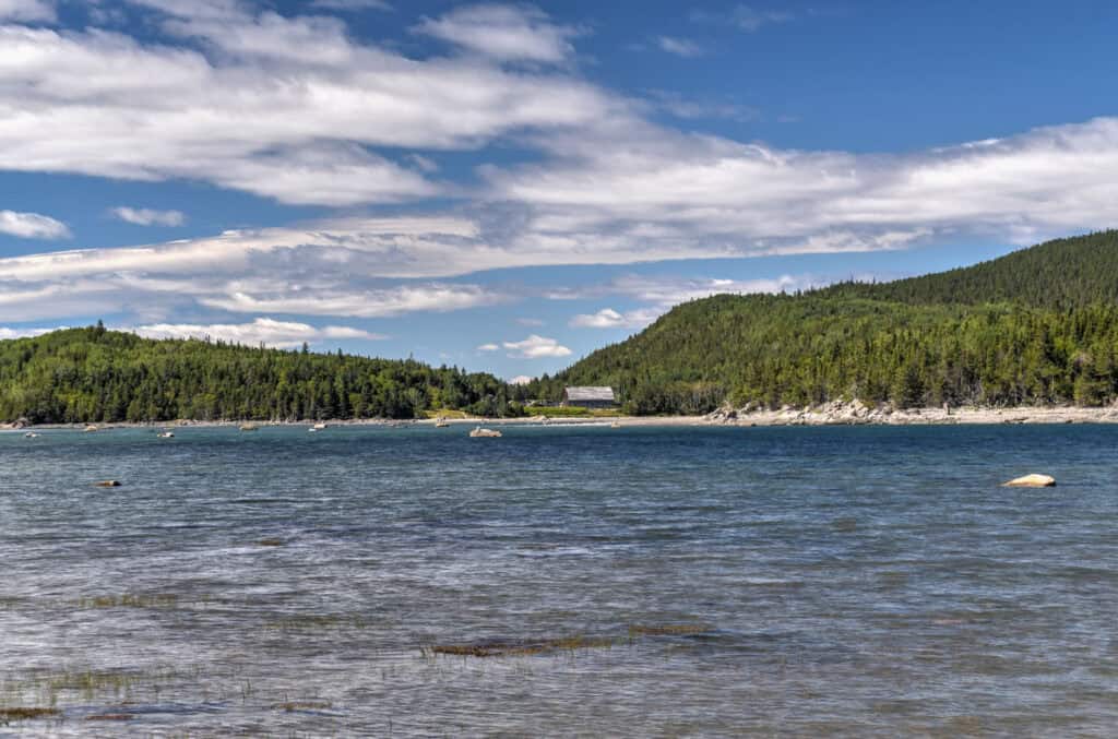
This was the first trail we did when we visited BIC National Park. It was late in the afternoon and we arrived as the tide was nearing its low point. This is one of the park’s unique trails that is only accessible during low tide. In contrast to the other such trails in the park, this one is short, easy, and doesn’t require any technical scrambling skills. That being said, you still want to be careful about the tides and not get caught on the island after the waters have risen.


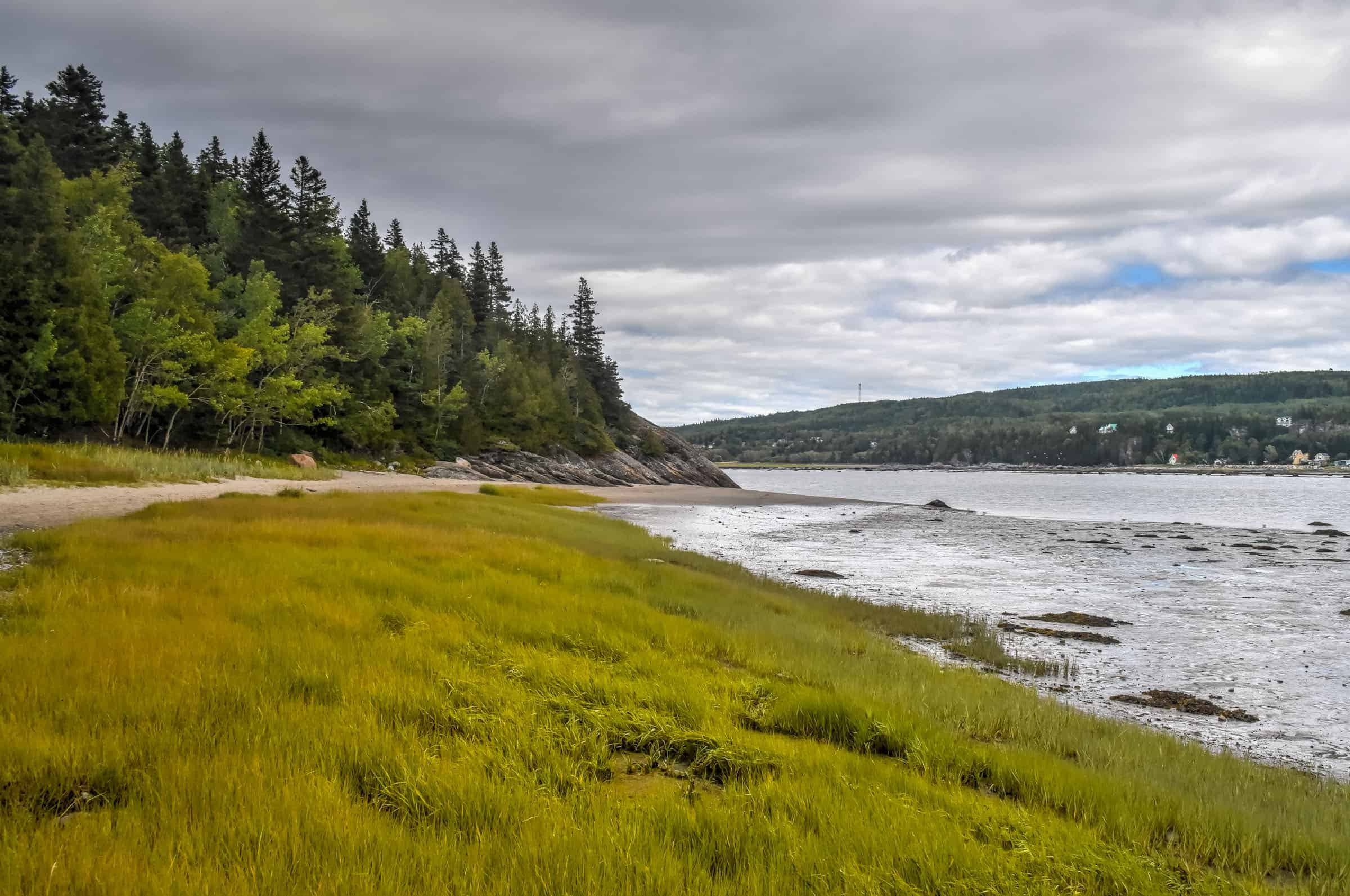
The trail follows a non-developed path that crosses a sand spit that connects the mainland to the L’ile-aux-Amours island. A network of paths and stairs connects the two sides of the island. You can also walk around it but the route is less straightforward.
Distance: 1.4 km
Route Type: Out & Back
Elevation gain: 16 m
Start point: Car Park
AllTrails rating: (4.4, 105 ratings (2024))
Duration: Most people complete the trail in under 30 minutes.
Access Fees: SEPAQ daily rate
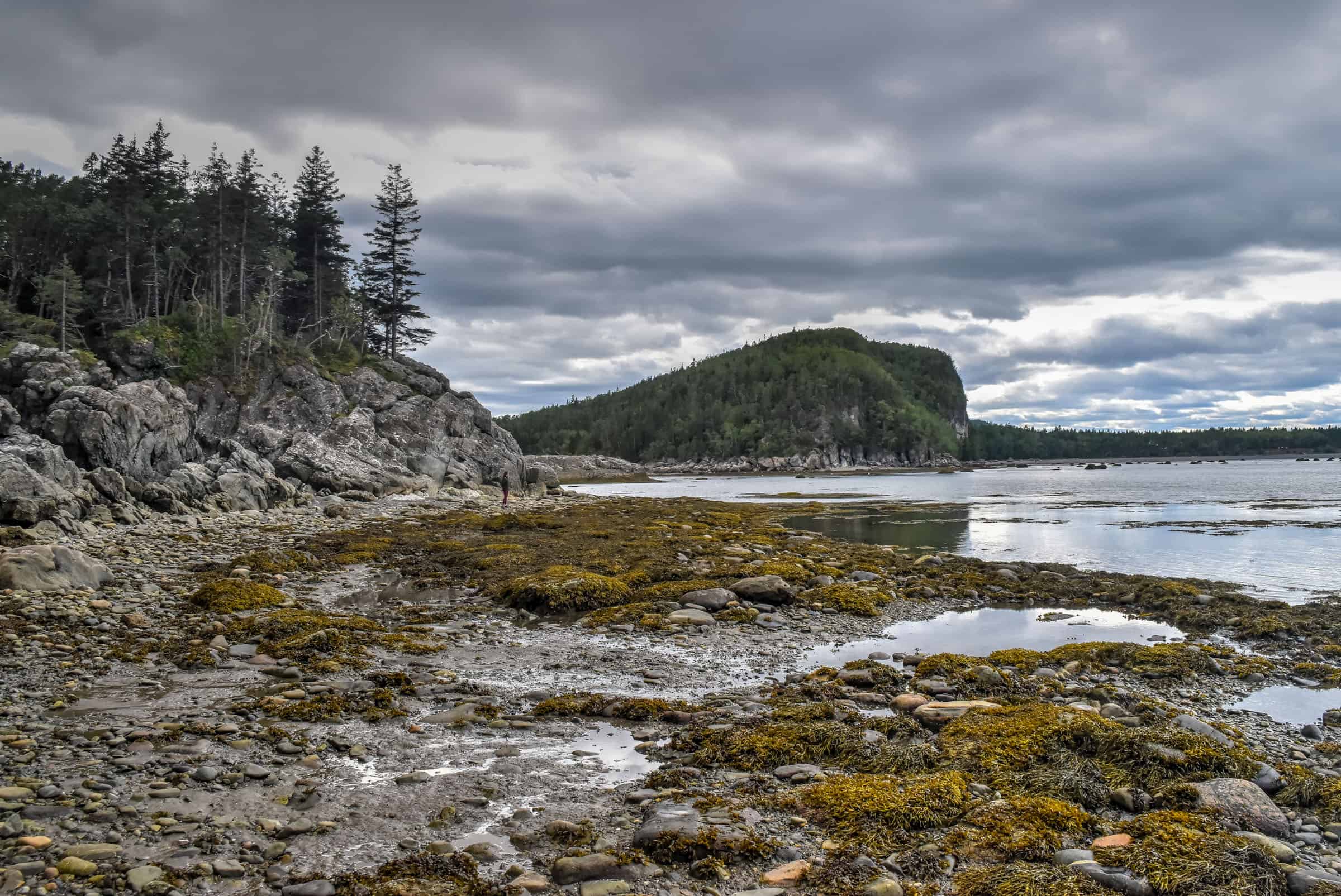
Les Anses Trail (moderate)
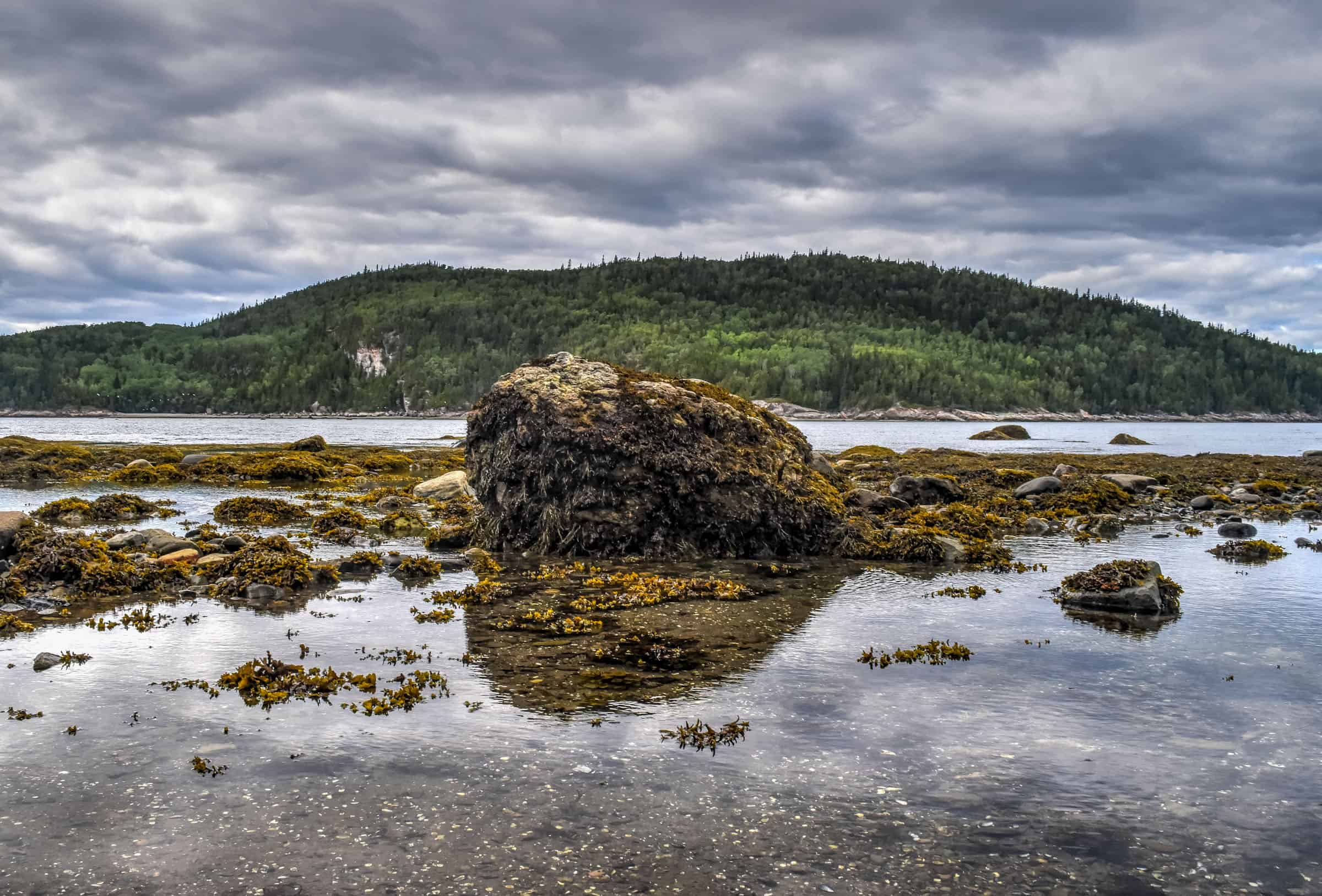
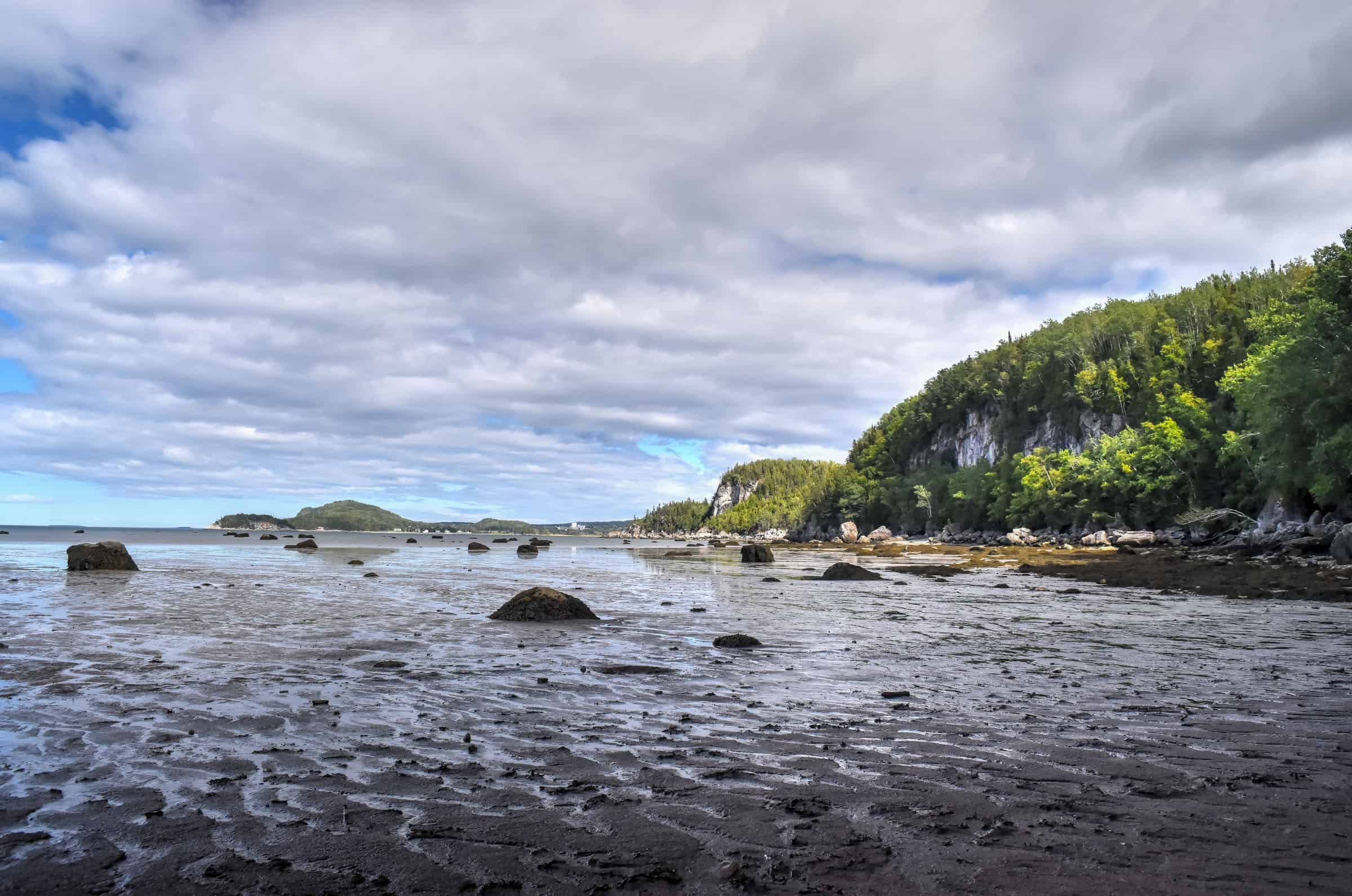
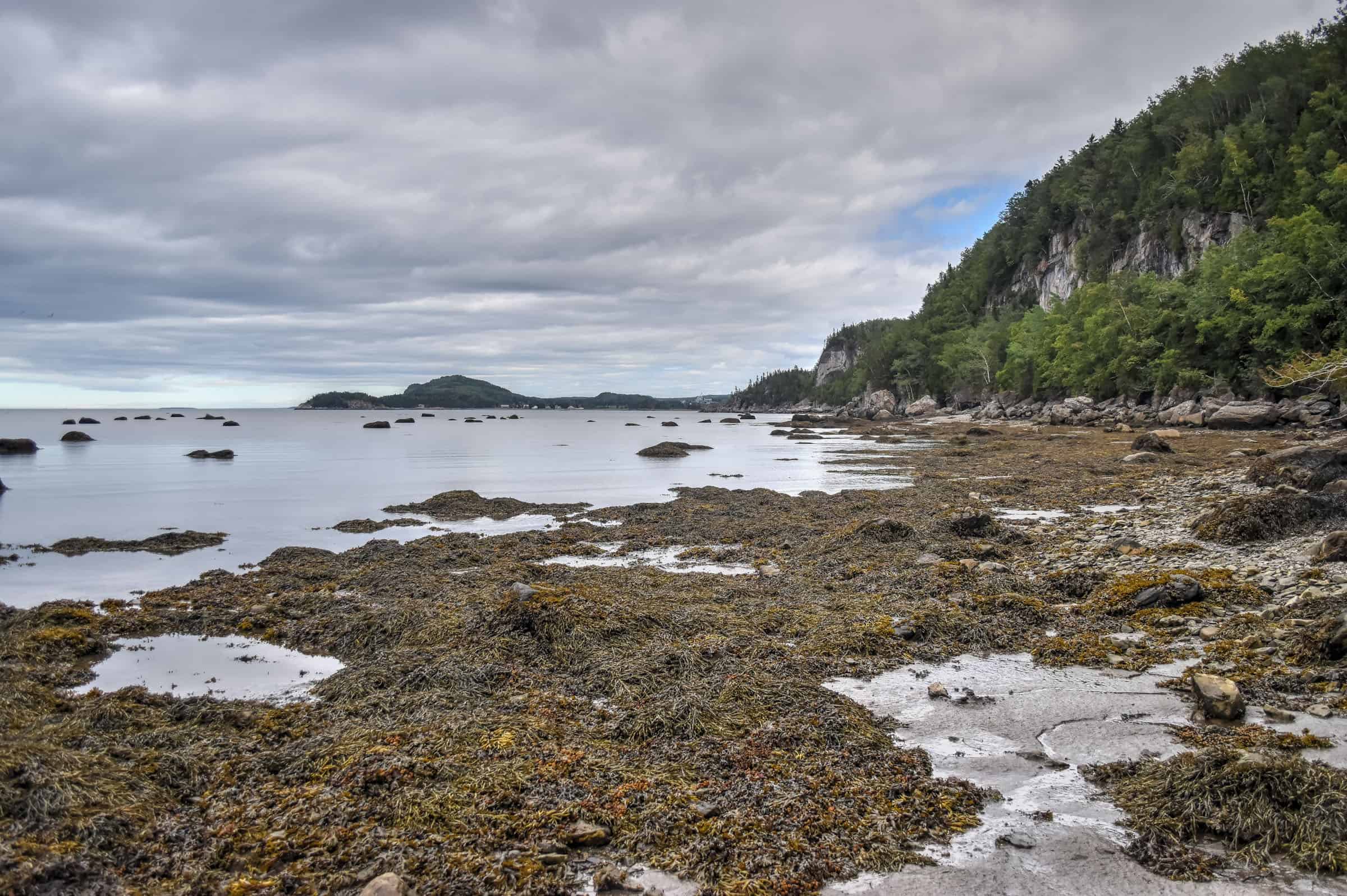
This trail takes you through coastal woodlands, rocky coastlines and beaches where, if you are lucky, can admire seals sunbathing in the distance. The trail is neither long nor steep, but there are a few technical sections due to the rocky and uneven nature of the path.


Unfortunately, the AllTrails loop trail depicted below isn’t the ideal way to do the trail as indicated by the park. While the loop option presented below exists, it’s not the best one as you’ll spend the last third of the trail following the road used by cars.
Instead, we recommend doing what we did, following the path depicted below. The part that looks to be over the water is actually a walk along the beach where you can see the seals.
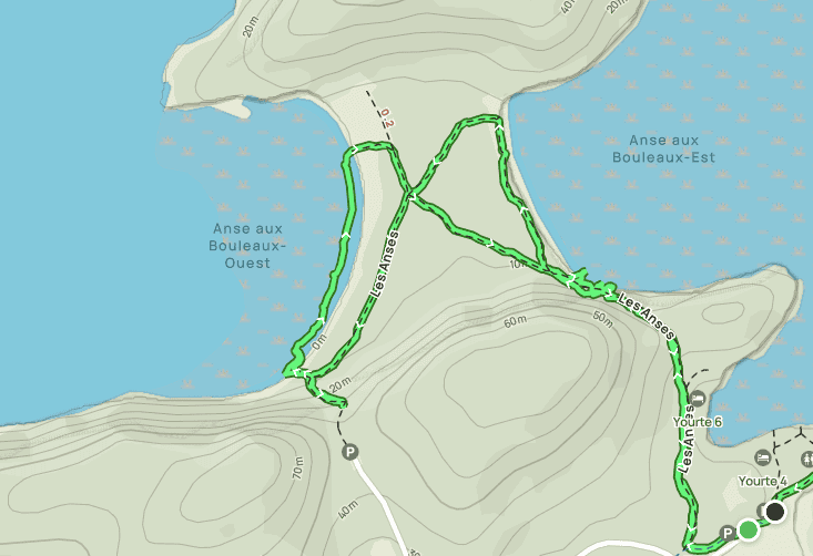
The following are the trail specifications for the path we took.
Distance: 4.0 km
Route Type: Out & Back with partial loops
Elevation gain: 40 m (cumulative elevation gain: 135 m)
Start point: Ferme Rioux Car Park
AllTrails rating: (4.6, 90 ratings (2024))
Duration: About 50-70 minutes.
Access Fees: SEPAQ daily rate
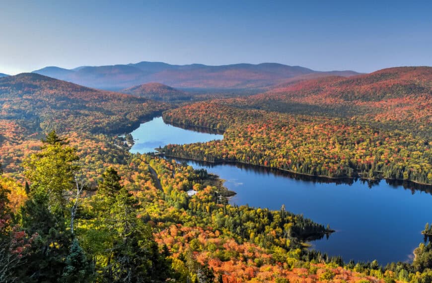
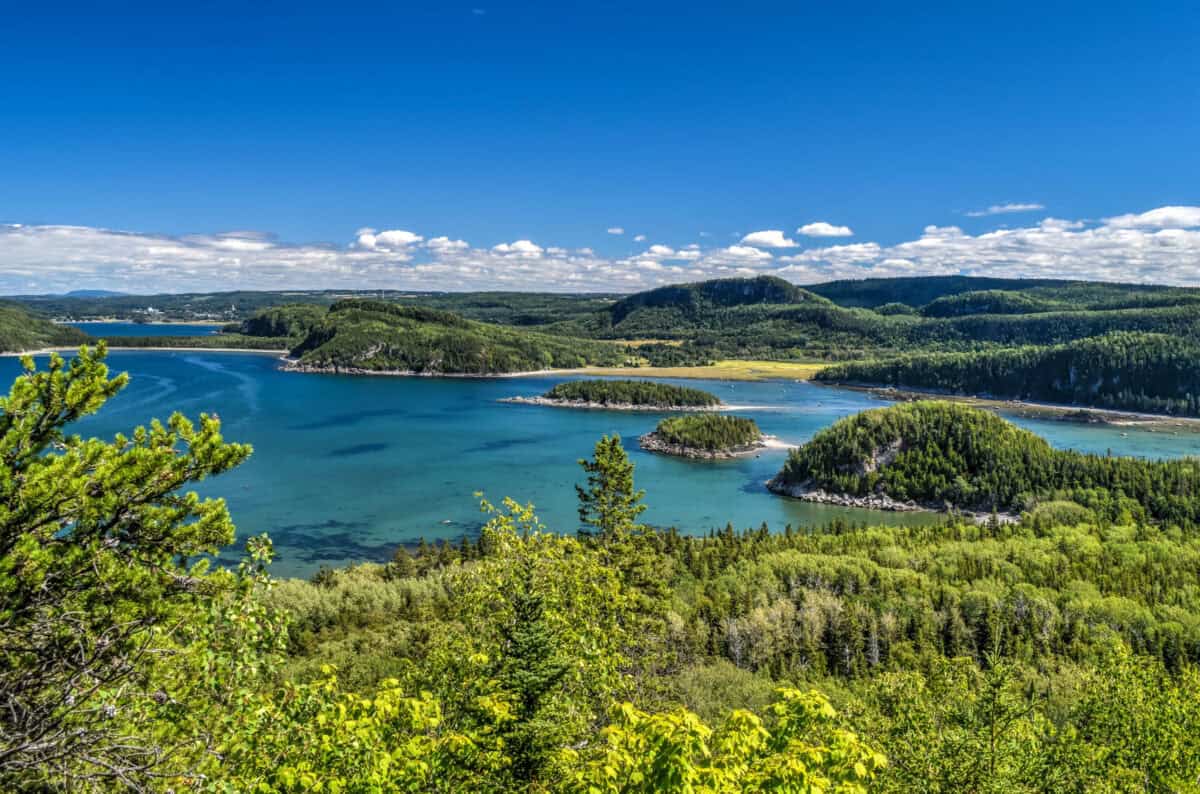
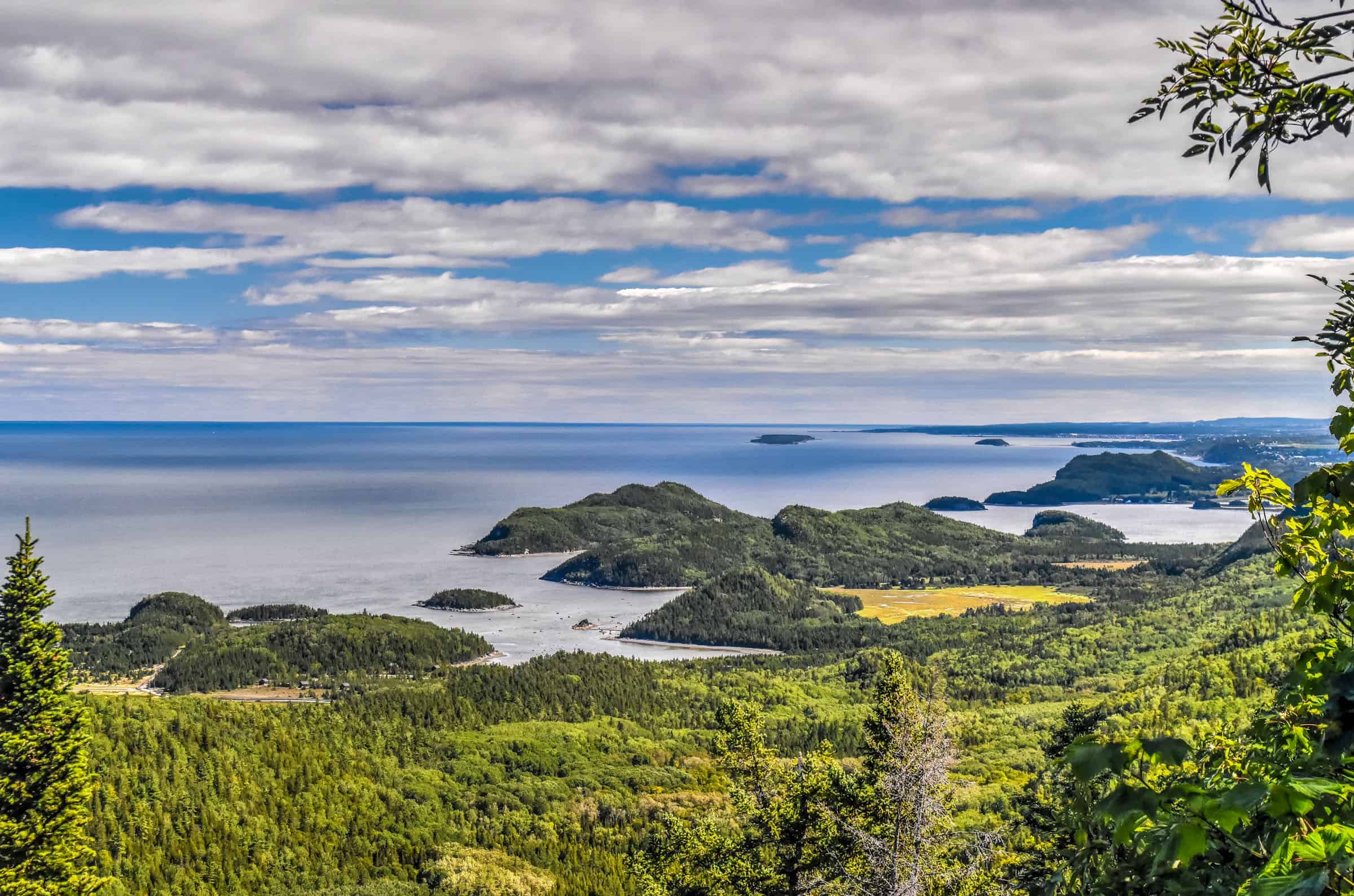
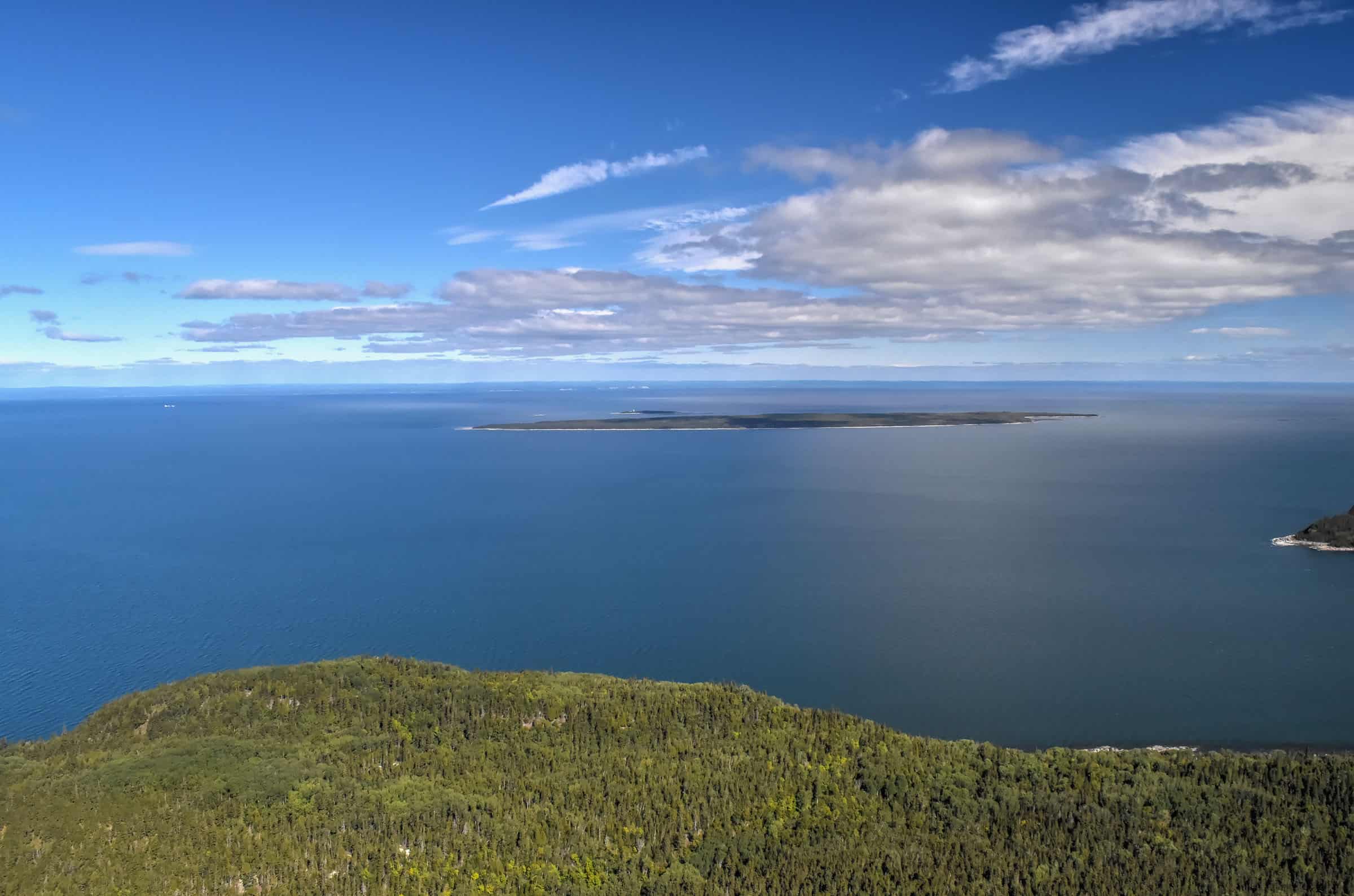
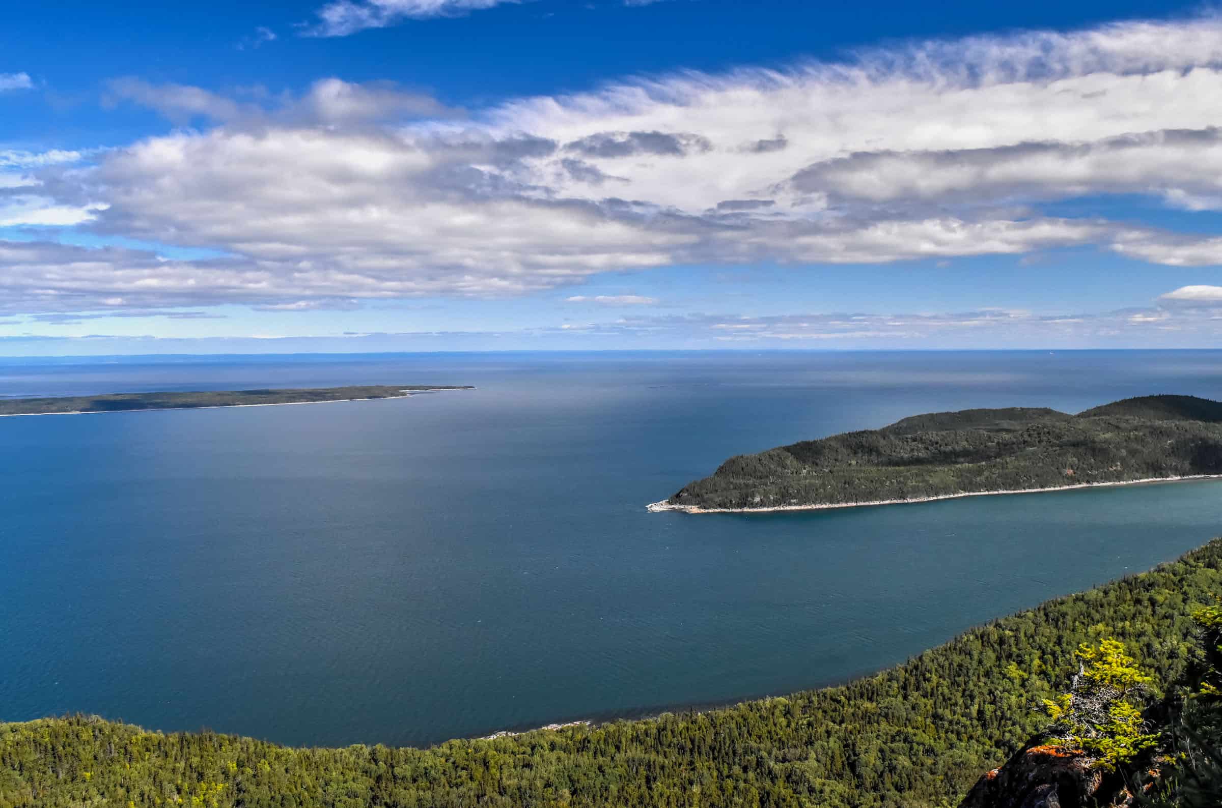
Pic Champlain Trail (moderate)
This trail offers the best aerial views of the entire park. Although the climb is one of the steepest, we found the trail to be not too difficult. The incline isn’t that steep compared to trails in other nearby national parks and the path itself wasn’t too challenging or technical, though you will have to navigate your fair share of tree roots along the trail.
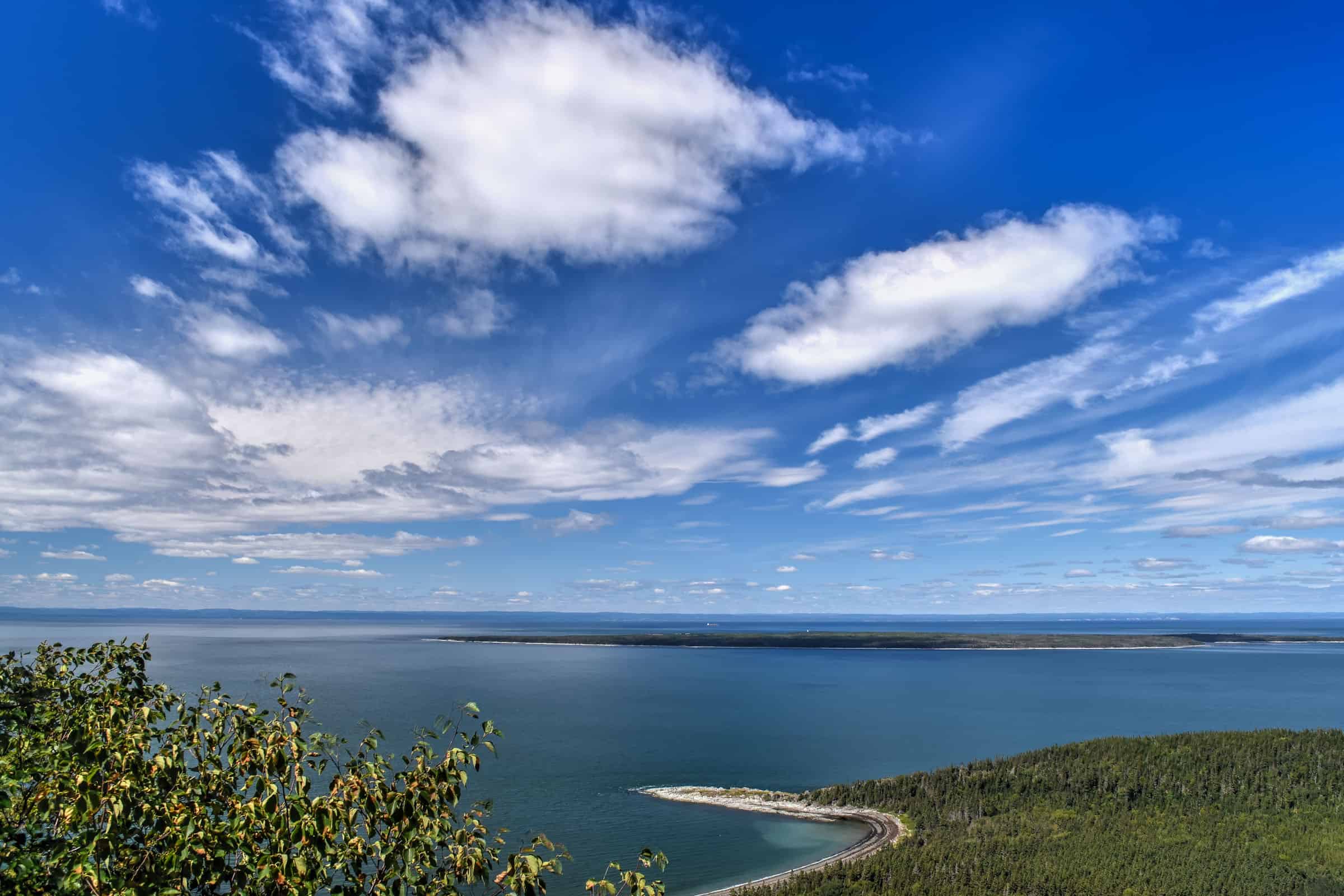
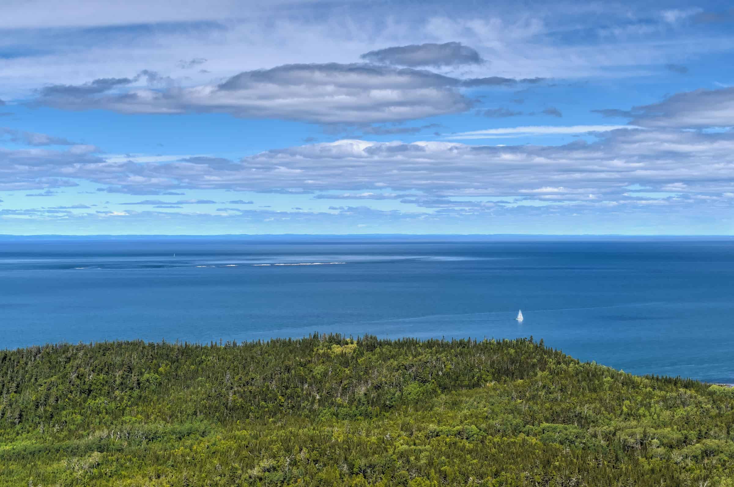
Near the Pic Champlain summit, you will cross a few beautiful viewpoints, followed by a large wooden belvedere offering fantastic panoramic views of the Saint Lawrence estuary.


Distance: 6.1 km
Route Type: Loop or Out-and-Back
Elevation gain: 200 m (cumulative elevation gain: 229 m)
Start point: Pic Champlain Car Park
AllTrails rating: (4.5, 506 ratings (2024))
Duration: Most people complete the trail in about 1h45-2h.
Access Fees: SEPAQ daily rate
You have two options for the return from the summit: follow the same path you walked up, or follow a slowly descending gravel path that creates a loop on your way back to the trailhead. Most people do the trail as an out-and-back as the gravel path is less interesting / scenic than the forest trail taken to reach the summit.
Alternatively, if you don’t like walking through uneven terrain with the occasional tree roots getting in the way of your footing, you can also just use the gravel road to reach the top. There’s also a shuttle bus service that uses that road to bring those with mobility issues to the observation deck at the summit.
A few final notes on the Pic Champlain trail:
-This is probably the park’s busiest trail, so don’t be surprised if you see more people here than on other trails.
-This is the only park trail where dogs (on a leash) are allowed (only during the summer months).
Not an AllTrails member yet? We highly recommend signing up for either their free or paid membership plans. The free plan allows you to find new trails and plan routes but it can only be used while hiking if you have access to mobile data. The paid membership plan (AllTrails+) allows you to download trail maps for offline use and provides live progress updates and off-route notifications.
If you are still uncertain – you should know that the All Trails mobile application was voted the 2023 iPhone App of the Year by Apple.
*Grand-tour, Cap-à-l’Orignal, Scoggan, Pinede and Contrebandier Trails
We are listing so many trails together because they are all located within the same section of the BIC peninsula (that we will call the Grand-Tour Peninsula for simplicity moving forward), and because they share to varying degrees various path sections with one another. That being said, their difficulty levels are very different and some can only be completed at low tide, so we will try to tease all these trails apart below to help you make better sense of them.
All the trails start by the visitor’s center located in an old farm building, known as the Ferme-Rioux.


Le Scoggan Trail (easy-to-moderate)
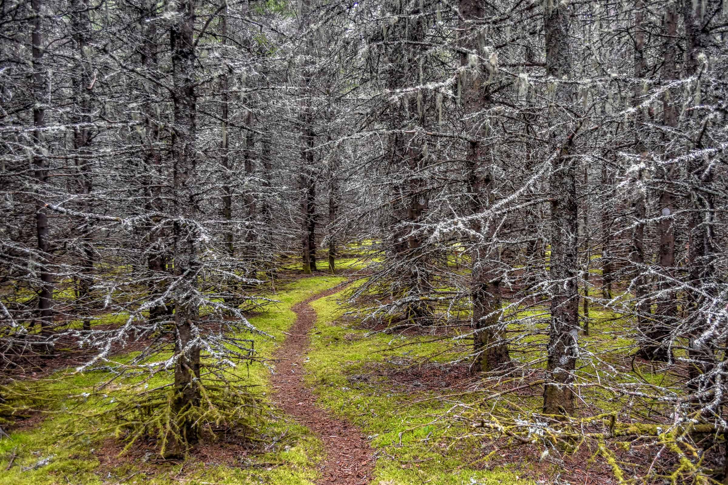
This trail is the easiest (but not the shortest) trail from the Grand Tour Peninsula. It primarily consists of a walk through a lovely forested section and will also follow some boardwalks, boulder beaches, and some coastal dirt trails with sweeping views of the Saint-Lawrence River.


Distance: 6.8 km
Route Type: Out & Back
Elevation gain: 90 m (cumulative elevation gain: 197 m)
Start point: Ferme Rioux Car Park
AllTrails rating: (4.6, 90 ratings (2024))
Duration: Most people complete the trail in about 1h45-2h
Access Fees: SEPAQ daily rate
La Pinède Trail (moderate)
The majority of the Pinede trail follows the same path as the Scoggan trail until it reaches the halfway point of the peninsula, where it then turns inland to gain elevation to reach two observation decks with fantastic views of BIC National Park. You’ll also discover along the way a cluster of centenary jack pines.


Distance: 5.8 km
Route Type: Out & Back
Elevation gain: 140 m (cumulative elevation gain: 198 m)
Start point: Ferme Rioux Car Park
AllTrails rating: (4.5, 146 ratings (2024))
Duration: Most people complete the trail in about 1h45-2h
Access Fees: SEPAQ daily rate
Hiking Packing List
All Trails subscription – This comes in really handy for areas with little or no cell reception, as the annual subscription allows you to download trail maps for offline use.
External Battery – If you are using your phone to track your progress along the trail or to help with navigation, you certainly don’t want your phone to die on you. That’s especially true in the unlikely event that you might get hurt or need assistance.
Hiking poles – These can be particularly useful in steep trails or muddy/boggy trail conditions.
Water Filter Bottle – The Life Straw bottle is an advanced water bottle with a filter that not only improves water taste but more importantly filters out bacteria and parasites, chemicals and microplastics.
Headlamp – very practical and a smart choice if you plan to start your hike before sunrise or finish it after sunset.
Cap-à-l’Orignal Trail & Grand-Tour Trail (challenging – low tide only)
We are lumping these two trails together because: 1) you are only allowed to do them during low tide and 2) the tides weren’t aligned with our schedule during our time in the national park, so we didn’t get to try these trails.
What makes these hiking trails challenging is not so much the distance travelled or the elevation gain, but rather the rugged and rocky coastal terrain you will have to navigate in certain areas, which includes undeveloped walking areas with no markers. The terrain might also be slippery and will require you to scramble at times. These trails are not recommended for young children nor are they recommended during rainy weather. You are required to do both trails in the counter-clockwise direction; this is important because of the narrow undeveloped trail areas along the northern coast of the Grand Tour Peninsula. Both trails are closed during winter.
If you plan to undertake these trails, it is recommended to start them about 2 hours before low tide. For more information on the tide schedules, you can consult www.marees.gc.ca. For more information on these trails please consult the BIC SEPAQ website.
Cap-à-l’Orignal Trail (called Chemain du Nord and Contrebandier on AllTrails)
Grand-Tour Trail
Entre Deux-Marées / Le Contrebandier Trail (moderate)
For those who want to see and hike as much as possible but not be constrained by the tides, this is the trail to do. It doesn’t have an official name on AllTrails (other than to name all the trail sections it uses), but it’s referred to as the Entre Deux-Marées Trail on the SEPAQ website (which means “between two tides”), and is mostly a combination of the Pinede trail and the Contrebandier Trail. This is the longest trail you can do during high tide as it stays mostly inland with a few coastal sections that aren’t affected by the tide. It essentially turns the Pinede trail into a loop (with a short out-and-back to the Pinede’s viewpoints), but done in reverse (counter-clockwise).
Distance: 8.5 km
Route Type: Out & Back
Elevation gain: 140 m (cumulative elevation gain: 250 m)
Start point: Ferme Rioux Car Park
AllTrails rating: (4.5, 195 ratings (2024))
Duration: Most people complete the trail in about 2h15-2h30
Access Fees: SEPAQ daily rate
Other BIC National Park activities
Seal-watching
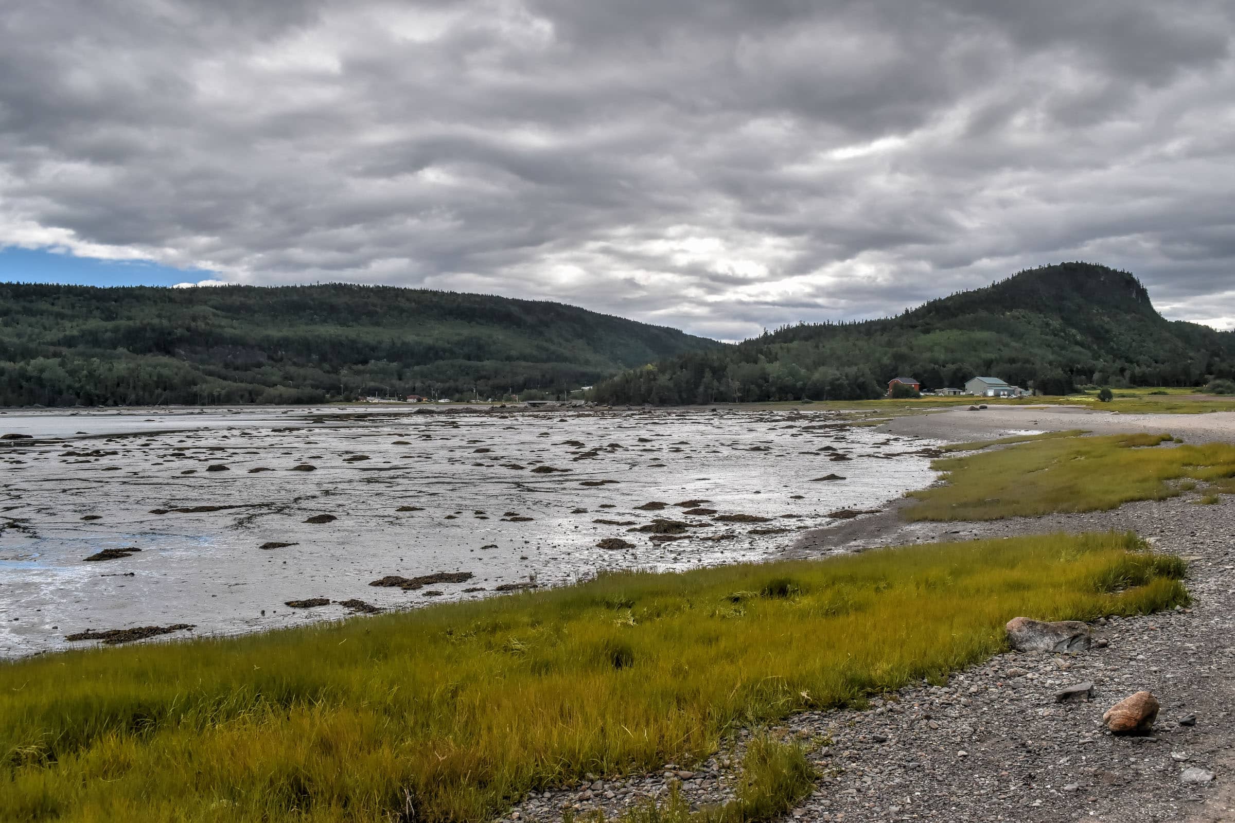
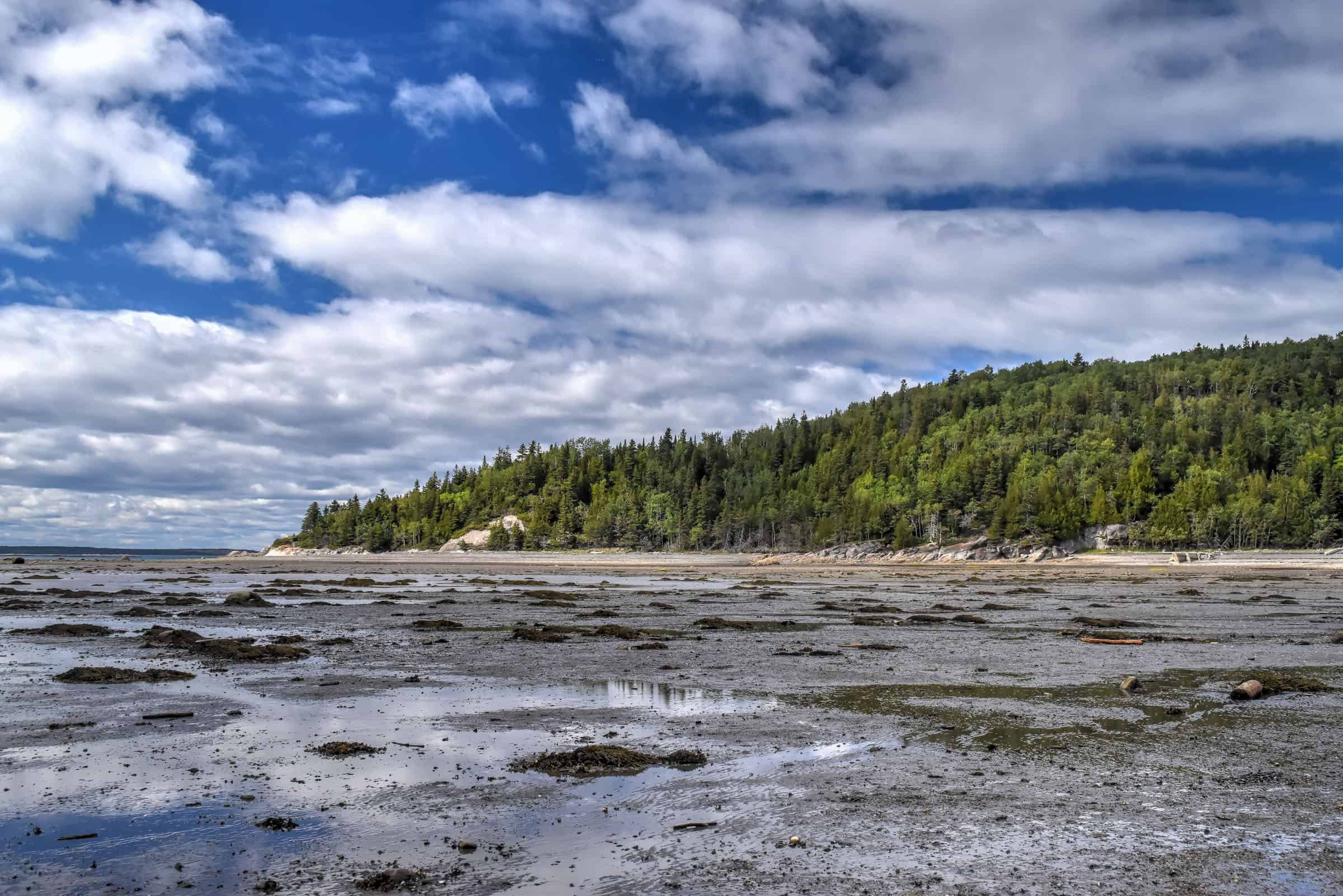
Seal-watching is undoubtedly one of the major attractions of the park, where two different species can be found (many visitors come here just to photograph these beautiful creatures. The common seal, which is also the animal emblem of the park, is present all year round in the estuary, while the gray seal joins it around mid-July.
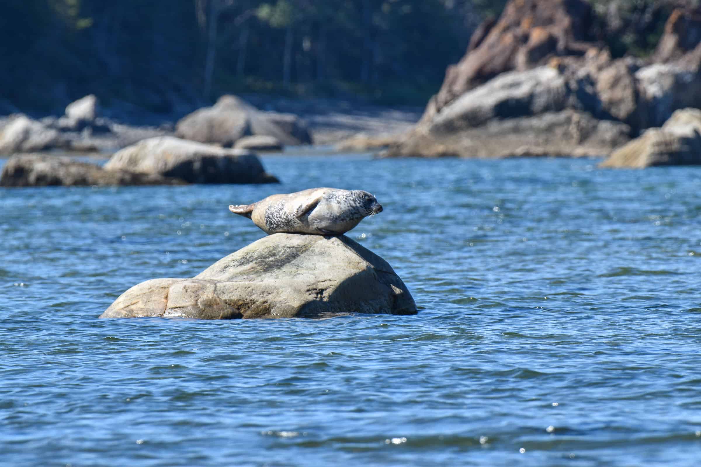
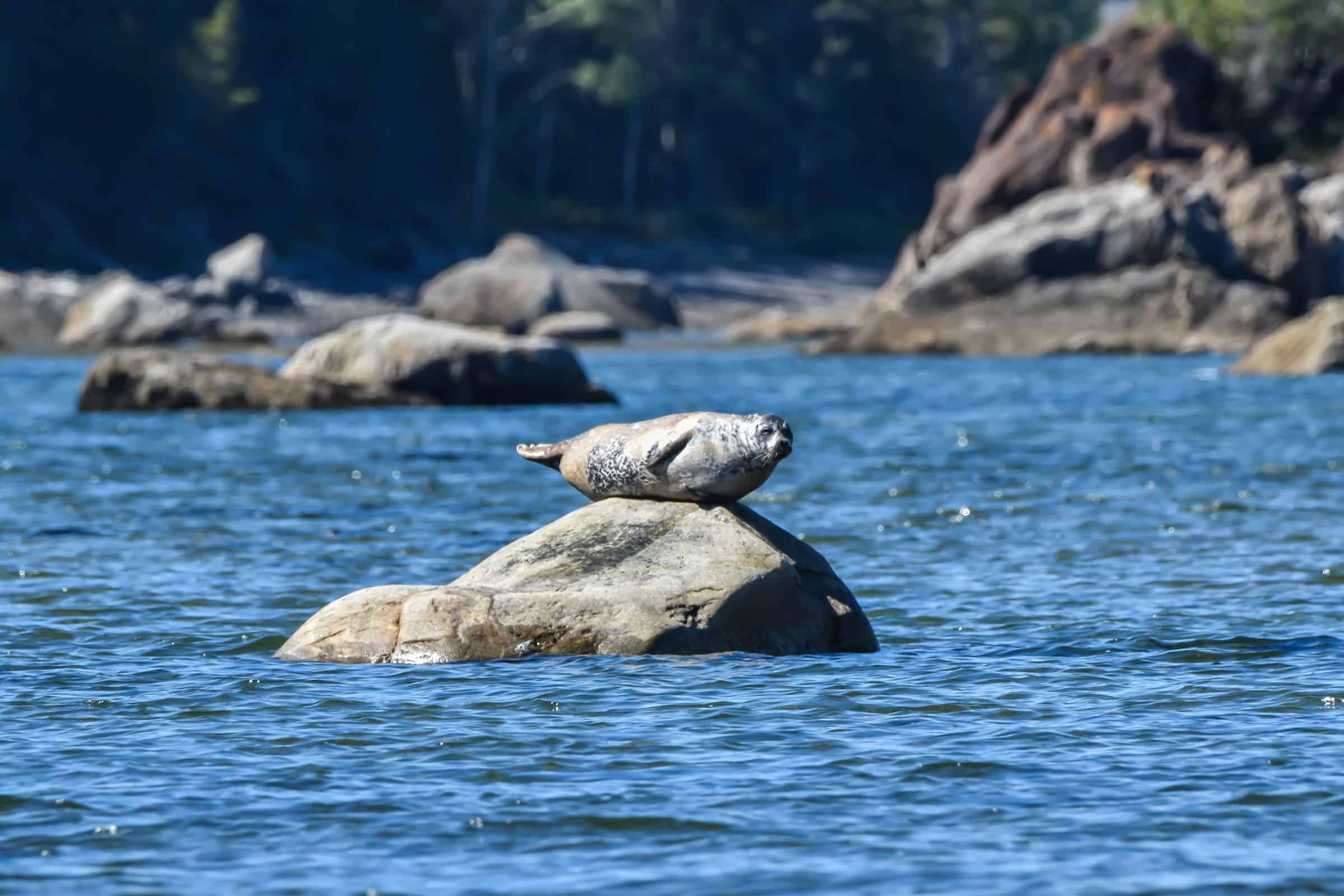
The seals can be observed from the shoreline, often resting or sunbathing on rocks during low tide. They are most reliably seen in two areas: Pointe aux Épinettes and Anse aux Bouleaux-Ouest. Both spots have car parks nearby, requiring only a short walk to reach the coastline.
Bicycle Trails and Rentals
There are over 30 km (9.3 mi) of biking trails available in Bic National Park. If needed, you can rent bikes in the Rivière-du-Sud-Ouest sector during the summer months. Bike rentals are available in the park on a first-come, first-served basis. Rental costs (2024) are $16 for an hour or $31 for 4 hours.
Guided Sea Kakaying Excursion
Sea kayaking is available at Bic National Park during the summer months. You can either head out on a guided excursion or you can take your personal kayaks. However, keep in mind that most boats are prohibited in the Anse à l’Original marine preservation zone, so contact Sépaq if you need more information about where you’re allowed to paddle in the park. Guided excursions (2024) cost $72 per adult (reduced fares for children). Reservations for the guided tours can be made at aventuresarchipel.com
Winter Months
Bic National Park offers both cross-country skiing and backcountry skiing during the winter months. There are over 40 km of marked snowshoeing trails available in Bic National Park during the winter season. You can also rent snowshoes at the Rivière-du-Sud-Ouest Visitors Centre if you don’t have your own.
BIC National Park Trail Tips
– During the peak summer and fall months, the parking lots can fill up quickly, particularly on weekends. Try to arrive early in the morning or late afternoon to guarantee a spot.
– Mosquitoes and black flies can be a nuisance at certain times during the year. The exact dates vary from year to year, but they are generally most present from mid-May to mid-July. Regardless of when you come, it’s always a good idea to carry some bug spray with you, just in case.
– Stick to the designated path to protect the surrounding environment.
Best time to visit BIC National Park
We highly recommend the end of summer and early fall (August, September and October). The weather will be pleasant and the likelihood of being harassed by bugs is significantly reduced. Moreover, July is when most people in Québec take their summer holidays.
Where to Stay Near BIC National Park
We enjoy staying in the nearby town of Rimouski when visiting the national park and can recommend either of these two mid-range hotels.

Planning a trip to nearby Gaspésie?
You might be interested in these pages (coming soon):
Gaspésie Best Attractions and Road Trip Itinerary
10 Awesome Hiking Trails to Discover in Gaspésie
Gaspésie’s Most Beautiful Lighthouses
We also highly recommend these guidebooks:
Lonely Planet Best Road Trips Ontario & Quebec
Gaspé the Romantique ‘Revisited’: A Road Trip Guide to the History, Legends and Attractions
Photography Gear
If you like our photography, you might be interested in some of the gear we use to shoot our travel and hiking destinations.
Camera Body – Nikon Z 6ii Fx-series Mirrorless Body
Main Lens – NIKON 24-120mm F/4G ED VR AF-S
Zoom Lens – Sigma 745-306 150-600mm f/5-6.3
Polarizing filters – Urth Circular Polarizing (CPL)
Camera Tripod – K&F Concept 64-inch Camera Tripod
Mini-tripod – Lammcou Flexible Camera Tripod
Camera/hiking backpack – Vanguard Alta Rise 48 Backpack
Universal Travel Adapter – VYLEE Universal International Power Travel Plug
Other Travel Essentials
Travel Insurance
SafetyWing is a travel insurance company that offers comprehensive coverage for travellers. Includes Medical Insurance and Travel Insurance. Primarily geared towards long-term travellers, digital nomads, and expats.
e-Sim cards
Airalo is the world’s first and largest eSIM store with eSIM plans for 200+ countries and regions worldwide. With Airalo eSIMs, travellers can get connected the moment they land at their destination and avoid nasty data roaming charges
eSIMS are a sustainable alternative to single-use SIM cards – they are 100% digital, require less energy to produce and be re-used rather than disposed of.
Car Rentals
Discover Cars is our go-to website for car rentals. We almost always find our preferred rate there.
Transfer from Airport
Welcome Pickups is our favourite private transfer service, which you can pre-book at a fixed price. Currently available in 220 cities all over the world (mostly in Europe, but with several major cities in Asia, the Middle East and the US).
Kiwitaxi is another private transfer service – we haven’t tried it yet, but it’s currently available in a few more countries (102 as of 2024).
Hotels and Accommodations (coming soon)
Photography Prints
If you found this blog useful, you can help support our blog by purchasing low-cost digital prints. Printed physical prints are also available for purchase.


—–
Well, that wraps it up! We hope you enjoyed our Guide to the Best Hiking Trails in BIC National Park and that it will prove useful for planning your hiking trip.
—–
You might also be interested in these related pages: