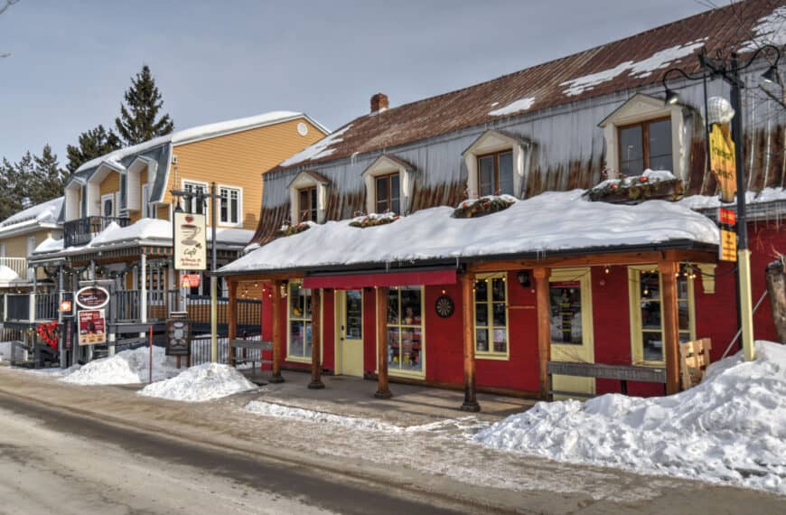
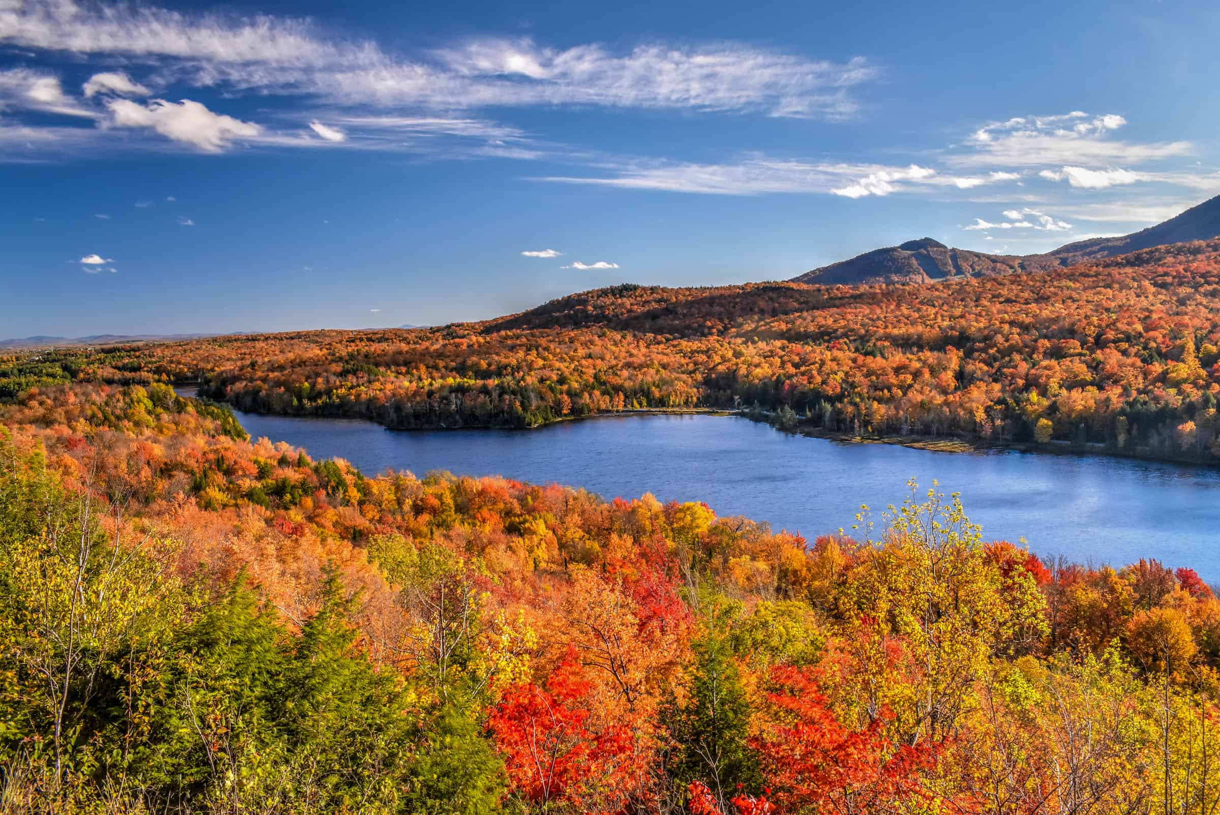
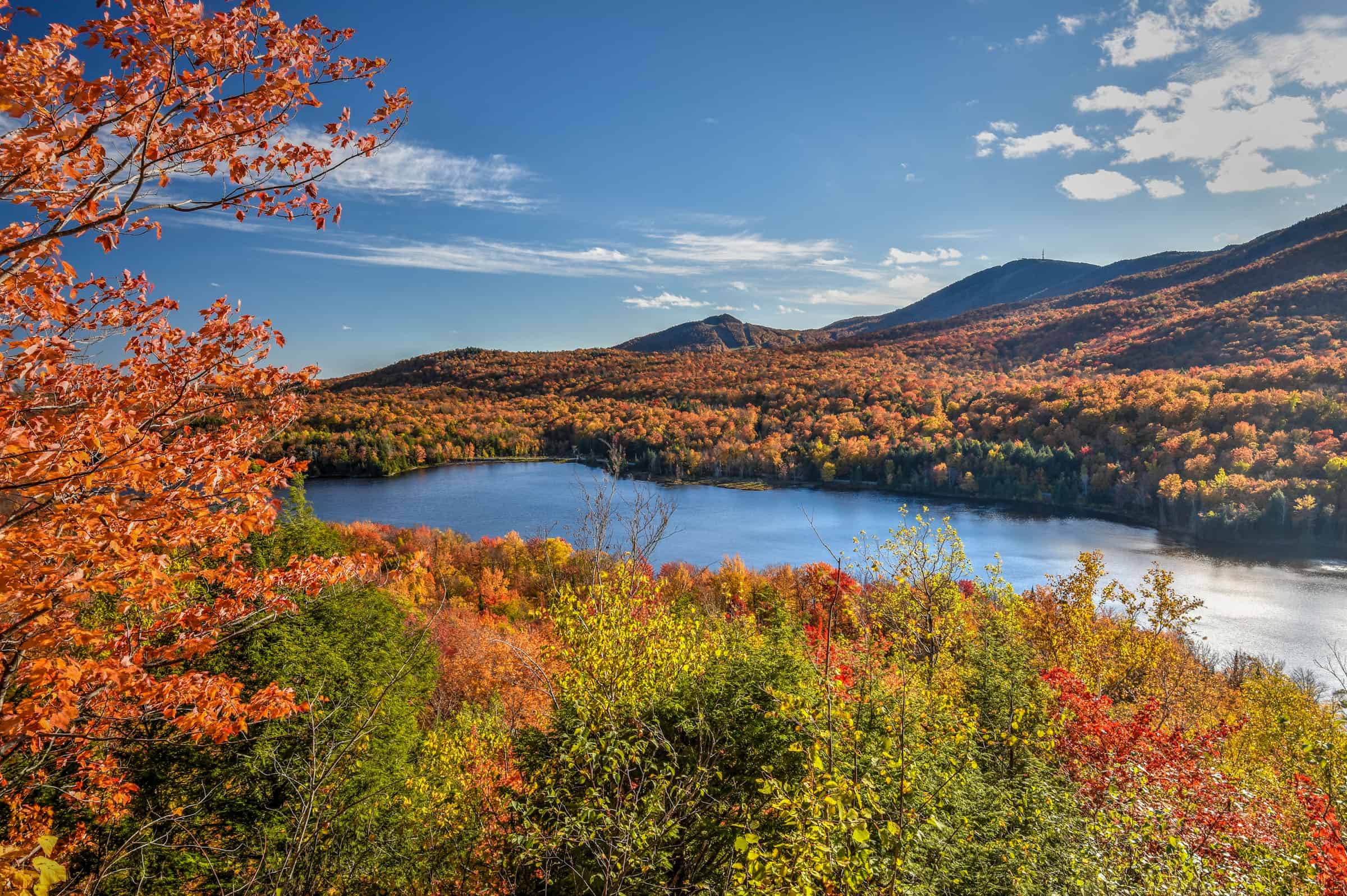
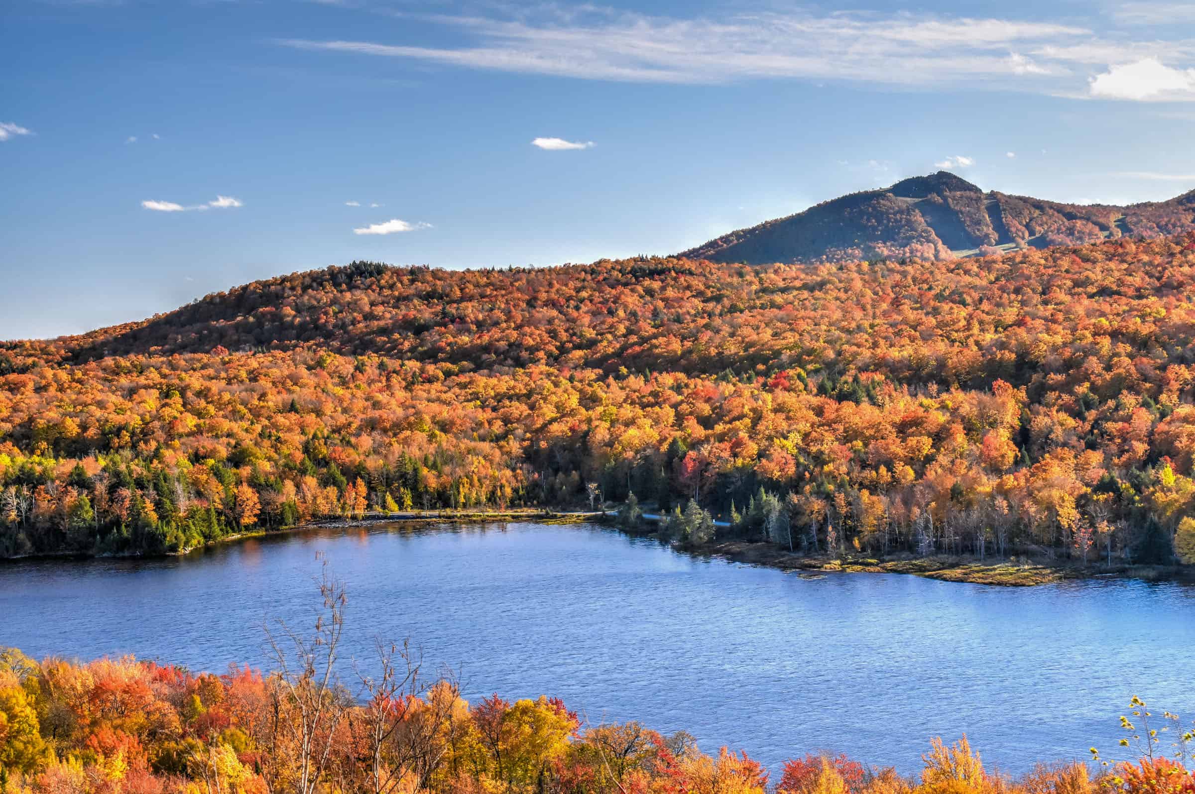
The Eastern Townships region of southern Québec (the Estrie Region or Les Cantons de l’Est in French) is synonymous with many things. It’s home to several charming small towns and villages, like Knoltown and Magog. It’s where you’ll find the only wine Route in Québec (with over 20 vineyards spread out across the region), but it’s also a land filled with a beautiful patchwork of rolling hills interspersed with taller peaks and scenic lakes, making an ideal area for some outdoor exploration and hiking. To help you plan your next outdoor adventure, we put together this guide on the Best Hiking Trails in Eastern Townships, focusing on those we believe best maximize the effort-to-reward ratio. Most of the trails presented below are within a two-hour drive of Montreal.
Disclosure: This page (Best Hiking Trails in Eastern Townships (Estrie Region) may contain product affiliate links. At no additional cost to you, we may receive a commission for purchases made through these links. More details can be found on our disclosure and policies page.
You might also be interested in these pages:
Best Hiking Trails Near Montreal
Best Hiking Trails Near Mont Tremblant
Quebec Hiking Trails that Are Stunning in Winter


Eastern Townships (Estrie) Location and Map
The Eastern Townships (French: Cantons de l’Est) is a historical administrative region in southeastern Quebec. Since 1987, most of the area lies within what is today known as the Estrie region, and the term “Eastern Townships” is now primarily used for touristic purposes.
It lies between the St. Lawrence Lowlands and the American border. More specifically, the region is east of Montreal and shares a border with three American States (Vermont, New Hampshire and Maine).
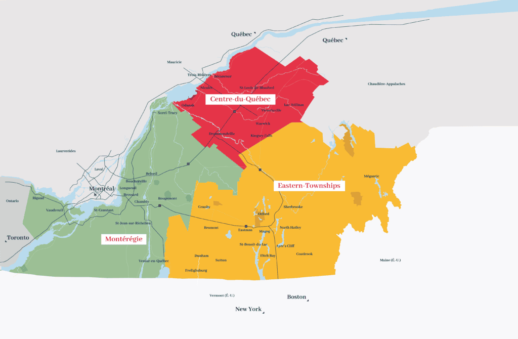
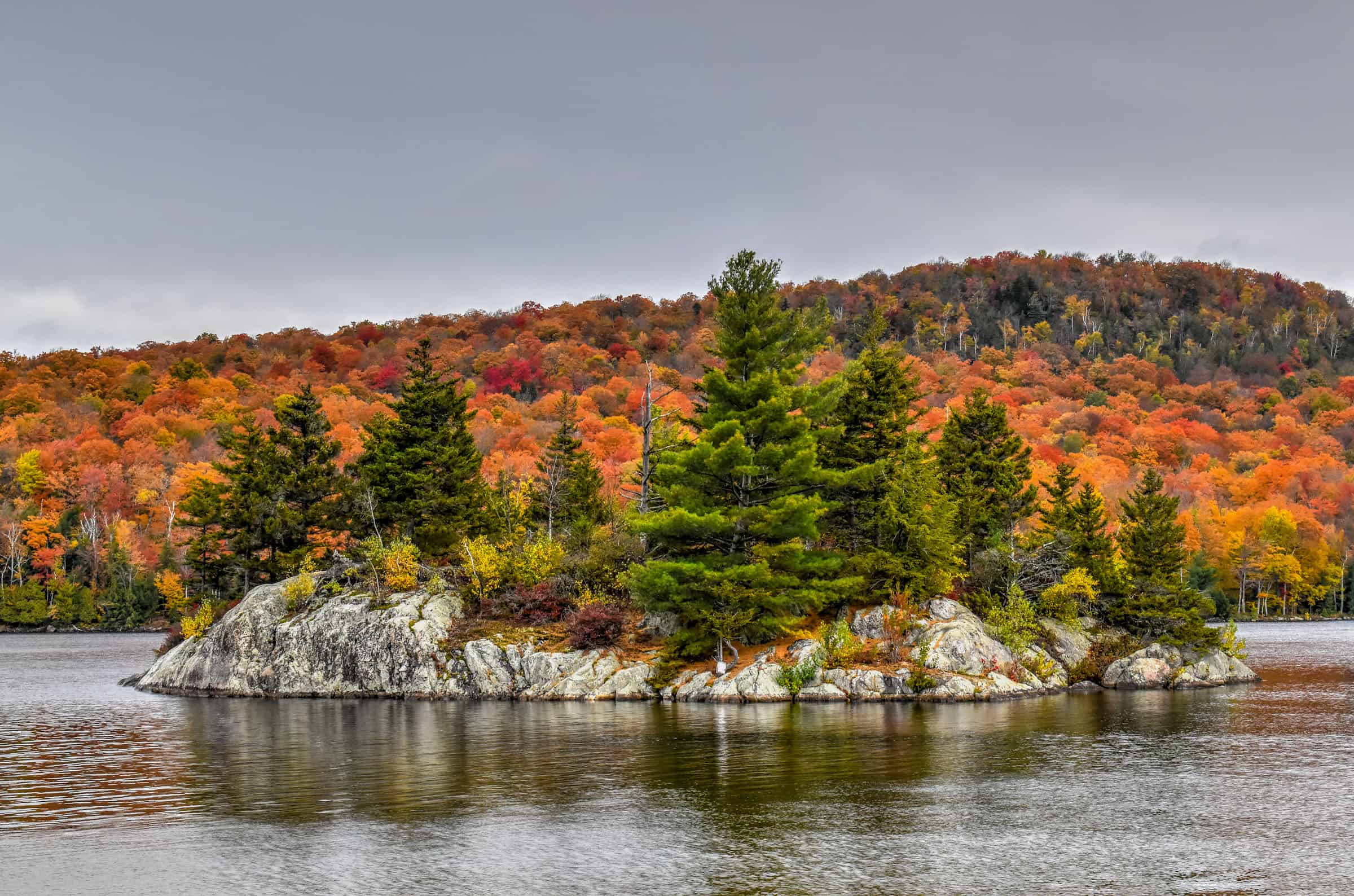
The Estrie region is home to 4 Quebec National Parks (indicated by the darker yellow patches in the map above): Mont Orford National Park, Mont Mégantic National Park, Frontenac National Park and Yamaska National Park. Several of the trails presented below are located within these national parks.
Although all provincial parks in Quebec have used the term “national park” since 2002, there is no connection to the federal national park system, administered by Parks Canada. All Quebec National Parks charge the same access fees and you can buy an annual pass that allows unlimited access to all parks.
Daily access fees and Annual passes
Quebec National Parks are managed by the SÉPAQ, a government agency that manages all provincial parks and wildlife preserves in Québec.
There is a limit to the number of visitors that can enter any Québec SÉPAQ National Park on any given day. It is therefore strongly recommended that you purchase your daily right of access online before a visit or that you acquire an annual pass.
The daily pass ($9.85 (2024)) can be purchased here up to 30 days before a visit.
The annual pass can be purchased here either for unlimited access to a single national park ($49.25 (2024)) or for unlimited access to all SÉPAQ national parks ($88.50 (2024)). Even if you have an annual pass, we still recommend arriving early in the morning or mid-to-late afternoon to avoid showing up to a filled parking lot.
If you need to book a rental vehicle for your hiking excursion, we highly recommend using Discover Cars to get the best rates on your rental in Montreal.
We also highly recommend Airalo (eSIM card) for your connectivity needs when travelling abroad. Airalo is the world’s first and largest eSIM store with eSIM plans for 200+ countries and regions worldwide.
Mont Orford National Park
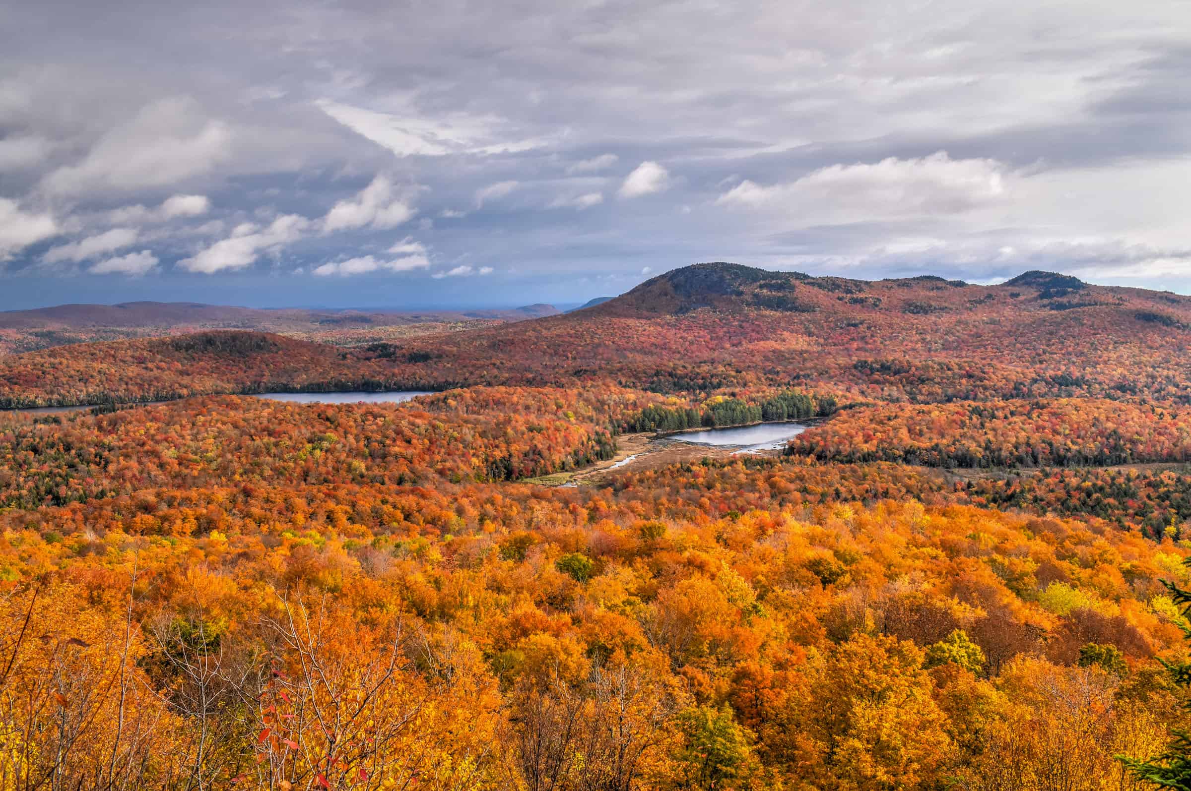
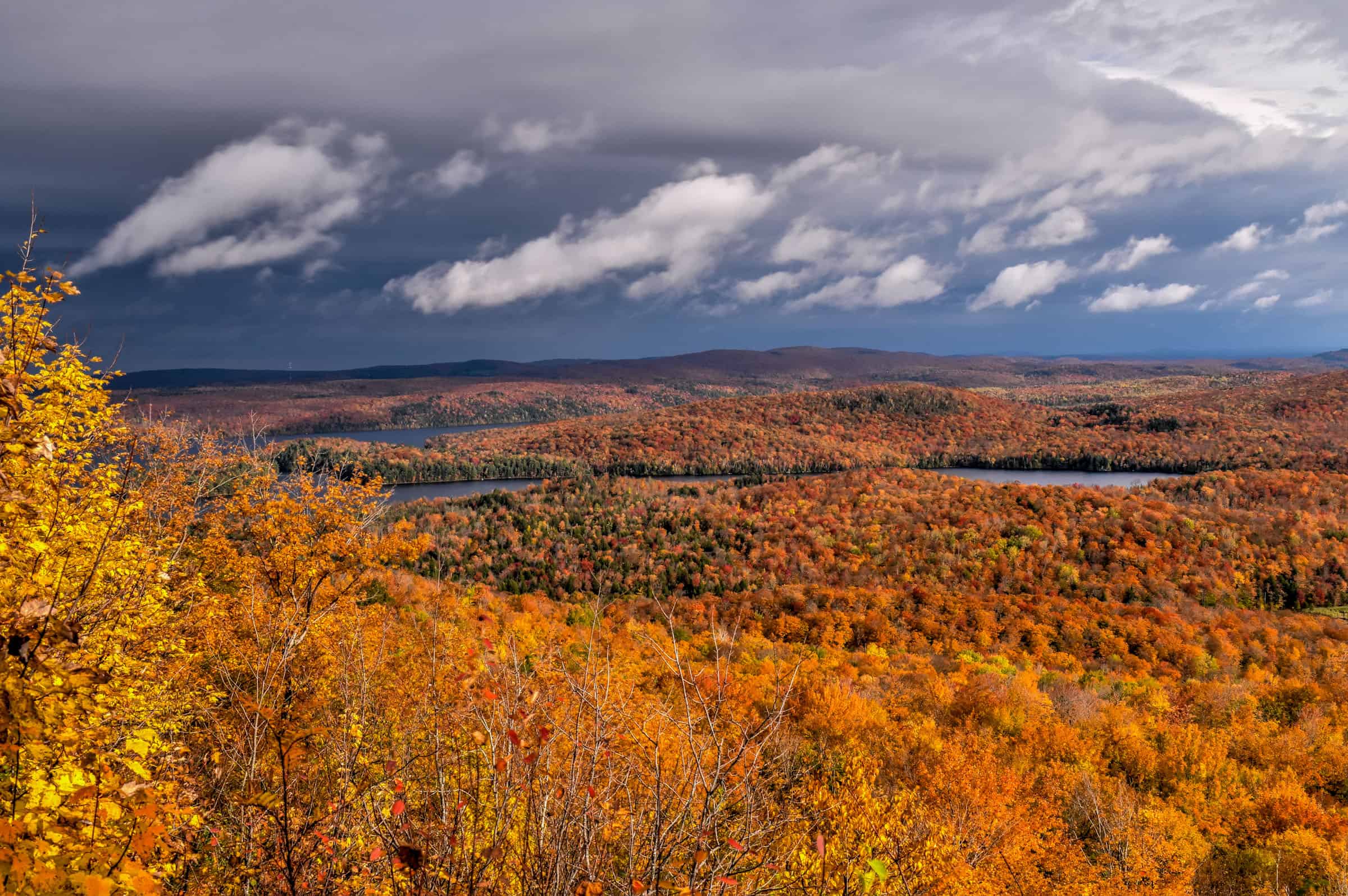
Mont Orford National Park is home to some of the best trails in the eastern townships, including the three trails presented below. The park is situated just north of Magog, about a 90-minute drive east of Montreal.
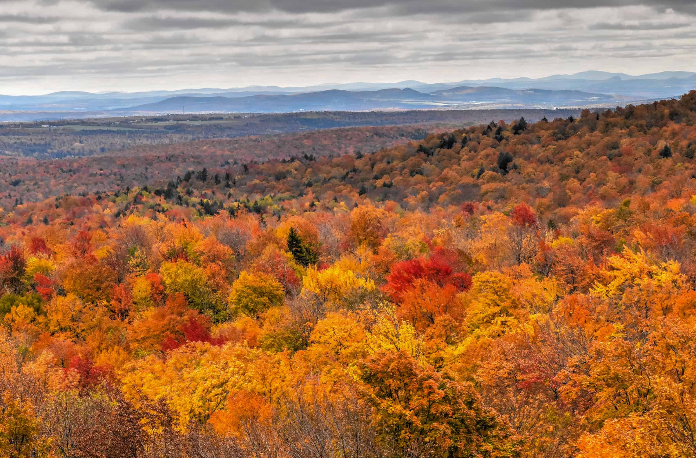
1. L’Escalier du Nord Trail (Mont Orford National Park)
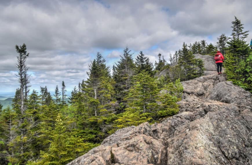
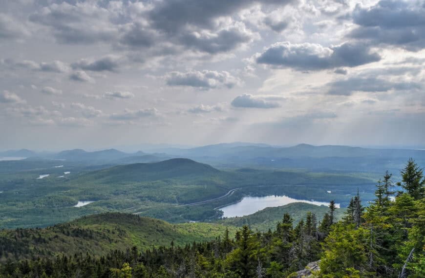
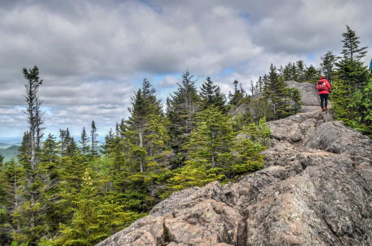
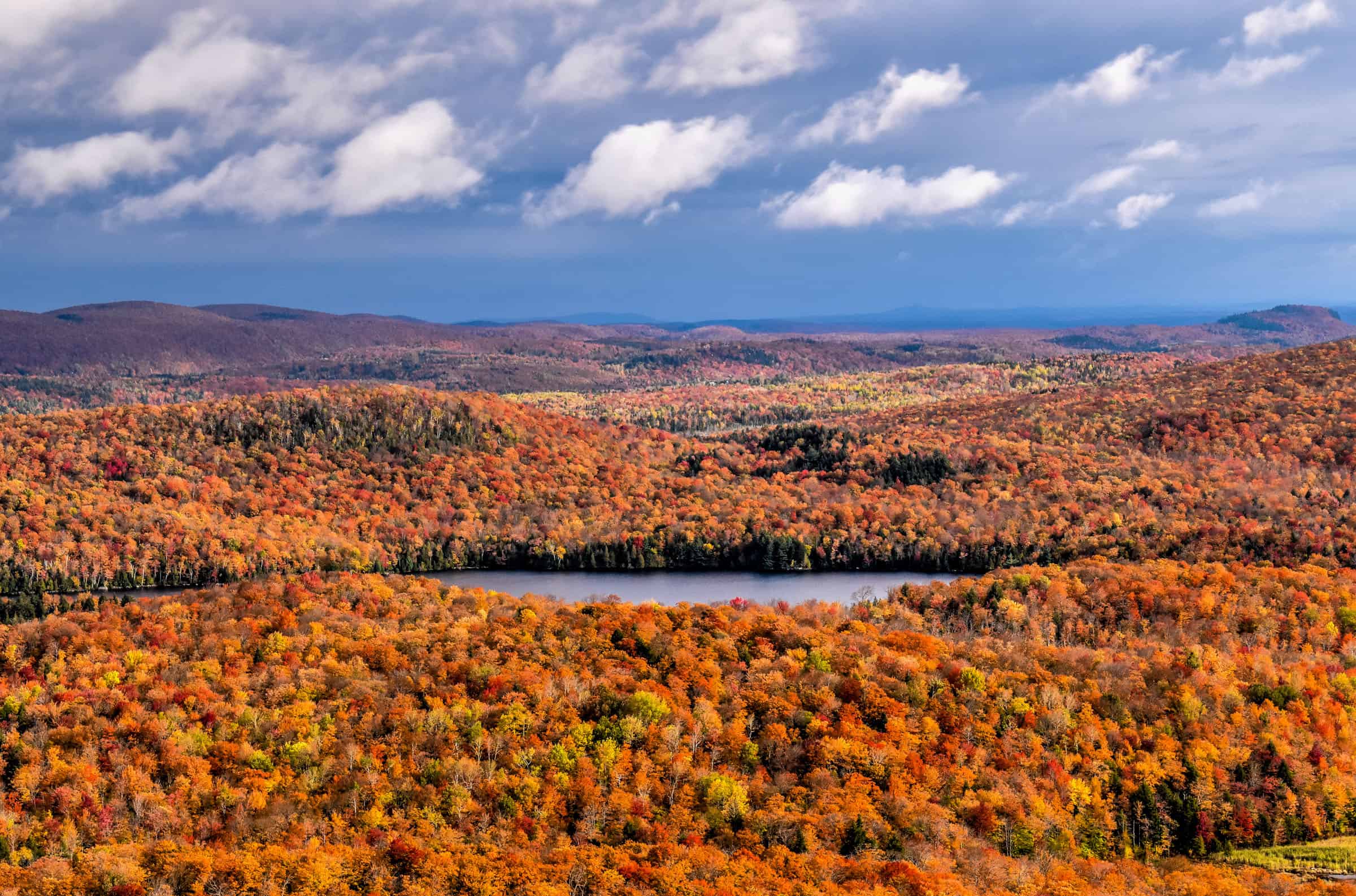
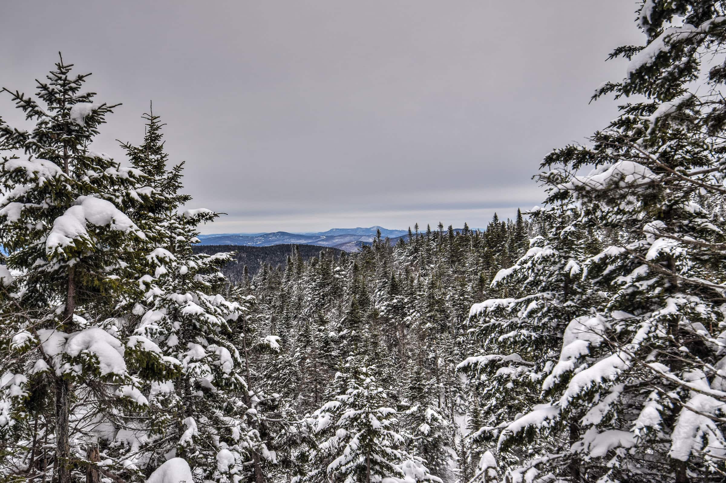
This moderately challenging trail takes you up to the Pic the l’Ours (mountain peak) and is probably one of the most difficult trails presented in this guide, both because of the elevation gain and the occasional rocky and uneven terrain, which can require a bit of light scrambling. You will be greatly rewarded for your effort, however, as you will cross several panoramic viewpoints along the trail. The scenery is beautiful both in summer and autumn.


Distance: 12.7 km
Route Type: Out & Back
Elevation gain: 450m (cumulative elevation gain: 624 m)
AllTrails rating: (4.6, 1293 ratings (2024))
Duration: Most people complete the trail in about 3h30-4h min
Access Fees: SEPAQ daily rate
Difficulty Level: Moderately challenging
2. Mont Chauve – Ruisseau David Trail (Mont Orford National Park)
This is a great and popular trail taking you up the summit of Mont Chauve. You can also significantly shorten the trail by skipping the loop portion of the trail (more on this below). This trail is less challenging than the previous trail but it also comes with less panoramic viewpoints along it. The best views are found from the observation deck located on Mont Chauve’s summit.


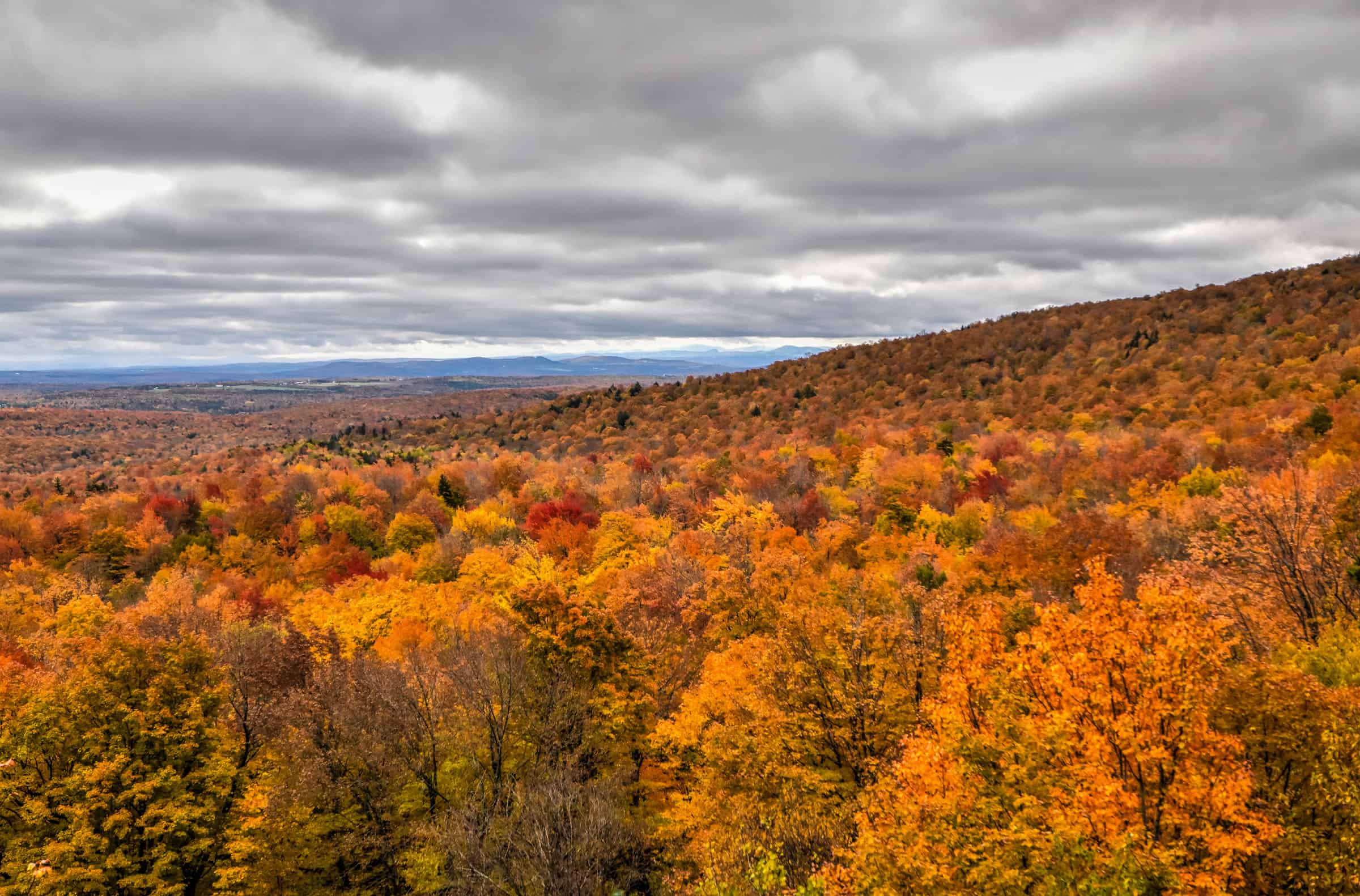
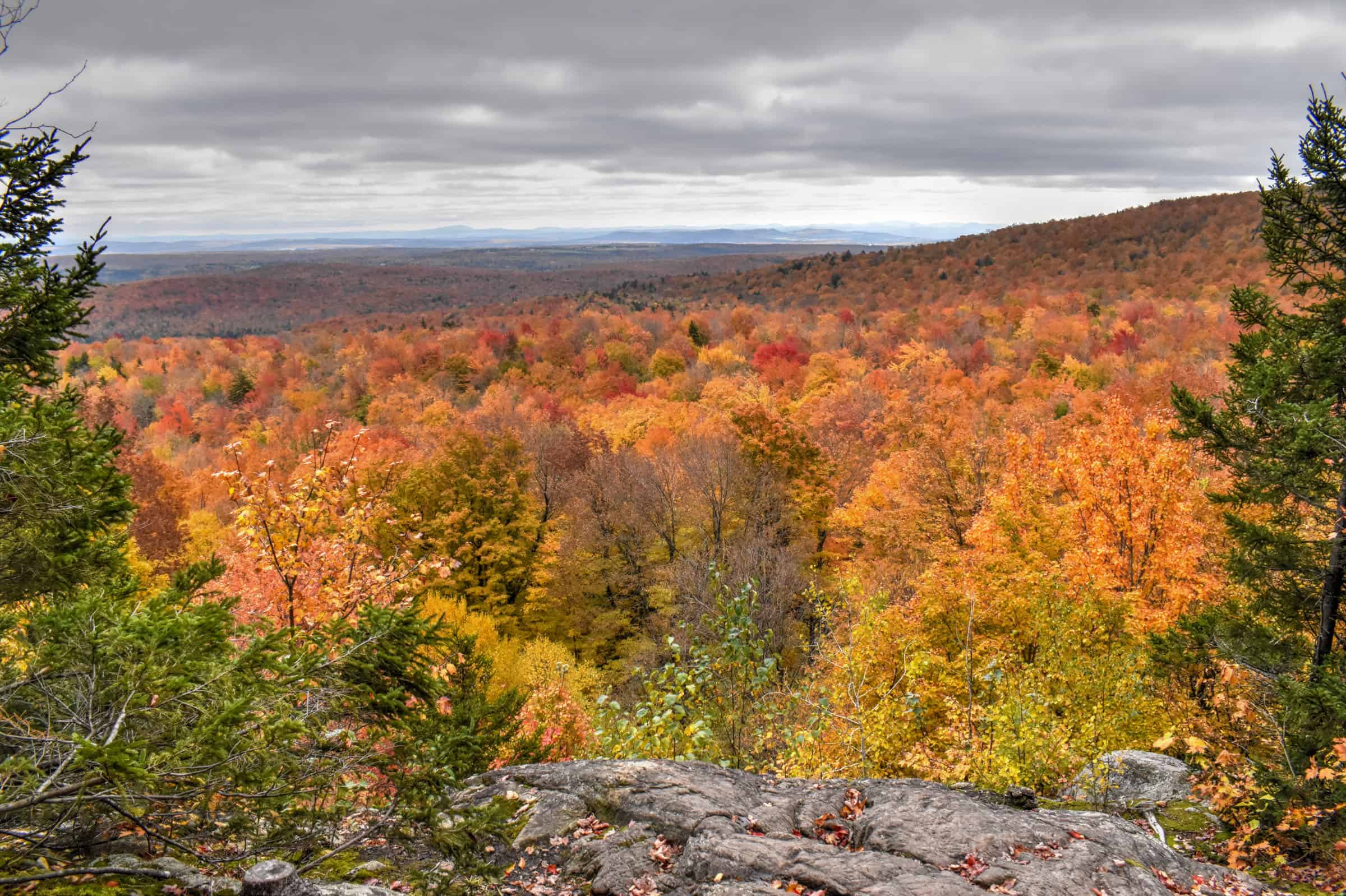
Distance: 12.7 km
Route Type: Out & Back and partial loop
Elevation gain: 280m (cumulative elevation gain: 556 m)
AllTrails rating: (4.5, 810 ratings (2024))
Duration: Most people complete the trail in about 3h30-4h min
Access Fees: SEPAQ daily rate
Difficulty Level: Moderately challenging
Not an AllTrails member yet? We highly recommend signing up for either their free or paid membership plans. The free plan allows you to find new trails and plan routes but it can only be used while hiking if you have access to mobile data. The paid membership plan (AllTrails+) allows you to download trail maps for offline use and provides live progress updates and off-route notifications.
If you are still uncertain – you should know that the All Trails mobile application was voted the 2023 iPhone App of the Year by Apple.
3. Pékan Trail (Mont Orford National Park)
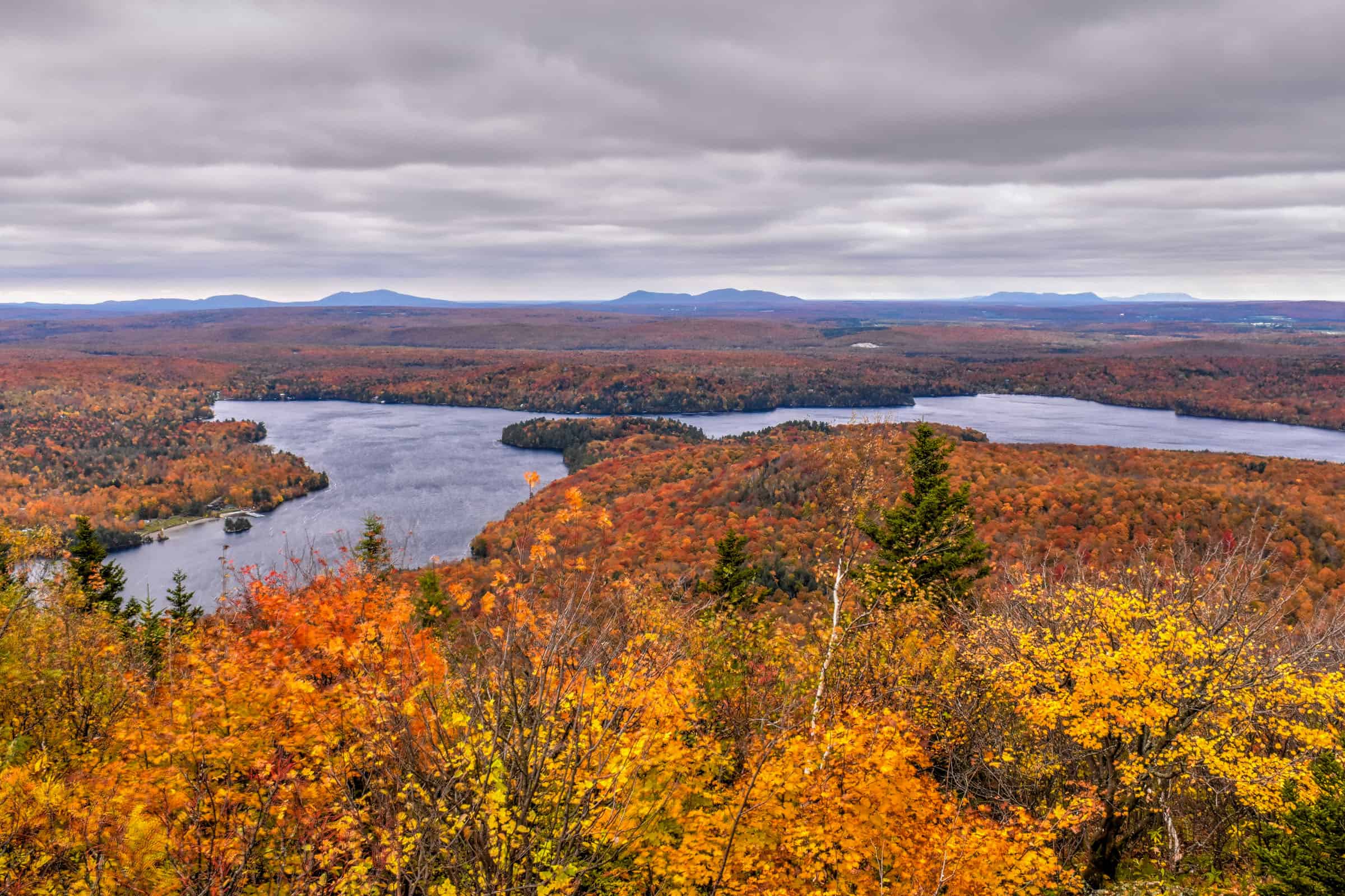
This is a beautiful lakeside trail that follows a path that gently goes up and down several times as you loop around the Étang aux Cerises pond (a pond that honestly looks more like a lake, to be honest), with several viewpoints along the way. The first half along the east side of the pond is lovely as you travel through various types of woodland, eventually climbing up to a beautiful promontory (Colline de la Serpentine) a few hundred feet above the pond. You will also get to enjoy great lakeside views during the first few hundred meters of the trail.


Distance: 8.5 km
Route Type: Loop
Elevation gain: 60m (cumulative elevation gain: 215 m)
AllTrails rating: (4.3, 918 ratings (2024))
Duration: Most people complete the trail in about 2h-2h30
Access Fees: SEPAQ daily rate
Difficulty Level: Moderate
For more information on these trails and Mont Orford National Park itself, check out our guide on the Best Trails Near Mont Orford.
Hiking Packing List
All Trails subscription – This comes in really handy for areas with little or no cell reception, as the annual subscription allows you to download trail maps for offline use.
External Battery – If you are using your phone to track your progress along the trail or to help with navigation, you certainly don’t want your phone to die on you. That’s especially true in the unlikely event that you might get hurt or need assistance.
Hiking poles – These can be particularly useful in steep trails or muddy/boggy trail conditions.
Water Filter Bottle – The Life Straw bottle is an advanced water bottle with a filter that not only improves water taste but more importantly filters out bacteria and parasites, chemicals and microplastics.
Headlamp – very practical and a smart choice if you plan to start your hike before sunrise or finish it after sunset.
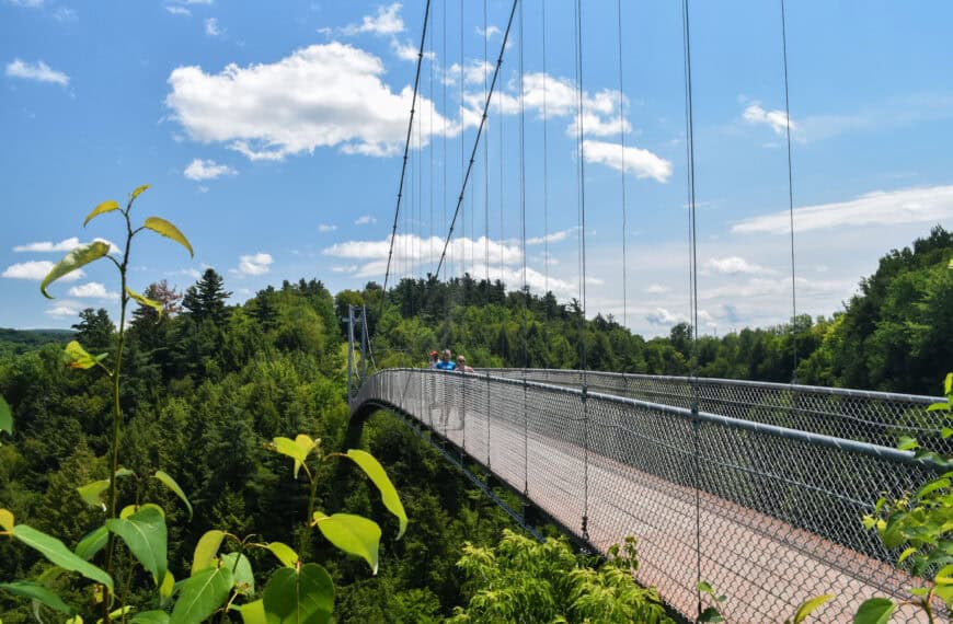
Coaticook Gorge Park
This park’s main attraction is its suspended bridge which crosses the Coaticook Gorge at a height of 50 metres. At 170 m (554 ft) long and 50 m (160 ft) high, the Coaticook Canyon Bridge is one of the longest suspension footbridges in North America and one of the most popular tourist attractions in the Eastern Townships. To our knowledge, the Gorge is the largest one in southern Quebec, and the Coaticook Gorge Park is impressive enough to attract over 300,000 visitors every year.
4. George de Coaticook Trail (Coaticook Gorge Park)
If you are short on time while in the area and only have time for a short hike, this is the one to do. The trail follows the gorge shoreline, down near the water level for most of the trail and up above the gorge for the middle part of the trail, which includes the crossing of the famous Coaticook pedestrian bridge. It is recommended to walk the loop portion of the trail counter-clockwise.


The highlight of this trail is obviously the suspended bridge that passes over the gorge, but it’s quite scenic all around. The trail is neither very long nor very difficult as there is very little elevation gain throughout the trail.


Distance: 3.7 km
Route Type: Out & Back with Partial Loop
Elevation gain: 60 m (cumulative elevation gain: 96 m)
Start point: Car Park (free parking)
AllTrails rating: (4.4, 270 ratings (2024))
Duration: Most people complete the trail in about 55-65 min
Access Fees: 10.50$ (2024) (you can prepay your access fee online)
Difficulty Level: Easy
Yamaska National Park
This park is centred on the large man-made Choinière Reservoir, and due to its relatively flat terrain is popular with both hikers and cyclists alike. The vast reservoir is teeming with life. Fish, ducks and Great Blue Herons call the park home. The park is located 92 km east of Montreal, and it takes an average of 1h-1h15 to reach by car.
5. The Riverage Loop Trail
This Trail is actually a combination of two smaller park trails (The Pinède and The Digue trails). It’s a lovely and mostly flat trail (but with some slight undulations) through various covered woodlands, with a few open areas, particularly near the dam. Although this trail is on the longer side distance-wise, we would still consider it an easy trail as there is no significant elevation gain.


Distance: 10.8 km
Route Type: Loop
Elevation gain: 50 m (cumulative elevation gain: 110 m)
Start point: Car Park
AllTrails rating: (4.3, 205 ratings (2024))
Duration: Most people complete the trail in about 2h-2h30 min
Access Fees: SEPAQ Daily rate
Difficulty Level: Easy
Mont Sutton
Mont Sutton, like many other mountains in the Eastern Townships, is primarily for known its ski resort. Most of the hiking trails on and around Mont Sutton are part of the Parc d’Environnement Naturel de Sutton (P.E.N.S), which is roughly 5km east of the village of Sutton and is only 10km from the Canadian-American border (Burlington (Vermont) is roughly a 90-minute drive away).
6. Round Top Trail (Mont Sutton)
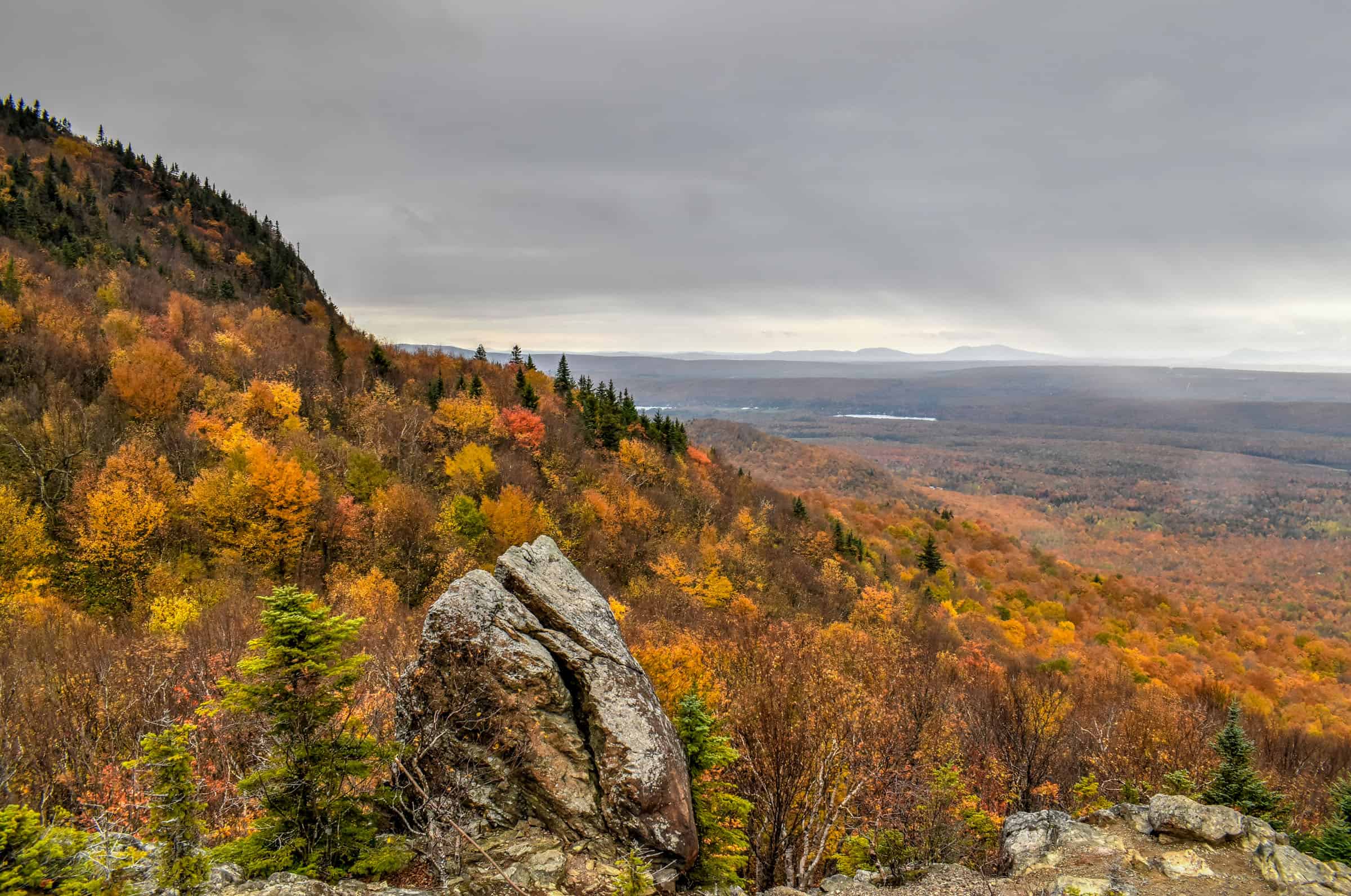
Round Top is the trail that most people want to do when they come to Sutton, but in reality, most combine it with the Lac Spruce trail since adding the Lake detour doesn’t add too much time to the trail itinerary. Both the Round Top and combined trail lead to the highest peak of the massif, the Round Top, which culminates at 968 meters, where it offers panoramic views of the St. Lawrence plain, the Monteregiennes and Lake Champlain. It’s a hike that we particularly enjoy doing in winter.


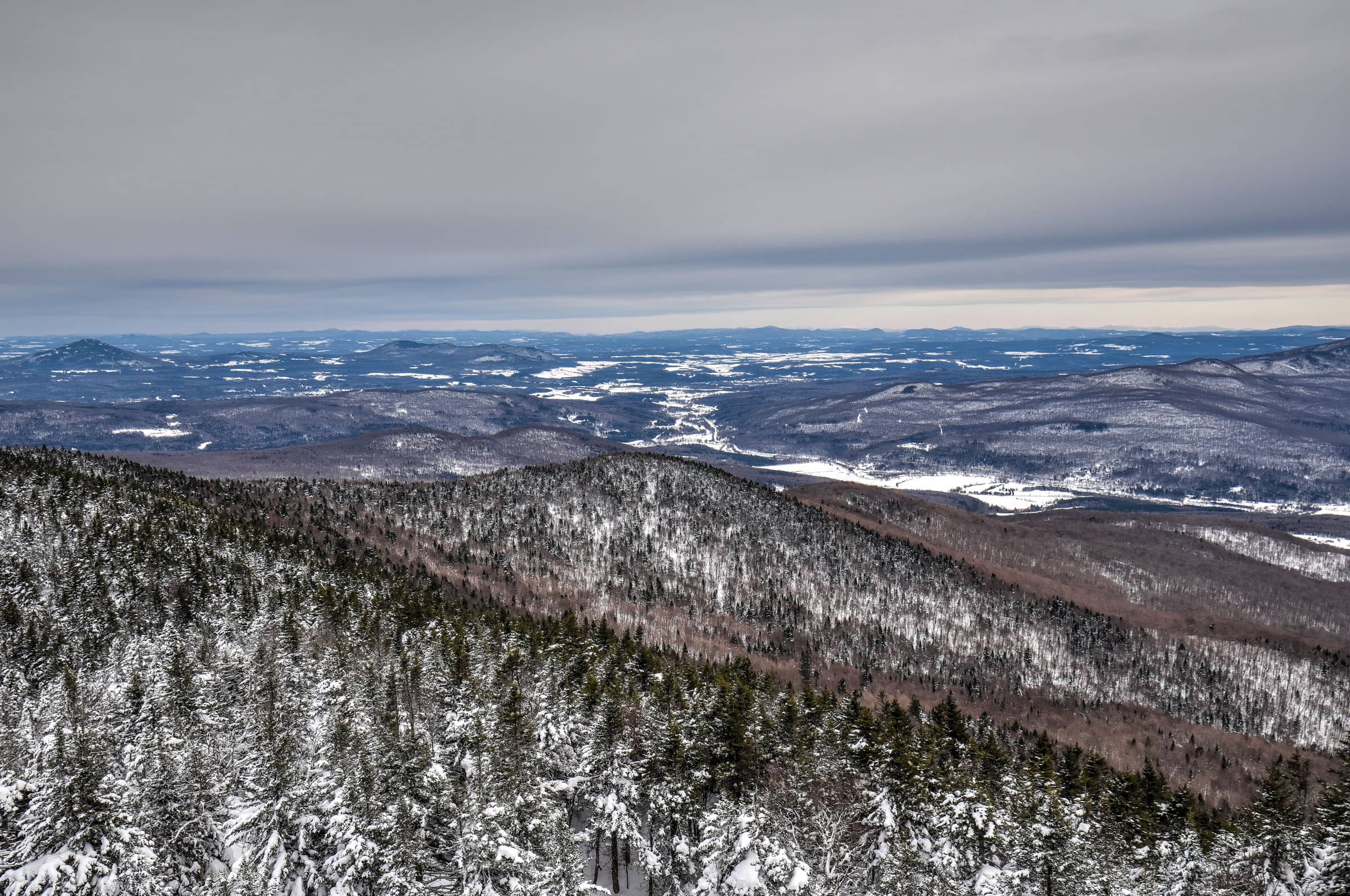
Distance: 6.0 km
Route Type: Out & back
Elevation gain: 396 m (cumulative elevation gain: 404 m)
AllTrails rating: (4.5, 370 ratings (2024))
Duration: Most people complete the trail in about 2h15-2h45
Access Fees: PENS daily rate
Difficulty Level: Moderately challenging
For more information on this trail, and on how you can combine it with the Lac Spruce Trail, you can check out our Round Top Hiking Guide.
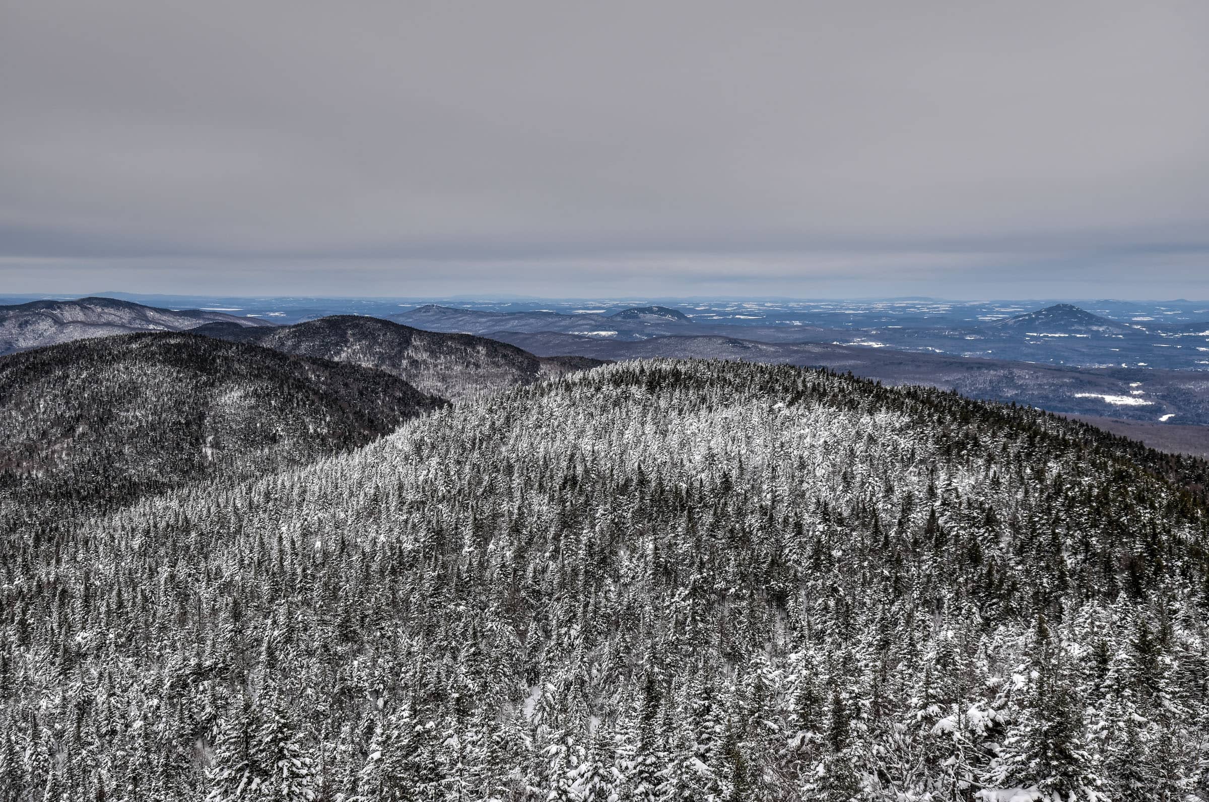
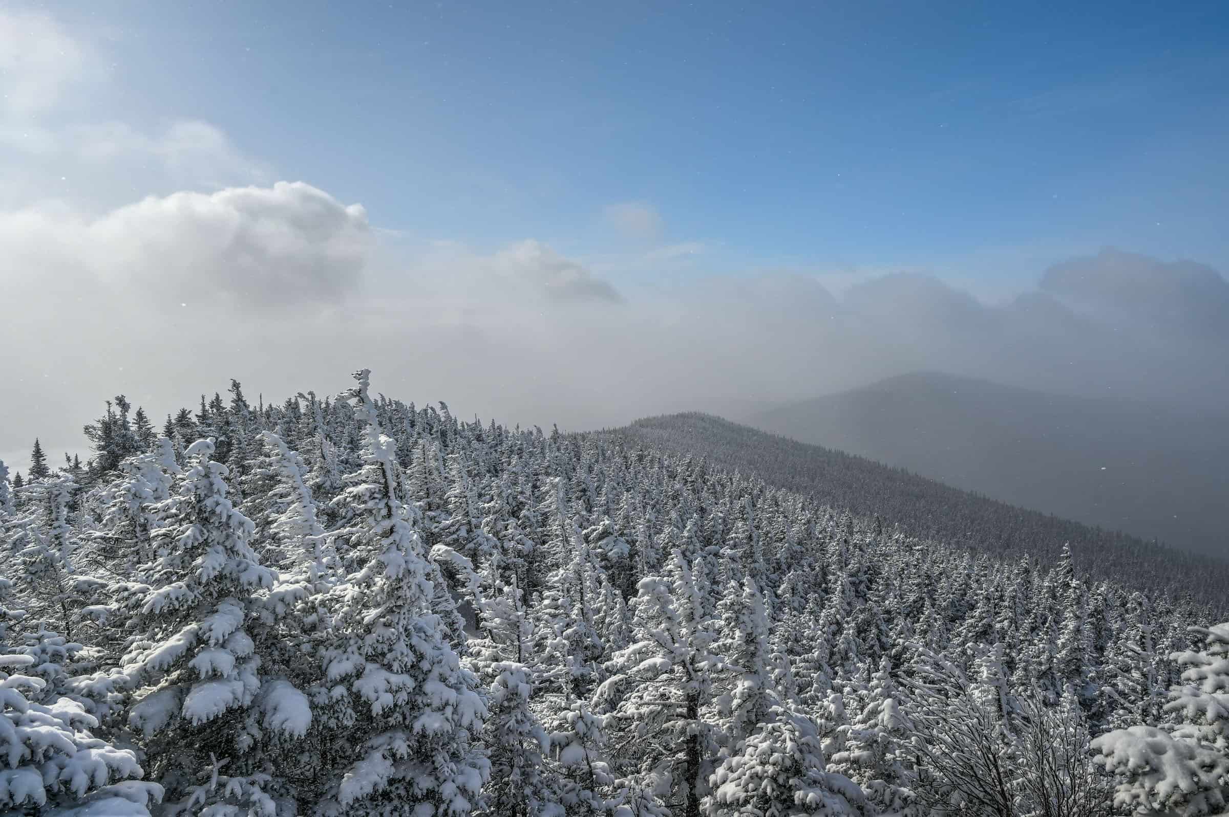
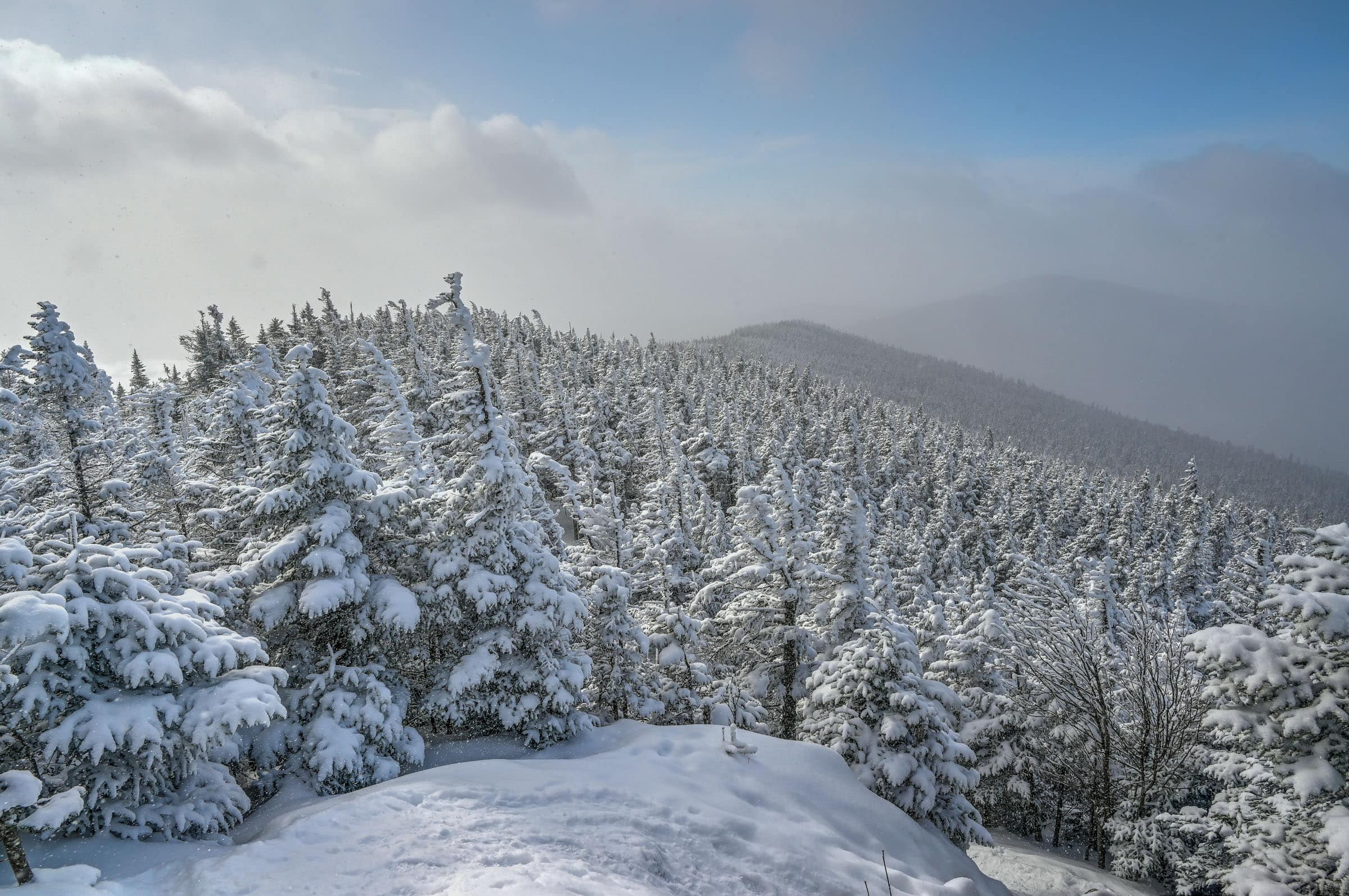
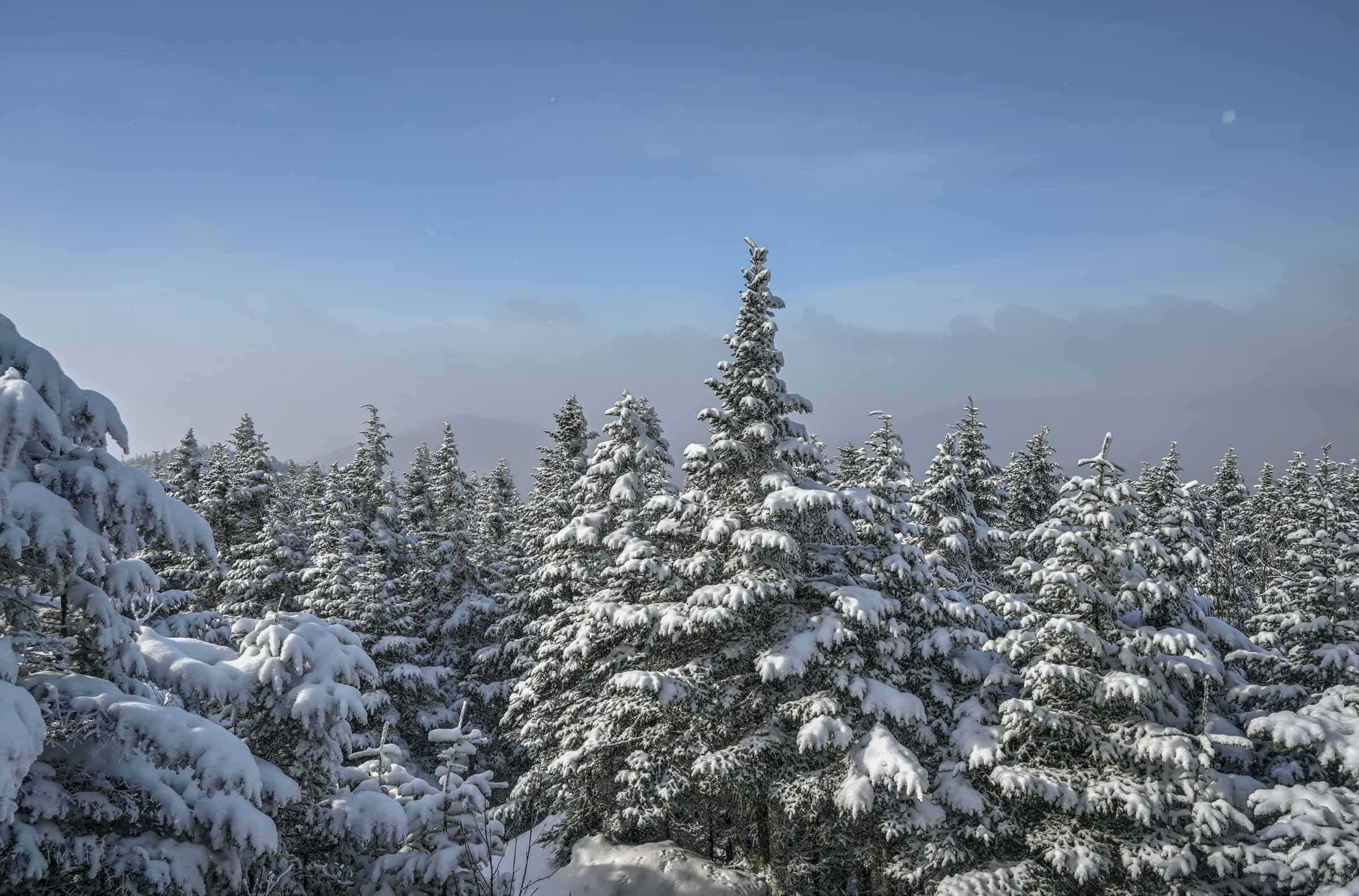
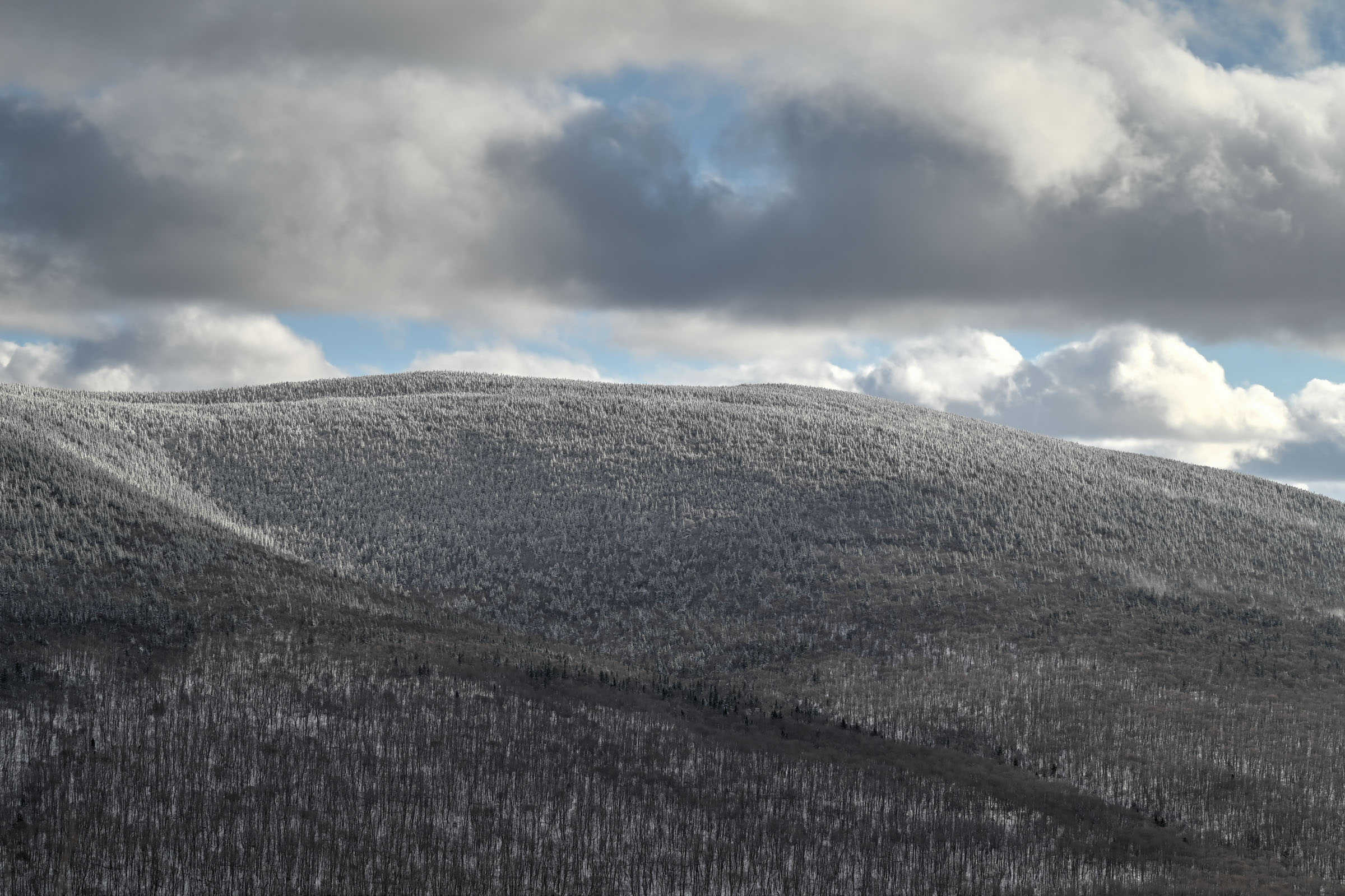
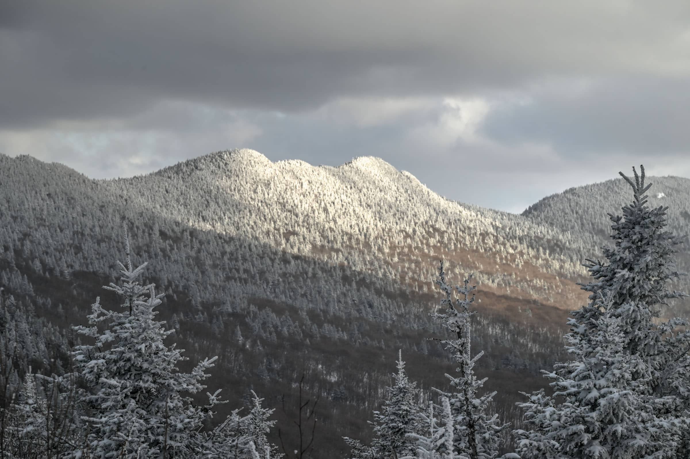
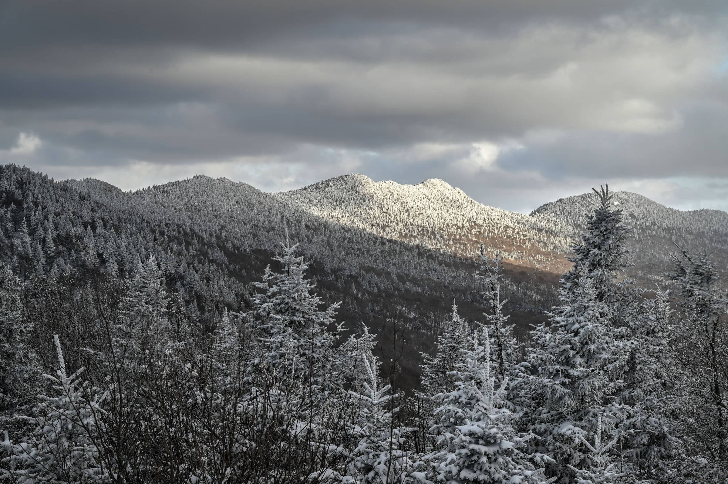
Why Hike in Winter?
– There are generally fewer people on the hiking trails, allowing for a more peaceful and enjoyable experience.
– Compacted snow generally makes the trail easier to walk on and removes the difficulties associated with walking over rocks, boulders and tree roots.
– The scenery is very different than in any other season but is no less beautiful.
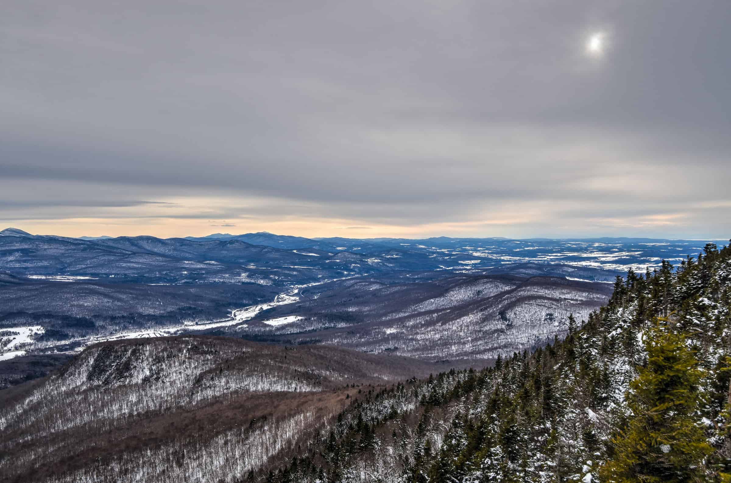
7. Hollandais Trail (Mont Sutton)
This is our second favorite PENS trail and another great winter hike. It’s also significantly less busy than the Round Top, so you are likely to encounter far fewer people. This trail follows a large square loop path, with a long section that follows a ridgeline between two summits (Hollandais summit and Orignal summit). There are several viewpoints along the ridgeline section providing beautiful vistas of the surrounding mountains.


Distance: 7.2 km
Route Type: Loop
Elevation gain: 300 m (cumulative elevation gain: 485 m)
Start point: PENS car park
AllTrails rating: (4.5, 783 ratings (2024))
Duration: Most people complete the trail in about 2h30-3h
Access Fees: PENS daily rate
Difficulty Level: Moderate
If you would like to know more about some of the awesome PENS trails and some of the practicalities of hiking in winter conditions, check out our guide on the Best Winter Hiking Trails Near Sutton.
Winter Hiking Packing List
Crampons / Ice Cleats – These are a must-have to help you with those steep ascents/descents or navigate icy trail conditions.
External Battery – Cold weather significantly affects cell phone battery drainage. Best to be prepared with an external power source to recharge your phone if needed.
Hiking poles – These can be particularly useful in winter, especially when not wearing any crampons or ice cleats.
Hand warmers – if you are like us and often remove your gloves to take pictures, having little hotties around care be hand life savers in freezing weather.
All Trails subscription – comes in really handy for areas with little or no cell reception, as the annual subscription allows you to download trail maps for offline use.
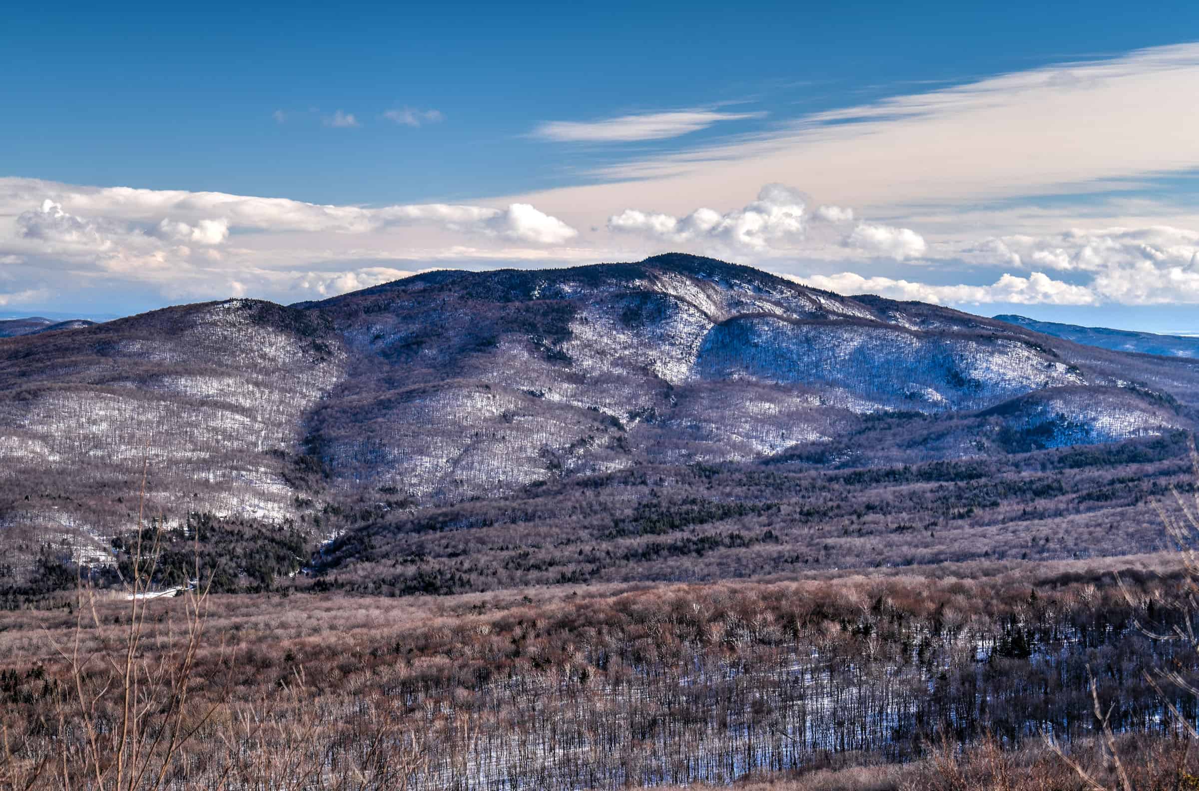
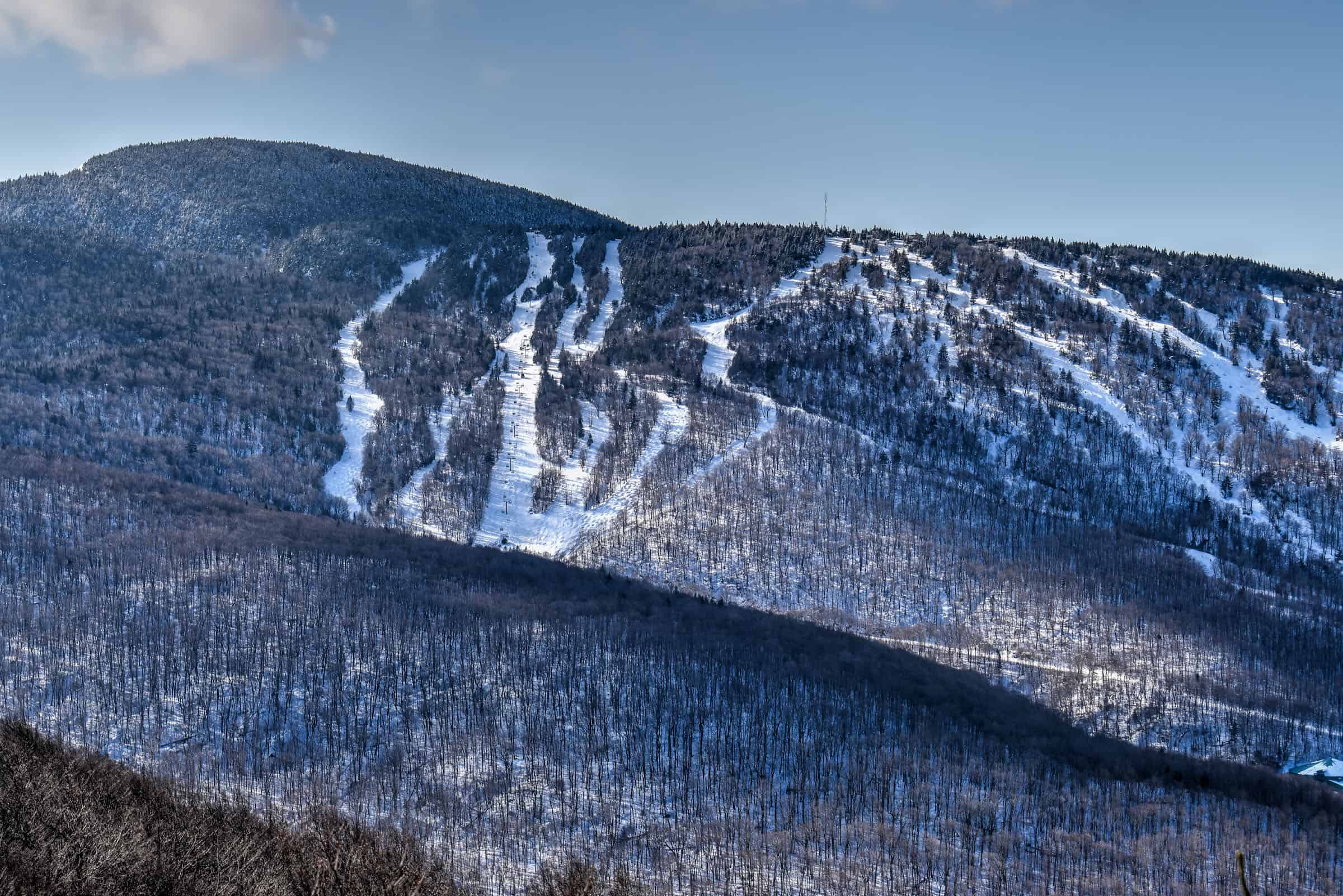
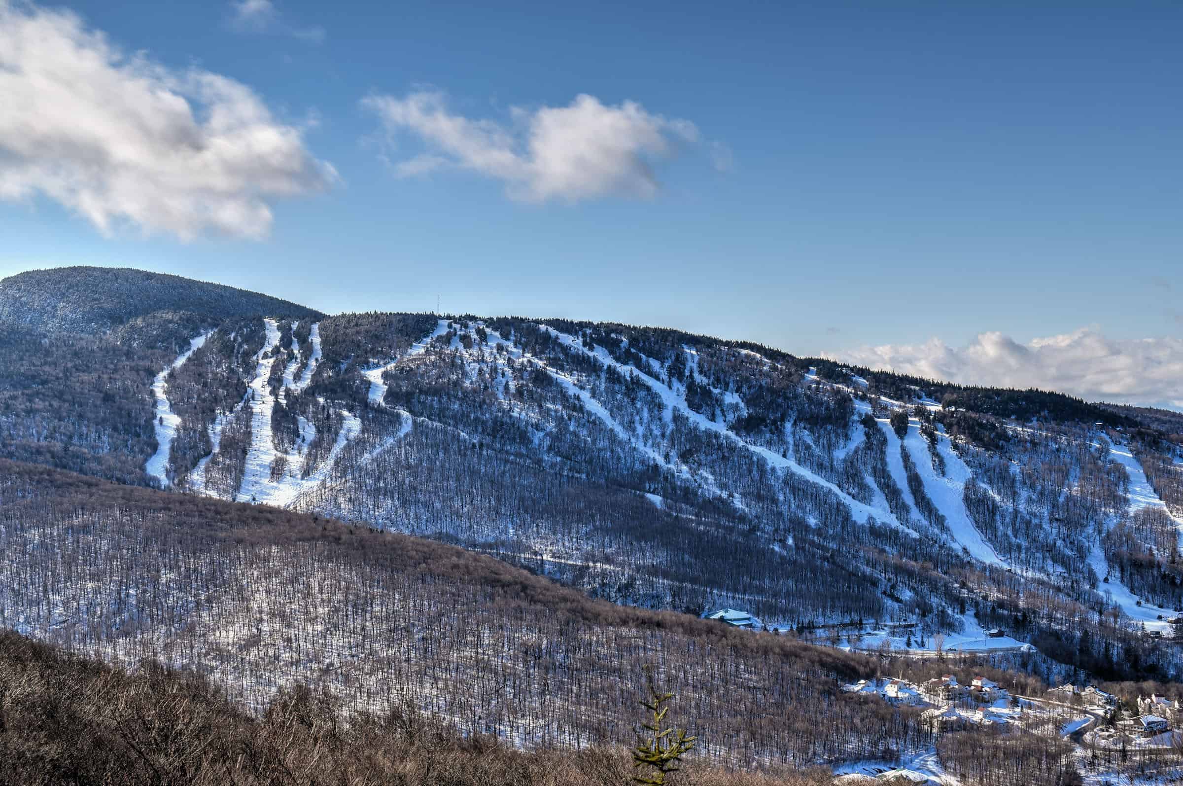
Mont Mégantic National Park
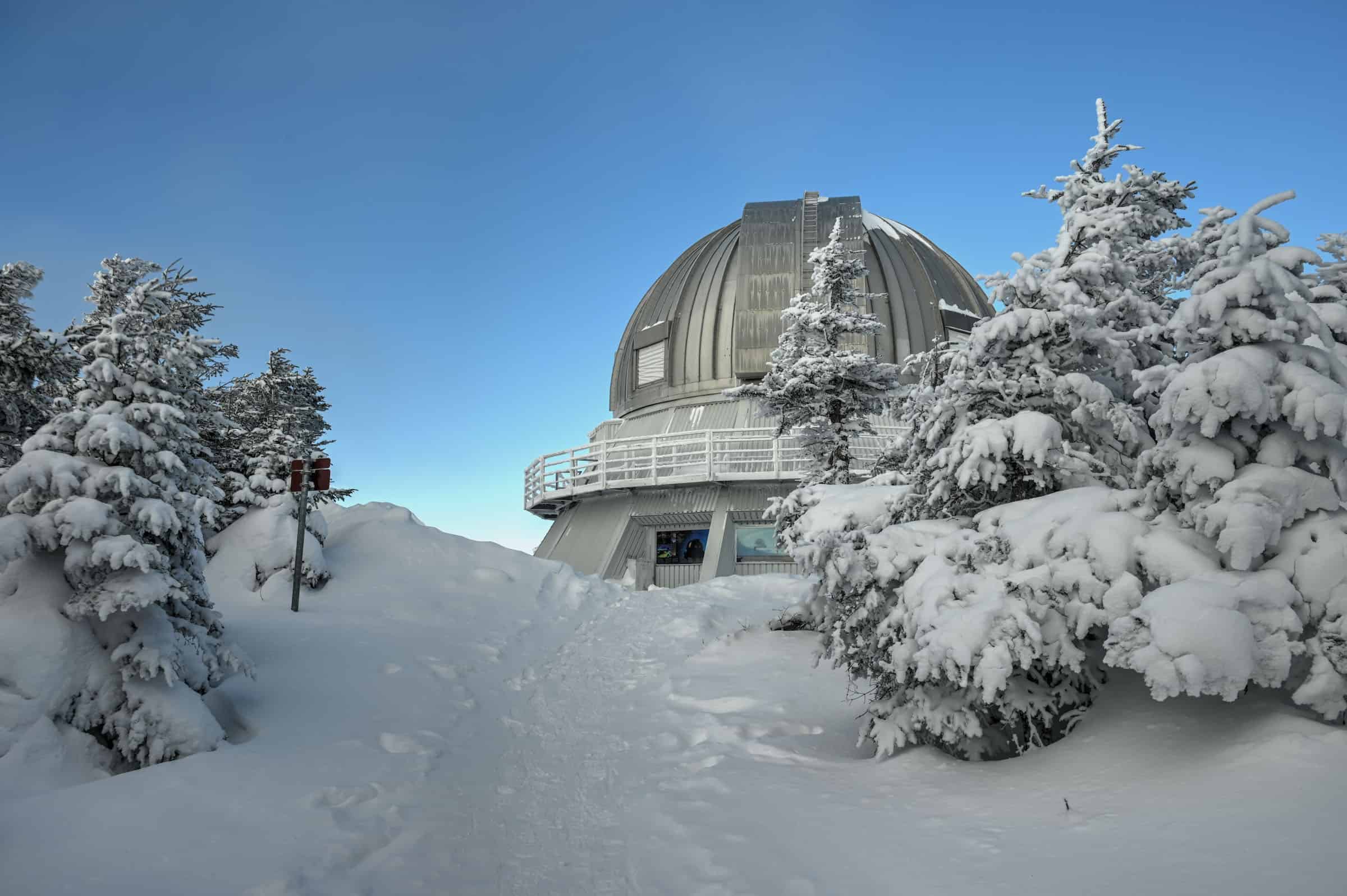
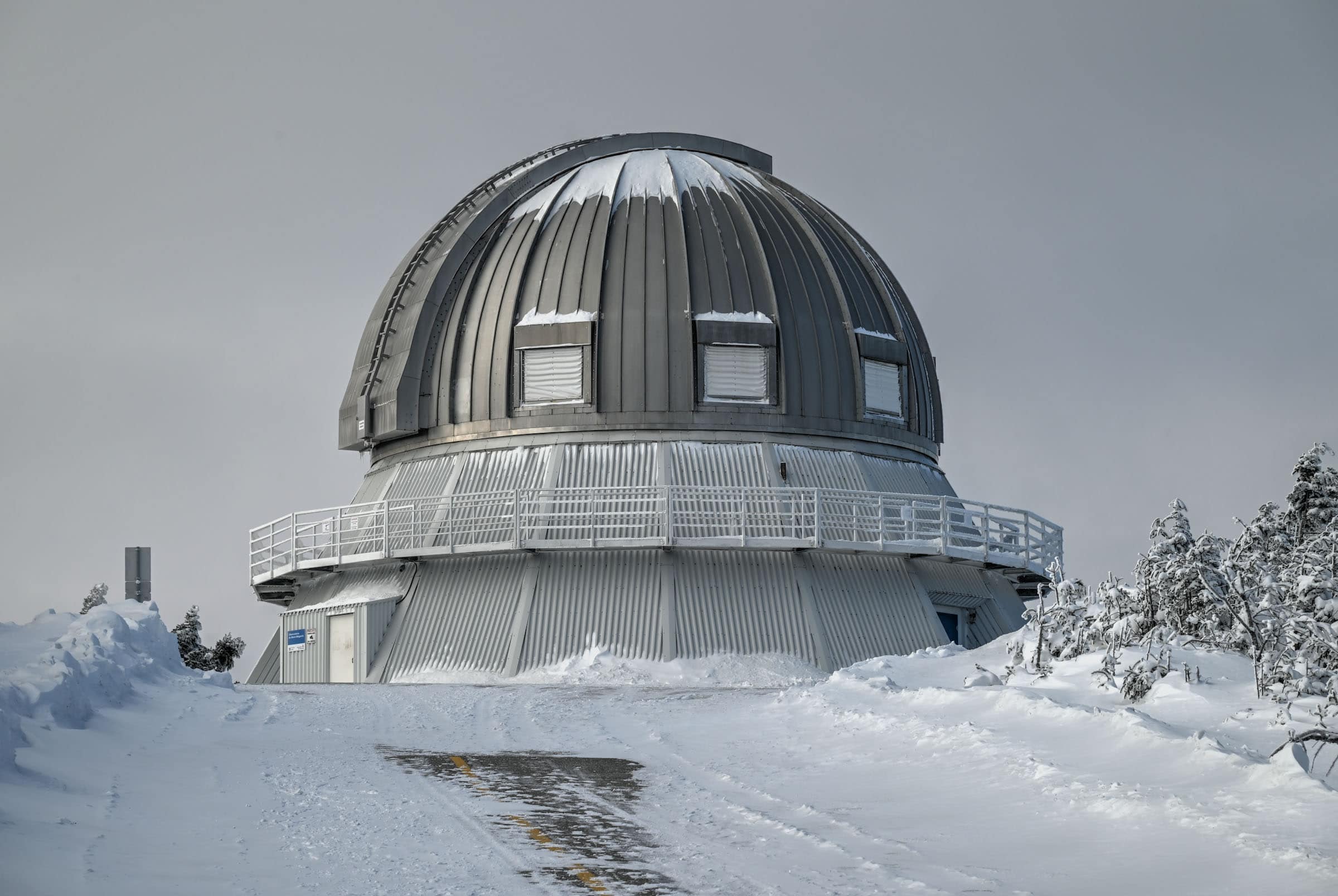
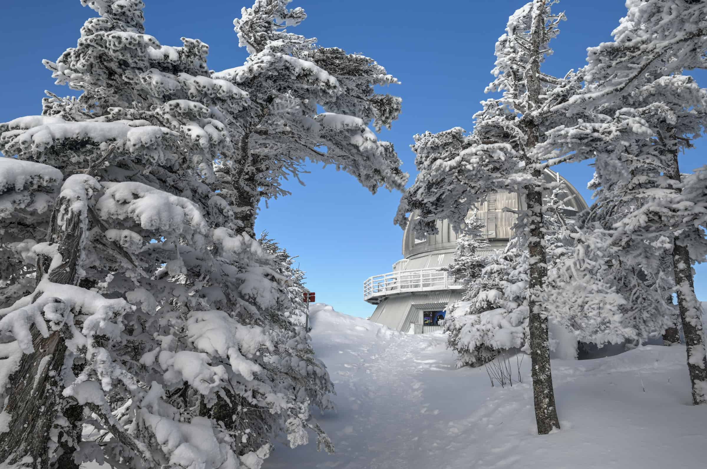
Mont Megantic National Park in southeastern Quebec is located near the southeastern corner of the province very close to the northwestern border of Maine (USA). The park is also part of what became the first international dark sky reserve in 2007 International Dark-Sky Association, making it the perfect place to do some star gazing after a great day of hiking.
It is a special place for outdoor enthusiasts. It’s fairly remote, has beautiful mountain scenery in all seasons and is home to the Mont Mégantic Astronomical Observatory. There are several peaks that are accessible by hiking trails, including Mout-Mégantic, which is Quebec’s tenth-highest peak. In total, the park has more than 50km of hiking trails, with a range of easy, moderate and difficult hikes.
7. Mont Mégantic Trail


For more information on this trail, check out our Mont Mégantic Trail Winter Hiking Guide.
9. Mont Saint-Joseph Trail (Mont Mégantic National Park)


10. Trail of the Peaks / “Sentier des Cimes”


Eastern Township Trail Tips
-During the peak summer and fall months, the parking lots can fill up quickly, particularly on weekends. Try to arrive early in the morning or late afternoon to guarantee a spot.
-Mosquitoes and black flies can be a nuisance at certain times during the year. The exact dates vary from year to year, but they are generally most present from mid-May to mid-July. Regardless of when you come, it’s always a good idea to carry some bug spray with you, just in case.
-Stick to the designated path to protect the surrounding environment. Moreover, ticks are present in the Eastern townships, so straying from the trails carries additional risk.
-Best time to visit (summer hiking): we highly recommend the end of summer and early fall (August, September and October). The weather will be pleasant and the likelihood of being harassed by bugs is significantly reduced. Moreover, July is when most people in Québec take their summer holidays.
-The best time to visit (winter hiking): the winter season hiking typically runs from late November to late March. Trail conditions vary throughout the season, so be sure to check up-to-date park trail conditions. It is highly recommended to wear crampons/traction cleats under your shoes or boots when hiking any trail with significant elevation gain (see winter packing list above). In the event of large amounts of recent snowfall, you might be better off using snowshoes than hiking with boots and cleats.
Want to Discover More Hiking Trails in Southern Québec?
You might be interested in these pages:
Best Hiking Trails Near Montreal
Best Hiking Trails Near Mont Tremblant
Quebec Hiking Trails that Are Stunning in Winter
Photography Gear
If you like our photography, you might be interested in some of the gear we use to shoot our travel and hiking destinations.
Camera Body – Nikon Z 6ii Fx-series Mirrorless Body
Main Lens – NIKON 24-120mm F/4G ED VR AF-S
Zoom Lens – Sigma 745-306 150-600mm f/5-6.3
Polarizing filters – Urth Circular Polarizing (CPL)
Camera Tripod – K&F Concept 64-inch Camera Tripod
Mini-tripod – Lammcou Flexible Camera Tripod
Camera/hiking backpack – Vanguard Alta Rise 48 Backpack
Universal Travel Adapter – VYLEE Universal International Power Travel Plug
Other Travel Essentials
Travel Insurance
SafetyWing is a travel insurance company that offers comprehensive coverage for travellers. Includes Medical Insurance and Travel Insurance. Primarily geared towards long-term travellers, digital nomads, and expats.
e-Sim cards
Airalo is the world’s first and largest eSIM store with eSIM plans for 200+ countries and regions worldwide. With Airalo eSIMs, travellers can get connected the moment they land at their destination and avoid nasty data roaming charges
eSIMS are a sustainable alternative to single-use SIM cards – they are 100% digital, require less energy to produce and be re-used rather than disposed of.
Car Rentals
Discover Cars is our go-to website for car rentals. We almost always find our preferred rate there.
Transfer from Airport
Welcome Pickups is our favourite private transfer service, which you can pre-book at a fixed price. Currently available in 220 cities all over the world (mostly in Europe, but with several major cities in Asia, the Middle East and the US).
Kiwitaxi is another private transfer service – we haven’t tried it yet, but it’s currently available in a few more countries (102 as of 2024).
Hotels and Accommodations (coming soon)
Photography Prints
If you found this blog useful, you can help support our blog by purchasing low-cost digital prints. Printed physical prints are also available for purchase.


—–
Well, that wraps it up! We hope you enjoyed our Guide to the Best Hiking Trails in Eastern Townships (Estrie Region) and that it will prove useful for planning your hiking trip.
—–
You might also be interested in these related pages: