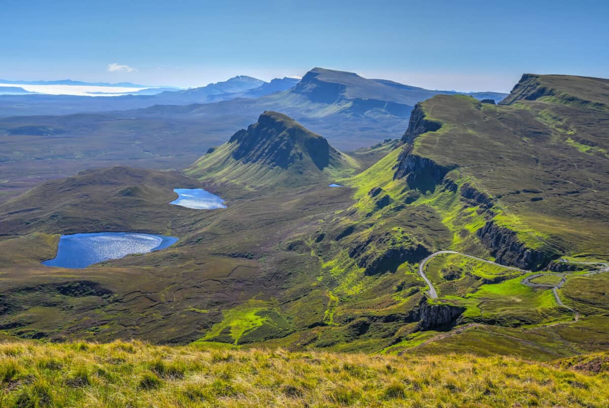
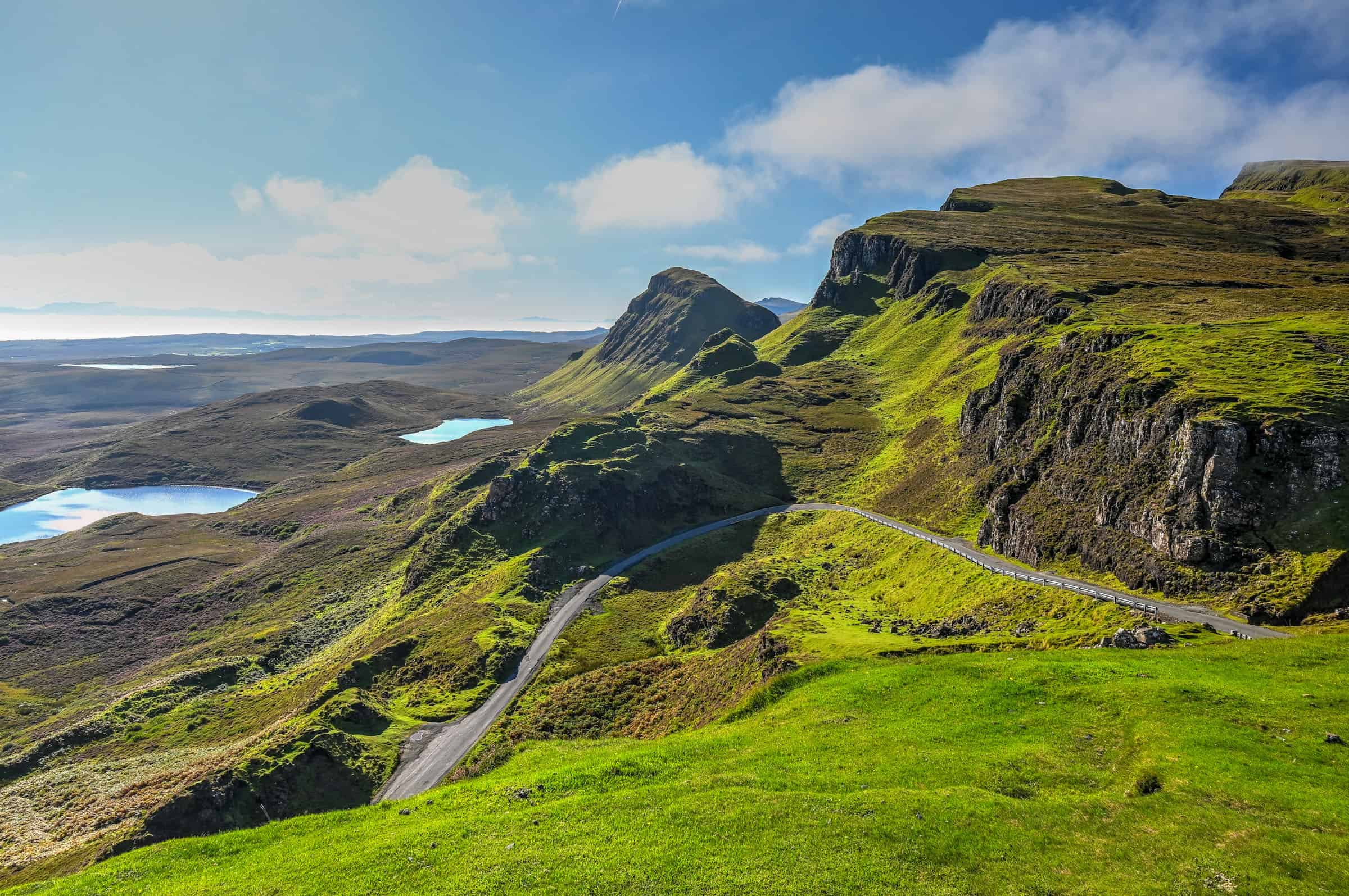
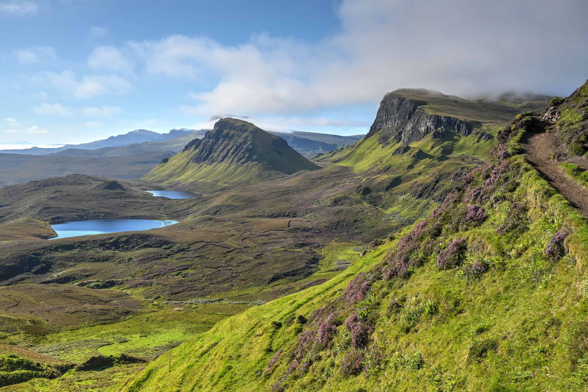
When most people think of the Isle of Skye, they are probably thinking of dramatic and stunning landscapes such as those of the Quiraing. Formed by a massive landslide, the Quiraing area is without a doubt one of the most spectacular landscapes to be seen on Skye and it is the setting for one of Scotland’s most iconic hikes (or walks as they say in the UK). If you are not an avid hiker, worry not, there are also two great viewpoints within a few hundred feet from the parking lot. If you visit the area, you will definitely remember these otherworldly and odd-shaped cliffs. Below we present our Quiraing Hiking Guide, which includes information on how to get to the trailhead, the various trail variations that you can do, and where the best views are.
Disclosure: This page (The Quiraing: Hiking Guide to one of Skye’s Most Stunning Landscapes) may contain product affiliate links. At no additional cost to you, we may receive a commission for purchases made through these links. More details can be found on our disclosure and policies page.
You might also be interested in these pages:
Top Things to See and Do on Skye
4-Day Roadtrip Isle of Skye Itinerary
Isle of Skye Travel Guide: Things to Know Before You Go
Where to Stay on the Isle of Skye
Skye’s Best Hiking and Walking Trails
About The Quiraing
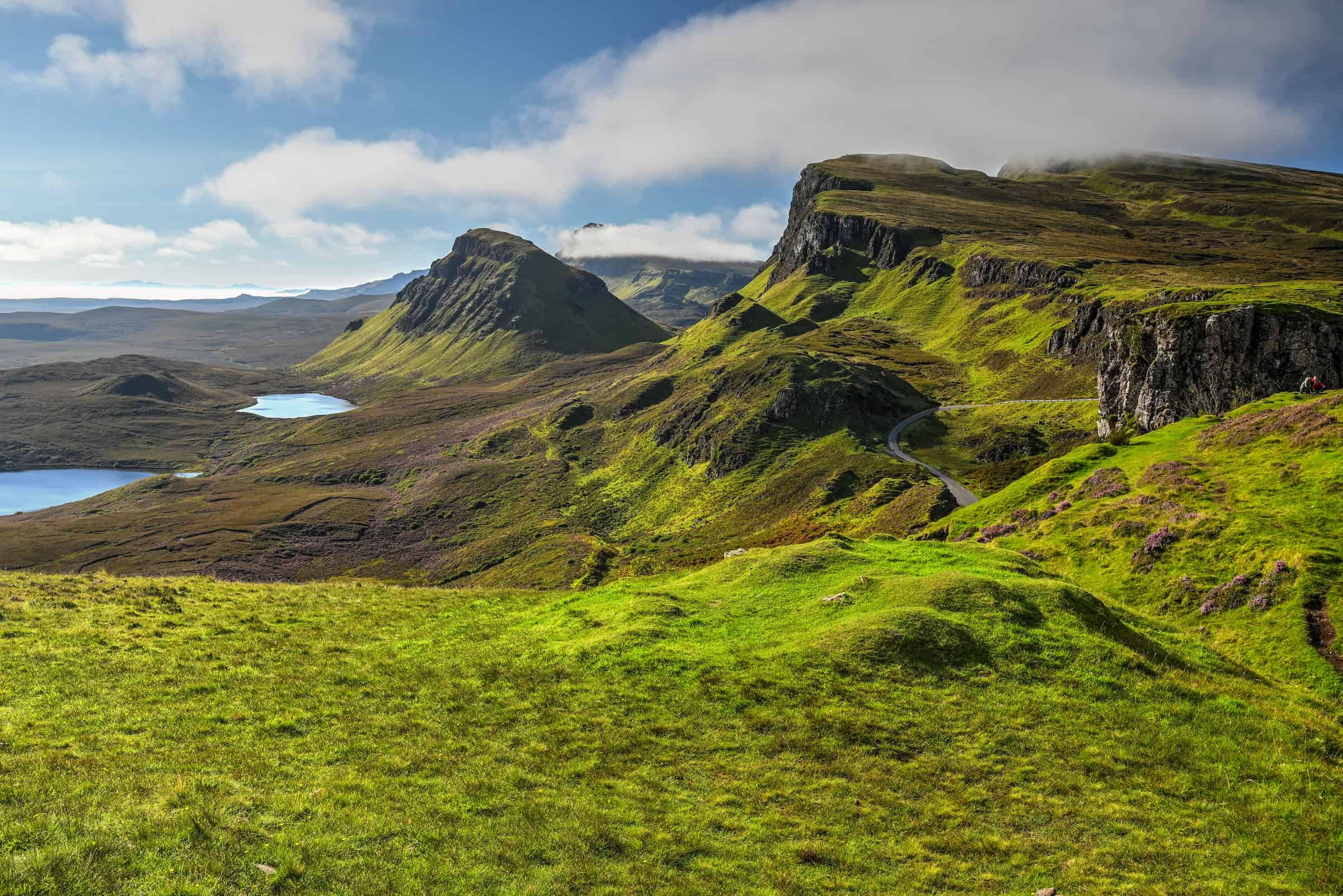
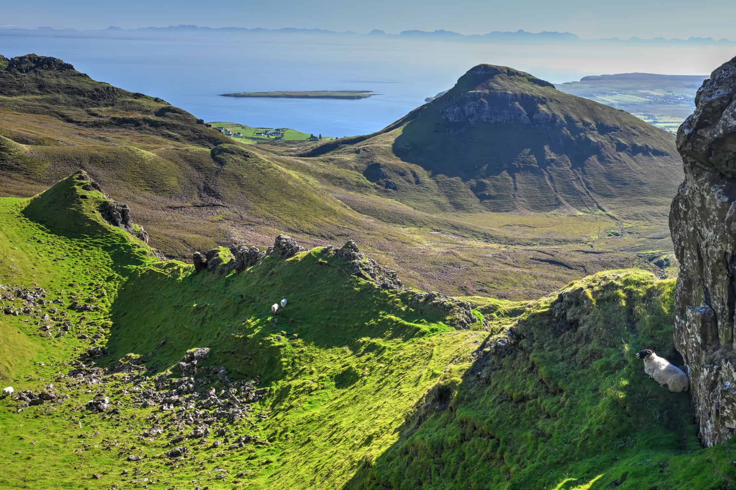
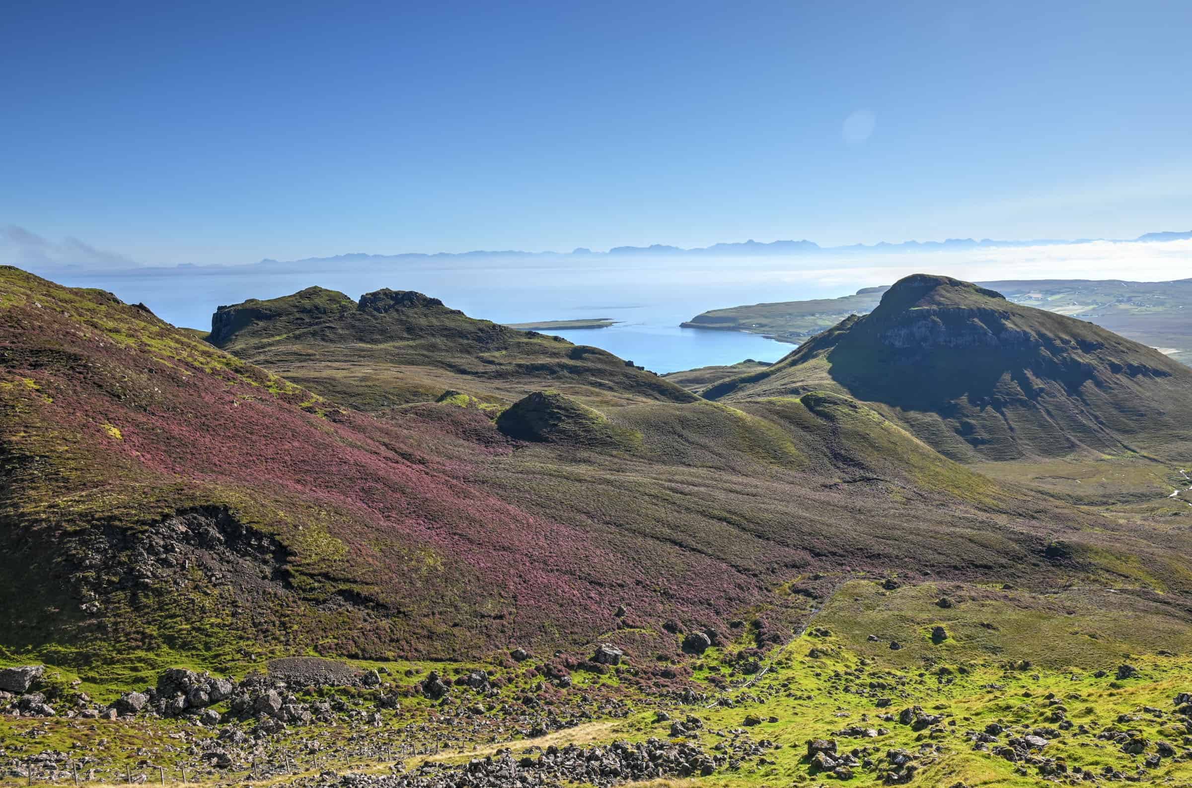
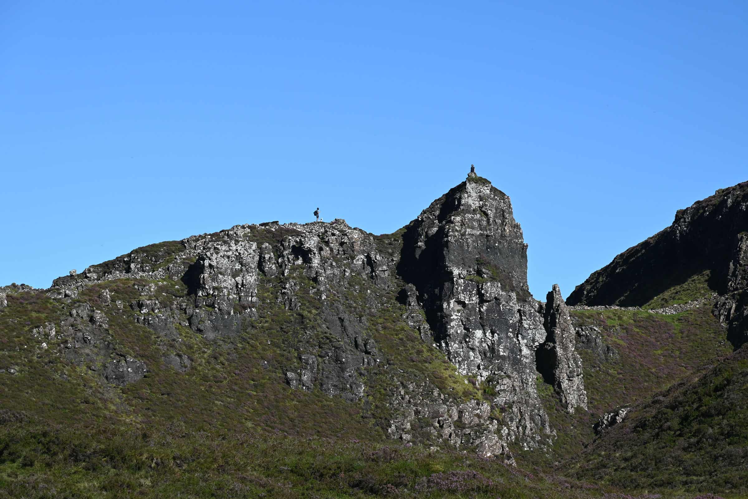
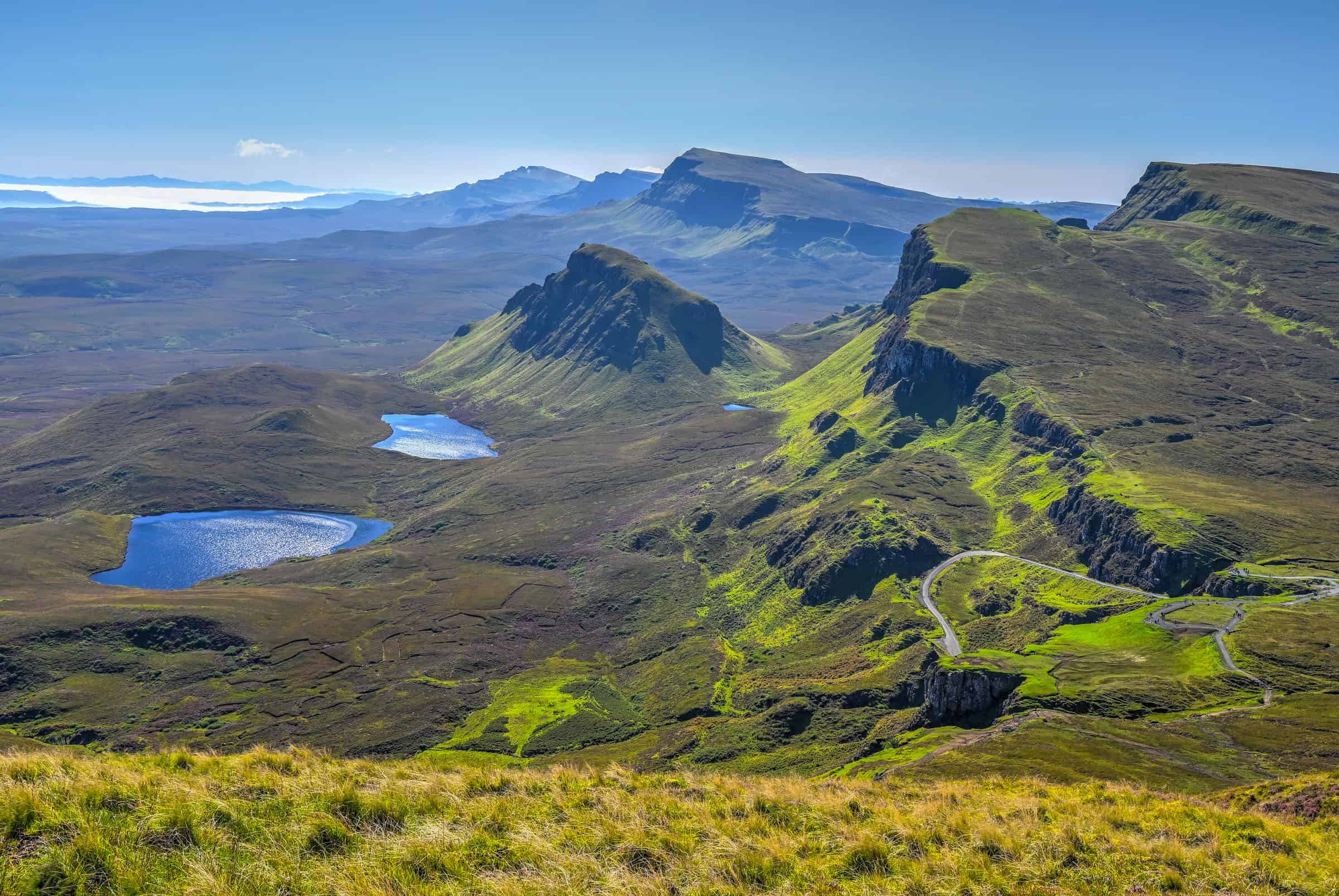
The Quiraing got its name from the Old Norse “Kví Rand,” meaning Round Fold, and refers to a collection of grass-topped rock towers and crags that appear to have frozen mid-tumble in a variety of strange angles, known to be the result of Britain’s largest landslide. At 2km wide, the Quiraing stretches from the escarpment down to the sea and actually is part of a much bigger series of ancient landslides all along the Trotternish ridge, which includes the Old Man of Storr. But unlike at the Storr, the earth at the Quiraing isn’t done wriggling around just yet—the road at its base has to be repaired yearly because the land still shifts a few centimeters each year.
ORIENTATION – WHERE IS THE QUIRAING?
The Quirang is located in northern Skye, near the northern tip of the Trotternish Peninsula.
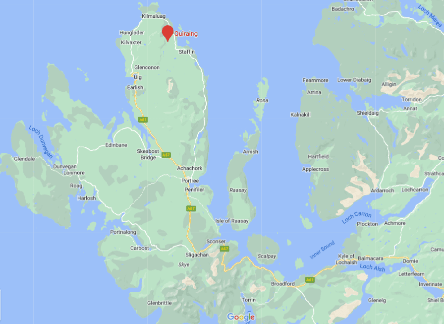
From Portree, Skye’s largest town, it is about a 40-minute drive (32 km) to get to the Quiraing. If coming from outside of Skye, the trailhead is roughly an 80-minute drive from the Skybridge, which connects the Isle of Skye to mainland Scotland. Note that the final portion of the drive is on a single-track unnamed road with sharp turns and elevation changes. It is a perfectly safe road that is in great condition, but it can be a nerve-wracking experience for some drivers and might not be ideal in bad weather conditions.
For advice and tips on how to drive in Scotland, check out our Scotland Roadtrip Driving Guide. For advice and tips that are more specific to Skye with a focus on single-track roads, check out our Isle of Skye Road Trip Driving Guide.
If you haven’t booked your rental vehicle yet, we highly recommend using Discover Cars to get the best rates on your rental in Scotland.
Note that there is no public transport available to reach the trailhead, as the nearest bus stop is 3 km away in Brogaig. If you don’t have your own wheels, another option could be to join a Skye group tour.
Parking: Although the Parking lot is fairly large, it does fill up quickly during peak times, particularly during the summer. When it does fill up, you might have to find some more challenging off-road parking spots. To be sure to get a spot, we recommend arriving before 10 a.m. or after 3 p.m. There is a fair bit of turnover, however, as many just come and walk to the viewpoint (or just walk the very beginning of the trail).
Hours: The trail is also open 24 hours a day, 7 days a week so you can visit any time you like.
Costs: Hiking the trail is free, but the car park is Pay & Display (£3 for up to 3 hours or £5 for up to 6 hours (2023)). Payment only applies from 8 am – 8 pm. Parking outside of these times is free of charge.
Facilities: There are no public toilets here. Occasionally there is a food truck (known as the “Tea Pot”) with snacks and drinks by the car park.
THE QUIRAING TRAIL
Quiraing Lookout
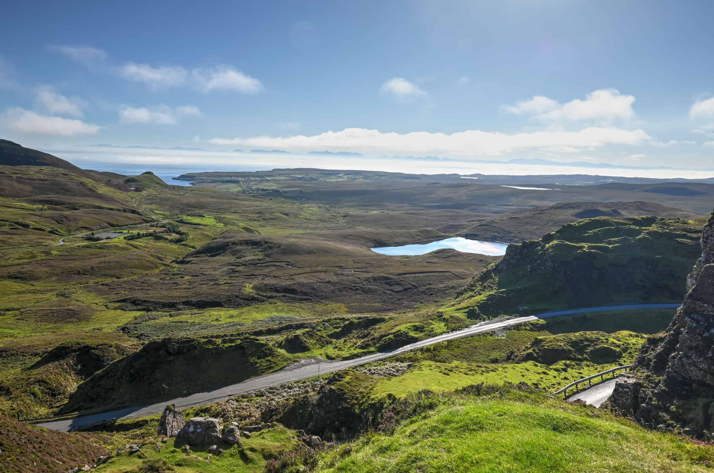
From the parking lot, if you walk straight along the road (without crossing it) towards the east for a few dozen feet, you’ll reach the edge of a cliff that hangs above the road. From this point, the scenery is quite stunning, giving you a glimpse of what is to come. The lookout is listed on Google Maps, but its location (in 2024) is inaccurate, you have to stay on the same side of the road as the parking lot.
Quiraing Viewpoint
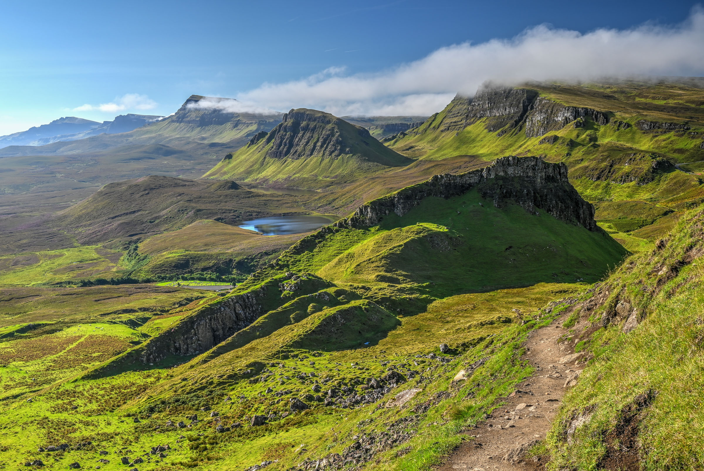
You won’t have to walk very far from the car park to get to the Quiraing Viewpoint, only about 500 feet to this point. The views from here are quite stunning as well and they will serve as a great prelude to much of what you will see during the Quiraing hike (or walk). If you would like to see a bit more of the scenery, but without undertaking the full hike, we highly recommend that you attempt the first few hundred meters of the trail, which is mostly flat. This first section of the trail will provide you with more fantastic views of the stunning and otherworldly landscapes of the Quiraing.
Quiraing Trail Details
Distance: 6.9 km
Route Type: Loop
Elevation gain: 265 m (cumulative elevation gain: 382 m)
Start point: Quiraing Car Park
AllTrails rating: (4.7, 1958 ratings (2023))
Duration: Most people complete the trail in 2h30-3h (there are generally several muddy, watery and slippery sections throughout, which makes this trail more slowgoing than you would expect given the distance and elevation gain).
Not an AllTrails member yet? We highly recommend signing up for either their free or paid membership plans. The free plan allows you to find new trails and plan routes but it can only be used while hiking if you have access to mobile data. The paid membership plan (AllTrails+) allows you to download trail maps for offline use and provides live progress updates and off-route notifications.
If you are still uncertain – you should know that the All Trails mobile application was voted the 2023 iPhone App of the Year by Apple.
Quiraing Trail Summary
The trail follows a counter-clockwise loop and can be divided into 5 uneven parts: 1) The ridge walk out to the pinnacles (the Prison and the Needle, 2) the valley, 3) the climb, 4) the Table (a large open plateau), and 5) the descent.
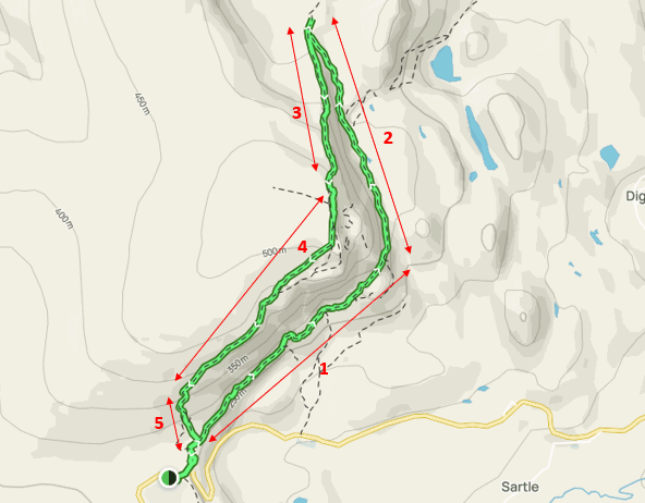
Note that the trail is often quite muddy after rain, particularly for sections 3, 4, and 5 of the trail. In bad weather conditions and poor visibility, we highly recommend not to undertake sections 3-4-5 of the trail, and to rather treat the trail as an out-and-back one by returning to the trailhead via sections 1 & 2. In fact, many people chose to do this even in good weather to avoid the steeper sections of the trail.
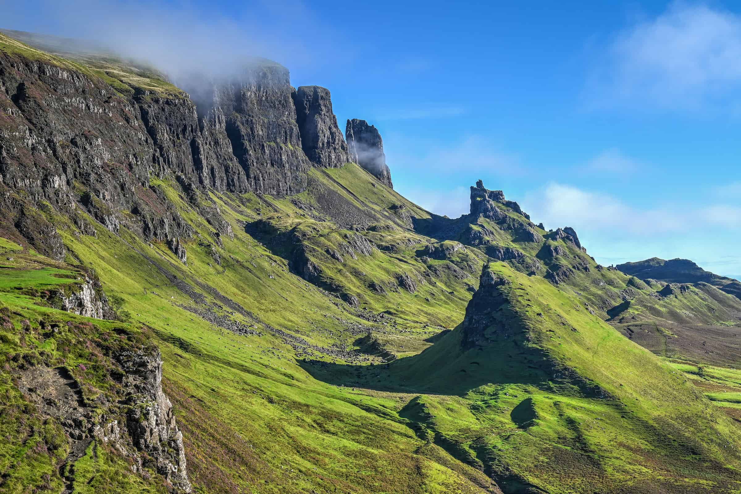
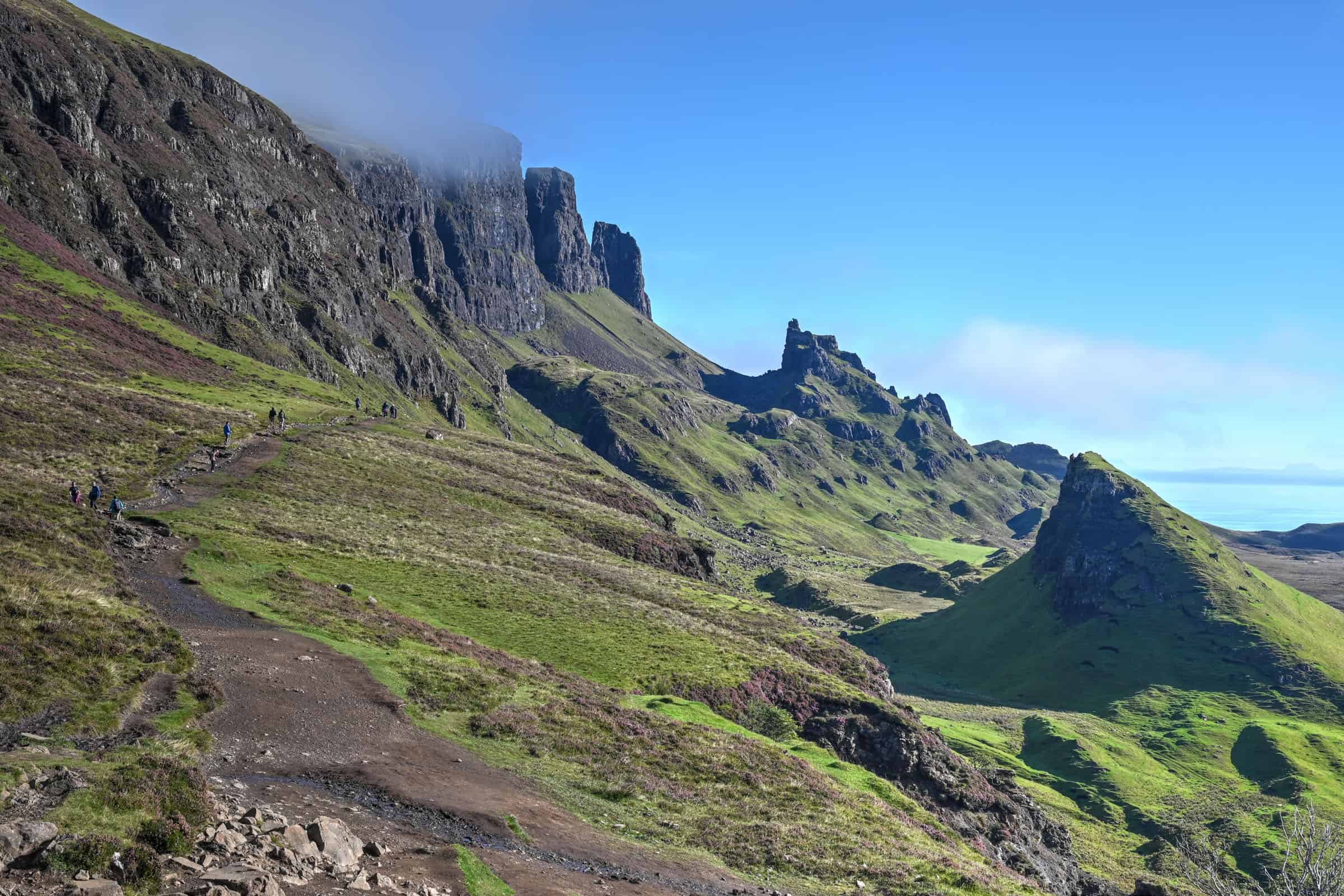
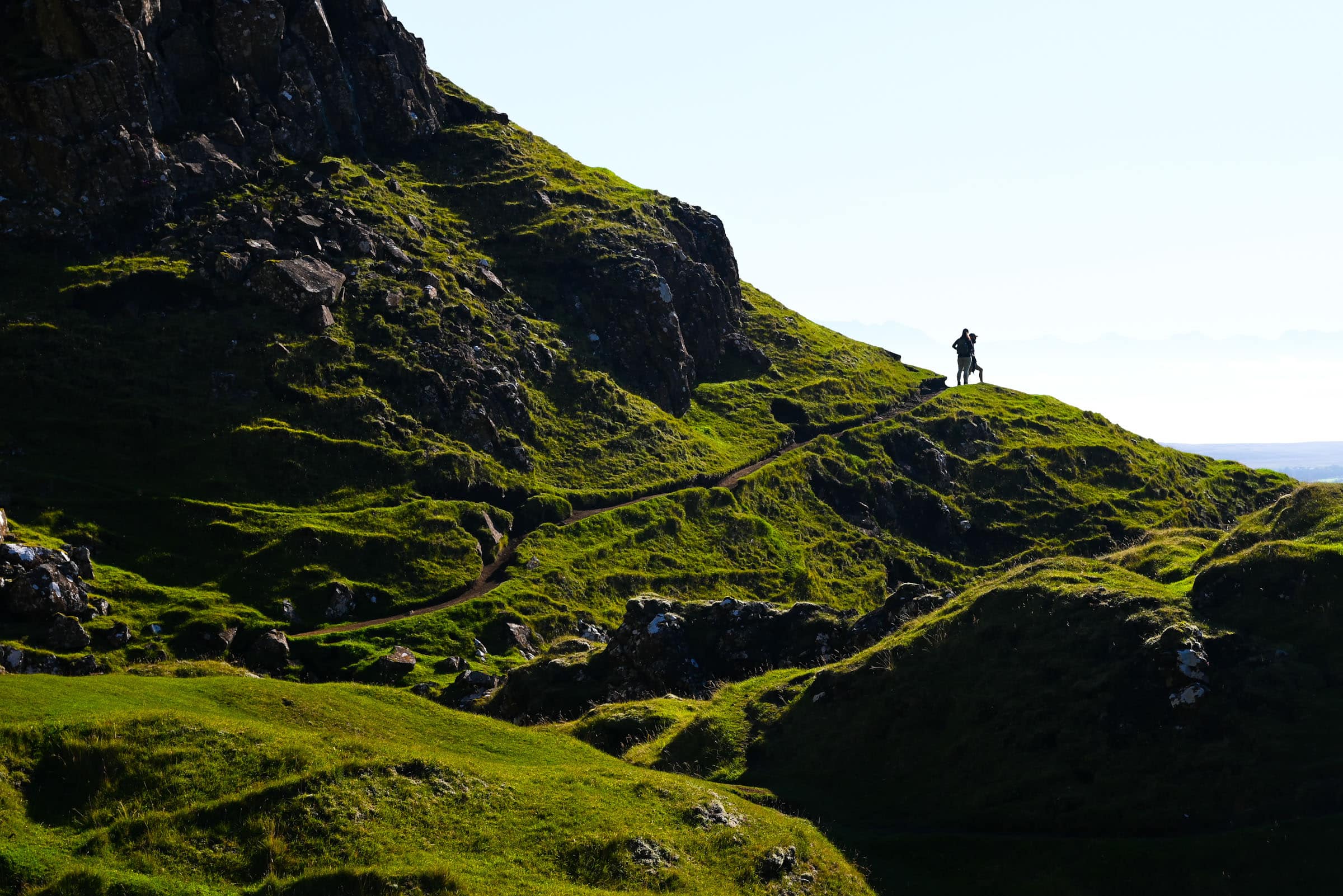
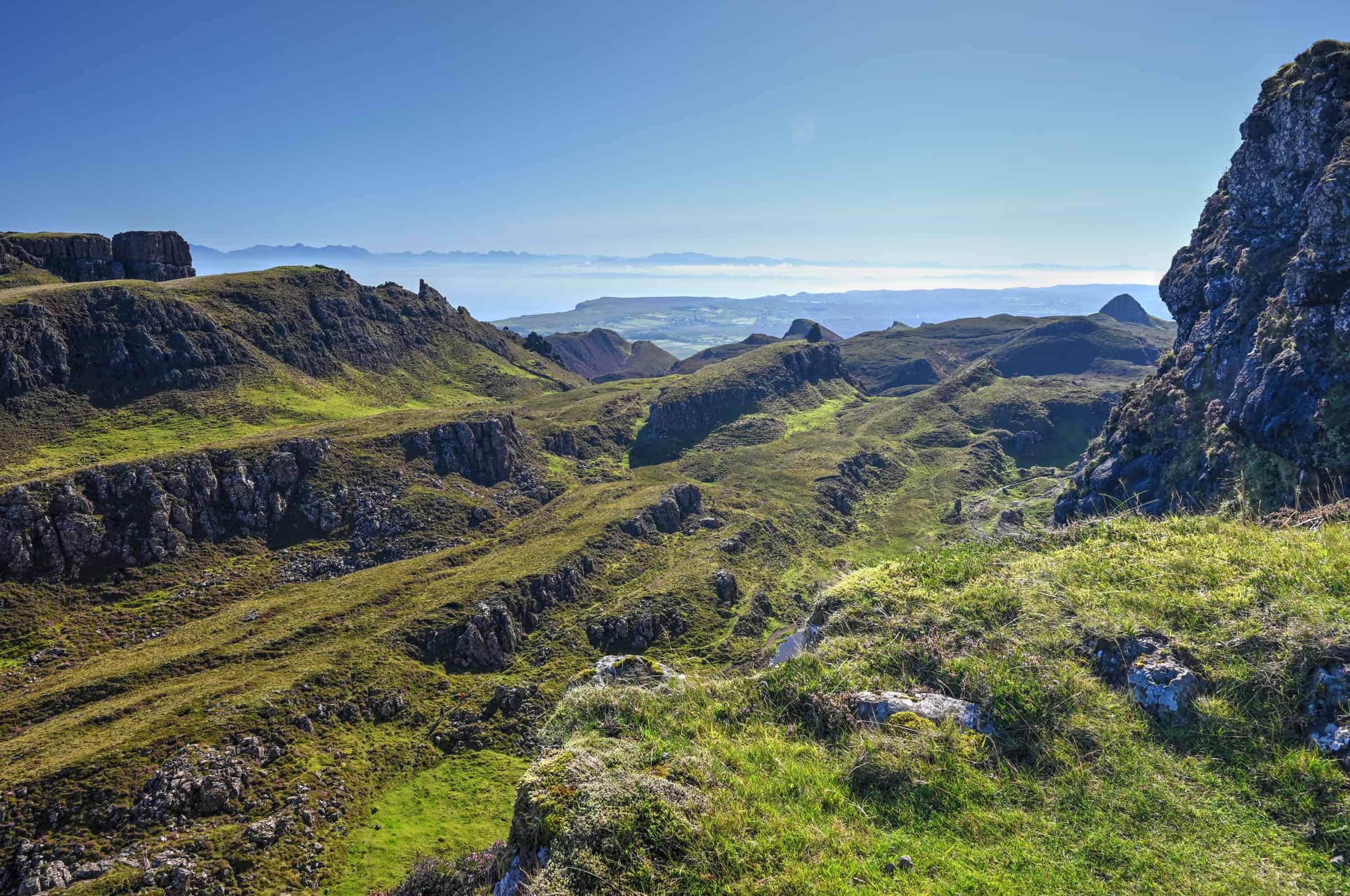
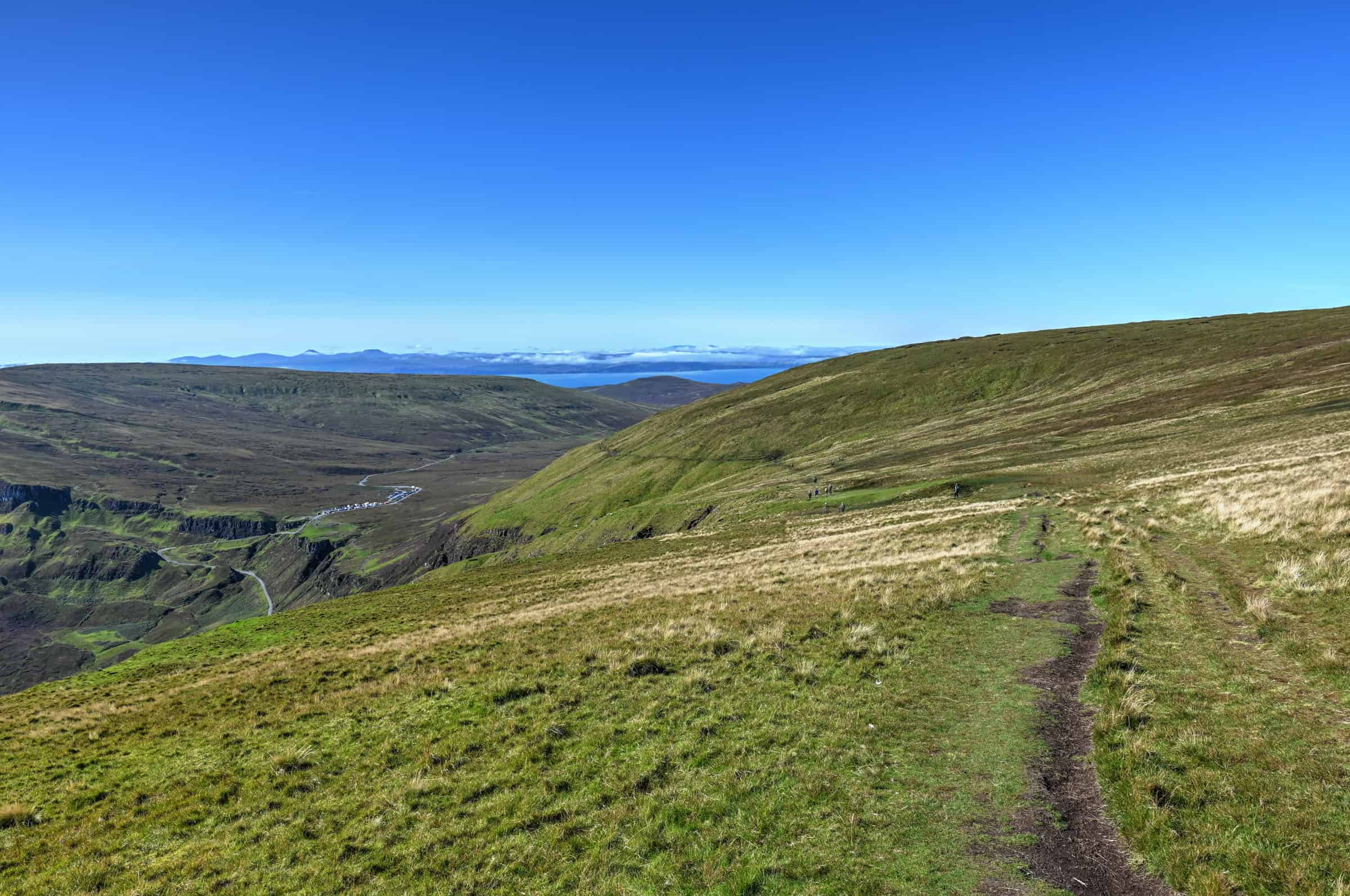
1. The ridge
This is the most scenic portion of the trail in our opinion – and many seem to share this opinion as it is also the busiest portion of the trail. In fact, many will simply wander along this first portion of the trail and eventually turn back without going much further. It is understandable, as the landscapes and the scenery are outstanding here and the trail in this portion is relatively flat, making it accessible to most. There is only one small awkward section where you have to undertake a brief rocky scramble over a tiny waterfall – nothing dangerous, but it can be a bit slippery.
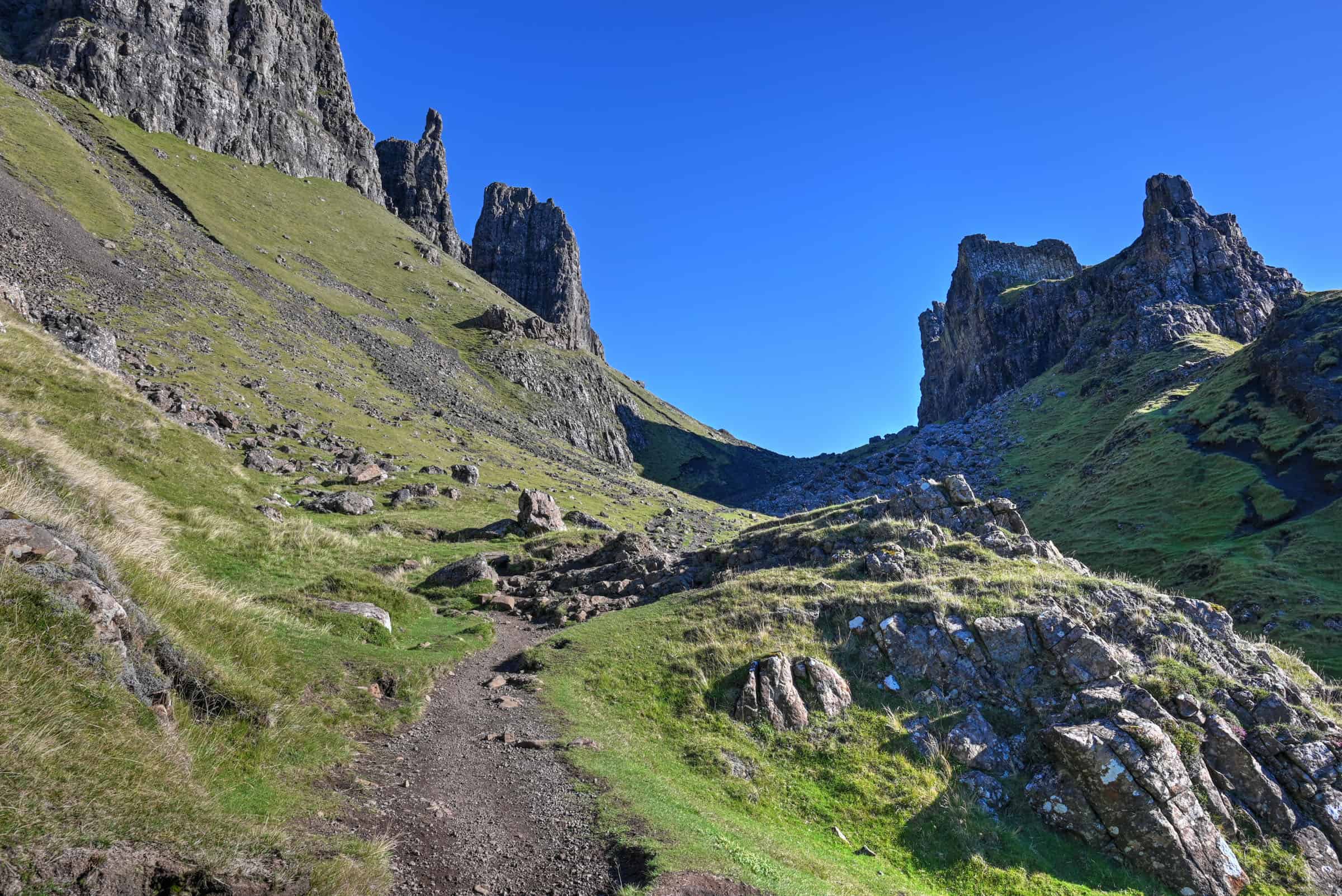
A little after the 1.5km mark, once you reach the pinnacles, there is an optional 10-minute detour that allows you to go around the pinnacle known as the Prison (a pyramid-shaped rocky peak to the right of the main trail). Note, however, that the final section of this detour is pretty steep (and often muddy) – getting back to the main trail can be a challenge for some.
2. The Valley
This is the only trail section where you are surrounded by rising cliffs on both sides. This 1.5km stretch is a fairly straightforward section as it is mostly flat. However, the footing at times is less obvious as the path is more rocky and there are often several puddles to avoid.
Near the end of the section, the trail goes slightly uphill until you reach a wire fence with a simple stile to cross. This roughly marks the halfway point of the trail. Turn left to continue with the trail, or go right for a breather atop a small rocky outcrop providing fantastic panoramic views to the north.
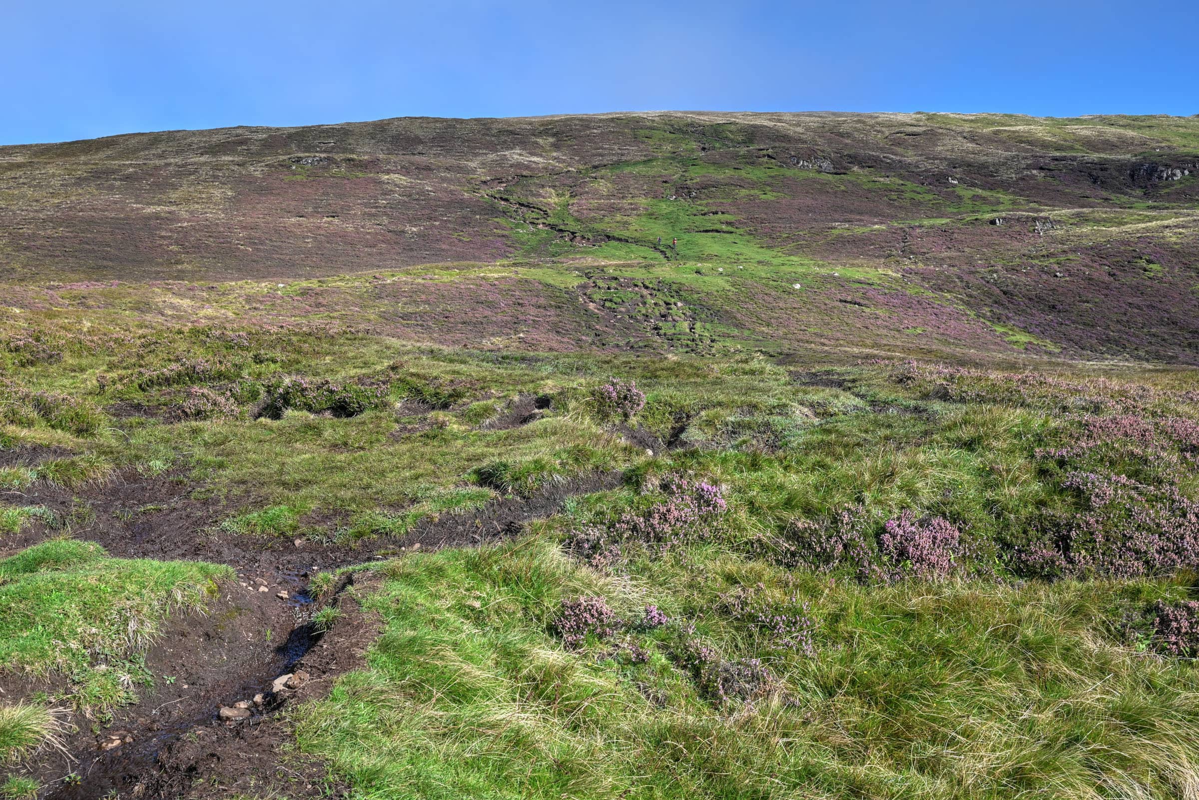
3. The Climb
This is the most demanding section — fitness-wise — of the trail. Though the slope isn’t too steep, it does feel like it goes on for quite some time while you are climbing.
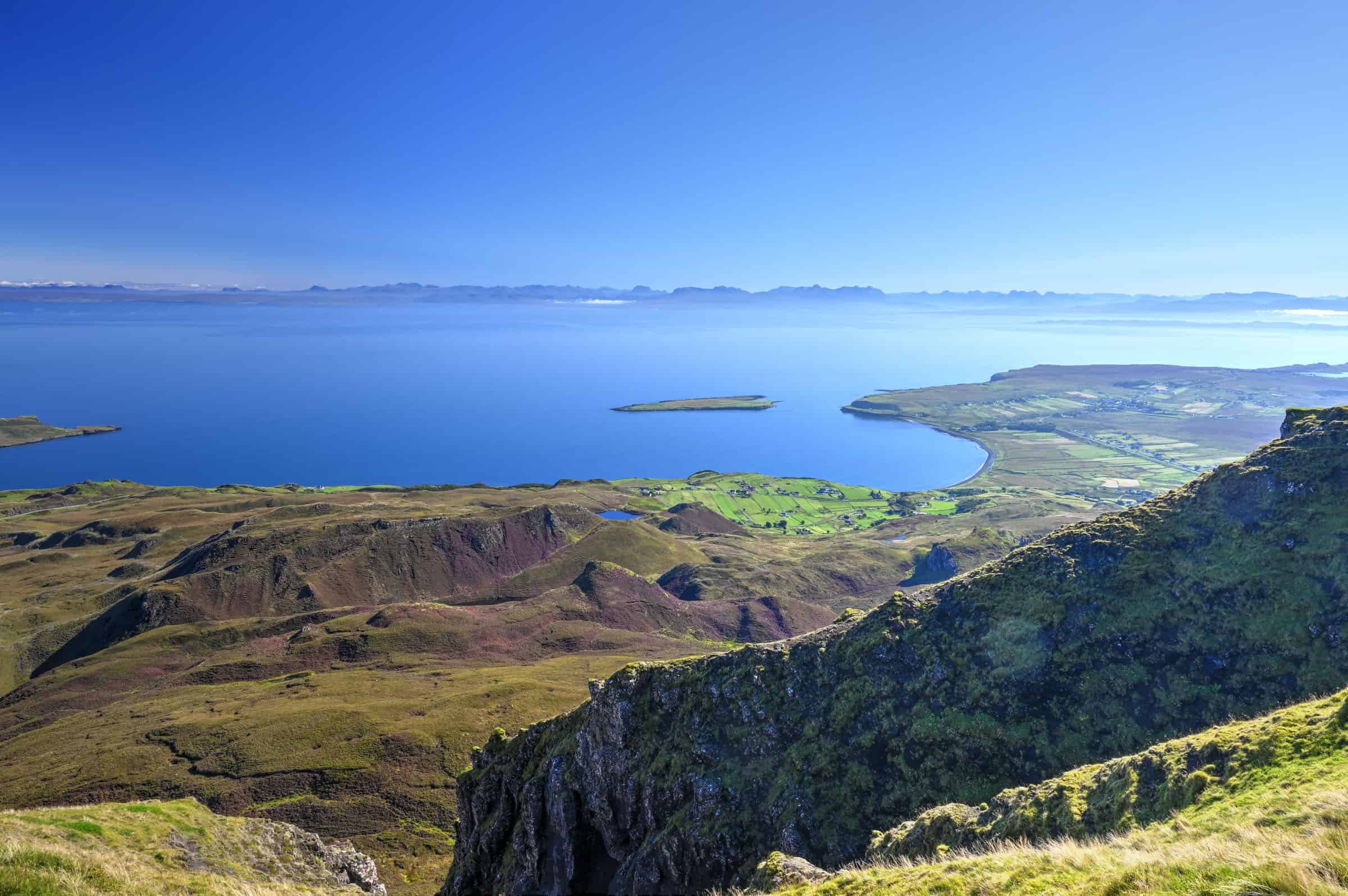
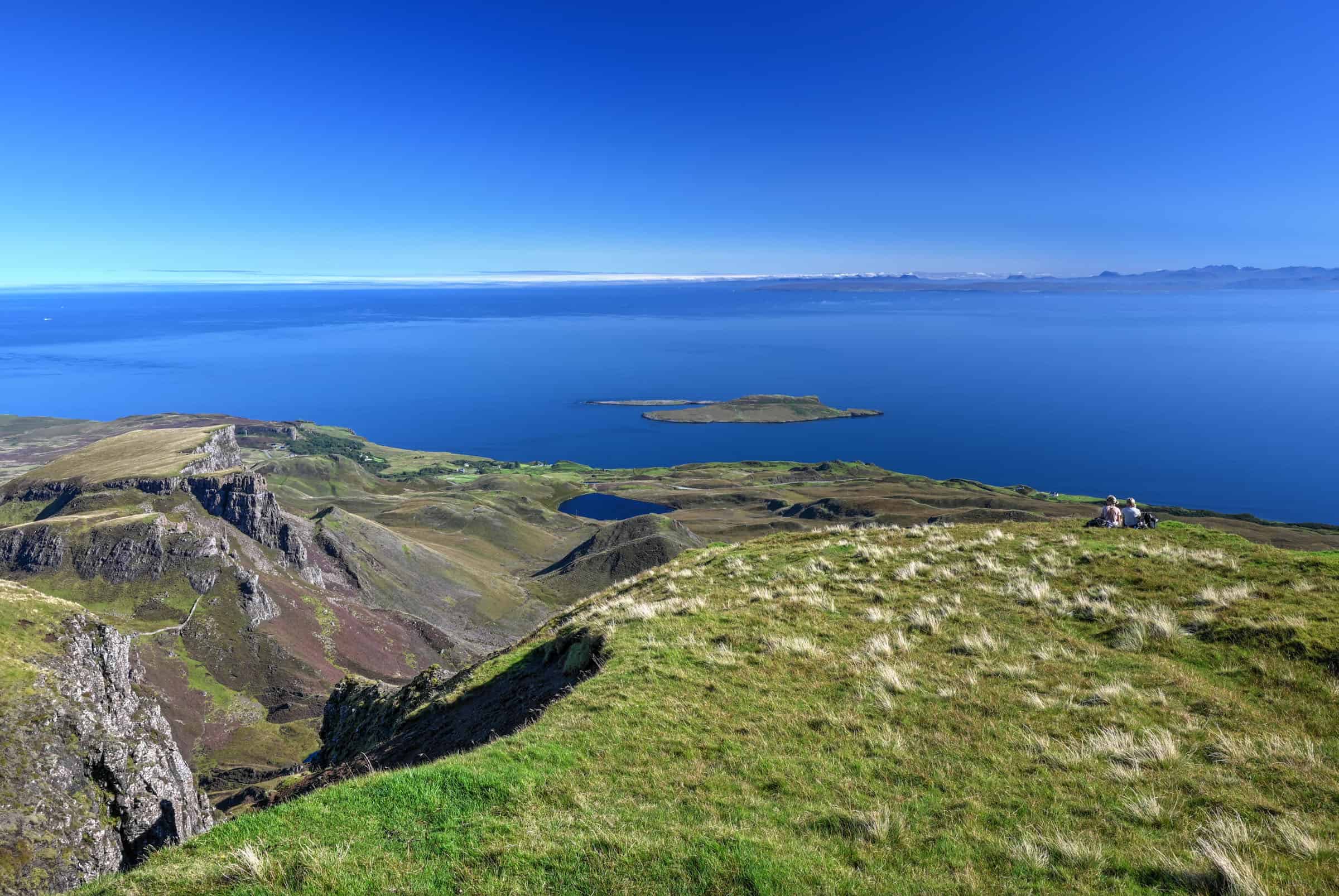
Several sections can be muddy even in good weather, and you will be close to the cliff edge at times, so take care while climbing. Feel free to take breaks and enjoy the view behind you or to your left. As you look out East you can see the village of Staffin below then the Islands of Raasay and Rona.
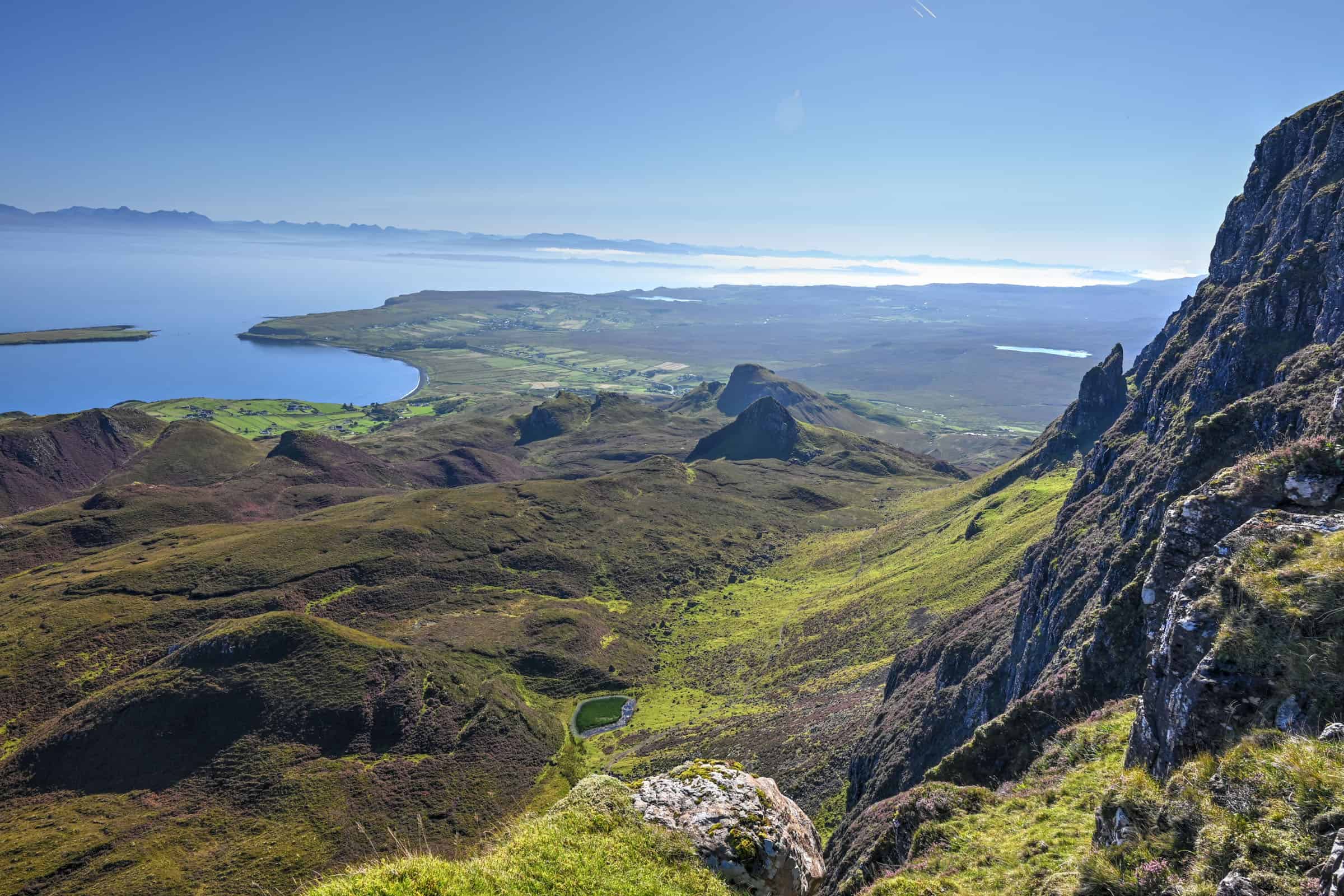
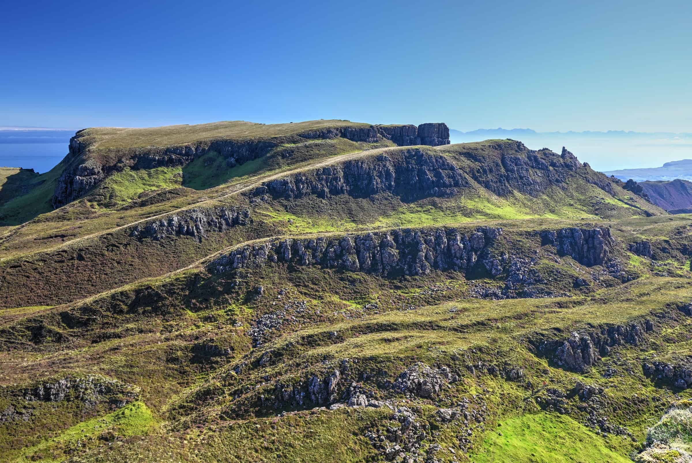
4. The Table
One of the easier sections of the trail, often referred to as The Table, is a vast plateau that mostly follows a gently descending slope. Local folklore states that hundreds of years ago the Table was used by farmers to hide sheep and cattle from invaders, as this hidden plateau cannot be seen from lower down.
You are however much more exposed, so take great care in windy and low-visibility conditions. When the weather conditions do enable good visibility, the views towards the sea and the horizon are quite remarkable.
Note that several sections of the Table path can remain quite boggy and damp, even after several consecutive days of good weather. You’ll often have to walk through or around puddles.
5. The Descent
This is the shortest section of the trail, but don’t underestimate the time required to complete it. It’s quite steep, often quite muddy, and there are several switchbacks that are slow going. Even though you’ll feel like you are at an arm’s length of the car park, take your time and descend with care.
Trail Variations
1) For a less challenging walk (particularly if the weather isn’t ideal), change the trail to an out-and-back by skipping sections 3 through 5 and simply return via sections 1 & 2. The total distance walked will roughly be the same as the full loop, just with significantly less elevation gain.
2) For a shorter trail, many will walk all the way to the Prison and then turn back towards the trailhead. This equates to a 4km out-and-back trail.
3) If you are looking to do things differently, or want to add some distance to the hike, you can start the hike from a small lot by route A855. Here the parking is free (but very limited), and is 2km from connecting with the main Quiraing trail.
Hiking Packing List
All Trails subscription – This comes in really handy for areas with little or no cell reception, as the annual subscription allows you to download trail maps for offline use.
External Battery – If you are using your phone to track your progress along the trail or to help with navigation, you certainly don’t want your phone to die on you. That’s especially true in the unlikely event that you might get hurt or need assistance.
Hiking poles – These can be particularly useful in steep trails or muddy/boggy trail conditions.
Water Filter Bottle – The Life Straw bottle is an advanced water bottle with a filter that not only improves water taste but more importantly filters out bacteria and parasites, chemicals and microplastics.
Headlamp – very practical and a smart choice if you plan to start your hike before sunrise or finish it after sunset.
QUIRAING HIKING GUIDE TIPS
- Come early if you can, as the parking lot can fill up during the day. Alternatively come later in the day, after 3 pm, but be sure to allow yourself enough time to return before dark.
- When it’s not overcast, we find the light is best early in the morning, as the eastern sun will shine everywhere along the trail. About a quarter of the trail will be completely in the shade in the afternoon, and even larger portions will be in the shade as the sun gets closer to the western horizon.
- Check the weather before heading out. Our favourite weather app for the area is the Met Office app.
- If coming during the summer months, beware of the pesky little midges. You can check the midge forecast beforehand.
- Stick to the designated path to protect the surrounding environment.
- Be prepared for windier and cooler conditions up on the Table section, as you are much more exposed than at any other point during the trail.
- It’s forbidden to fly your drone at the Quiraing, as the Isle of Skye has designed it as a conservation area.
- Remember that there are no washrooms here. Try to stop and use a restroom beforehand.
- Bring warm layers, it can get particularly windy and cool on the upper section of the trail.
OTHER SKYE HIKING TRAILS
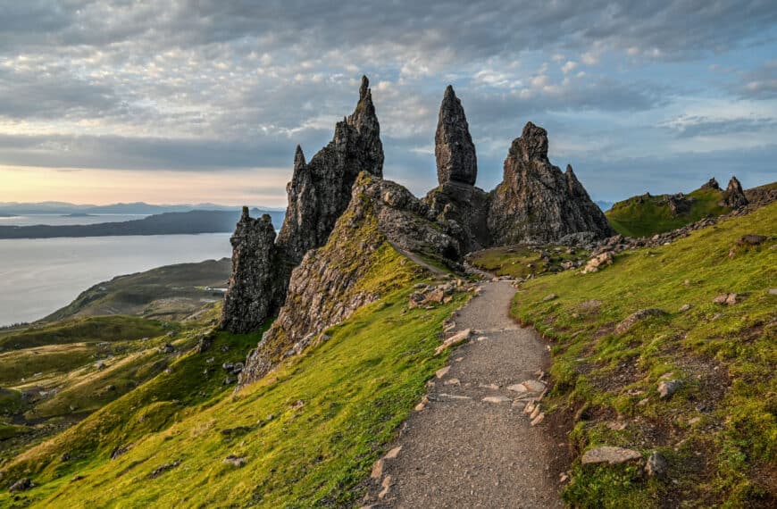
Another Skye classic with iconic otherworldly views – The Old Man of Storr
The Old Man of Storr is the most popular hiking option along the Trotternish Peninsula Loop, roughly a 20-minute drive from the Quiraing trailhead.


A lesser-known coastal beauty favourite of ours – Camanusary Bay. You’ll find tranquillity here and very few other hikers. The trailhead is about 90 minutes from the Quirang, in southern Skye.


A less demanding hike with stunning mountain and waterfall vistas – The Fairy Pools
Another Skye classic, located a 45-minute drive from the Quiraing.


To find yourself on a beach between sea stacks, cows and a stunning waterfall – Talisker Bay
Like Camasunary Bay, a very peaceful and tranquil trail. Located about a 65-minute drive from the Quiraing.


NEARBY ATTRACTIONS
Sligachan Old Bridge and Waterfall – A more than worthy photo stop along Skye’s main road
The bridge parking lot is roughly a 40-minute drive from the Quiraing.


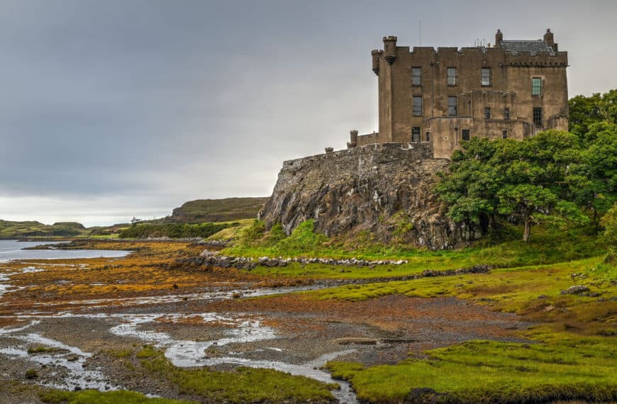
Dunvegan Castle – Visit Skye’s most impressive and well-preserved castle. The castle is about a 60-minute drive away.


Talisker Distillery – Sample some whiskey at Skye’s oldest and most famous distillery. Located in between the Fairy Pools and Talisker Bay trails highlighted above, roughly a 45-minute drive from the Quiraing.


Town of Portree – Take a stroll through Skye’s largest town and its colourful harbour homes. The town is a short 30-minute drive from the trailhead.


Eilean Donan – Although it’s not quite on Skye, it’s without a doubt a worthy stop on your way in or out of Skye.


Neist Point Lighthouse – A beautiful drive along a long and winding road will take you to the stunning vistas of Skye’s most photogenic lighthouse. It’s about a 75-minute drive from the Quiraing.


Trotternish Peninsula – Not a single attraction but rather a collection of several, including several waterfalls and hiking trails including the Quiraing and the Old Man of Storr.


Preparing a trip to the Highlands?
You might be interested in these pages:
Top Things to See and Do on Skye
4-Day Roadtrip Isle of Skye Itinerary
Isle of Skye Travel Guide: Things to Know Before You Go
Where to Stay on the Isle of Skye
Skye’s Best Hiking and Walking Trails
Preparing a trip to Scotland?
You might be interested in these Scotland pages:
10-Day Scotland Roadtrip Itinerary (Edinburgh and Highlands)
Scotland Driving Guide and Tips
7 of the Best Castles to Visit in Scotland
Best Things to See in the Scottish Highlands
Best Hikes to do in the Scottish Highlands
We also highly recommend these guidebooks:
Rick Steves Scotland
Lonely Planet Scotland’s Highlands
Photography Gear
If you like our photography, you might be interested in some of the gear we use to shoot our travel and hiking destinations.
Camera Body – Nikon Z 6ii Fx-series Mirrorless Body
Main Lens – NIKON 24-120mm F/4G ED VR AF-S
Zoom Lens – Sigma 745-306 150-600mm f/5-6.3
Polarizing filters – Urth Circular Polarizing (CPL)
Camera Tripod – K&F Concept 64-inch Camera Tripod
Mini-tripod – Lammcou Flexible Camera Tripod
Camera/hiking backpack – Vanguard Alta Rise 48 Backpack
Universal Travel Adapter – VYLEE Universal International Power Travel Plug
Other Travel Essentials
Travel Insurance
SafetyWing is a travel insurance company that offers comprehensive coverage for travellers. Includes Medical Insurance and Travel Insurance. Primarily geared towards long-term travellers, digital nomads, and expats.
e-Sim cards
Airalo is the world’s first and largest eSIM store with eSIM plans for 200+ countries and regions worldwide. With Airalo eSIMs, travellers can get connected the moment they land at their destination and avoid nasty data roaming charges
eSIMS are a sustainable alternative to single-use SIM cards – they are 100% digital, require less energy to produce and be re-used rather than disposed of.
Car Rentals
Discover Cars is our go-to website for car rentals. We almost always find our preferred rate there.
Transfer from Airport
Welcome Pickups is our favourite private transfer service, which you can pre-book at a fixed price. Currently available in 220 cities all over the world (mostly in Europe, but with several major cities in Asia, the Middle East and the US).
Kiwitaxi is another private transfer service – we haven’t tried it yet, but it’s currently available in a few more countries (102 as of 2024).
Hotels and Accommodations (coming soon)
Photography Prints
If you found this blog useful, you can help support our blog by purchasing low-cost digital prints. Printed physical prints are also available for purchase.


—–
—–
Preparing a trip to Scotland?
We highly recommend these guidebooks:
—–
You might also be interested in these related pages:
1 Comment