Iceland is truly a unique land of natural wonders and out-of-this-world landscapes. Amazing moon-like terrain, jaw-dropping national parks, volcanoes, hot springs, giant glacier lagoons, and an endless supply of waterfalls, are just some of the few things that will keep you wanting to come to Iceland. Below we present our Top Things to See and Do in Iceland Travel Guide.
Disclosure: This page (Travel Guide of the Top Things to See and Do in Iceland) may contain affiliate links to products. At no additional cost to you, we may receive a commission for purchases made through these links. We only recommend products or services we personally believe in. More details can be found on our disclosure and policies page.
Obviously, the following list is not an exhaustive one, but we wanted to focus on the things that were indeed the most impressive to us. We also only wanted to include places that we visited ourselves — we wouldn’t feel comfortable recommending something or someplace we didn’t get to experience personally.
Iceland lends itself particularly well to a road trip: it has an excellent road system and you can cover most of the country in as little as 7 days (if that’s all the time you have), but 10 days for the trip is probably ideal. If you are not sure where to start, be sure to check out our suggested 10-Day Iceland itinerary.
The Ring Road
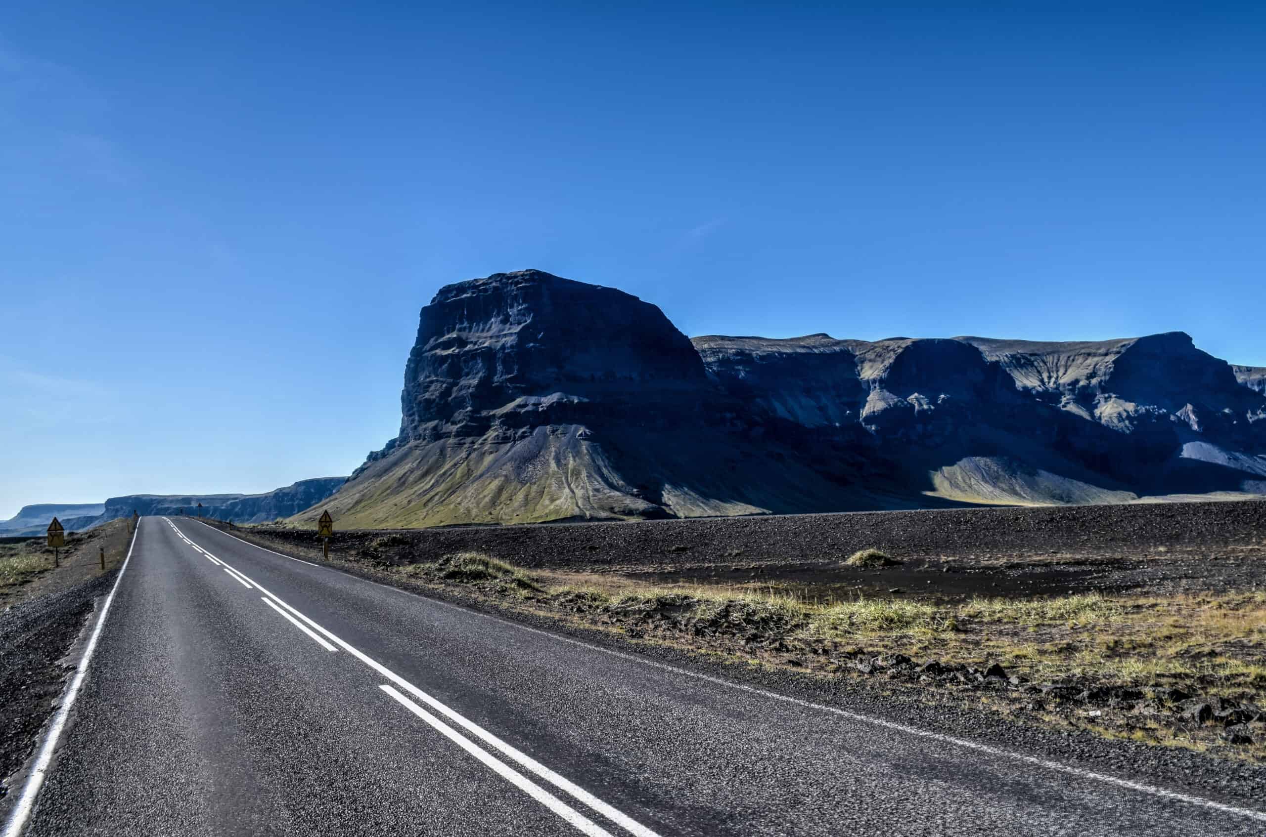
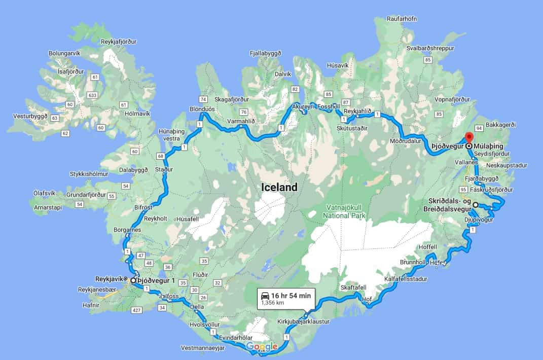
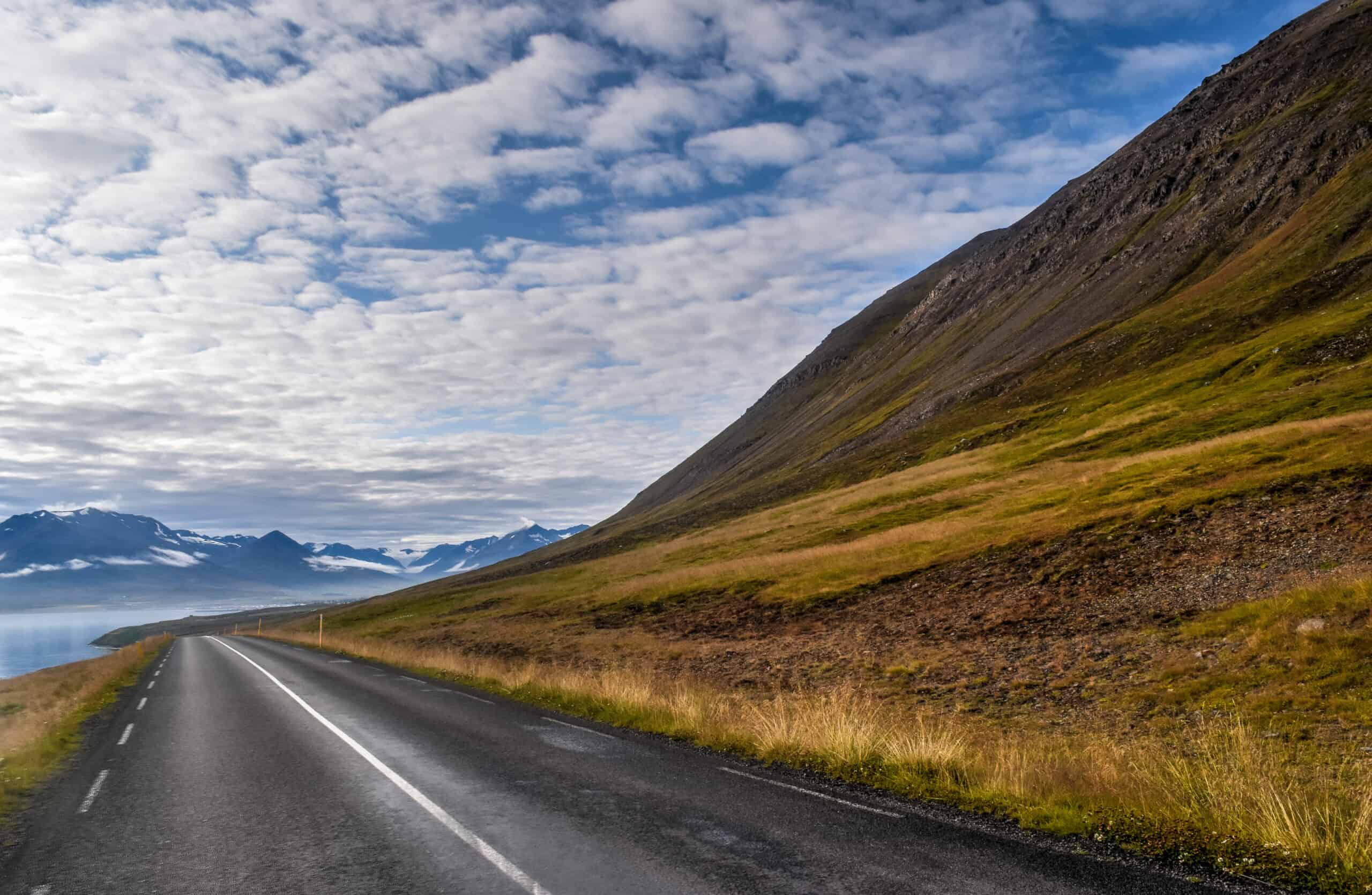
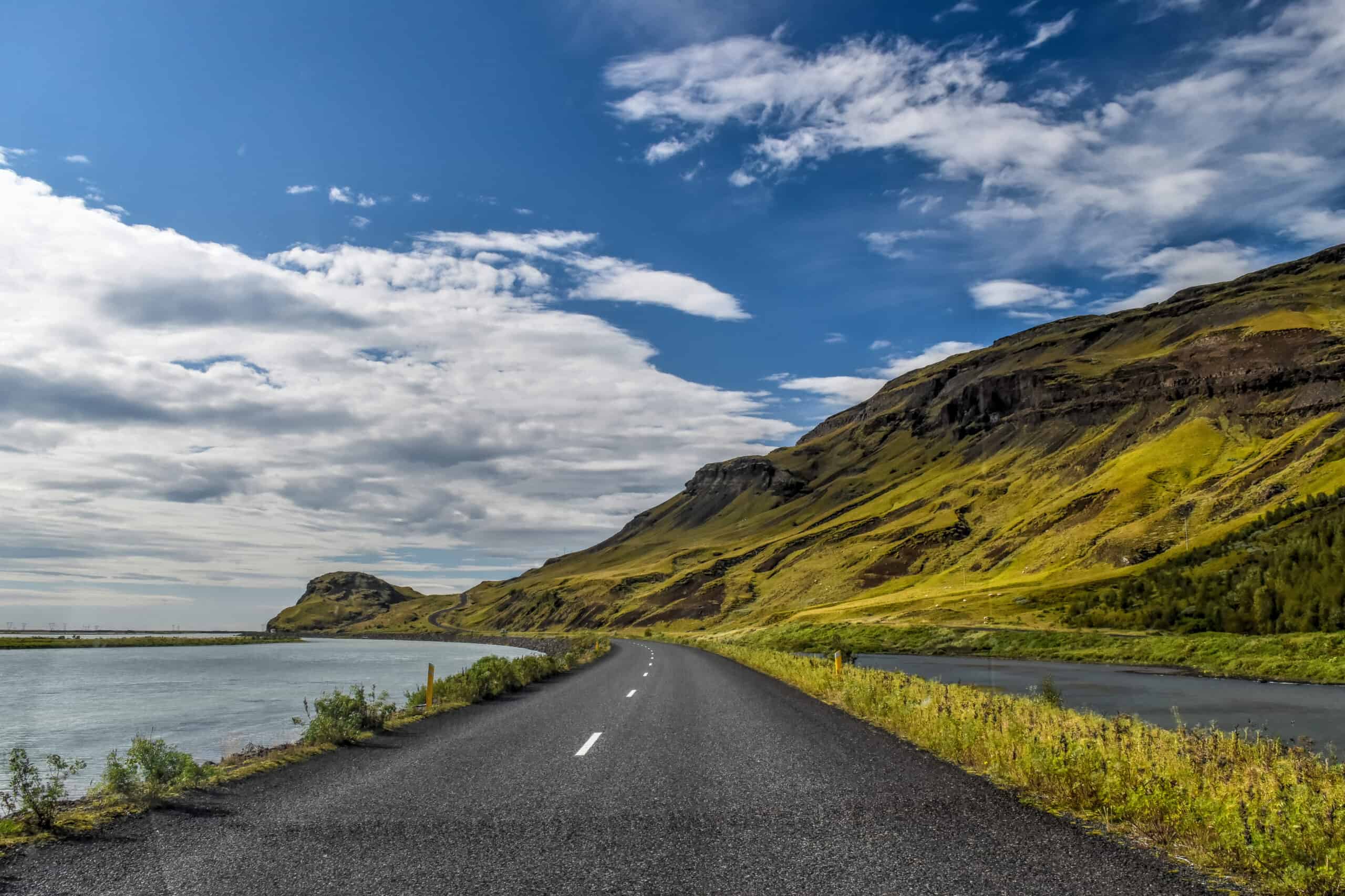
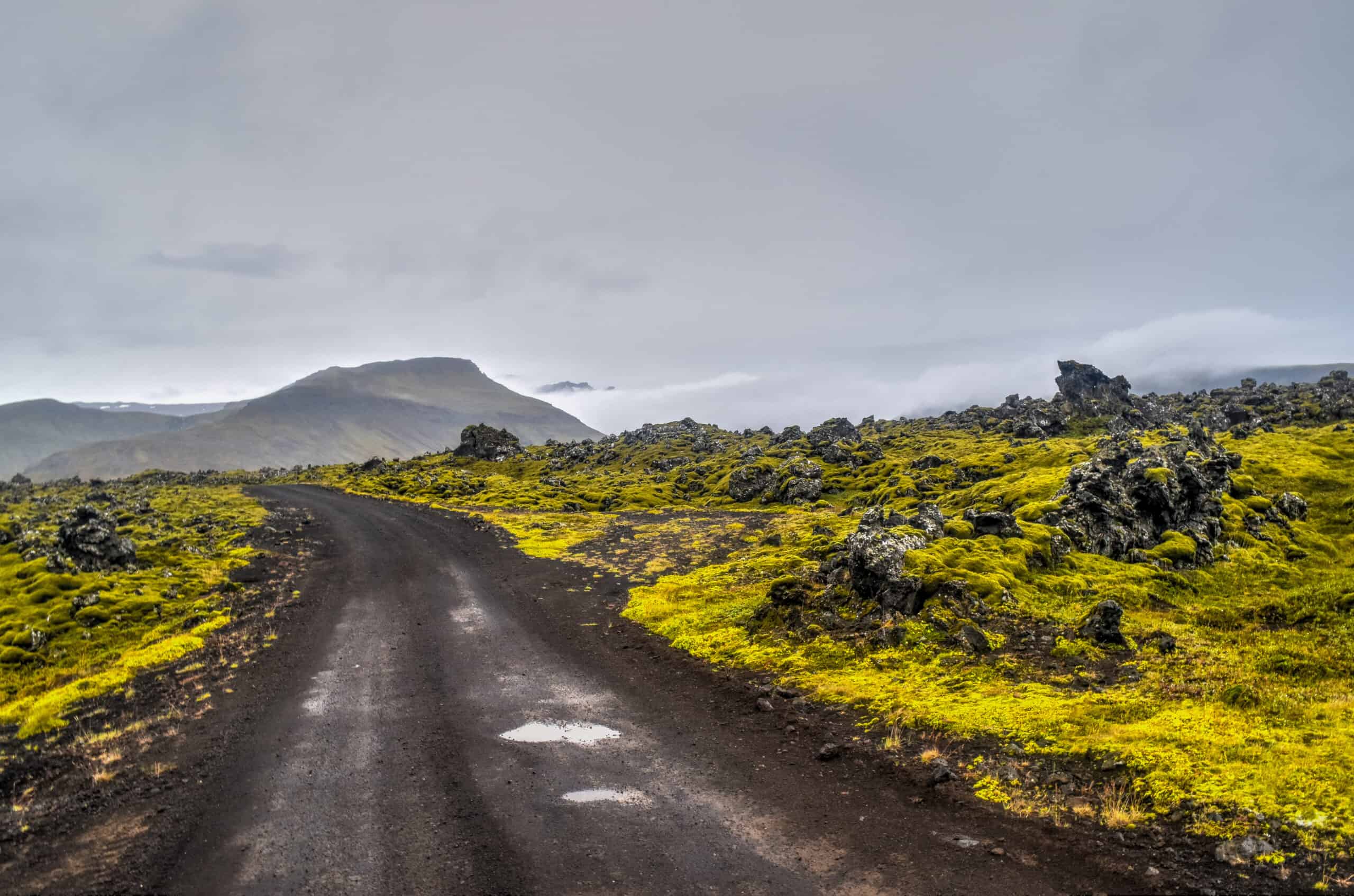
The Ring Road (also known as Route 1) is a national road in Iceland that circles the entire country. It is without a doubt one of the most amazing roads we’ve ever driven on — and it should be at the top of your list of things to see and do in Iceland. It connects all the major towns with one another, has several dozen sites of interest that are just off the road, is never more than two lanes wide (one in each direction), and is constantly surrounded by amazing scenery and nature.
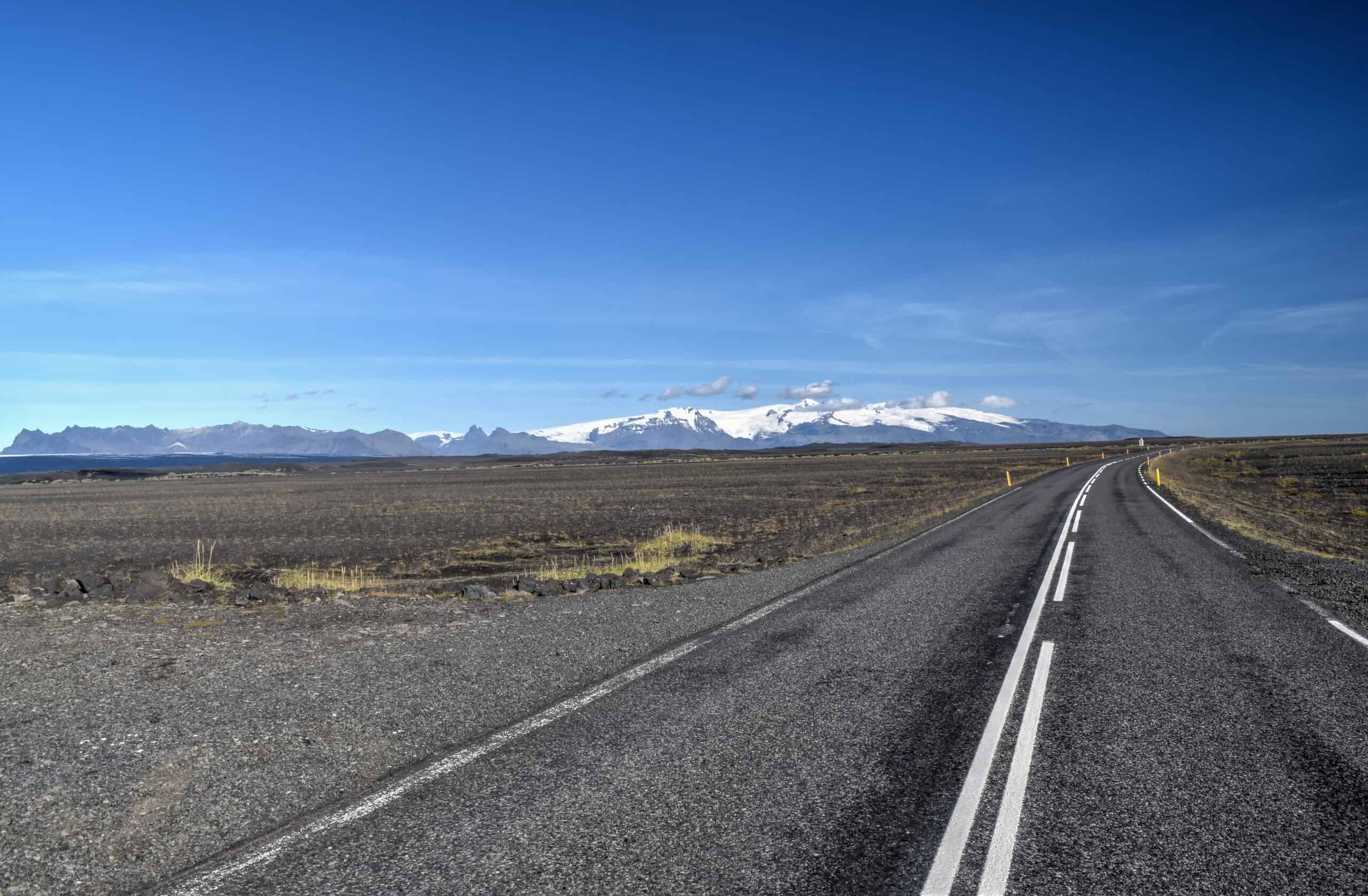
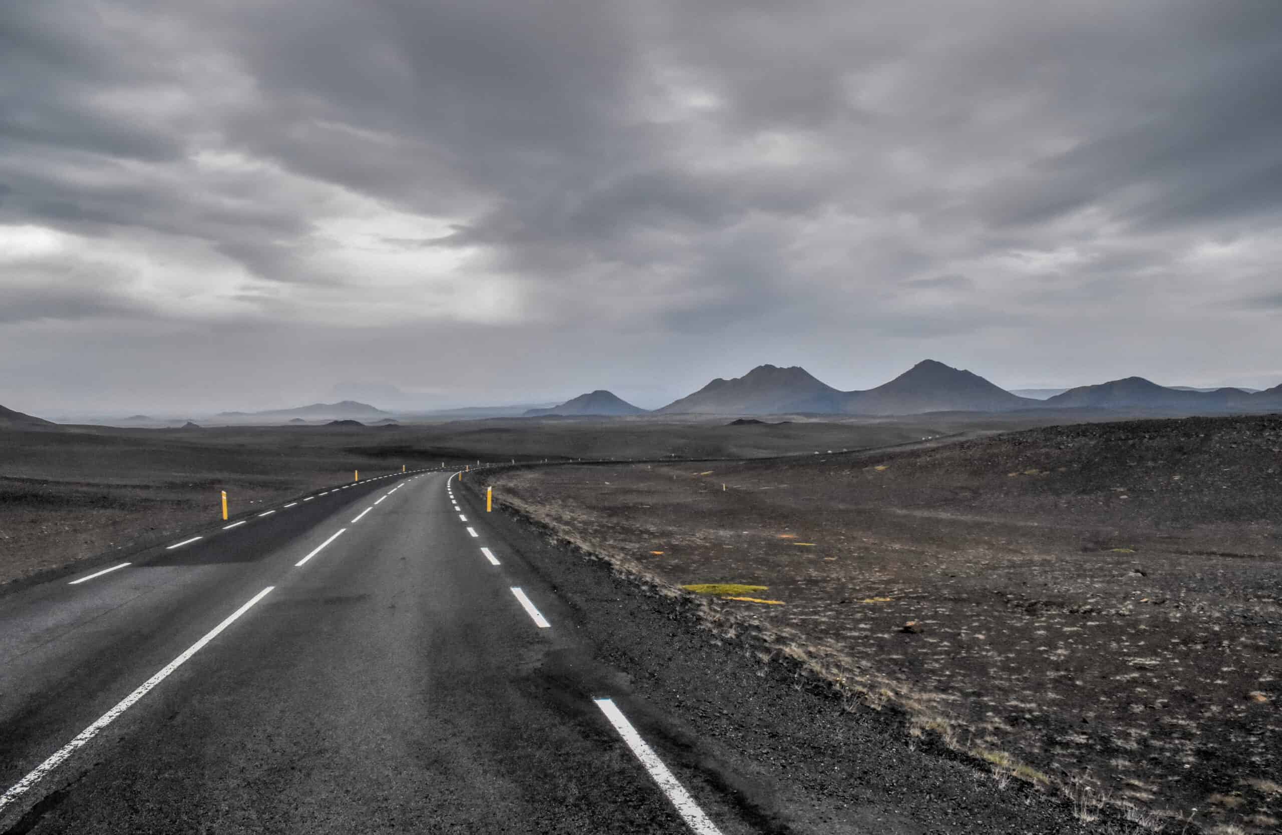
Yes, you can drive the full loop in less than 17 hours, and even if that will be the best 17 hours ever driven, you’ll have missed so much.
As we highlighted earlier, we recommend splitting this drive into at least 7 to 10 days, which means you’ll need to drive on average 2-3 hours per day along the Ring Road. But keep in mind that some sites of interest require additional driving from the main road, so the average daily driving time is closer to 3-4 hours. It might seem like a lot of driving, but time will just fly with all the amazing and varying landscapes you’ll see.
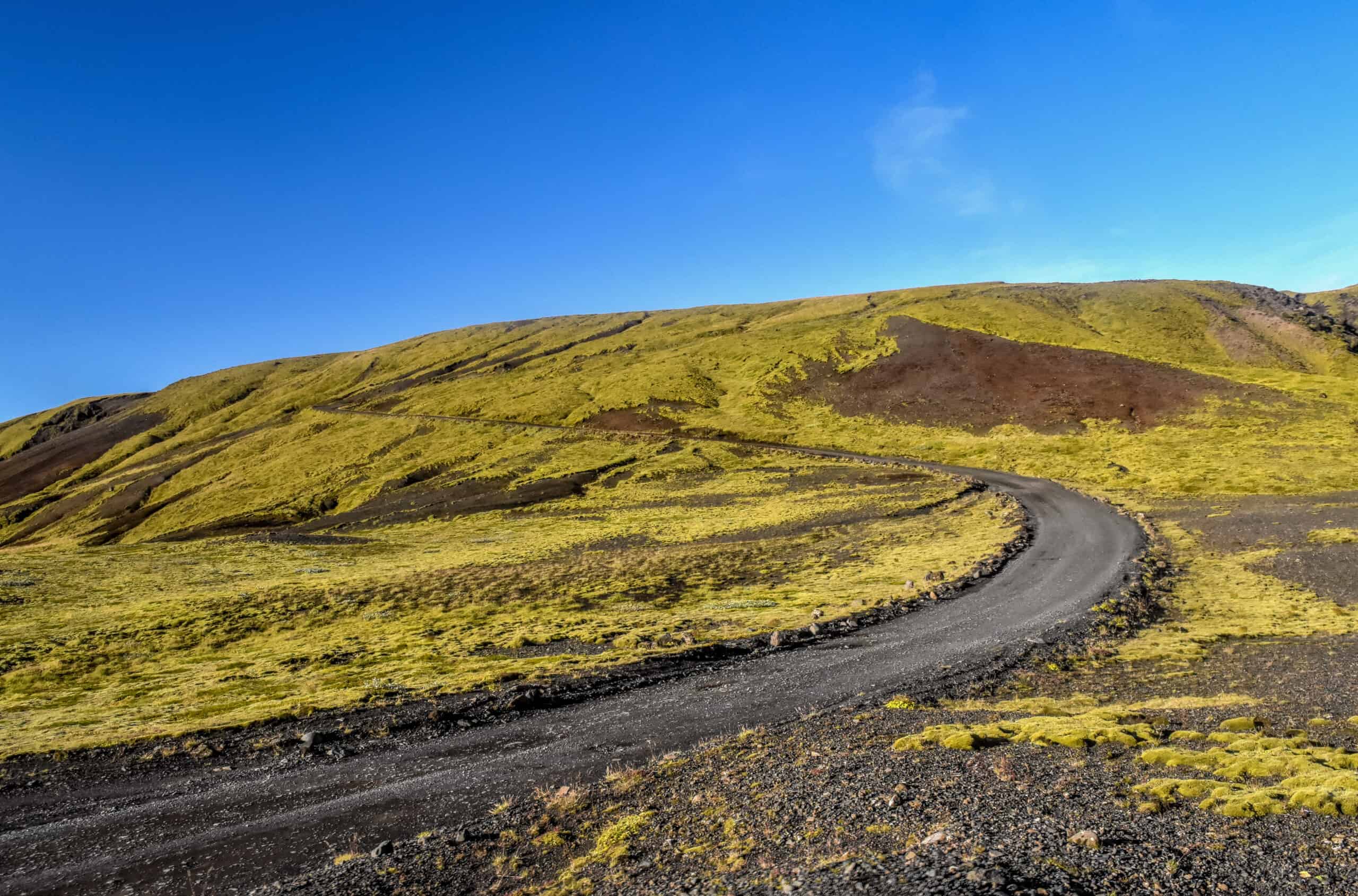
And don’t worry, when you leave the Ring Road, the views often get even better! And don’t worry about the gravel roads you see below, they were all easily drivable with a standard 2wd. Generally speaking, only F-roads in Iceland require 4wd.
In the following sections, we will cover the top things to see and do in Iceland following a geographical sequence, as if you were driving around the Ring Road counterclockwise from Reykjavik, and ending with separate sections for Reykjavik and the Snæfellsnes and Reykjanes peninsulas.
Sights of Southwest Iceland
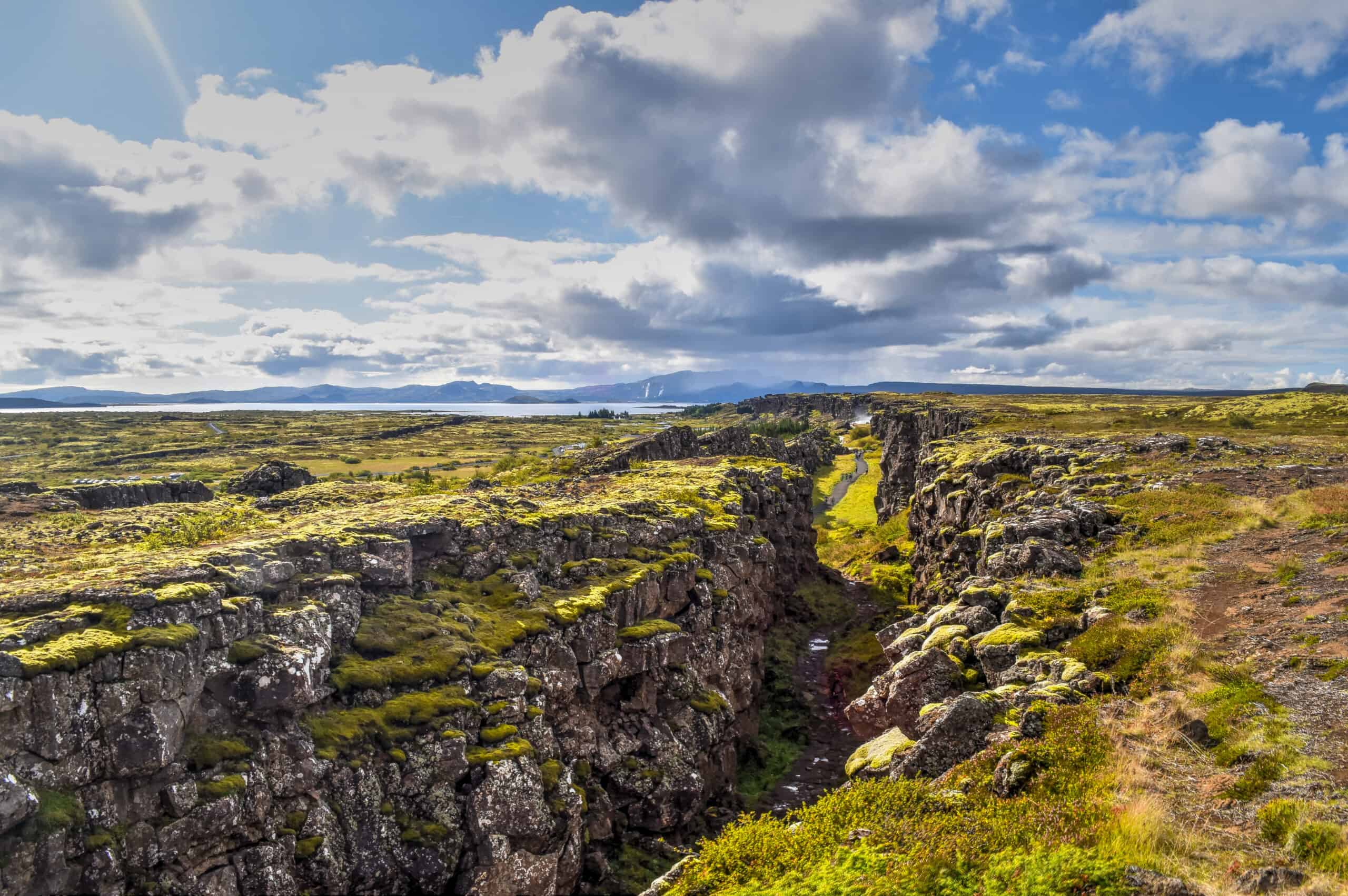
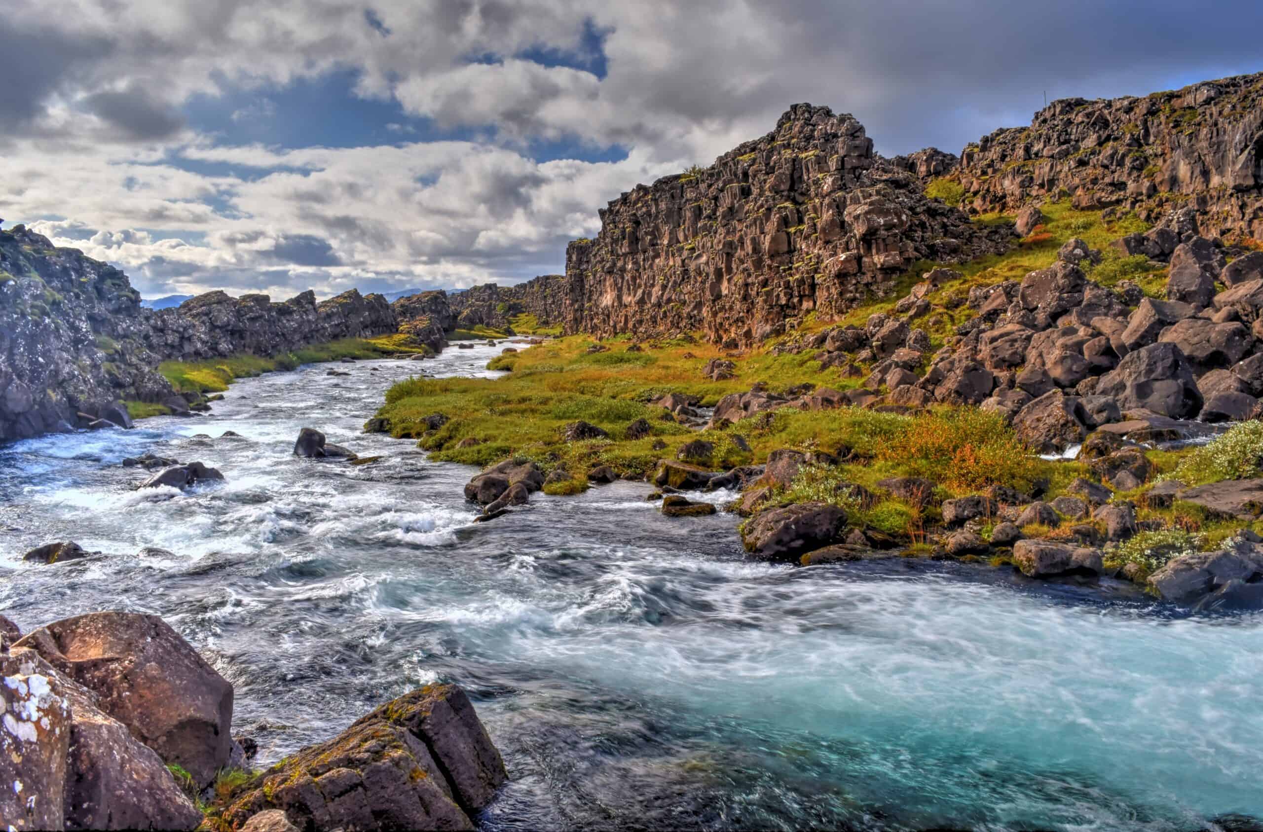
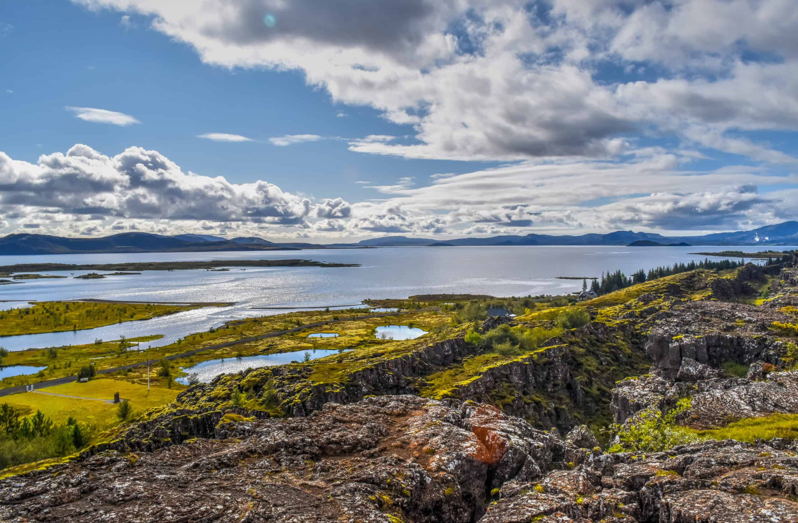
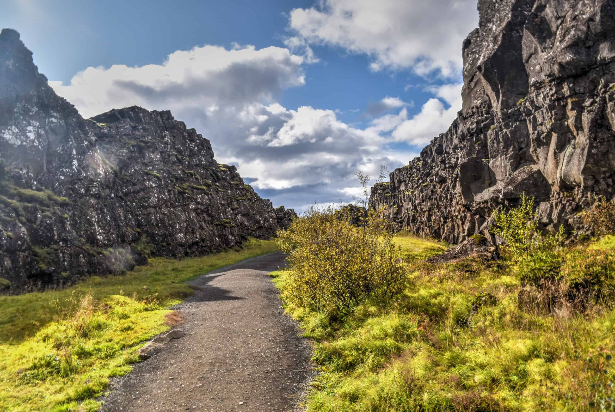
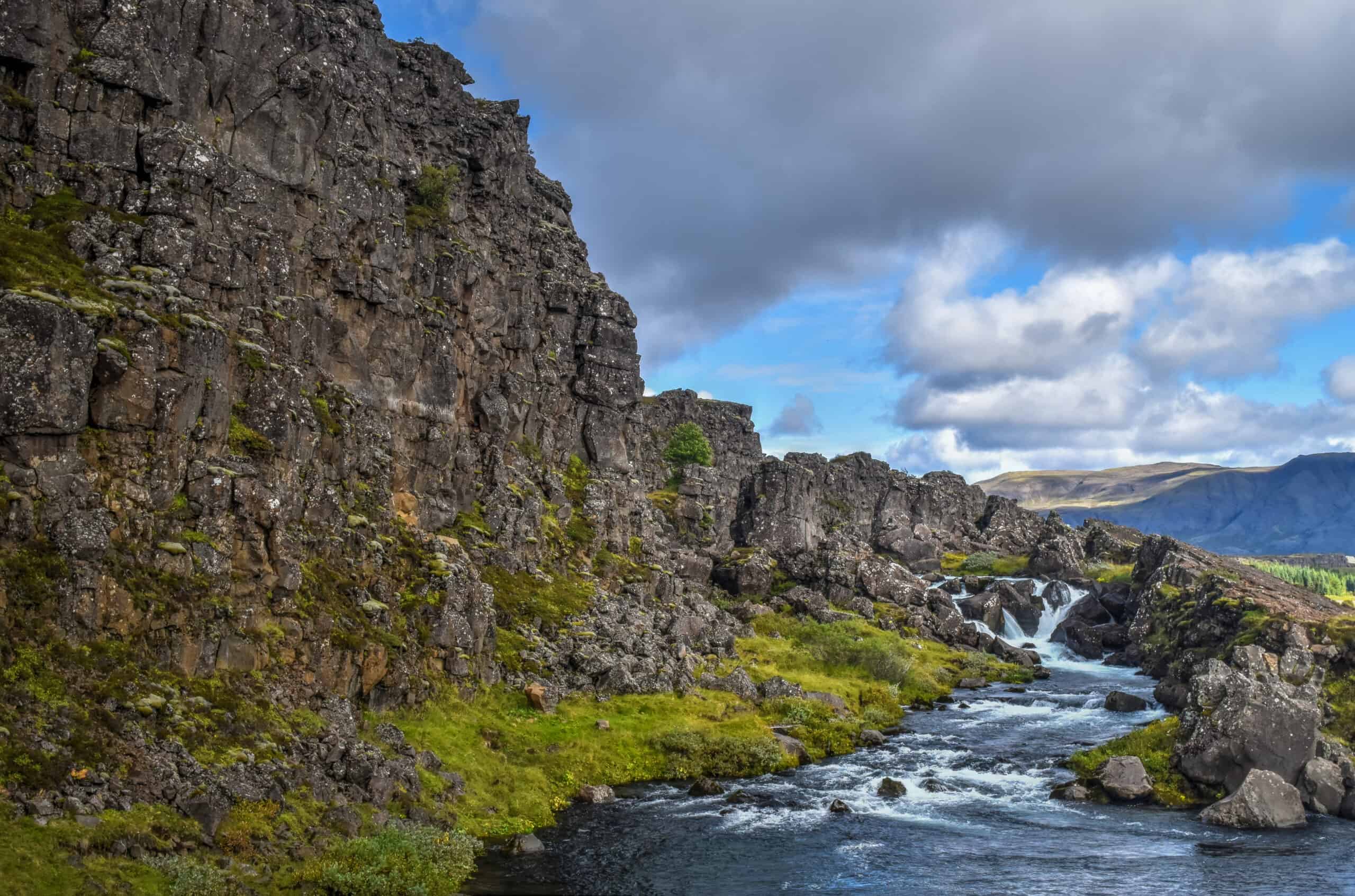
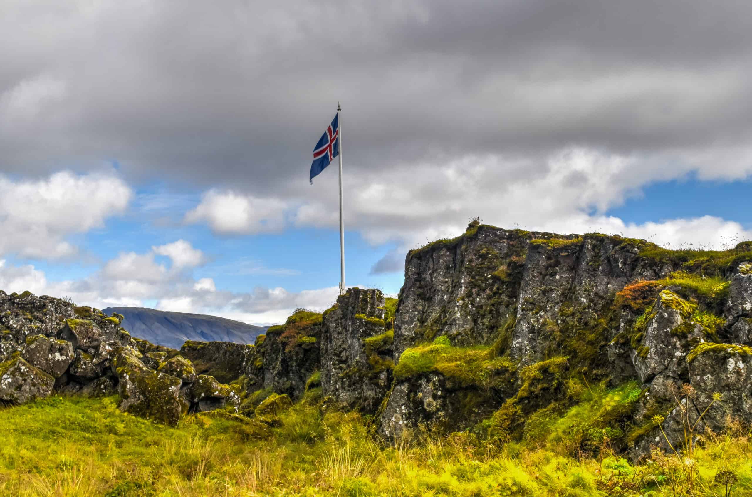
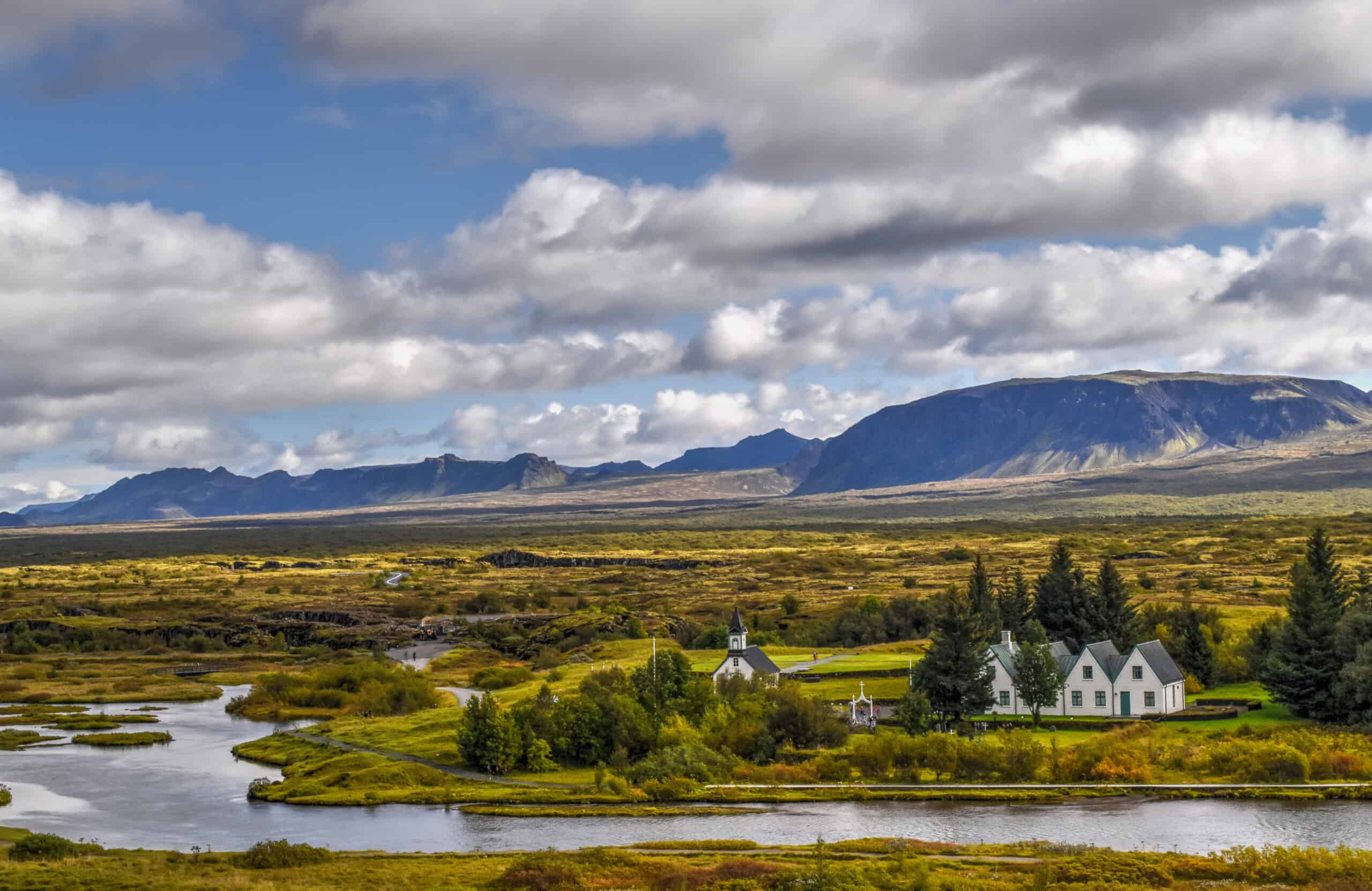
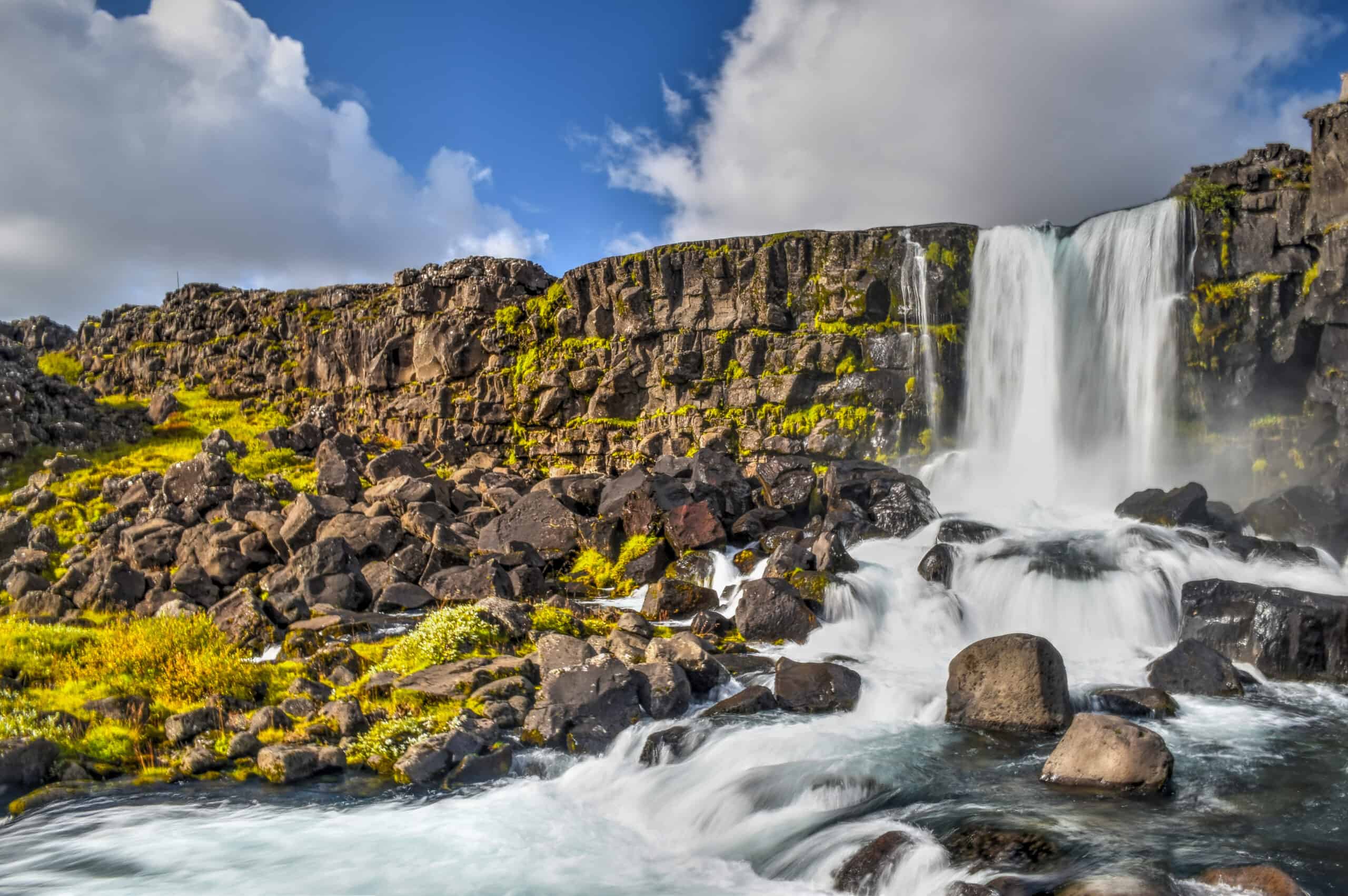
Þingvellir National Park
Þingvellir is the only UNESCO World Heritage Site on the Icelandic mainland and is definitely a unique National Park because you’ll find here both evidence of Iceland’s stark geological processes playing out right in front of you and the birthplace of parliamentary sessions–that’s right, the first-ever parliament in the world was held here. Here you’ll also find ruins, cascades, canyons and beautiful scenery all around, all within a stone’s throw of Reykjavik. You can easily spend 2-3 hours here exploring the park’s main attractions.
Gullfoss and the Golden Circle
Unless you have been living in a cave (apologies if you have), you likely know that The Golden Circle is the most popular tourist route in southern Iceland, which covers three primary stops: Þingvellir National Park, the Gullfoss waterfall, and the geothermal area in Haukadalur, which is where you’ll find the geysers Geysir and Strokkur. The name Golden Circle is a marketing term for the route, derived from Gullfoss, which means “golden waterfall” in Icelandic.
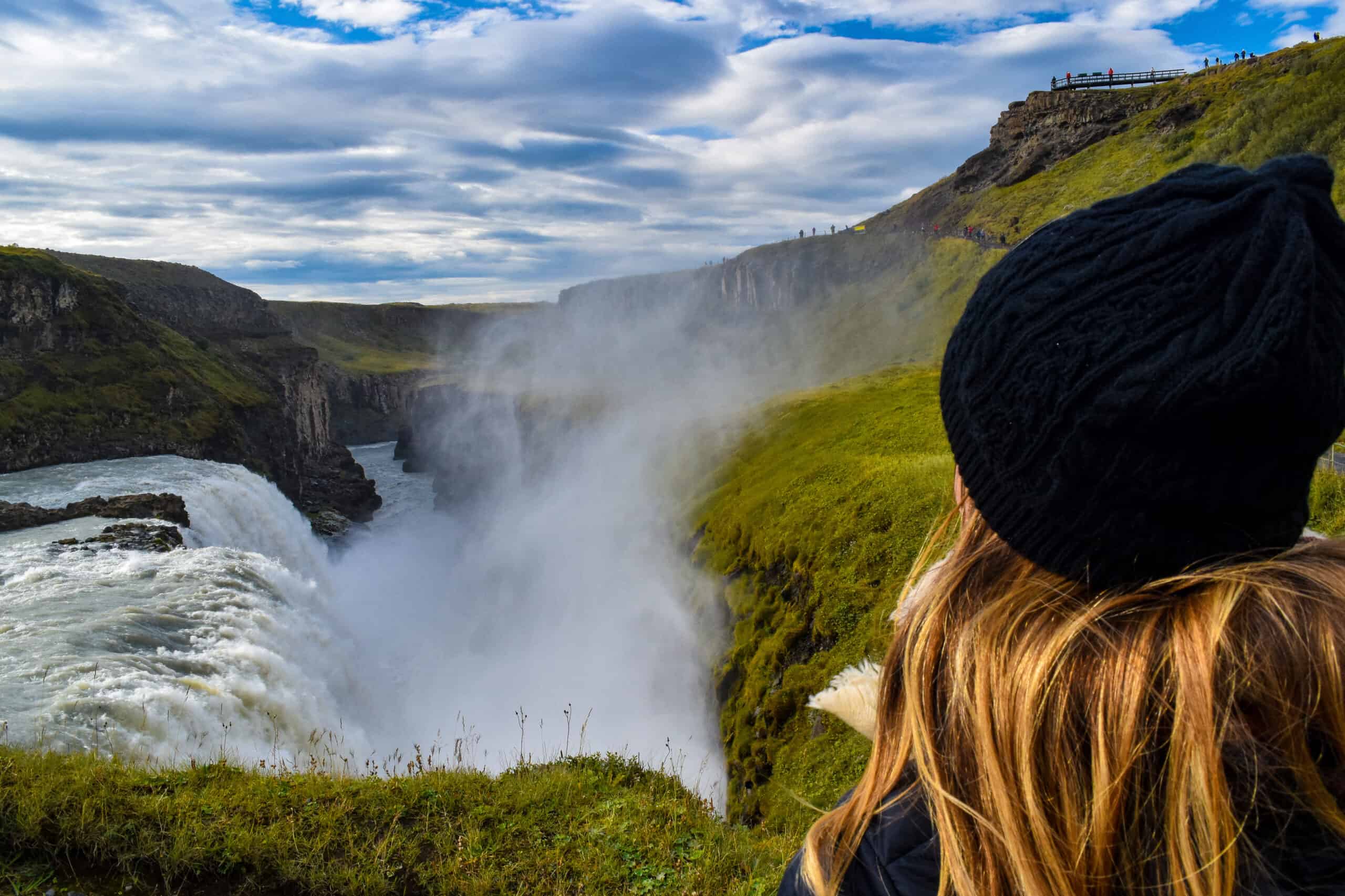
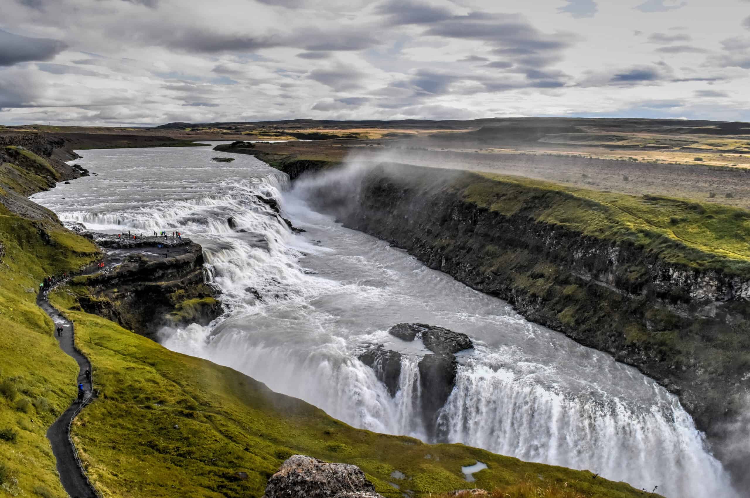
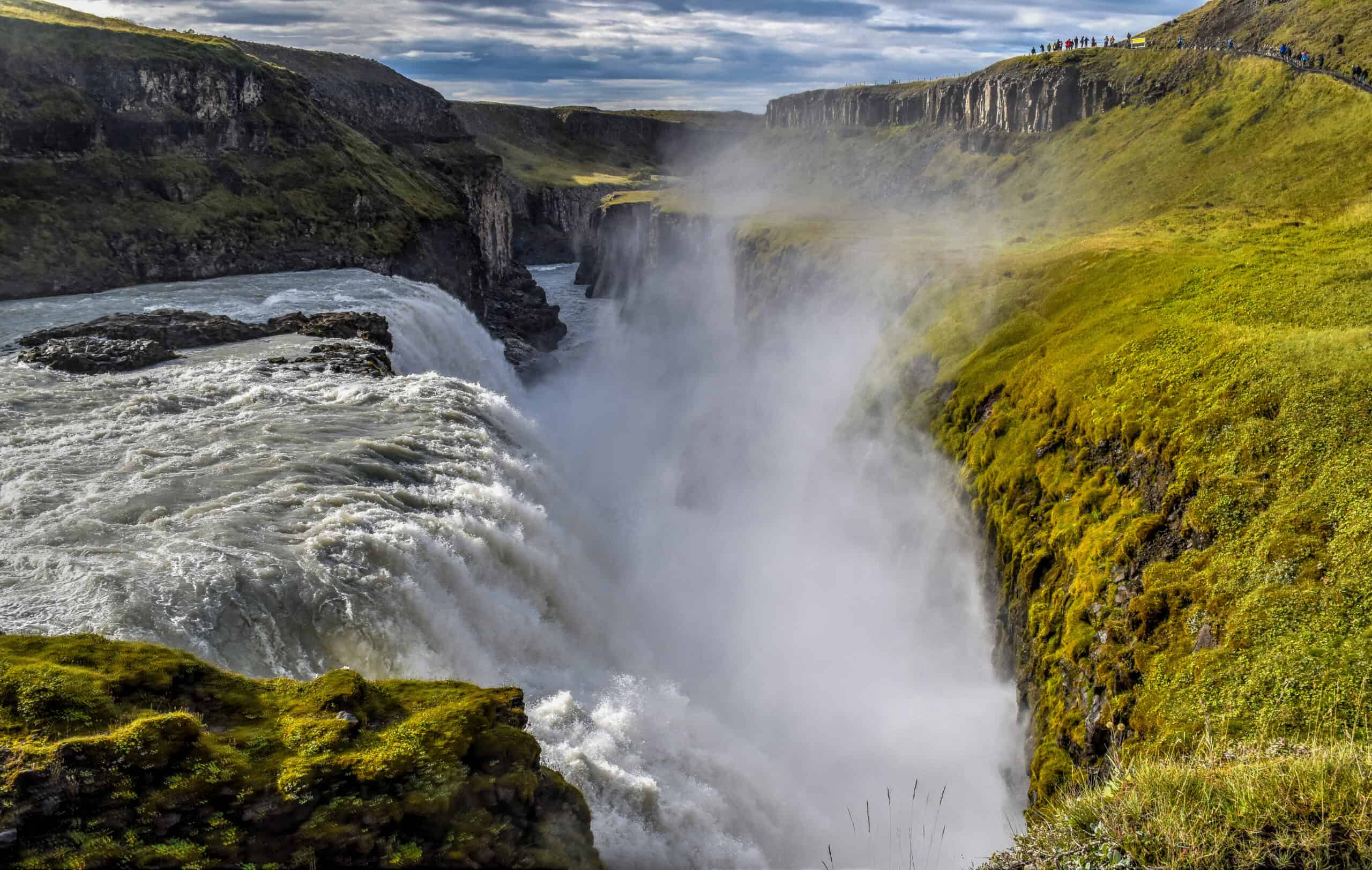
We’ve already touched on the Þingvellir, so here we’ll focus on Gullfoss and the Haukadalur geothermal area. Gullfoss is probably Iceland’s most famous and most photographed waterfall. Apart from its size and beauty, what makes Gullfoss particularly special are the numerous different viewpoints from which one can admire its multi-step drops and the spectacular canyon below the final drop.
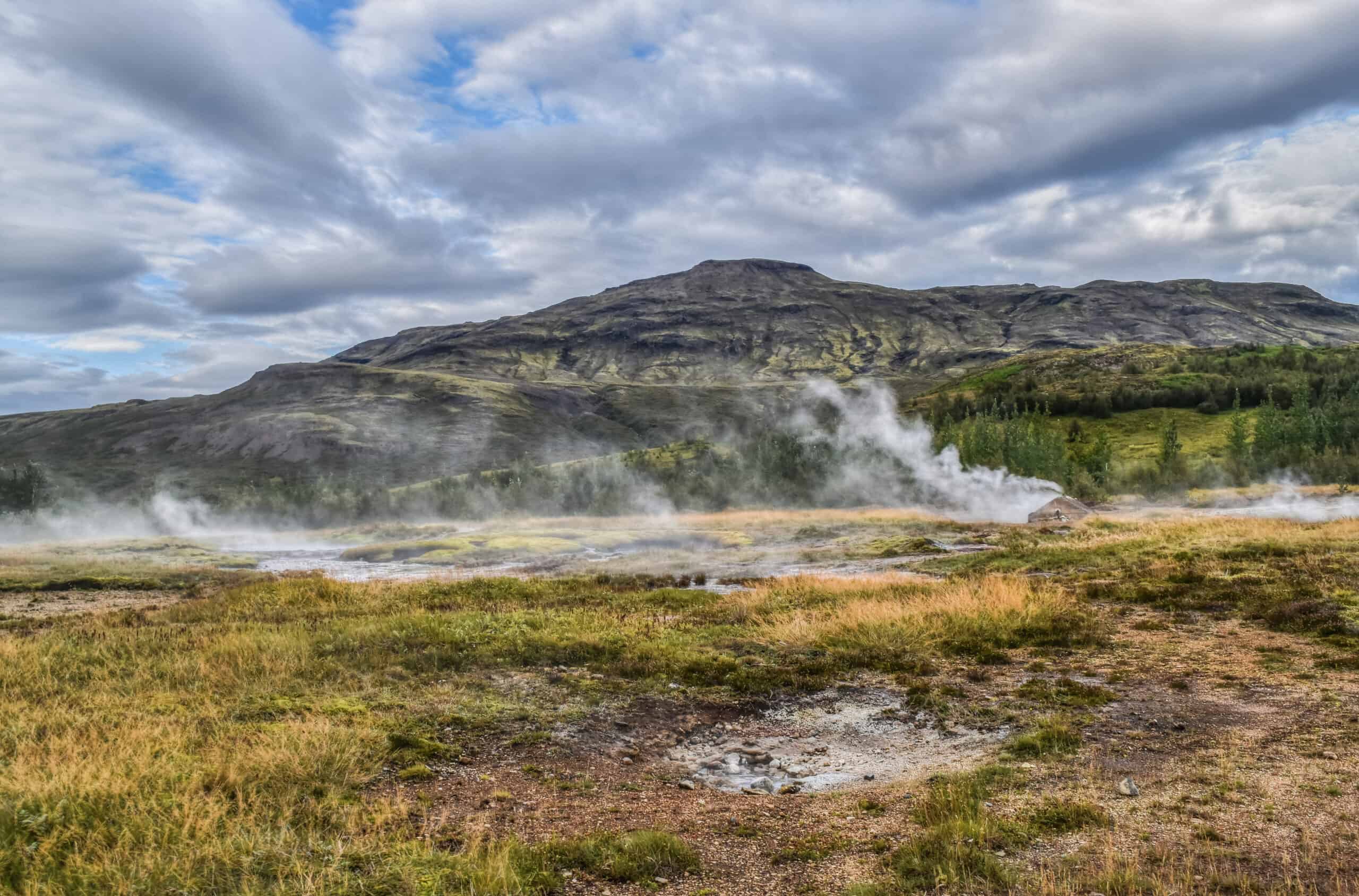
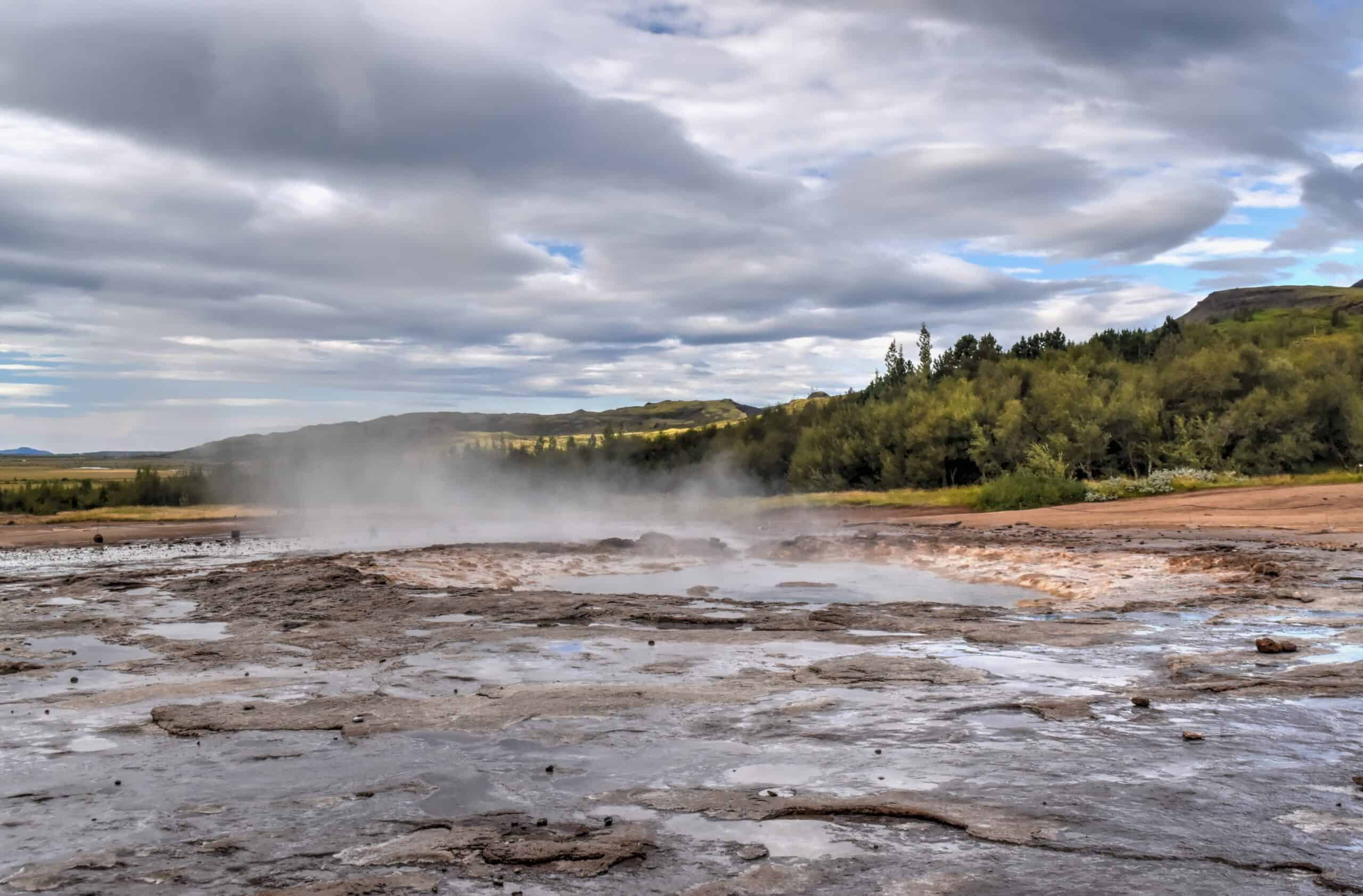
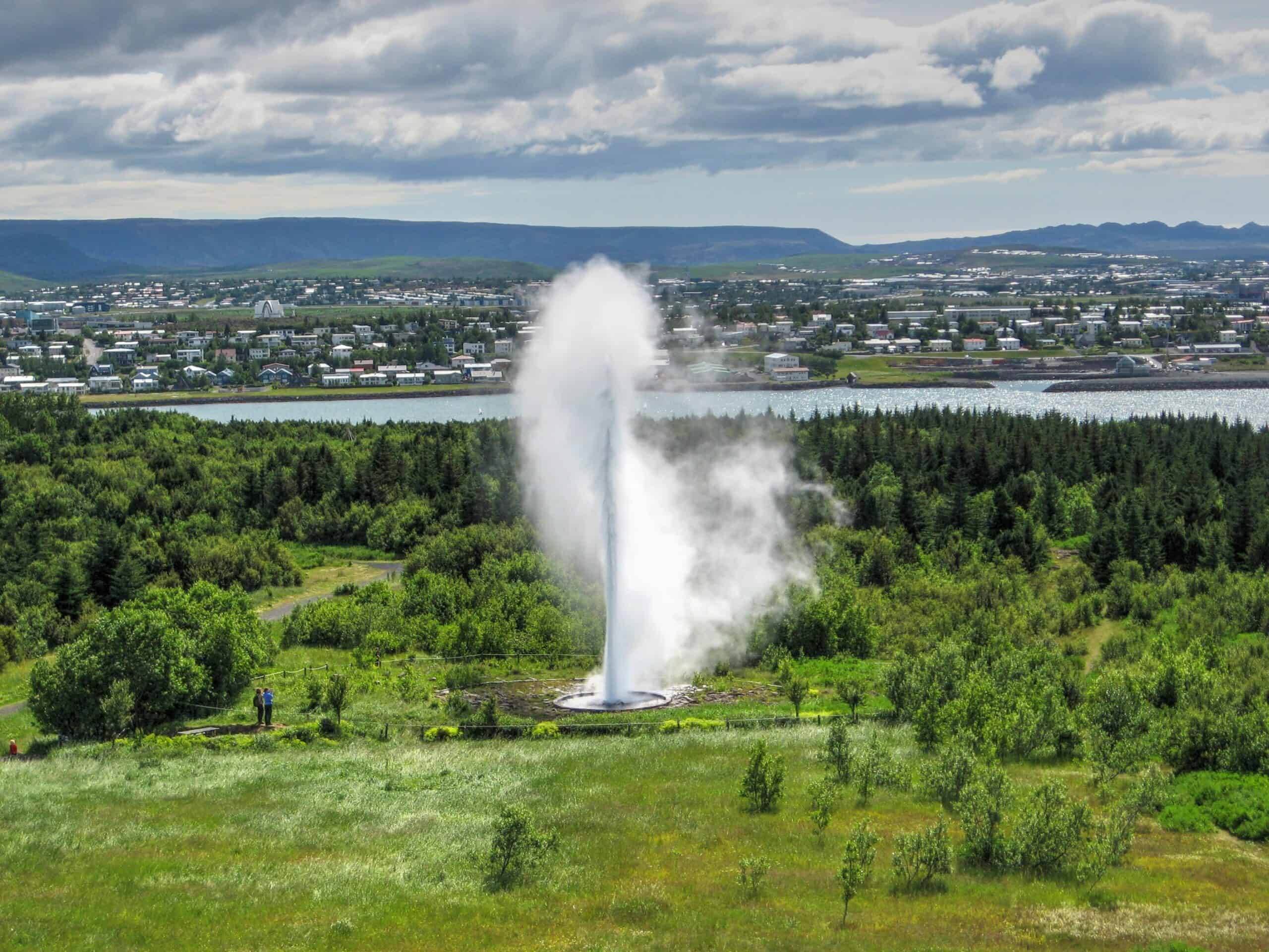
Haukadalur is a geothermal valley in South Iceland. Although it is home to numerous hot springs, mud pots, and fumaroles, it is most famous for its geysers: Geysir (The English word geyser derives from Geysir) and Strokkur — and both geysers are a short 50m apart.
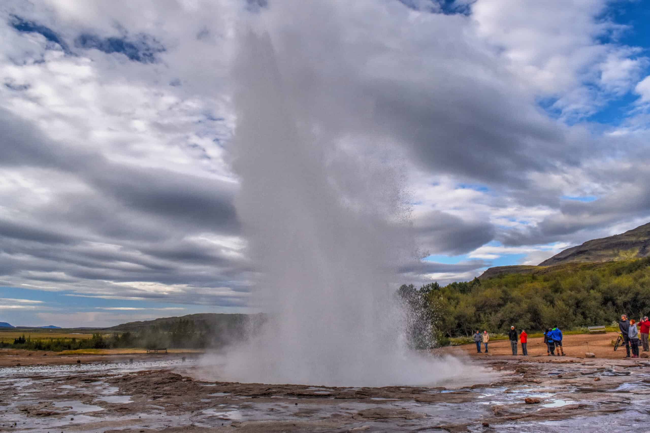
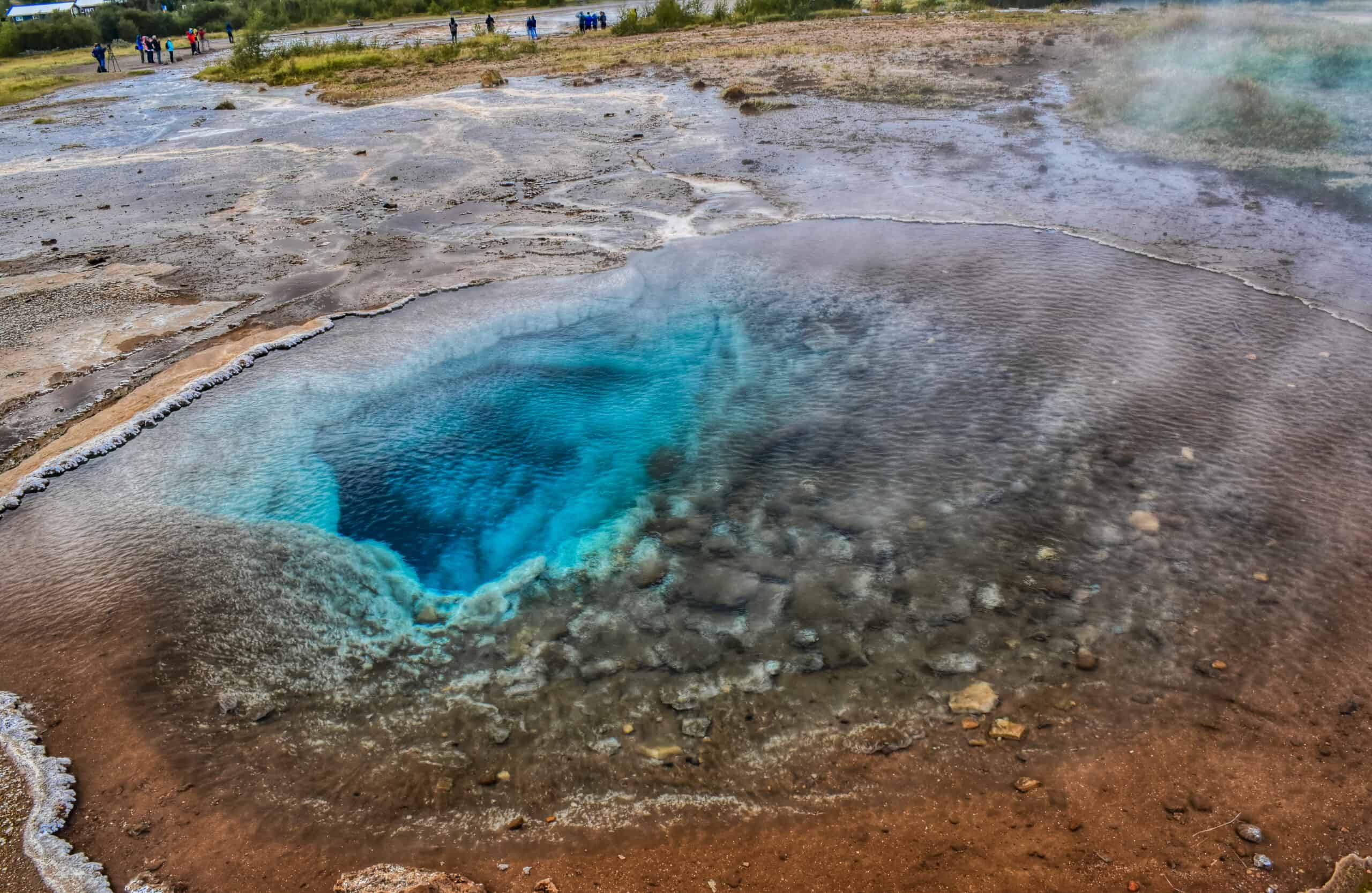
Geysir was the first geyser to ever be described in the literature, in the 13th century, making it the first geyser that was known to Europeans. However Geysir is not the most active geyser in the area and is not very predictable; that title goes to Strokkur, which erupts every 4-10 minutes with steam that can reach heights of 130 feet (40 meters) high.
Near the Golden Circle: Kerid and Hjalparfoss
If you made quick work of the Golden Circle sites, you will be happy to know there are many other fantastic attractions to see nearby.
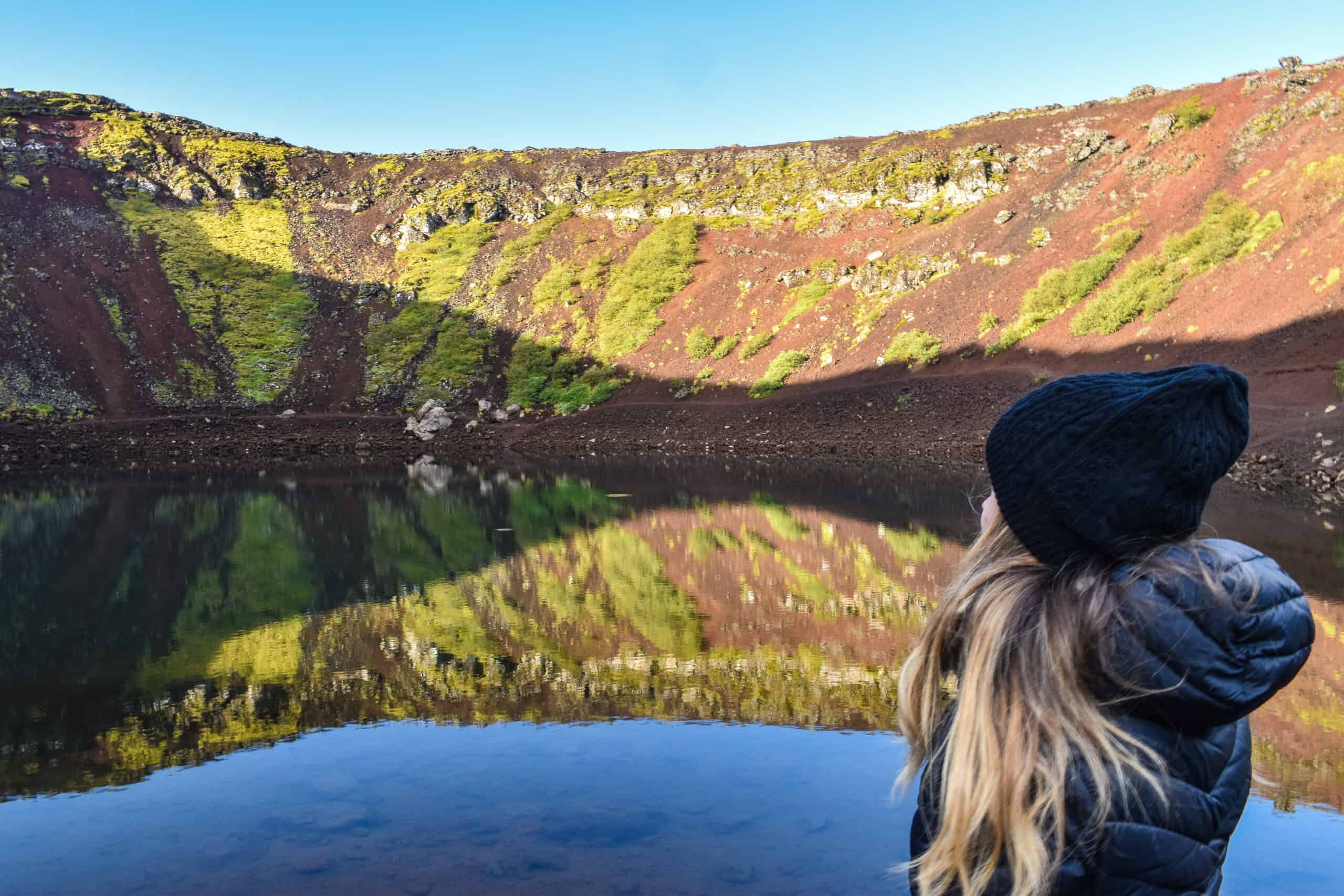
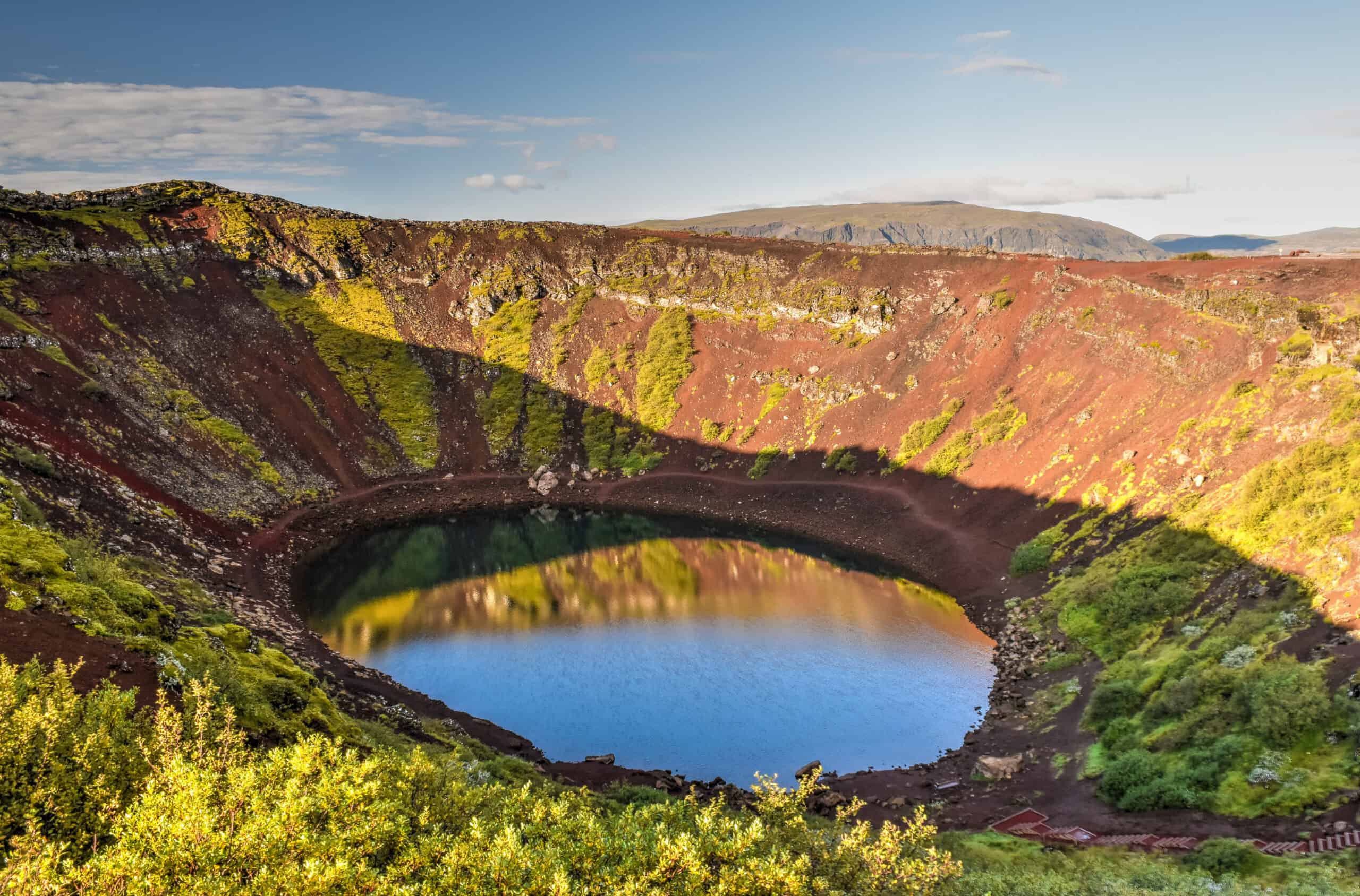
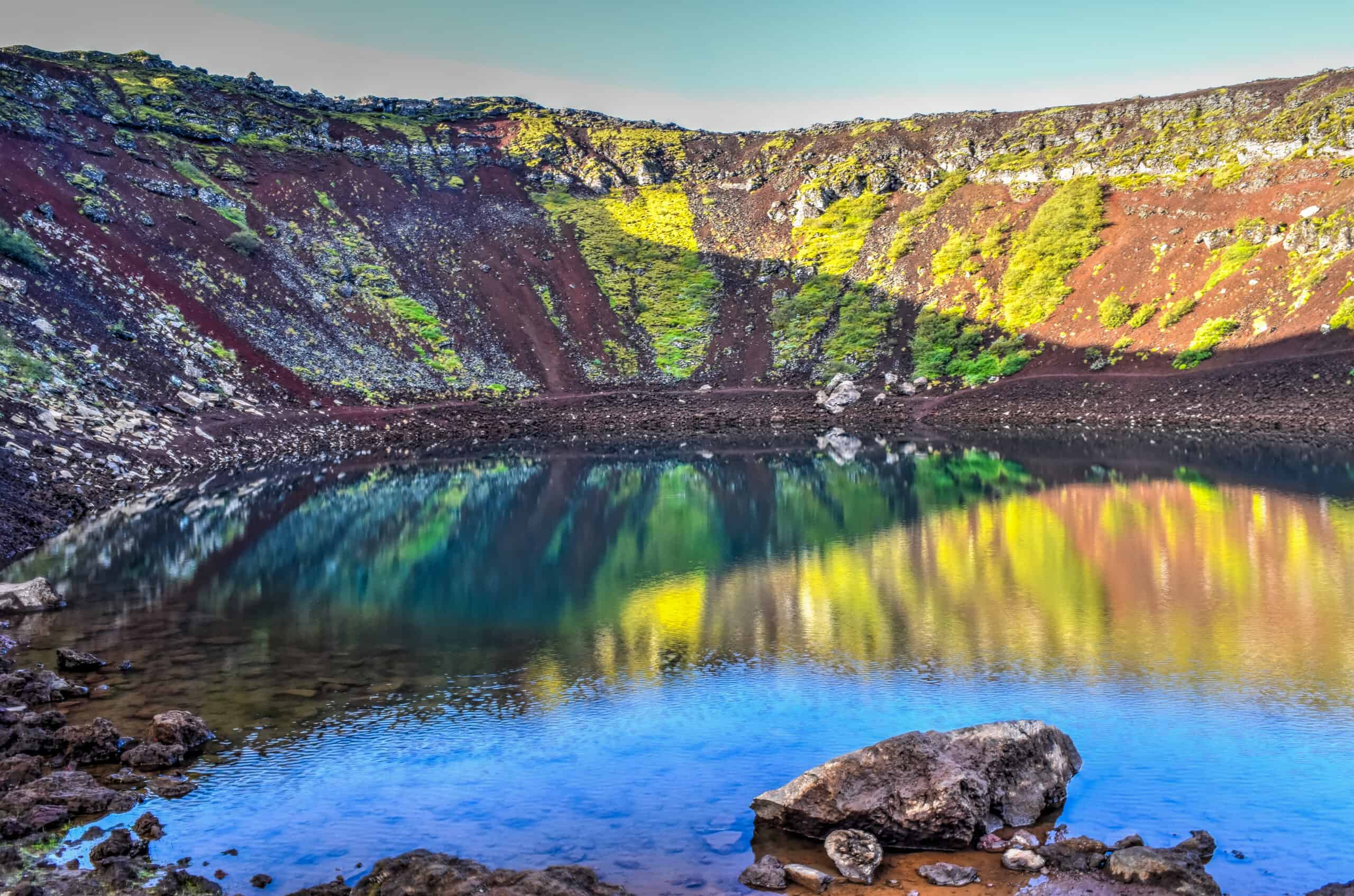
Kerið is a striking volcanic crater lake filled with aquamarine water against a backdrop of stark black and deep red slopes, in the Grímsnes area of South Iceland. It is unique among crater lakes in several ways. First, its caldera likely didn’t form from an explosion as most do; it is believed to have formed when the magma in the center simply depleted itself, and the empty chamber beneath caved in. Second, it is a relatively young crater compared to other Icelandic craters, which is the major reason why Kerið’s slopes are red in colour, rather than volcanic black. The iron deposits in the soil are still relatively new, and they give the terrain its distinct reddish colour.
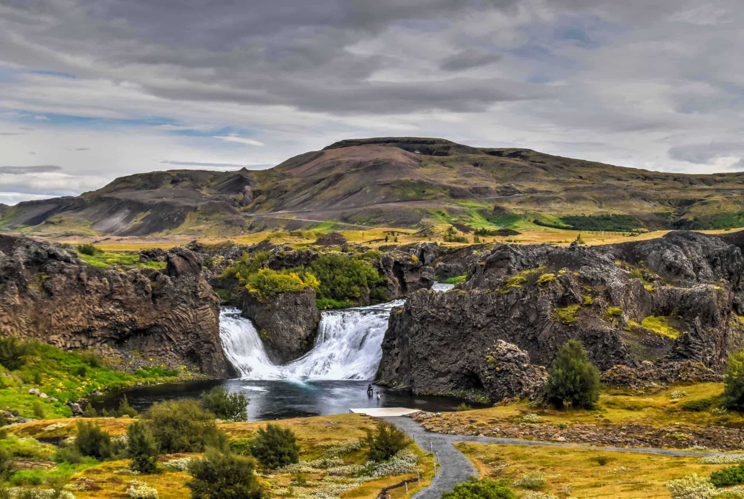
In stark contrast to Gullfoss, Hlalparfoss is somewhat off the beaten track, and when we visited there was only one other car in the parking lot (which is roughly an hour’s drive from Gullfoss).
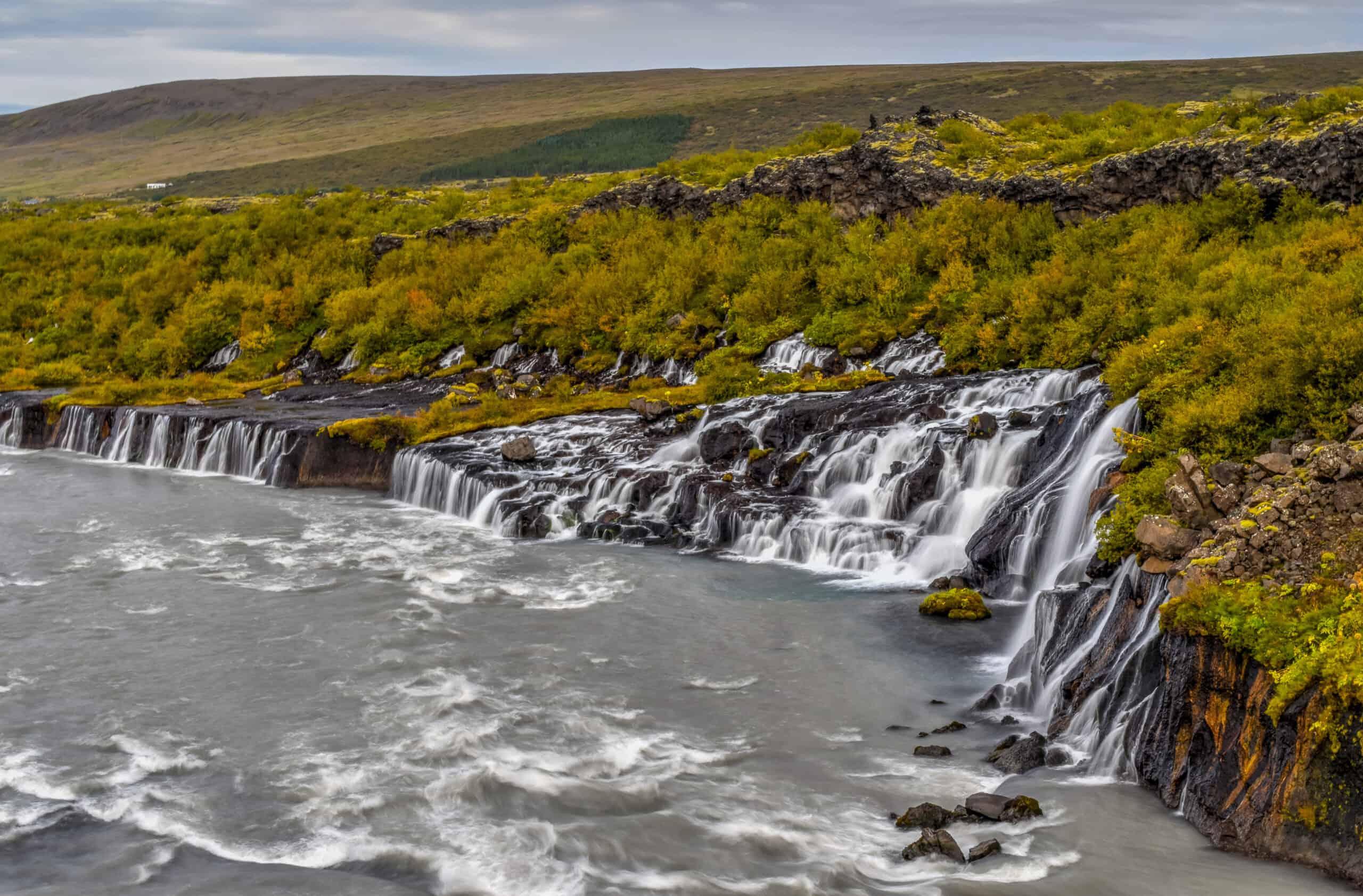
Hjálparfoss is also a very unique waterfall, as it’s actually two waterfalls in one. It marks the spot where the rivers Fossá and Þjórsá meet. The two rivers fall from a lava field at about a 45-degree angle from each other, and their cascades merge as they tumble over the edge.
Seljalandsfoss, Skógafoss, Sólheimasandur plane, & Reynisfjara
What do two waterfalls, a plane wreck, and a black sand beach have in common? Not much, other than their close proximity to one another — that’s why we grouped them together here. They are all located along a stretch of 60 km of the Ring Road, just west of Vik.
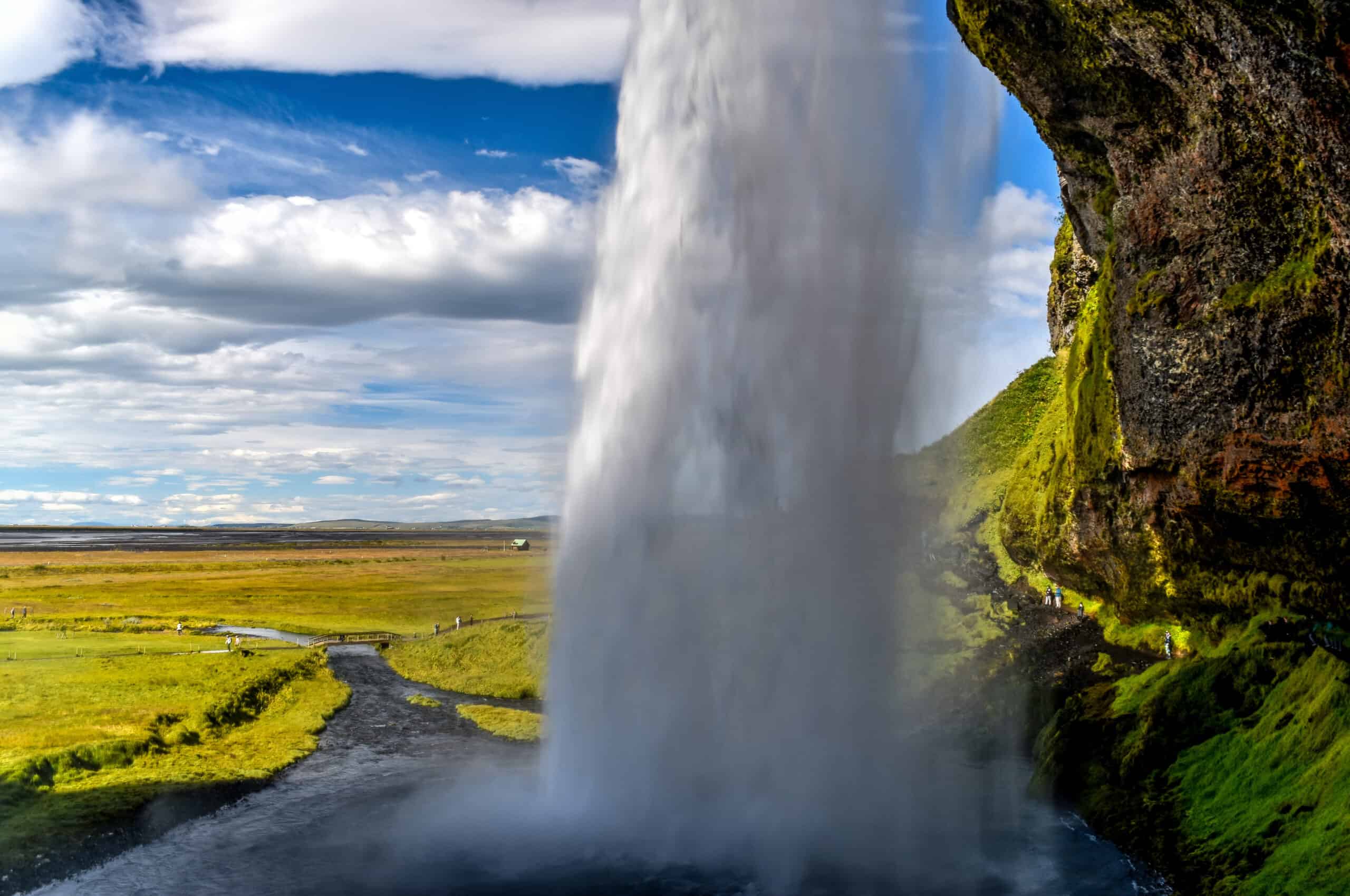
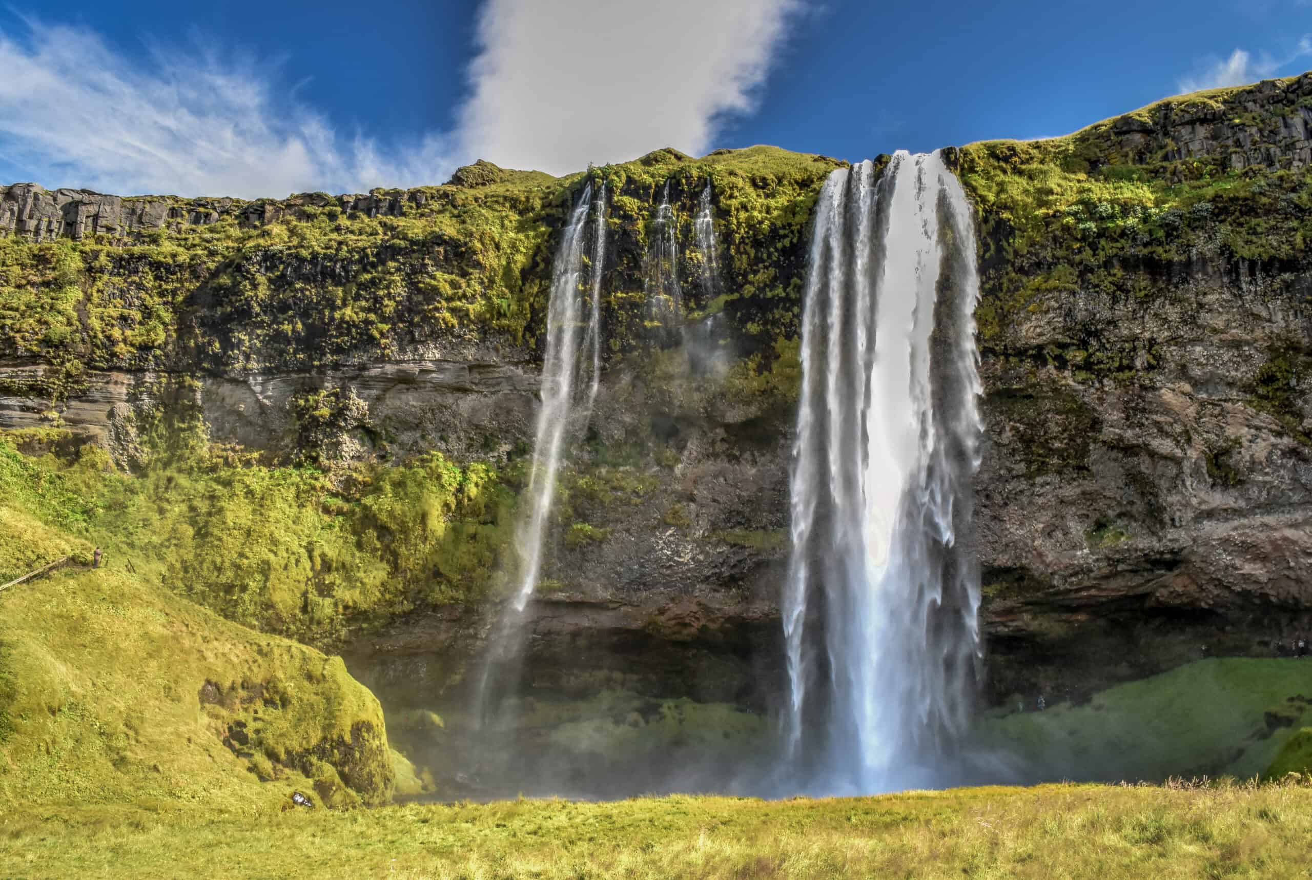
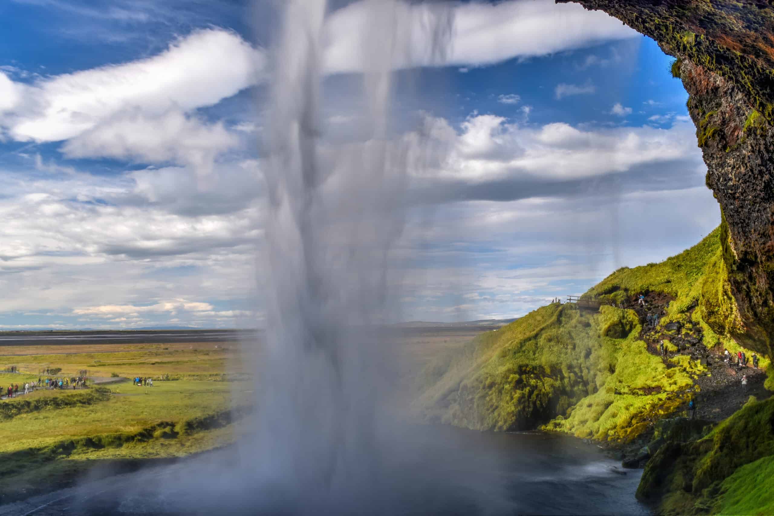
The first of these you will come across coming from the west is the majestic Seljalandsfoss. It’s conveniently along Iceland’s Ring Road (roughly a 90min drive from Reykjavik), and what makes Seljalandsfoss particularly interesting is one of its unique features: you can go for a stroll behind the falls!
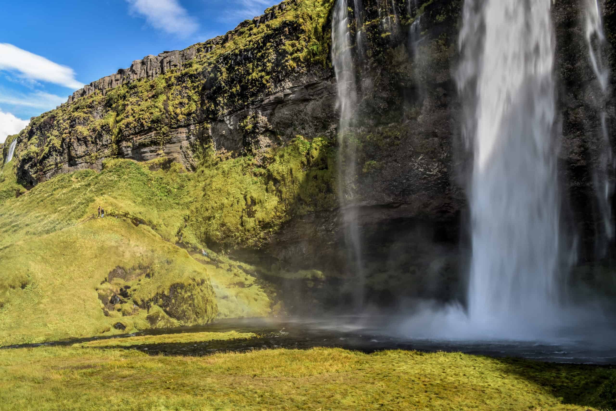
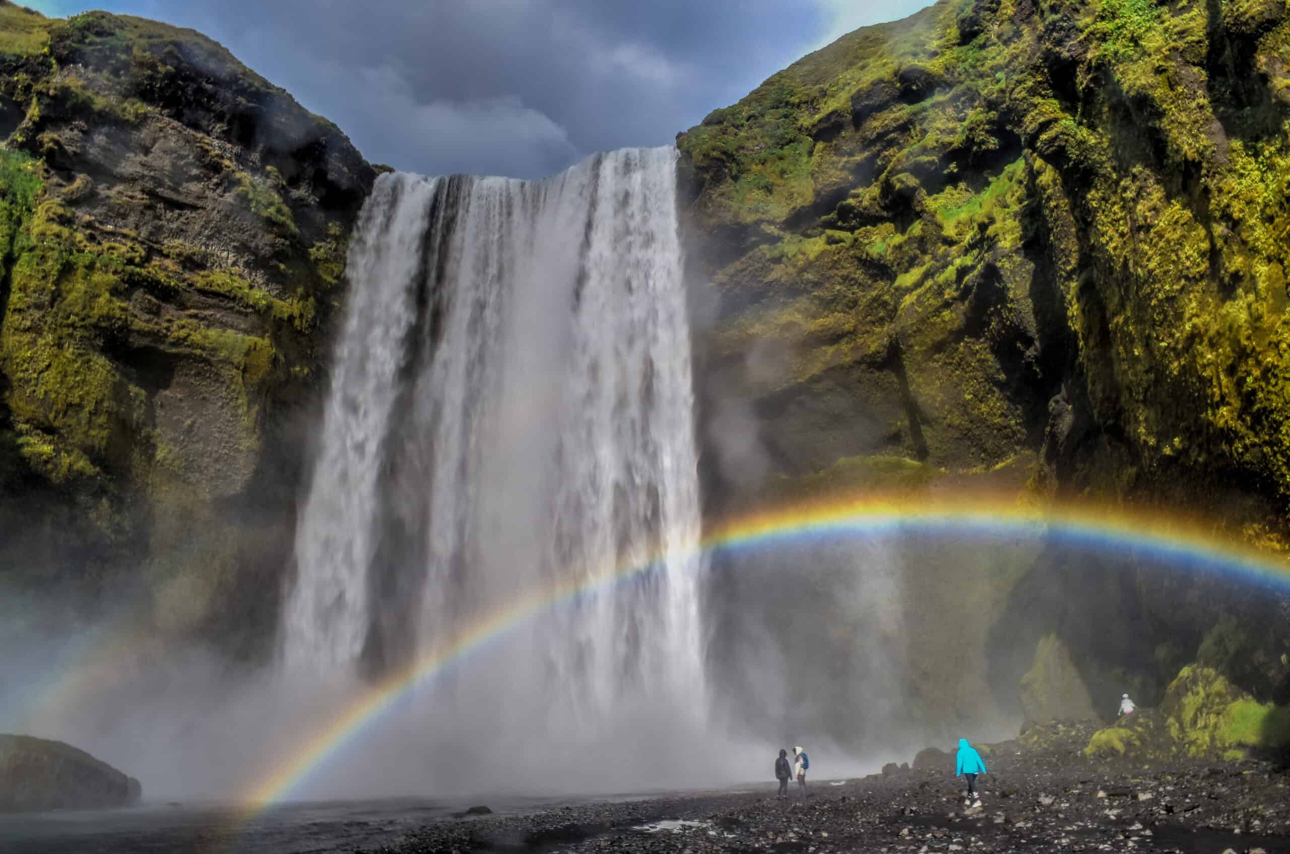
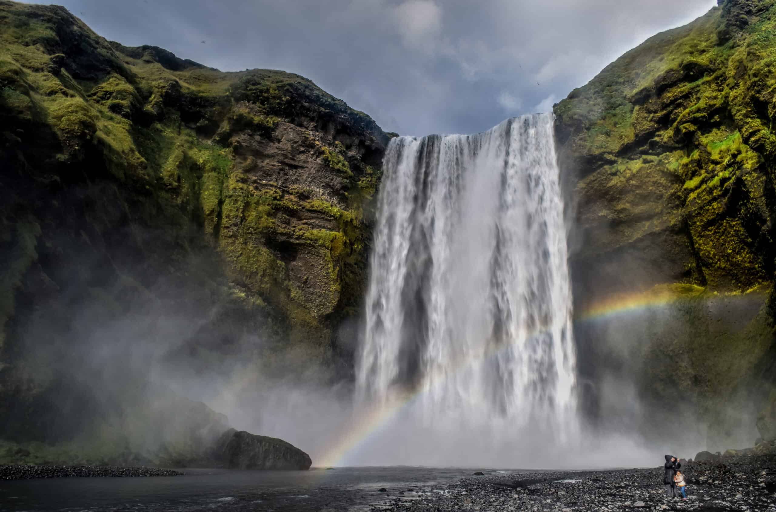
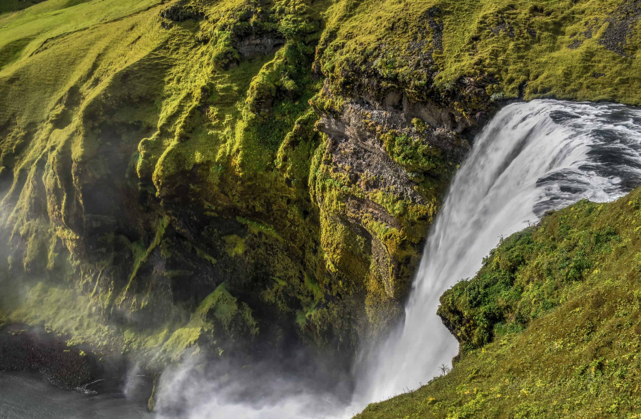
Another 20-25 min down the Ring Road from Seljalandsfoss (going east) you will find thundering Skógafoss. Where Seljalandsfoss has a walking path behind the falls, Skógafoss has one going to the top to provide you with amazing views from above the falls. And the occasional rainbow.
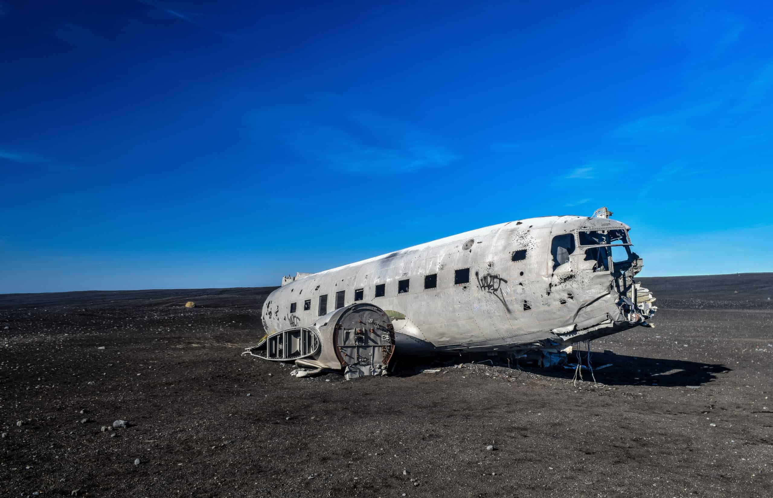
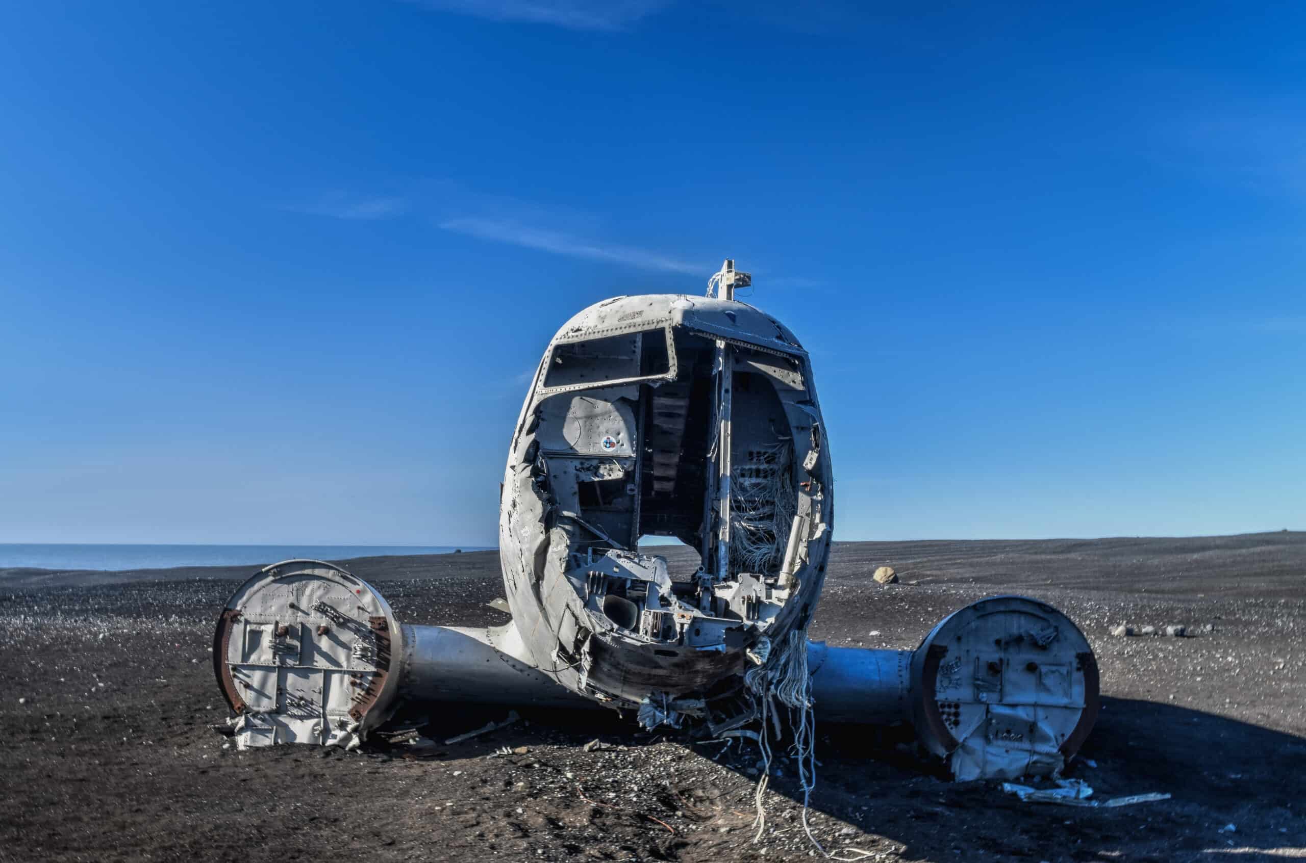
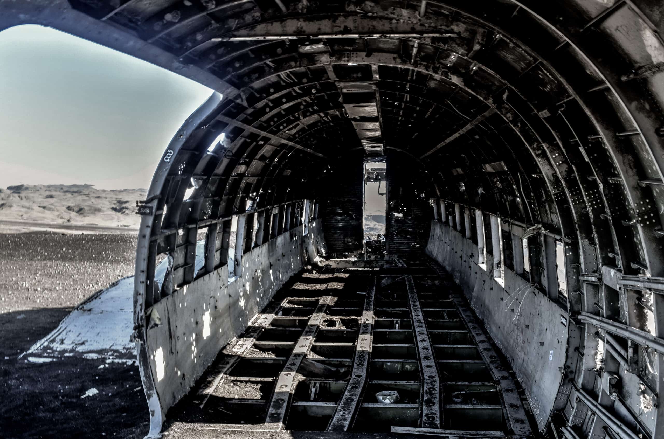
While most love Seljalandsfoss, Skógafoss, and Reynisfjara, visitors seem to other love or hate the Sólheimasandur plane crash site (in 1973 a United States Navy DC plane ran out of fuel and crashed on the black beach at Sólheimasandur). On the one hand, it’s not particularly Icelandic, and it requires a fair walk to get it (roughly 1hr each way from the parking lot right off the Ring Road), so it’s understandable that it’s not for everyone and it might not end up on your personal list of top things to see and do in Iceland. On the other hand, if you are looking for an easy walk on flat terrain (especially if it’s nice out) and like exploring abandoned and usual places, this might be for you.
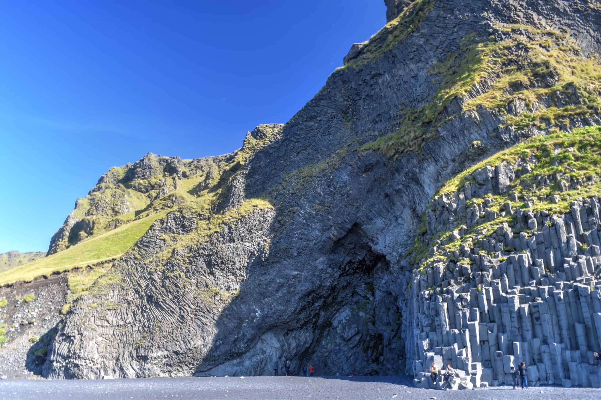
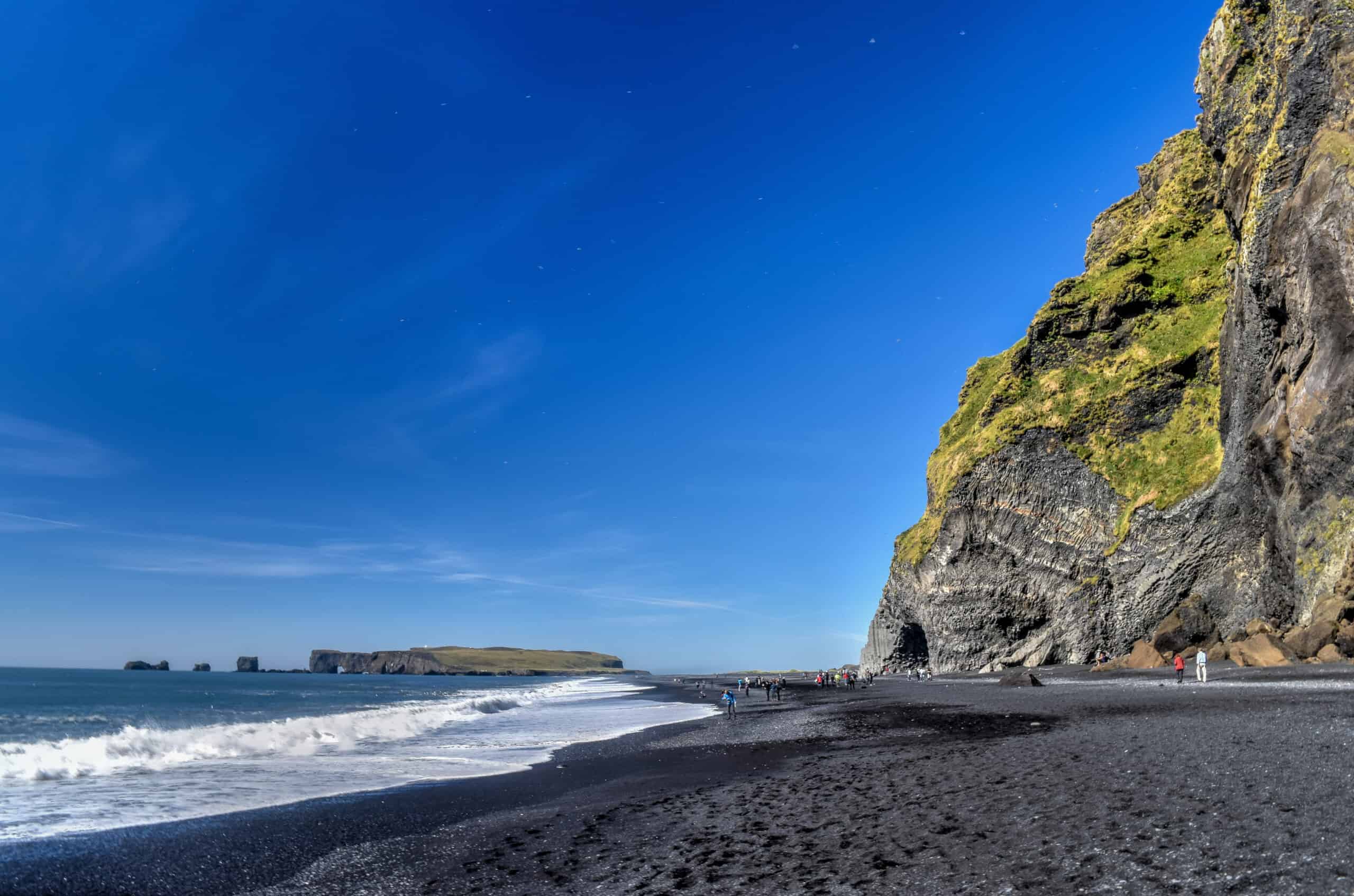
Reynisfjara is a world-famous black-sand beach found on the South Coast of Iceland, just beside Vik í Myrdal, which is the southernmost village on the mainland of Iceland. It’s approximately 25 km east of the Sólheimasandur parking lot. The beach is in a stunning setting of sea stacks and basalt columns and black volcanic sand. Because of the latter fact, it is often referred to as “the” black sand beach in Iceland, even though there are countless black sand beaches in Iceland.
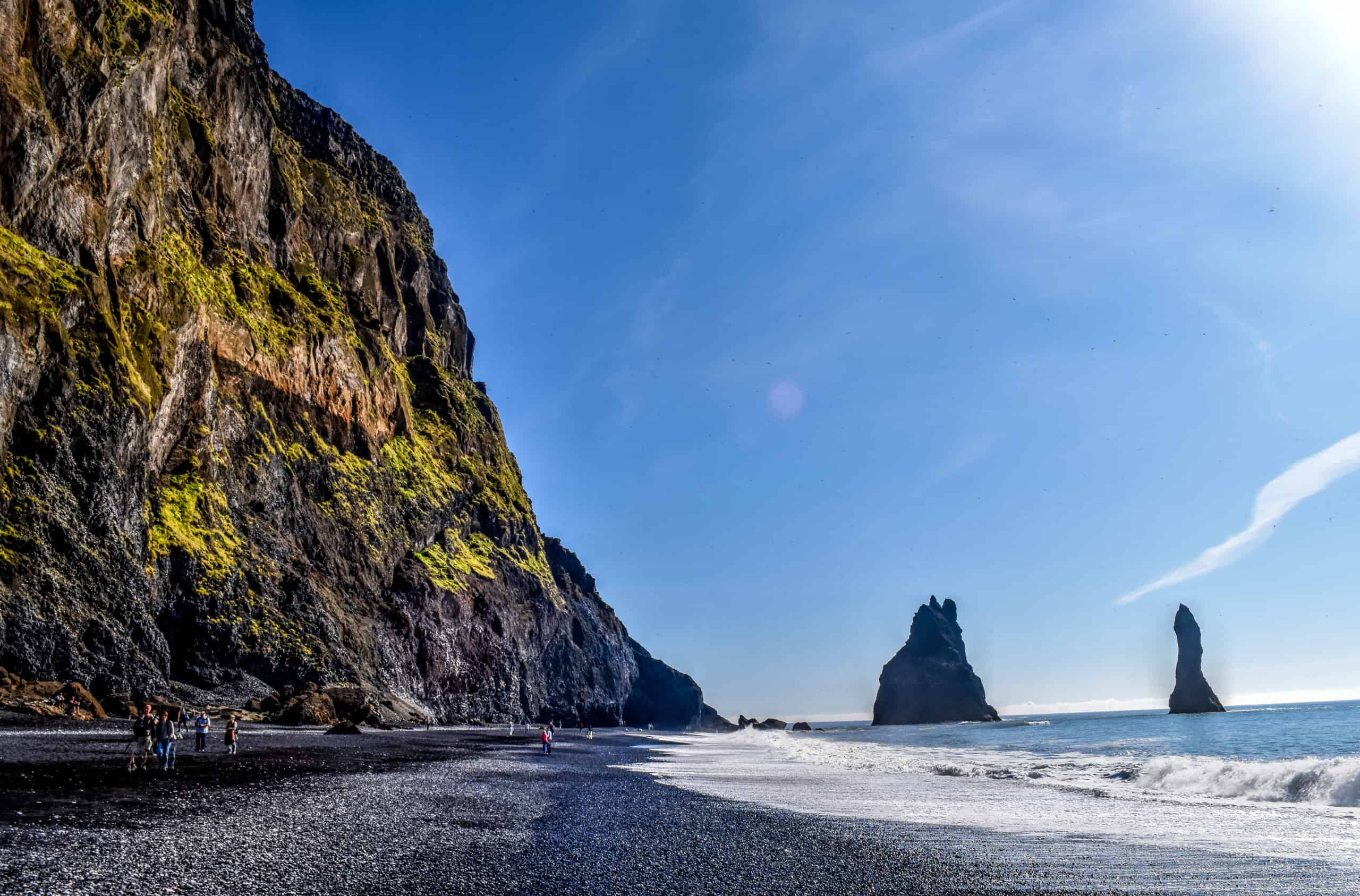
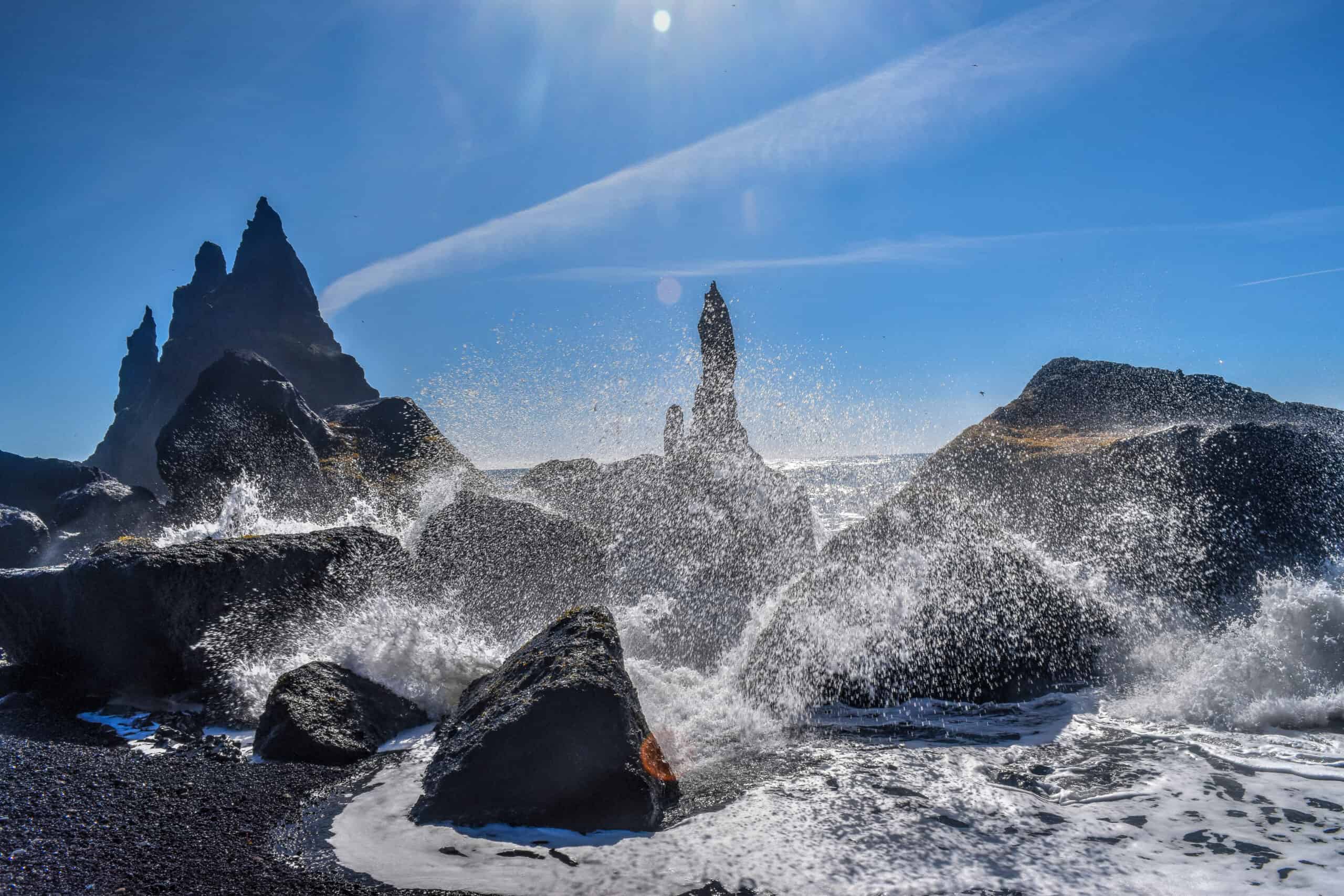
Please be careful when visiting Reynisfjara Beach, the sea here has claimed several lives. Most of the south coast is very susceptible to “sneaker wavers”, huge coastal waves that can suddenly appear in a train of smaller waves. There are no significant landmasses in between Antarctica and the shores of Reynisfjara, meaning waves have thousands of kilometres to build. Visitors are advised to never turn their back on the waves, and keep a safe distance of at least 30 meters.
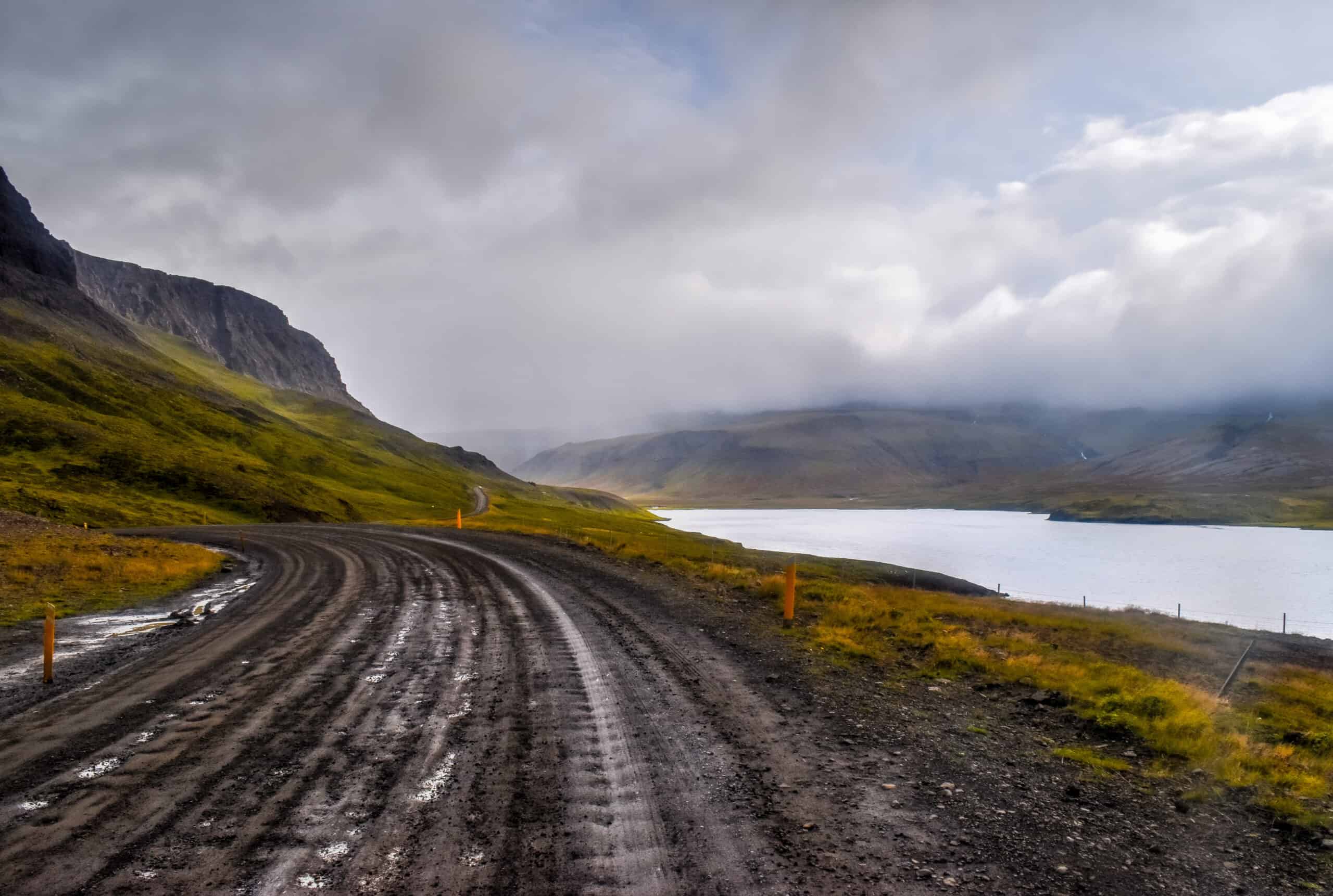
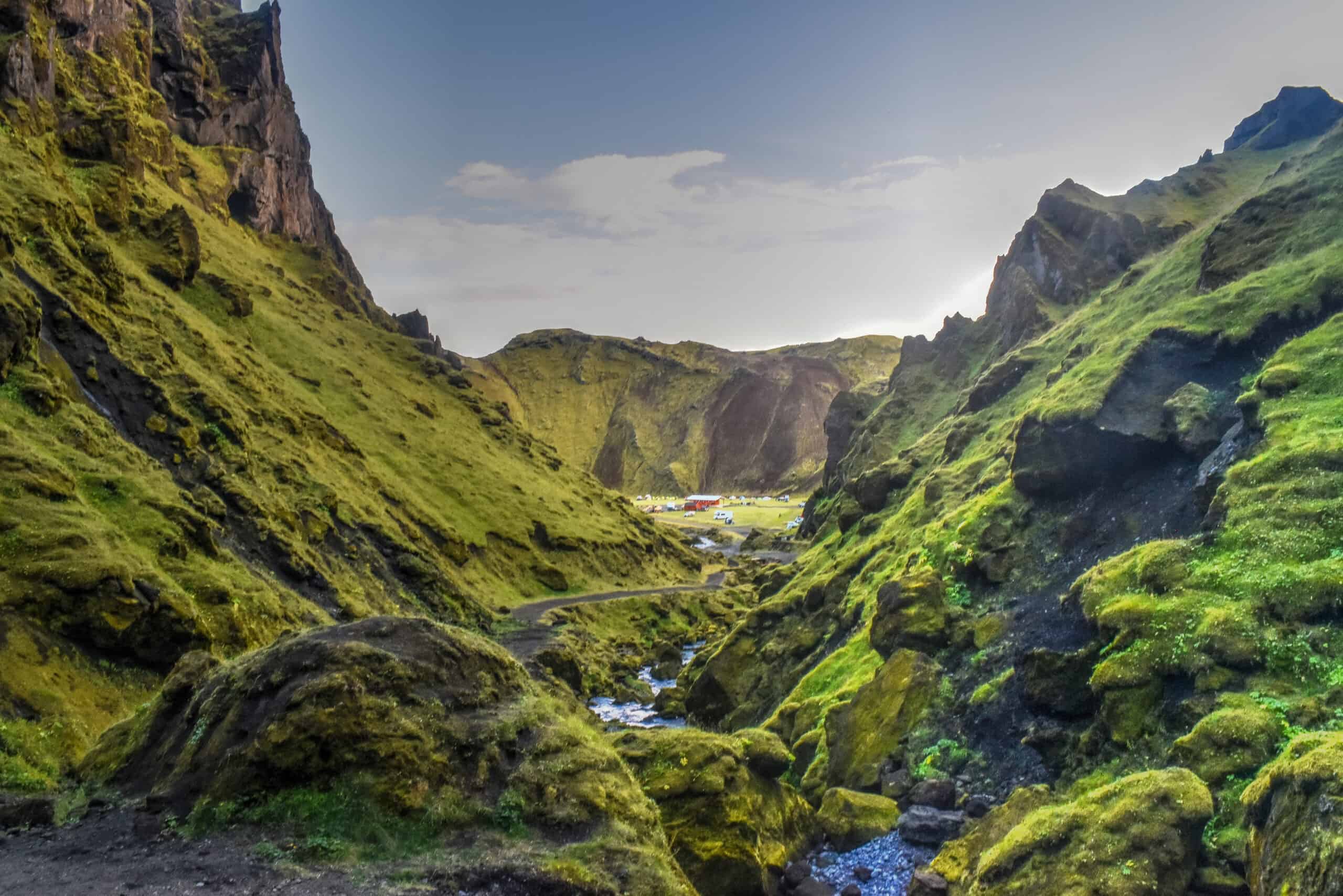
The drive to Þakgil
We assume that few will actually experience this drive because the only reason to venture this far off the Ring Road on such a bumpy gravel road is to stay at the Þakgil campground. Having done exactly that, we felt it was definitely worth highlighting given how beautiful the scenery was. And you’ll have time to enjoy it: Google Maps estimates that on average it takes 42 min to cover the 16km road that separates the campground from the Ring Road – there are so many twists and turns that you can’t afford to go fast.
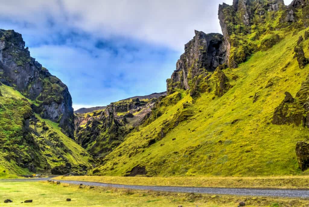
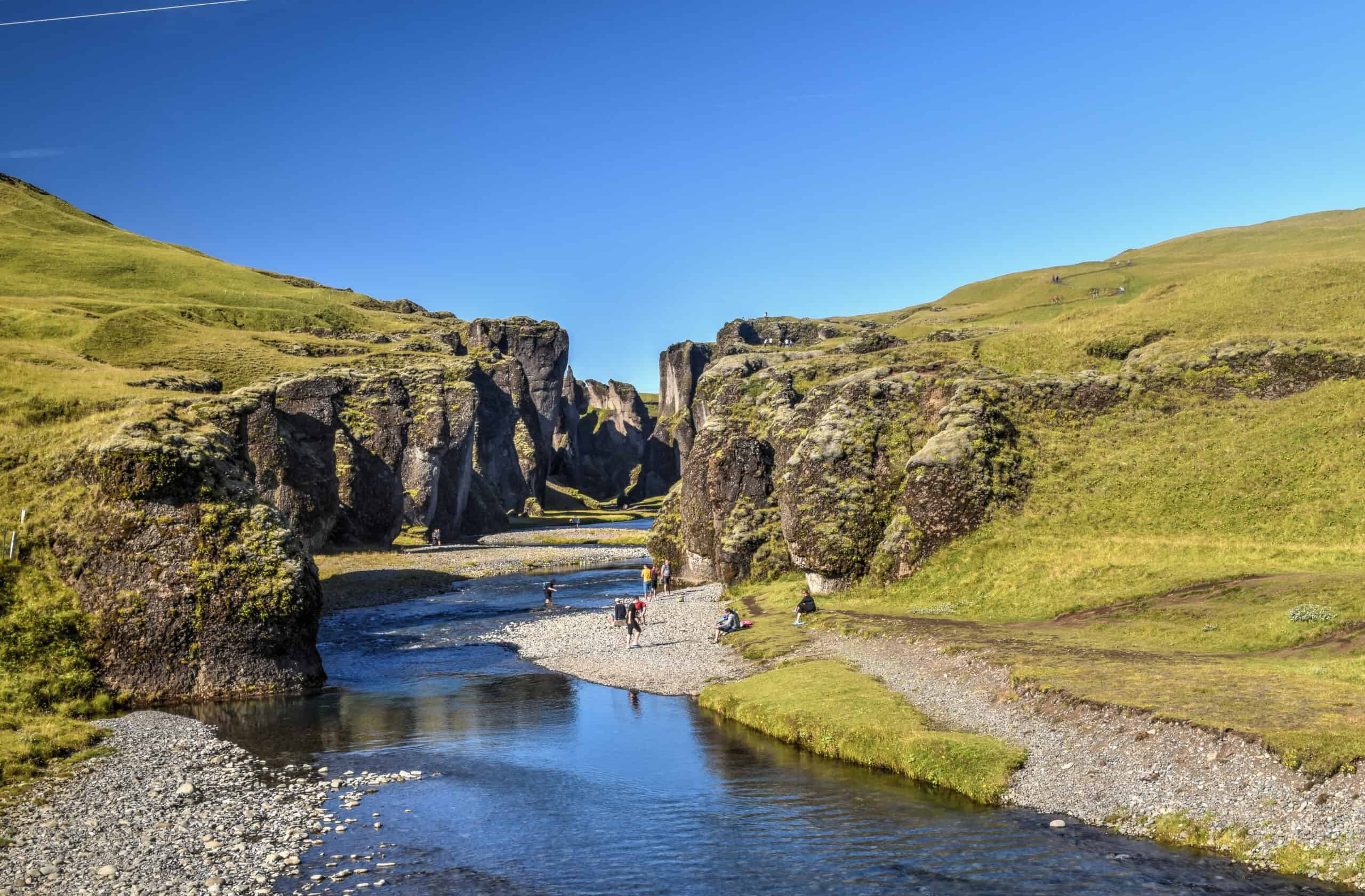
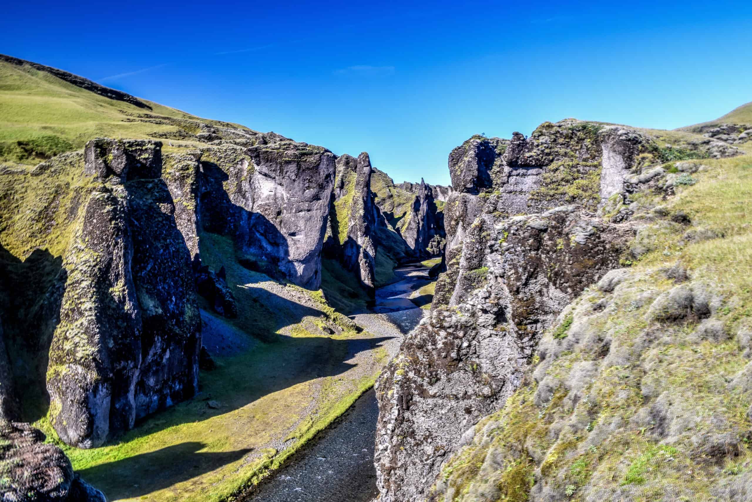
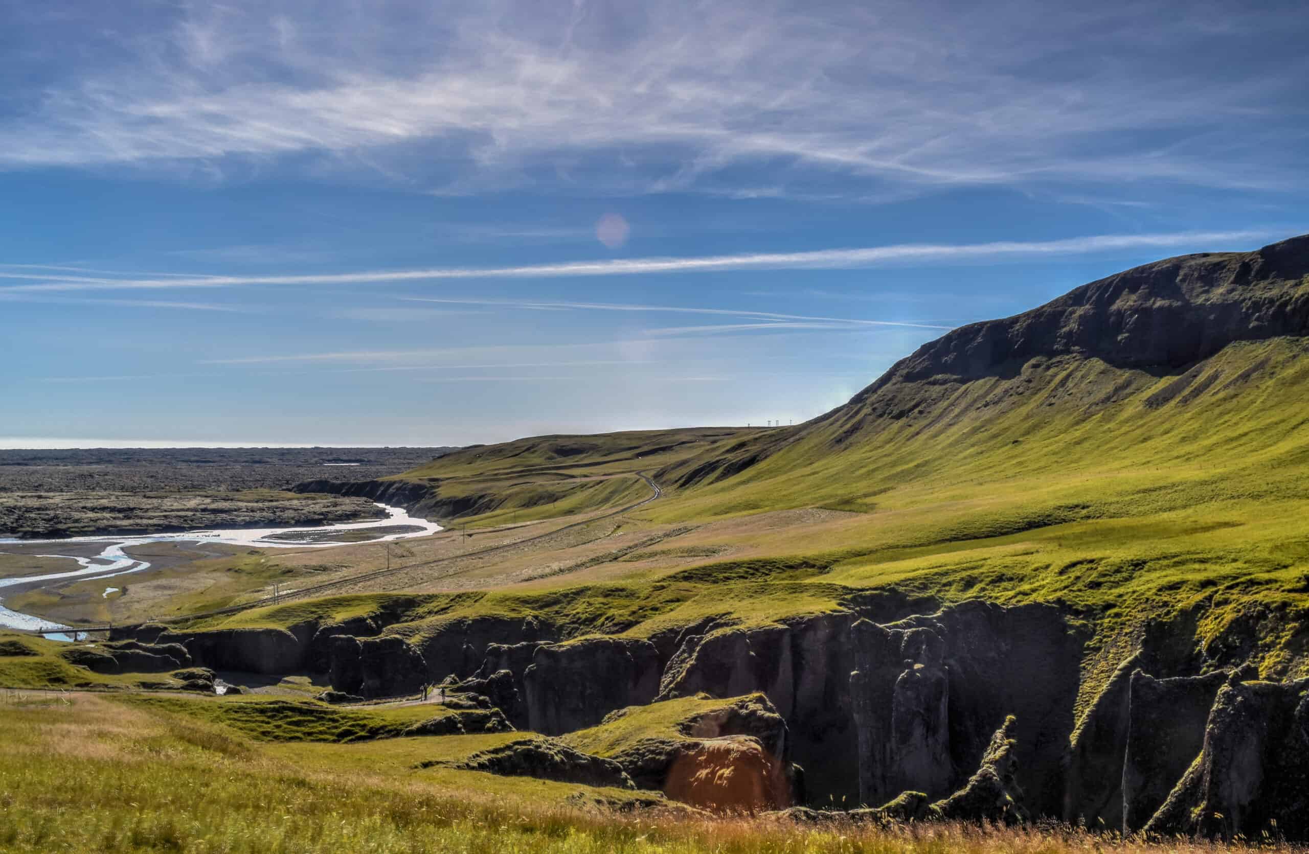
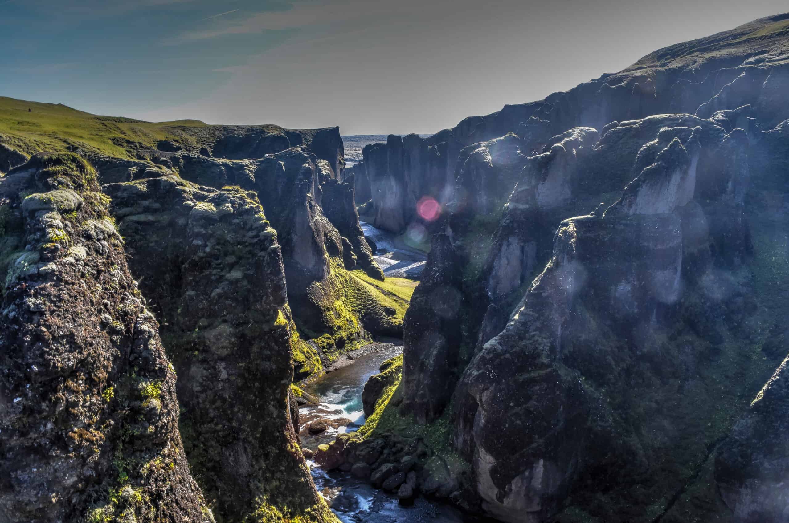
Fjaðrárgljúfur
Somewhat ironically splitting Southeast and Southwest Iceland lies Fjaðrárgljúfur, a majestic 100m deep and 2km long canyon like no other. A short 3 km drive from the Ring Road brings you to the parking lot, from which you can hike along the canyon’s ridge and enjoy spectacular views. Its serpent-like shape, sheer cliffs, and green moss coverage definitely make it a very unique canyon to witness and explore. Deep in the canyon, a lazy river serpentines its way toward the sea.
Map of top things to see and do in Southwest Iceland
Sights of Southeast Iceland
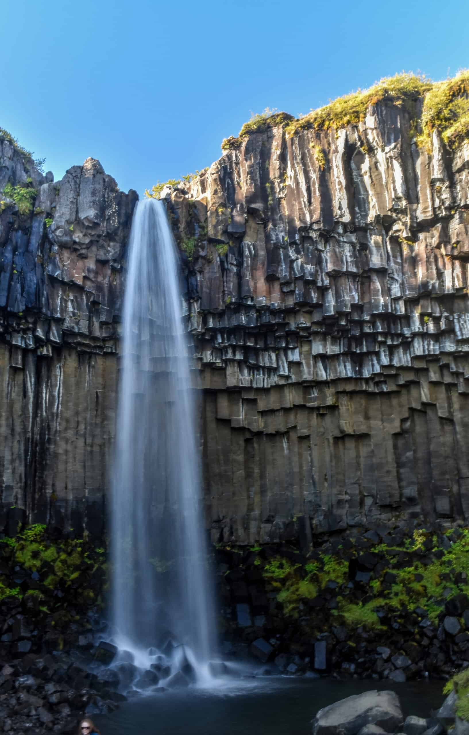
Skaftafell
Skaftafell is a true wilderness area in Iceland’s Vatnajökull National Park. Here you’ll find lots of hiking trails, Iceland’s tallest mountain as well as its largest glacier. In truth, however, we didn’t spend enough time in Skaftafell to fully take advantage of what it had to offer. With only 10 days in Iceland, we had to cut a few corners so we only hiked to Svartifoss after our arrival (3.2 km return), enjoyed the scenery around the campground and spent the night, and then were on our way early the next morning to explore the glacial lagoons further down the ring road. But there is definitely more to see and do here with more time.
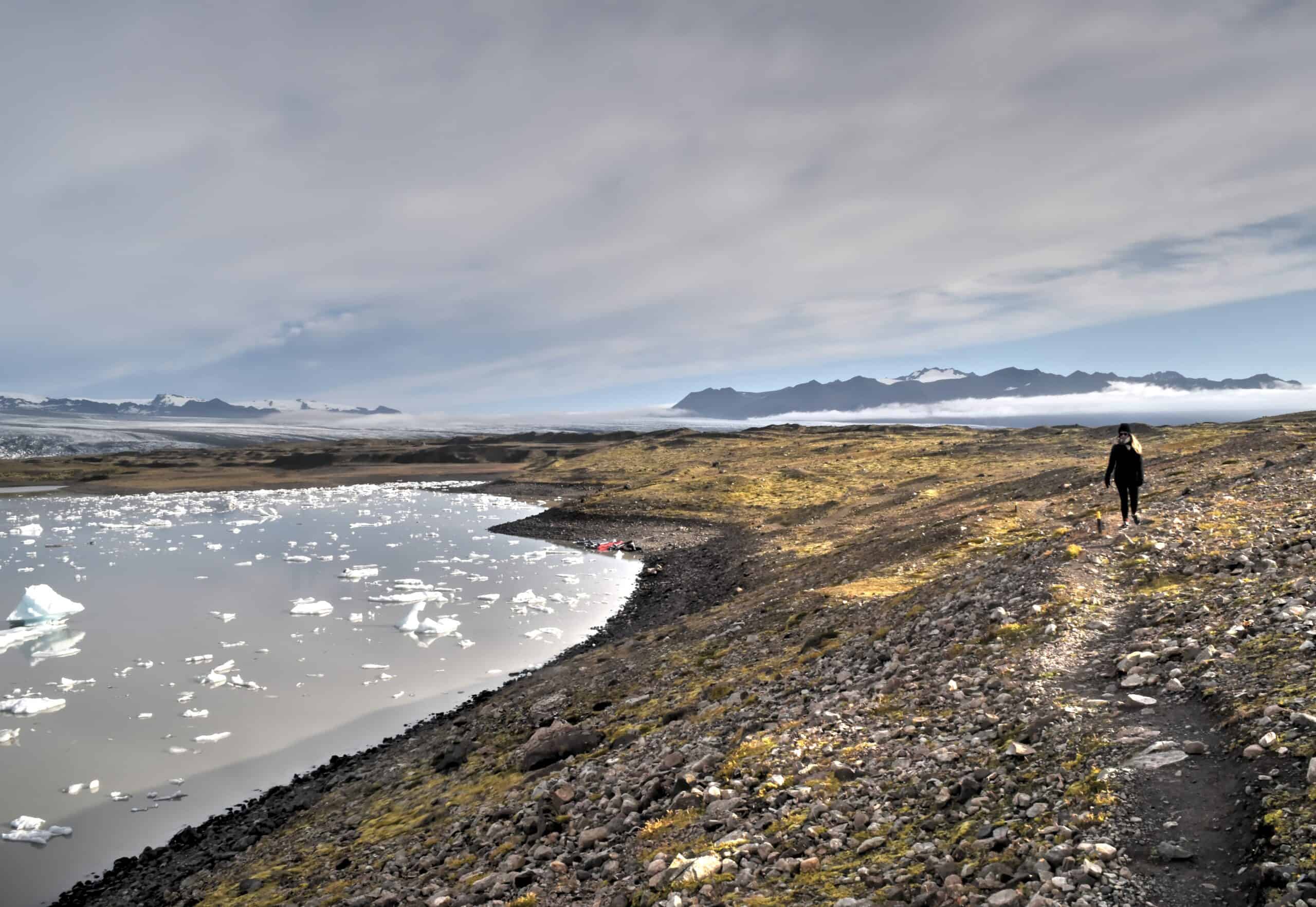
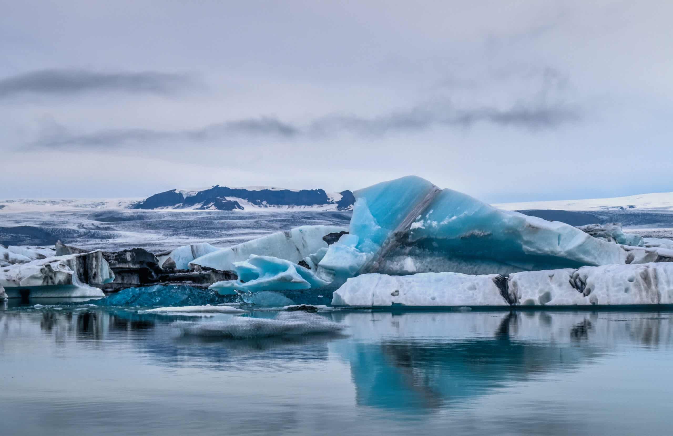
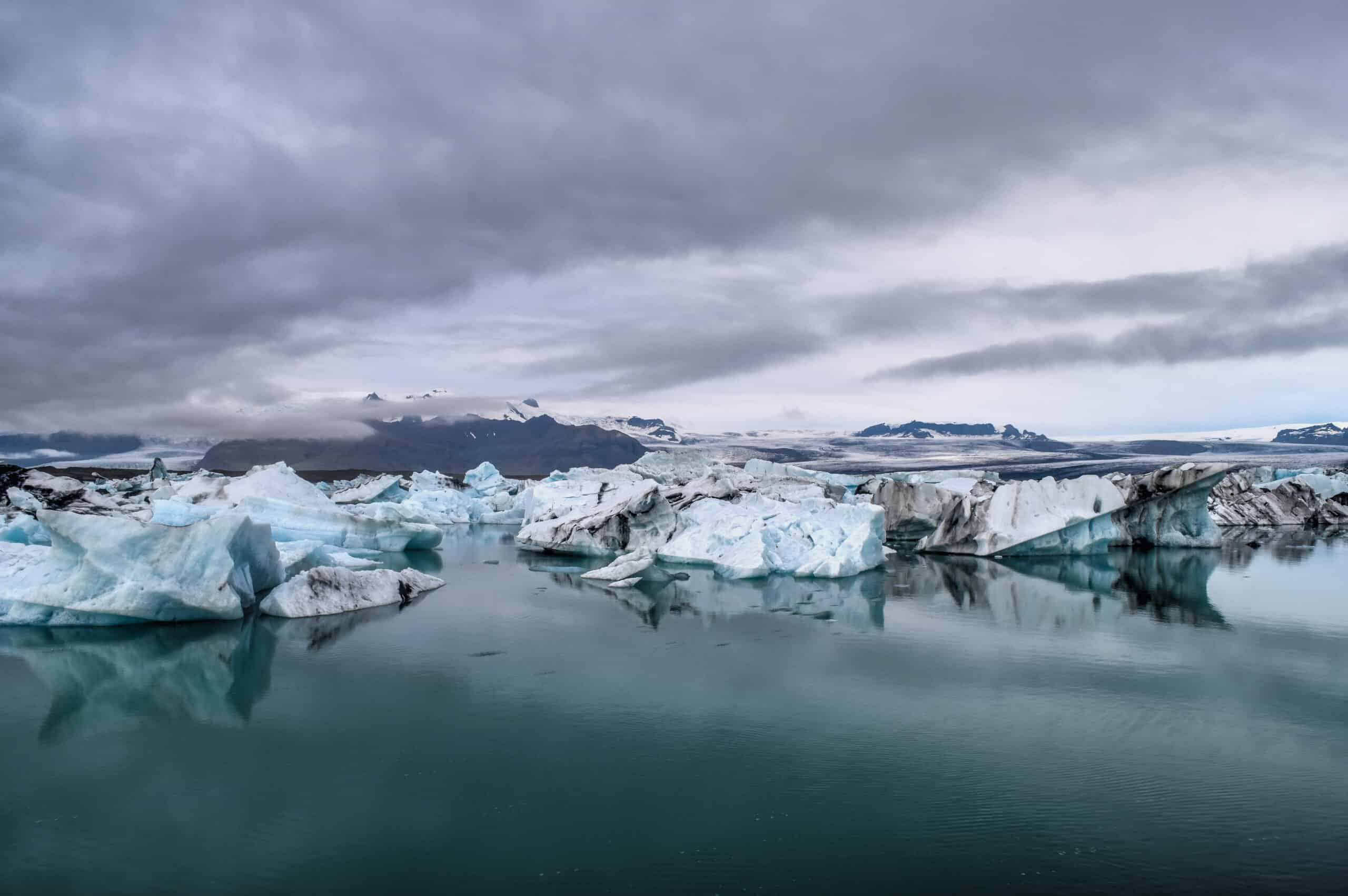
The Glacial Lagoons – Fjallsárlón & Jökulsárlón (& Diamond beach)
Fjallsárlón is an impressive glacial lagoon in Iceland, located on the southern end of Vatnajökull glacier. Although not as popular as its bigger brother Jökulsárlón (10 km further east), you can get much closer to the ice cap because of Fjallsárlón smaller size, which gives you get the impression that Iceland’s largest volcano Öræfajökull, looms over Fjallsárlón.
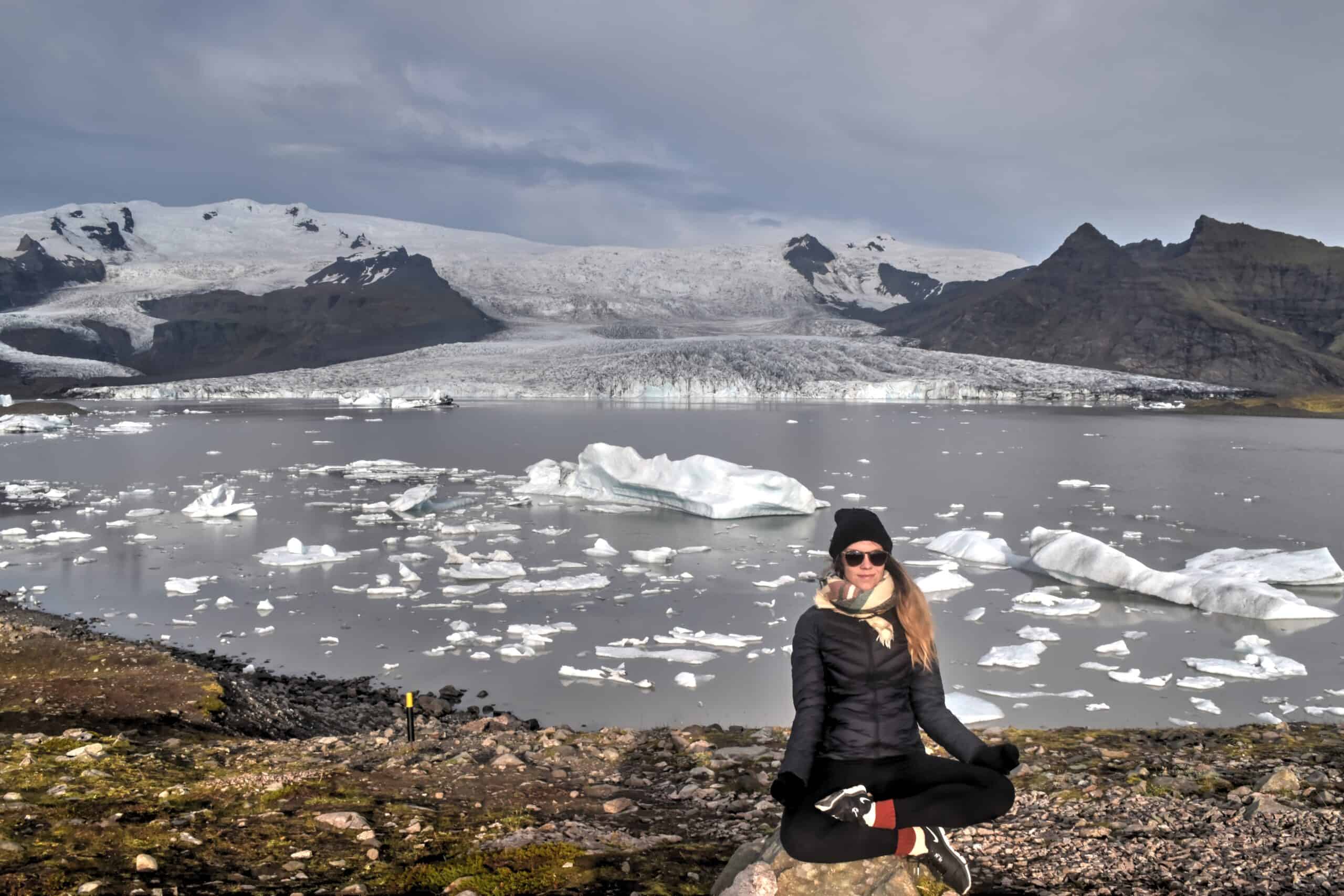
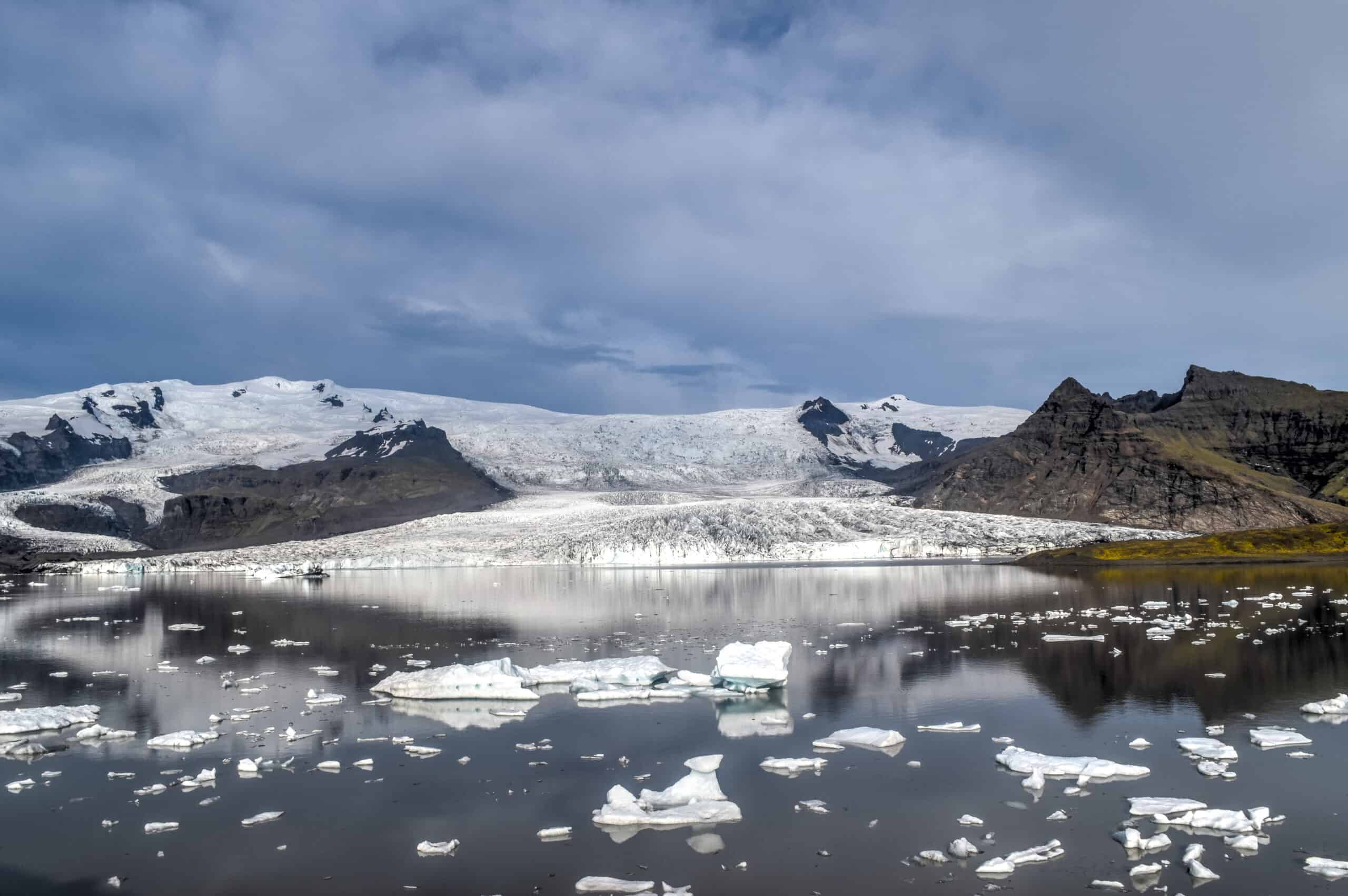
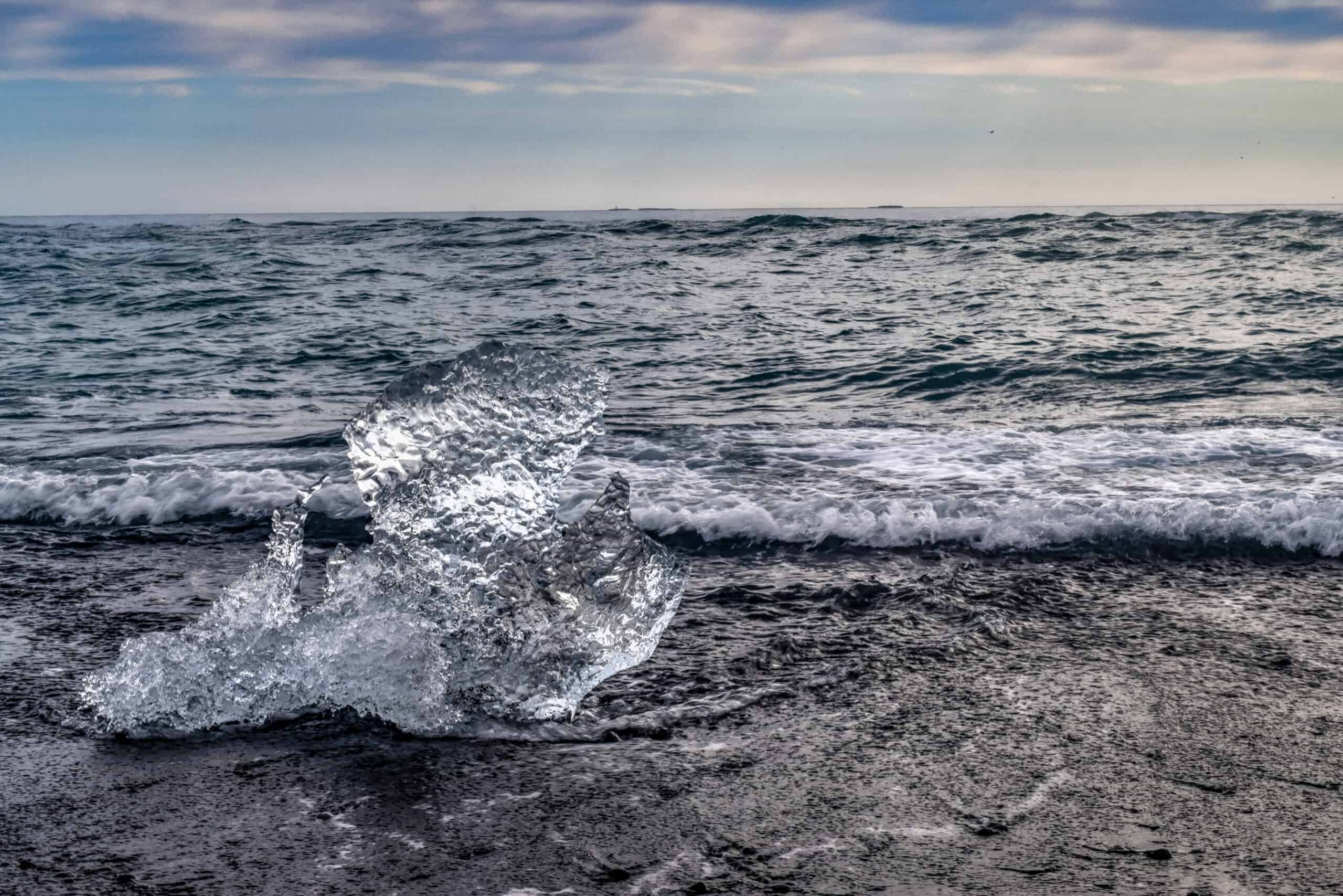
The floating icebergs themselves are more impressive at Jökulsárlón, whose lagoon is roughly five times bigger than Fjallsárlón’s. Here you’ll find blue, white, turquoise and black streaked icebergs shifting and dancing across the lagoon. The icebergs are 1,000-year-old chunks of the retreating Oraefajokull glacier that have broken off and are floating out to sea.
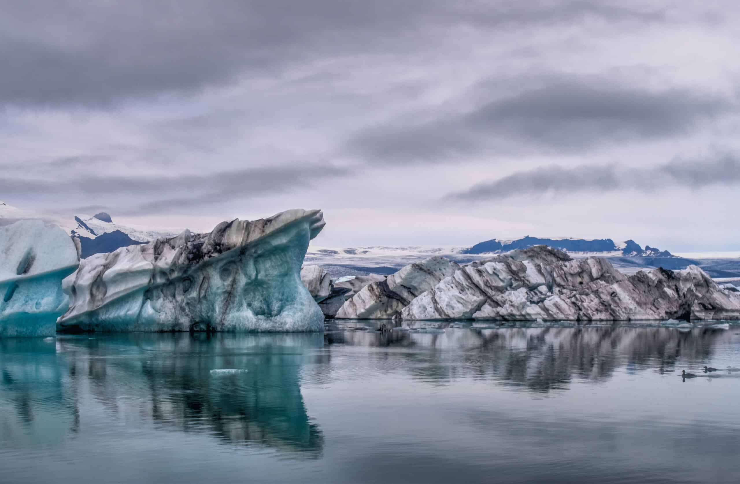
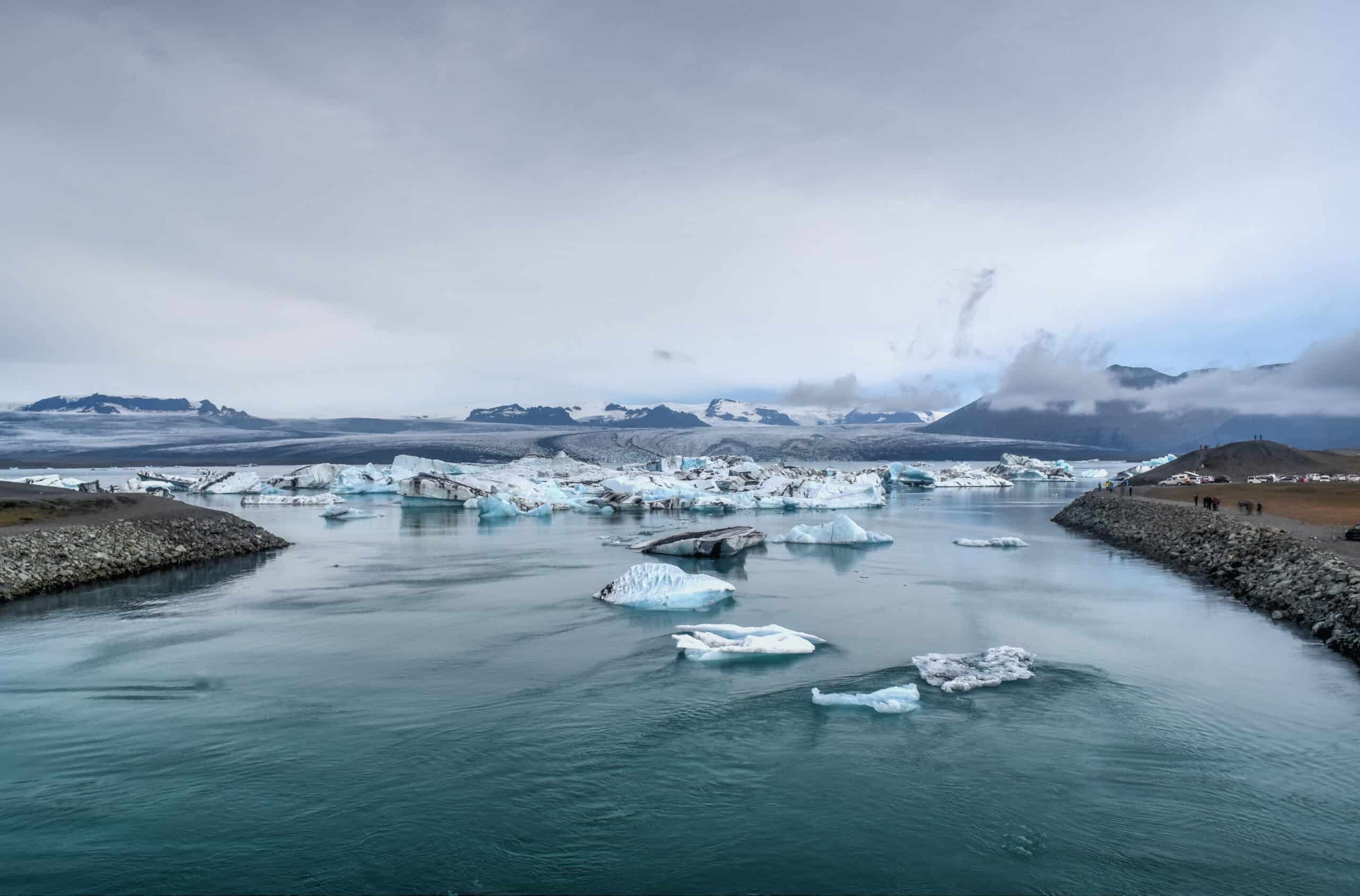
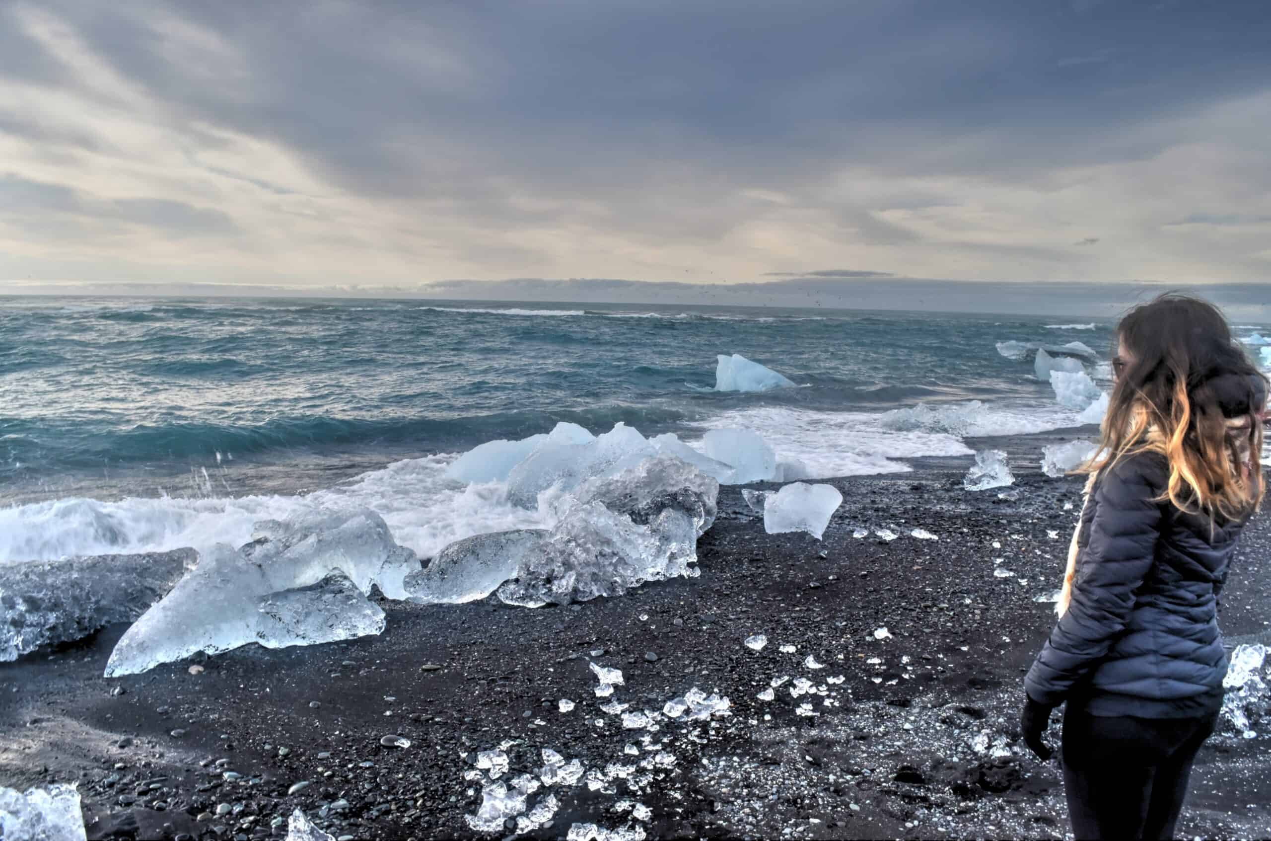
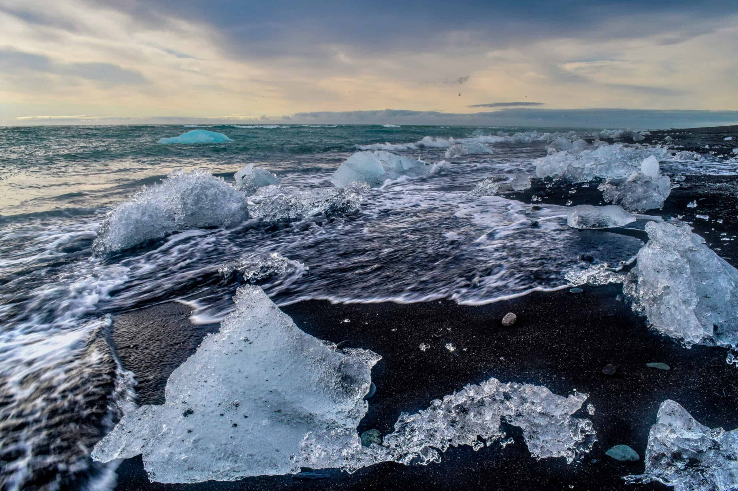
Did we say floating out to sea? That’s right. Although the icebergs from the Jökulsárlón tidal pond float out to sea, the ocean’s waves bring them back to shore where they end up on the black volcanic sand of Diamond Beach (the proper Icelandic name for the beach is Breidamerkursandur), just across the road from the lagoon.
Stokksnes & Vestrahorn
Vestrahorn, on the Stokksnes peninsula in Southeast Iceland, is one of the country’s most breathtaking mountains. It’s slightly off the beaten track, a 10 min drive off the Ring Road (roughly an hour from the Jökulsárlón lagoon), meaning you’re likely to see fewer tourists around (in fact, we were somewhat curiously all alone when we visited).

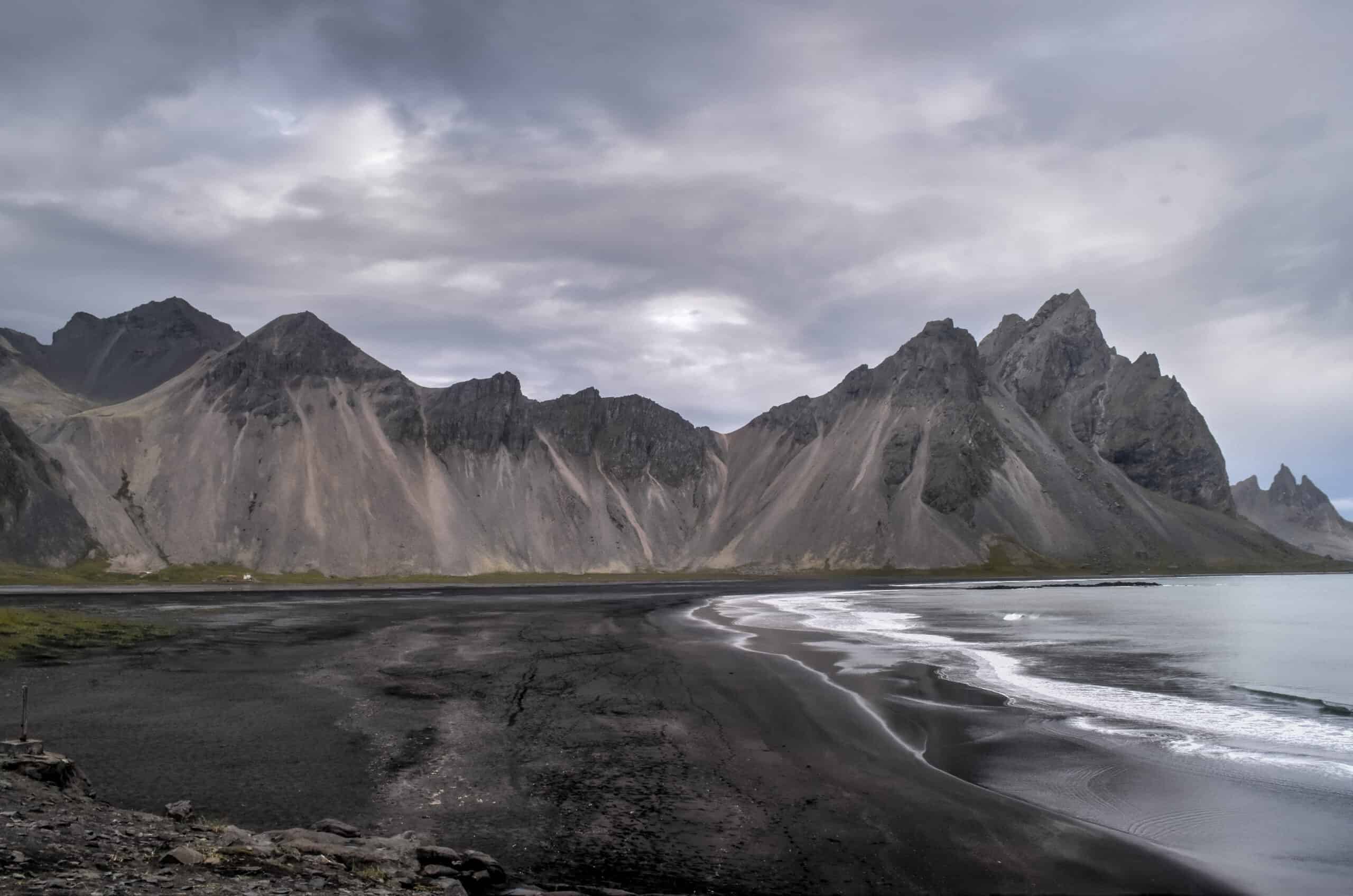
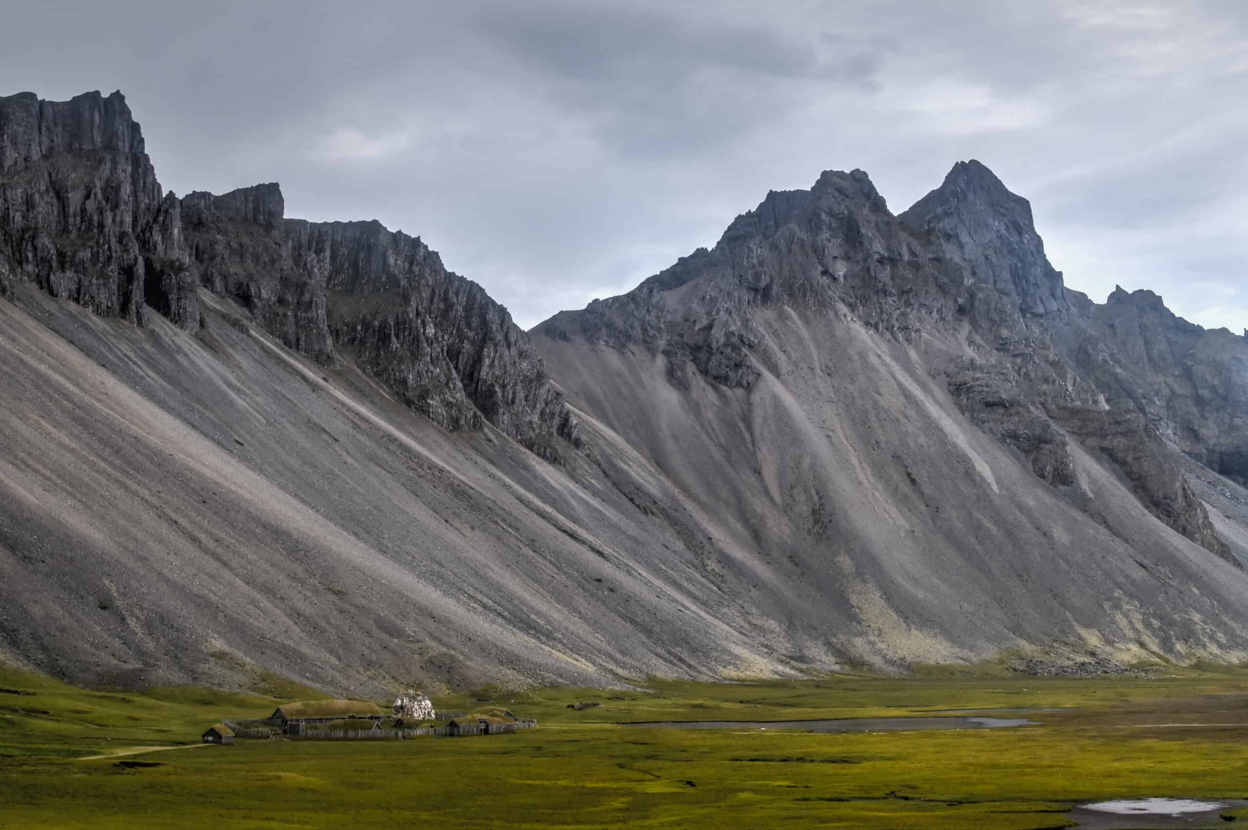
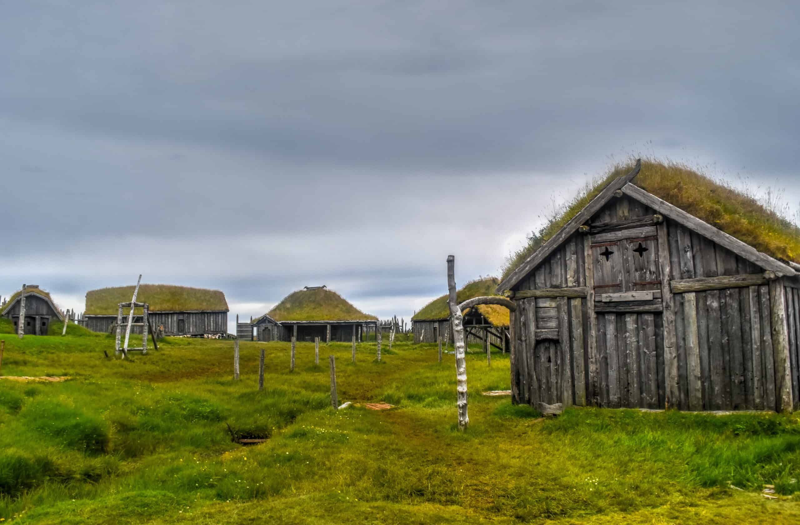
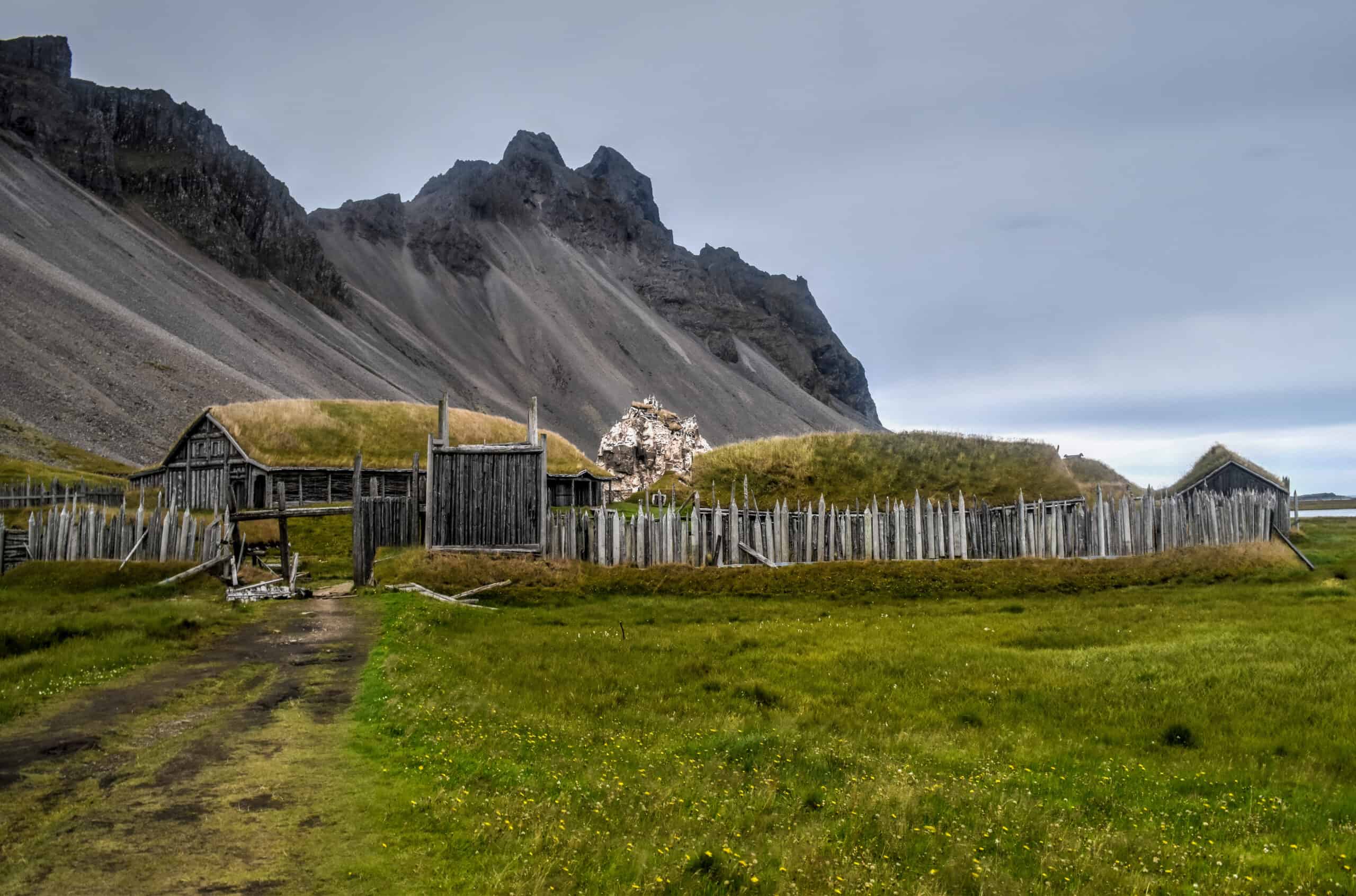
Note that Vestrahorn is located on privately owned land, and the owners charge an entrance fee (900 ISK in 2023). The fee can be paid at the Viking Cafe, which will allow you to visit the Stokknes beach, the nearby lighthouse and the Viking Village (which is a movie set built in 2010 but was never used).
Map of top things to see and do in Southeast Iceland
Sights of Northeast Iceland
Driving along the Eastfjords
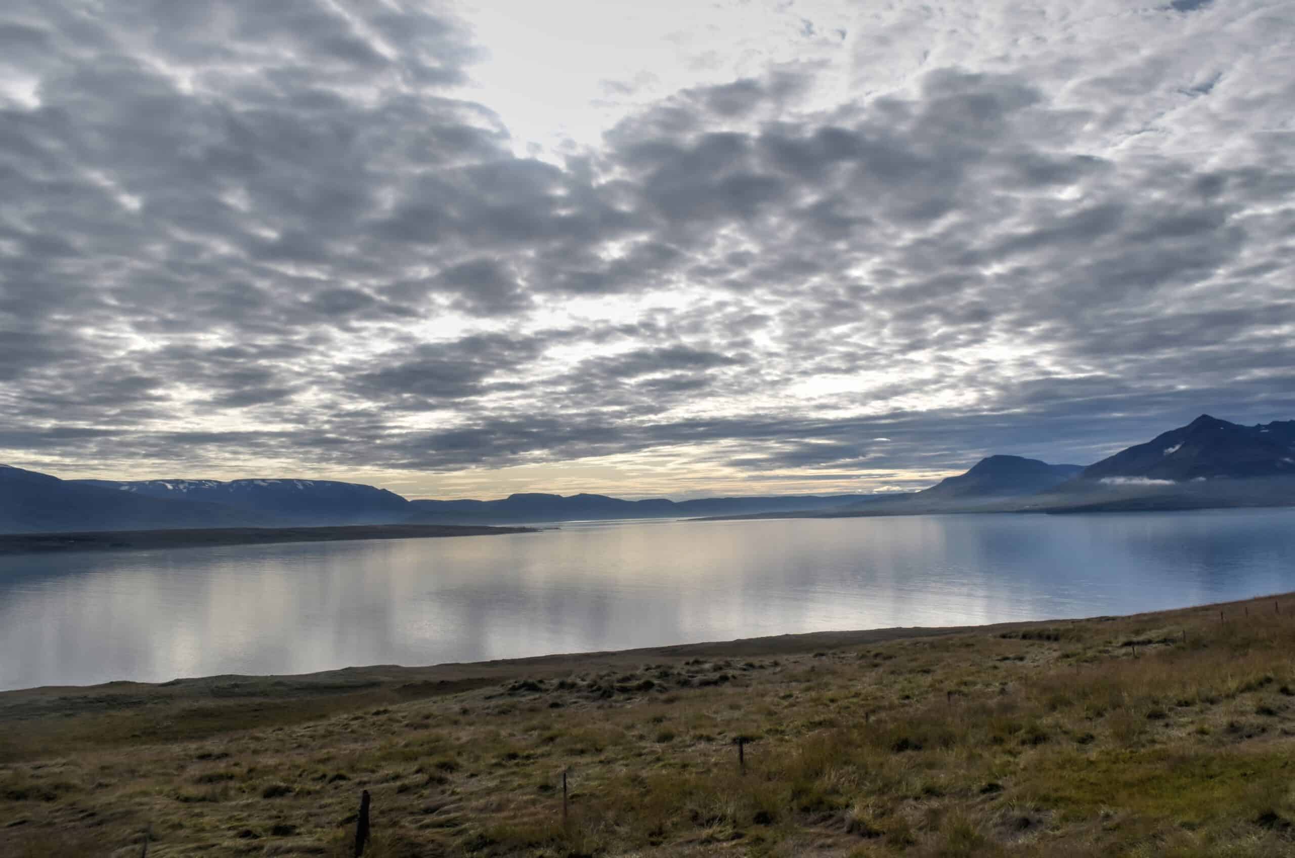
If you want to escape the crowds and feel immersed in pristine coastline settings, the Eastfjords are the place to go. It’s pretty much as far from Reykjavik as you can be, and it is a great place to grab a sneak peek into the fishing and art culture in the heart of small-town Iceland. Egilstaðir, the largest town of the Eastfjords (and is unofficially referred to as the capital of the East) has a population of just over 2000.
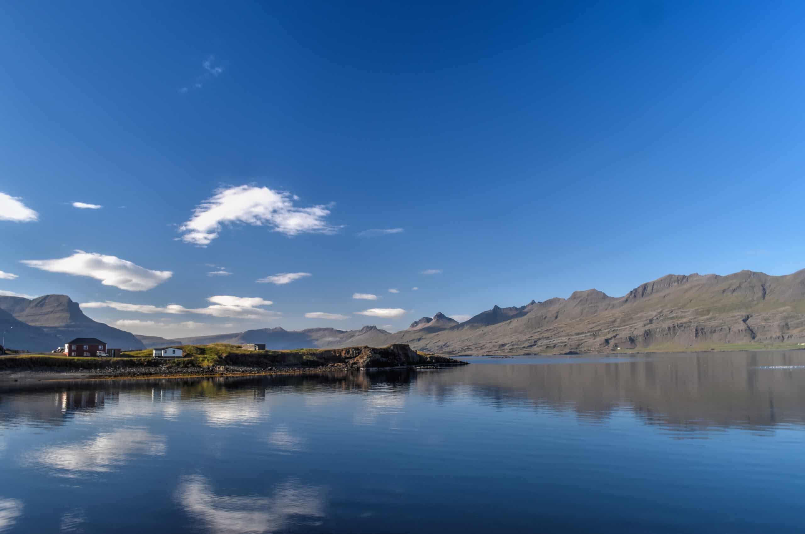
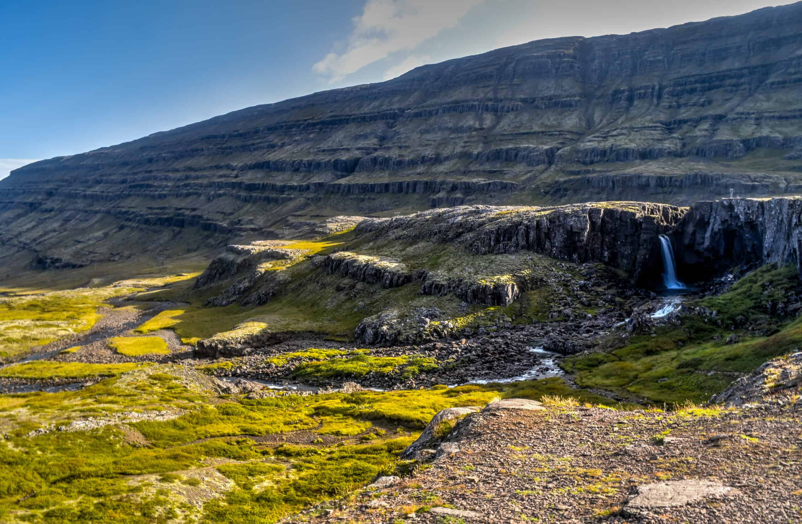
With more time we would have loved to explore the area further (with only a day in the area, we chose to focus our time on Seydisfjordur and Borgarfjörður Eystri, with an overnight in Egilstaðir) – but we nonetheless thoroughly enjoyed slow-driving across this quaint region of Iceland.
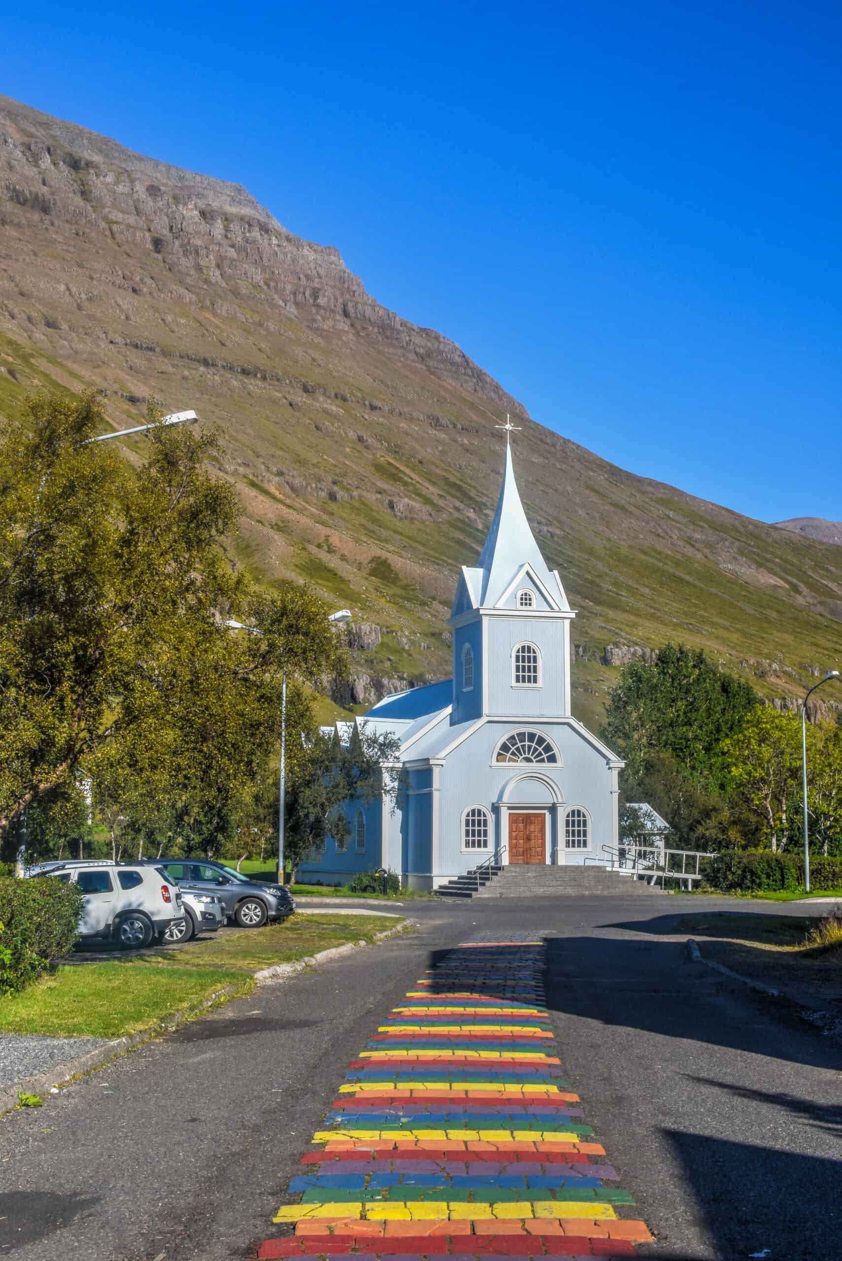
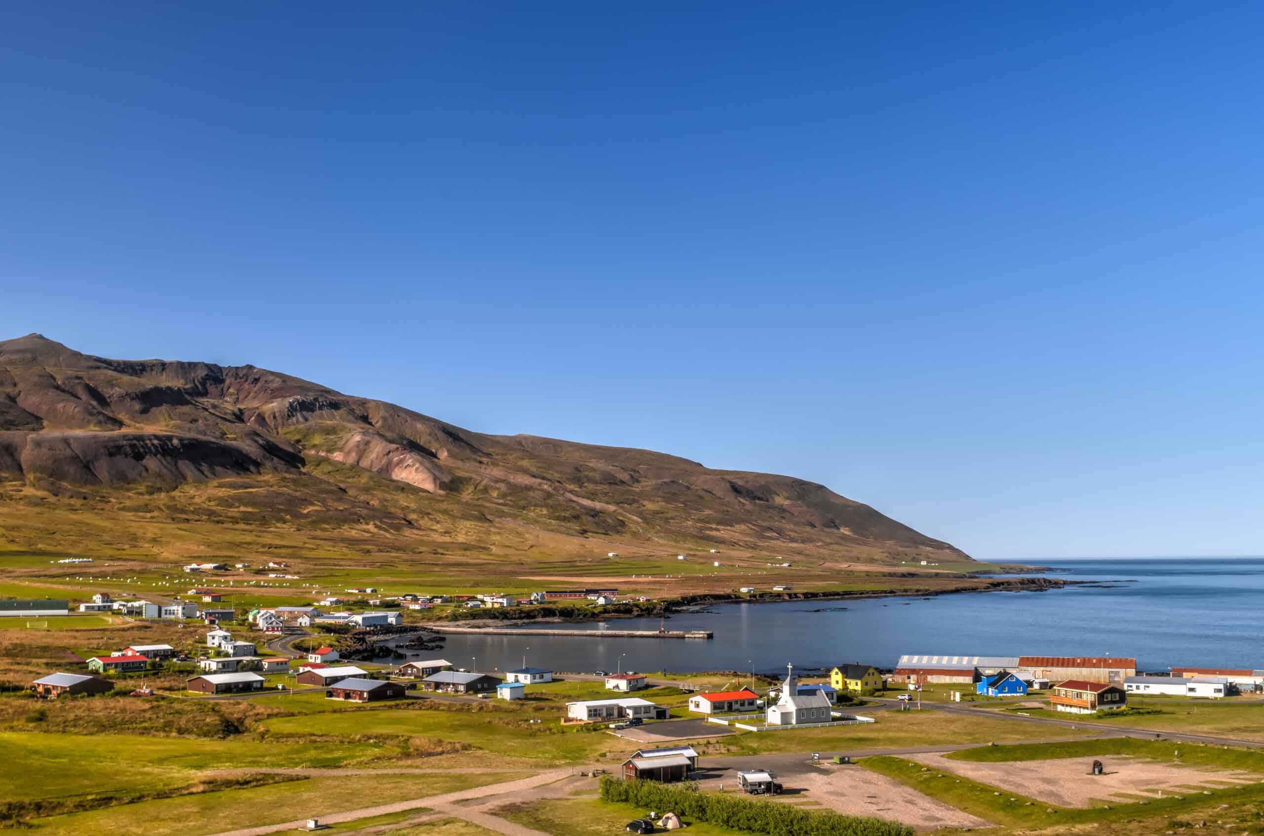
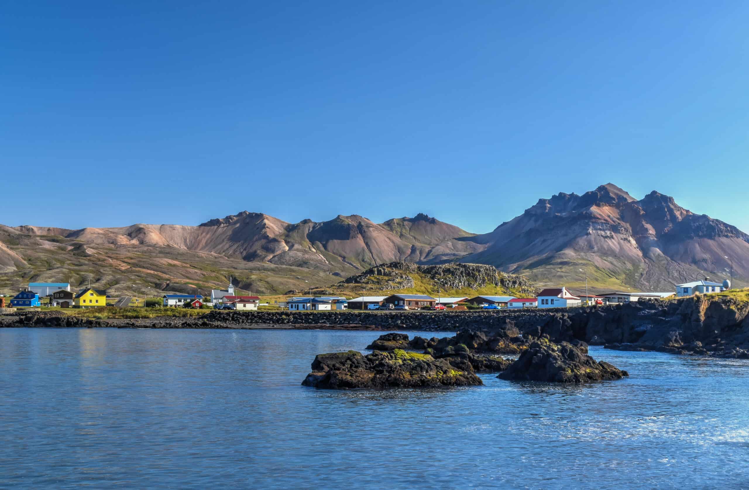
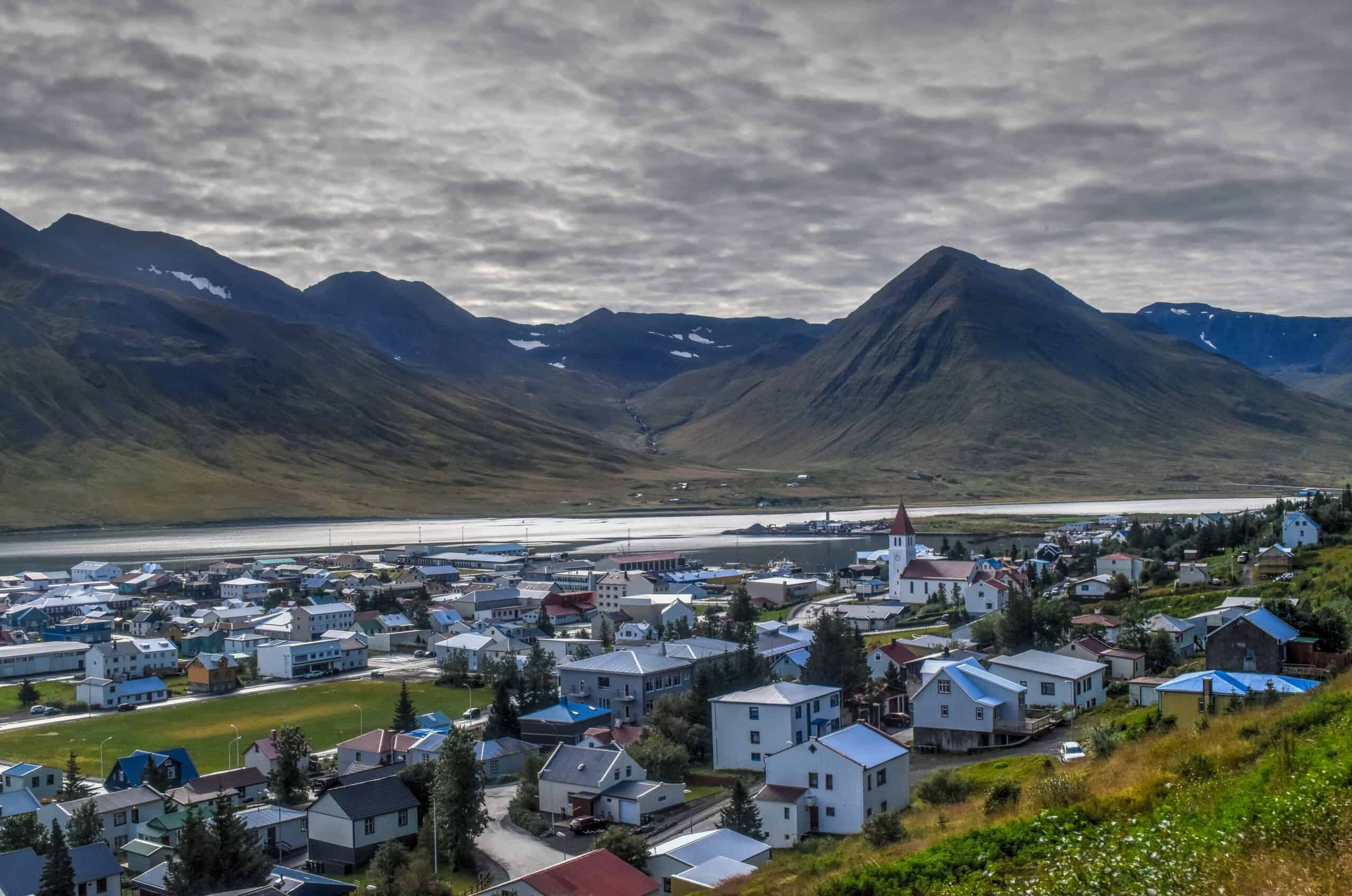
Seydisfjordur
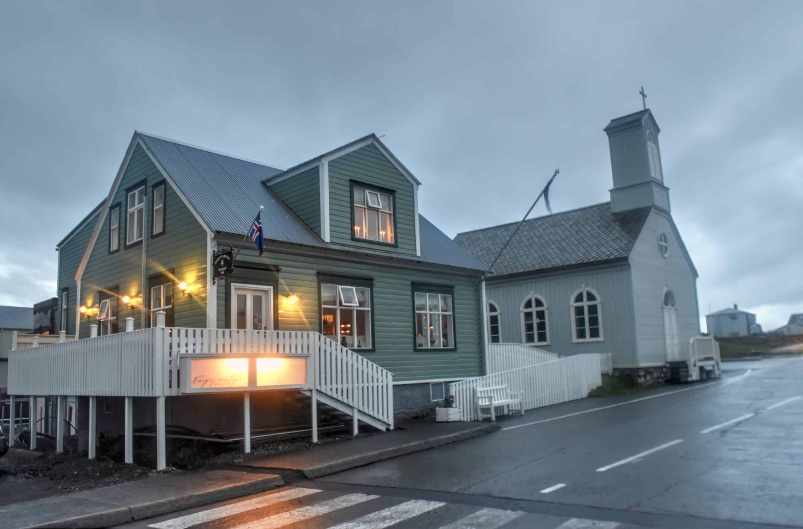
Seyðisfjörður is probably the most scenic of the Eastfjords towns with its instagrammable rainbow street and blue church. The small town of 700 people is also known as an artistic hotspot and hosts several art Festivals. It’s hard to beat Seyðisfjörður’s stunning and serene panoramas over the adjacent fjord.
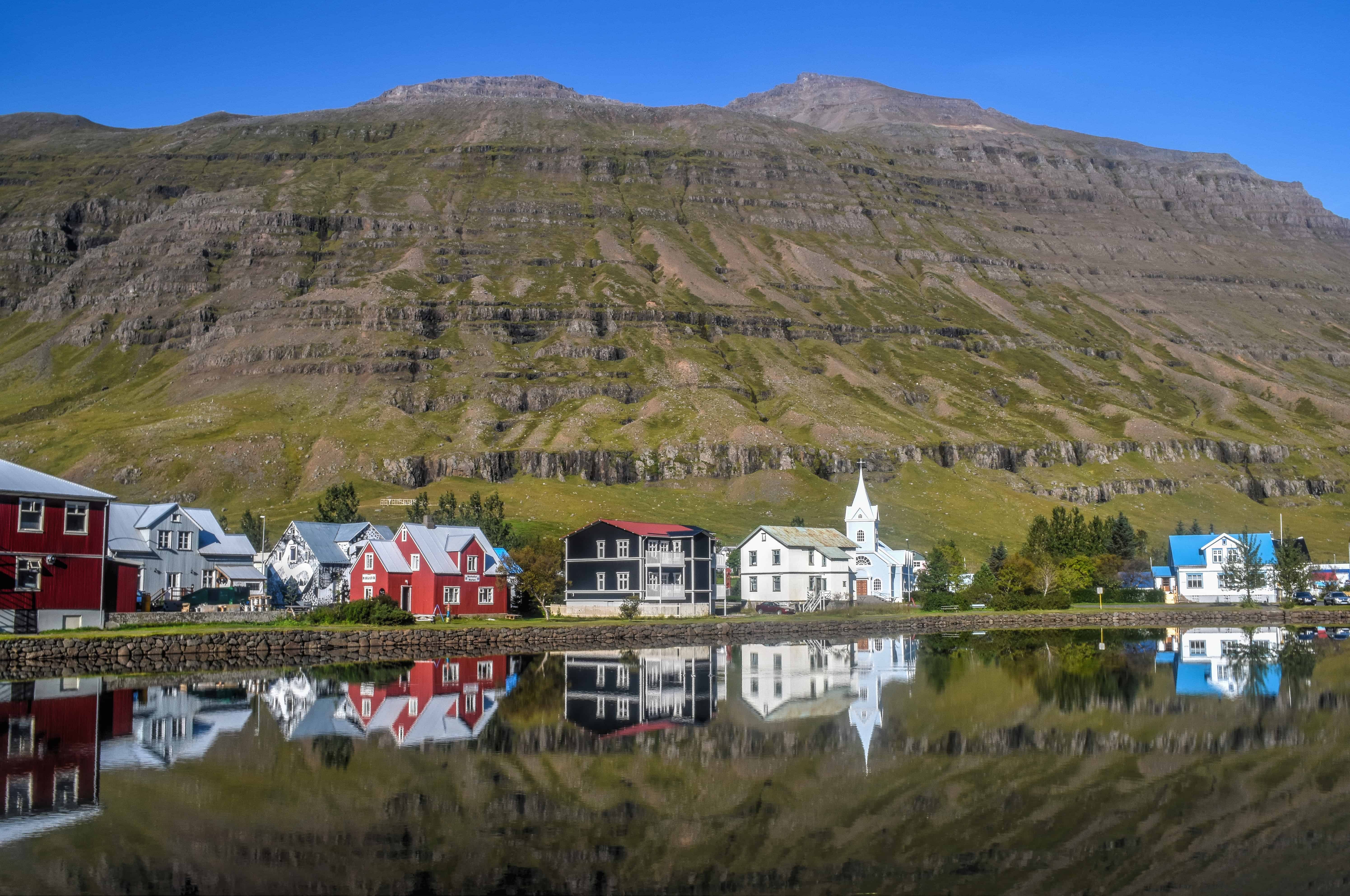
Seydisfjordur is roughly a 25 min drive along the very scenic road 93 from Egilstaðir, from which you can see several waterfalls along the way, such as Fardagafoss, Gljúfurfoss and Gufufoss.
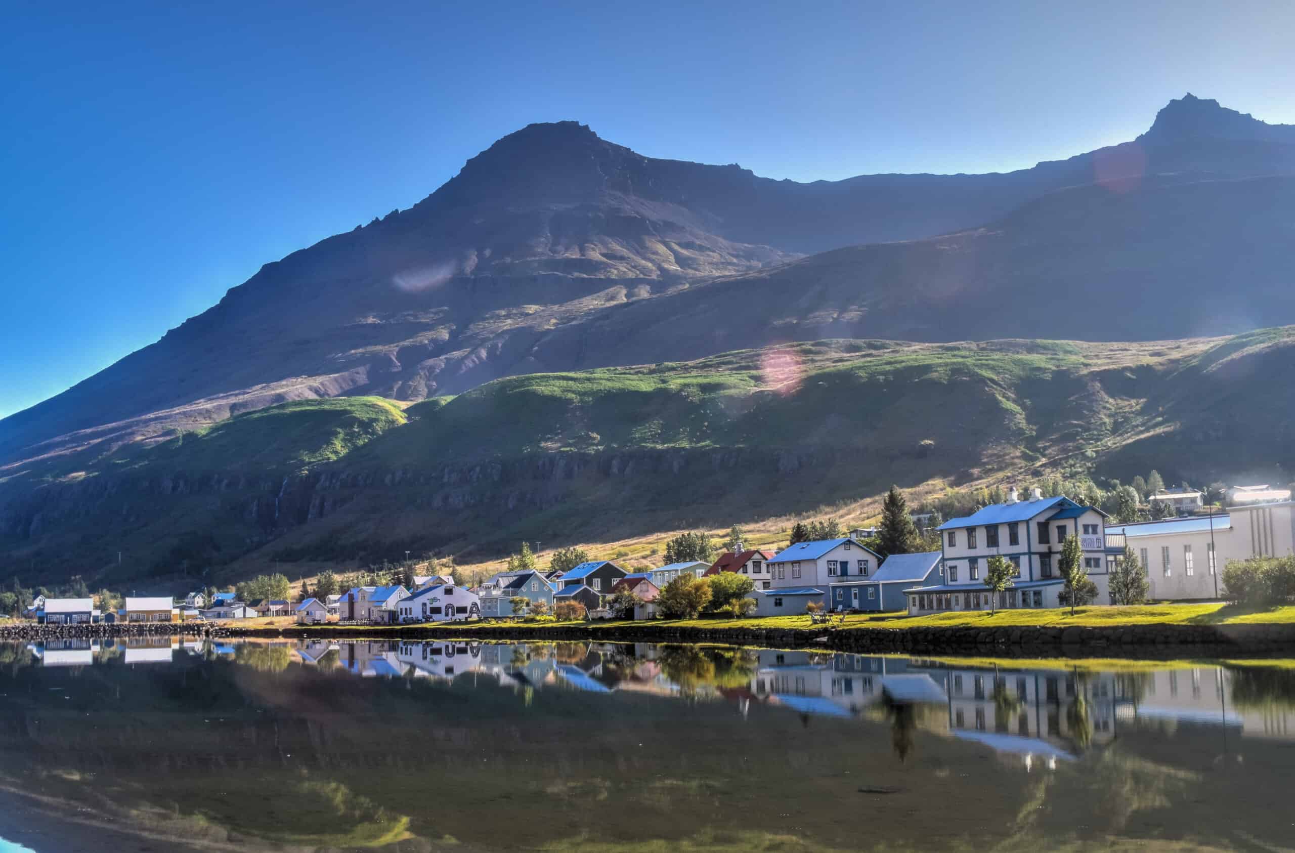
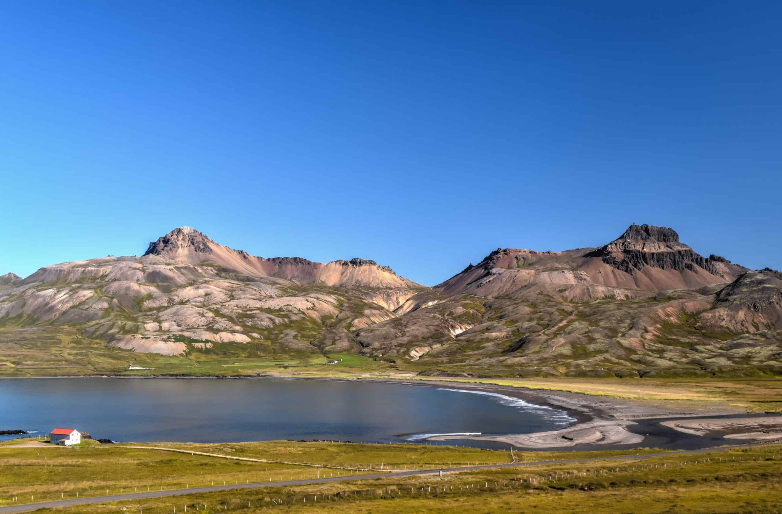
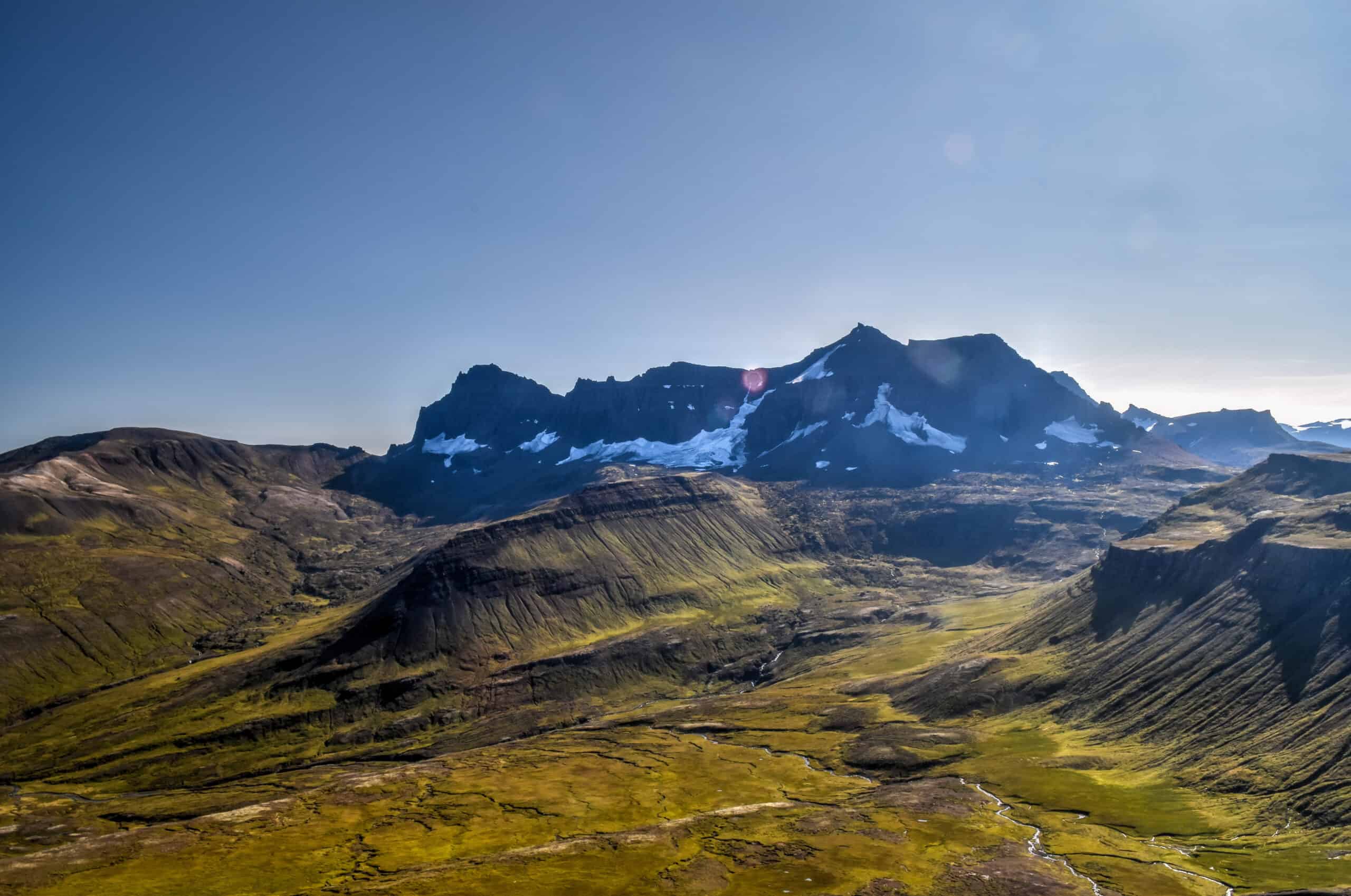
Borgarfjörður Eystri & Stórurð
Want to visit a town that’s even more remote than Seydisfjordur? Then consider Borgarfjörður Eystri, a paradise for travellers and hikers looking for a quaint retreat from some of the busier tourist hotspots. Though note that it’s a one-hour drive to get here on a decent but gravel road (road 94), from the Ring Road at Egilstaðir.
The town, or village rather, is inhabited by just 100 people and the houses don’t even have any addresses.
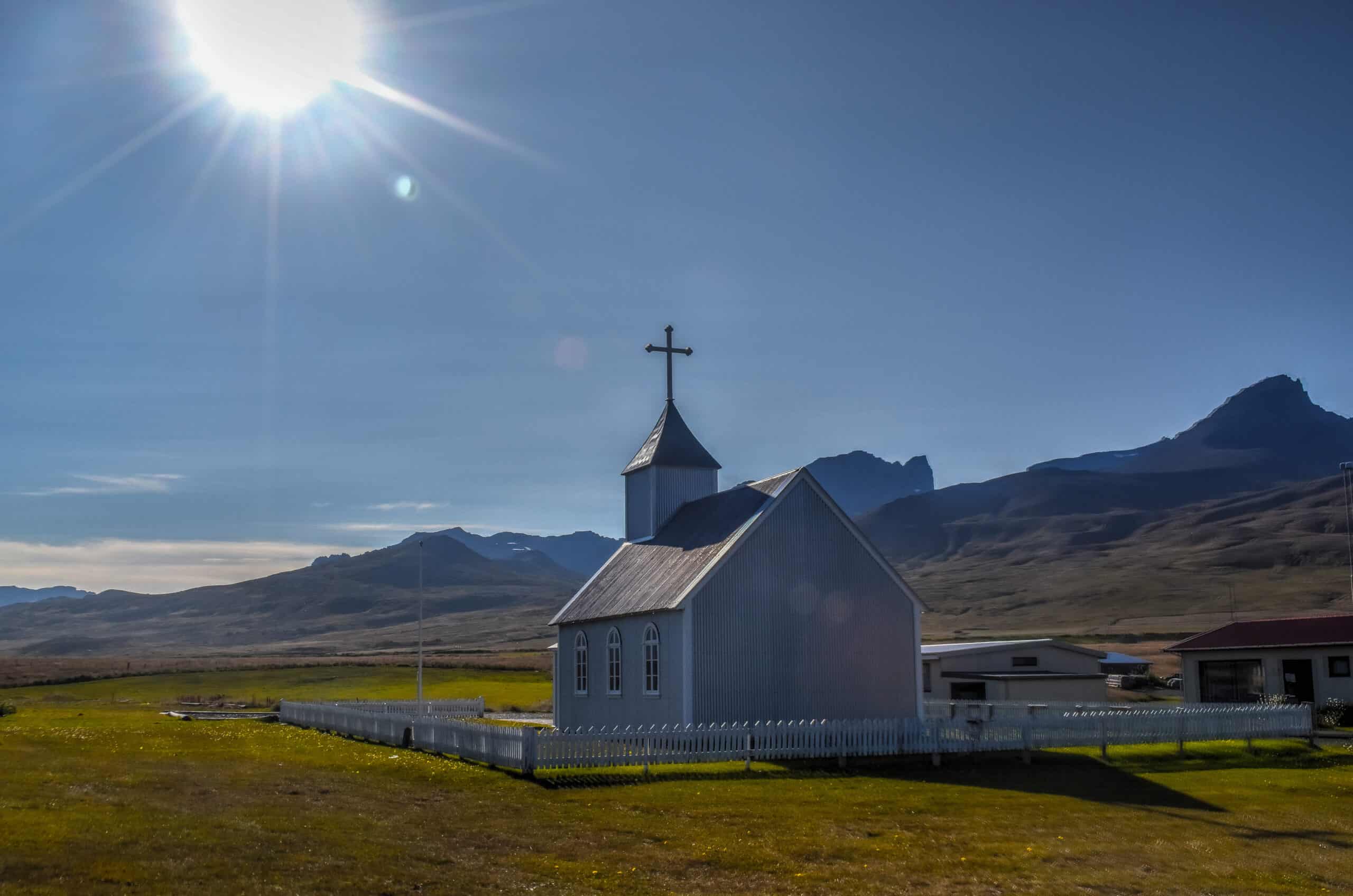
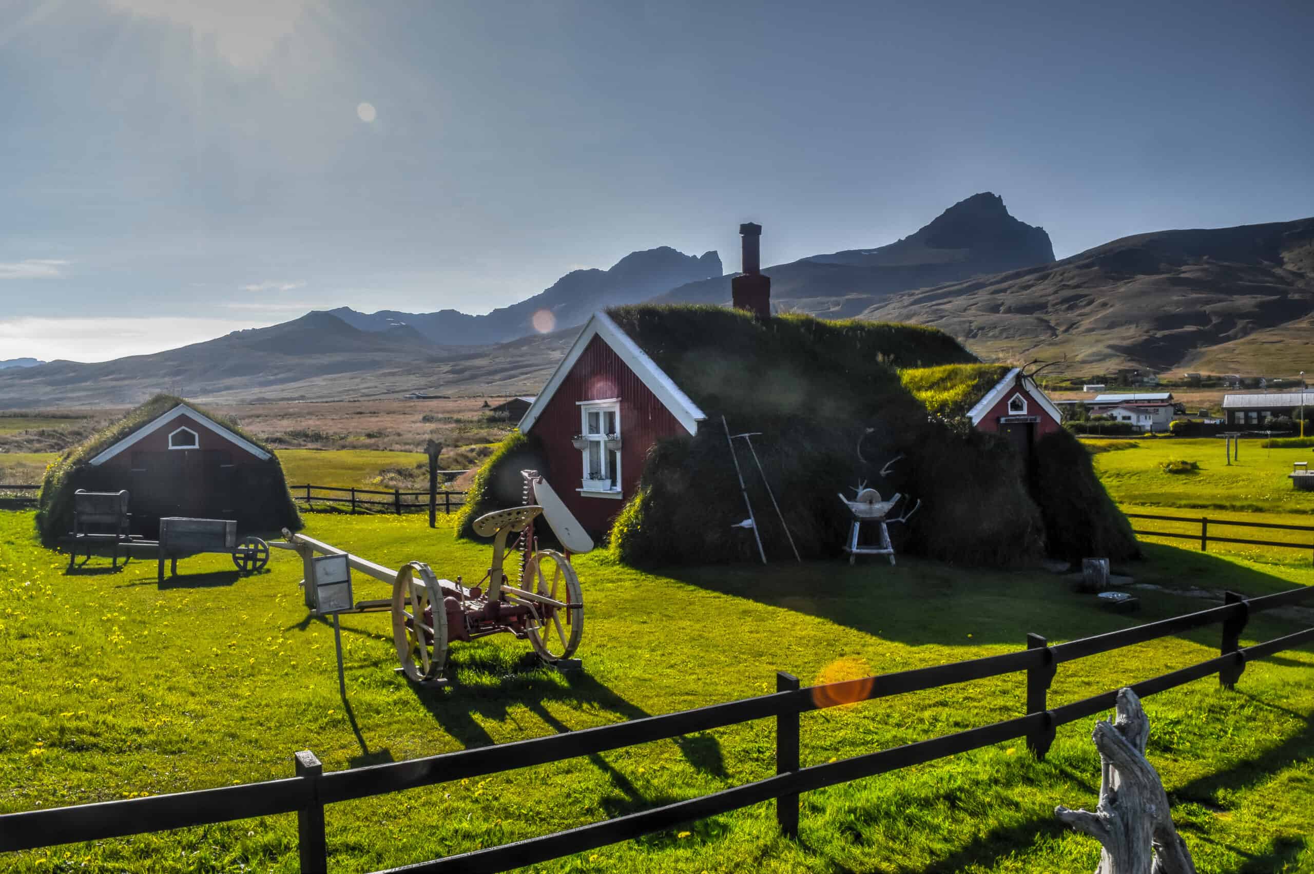
While in town be sure to check out the church and its beautiful surroundings, the turf house, and climb the Álfaborg hill for some amazing views.
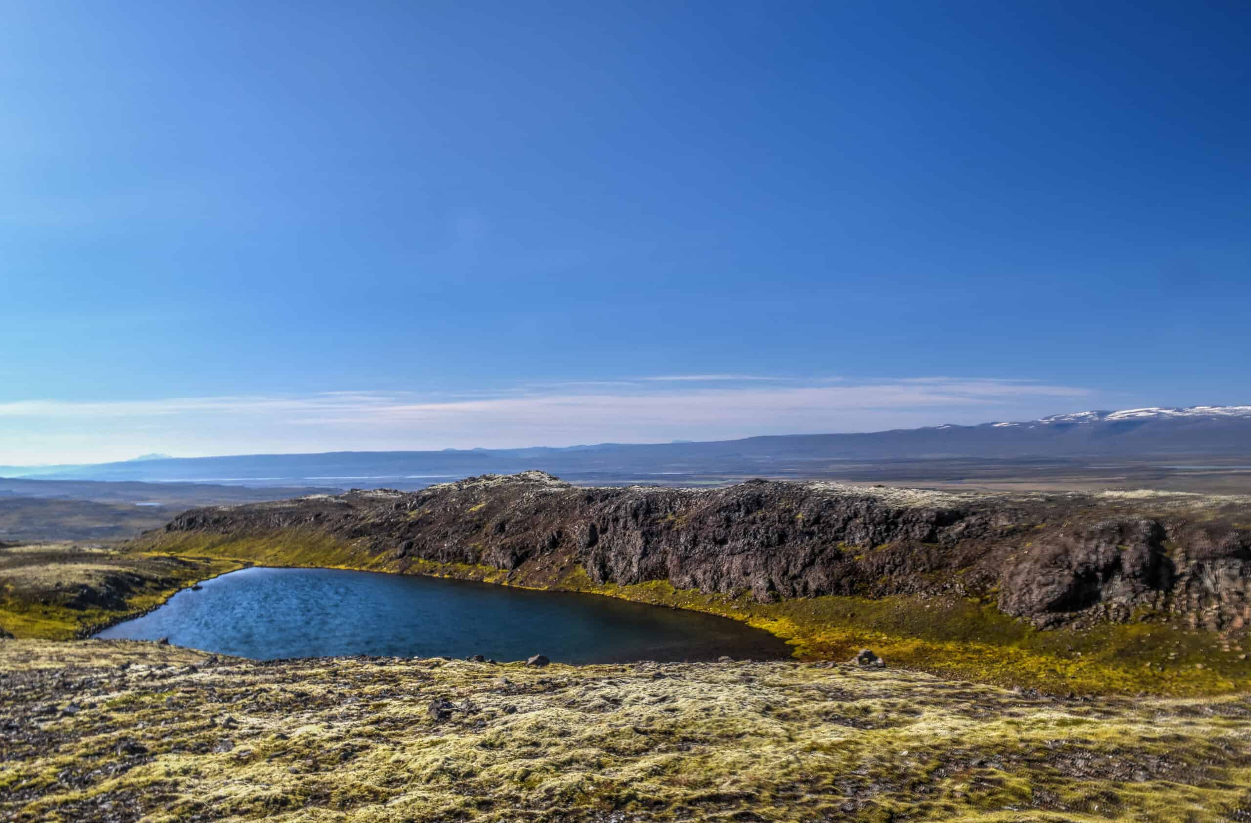
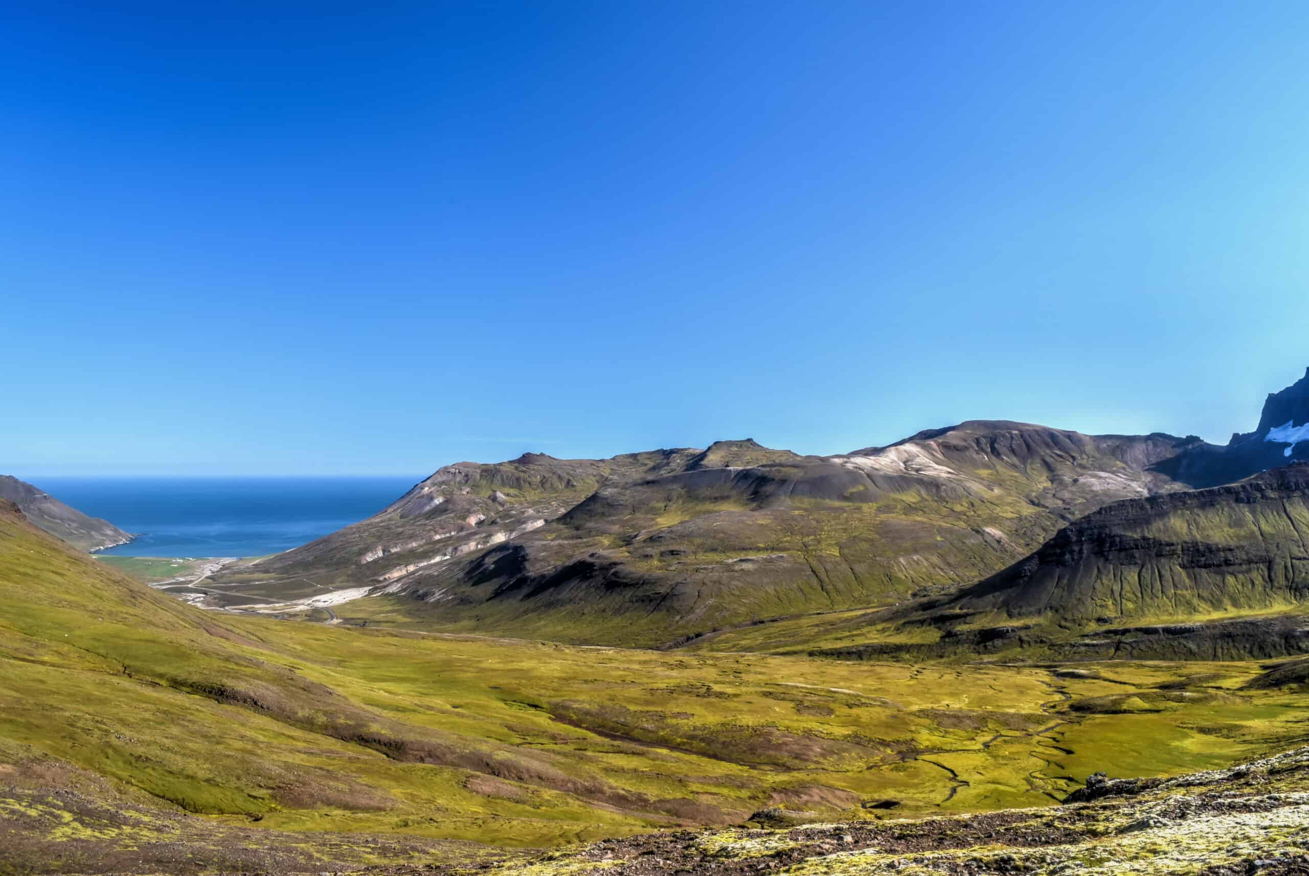
One of the great reasons to come to this area is to experience some of its great hiking trails, such as Stóruð (photos below). It’s also a great spot to see Puffins during the summer months, but they were already long gone when we visited in September.
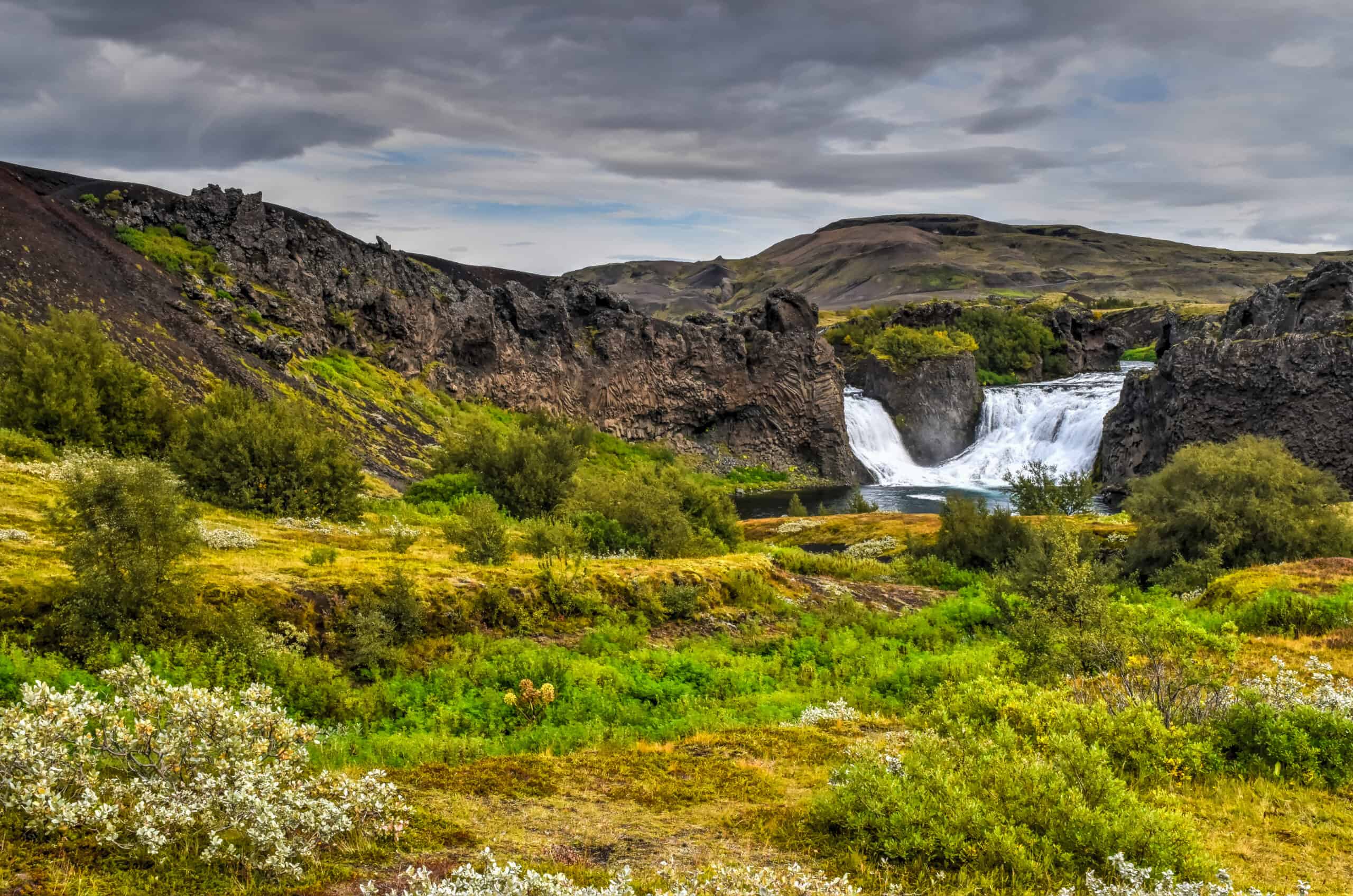
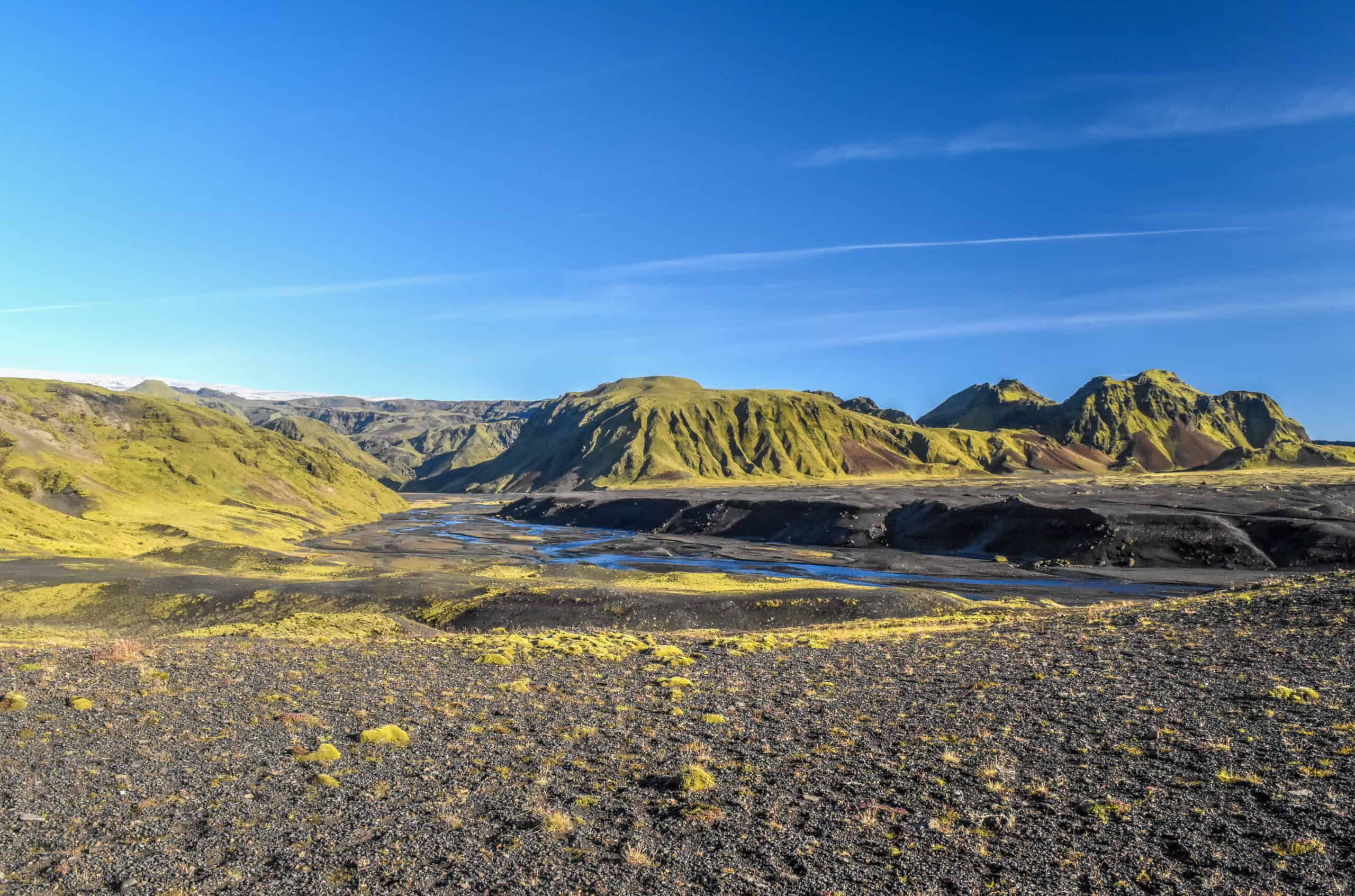
Dettifoss
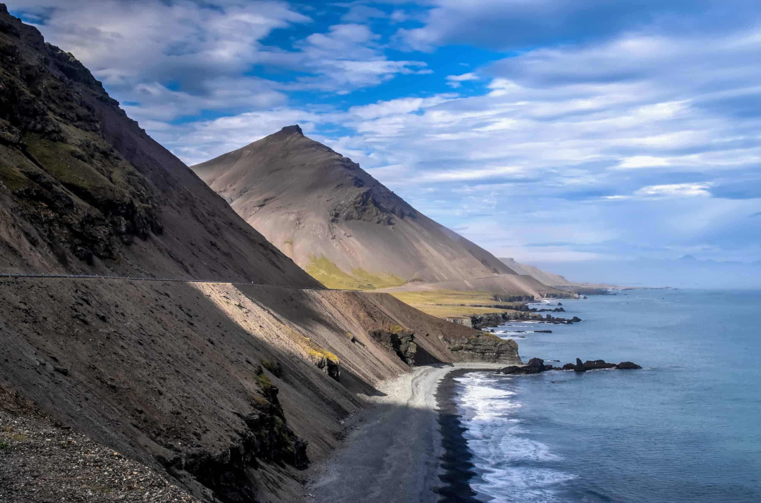
Dettifoss is one of the most impressive waterfalls in Iceland and, in fact, is the most powerful in all of Europe, emptying into the breathtaking Jokulsargljufur Canyon. Each second, 193 cubic meters of water rush through this 100-meter wide and 44-meter tall waterfall.
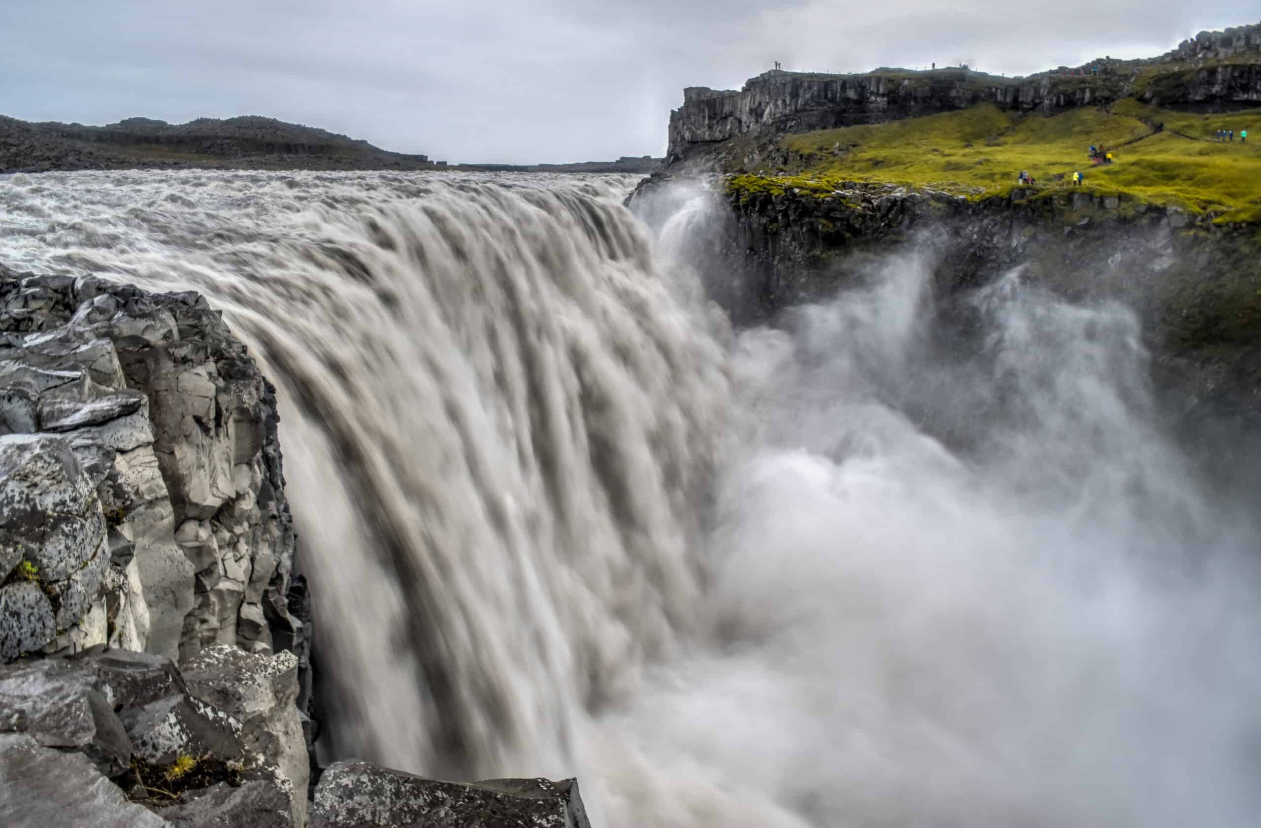
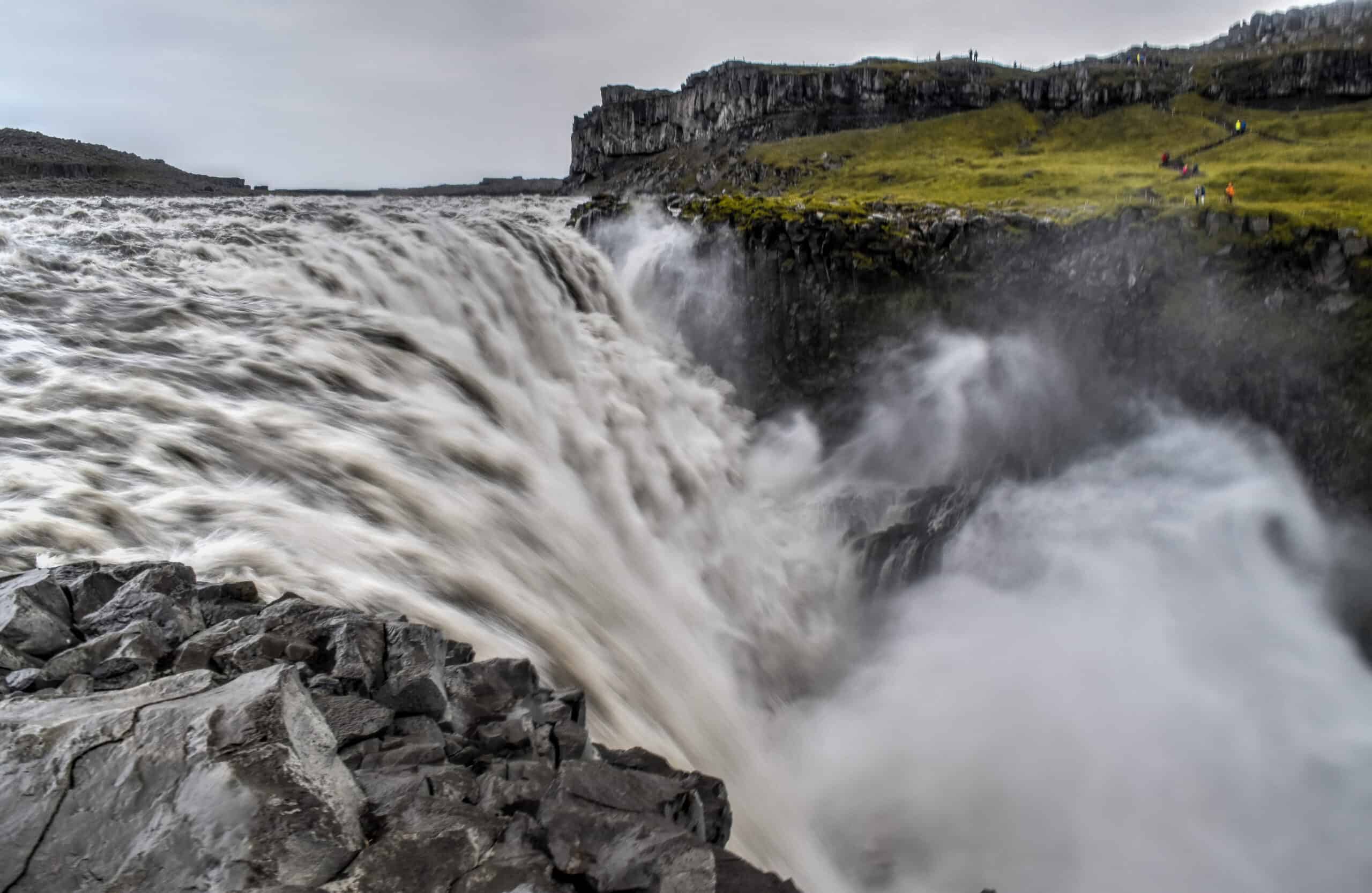
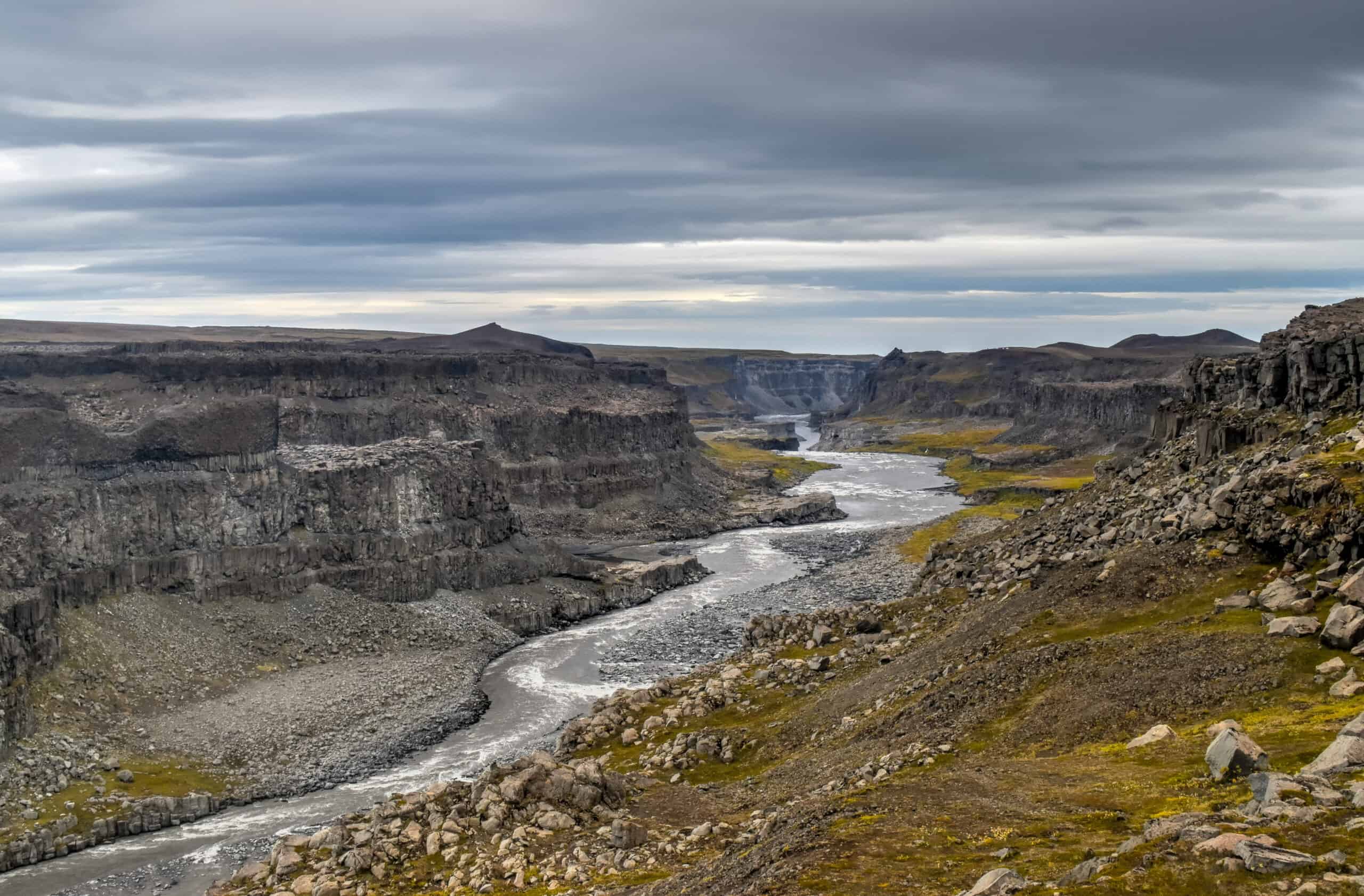
Dettifoss is a bit off the beaten track of the Ring Road, requiring either a 25 or 45min drive north (depending on which viewpoint you want to visit; see next paragraph). But it is well worth the detour as, in addition to Dettifoss, you can also admire the views of the spectacular Jökulsárgljúfur canyon by just looking in the opposite direction of the falls (second picture above) and visit Hafragilsfoss, which lies just a few hundred meters further down (north) the canyon. And if you walk a few hundred meters in the other direction (south) you’ll up across Selfoss (not pictured here) upstream of Dettifoss.
Viewpoint access: Note that there are actually two access points and parking lots to view the falls, one from the east and one from the west. We chose the one to the east as it offers the best viewpoints and you can get much closer to the falls, but we had to travel on a slower (45 min) bumpy gravel road (864) to get there. The viewpoint to the west however is more easily accessible (paved road) and only takes about 25 min to get there. If you are really keen on seeing both viewpoints, know that the shortest route between them takes about 1 hr.
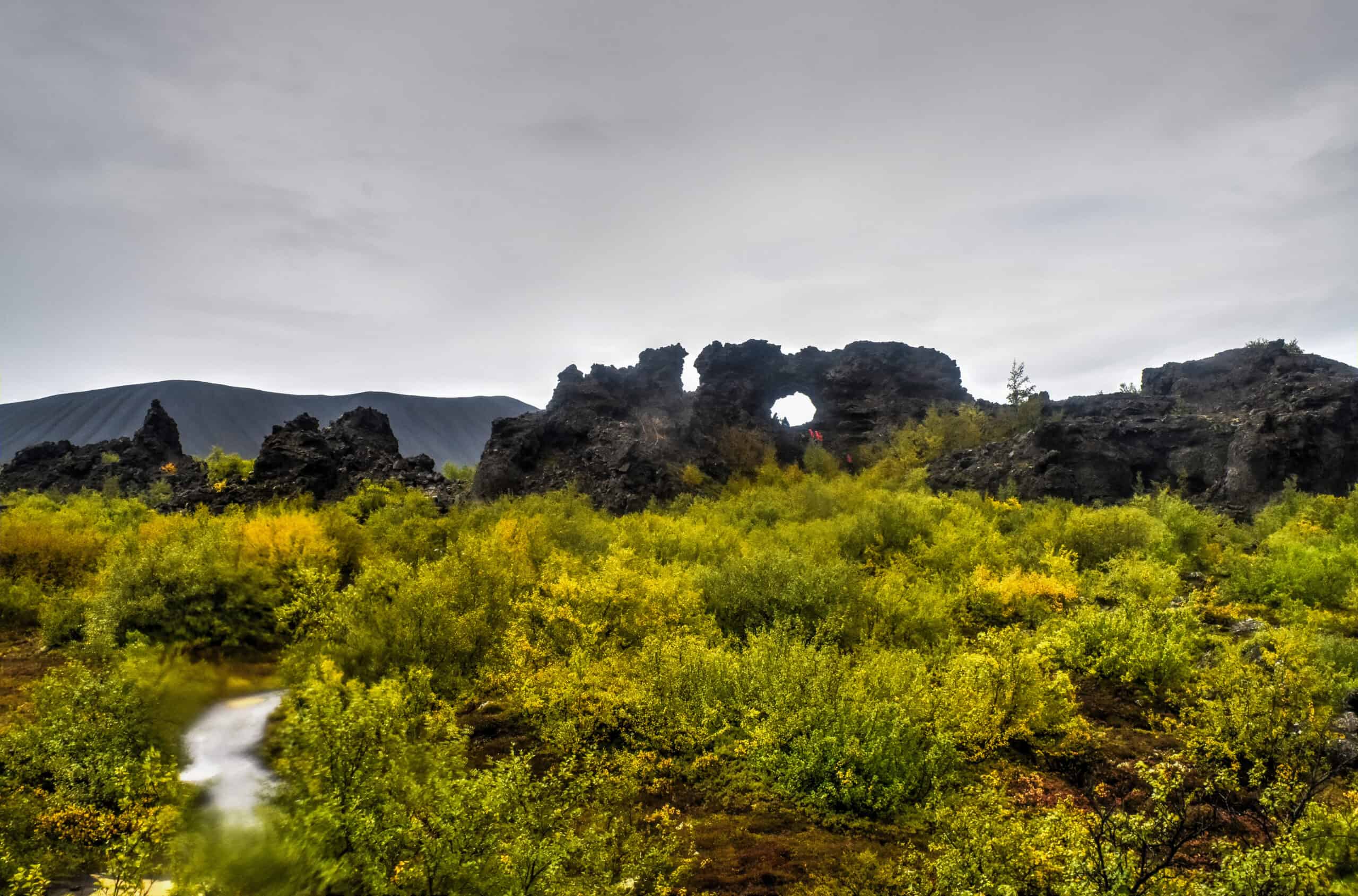
Myvatn, Hverir, and Godafoss
Lake Mývatn is Iceland’s fourth-largest body of water and, while a beautiful lake, it is more its immediate surroundings that are the true draw to the area. Among these, you’ll find some incredible geological features, true Martian landscapes and hot springs rivalled only the Blue Lagoon near Reykjavik.
The most impressive area to us was the Hverir Geothermal Area, which instantly gave us the impression to have somehow landed on a geologically active Mars. The barren and dramatic red landscapes around Mount Námafjall and the swirling steam emanating from the fumaroles provide a unique setting like no other.
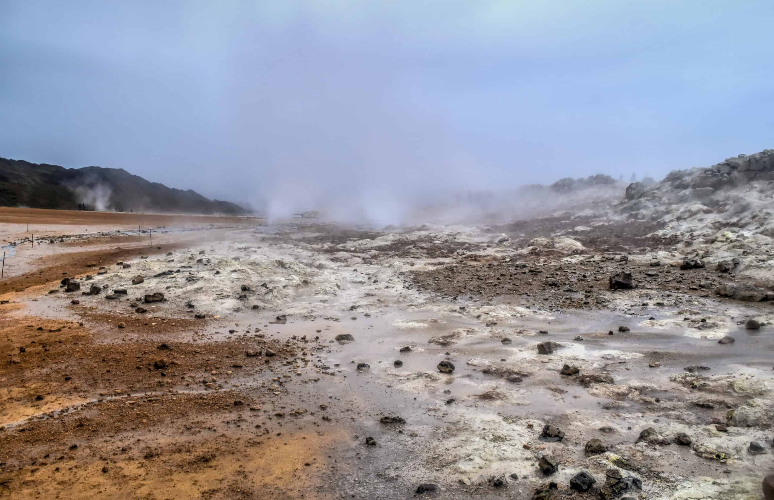
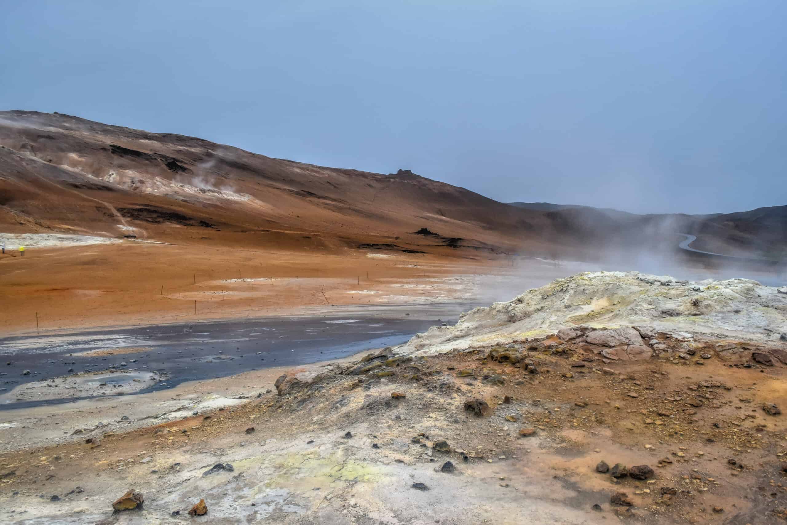
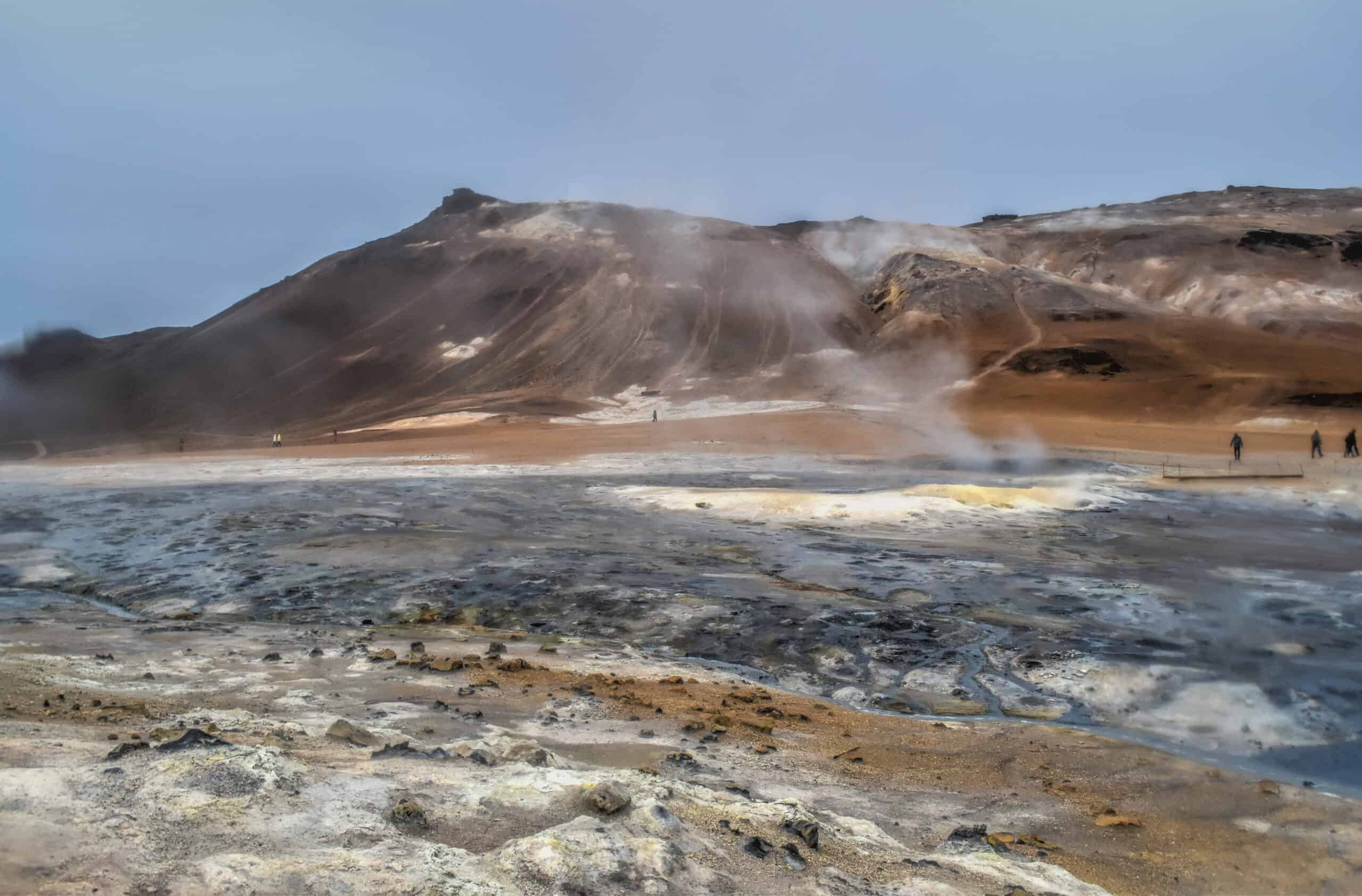
Be sure to stick to the walking paths though, as the ground around the fumaroles is unstable and filled with boiling water.
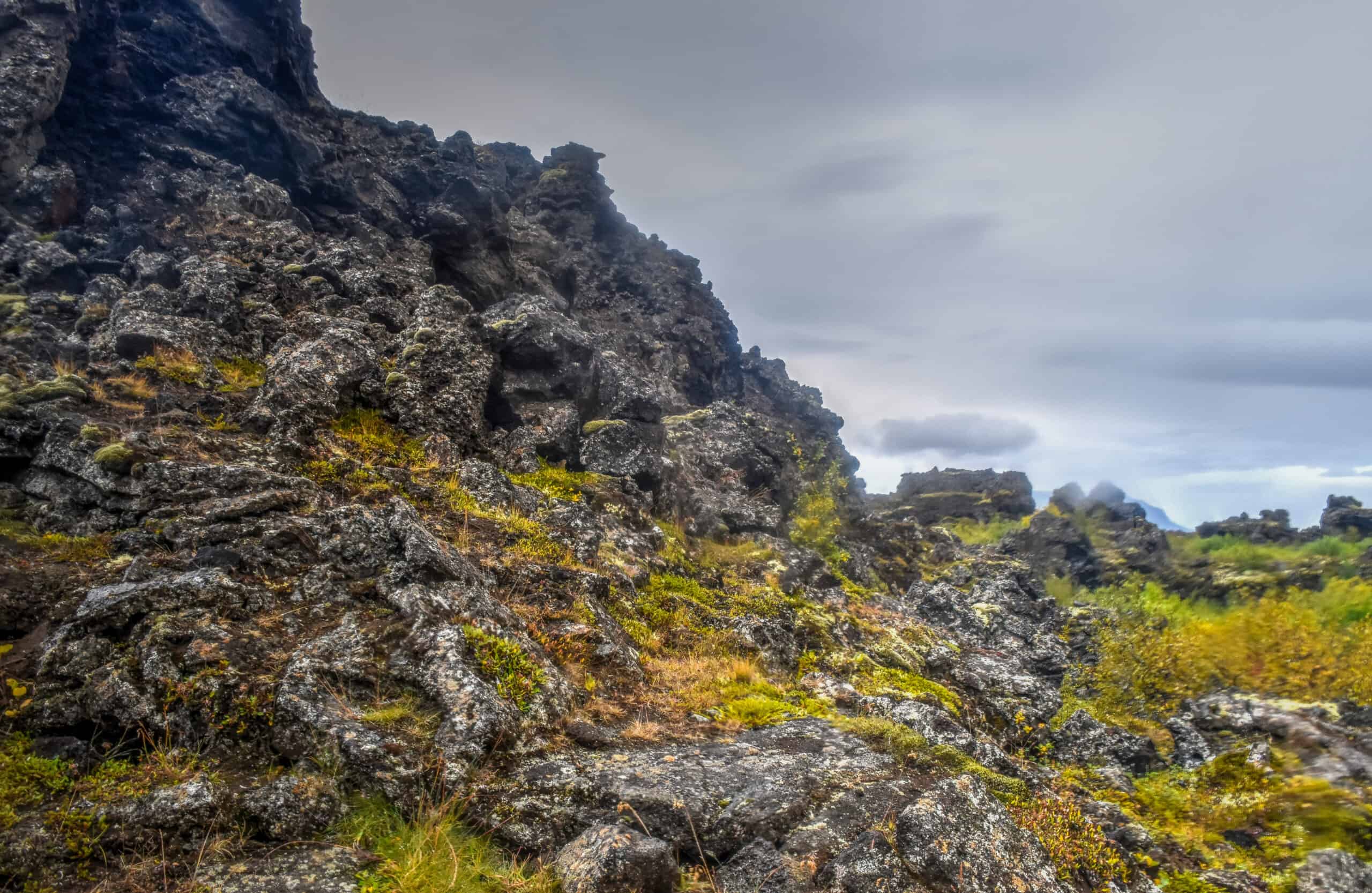
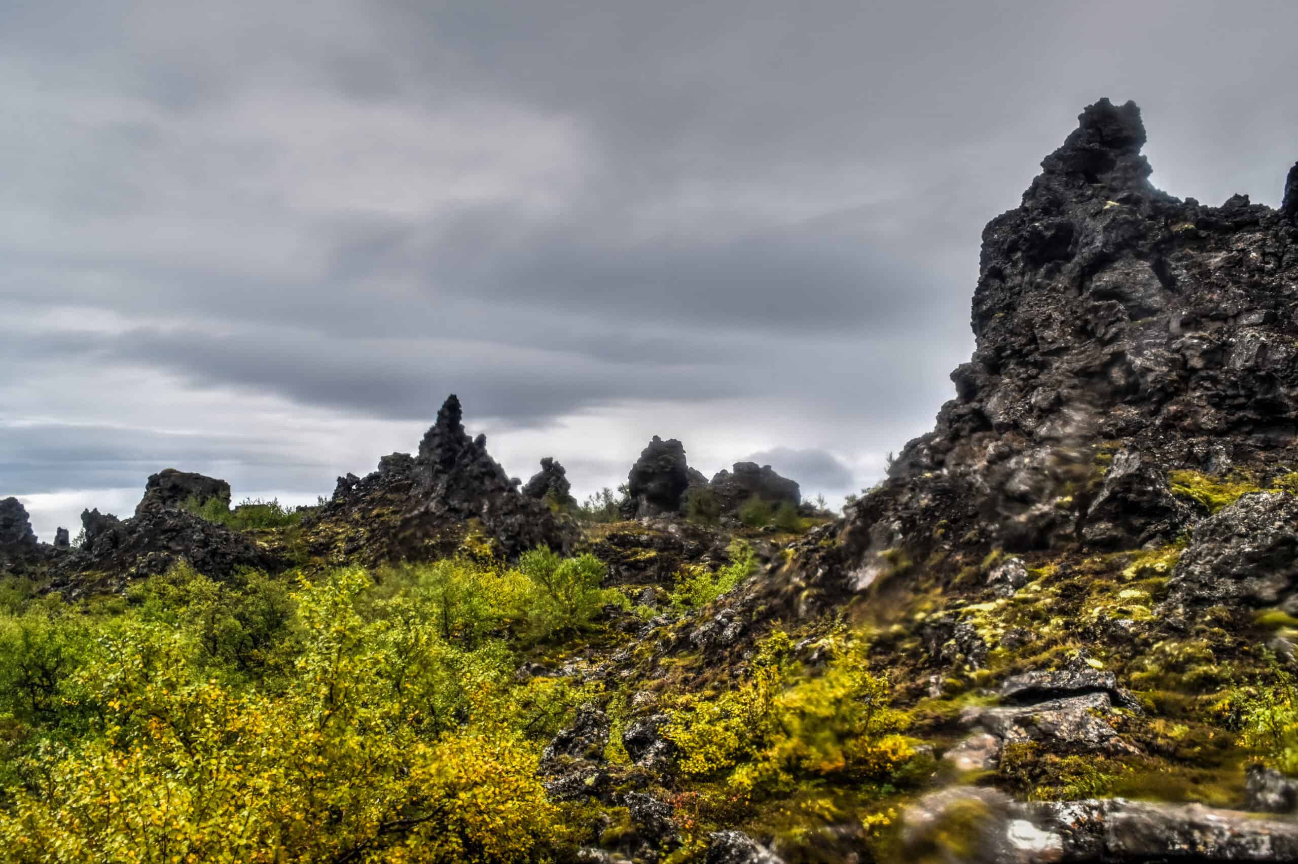
Closer to Lake Myvtan you’ll find the Dimmuborgir lava field. There are short walking paths throughout the lava field that will allow you to explore the wide variety of lava formations that can be found here. A 10 min drive north of the Dimmuborgir parking lot, you’ll find the parking lot for Grjótagjá, a hot spring cave renowned for its pristine beauty and azure waters and made famous by a Game of Thrones scene.
Finally, in need of a relaxing break from all that exploring? Look no further than the Myvatn Nature Baths! These Nature Baths are geothermally heated pools and one of the top attractions in North Iceland. Although the baths are less opulent and more basic than those found in the Blue Lagoon, the entrance fee is also significantly cheaper, providing a great alternative for those not wanting to splurge at the Blue Lagoon.
As you can see, all 4 sites described here are in very close proximity to each other on the east side of Lake Myvatn.
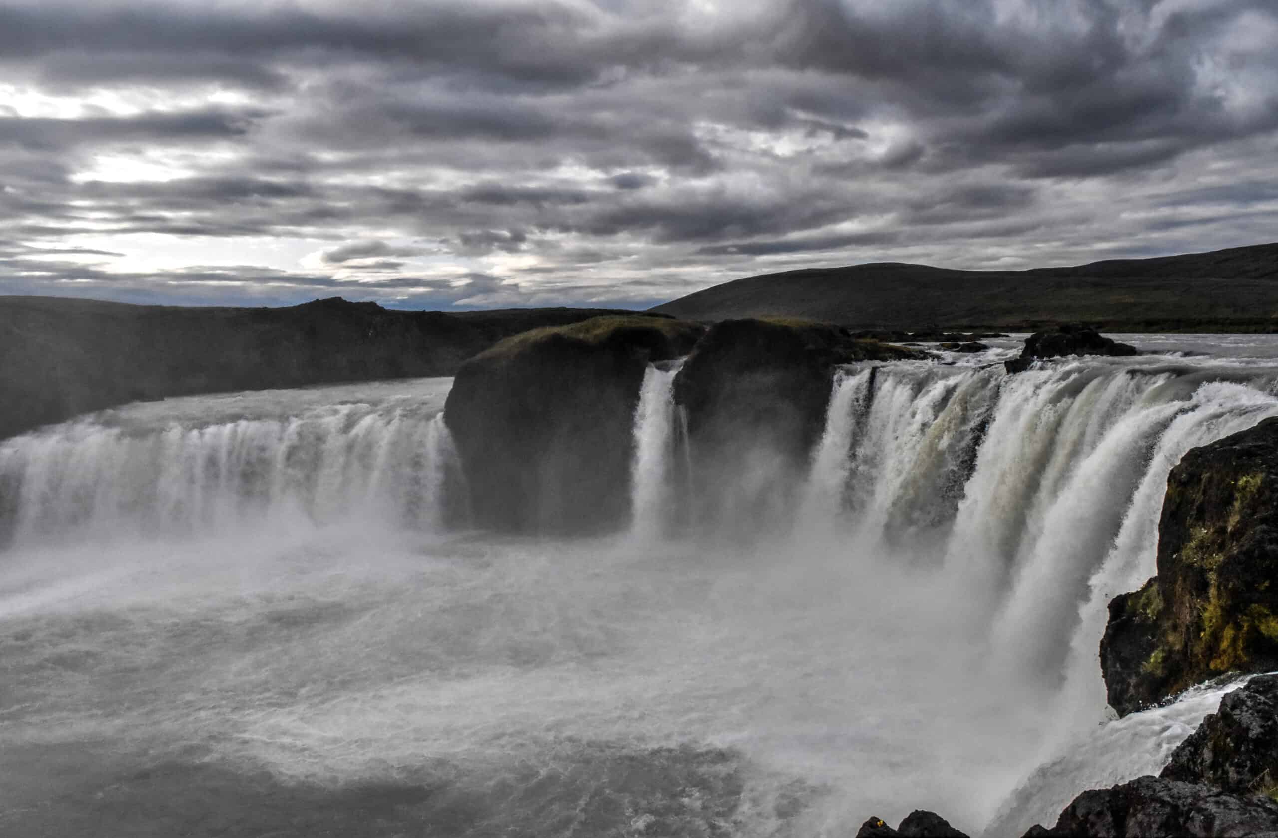
Finally, continue west and you will come across the spectacular Godafoss, literally meaning waterfall of the gods, perfectly located along the Ring Road halfway between the scenic Lake Myvatn area and Akureyri.
Map of top things to see and do in Northeast Iceland
Sights of Northwest Iceland
Akureyri
Akureyri, North Iceland’s unofficial capital (and Iceland’s second-largest city) straddles the line between Northwest and Northeast Iceland and is worthy at the very least of a quick stop to stretch your legs and stock up on supplies.
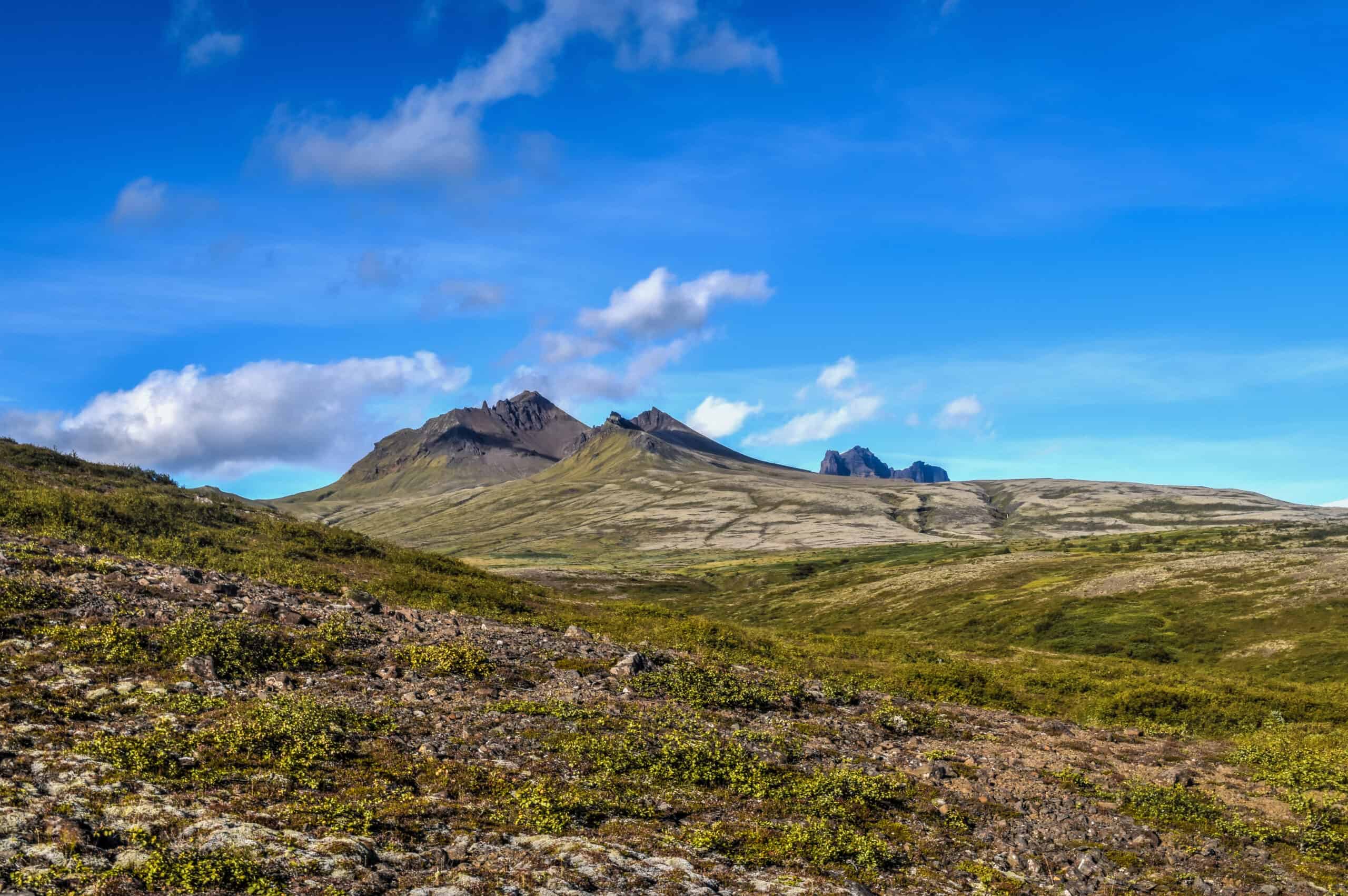
Tröllaskagi (Troll peninsula)
Tröllaskagi is a scenic peninsula that lies to the west of Eyjafjorður, the fjord in which Akureyri, is nestled, and to the east of Skagafjörður. It is in part renowned for its enormous mountains, with several exceeding 1,000 metres (3281 ft) in height (Mount Kerling actually exceeds 1,500 metres).
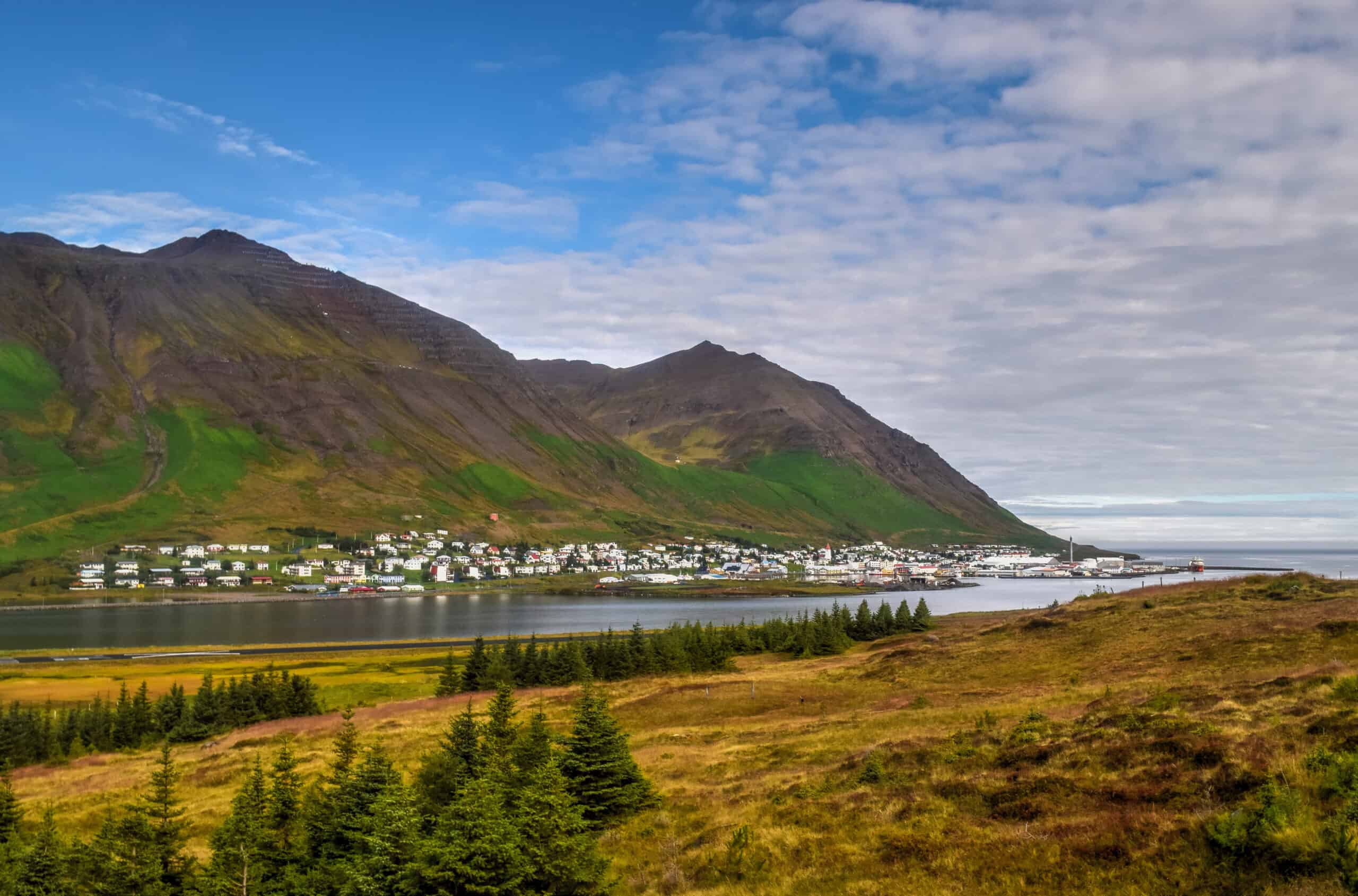
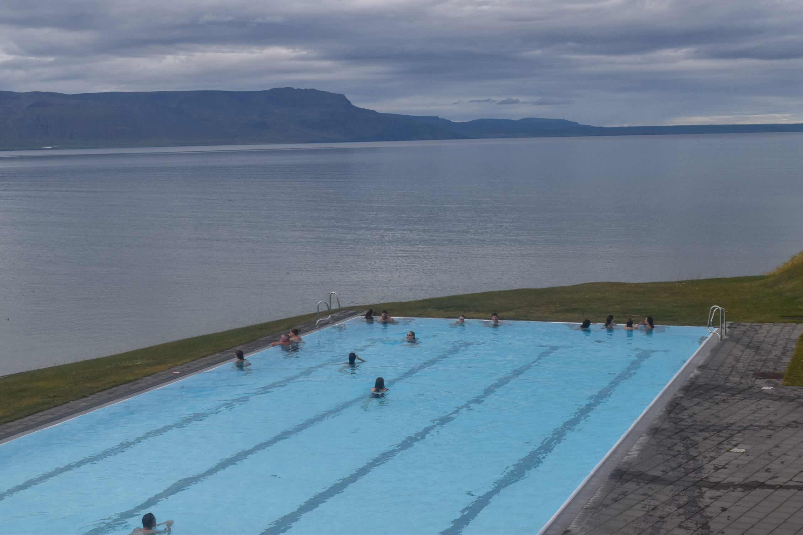
Aside from the scenic drive, the most popular towns for visitors are Hofsós (with its outdoor swimming pool with stunning views) and Siglufjörður. Siglufjörður is truly the gem of the Tröllaskagi towns — a timeless fishing town, filled with bright colours and set in a stunning setting between the fjord and mountains.
The Tröllaskagi Peninsula is a worthy detour from the Ring Road. Keep in mind that with brief stops in at least Hofsós & Siglufjörður, you should set aside a good 5-6 hours. The drive itself around the peninsula is just under 4 hours if you were to drive it non-stop, but with stunning scenery all around you’ll likely want to make a few stops to take it all in.
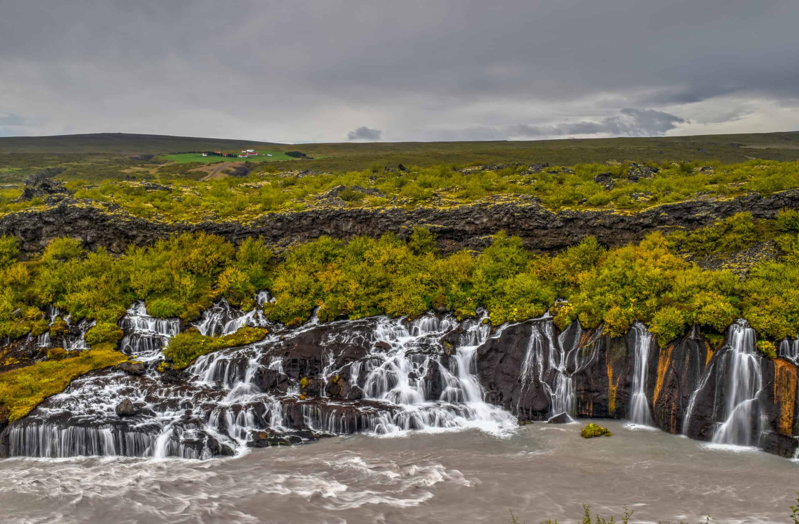
Hraunfossar
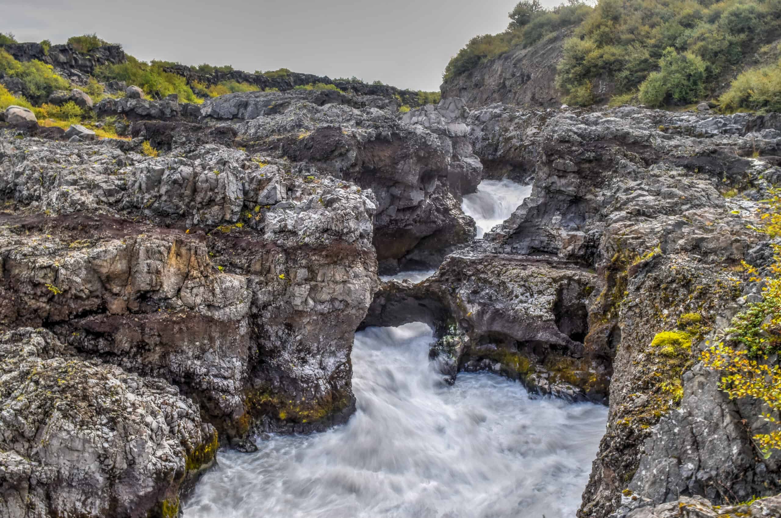
Once you’ve rejoined the Ring Road after completing the Tröllaskagi loop, you will be about 3 hours away from Husafell, the nearest settlement (and a good place to spend the night if in the area) to the majestic Hraunfossar waterfalls. These waterfalls actually consist of small streams of water flowing at the edge of the Hallmundarhraun lava field. And a few steps to the east (literally a few steps) you will find Barnafossar, a waterfall that resembles a series of rapids through a narrow passage of volcanic rock (see third picture below).
These falls are somewhat off the beaten track of the Ring Road, as you’ll need to drive east for roughly 30 min from where the Ring Road crosses Highway 50. Given that there isn’t that much else to see in the area, it might not be worth the detour for most just passing through, but it was perfect for us as we stayed at the nearby Husafell campground, which was located in an ideal location midway between Snæfellsnes peninsula (where we were coming from) and Þingvellir National Park (where we were headed the next day).
Map of top things to see and do in Northwest Iceland
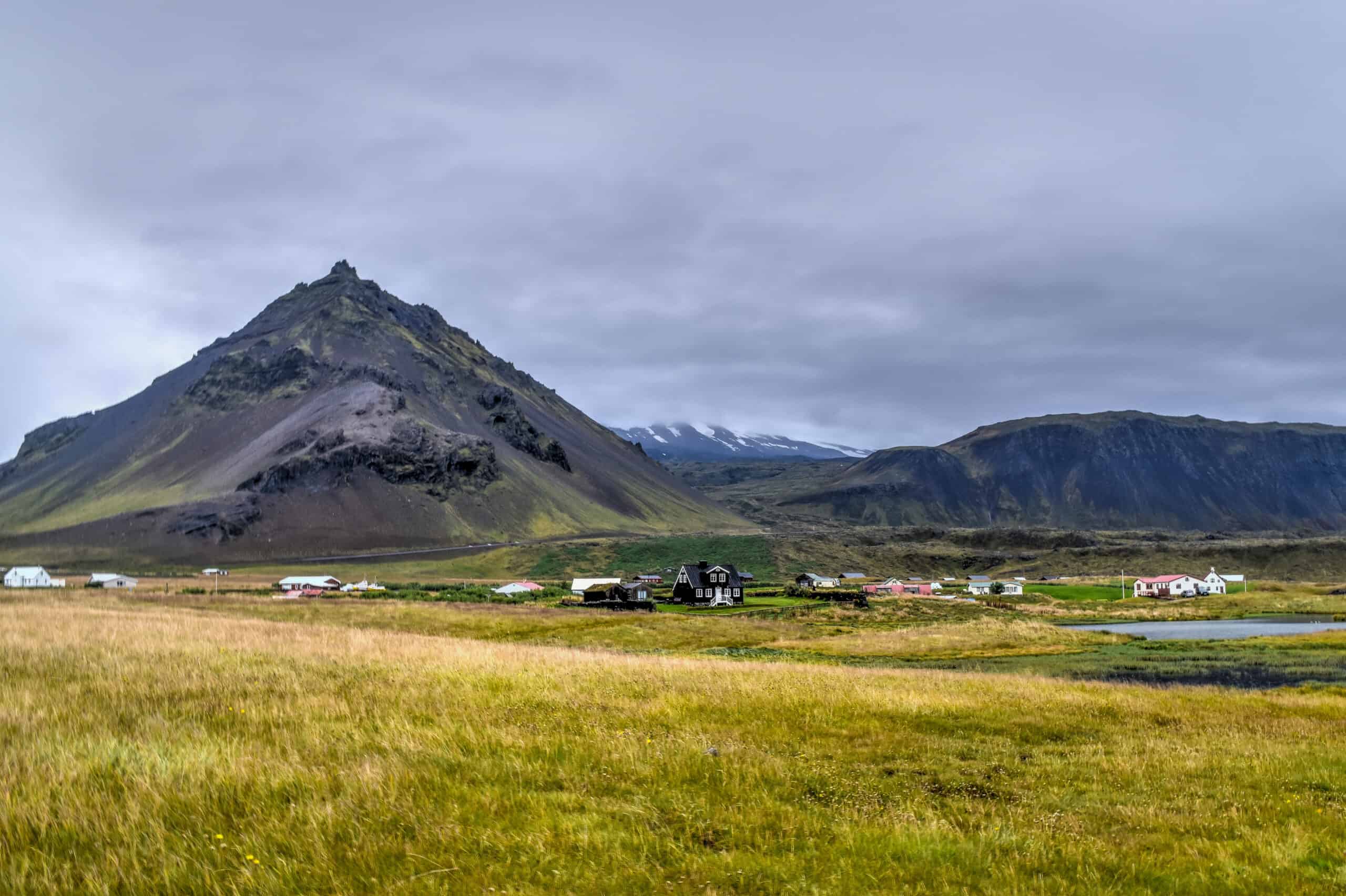
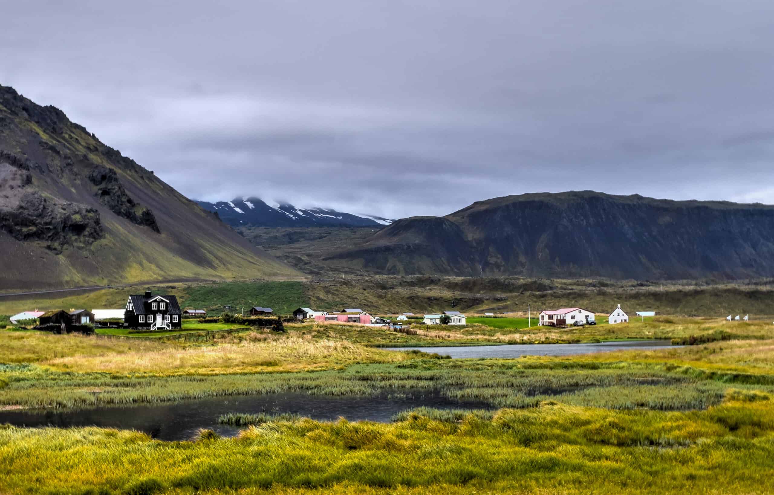
Snæfellsnes peninsula
Snæfellsnes is a large peninsula extending 90 km from West Iceland, between the Reykjanes Peninsula to the south and the Westfjords to the north. The Snæfellsnes peninsula is often referred to as a “Miniature Iceland”, because of the diversity of its beautiful and stunning landscapes not unlike what you’ll find elsewhere around Iceland. Snæfellsnes peninsula is the perfect place to visit if you only have a few days in Iceland and most of the key sites listed below can be visited in a day.
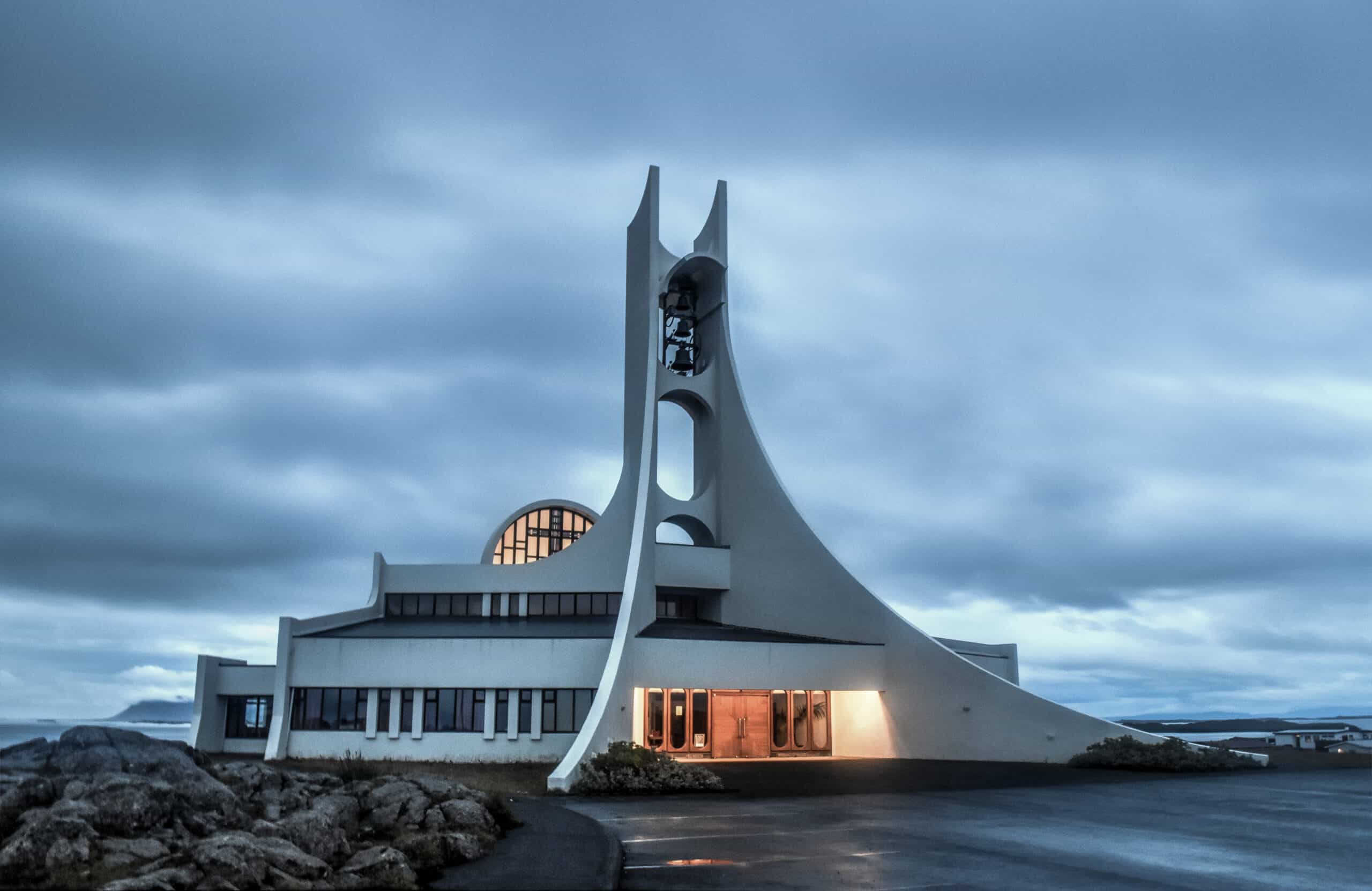
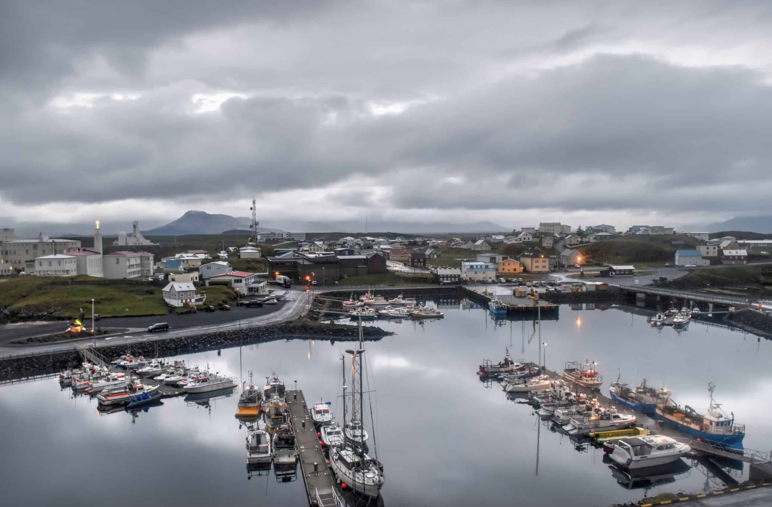
The first place worthy of a stop is the town of Stykkishólmur (we spent the night at the local campground). Stykkishólmur is a charming town with colourful houses and a picturesque harbour. Stopping by Stykkisholmskirkja is also worth your time, as it’s one of Iceland’s few modern-looking churches with impressive and unique architecture.
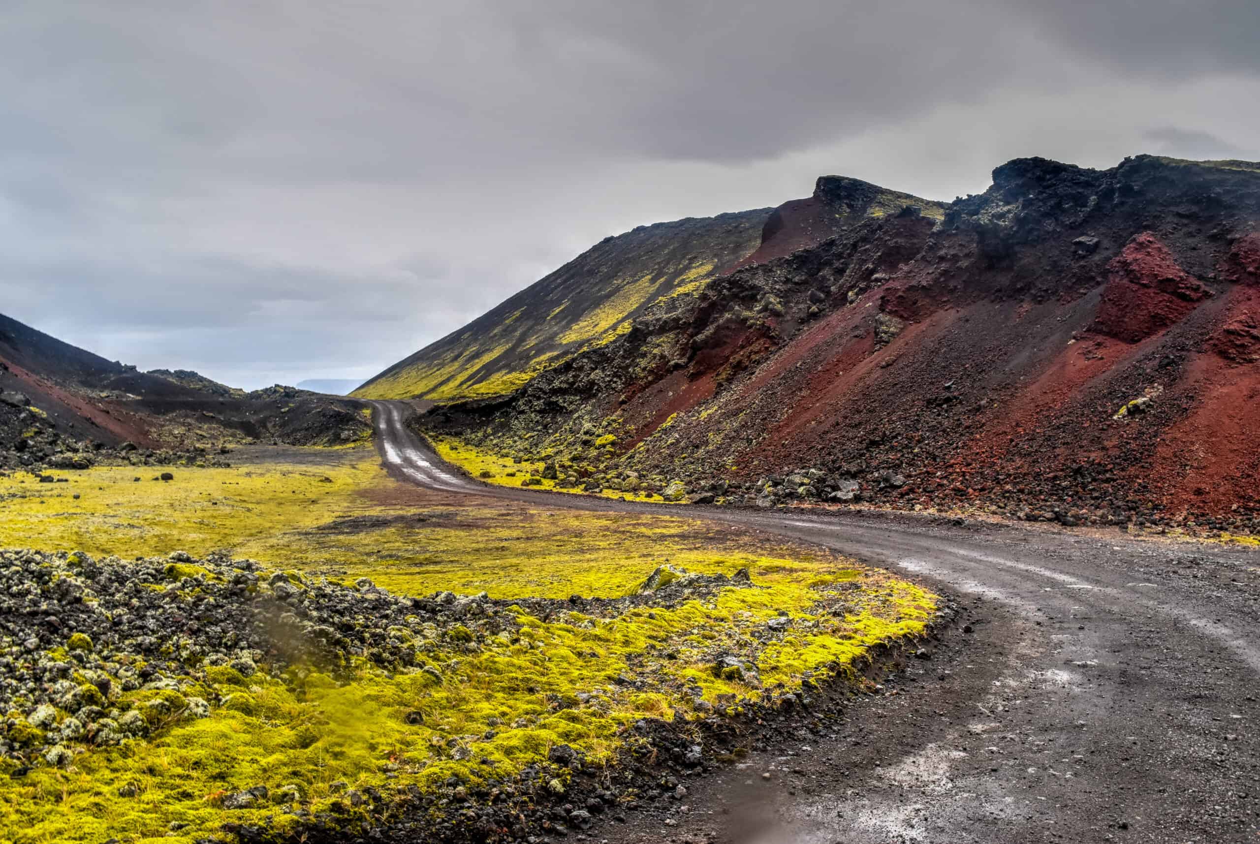
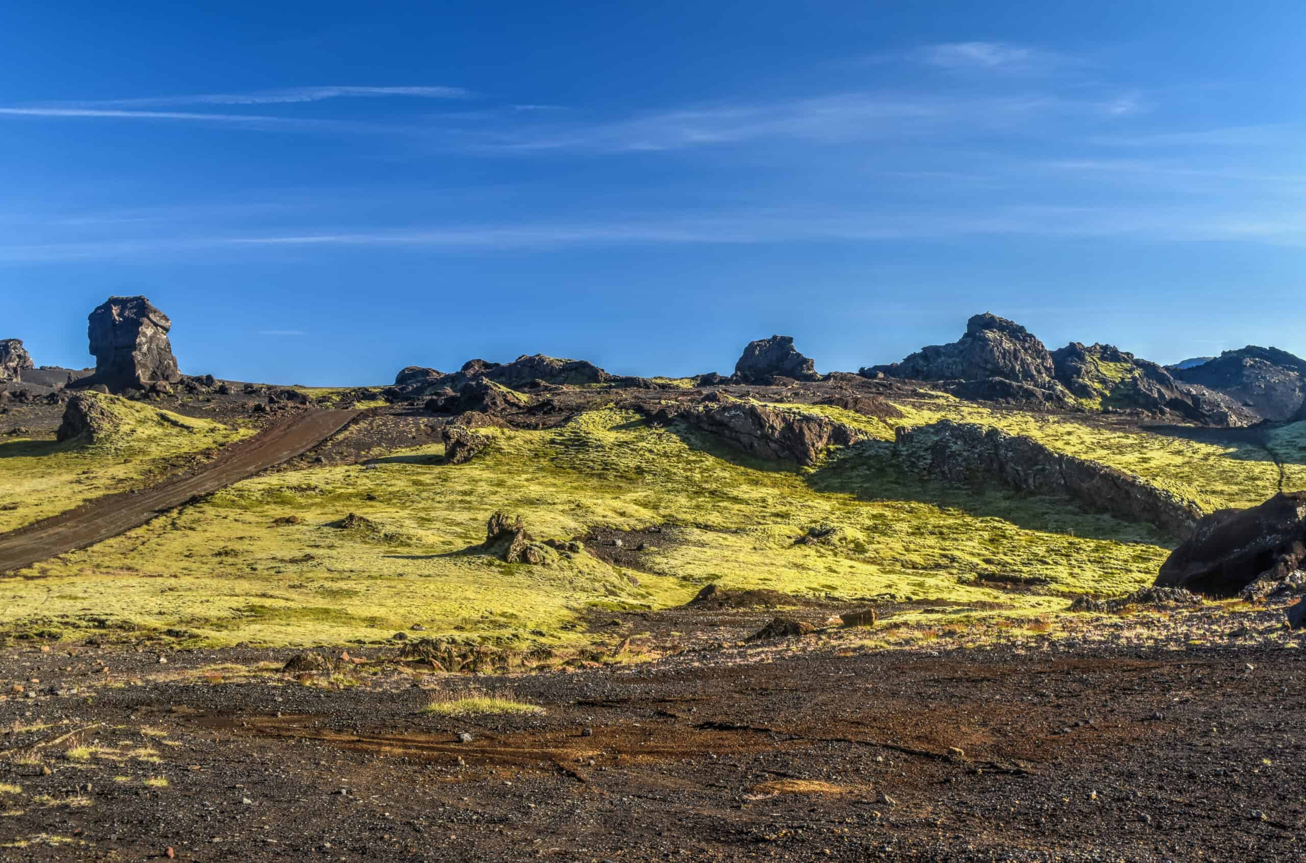
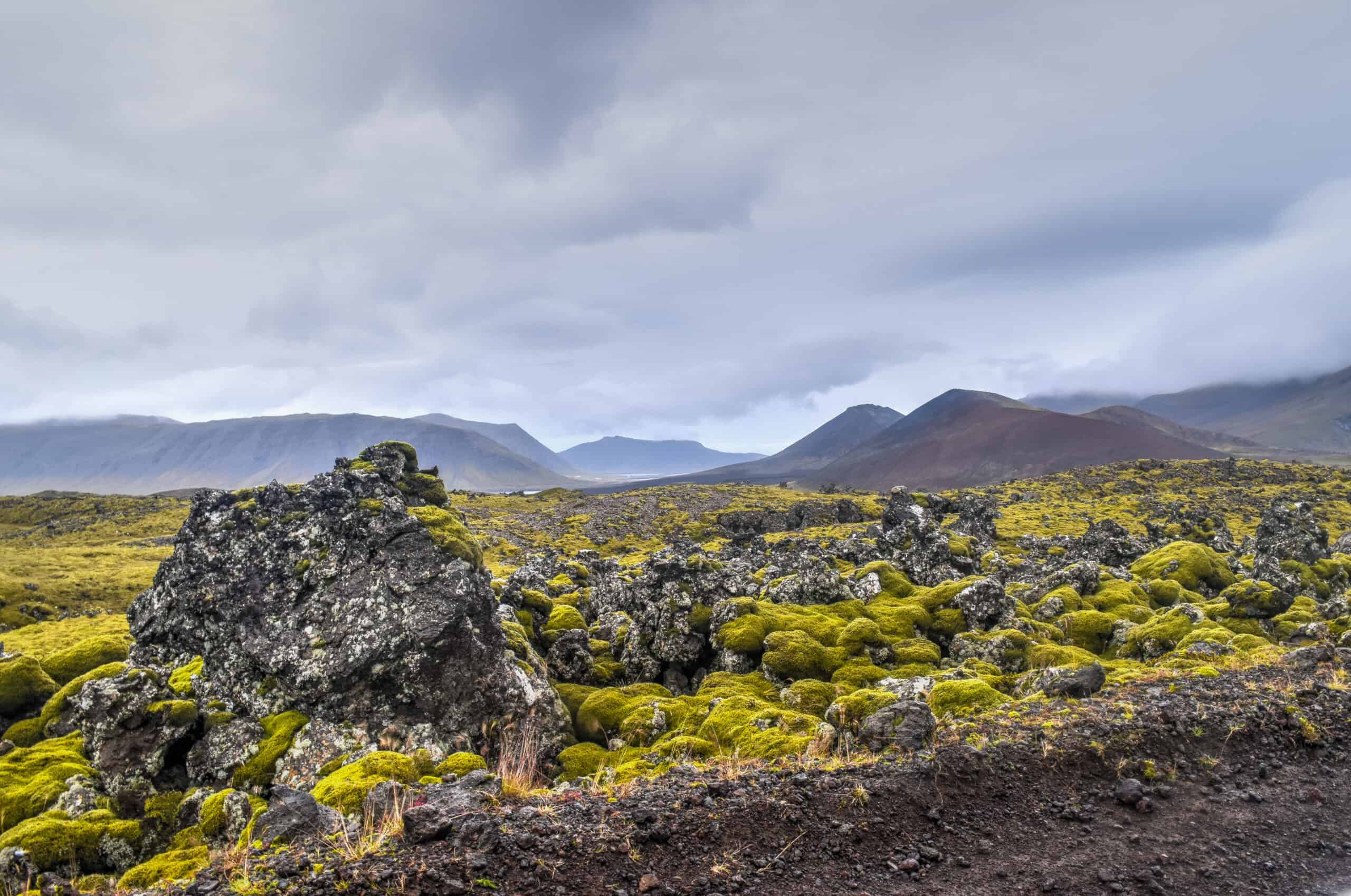
Heading further west you will come across the Berserkjahraun lava field, which was one of our favourite places to drive in Iceland. In fact, one of the best ways to visit the area was to slowly drive around the bumpy gravel loop road that goes around and through the 4000-year-old lava field. The landscapes here are completely otherworldly.
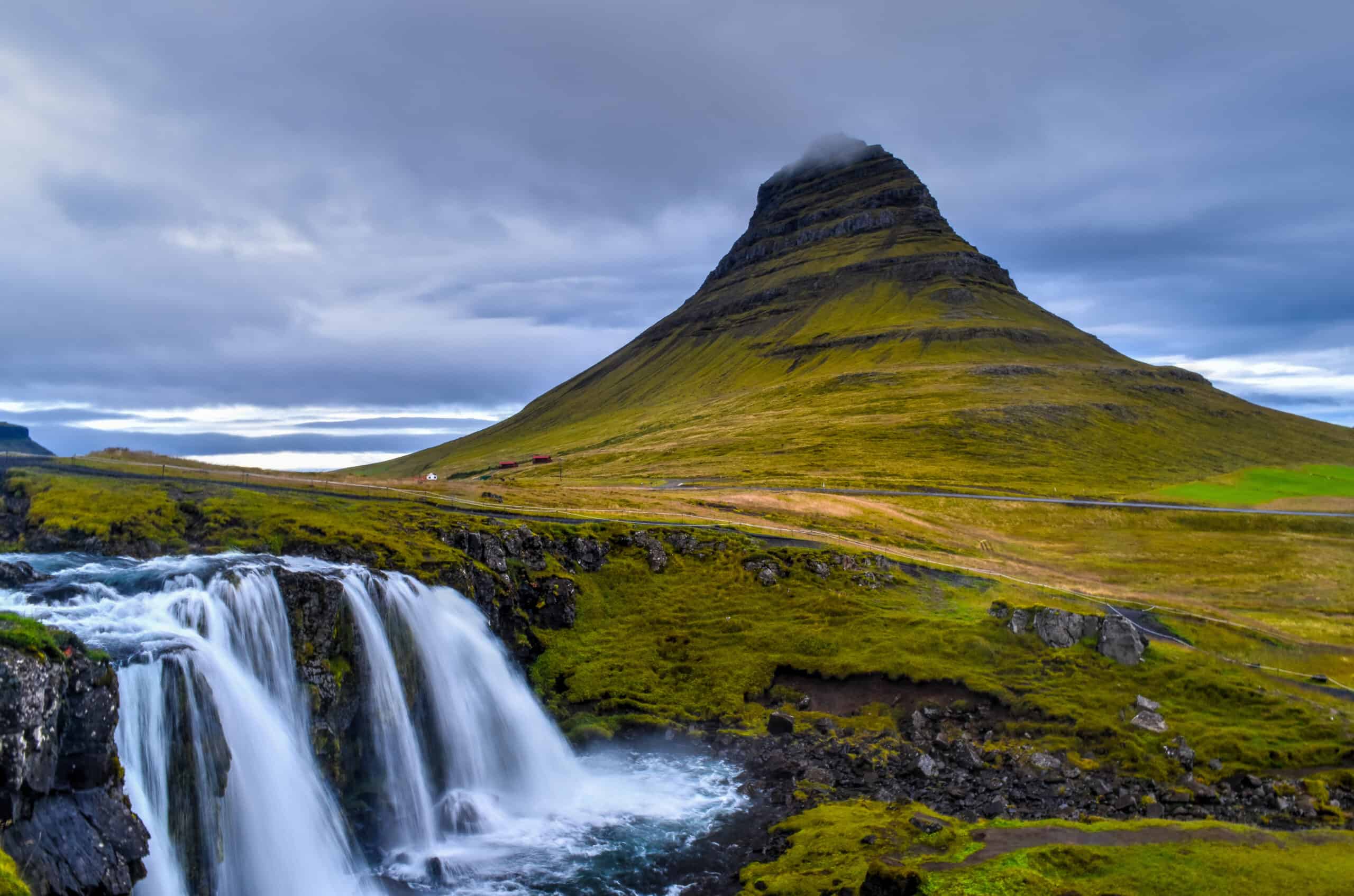
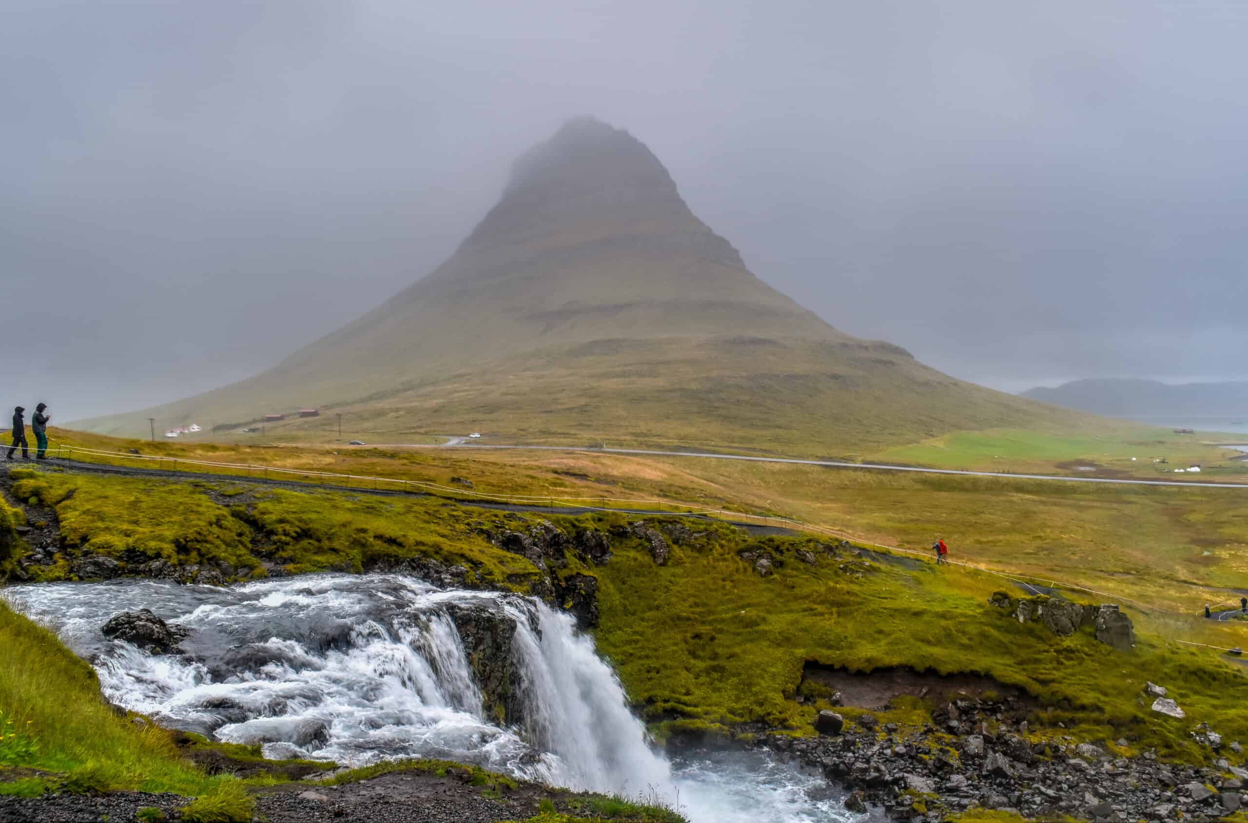
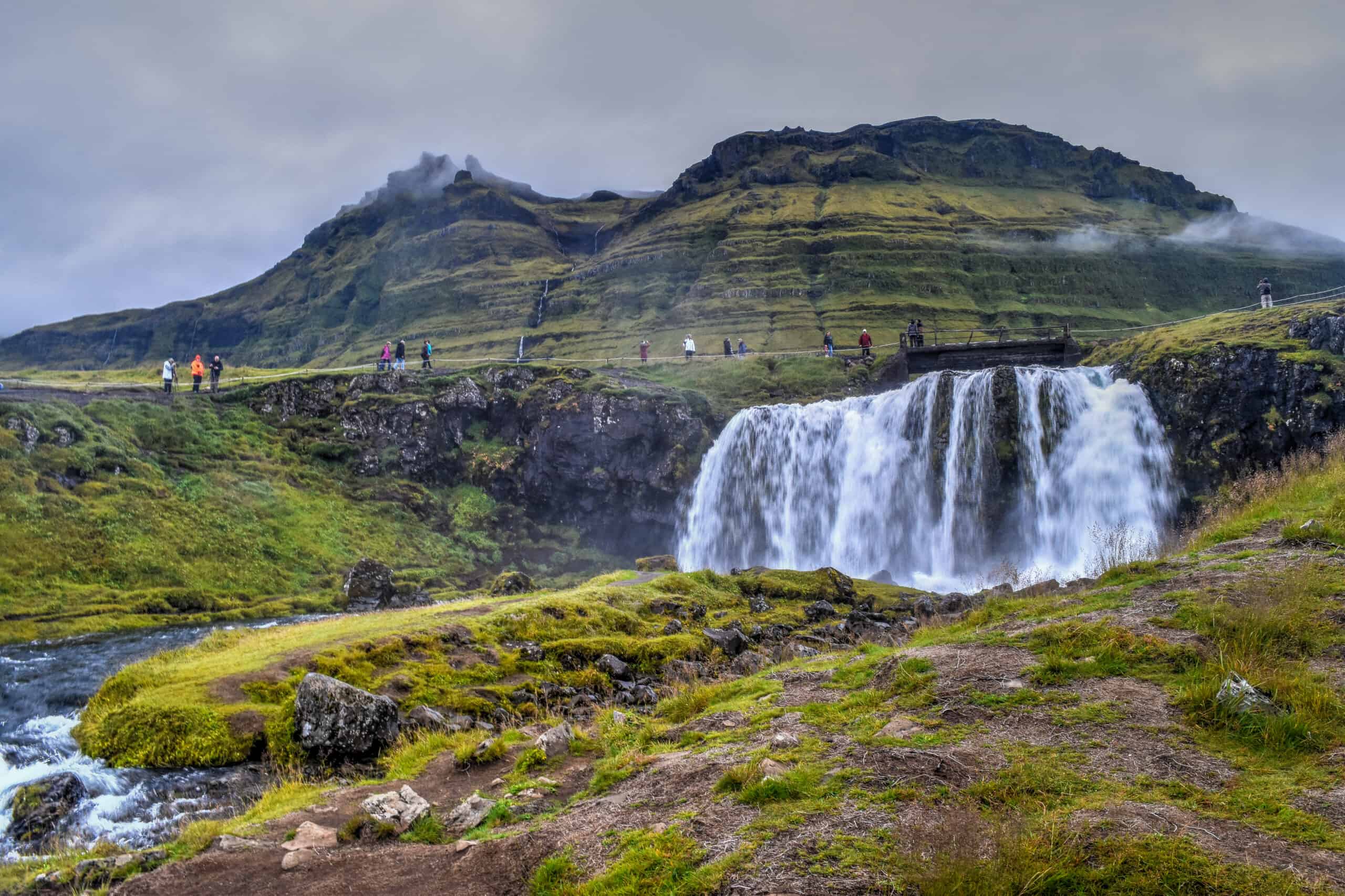
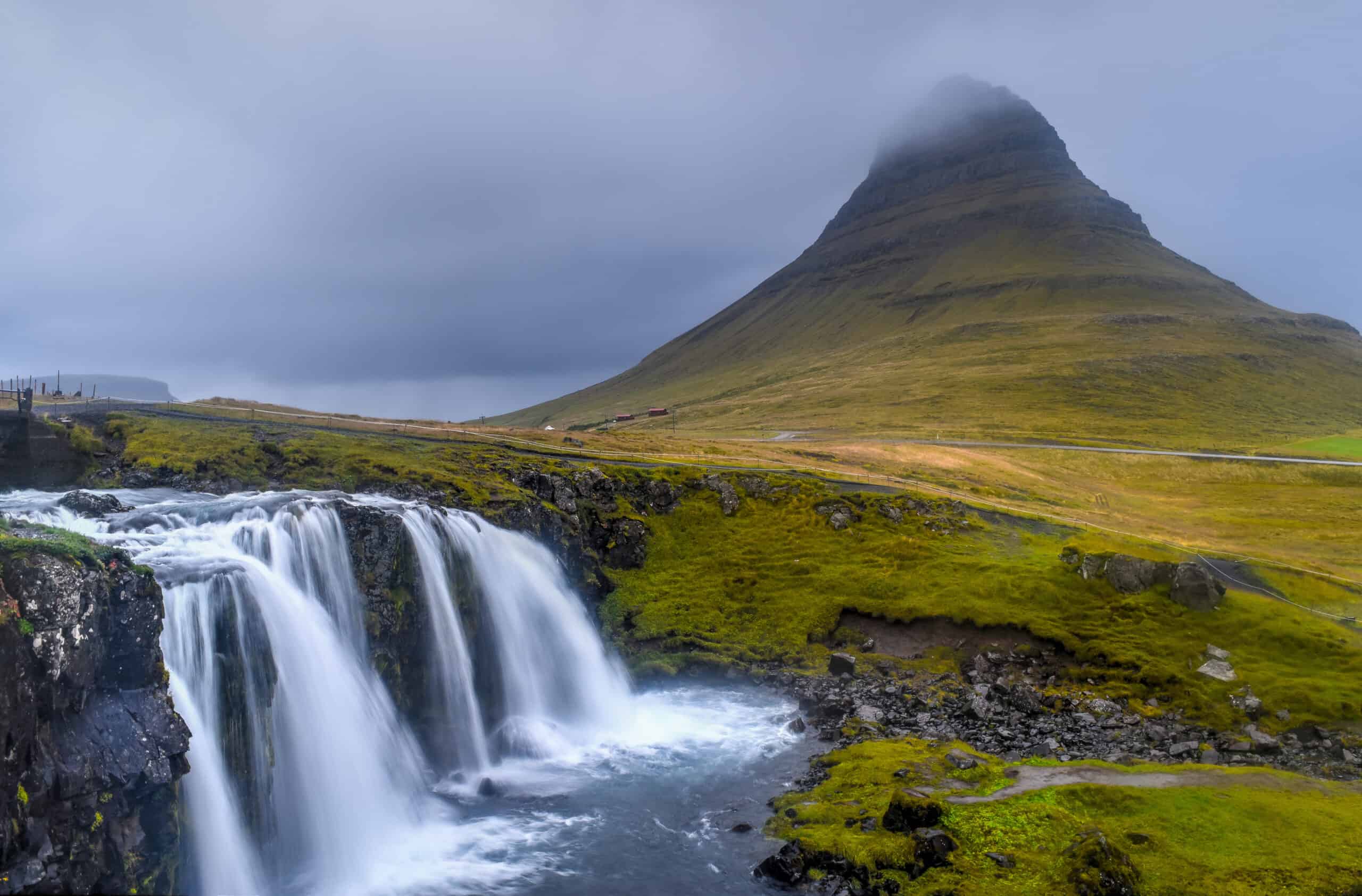
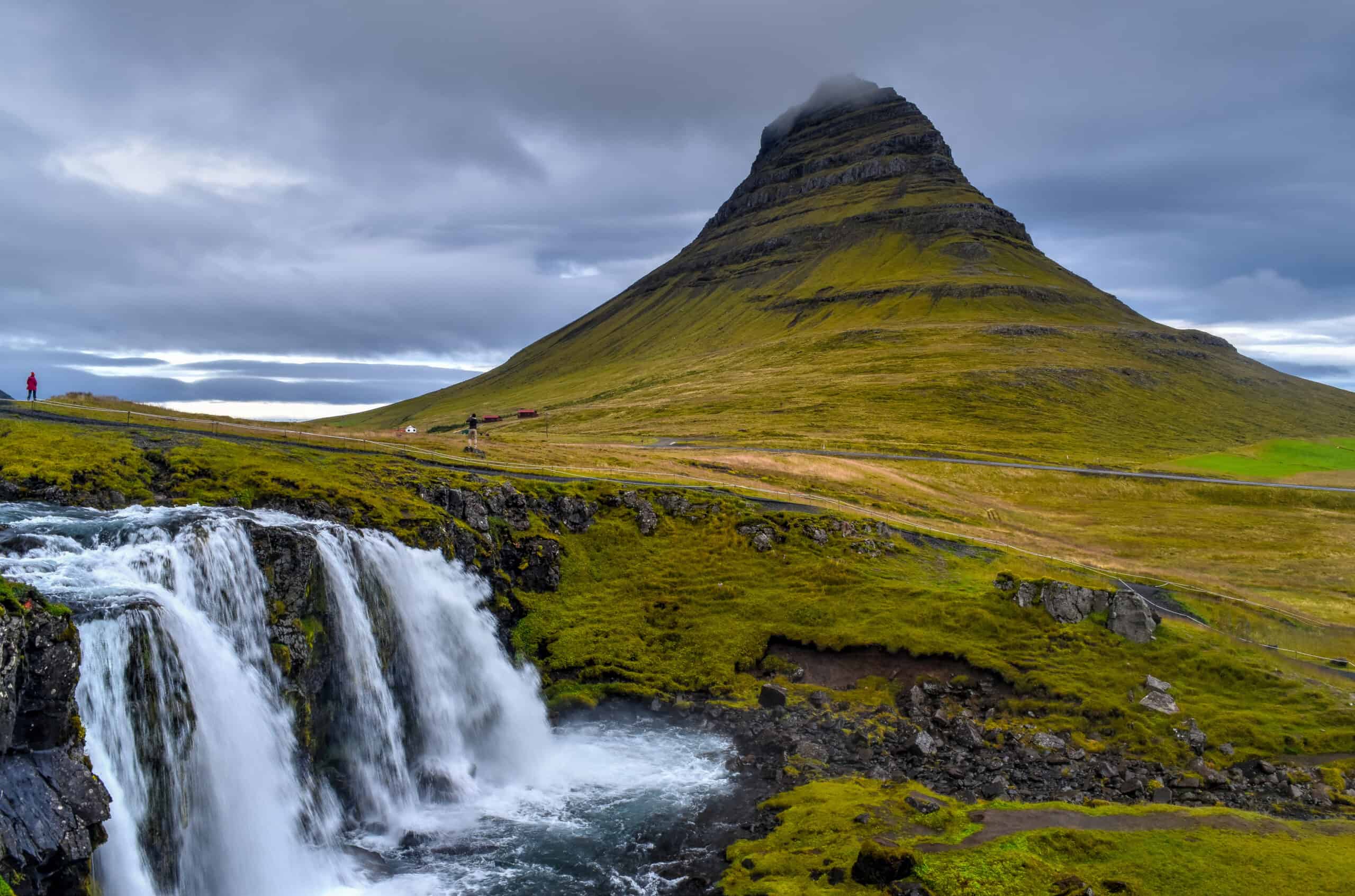
After touring the lava field, brace yourself for one of the most photographed waterfalls in Iceland, Kirkjufellsfoss, made famous in part of the scenic backdrop offered by Mount Kirkjufell and its distinctively shaped peak.
Once you reach the western point of Snæfellsnes you will have entered Snæfellsjökull National Park, where there are several sights of interest that offer great opportunities to stretch your legs and admire spectacular coastal scenery.
Skarðsvík Beach is a beautiful and rare golden sandy beach in Iceland, encompassed by dark volcanic rocks.
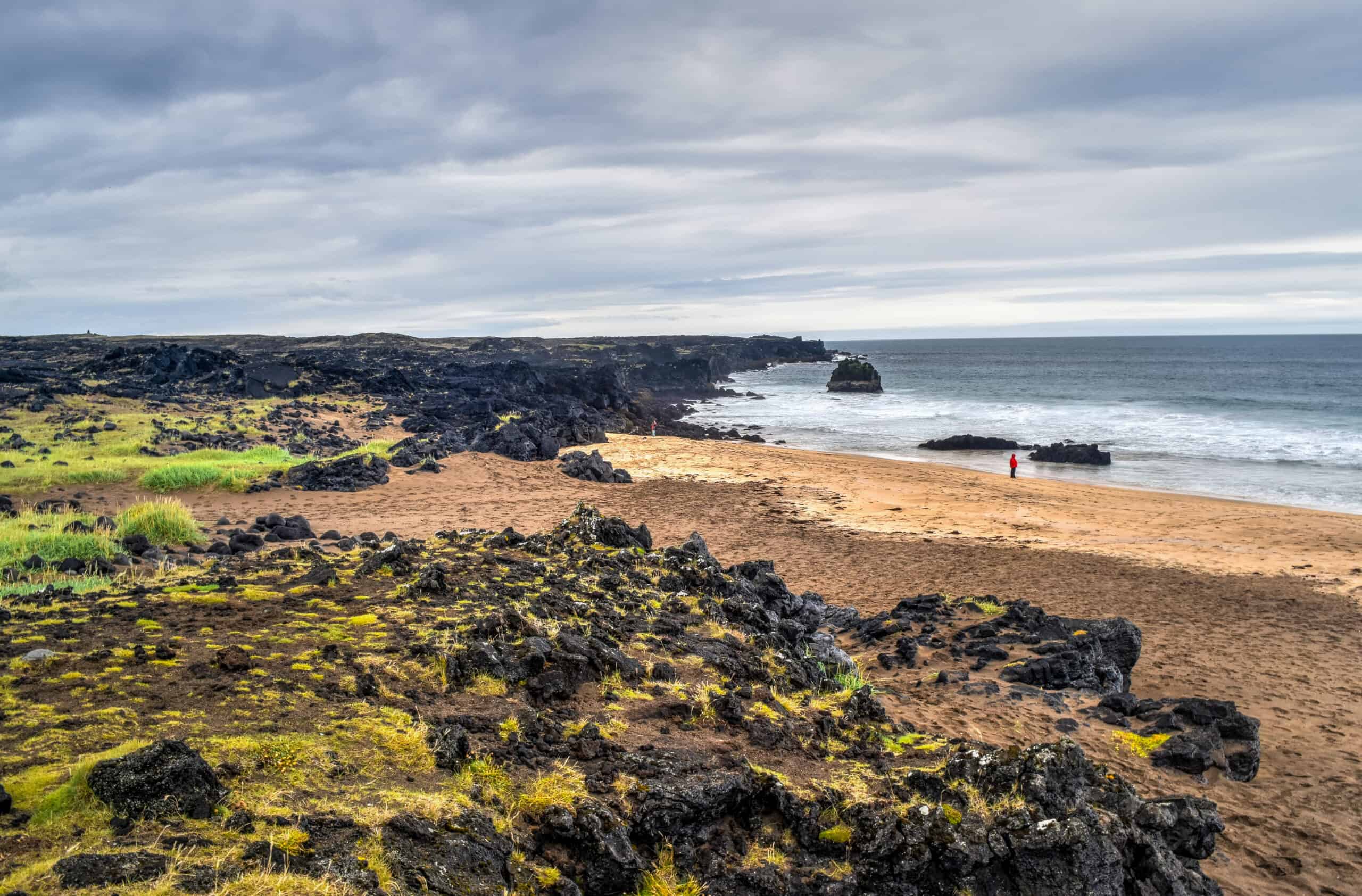
Djúpalónssandur is a black sand beach beautifully framed by stunning rock formations.
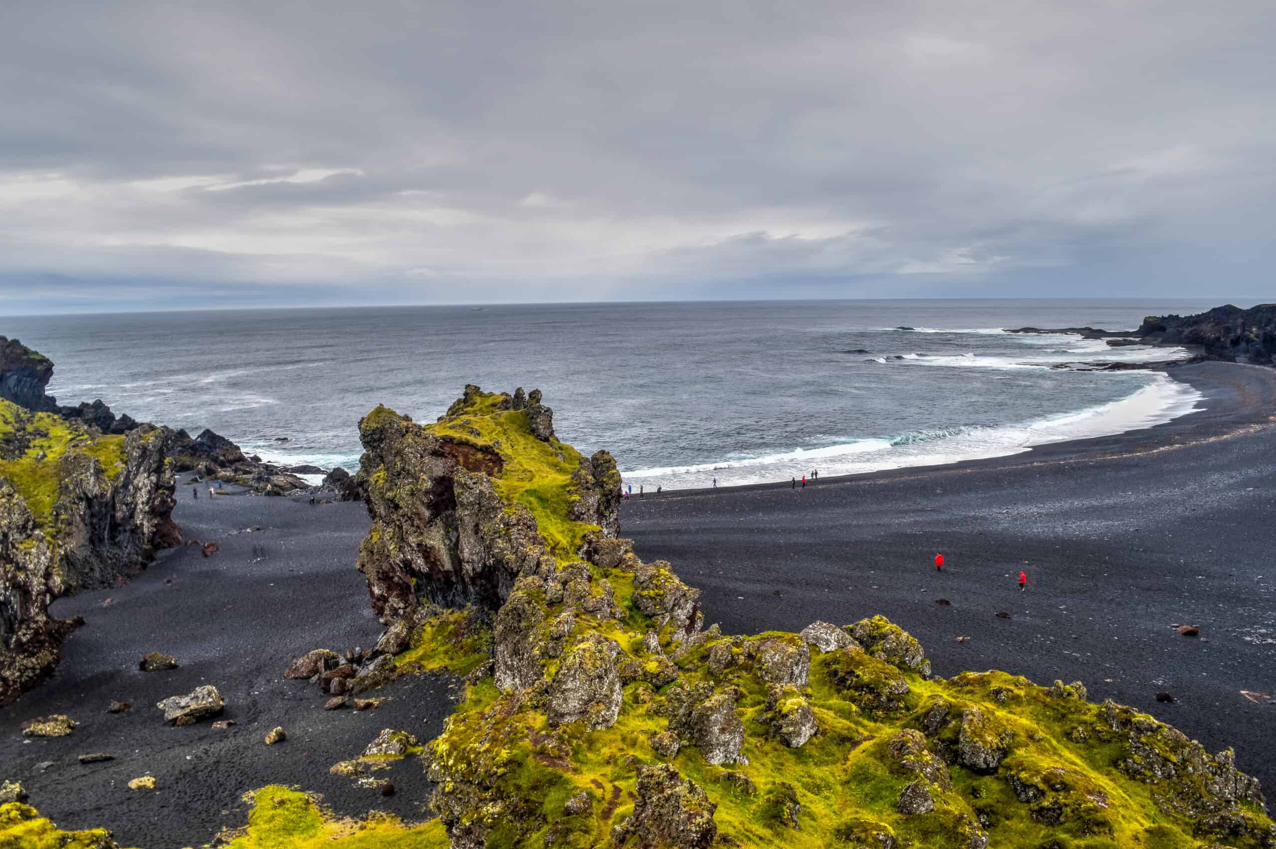
Warning regarding the above-mentioned beaches: take heed that these are treacherous waters and the Atlantic Ocean’s rip currents can easily carry you out to sea. They are best enjoyed from a safe distance.
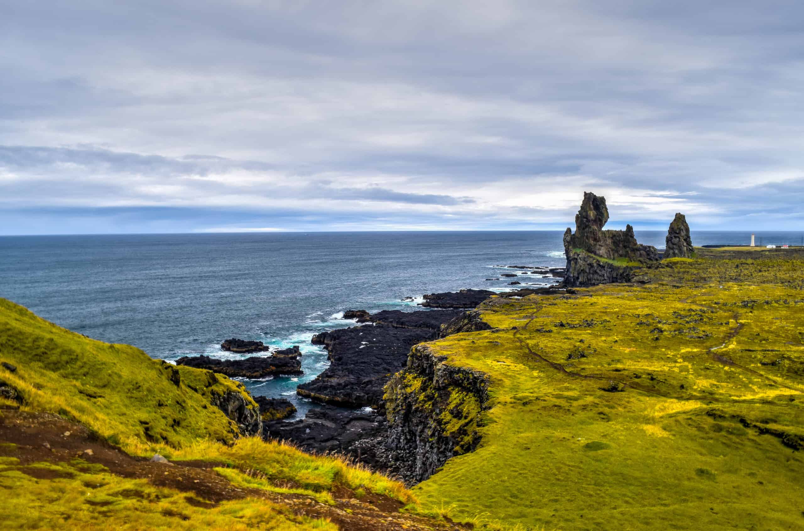
Lóndrangar basalt pillars are an impressive sight. Once a volcanic crater, all that remains after millennia of ocean erosion are two great pillars upon a cliff. The dramatic setting has earned them the nickname ‘the rocky castle.’
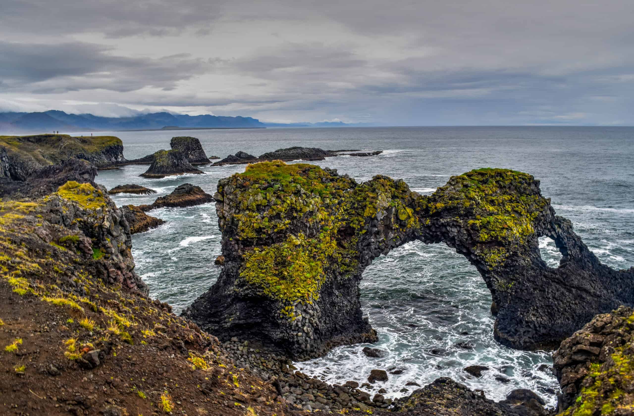
After exiting the National Park and heading back east, you will reach Arnastapi & Gatklettur. The former is a picturesque small fishing village at the foot of Mount Stapafell, while the latter is a stunning arch-shaped rock formation, set over the water with bird-rich cliffs nearby.
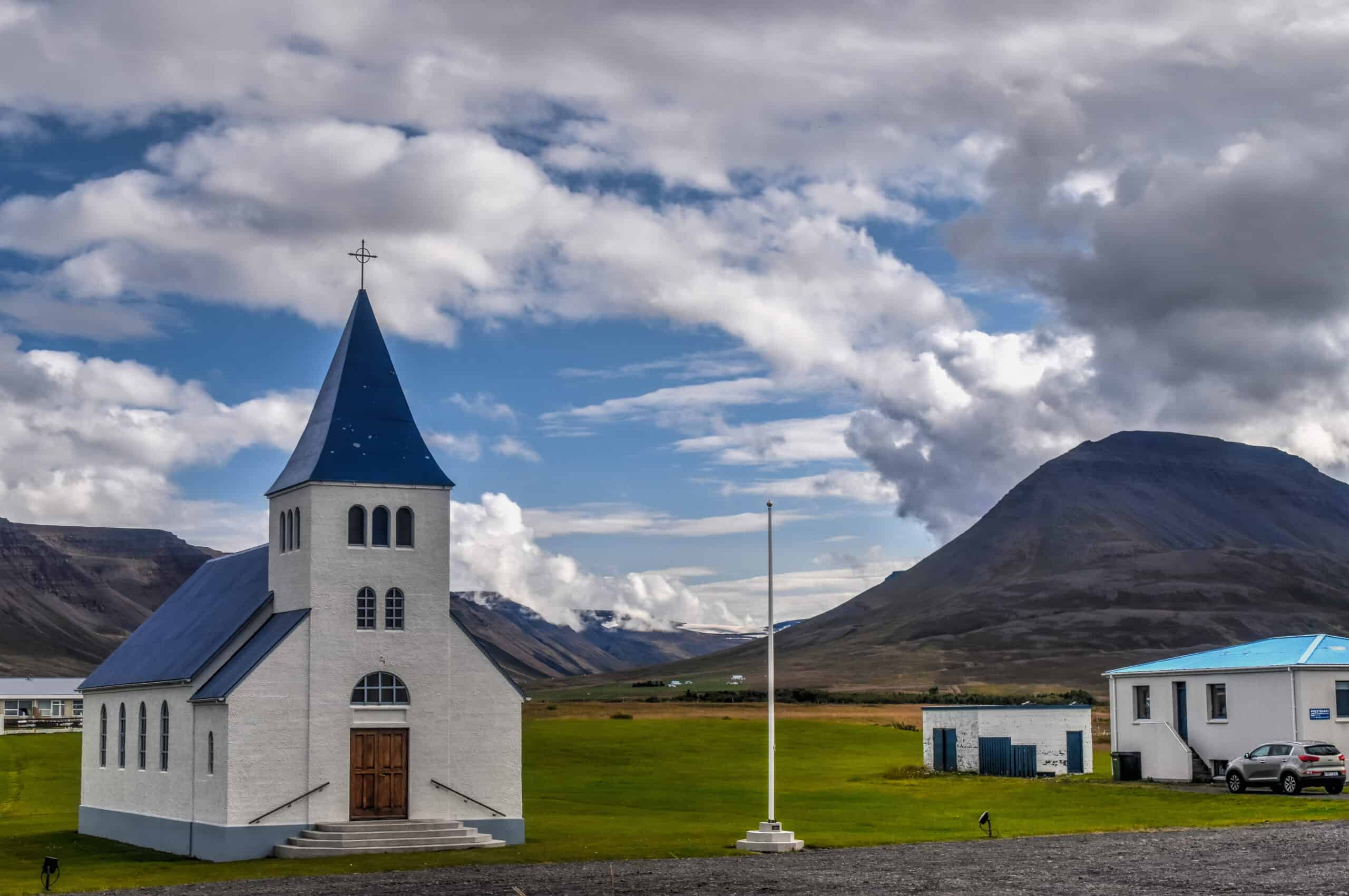
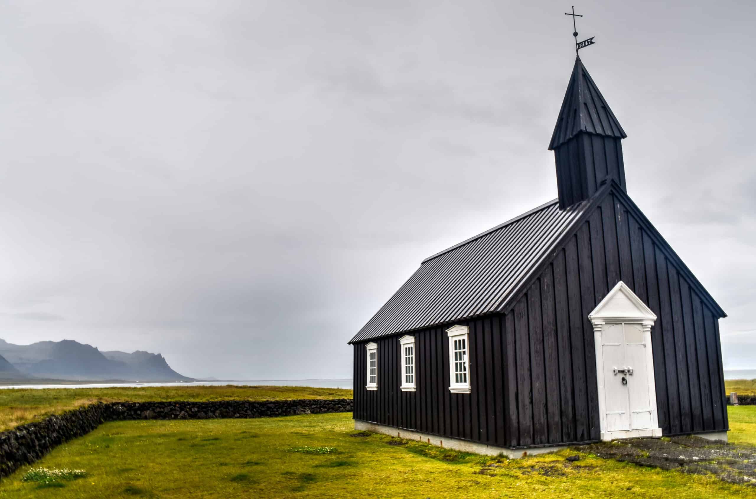
A short drive further east and a slight detour towards the coast will take you to one of Iceland’s most photogenic churches, Búðavegur, a small wooden church dating from 1848.
Our last stop on before leaving the peninsula was Ytri Tunga Beach famous for its seal colony. However, unfortunately for us, they were nowhere to be found that day. Typically the best season to see them is during the summer months from May to early August, we were about a month too late.
Map of top things to see and do in Snaefellsnes Peninsula
If the Snaefellsnes Peninsula looks like an interesting place to you, be sure to check out our dedicated page to the Peninsula.
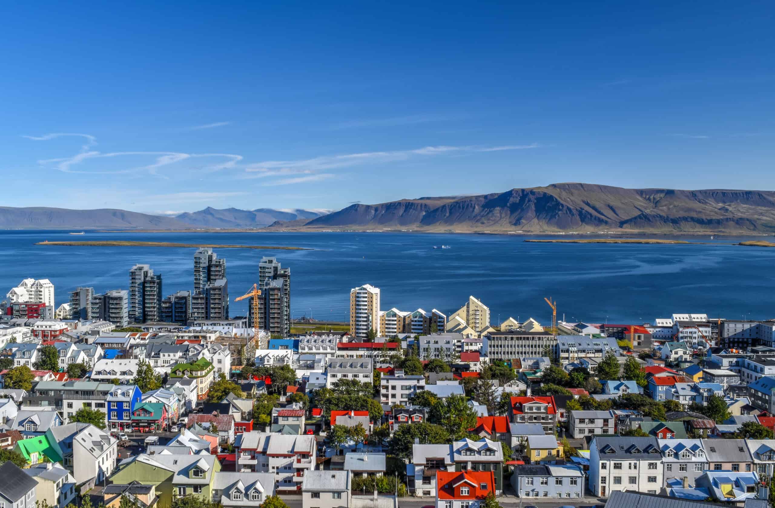
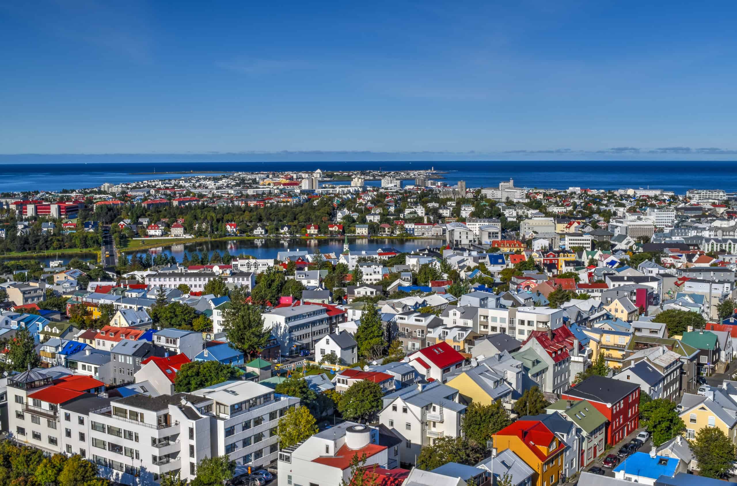
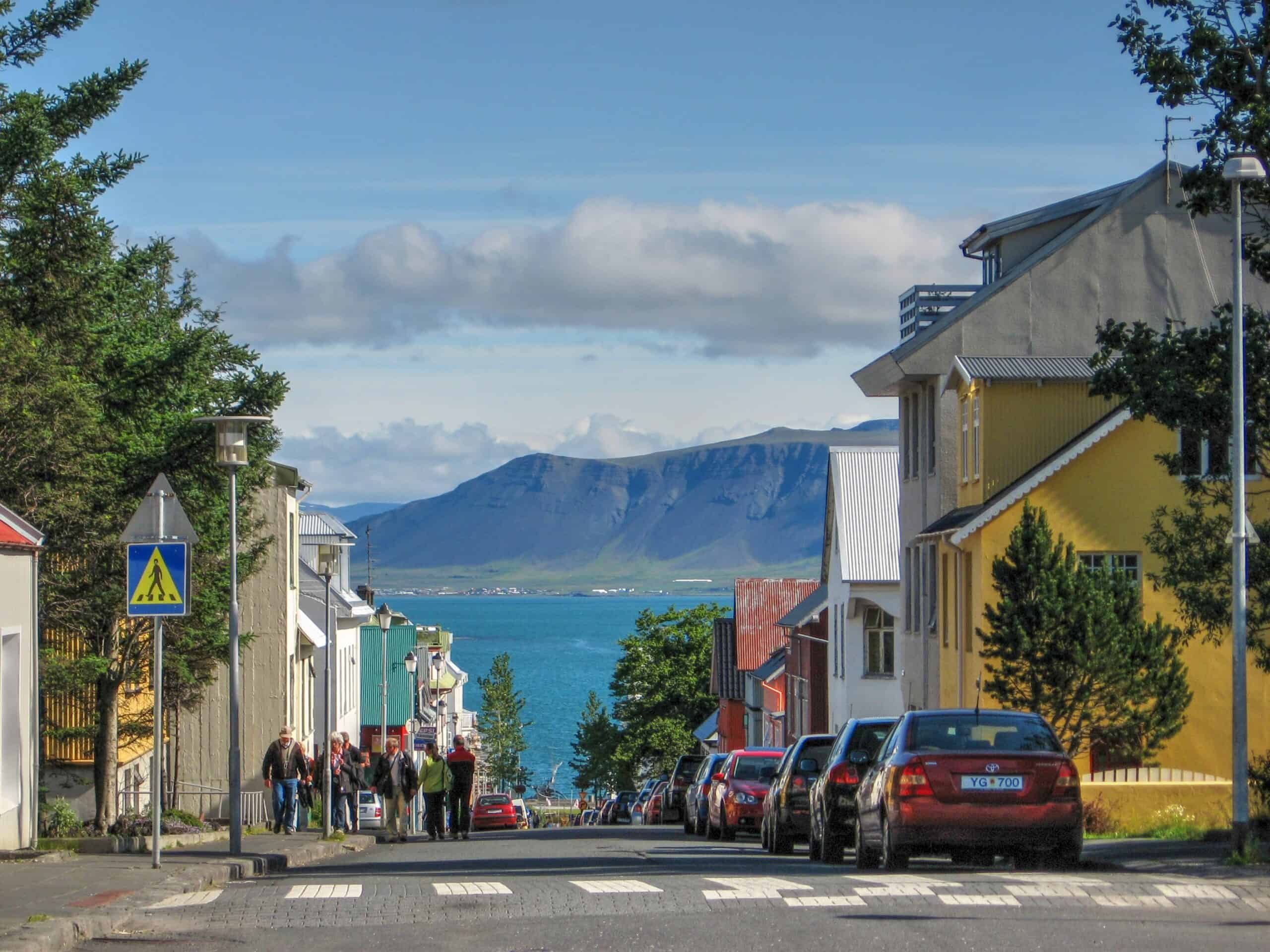
Reykjavik
Reykjavik is a cute and lovely town, with a few sites of interest. It wouldn’t be a crime to skip visiting the town if you are short on time and would prefer to spend what time you do have exploring some of the beautiful scenery Iceland has to offer. But if you have a few hours to spare, Reykjavik does have its fair share of cool attractions to fill that time.
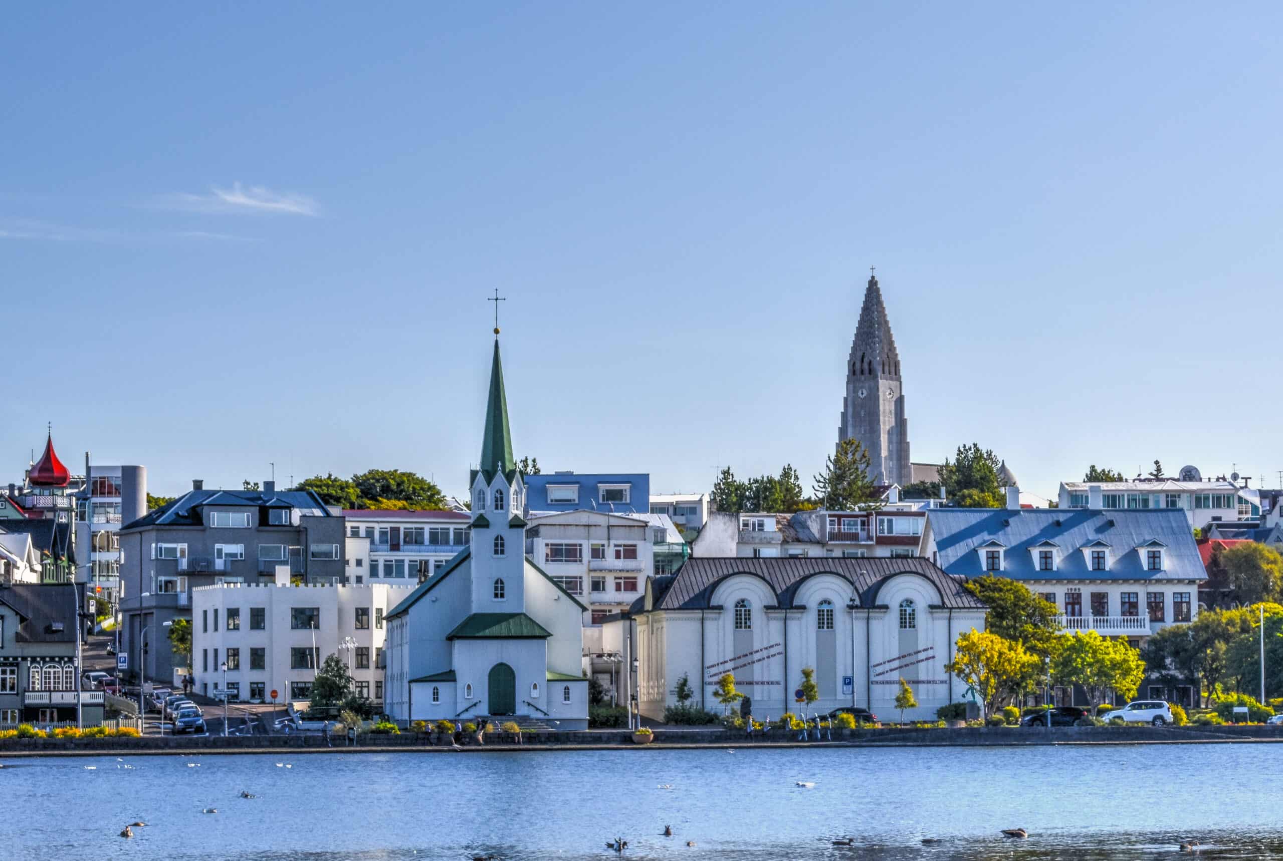
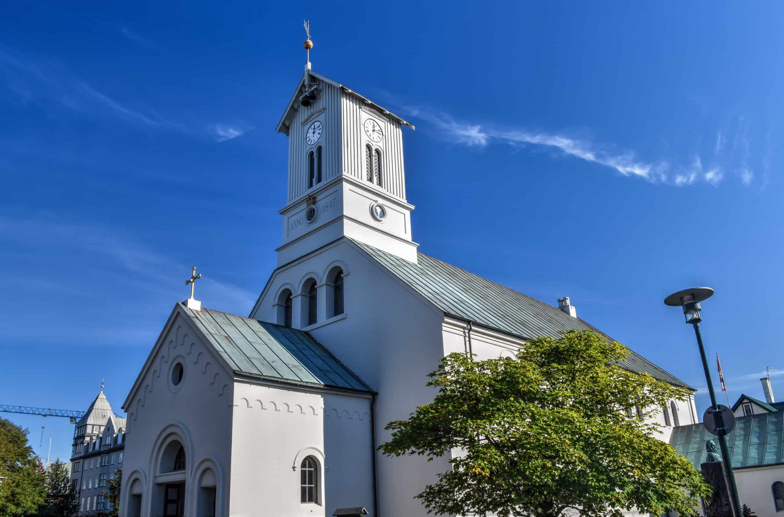
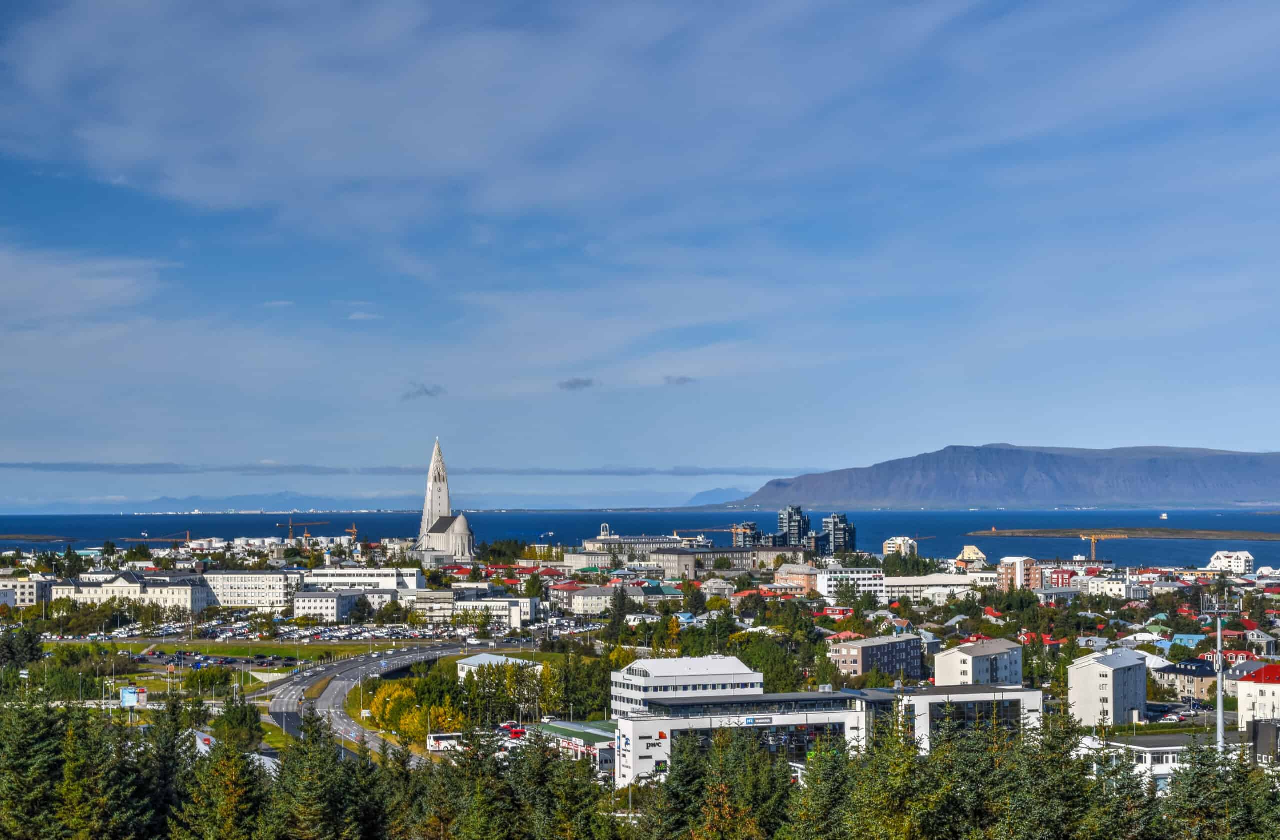
Hallgrímskirkja
The main sight of interest is no doubt the city’s imposing cathedral, Hallgrímskirkja. It is Iceland’s largest church and can be seen from almost anywhere in the city due to its central hilltop location. It took 41 years to build the church: construction started in 1945 and ended in 1986, but the landmark tower was completed long before the rest of the church was finished.
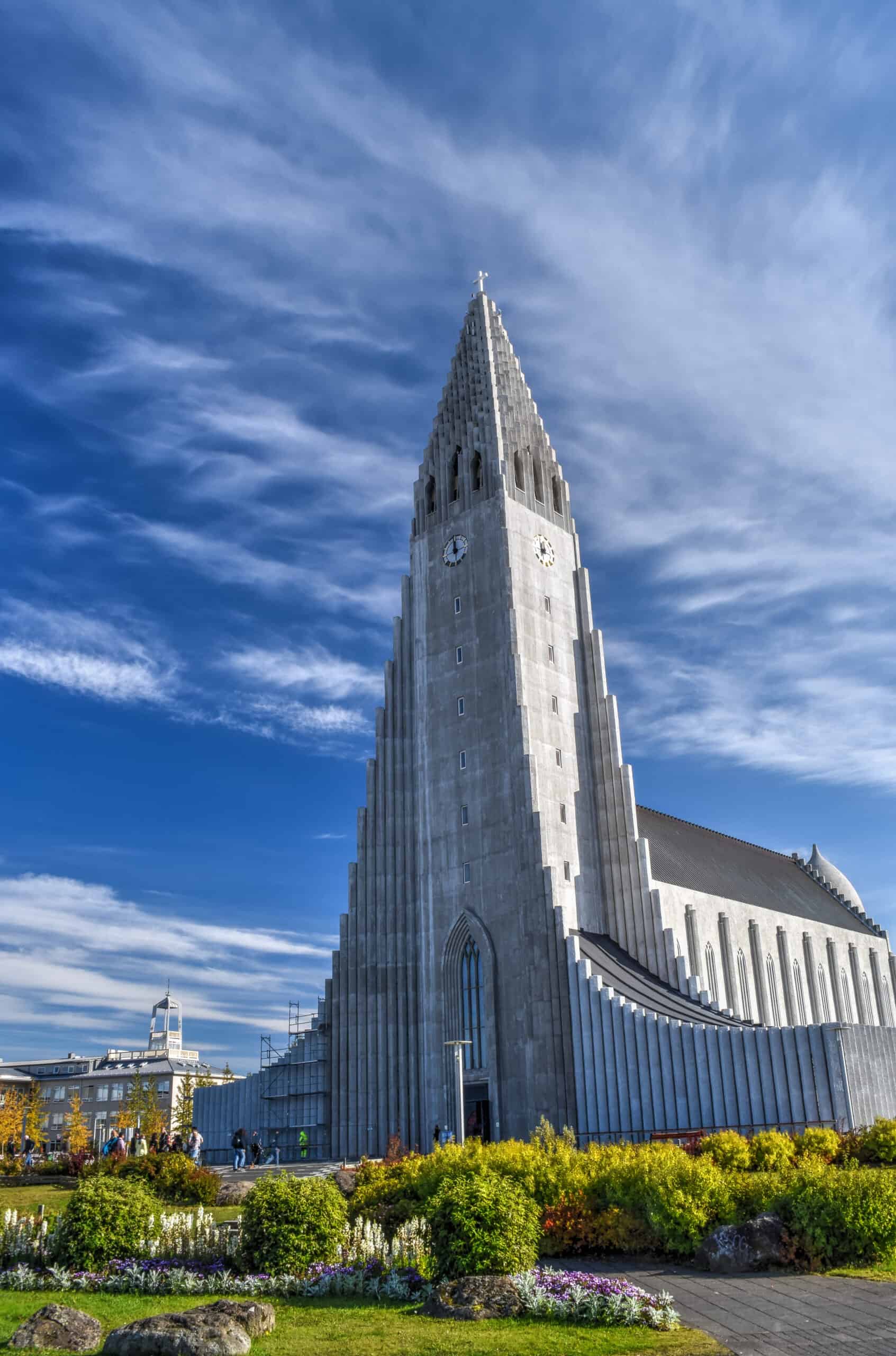
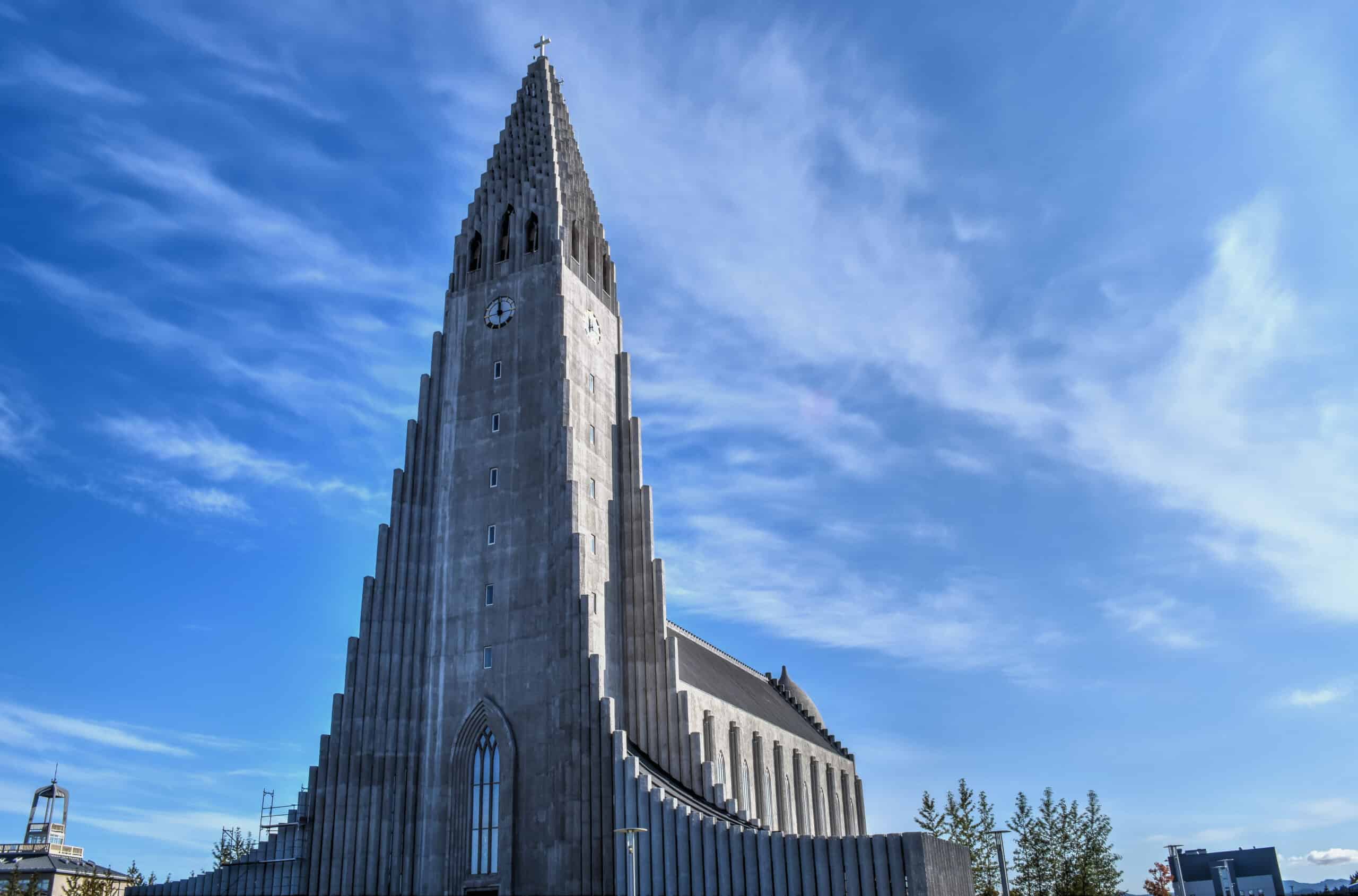
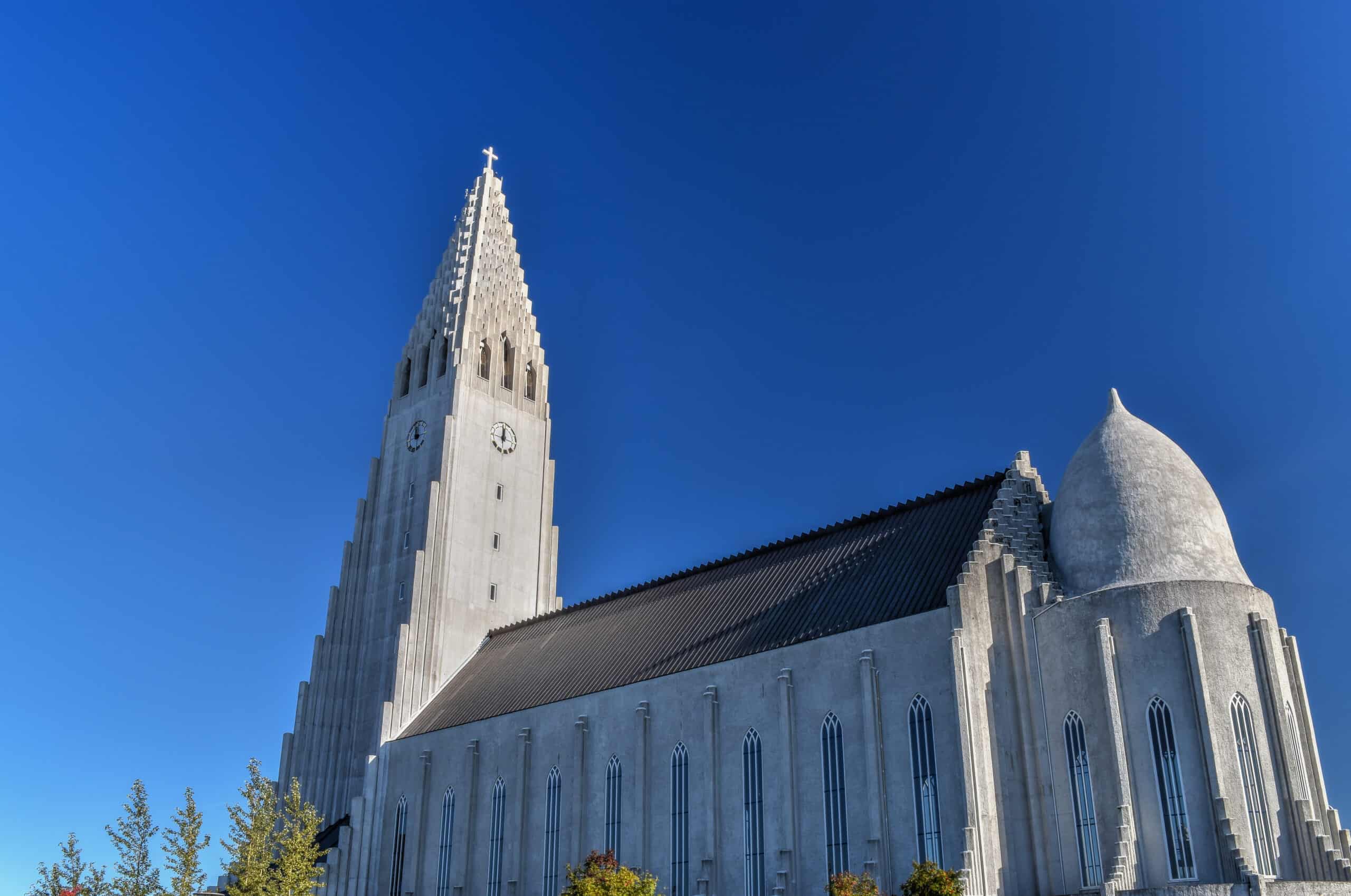
Not only is it an impressive and beautiful church, but its tower will provide you with fantastic views of the city. However, here you have to use an elevator, and as such accessing the tower is more expensive (1,000 kr, roughly 7 Euros) than in other churches across Europe. For more information about daily opening hours, check out the cathedral’s website.
Waterfront
Reykjavik’s northern waterfront is a great place for a walk for great views across the Bay.
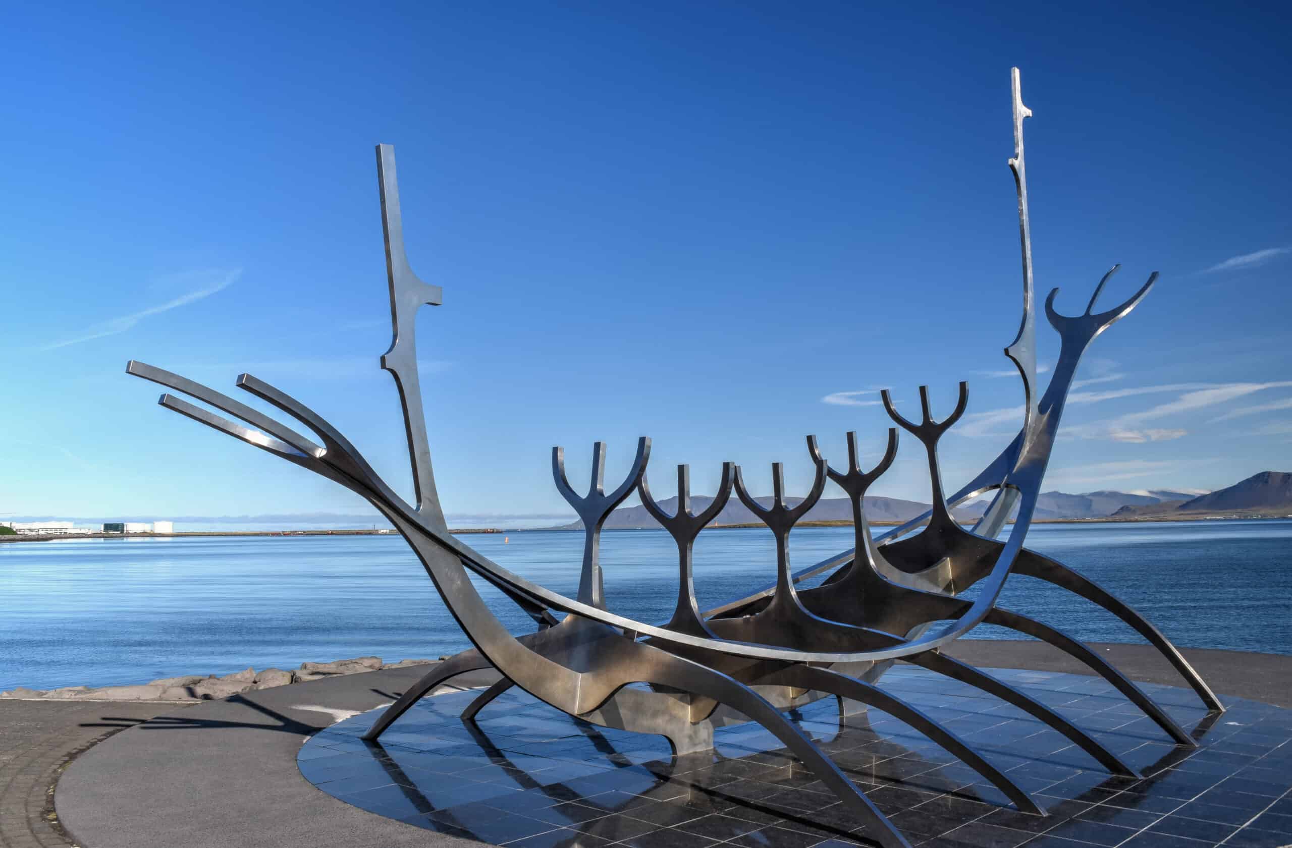
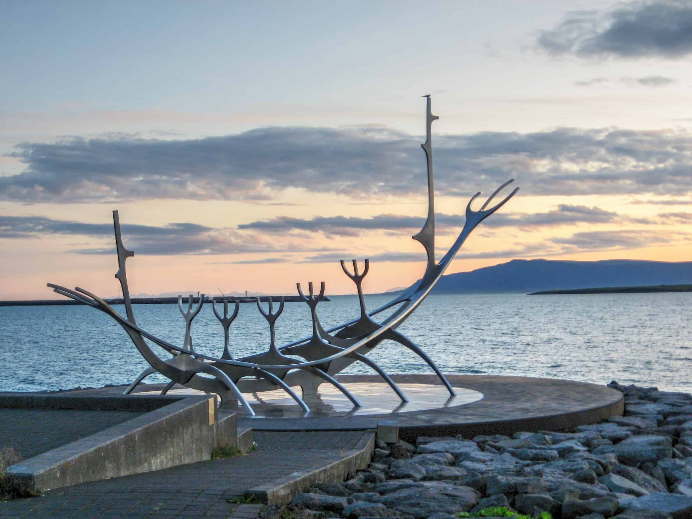
It is here that you will find one of Reykjavik’s most famous landmarks, the Sun Voyager. The Sun Voyager is a sculpture by Jón Gunnar Árnason and is described as a dreamboat or an ode to the Sun. It is as such also a fantastic place to watch the sunset.
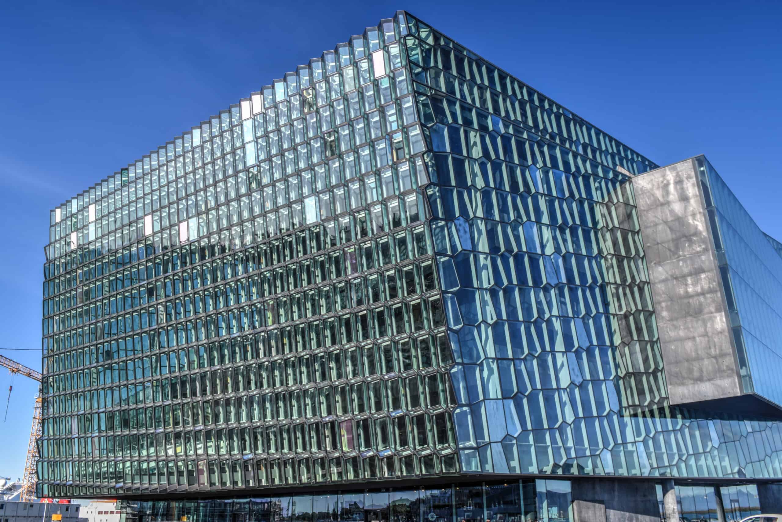
At the very western end of the waterfront, by the old harbour, you will find Reykjavik’s impressive concert hall and conference center, Harpa.
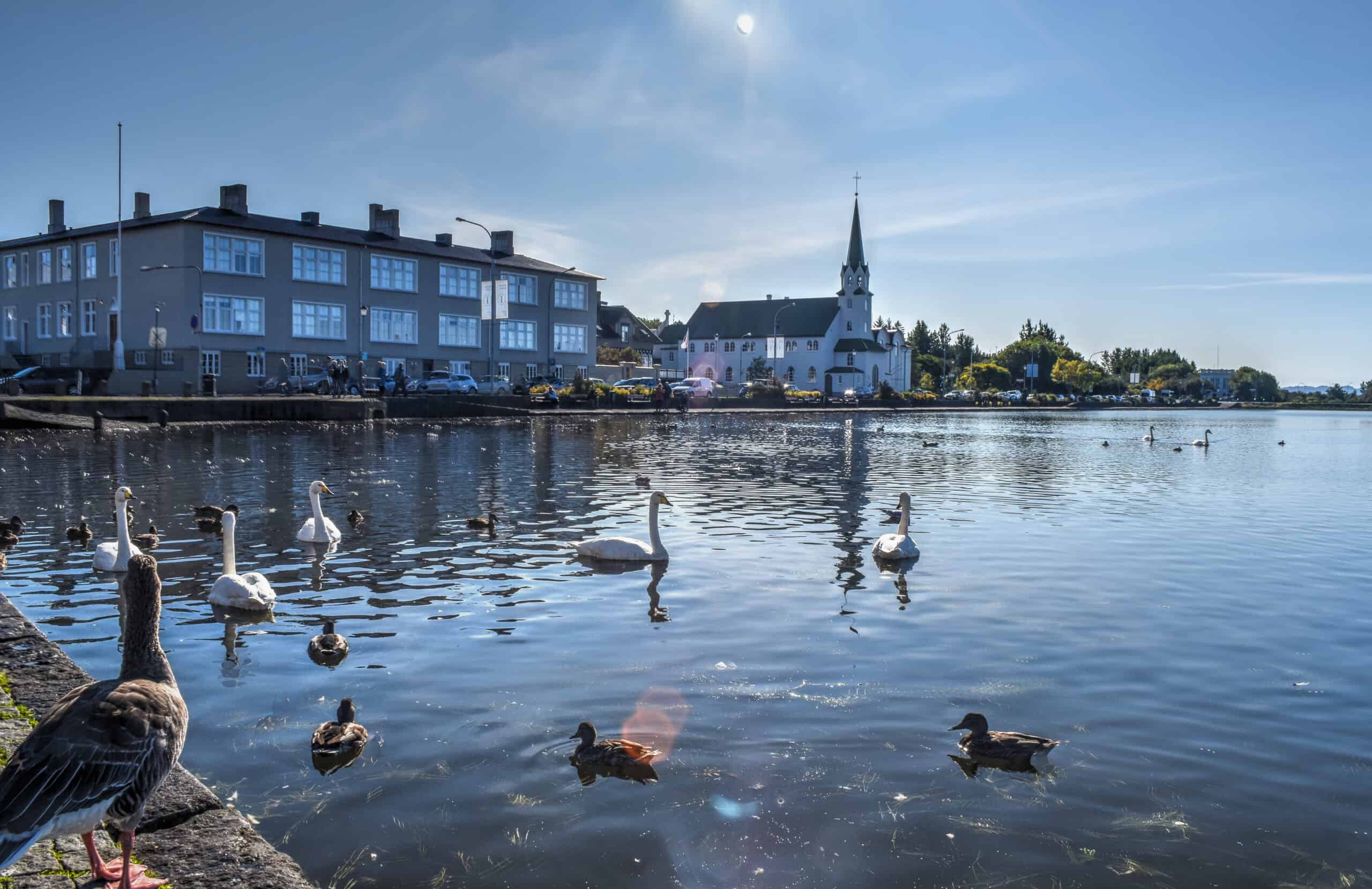
Tjörnin lake
You will find Tjörnin teeming with over forty different bird species. Feeding the birds at Tjörnin is a popular pastime for families, so popular in fact that the pond is often referred to in Icelandic as “stærsta brauðsúpa í heimi” (“The biggest bread soup in the world”). It’s also just a great place to enjoy the view. For a brief moment, you will completely forget that you are in the center of the city.
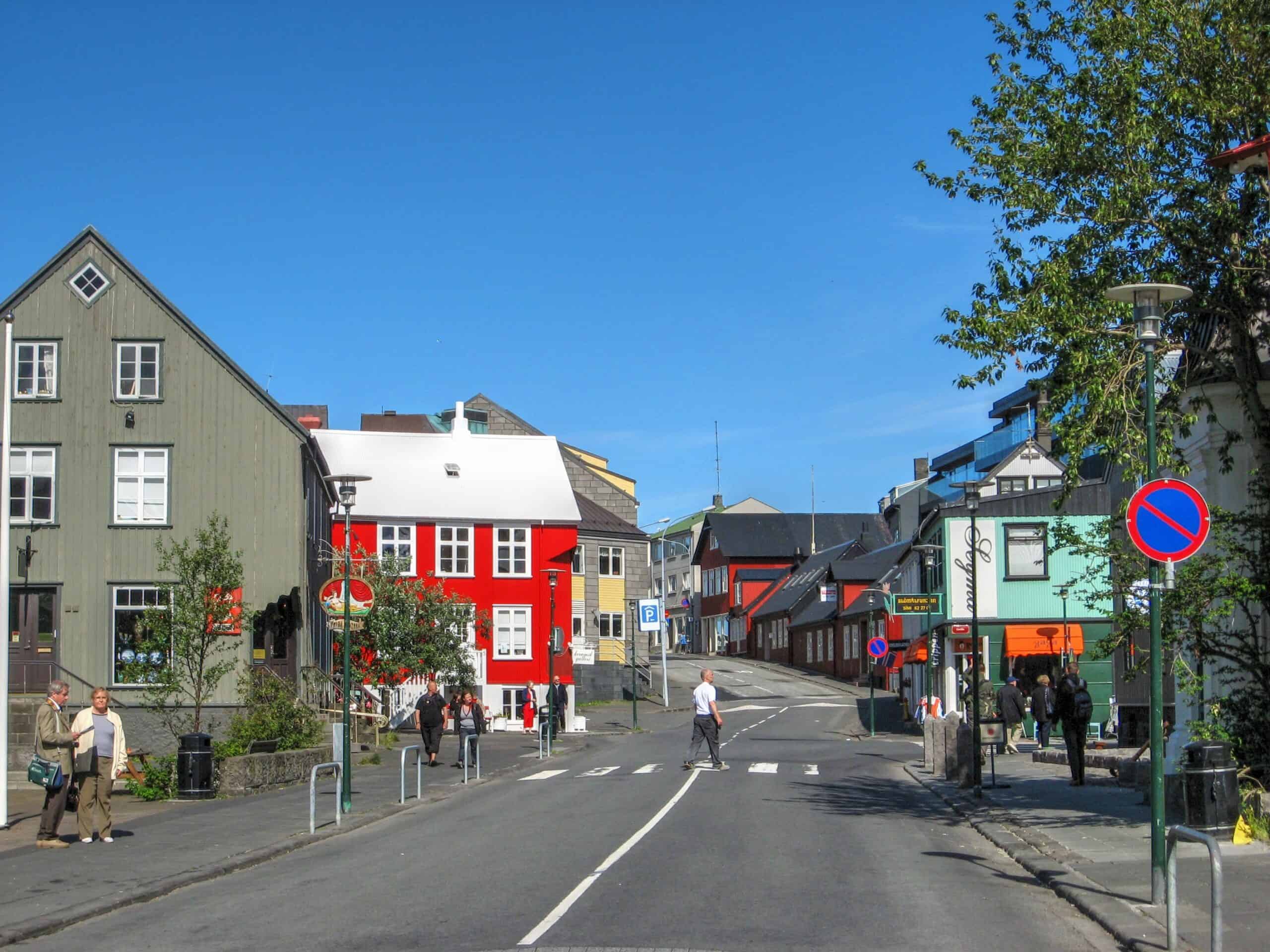
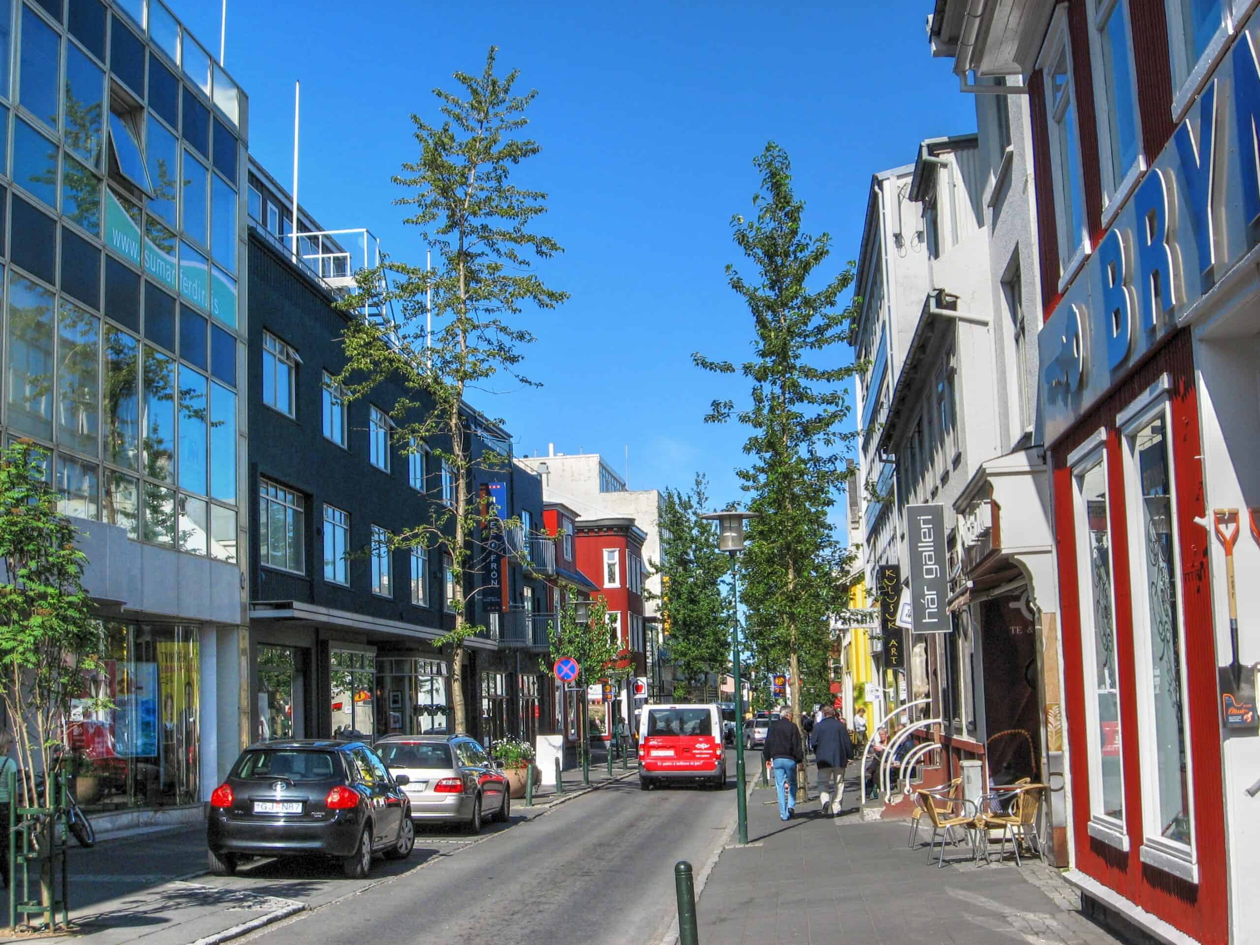
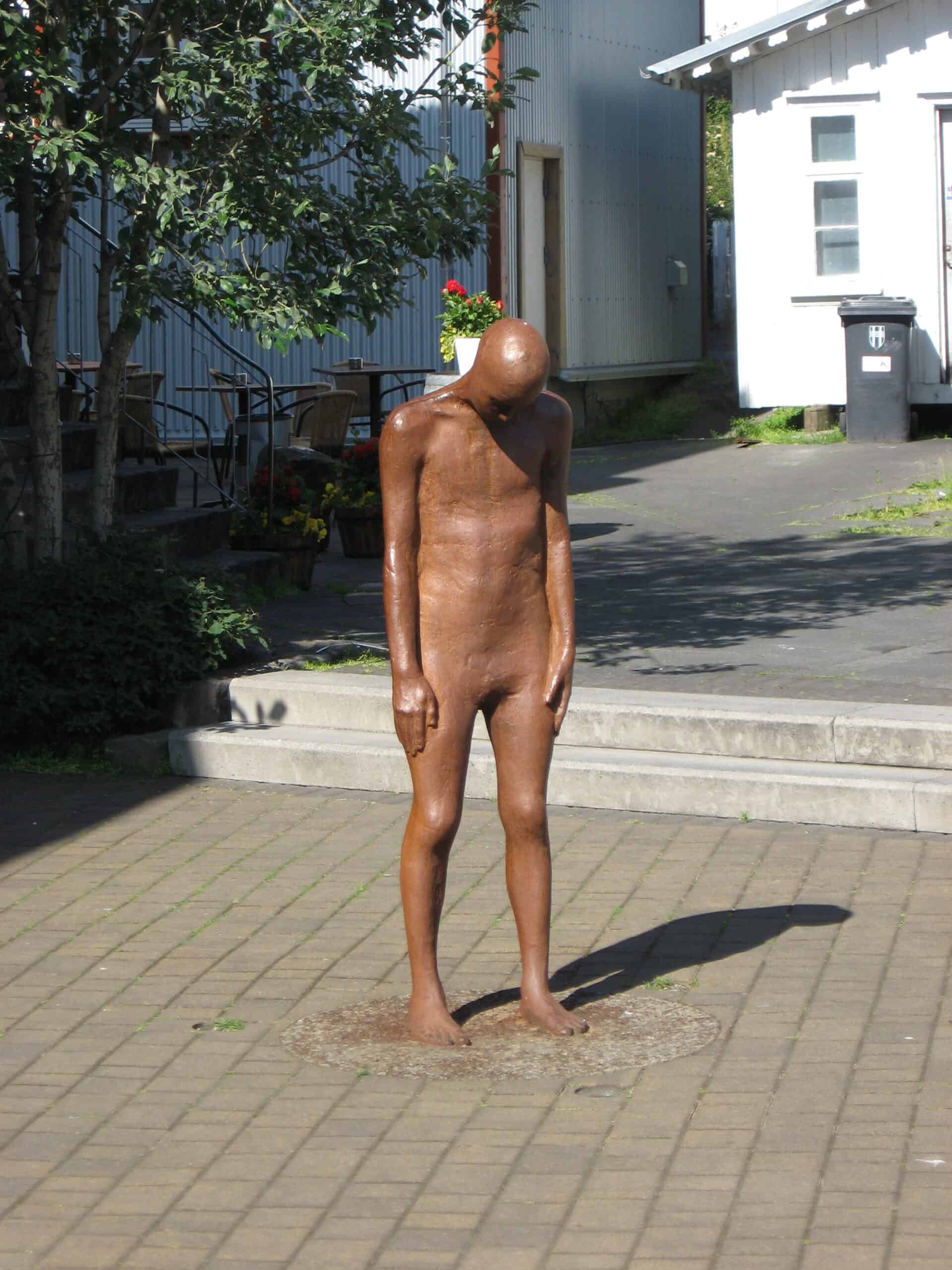
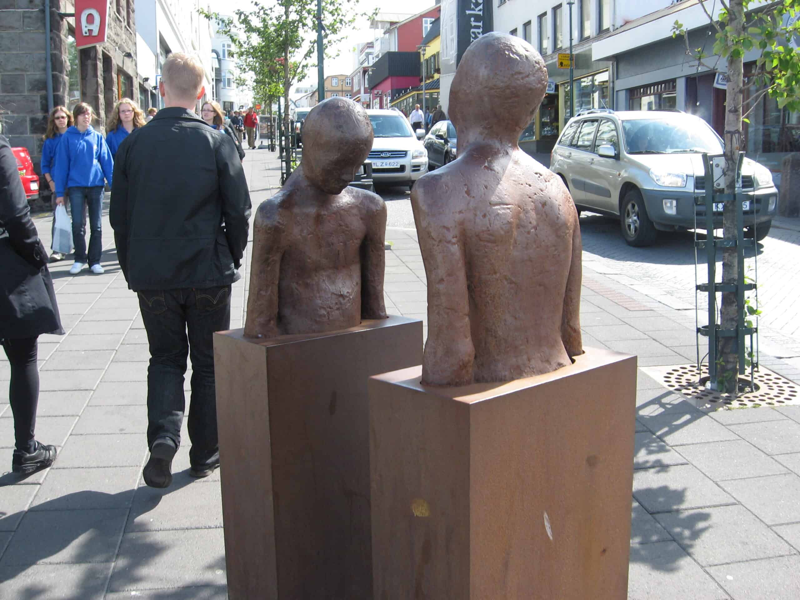
Main shopping streets
Apart from the main attractions that Reykjavik has to offer, the next best thing to do is just to stroll through the city center. The two main streets of interest are Skólavörðustígur (aka the “Rainbow Street”) and Laugavegur, where most of the shops are located. However, with more time, it’s worth exploring some of the other nearby streets. There are so many colourful buildings, quirky street art, and small nooks to be discovered.
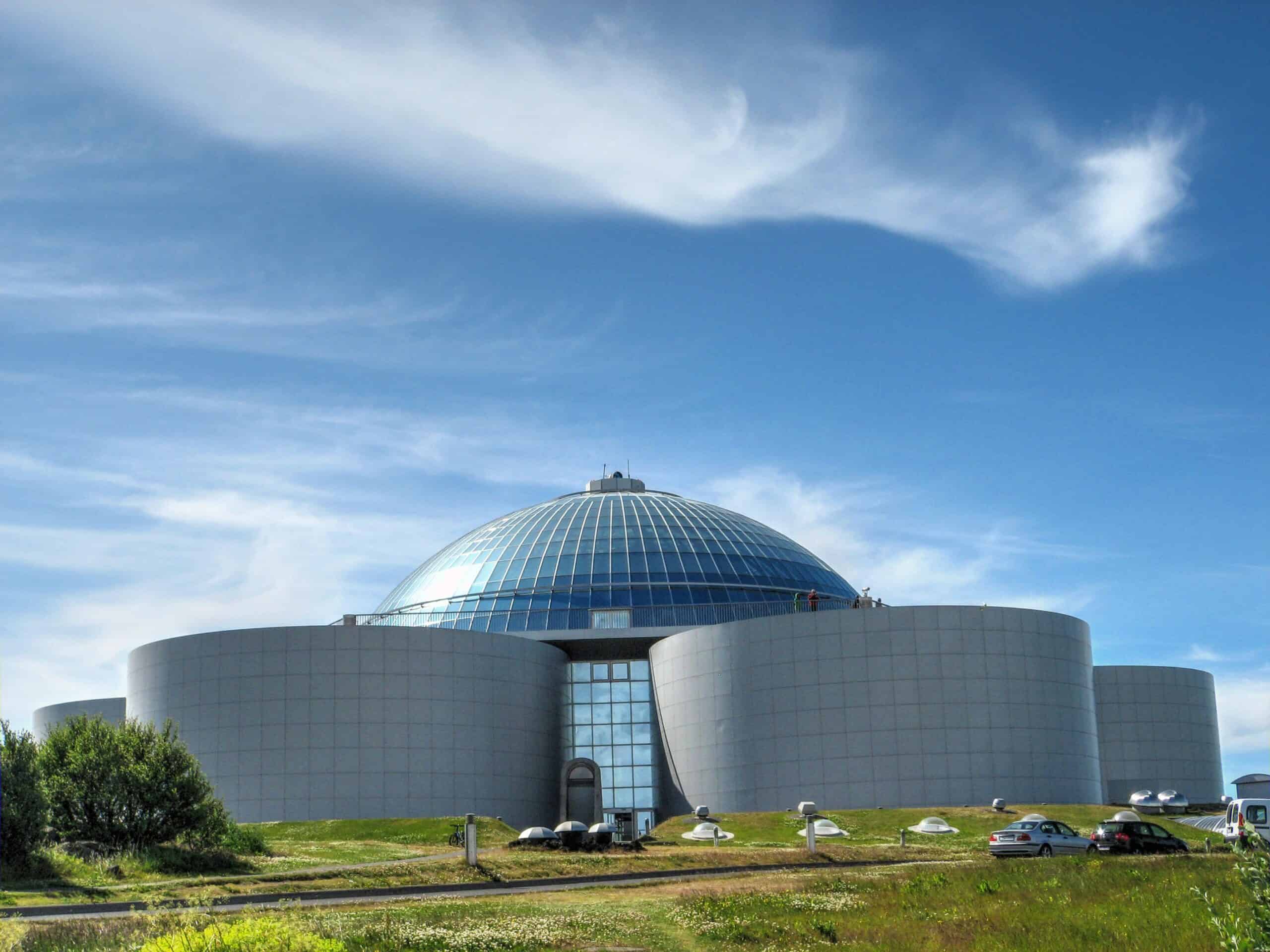
Perlan
We’ll start by saying that Perlan, a museum that offers impressive views of the city, is somewhat farther out of the city center. It’s about a 25 min (mostly uphill) walk south from Hallgrímskirkja. If you have the time and don’t mind the effort (though you can also reach the Perlan via a bus that departs from Harpa or via the hop-on hop-off City tour bus), it’s a fantastic museum with several exhibits, including a real ice tunnel and a northern light show.
For more information on visiting Iceland’s capital, check out our Reykjavik page with a suggested self-guided walking tour.
Reykjanes Peninsula & Blue Lagoon
Often overlooked by most tourists, Reykjanes peninsula is definitely worthy of your time. Many think that this region is home to two things, the airport and the famous Blue Lagoon, but there is so much more to see.
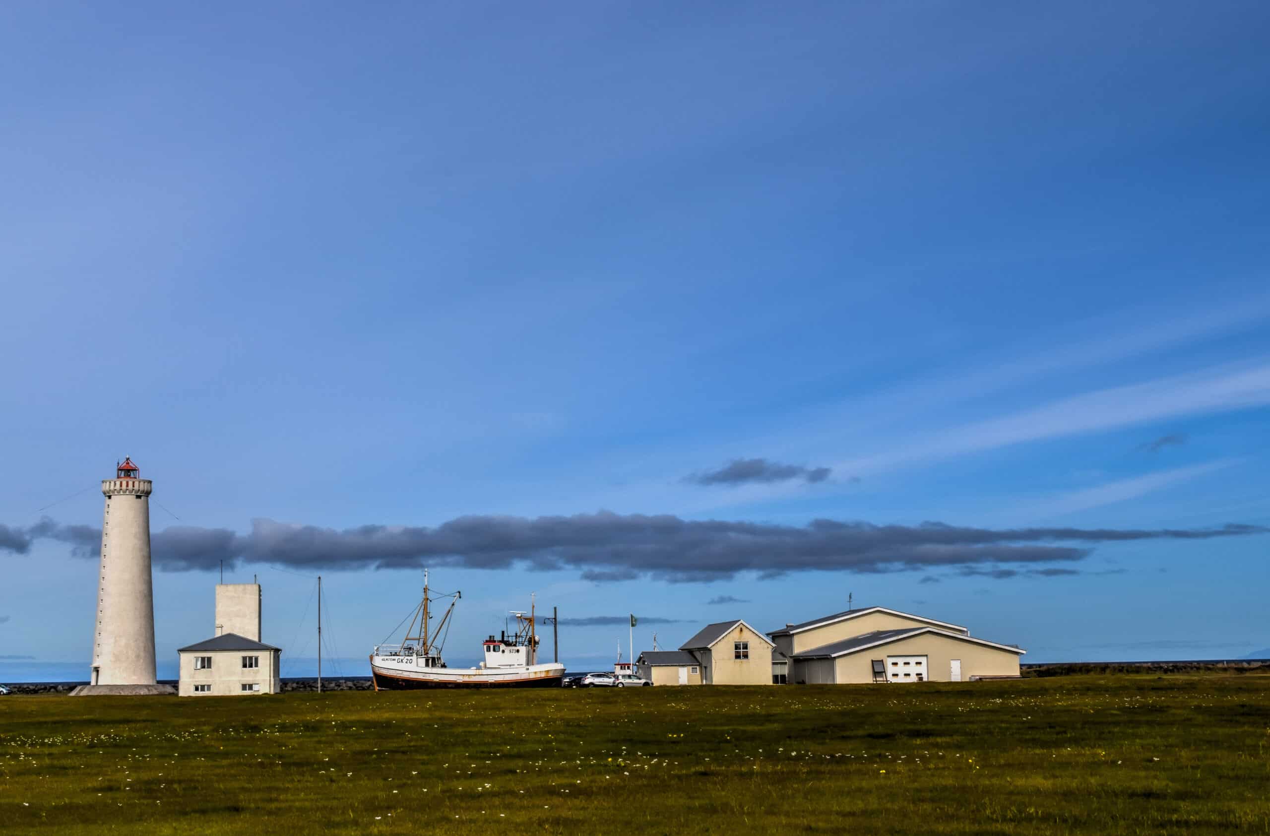
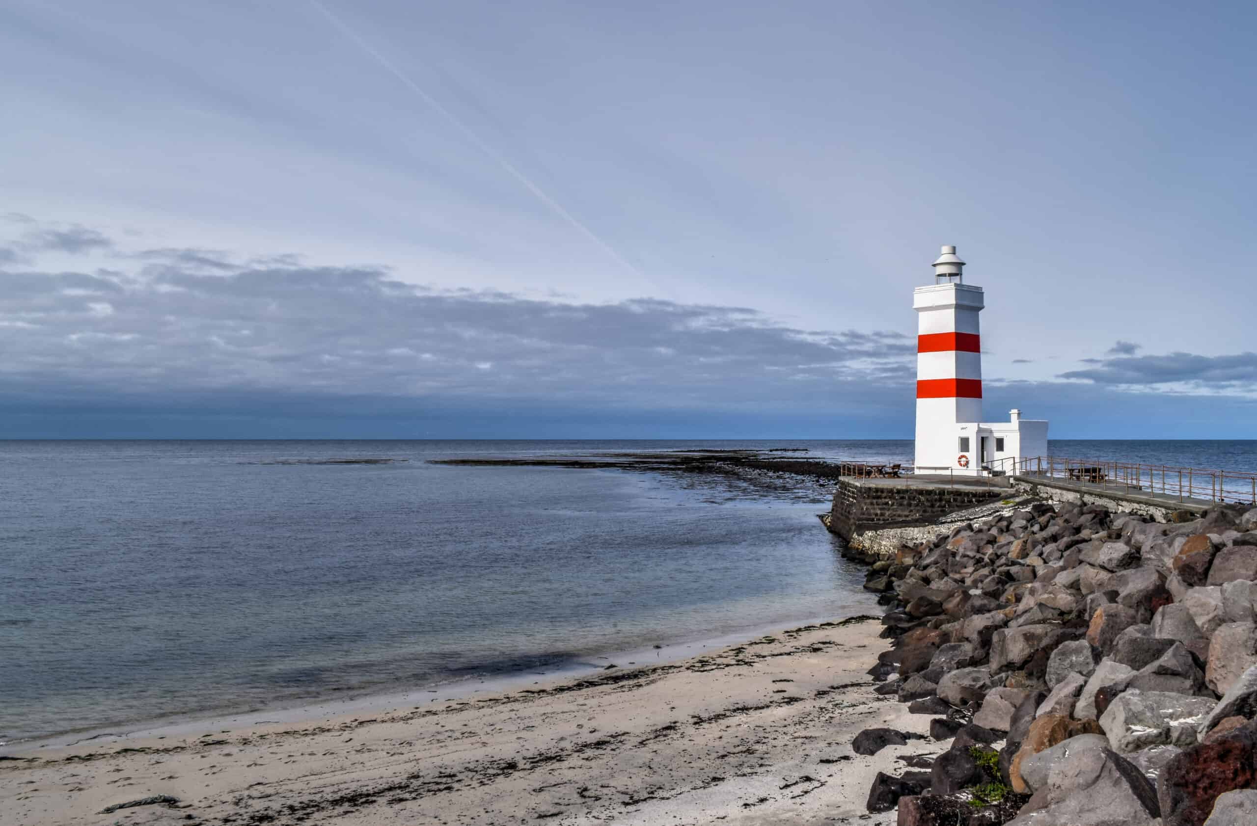
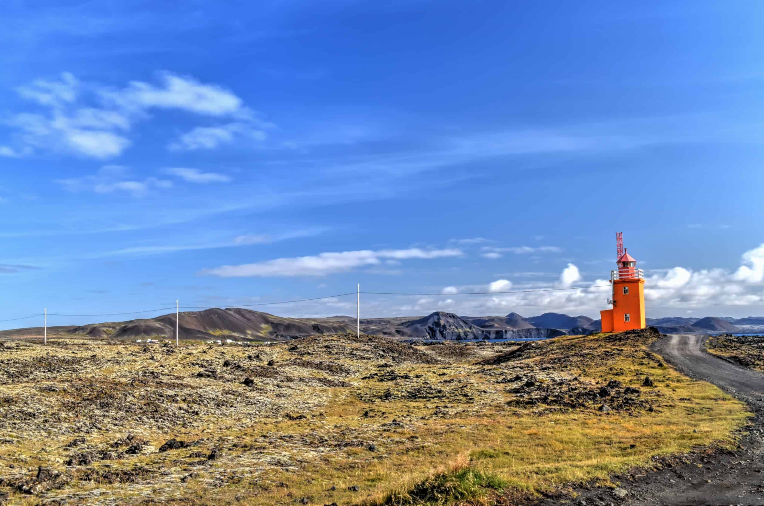
Garður Lighthouses – the smaller striped one is one of the first lighthouses built in the country, dating back to 1897.
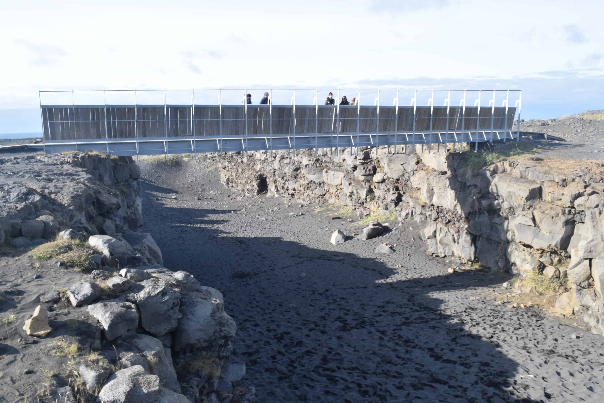
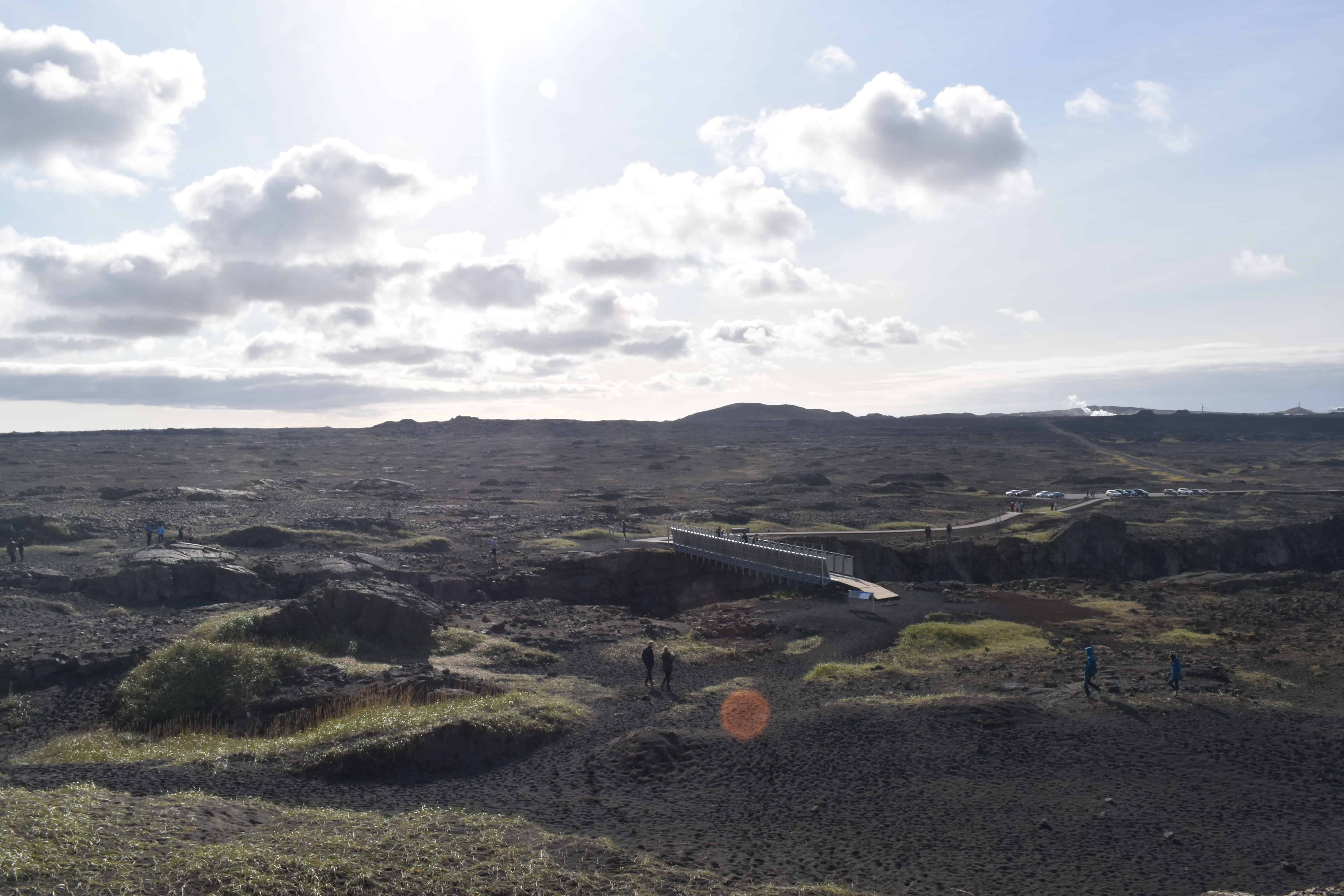
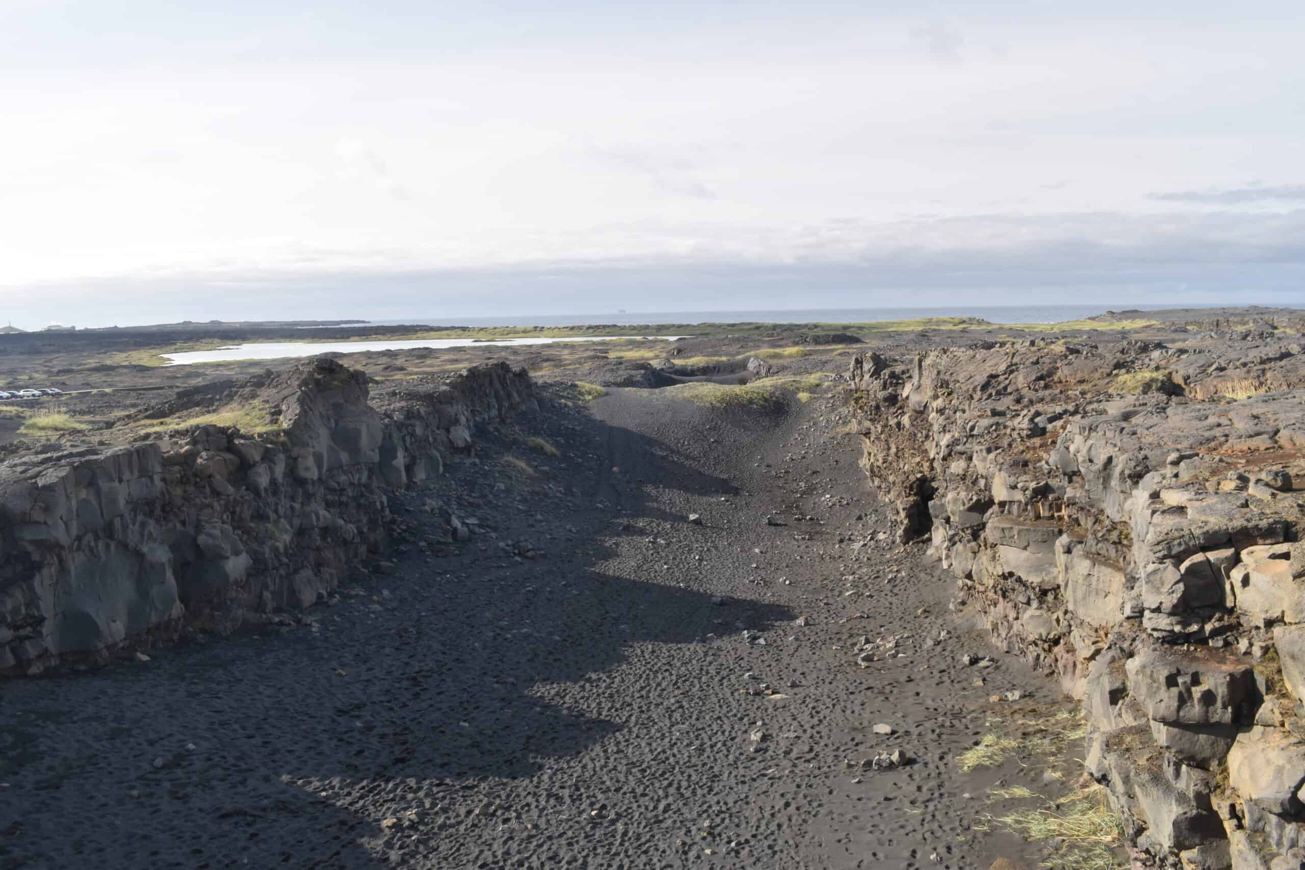
Bridge Between Two Continents – a 15-meter (50 ft) footbridge spanning a gaping rift between the Eurasian and North American tectonic plates.
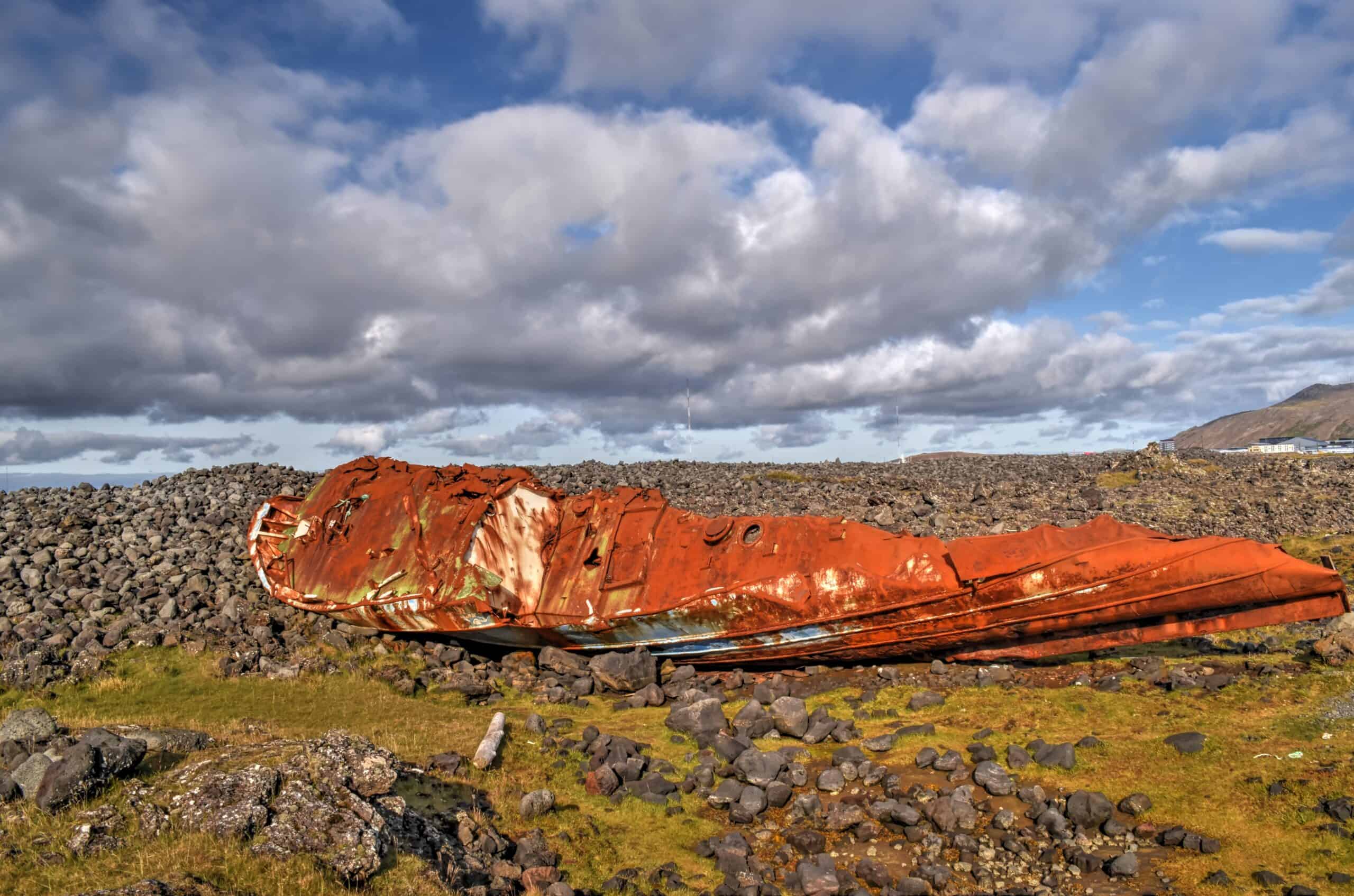
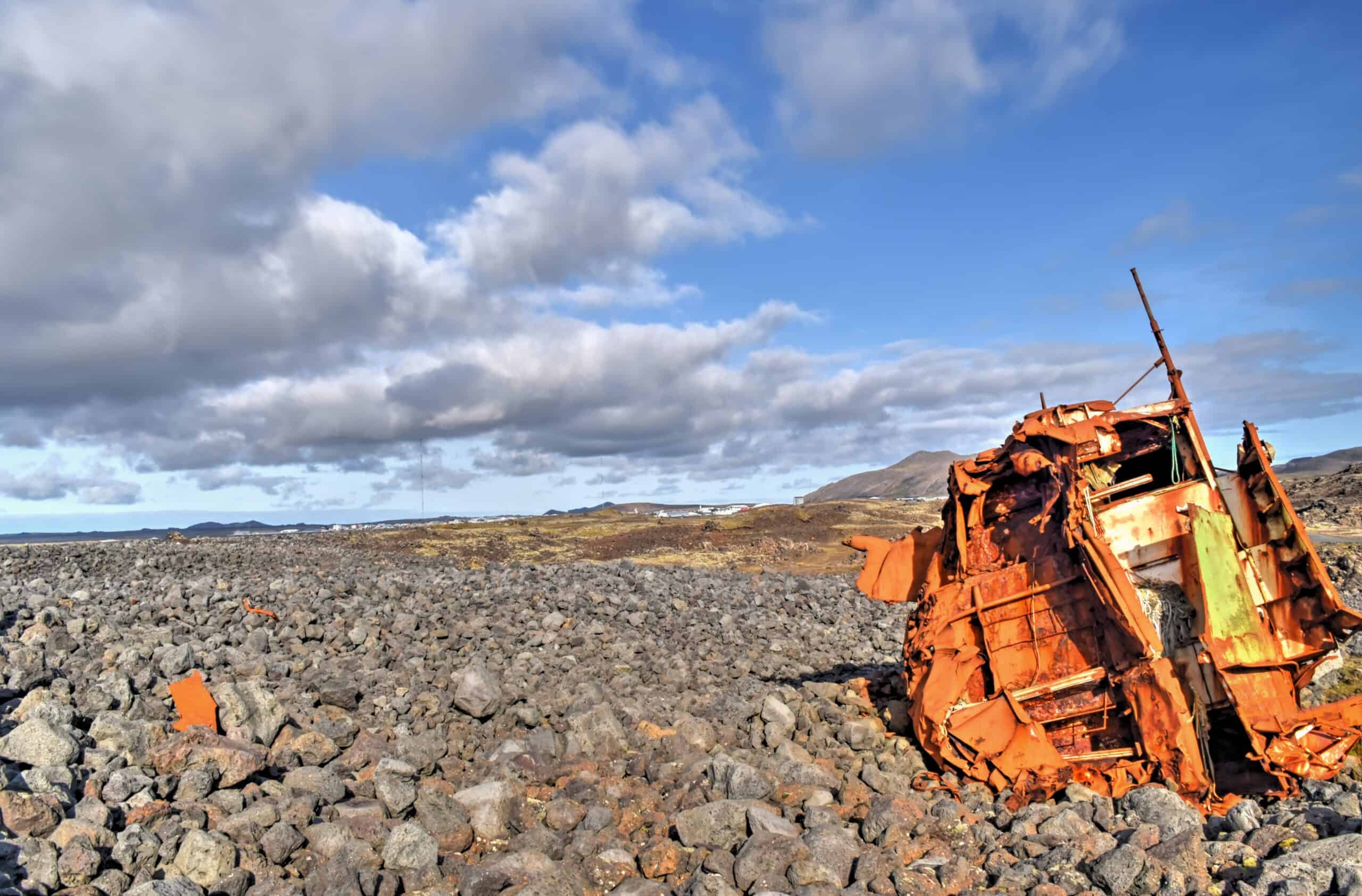
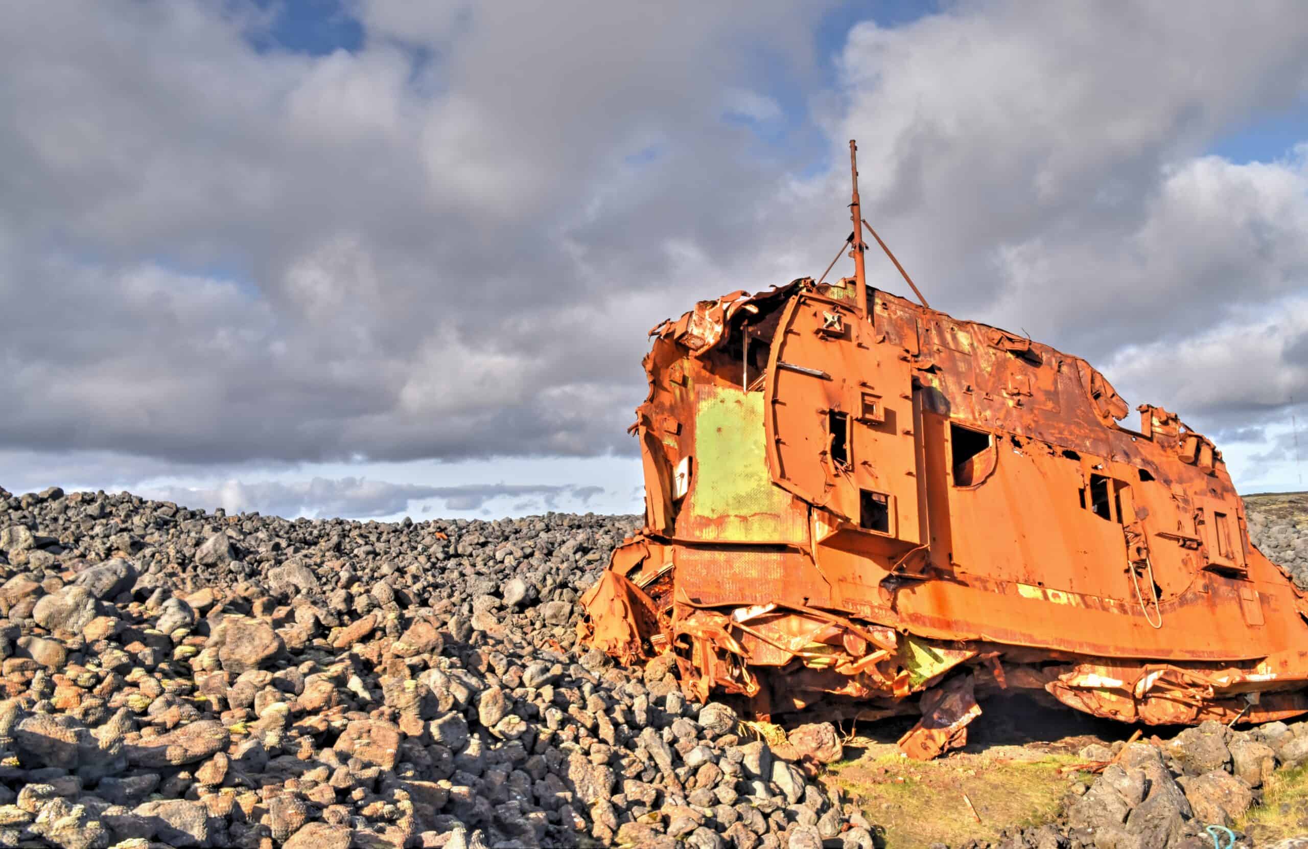
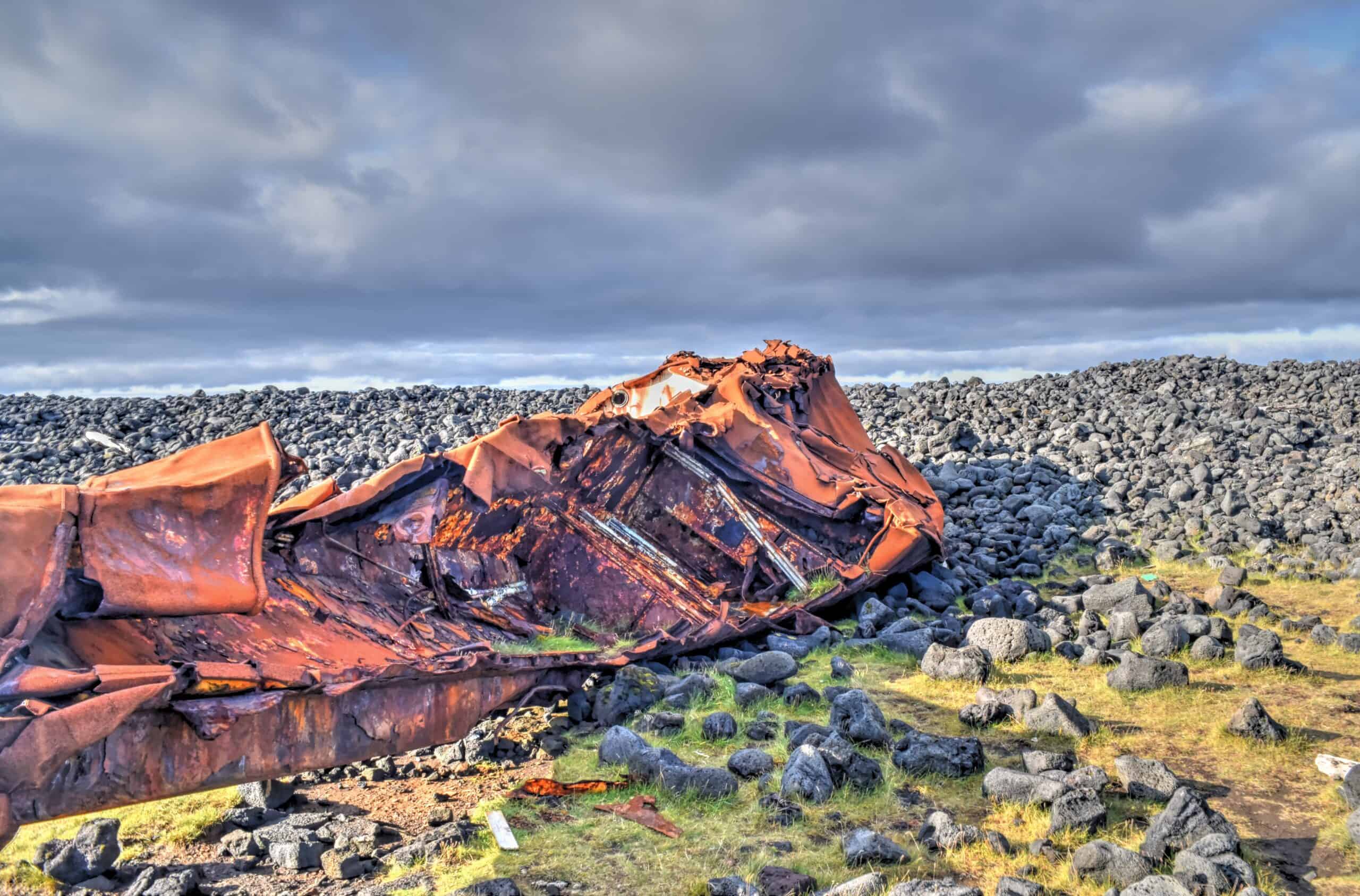
Shipwrecks near Grindavik & Hópsnes lighthouse – There are about 10 shipwrecks along the Hópsnes peninsula near Grindavík. Most of the wrecks have information boards detailing their history.
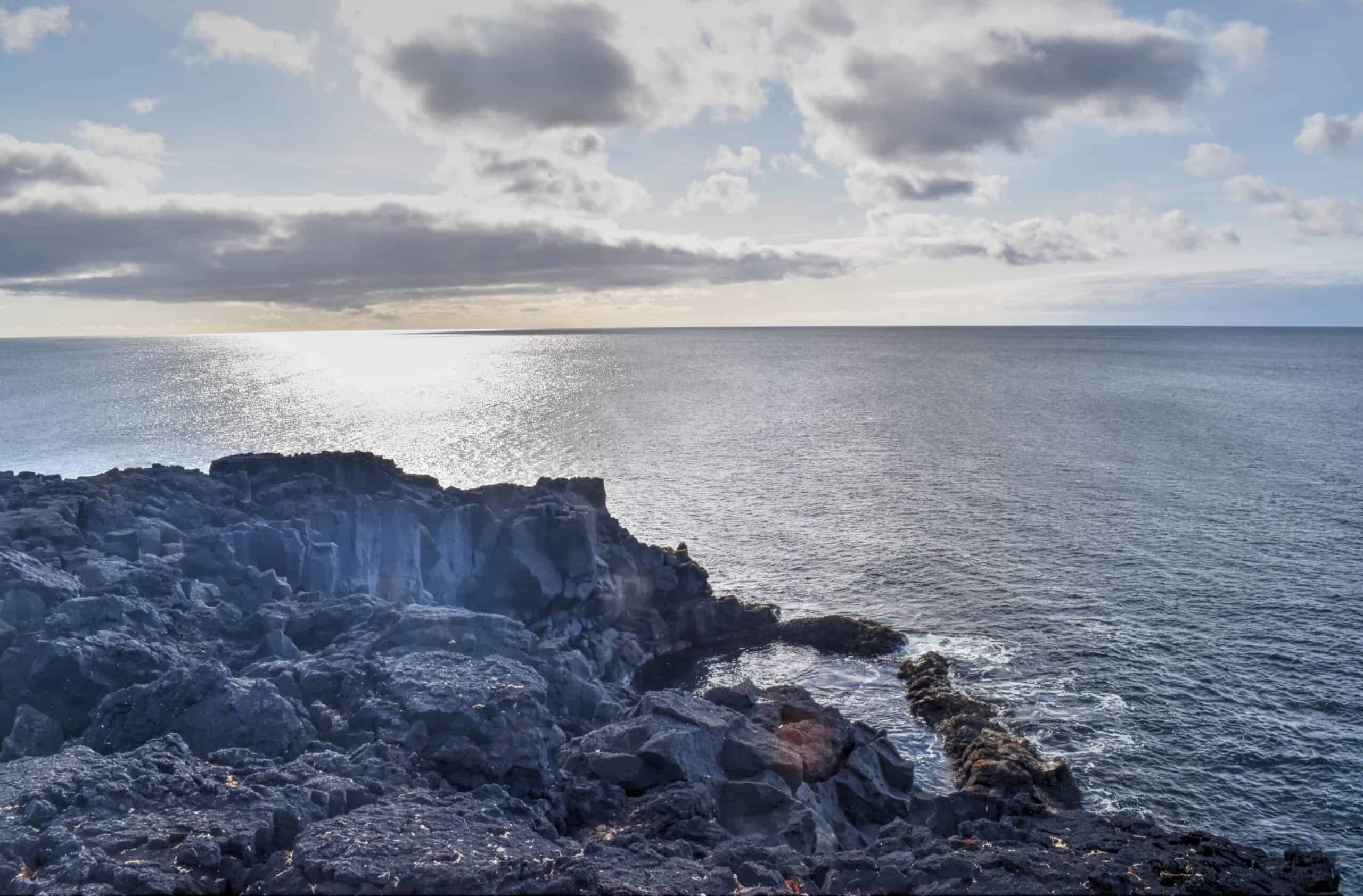
Brimketill lava rock pool & sea cliffs – a large natural lava rock pool sitting by the ocean’s edge, carved by the pounding of waves against soft lava rocks.
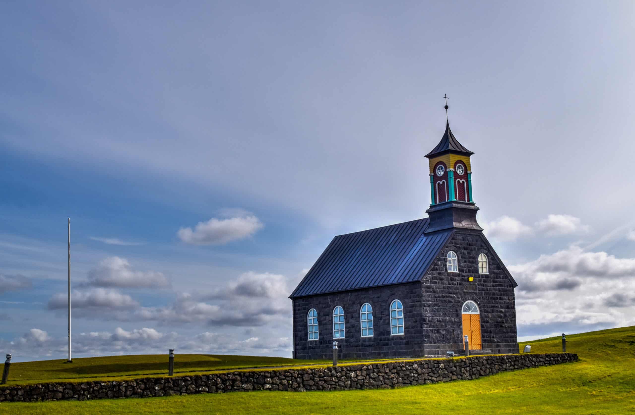
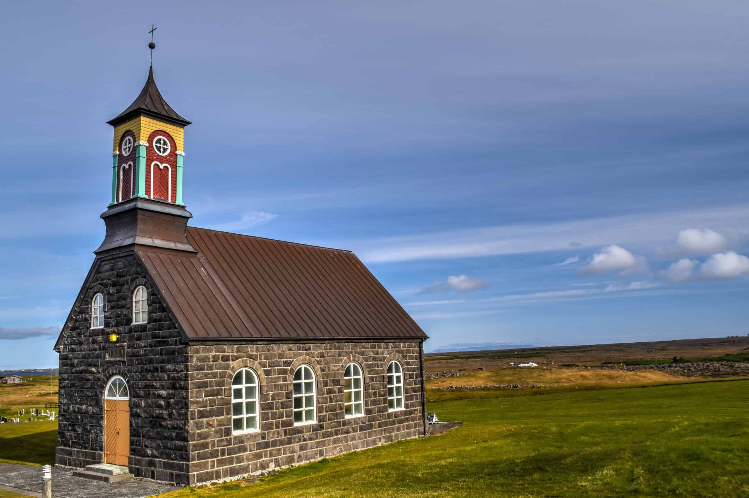
Hvalsneskirkja – a small photogenic stone church dating from 1887.
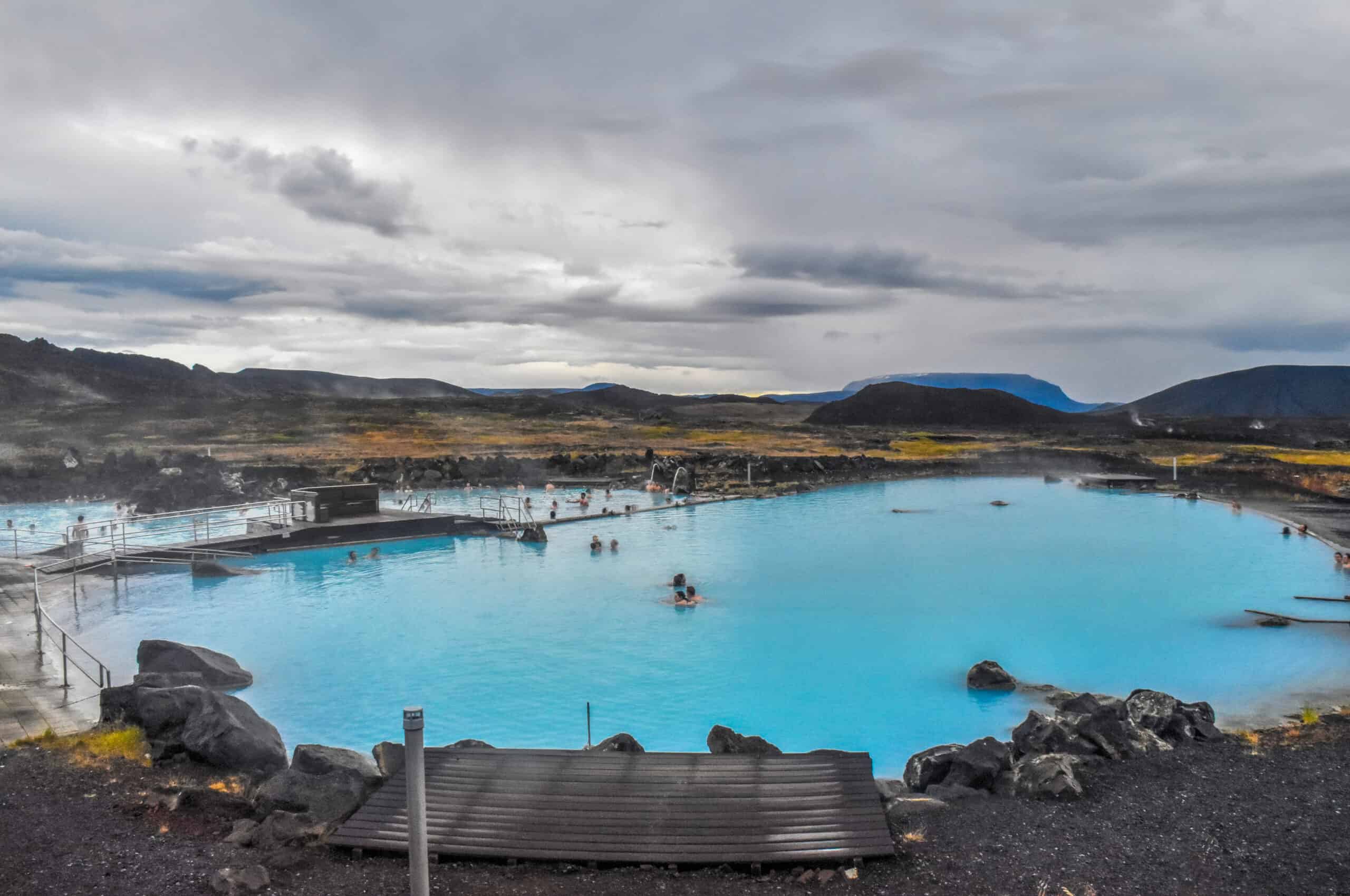
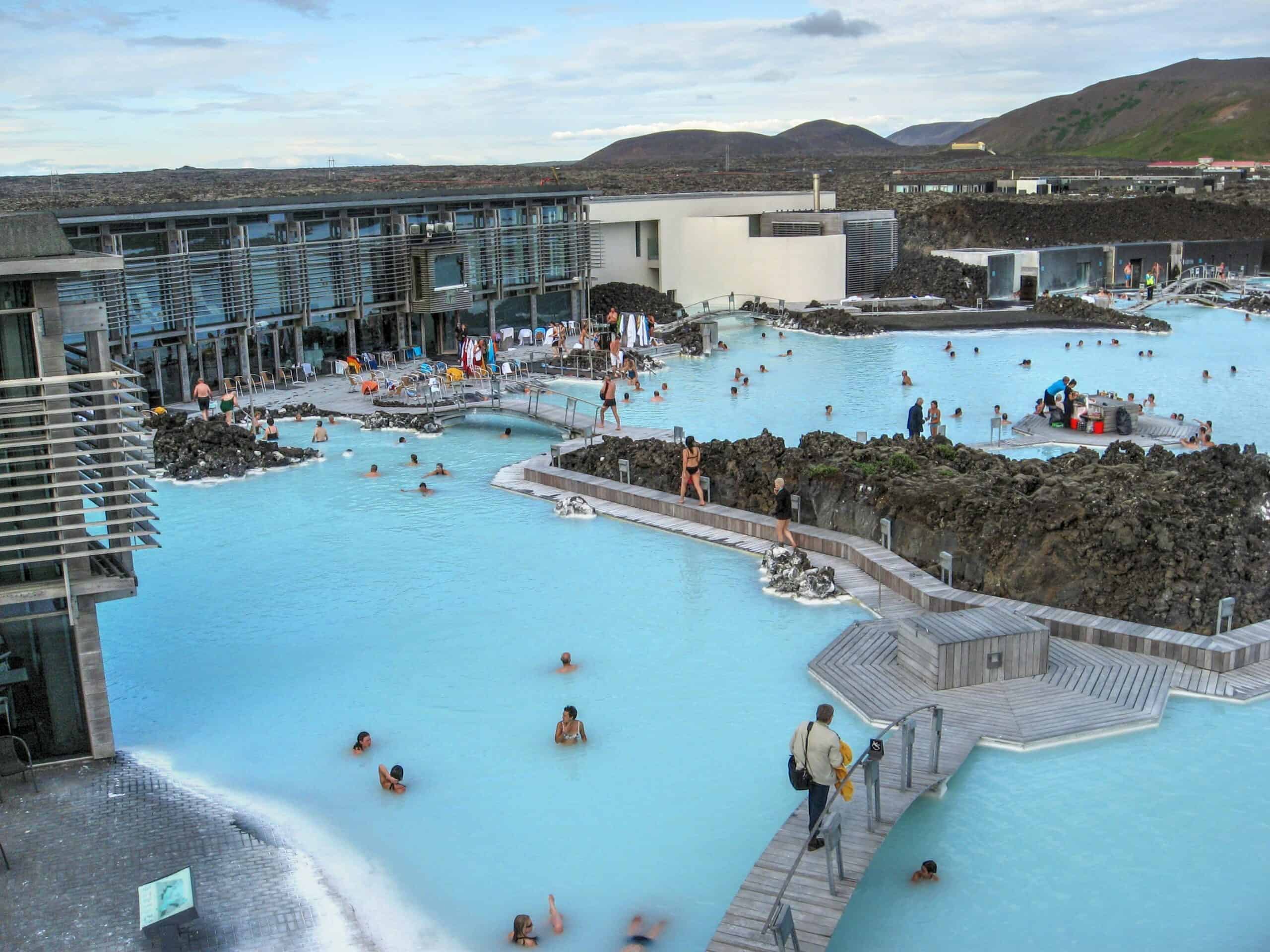
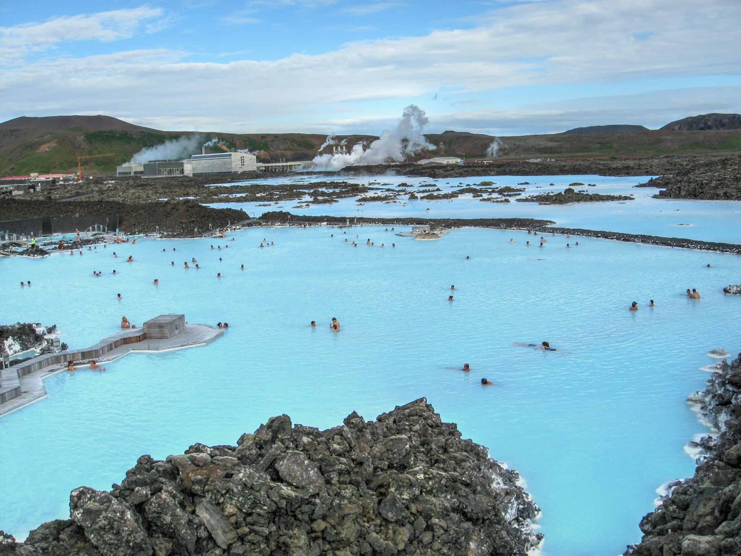
Blue Lagoon
Last but not least, we’ll end with the world-famous Blue Lagoon. Many have debated whether the Blue Lagoon is even worth the steep entry price. Well, that is obviously a very personal and subjective decision. We felt the Blue Lagoon was a truly unique experience and we would definitely go again. Yes, it’s an expensive activity, but then again it’s not something you do every weekend. It’s a spa experience like no other, set in a magical backdrop of Icelandic volcanic terrain. We also stayed well beyond sunset, and it’s an even more magical experience after dark.
Map of top things to see and do in Reykjanes Peninsula
There are also a few things and places we didn’t get the chance to explore during our loop around the Reykjanes Peninsula, such as the Viking World Museum in Njardavik, the Hafnarberg sea cliffs, and the Fagradalsfjall Volcano, which erupted in March of 2021 and subsequently became a tourist sensation.
That wraps it up! We hope you enjoyed our Top Things to See and Do in Iceland Travel Guide and that it will prove useful in helping you plan your trip to Iceland.
You might also be interested in these related pages:
2 Comments