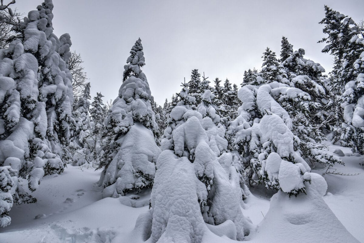
One of our favorite areas to do some winter hiking is the Sutton region of the beautiful Eastern Townships, an area easily reached from Montreal as a day trip. Though Sutton is primarily known for its downhill skiing resort, there are several great winter hiking trails in the Parc d’Environnement Naturel de Sutton (PENS), including its popular Round Top trail. To help you get the best out of your time here, we put together this guide on the Best Winter Hiking Trails near Sutton that focuses on those that we believe best maximize the effort-to-reward ratio.
Disclosure: This page (Best Winter hiking trails near Sutton) may contain product affiliate links. At no additional cost to you, we may receive a commission for purchases made through these links. More details can be found on our disclosure and policies page.
You might also be interested in these pages:
Quebec Hiking Trails that Are Stunning in Winter
Best Winter Hiking Trails in Charlevoix region
Best Winter Hiking Trails in Mont Mégantic National Park
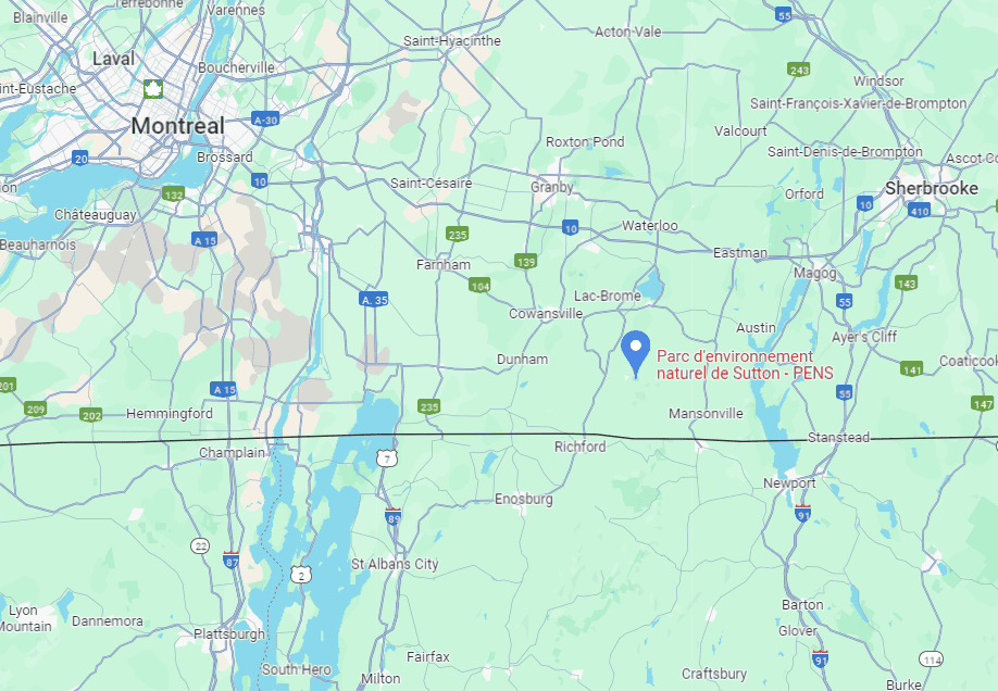
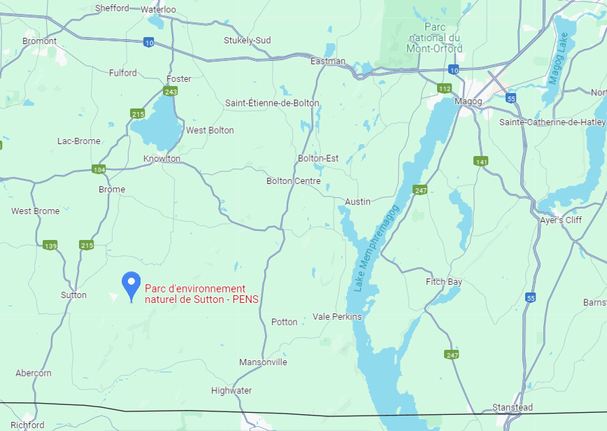
Mont Sutton Location and Map
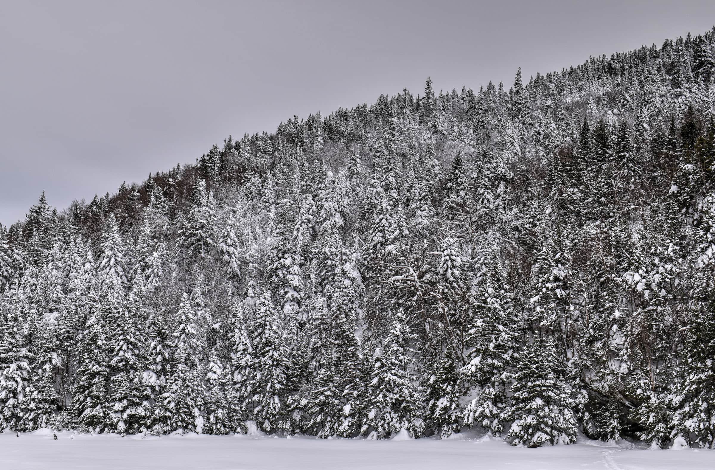
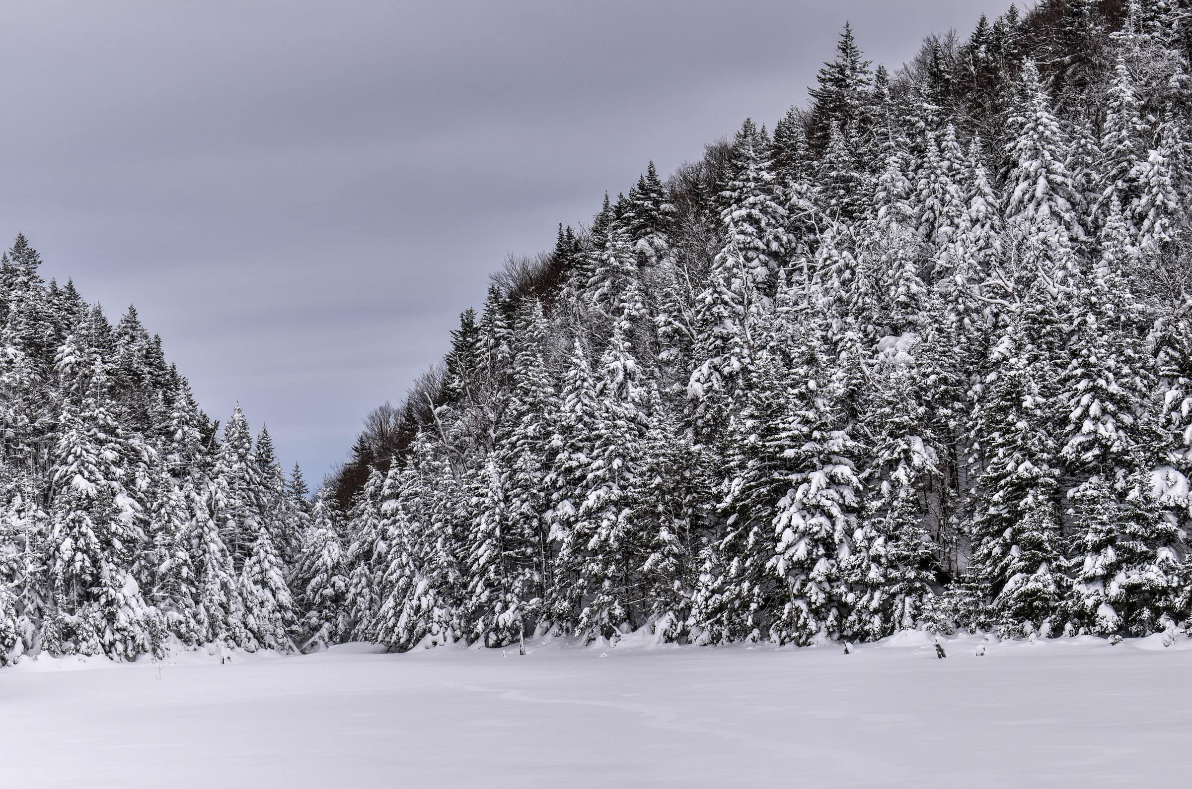
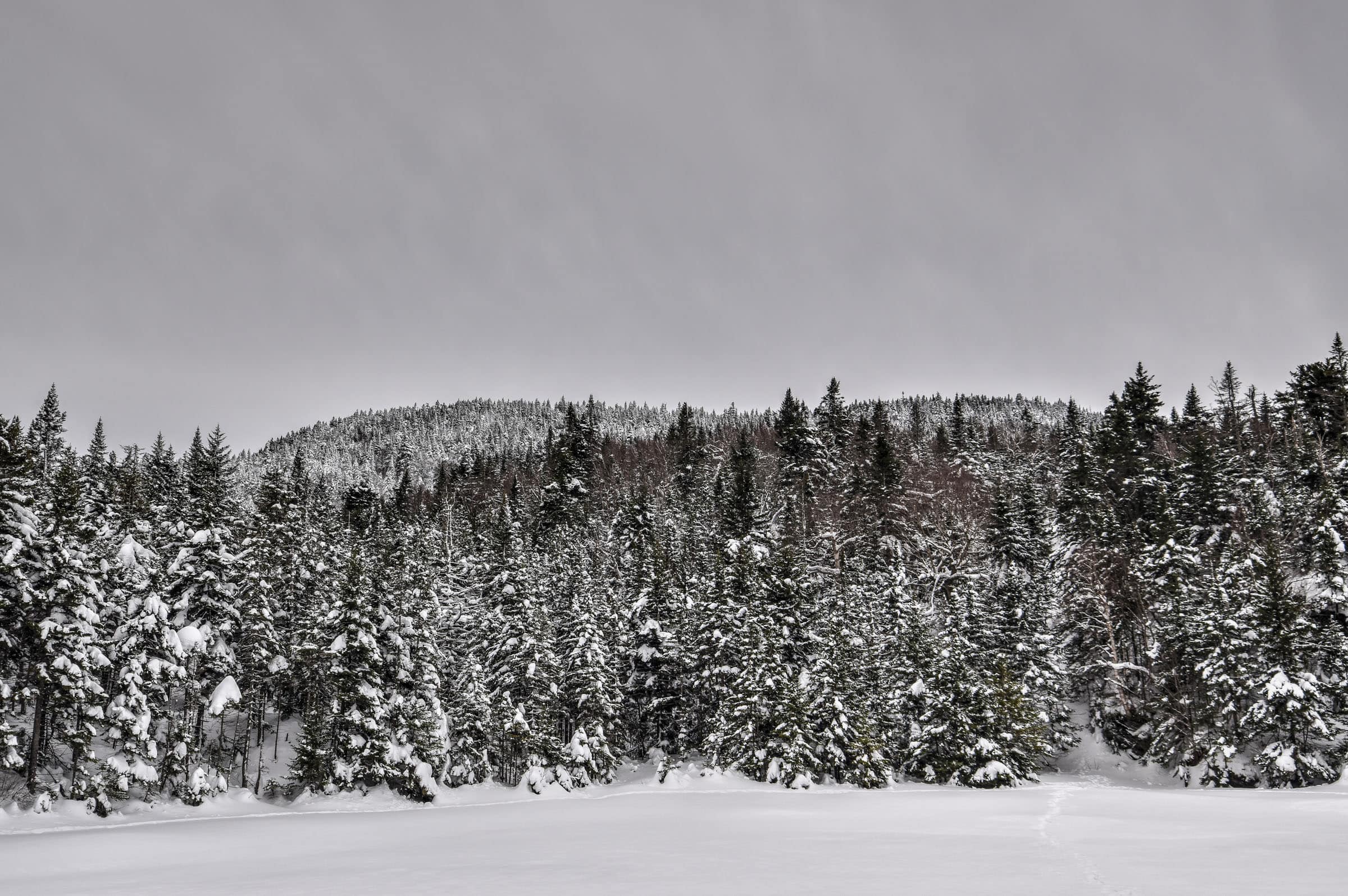
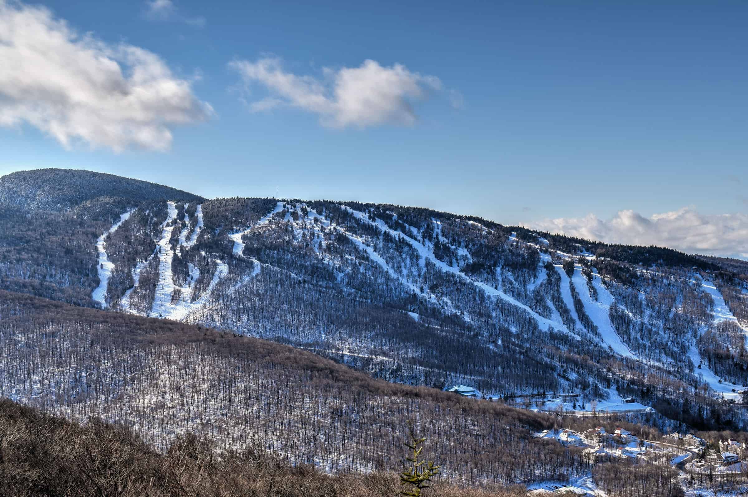
Mont Sutton, and more specifically the Parc d’Environnement Naturel de Sutton (PENS), the eastern townships of Québec, close to the Vermont state border and near the Mont Sutton ski resort (link to Google Maps). Between its four summits, lakes and streams, the PENS offers 48 km of marked trails.
How to Get to Sutton (PENS)
The easiest way to reach the PENS is by car.
From Montreal: about a 1h30 drive (125 km)
From Sherbrooke: about a 1h15 drive (95 km)
From Burlington (Vermont): about a 1h30 drive (70 miles)
If you need to book a rental vehicle for your hiking excursion, we highly recommend using Discover Cars to get the best rates on your rental in Montreal.
We also highly recommend Airalo (eSIM card) for your connectivity needs when travelling abroad. Airalo is the world’s first and largest eSIM store with eSIM plans for 200+ countries and regions worldwide.
Alternatively, you can also reach the park from Montreal by organized transfer via the Navette Nature service, which offers bus trips on various weekend dates. The service rotates between parks, so there might be only one or two trips per park per season.
PENS Trail Access, Fees, and Parking
Trailheads & car park locations: Not all trails share the same car parks and trailheads. These will be detailed on a trail-by-trail basis below.
Trail access & parking fees: To hike any PENS trail you’ll need to pay an 8$ access fee (2024) and it is highly recommended to book ahead online. The purchased ticket will be valid only for the selected day and selected timeslot, meaning that will you have to start your hike either between 9 am and 12 pm or between 12:30 pm and 3:30 pm.
Trail opening hours: The PENS park is typically open to visitors from 9 am to 5 pm during the summer and 9 am to 4 pm during the winter. We recommend consulting the park website for up-to-date hours.
The park’s trails are generally open year-round except for the spring snowmelt period (typically mid-April to mid-May, exact dates vary depending on the yearly weather). We recommend checking out the park’s official website to see if there are any temporary trail closures (PENS trail conditions page).
Parking lot: The car park is quite large, and there are rarely issues with finding parking.
Facilities: Toilets are available by the Round Top trailhead next to the ticket check counter.
Best Time to Hike The PENS Trails
To experience a proper winter hike and beautiful white landscapes, it’s best to plan your visit between mid-December and mid-March. That being said, there are year-to-year differences regarding the early and late winter snow conditions. If you would like to visit early or late in the winter season, it’s best to check the park conditions first (PENS trail conditions page).
Why Hike in Winter?
– There are generally fewer people on the hiking trails, allowing for a more peaceful and enjoyable experience.
– Compacted snow generally makes the trail easier to walk on and removes the difficulties associated with walking over rocks, boulders and tree roots.
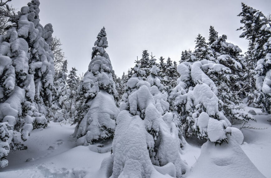
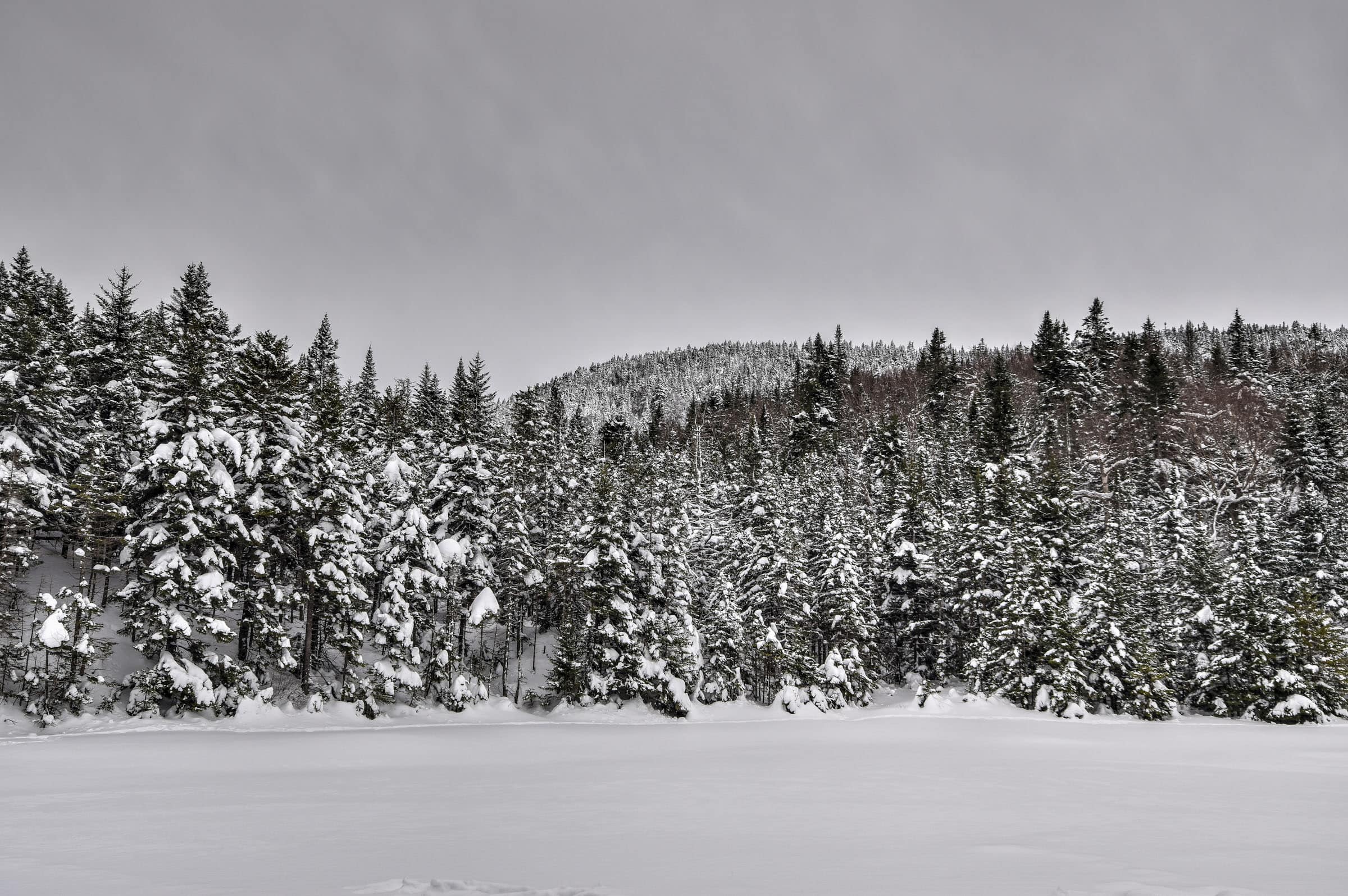
– The scenery is very different than in any other season but is no less beautiful.
Winter Hiking and Trail Safety Tips
In the absence of any significant recent snowfall, it is highly recommended to wear crampons/traction cleats under your shoes or boots when hiking most trails in this park, particularly any trail that has significant elevation gain. You can rent traction crampons/ice cleats to attach to your boots for 10$ (2024) at the PENS visitor center. If you plan on needing cleats for more than 2 days, you’re probably better off buying your own.
Winter Hiking Packing List
Crampons / Ice Cleats – These are a must-have to help you with those steep ascents/descents or navigate icy trail conditions.
External Battery – Cold weather significantly affects cell phone battery drainage. Best to be prepared with an external power source to recharge your phone if needed.
Hiking poles – These can be particularly useful in winter, especially when not wearing any crampons or ice cleats.
Hand warmers – if you are like us and often remove your gloves to take pictures, having little hotties around care be hand life savers in freezing weather.
All Trails subscription – comes in really handy for areas with little or no cell reception, as the annual subscription allows you to download trail maps for offline use.
If there was a lot of recent snowfall, you might want to hike with snowshoes instead of ice cleats to help navigate the soft snow. To help you decide what footwear to bring, the national park details the recent snowfall and trail conditions via the “information of the day” button at the top of the page ( e.g. typically either densely packed snow or fresh powdered snow). The visitor center also rents out snowshoes if need be.
Also, always bear in mind that no matter how cold it is at the base of the mountain, it’s going to be even colder at the summit (and windier), so remember to dress appropriately. It’s generally recommended to wear fewer layers to start since you will warm up after a few minutes of hiking. But it’s a great idea to pack some extra warm gear for when you take a break or reach the summit.
Best Hiking Trails Near Sutton
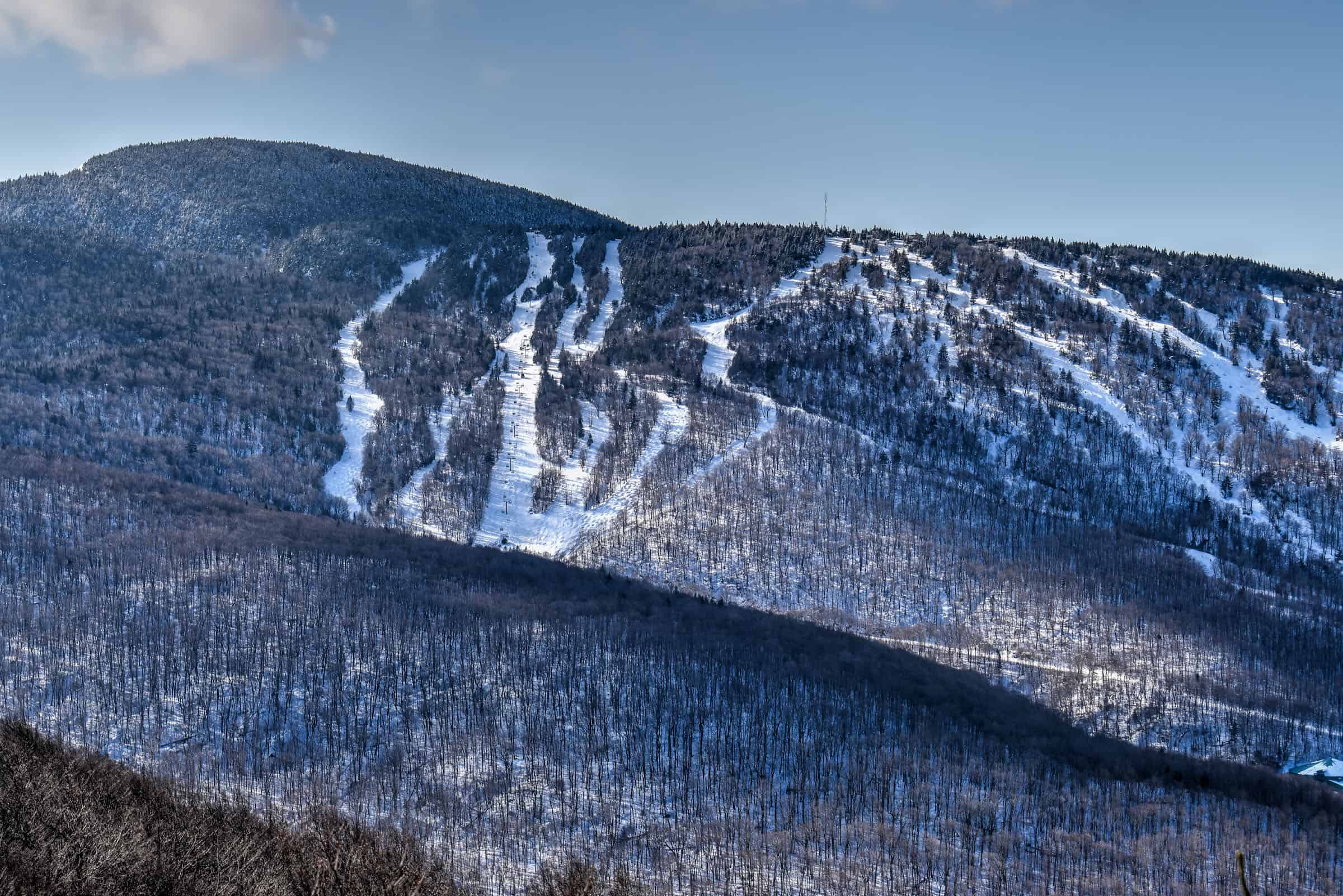
Mont Sutton, like many other mountains in the Eastern Townships (e.g. Bromont, Orford, Owl’s Head) is primarily for known its ski resort. However, it has also built a solid reputation as a great winter hiking destination, particularly because of its marquee trail – the Round Top. All of the trails listed below are part of the PENS network of trails. We will present them from easiest to hardest.
It’s important to note that dogs are not permitted on two of the trails described below: the Round Top Trail and the Hollandais Trail. This is because sections of these trails are part of the Green Mountains Nature Reserve, which is the natural habitat of the rare and endangered Bicknell’s Thrush. Dogs must be on a leash anywhere else in the network of PENS trails.
Easy Trails
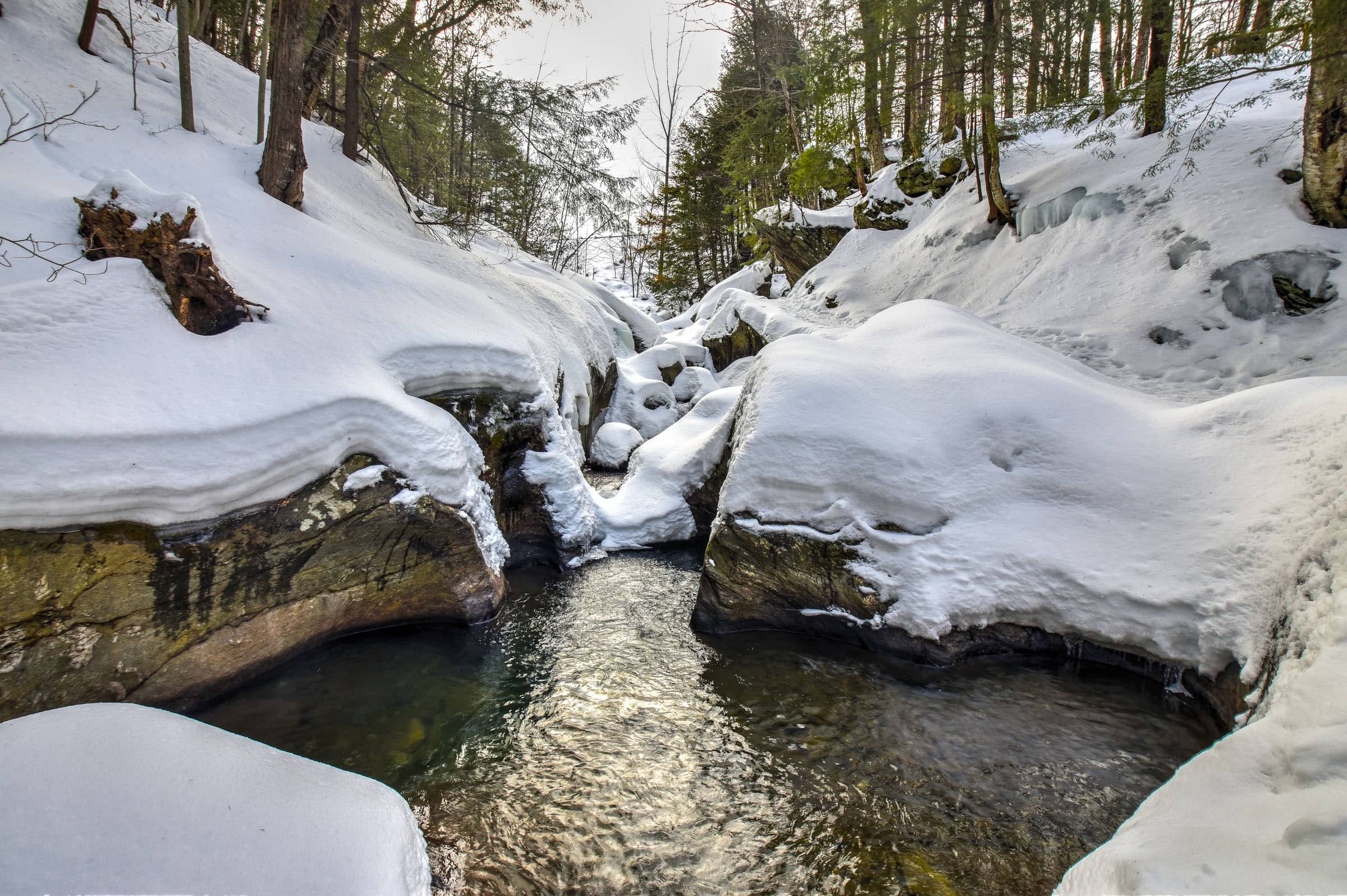
Pékan Falls Trail
This a a very short trail that will take you through an uphill forested section that is more challenging than the previous trail. Although you only gain about 100m in elevation, you do so in a kilometre, making it a steeper ascent. Although the trail itself was quite pleasant, the waterfall at the end was somewhat of a letdown since it was completely frozen and mostly snow-covered. Dogs are welcome but must be on a leash.
Distance: 1.9 km
Route Type: Out & back
Elevation gain: 92 m (cumulative elevation gain: 96 m)
Start point: P3 car park
AllTrails rating: (4.3, 119 ratings (2024))
Duration: Most people complete the trail in about 45-60 min
Access Fees: PENS daily rate
Lac Spruce Trail
This is one of the most popular PENS trails. Although most follow the Lac Spruce and Round Top combined trails (presented further below and described in greater detail in our Round Top Hiking Guide), if you are short on time or don’t want to gain twice as much elevation, this trail might be for you. This loop trail takes you to the beautiful and scenic Spruce Lake. It’s also worth the small detour to visit the smaller Lac Vogel. Dogs are welcome but must be on a leash.


Distance: 4.5 km
Route Type: Loop
Elevation gain: 230 m (cumulative elevation gain: 234 m)
Start point: PENS car park
AllTrails rating: (4.5, 380 ratings (2024))
Duration: Most people complete the trail in about 1h25-1h45
Access Fees: PENS daily rate
Not an AllTrails member yet? We highly recommend signing up for either their free or paid membership plans. The free plan allows you to find new trails and plan routes but it can only be used while hiking if you have access to mobile data. The paid membership plan (AllTrails+) allows you to download trail maps for offline use and provides live progress updates and off-route notifications.
If you are still uncertain – you should know that the All Trails mobile application was voted the 2023 iPhone App of the Year by Apple.
Moderate Trails
Village-Montagne Trail


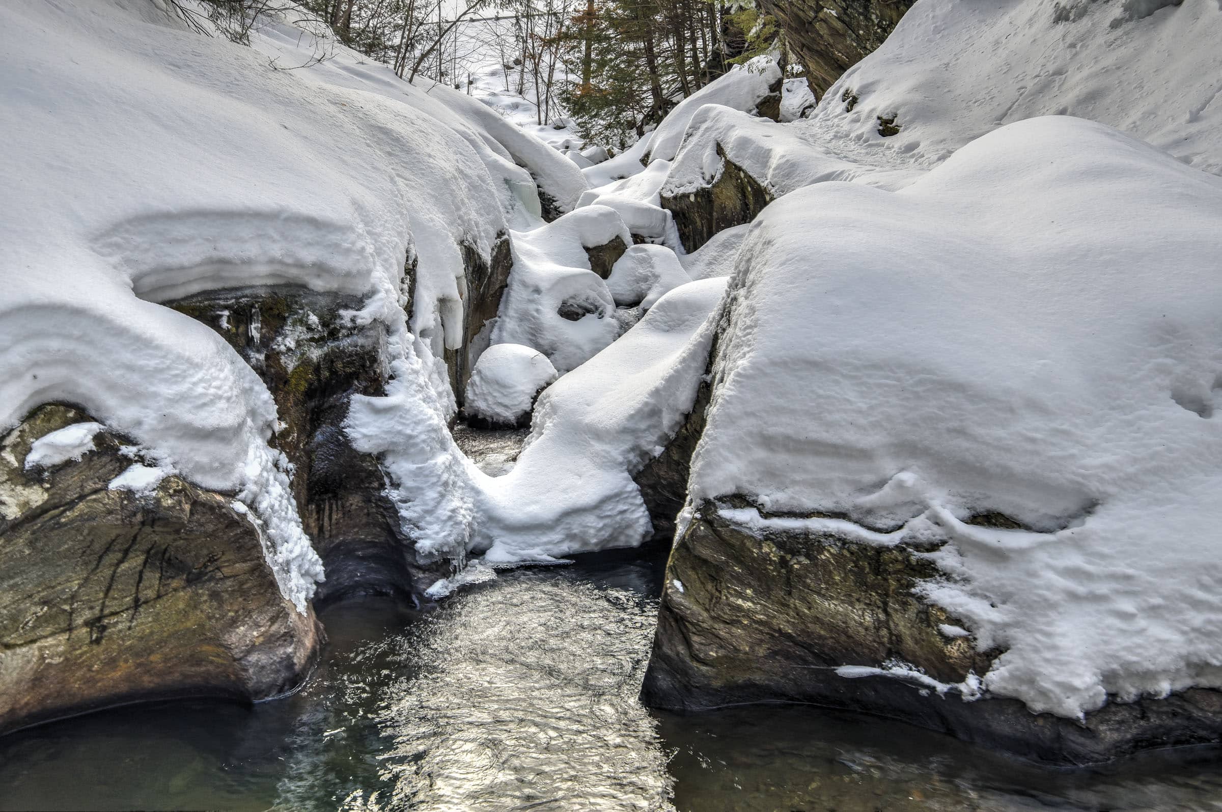
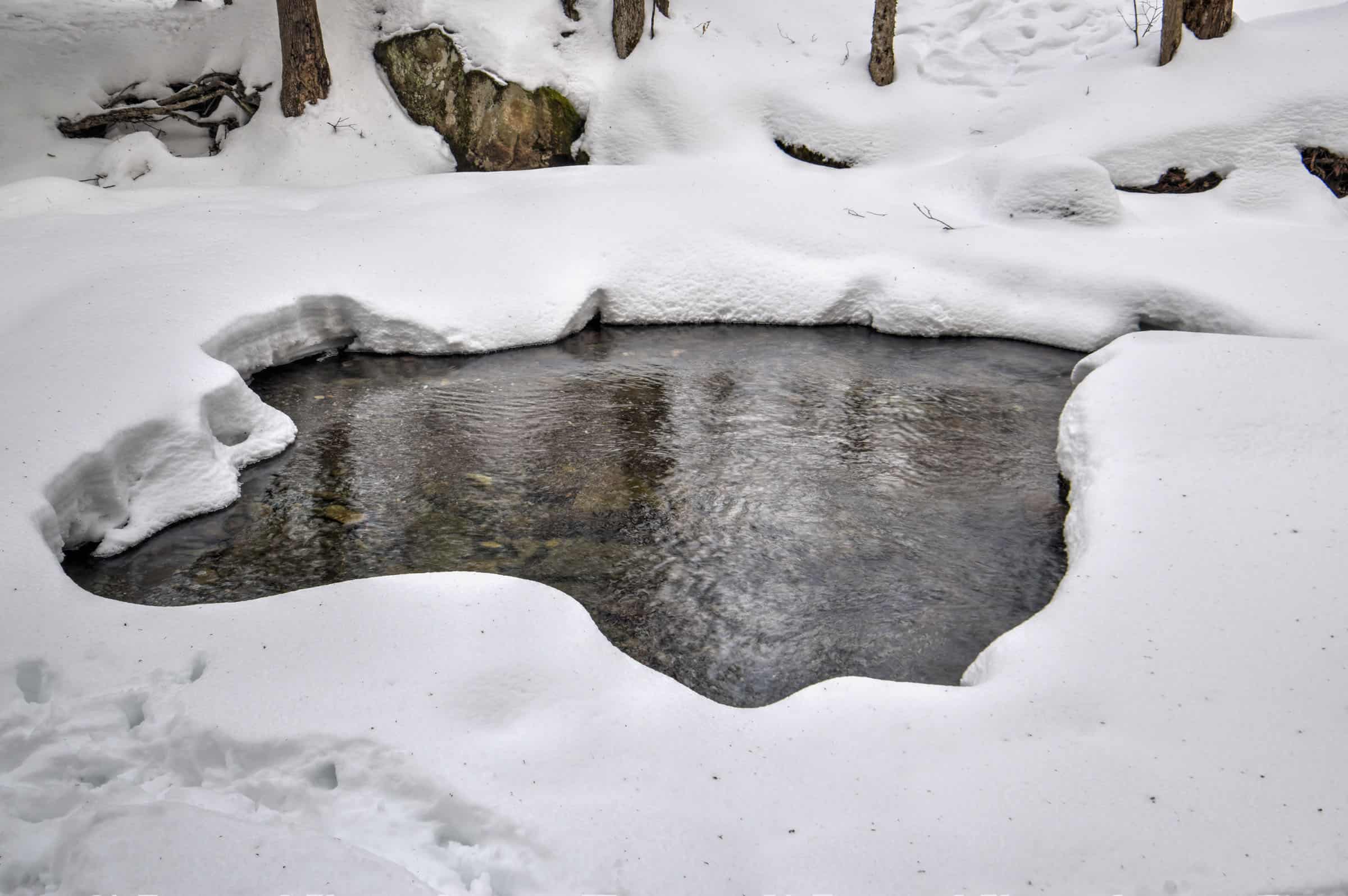
This lovely trail follows a gentle stream through various forested sections between some occasional farmland fields. It’s a very peaceful walk with a nice reward for those who make it to the end: a series of pools known locally as the “Witches’ Pot” (la marmite des sorcières).
Aside from its length, the trail does not present any difficult challenges. Although there is some elevation gain, it occurs smoothly and progressively throughout the trail. Dogs are welcome but must be on a leash.
Distance: 10.1 km
Route Type: Out & back
Elevation gain: 190 m (cumulative elevation gain: 340 m)
Start point: Trailhead: Parc Godue; Car park.
AllTrails rating: (4.6, 540 ratings (2024))
Duration: Most people complete the trail in about 2h30-3h
Access Fees: PENS daily rate
Village-Montagne & Pékan Falls Combo Trail
This trail is simply the combination of the two previous trails, which can be easily achieved since the Village-Montagne trail ends across the street from where the Pékan Falls trail begins.
Distance: 12.2 km
Route Type: Partial Out & back, Partial Loop
Elevation gain: 320 m (cumulative elevation gain: 355 m)
Start point: Trailhead: Parc Godue; Car park.
AllTrails rating: (4.2, 49 ratings (2024))
Duration: Most people complete the trail in about 3h-3h45
Access Fees: PENS daily rate
*Note that our distance and elevation values differ from the All Trails website as we modified the starting point to be identical to the one listed above for the Village-Montagne trail because there is no parking nearby to the startpoint indicated by All Trails.
**We recommend not doing the loop as depicted in the All Trails map below, but rather returning the same way you made your way up to the falls because the return section follows a road as opposed to a proper hiking trail.
Moderately-Challenging Trails
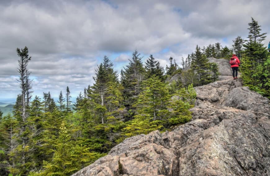
Round Top Trail
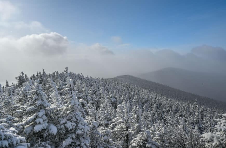
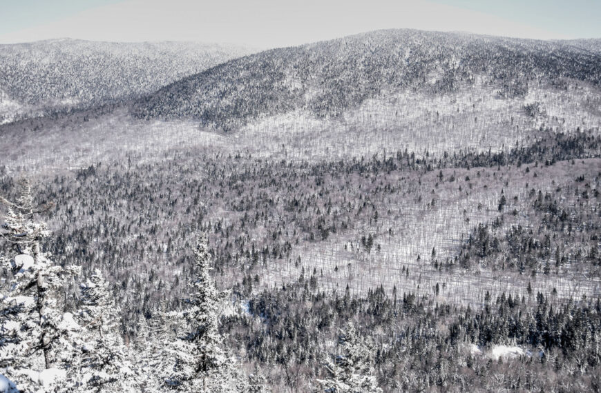
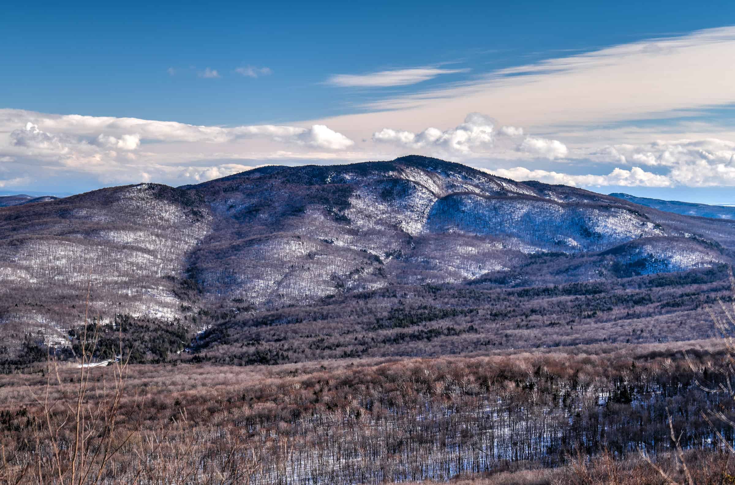
This is the trail that most people want to do when they come to Sutton. It leads to the highest peak of the massif, the Round Top, which culminates at 968 meters, where it offers panoramic views of the St. Lawrence plain, the Sutton Mountains and Lake Champlain. The final sections can be very icy, particularly those that involve the steps, so proper winter footwear (winter crampons or ice cleats are preferable) is highly recommended. Dogs are not permitted on this trail.
For more information on this trail, and on how you can combine it with the Lac Spruce Trail, you can check out our Round Top Hiking Guide.


Distance: 6.0 km
Route Type: Out & back
Elevation gain: 396 m (cumulative elevation gain: 404 m)
Start point: PENS car park
AllTrails rating: (4.5, 370 ratings (2024))
Duration: Most people complete the trail in about 2h15-2h45
Access Fees: PENS daily rate
Hollandais Trail
This trail is very different from those described to date. It follows a large square loop path, with a long section that follows a ridgeline between two summits (Hollandais summit and Orignal summit). There are several viewpoints along the ridgeline section providing beautiful vistas of the surrounding mountains. Note that it is not as busy as the other trails mentioned above, often resulting in less packed snow, meaning that snowshoes could be more helpful than ice crampons (though in our experience it was always still very manageable in our normal winter boots). Dogs are not permitted on this trail.


Distance: 7.2 km
Route Type: Loop
Elevation gain: 300 m (cumulative elevation gain: 485 m)
Start point: PENS car park
AllTrails rating: (4.5, 783 ratings (2024))
Duration: Most people complete the trail in about 2h30-3h
Access Fees: PENS daily rate
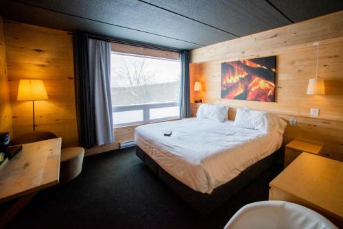
Where to Stay Near Sutton
If you would like to spend a night (or more) to have the chance to enjoy several trails in the area, there are a few great accommodation options nearby.
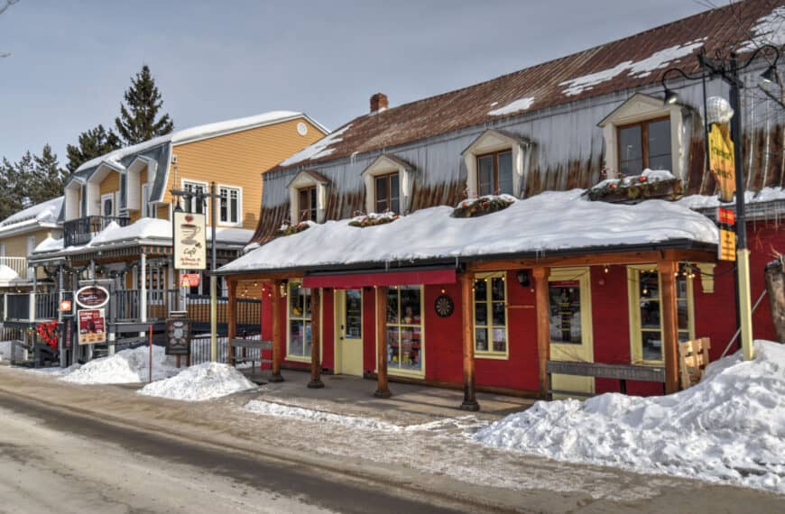
We also can particularly recommend Le Pleasant Hôtel & Café, situated in the heart of Sutton village, a short 5-minute drive from most of the hiking trailheads.

Otherwise, just outside of town is the popular and rustic Hotel de L’horizon.

You might also be interested in these pages:
Quebec Hiking Trails that Are Stunning in Winter
Best Winter Hiking Trails in Charlevoix region
Best Winter Hiking Trails in Mont Mégantic National Park
Photography Gear
If you like our photography, you might be interested in some of the gear we use to shoot our travel and hiking destinations.
Camera Body – Nikon Z 6ii Fx-series Mirrorless Body
Main Lens – NIKON 24-120mm F/4G ED VR AF-S
Zoom Lens – Sigma 745-306 150-600mm f/5-6.3
Polarizing filters – Urth Circular Polarizing (CPL)
Camera Tripod – K&F Concept 64-inch Camera Tripod
Mini-tripod – Lammcou Flexible Camera Tripod
Camera/hiking backpack – Vanguard Alta Rise 48 Backpack
Universal Travel Adapter – VYLEE Universal International Power Travel Plug
Other Travel Essentials
Travel Insurance
SafetyWing is a travel insurance company that offers comprehensive coverage for travellers. Includes Medical Insurance and Travel Insurance. Primarily geared towards long-term travellers, digital nomads, and expats.
e-Sim cards
Airalo is the world’s first and largest eSIM store with eSIM plans for 200+ countries and regions worldwide. With Airalo eSIMs, travellers can get connected the moment they land at their destination and avoid nasty data roaming charges
eSIMS are a sustainable alternative to single-use SIM cards – they are 100% digital, require less energy to produce and be re-used rather than disposed of.
Car Rentals
Discover Cars is our go-to website for car rentals. We almost always find our preferred rate there.
Transfer from Airport
Welcome Pickups is our favourite private transfer service, which you can pre-book at a fixed price. Currently available in 220 cities all over the world (mostly in Europe, but with several major cities in Asia, the Middle East and the US).
Kiwitaxi is another private transfer service – we haven’t tried it yet, but it’s currently available in a few more countries (102 as of 2024).
Hotels and Accommodations (coming soon)
Photography Prints
If you found this blog useful, you can help support our blog by purchasing low-cost digital prints. Printed physical prints are also available for purchase.


—–
Well, that wraps it up! We hope you enjoyed our Guide on the Top Things to See and Do in Baie-Saint-Paul (Charlevoix) and that it will prove useful for planning your trip to the beautiful Charlevoix region of Québec.
—–
You might also be interested in these related pages:

—–
Well, that wraps it up! We hope you enjoyed our Guide on the Best winter hiking trails near Sutton and that it will prove useful for planning your trip to the beautiful Eastern Townships.
—–
Preparing a trip to Québec?
We highly recommend these guidebooks:
—–
You might also be interested in these related pages: