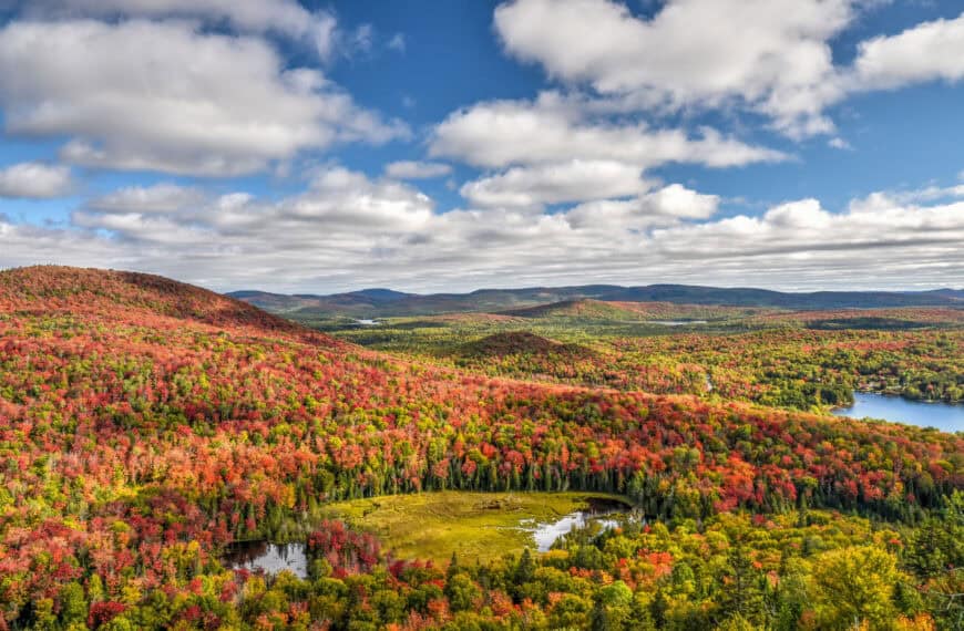
Although not known to many, as it is somewhat remote and quite far from most metropolitan centers, Gaspésie is one of the best hiking destinations in the province of Québec. It has a beautiful mix of mountain and coastal trails, is home to the northern end of the Appalachian mountains, and is where you will find two Québec National Parks, one Canadian National Park and one UNESCO Geopark, among other fantastic hiking locations. To help you plan your next outdoor adventure in the region, we put together this guide on 10 Awesome Hiking Trails to Discover in Gaspésie, with a focus on those that we believe best maximize the effort-to-reward ratio. We will primarily focus on easy, moderate and moderately challenging trails that can be completed in under 4 hours.
Disclosure: This page (10 Awesome Hiking Trails to Discover in Gaspésie) may contain product affiliate links. At no additional cost to you, we may receive a commission for purchases made through these links. More details can be found on our disclosure and policies page.
You might also be interested in these pages:
Gaspésie Best Attractions and Road Trip Itinerary
Best Things to See and Do Percé
Gaspésie’s Most Beautiful Lighthouses


Gaspésie National Park
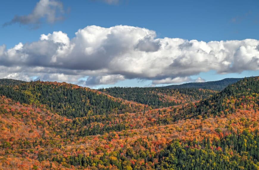
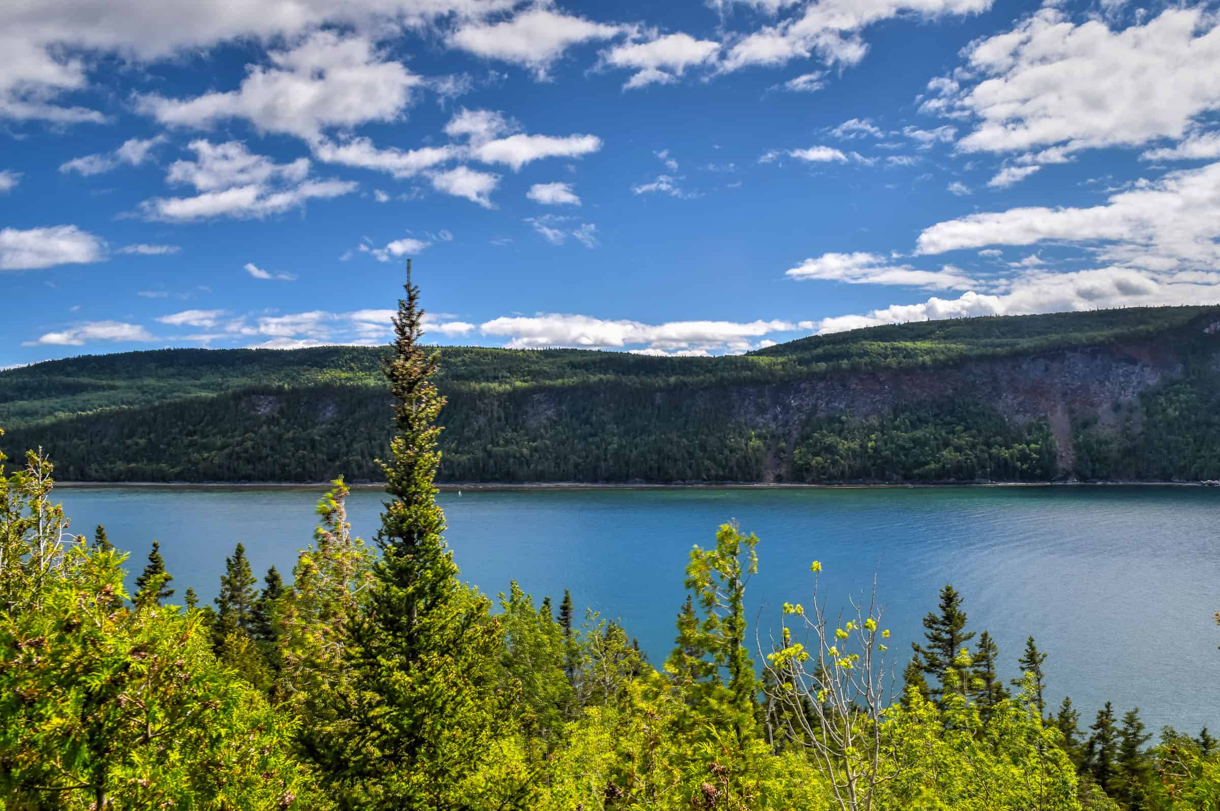
Gaspésie National Park is one of 28 Quebec National Parks, the majority of which are administered by the Société des établissements de plein air du Québec (SÉPAQ). Among the region’s other parks, this one is unique in that it does not hug a coastline. The park is a hiker’s paradise, with more than 25 peaks reaching over 1,000 meters, including the highest peak of the Appalachian Mountains in Canada, Mont Jacques-Cartier, at 1,270 metres (4,170 ft) above sea level.
All Quebec National Parks (including the Gaspésie National Park) charge the same access fees and you can buy an annual pass that allows unlimited access to all parks.
Daily access fees and Annual passes
Quebec National Parks are managed by the SÉPAQ, a government agency that manages all provincial parks and wildlife preserves in Québec.
There is a limit to the number of visitors that can enter any Québec SÉPAQ National Park on any given day. It is therefore strongly recommended that you purchase your daily right of access online before a visit or that you acquire an annual pass.
The daily pass ($9.85 (2024)) can be purchased here up to 30 days before a visit.
The annual pass can be purchased here either for unlimited access to a single national park ($49.25 (2024)) or for unlimited access to all SÉPAQ national parks ($88.50 (2024)). Even if you have an annual pass, we still recommend arriving early in the morning or mid-to-late afternoon to avoid showing up to a filled parking lot.
Lac-aux-Américains Trail (easy)
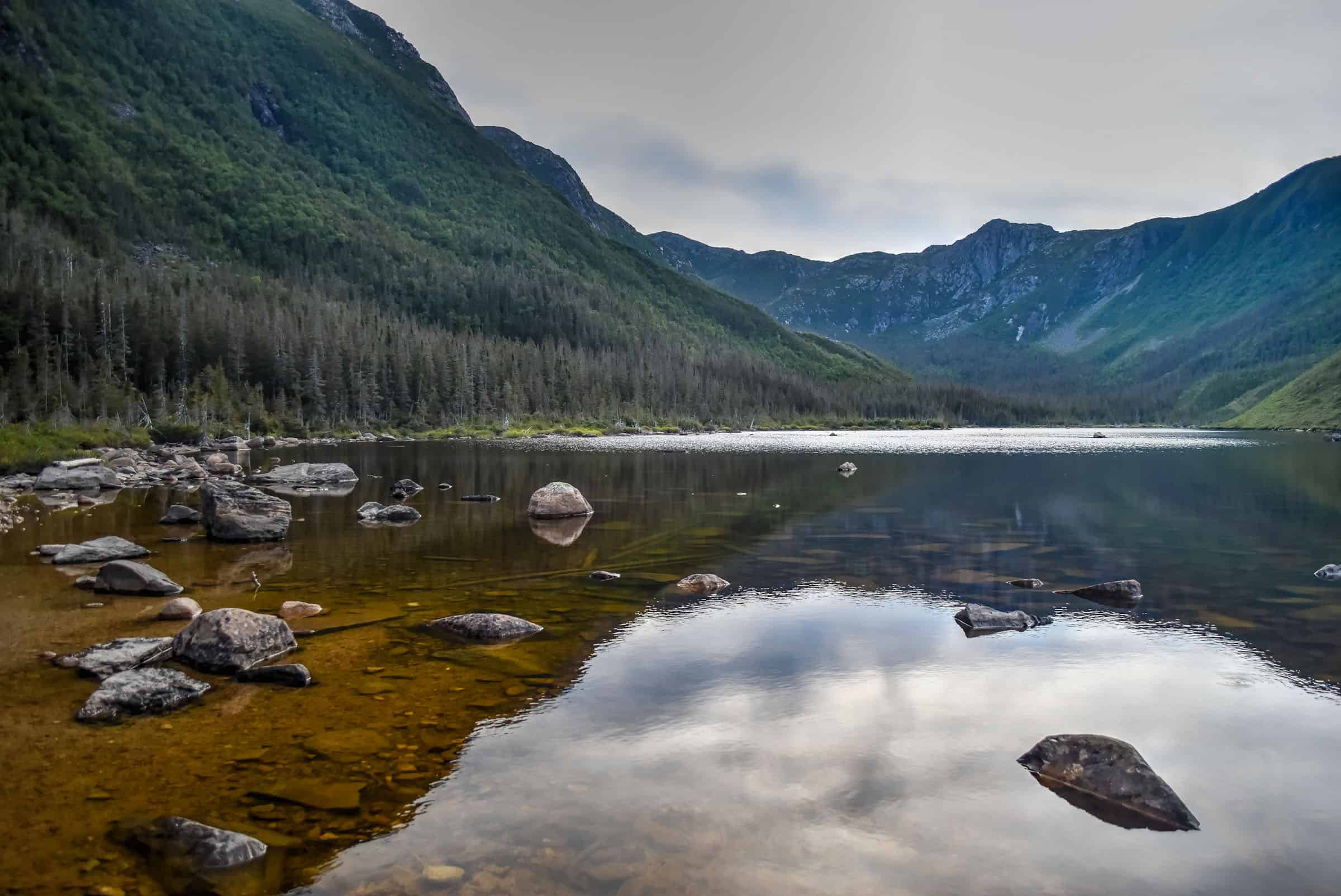
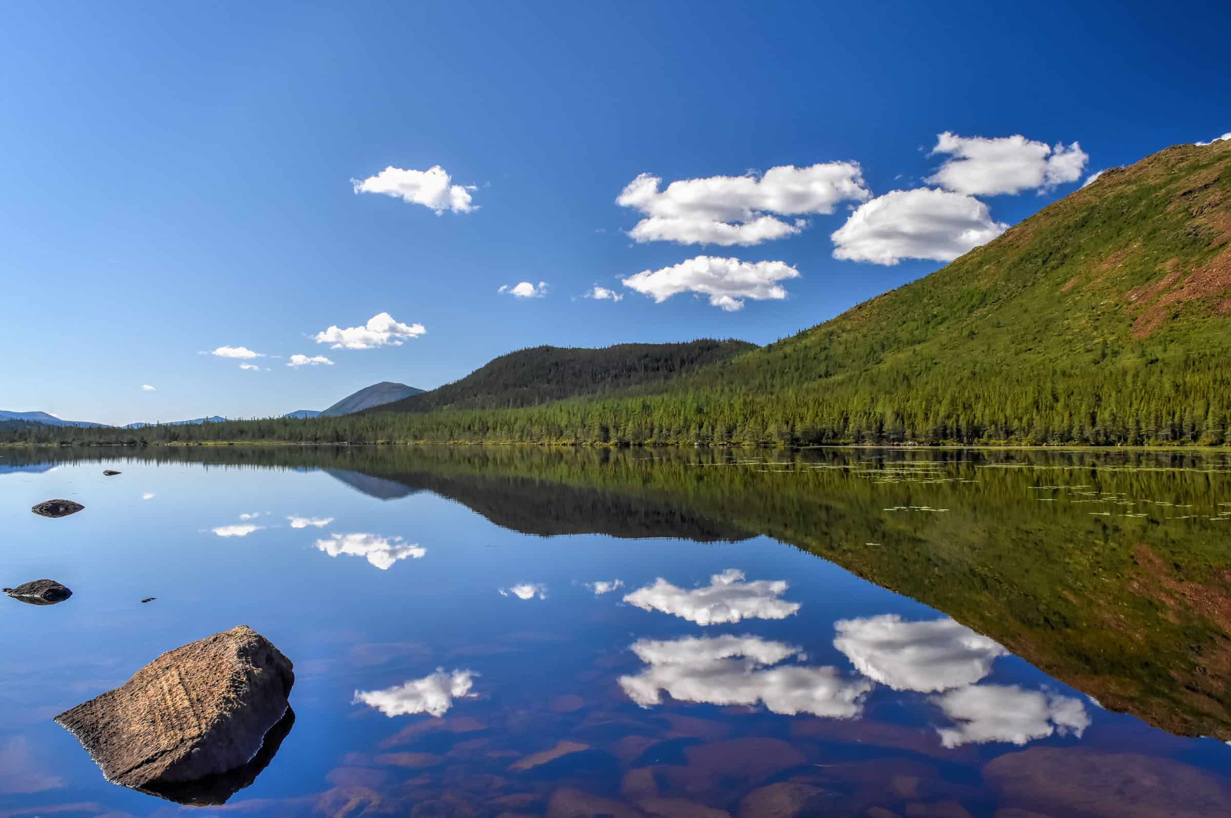
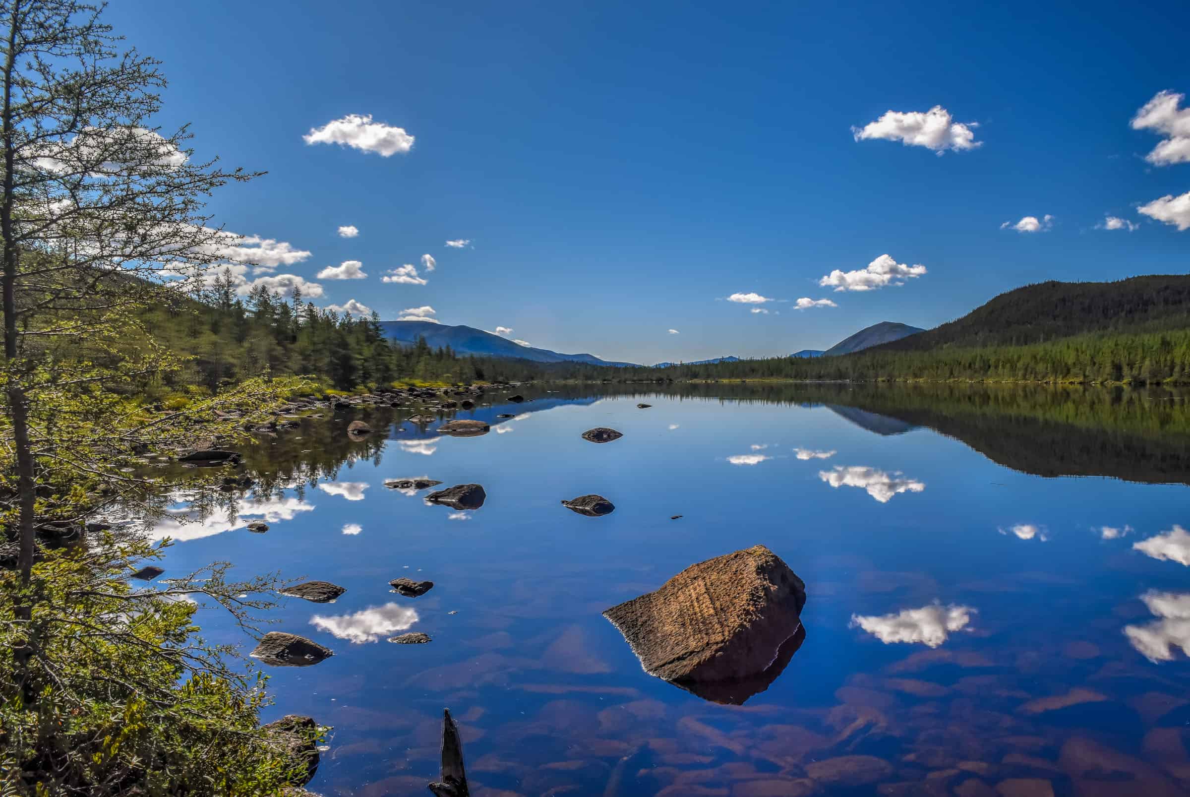
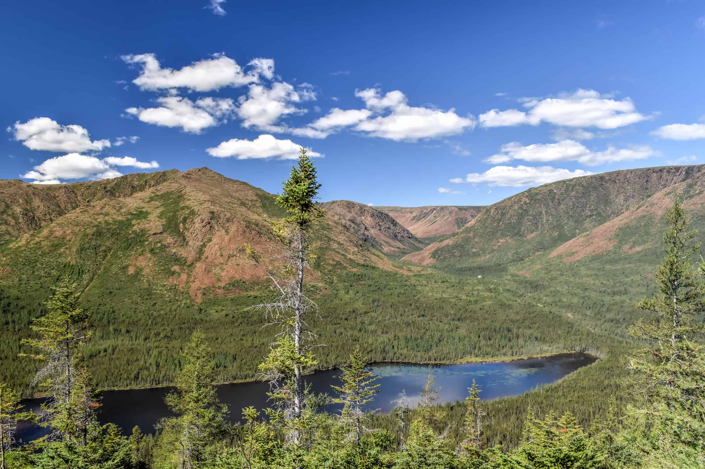
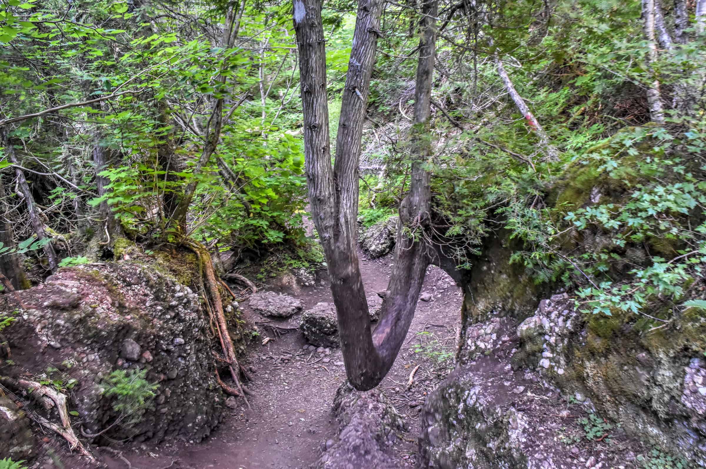
This trail was definitely one of our favourite “easy” hikes in Gaspésie. At the end of a short trail with a constant uphill but easy climb, you’ll end up in front of an alpine lake (Lac-aux-Américains) known as a glacial cirque, a bowl-shaped depression/valley formed by glacial erosion. The name of the lake, which translates to “American Lake”, is a nod to a time when US botanists had set up a research base camp along the lake’s shores in the early 20th century.


We arrived early in the morning and had the lake to ourselves, where we could enjoy the wooden pier and the beautiful scenery in a tranquil setting. Though the trail isn’t very long, you might want to hang around by the lake for a while.


Trail Details
Distance: 2.9 km
Route Type: Out & Back
Elevation gain: 92 m (cumulative elevation gain: 104 m)
Start point: Mont Xalibu Car Park
AllTrails rating: (4.6, 299 ratings (2024))
Duration: Most people complete the trail in about 45-60 min
Access Fees: SEPAQ daily rate
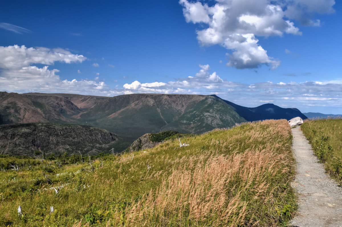
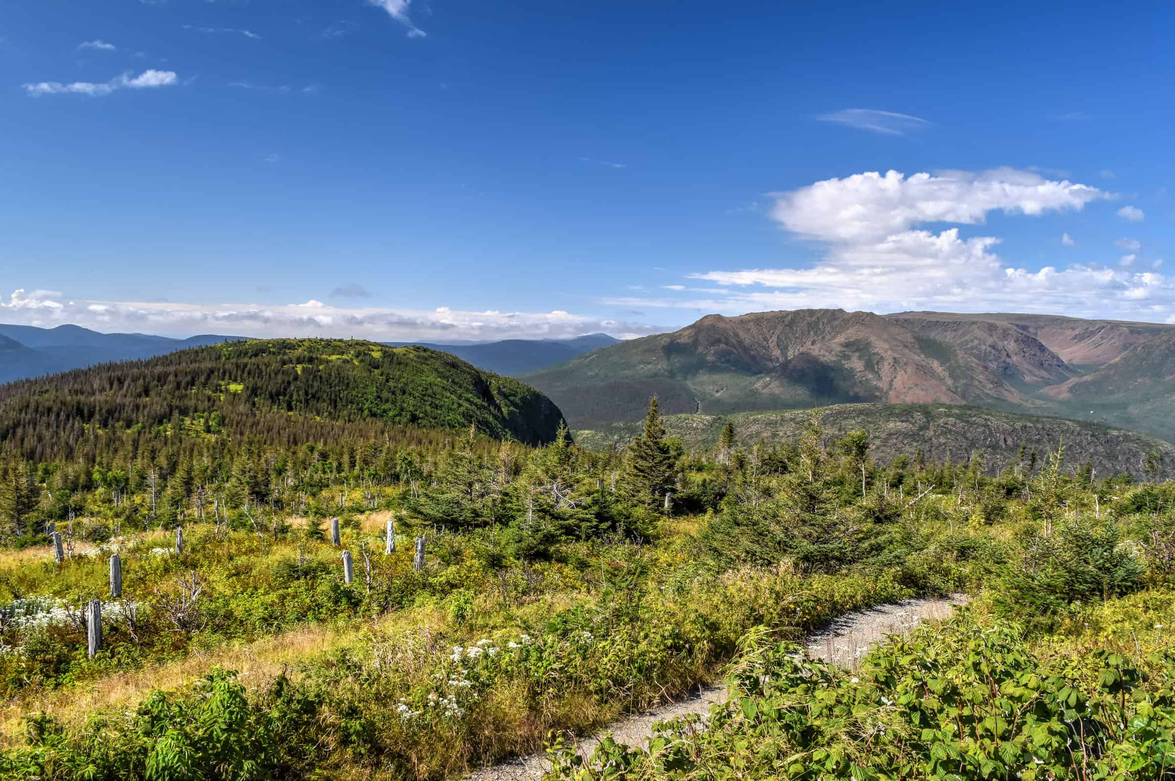
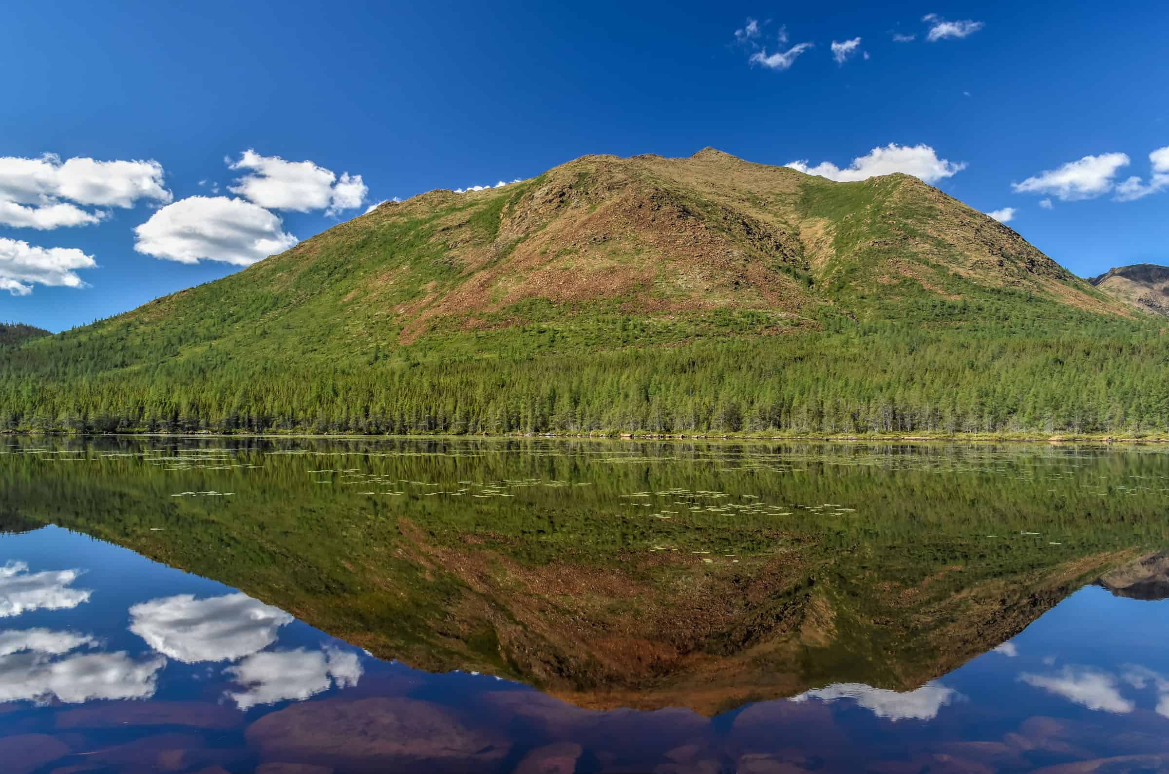
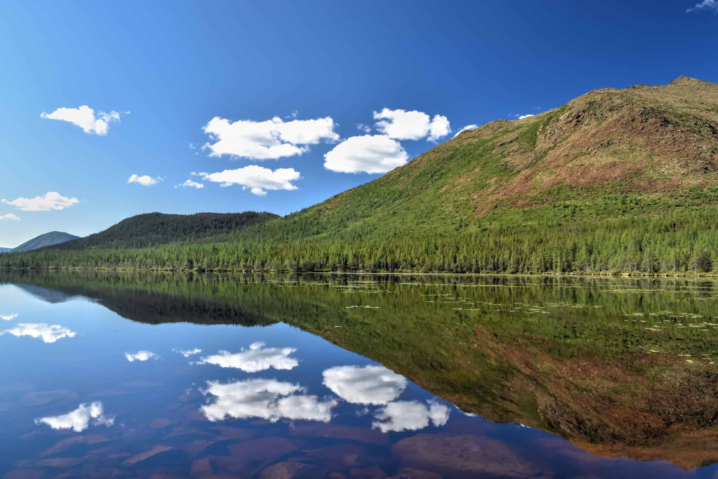
Mont Ernest-Laforce Trail (moderate)
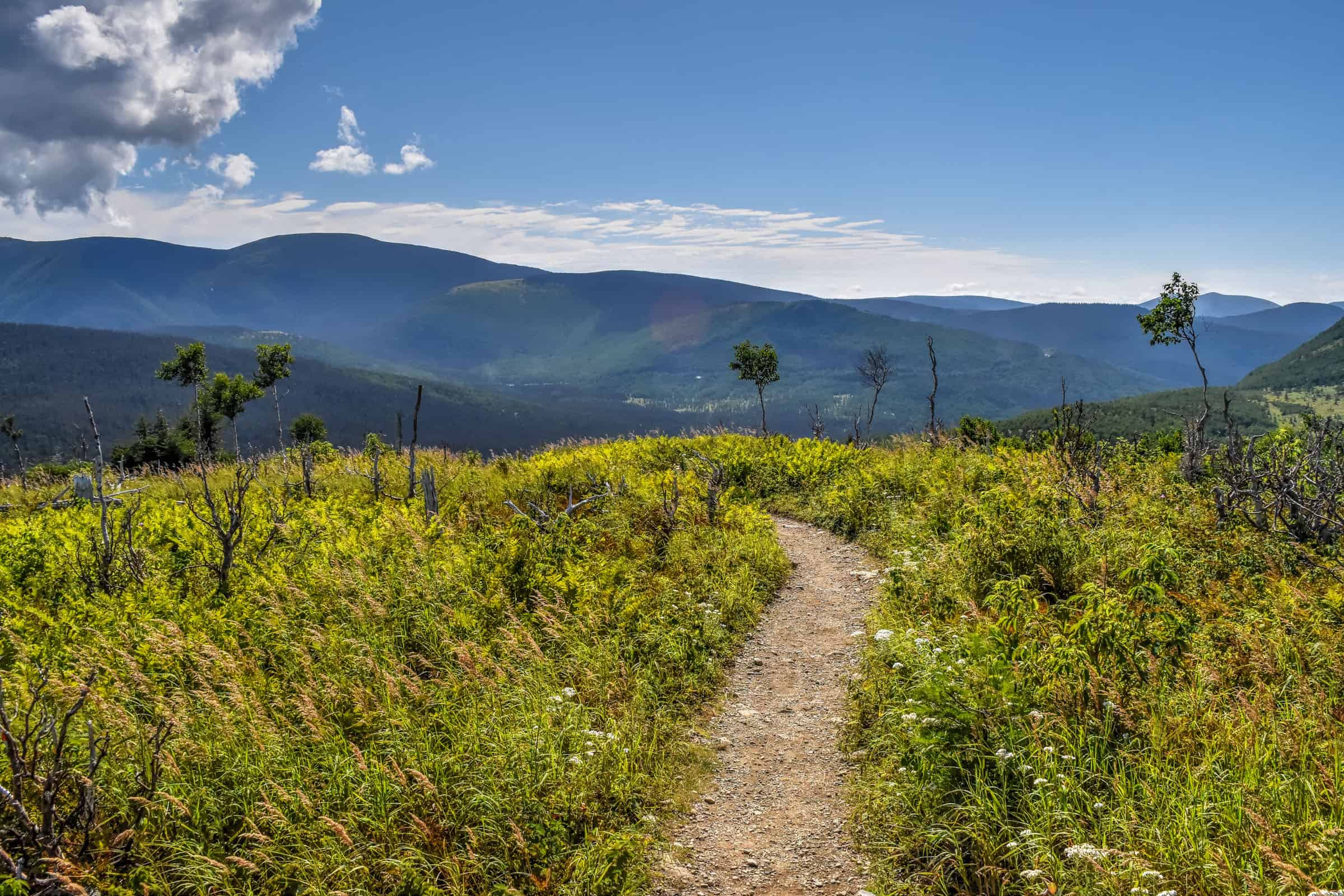
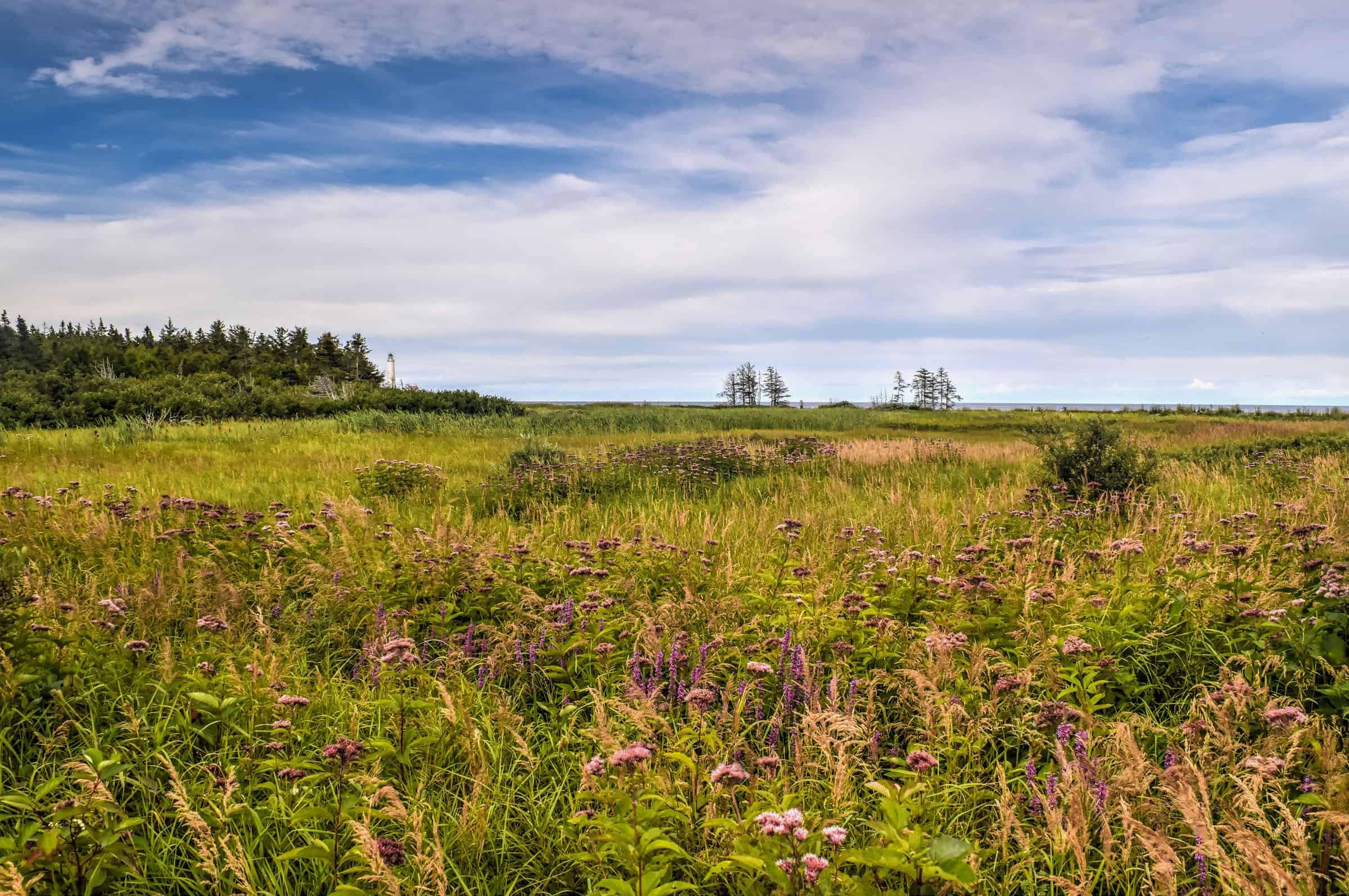
This is one of the more popular trails in the park due to its accessibility, moderate difficulty, and rewarding 360° unobstructed views from the summit. You’ll get fantastic views of Mont Olivine and Mont Albert across the valley.


The trail ascends fairly steadily from the car park until you reach the summit. Initially, you will through forested sections, but you won’t need to wait long to enjoy panoramic views of the surrounding scenery as they will quickly reveal themselves as you start the loop section. Here the trees give way to a meadow-like environment where tall grasses frame the distant mountains.


Trail Details
Distance: 4.6 km
Route Type: Out & Back
Elevation gain: 175 m (cumulative elevation gain: 187 m)
Start point: Mont Ernest-Laforce Car Park
AllTrails rating: (4.6, 734 ratings (2024))
Duration: Most people complete the trail in about 1h30-1h45 min
Access Fees: SEPAQ daily rate
Not an AllTrails member yet? We highly recommend signing up for either their free or paid membership plans. The free plan allows you to find new trails and plan routes but it can only be used while hiking if you have access to mobile data. The paid membership plan (AllTrails+) allows you to download trail maps for offline use and provides live progress updates and off-route notifications.
If you are still uncertain – you should know that the All Trails mobile application was voted the 2023 iPhone App of the Year by Apple.
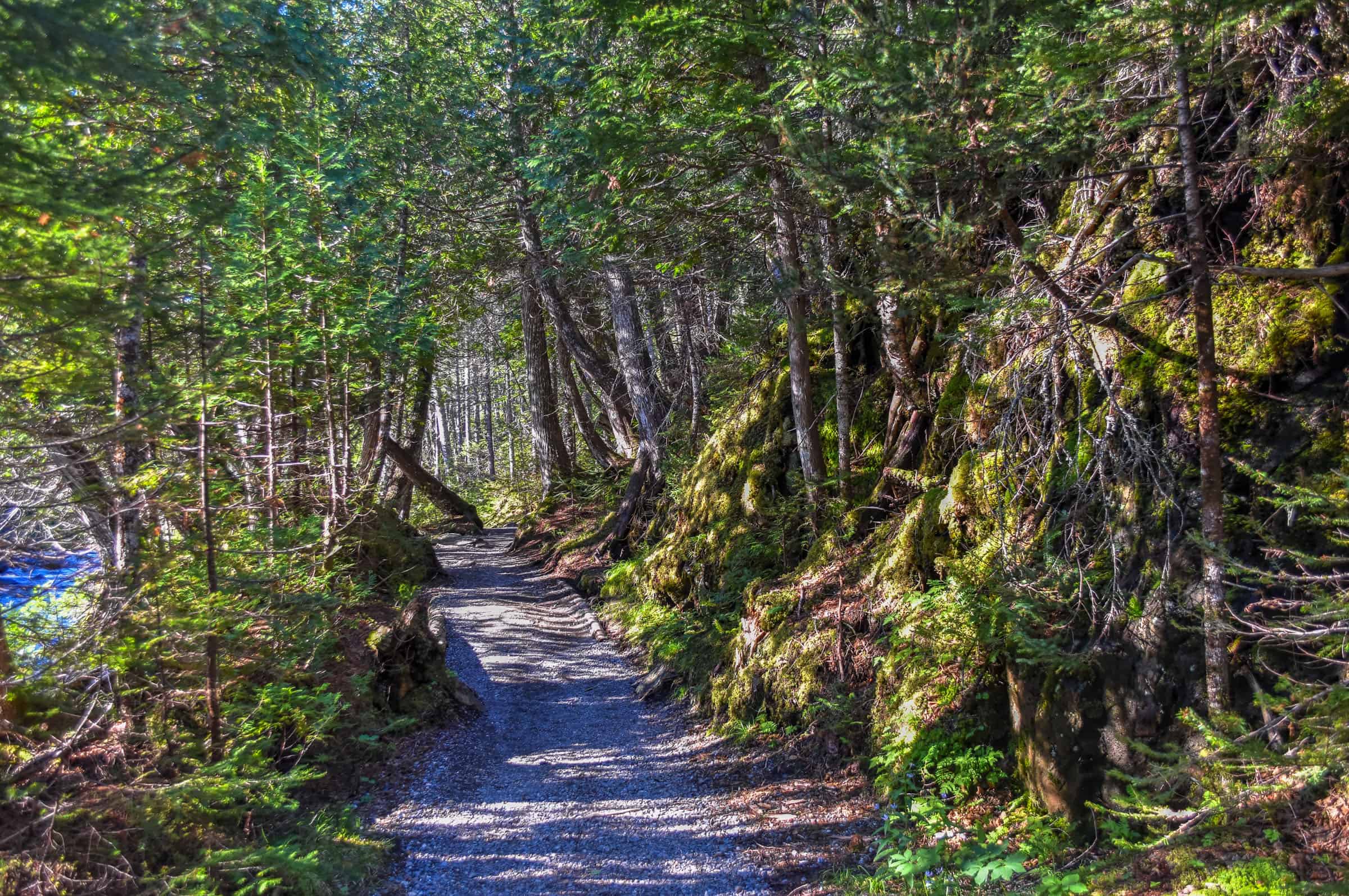
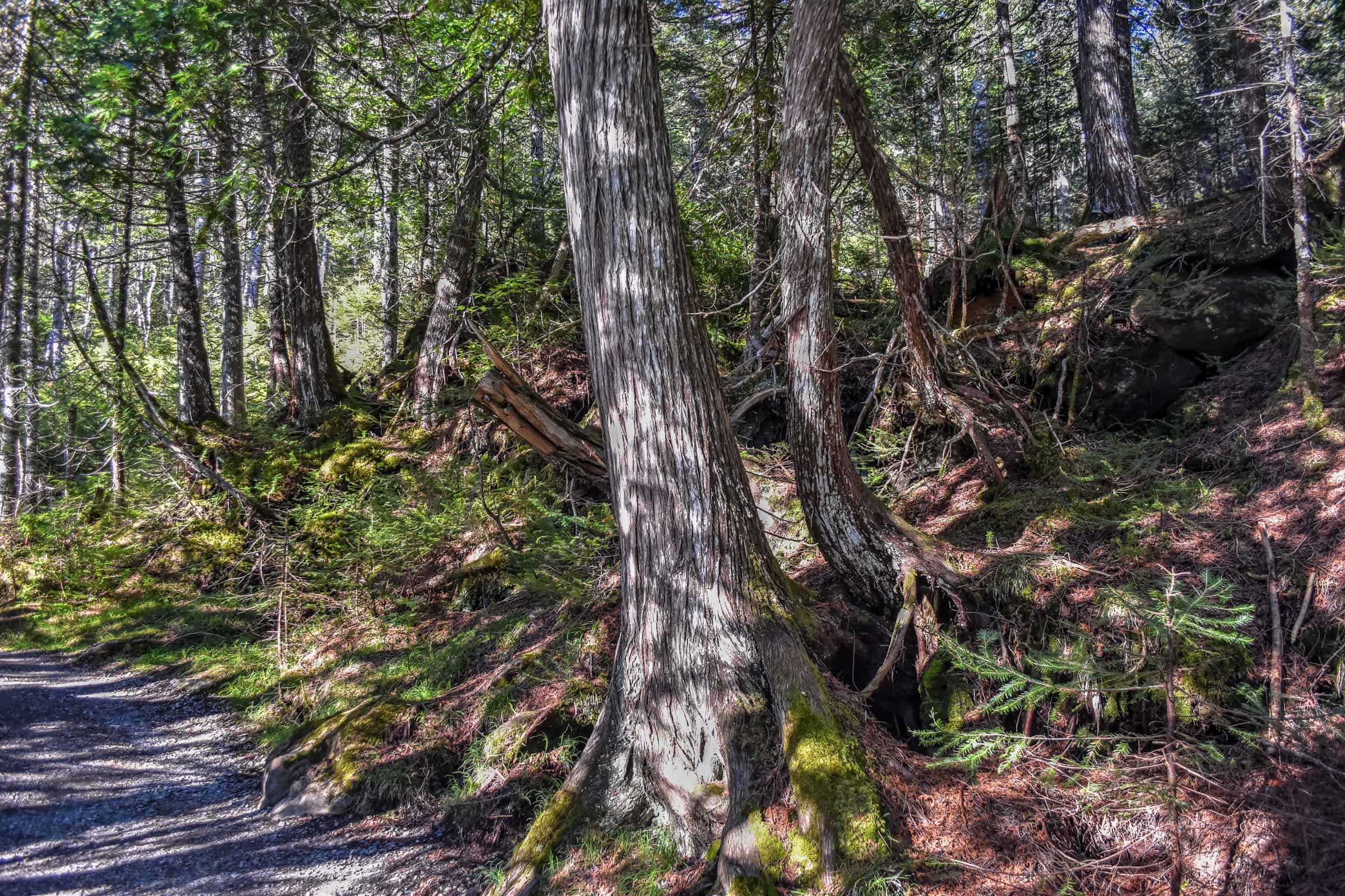
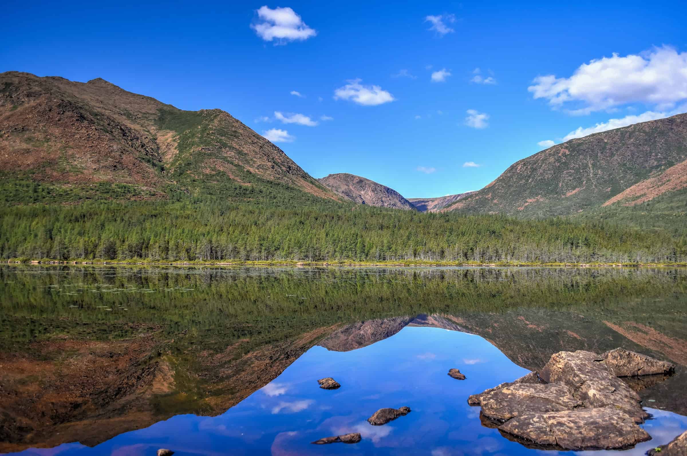
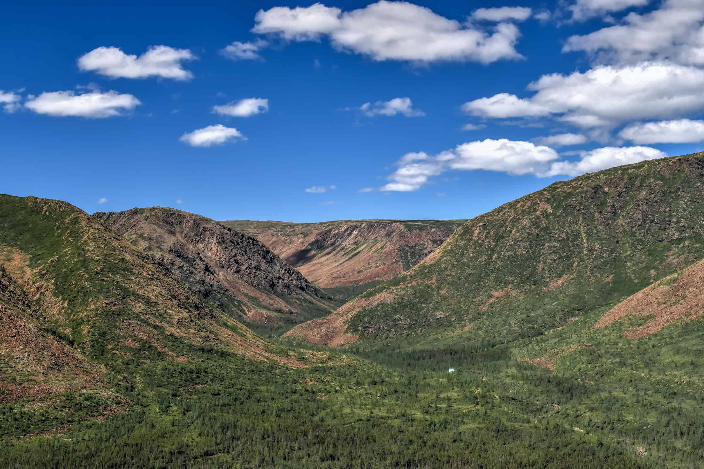
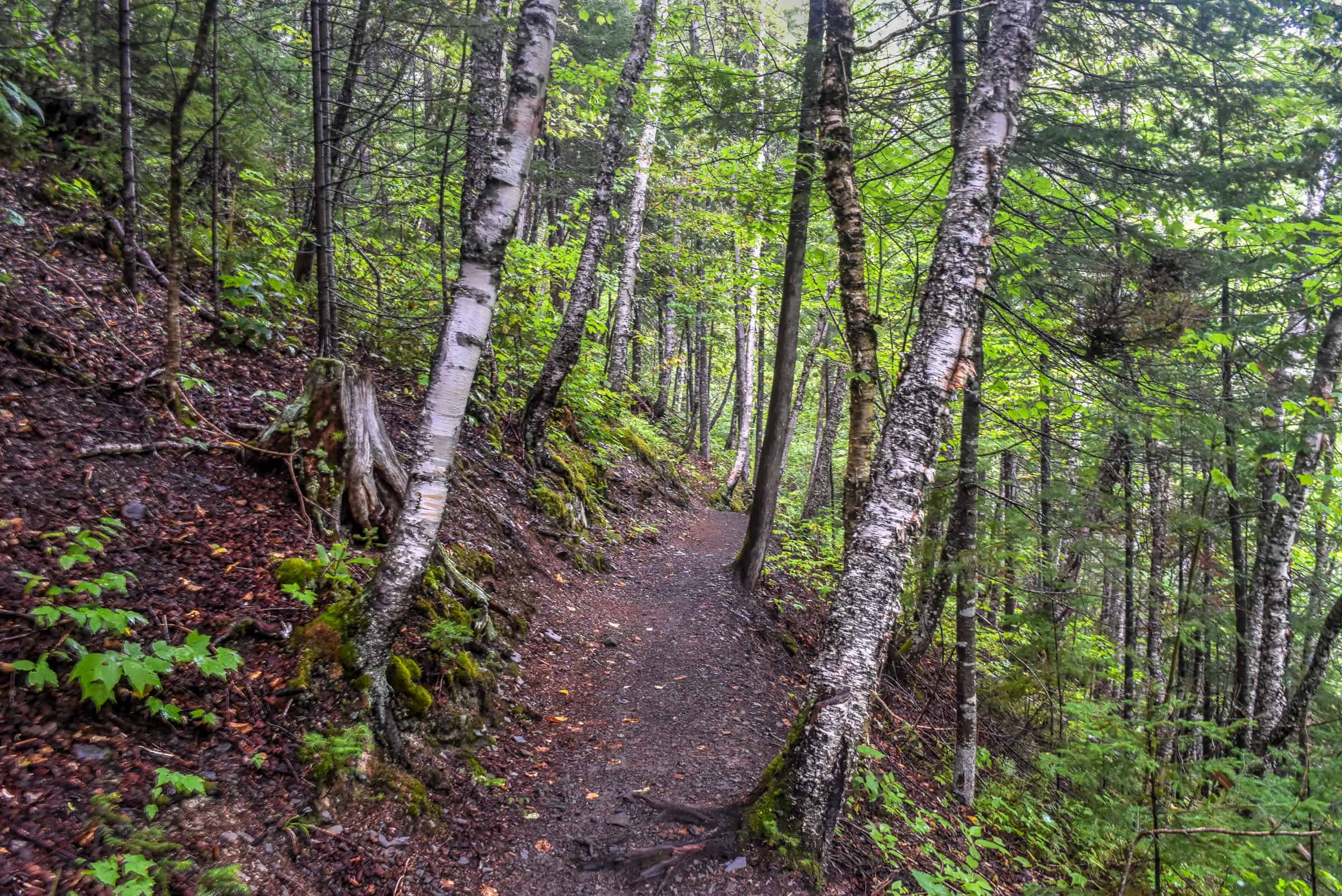
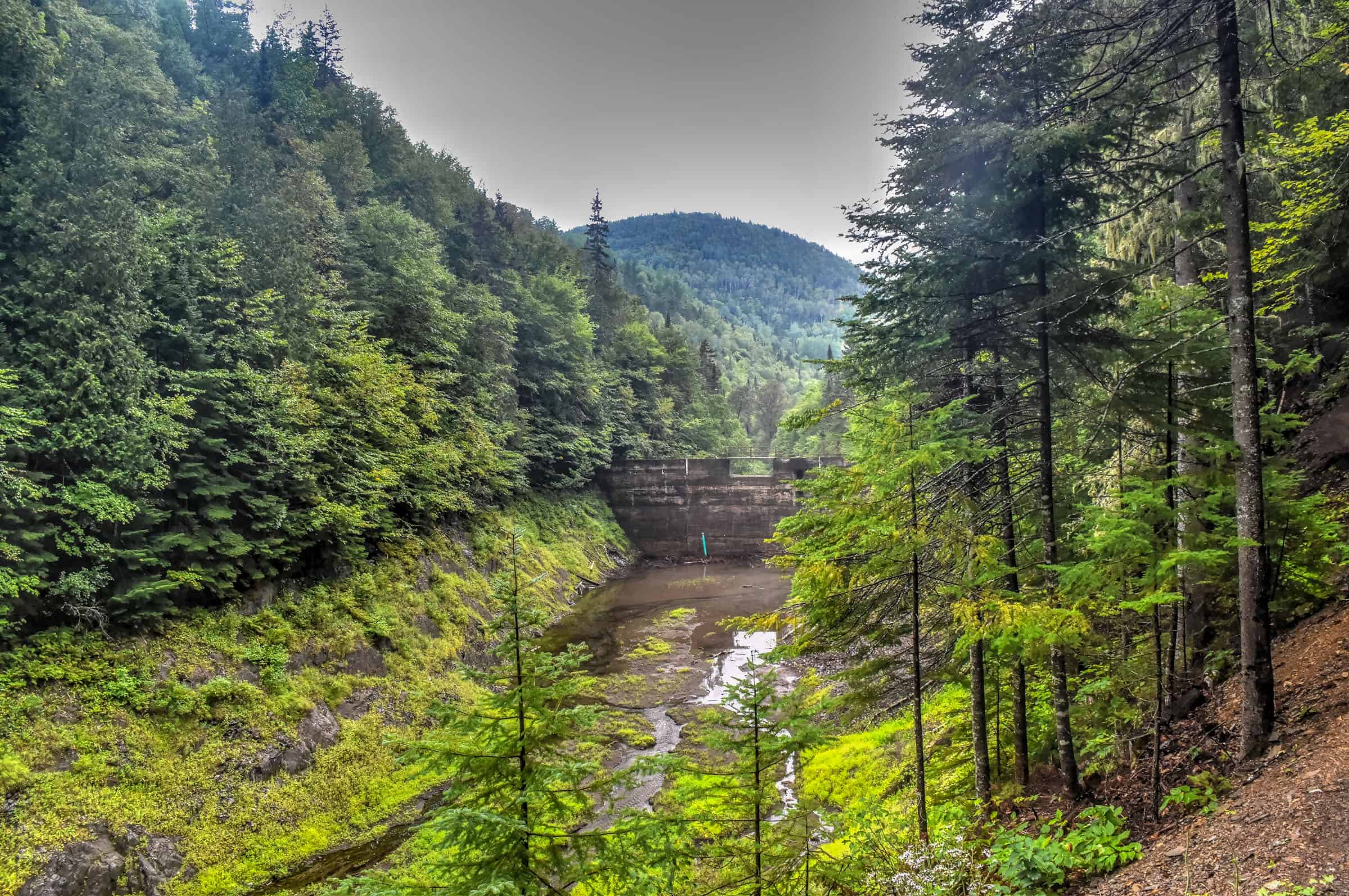
Mont Olivine Trail (moderately challenging)
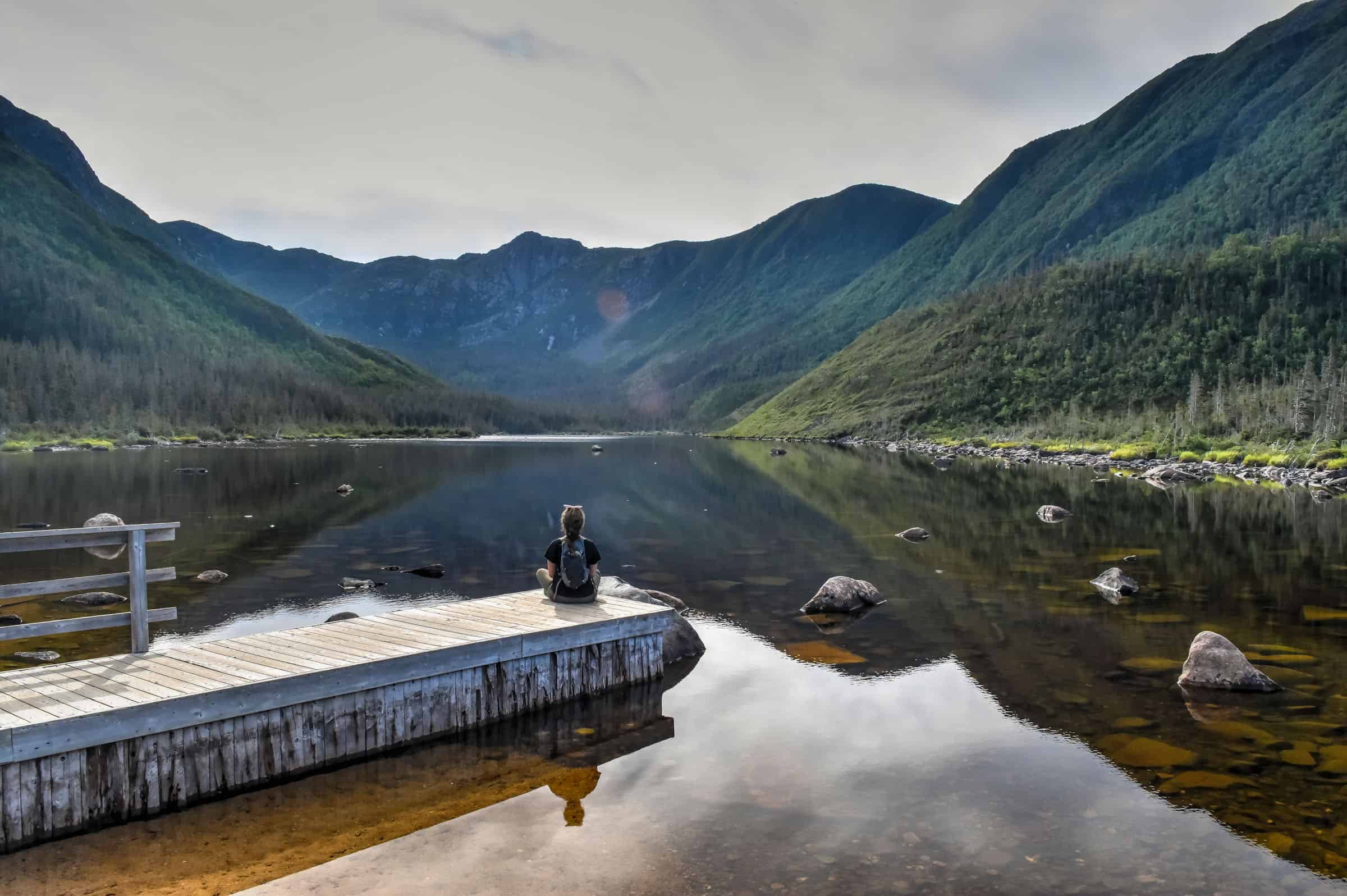
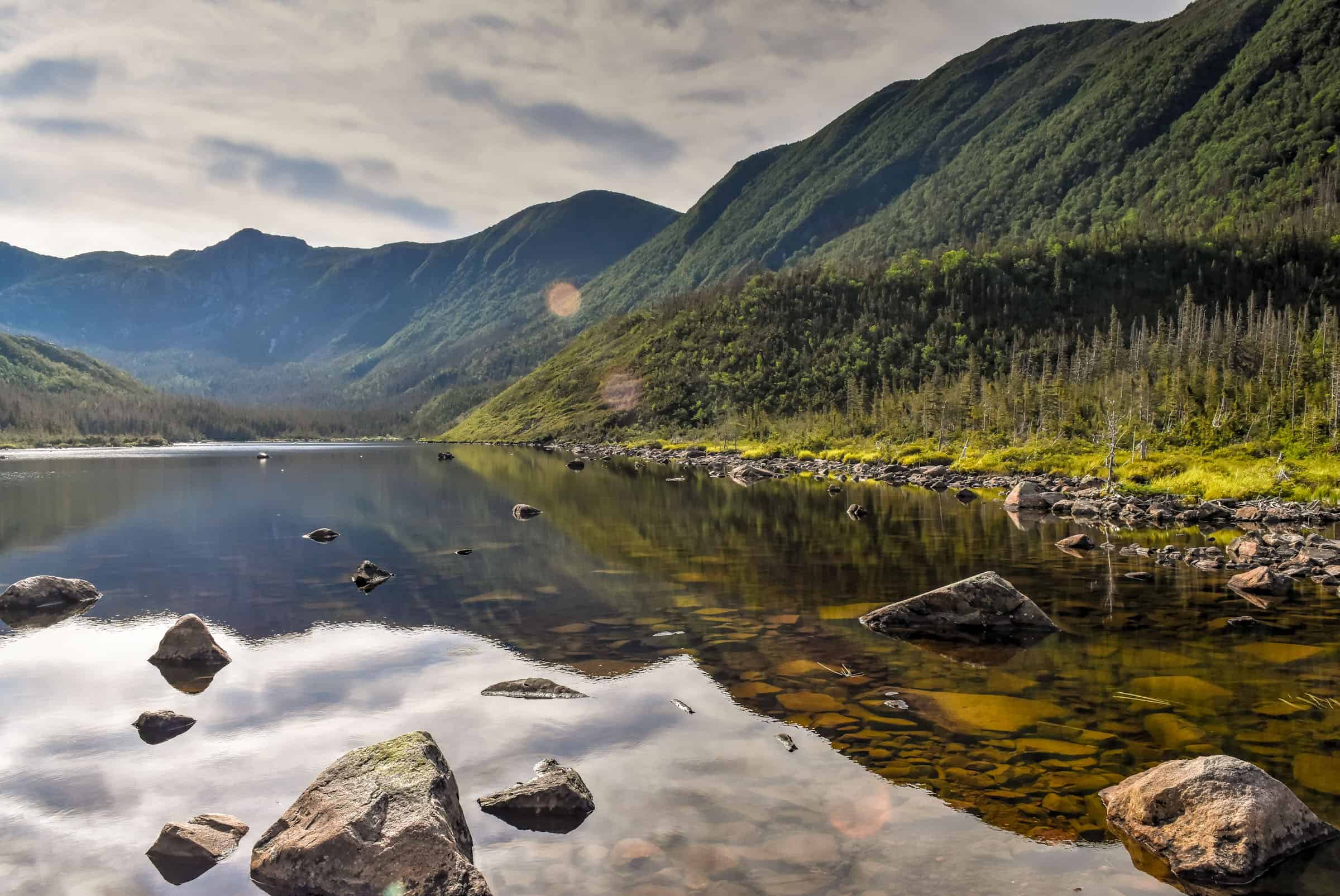
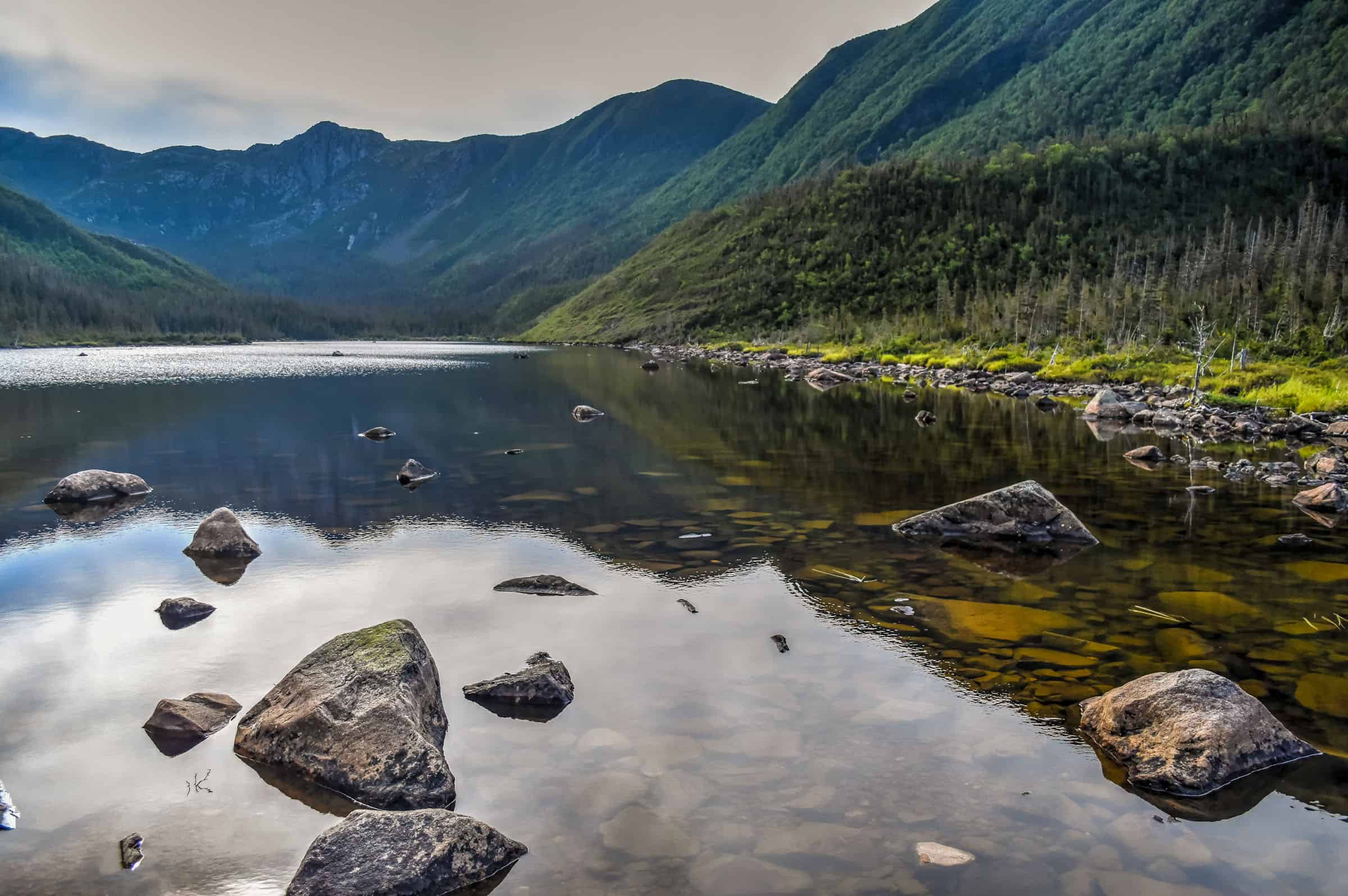
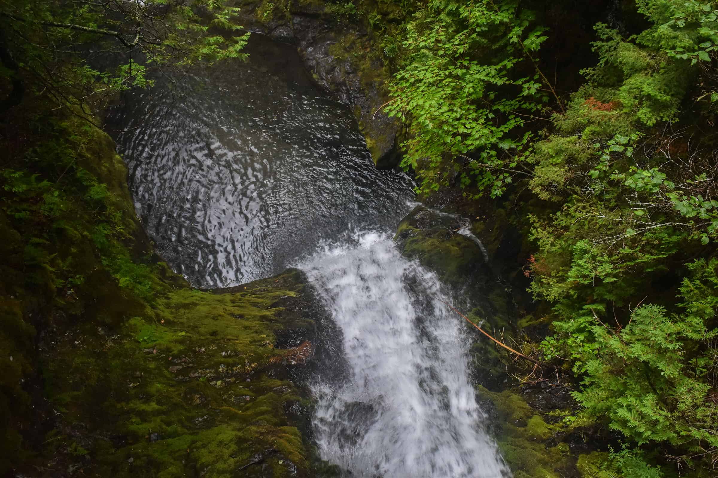
The Mont Olivine Trail was our favorite trail in the park. It combines several waterfall and river viewpoints, a beautiful lake and stunning panoramic views from the summit of Mont Olivine. Although the more famous Mont Albert Loop trail sees many of the same attractions, it’s a significantly longer trail, 20.3km vs 10.3km.
The first section of the trail is rather easy as you quickly reach the Chute-Sainte-Anne waterfall.


The first section following the Chute-Sainte-Anne waterfall is very straightforward and stays relatively flat for quite some time until you eventually cross a wide river over a bridge.


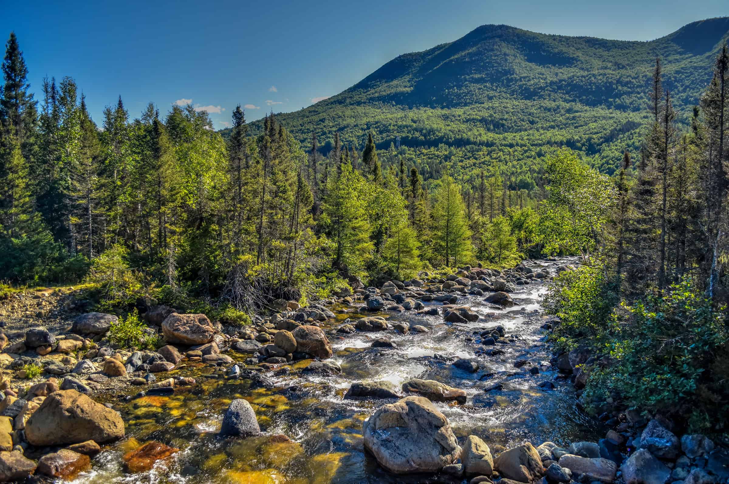
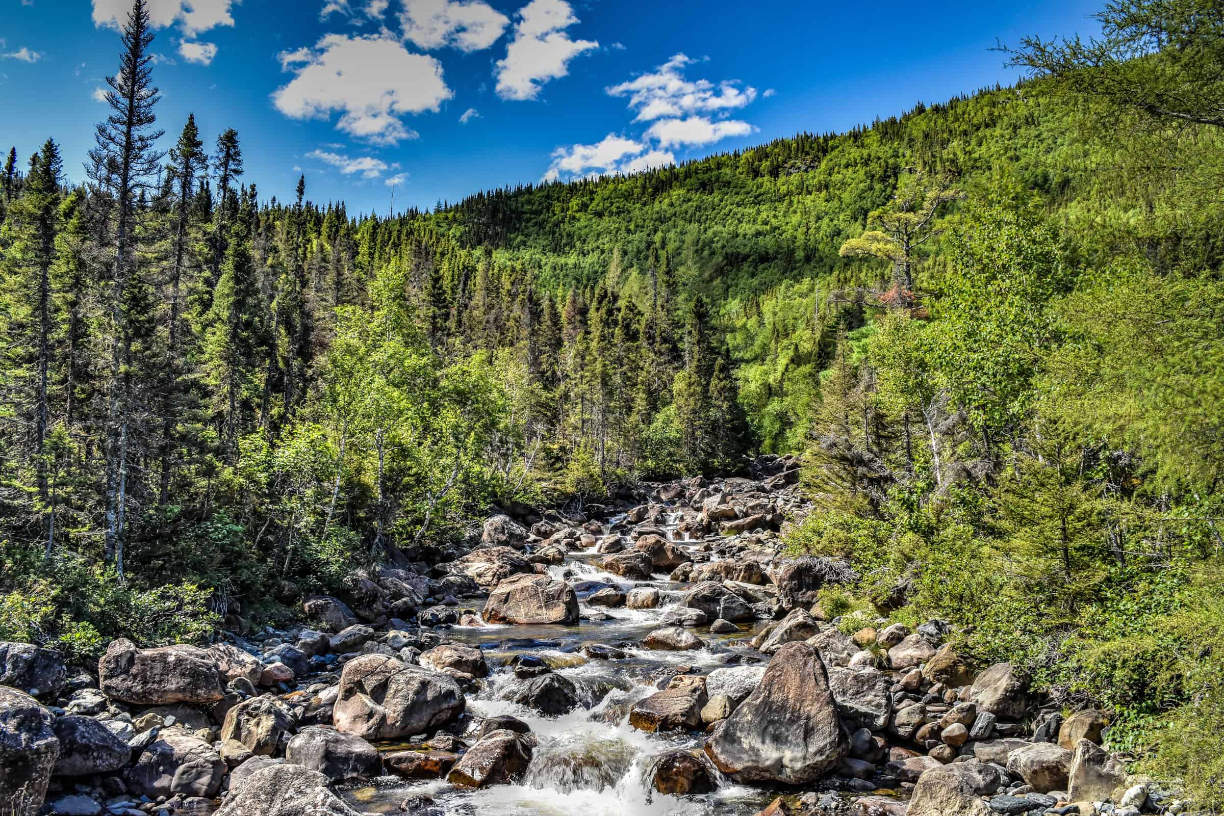
After crossing the river, the trail starts to rise sharply, but you will reach the waterfall viewpoint just a few minutes after having crossed the river.
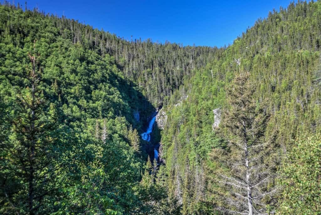
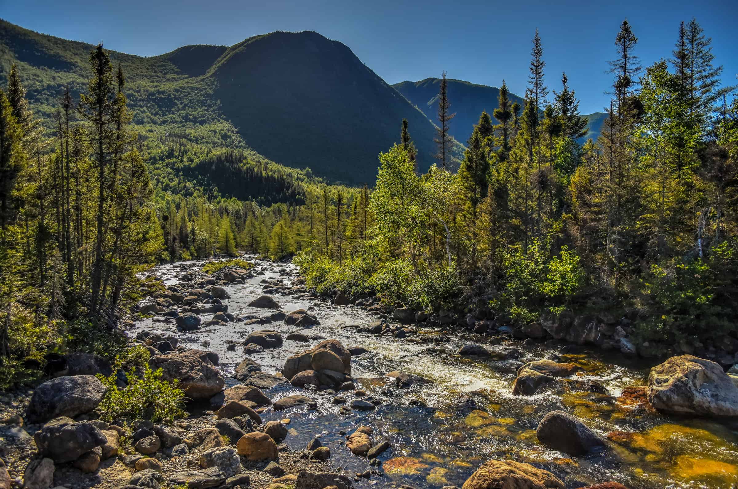
Although continuing from this point towards the lake doesn’t add much distance to the trail (1.25 km each way), the path between the waterfall and the lake is significantly steeper and more challenging (very rocky and uneven terrain).
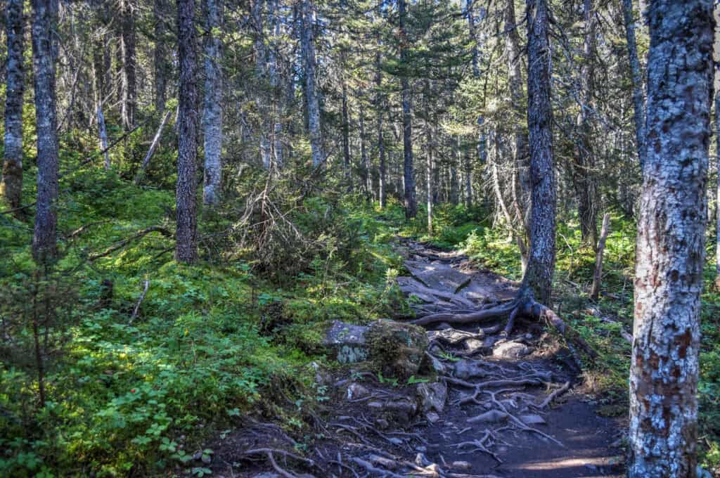
After a steady climb over about 1 km, you will reach a trail intersection: go right to head towards the lake. You will cross over a series of raised wooden boardwalks as you make your way there.


After a few minutes, you will have arrived at the stunning Lac-du-Diable.


Once you reach the intersection for the trail leading to the lake, it’s only another 1km to reach the summit of Mont Olivine (though it’s another 150 m of the revelation gain. The last bit of climbing is done along a ridgeline offering stunning views on either side of the mountain: to one side the Saint-Anne River valley and to the other the towering Mont Albert.


Trail Details
Distance: 10.3 km
Route Type: Out & Back
Elevation gain: 470 m (cumulative elevation gain: 570 m)
Start point: Discovery Center
AllTrails rating: (4.7, 209 ratings (2024))
Duration: Most people complete the trail in about 3h30-4h
Access Fees: SEPAQ daily rate
Note: the AllTrails map to the Mont Olivine summit doesn’t include the short detour to Lac-du-Diable (lake). Adding the lake detour increases the trail distance to 11 km, but doesn’t add any elevation gain.
For more information on visiting the Gaspésie National Park, its hiking trails, and where to stay, check out our guide on the Best Hiking Trails in Gaspésie National Park.
Forillon National Park
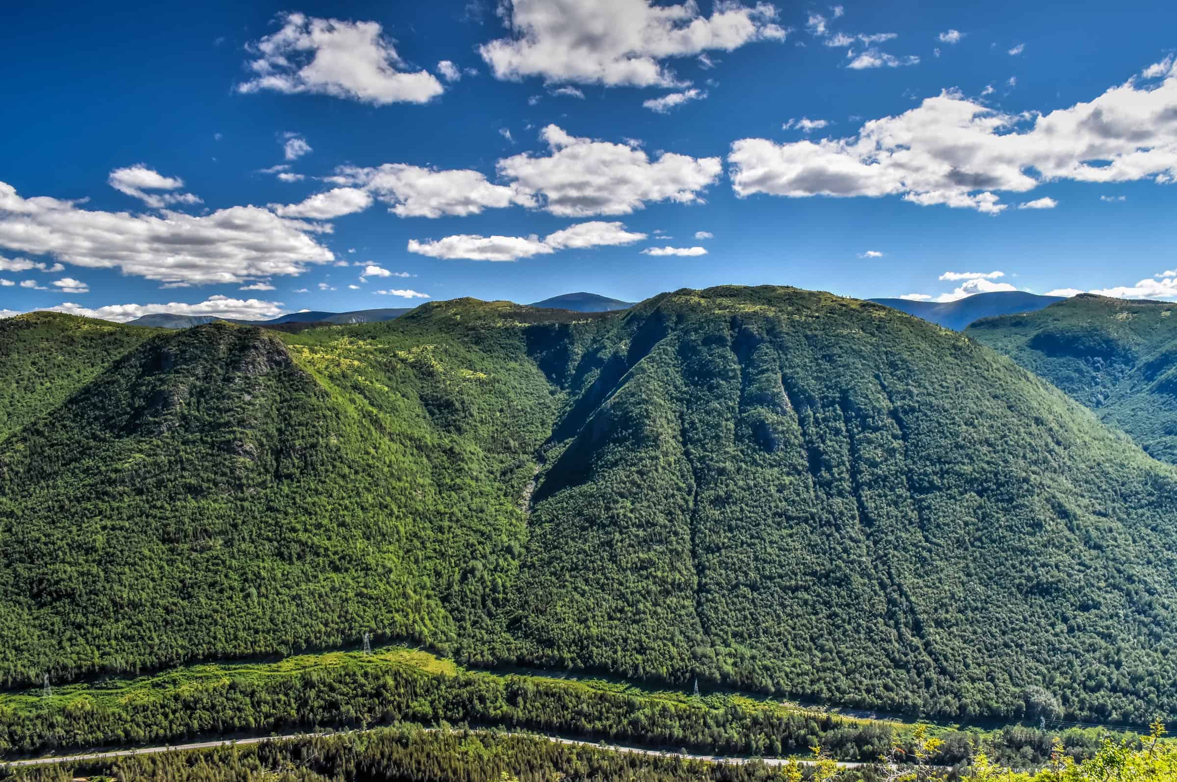
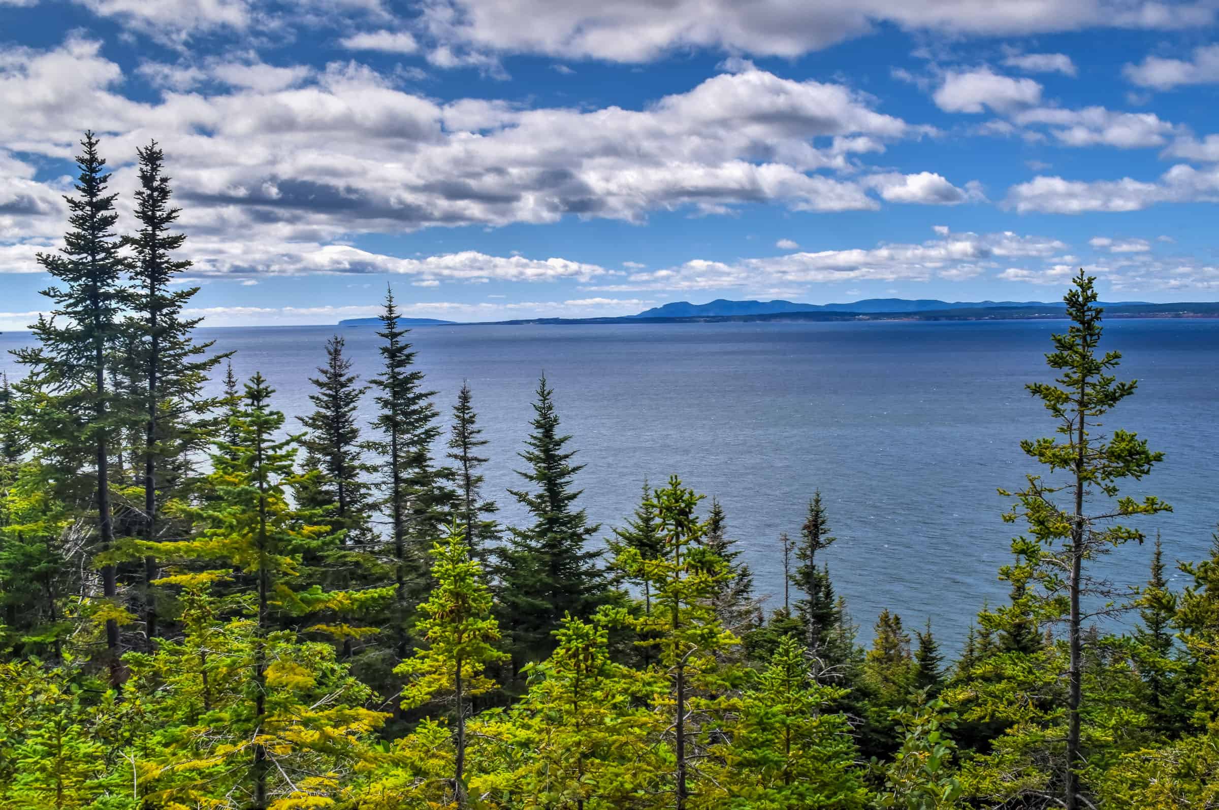
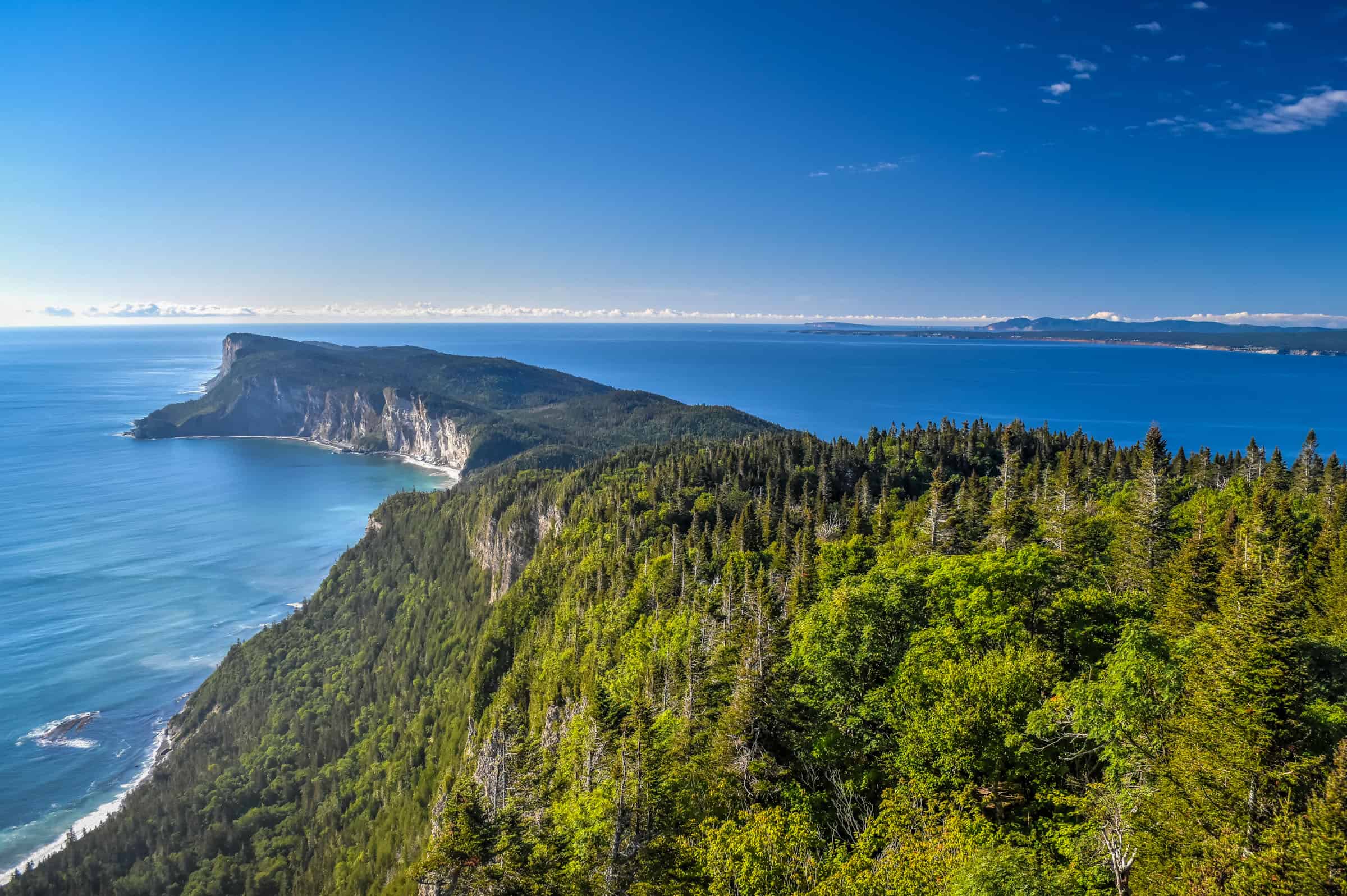
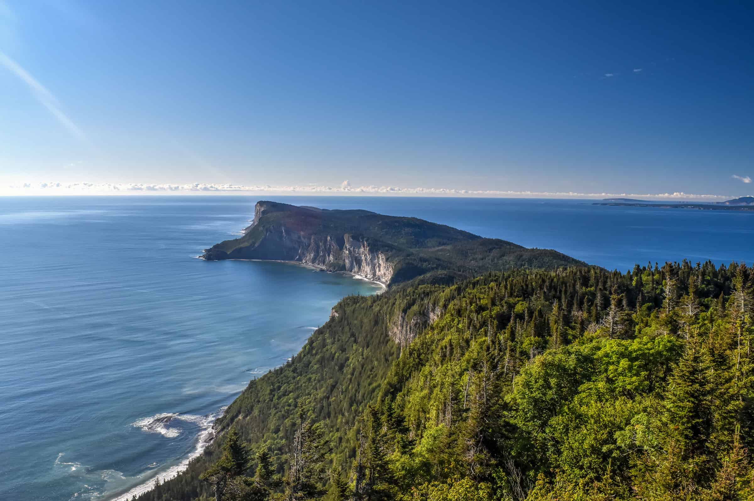
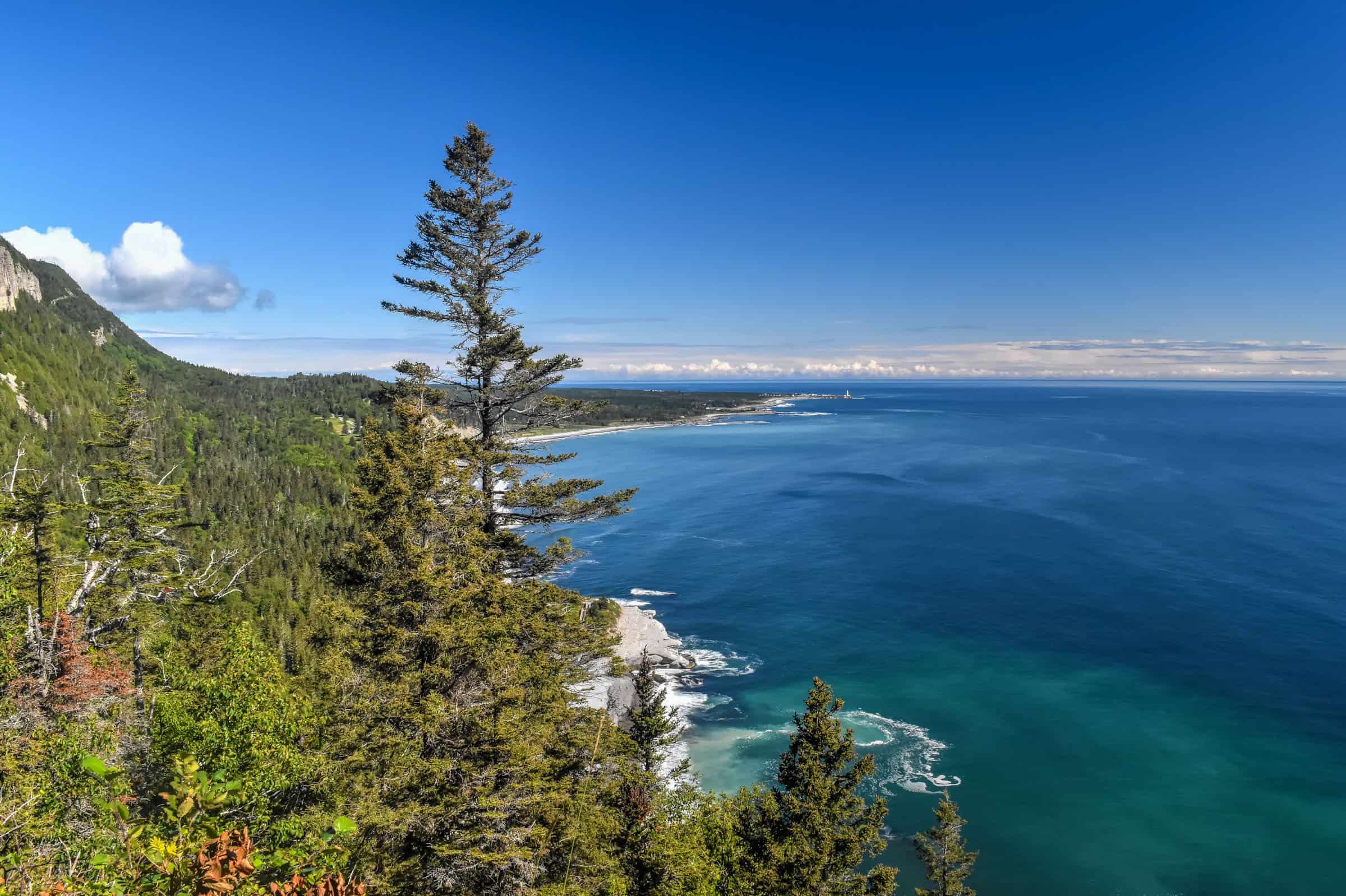
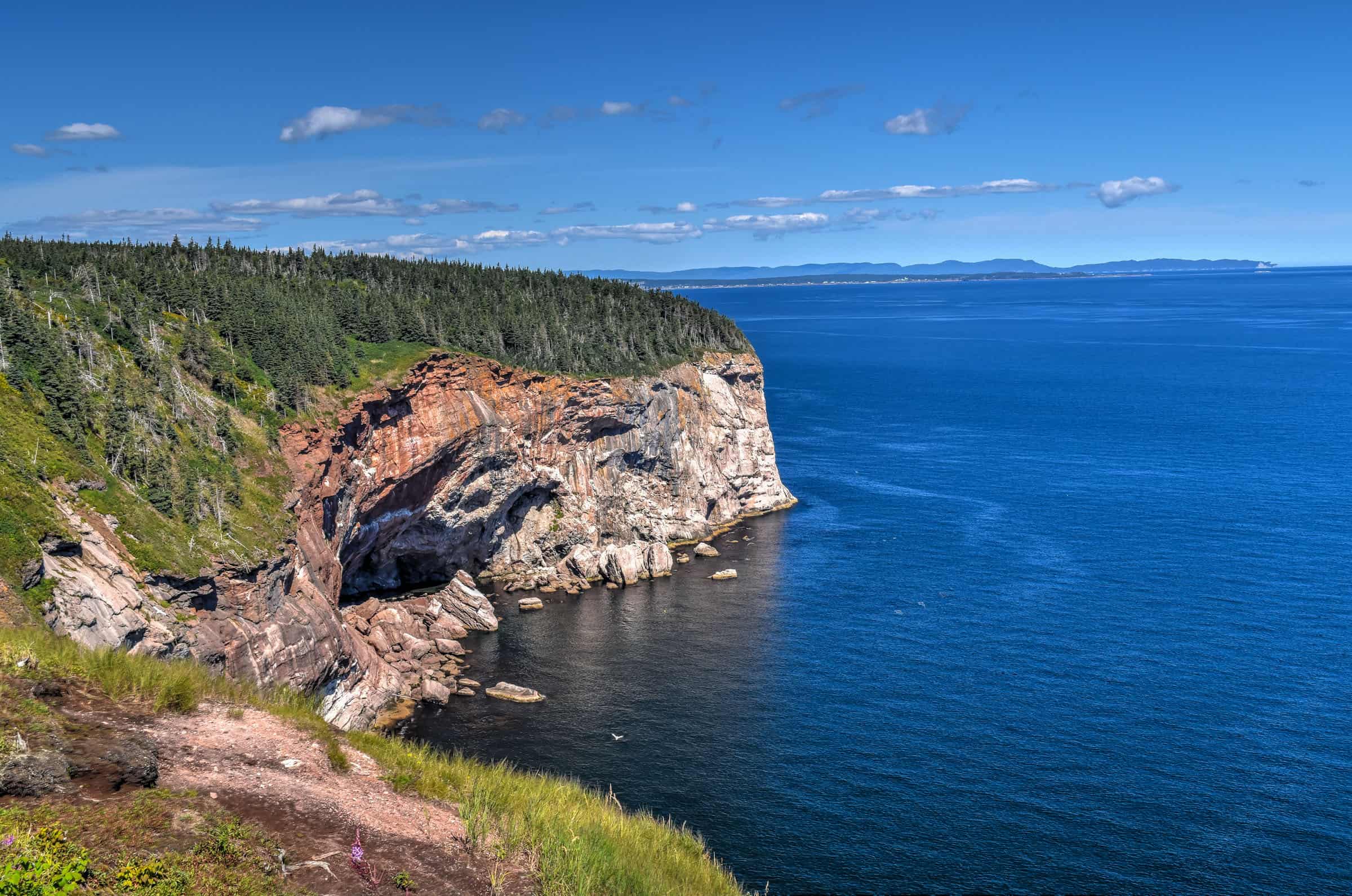
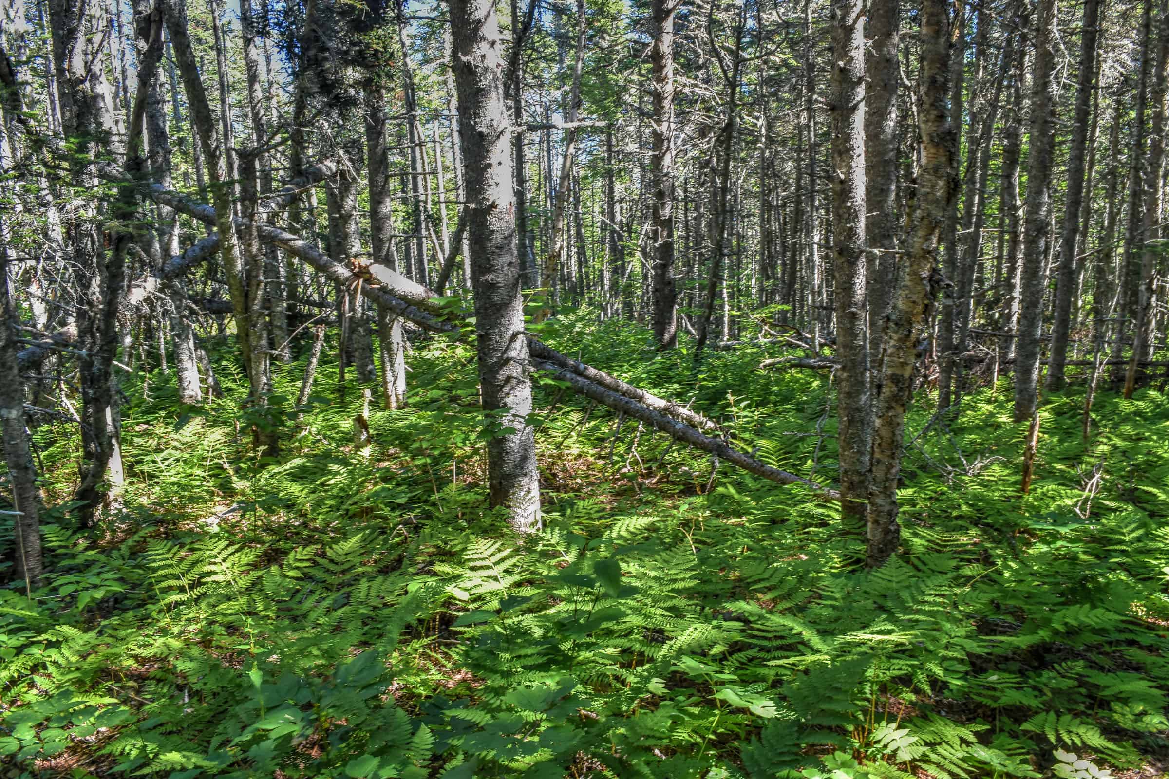
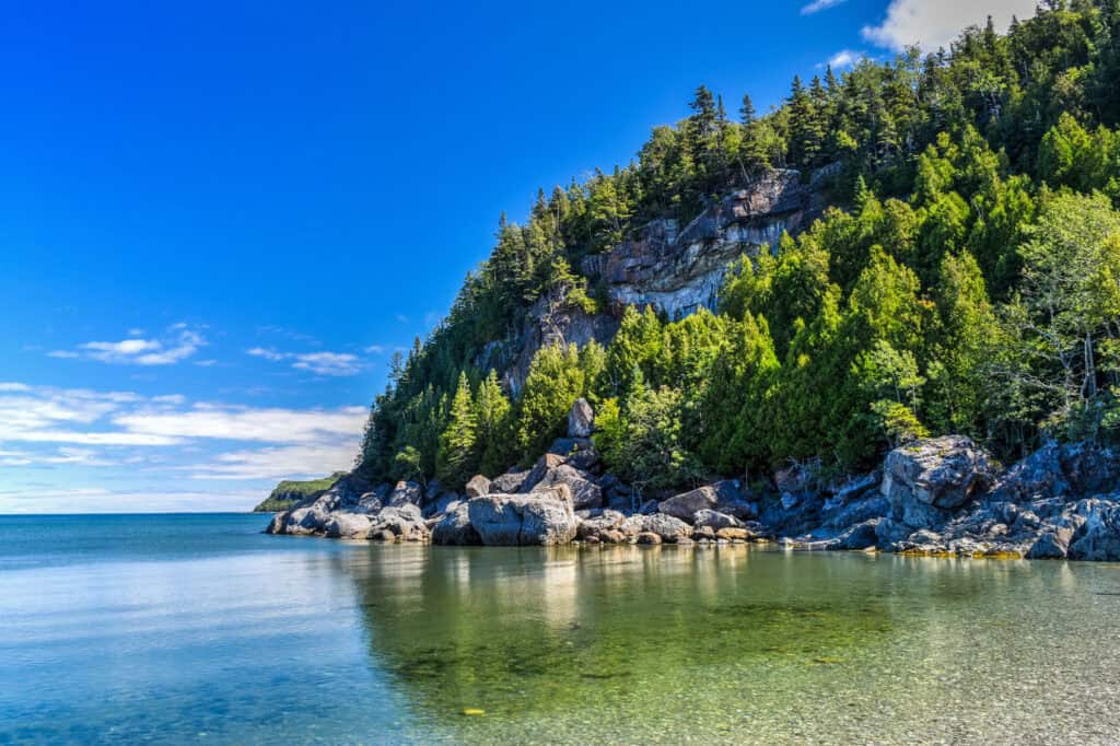
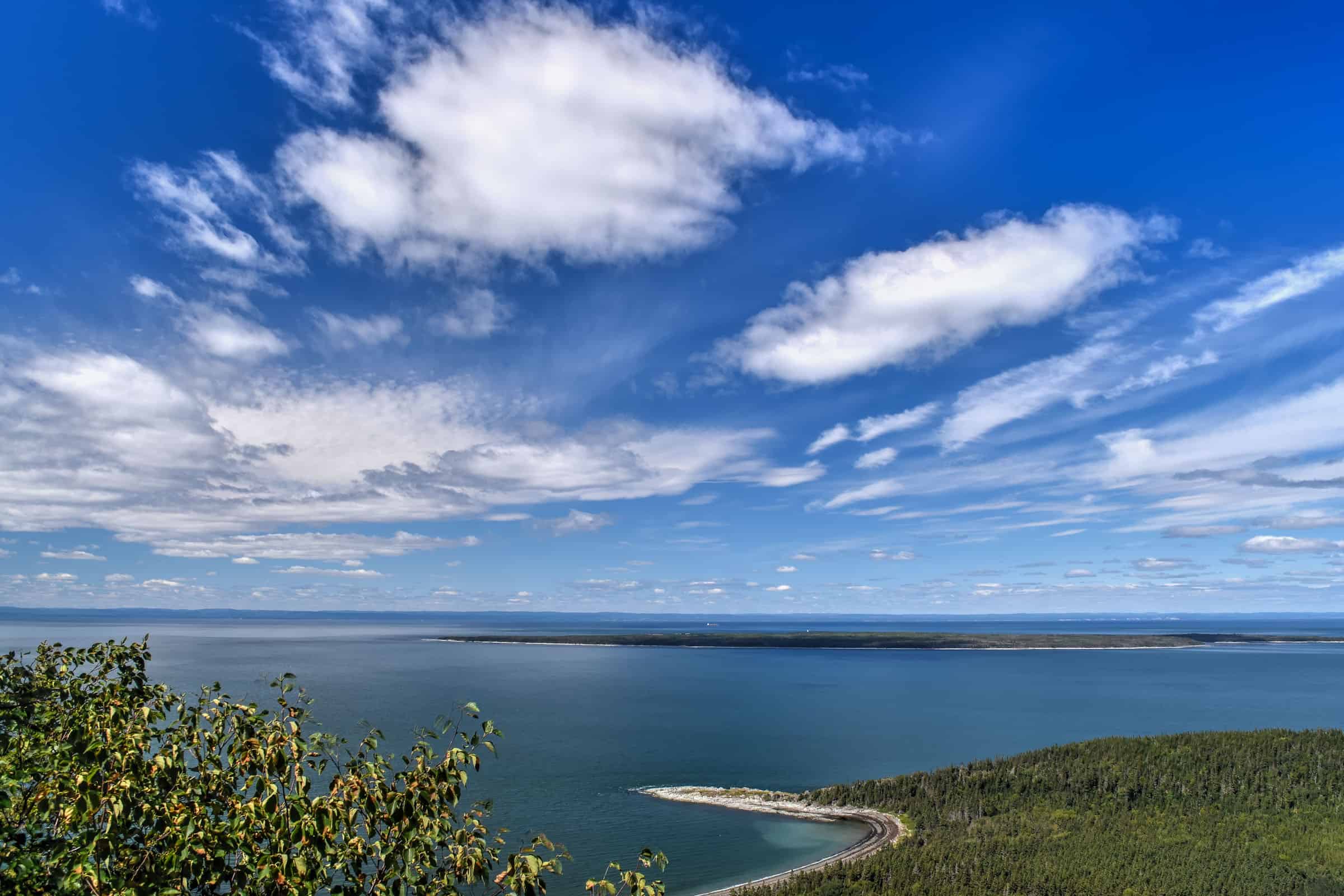
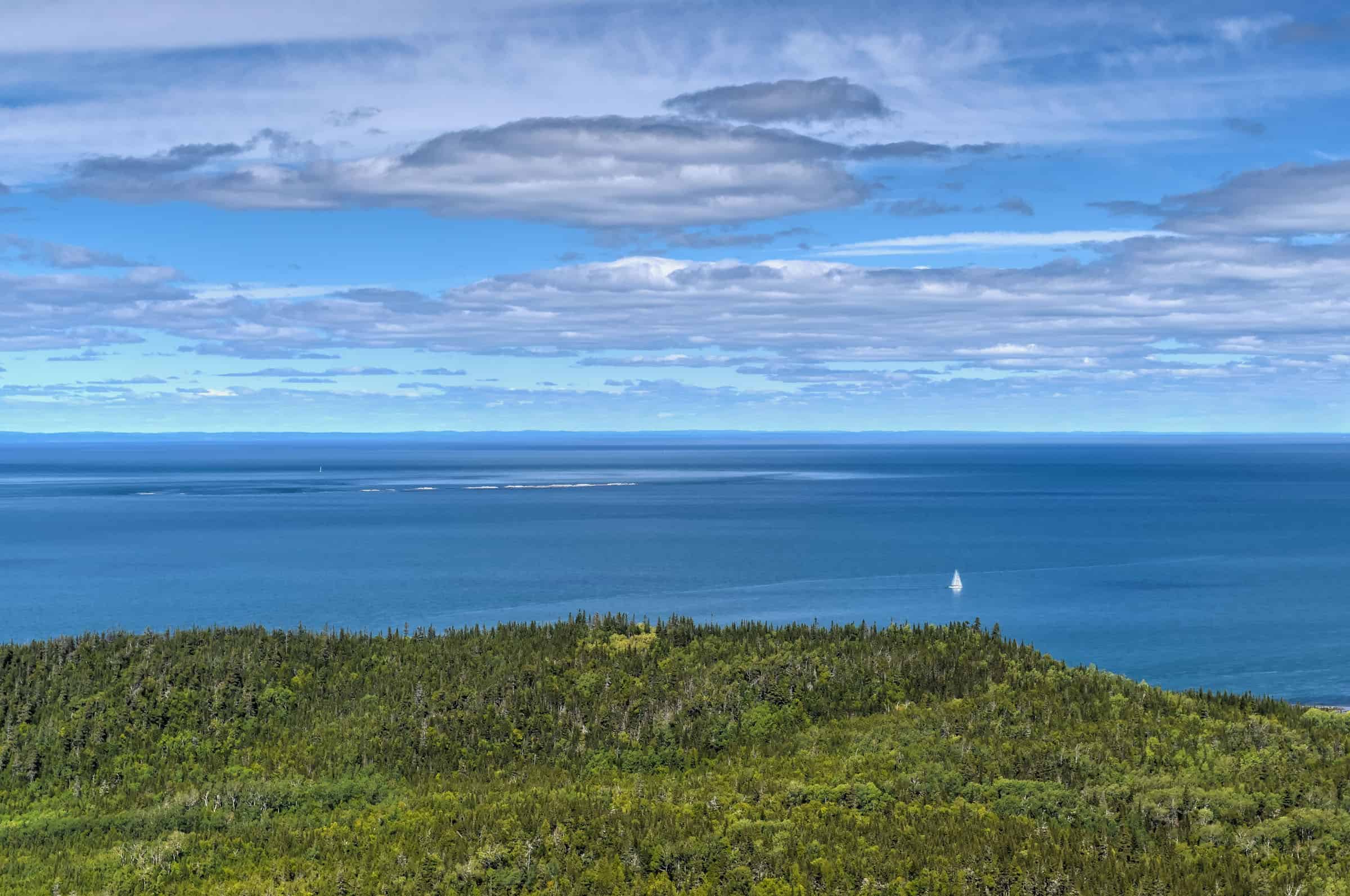
Forillon National Park is one of 42 Canadian National Parks and is located at the outer tip of the Gaspé Peninsula, where the mountains plunge directly into the St Lawrence Gulf. The park includes a rich variety of ecosystems including dense forests, sea cliffs, mountains, wetlands and marshes. The park also marks the Appalachians’ northernmost (and easternmost) tip of continental North America. Forillon is renowned for its beautiful hiking and walking trails, sea kayaking and wildlife viewing.
Du Banc Trail (easy)
The Du Banc Trail, sandwiched between Canada’s tallest lighthouse to the North and the magnificent Forillon cliffs to the south, is a straightforward trail with very little elevation gain but with beautiful and quaint views along the coast. The trail is very wide and flat, suitable for strollers and bicycles as well, making it one of the park’s most accessible trails. The trail alternates between a flattened gravel surface and a wooden boardwalk. There is also a two-story observation tower placed along the trail.


Trail Details
Distance: 4.2 km
Route Type: Out & back
Elevation gain: 13 m (cumulative elevation gain: 31 m)
Start point: Cap-des-Rosiers parking lot or Visitor Information and Discovery Centre (North Area)
AllTrails rating: (4.5, 66 ratings (2024))
Duration: Most people complete the trail in around 45-60 minutes
Access Fees: Parks Canada daily rate
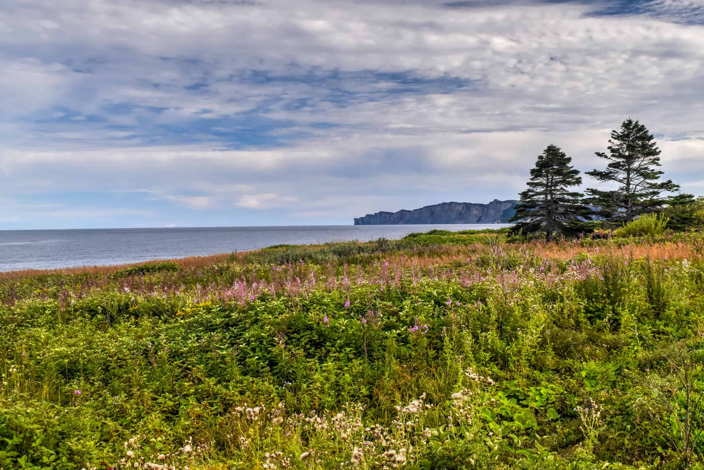
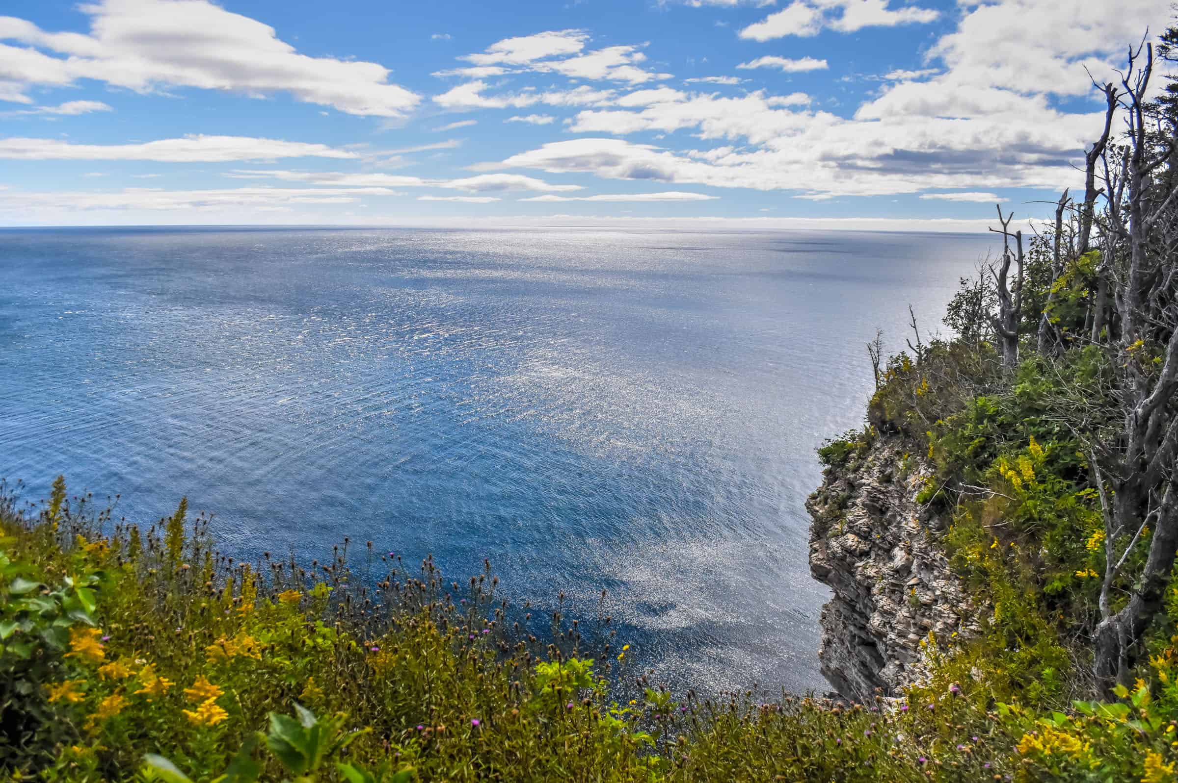
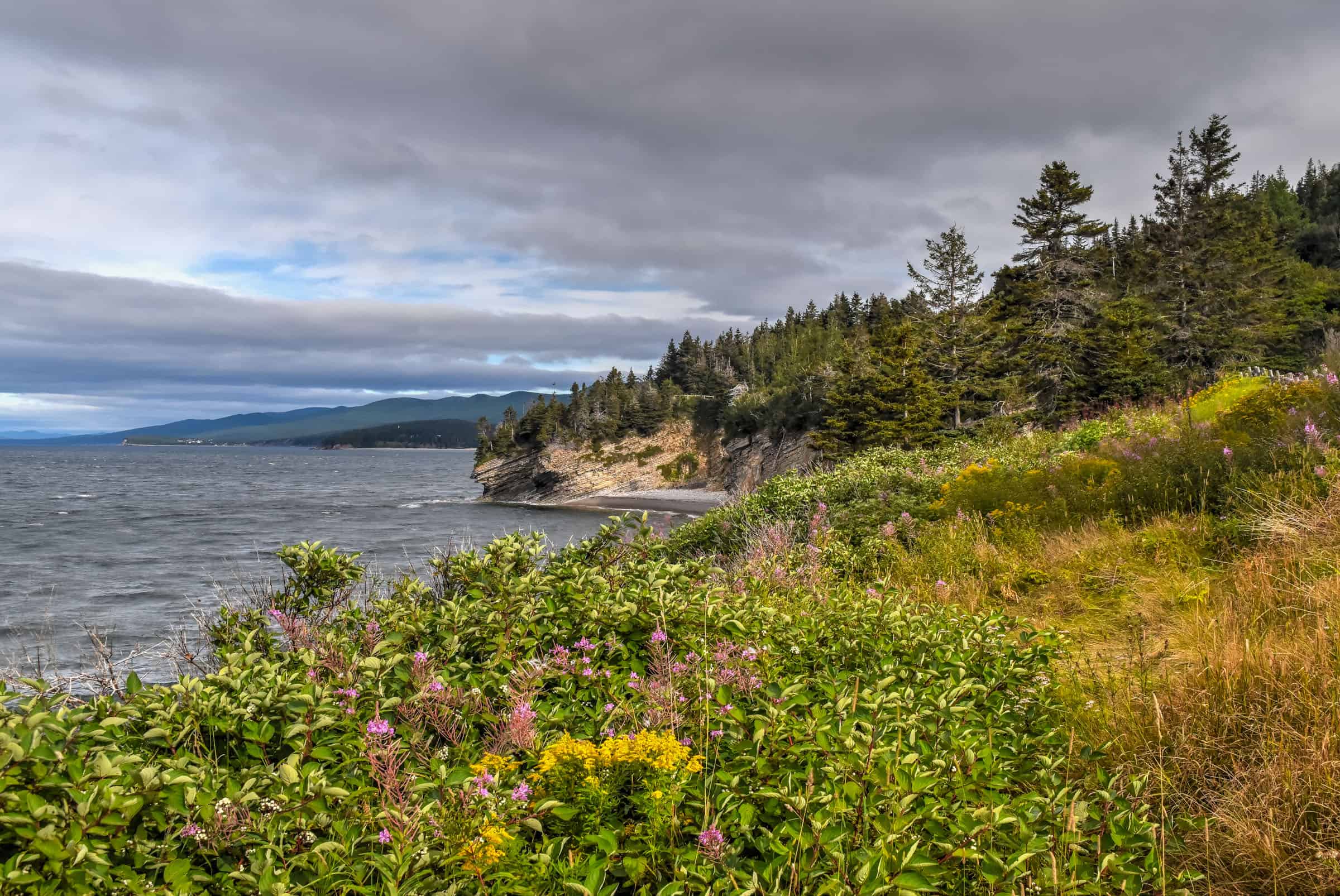
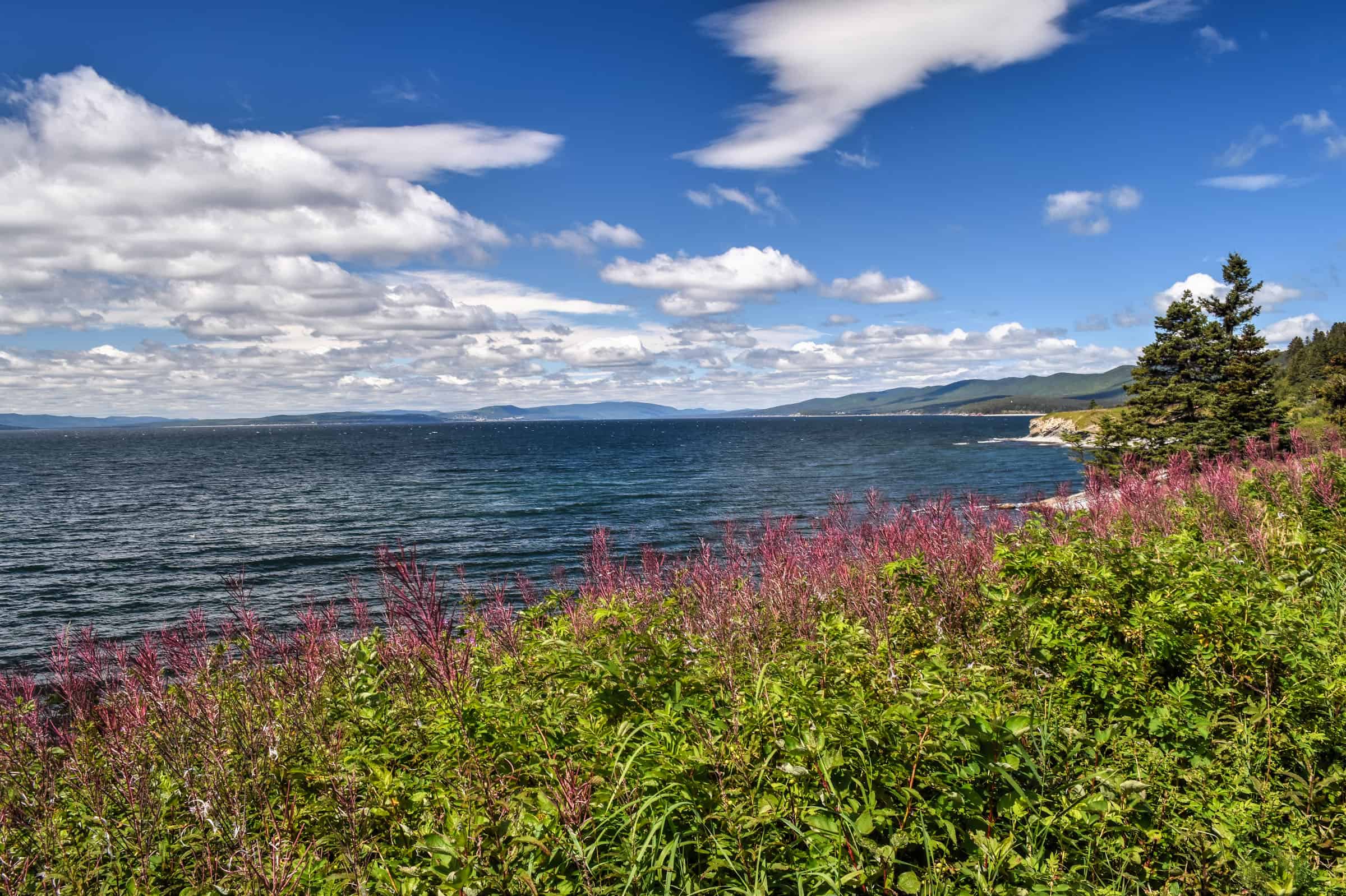
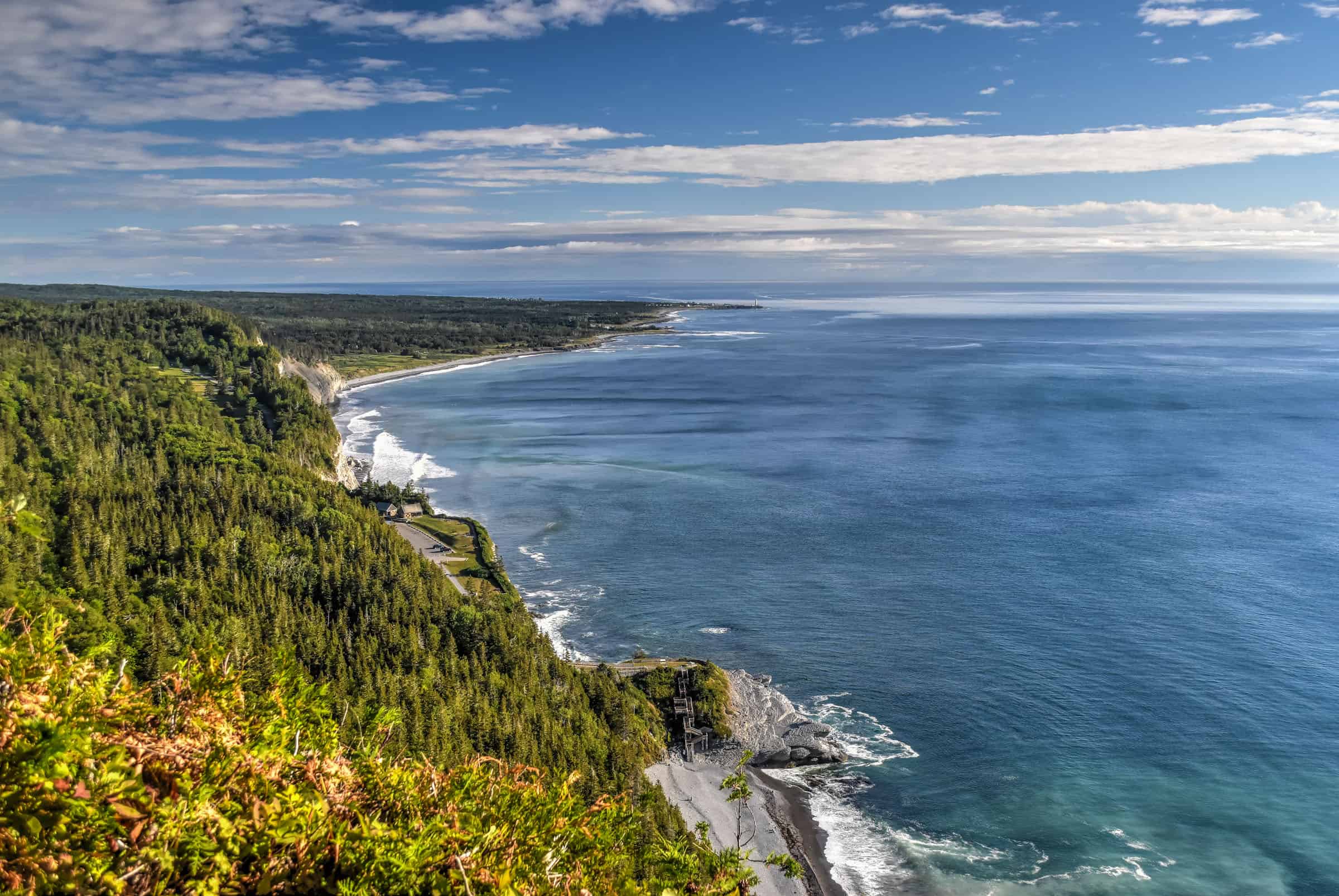
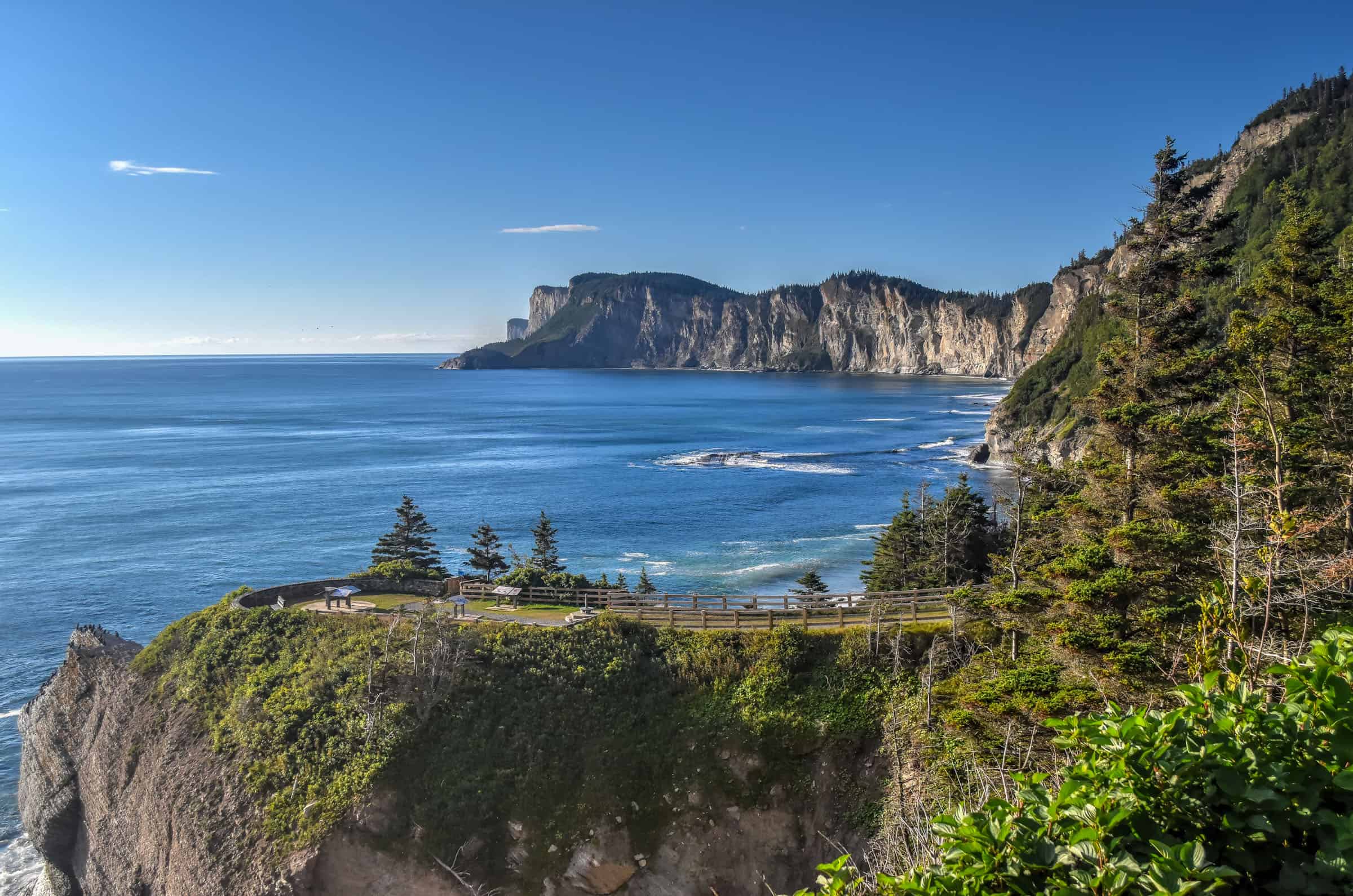
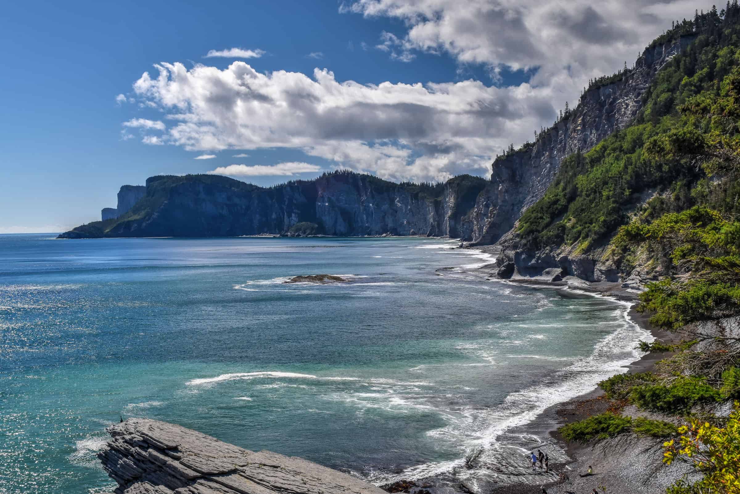
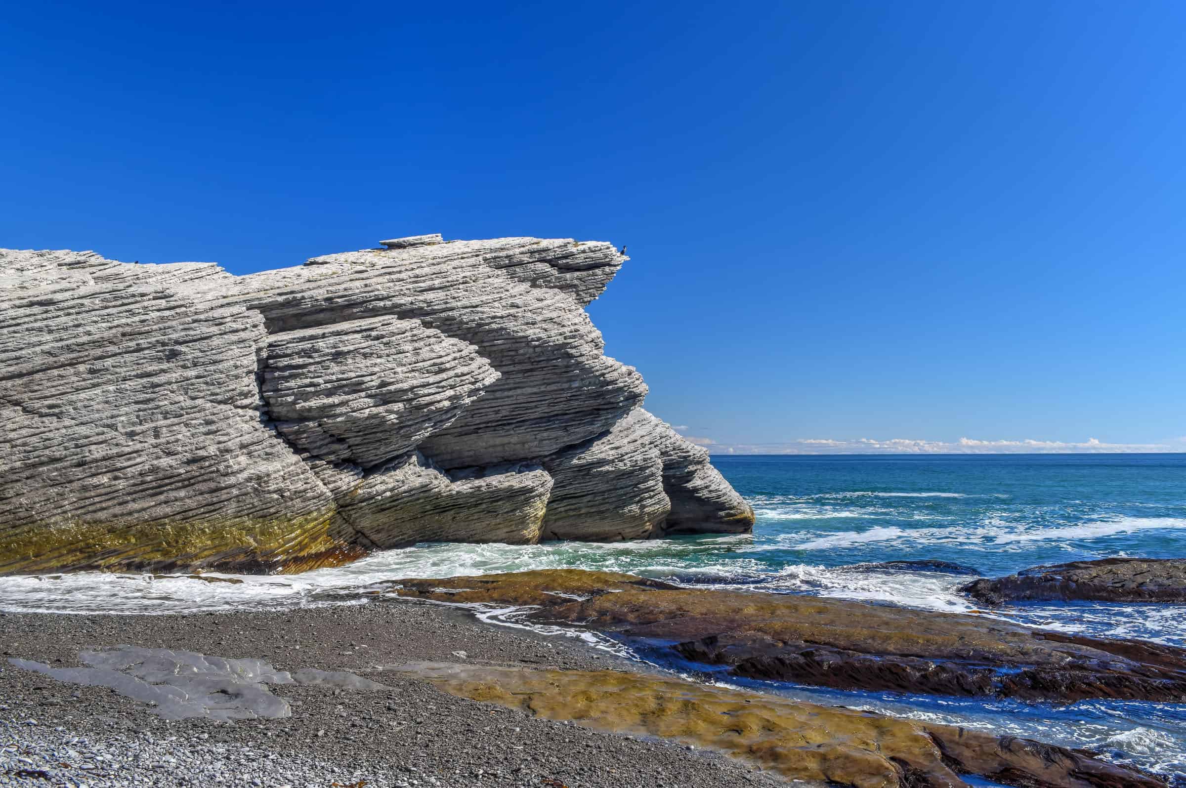
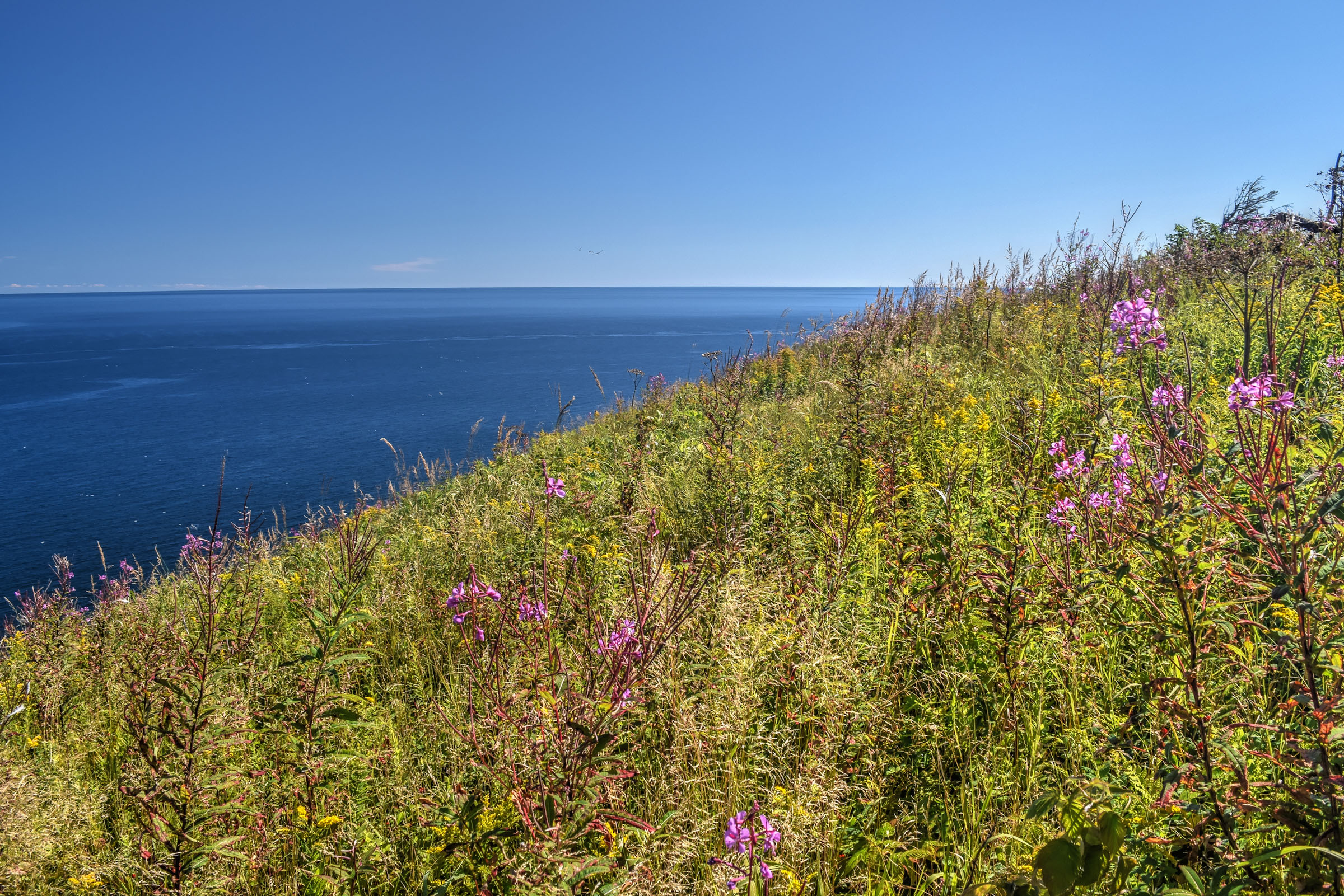
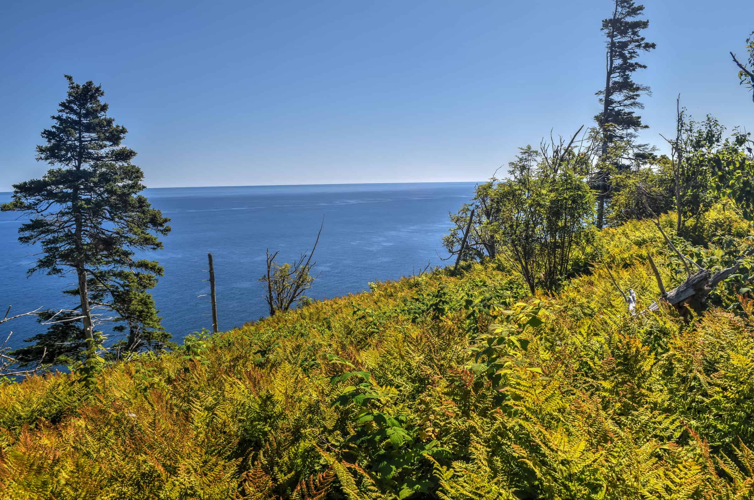
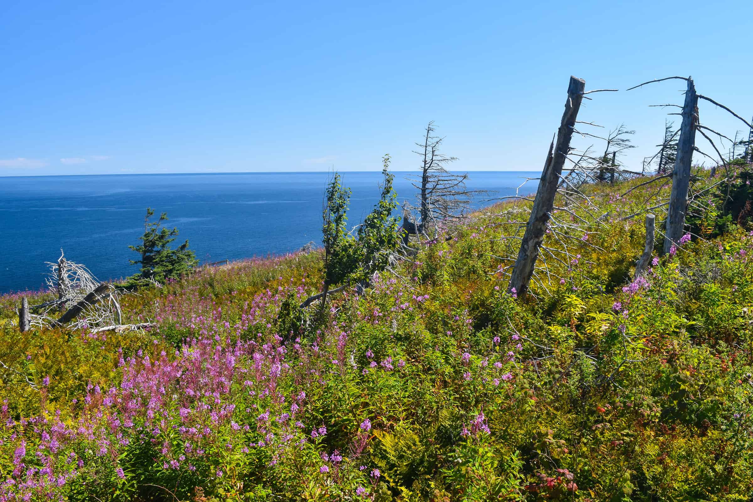
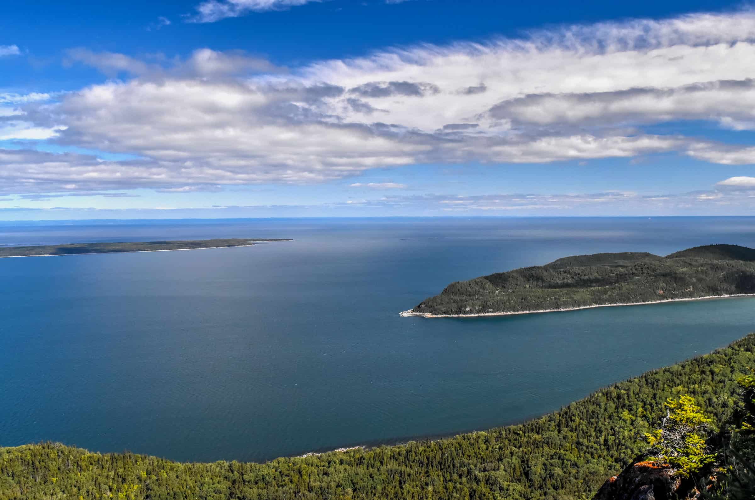
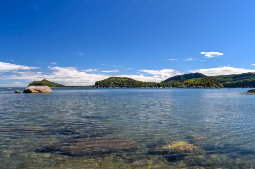
Les Graves Trail (moderately challenging)
Although the trail has some ups and downs, the main challenge here is the distance (16 km). This is such a beautiful trail that meanders along the coast through pretty meadows with breathtaking views of Gaspé Bay. If you are lucky, you might see whales and dolphins swimming by you.


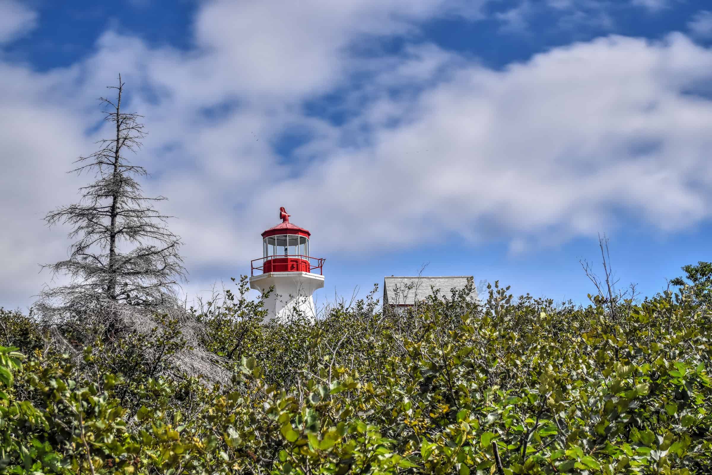
After a short but intense final climb, you can choose to end your hike at Cap-Gaspé, where a lighthouse sits atop a 95-meter cliff.


Alternatively, you can continue along a final 0.3km section of the trail where you’ll drop down to nearly sea level to reach Land’s End, where you are very likely to see loads of marine and coastal wildlife.


Note that the trail overall has several up-and-down sections, meaning that the total cumulative elevation gain (see below) is much greater than the actual elevation difference listed on the park website.
Distance: 16.1 km
Route Type: Out & back
Elevation gain: 90 m (cumulative elevation gain: 377 m)
Start point: Grande Grève parking lot
AllTrails rating: (4.7, 257 ratings (2024))
Duration: Most people complete the trail in around 4h-5h
Access Fees: Parks Canada daily rate
Note: Many stop at the lighthouse and picnic tables about 0.3km from the end of the trail (the area known as Gap Gaspé). If you continue to the very end (to the point referred to as Land’s end), you’ll climb down nearly 100m (along a steep section of trail) to get close to sea level (and you’ll have to climb that back up again), nearly doubling your elevation gain for the trail. If you chose not to go down, the total cumulative elevation gain for the whole trail would be closer to 300 m.
Alternative half-trail: You can reduce the hike’s distance by nearly half starting at the L’anse-aux-Améridiens parking lot.
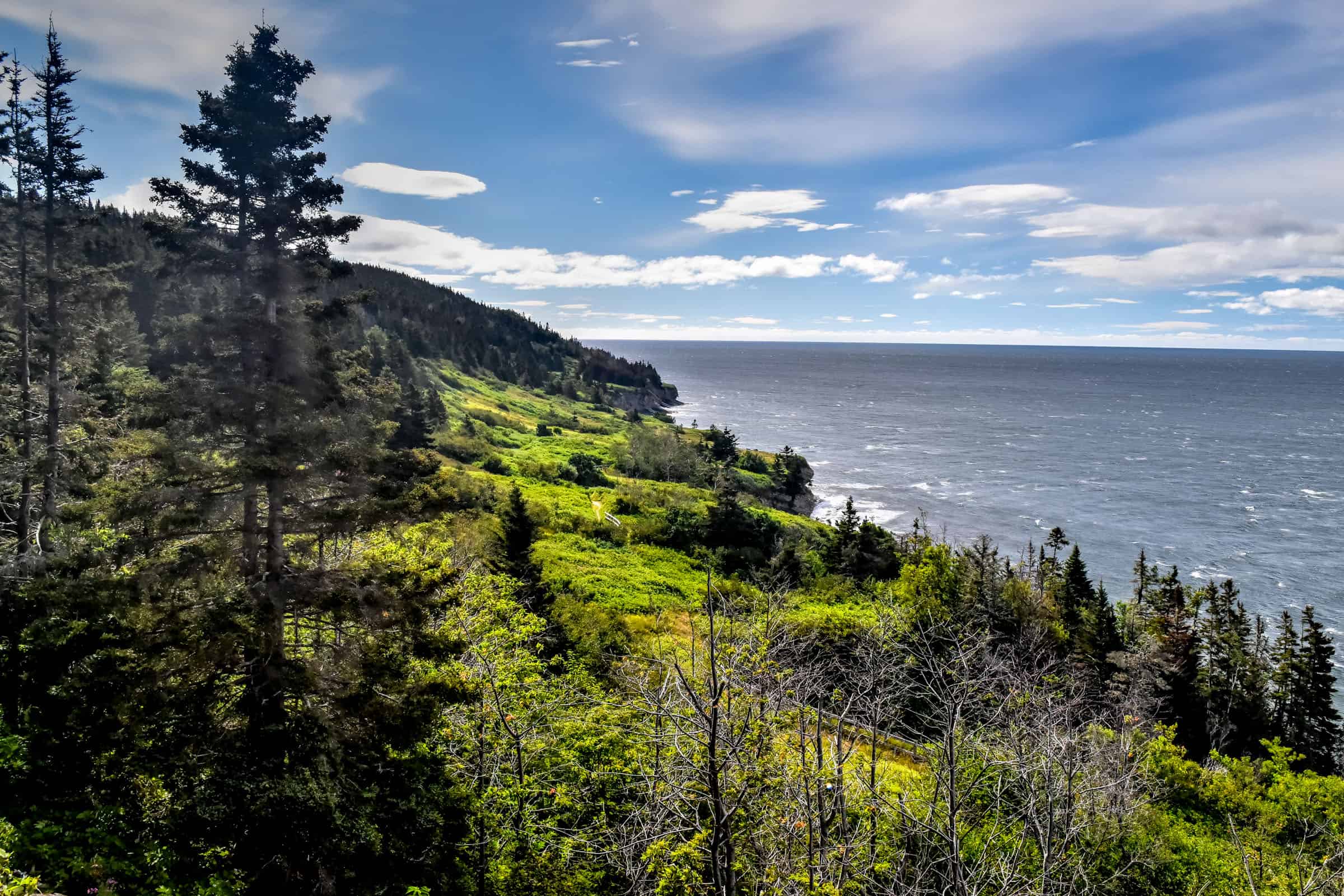
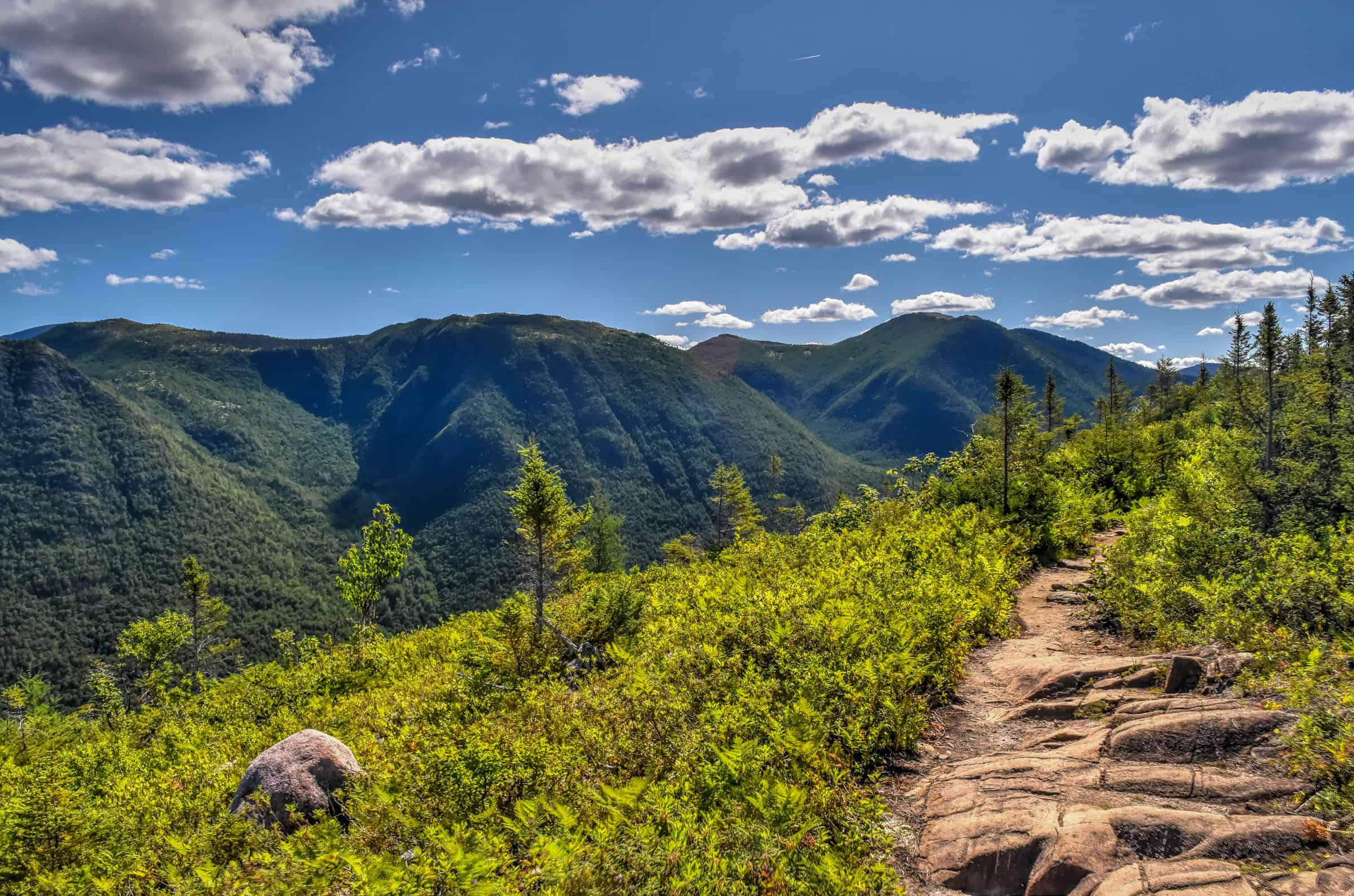
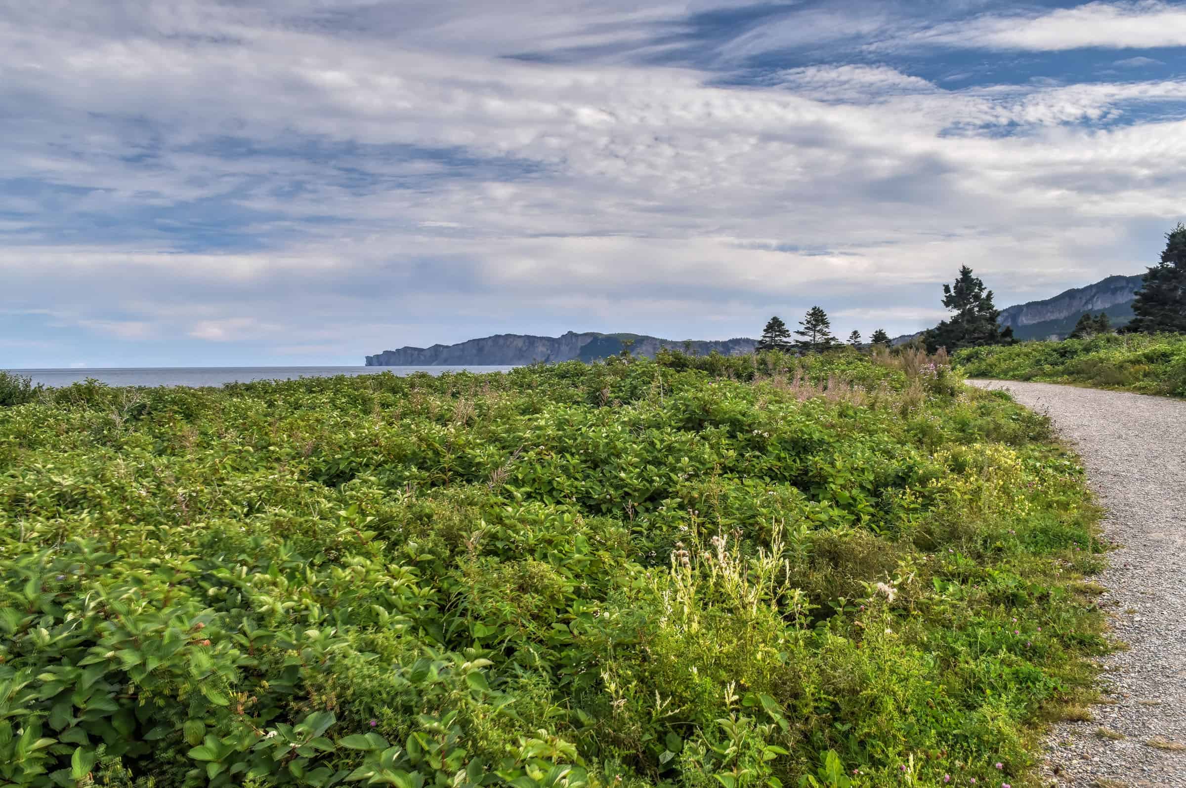
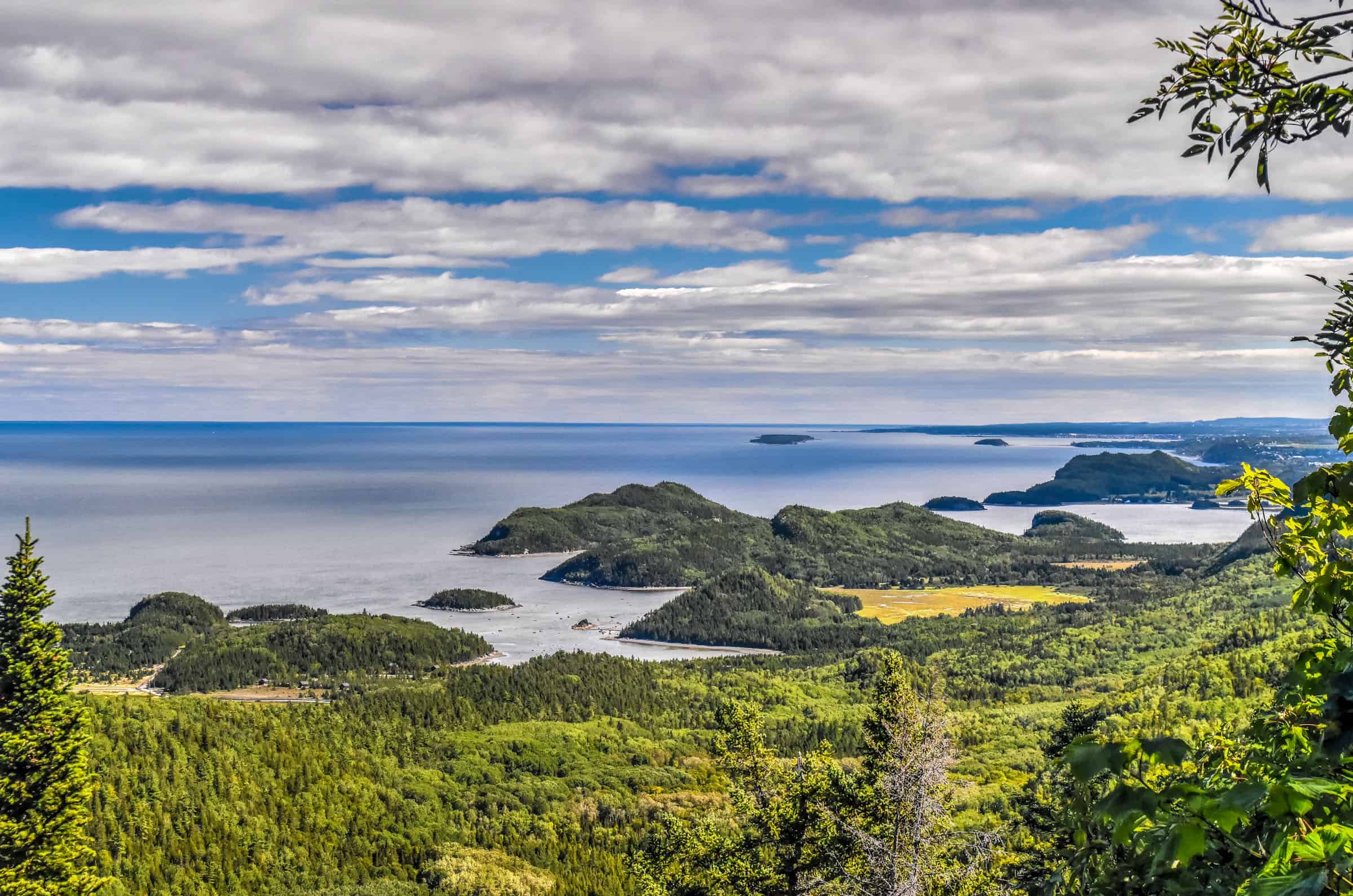
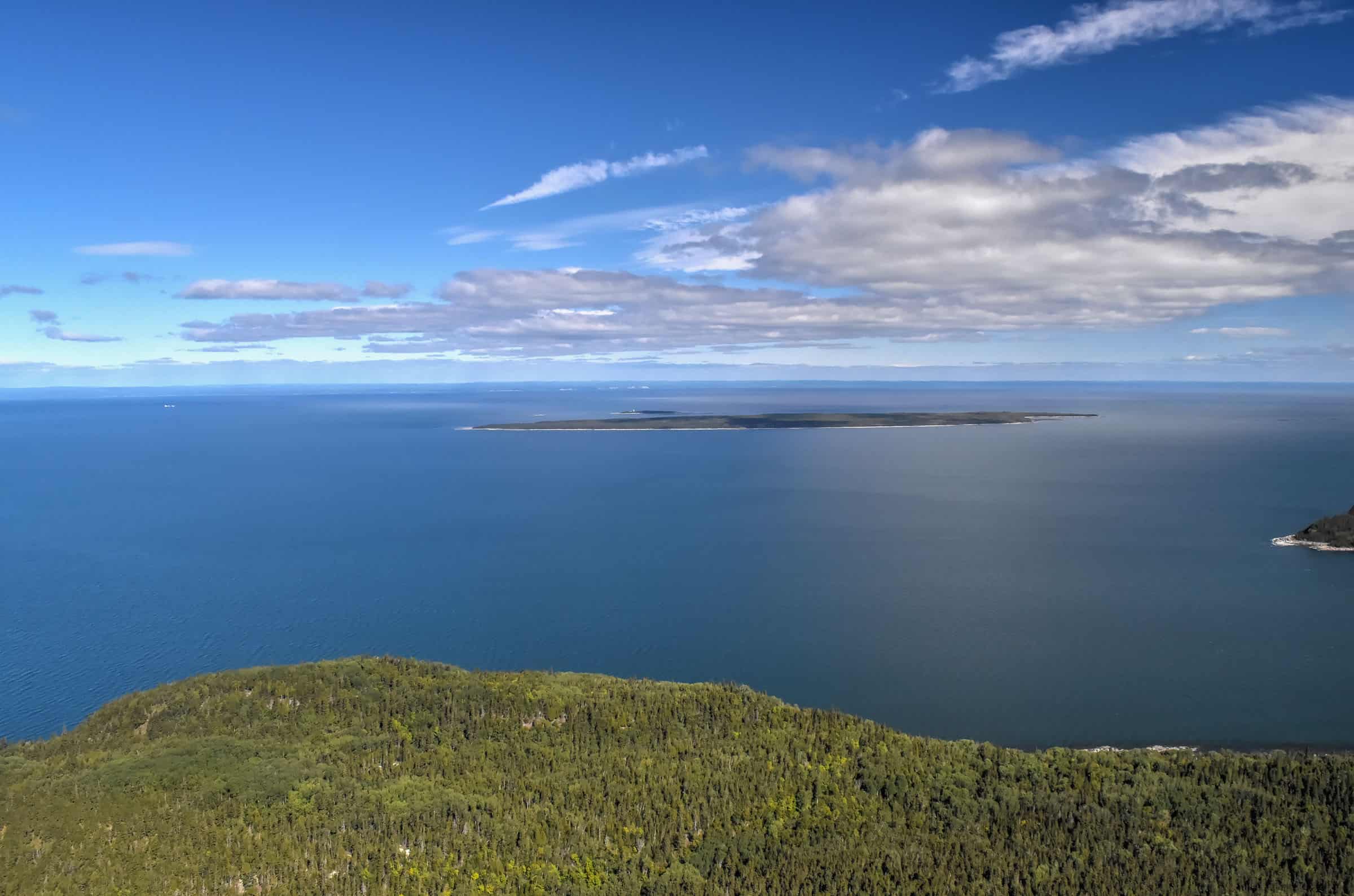
Mont Saint-Alban (moderate)
This is the most rewarding trail of the park in terms of sweeping grand views of the beautiful Forillon coastline, stretching out to Cap Gaspé and Land’s End. It is also probably the most difficult trail in terms of steep ascending sections, particularly the very first section where you will gain just under 300 m over the first 2 km. But once you get through that first section, the trail is pretty easygoing with mostly flat and downhill sections.
The main draw here is the observation tower built near the mountain’s summit, which offers a fantastic 360-degree panoramic view of the surrounding area.


Trail Details
Distance: 7.9 km
Route Type: Out & back
Elevation gain: 260 m (cumulative elevation gain: 434 m)
Start point: Cap Bon-Ami Parking Lot
AllTrails rating: (4.6, 687 ratings (2024))
Duration: Most people complete the trail in around 2h45-3h
Access Fees: Parks Canada daily rate
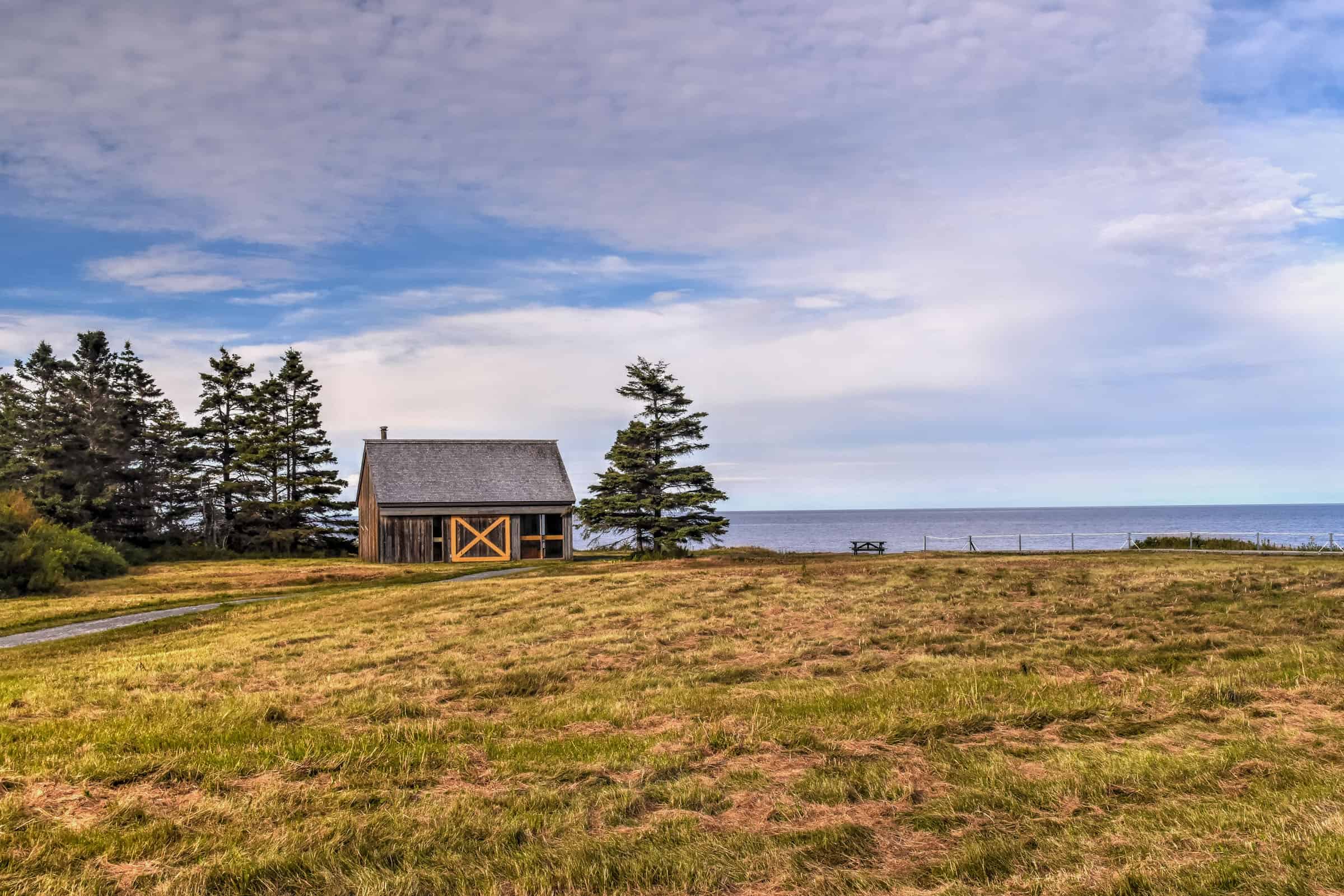
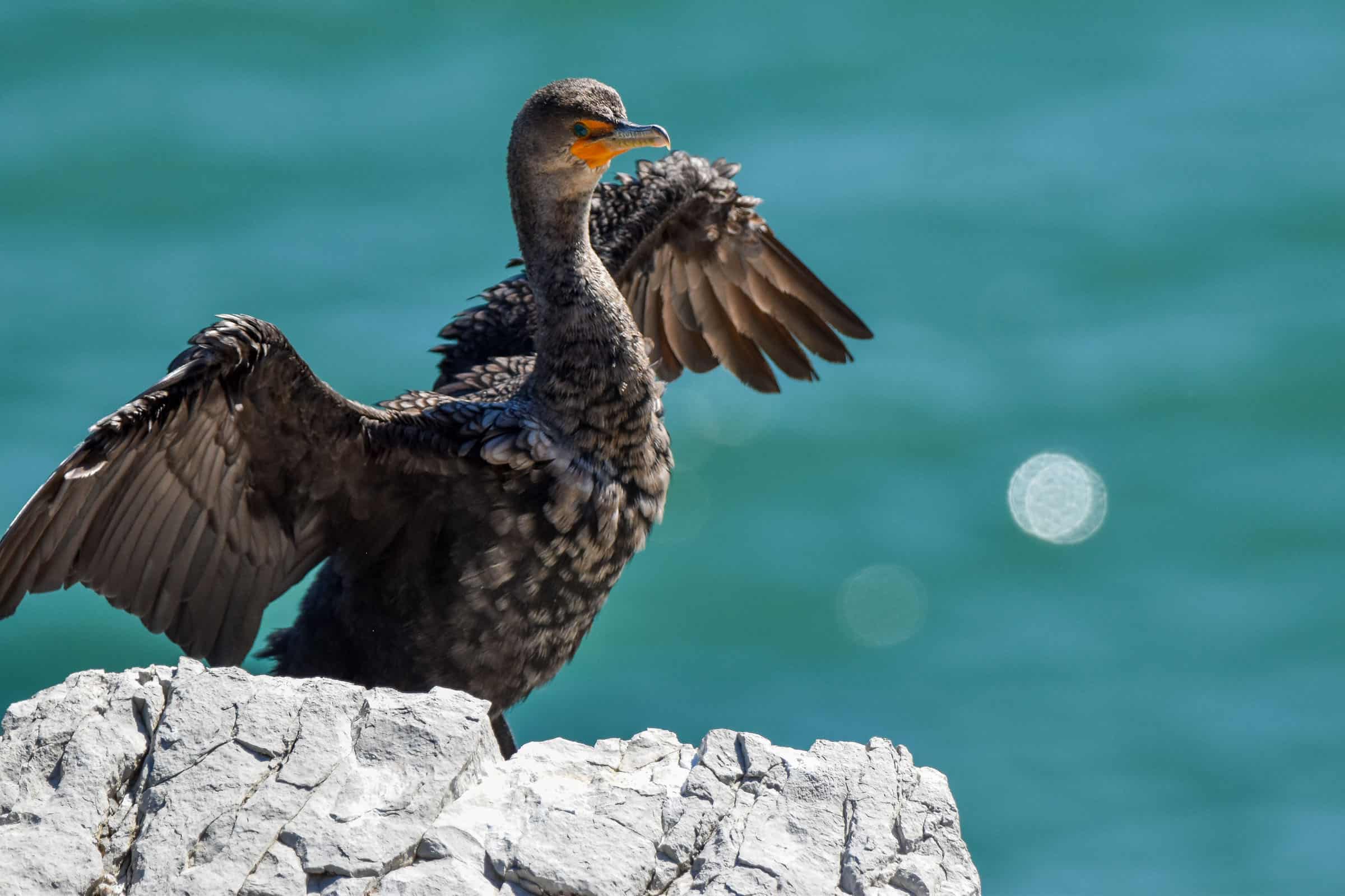
Either before or after your hike, be sure to explore the beautiful area of Cap-Bon-Ami, a beautiful viewpoint and the starting point of the park’s Mont Saint-Alban trail. It’s a beautiful spot that only requires going down (and then back up) a few flights of stairs down to the beach. It’s also a great spot to see some double-crested cormorants.


For more information on visiting Forillon National Park, its hiking trails, and where to stay, check out our guide on the Best Hiking Trails in Forillon National Park.
Hiking Packing List
All Trails subscription – This comes in really handy for areas with little or no cell reception, as the annual subscription allows you to download trail maps for offline use.
External Battery – If you are using your phone to track your progress along the trail or to help with navigation, you certainly don’t want your phone to die on you. That’s especially true in the unlikely event that you might get hurt or need assistance.
Hiking poles – These can be particularly useful in steep trails or muddy/boggy trail conditions.
Water Filter Bottle – The Life Straw bottle is an advanced water bottle with a filter that not only improves water taste but more importantly filters out bacteria and parasites, chemicals and microplastics.
Headlamp – very practical and a smart choice if you plan to start your hike before sunrise or finish it after sunset.
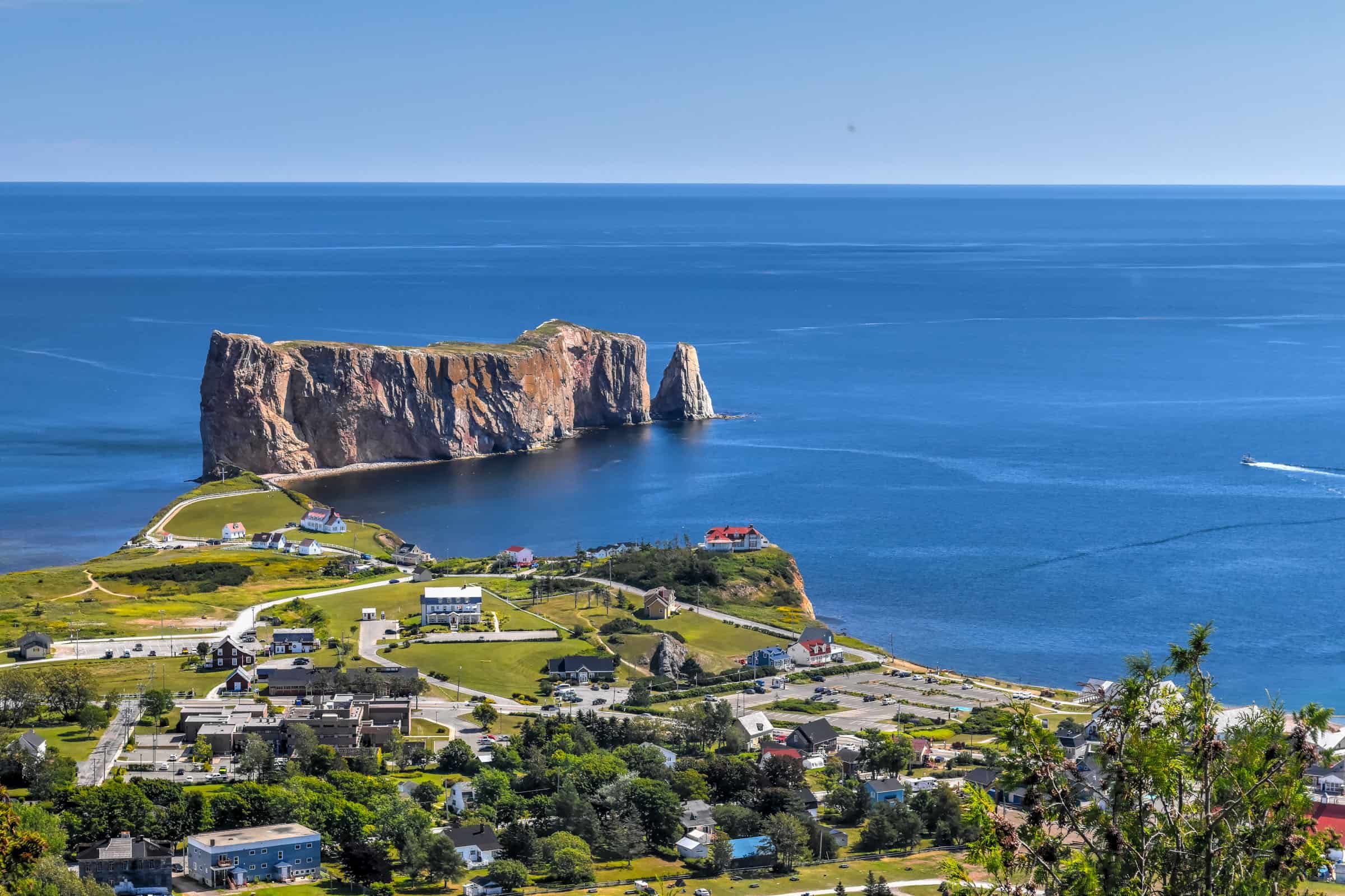
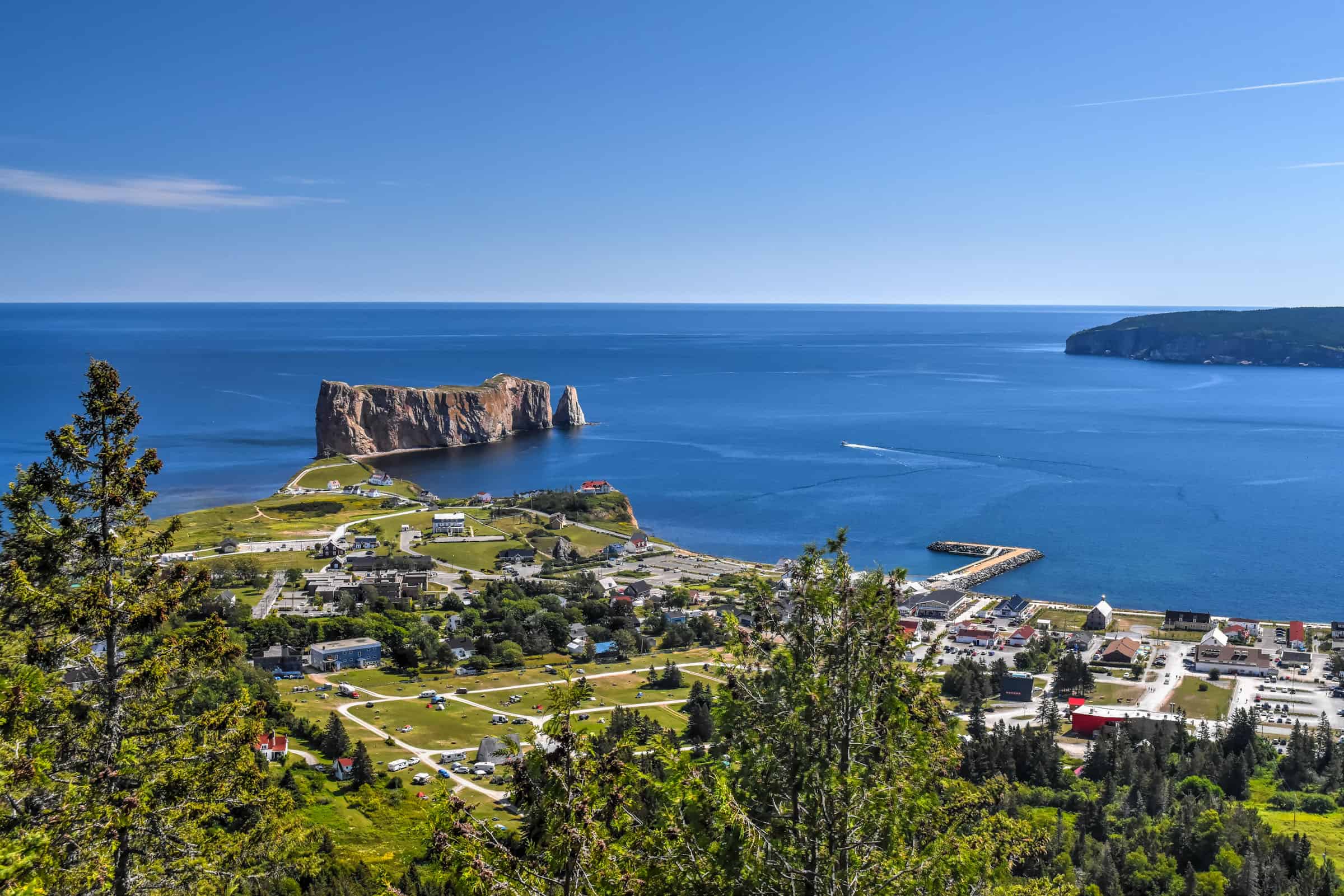
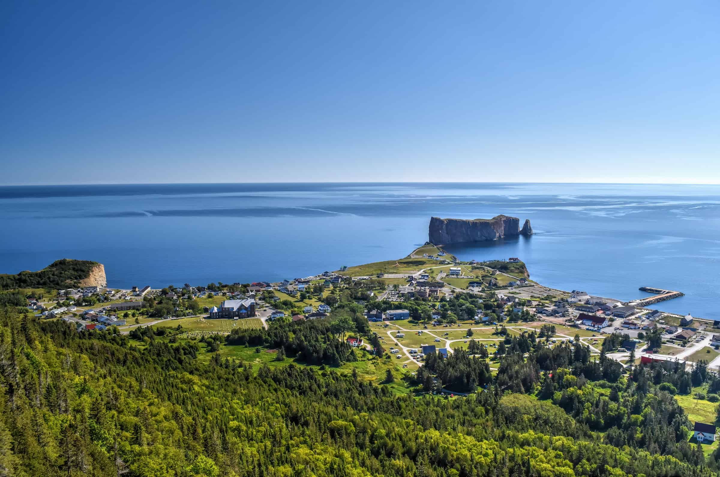
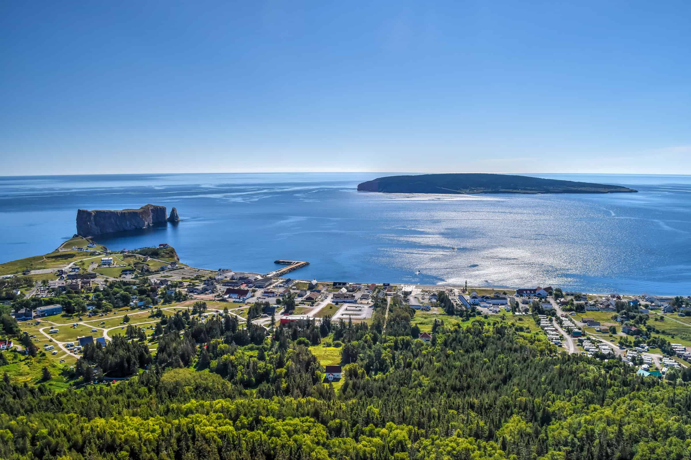
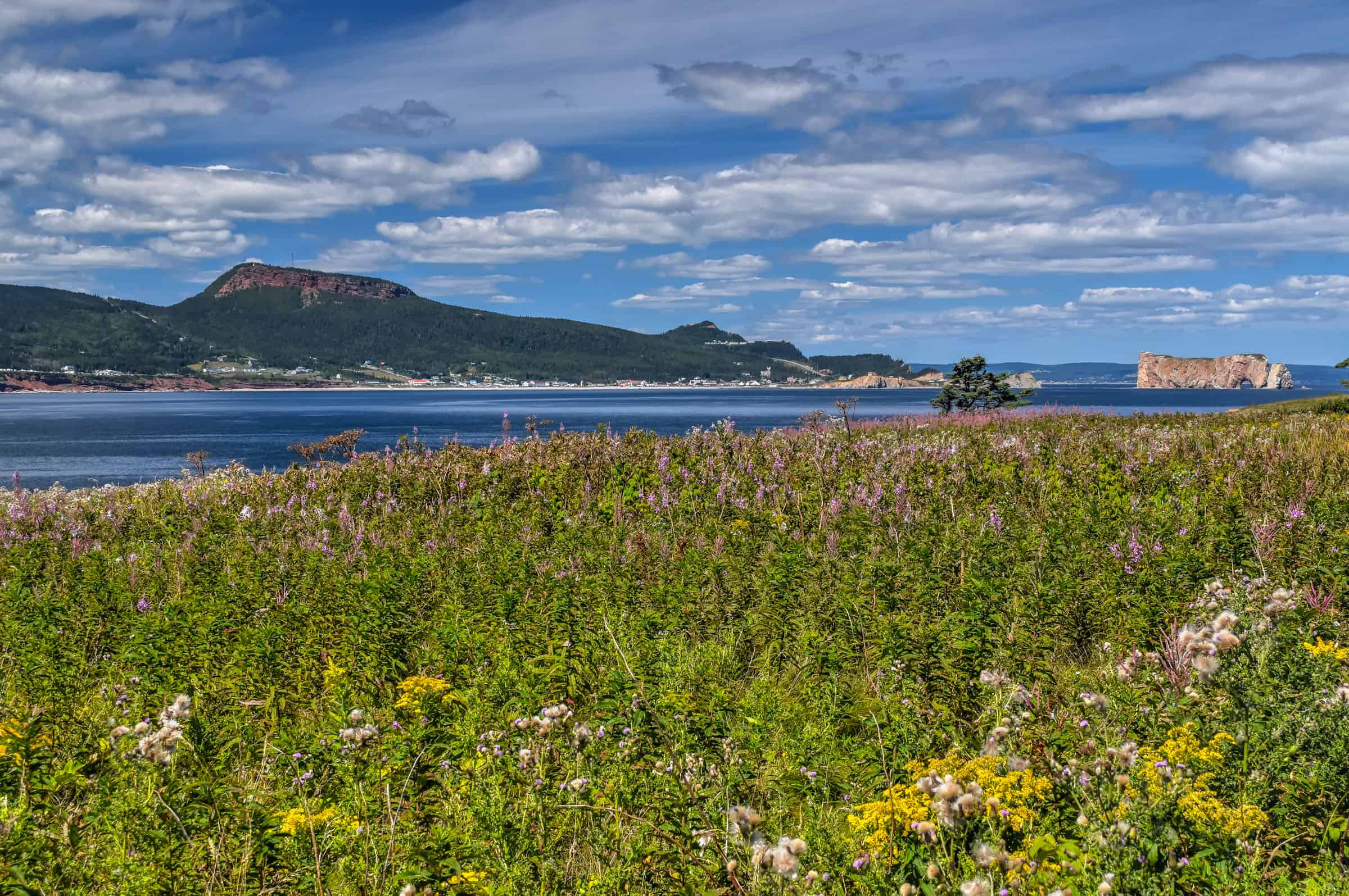
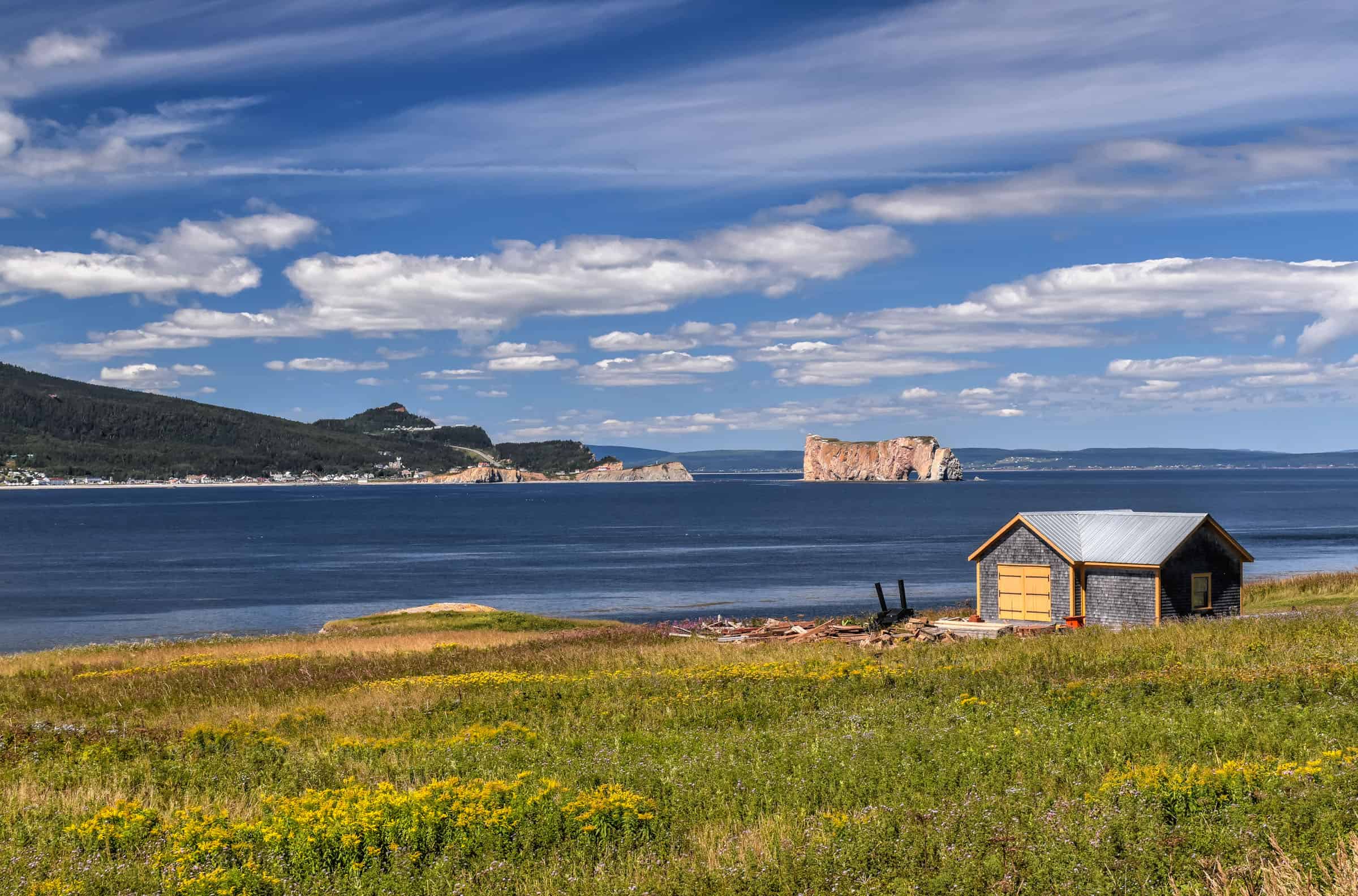
UNESCO Global Geopark of Percé
Percé has a fun hiking area around Mont Saint-Anne, that is neither a national nor a provincial park. It’s in fact quite more unique – a UNESCO Global Geopark, one of only five in Canada. These Geoparks are “unified geographical areas where sites and landscapes of international geological significance are managed with a holistic concept of protection, education and sustainable development”.
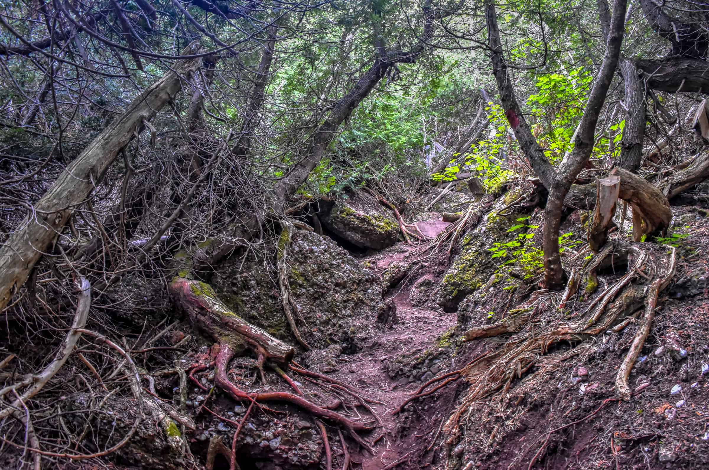
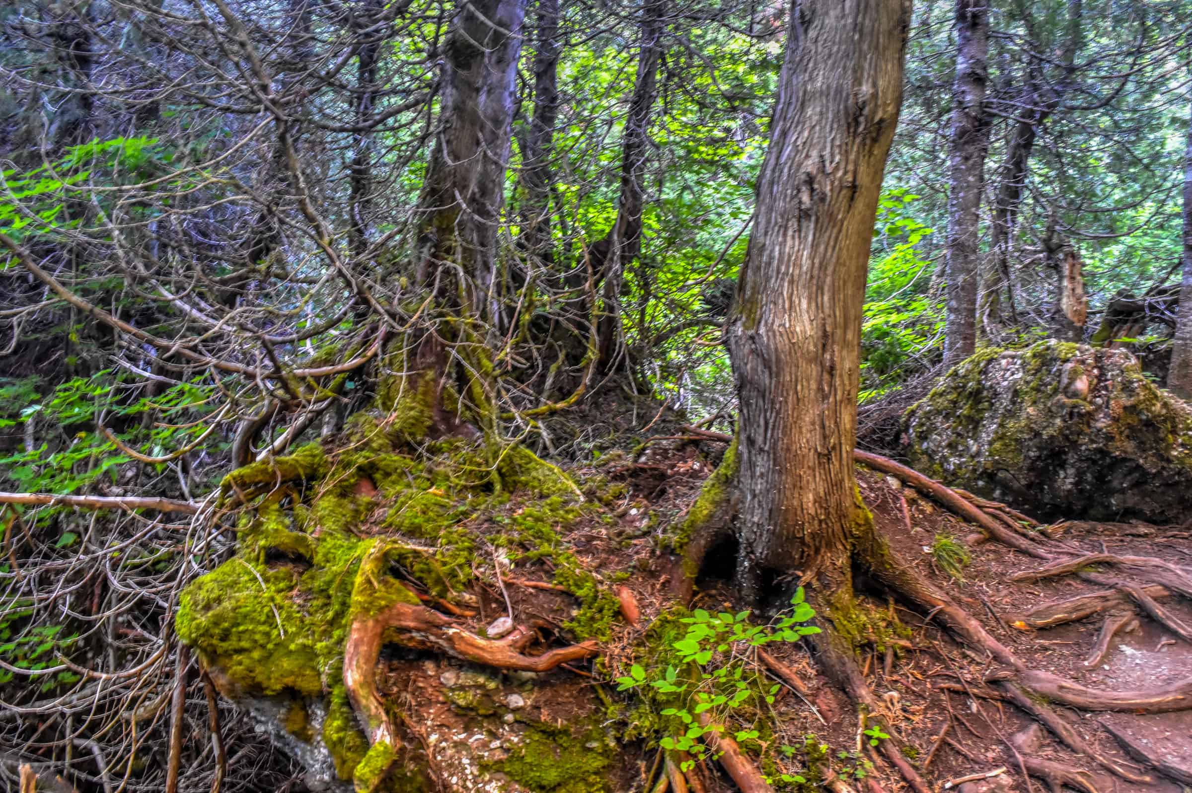
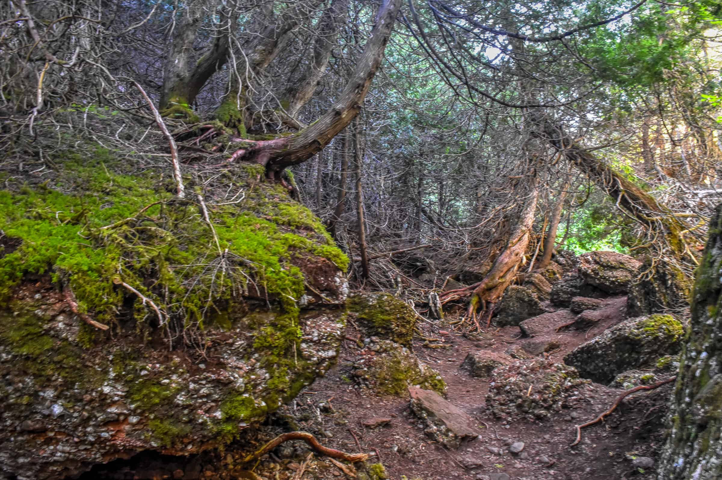
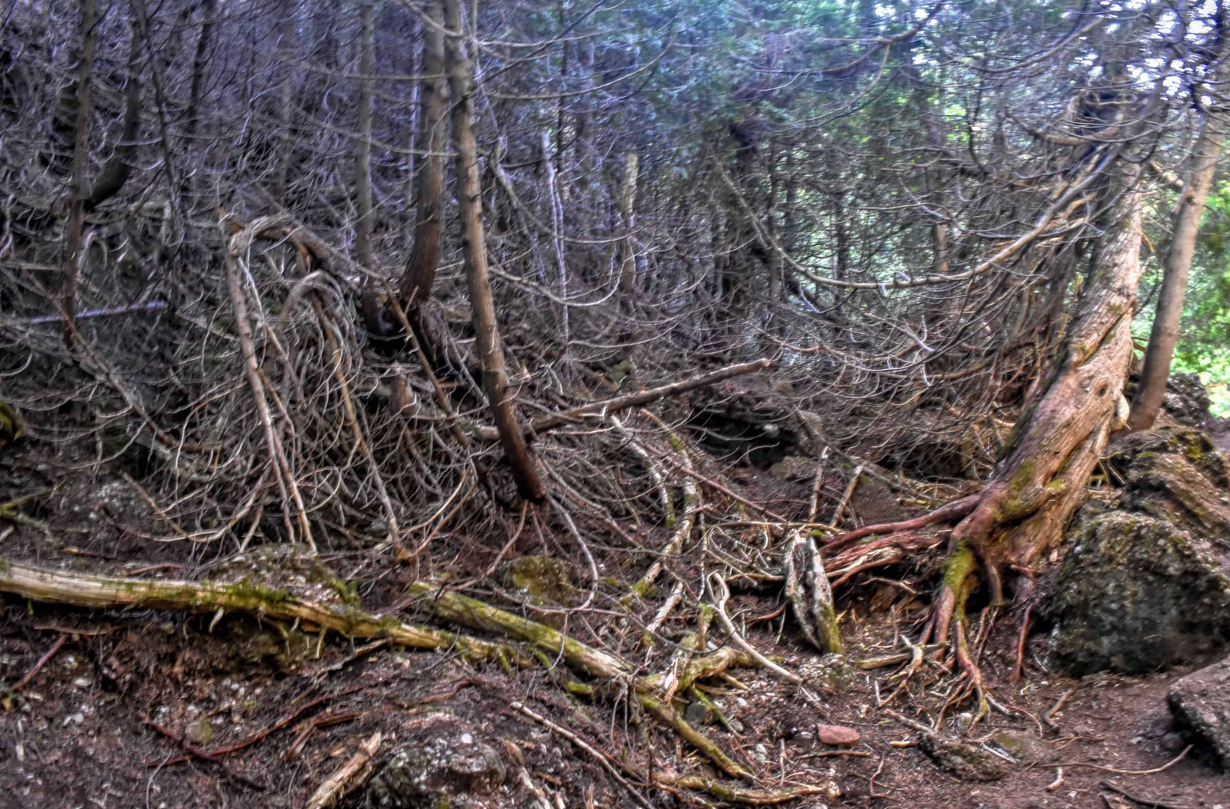
Belvedere and Magic Forests Trails (moderate)
Of the many hiking trails in the Geopark, the two most rewarding trails in our opinion, especially if you are short on time, are the Belvedere trail (5km return), which has several viewpoints and provides access to a glass viewing platform about halfway up the trail, and the Magic Forest trail (1km loop), which starts and ends just after the suspended platform along the Belvedere trail.
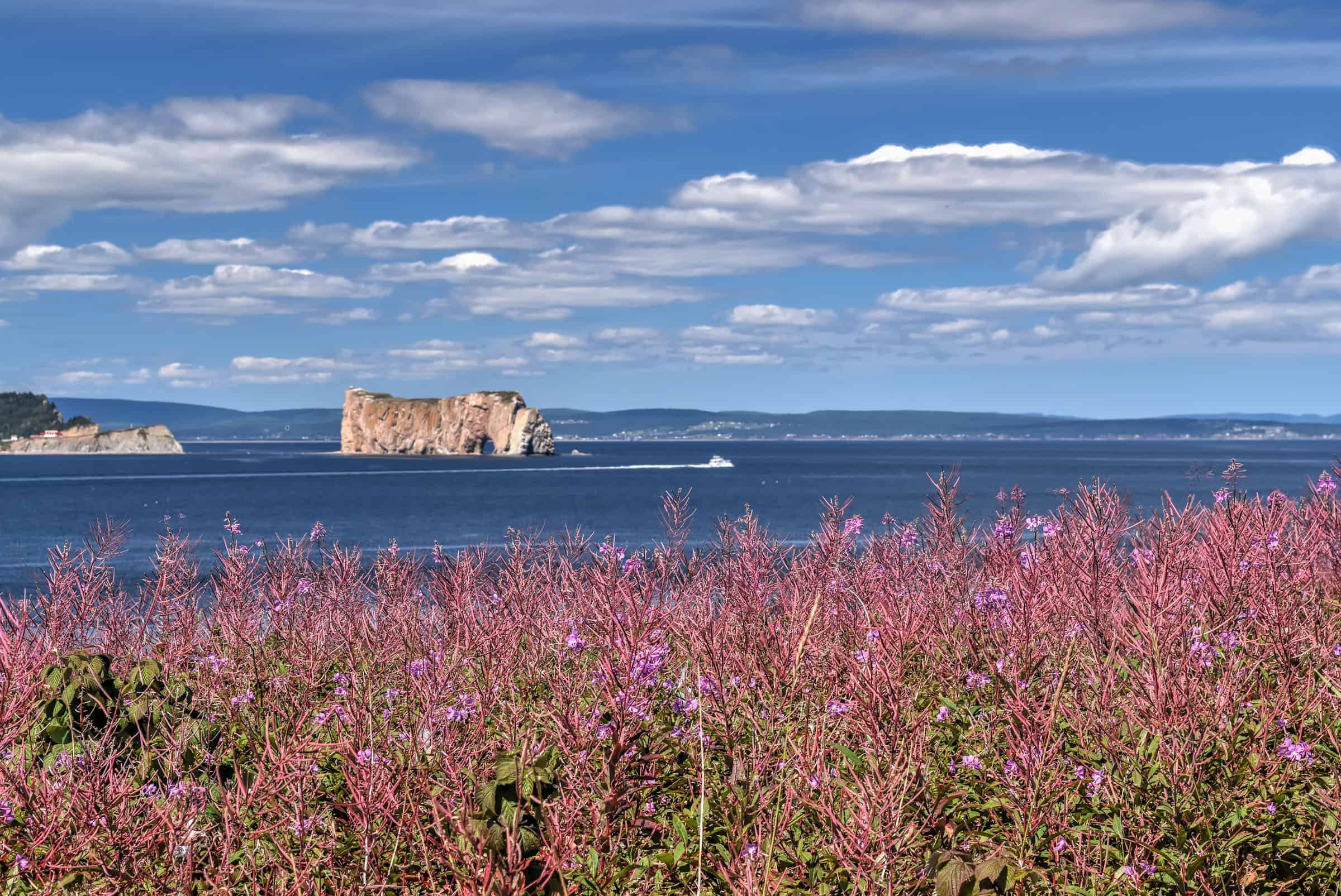
The Belvedere trail offers spectacular views of the scenery below, including the Rocher Percé, Bonaventure Island and the open sea.


Although the trail is free, for $15 (2024) you can walk onto an impressive glass platform hanging over the edge of the Mont Sainte-Anne mountain.


The Magic Forest trail follows a path that loops through a dense forest where large tree roots, moss-covered rocks and dark green tones give the forest a definite eerie or magical feel.


On AllTrails, a combined version of the trails exists under the name Arpenteurs Trail, which starts from the town campground near the Tektonic Pavillon.
Trail Details
Distance: 7.1 km
Route Type: Out & back with loop sections
Elevation gain: 305 m (cumulative elevation gain: 390 m)
Start point: Pavilion Tektonik
AllTrails rating: (4.5, 148 ratings (2024))
Duration: Most people complete the trail in around 2h30-2h45 minutes
Access Fees: Free
For more information on the hiking trails in the Percé UNESCO Geopark, check out our guide on the Best things to see and do in Percé.
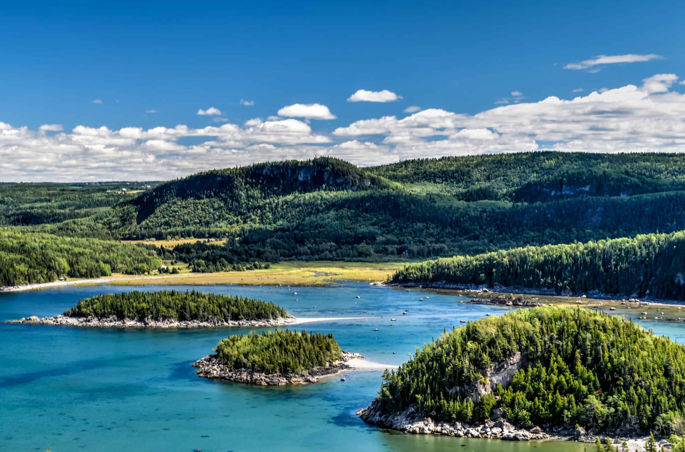
Bonaventure Island
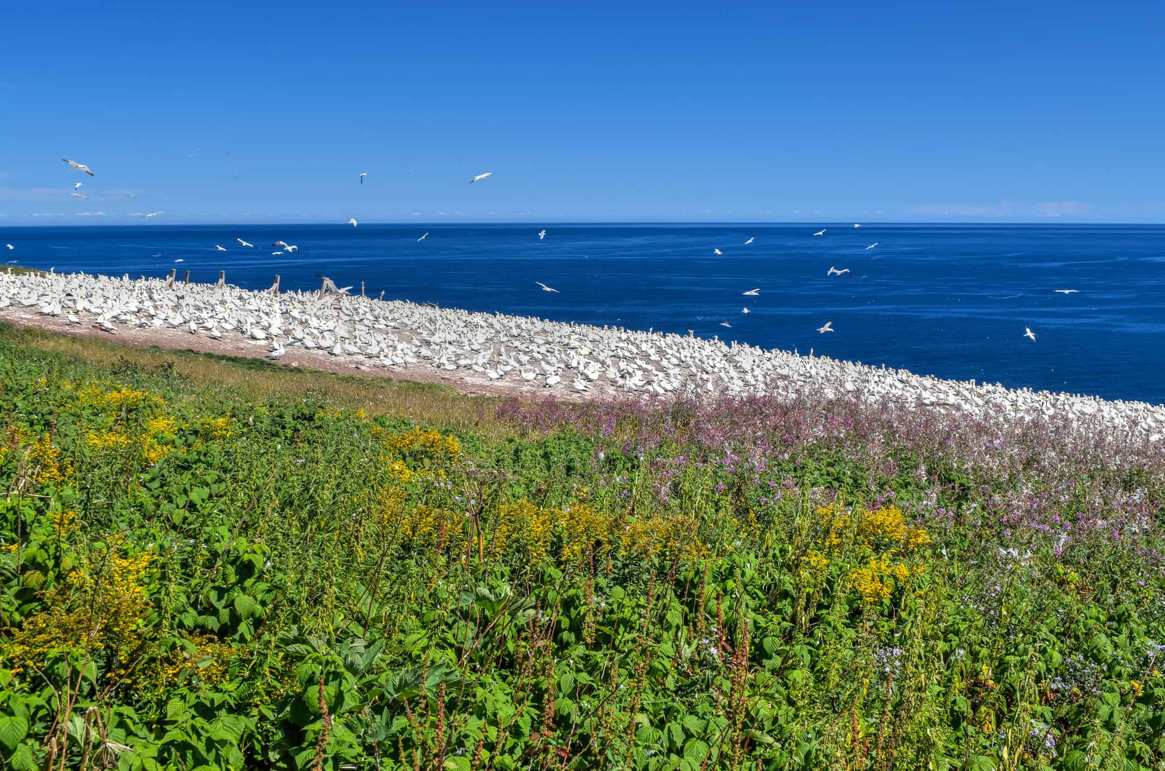
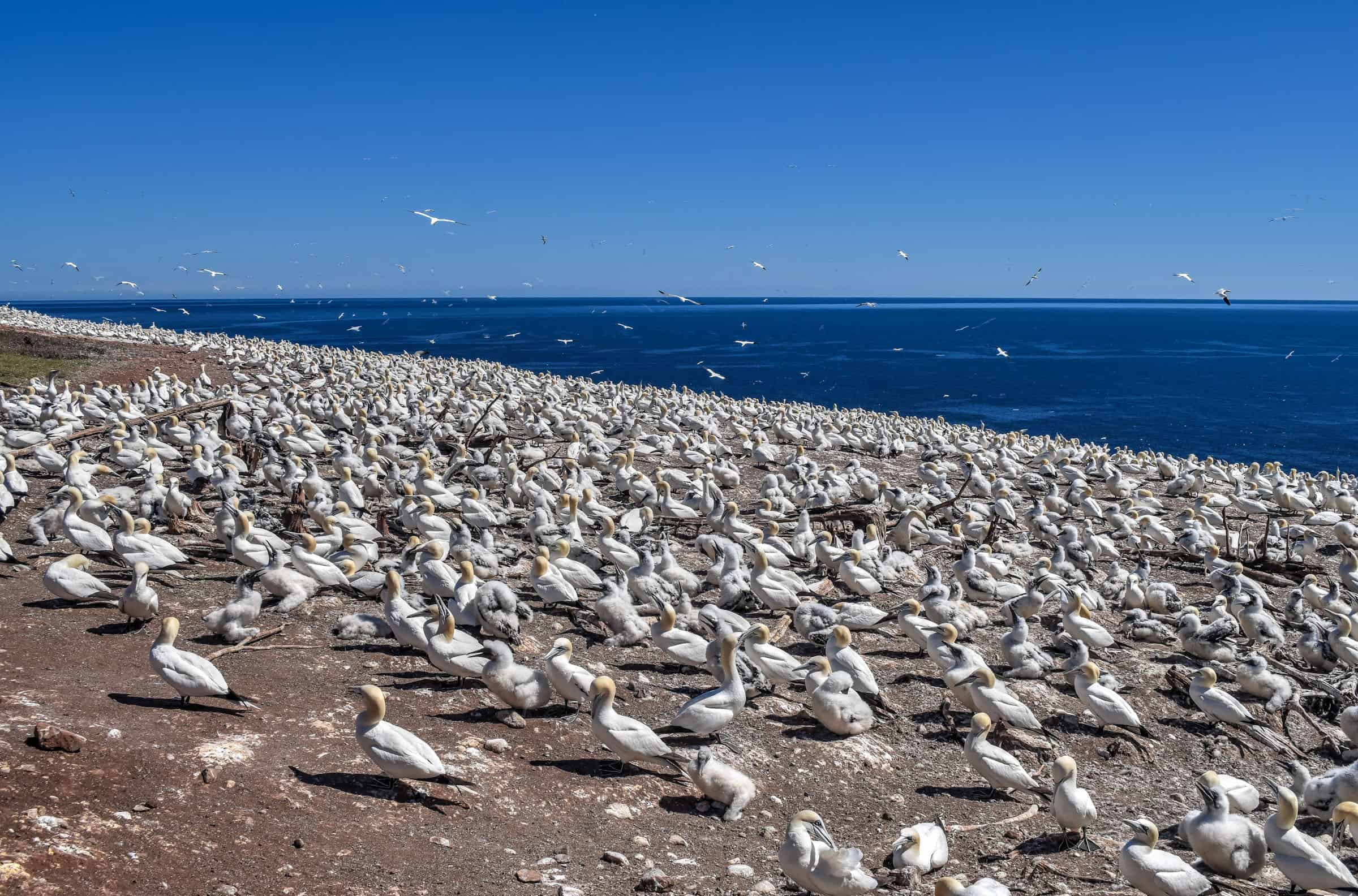
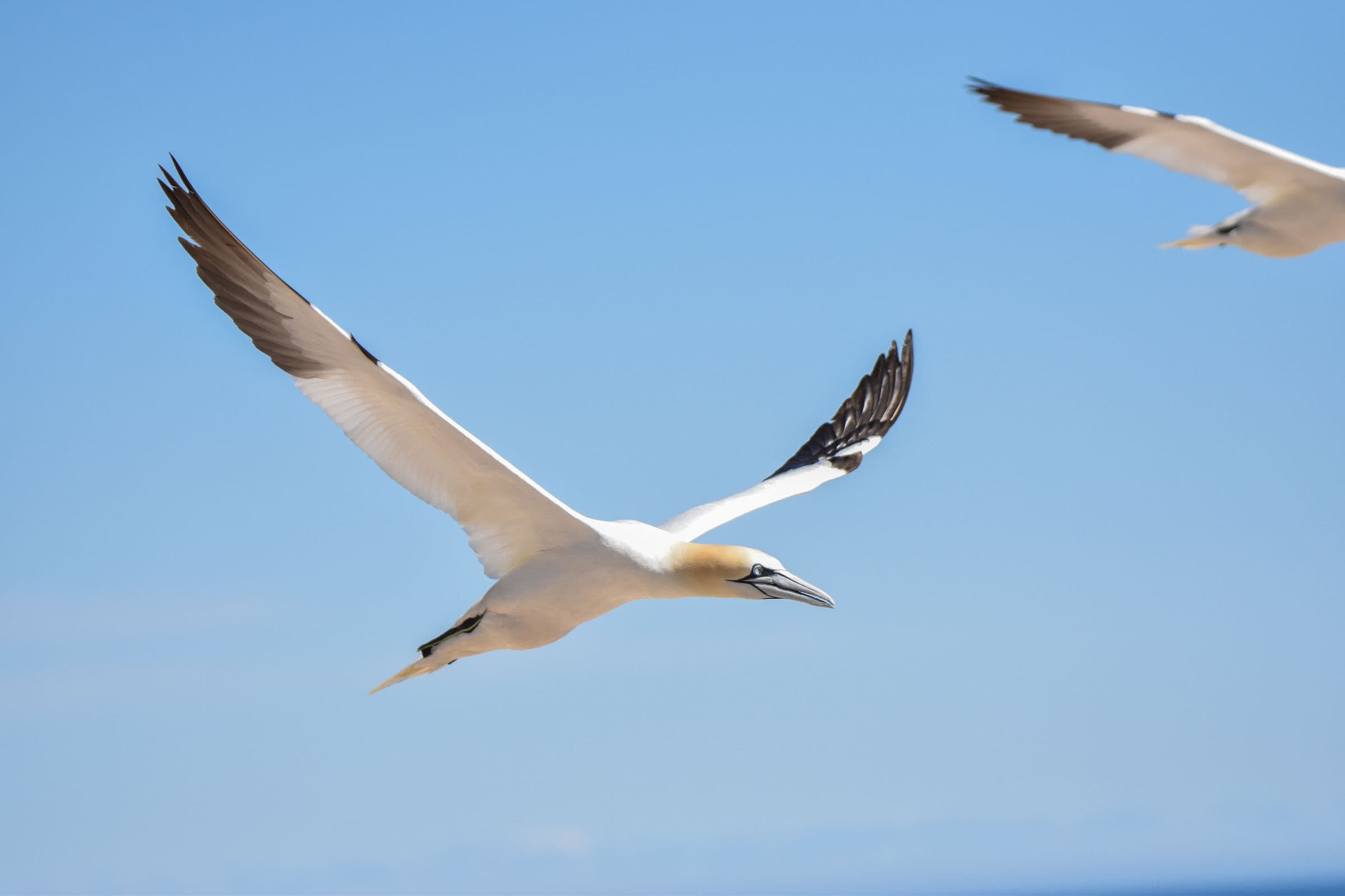
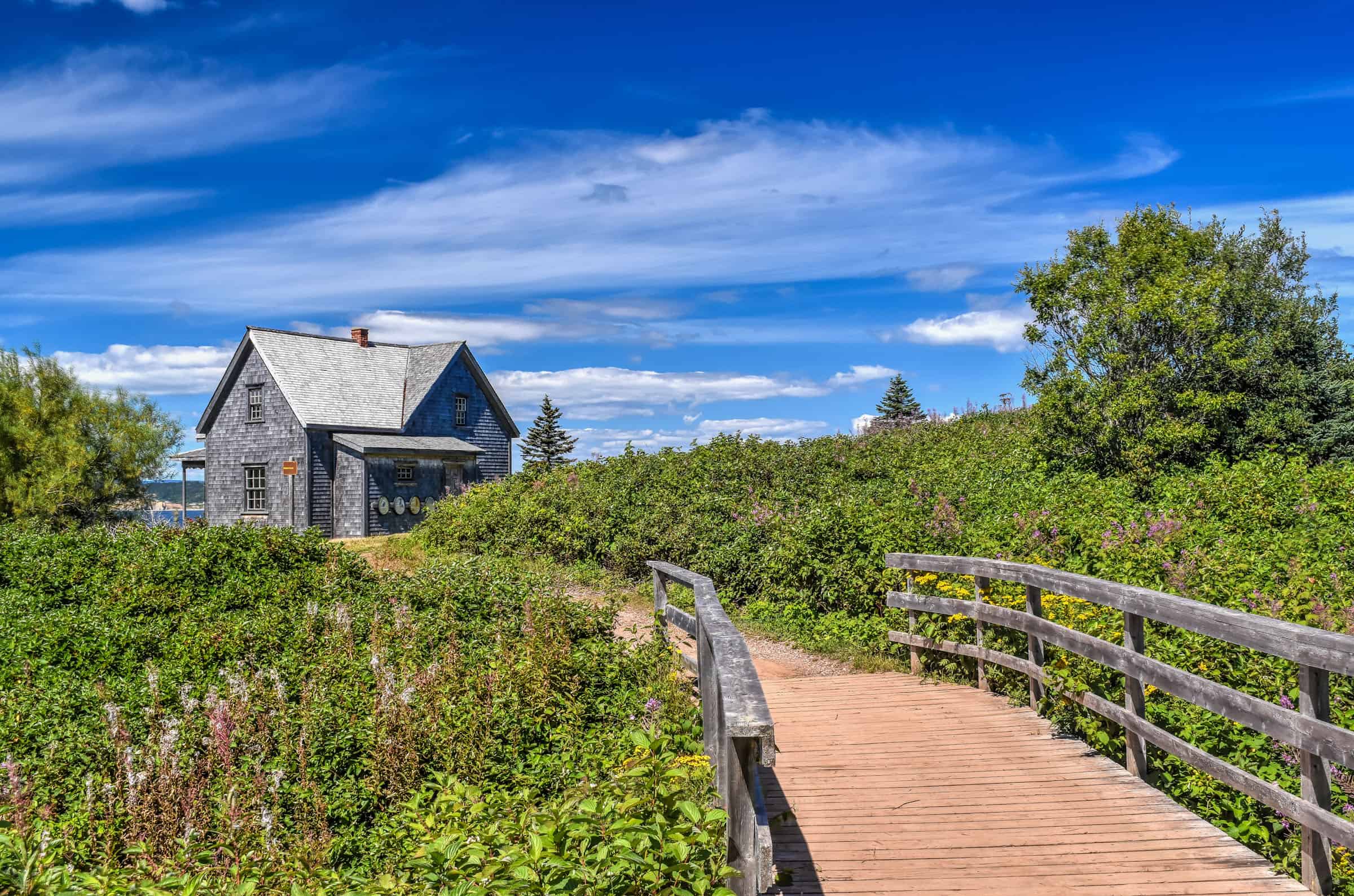
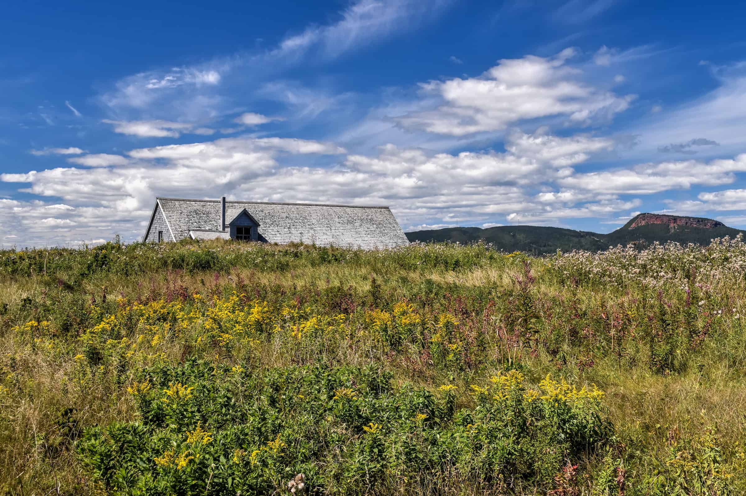
No trip to the beautiful Gaspésie region is complete without a visit to Ile-Bonaventure National Park (the park’s full name is Île-Bonaventure-et-du-Rocher-Percé National Park and is often referred to as Bonaventure Island). This spectacular island is located just off the coast of Percé, which is beautiful and scenic in its own right, its main draw is the largest migratory bird refuge in North America, where you will find the most accessible and second-largest Northern Gannet colony in the world. The Northern Gannet is the most common bird found on the island, with a population of over 100,000. For those of you who like walking outdoors, the island also has 4 different hiking trails, all of which connect the port of arrival on the west side of the island to the gannet colony viewing areas along the eastern coast. Here we will focus on two trails, the Mousses and the Chemin-du-Roy trails, which when combined form the Island Loop Trail.
Les Mousses Trail
This is a beautiful trail that is just over 3 km in length. The trail is initially quite narrow, first through forested sections where you are surrounded by moss- and lichen-covered vegetation all around before eventually reaching the northwestern island cliffs, offering magnificent views of the open sea ahead along with beautiful colored wildflowers.


By now, you don’t quite see the colony, but you can definitely hear them – they are a loud bunch!
The Gannet Viewing Areas
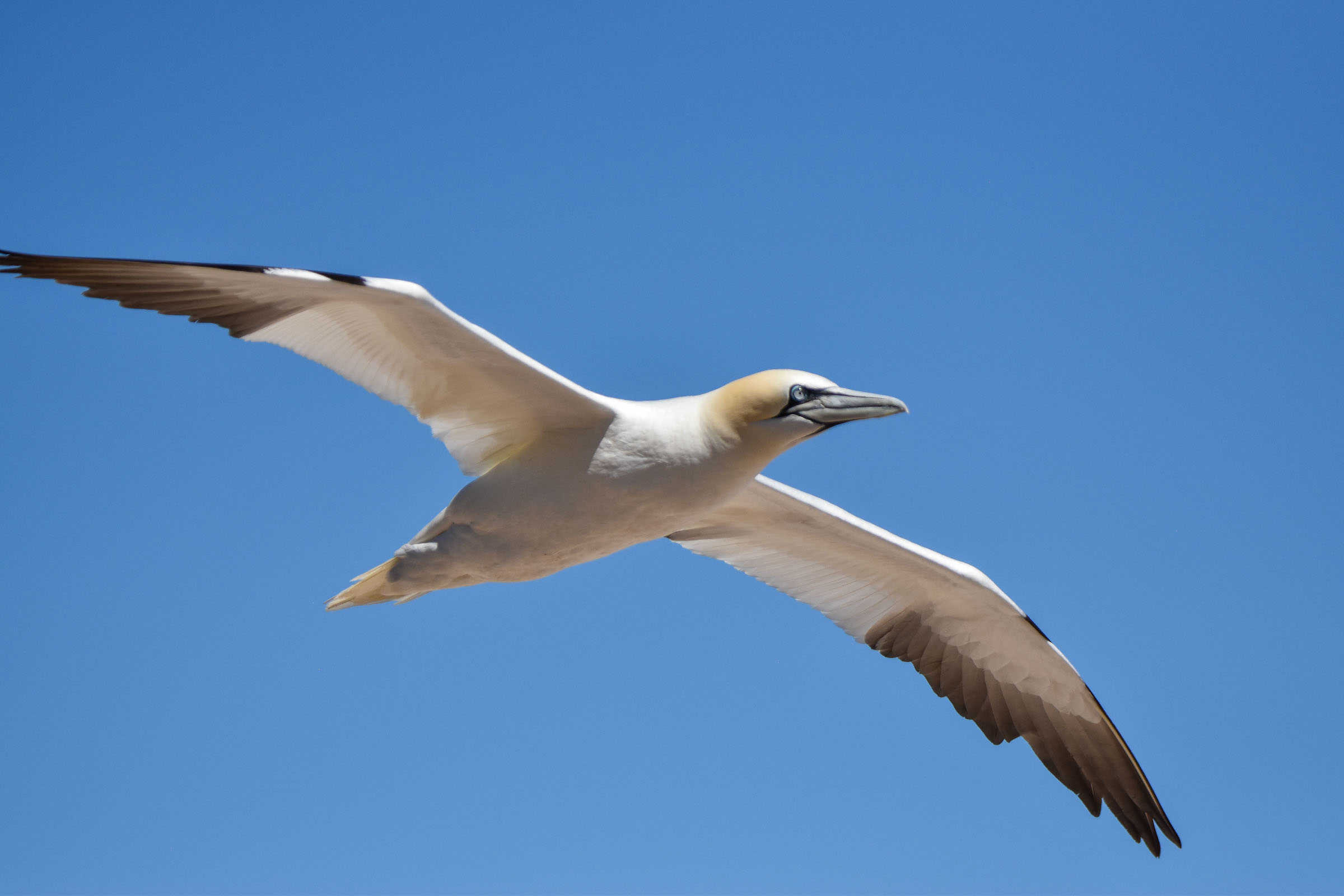
As you approach the colony, the noise can become quite deafening, but you hardly notice or are bothered by it given the stunning visual of the sheer number of birds ahead of you. Surprisingly, the birds seem perfectly indifferent to the presence of visitors, despite how close we can get to them, from behind wooden and rope barriers. It definitely felt like a privilege to be able to get so close to these spectacular birds.


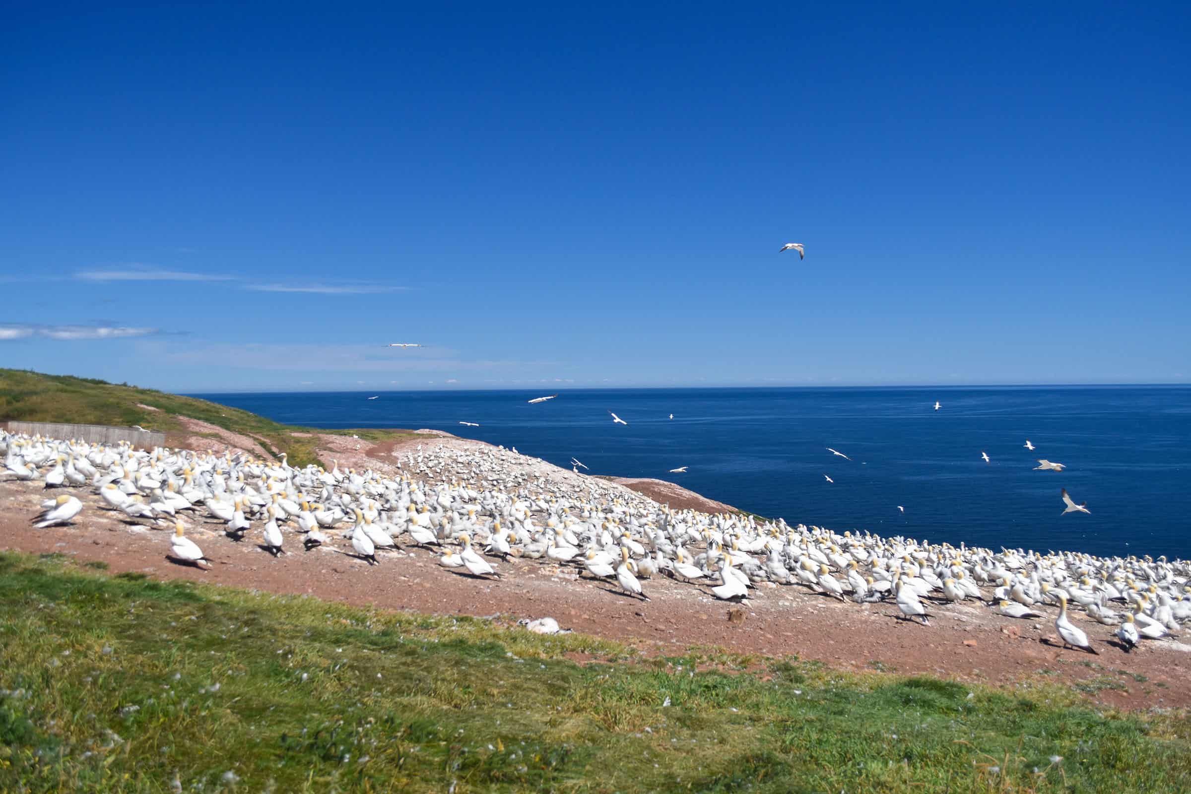
They are beautiful to see glide through the air.


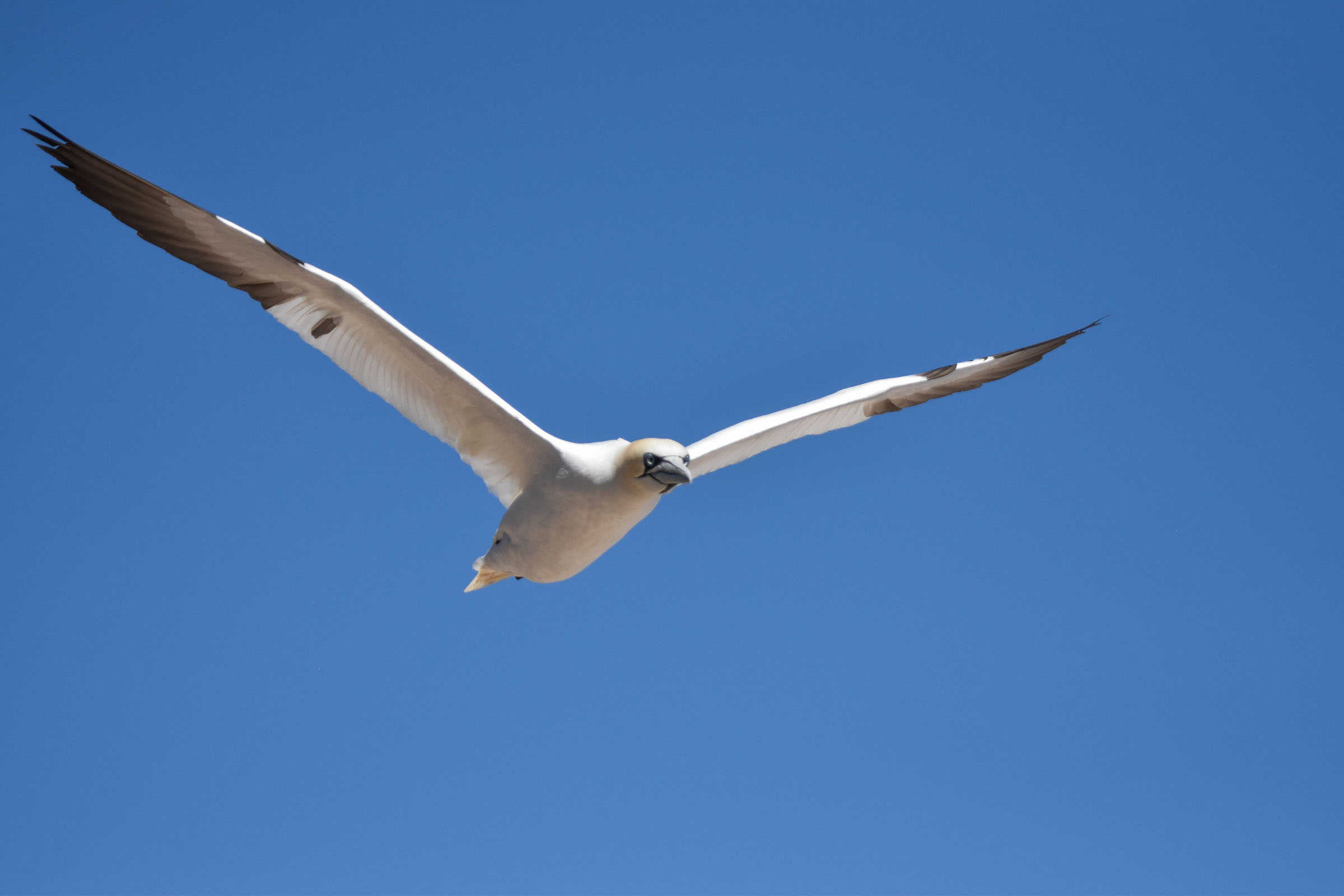
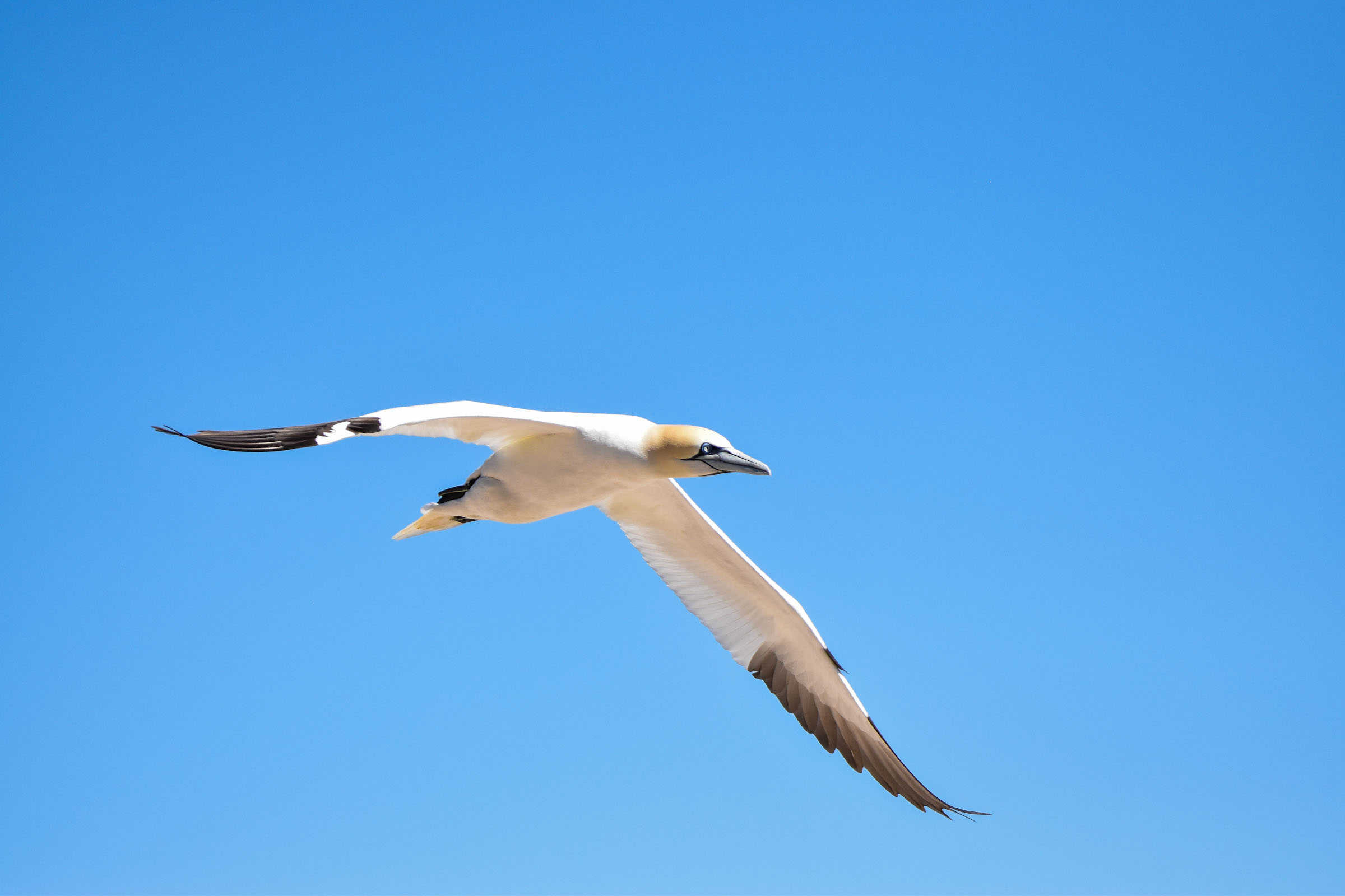
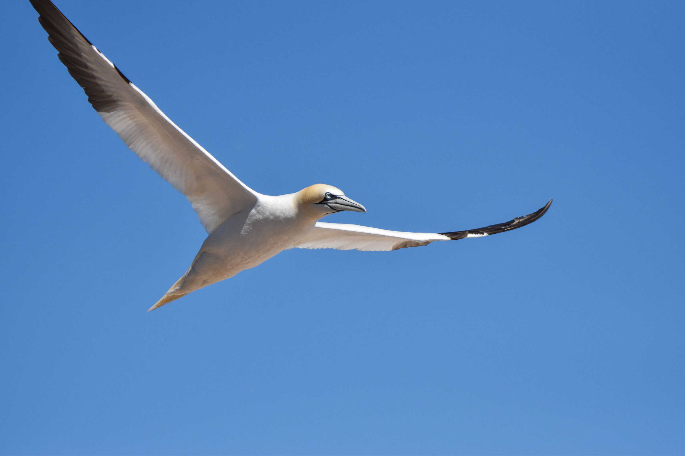
And definitely entertaining to watch land.


The Northern Gannet colony occupies a large space along the island’s eastern coast. The viewing areas stretch over a few hundred meters before the path turns into the Chemin-du-Roy Trail. You can stay as long as you like here, just be sure not to miss the last departing boat.
We probably stayed around 45 minutes, including a short break for a snack (there’s a snack bar and picnic tables near the viewing areas, more on these below).


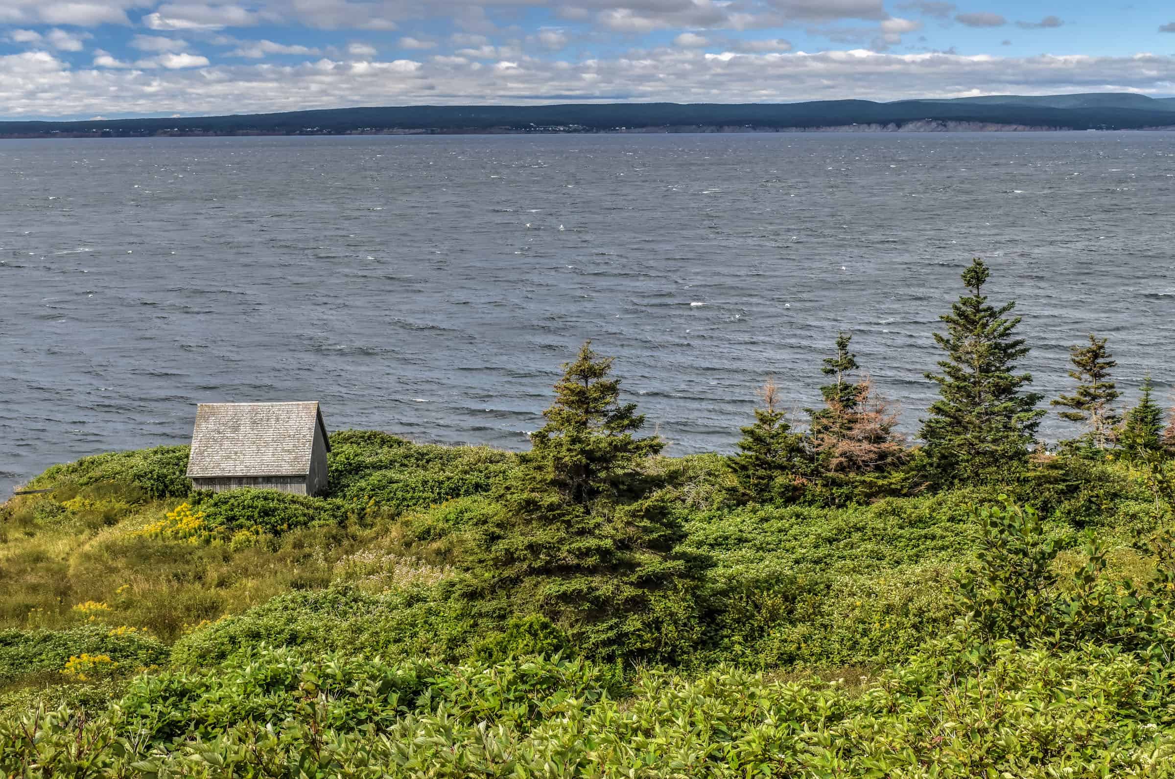
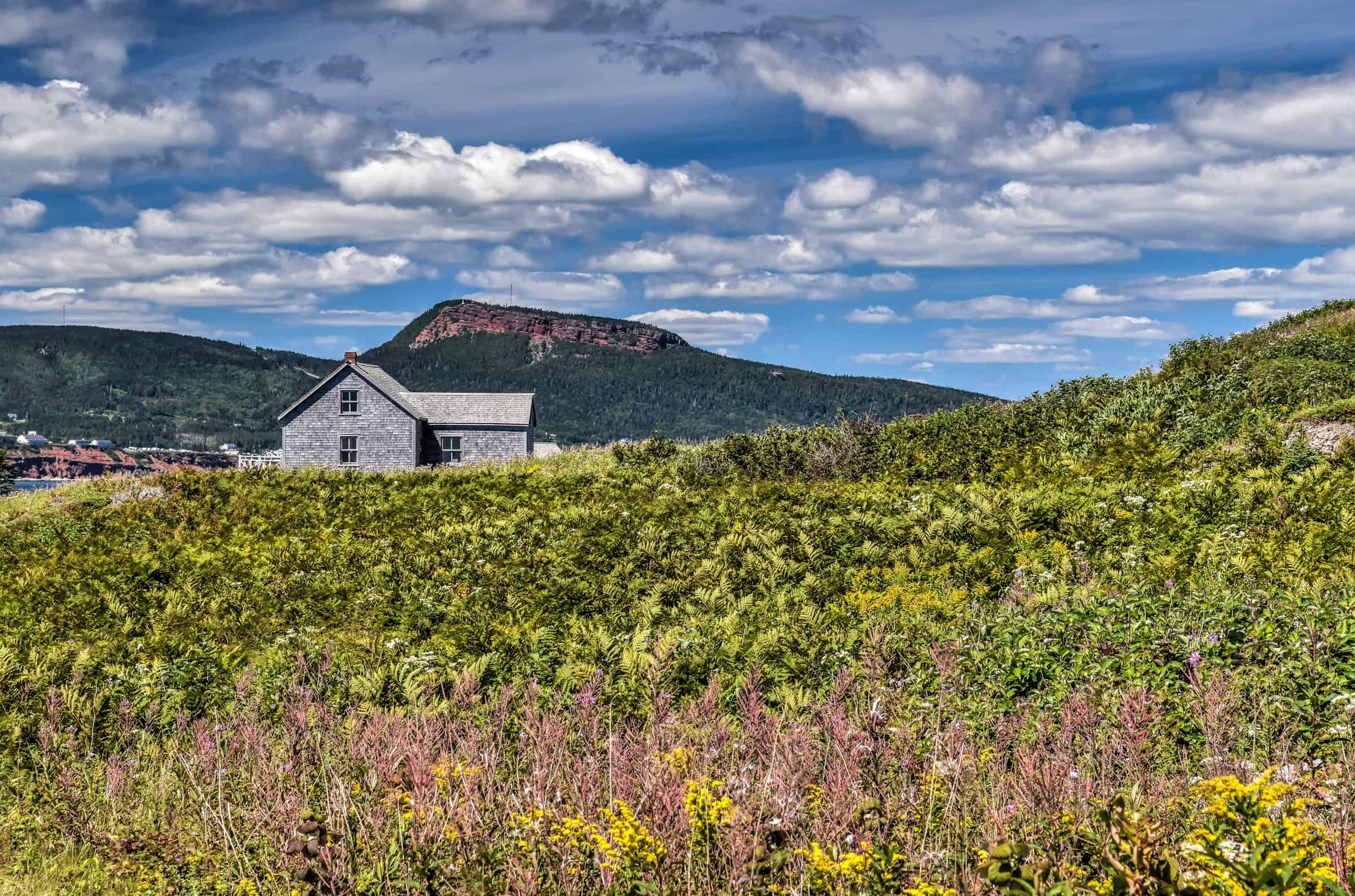
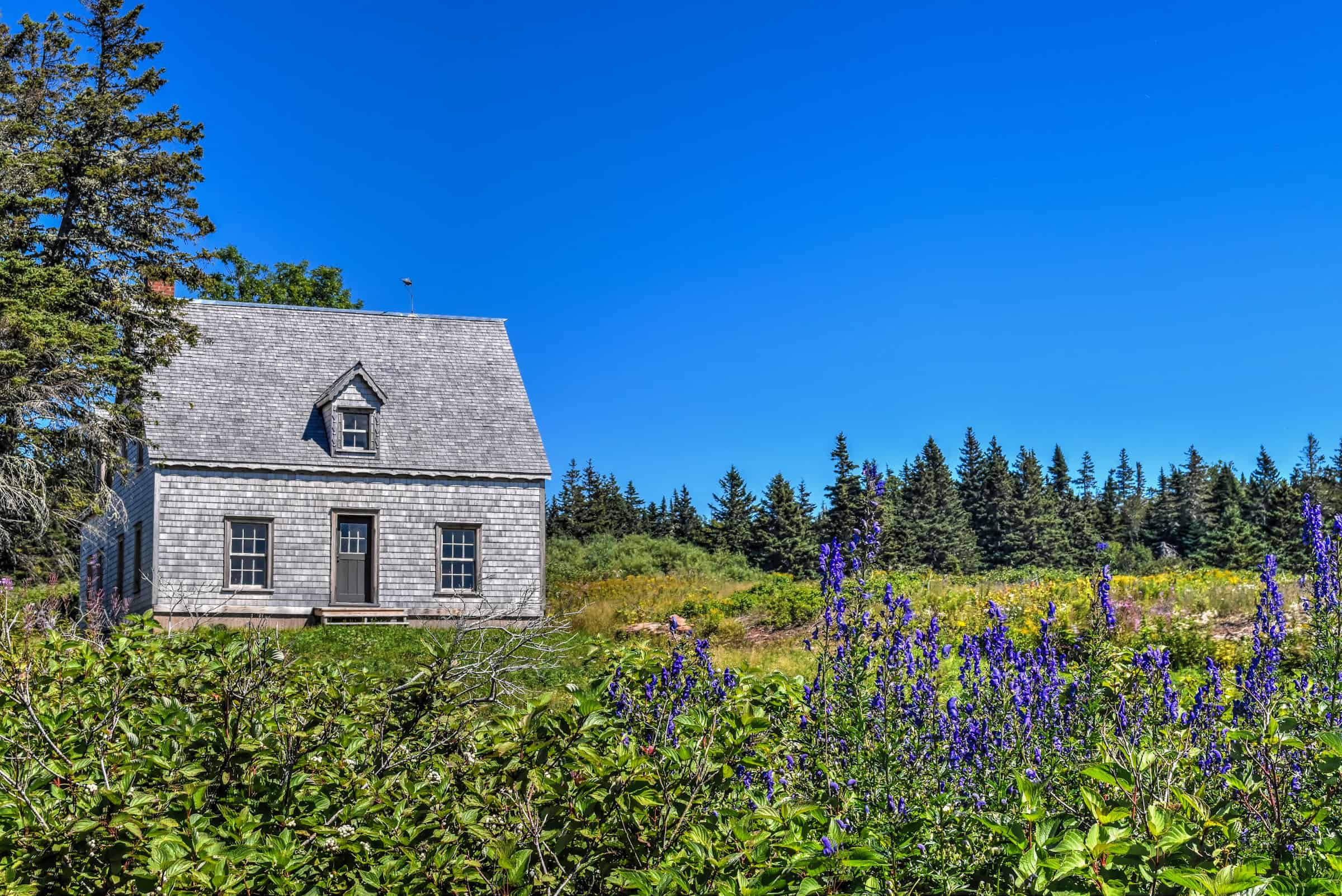
Chemin-du-Roy Trail
In addition to being a beautiful coastal trail, it is also a heritage trail that reflects the island’s rich historic past. The trail alternates between forests, rocky coastlines and idyllic meadows. You are also very likely to see (and hear!) a pack of grey seals along the island’s southern coast.


Once you reach the beautiful coastal meadows, you will notice completely restored ancestral homes, many of which you can visit along the way.


Trail Details
Distance: 8.4 km
Route Type: Loop
Elevation gain: 120 m (cumulative elevation gain: 264 m)
Start point: Boat dock
AllTrails rating: (4.7, 295 ratings (2024))
Duration: Most people complete the full loop in around 2h30-2h45 minutes (excluding the time spent observing the northern gannets)
Access Fees: SEPAQ daily rate
For more information on visiting and the best hiking trails, check out our Île-Bonaventure-et-du-Rocher-Percé National Park guide
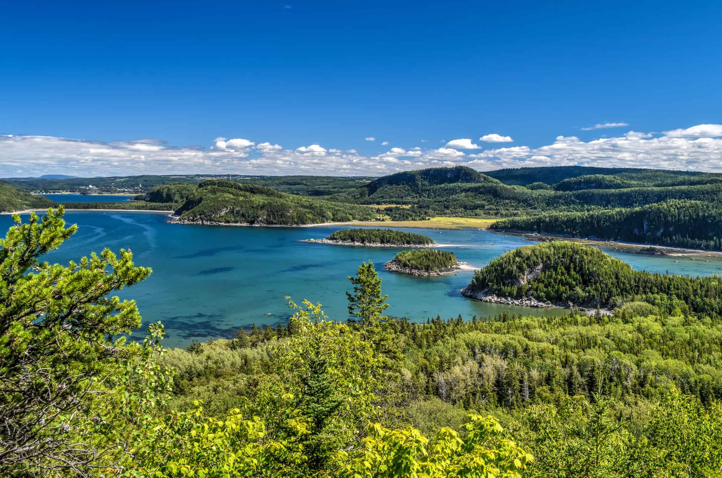
Mont St-Joseph Regional Park
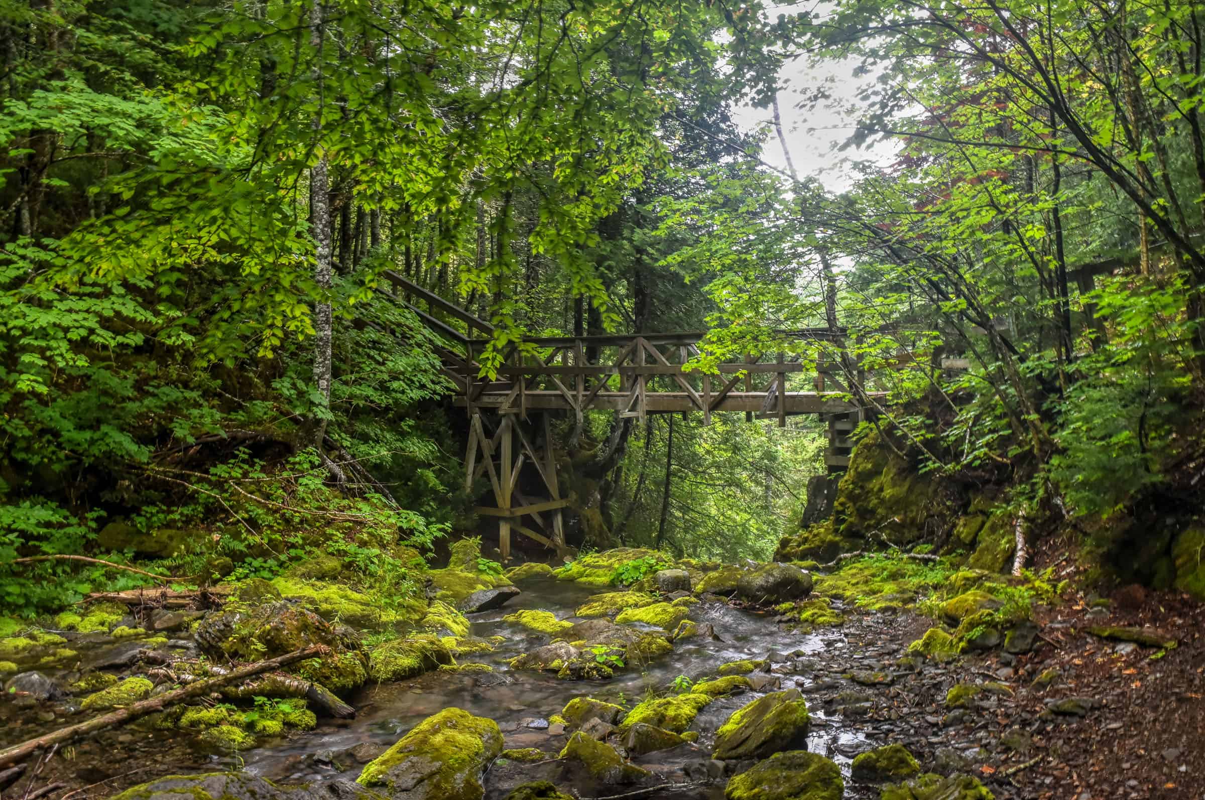
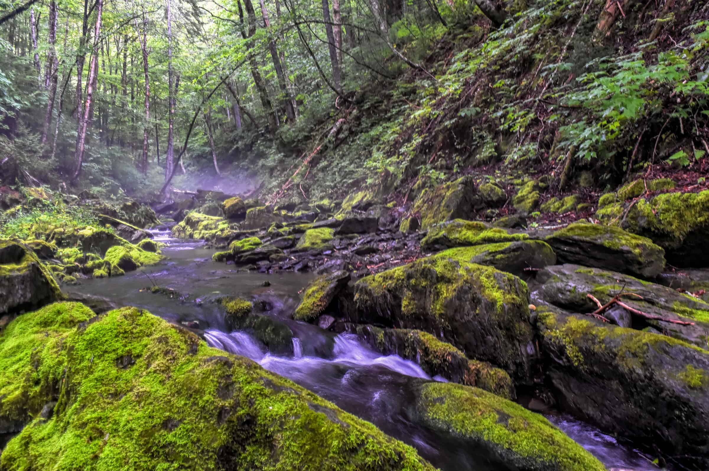
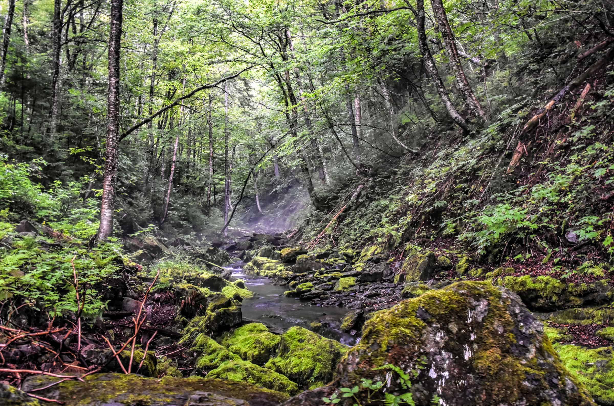
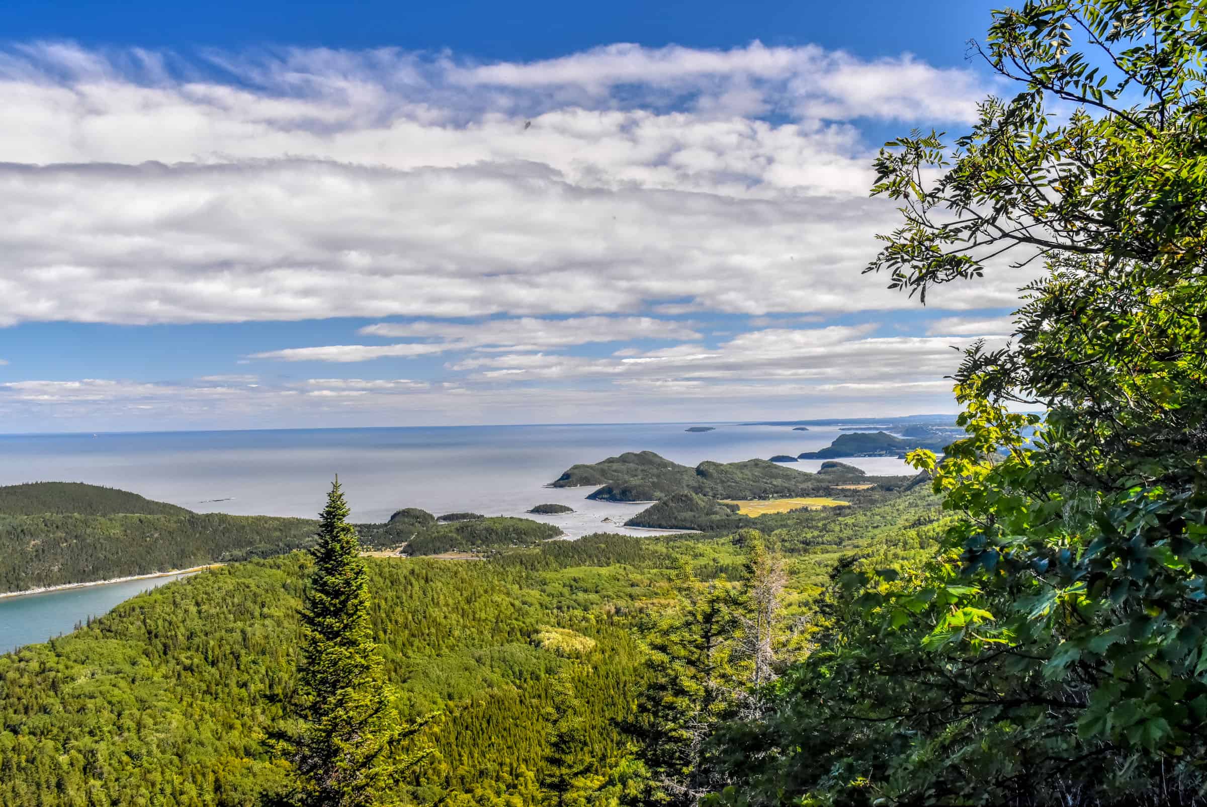
At 555 metres above sea level, Mont Saint-Joseph is one of the highest points in the Baie-des-Chaleurs area and its summit offers a spectacular view of the open bay all the way to the New Brunswick coast – on a clear day that is, because we were unlucky and had dense clouds significantly limiting visibility. So here we will on a short, lower-elevation trail that follows a gentle stream with some waterfall viewpoints, where the foggy and rainy weather gave the forest a unique mystical feel.
Smelt Loop Trail (Boucle de l’Éperlan)


Trail Details
Distance: 3.1 km
Route Type: Loop
Elevation gain: 110 m (cumulative elevation gain: 126 m)
Start point: Car Park, chemin à Bouchard
AllTrails rating: (4.7, 184 ratings (2024))
Duration: Most people complete the trail in about 50-70 min
Access Fees: Park daily rate
For more information on visiting southern Gaspésie, check out our guide on the Best Attractions and Things to Do in Carleton-Sur-Mer.
Bonus Trails: BIC National Park
Although BIC National Park isn’t technically in Gaspésie, it’s so close and such a great park we decided to include some of our favourite trails here.
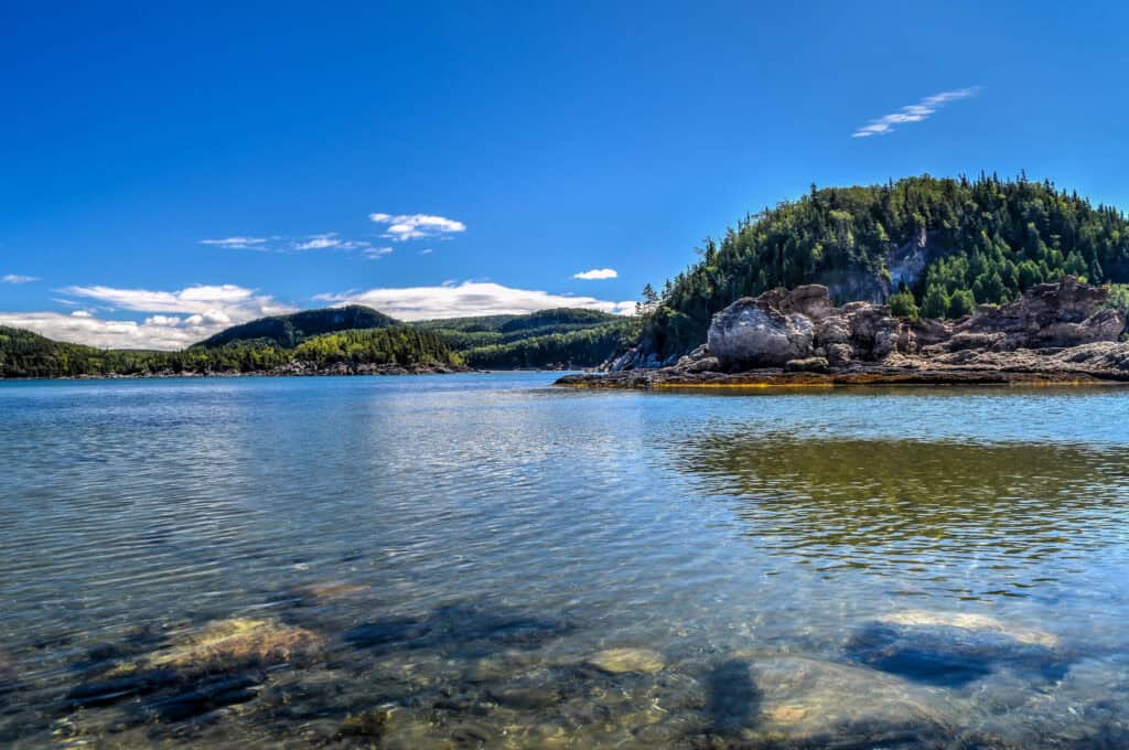
BIC National Park is a unique coastal environment where you will find scenic hiking trails among capes, bays, coves, islands, salt marshes and steep peaks. Here the tides also play a role, as several trails are only accessible during low tide. It’s also a fantastic place to enjoy some sea kayaking. The park’s coast is more jagged than the rest of the shoreline and its mountainous massifs are higher than all others in the region. It’s also a great park for marine wildlife sightings the many harbour and grey seals that frequent the waters of the park.
Pic Champlain Trail (moderate)
This trail offers the best aerial views of the entire park. Although the climb is one of the steepest, we found the trail to be not too difficult. The incline isn’t that steep compared to trails in other nearby national parks and the path itself wasn’t too challenging or technical, though you will have to navigate your fair share of tree roots along the trail.
Near the Pic Champlain summit, you will cross a few beautiful viewpoints, followed by a large wooden belvedere offering fantastic panoramic views of the Saint Lawrence estuary.


Trail Details
Distance: 6.1 km
Route Type: Loop or Out-and-Back
Elevation gain: 200 m (cumulative elevation gain: 229 m)
Start point: Pic Champlain Car Park
AllTrails rating: (4.5, 506 ratings (2024))
Duration: Most people complete the trail in about 1h45-2h.
Access Fees: SEPAQ daily rate
Le Scoggan Trail (easy-to-moderate)
This trail is the easiest (but not the shortest) trail from the Grand Tour Peninsula. It primarily consists of a walk through a lovely forested section and will also follow some boardwalks, boulder beaches, and some coastal dirt trails with sweeping views of the Saint-Lawrence River.


Trail Details
Distance: 6.8 km
Route Type: Out & Back
Elevation gain: 90 m (cumulative elevation gain: 197 m)
Start point: Ferme Rioux Car Park
AllTrails rating: (4.6, 90 ratings (2024))
Duration: Most people complete the trail in about 1h45-2h
Access Fees: SEPAQ daily rate
La Pinède Trail (moderate)
The majority of the Pinede trail follows the same path as the Scoggan trail until it reaches the halfway point of the peninsula, where it then turns inland to gain elevation to reach two observation decks with fantastic views of BIC National Park. You’ll also discover along the way a cluster of centenary jack pines.


Trail Details
Distance: 5.8 km
Route Type: Out & Back
Elevation gain: 140 m (cumulative elevation gain: 198 m)
Start point: Ferme Rioux Car Park
AllTrails rating: (4.5, 146 ratings (2024))
Duration: Most people complete the trail in about 1h45-2h
Access Fees: SEPAQ daily rate
For more information on visiting this National Park, check out our BIC National Park hiking guide.
Planning a trip to Gaspésie?
You might be interested in these pages (coming soon):
Gaspésie Best Attractions and Road Trip Itinerary
10 Awesome Hiking Trails to Discover in Gaspésie
Gaspésie’s Most Beautiful Lighthouses
We also highly recommend these guidebooks:
Lonely Planet Best Road Trips Ontario & Quebec
Gaspé the Romantique ‘Revisited’: A Road Trip Guide to the History, Legends and Attractions
Want to Discover More Quebec Hiking Trails?
You might be interested in these pages (coming soon):
Best National Parks for Hiking Near Montreal
Best Hiking Trails in the Laurentians
Best Hiking Trails in the Eastern Townships
Photography Gear
If you like our photography, you might be interested in some of the gear we use to shoot our travel and hiking destinations.
Camera Body – Nikon Z 6ii Fx-series Mirrorless Body
Main Lens – NIKON 24-120mm F/4G ED VR AF-S
Zoom Lens – Sigma 745-306 150-600mm f/5-6.3
Polarizing filters – Urth Circular Polarizing (CPL)
Camera Tripod – K&F Concept 64-inch Camera Tripod
Mini-tripod – Lammcou Flexible Camera Tripod
Camera/hiking backpack – Vanguard Alta Rise 48 Backpack
Universal Travel Adapter – VYLEE Universal International Power Travel Plug
Other Travel Essentials
Travel Insurance
SafetyWing is a travel insurance company that offers comprehensive coverage for travellers. Includes Medical Insurance and Travel Insurance. Primarily geared towards long-term travellers, digital nomads, and expats.
e-Sim cards
Airalo is the world’s first and largest eSIM store with eSIM plans for 200+ countries and regions worldwide. With Airalo eSIMs, travellers can get connected the moment they land at their destination and avoid nasty data roaming charges
eSIMS are a sustainable alternative to single-use SIM cards – they are 100% digital, require less energy to produce and be re-used rather than disposed of.
Car Rentals
Discover Cars is our go-to website for car rentals. We almost always find our preferred rate there.
Transfer from Airport
Welcome Pickups is our favourite private transfer service, which you can pre-book at a fixed price. Currently available in 220 cities all over the world (mostly in Europe, but with several major cities in Asia, the Middle East and the US).
Kiwitaxi is another private transfer service – we haven’t tried it yet, but it’s currently available in a few more countries (102 as of 2024).
Hotels and Accommodations (coming soon)
Photography Prints
If you found this blog useful, you can help support our blog by purchasing low-cost digital prints. Printed physical prints are also available for purchase.


—–
Well, that wraps it up! We hope you enjoyed our Guide to the Île-Bonaventure National Park and Northern Gannet Travel Guide and that it will prove useful for planning your hiking trip.
—–
You might also be interested in these related pages: