About the Escarpment and Cimes Trails


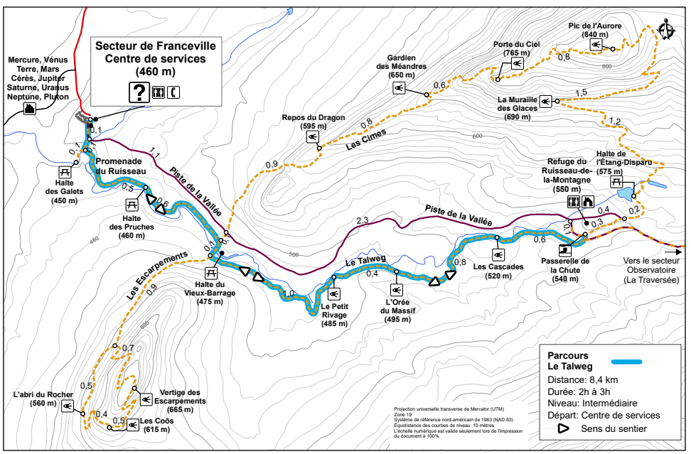
Location of the Cimes and Escarpment Trails and Map
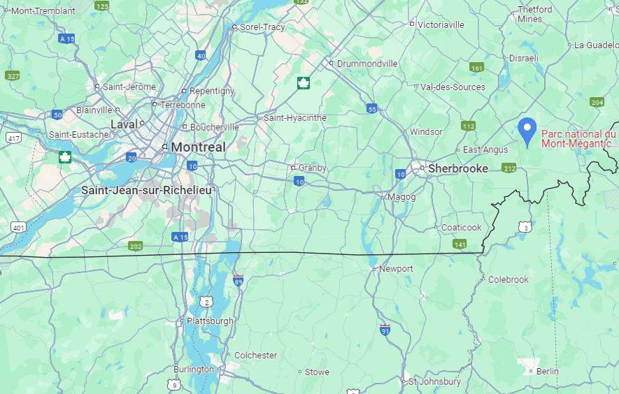
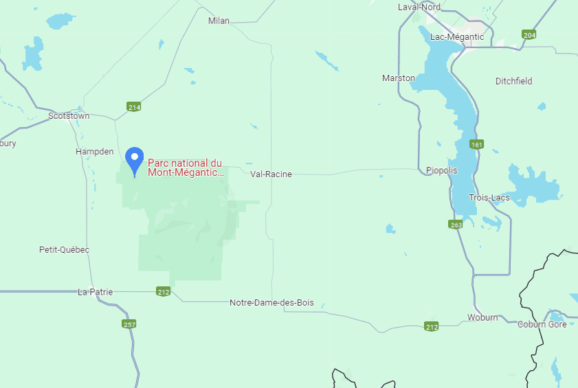
Both trails are located in the Franceville Sector of the Mont-Mégantic National Park which itself is in the eastern townships of Québec, close to the New Hampshire and Maine state borders (link to Google Maps).
How to Get to the Mont Mégantic National Park (Franceville Sector)
Given the remoteness of the national park, the easiest way to reach the Franceville Sector is by car.
From Montreal: about a 2h30 drive (230 km)
From Sherbrooke: about a 1h drive (70 km)
From Québec City: about a 2h30 drive (200 km)
From Burlington (Vermont): about a 3h15 drive (170 miles)
From Augusta (Maine): about a 3h drive (135 miles)
If you need to book a rental vehicle for your hiking excursion, we highly recommend using Discover Cars to get the best rates on your rental in Montreal.
We also highly recommend Airalo (eSIM card) for your connectivity needs when travelling abroad. Airalo is the world’s first and largest eSIM store with eSIM plans for 200+ countries and regions worldwide.
Alternatively, you can also reach the park from Montreal by organized transfer via the Navette Nature service, which offers bus trips on various weekend dates. The service rotates between parks, so there might be only one or two trips per park per season.
Cimes and Escarpment Trail Access, Fees, and Parking
Trailheads & car park location: Both are found here.
Trail access & parking fees: Québec National Park fees apply for day visits to the park. There are no additional fees for parking.
Daily access fees and Annual passes
Quebec National Parks are managed by the SÉPAQ, a government agency that manages all provincial parks and wildlife preserves in Québec.
There is a limit to the number of visitors that can enter any Québec SÉPAQ National Park on any given day. It is therefore strongly recommended that you purchase your daily right of access online before a visit or that you acquire an annual pass.
The daily pass ($9.85 (2024)) can be purchased here up to 30 days before a visit.
The annual pass can be purchased here either for unlimited access to a single national park ($49.25 (2024)) or for unlimited access to all SÉPAQ national parks ($88.50 (2024)). Even if you have an annual pass, we still recommend arriving early in the morning or mid-to-late afternoon to avoid showing up to a filled parking lot.
Trail opening hours: Although the trail is technically open at all times, the visitor center is typically only open from 10am – 4pm. For up-to-date visitor center schedules, we recommend checking the park’s schedule website page before visiting.
Parking lot: The car park is quite large, and there are rarely issues with finding parking.
Facilities: Toilets are available in the visitor center by the car park.
Best Time to Hike The Trails
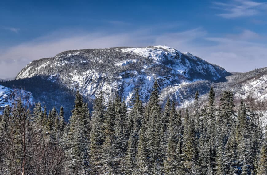
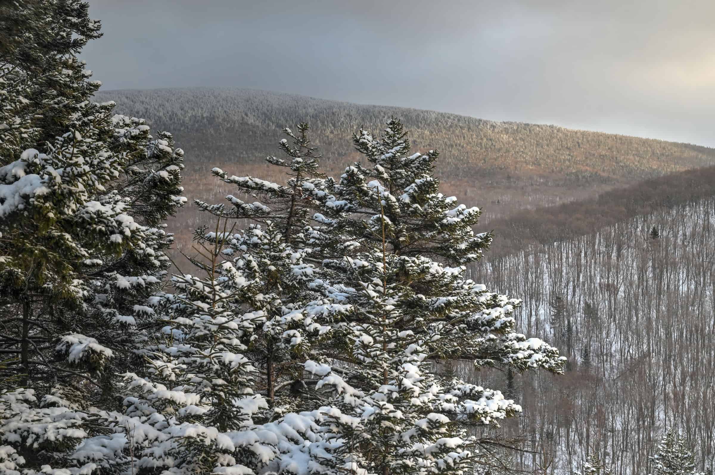
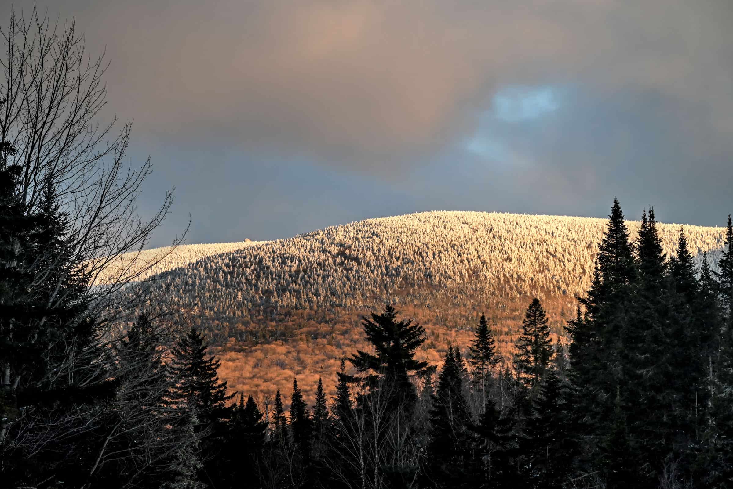
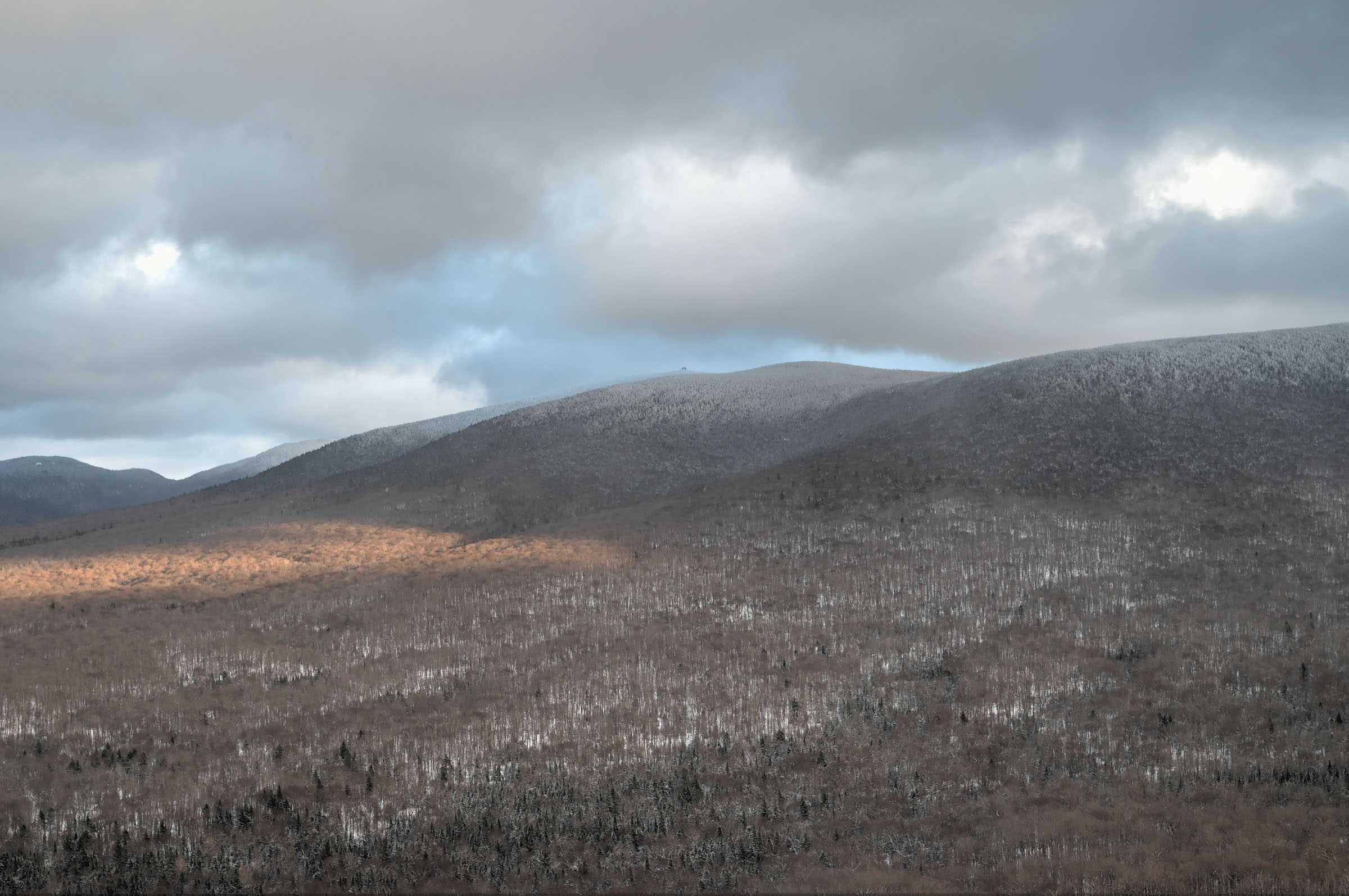
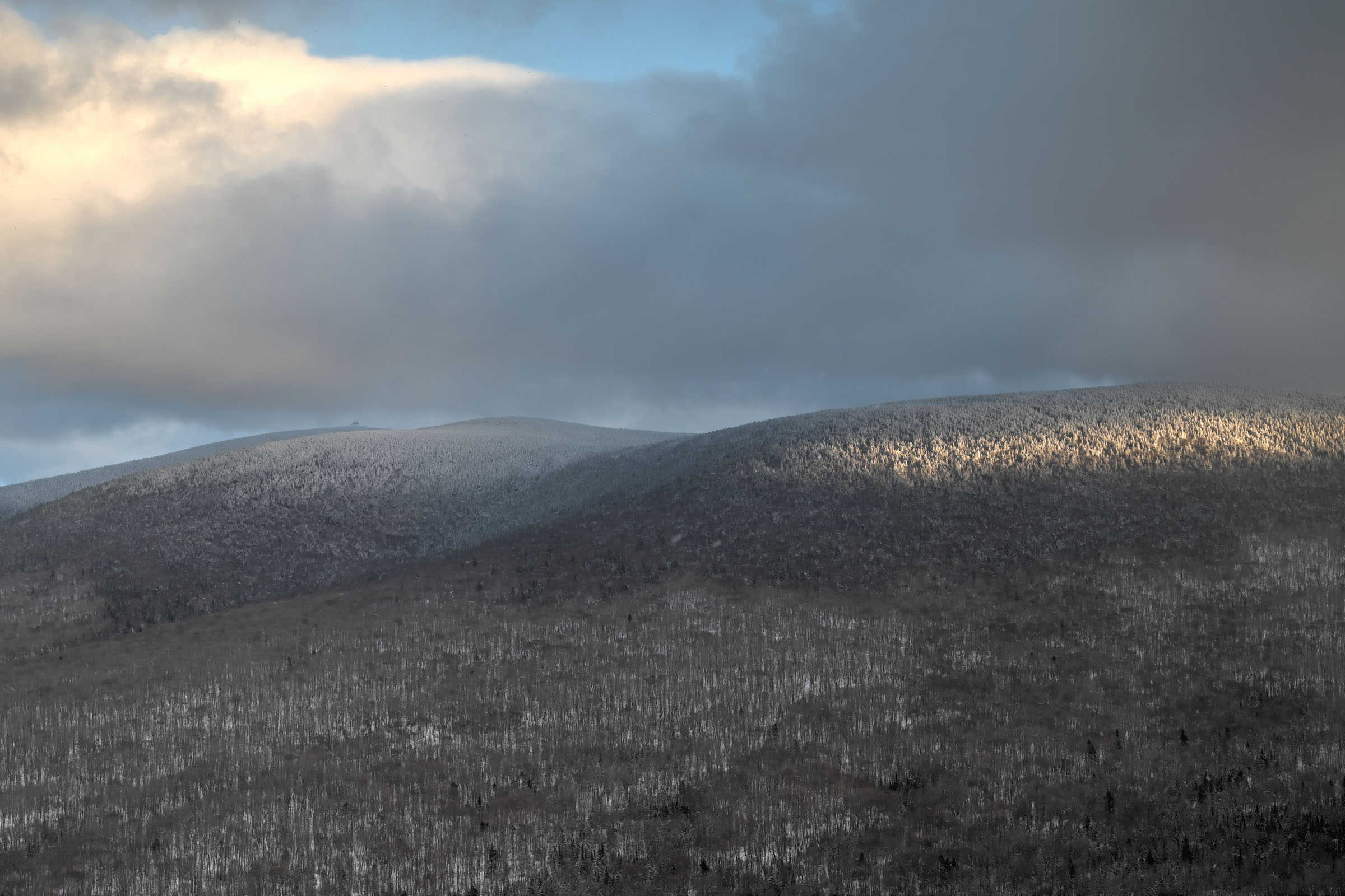
To experience a proper winter hike and beautiful white landscapes, it’s best to plan your visit between mid-December and mid-March. That being said, there are year-to-year differences regarding the early and late winter snow conditions. If you would like to visit early or late in the winter season, it’s best to check the park conditions first. You can generally find them listed at the top of the national park page. The trail may close during the spring season snow-melt period (dates vary from year to year).
Why Hike in Winter?
– There are generally fewer people on the hiking trails, allowing for a more peaceful and enjoyable experience.
– Compacted snow generally makes the trail easier to walk on and removes the difficulties associated with walking over rocks, boulders and tree roots.
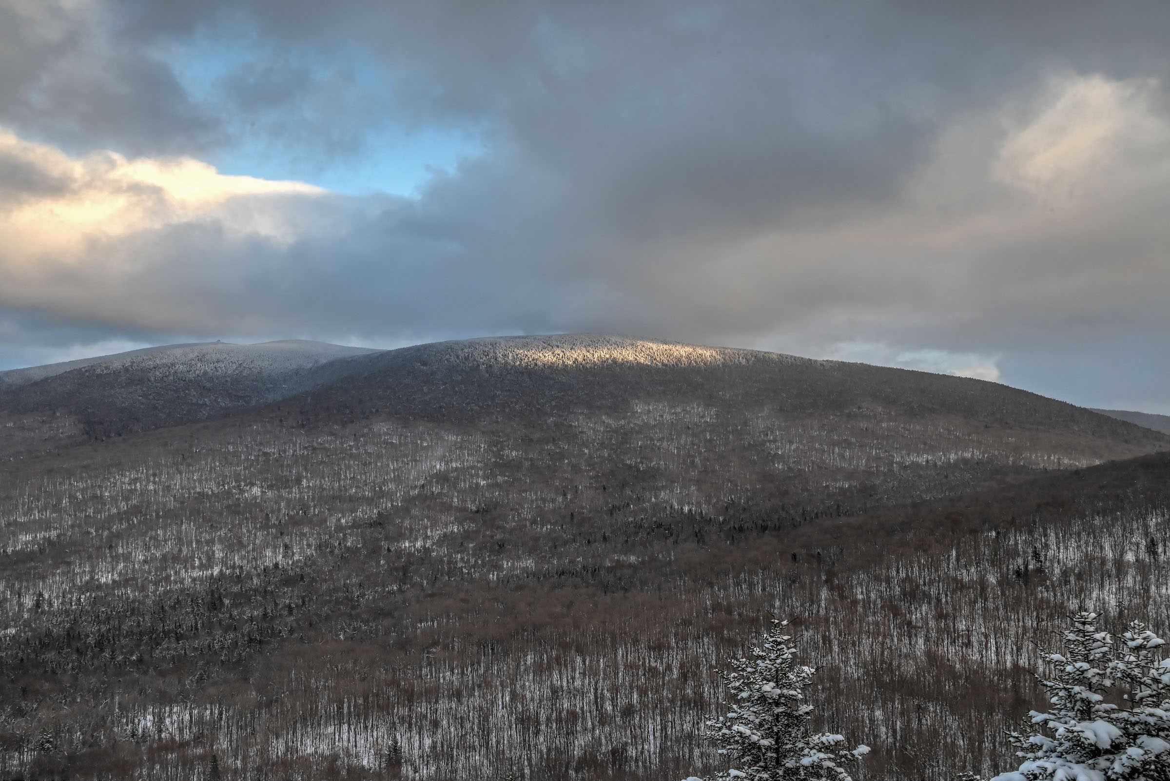
– The scenery is very different than in any other season but is no less beautiful.
Winter Hiking and Trail Safety Tips
In the absence of any significant recent snowfall, it is highly recommended to wear crampons/traction cleats under your shoes or boots when hiking most trails in this park, particularly any trail that has significant elevation gain. You can rent traction crampons/ice cleats to attach to your boots for 8$ (2024) at the visitor center (located between the car park and the trailhead). If you plan on needing cleats for more than 2 days, you’re probably better off buying your own.
Winter Hiking Packing List
Crampons / Ice Cleats – These are a must-have to help you with those steep ascents/descents or navigate icy trail conditions.
External Battery – Cold weather significantly affects cell phone battery drainage. Best to be prepared with an external power source to recharge your phone if needed.
Hiking poles – These can be particularly useful in winter, especially when not wearing any crampons or ice cleats.
Hand warmers – if you are like us and often remove your gloves to take pictures, having little hotties around care be hand life savers in freezing weather.
All Trails subscription – comes in really handy for areas with little or no cell reception, as the annual subscription allows you to download trail maps for offline use.
If there was a lot of recent snowfall, you might want to hike with snowshoes instead of ice cleats to help navigate the soft snow. To help you decide what footwear to bring, the national park details the recent snowfall and trail conditions via the “information of the day” button at the top of the page ( e.g. typically either densely packed snow or fresh powdered snow). The visitor center also rents out snowshoes if need be.
Also, always bear in mind that no matter how cold it is at the base of the mountain, it’s going to be even colder at the summit (and windier), so remember to dress appropriately. It’s generally recommended to wear fewer layers to start since you will warm up after a few minutes of hiking. But it’s a great idea to pack some extra warm gear for when you take a break or reach the summit.
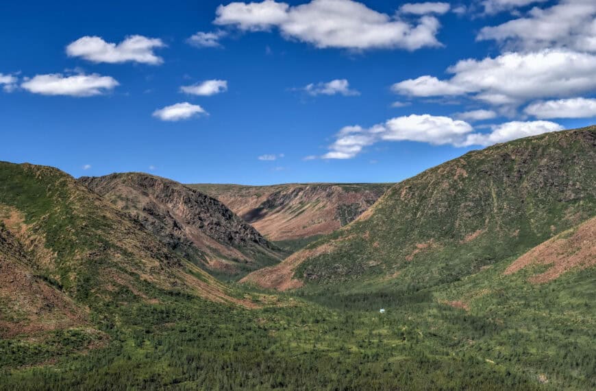
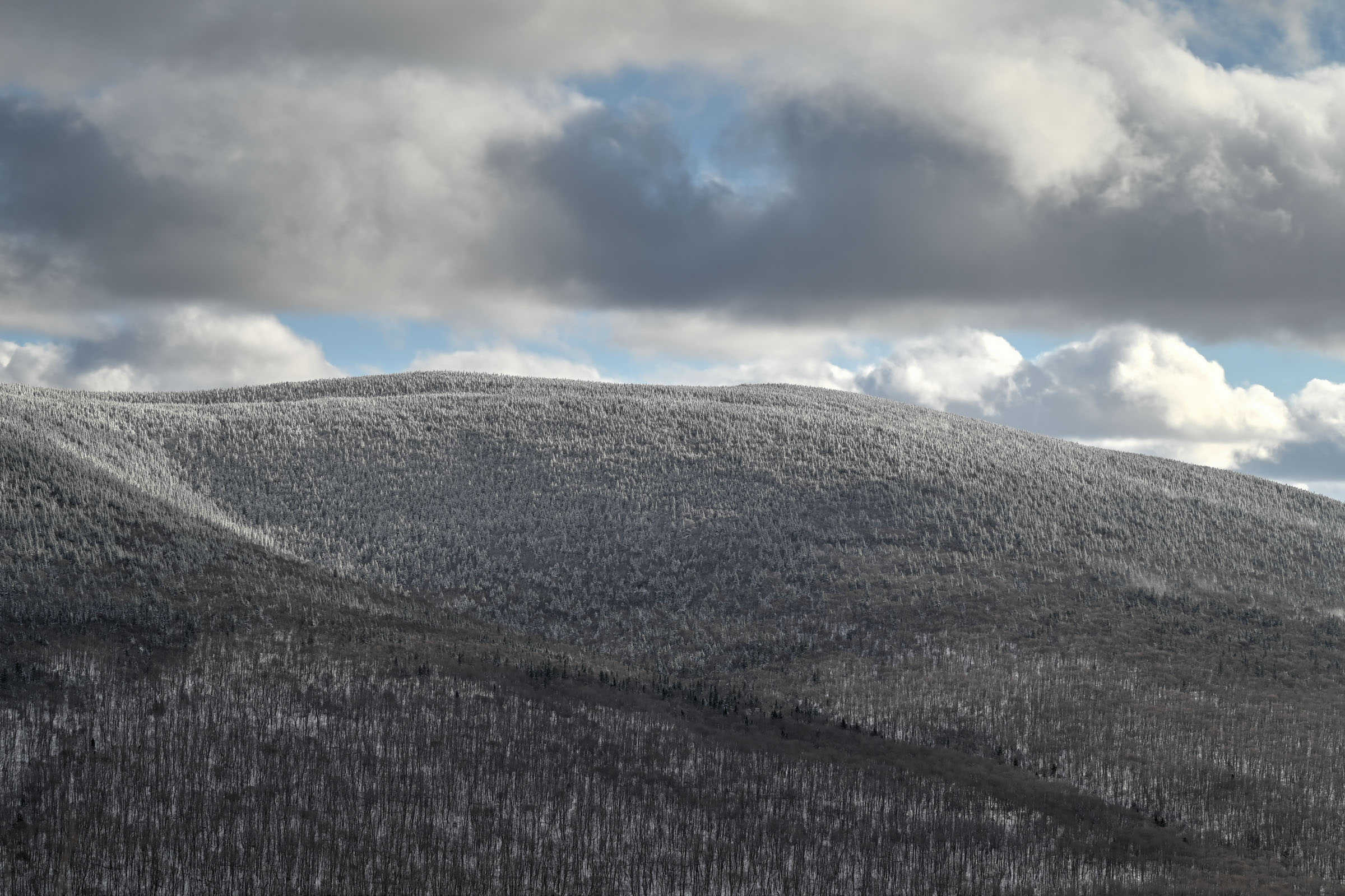
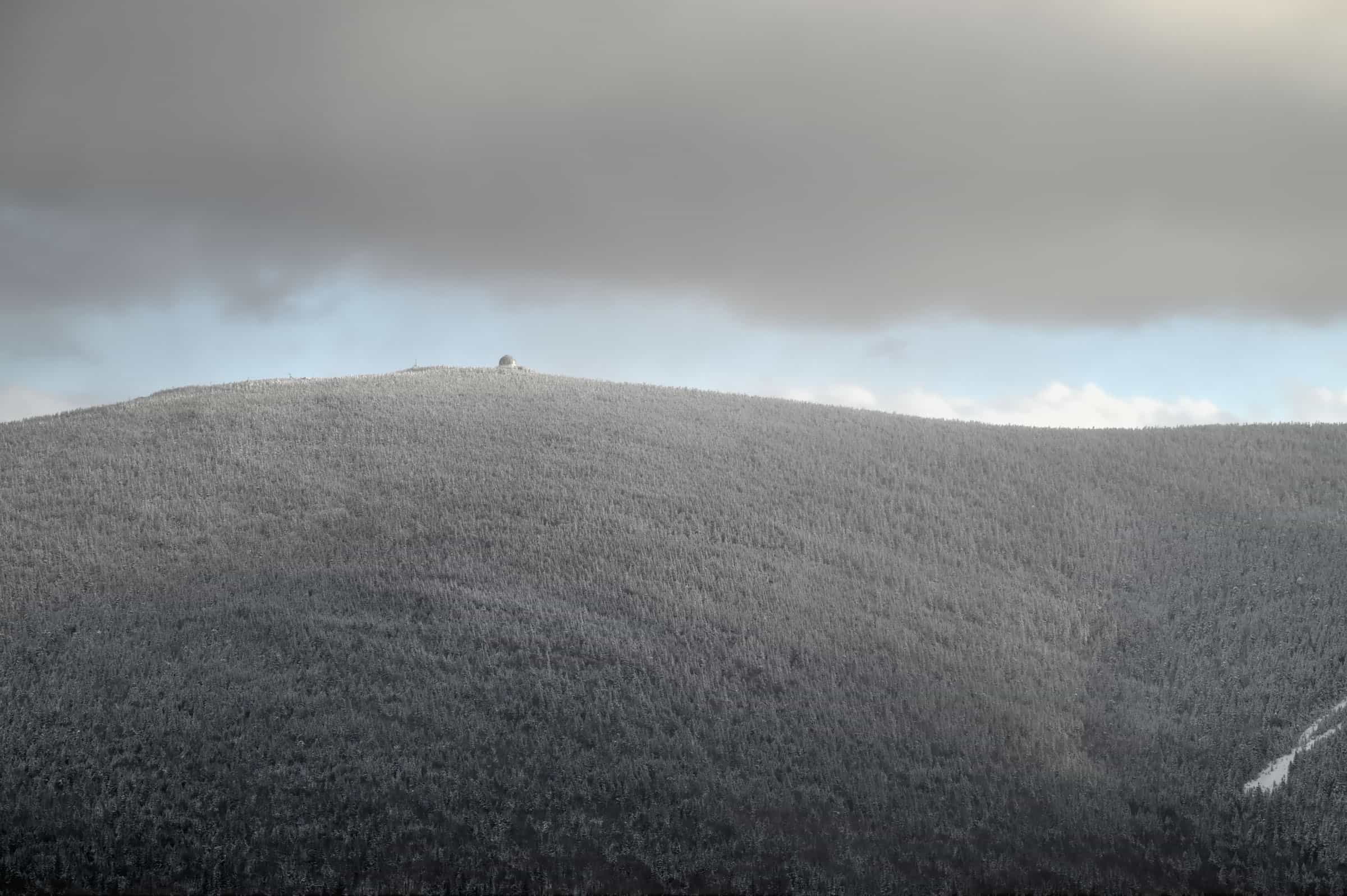
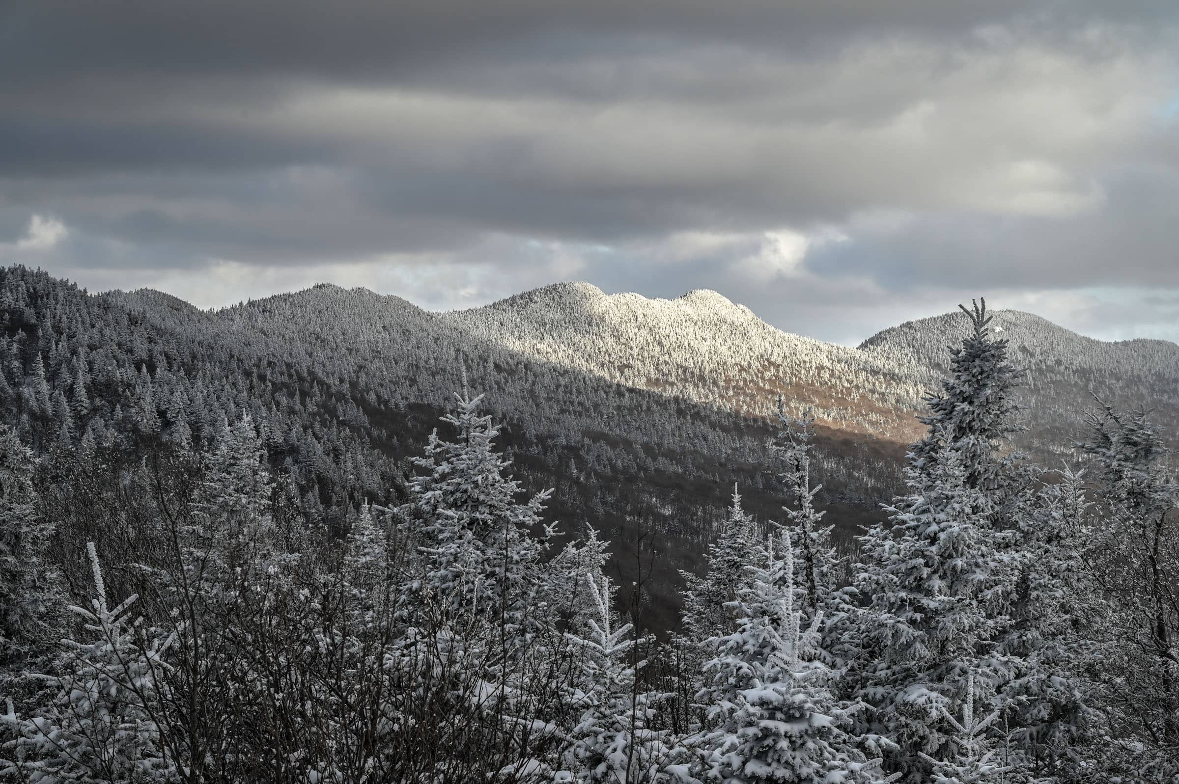
The Cime Trail (Trail of the Peaks)
Cimes Trail Details and Map
Other Cimes Trail Details
– Canine companions: Dogs are not allowed on this trail.
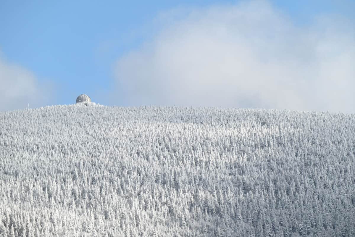
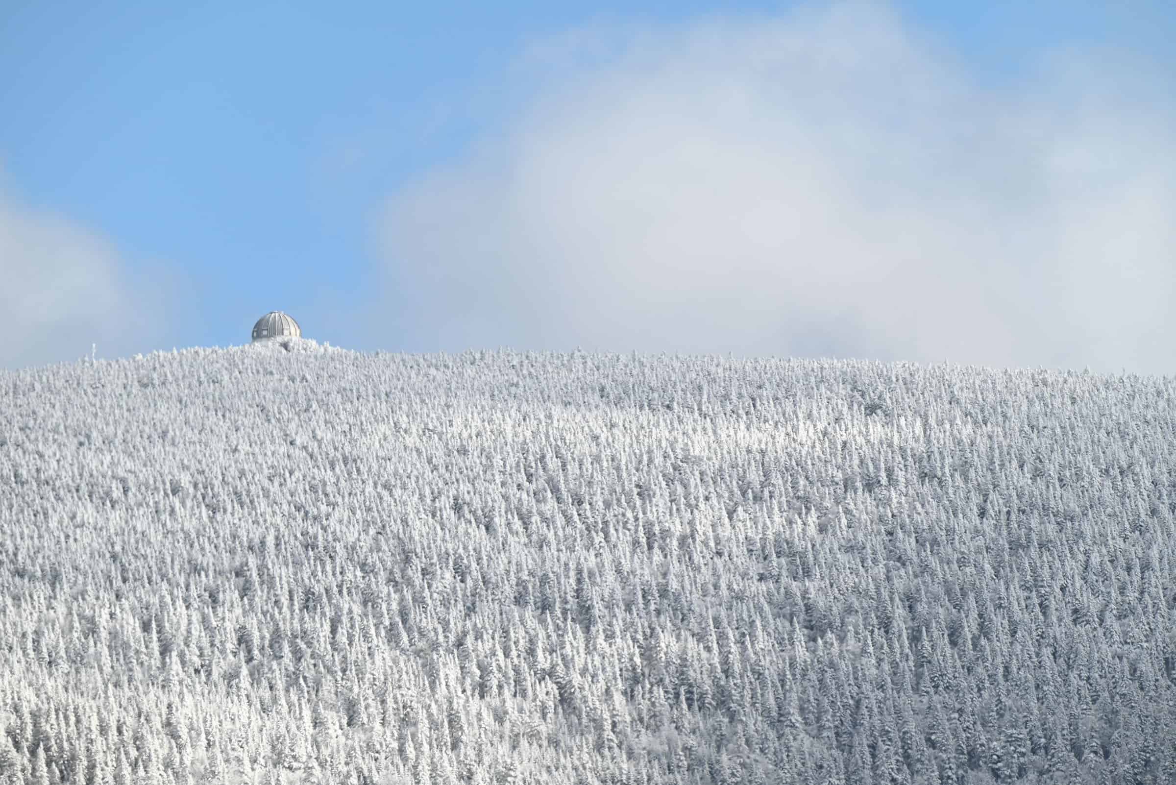
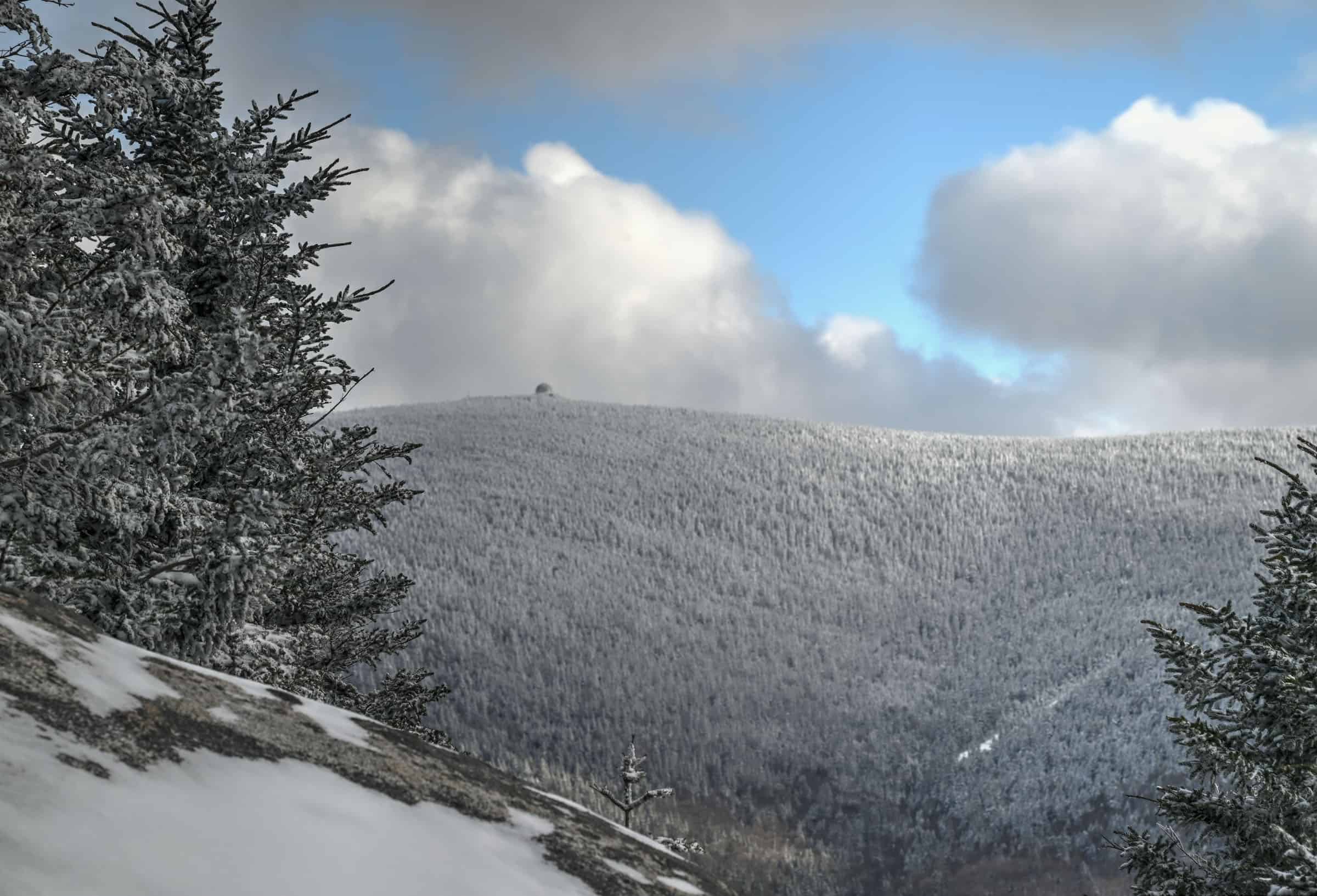
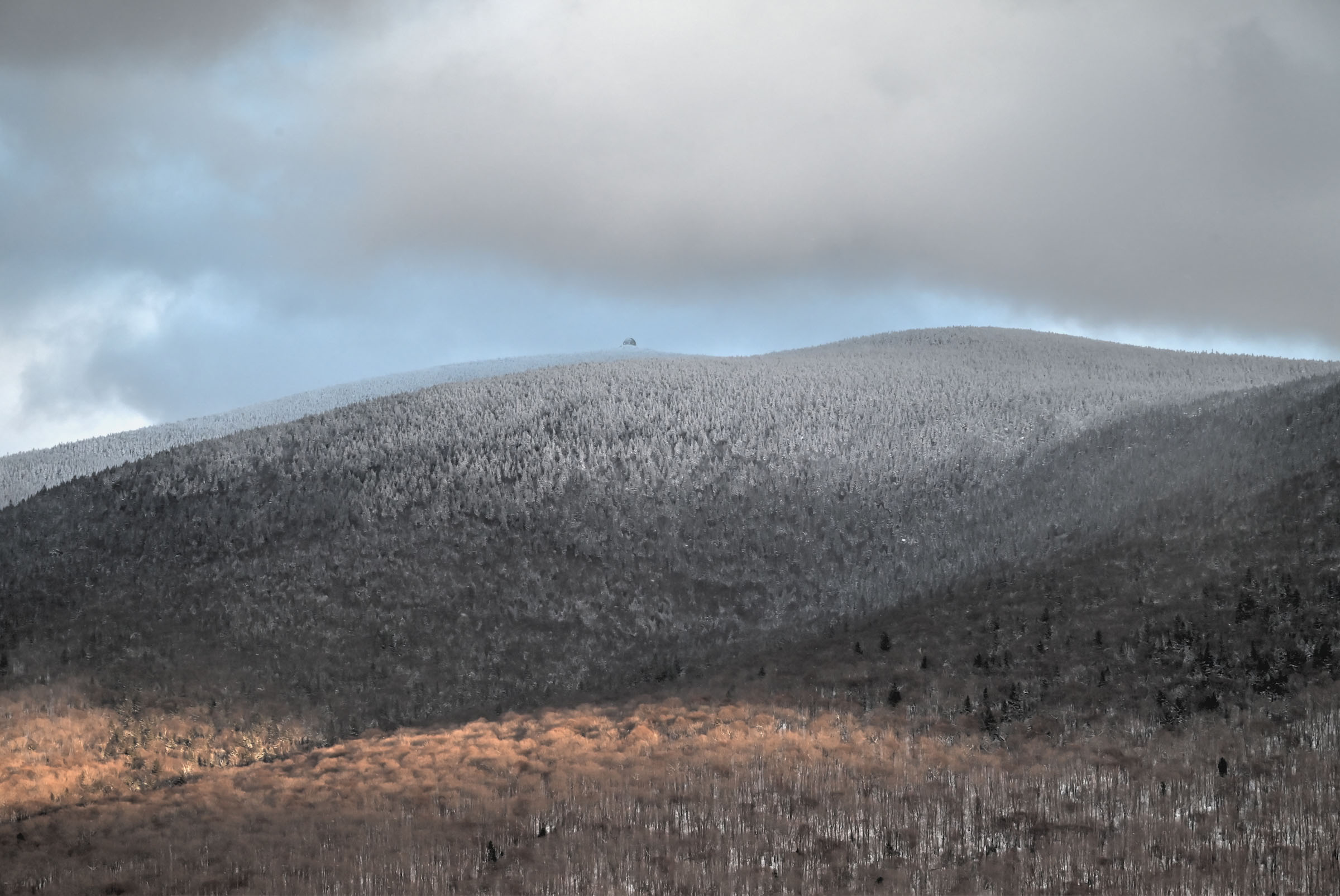
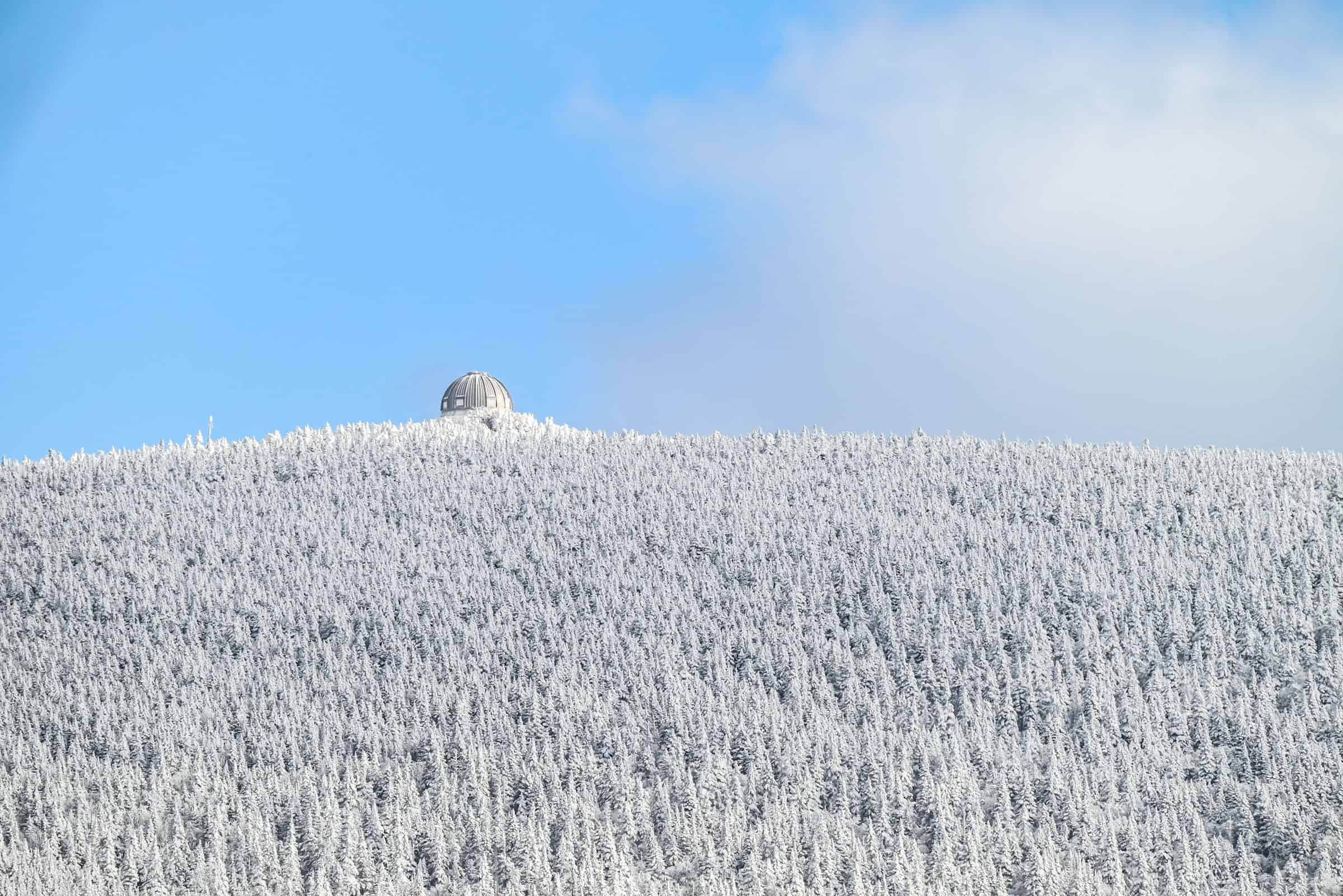
– Summit: Pic de l’Aurore summit is located at an altitude of 840 m.
– Number of viewpoints: According to the National Park, the trail has 4 official viewpoints along the ridgeline. The trail also boasts several lower elevation viewpoints with partially obstructed views.
– Trail environment: Mostly forested, with a few open ridgeline areas.
– Trail Surface / Technical Trail: The fun thing about winter hiking is that technical trail surfaces (rocks, boulders and tree branches) get buried under the snow. The main challenges that remain are the steep sections that often require ice cleats or crampons.
– Average trail slope grade: 7%
– Trail difficulty level assessment: Moderate
(based on our personal assessment, taking into account the trail length, slope grade and trail surface – 5-point difficulty scale: Very easy, Easy, Moderate, Moderately Challenging, Challenging)
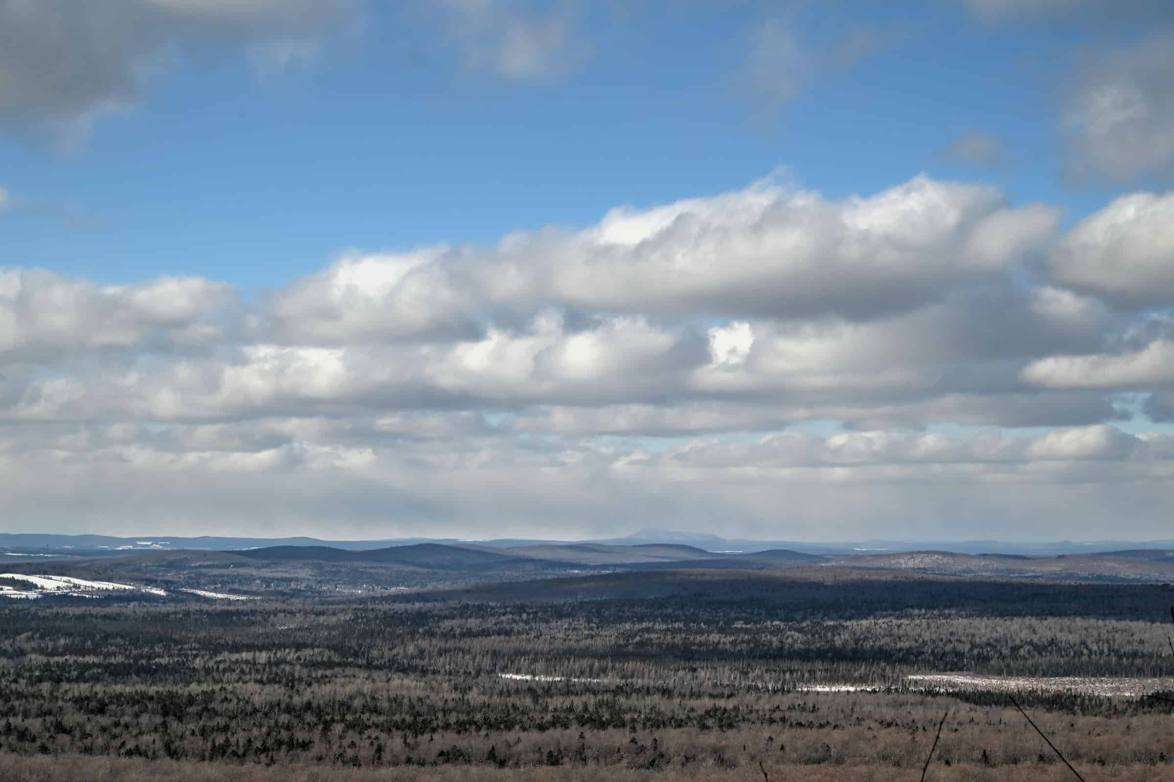
Cimes Trail (Trail of the Peaks) – Trail Description
First section: The Ruisseau Trail segment

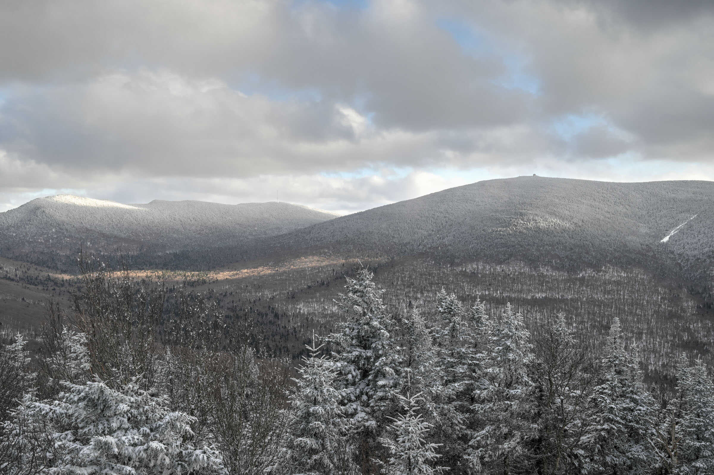
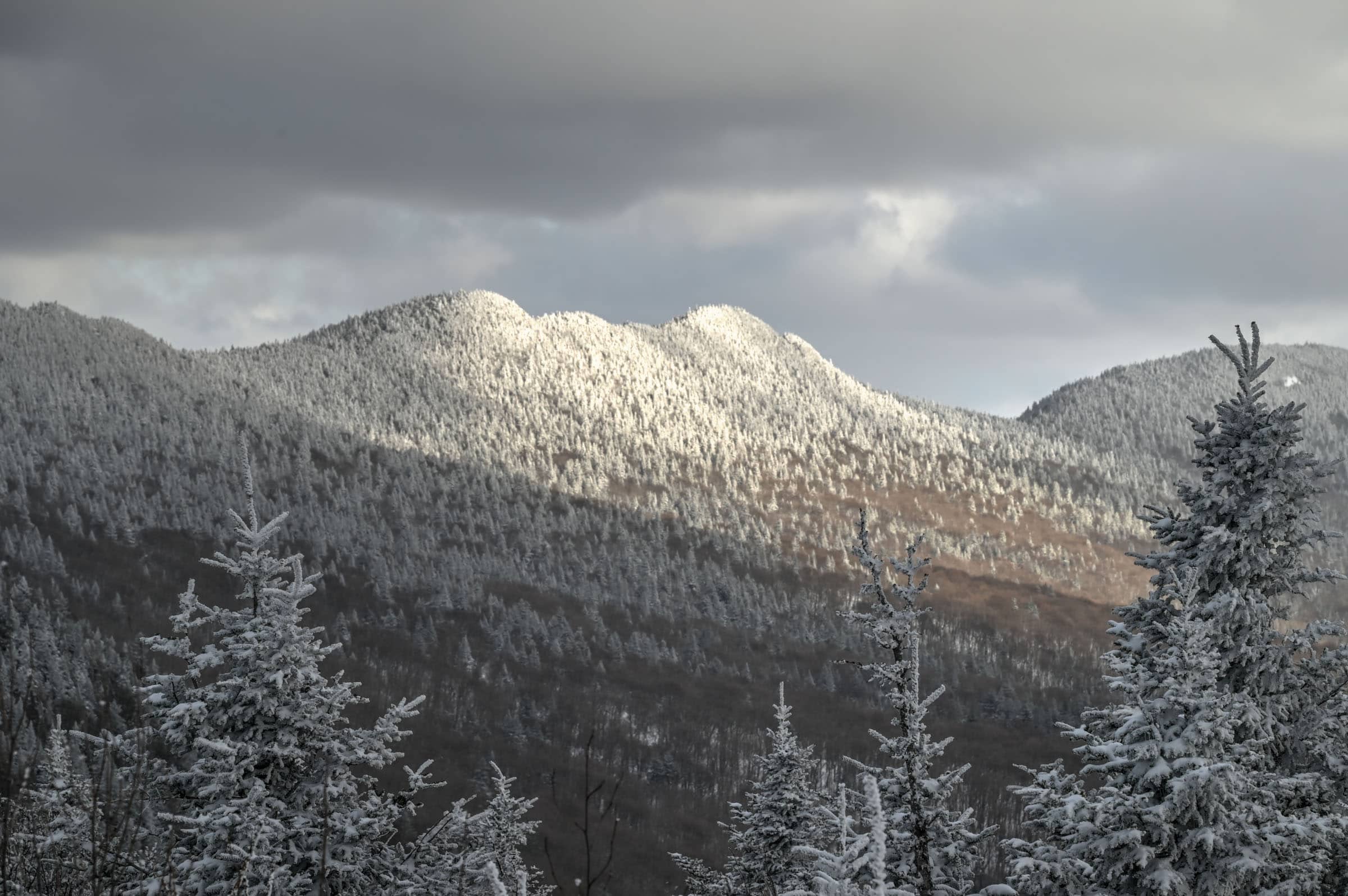
Second section: The ascent, the ridgeline, and the Pic de l’Aurore summit


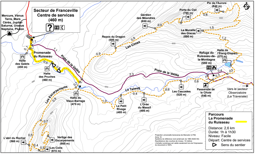


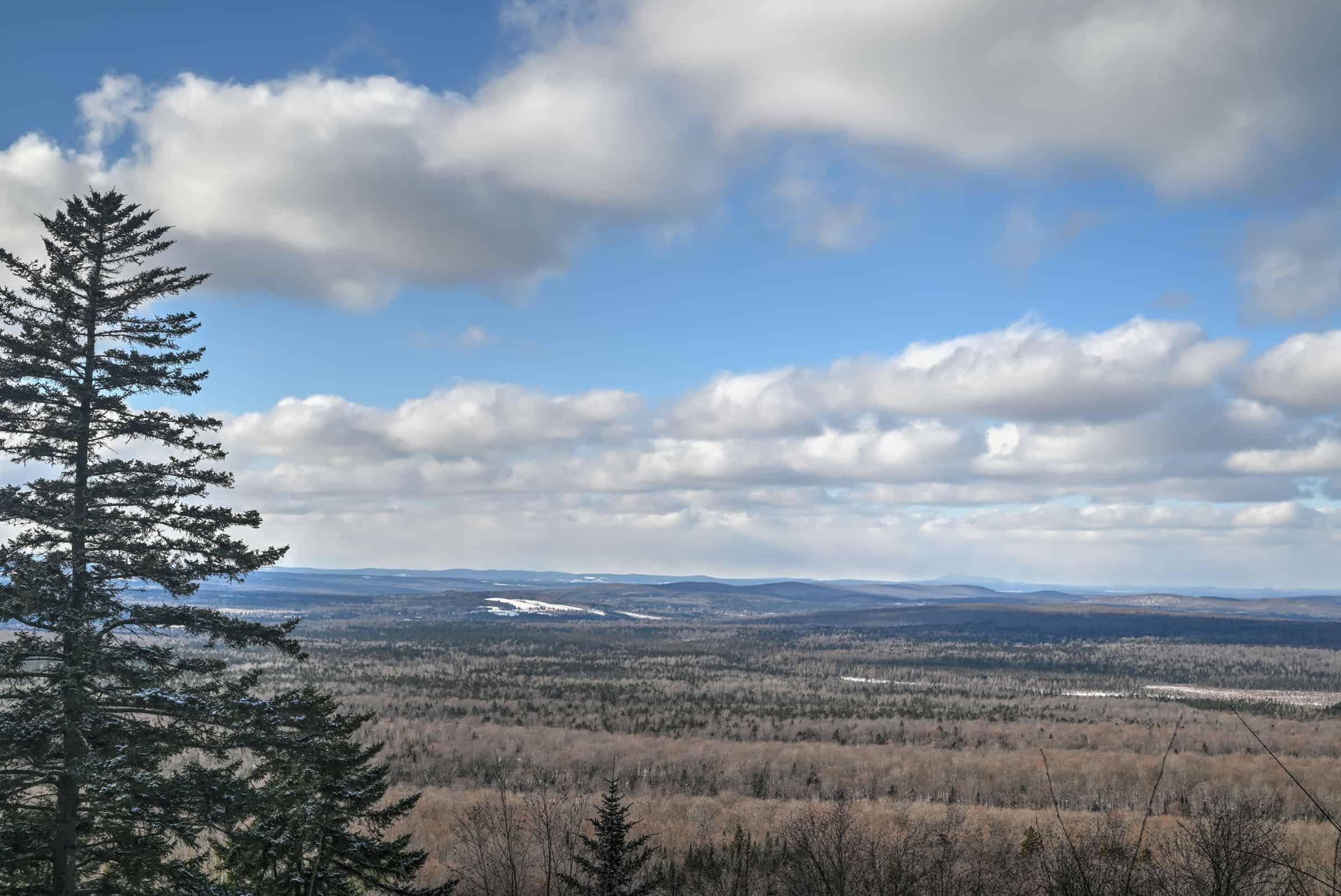


Third section: The descent and the Talweg Trail segment

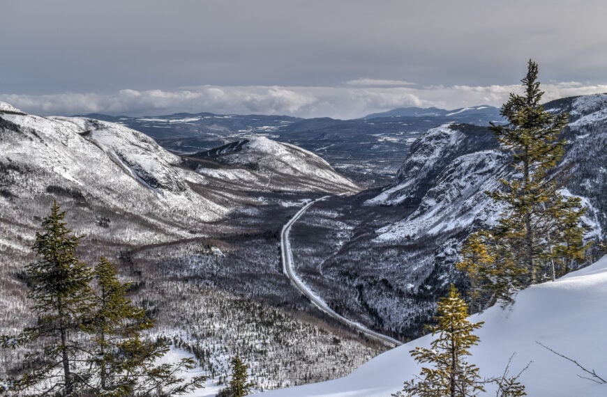
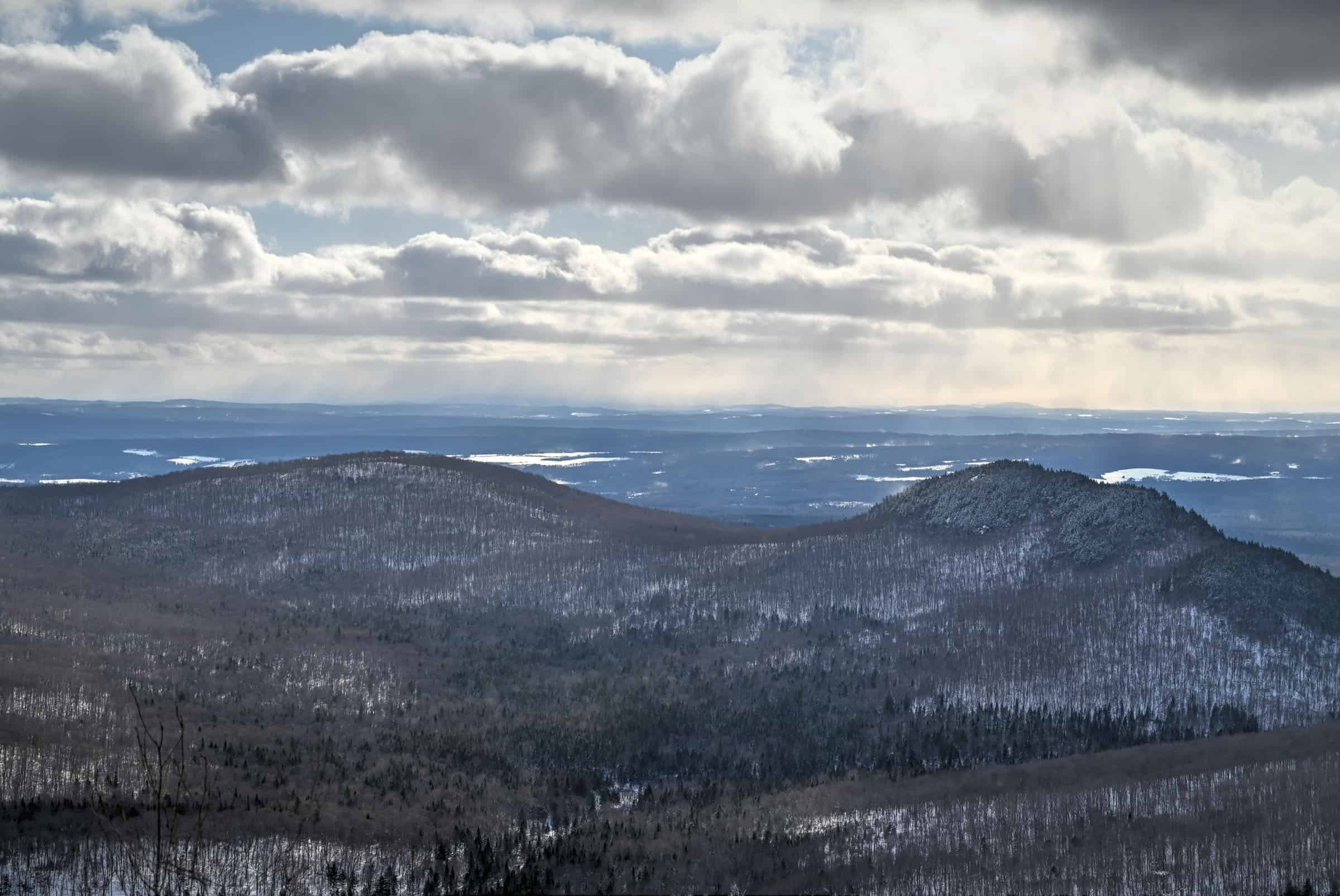
The Escarpment Trail (to Sugarloaf Mountain)
Escarpment Trail Details and Map
Other Escarpment Trail Details
– Canine companions: Dogs are not allowed on this trail.
– Summit: Sugarloaf summit is located at an altitude of 665 m.
– Number of viewpoints: According to the National Park, the trail has 3 official viewpoints.
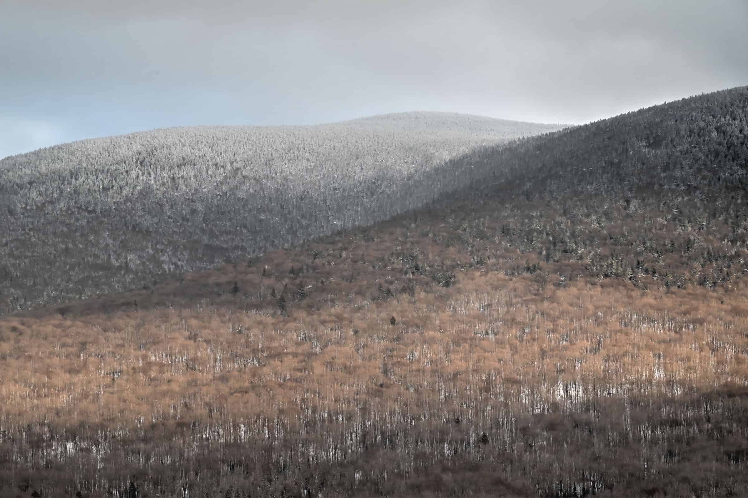
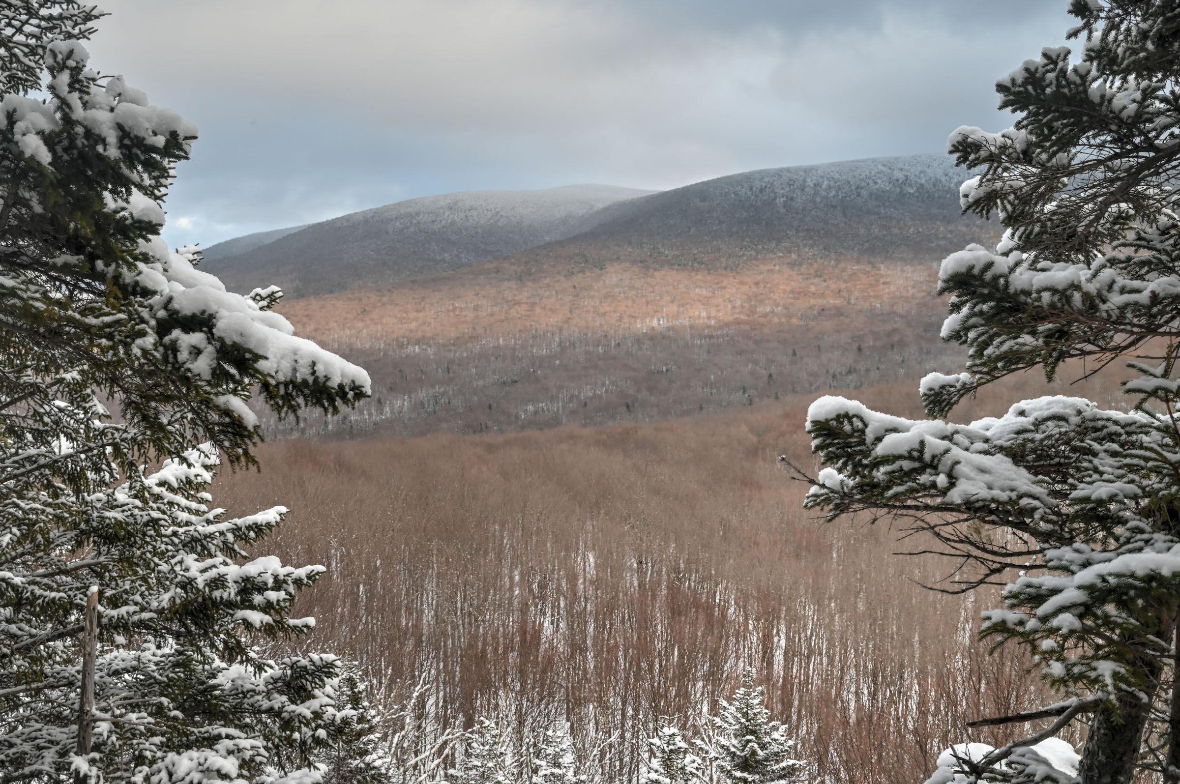
– Trail environment: Mostly forested
– Average trail slope grade: 7%
– Trail difficulty level assessment: Moderate
(based on our personal assessment, taking into account the trail length, slope grade and trail surface – 5-point difficulty scale: Very easy, Easy, Moderate, Moderately Challenging, Challenging)
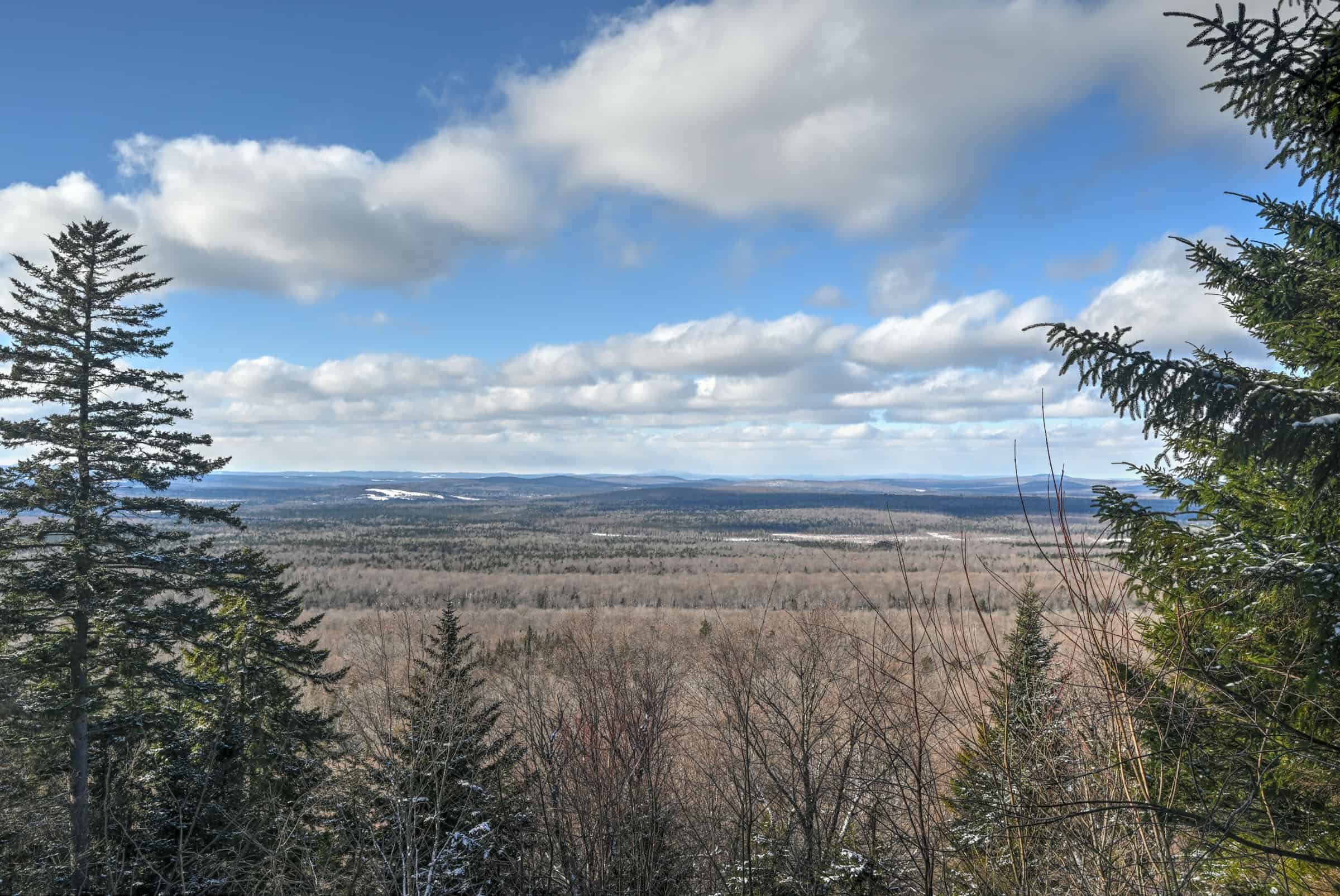
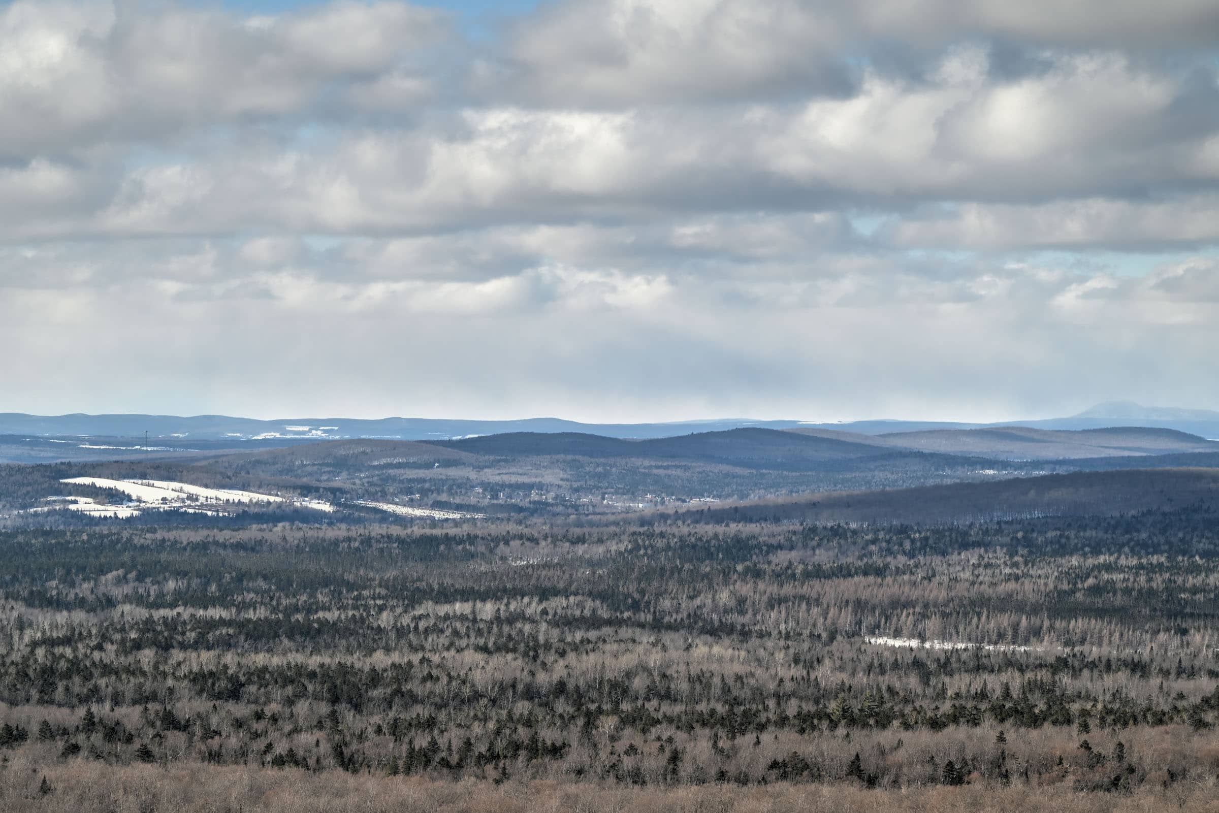
Escarpment Trail Description and Summary


Fanceville Sector Trail Alternatives

Where to Stay Near Mont Mégantic National Park
Photography Gear
If you like our photography, you might be interested in some of the gear we use to shoot our travel and hiking destinations.
Camera Body – Nikon Z 6ii Fx-series Mirrorless Body
Main Lens – NIKON 24-120mm F/4G ED VR AF-S
Zoom Lens – Sigma 745-306 150-600mm f/5-6.3
Polarizing filters – Urth Circular Polarizing (CPL)
Camera Tripod – K&F Concept 64-inch Camera Tripod
Mini-tripod – Lammcou Flexible Camera Tripod
Camera/hiking backpack – Vanguard Alta Rise 48 Backpack
Universal Travel Adapter – VYLEE Universal International Power Travel Plug
Other Travel Essentials
Travel Insurance
SafetyWing is a travel insurance company that offers comprehensive coverage for travellers. Includes Medical Insurance and Travel Insurance. Primarily geared towards long-term travellers, digital nomads, and expats.
e-Sim cards
Airalo is the world’s first and largest eSIM store with eSIM plans for 200+ countries and regions worldwide. With Airalo eSIMs, travellers can get connected the moment they land at their destination and avoid nasty data roaming charges
eSIMS are a sustainable alternative to single-use SIM cards – they are 100% digital, require less energy to produce and be re-used rather than disposed of.
Car Rentals
Discover Cars is our go-to website for car rentals. We almost always find our preferred rate there.
Transfer from Airport
Welcome Pickups is our favourite private transfer service, which you can pre-book at a fixed price. Currently available in 220 cities all over the world (mostly in Europe, but with several major cities in Asia, the Middle East and the US).
Kiwitaxi is another private transfer service – we haven’t tried it yet, but it’s currently available in a few more countries (102 as of 2024).
Hotels and Accommodations (coming soon)
Photography Prints
If you found this blog useful, you can help support our blog by purchasing low-cost digital prints. Printed physical prints are also available for purchase.


—–
Well, that wraps it up! We hope you enjoyed our Cimes and Escarpment Trails Winter Hiking Guide and that it will prove useful for planning your hiking adventures.
—–
You might also be interested in these related pages: