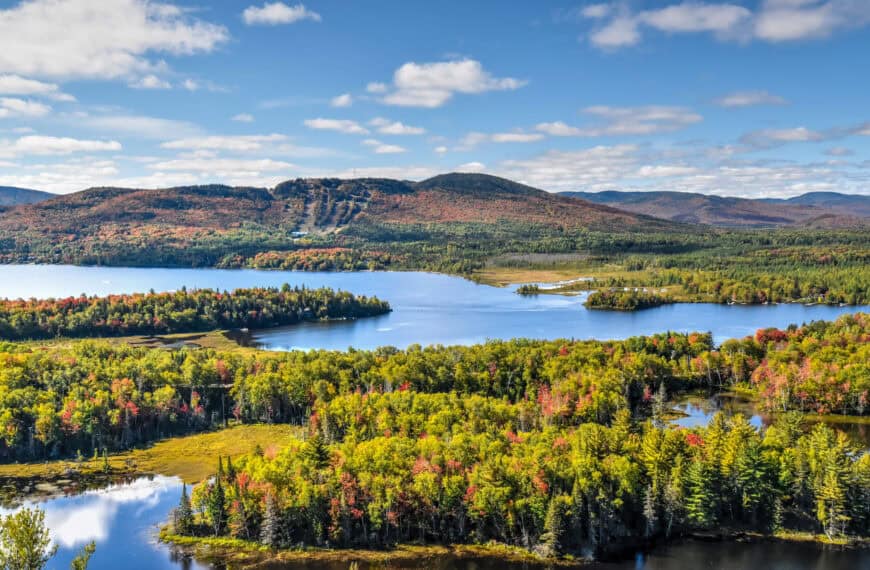
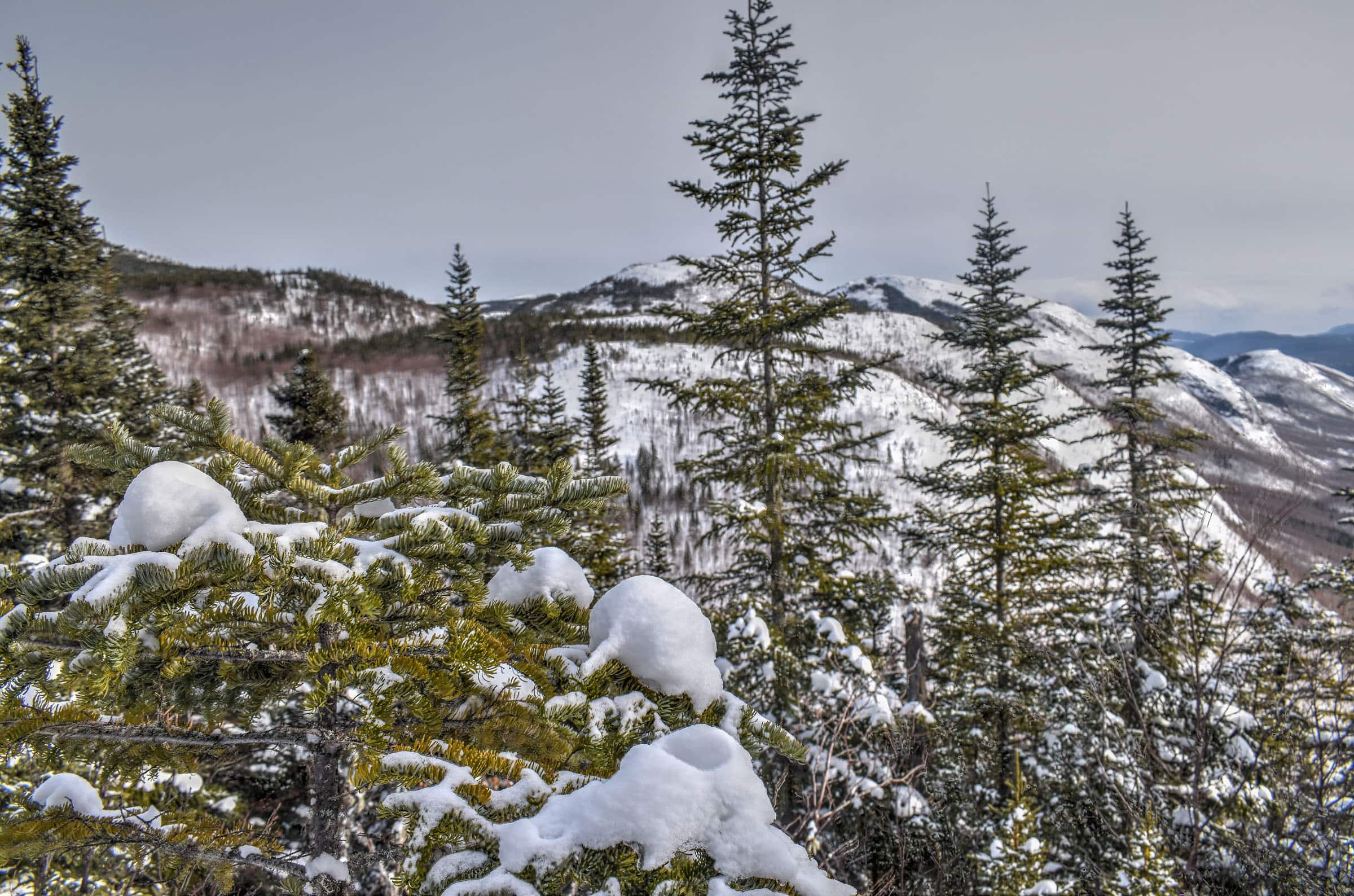
The Mont du Dome, whose summit of the same name peaks at 960m, is home to one of our favorite trails in Quebec’s stunningly beautiful Charlevoix region. It’s a fun trail to do, particularly in winter, and will provide you with stunning views of the surrounding mountains and the glacier-carved valleys below. Its close proximity to other trails in the nearby Grands-Jardins National Park makes it a great alternative option for those planning to visit the area as it is generally much less busy. So to help you get the most out of your hiking adventure, we put together this Mont du Dome Winter Hiking Guide.
Disclosure: This page (Mont du Dome Winter Hiking Guide ) may contain product affiliate links. At no additional cost to you, we may receive a commission for purchases made through these links. We only recommend products or services we personally believe in. More details can be found on our disclosure and policies page.
You might also be interested in these Guides:
Best Things to See and Do in Baie-Saint-Paul
Grands-Jardins National Park Hiking Guide
Best Hiking Trails near Baie-Saint-Paul
6 Quebec Hiking Trails that Are Stunning in Winter


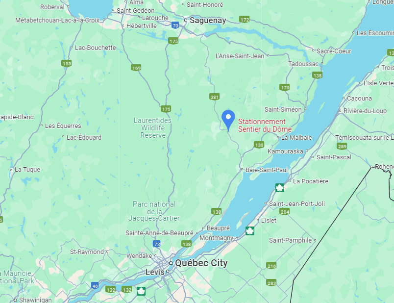
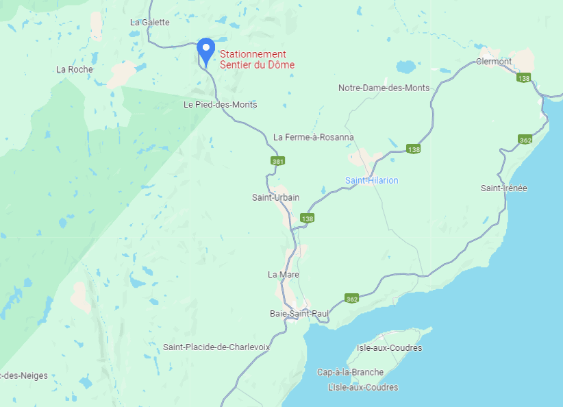
Mont du Dome Location and Map
The Mont du Dome is located in the beautiful Charlevoix of Québec, near the town of Baie-Saint-Paul (link to Google Maps). Although the trail parking lot is just 2km past the Grands-Jardins National Park visitor center, it is not part of the National Park. Rather, it is part of a conservation area known as the Zec des Martres.
How to Get to the Mont du Dome Trail
The easiest way to reach the Mont-du-Lac-des-Cygnes trailhead is by car.
From Montreal: about a 4h drive (390 km)
From Québec City: about a 1h30 drive (125 km)
From Baie-Saint-Paul: about a 30 min drive (30 km)
If you need to book a rental vehicle for your hiking excursion, we highly recommend using Discover Cars to get the best rates on your rental in Montreal.
We also highly recommend Airalo (eSIM card) for your connectivity needs when travelling abroad. Airalo is the world’s first and largest eSIM store with eSIM plans for 200+ countries and regions worldwide.
Mont du Dome Trail Access, Fees, and Parking
Trailhead & car park location: Both are found here.
Trail access & parking fees: Because the trail is part of the Zec des Martres conservation area, registration is mandatory before undertaking the hiking trail. You can either register at the reception area located 12 km south of the trail parking lot, or you can self-register at the trailhead, where you can also find a contribution box (suggested contribution is 7$). You can also make your contribution online here.
Trail opening hours: sunrise to sunset
Parking lot: The parking lot (which is next to the trailhead) isn’t particularly large and parking along the side of the road is not permitted, therefore we recommend an early arrival if possible (or to start in the mid-afternoon once the morning hikers have started to leave).
Facilities: When we last visited there were no on-site toilets.
Best Time to Hike The Trail
To experience a proper winter hike and beautiful white landscapes, it’s best to plan your visit between mid-December and mid-March. That being said, there are year-to-year differences regarding the early and late winter snow conditions. If you would like to visit early or late in the winter season, it’s best to check the park conditions first. You can generally find them listed at the top of the national park page. The trail may close during the spring season snow-melt period (dates vary from year to year).
Why Hike in Winter?
– There are generally fewer people on the hiking trails, allowing for a more peaceful and enjoyable experience.
– Compacted snow generally makes the trail easier to walk on and removes the difficulties associated with walking over rocks, boulders and tree roots.
– The scenery is very different than in any other season but is no less beautiful.
It’s also a great hike to do in the early morning. The light is perfect for photography and the trail isn’t too crowded.
* It is recommended to exercise caution and to wear bright colourful clothing if hiking the Mont du Dome trail during moose hunting season (from late September to early October). Though there is no hunting directly where the Dome trail passes, it is very important not to venture off the trail and wearing an orange vest and cap is mandatory if you do. But if you come during winter like we did, there is absolutely nothing to worry about. For more information, you can consult the trail management’s website.
Winter Hiking and Trail Safety Tips
In the absence of any significant recent snowfall, it is highly recommended to wear crampons/traction cleats under your shoes or boots when hiking most trails in this park, particularly any trail that has significant elevation gain. You can rent traction crampons/ice cleats to attach to your boots for 8$ (2024) at the visitor center. If you plan on needing cleats for more than 2 days, you’re probably better off buying your own.
Winter Hiking Packing List
Crampons / Ice Cleats – These are a must-have to help you with those steep ascents/descents or navigate icy trail conditions.
External Battery – Cold weather significantly affects cell phone battery drainage. Best to be prepared with an external power source to recharge your phone if needed.
Hiking poles – These can be particularly useful in winter, especially when not wearing any crampons or ice cleats.
Hand warmers – if you are like us and often remove your gloves to take pictures, having little hotties around care be hand life savers in freezing weather.
All Trails subscription – comes in really handy for areas with little or no cell reception, as the annual subscription allows you to download trail maps for offline use.
If there was a lot of recent snowfall, you might want to hike with snowshoes instead of ice cleats to help navigate the soft snow. To help you decide what footwear to bring, the national park details the recent snowfall and trail conditions via the “information of the day” button at the top of the page ( e.g. typically either densely packed snow or fresh powdered snow). The visitor center also rents out snowshoes if need be.
Also, always bear in mind that no matter how cold it is at the base of the mountain, it’s going to be even colder at the summit (and windier), so remember to dress appropriately. It’s generally recommended to wear fewer layers to start since you will warm up after a few minutes of hiking. But it’s a great idea to pack some extra warm gear for when you take a break or reach the summit.
Mont du Dôme Trail Details and Map
Distance: 8.4 km (Mont du Dome & Mont Saint-Michel summits); 7 km if Mont du Dome only.
Route Type: Partial Out & back, Partial Loop
Elevation gain: 320 m (cumulative elevation gain: 461 m)
Start point: Car Park
AllTrails rating: (4.6, 1068 ratings (2024))
Duration: Most people complete the trail in about 2h45-3h15
Access fee: suggested contribution of 7$.
* We recommend the following changes from the suggested AllTrails route:
1) To do the trail clockwise, which allows you to tackle the steepest part of the trail first and during the ascent.
2) During winter without snowshoes, we recommend skipping the trail section heading to Mont Saint-Michel (indicated by the yellow (1) in the map above). Few people venture here and the snow along the trail is rarely densely packed.
Not an AllTrails member yet? We highly recommend signing up for either their free or paid membership plans. The free plan allows you to find new trails and plan routes but it can only be used while hiking if you have access to mobile data. The paid membership plan (AllTrails+) allows you to download trail maps for offline use and provides live progress updates and off-route notifications.
If you are still uncertain – you should know that the All Trails mobile application was voted the 2023 iPhone App of the Year by Apple.
Other Mont-du-Lac-des-Cygnes Trail Details
– Canine companions: Dogs (on a leash) are permitted on this trail.
– Summit: Mont du Dome summit is located at an altitude of 975 m.
– Trail environment: Mix of forested and uncovered open sections.
– Number of viewpoints: The trail doesn’t have specific official viewpoints, but the entire summit (and part of the trail leading to it) is completely open, offering numerous unobstructed panoramic views.
– Trail Surface / Technical Trail: The fun thing about winter hiking is that technical trail surfaces (rocks, boulders and tree branches) get buried under the snow. The main challenges that remain are the steep sections that often require ice cleats or crampons, and there are a few such places on this trail, particularly the main ascent section of the trail (details below).
– Average trail slope grade: 11% (although this is not particularly steep on average, some sections are particularly sleep, especially the main ascent between the 0.5 and 1.5 km mark, where you will gain nearly 200 m (20% slope).
– Trail difficulty level assessment: Moderately Challenging
(based on our personal assessment, taking into account the trail length, slope grade and trail surface – 5-point difficulty scale: Very easy, Easy, Moderate, Moderately Challenging, Challenging)
Mont du Dôme Trail Description
You’ll notice from the map above, that the proposed AllTrails path leads you to two separate summits, Mont du Dôme (the western branch from the loop and Mont Saint-Michel (the eastern branch from the loop). Because fewer people go to the Mont Saint-Michel summit, in winter snowshoes are generally required. We didn’t have any with us during our hike, so we opted to just do the loop combined with the trail branch leading up to the Mont du Dôme summit. This resulted in slightly less elevation gain and a 7km trail length instead of the 8.4km listed above, which we were able to complete in under 2h30.
From the trailhead, the climb is initially gradual and smooth. At about the 0.5 km mark, you will come across an intersection, where you will have the option of going left or right. If you intend on doing the loop, it is generally recommended to start with the steep section to the left of the intersection (clockwise). This is because in summer you have to scramble over some large boulders, which is easier to do when ascending, and in winter the slippery (and potentially icy) terrain makes it much more treacherous to come down.
Starting the clockwise loop, you will soon come across a wooden cabin (which can be booked here) with nice views of the valley.


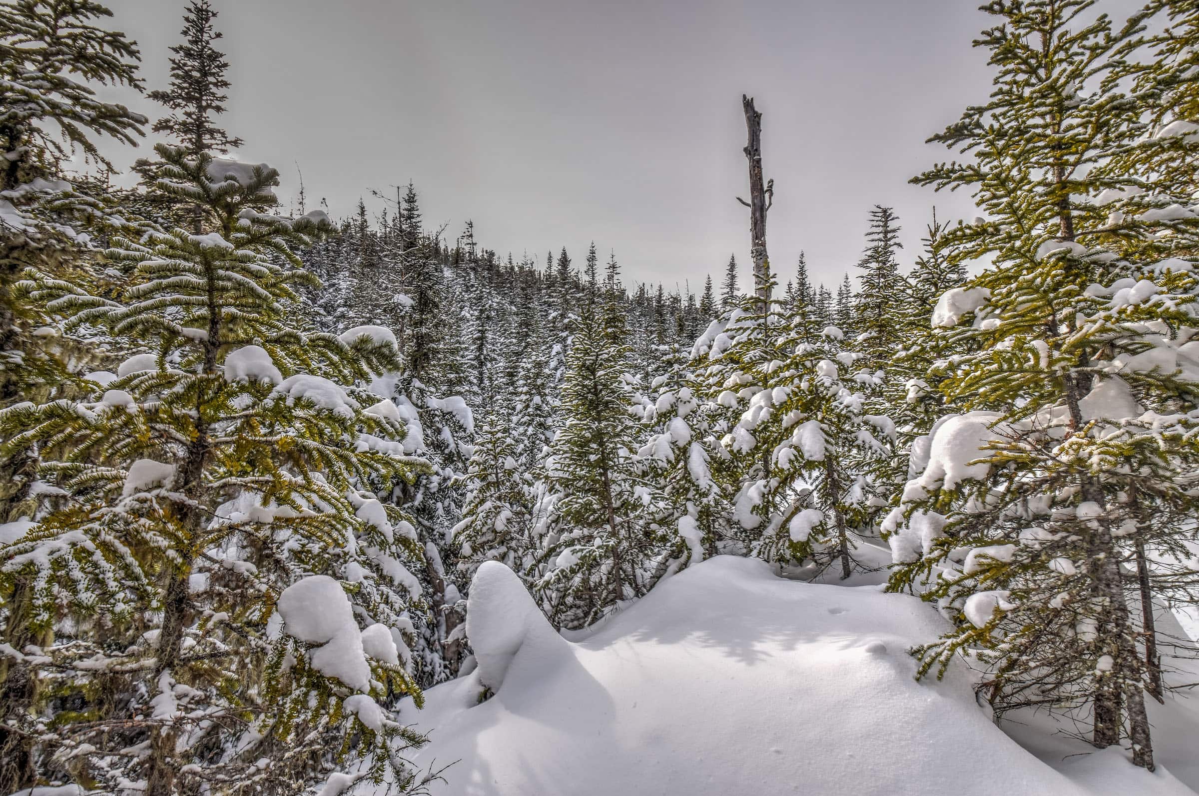
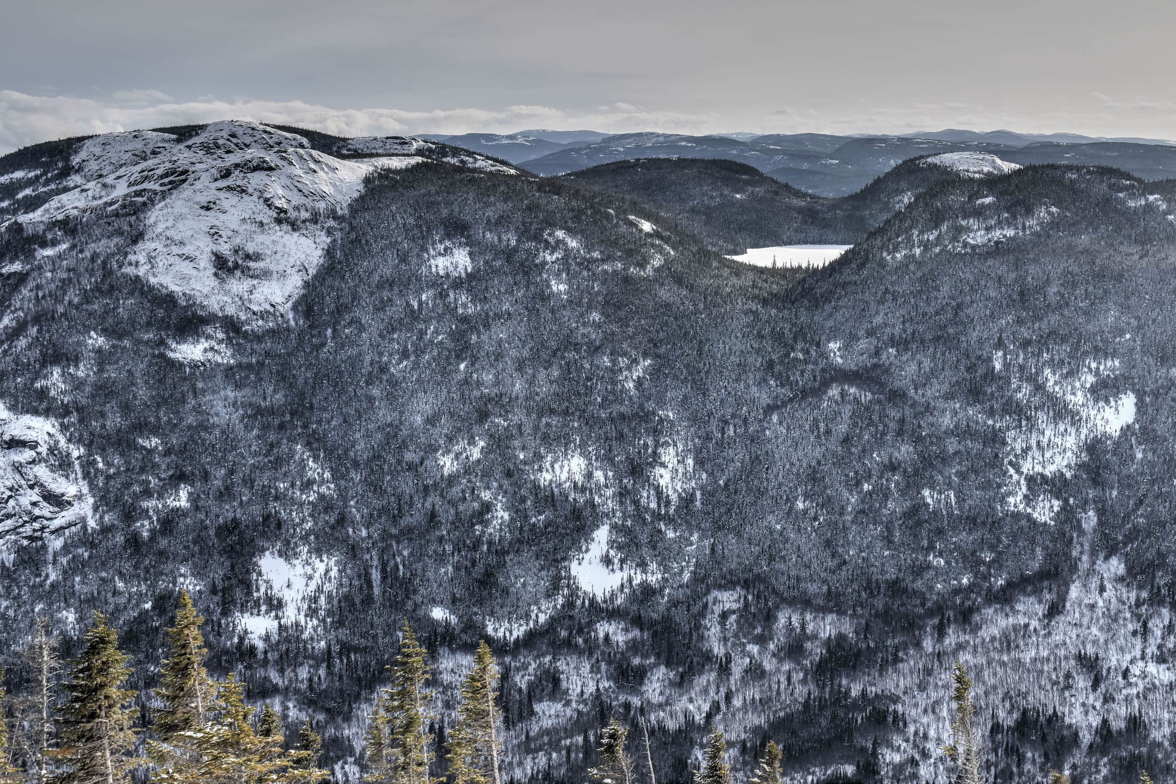
Regardless of which direction you take, near the western trail branch towards the Mont du Dôme summit, you’ll come across the beautiful Lac du Gros Ruisseau. From this point onward, the trail starts to flatten out. While there are still some slight elevation gains, you definitely got most of the ascent out of the way by now.


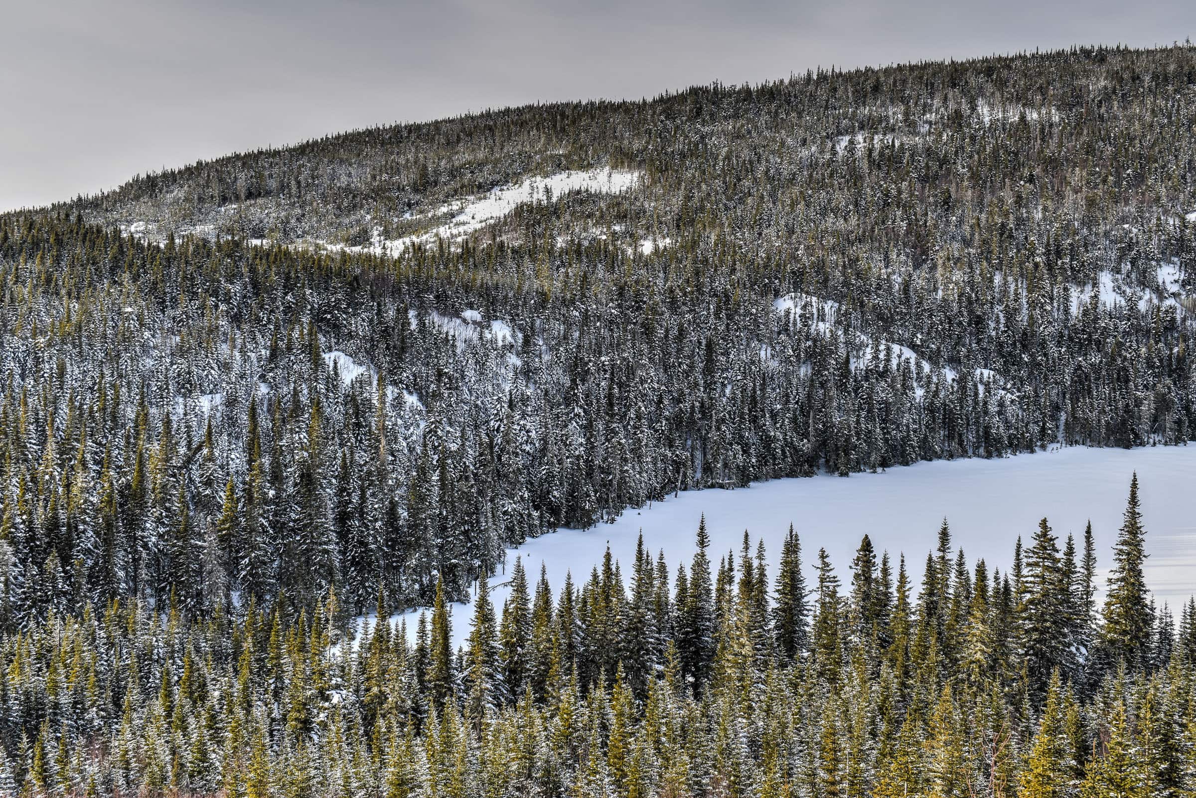
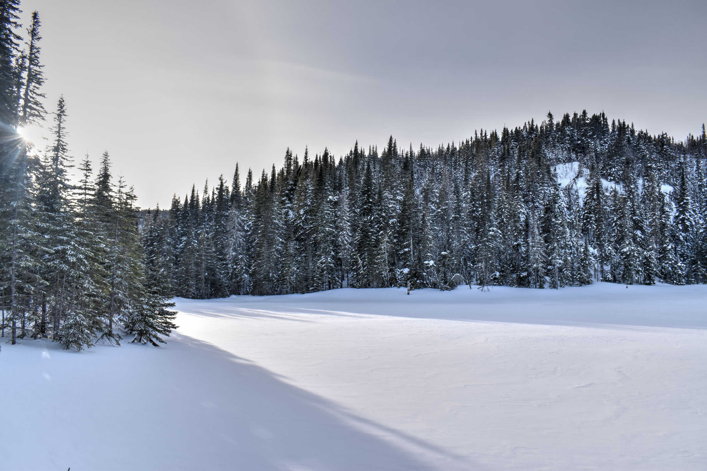
Continuing onward towards the summit, the winter alpine scenery continuously becomes even more magical with an endless series of snow-covered pines. You’ll definitely start to feel as though you have entered a winter wonderland as you walk through the narrow trail.


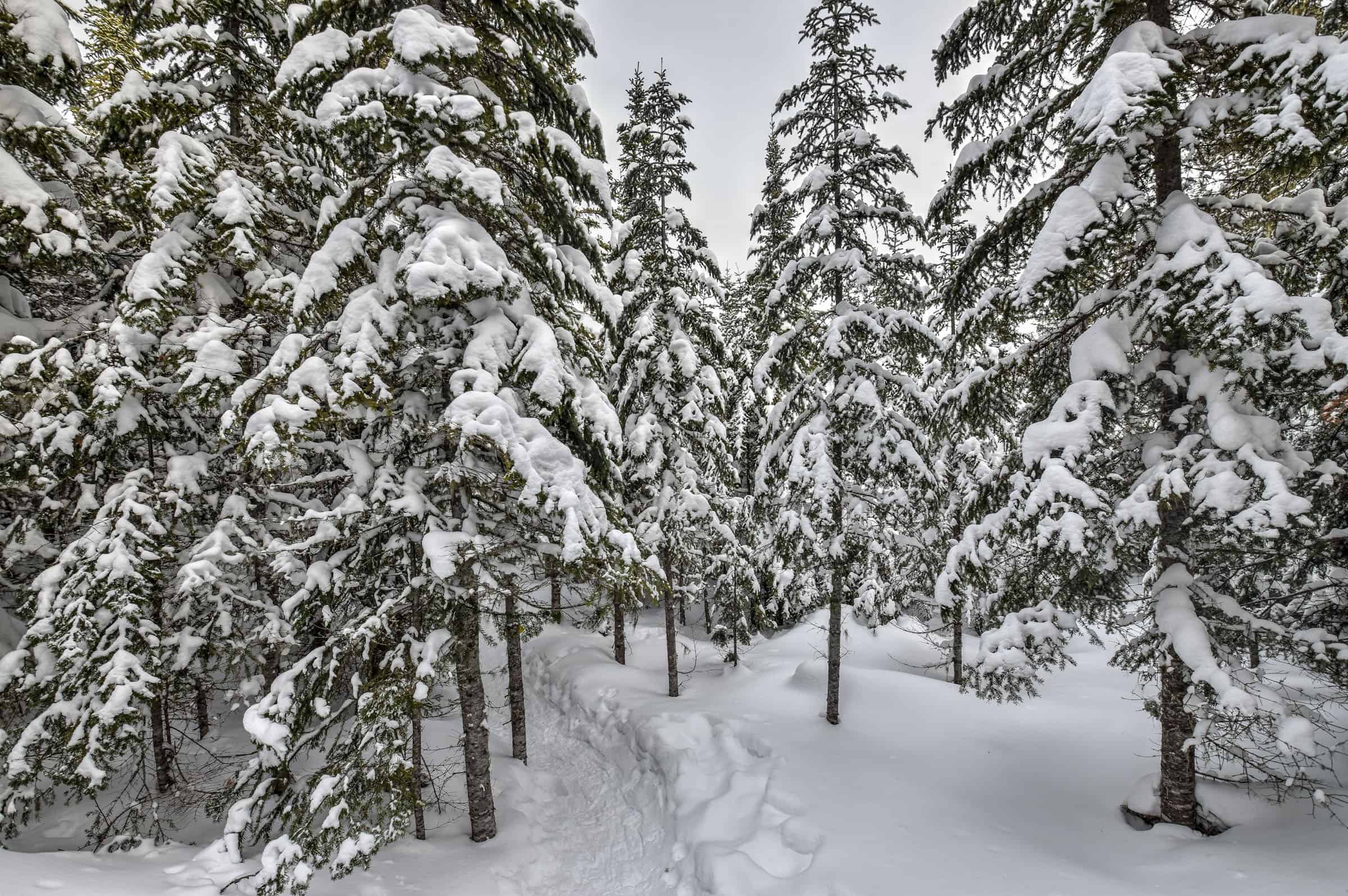
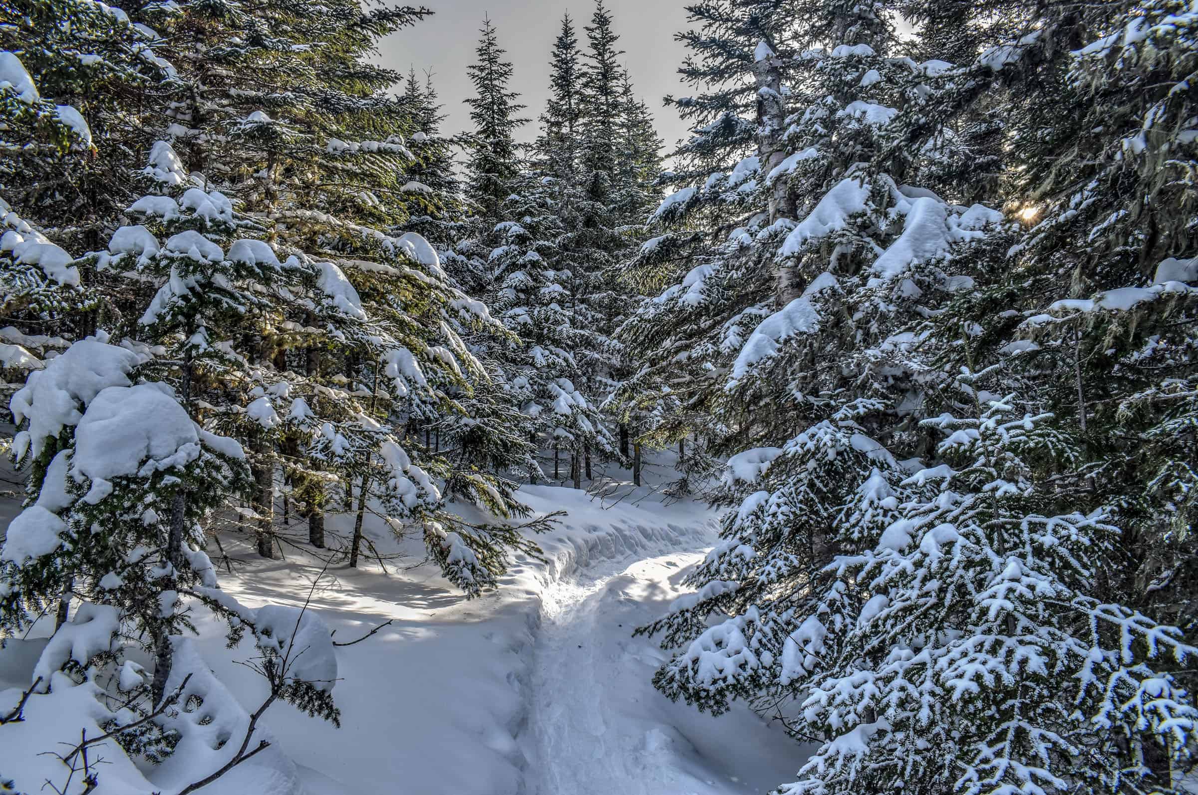
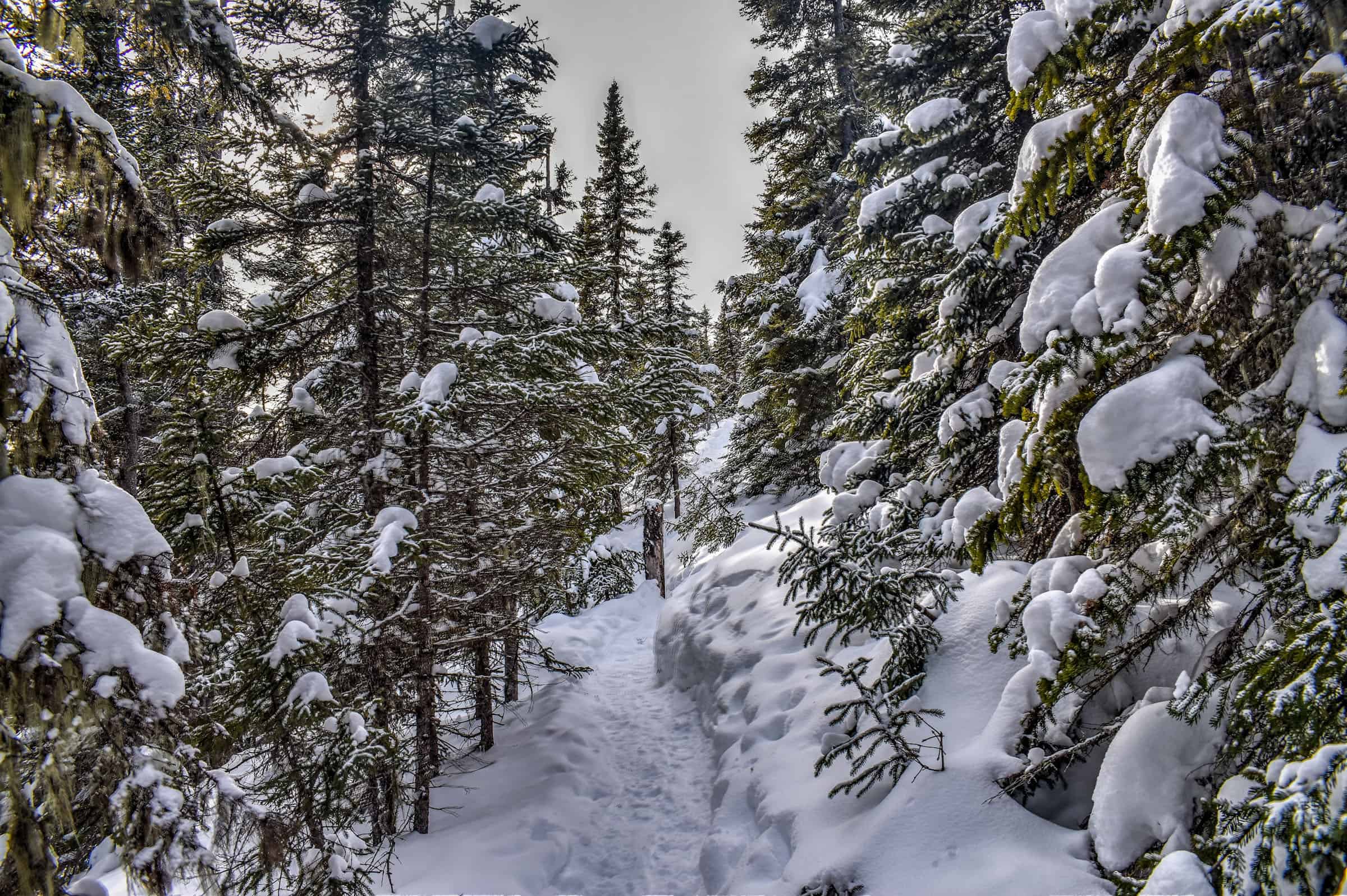
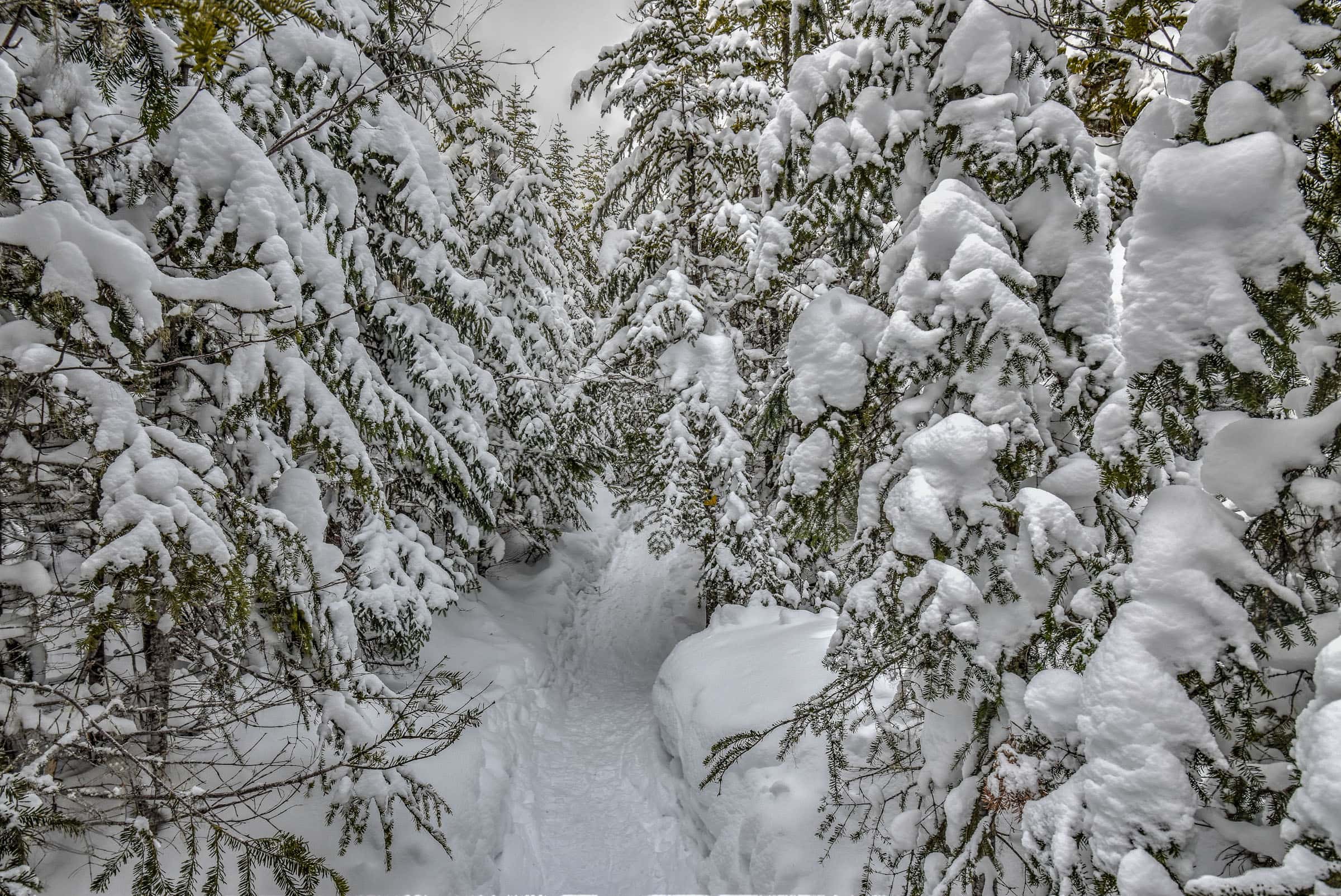
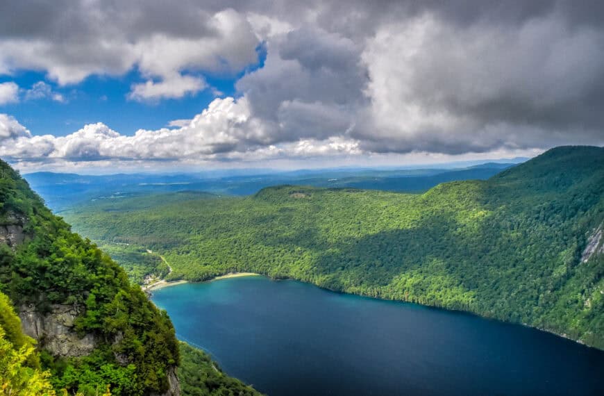
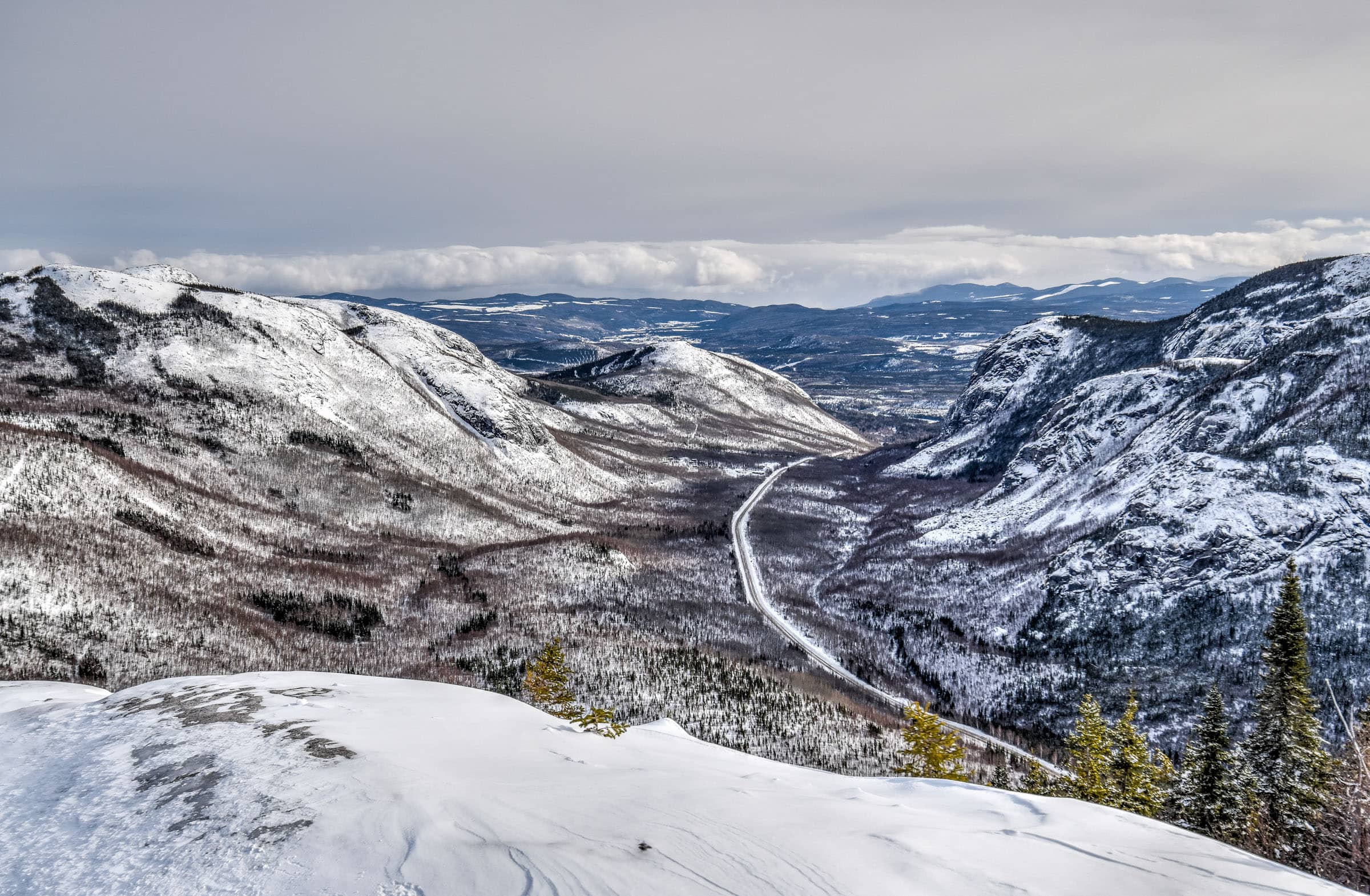
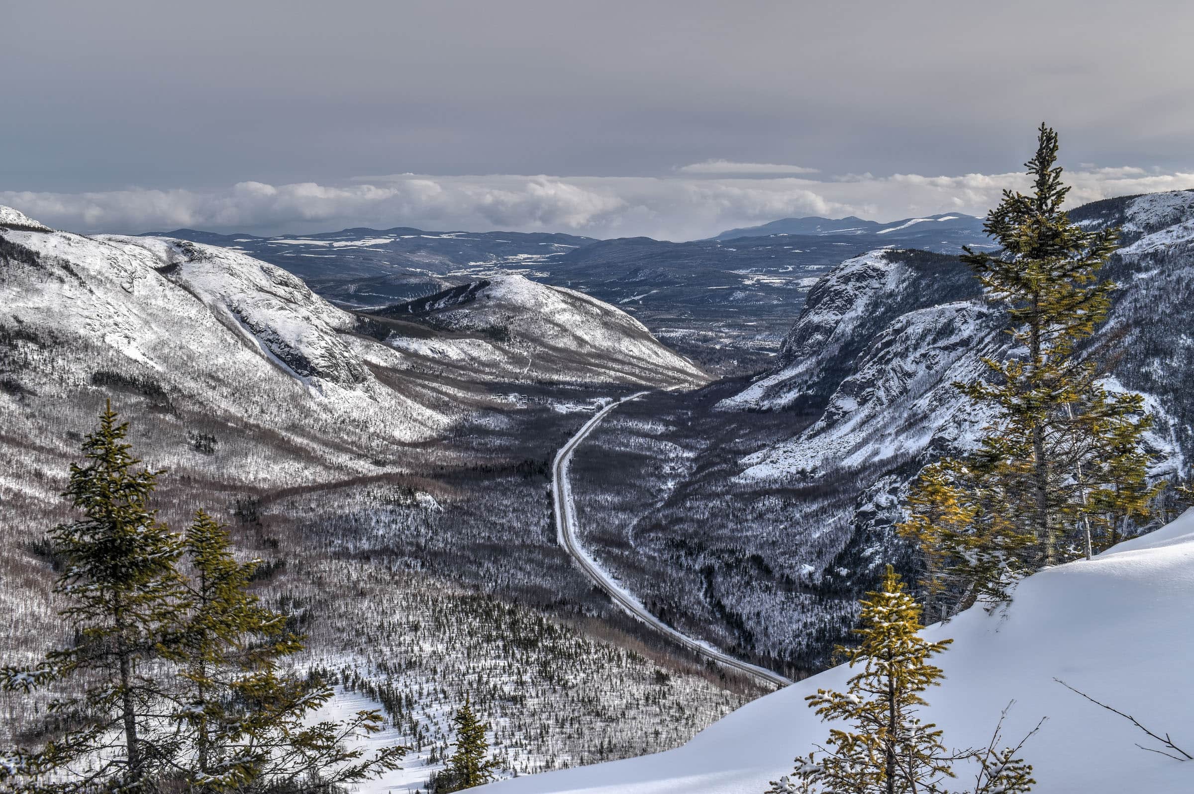
Eventually, the trees start to make way for the rocky summit, at which point you can enjoy the stunning scenery that surrounds you, from the beautiful glacier-carved valley below to the distant town of Baie-Saint-Paul and the St. Lawrence estuary. There’s lots of room to walk around and explore the summit, so don’t stop at the first you come across with an open view.


Once you have taken the time to enjoy the summit, you can return the same way you came up, but the descent will be very steep in tricky. We recommend you complete the loop on your way back down as it’s both an easier walk and you will get to enjoy different scenery on the way down.
Mont du Dome Trail Alternatives
Harder but quicker route: Instead of doing the loop, you can reach the Mont du Dome summit via a quicker out-and-back path. Note however that your descent will be significantly more challenging and technical. Following this route will knock off 1.5 km compared to following the loop route.
Easier but longer route: You can also do an out-and-back following the right side of the loop trail. The ascent and descent will be much more gradual. Doing this will add 1.5 km compared to following the loop route.
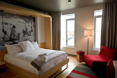
Where to Stay in the Area?
Without a doubt, our favorite place to stay in the area is at the Hotel & Spa Le Germain Charlevoix, located in the picturesque town of Baie Saint Paul, located a short 30-minute drive from the National Park. This modern boutique hotel is located just on the outskirts of town and features barn-inspired wood features throughout, with rooms available in five different pavilions. Also, as stated in the name, the hotel features a swimming pool, a steam room, a Jacuzzi, and a sauna, in addition to housing two on-site restaurants and a breakfast buffet.

The town itself is quite charming, and we put together a Baie-Saint-Paul Visiting Guide to help discover all the key attractions in the area.


Other Great Hiking Trails in the Area
Beyond the National Park, there are several other great hiking trails in the area, and we describe several of them in our guide on the Best Hiking Trails near Baie-Saint-Paul. For trails that are particularly close to the Mont du Dome trail, check out our Grands-Jardin National Park guide.


You might also be interested in these Guides:
Grands-Jardins National Park Winter Hiking Guide
Best Winter Hiking Trails near Sutton (Eastern townships)
Best Winter Hiking Trails in Mont Mégantic National Park
6 Quebec Hiking Trails that Are Stunning in Winter
Photography Gear
If you like our photography, you might be interested in some of the gear we use to shoot our travel and hiking destinations.
Camera Body – Nikon Z 6ii Fx-series Mirrorless Body
Main Lens – NIKON 24-120mm F/4G ED VR AF-S
Zoom Lens – Sigma 745-306 150-600mm f/5-6.3
Polarizing filters – Urth Circular Polarizing (CPL)
Camera Tripod – K&F Concept 64-inch Camera Tripod
Mini-tripod – Lammcou Flexible Camera Tripod
Camera/hiking backpack – Vanguard Alta Rise 48 Backpack
Universal Travel Adapter – VYLEE Universal International Power Travel Plug
Other Travel Essentials
Travel Insurance
SafetyWing is a travel insurance company that offers comprehensive coverage for travellers. Includes Medical Insurance and Travel Insurance. Primarily geared towards long-term travellers, digital nomads, and expats.
e-Sim cards
Airalo is the world’s first and largest eSIM store with eSIM plans for 200+ countries and regions worldwide. With Airalo eSIMs, travellers can get connected the moment they land at their destination and avoid nasty data roaming charges
eSIMS are a sustainable alternative to single-use SIM cards – they are 100% digital, require less energy to produce and be re-used rather than disposed of.
Car Rentals
Discover Cars is our go-to website for car rentals. We almost always find our preferred rate there.
Transfer from Airport
Welcome Pickups is our favourite private transfer service, which you can pre-book at a fixed price. Currently available in 220 cities all over the world (mostly in Europe, but with several major cities in Asia, the Middle East and the US).
Kiwitaxi is another private transfer service – we haven’t tried it yet, but it’s currently available in a few more countries (102 as of 2024).
Hotels and Accommodations (coming soon)
Photography Prints
If you found this blog useful, you can help support our blog by purchasing low-cost digital prints. Printed physical prints are also available for purchase.


—–
Well, that wraps it up! We hope you enjoyed our Winter Hiking Guide for the Mont du Dome and that it will prove useful for planning your trip to the beautiful Charlevoix region of Québec.
—–
You might also be interested in these related pages: