
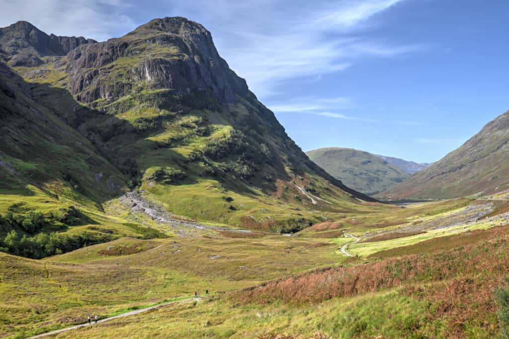
The Scottish Highlands are without a doubt a paradise for outdoor enthusiasts with so many beautiful hiking and walking trails throughout. Some of our favorite trails in Scotland are located in the stunning Glen Coe region, and the Lost Valley trail (also known as the Hidden Valley or Coire Gabhail trail) is definitely one of our favorites in the area. The trail has a little of everything, a scenic river, a densely forested section, and a spectacular open valley. The path itself is quite varied and includes sections with a narrow ridge, a metal staircase, an easy river crossing, a wooden bridge, large boulders that require a light scramble, and a polished boulder surface that could almost be used as a slide. As a bonus, its trailhead is next to the famous Three Sisters of Glen Coe, three iconic peaks that can be seen from the road. You can also extend the trail by combining it with the old military road trail. Below we present our Glen Coe Lost Valley Hiking Guide, which includes information on how to get to the trailhead, how difficult the trail is, where the best views are and when is the best time to hike the trail.
Disclosure: This page (Glen Coe Lost Valley Hiking Guide) may contain product affiliate links. At no additional cost to you, we may receive a commission for purchases made through these links. More details can be found on our disclosure and policies page.
You might also be interested in these pages:
Top Things to See and Do in Glen Coe
Best Hikes and Walks in Glen Coe
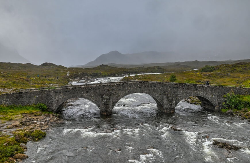
Glenfinnan Viaduct and Jacobite Steam Train Travel Guide
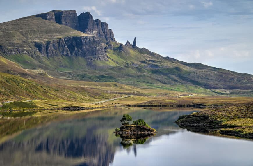
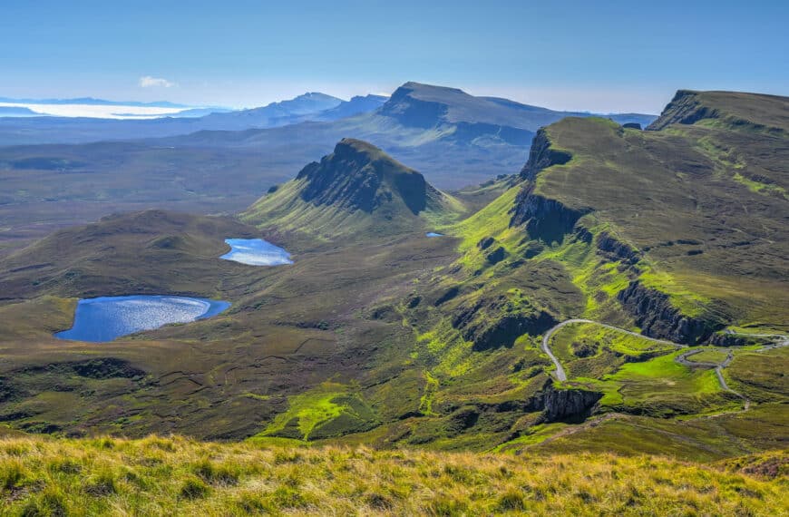
Top Things to See and Do on Skye
Skye’s Best Hiking and Walking Trails


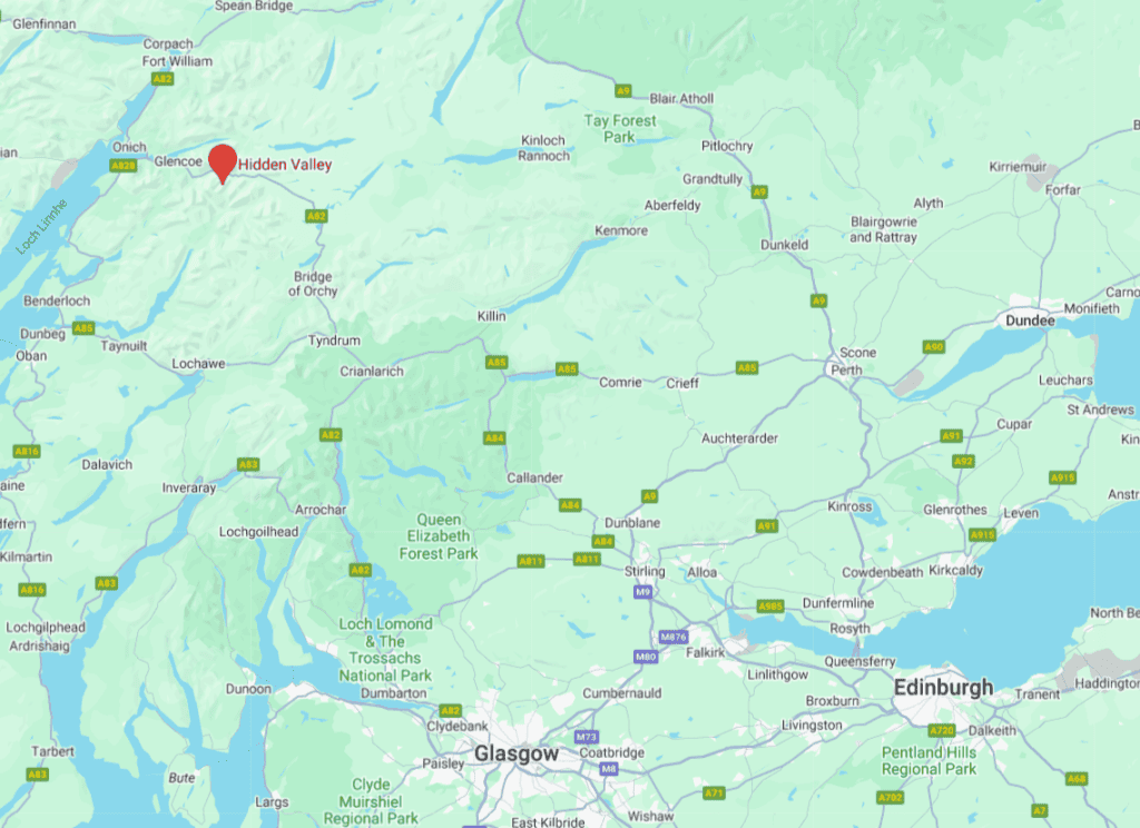
the Lost Valley Trail Location & Map
The Lost Valley trail (also known as the Hidden Valley or Coire Gabhail trail) is located in the heart of Glen Coe, one of Scotland’s most beautiful and dramatic valleys and one of Scotland’s most popular hiking and walking areas.
How to get to the Lost Valley Trail
By Car: Getting to the Lost Valley trailhead is simplest with your own vehicle. It is about a 35 km drive (30 min) to get here from Fort William. From Oban, it is about a 65km drive (60 min). Getting here from Glasglow or Edinburgh will take a bit longer, roughly 2h and 2h30, respectively. If you are staying in Glencoe village, it’s a short 10-minute drive to the trailhead.
For advice and tips on how to drive in Scotland, check out our Scotland Roadtrip Driving Guide.
If you haven’t booked your rental vehicle yet, we highly recommend using Discover Cars to get the best rates on your rental in Scotland.
By Public Transit: At the moment and to our knowledge, no public transportation option will take you to the Lost Valley Trailhead. While not impossible, reaching the Lost Valley Trail by public transit is less straightforward than with your own vehicle. City Link runs several buses into Fort William from Oban, Glasgow and Edinburgh, most of which will stop in either Glencoe Village or nearby Ballachulish. Things get more challenging from there, however. Your best option would be to hire a local taxi to get to the trailhead and pre-arrange a pick-up afterwards. We wouldn’t recommend trying to walk to the trailhead, as it’s a 9km stretch of road with a very narrow shoulder.
Arrival, parking and trail access fees
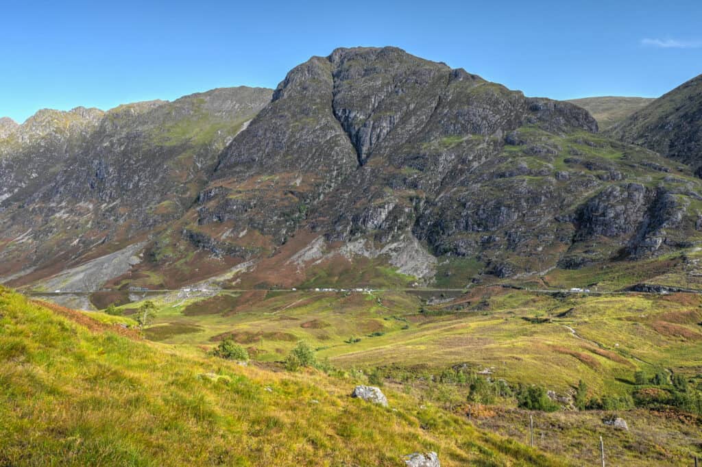
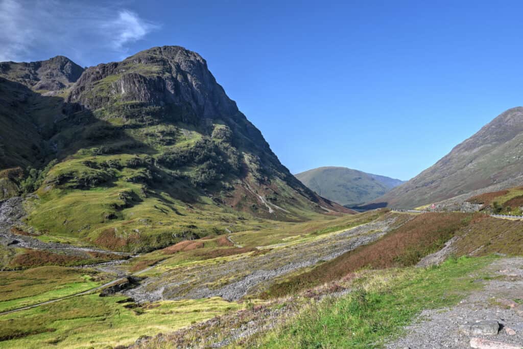
Parking lot: The closest parking lot to the trailhead, the Three Sisters Car Park, is not particularly large and can fill up quickly during the day – particularly because many use it as short-term parking for quick photo stops of the Three Sisters of Glen Coe, a beautiful set of three side-by-side peaks in the Glen Coe Valley. If you don’t arrive early enough, you might need to park in one of the other nearby parking lots, such as the Aonach Eagach Car Park or Hidden Valley Car Park. Both of these car parks are just a few hundred meters away from the Three Sisters Car Park and connect with the Lost Valley trail via the Old Military Road trail.
Trail Hours: The trail is also open 24 hours a day, 7 days a week so you can visit any time you like.
Trail Costs: Hiking the trail is free, as is the car park (2023).
Trail Facilities: The nearest public toilets are in Glencoe Village and Ballachulish, a ten-minute drive to the west, or are near the Kinghouse Hotel, a 10 min drive away to the east.
The Lost Valley Trail Details
Distance: 6.3 km
Route Type: Out & back
Elevation gain: 230 m (cumulative elevation gain: 340 m)
Start point: Three sisters car park
AllTrails rating: (4.7, 1264 ratings (2023))
Duration: 2h-2h30
Not an AllTrails member yet? We highly recommend signing up for either their free or paid membership plans. The free plan allows you to find new trails and plan routes but it can only be used while hiking if you have access to mobile data. The paid membership plan (AllTrails+) allows you to download trail maps for offline use and provides live progress updates and off-route notifications.
If you are still uncertain – you should know that the All Trails mobile application was voted the 2023 iPhone App of the Year by Apple.
The Lost Valley Trail Summary
As a whole, this out-and-back trail is generally considered by most to be of moderate difficulty, more so because of the terrain surface in places than because of the length of the trail or the elevation gain. In particular, some light scrambling over rocks is required in a few different spots along the trail. That being said, we feel that most people should be able to manage these sections with relative ease. Great care should still be taken in small sections where there is a steep drop-off from the path, particularly during wet and rainy conditions. If you have hiking poles, this is a good trail to make use of them. Most people take 2 to 2h30 hours to complete the trail.
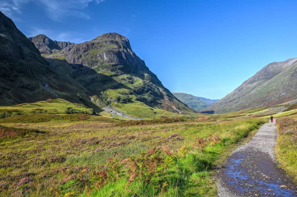
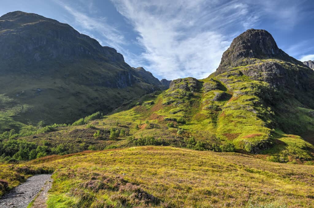
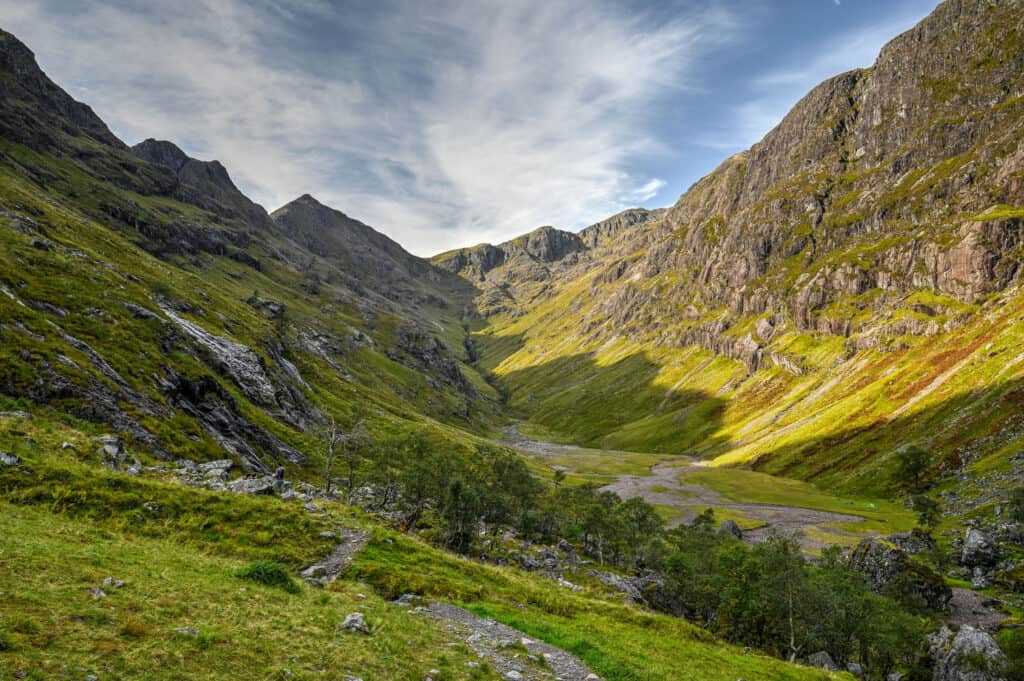
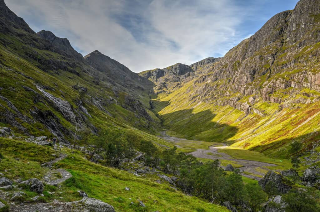
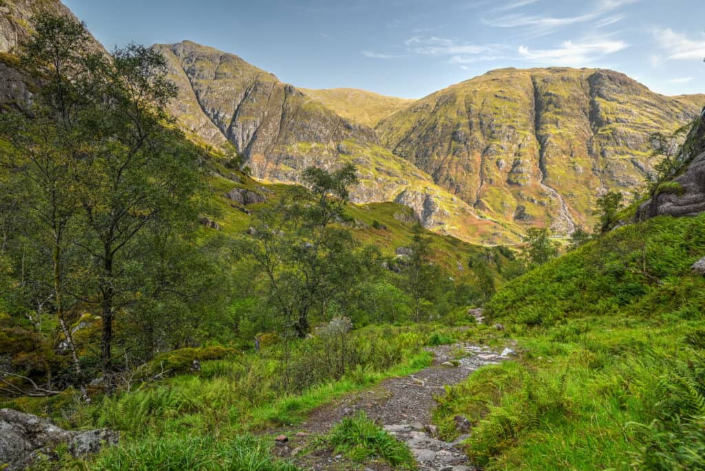
From the car park, the trail descends slightly and connects with the Glencoe Old Military Road Trail (first picture below). From here you want to turn left and follow the trail as it slowly turns right towards the Lost Valley (second picture below). Going right will follow the Old Military Road Trail, which runs parallel to the main road through Glen Coe (A82).
A few hundred meters later you’ll come across a metal staircase, which you’ll need to descend to then cross a wooden bridge across the river Coe. The metal staircase is fairly steep and will easily become slippery when damp, so care should be taken when descending after a period of rain.


As you emerge from the other side of the bridge, you will come across one of the first challenges of the trail, a section of large boulders that ascend fairly steeply, which acts as a very uneven staircase; a metal handrail has been placed along the right side of the rock face to assist with the ascent/descent of this rocky section. This section might be a bit difficult for those with bad knees, and hiking poles could come in handy.
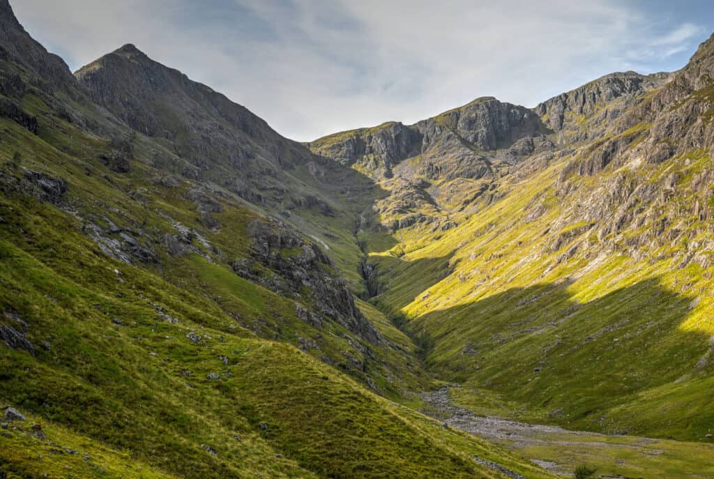
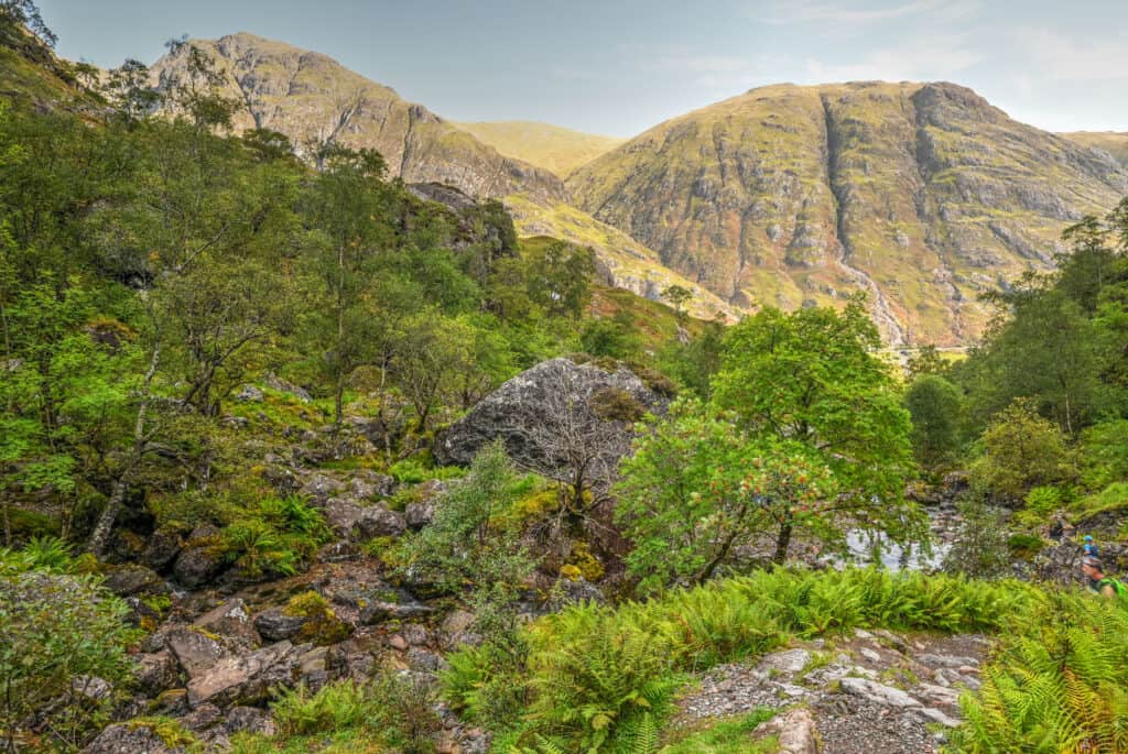
After the rocky section, you’ll go through various forested sections that are quite lovely. Eventually, after climbing several stone step sections, you’ll emerge along a narrow ridgeline section with the river below you to your left. This is a spot where you have to exercise caution if the trail is wet and slippery, the drop-off to your left is quite steep.

Eventually, you’ll reach a point where you need to cross the river (which is very shallow at this point) to continue. This is fairly straightforward as several stepping stones can be used to cross.
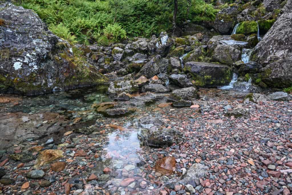
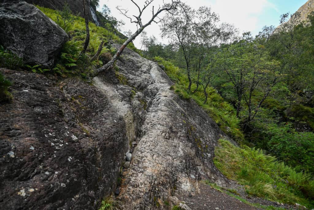
Shortly after the river crossing, you’ll reach a tricky rocky section. Here the surface has been smoothed by countless hikers descending this section on their bottoms, having left it rather polished and slippery (particularly in wet weather). Please advance through this section with care. Alternatively, you can climb over the rocky section to the left. It’s less slippery but definitely requires more scrambling skills.
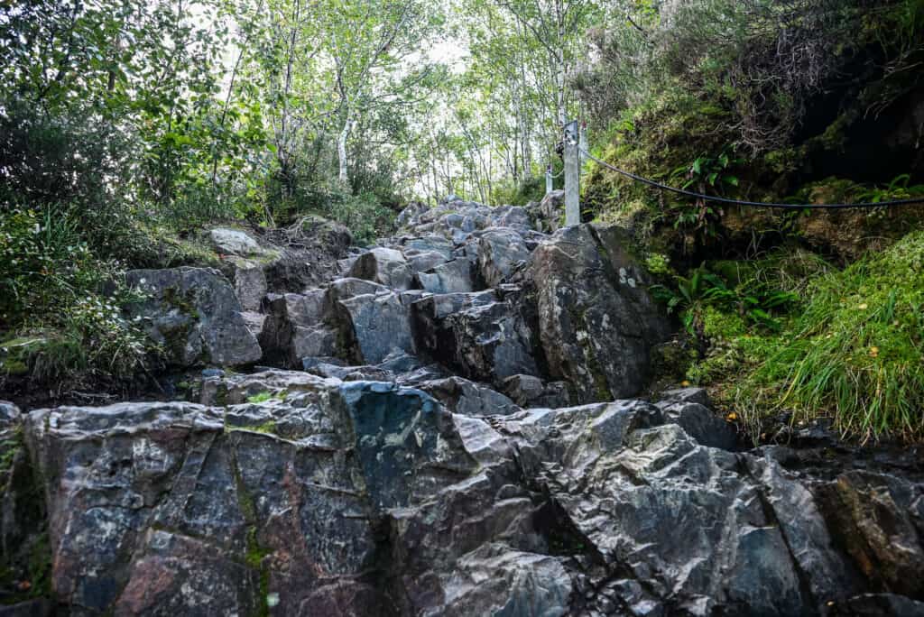
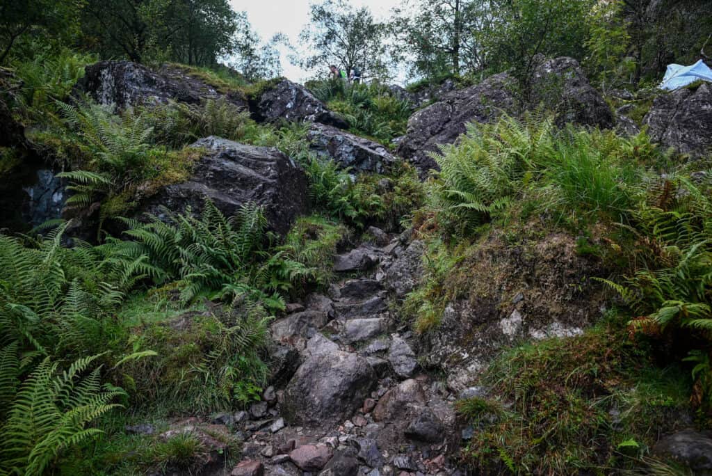
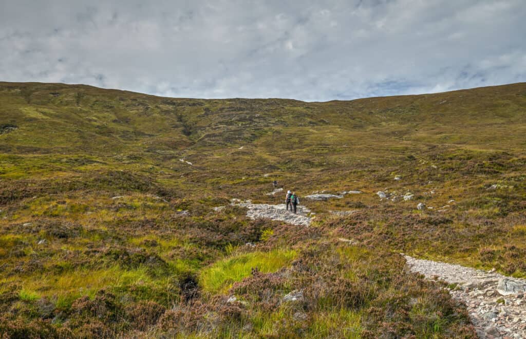
After this, you’ll continue onwards with a few various stone and small boulder sections acting as staircases to climb up, though they are not as difficult as they appear in the picture below – you have already conquered the more challenging sections of the trail at this point.
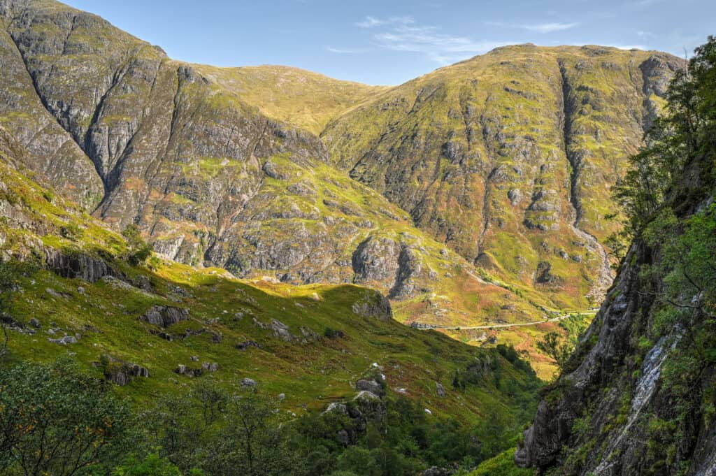
Finally, you will reach a point where the trail opens up and you emerge in the stunningly beautiful green Lost Valley. From here you can enjoy the view or continue to explore down into the valley floor.
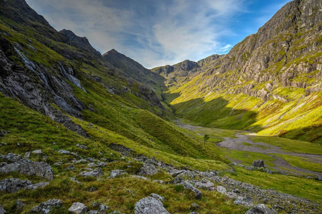
It’s definitely easy to get mesmerized by the valley’s beauty or to think about its historical importance, having served both as a hiding place for stolen cattle by the MacDonalds of Glen Coe and as a refuge for those who escaped the 1692 Massacre of Glen Coe.
Once you’ve decided to make your way back, don’t be too disappointed as there are some great views to be had in the other direction as well, as you will be staring at the other side of Glen Coe Valley.
Hiking Packing List
All Trails subscription – This comes in really handy for areas with little or no cell reception, as the annual subscription allows you to download trail maps for offline use.
External Battery – If you are using your phone to track your progress along the trail or to help with navigation, you certainly don’t want your phone to die on you. That’s especially true in the unlikely event that you might get hurt or need assistance.
Hiking poles – These can be particularly useful in steep trails or muddy/boggy trail conditions.
Water Filter Bottle – The Life Straw bottle is an advanced water bottle with a filter that not only improves water taste but more importantly filters out bacteria and parasites, chemicals and microplastics.
Headlamp – very practical and a smart choice if you plan to start your hike before sunrise or finish it after sunset.
Is the Lost Valley Trail Worth it?
Why you might like the Lost Valley Trail
-There’s definitely a strong wow factor once you arrive in the Lost Valley.
-It’s a hike that offers a nice challenge without being too strenuous
-The scenery is both spectacular and varied all along the trail. It includes forested and open space sections, you’ll encounter a few easy river crossings (both over bridges and some that will require you to hop over a few rocks)
-The trail doesn’t take too long to complete, leaving you time to do a second trail in the area if that’s something you would be interested in.
Why you might not like the Lost Valley Trail
-If you are looking for the type of sweeping views that you get from reaching a summit, you won’t get those here. You will have partial views into the Glen Coe Valley, which you will mostly notice during the return leg of the hike.
-Several sections of the trail go over very uneven rocky terrain including some light scrambling over large boulders. If you are not an experienced hiker or have bad knees, you might find these sections overly challenging.
-If there has been lots of recent rain and you are not an experienced hiker, you might find some sections of this trail unnerving, particularly those with steep drop-offs.
Trail Variations and Alternatives
Extend your hike with the Old Military Road Trail
Extending your hike by following the Old Military Road Trail will add distance and beautiful scenery to your hike, but without adding much difficulty or revelation gain. Both trails share the same trailhead (and end point since both are out-and-back trails): while the Lost Valley Trail runs perpendicular to the road, the Old Military Road Trail runs parallel to it.


The combination doesn’t exist as a trail on All Trails, but you can easily imagine how it would look by combining both trails below (both trails share the same start and end point). Doing both together would create a trail of 9-10 km in distance.
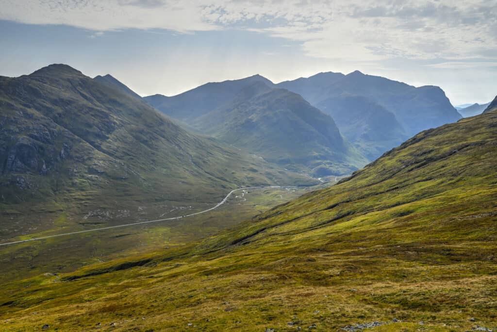
Extend your hike to Stob Coire and Bidean Nam Bian
We’ll quickly preface this by saying this is an incredibly challenging route and should only be undertaken by experienced hikers. The trail has a cumulative elevation gain of 1262m, stretched out over 11.4 km in distance. Navigation can be an issue near the peaks, so an offline map is recommended. To do this trail, instead of turning around once you’ve reached the heart of the Lost Valley, continue onward to climb out of the valley to complete a long loop through
Other Nearby Hiking Trails in Glen Coe
The Lost Valley was one of our two favorite trails in Glen Coe. The other was the Devil’s Staircase. This trail is technically part of the West Highland Way trail (a long-distance walking route through the Highlands), one where you’ll be required to climb 400 m in elevation over a short 2.5 km section of trail. However, despite the intense ascent, the reward at the top is definitely worth the effort. The scenery as seen from the summit is simply stunning, which is why this trail is one of our favourites in the Glencoe area. And like the Glen Coe Old Military trail highlighted above, you have non-stop jaw-dropping views during the entire trail.

Distance: 5.1 km
Route Type: Out & back
Elevation gain: 400 m
Start point: Devils Staircase car park
AllTrails rating: (4.5, 103 ratings (2024))
Duration: Most people complete the trail in 2h – 2h30
For more information on this trail, check out our Devil’s Staircase trail guide.
Lost Valley Hiking Tips
- Best time to visit: we highly recommend shoulder season (May, June, September and early October). The weather will be pleasant, it won’t be as crowded as during the peak summer months, and you will be outside the peak midge period.
- Come early in the morning if you can, as the parking lot can fill up during the day.
- Check the weather before heading out. Our favourite weather app for the area is the Met Office app.
- As this is Scotland, the trail can get boggy and slippery after rain, so do wear appropriate footwear. Some sections have sharp cliff dropoffs, so extreme care should be taken in wet weather. In the winter months, this trail can get very snowy. Proper winter hiking equipment would be advised.
- Dogs are welcome but must be kept on a leash.
- If coming during the summer months, beware of the pesky little midges (tiny little mosquitoes). You can check the midge forecast beforehand.
- Stick to the designated path to protect the surrounding environment.
Preparing a trip to the Highlands?
You might be interested in these pages:
Top Things to See and Do in Glen Coe
Best Hikes and Walks in Glen Coe
Glenfinnan Viaduct and Jacobite Steam Train Travel Guide
Top Things to See and Do on Skye
Skye’s Best Hiking and Walking Trails
Preparing a trip to Scotland?
You might be interested in these Scotland pages:
10-Day Scotland Roadtrip Itinerary (Edinburgh and Highlands)
Scotland Driving Guide and Tips
7 of the Best Castles to Visit in Scotland
Best Things to See in the Scottish Highlands
Best Hikes to do in the Scottish Highlands
We also highly recommend these guidebooks:
Rick Steves Scotland
Lonely Planet Scotland’s Highlands
Photography Gear
If you like our photography, you might be interested in some of the gear we use to shoot our travel and hiking destinations.
Camera Body – Nikon Z 6ii Fx-series Mirrorless Body
Main Lens – NIKON 24-120mm F/4G ED VR AF-S
Zoom Lens – Sigma 745-306 150-600mm f/5-6.3
Polarizing filters – Urth Circular Polarizing (CPL)
Camera Tripod – K&F Concept 64-inch Camera Tripod
Mini-tripod – Lammcou Flexible Camera Tripod
Camera/hiking backpack – Vanguard Alta Rise 48 Backpack
Universal Travel Adapter – VYLEE Universal International Power Travel Plug
Other Travel Essentials
Travel Insurance
SafetyWing is a travel insurance company that offers comprehensive coverage for travellers. Includes Medical Insurance and Travel Insurance. Primarily geared towards long-term travellers, digital nomads, and expats.
e-Sim cards
Airalo is the world’s first and largest eSIM store with eSIM plans for 200+ countries and regions worldwide. With Airalo eSIMs, travellers can get connected the moment they land at their destination and avoid nasty data roaming charges
eSIMS are a sustainable alternative to single-use SIM cards – they are 100% digital, require less energy to produce and be re-used rather than disposed of.
Car Rentals
Discover Cars is our go-to website for car rentals. We almost always find our preferred rate there.
Transfer from Airport
Welcome Pickups is our favourite private transfer service, which you can pre-book at a fixed price. Currently available in 220 cities all over the world (mostly in Europe, but with several major cities in Asia, the Middle East and the US).
Kiwitaxi is another private transfer service – we haven’t tried it yet, but it’s currently available in a few more countries (102 as of 2024).
Hotels and Accommodations (coming soon)
Photography Prints
If you found this blog useful, you can help support our blog by purchasing low-cost digital prints. Printed physical prints are also available for purchase.


—–
—–
Well, that wraps it up! We hope you enjoyed our Glen Coe Lost Valley Hiking Guide and that it will prove useful for planning your trip to the beautiful Scottish Highlands.
—–
You might also be interested in these related pages:

1 Comment