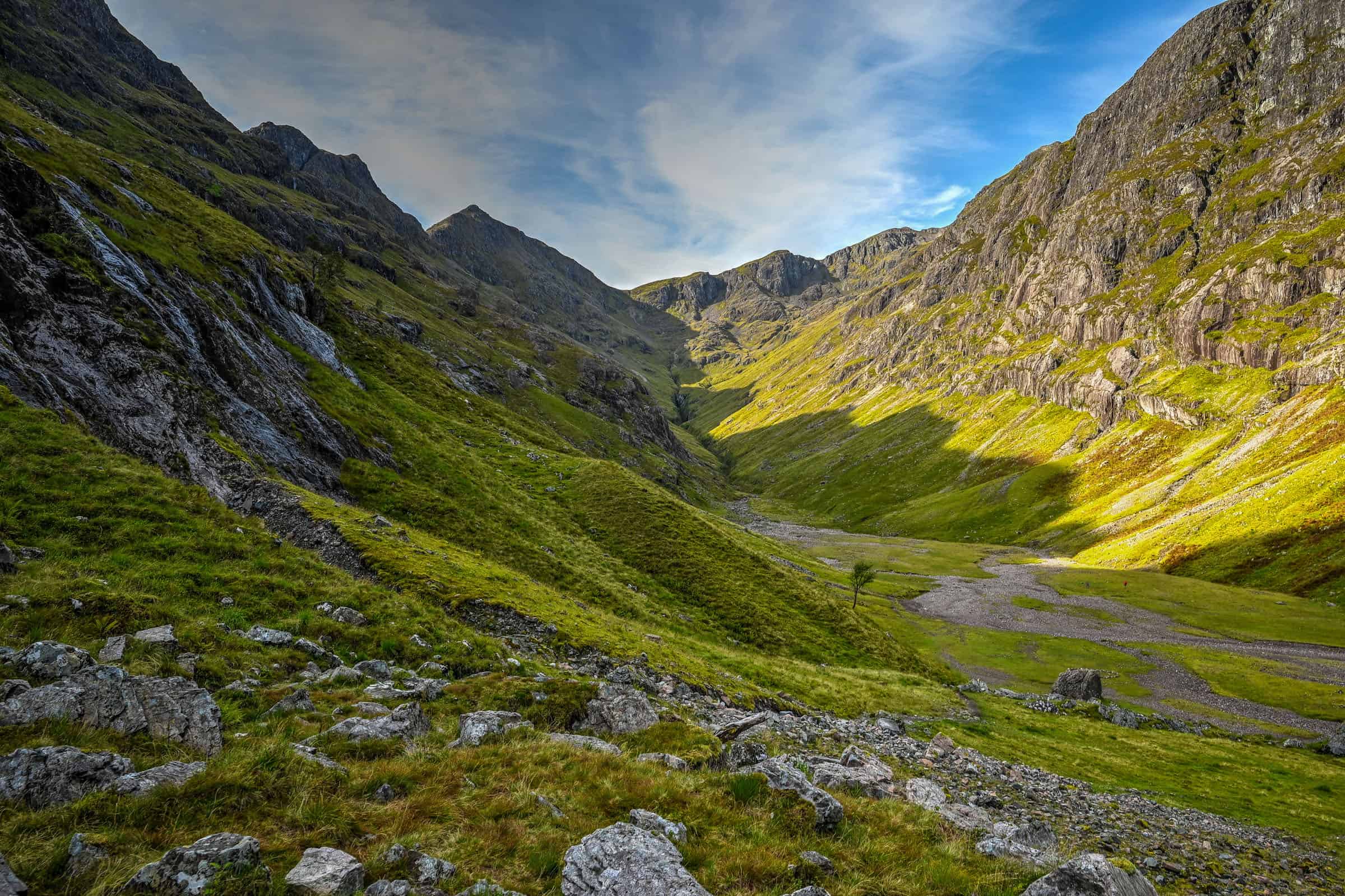
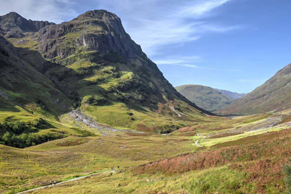
The Lost Valley (Hidden Valley) trail in Glen Coe is one of the most varied and memorable hikes in the area, and is one of our favorite trails in Scotland. The Lost Valley trail leads from the valley floor into a secluded basin hidden between steep mountains. Along the way, the trail passes through forest, crosses a river, and climbs over rocky sections before opening into a wide, dramatic valley.
The Lost Valley Trail (also known as Coire Gabhail in Scottish Gaelic) is a more hands-on trail than some of the easier routes in Glen Coe, with short scrambly sections and uneven terrain, but nothing overly technical for reasonably fit hikers. This guide explains how to reach the trailhead, what to expect along the route, the best time to hike the trail, and how it compares to other trails in the area.
Lost Valley (Hidden Valley) Trail – At a Glance
A varied and hands-on Glen Coe walk
This trail combines multiple terrain types in a relatively short distance, from forest paths and river crossings to rocky sections and light scrambling.
Leads to a secluded alpine-style valley
The route opens into a wide, hidden basin surrounded by steep peaks, the highlight of the hike and a very different landscape from the valley floor.
More engaging than typical valley walks
Expect uneven ground, boulders, and a few sections that require using your hands, making this feel more adventurous than easier trails like the Old Military Road.
Located beside the Three Sisters
The trailhead sits directly below one of Glen Coe’s most iconic viewpoints, making it easy to combine with roadside stops.
Trail difficulty: Moderate (short scrambling sections)
Time required: 2h–2h30 round trip


Disclosure: This page (Lost Valley Hiking Guide) may contain product affiliate links. At no additional cost to you, we may receive a commission for purchases made through these links. More details can be found on our disclosure and policies page.
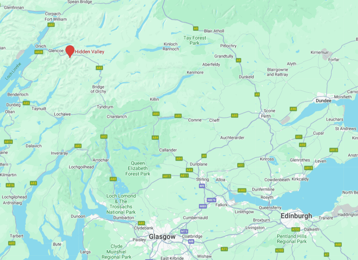
The Lost Valley (Hidden Valley) Location & Map
The Lost Valley trail is located in the heart of Glen Coe, one of Scotland’s most beautiful and dramatic valleys, and is one of Scotland’s most popular hiking and walking areas.
How to get to the Lost Valley Trail
By Car: Getting to the Lost Valley trailhead is simplest with your own vehicle. It is about a 35 km drive (30 min) to get here from Fort William. From Oban, it is about a 65km drive (60 min). Getting to the Lost Valley trail from Glasgow or Edinburgh will take quite a bit longer, roughly 2h and 2h30, respectively. If you are staying in Glencoe village, it’s only a short 10-minute drive to the trailhead.
For advice and tips on how to drive in Scotland, especially if you are not used to driving on the left-hand side of the road, check out our Scotland Roadtrip Driving Guide.
If you haven’t booked your rental vehicle yet, we highly recommend using Discover Cars to get the best rates on your rental in Scotland.
We also highly recommend Airalo (eSIM card) for your connectivity needs when travelling abroad. Airalo is the world’s first and largest eSIM store with eSIM plans for 200+ countries and regions worldwide.
By Public Transit: At the moment and to our knowledge, no public transportation option will take you directly to the Lost Valley Trailhead. City Link runs several buses into Fort William from Oban, Glasgow and Edinburgh, most of which will stop in either Glencoe Village or nearby Ballachulish. Things get more challenging from there, however. Your best option would be to hire a local taxi to get to the trailhead and pre-arrange a pick-up afterwards. We wouldn’t recommend trying to walk to the trailhead from Glencoe Village, as it’s a 9km stretch of road with a very narrow shoulder.
Arrival, Parking and Lost Valley Trail Access Fees
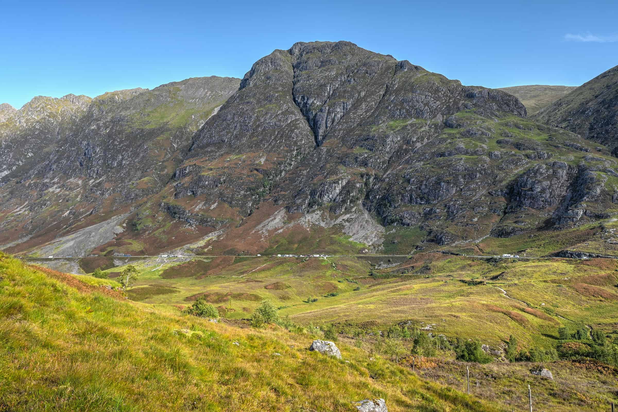
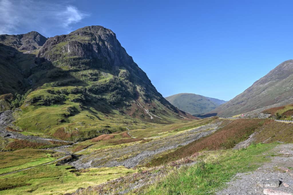
Parking lot: The closest parking lot to the trailhead, the Three Sisters Car Park (link to Google Maps), is not particularly large and can fill up quickly during the day – particularly because many use it as short-term parking for quick photo stops of the Three Sisters of Glen Coe, a beautiful set of three side-by-side peaks in the Glen Coe Valley.
If you don’t arrive early enough, you might need to park in one of the other nearby parking lots, such as the Aonach Eagach Car Park (link to Google Maps) or Hidden Valley Car Park (link to Google Maps). Both of these car parks are just a few hundred meters away from the Three Sisters Car Park and connect with the Lost Valley trail via the Old Military Road trail – ironically, the Hidden Valley Car Park is further away from the Hidden Valley trail than is the Three Sisters Car Park.
Trail Hours: The trail is also open 24 hours a day, 7 days a week.
Trail Costs: Hiking the trail is free, as is the car park (2025).
Trail Facilities: The nearest public toilets are in Glencoe Village and Ballachulish (link to Google Maps), a ten-minute drive to the west, or near the Kinghouse Hotel (link to Google Maps), a 10-minute drive away to the east.
The Lost Valley Trail Details and Map
Distance: 4.8 km
Route Type: Out & back
Elevation gain: 230 m (cumulative elevation gain: 275 m)
Start point: Three sisters car park
AllTrails rating: (4.8, 2867 ratings (2025))
Duration: Most people complete the trail in about 2h-2h30
Not an AllTrails member yet? We highly recommend signing up for either their free or paid membership plans. The free plan allows you to find new trails and plan routes but it can only be used while hiking if you have access to mobile data. The paid membership plan (AllTrails+) allows you to download trail maps for offline use and provides live progress updates and off-route notifications.
If you are still uncertain – you should know that the All Trails mobile application was voted the 2023 iPhone App of the Year by Apple.
We find that AllTrails is a great tool to have when hiking, particularly for assisting with navigation when the trail is hard to locate and to help monitor your progress along the trail, which helps estimate how much time you’ll need to complete the trail.
Other Lost Valley Trail Details
– Canine companions: Dogs are permitted on leashes.
– Summit: No summits will be ascended during this hike. The highest point on the trail is at an altitude of 380 m.
– Trail environment: A mix of forest with partial tree cover and open moorland.
– Number of viewpoints: The trail boasts several viewpoints due to the open nature of the trail, particularly once in the Lost Valley proper.
– Trail Surface / Technical Trail: The main challenge of the Lost Valley trail relates to the technical nature of the hike. The trail is often characterized by rocky ground, boulders, and steep climbs, which occasionally require some light scrambling (meaning that you will need to use your hands to scramble over some large boulders).
Some brief sections of the trail have very slick ground with sharp drop-offs, so caution needs to be exercised, particularly in damp weather.
– Average trail slope grade: 11%. However, the first and last sections of the trail are relatively flat, meaning that the average slope grade of the middle ascending section is closer to 20%, which is quite steep.
– Trail difficulty level assessment: Moderately Challenging.
(based on our personal assessment, taking into account the trail length, slope grade and trail surface – 5-point difficulty scale: Very easy, Easy, Moderate, Moderately Challenging, Challenging)
While quite short, the Lost Valley trail has a very steep middle section with a challenging trail surface.
The Lost Valley Trail Summary
Despite the trail difficulties and challenges above, we feel that most people should be able to manage these sections. Great care should still be taken in the short sections where there is a steep drop-off from the path, particularly during wet and rainy conditions. If you have hiking/trekking poles, this is a good trail to make use of them. Most people take between 2 hours and 2h30 to complete the trail.
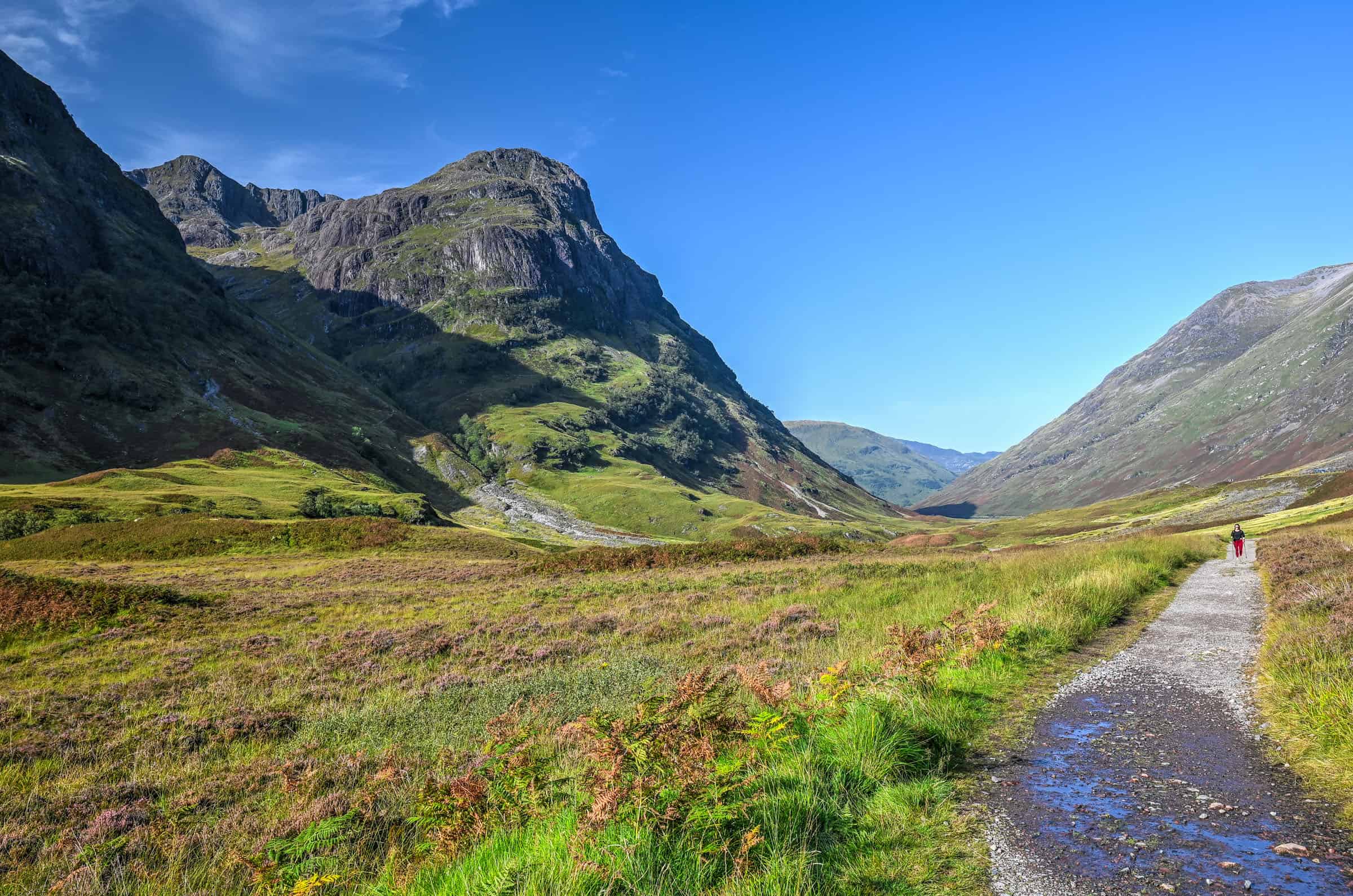
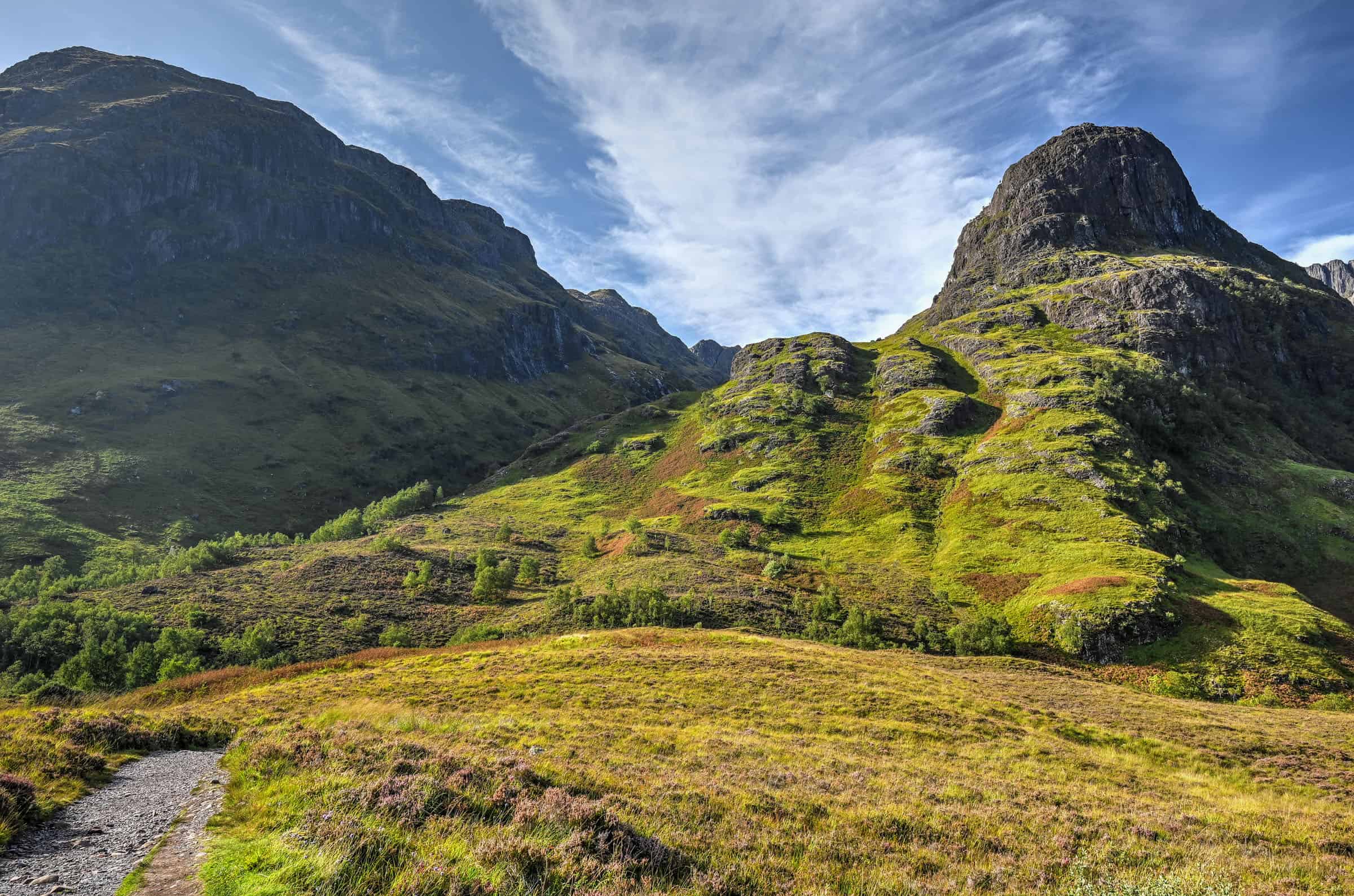
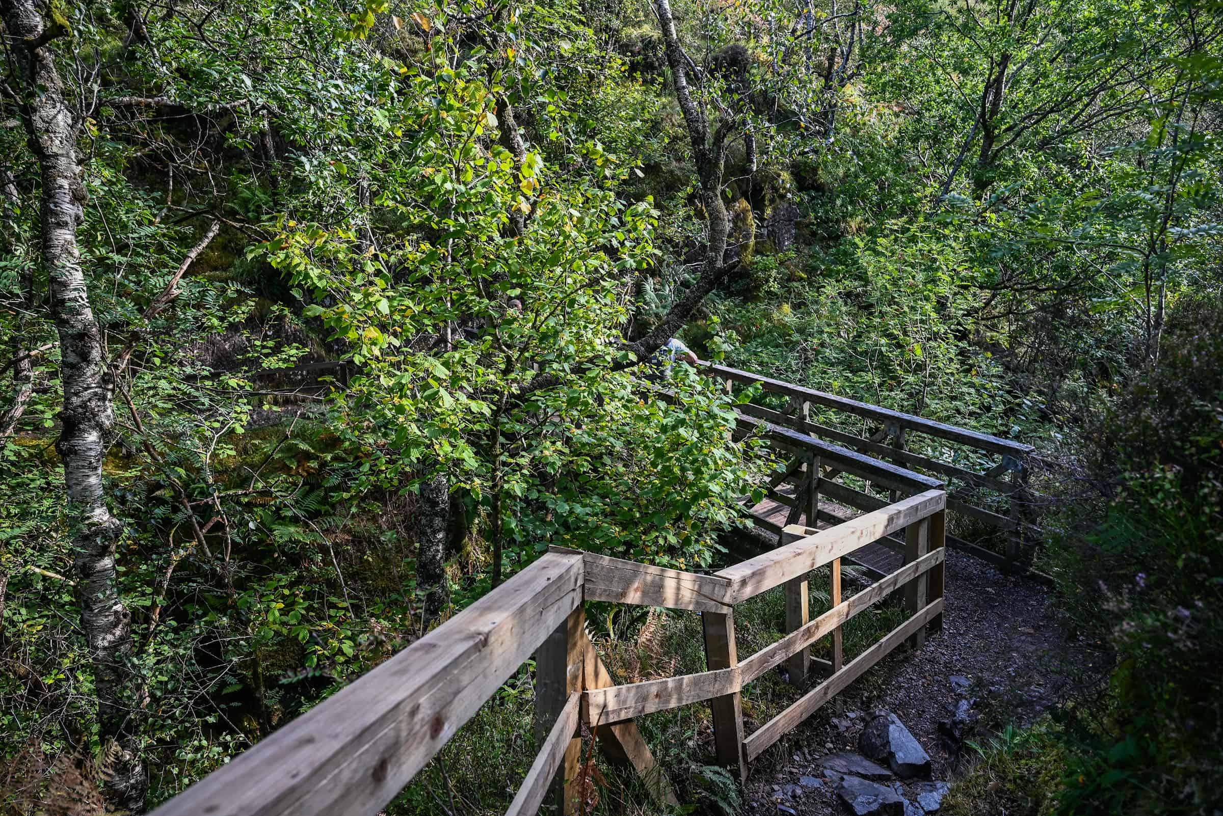
From the car park, the trail descends slightly and connects with the Glencoe Old Military Road Trail (first picture below). From here, you want to turn left and follow the trail as it slowly turns right towards the Lost Valley (second picture below). Going right will follow the Old Military Road Trail, which runs parallel to the main road through Glen Coe (A82).
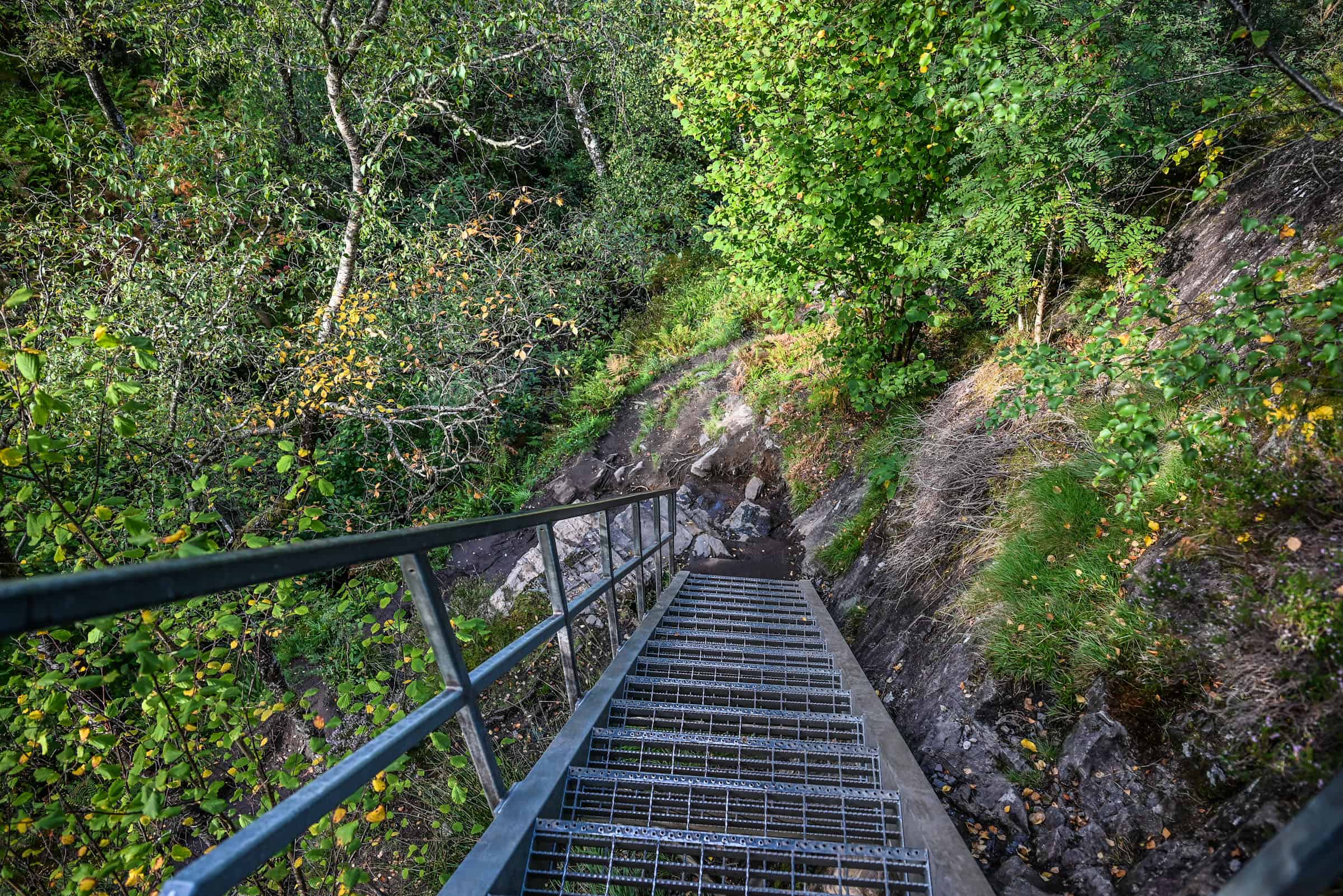
About a few hundred meters later, you’ll come across a metal staircase, which you’ll need to descend to then cross a wooden bridge across the River Coe. The metal staircase is fairly steep and will easily become slippery when damp, so care should be taken when descending after a period of rain.
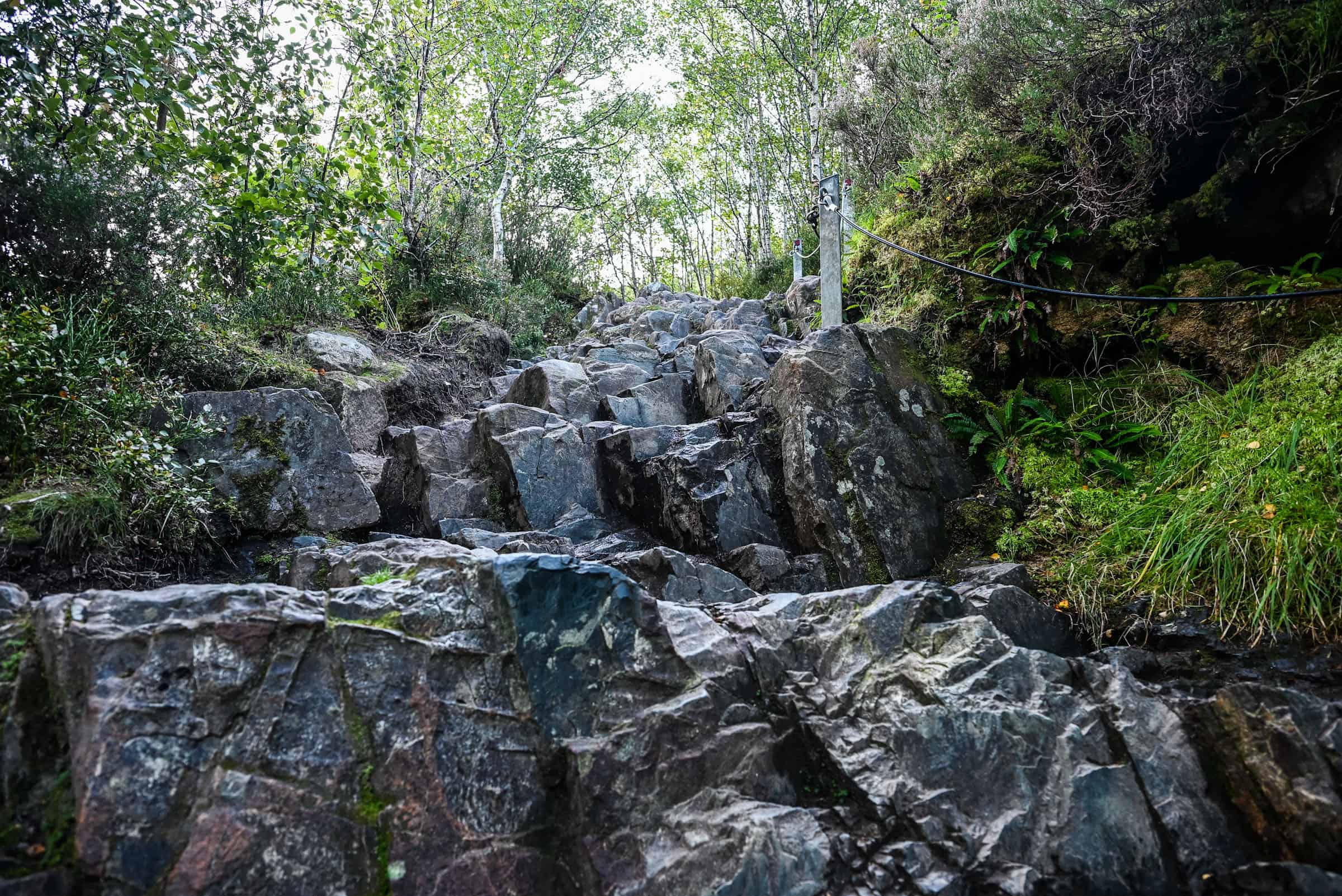
As you emerge from the other side of the bridge, you will come across one of the first challenges of the trail, a section of large boulders that ascend fairly steeply, which acts as a very uneven staircase; a metal handrail has been placed along the right side of the rock face to assist with the ascent/descent of this rocky section. This section might be a bit difficult for those with bad knees, and hiking poles could come in handy.
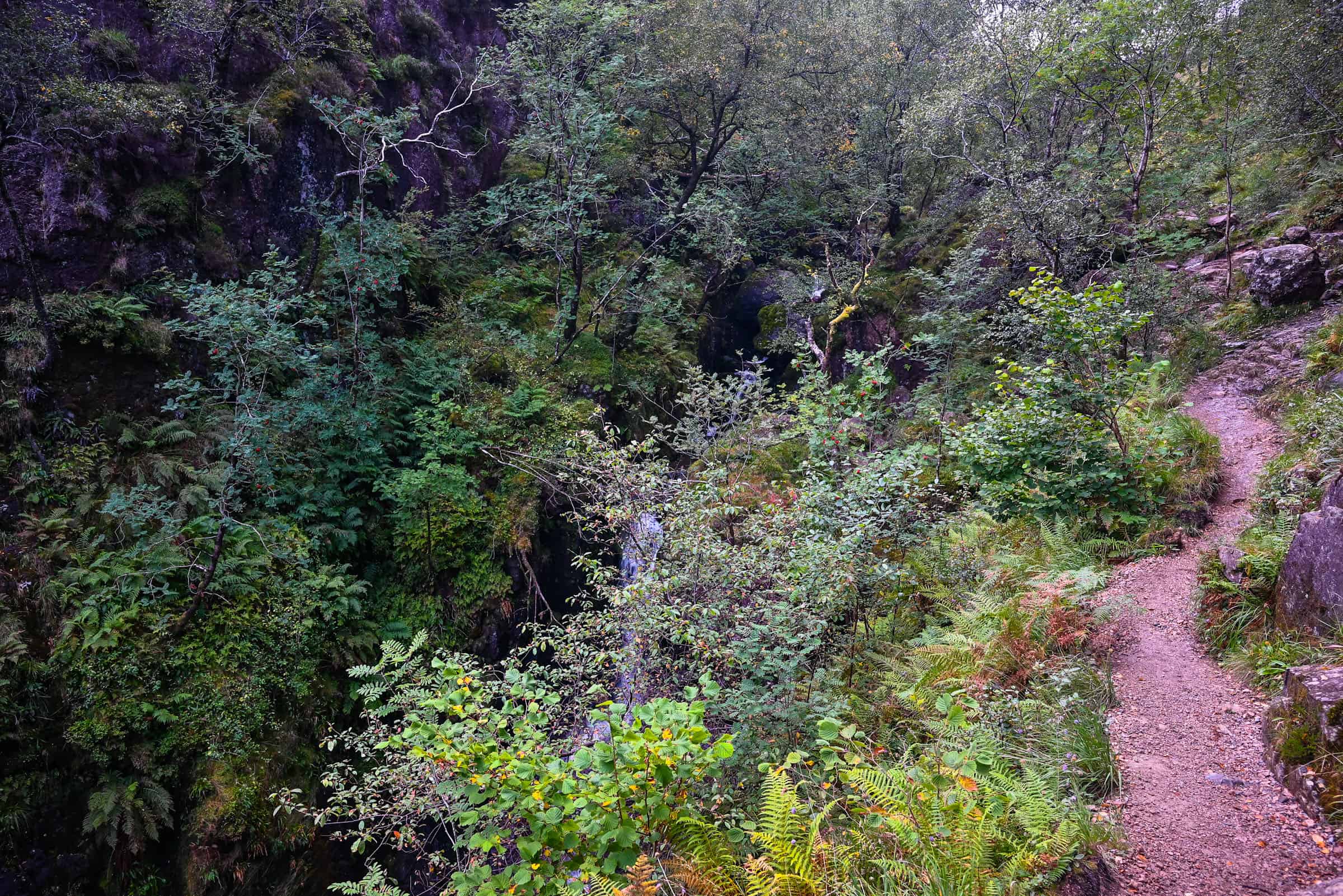
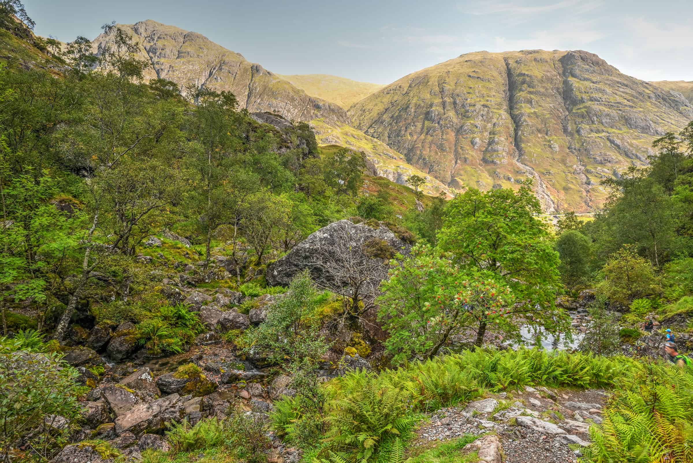
After the rocky section, you’ll go through various forested sections that are quite lovely. Eventually, after climbing several stone step sections, you’ll emerge along a narrow ridgeline section with the river below you to your left. This is a spot where you have to exercise caution if the trail is wet and slippery; the drop-off to your left is quite steep.
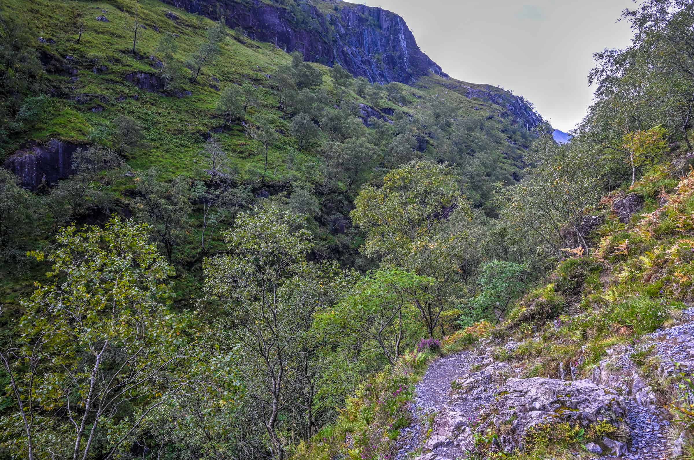
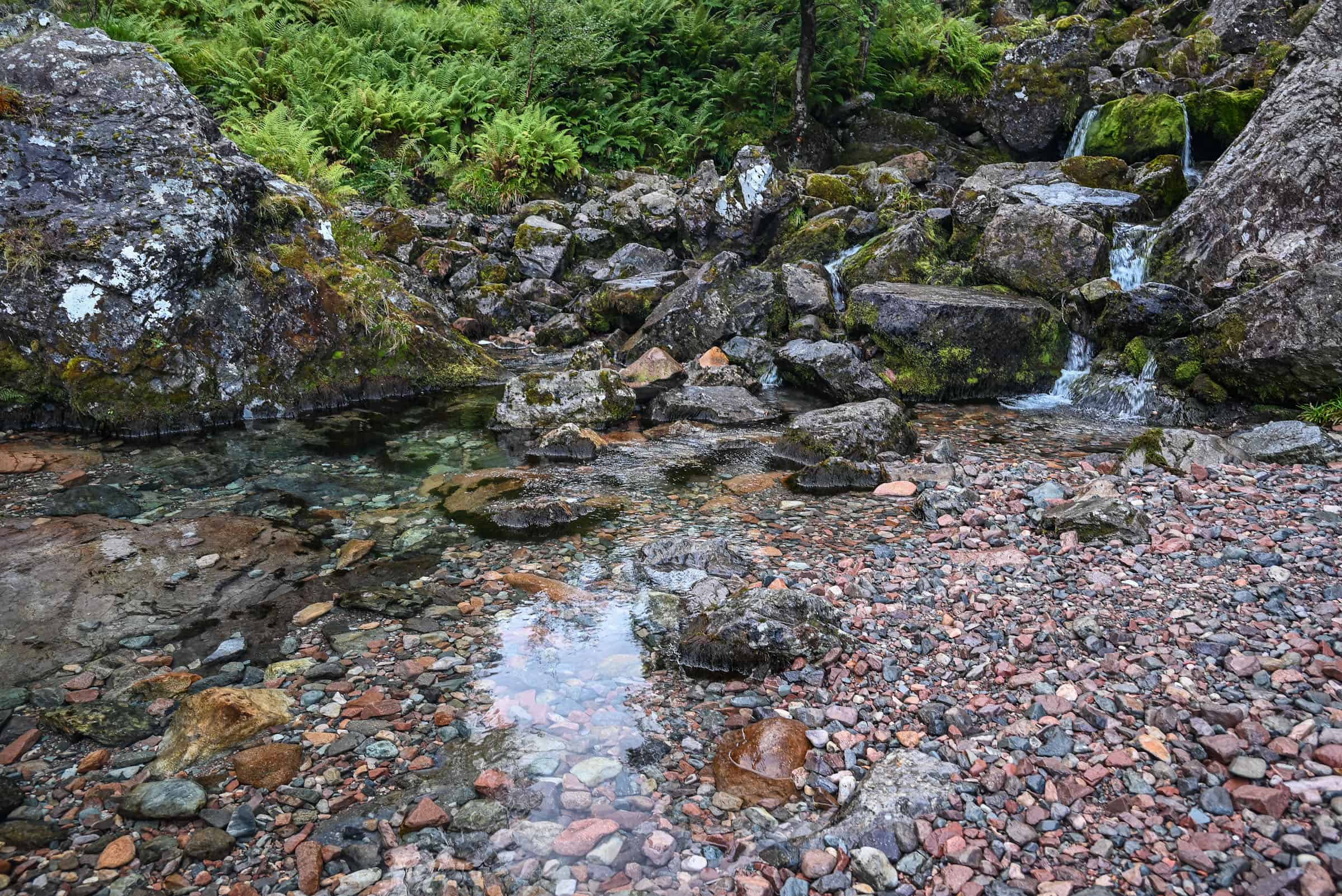
Eventually, you’ll reach a point where you need to cross the river (which is very shallow at this point) to continue. This is fairly straightforward, as several rocks can be used as stepping stones to cross the river.
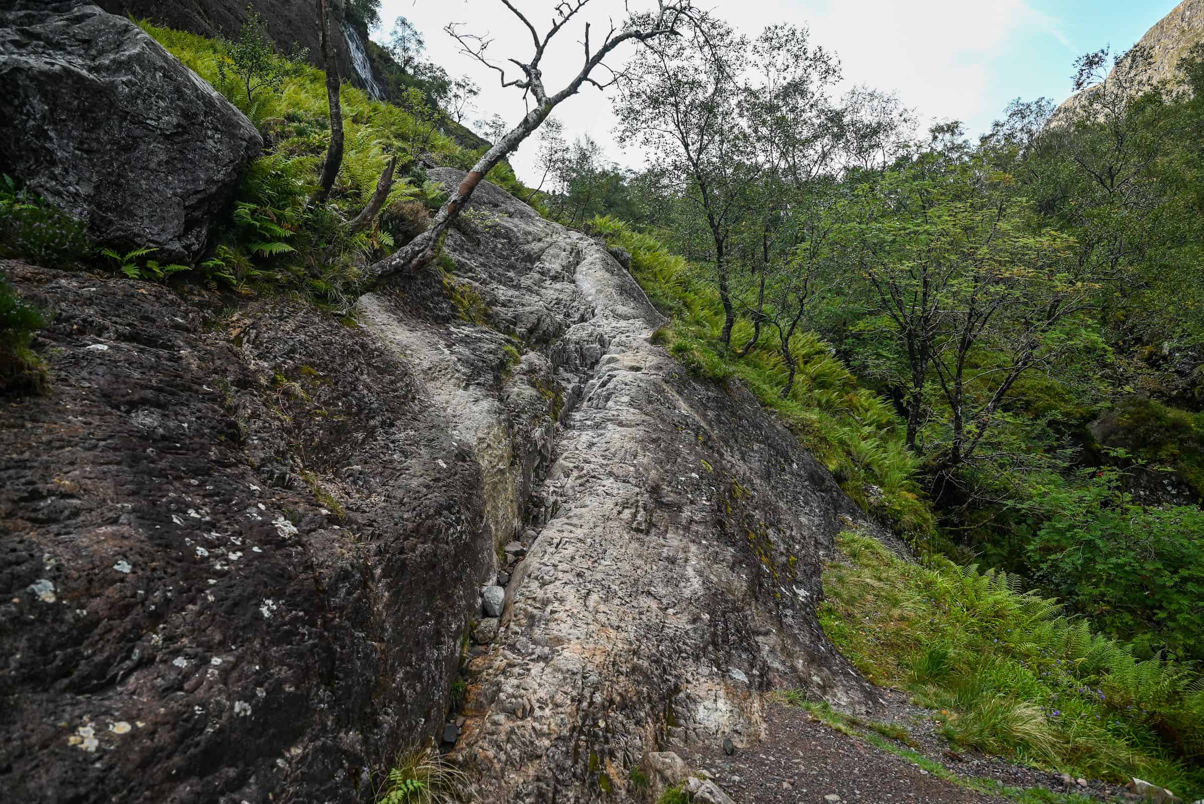
Shortly after the river crossing, you’ll reach a tricky (read slippery) rocky section. Here, the surface has been smoothed by countless hikers descending this section on their bottoms, having left it rather polished and slippery (particularly in wet weather). Please advance through this section with care. Alternatively, you can climb over the rocky section to the left. It’s less slippery, but it definitely requires more scrambling skills.
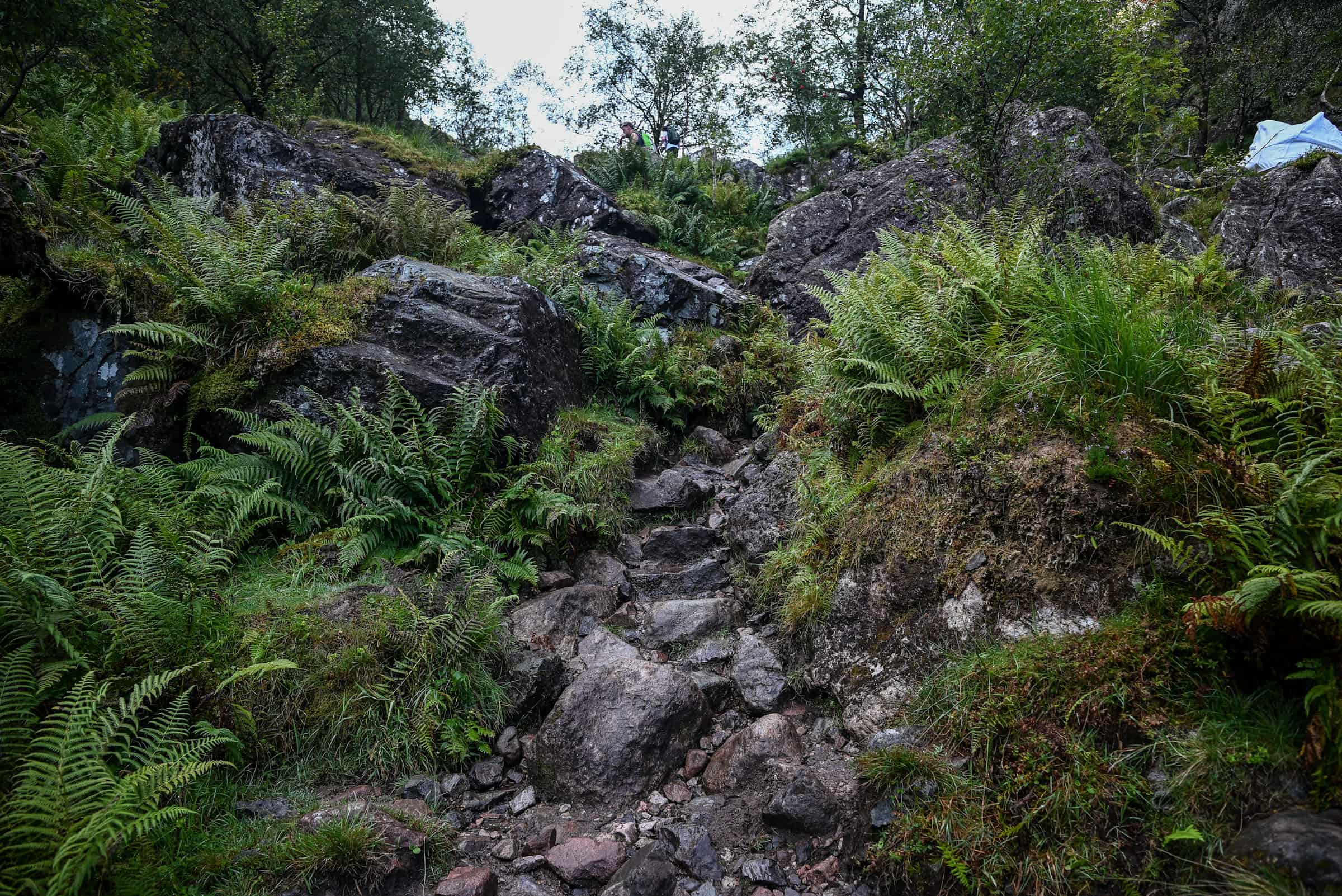
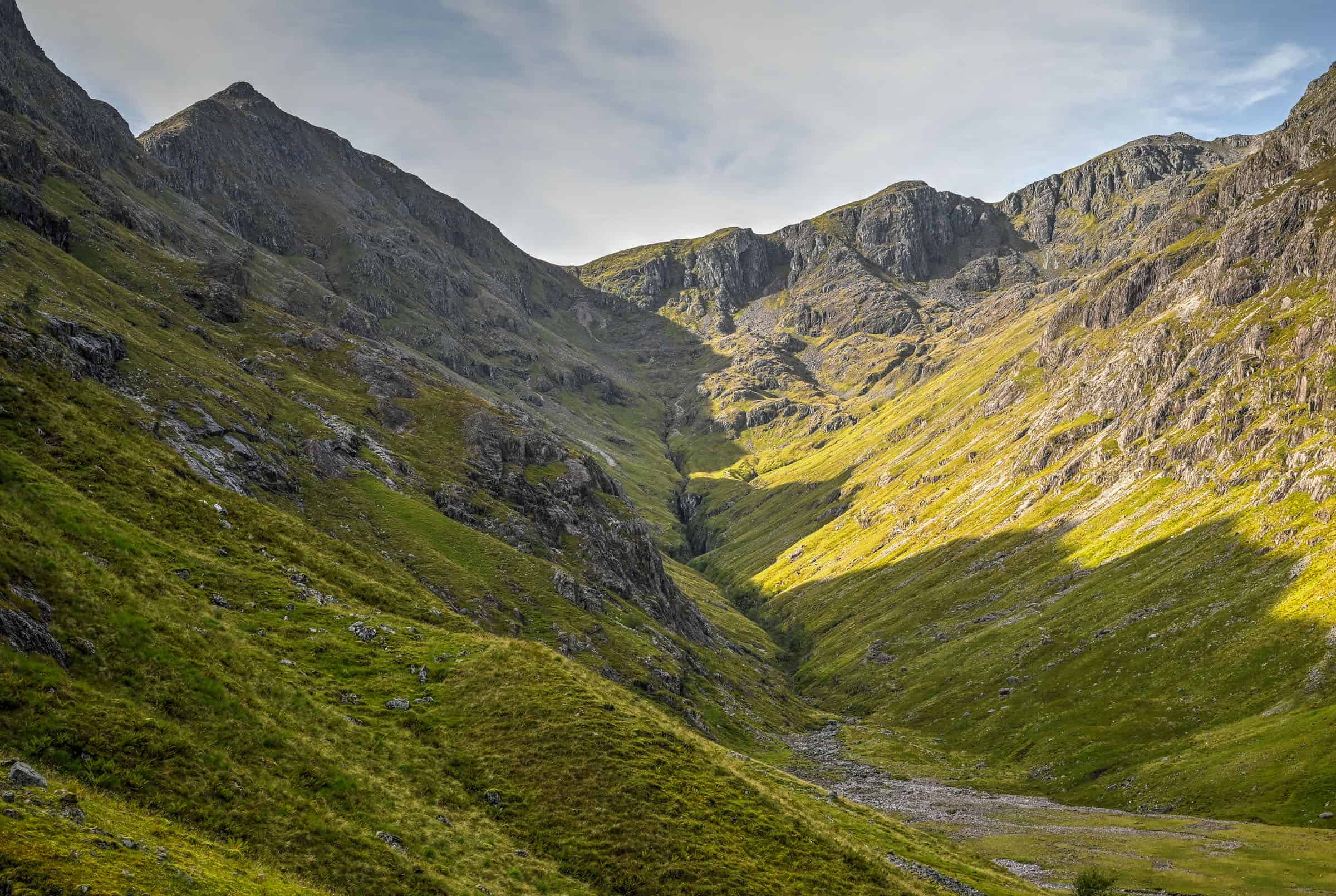
After this, you’ll continue onwards with a few various stone and small boulder sections acting as staircases to climb up, though they are not as difficult as they appear in the picture below – you have already conquered the more challenging sections of the trail at this point.
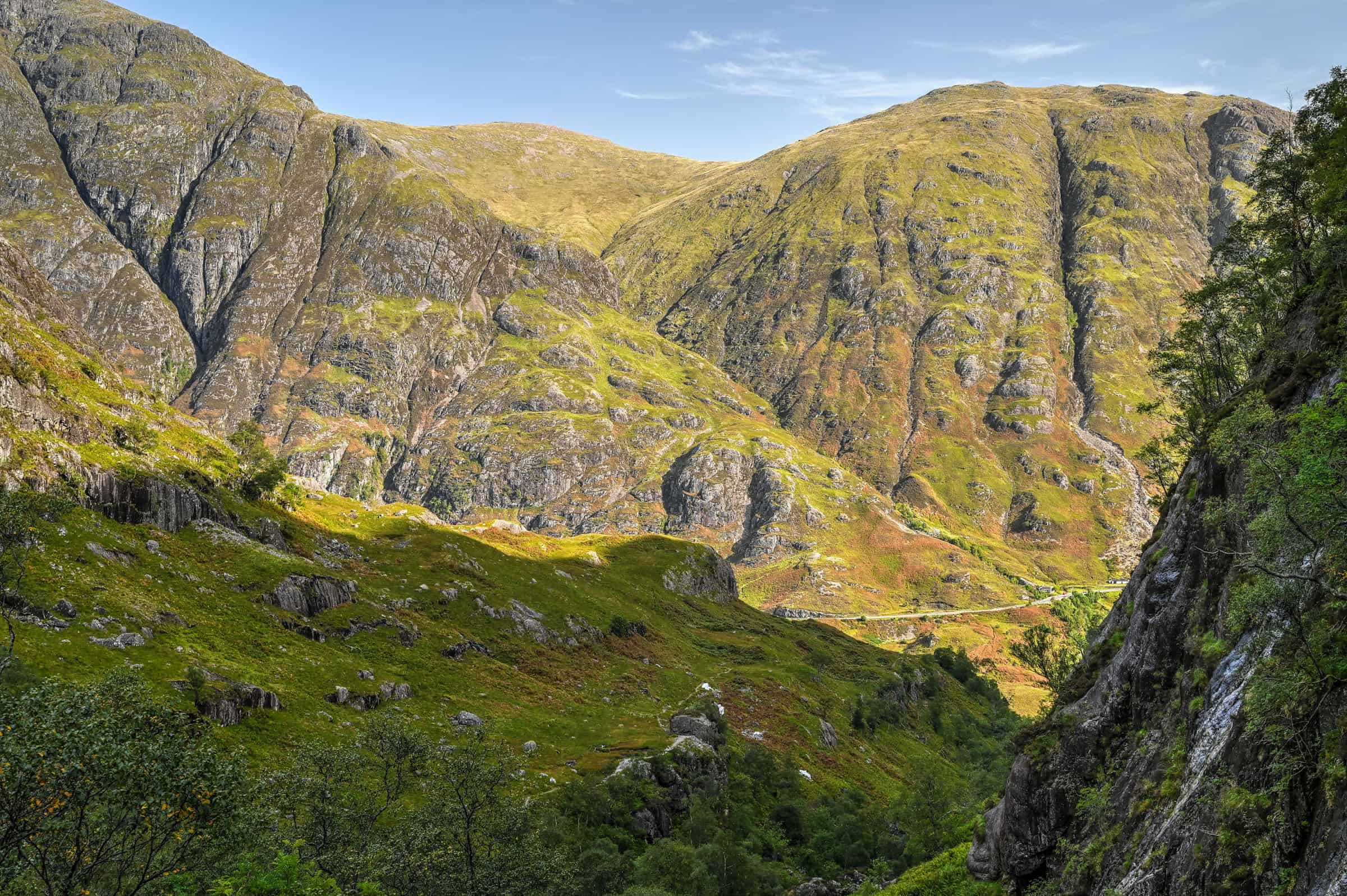
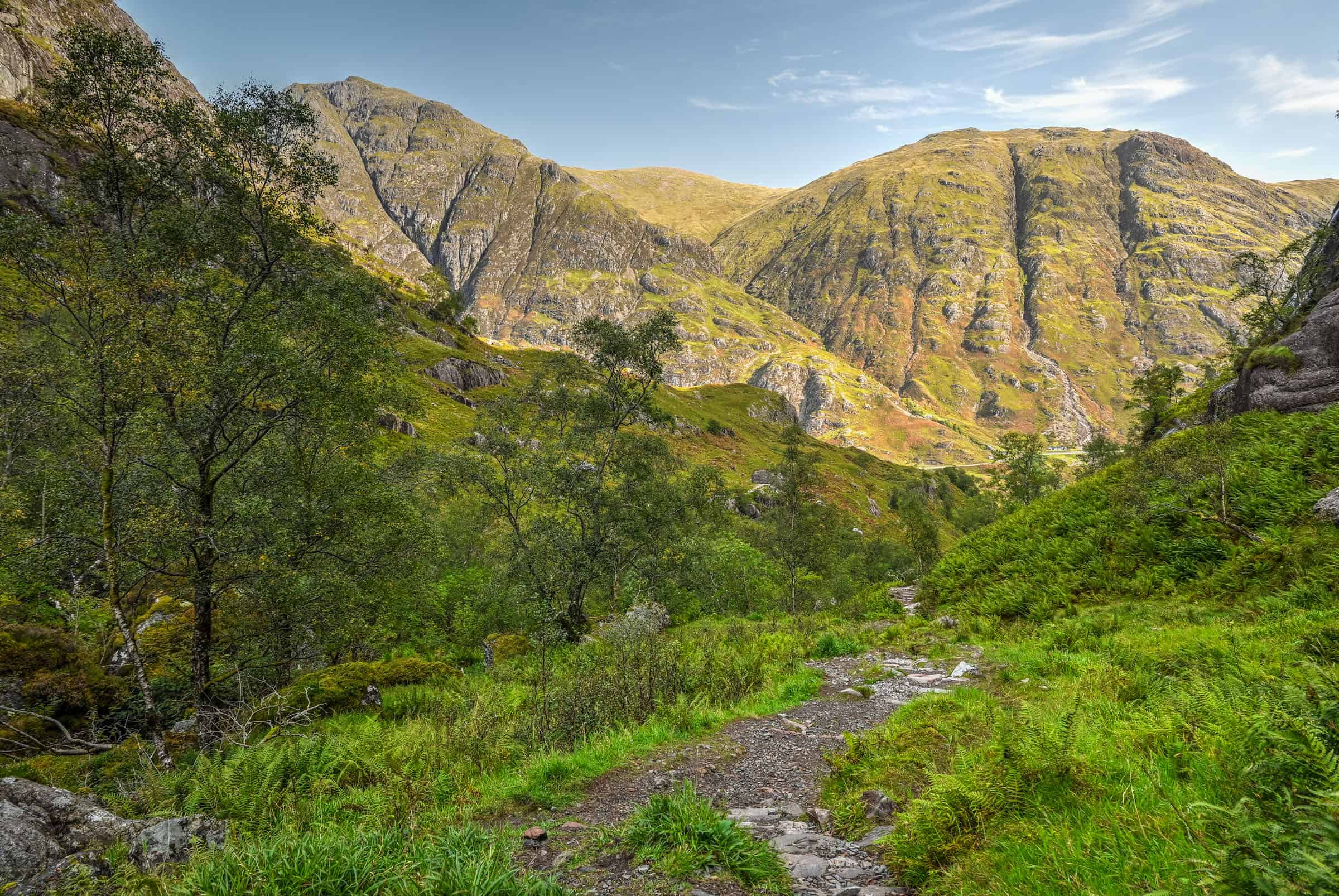
Finally, you will reach a point where the trail opens up and you emerge in the stunningly beautiful green Lost Valley. From here, you can enjoy the view or continue to explore down into the valley floor.
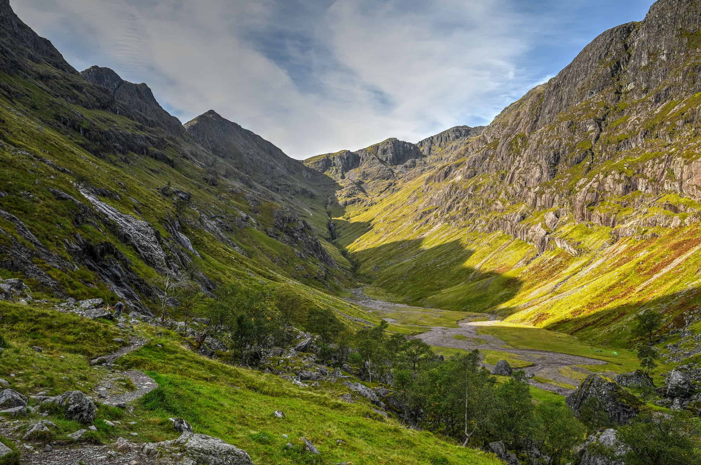
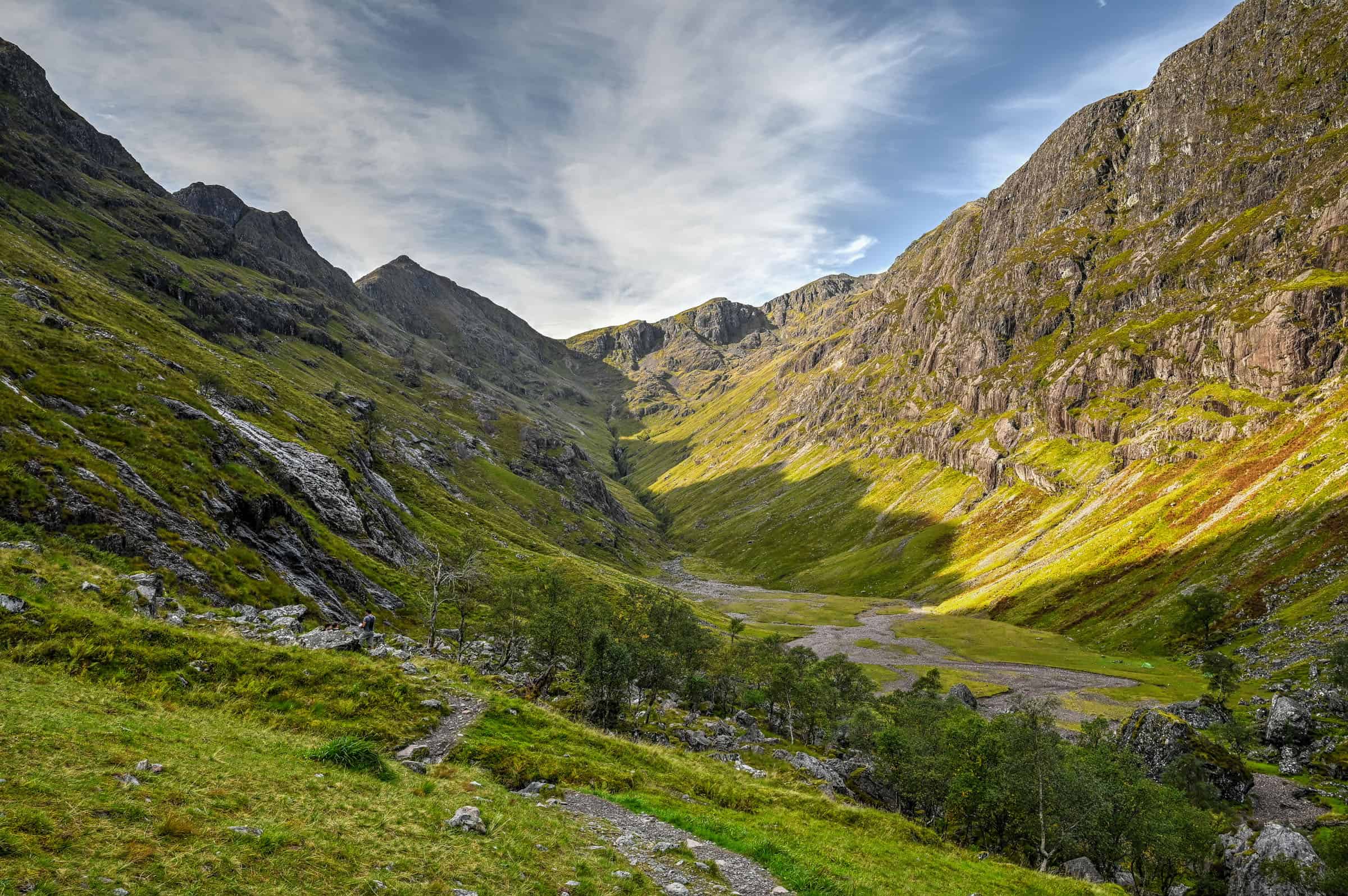
It’s definitely easy to get mesmerized by the valley’s beauty or to think about its historical importance, having served both as a hiding place for stolen cattle by the MacDonalds of Glen Coe and as a refuge for those who escaped the 1692 Massacre of Glen Coe.
Once you’ve decided to make your way back, don’t be too disappointed as there are some great views to be had in the other direction as well, as you will be staring at the other side of Glen Coe Valley.
Is the Lost Valley Trail Worth it?
Why you might like the Lost Valley Trail
-There’s definitely a strong wow factor once you arrive in the Lost Valley.
-It’s a hike that offers a nice challenge without being too strenuous, as the trail is rather short.
-The scenery is both spectacular and varied all along the trail. It includes forested and open space sections, and you’ll encounter a few easy river crossings (both over bridges and some that will require you to hop over a few rocks)
-The trail doesn’t take too long to complete, leaving you time to do a second trail in the area if that’s something you would be interested in.
Why you might not like the Lost Valley Trail
-If you are looking for the type of sweeping views that you get from reaching a summit, you won’t get those here. You will have partial views of the Glen Coe Valley, which you will mostly notice during the return leg of the hike.
-Several sections of the trail go over very uneven rocky terrain, including some that will require light scrambling over large boulders. If you are not an experienced hiker or have bad knees, you might find these sections overly challenging.
-If there has been lots of recent rain and you are not an experienced hiker, you might find some sections of this trail unnerving, particularly those with steep drop-offs.
Best Time to Hike the Lost Valley Trail
Best Time of the Year
We highly recommend shoulder season (May, June, September and early October). The weather will still be relatively warm and ideal for hiking. Moreover, the trails won’t be as crowded as during the peak summer months, and you will also be outside the peak midge period.
Best Time of Day
From May to October, the best times to do the trail are either early in the morning or in the late afternoon. These are times when the trail is less likely to be busy and, perhaps more importantly, are times when you are less likely to struggle to find parking. You can expect the Lost Valley trail to be very busy between 9 am and 4 pm, particularly on weekends.
Other Tips for Hiking the Lost Valley Trail
- Check the weather before heading out. Our favourite weather app for the area is the Met Office app.
- As this is Scotland, the trail can get boggy and slippery after rain, so do wear appropriate footwear. Some sections have sharp cliff drop-offs, so extreme care should be taken in wet weather. In the winter months, this trail can get very snowy. Proper winter hiking equipment would be advised.
- If coming during the summer months, beware of the pesky little midges (tiny little mosquitoes). You can check the midge forecast beforehand.
- Stick to the designated path to protect the surrounding environment.
Hiking Packing List
All Trails subscription – This comes in really handy for areas with little or no cell reception, as the annual subscription allows you to download trail maps for offline use.
External Battery – If you are using your phone to track your progress along the trail or to help with navigation, you certainly don’t want your phone to die on you. That’s especially true in the unlikely event that you might get hurt or need assistance.
Hiking poles – These can be particularly useful in steep trails or muddy/boggy trail conditions.
Water Filter Bottle – The Life Straw bottle is an advanced water bottle with a filter that not only improves water taste but more importantly filters out bacteria and parasites, chemicals and microplastics.
Headlamp – very practical and a smart choice if you plan to start your hike before sunrise or finish it after sunset.
Trail Variations and Alternatives
Extend your hike with the Old Military Road Trail
Extending your hike by following the Old Military Road Trail will add distance and beautiful scenery to your hike, but without adding much difficulty or elevation gain. Both trails share the same trailhead (and end point since both are out-and-back trails): while the Lost Valley Trail runs perpendicular to the road, the Old Military Road Trail runs parallel to it.


The combination doesn’t exist as a trail on All Trails, but you can easily imagine how it would look by combining both trails below (both trails share the same start and end point). Doing both together would create a trail of 9-10 km in length.
Extend your hike to Stob Coire and Bidean Nam Bian
We’ll quickly preface this by saying this is an incredibly challenging route and should only be undertaken by experienced hikers. The trail has a cumulative elevation gain of 1262m, stretched out over 11.4 km in distance. Navigation can be an issue near the peaks, so an offline map is recommended. To do this trail, instead of turning around once you’ve reached the heart of the Lost Valley, continue onward to climb out of the valley, summit the neighbouring Stob Coire and Bidean Nam Bian peaks, to then complete a long loop through the adjacent valley, following the Allt Coire Gabhail stream down to Glen Coe.
The Lost Valley: Its History and Significance
Coire Gabhail is a high-level glen in the Bidean nam Bian mountain massif to the south of Glen Coe, and as we mentioned before, is more commonly known as the Lost Valley or the Hidden Valley.
The name Coire Gabhail refers to former times when the corrie was used by members of Clan Macdonald (a Highland Scottish clan that lived in Glen Coe between the 14th and 18th centuries) to hide cattle and other livestock, whether their own or stolen from others. Like other clans in the area, cattle were at the center of their economy.
The MacDonalds commonly had feuds with Clan Campbell. This culminated tragically in the 1692 Massacre of Glencoe when Government soldiers, under the command of Archibald Campbell, turned on Macdonald clansfolk allegedly for failing to pledge allegiance to the new monarchs, William III and his wife Mary II. More than 100 soldiers, who had been quartered amicably upon the MacDonalds for more than a week, suddenly attacked them on the cold night of February 13th, 1692, chasing the MacDonalds into Coire Gabhail during a winter blizzard. It is estimated that 30 McDonald’s were killed on that gruesome night.
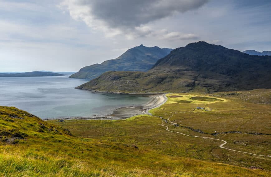
Other Nearby Hiking Trails in Glen Coe
The Lost Valley was one of our two favorite trails in Glen Coe. The other was the Devil’s Staircase. This trail is technically part of the West Highland Way trail (a long-distance walking route through the Highlands), one where you’ll be required to climb 400 m in elevation over a short 2.5 km section of trail. However, despite the intense ascent, the reward at the top is definitely worth the effort. The scenery as seen from the summit is simply stunning, which is why this trail is one of our favourites in the Glencoe area. And like the Glen Coe Old Military trail highlighted above, you have non-stop jaw-dropping views during the entire trail.


Where to Stay Near Glen Coe and the Lost Valley Trail
Glencoe village and Fort William are the two most popular places to overnight when exploring the Glen Coe hiking trails. These are two of the better mid-range accommodation options in the Glen Coe and Fort William areas.
The Glencoe Inn (Glencoe)


The Garrison (Fort William)

Alternatively, we’ve also enjoyed using Oban as a base to explore Glen Coe and the surrounding area (a very scenic 45-50 minute drive away.
Some of Our Other Favorite Trails in Scotland
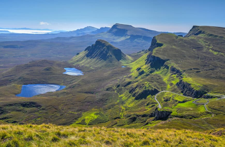
The Quiraing (Isle of Skye)
Located in the northern part of Skye’s Trotternish Peninsula, no area best depicts Skye’s otherworldly landscapes as much as the Quiraing. Shaped by a never-ending landslide lasting millennia, the landscape formations of the Quirang are unlike any other you’ve probably ever seen, so odd-shaped and yet so vividly colorful. What makes the Quirang particularly appealing for some is that you don’t even need to walk very far to get some of the best views the trail has to offer, as many are satisfied with what they see barely a few hundred feet beyond the parking lot. But we highly recommend walking the full trail, as this was our favorite one in Skye. For more information on exploring the Quiraing, check out our Quiraing Trail Guide.


The Old Man of Storr (Isle of Skye)
The Old Man of Storr, a towering pinnacle and an iconic landmark of the Isle of Skye, is where you can experience one of Scotland’s most spectacular hiking trails. Although you have probably seen many pictures of the area before, there is definitely something special about seeing it with your own two eyes. The trail is located, like the Quiraing trail, in the Trotternish Peninsula, not far from Portree. The trail leading up to the iconic Old Man of Storr was one of our favorites in Scotland, let alone Skye. Although a moderately challenging uphill trail, the walk up to the main viewpoints isn’t particularly long. The walk and views of the surrounding landscape are particularly beautiful in the early morning around sunrise. For more information on exploring this iconic trail, check out our Old Man of Storr Guide.


Camanusary Bay (Isle of Skye)
Of the many walks and hikes we did on Skye, Camasunary Bay is probably the one that surprised us the most. It starts by meandering through fields filled with grazing sheep and then slowly goes up and down through rolling hills with beautiful views of the nearby Cuillin mountains, until a final ascent takes you to a plateau where a stunning coastal and beach vista awaits. It’s a moderately long trail, but not particularly difficult in terms of elevation gain. The trailhead is located in southern Skye, near the town of Elgol, 60km south of Portree. We were very surprised by how few other people we saw on this trail, given how beautiful the scenery is. For more information on exploring this Skye hidden gem, check out our Camanusary Bay Guide.


The Isle of Kerrera (near Oban)
Although its Hebrides Isle neighbours of Mull, Iona, Jura and Islay are more famous and well-known, Kerrera should definitely not be overlooked when visiting Oban. It’s a land of lush and green rolling hills with a beautiful walking trail from which to admire it, and there’s also a stunning hilltop castle ruin to visit and a delightful tea garden from which you can relax and enjoy the beautiful island scenery. Located less than a mile from the shores of Oban, a walk on the Isle of Kerrera is truly a wonderful way to spend a day in the Oban area. For more information on visiting Kerrara, check out our Isle of Kerrera hiking guide.


Glenfinnan Viaduct Loop (west of Fort William)
Easily one of the most beautiful railway bridges in the world, let alone the UK, the Glenfinnan Viaduct has skyrocketed to the top of many travel bucket lists since appearing in the Harry Potter films and makes for an excellent day trip from Fort William. The setting becomes even more spectacular when the Jacobite steam train (a.k.a. the Harry Potter train or the Hogwarts Express) passes over the viaduct. There’s more to see and do in Glenfinnan besides the viaduct, including a lovely church and a great short hiking trail offering stunning views of Loch Shiel. For more information on visiting the Glenfinnan Viaduct, check out our Glenfinnan Viaduct Travel Guide.


Preparing a trip to the Highlands?
You might be interested in these pages:
Top Things to See and Do in Glen Coe
Best Hikes and Walks in Glen Coe
Glenfinnan Viaduct and Jacobite Steam Train Travel Guide
Top Things to See and Do on Skye
Skye’s Best Hiking and Walking Trails
Preparing a trip to Scotland?
You might be interested in these Scotland pages:
10-Day Scotland Roadtrip Itinerary (Edinburgh and Highlands)
Scotland Driving Guide and Tips
7 of the Best Castles to Visit in Scotland
Best Things to See in the Scottish Highlands
Best Hikes to do in the Scottish Highlands
We also highly recommend these guidebooks:
Rick Steves Scotland
Lonely Planet Scotland’s Highlands
Photography Gear
If you like our photography, you might be interested in some of the gear we use to shoot our travel and hiking destinations.
Camera Body – Nikon Z 6ii Fx-series Mirrorless Body
Main Lens – NIKON 24-120mm F/4G ED VR AF-S
Zoom Lens – Sigma 745-306 150-600mm f/5-6.3
Polarizing filters – Urth Circular Polarizing (CPL)
Camera Tripod – K&F Concept 64-inch Camera Tripod
Mini-tripod – Lammcou Flexible Camera Tripod
Camera/hiking backpack – Vanguard Alta Rise 48 Backpack
Universal Travel Adapter – VYLEE Universal International Power Travel Plug
Other Travel Essentials
Travel Insurance
SafetyWing is a travel insurance company that offers comprehensive coverage for travellers. Includes Medical Insurance and Travel Insurance. Primarily geared towards long-term travellers, digital nomads, and expats.
e-Sim cards
Airalo is the world’s first and largest eSIM store with eSIM plans for 200+ countries and regions worldwide. With Airalo eSIMs, travellers can get connected the moment they land at their destination and avoid nasty data roaming charges
eSIMS are a sustainable alternative to single-use SIM cards – they are 100% digital, require less energy to produce and be re-used rather than disposed of.
Car Rentals
Discover Cars is our go-to website for car rentals. We almost always find our preferred rate there.
Transfer from Airport
Welcome Pickups is our favourite private transfer service, which you can pre-book at a fixed price. Currently available in 220 cities all over the world (mostly in Europe, but with several major cities in Asia, the Middle East and the US).
Kiwitaxi is another private transfer service – we haven’t tried it yet, but it’s currently available in a few more countries (102 as of 2024).
Hotels and Accommodations (coming soon)
Photography Prints
If you found this blog useful, you can help support our blog by purchasing low-cost digital prints. Printed physical prints are also available for purchase.


—–
—–
Well, that wraps it up! We hope you enjoyed our Glen Coe Lost Valley Hiking Guide and that it will prove useful for planning your trip to the beautiful Scottish Highlands.
—–
You might also be interested in these related pages:
1 Comment