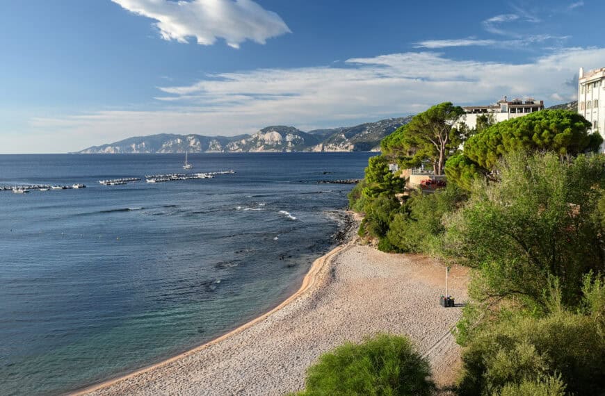
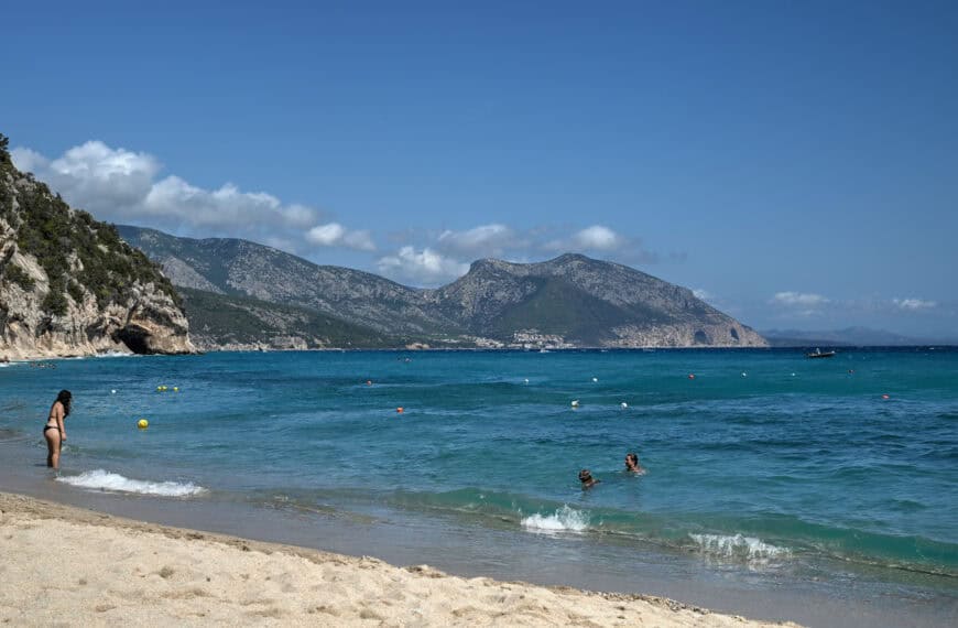
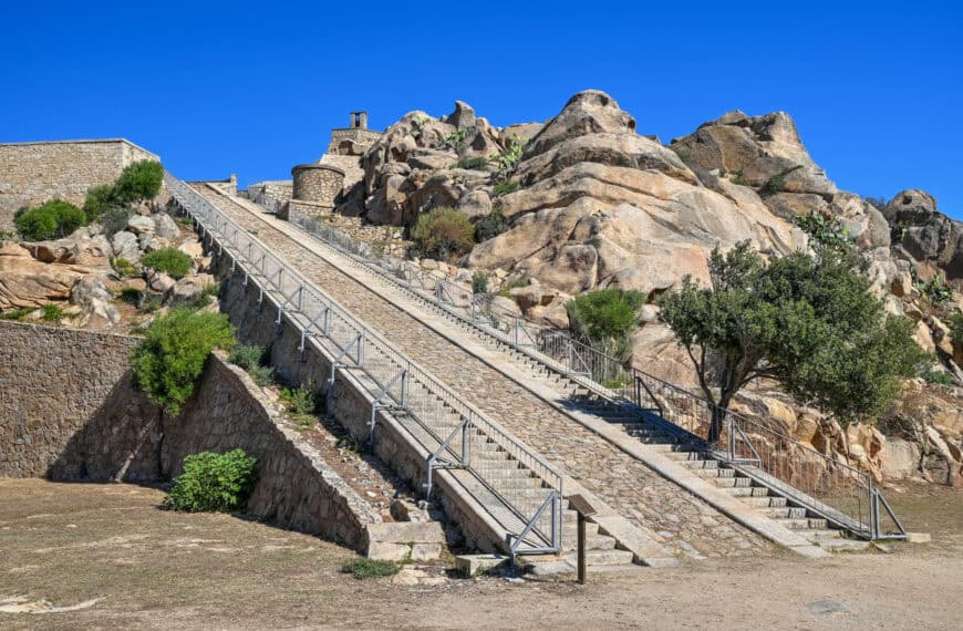
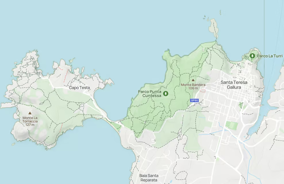
Punta Contessa is a small but scenic coastal park just west of Santa Teresa Gallura, Sardinia, with a network of walking trails, viewpoints, abandoned military structures, and some of the best elevated views toward Capo Testa. Several trails criss-cross the park, mostly running in a north-south direction, including the Sentiero Natura trail.
For us, the main reason to hike here is the variety of views. Near the southern end of the park, the trails lead to a belvedere with beautiful aerial views over the Capo Testa peninsula. Farther north, the paths reach viewpoints overlooking Isola di Municca, the rugged coastline, and, on clear days, Corsica in the distance.
To help you plan your time in the park, understand how the trails connect, and find the best viewpoints, we put together this guide to hiking in Punta Contessa.
Hiking in Punta Contessa Park – At a Glance
Location
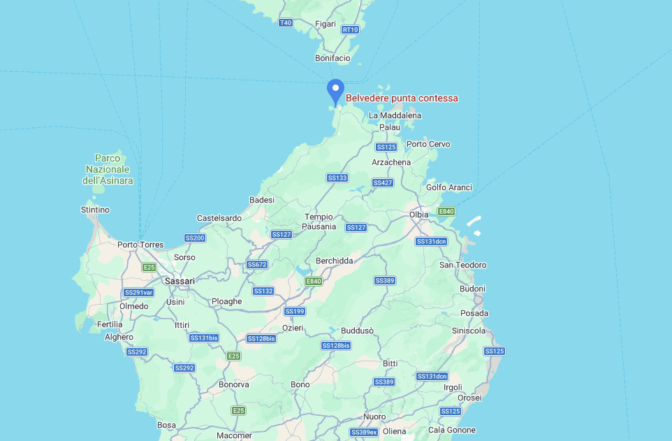
Punta Contessa is located just west of Santa Teresa Gallura, between the town and the Capo Testa peninsula.
Trail Network
Several trails criss-cross the park, with many of the main paths running roughly north to south. This makes it possible to create short loops, out-and-back walks, or a longer route connecting Santa Teresa Gallura with Capo Testa.
Main Highlights
– Belvedere with elevated views over Capo Testa near the southern end of the park
– Viewpoints toward Isola di Municca and Corsica near the northern end
– Abandoned military structures and outposts in the central part of the park
Time Required
Plan for around 1–2 hours for a shorter walk focused on the viewpoints, or longer if you want to connect Santa Teresa Gallura with Capo Testa on foot.
Good to know
The trails are generally not too difficult, but they can be rocky, uneven, and narrow in places.


Disclosure: This page (Punta Contessa Park) may contain product affiliate links. At no additional cost to you, we may receive a commission for purchases made through these links. More details can be found on our disclosure and policies page.
Punta Contessa: Location, Map, and How to Get There
Punta Contessa is located just west of Santa Teresa Gallura, between the town and the Capo Testa peninsula. While there are a few small car parks along the road that runs parallel to the park, Punta Contessa is most easily reached on foot, either from Santa Teresa Gallura or Capo Testa.
If you need to book a rental vehicle for your travels, we highly recommend using Discover Cars to get the best rates on your rental in Sardinia.
We also highly recommend Airalo (eSIM card) for your connectivity needs when travelling abroad. Airalo is the world’s first and largest eSIM store with eSIM plans for 200+ countries and regions worldwide.
How to Access Punta Contessa
Punta Contessa can be reached from several different access points, depending on where you are starting and what part of the park you want to explore. If you are staying in Santa Teresa Gallura or using the trails to connect to Capo Testa, we recommend one of the following four access points.
Via Romagna, Santa Teresa Gallura
This is one of the easiest access points if you are staying in Santa Teresa Gallura. At the end of Via Romagna (Link to Google Maps), the road gives way to a trail leading into the northern side of the park. This is the best access point if you want to reach the viewpoints toward Isola di Municca and Corsica without starting farther south.
Near the split between Strada Lu Patru and Strada dell’Acquedotto
Another useful access point is near where Strada Lu Patru and Strada dell’Acquedotto split, just off Via Capo Testa (Link to Google Maps). This is also convenient from Santa Teresa Gallura and gives access to the central part of the trail network. It is located near Monti Bandera, one of the higher points in the park, though it is more of a broad elevated area than a distinct hiking destination.
Northern Sentiero Natura Trailhead
About halfway between Santa Teresa Gallura and Capo Testa, there is a small roadside parking area along Via Capo Testa, with space for roughly 6–8 vehicles (Link to Google Maps). This marks the northern end of the Sentiero Natura route and is a useful access point if you want to explore the central and southern parts of Punta Contessa without starting directly from town.
Southern Sentiero Natura trailhead near Capo Testa
A second small roadside parking area, also with space for roughly 6–8 vehicles, is located farther south along Via Capo Testa (Link to Google Maps), closer to Capo Testa itself. This is the southernmost access point and the most convenient option if your main goal is to hike the Sentiero Natura, reach the Punta Contessa belvedere, or continue toward Capo Testa on foot.
Punta Contessa Highlights
Punta Contessa Belvedere
The Punta Contessa Belvedere is located in the southern part of the park and is one of the main highlights of the trail network. From the main path, a short side trail and a wooden staircase lead to a large open rocky outcrop with beautiful aerial views toward Capo Testa and the narrow isthmus connecting it to the mainland.
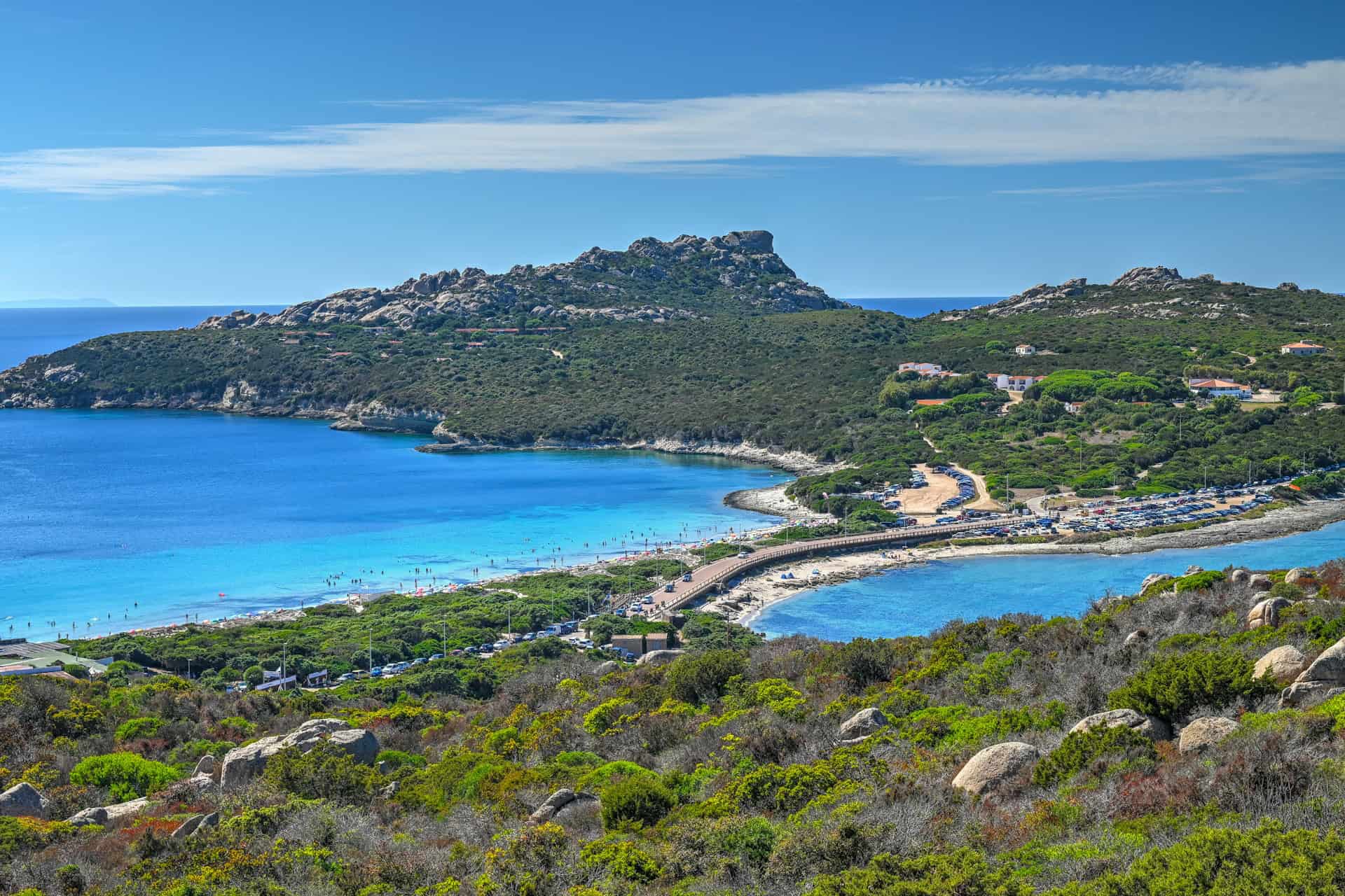


If this viewpoint is your main priority, the easiest approach is from the southernmost access point near Capo Testa. From there, you can reach the belvedere without crossing the entire park.
Although we did not experience it ourselves, this is also a popular sunset spot. We visited around midday and had the viewpoint completely to ourselves, which made it a peaceful place to pause and take in the views.
Isola di Municca Viewpoints
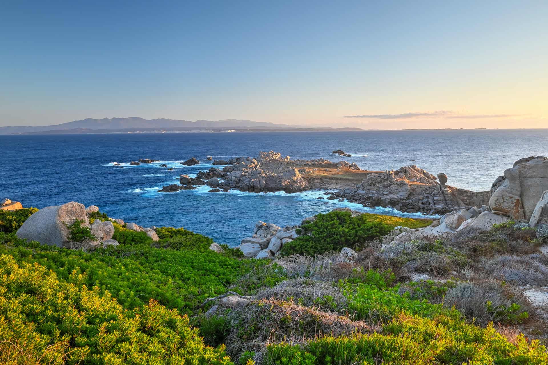
Toward the northern end of Punta Contessa, the trails lead to viewpoints overlooking Isola di Municca, a small, rugged, uninhabited rocky islet just northwest of Santa Teresa Gallura’s Rena Bianca beach. Beyond the islet, you can also see Corsica in the distance, about 18 km away across the Strait of Bonifacio on a clear day.
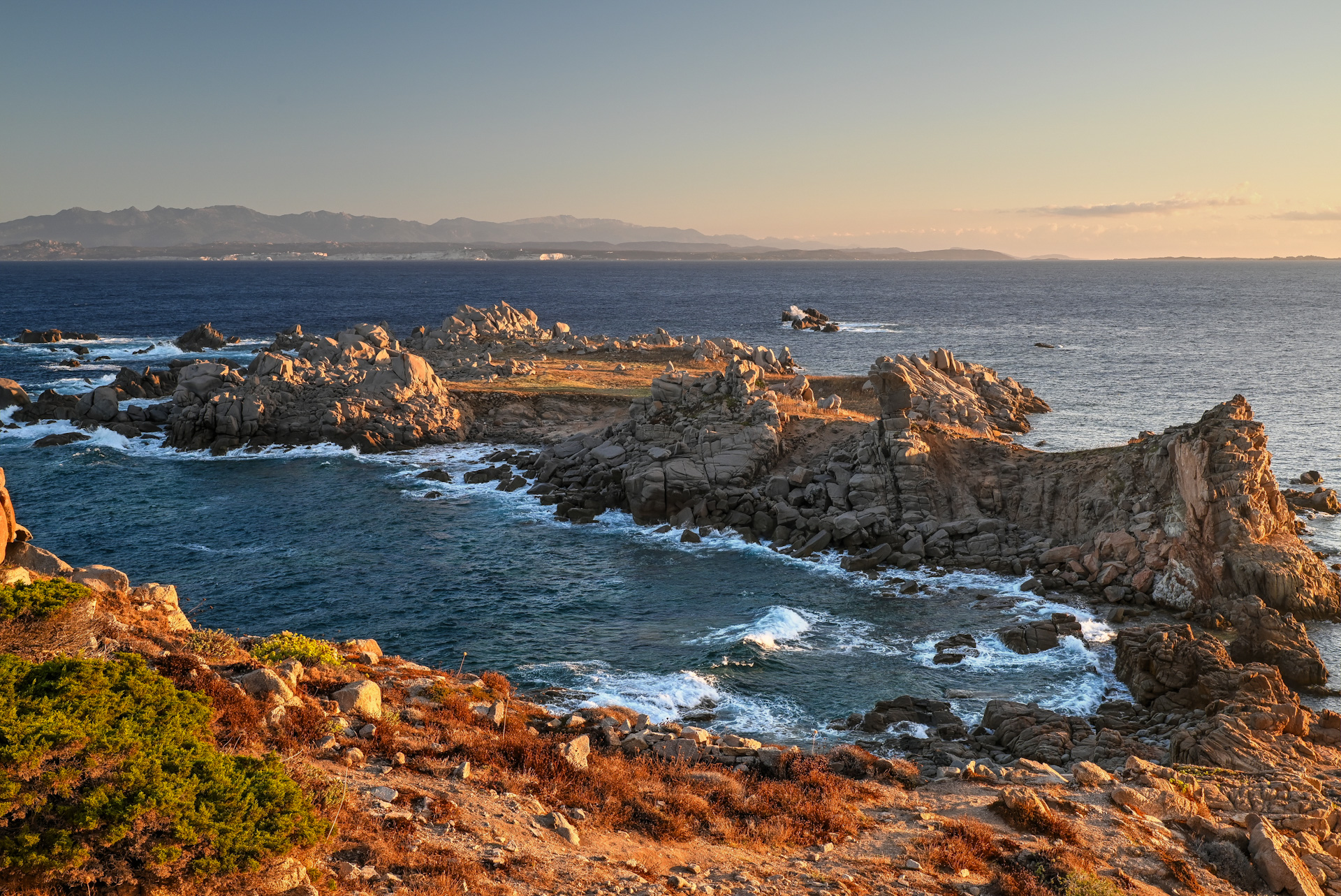


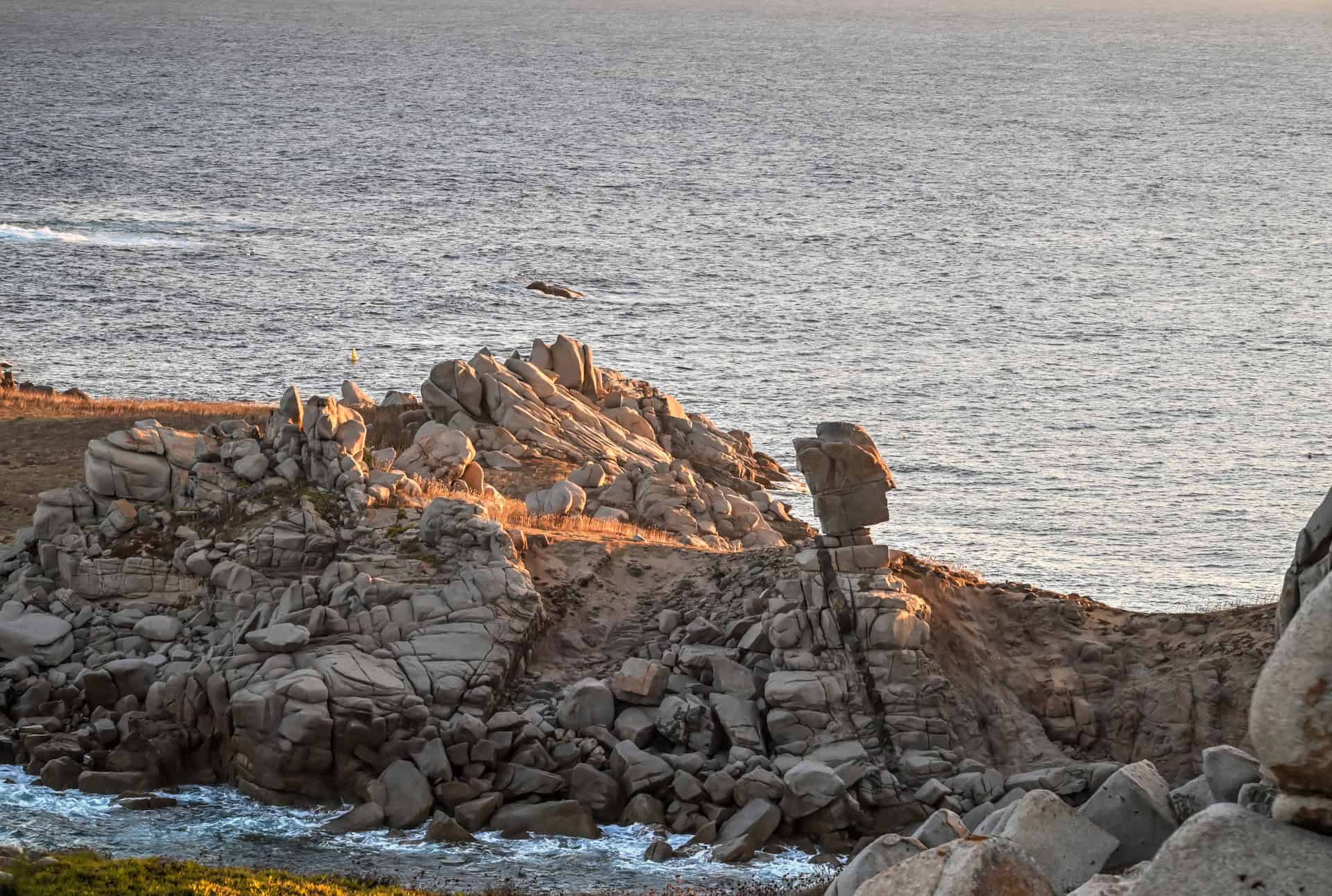
Keep an eye out for the island’s most distinctive natural rock formation, sometimes referred to as the “Uomo di Municca.” This large granite block appears balanced on a narrower base and is often compared to the head of a stiff military officer.
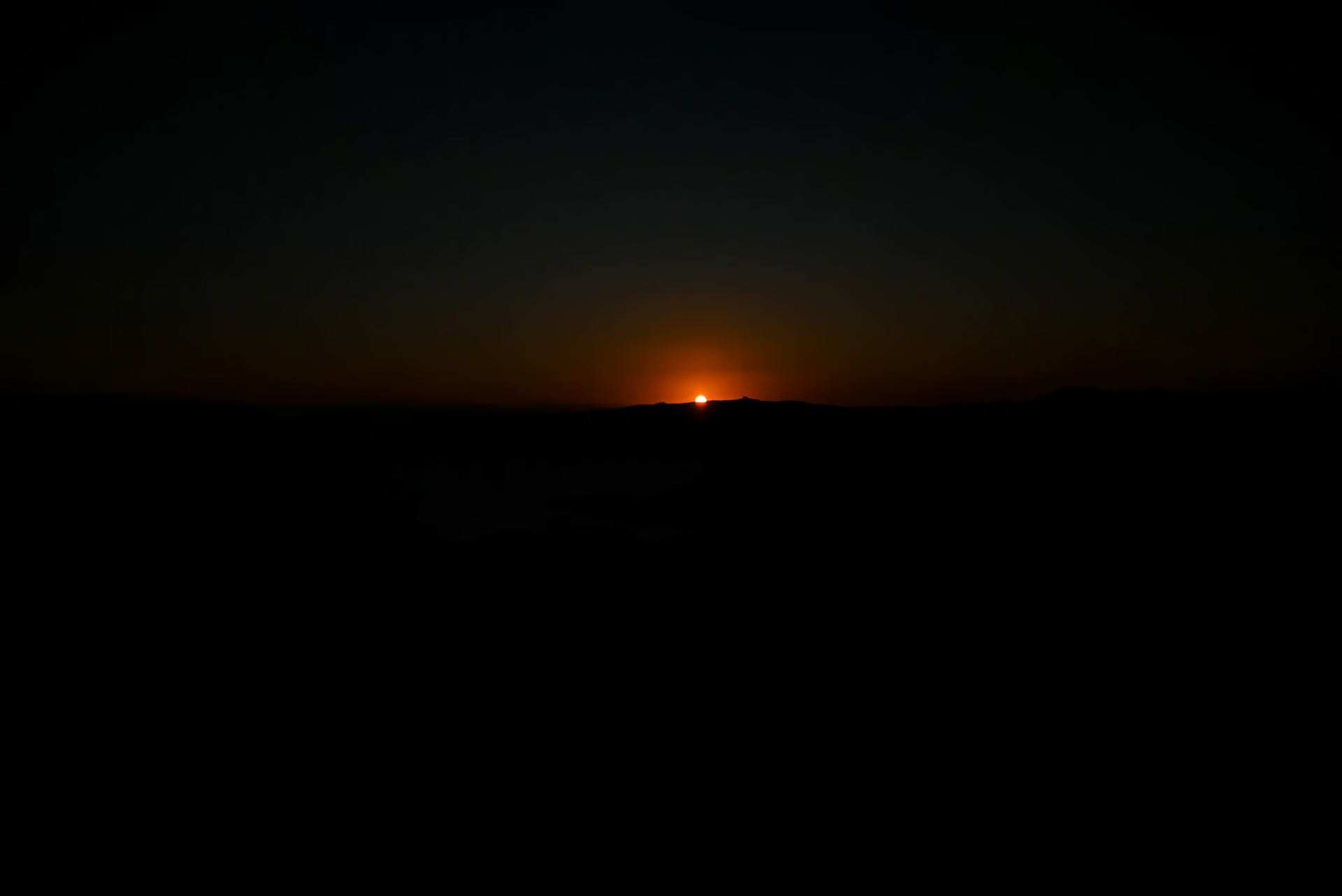
This northern viewpoint area is also an excellent place for sunrise. It was one of the most beautiful sunrise spots we experienced in Sardinia, with the early morning light hitting the rocky islet and the coast around Santa Teresa Gallura.


Abandoned Military Structures
In the central part of Punta Contessa, you will come across several abandoned military structures, including concrete bunkers, lookout points, and former coastal defense batteries. Many of these structures have been abandoned and left to weather naturally into the landscape, giving this part of the park a slightly rugged, forgotten feel.


One of the most notable sites is the former Fortezza Militare Galassini, built around 1920. Unlike older medieval or Spanish watchtowers found elsewhere along Sardinia’s coast, this was a more modern coastal defense battery designed to protect the strategic Strait of Bonifacio and monitor naval traffic in the area.
Punta Contessa Trails: Distances, Difficulty, and Logistics
None of the trails in Punta Contessa are particularly long on their own. From the southern end near the start of the Sentiero Natura to the northern viewpoints near Isola di Municca, it is roughly 3 km one way. If you wander through most of the main trails and connectors in the park, you can cover around 8 km in total.
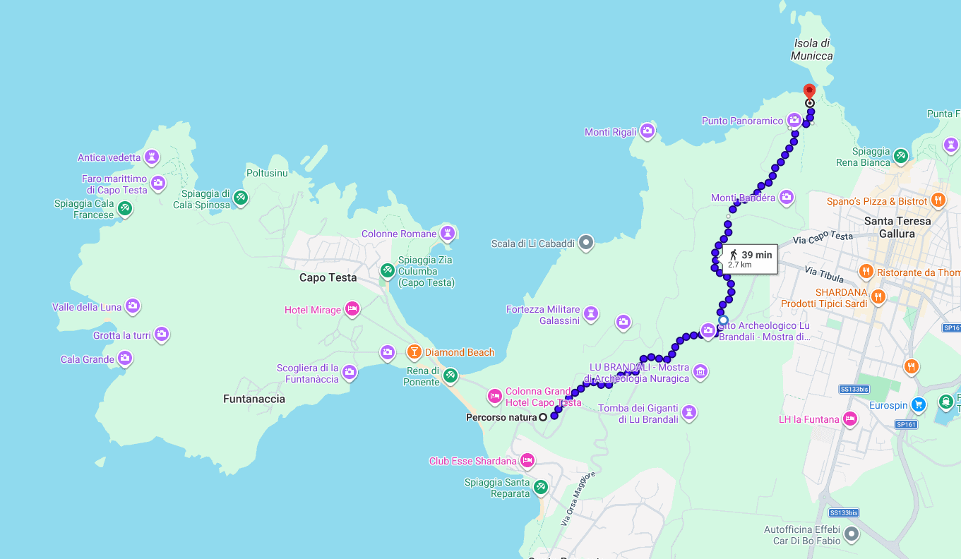
From the south, the main north-south routes are Strada Punta Contessa, which runs more centrally through the park, and Sentiero Natura, which stays closer to the road. Beyond the roadside parking area where the Sentiero Natura ends, the route continues as Strada Lu Patru Punta Contessa before connecting farther north with Strada Municca, which leads toward the viewpoints near Isola di Municca.
The main paths are generally fairly wide and easy to follow, but several narrower connector trails allow you to criss-cross between the main routes. Some of these can be slightly overgrown in places. A few sections are signposted, but signage is not consistent, so it is a good idea to track your route using Google Maps, AllTrails, or another offline map.
Main central trails:


Sentiero Natura:


You will not encounter any major sustained elevation gain in Punta Contessa. The highest points along the trail network are around 100 meters above sea level, while the lowest sections sit just above the coast. One of the steeper stretches is along the Sentiero Natura, where you gain close to 100 meters over a little more than a kilometer, but after that, the terrain is mostly a series of manageable ups and downs.
If your main goal is to hike from Santa Teresa Gallura to Capo Testa, the route is about 3–4 km one way from the western side of town, depending on your exact starting point. Starting from the Via Romagna access point, you can connect through the park and continue toward Capo Testa. Along the way, you will likely pass some abandoned military structures and the Punta Contessa Belvedere, which offers excellent views toward Capo Testa. However, you will not automatically pass the Isola di Municca viewpoints unless you intentionally detour toward the northern end of the park. If those views are a priority, plan extra time and distance before continuing south toward Capo Testa.
Punta Contessa – Is it Worth it?
Yes, hiking in Punta Contessa is worth it if you want to add a quieter nature walk to your time in Santa Teresa Gallura. The park has beautiful coastal scenery, elevated viewpoints, views toward Capo Testa, and a mix of open trails, abandoned military structures, and rugged landscapes.
That said, we would not necessarily prioritize Punta Contessa over Capo Testa, especially if you have limited time. Capo Testa is more dramatic overall, with its granite rock formations, beaches, coves, and lighthouse area. We would also give priority to Punta Falcone if you want a shorter and easier scenic walk closer to the center of Santa Teresa Gallura.
Where Punta Contessa really makes sense is if you want something quieter and more trail-focused. We did not find the paths particularly busy and crossed very few people during our time in the park, which made it feel like a peaceful break from the more popular beaches and viewpoints nearby.
Bottom line: Punta Contessa is worth visiting if you enjoy hiking, coastal views, and a bit of solitude in nature. It is not the most essential stop near Santa Teresa Gallura, but it is a rewarding option if you have extra time or want to walk from town toward Capo Testa instead of driving
Best Time to Visit Punta Contessa
Best Time of Year
The best time to hike in Punta Contessa is during the shoulder season, especially May, June, September, and early October. During these months, the weather is usually warm and pleasant, but the trails are more comfortable than in the peak summer heat.
July and August are still possible, but the park is very exposed, and the trails can feel hot during the middle of the day. Since Punta Contessa is more about walking and viewpoints than beach time, we would try to avoid the hottest hours if visiting in summer.
Outside the main season, Punta Contessa can still be a nice place for hiking, coastal views, and photography, but wind can have a bigger impact on the experience, especially around the more exposed viewpoints.
Best Time of Day
Early morning or late afternoon is usually best. Morning is especially good if you want to hike before the heat builds, and the northern viewpoints toward Isola di Municca can be beautiful at sunrise. This was one of our favorite sunrise spots in the Santa Teresa Gallura area.
Late afternoon can also be a good option, especially if you are heading toward the Punta Contessa Belvedere, which is known as a popular sunset viewpoint over Capo Testa.
Midday can work if temperatures are mild, but in summer the exposed trails, limited shade, and rocky terrain make early or late visits much more comfortable.
Other Places to Visit Near Punta Contessa
Capo Testa
On the southern end of Punta Contessa lies Capo Testa, a peninsula known for its sandy beaches, scenic coves, walking trails, and wind-shaped granite rock formations, with several areas that feel surprisingly wild despite being easy to reach from town. It is more varied and dramatic than Punta Contessa overall, but substantially busier.


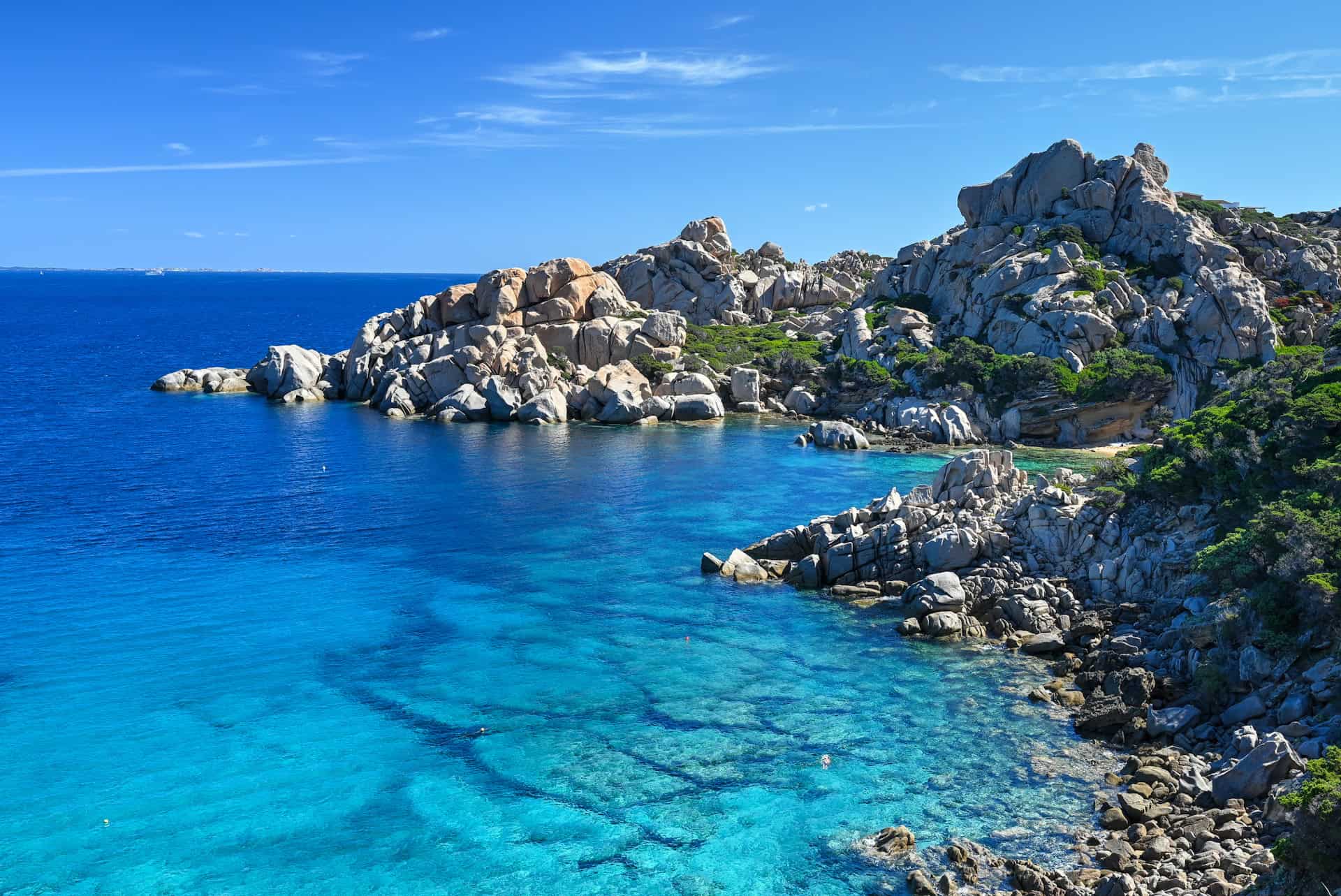
For more details and visiting tips, see our detailed Capo Testa travel guide.
Santa Teresa Gallura
Santa Teresa Gallura is the closest town to Punta Contessa and the most practical base for exploring this part of northern Sardinia. The town has a compact center, restaurants, shops, and access to Rena Bianca, one of the area’s most popular sandy beaches. It is also where you’ll find ferry connections and day trips toward Corsica, making it a useful stop even if you are not staying overnight.
La Maddalena Archipelago
La Maddalena Archipelago is one of the classic day trips in northern Sardinia and pairs well with Santa Teresa Gallura-adjacent if you are spending several days in the area. The islands are best explored by boat, with tours usually departing from Palau and stopping at beaches, coves, and swimming spots around islands such as Spargi, Budelli, Santa Maria, and La Maddalena.
Fortezza di Monte Altura
Fortezza di Monte Altura is a good option if you want to add a short historic stop to a northern Sardinia itinerary. Located near Palau, this late 19th-century hilltop fortress is visited via guided tours and offers a different type of experience from the beaches and granite landscapes around Capo Testa. The views over Palau, the coast, and La Maddalena are also a highlight.
Bonifacio (Corsica)
Bonifacio isn’t just distant scenery seen from Punta Contessa, but it makes for a memorable day trip from Santa Teresa Gallura if you want to visit Corsica during your stay in northern Sardinia. Ferries connect Santa Teresa Gallura with Bonifacio, where you can explore the dramatic cliff-top old town, walk along the harbor, and enjoy views over the limestone cliffs. It is a longer and more logistics-heavy outing, but it is one of the most unique day trips you can do from this part of Sardinia.
Punta Contessa Frequently Asked Questions (FAQ)
Where is Punta Contessa located?
Punta Contessa is located just west of Santa Teresa Gallura, between town and the road toward Capo Testa. The trail network sits close enough to town that you can access it on foot from several points.
How do you access Punta Contessa?
There are several access points, including from Via Romagna in Santa Teresa Gallura, near the split between Strada Lu Patru and Strada dell’Acquedotto, and from two small roadside parking areas along Via Capo Testa. The best access point depends on whether you want to focus on the northern viewpoints, the Sentiero Natura, or the belvedere toward Capo Testa.
Can you hike from Santa Teresa Gallura to Capo Testa through Punta Contessa?
Yes, it is possible to use the Punta Contessa trails as a scenic walking route between Santa Teresa Gallura and Capo Testa. From the western side of town, the route is roughly 3–4 km one way, depending on your exact starting point.
How long are the Punta Contessa trails?
None of the individual trails are especially long. From the southern end of the park to the northern viewpoints near Isola di Municca, it is about 3 km one way. If you wander through most of the main trails and connectors, you can cover around 8 km in total.
Are the Punta Contessa trails difficult?
The trails are not particularly difficult, but they can be rocky, uneven, narrow, and exposed in places. There is some elevation gain, especially along parts of the Sentiero Natura, but the terrain is mostly manageable if you are comfortable walking on natural paths.
What are the main highlights of Punta Contessa?
The main highlights are the Punta Contessa Belvedere, with aerial views toward Capo Testa; the northern viewpoints toward Isola di Municca and Corsica; and the abandoned military structures scattered through the central part of the park.
Is Punta Contessa good for sunrise or sunset?
Yes. The northern viewpoints toward Isola di Municca are especially beautiful at sunrise, while the Punta Contessa Belvedere is known as a good sunset spot thanks to its views toward Capo Testa.
Do you need a map for Punta Contessa?
Yes, we recommend using Google Maps, AllTrails, or another offline map. Some of the main paths are signposted, but signage is not consistent, and there are several smaller connector trails throughout the park.
Is Punta Contessa crowded?
In our experience, no. We found the trails much quieter than nearby Capo Testa and crossed very few people during our time in the park. This makes it a good option if you want a more peaceful walk near Santa Teresa Gallura.
What should you bring for hiking in Punta Contessa?
Bring comfortable walking shoes, water, sun protection, and a downloaded map. The area is exposed, with limited shade, so heat and wind can have a noticeable impact on the hike.
Can you visit Punta Contessa without a car?
Yes, especially if you are staying in Santa Teresa Gallura. Several trail access points can be reached on foot from the western side of town. A car is only useful if you want to start from one of the roadside parking areas along Via Capo Testa.
Photography Gear
If you like our photography, you might be interested in some of the gear we use to shoot our travel and hiking destinations.
Camera Body – Nikon Z 6ii Fx-series Mirrorless Body
Main Lens – NIKON 24-120mm F/4G ED VR AF-S
Zoom Lens – Sigma 745-306 150-600mm f/5-6.3
Polarizing filters – Urth Circular Polarizing (CPL)
Camera Tripod – K&F Concept 64-inch Camera Tripod
Mini-tripod – Lammcou Flexible Camera Tripod
Camera/hiking backpack – Vanguard Alta Rise 48 Backpack
Universal Travel Adapter – VYLEE Universal International Power Travel Plug
Other Travel Essentials
Travel Insurance
SafetyWing is a travel insurance company that offers comprehensive coverage for travellers. Includes Medical Insurance and Travel Insurance. Primarily geared towards long-term travellers, digital nomads, and expats.
e-Sim cards
Airalo is the world’s first and largest eSIM store with eSIM plans for 200+ countries and regions worldwide. With Airalo eSIMs, travellers can get connected the moment they land at their destination and avoid nasty data roaming charges
eSIMS are a sustainable alternative to single-use SIM cards – they are 100% digital, require less energy to produce and be re-used rather than disposed of.
Car Rentals
Discover Cars is our go-to website for car rentals. We almost always find our preferred rate there.
Transfer from Airport
Welcome Pickups is our favourite private transfer service, which you can pre-book at a fixed price. Currently available in 220 cities all over the world (mostly in Europe, but with several major cities in Asia, the Middle East and the US).
Kiwitaxi is another private transfer service – we haven’t tried it yet, but it’s currently available in a few more countries (102 as of 2024).
Hotels and Accommodations (coming soon)
Photography Prints
If you found this blog useful, you can help support our blog by purchasing low-cost digital prints. Printed physical prints are also available for purchase.


—–
Well, that wraps it up! We hope you enjoyed our Punta Contessa Guide and that it will prove useful for planning your trip to Sardinia.
—–
You might also be interested in these related pages: