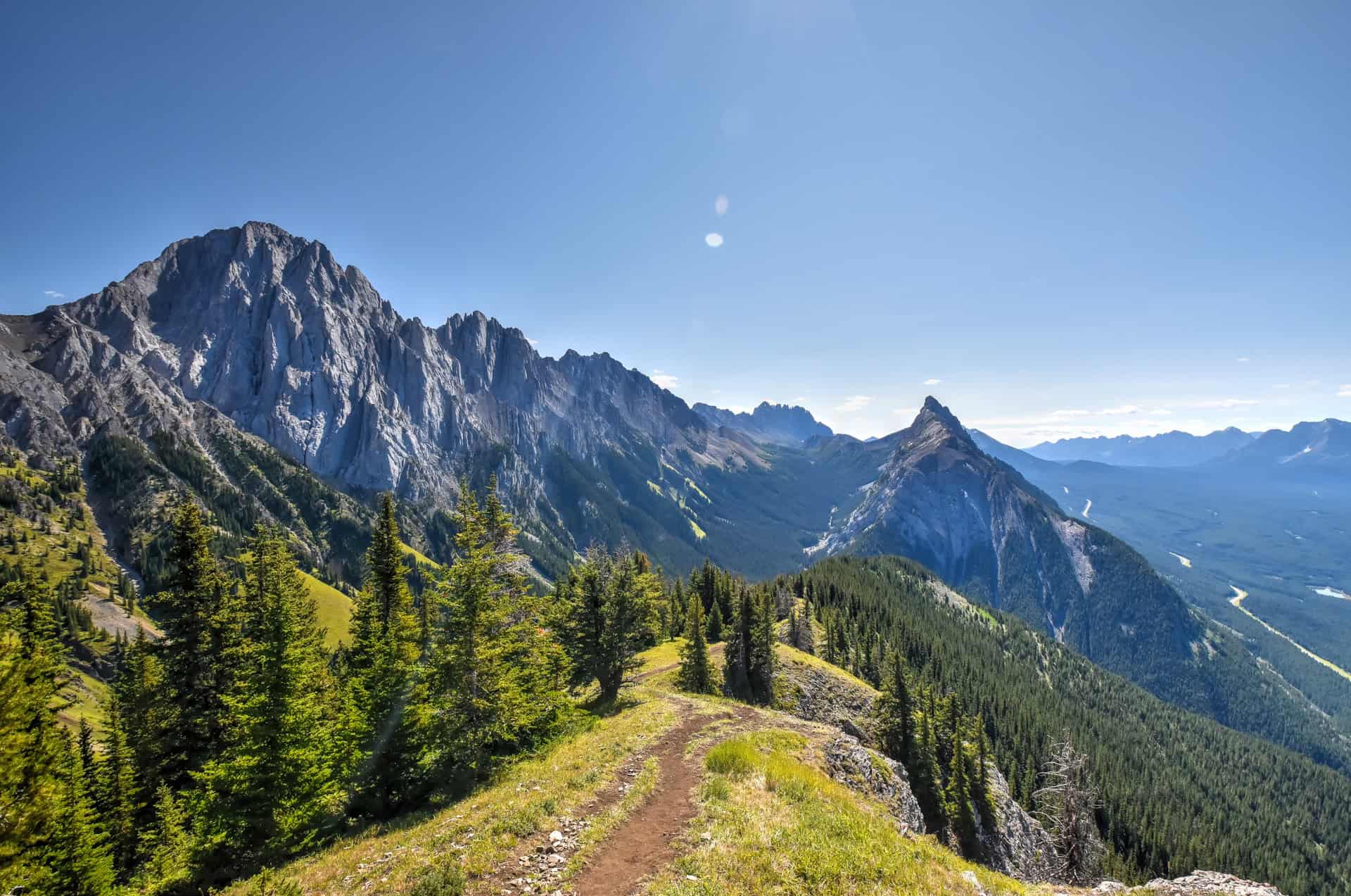
The King Creek Ridge Trail is easily one of our favorite hikes in the Canadian Rockies, let alone in Kananaskis. Although the trail is relatively short, it is quite challenging, with one of the steepest slope grades we’ve ever climbed, particularly during the first 2 km or so of the ascent. The trail is definitely not recommended for novice hikers, and you’ll probably want sturdy hiking shoes and trekking poles, particularly for the return leg, as you’ll descend on very steep terrain. Once on the ridgeline, however, you will be rewarded with sublime 360-degree panoramic views of the surrounding spectacular mountain scenery, including the Opal Range and the Kananaskis Lakes. To help you discover this beautiful K-country trail south of Canmore, we’ve put together this King Creek Ridge Trail hiking guide, which includes details on the trail’s difficulty, the estimated hiking time, and the fantastic views it offers.
Disclosure: This page (King Creek Ridge Trail – A Kananaskis Hiking Guide) may contain product affiliate links. At no additional cost to you, we may receive a commission for purchases made through these links. More details can be found on our disclosure and policies page.


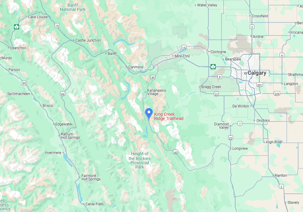
King Creek Ridge Trail Location and Map
The King Creek Ridge Trail is located in Kananaskis (Alberta), south of Canmore (link to Google Maps) and west of Calgary.
How to Get to King Creek Ridge Trail
As with many trails in the area, the easiest way to reach the King Creek Ridge trailhead is by car.
From Kananaskis Village: 30 km (25 min drive)
From Canmore: 80 km (50 min drive)
From Calgary: 125 km (1h25 drive)
From Banff: 105 km (1h10 drive)
If you need to book a rental vehicle for your hiking excursion, we highly recommend using Discover Cars to get the best rates on your rental in Alberta.
We also highly recommend Airalo (eSIM card) for your connectivity needs when travelling abroad. Airalo is the world’s first and largest eSIM store with eSIM plans for 200+ countries and regions worldwide.
Nearest Gas Station
The nearest gas station is the Fortress Junction Service Centre (link to Google Maps), 8 km north of the King Creek Ridge trailhead along Highway 40.
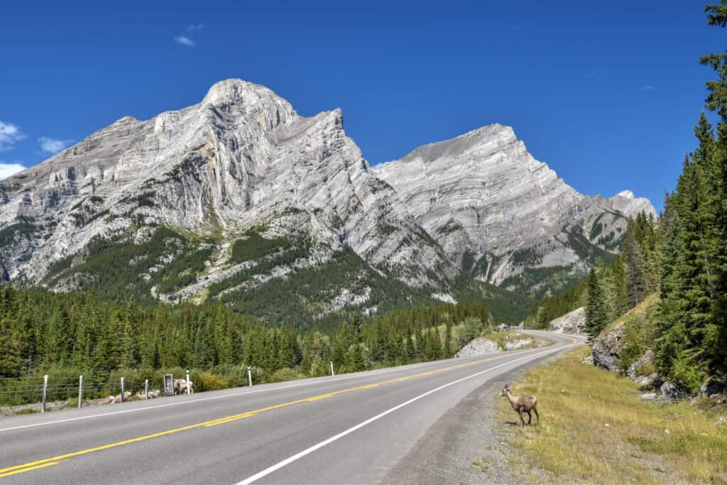
Roadside wildlife
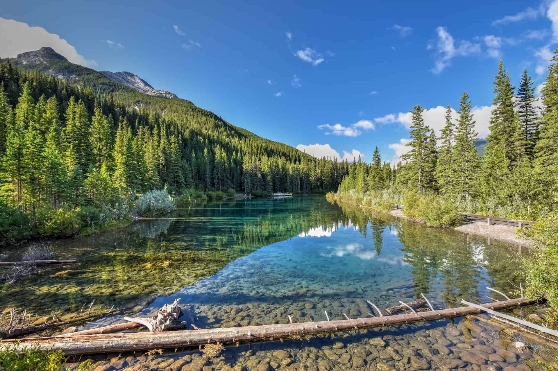
Also, please don’t speed along Highway 40 and keep your eyes open for Rocky Mountain Sheep, either along the roadside or crossing the road. We seemed to come across a flock crossing the road every time we drove through Kananaskis.
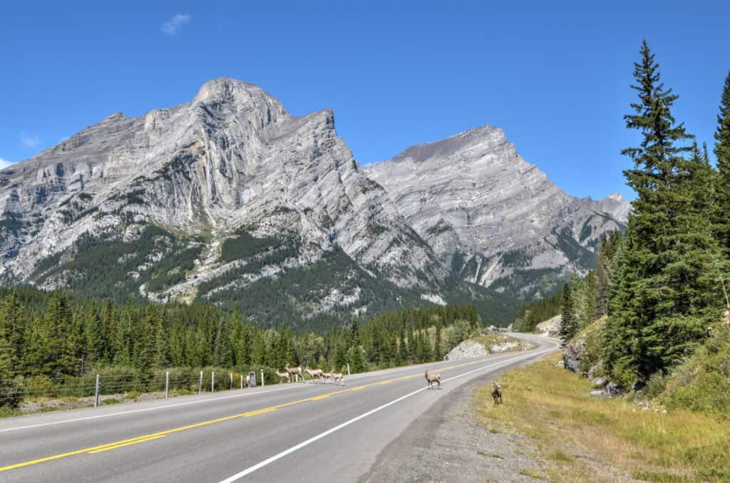
In particular, there are often puddles of water by the intersection of Highway 40 and the turnoff towards the Rawson Lake trailhead, and many sheep gather here for a drink.


King Creek Ridge Trail Access, Fees, and Parking
Trailhead & car park location: King’s Creek Ridge car park and trailhead. If coming from the north (e.g. Canmore, Banff, Calgary), the turn-off for the trail head, which will be on your left, is immediately before the turn-off for the Kananaskis Lakes, which will be on your right.
Trail access and fees
Because this trail is located within Kananaskis Country, you’ll need a Kananaskis Conservation pass before you start hiking. The pass is required to park your vehicle in Kananaskis and the Bow Valley, and fines are hefty ($150 in 2025) if you don’t have one.
Because the pass is tied to parking and not trail access, you only need one pass per vehicle, regardless of how many are in your group.
You can purchase your pass online here, where you will need to register your car licence plate. The pass costs $15 per day or $90 per year (2025) – each purchase includes a $5 non-refundable transaction fee. You will be required to buy the annual pass if you plan on being in the area for 6 consecutive days or more. One advantage of the annual pass is that you can register up to three different vehicles.
If you need to cancel your pass, you can receive a refund, minus the $5 transaction fee, if the cancellation is made before 11:59 p.m. the day before the originally scheduled start date of the pass.
A Kananaskis Conservation pass is required for a large region around and south of Canmore (excluding the town area), covering several provincial parks, including Peter Lougheed Provincial Park, Bow Valley Provincial Park, Sheep River Provincial Park, and Elbow-Sheep Wildland Provincial Park. For more detailed information on the Kananaskis Conservation Pass boundary, you can consult this online map.
Free Access Days: You can park for free in Kananaskis on Wilderness Wednesdays, the first Wednesday of every month.
Additional free days include: New Year’s Day: January 1 – Family Day: 3rd Monday of February – Earth Day: April 22 – Indigenous People’s Day: June 21 – Parks Day: 3rd Saturday of July – Kananaskis Country’s Birthday: September 22 – Remembrance Day: November 11 – First day of winter: December 21 – Christmas Day: December 25
Trail opening Hours: 24 hours – all year. However, hiking in winter is not recommended unless you are an experienced winter hiker.
Parking lot: You can park at the King Creek Day Use Area (link to Google Maps) — drive south on Highway 40 past the turnoff for Kananaskis Village and watch for the King Creek Day Use Area on your left-hand side (just before the winter gates and immediately before you’d turn right into the campgrounds of Peter Lougheed Provincial Park).
Note that the parking lot is quite small, so an early arrival is ideal to guarantee a spot. When full, people often park on the side of the road.
Facilities: Pit/Vault Toilets are available next to the car park.
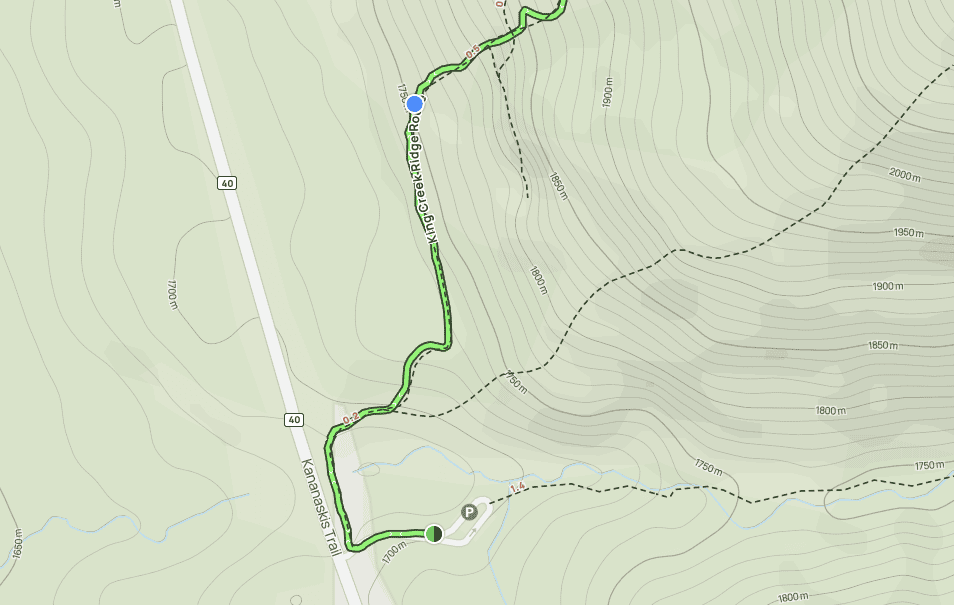
King Creek Ridge Trail Details and Map
Distance: 6.9 km
Route Type: Out & back
Elevation gain: 720 m (cumulative elevation gain: 791 m)
Start point: Car Park
AllTrails rating: (4.7, 3736 ratings (2025))
Duration: Most people complete the trail in about 3h30-4h30
Additional King Creek Ridge Trail Details
– Canine companions: Dogs are permitted on leashes.
– Summit: The King Creek Ridge Peak is located at an altitude of 2423 m.
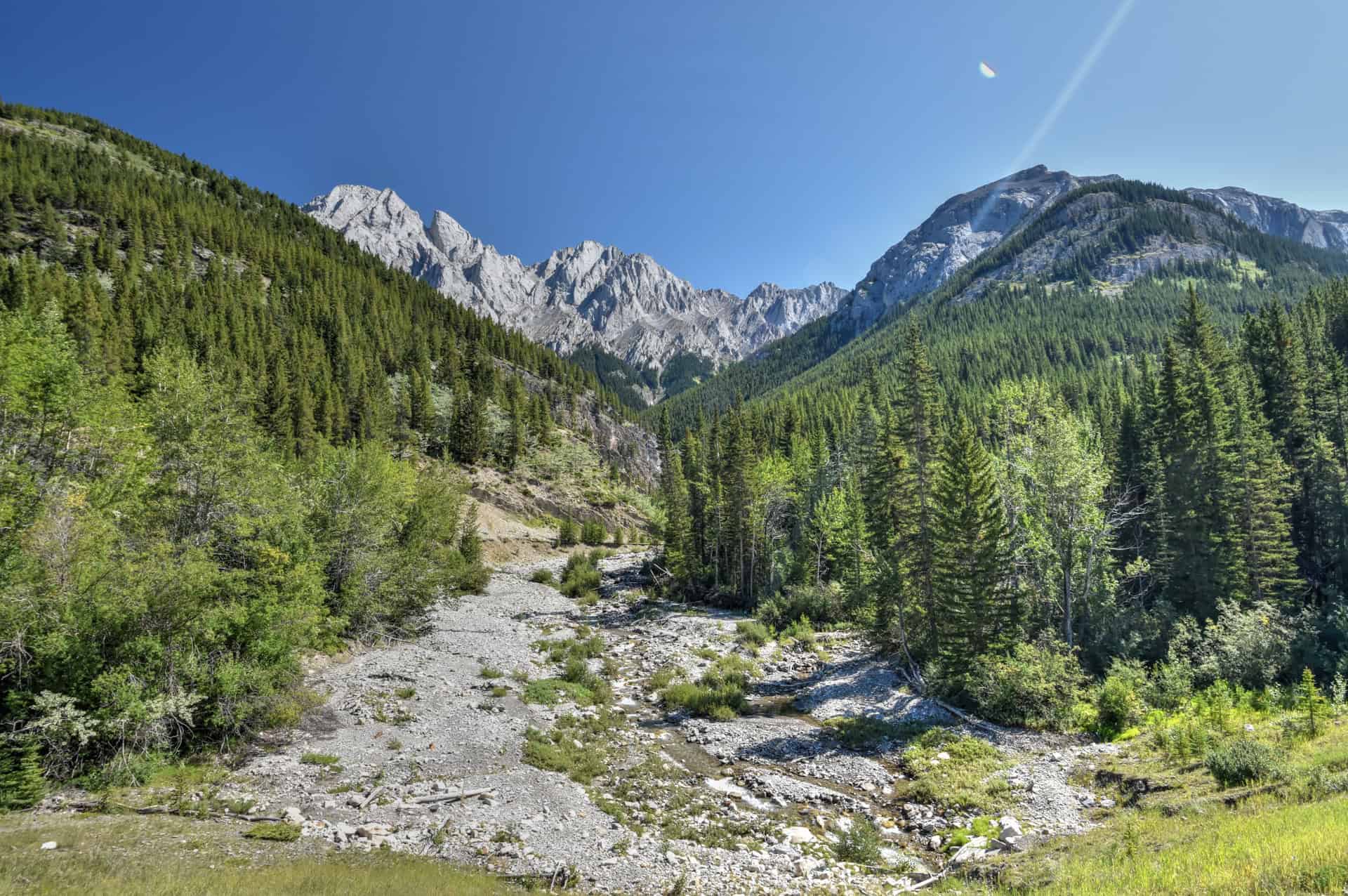
– Trail environment: The first two kilometres of the trail, which includes the very steep ascent (see below), alternates between forest and unforested sections that open up onto beautiful views of the Kananaskis lakes in the distance. The second part of the trail follows a ridgeline that is mostly without tree cover.
– Route Signage: None. Though the trail is easy to follow for the most part, one turn-off is easy to miss during the return leg. GPS-based apps such as AllTrails can help to keep you on track.
– Trail Surface / Technical trail: Although the trail follows an undesignated and unmaintained route by Alberta Parks, the trail is in good condition and easy to follow in most spots due to the amount of regular traffic the trail receives. However, the trail’s steeper sections are quite technical, particularly when descending, as loose stones and gravel can make it quite slippery. We don’t regularly hike with trekking poles, but we highly recommend using some here (we were very glad we had them).
– Average trail slope grade: 22%, which is very steep, especially since the trail has almost no switchbacks…you’ll be climbing straight up (or down) nearly the entire trail. The steepest section is between the 0.7 and 1.7km mark, where you will ascend almost 400m over 1 km (40% slope grade).
– Trail difficulty level assessment: Moderately Challenging.
(based on our personal assessment, taking into account the trail length, slope grade and trail surface – 5-point difficulty scale: Very easy, Easy, Moderate, Moderately Challenging, Challenging)
While the intensely steep section of the trail would definitely rate as “challenging”, the rest of the trail is much more manageable, and the trail isn’t very long in terms of distance travelled.
King Creek Ridge Trail Description and Summary
From the car park, you’ll have to backtrack towards Highway 40 to find the trailhead. Be on the lookout for a faint trail heading through the grass beside the highway – heading off to your right as you face the highway.
From there, the trail will run parallel to the highway for about 100 meters and you’ll cross over a dry riverbed, before the trail veers right, and then left again another 200 meters later, at which point the trail will again run parallel to the highway for about 300-400 meters.
This first 0.7 km section of the trail is relatively flat compared to the rest of the trail, but you will still ascend about 50 m by the time you reach the point indicated by the blue dot on the map above.
At this point, the trail veers right, and this is where you will start the intense ascent, where you will gain about 400 m in elevation over the next kilometre. The climb is fairly relentless, with almost no switchbacks to lessen the steepness.
Don’t hesitate to take your time and take breaks – this is the trail’s hardest section, and you shouldn’t feel bad about a slow pace here. Also, take the time to turn around and enjoy the view towards the east of Peter Lougheed Provincial Park across the highway. As you continue to climb, you’ll start to notice Lower and Upper Kananaskis Lakes.
–On the way down, be sure to take your time again here – in fact, we were probably slower on the way down here than we were on the way up, just making sure we had the correct footing as we slowly descended some of the more technical sections of the trail. Loose rock and gravel made the descent quite challenging at times, and we were very glad that we had our trekking poles with us for extra grip and stability.
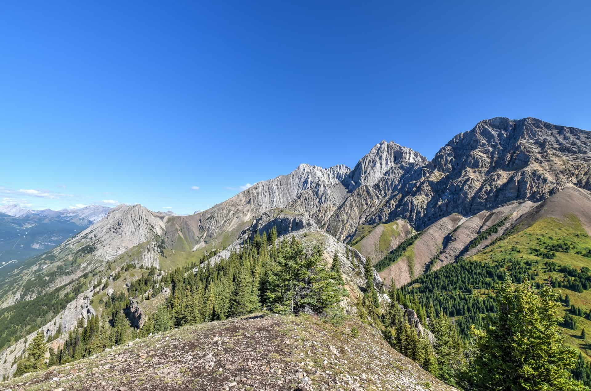
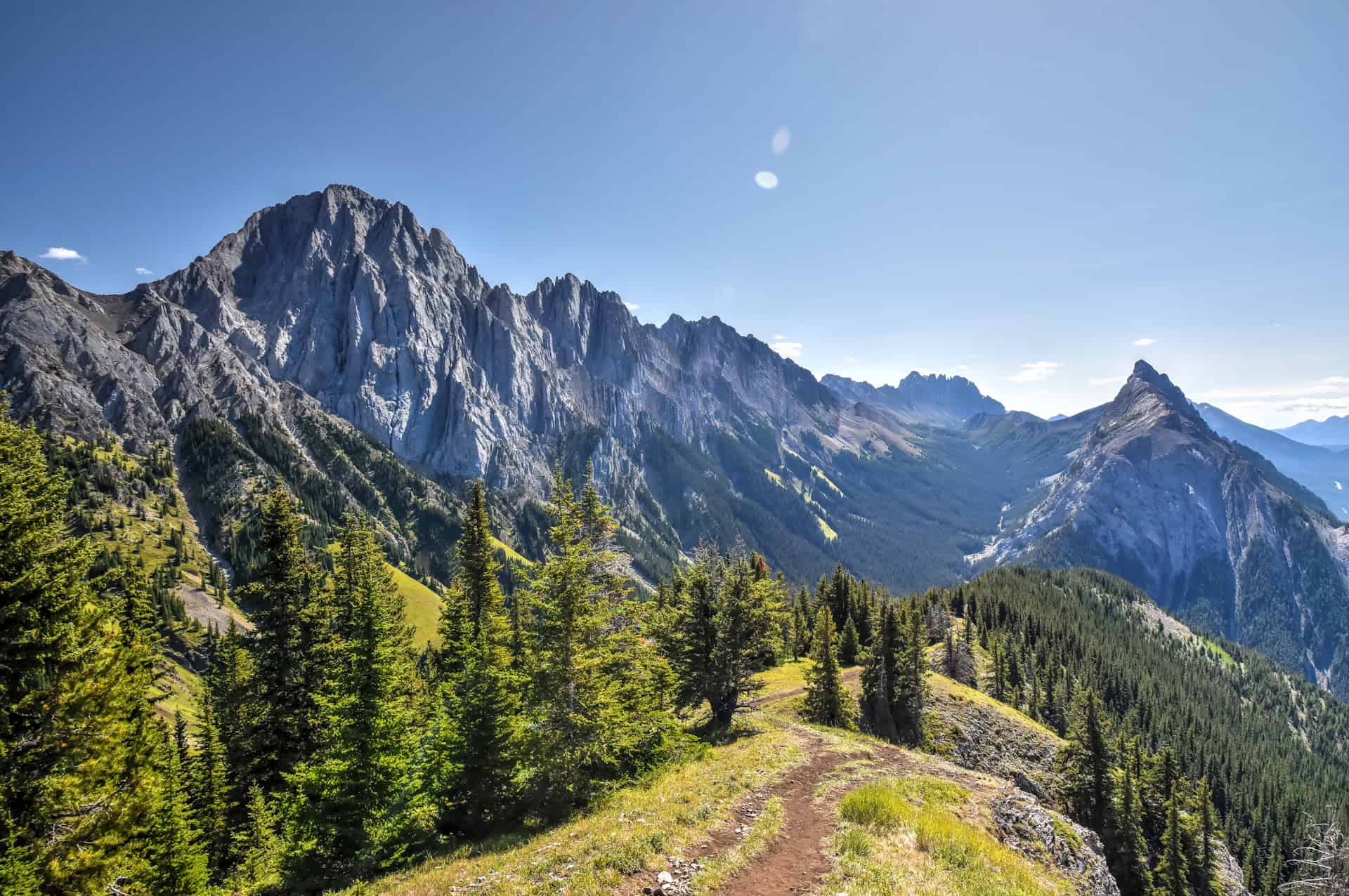
After about a kilometre, your intense uphill slog will come to an end as you’ll reach the King Creek ridgeline (indicated by point #1 on the image below).
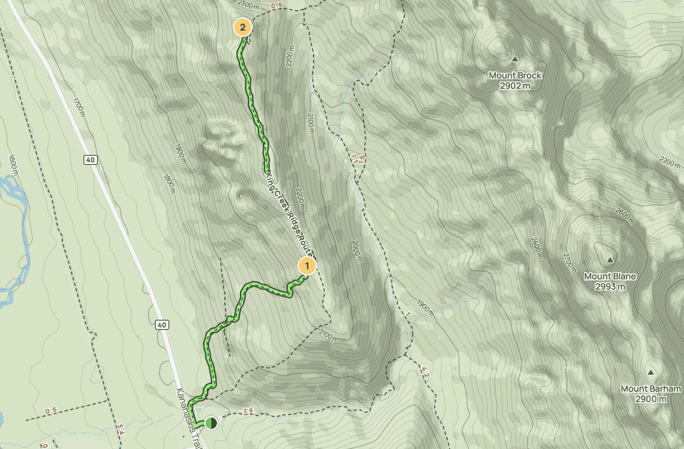
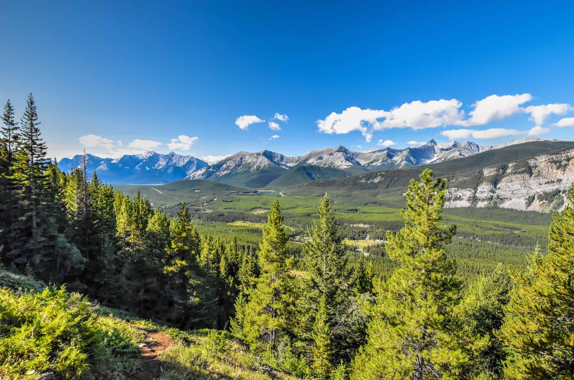
From here, you’ll want to head left (north) to make your way towards King Creek Ridge’s summit. The path is relatively straightforward from here, and the trail along the ridgeline is never particularly narrow.
You will continue to gain elevation as you head north toward the summit along the ridgeline, but at a much slower rate, as its slope grade is nothing compared to what you just climbed to reach the ridgeline.


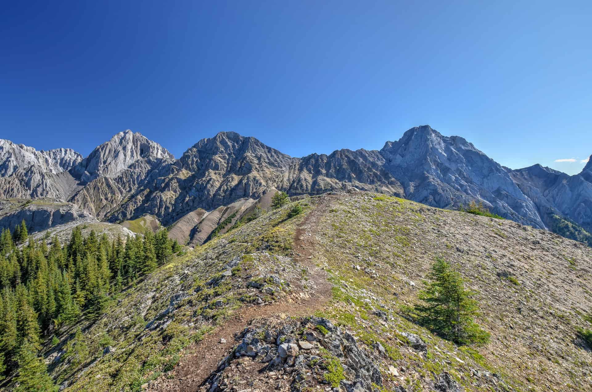
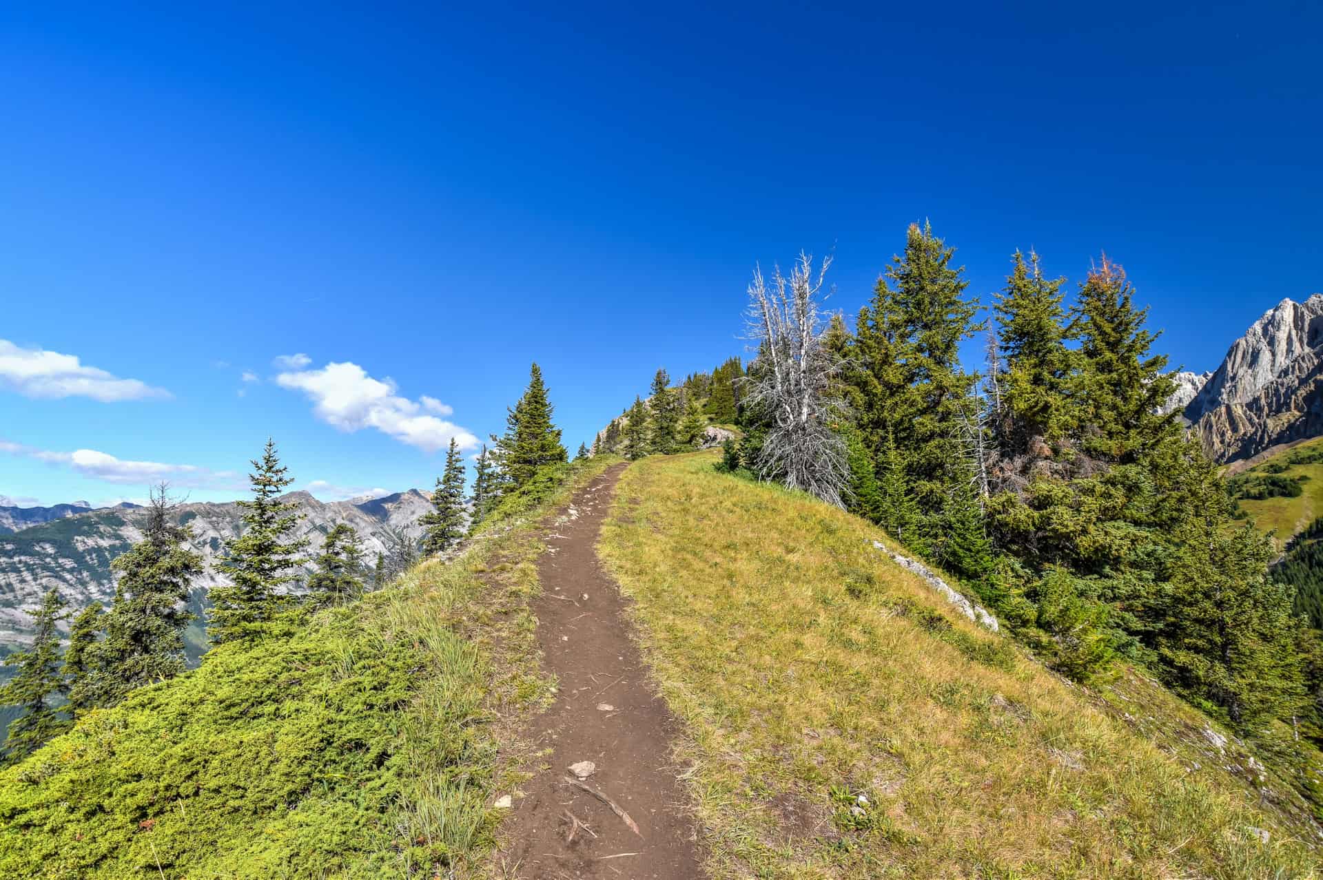
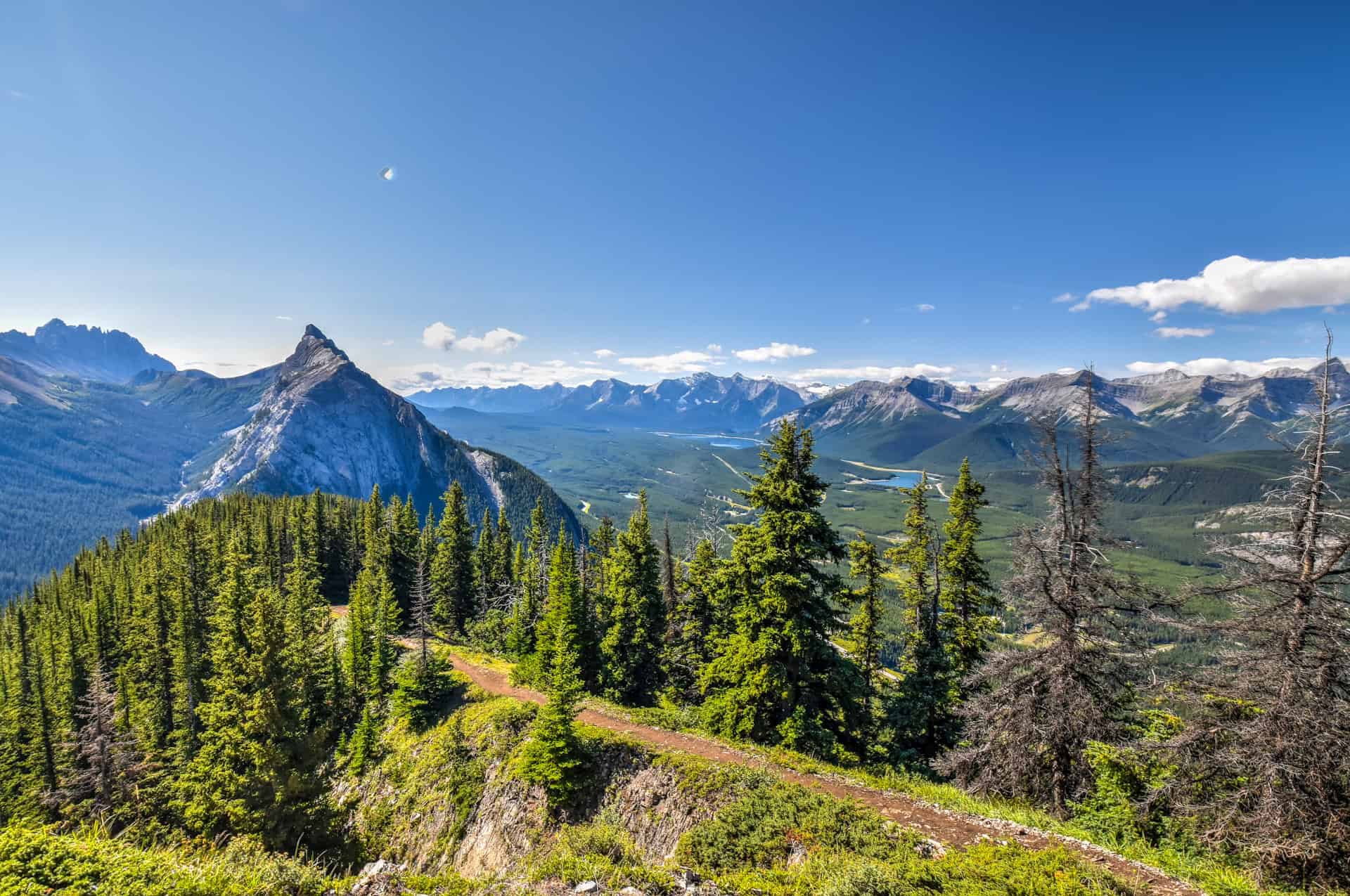
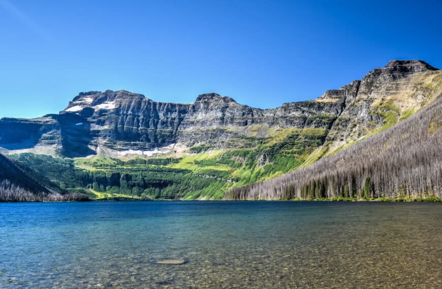
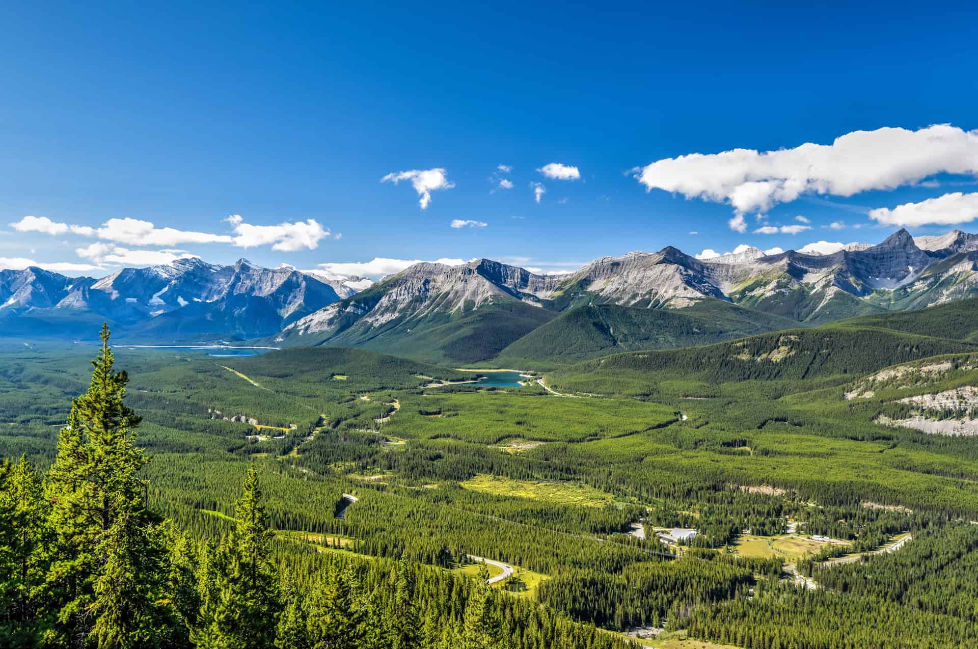
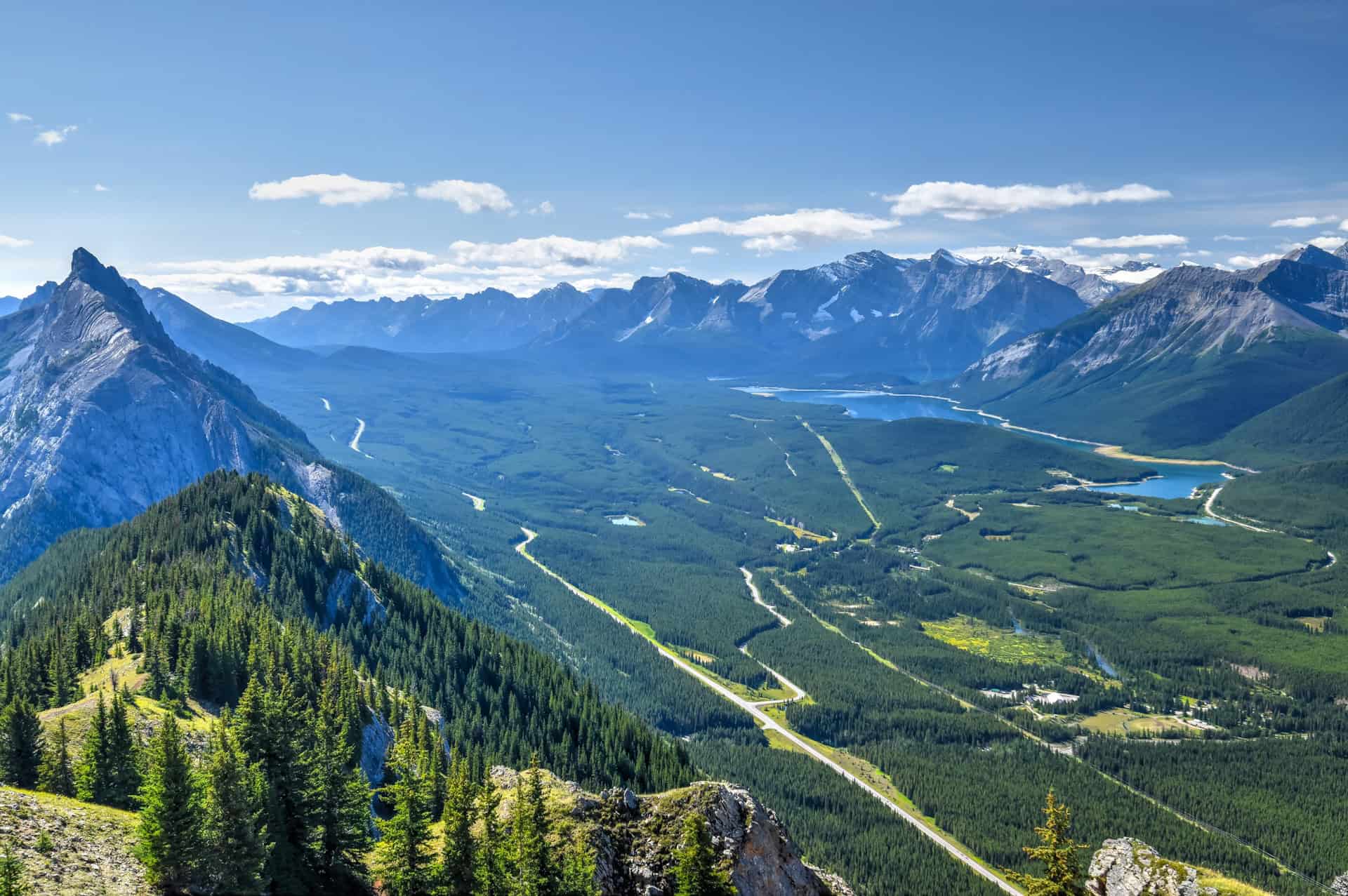
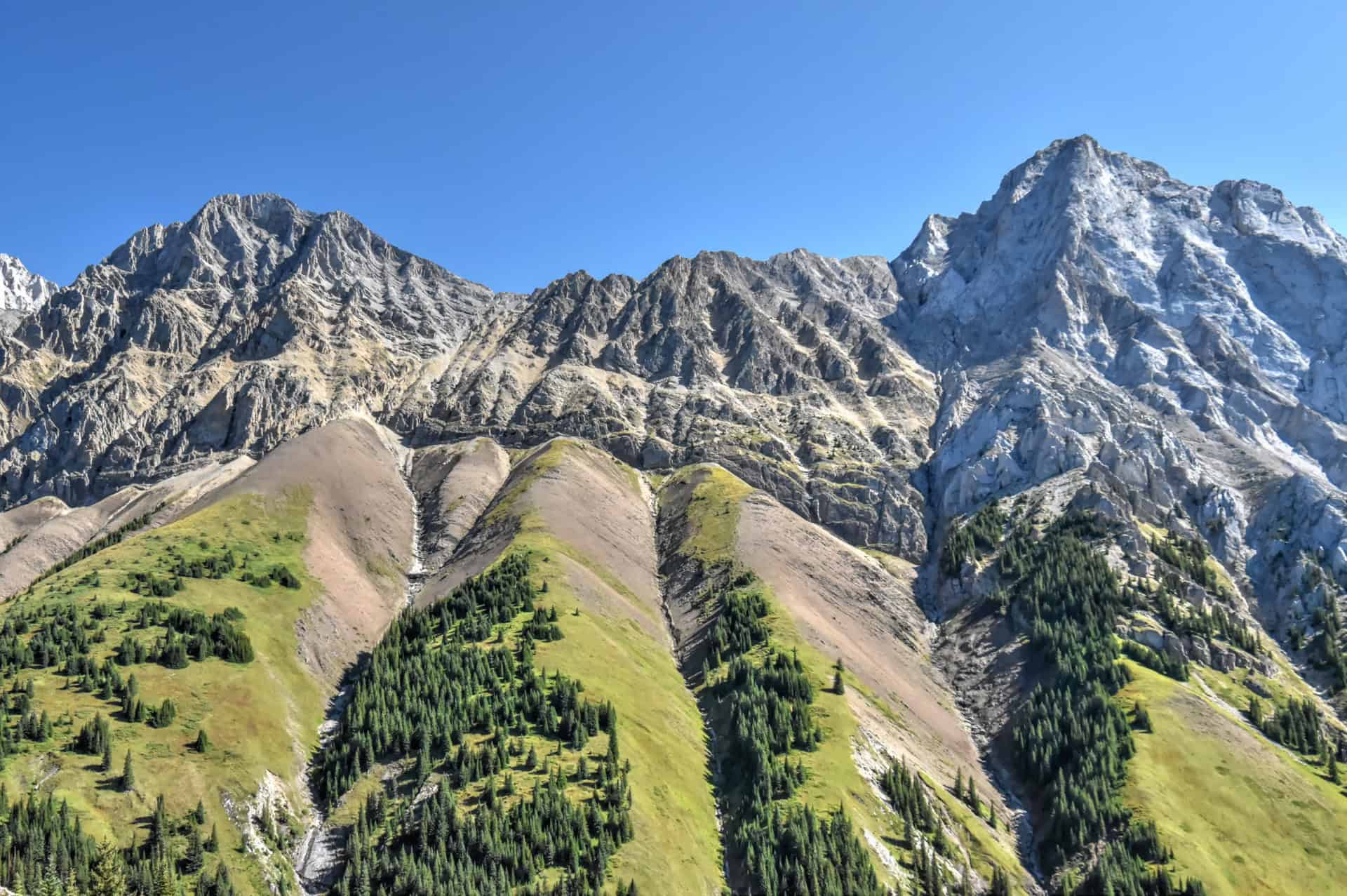
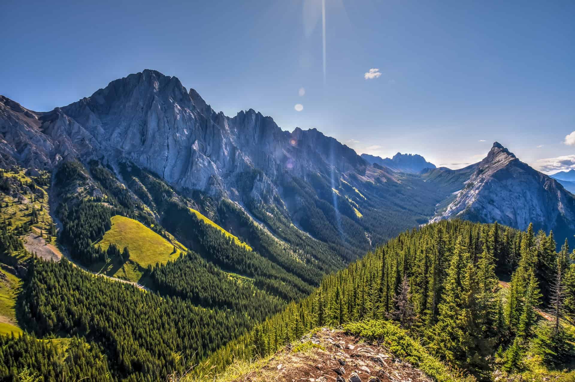
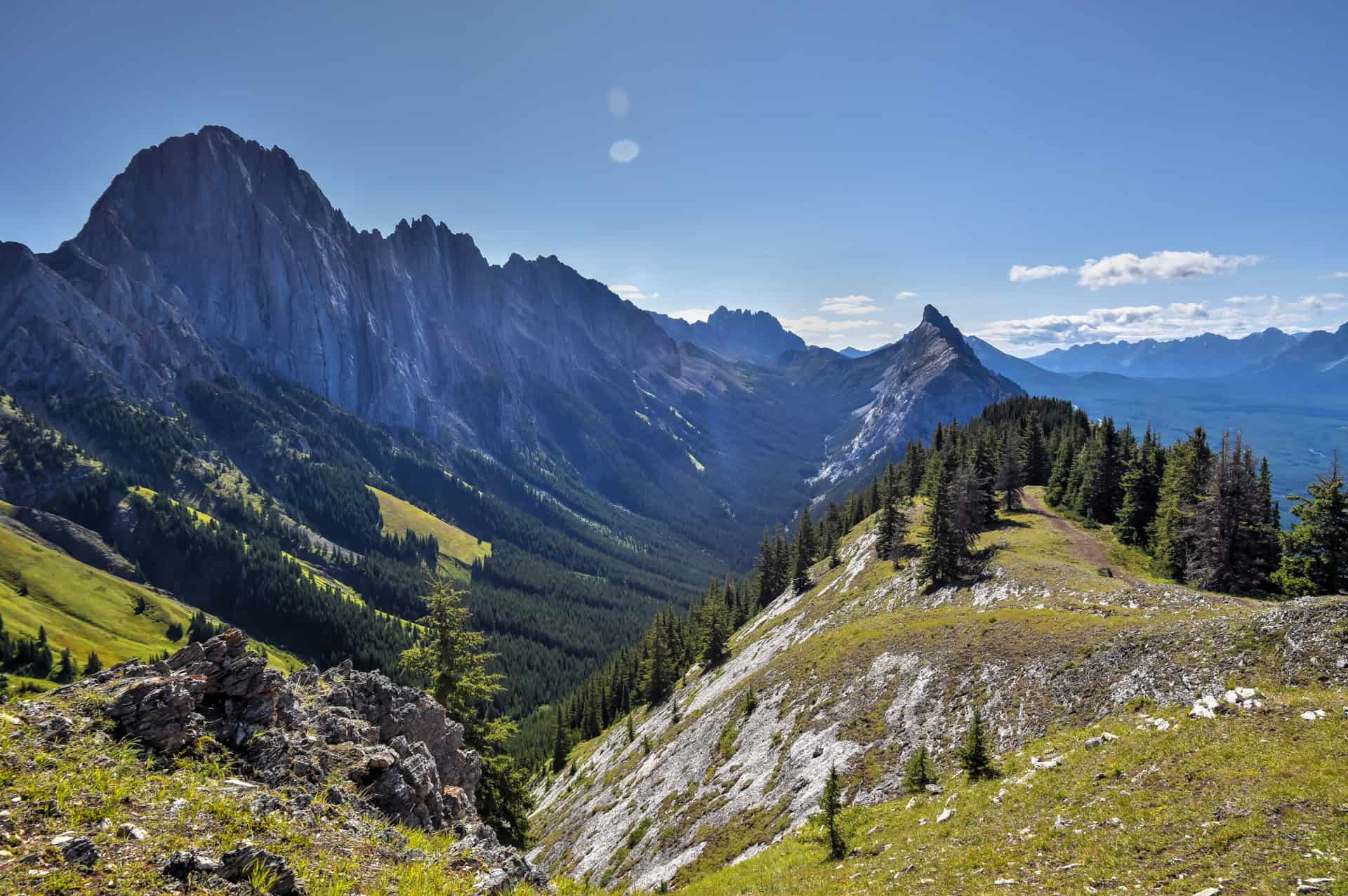
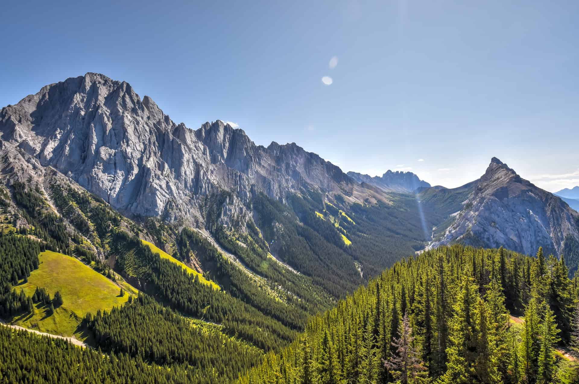
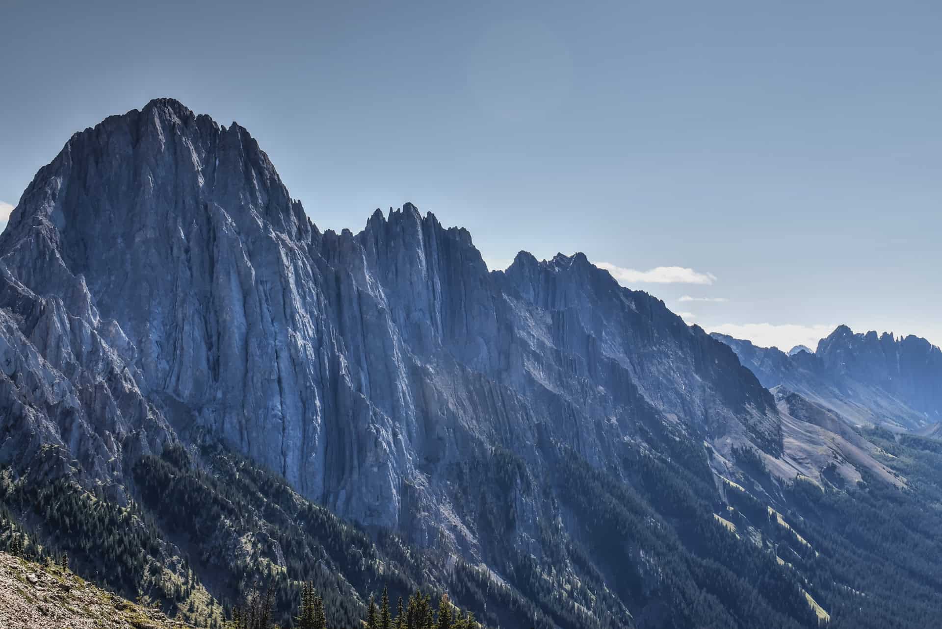
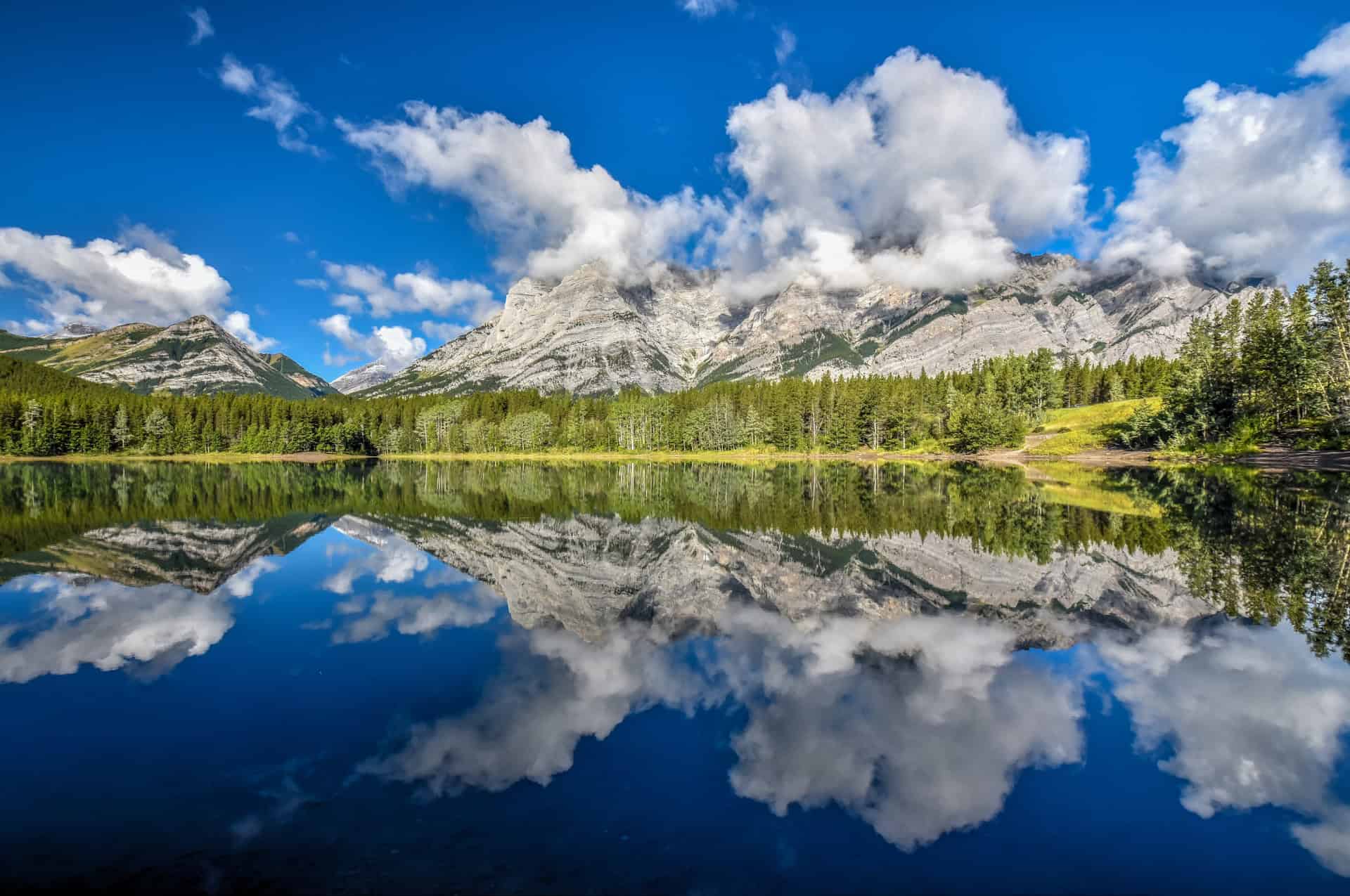
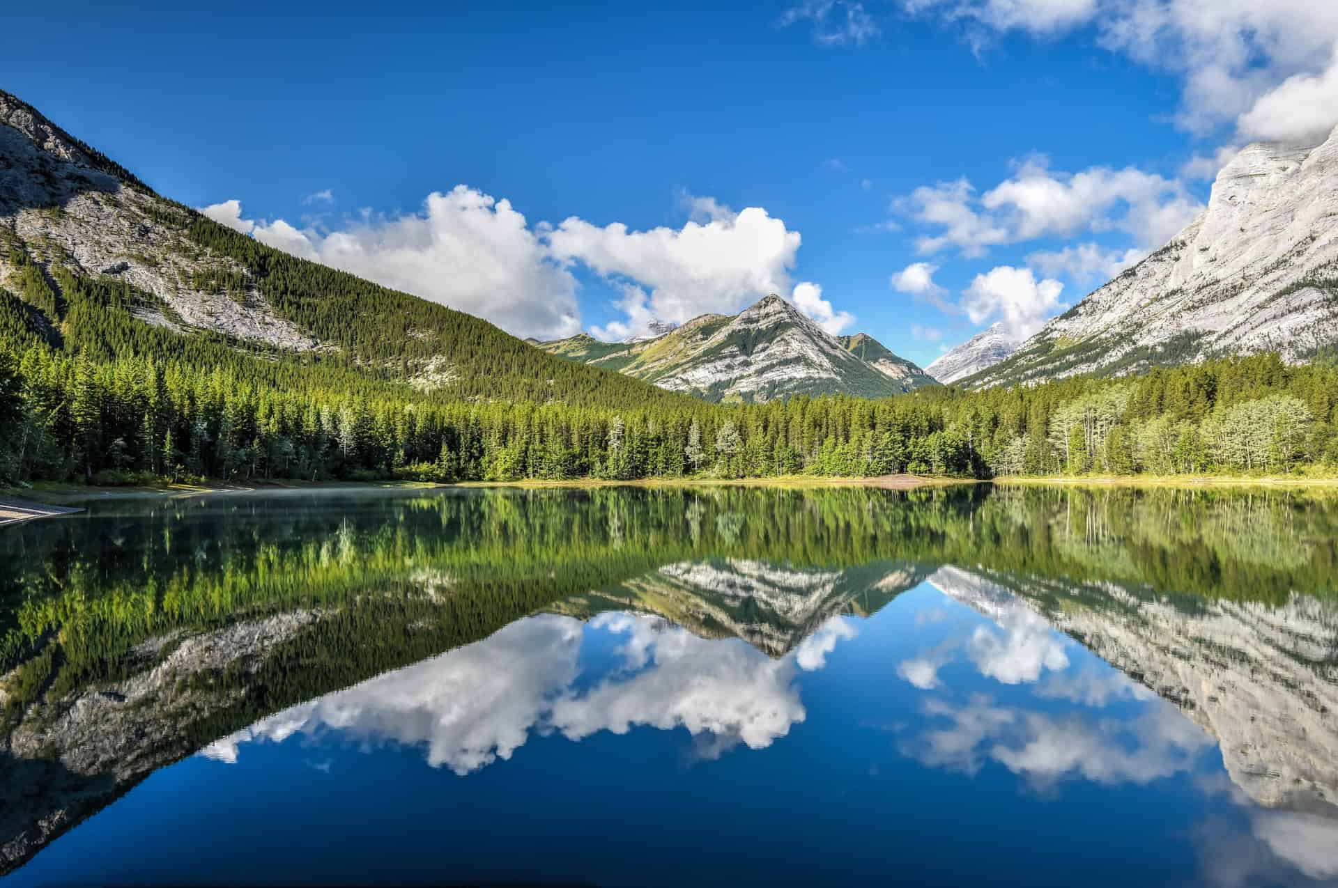
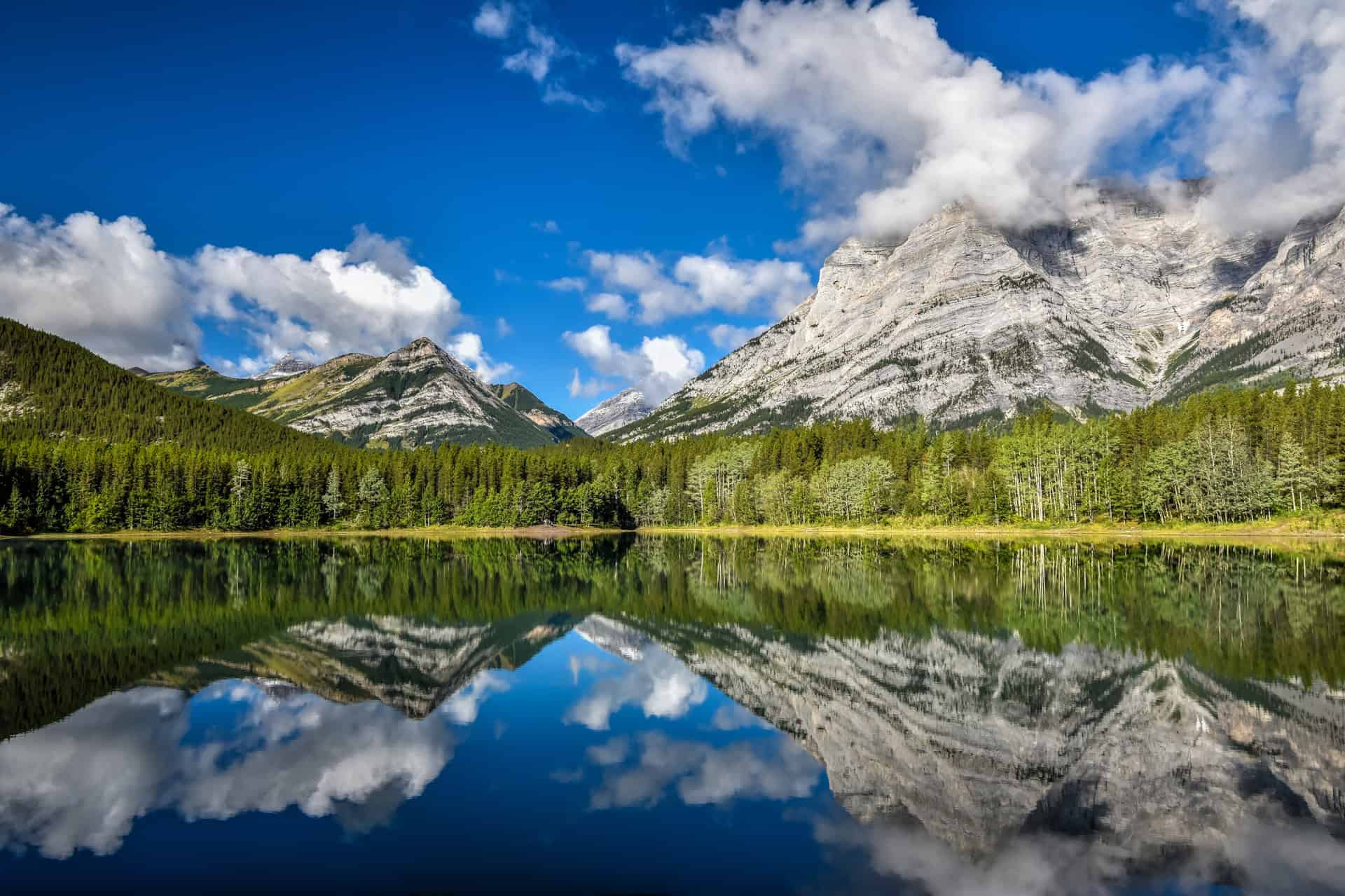
From various points along the ridgeline, you’ll have spectacular panoramic views in every direction, and you’ll also be surrounded by the sublime Opal Range.
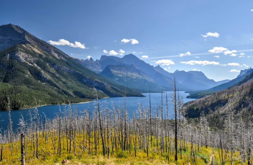
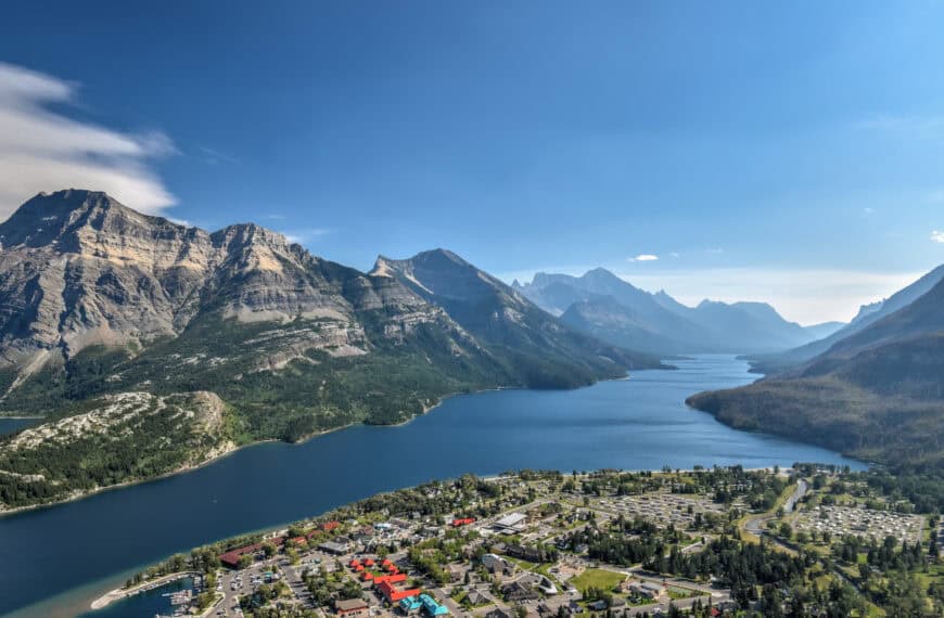
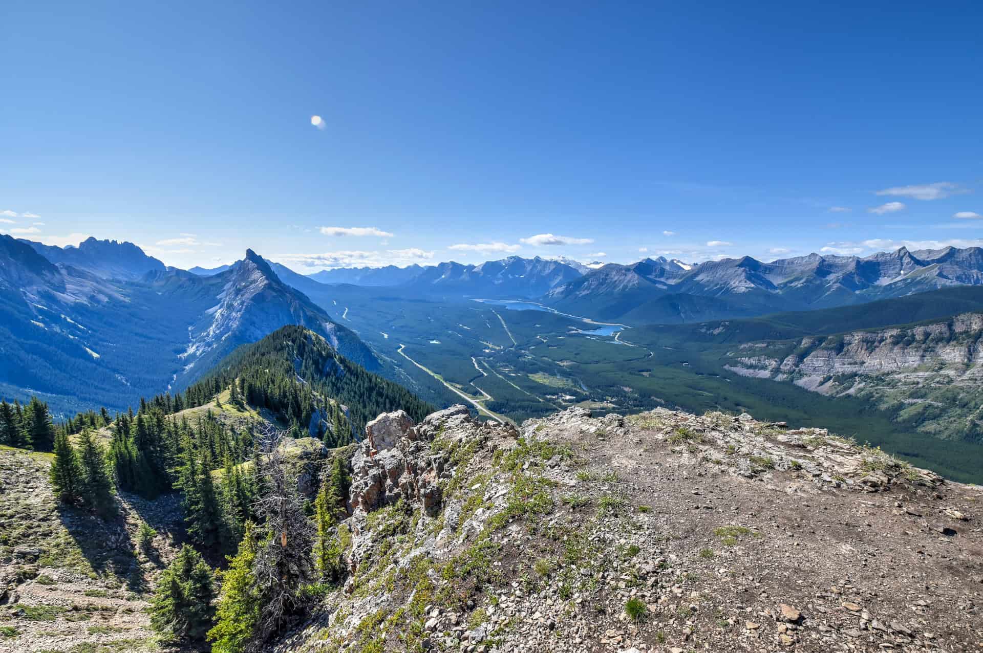
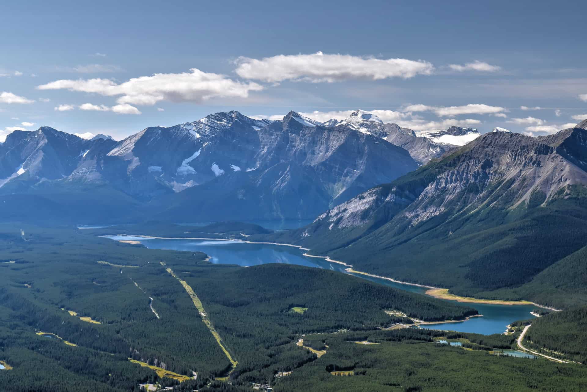
To the west, you’ll have distant views of the Kananaskis Lakes, backdropped by towering snowcapped peaks.

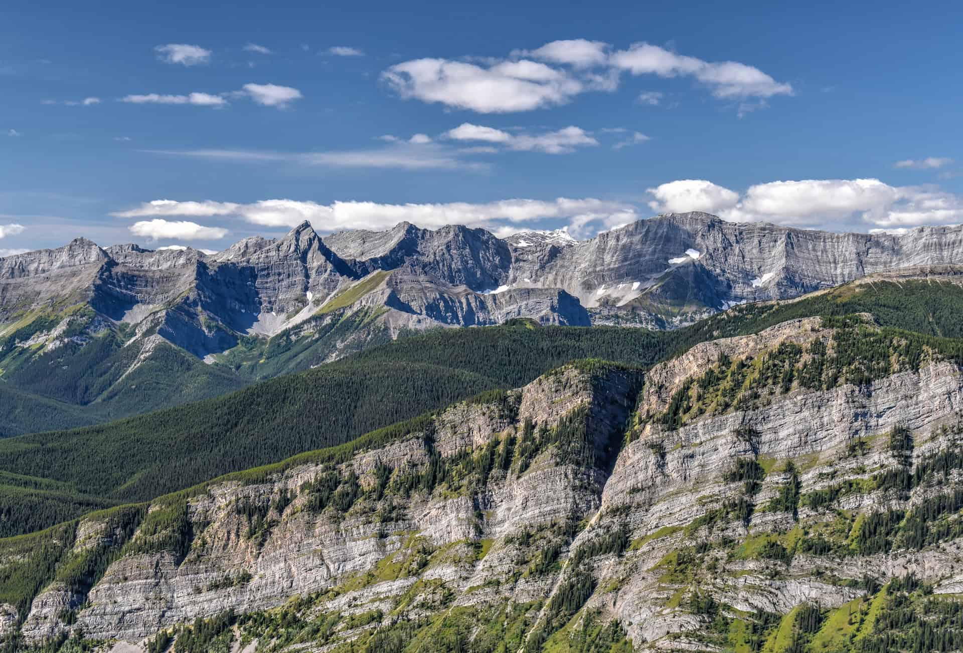
To the east, you’ll have close-up views of Mount Blane, Mount Brock and Mount Hood.


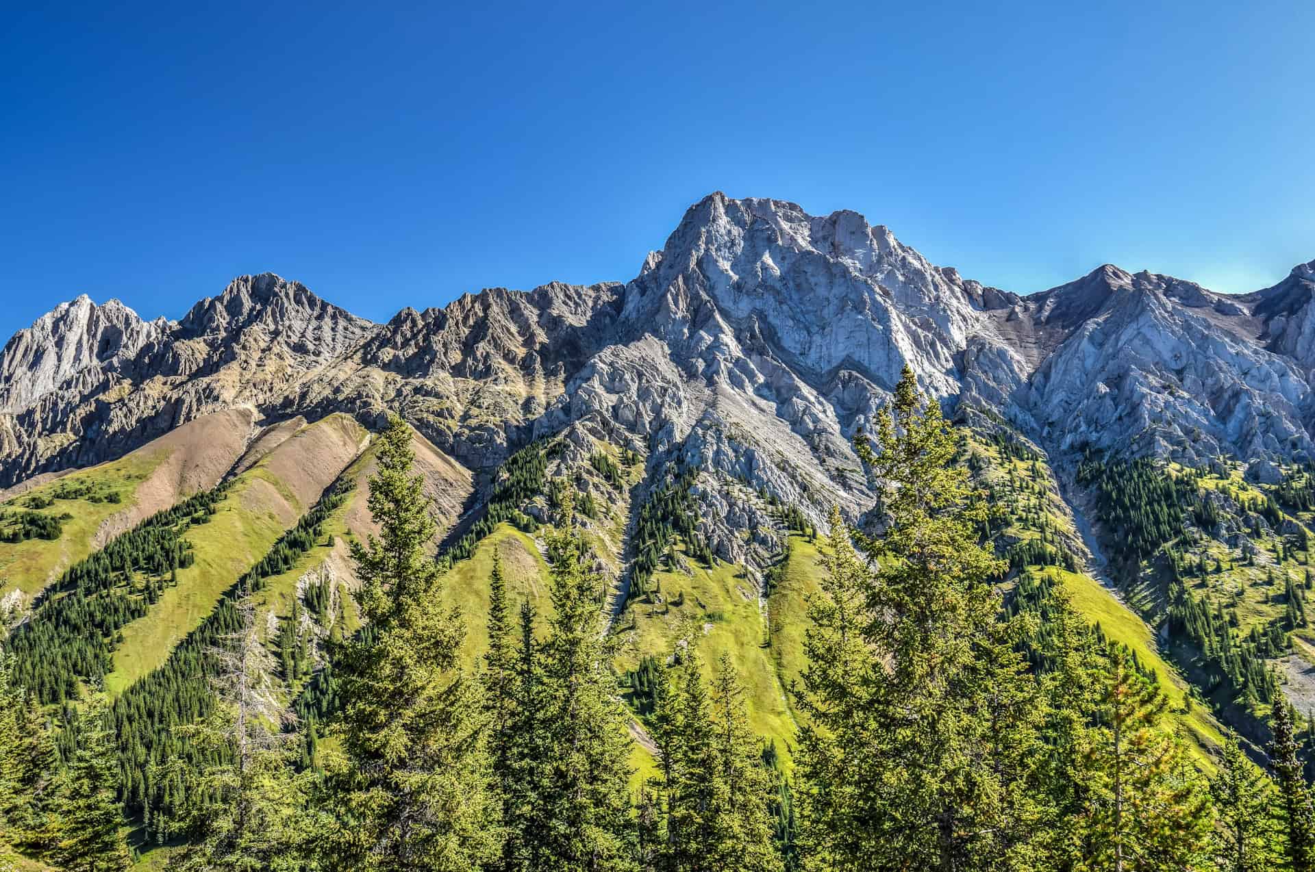
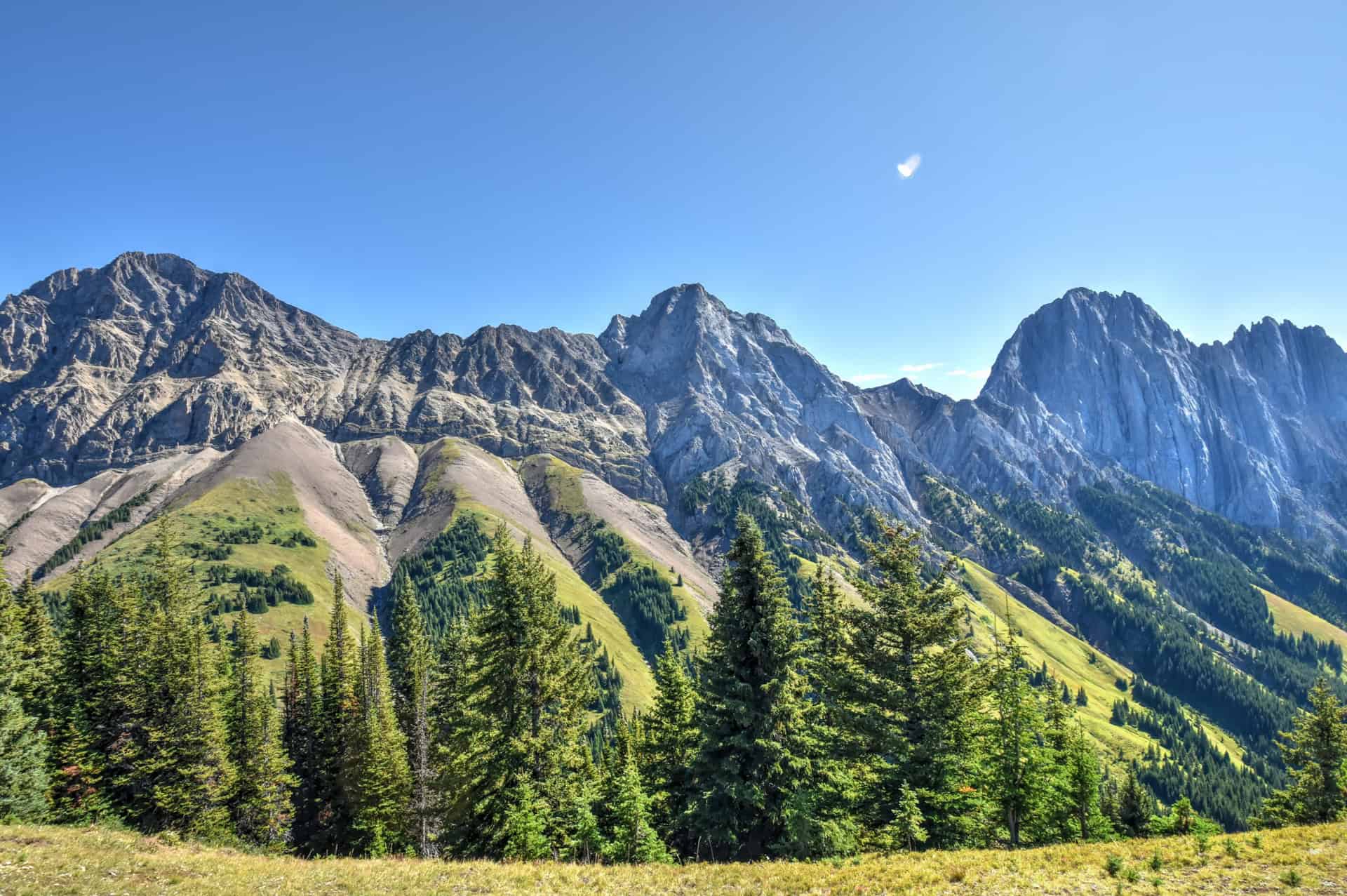
As you near the summit, you’ll have fantastic views of Mount Packenham, Mount Evan-Thomas, and Grizzly Peak. You’ll also have fantastic views of the Kananaskis Valley with Highway 40 snaking its way down towards Kananaskis Village.


There are actually two “summits” at the end of the ridgeline. A first, false summit that is more spacious and grassy, which is better suited for a break and a picnic. From there, you only need to continue for about another 100 m to reach the true summit, which is rockier and will require some light scrambling to reach.
From the summit, you simply have to retrace your steps back along the trail for the return leg.
If you didn’t spoil the surprise by looking behind you during the ascent, you’ll notice that some of the most spectacular scenery is seen on the return leg along the ridgeline (heading south). The jagged peaks of Tombstone Mountains and Mount Wintour are indeed an impressive sight.


We should mention two final important things the return leg:
1) There’s no signage to indicate the turn-off from the ridgeline, so you’ll have to look for signs of the well-trodden trail connecting the ridgeline to the trailhead. We strongly suggest using a GPS-based app to retrace your steps, such as AllTrails.
Not an AllTrails member yet? We highly recommend signing up for either their free or paid membership plans. The free plan allows you to find new trails and plan routes but it can only be used while hiking if you have access to mobile data. The paid membership plan (AllTrails+) allows you to download trail maps for offline use and provides live progress updates and off-route notifications.
If you are still uncertain – you should know that the All Trails mobile application was voted the 2023 iPhone App of the Year by Apple.
We find that AllTrails is a great tool to have when hiking, particularly for assisting with navigation when the trail is hard to locate and to help monitor your progress along the trail, which helps estimate how much time you’ll need to complete the trail.
2) As we mentioned earlier, you’ll definitely want to take your time deciding the first kilometer of the trail after you leave the ridgeline. Loose rock and gravel made the descent quite challenging at times, and we were very glad that we had our trekking poles with us for extra grip and stability.
King’s Creek Ridge Hiking Tips
Hiking Experience
As we stated above, this is not a trail to be undertaken lightly. Several sections of the trail are challenging and very steep, and experience with wayfinding will help with the return leg as there is no signage along the trail.
We don’t recommend the trail for young children.
Cell Service
Cell service is very weak or non-existent during most of the trail.
Cell service in Kananaskis is generally unreliable and spotty, with limited coverage outside of developed areas like Kananaskis Village.
Leave No Trace
Stick to the designated path to protect the surrounding environment.
Bugs
Mosquitoes and black flies can be a nuisance in Kananaskis at certain times during the year. Their numbers vary a lot from year to year, but black flies are generally most present from mid-May to mid-July, whereas mosquitoes can be abundant throughout the summer if there have been prolonged periods of rain and damp weather. Regardless of when you come, it’s always a good idea to carry some bug spray with you, just in case.
Equipment
Bring Trekking Poles – you’ll definitely want to use them at the very least for the steep descent. You’ll want shoes with a good grip, too.
Best Time to Hike the Trail
The best months to hike in Kananaskis are generally June through October.
June*: Long daylight hours, wildflowers, but more chance of bugs
July & August: Best weather, some wildflowers in July, but more crowded trails
September: Good balance of pleasant weather and fewer crowds
October*: Potential for fall colors early in the month, cooler hiking temperatures
*Lingering snow and ice may be present at higher elevations in June, and snowfall is also possible in October.
Winter Hiking is also popular along the King Creek Trail, but prior experience and ice cleats are strongly recommended.
Wildlife
Always maintain a safe distance from wildlife, whether deer, big-horned sheep, elk or wolves. Never attempt to feed wildlife, either.
Bears: Kananaskis is bear territory, so you should carry bear spray at all times (keep it easily accessible in a bear spray holster) and know how to use it.
When possible, hike in groups, and try to make frequent noise while you hike to avoid surprise encounters.
Follow Alberta Parks adivosires webpage for more information on current bear sightings and trail closures.
We didn’t encounter any large wildlife during our time on the King Creek Ridge trail, but it’s always better to be safe than sorry.
Hiking Packing List
All Trails subscription – This comes in really handy for areas with little or no cell reception, as the annual subscription allows you to download trail maps for offline use.
External Battery – If you are using your phone to track your progress along the trail or to help with navigation, you certainly don’t want your phone to die on you. That’s especially true in the unlikely event that you might get hurt or need assistance.
Hiking poles – These can be particularly useful in steep trails or muddy/boggy trail conditions.
Water Filter Bottle – The Life Straw bottle is an advanced water bottle with a filter that not only improves water taste but more importantly filters out bacteria and parasites, chemicals and microplastics.
Headlamp – very practical and a smart choice if you plan to start your hike before sunrise or finish it after sunset.
Some of Our Other Nearby Favorite Trails in Kananaskis
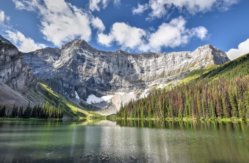
Rawson Lake Trail
The Rawson Lake Trail is another of our favorite hikes in Kananaskis Country. It’s not an overly difficult trail, nor is it very long, and it rewards hikers with sublime views of not just one but two stunning lakes. Though Rawson Lake is the perfect reward at the end of the outgoing leg of the hike, the trail starts and ends by the beautiful Upper Kananaskis Lake, which is vast and surrounded by towering peaks. The trail can also be extended further beyond Rawson Lake along the Sarrail Ridge.


For more information on this trail, be sure to check out our Rawson Lake Trail hiking guide.
Upper Kananaskis Lake Trail
Rawson Lake trail is shared with the Upper Kananaskis Lake Trail (they also share the same trailhead). If you are looking for a long, scenic walk without much elevation gain, then this might be the trail for you.


The first 4 km of the trail (clockwise direction) are the flattest with little overall elevation gain, so one option is to make the 4 km mark a turning point and return towards the trailhead, resulting in an easy, scenic hike of 8 km.
The same is true of the first 3 km when following the counter-clockwise direction, where the trail is mostly flat with little elevation gain.
If you are feeling more adventurous, you can do the full loop of the Upper Kananaskis Lake. The full length of the trail is 15.4 km, and most will complete it in about 4h30.
While there is some elevation, it only totals 478 m, which isn’t a lot over 15 km. Moreover, most of that elevation gain results from the cumulative ups and downs you’ll go through as you loop around the lake — you’ll never be more than 100 m above the lake level.
Things To See and Stops to Make on Your Way To Rawson Lake
Assuming that, like most people, you’ll be coming from one of Calgary, Canmore or Banff, you might be interested in making stops at some of the following beautiful locations along Highway 40 as you head south towards Kananaskis Country and the Rawson Lake trail.
The Widowmaker
Despite its ominous name, the Widowmaker Day Use area (link to Google Maps) is a popular destination for kayakers and canoeists, who may be seen on the river’s edge getting ready to plunge into the rapids below or navigating the river itself. For those who wish to stay on dry land, there’s a peaceful picnic area and a short riverside trail.
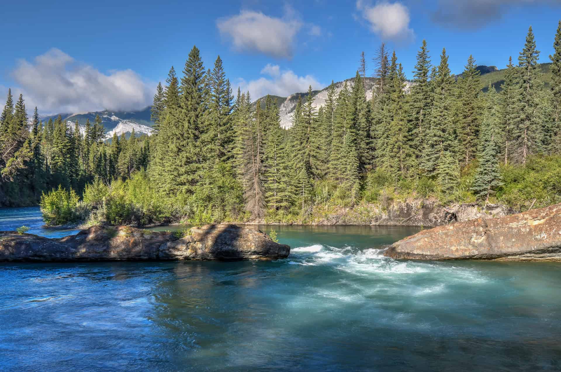
The Widowmaker Day Use area is located about a 25-minute drive from Canmore.
Barrier Lake
Less than 1 km from the Widowmaker lies Barrie Lake (link to Google Maps), a man-made reservoir at the north end of Kananaskis Country. It’s another scenic area that is popular with canoers and paddleboarders, and has a hiking path running alongside the lake.
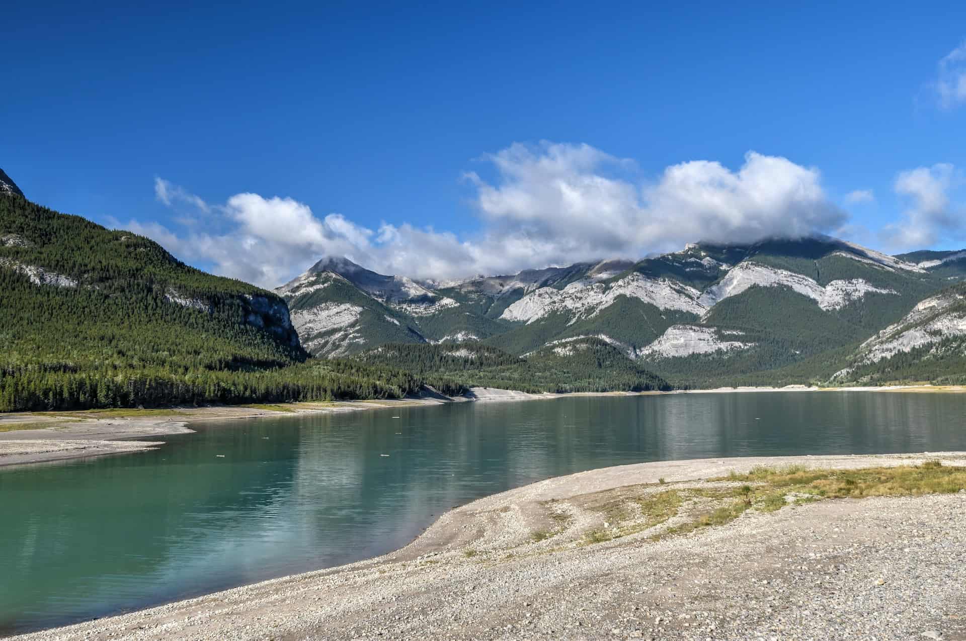
Fun fact: Barrier Lake was featured in the 2003 film X2: X-Men United as the stand-in for Alkali Lake.
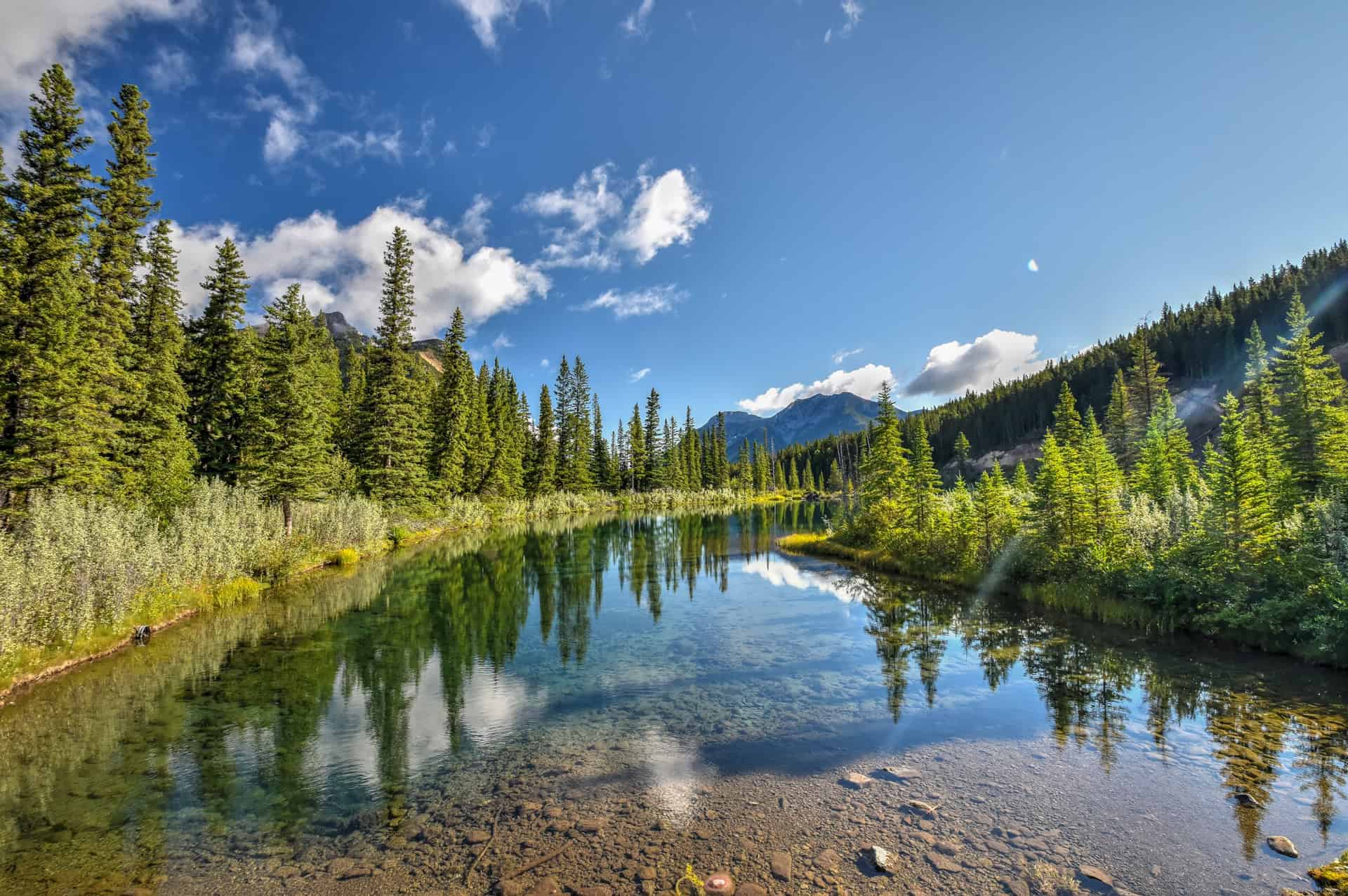
Mount Lorette Ponds
Mount Lorette Ponds is a day-use area in Bow Valley Provincial Park, Kananaskis, featuring two ponds that were once part of the Kananaskis River (link to Google Maps). It’s a popular spot for nature viewing, fishing (the ponds are stocked with trout), and enjoying the scenery.
The ponds are a 10-minute drive south of Barrier Lake.


Wedge Pond
Wedge Pond Day Use area is centred around a scenic, small mountain lake located in Spray Valley Provincial Park, Kananaskis Country (link to Google Maps). It’s a popular spot for hiking, picnicking, and paddling. The Wedge Pond Loop trail is a 1 km easy loop around the pond, perfect for families or a short, pleasant stroll.
Wedge Pond is located roughly halfway between Canmore (a 40-minute drive) and Rawson Lake (a 30-minute drive).


Where to Stay near the King’s Creek Ridge trail?
We typically like to stay in Canmore, the closest town to Kananaskis with all the amenities you would need when visiting the area, including restaurants and various hotel accomodations. The following are smoe of the best mid-range options in town.


Want to Discover More Hiking Trails In The Canadian Rockies?
You might be interested in these pages (coming soon):
Photography Gear
If you like our photography, you might be interested in some of the gear we use to shoot our travel and hiking destinations.
Camera Body – Nikon Z 6ii Fx-series Mirrorless Body
Main Lens – NIKON 24-120mm F/4G ED VR AF-S
Zoom Lens – Sigma 745-306 150-600mm f/5-6.3
Polarizing filters – Urth Circular Polarizing (CPL)
Camera Tripod – K&F Concept 64-inch Camera Tripod
Mini-tripod – Lammcou Flexible Camera Tripod
Camera/hiking backpack – Vanguard Alta Rise 48 Backpack
Universal Travel Adapter – VYLEE Universal International Power Travel Plug
Other Travel Essentials
Travel Insurance
SafetyWing is a travel insurance company that offers comprehensive coverage for travellers. Includes Medical Insurance and Travel Insurance. Primarily geared towards long-term travellers, digital nomads, and expats.
e-Sim cards
Airalo is the world’s first and largest eSIM store with eSIM plans for 200+ countries and regions worldwide. With Airalo eSIMs, travellers can get connected the moment they land at their destination and avoid nasty data roaming charges
eSIMS are a sustainable alternative to single-use SIM cards – they are 100% digital, require less energy to produce and be re-used rather than disposed of.
Car Rentals
Discover Cars is our go-to website for car rentals. We almost always find our preferred rate there.
Transfer from Airport
Welcome Pickups is our favourite private transfer service, which you can pre-book at a fixed price. Currently available in 220 cities all over the world (mostly in Europe, but with several major cities in Asia, the Middle East and the US).
Kiwitaxi is another private transfer service – we haven’t tried it yet, but it’s currently available in a few more countries (102 as of 2024).
Hotels and Accommodations (coming soon)
Photography Prints
If you found this blog useful, you can help support our blog by purchasing low-cost digital prints. Printed physical prints are also available for purchase.


—–
Well, that wraps it up! We hope you enjoyed our Kananaskis Hiking Guide for the King Creek Ridge Trail and that it will prove useful for planning your hiking trip.
—–
You might also be interested in these related pages: