The Lakeshore Trail in Waterton Lake National Park is one of the most unique hiking trails in the Canadian Rockies, as it is part of the Continental Divide Trail that crosses the US/Canada border. Although many only hike from Waterton to Boundary Bay, just before the international border, if you have your passport, you can cross it and continue with your hike to Goat Haunt in Glacier National Park (Montana). From there, if you don’t want to undertake the long return journey, you can return to Waterton via the Shoreline Cruise ferry (the reverse itinerary is also possible). But even if you don’t want to undertake such a long hike, the Lakeshore Trail is a beautiful coastal trail that can be enjoyed even when only hiking a portion of it. To help you discover this beautiful area, we put together this Lakeshore Trail hiking guide, which includes details on trail difficulty, estimated hiking time, and the incredible viewpoints that make it such a memorable hike.
Disclosure: This page (Lakeshore Trail – A Waterton Hiking Guide) may contain product affiliate links. At no additional cost to you, we may receive a commission for purchases made through these links. More details can be found on our disclosure and policies page.


You might also be interested in these Waterton Lakes National Park pages:
Best Hikes in Waterton Lakes National Park
Wildlife Watching in Waterton Lakes National Park
Best Things to Do in Waterton Lakes National Park – Complete Activities Guide
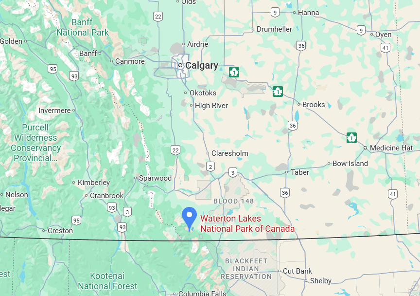
Lakeshore Trail Location and Map
The Lakeshore Trail is located in Waterton Lakes National Park, in the extreme southwestern corner of Alberta (link to Google Maps).
About Waterton Lakes National Park
Where Mountains Meet the Prairies: The park’s range lies between the Canadian Rockies and the Prairies, and is often referred to as the “park where mountains meet the prairies.” Waterton Lakes became Canada’s fourth national park in 1895, though its official status, park boundary and name have varied over the years.
Small in Size, Grand in Scenery: Although Waterton Lakes is currently the smallest of the National Parks located in the Canadian Rockies, it has about 200 km of hiking trails, making its backcountry the most developed of the Canadian mountain parks.
Dark Skies: Waterton Lakes National Park and Glacier National Park in the United States are now recognized by the International Dark-Sky Association (IDA) as an International Dark Sky Park and together form the first transboundary IDA International Dark Sky Park.
International Peace Park: Waterton Lakes National Park shares a border with Glacier National Park in Montana, United States: together they form the Waterton-Glacier International Peace Park, designated as a World Heritage Site in 1995 for the parks’ distinctive climate, physiographic setting, and mountain-prairie interface. The Peace Park was first established in 1932 and was the first of its kind in the world. It was intended to promote goodwill between nations and highlight the international nature of protecting wilderness.
Diverse Park Flora: Waterton Lakes National Park is home to many rare plants, more so than any national park in the Canadian Rockies. More than half of Alberta’s plant species are found in Waterton, which is also the only Canadian national park that preserves foothills fescue grasslands. Several different ecological regions converge in Waterton, with prairie plants of the Great Plains, Rocky Mountain plants from northern areas, and coastal plants from the Pacific Northwest all overlapping.
Impressive Wildlife: Waterton Lakes National Park is home to more than 60 species of mammals, including elk, moose, mule deer, white-tailed deer, bighorn sheep, mountain goats, plain bison, lynx, bobcats, wolves, coyotes, cougars, black bears and grizzly bears.
How to Get to Lakeshore Trail & Waterton Lakes National Park
The Lakeshore Trail shares the same trailhead as the Bertha Lake trail, which is located just outside the town of Waterton (within walking distance), in the heart of Waterton Lakes National Park. If you are not staying in the town of Waterton, then you will definitely want to drive to the trailhead (see further below for parking information), as there is no transportation service within the park to get to the trailhead. There is no outside public transit option with service to Waterton Lakes National Park either. There is, however, an airport charter service available from Calgary, though this is a rather expensive means of reaching the park, and obviously isn’t very useful for getting around the park afterwards.
If coming from outside the park, you can expect the following drive times from the nearest major cities:
From Lethbridge: 130 km (1h30 min drive)
From Calgary: 280 km (3h drive)
From Medicine Hat: 300 km (3h15 min drive)
From Banff: 360 km (3h45 drive)
If you need to book a rental vehicle for your hiking excursion, we highly recommend using Discover Cars to get the best rates on your rental in Alberta.
We also highly recommend Airalo (eSIM card) for your connectivity needs when travelling abroad. Airalo is the world’s first and largest eSIM store with eSIM plans for 200+ countries and regions worldwide.
Nearest Gas Station
The nearest gas station is in the town of Waterton (there’s only one) (link to Google Maps). Otherwise, the nearest gas stations are outside of the park, in Mountainview to the east (20 km away) and in Pincher Creek to the north (45 km away).
Roadside wildlife
It’s important to drive slowly throughout the park’s roads, as there is abundant wildlife around every corner. Deer are often seen throughout the Waterton townsite, and deer, elk and bears are often seen alongside many of the park’s roads.


Lakeshore Trail Access, Fees, and Parking
Trailhead & car park location: The Lakeshore/Betha Lake trailhead (link to Google Maps) is located just south of town, next to the townsite campground. It’s a short 10-minute walk from the center of town and the Waterton Lakes National Park Visitor Centre.
Trail access and fees
Anyone visiting Waterton Lakes National Park, whether for a hike or simply to enjoy the scenery, must first pay the applicable Parks Canada entrance fee.
Daily Fee: $11 (adults; discount for seniors and free for children)
Annual Waterton Lakes Pass*: $54.50 (adults; discount for seniors and free for children)
Parks Canada Discovery Pass**: $75.25 (adults; discount for seniors)
The Parks Canada Discovery Pass is valid for 12 months after the date of purchase, which can be purchased online here (includes access to all Canadian National Parks)
As of 2025, the Waterton Day Use and Annual passes can only be purchased in person.
*If you plan on spending at least 5 days in Waterton Lakes National Park, you are better off purchasing the Annual Waterton Lakes Pass.
**If you plan on spending at least 7 days within a Canadian National Park during any 12-month period, you are better off purchasing the Parks Canada Discovery Pass. This is usually easily achieved during road trips through the Canadian Rockies.
For up-to-date fee information, consult the Waterton Lakes National Park fee page.
Trail opening Hours: 24 hours – all year. It’s also a great winter hiking and snowshoeing destination for those visiting during the snowy season (see further below for more information and advisories regarding visiting this trail in winter).
Parking lot: The parking lot by the trailhead isn’t overly large (it can accommodate up to 40 cars), and you can expect the lot to fill during busy summer weekends. As mentioned earlier, you can also easily walk to the car park from pretty much anywhere in the town of Waterton.
Alternatively, there’s street-side parking along Evergreen Ave, the street that leads to the car park. You can also park at the Waterton Visiting Center (link to Google Maps), which is about 1 km from the trailhead.
Facilities: There are no toilets by the trailhead or anywhere along the trail.
Lakeshore Trail Details and Map
There are multiple endpoints (or turning points) you can choose when hiking the outgoing leg of the Lakeshore Trail. Most choose to turn around at Boundary Bay, just before reaching the US border.
Lakeshore to Boundary Bay
Distance: 13 km
Route Type: Out & back
Elevation change: 100 m (difference between trail high and low point)
Elevation gain: 543 m (cumulative elevation gain)
AllTrails rating: (4.7, 627 ratings (2025))
Duration: Most people complete the trail in about 3h-3h30
Not an AllTrails member yet? We highly recommend signing up for either their free or paid membership plans. The free plan allows you to find new trails and plan routes but it can only be used while hiking if you have access to mobile data. The paid membership plan (AllTrails+) allows you to download trail maps for offline use and provides live progress updates and off-route notifications.
If you are still uncertain – you should know that the All Trails mobile application was voted the 2023 iPhone App of the Year by Apple.
We find that AllTrails is a great tool to have when hiking, particularly for assisting with navigation when the trail is hard to locate and to help monitor your progress along the trail, which helps estimate how much time you’ll need to complete the trail.
Lakeshore Trail to Bertha Bay (shorter option)
The trail version of choice for those overnighting at the Bertha Bay campground, it’s also ideal for those looking for just a glimpse of what the Lakeshore offers without having to log many miles of hiking.
Distance: 4.8 km
Route Type: Out & back
Elevation gain: 100 m (difference between trail high and low point)
Elevation gain: 216 m (cumulative elevation gain)
AllTrails rating: (4.5, 292 ratings (2025))
Duration: Most people complete the trail in about 1h15-1h45
Lakeshore to Goat Hunt (Glacier National Park, Montana) (longer option)*
*This is typically done as a point-to-point hike, with either the outgoing or return leg completed via ferry (see further below for ferry details) – You’re passport will also be required to cross the border. Where this trail crosses the border, it becomes part of the CDT (Continental Divide Trail).
Distance: 13.5 km
Route Type: Point-to-Point
Elevation change: 100 m (difference between trail high and low point)
Elevation gain: 344 m (cumulative elevation gain)
Start point: Car Park or ferry dock in Goat Haunt
AllTrails rating: (4.4, 65 ratings (2025))
Duration: Most people complete the trail in about 3h-4h
The closer you get to the US border, the more overgrown the trail tends to be, as fewer and fewer people make it that far. On the US side, the path tends to be even more overgrown, given the small number of people who hike all the way to Goat Haunt – so wearing long pants is recommended. Those who do depart from Goat Haunt typically take the ferry from Waterton to get there, as Goat Haunt is a remote area located at the head of Waterton Lake in Glacier National Park, Montana, that can only be reached by boat or by hiking trails (there is no direct road access).
Crossing the US border on Foot
All visitors travelling to Goat Haunt must report their entry to Customs and Border Protection (CBP) through the CBP ROAM app using their personal device, or by using a tablet at a partner location in Waterton Townsite. This can be completed up to five hours before entry.
The only exception to this regulation is those who travel to Goat Haunt on a round-trip ferry ride, via Waterton Inter-Nation Shoreline Cruise Co., and do not plan on staying longer than 30 minutes or hiking past the Goat Haunt Ranger Station.
For more information, see the National Park Service website.
The Wateron Ferry to Goat Haunt
Visitors to Goat Haunt arriving by boat may disembark at the dock and explore the exhibits at the International Peace Park shelter and walk along the paved pathway to the Ranger Station. Those wanting to hike back to Wateron will have to complete the steps outlined in the section above.
The ferry between Waterton and Goat Haunt runs twice daily in each direction (three times on summer weekends) between June 21 and Sept 21. One-way tickets cost $55 (2025 prices). Return trips for those not intending to hike cost $89.
For more details on taking the ferry, see the Waterton Shoreline Cruise website.
Guided International Peace Park hike
You can also undertake this hike as part of a guided adventure. Join a Parks Canada Interpreter and National Park Service Ranger on this 13.5-kilometre guided hike. Travel down the lakeshore and cross the international boundary into Glacier National Park. Learn about the founding of the International Peace Park as you go.
This hike departs promptly at 10 am from the Bertha Trailhead.
When (2025): Fridays, June 27 to August 29; 10 am
You can find additional information about this guided hike on the Parks Canada website.
Additional Lakeshore Trail Details
– Canine companions: Dogs are permitted on leashes (but not beyond the US border).
– Summit: The trail doesn’t climb a summit, but its highest point at Bertha Point lies at an elevation of 1382 m.
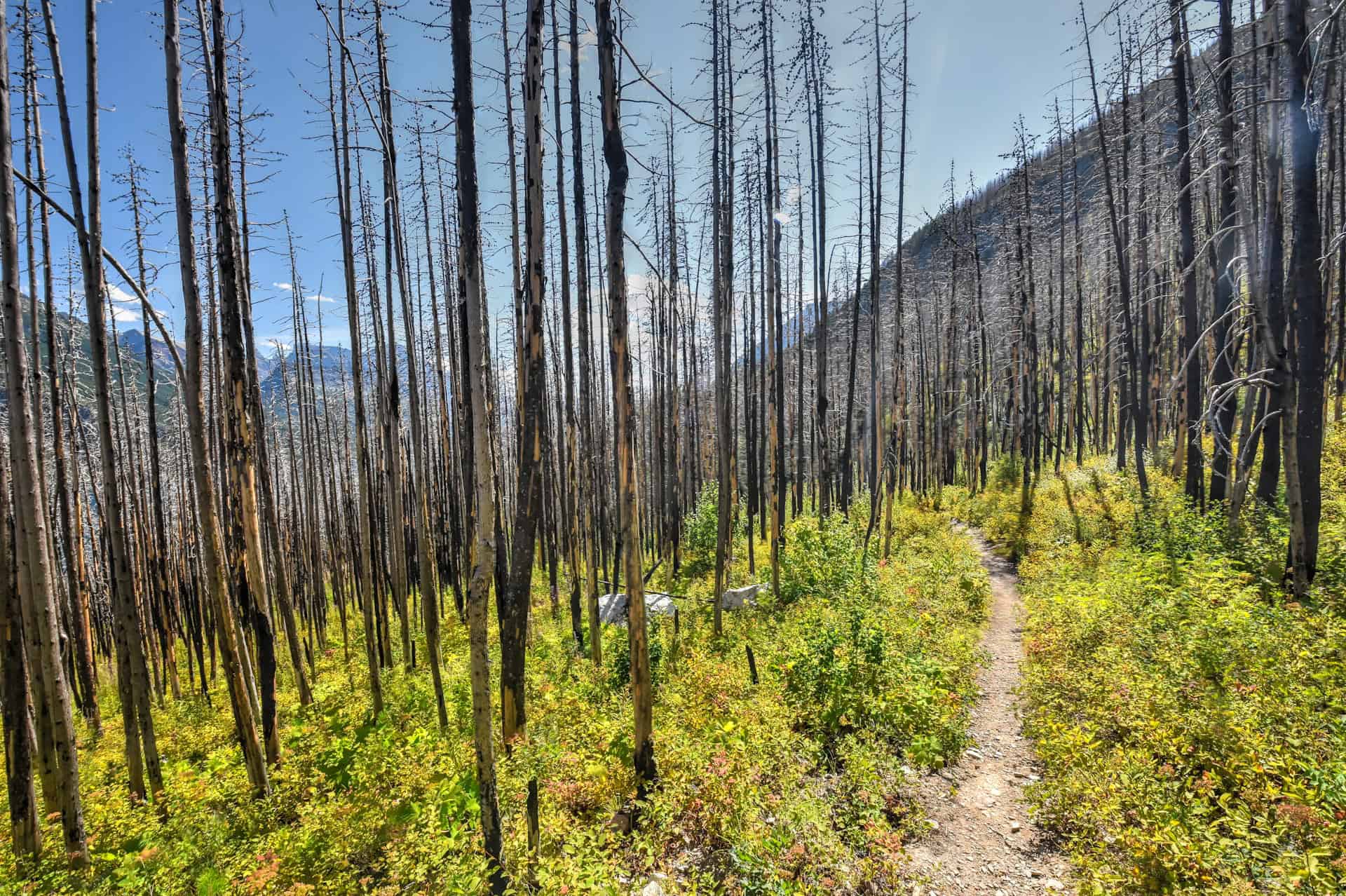
– Trail environment: A mix of forest and shoreline bush. The further you go along the trail, the more overgrown the surrounding vegetation tends to be.
– Route Signage: Limited – but the trail is generally quite easy to follow (there’s only one intersection, where the Bertha Lake Trail and the Lakeshore Trail split)
– Trail Surface / Technical trail: The trail isn’t a technical one, and the trail surface doesn’t present any particular challenges. The trail is mostly along a flat, hardened surface, with rocks here and there.
– Average trail slope grade: This varies depending on how far you go. If you make it all the way to the US border (Boundary Bay), the average slope grade is 7%, which is generally considered an easy-to-moderate slope. However, the trail follows a series of ups and downs, so you will rarely be continuously going up or down for long periods.
– Trail difficulty level assessment (based on our personal assessment, taking into account the trail length, slope grade and trail surface) :
Very Easy | Easy | Moderate | Moderately Challenging | Challenging
This is our assessment of the trail all the way to Boundary Bay. The trail’s primary challenge is its length, with a fair amount of cumulative elevation gain.
Lakeshore Trail Description and Summary
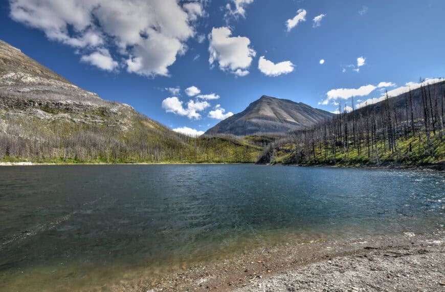
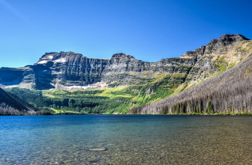
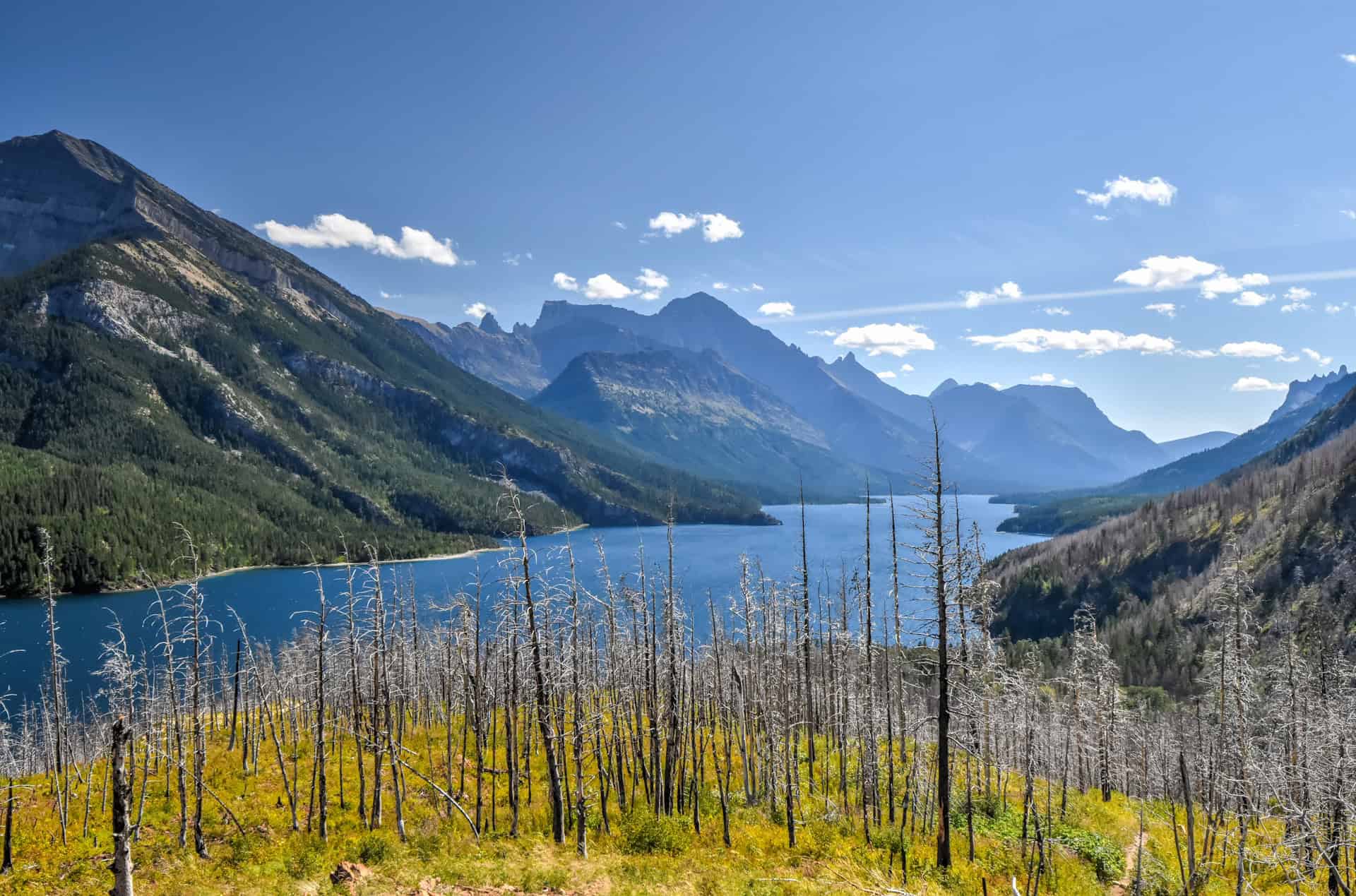
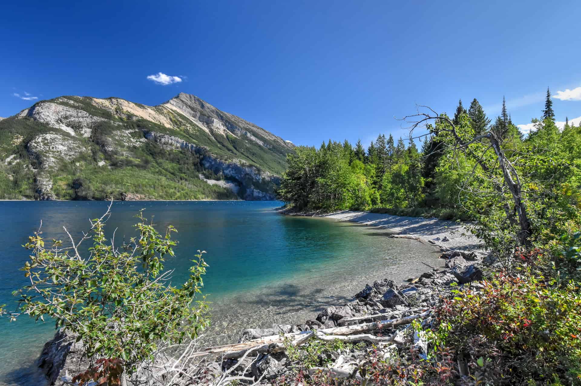
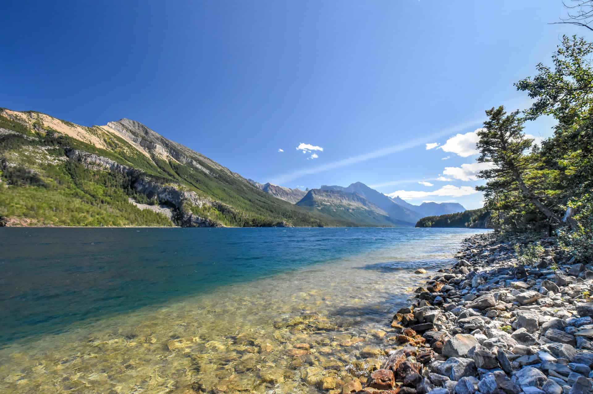
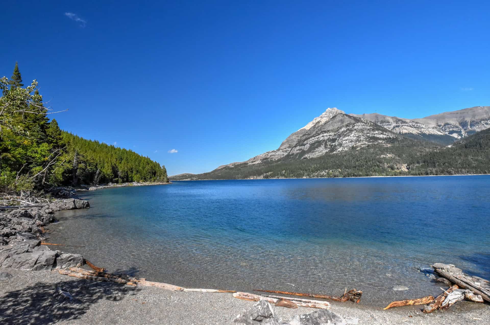
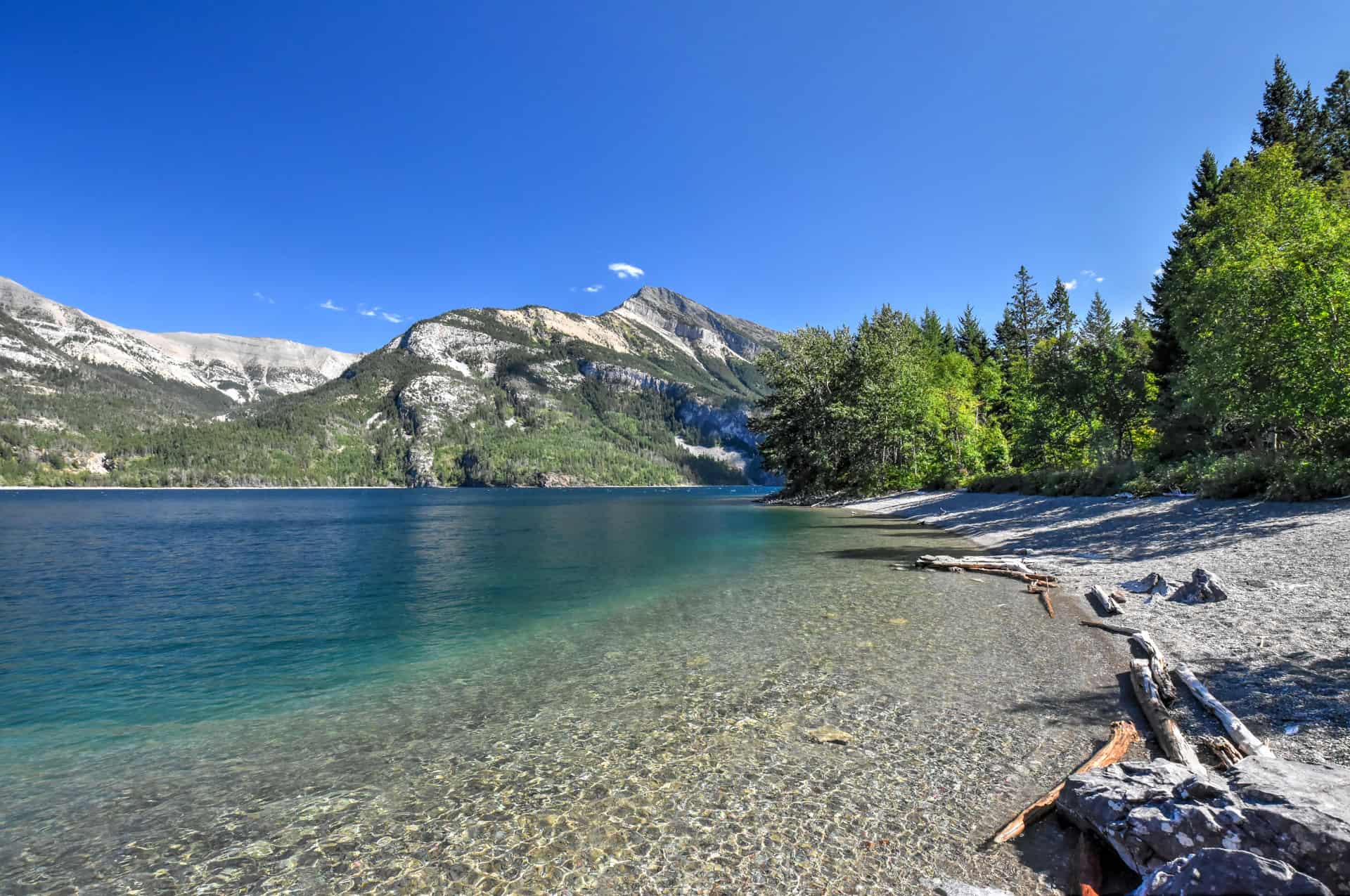
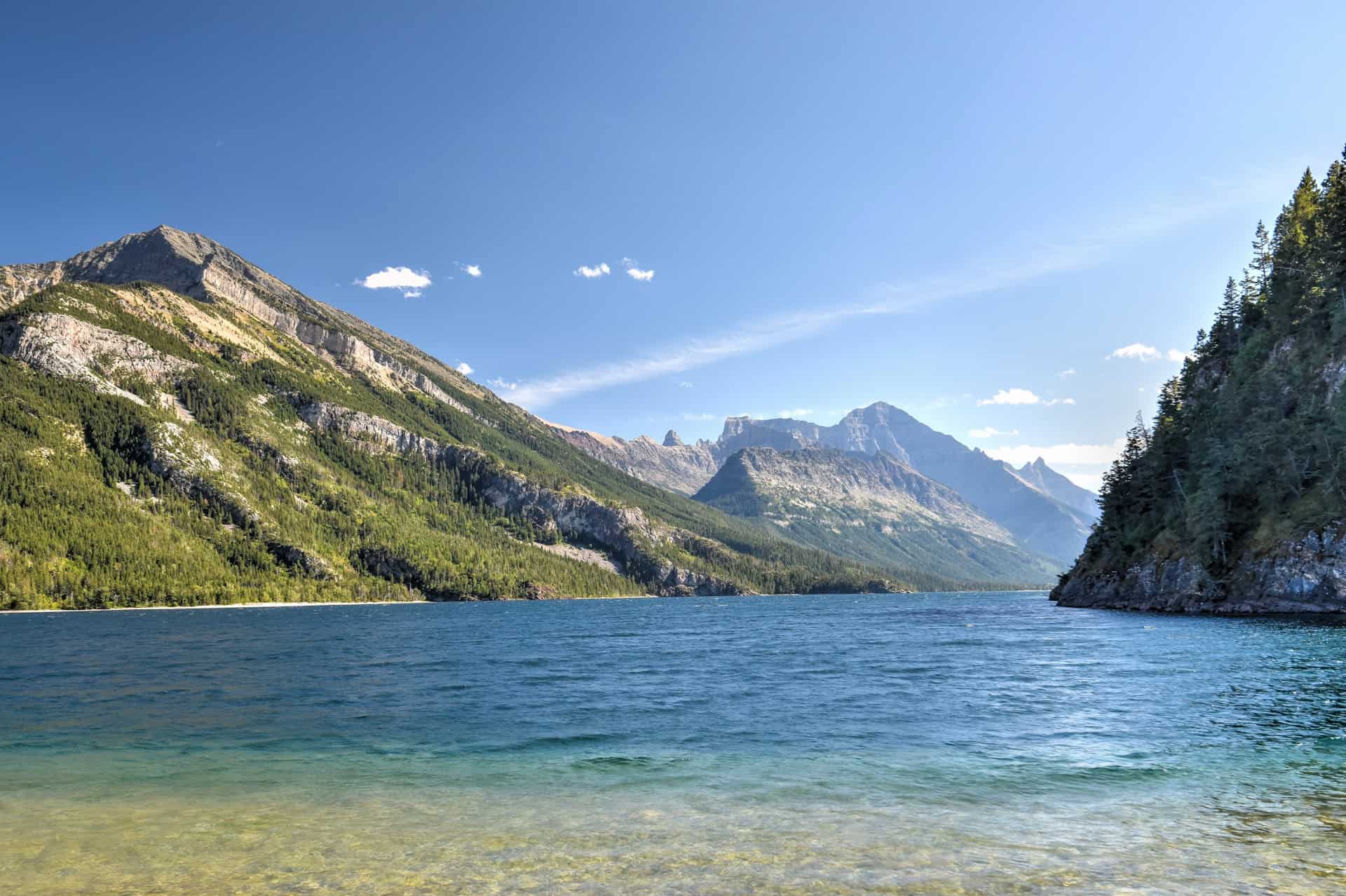
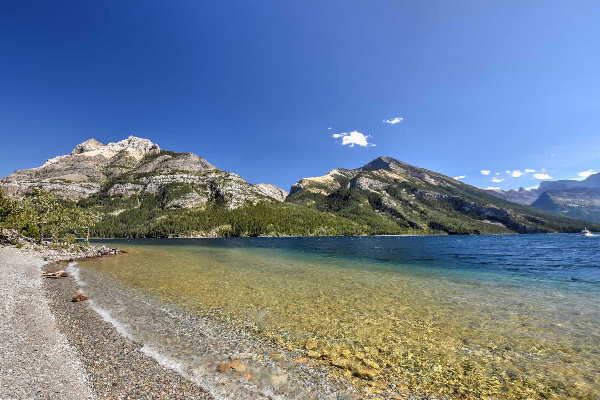
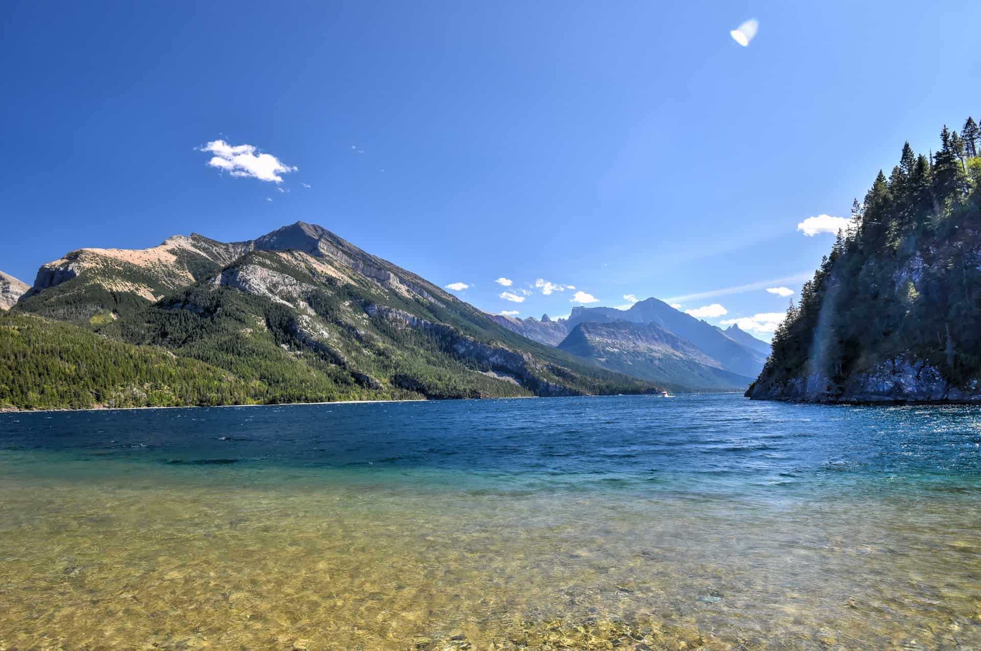
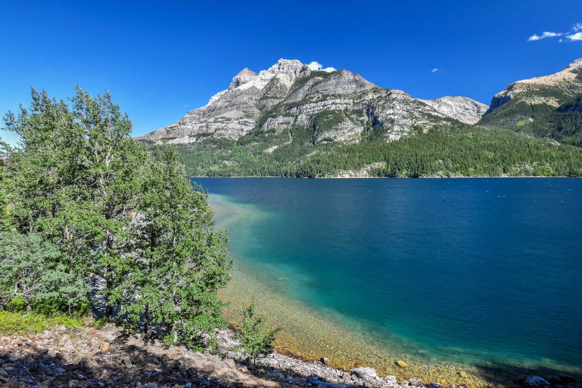
From the trailhead, after having gone through a few short switchbacks, the trail slowly gains elevation as you follow a path that roughly runs parallel to Upper Wateron Lake.


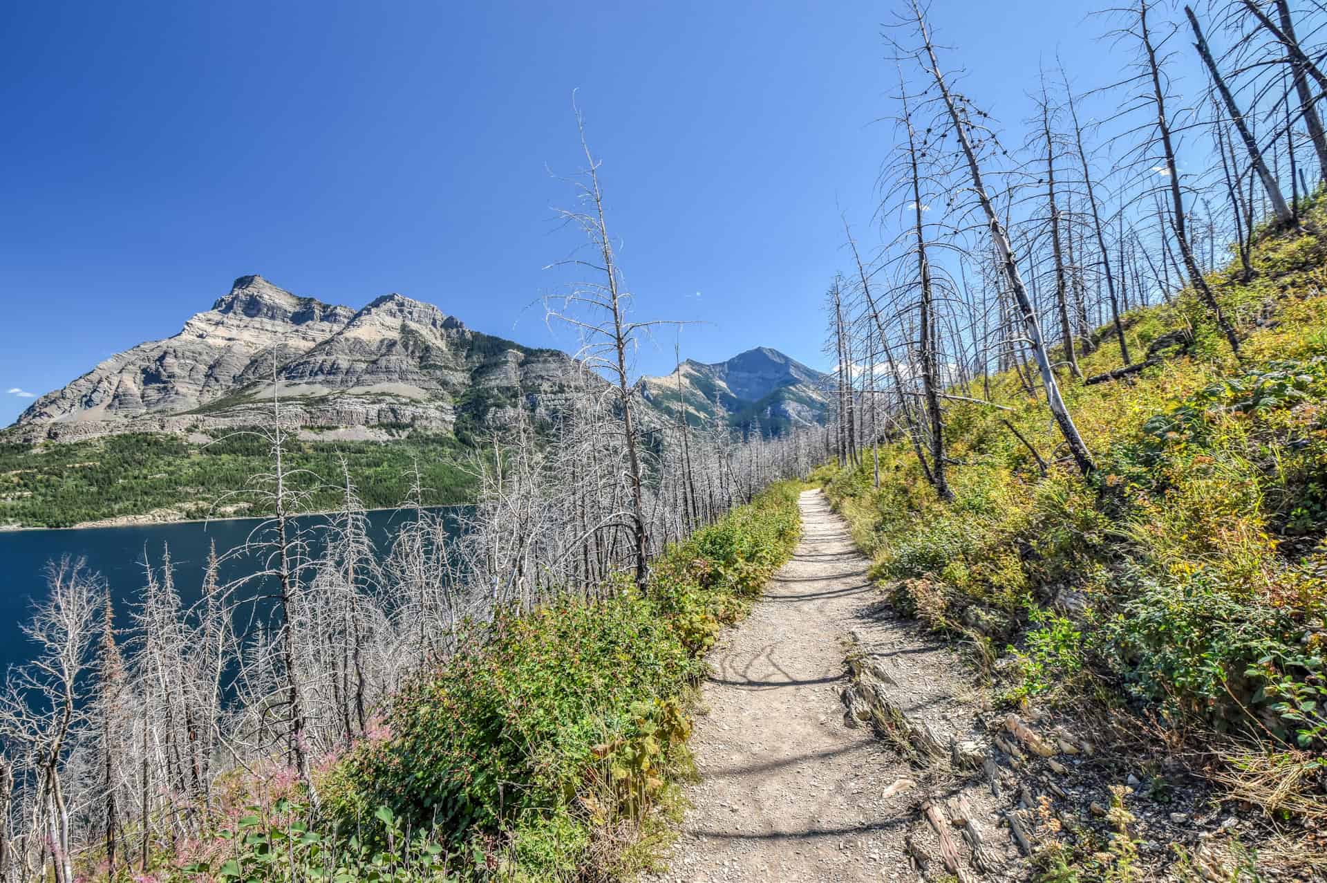
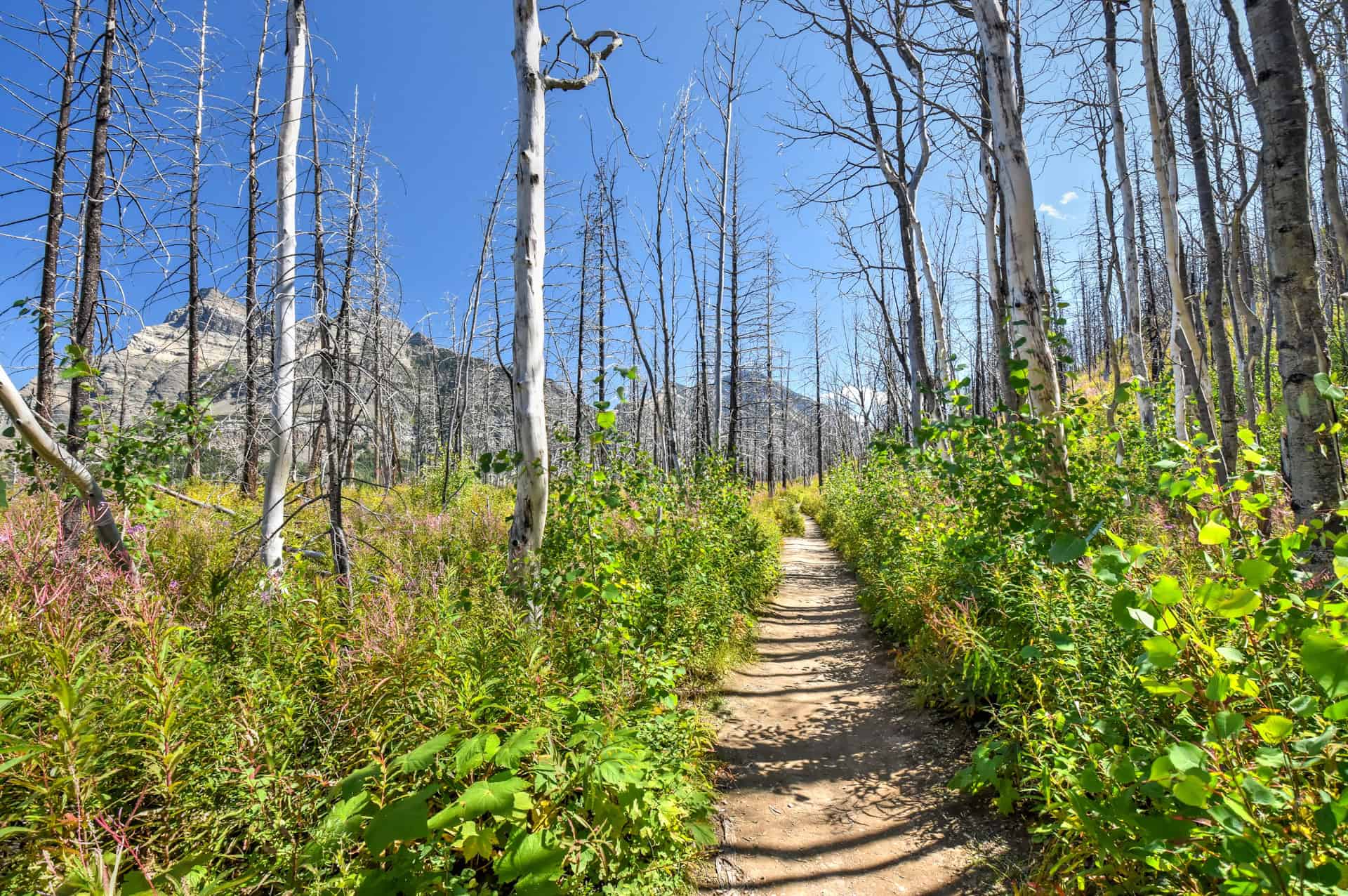
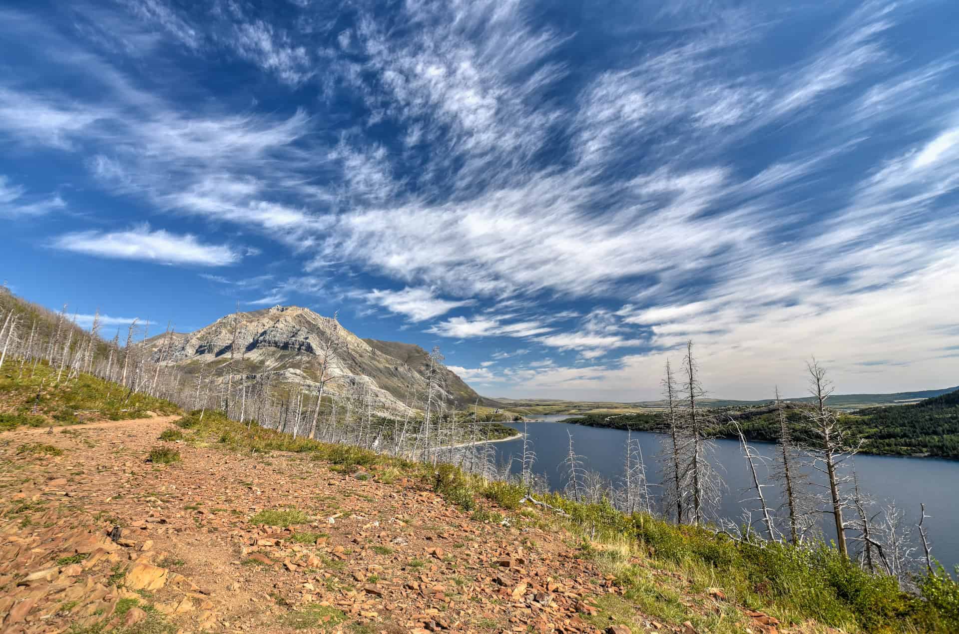
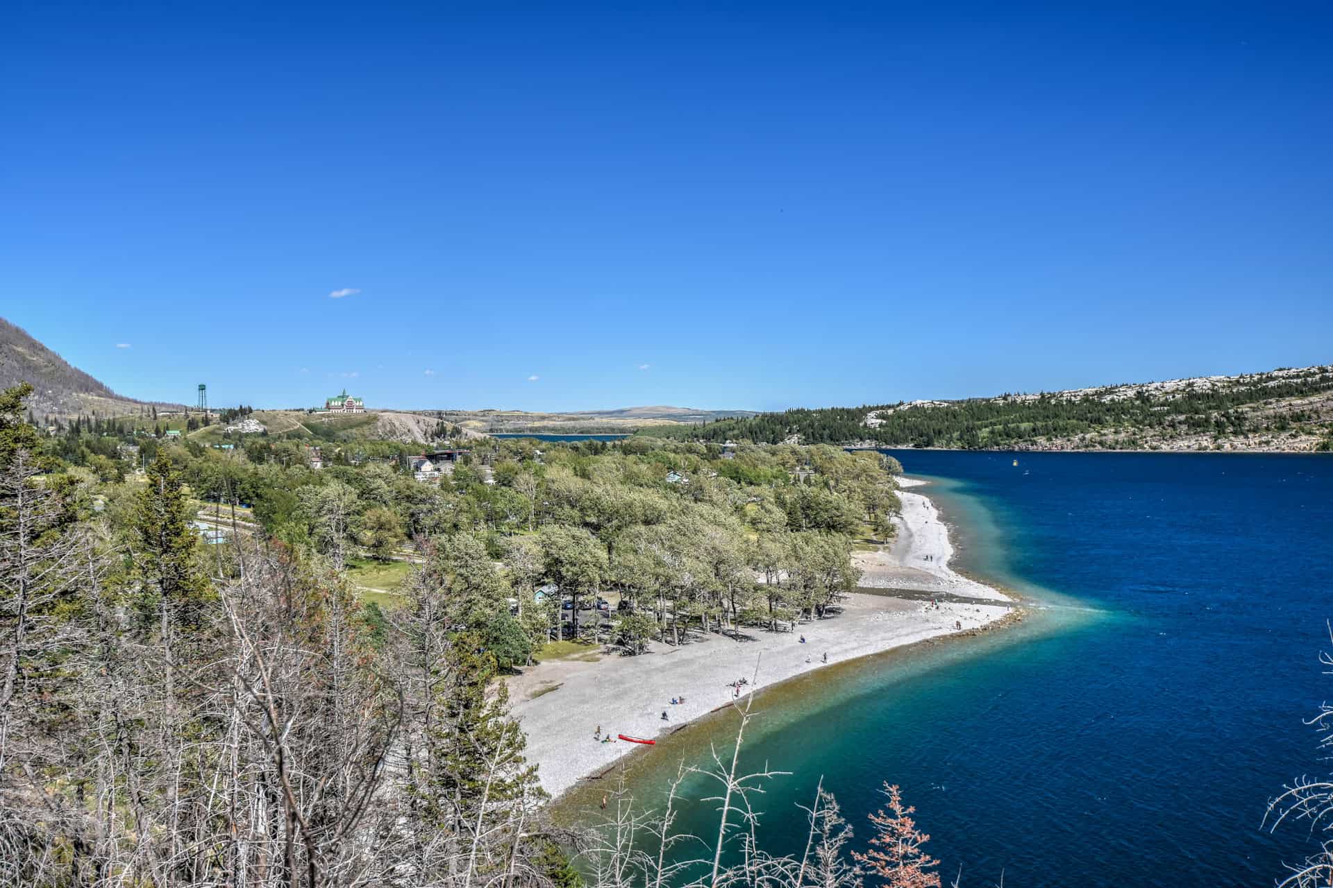
After having gained about 80 m in elevation by the 1.5 km mark, you will have reached the first impressive viewpoint: a large open area known as Bertha Point. The views in either direction are superb: to the north, the Waterton townsite and Mount Crandell towering above it, and to the south, the seemingly endless Upper Waterton Lake as it makes its way into Glacier National Park in Montana (USA). There’s also a bench here to sit down and relax while enjoying the spectacular scenery.


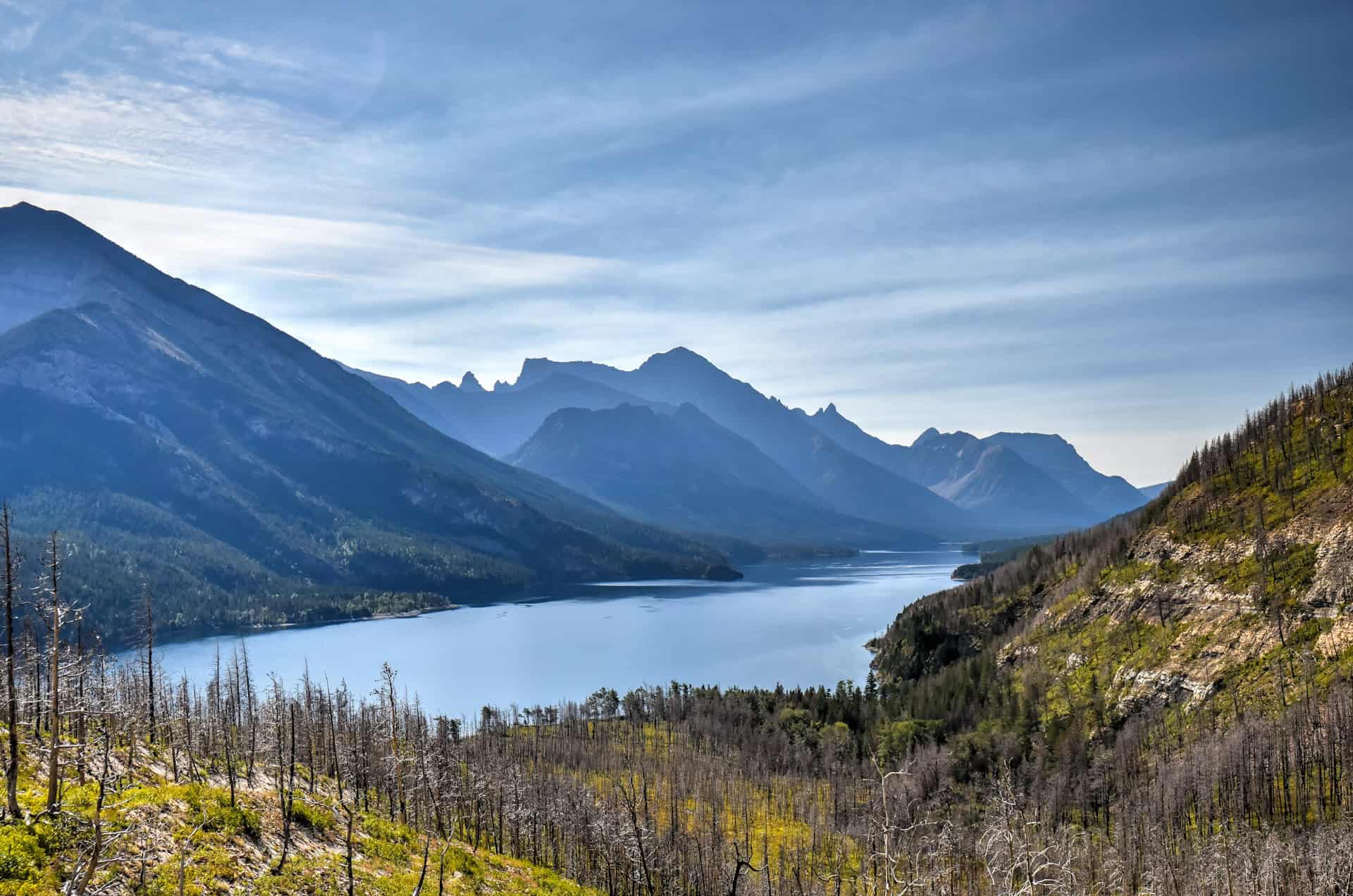
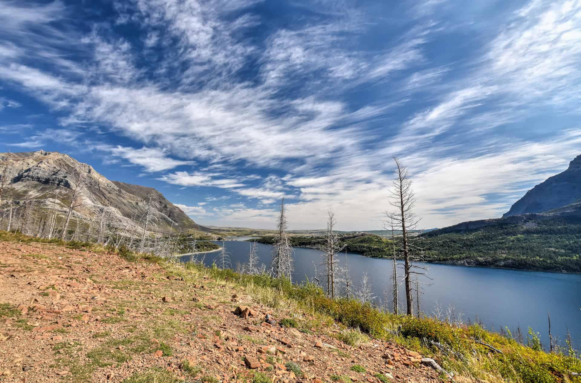
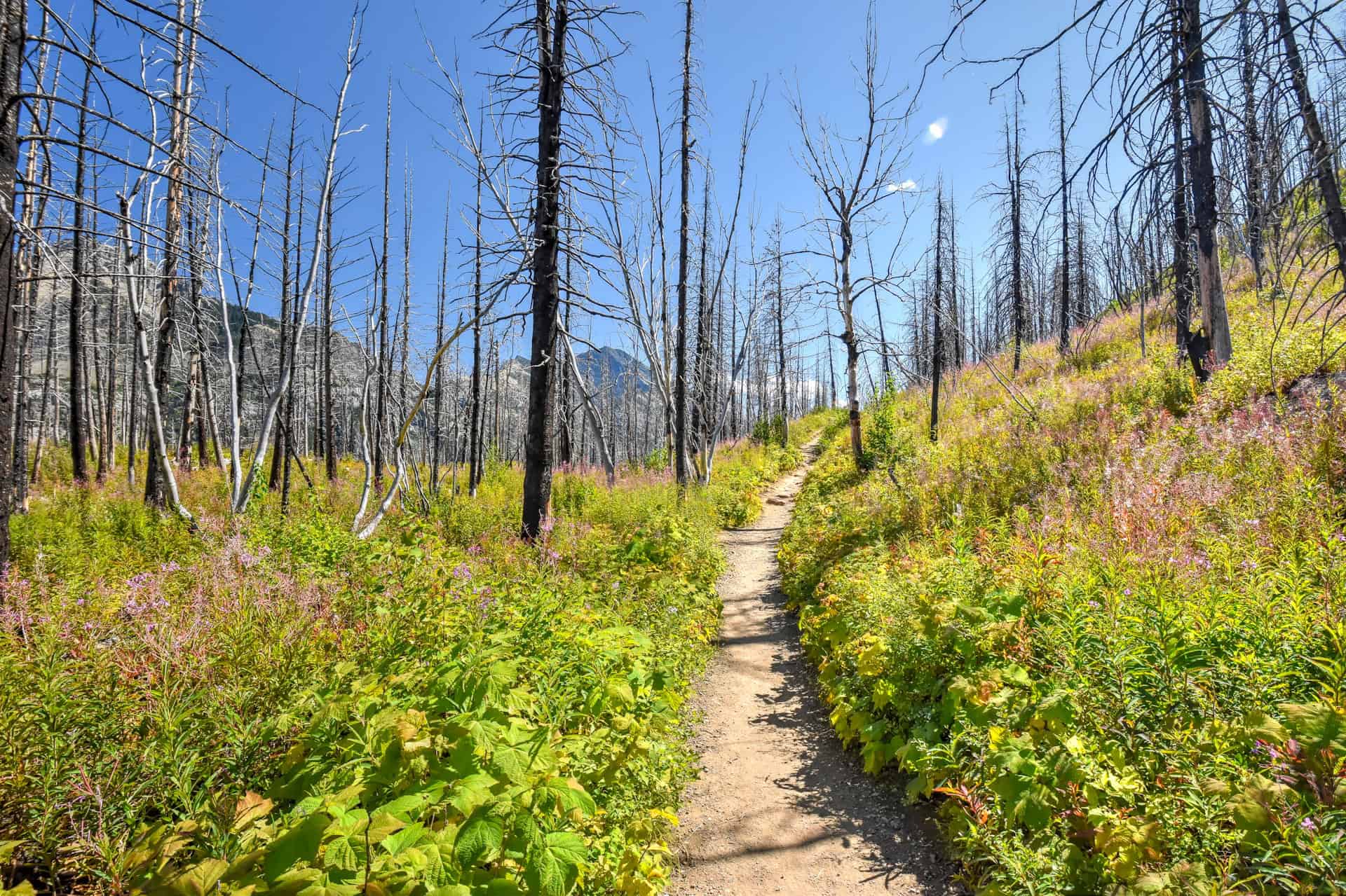
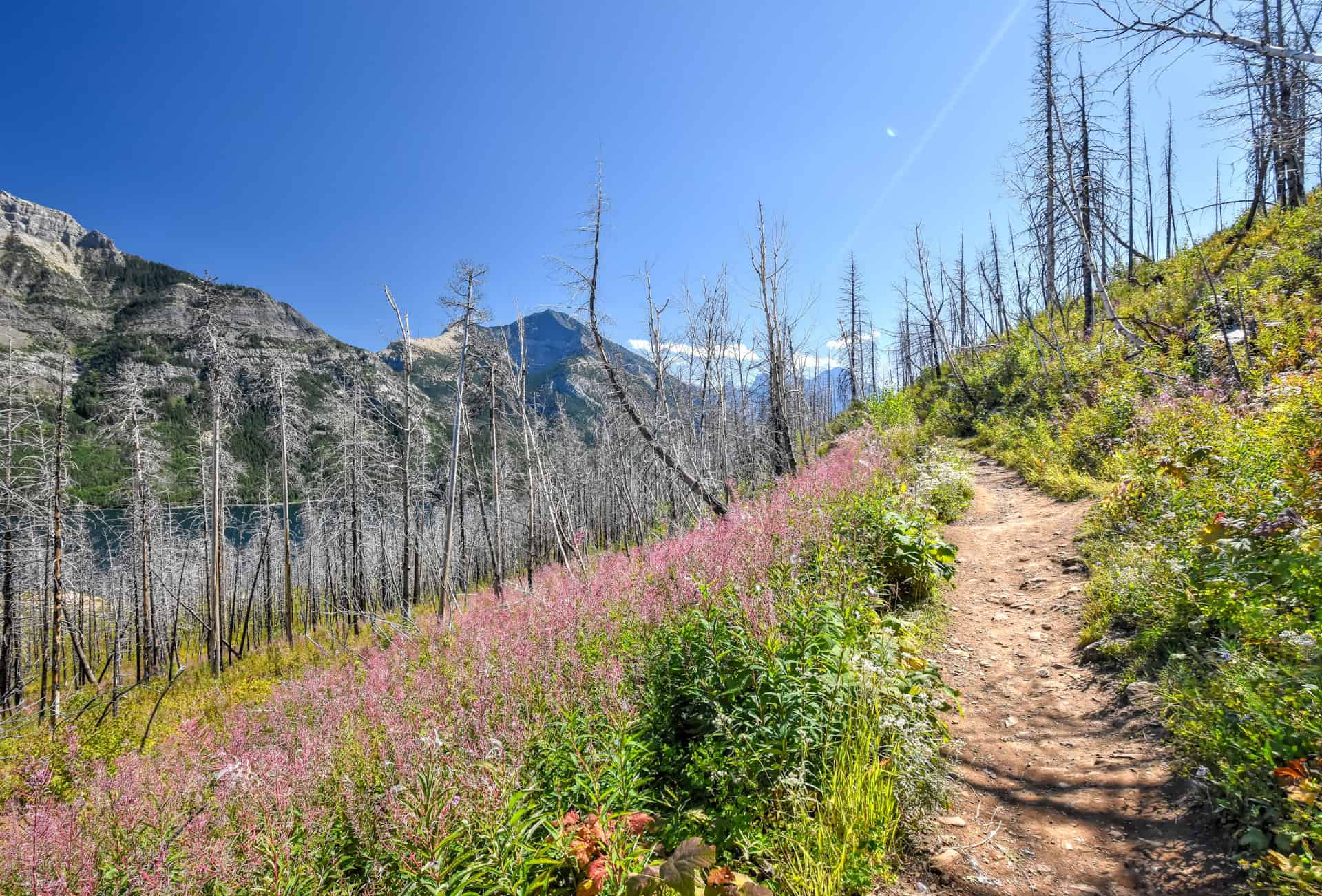
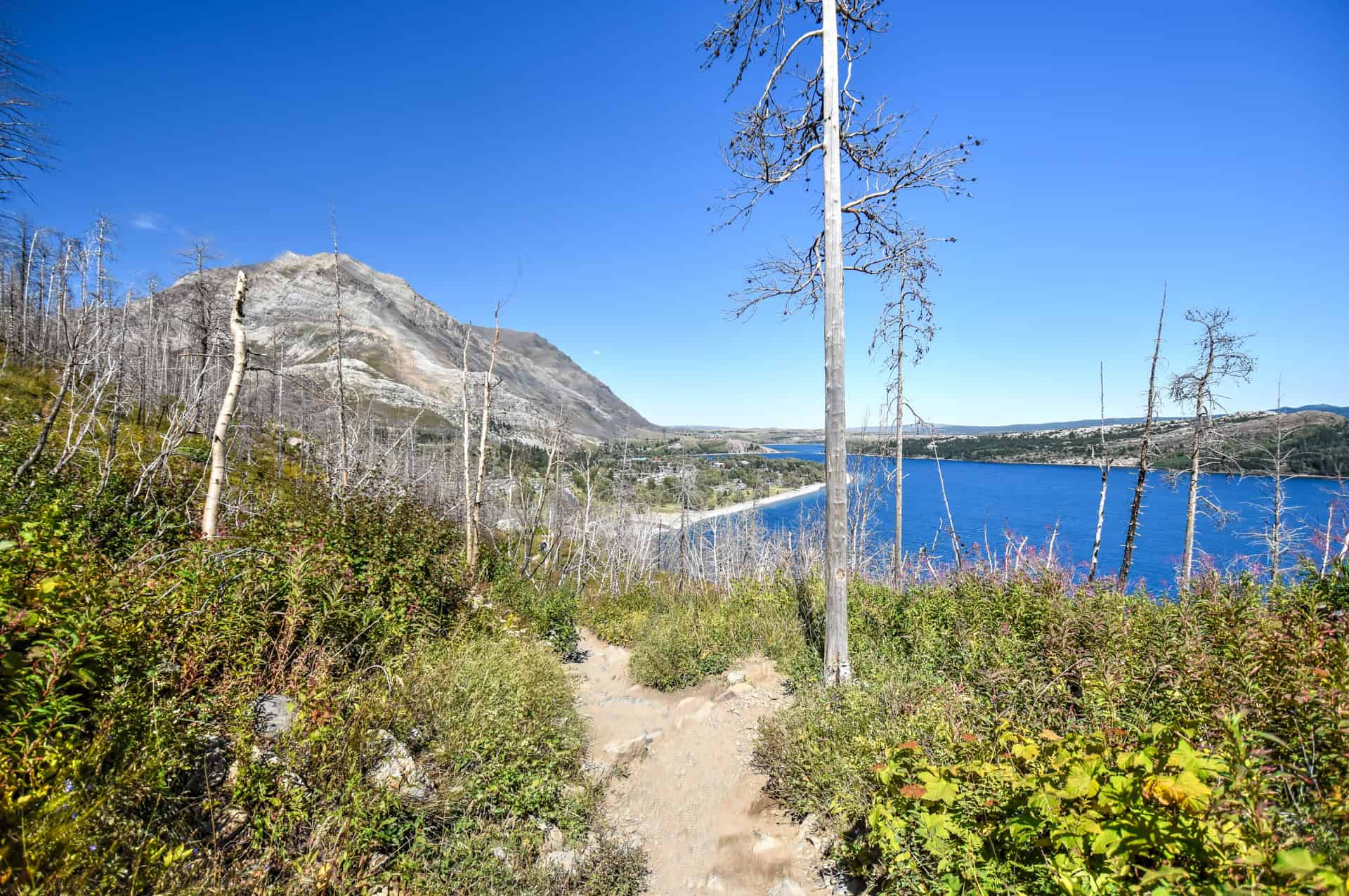
You will likely notice many scorched trees along the trail, evidence of the destructive Kenow forest fire that ravaged the national park in 2017. Fortunately, signs of regrowth are quite evident as the forest floor is now thick with lush vegetation.
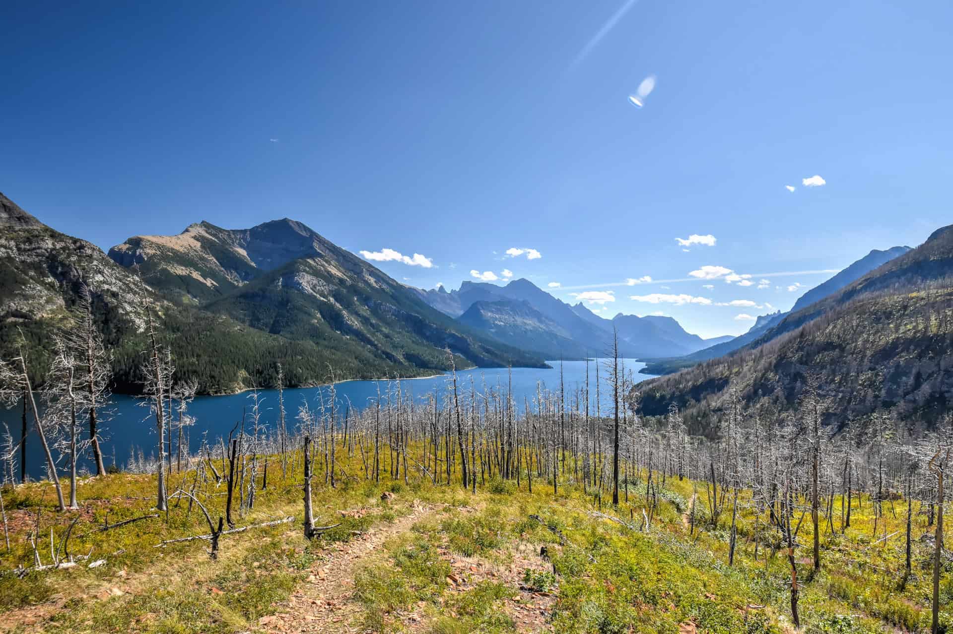
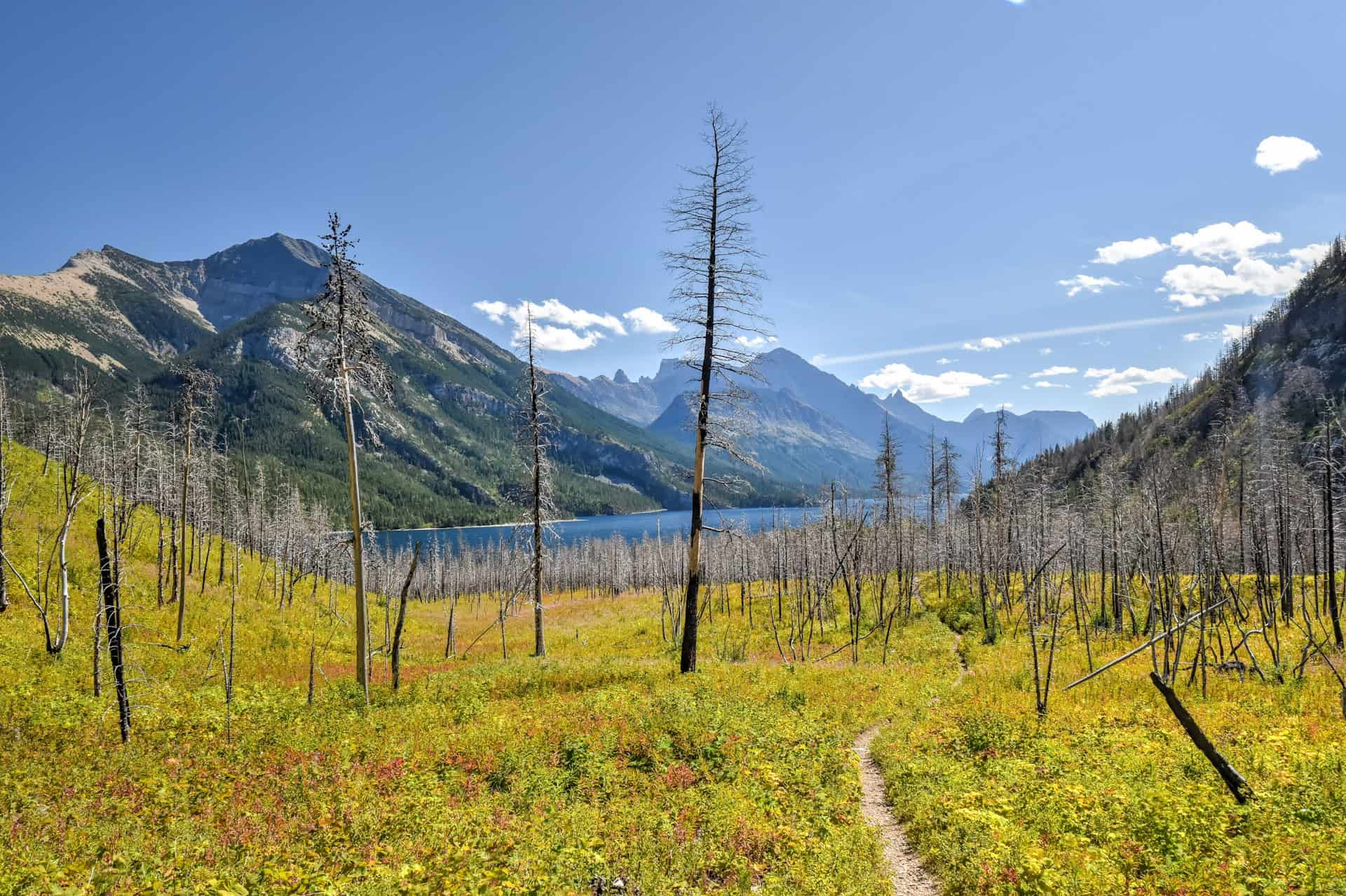
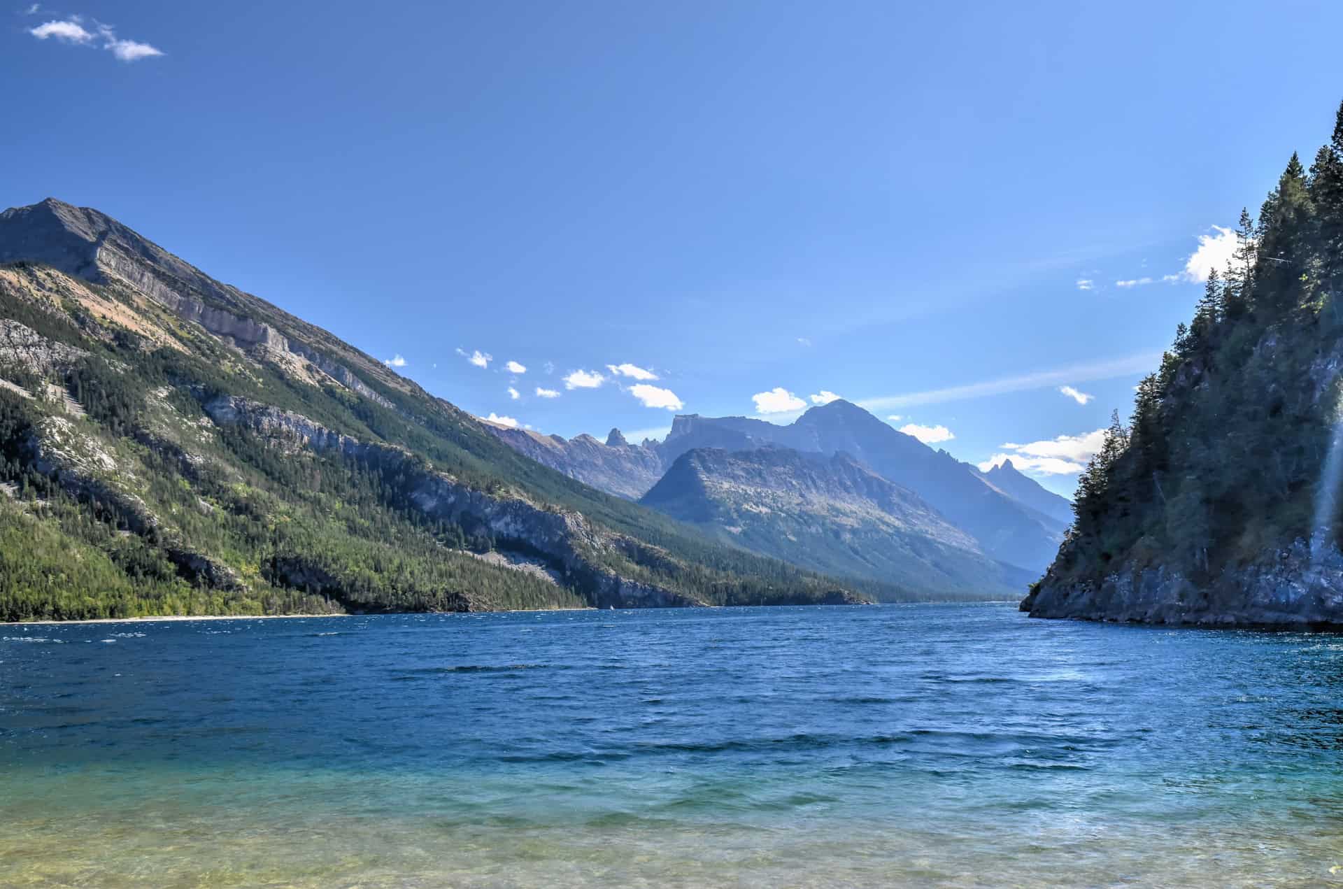
From Bertha Point, the highest point along the trail, the trail splits: head straight to continue along the Lakeshore Trail, or turn right to continue towards Bertha Lake. Continuing onwards parallel to Upper Waterton Lake, the trail will continue to oscillate through gentle ups and downs.
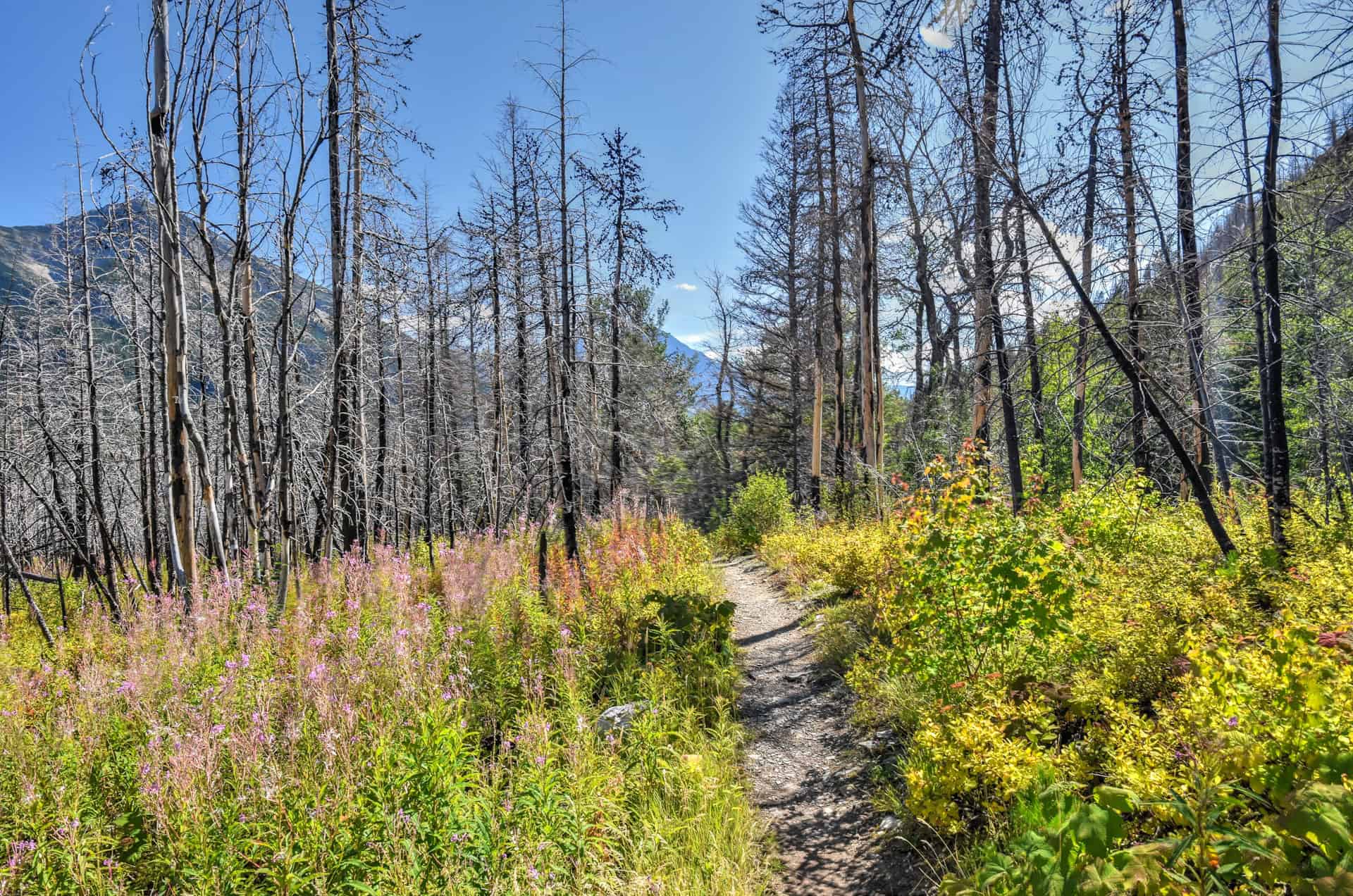
The trail will mostly follow a path along the shoreline, but with occasional access to beautiful hidden beaches. Few people venture beyond Bertha Point, aside from those heading to either the Bertha Bay or Boundary Bay Backcountry Campgrounds, so we had the trail and the beaches to ourselves.


Another fun thing about this trail (like many others in Waterton Lakes National Park) is that you are quite likely to come across some local wildlife along it. We crossed some deer during the early part of the trail.

Finally, as you near the end of the hike, you’ll start to see views of Waterton and Mount Crandell emerge from behind the treeline.
Lakeshore Hiking Tips
Hiking Experience
The Lakeshore Trail is suitable for most novice hikers as the trail isn’t technical and doesn’t require special skills. The main requirement is a sufficient level of fitness, given that it is a long trail.
Cell Service
Cell service in Waterton Lakes National Park is limited and unreliable. While some cell service is available in the town of Waterton, it is generally spotty and may be unavailable in other areas of the park.
Leave No Trace
Stick to the designated path to protect the surrounding environment.
Bugs
The prairie-meets-mountain environment of the Waterton Lakes National Park means you can encounter both wetland-loving mosquitoes and sunny-meadow-loving horseflies when visiting Waterton Lakes National Park.
Late May – Mid June: Mosquito activity begins in low-lying, wet areas (near lakes, streams, marshy valleys).
Late June – Mid August: Mosquitoes are most active around dawn/dusk, especially near vegetation and water. Black and deer flies are worse during calm, sunny days in open areas.
Late August – September: Bug activity drops sharply as nights cool.
Ticks are also present in the park and the surrounding area. They are most active from April to June, especially in dry, grassy slopes.
In summary, be sure to pack insect repellent for your visit to Waterton. We can recommend visiting in late August, which is when we spent most of our time in Waterton, as we didn’t find bugs to be a nuisance during our time there.
Equipment
No specialized equipment is required for the Lakeshore Trail, though proper hiking footwear is recommended.
Weather and Exposure
Waterton Lakes National Park is notoriously windy, and this will be particularly true along some sections of the Lakeshore trail. The lack of tree cover (until there is significant regrowth) also means you will be at the mercy of the weather along the trail, whether that be a strong sun or pouring rain.
Be sure to wear sunscreen on sunny days.
Current Trail Conditions
Check this page of the Waterton Lakes NP for up-to-date trail conditions and any notices of temporary trail closure.
Also note that the Bertha trailhead is in an avalanche path. Check the Bertha-Townsite avalanche advisory (updated daily) before accessing the area.
Best Time to Hike the Trail
The best months to hike in Waterton are generally late May through early October.
June & September: These shoulder season months offer a good balance of pleasant weather and fewer crowds. You might encounter some rain or cooler temperatures, but you’ll also experience more tranquillity on the trails.
-Wildflowers will start to peak in late June.
-Mosquitoes can be quite active in June.
-Fall colours are apparent in late September.
July & August: Best weather (warmer, drier and more dependable) but more crowded trails – the park attracts around 500,000 visitors each year. Nearly 50% of visitors come in July and August.
-July is peak wildflower season.
-Bugs are still quite active in July, with their activity decreasing throughout August.
May and October*: These months are more unpredictable, with the possibility of snow, especially at higher elevations, and hiking may be limited to lower-elevation trails.
Quick Summary
If you want wildflowers and smaller crowds, late June to early July is ideal. Daylight hours are also significantly longer during these months, allowing you more time to explore every day.
If you want fall colors and fewer people, aim for mid-to-late September. Cooler temperatures make longer hikes more comfortable.
During the peak summer months, it’s best to go early in the morning or late in the afternoon to avoid the trail’s most crowded times.
Winter Hiking and Snowshoeing are also popular in Waterton during the snowy months, particularly along the shared portion of the Bertha Lake and Lakeshore trails up to Bertha Point. Beyond Bertha Point, you’ll definitely need snowshoes as you aren’t likely to find winter hiking tracks. As noted above, the Bertha trailhead is in an avalanche path. Check the Bertha-Townsite avalanche advisory (updated daily) before accessing the area. The rest of the trail, much like most trails in the park during winter, traverses avalanche terrain.
Wildlife
You may encounter wildlife along the trails, and it is important to know how to react in the presence of wild animals appropriately. Always maintain a safe distance from wildlife, whether deer, big-horned sheep, elk or wolves. Never attempt to feed wildlife, either: feeding wildlife in a Canadian national park is prohibited by law and may lead to a fine of up to $25,000.
Bears: Waterton Lakes National Park is bear territory, so you should carry bear spray at all times (keep it easily accessible in a bear spray holster) and know how to use it.
When possible, hike in groups, and try to make frequent noise while you hike to avoid surprise encounters.
Follow Waterton’s advisories and Trail Condition pages for more information on current bear sightings and trail closures.
For more tips on wildlife encounters and safety precautions, be sure to check out our guide on Wildlife Watching in Waterton.
Hiking Packing List
All Trails subscription – This comes in really handy for areas with little or no cell reception, as the annual subscription allows you to download trail maps for offline use.
External Battery – If you are using your phone to track your progress along the trail or to help with navigation, you certainly don’t want your phone to die on you. That’s especially true in the unlikely event that you might get hurt or need assistance.
Hiking poles – These can be particularly useful in steep trails or muddy/boggy trail conditions.
Water Filter Bottle – The Life Straw bottle is an advanced water bottle with a filter that not only improves water taste but more importantly filters out bacteria and parasites, chemicals and microplastics.
Headlamp – very practical and a smart choice if you plan to start your hike before sunrise or finish it after sunset.
Lakeshore Trail Add-Ons
Lake Bertha Trail
Because they share the same first 1.5 km sections, you can easily combine the Lakeshore and Lake Bertha trails. There’s more elevation gain with the Lake Bertha trail, so you might want to start with that one before deciding how much of the Lakeshore trail you want to do.


For more information about this trail, be sure to check out our Lake Bertha Trail hiking guide.
Some of Our Other Nearby Favorite Nearby Trails in Waterton
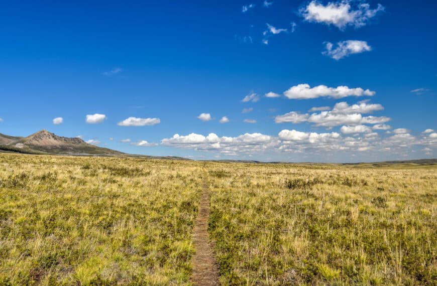
Bellevue Prairie Trail
If you are looking for a family-friendly and uncrowded hiking adventure, the Bellevue Prairie Trail might be for you. While it may lack some of the “wow” factor that some of the park’s more popular trails are known for, it still offers beautiful panoramic views of the surrounding landscape while you traverse gently undulating grassland hills. With mountains on one side and open blue skies on the other, the Bellevue Trail perfectly exemplifies the park’s motto, “where the mountains meet the prairies.” The trail ends by the park’s bison paddock, offering you a chance to see Bison roam the fields.


For more information on this trail, be sure to check out our Bellevue Prairie Trail hiking guide.
Bear’s Hump Trail
Most people will tell you that the best views in Waterton Lakes National Park are from the top of the Bear’s Hump, the endpoint of the park’s most popular trail, and we’d have to agree. The sweeping panorama from the summit is simply sublime, reminiscent of the dramatic vistas you might see above a Norwegian fjord. The hike itself is fairly steep, but because it’s so short, it remains accessible to most novice hikers and is a good option for families who don’t mind a brief, vigorous climb.


For more information on this trail, be sure to check out our Bear’s Hump hiking guide.
Where to stay near the Lakeshore Trail
Unlike many national parks, Waterton Lakes National Park offers several lodging options right inside its charming lakeside townsite, putting visitors just steps from the trails, restaurants, and waterfront views. Staying within the park means you can enjoy sunrise and sunset over the lake without ever needing to drive far.
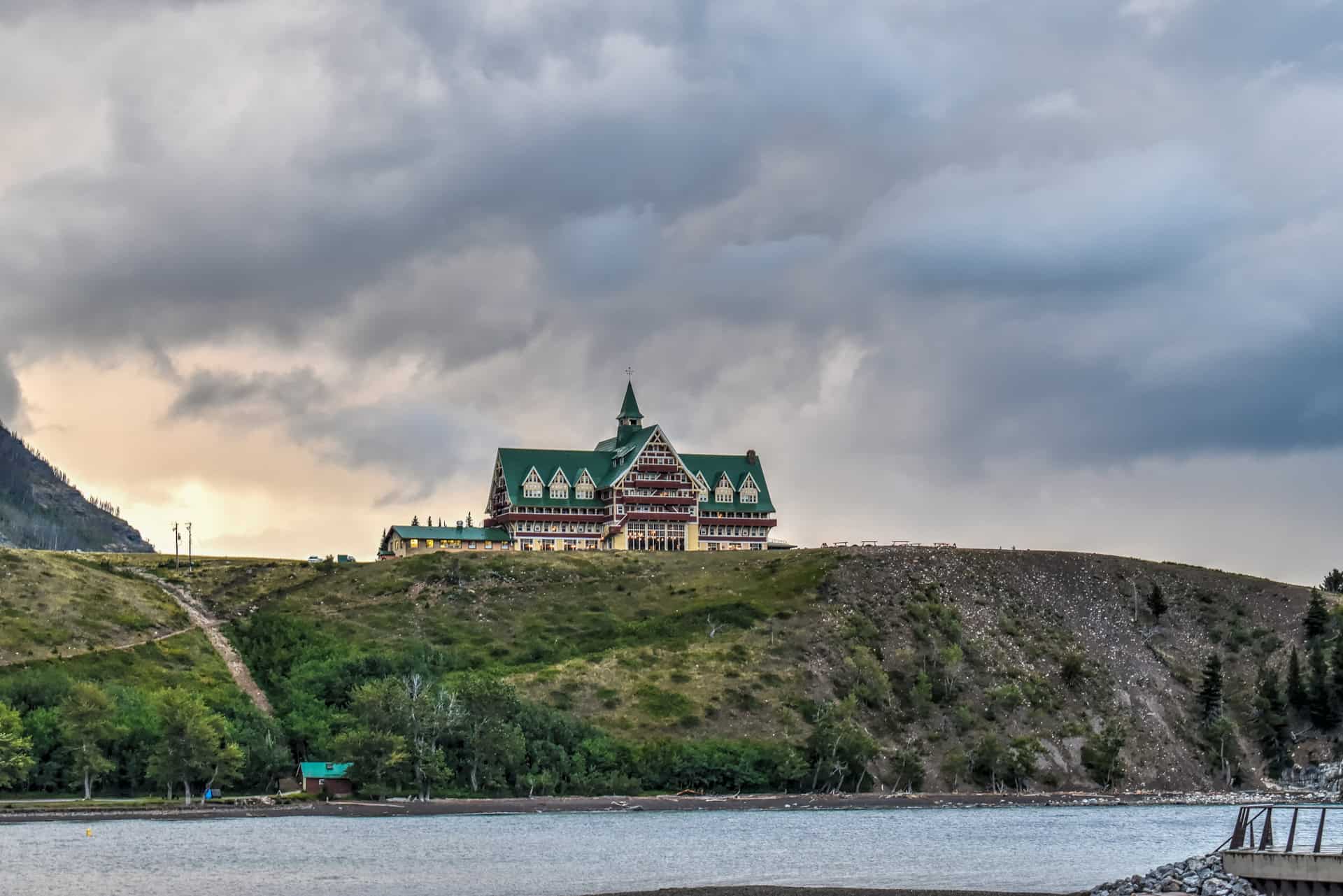
Prince of Wales Hotel – One of the most iconic places to stay in the park, this historic 1920s landmark is perched dramatically on a bluff overlooking Upper Waterton Lake. Its vintage interiors, elegant tea service, and panoramic views make it one of Canada’s most memorable national park lodges.
Bayshore Inn & Spa – For those who prefer to stay closer to the heart of the village, the Bayshore Inn & Spa offers modern comforts right on the lakefront. Ideal for travellers who want easy access to restaurants, shops, and boat rentals.


Aspen Village – Meanwhile, the Aspen Village Inn provides a relaxed, family-friendly alternative with spacious rooms and great value, all within walking distance of the park’s main attractions.


Want to Discover More Hiking Trails In The Canadian Rockies?
You might be interested in these pages (coming soon):
Photography Gear
If you like our photography, you might be interested in some of the gear we use to shoot our travel and hiking destinations.
Camera Body – Nikon Z 6ii Fx-series Mirrorless Body
Main Lens – NIKON 24-120mm F/4G ED VR AF-S
Zoom Lens – Sigma 745-306 150-600mm f/5-6.3
Polarizing filters – Urth Circular Polarizing (CPL)
Camera Tripod – K&F Concept 64-inch Camera Tripod
Mini-tripod – Lammcou Flexible Camera Tripod
Camera/hiking backpack – Vanguard Alta Rise 48 Backpack
Universal Travel Adapter – VYLEE Universal International Power Travel Plug
Other Travel Essentials
Travel Insurance
SafetyWing is a travel insurance company that offers comprehensive coverage for travellers. Includes Medical Insurance and Travel Insurance. Primarily geared towards long-term travellers, digital nomads, and expats.
e-Sim cards
Airalo is the world’s first and largest eSIM store with eSIM plans for 200+ countries and regions worldwide. With Airalo eSIMs, travellers can get connected the moment they land at their destination and avoid nasty data roaming charges
eSIMS are a sustainable alternative to single-use SIM cards – they are 100% digital, require less energy to produce and be re-used rather than disposed of.
Car Rentals
Discover Cars is our go-to website for car rentals. We almost always find our preferred rate there.
Transfer from Airport
Welcome Pickups is our favourite private transfer service, which you can pre-book at a fixed price. Currently available in 220 cities all over the world (mostly in Europe, but with several major cities in Asia, the Middle East and the US).
Kiwitaxi is another private transfer service – we haven’t tried it yet, but it’s currently available in a few more countries (102 as of 2024).
Hotels and Accommodations (coming soon)
Photography Prints
If you found this blog useful, you can help support our blog by purchasing low-cost digital prints. Printed physical prints are also available for purchase.


—–
Well, that wraps it up! We hope you enjoyed our Waterton Hiking Guide for the Lakeshore Trail and that it will prove useful for planning your hiking trip.
—–
You might also be interested in these related pages: