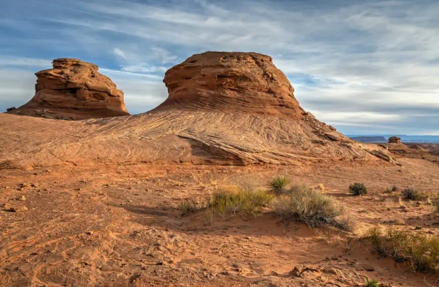
Just north of Flagstaff, Sunset Crater Volcano National Monument preserves one of Arizona’s most striking volcanic landscapes: a place where cinder cones, jagged lava flows, and resilient pines tell the story of a powerful eruption that reshaped the region nearly a thousand years ago. Trails wind through frozen rivers of basalt, climb cinder slopes for panoramic views, and reveal how life gradually reclaimed the land after the eruption. Whether you’re after dramatic viewpoints, fascinating geology, or a peaceful stop between Flagstaff, Page, or the Grand Canyon’s North Rim, this guide will walk you through how to reach Sunset Crater, what to expect once you’re there, and the scenic spots that make it one of northern Arizona’s most underrated destinations.
Sunset Crater shares its access road with its sister site, Wupatki National Monument, home to ancient Ancestral Puebloan ruins set amid painted desert badlands. The Wupatki–Sunset Crater Loop Drive connects the two parks in a 35-mile scenic circuit, making it easy to visit both in a single trip.
Although they’re managed under a single administrative unit and share one National Park Service entrance fee, the two monuments showcase strikingly different landscapes: Sunset Crater for volcanic geology, and Wupatki for archaeology and desert history. Together, they form one of northern Arizona’s most fascinating and photogenic routes.
Sunset Crater Volcano Guide – At a Glance
A striking volcanic landscape near Flagstaff – Formed by an eruption about 900 years ago, Sunset Crater’s rugged terrain of black cinder fields, lava flows, and charred rock feels almost lunar. The contrast between dark volcanic soil and the surrounding pine forest makes this one of Arizona’s most distinctive natural sites.
Easy access and short scenic trails – Just 25 minutes from Flagstaff along Highway 89, Sunset Crater is compact and easy to explore. Several short trails, like the Lava Flow Trail, A’a Trail, and Lenox Crater Trail, offer close-up views of frozen lava rivers, jagged spatter cones, and panoramic overlooks of the San Francisco Peaks.
Linked to Wupatki National Monument – The 35-mile scenic loop connecting Sunset Crater and Wupatki National Monuments reveals two completely different worlds in a single drive: from the black volcanic fields of Sunset Crater to the red sandstone ruins and painted desert landscapes of Wupatki. Both are included under one entrance fee.


Disclosure: This page (Sunset Crater Volcano) may contain product affiliate links. At no additional cost to you, we may receive a commission for purchases made through these links. More details can be found on our disclosure and policies page.
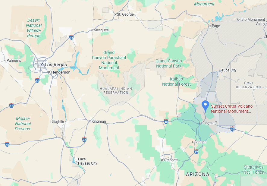
Sunset Crater Volcano Location and Map
Sunset Crater Volcano National Monument (Google Maps link) lies about 15 miles (24 km) northeast of Flagstaff, Arizona, along Highway 89, the scenic route that also leads toward Page and the Grand Canyon’s North Rim.
How to Get to Sunset Crater Volcano
Sunset Crater Volcano is best reached by car, as there’s no public transportation directly serving the monument.
Driving times to Marble Canyon
- Flagstaff, AZ: 24 km / 15 mi – about 25 minutes
- Sedona, AZ: 80 km / 50 mi – about 1h
- Grand Canyon South Rim: 150 km / 93 mi – about 1h45
- Page, AZ: 185 km / 115 mi – about 2h
- Phoenix, AZ: 260 km / 160 mi – about 2h30
- Kanab, UT: 300 km / 190 mi – about 3h
- Las Vegas, NV: 440 km / 275 mi – about 4h
These times assume good weather and minimal stops.
If you need to book a rental vehicle for your hiking excursion, we highly recommend using Discover Cars to get the best rates on your rental in Utah, Nevada and Arizona.
We also highly recommend Airalo (eSIM card) for your connectivity needs when travelling abroad. Airalo is the world’s first and largest eSIM store with eSIM plans for 200+ countries and regions worldwide.
Nearest Gas Stations
There are no gas stations within Sunset Crater Volcano National Monument, so plan to fill up before your visit.
- South of the Monument: Several gas stations are located along Highway 89 between Flagstaff and the park entrance, roughly a 25-minute drive. These are the most convenient options for visitors approaching from Flagstaff, Sedona, or Phoenix.
- North of the Monument: The nearest reliable stations are about 15–25 miles north, near the junction of Highway 89 and Highway 64 (the turnoff toward the Grand Canyon South Rim).
It’s best to top off your tank before exploring, especially if you plan to continue north toward Wupatki National Monument or Marble Canyon, where services become sparse.
Sunset Crater & Wupatki: Access, Fees, and Parking
Access: Sunset Crater Volcano and Wupatki National Monuments are connected by a single scenic route, the Loop Road (Highway 395/FR 545), which branches off Highway 89, about 15 miles (25 km) north of Flagstaff, Arizona. The 35-mile (56 km) drive through both monuments showcases striking transitions in landscape, from black volcanic cinder fields to red sandstone mesas and ancient pueblo ruins. You can enter from either end:
- Southern entrance: Near Sunset Crater Volcano Visitor Center (closest to Flagstaff).
- Northern entrance: Near Wupatki Visitor Center (closest to Cameron and the Grand Canyon turnoff).
Most travellers drive the full loop in one direction, combining both monuments in a half-day or full-day visit. Driving from the south entrance to the north entrance along the loop road takes 50-60 minutes (35 mi / 56 km), without stops.
Parking: There are several convenient parking areas along the loop road, depending on what you plan to visit.
- Sunset Crater Volcano Visitor Center: Main paved lot with restrooms, picnic tables, and trail access.
- Lava Flow Trailhead: Large paved lot just beyond the visitor center, providing access to the main loop trail through the lava field.
- Lenox Crater Trailhead: Smaller roadside lot for the short hike up Lenox Crater.
- Wupatki Visitor Center: Ample paved parking for cars and RVs; trailheads for the main Wupatki and Wukoki Pueblo ruins start nearby.
- Additional pullouts: Several scenic viewpoints and small parking areas line the connecting road between the two monuments.
Facilities: Both visitor centers have restrooms, water fountains, and small gift shops. Picnic areas are available near Sunset Crater’s Lava Flow Trail and at Wupatki’s visitor area. Drinking water is limited along the loop road, so bring plenty, especially in summer.
Hours: The park roads and trails at Sunset Crater Volcano National Monument are open 24/7, but the Visitor Center is open daily from 9:00 AM to 4:30 PM, though hours may vary seasonally.
Sunset Crater & Wupatki Access Fees
A single entrance fee covers both Sunset Crater Volcano and Wupatki National Monument.
Entrance Fee: $25 per vehicle (valid for 7 days).
Holders of an America the Beautiful Pass can enter free of charge. You can purchase your pass ahead of time through the REI store.
Sunset Crater Volcano – Some Quick Facts
Establishment: Designated a U.S. National Monument in 1930 by President Herbert Hoover to protect the volcanic landscape and surrounding lava fields from damage caused by tourism and development.
Visitor Numbers: The monument receives around 180,000–200,000 visitors annually, often combined with trips to nearby Wupatki National Monument or the Grand Canyon.
Size: Covers approximately 3,040 acres (1,230 hectares) within the Coconino National Forest, preserving cinder cones, lava flows, and pine-covered slopes.
Elevation: The summit of Sunset Crater Volcano rises to 8,042 feet (2,451 m), about 1,000 feet above the surrounding plateau.
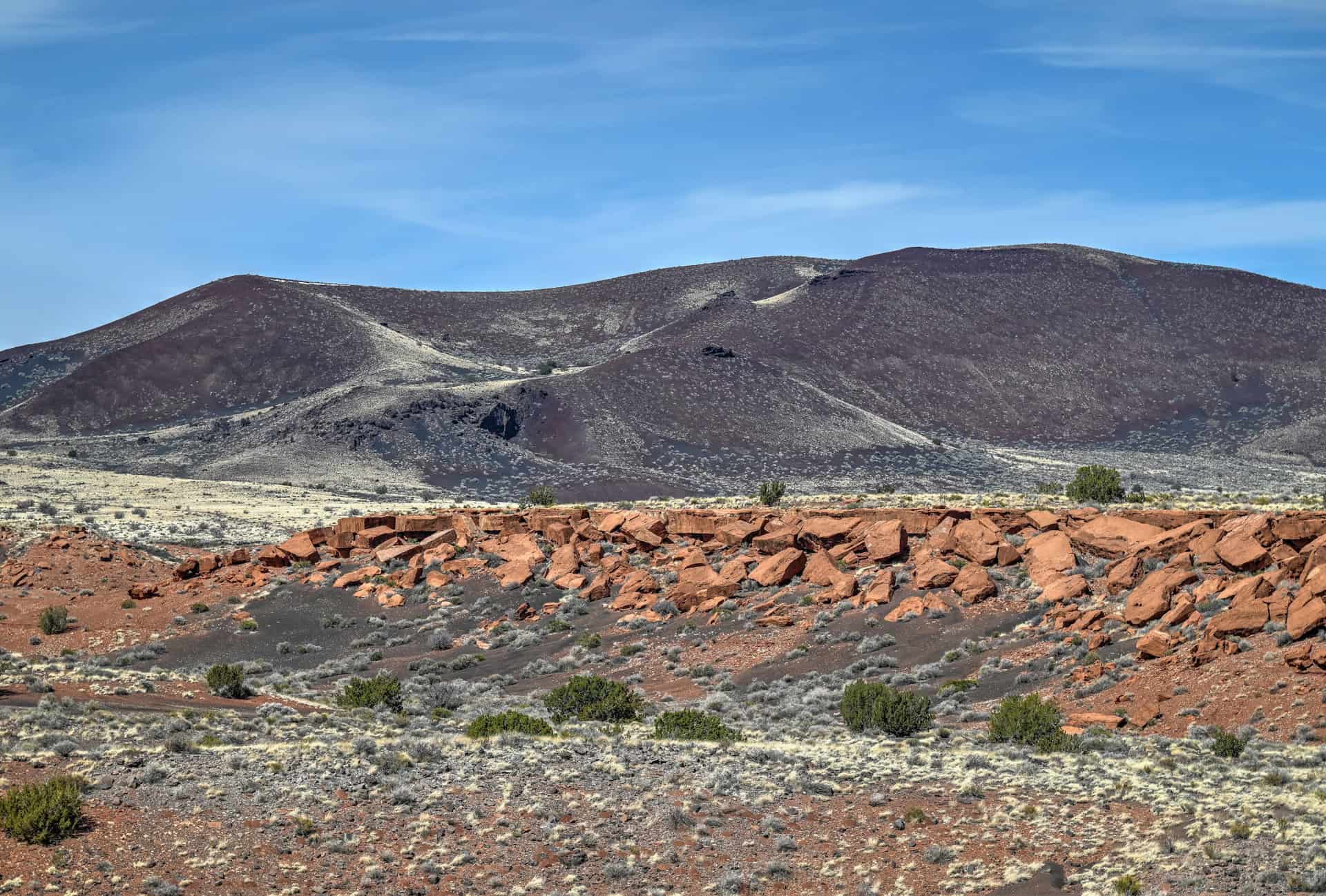
Geology: Formed by a violent eruption around 1085 CE, Sunset Crater is the youngest volcano in the San Francisco Volcanic Field, a region with over 600 cinder cones and volcanic domes. The eruption spread ash as far as 800 square miles (2,000 km²), altering local ecosystems and Native settlements.
Unique Features: Visitors can explore lava flows, cinder fields, and crater overlooks along several short trails. Though hiking to the summit is no longer permitted (to prevent erosion), nearby viewpoints and interpretive walks reveal striking contrasts of red, black, and green across the volcanic terrain.
Sunset Crater Volcano – Why You Should Visit
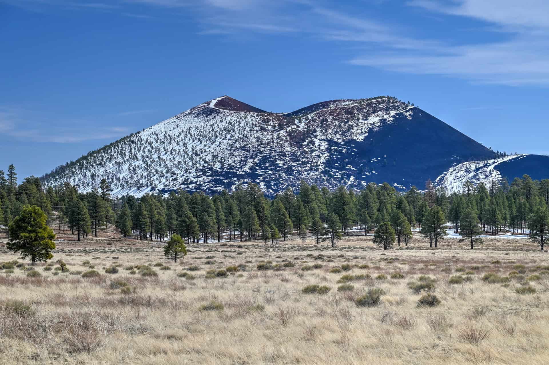
A Landscape Born from Fire: Rising dramatically from the ponderosa pine forests north of Flagstaff, Sunset Crater Volcano tells the story of one of the most recent volcanic eruptions in the American Southwest, which blanketed the region with cinders and ash and reshaped the surrounding landscape for miles. The volcano’s summit still glows reddish-orange at sunset, giving Sunset Crater its name.
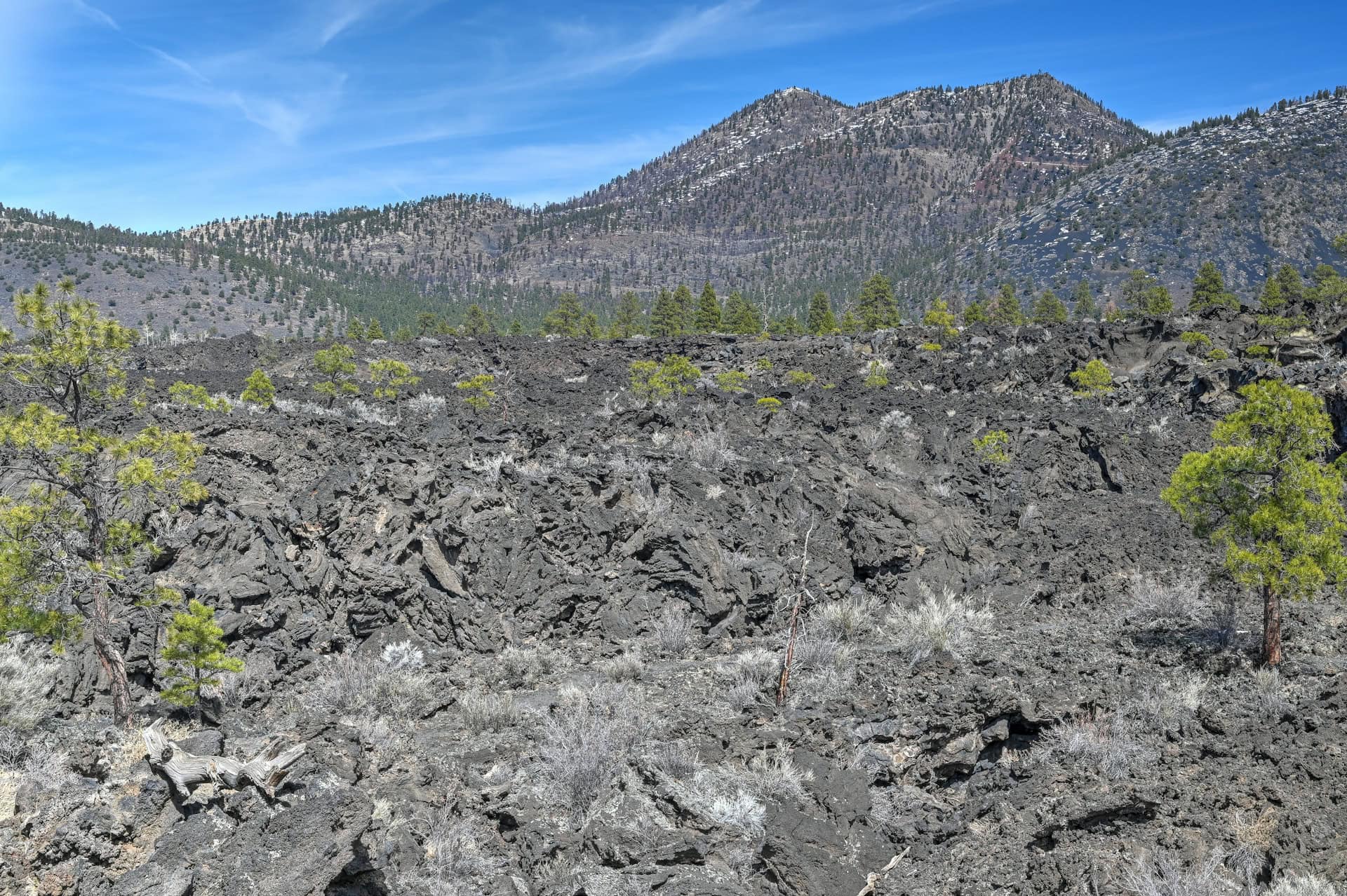
Where Lava Meets Life: Though the eruption devastated the area at first, nature quickly reclaimed it. Today, hardy species of pine, wildflowers, and lichens grow amid fields of black basalt and twisted lava, illustrating how ecosystems recover after volcanic disturbance. The sharp contrast between the jet-black cinders and bright green forest makes this one of the most photogenic spots in northern Arizona.
Compact and Accessible: Sunset Crater Volcano National Monument is relatively small and easy to explore. Short, well-marked trails like the Crater Trail and Lenox Crater Trail allow visitors to experience the volcanic landscape up close without committing to long hikes. Scenic overlooks provide dramatic panoramas of cinder cones, lava flows, and surrounding forests.
Family-Friendly Adventure: Whether you’re taking a leisurely stroll along the interpretive paths, climbing gently on the cinder slopes, or stopping at the visitor center for exhibits, Sunset Crater offers an engaging and safe experience for all ages. Kids and adults alike can learn about volcanic geology and the power of natural forces while exploring a dynamic, ever-changing landscape.
Nearby Cultural and Geological Highlights: Sunset Crater sits adjacent to Wupatki National Monument, where ancient Native American pueblos reveal human adaptation to this volcanic landscape. Together, these sites provide a fascinating mix of natural and cultural history, making the area a must-see for anyone travelling north from Flagstaff toward Page or the Grand Canyon North Rim.
Best Things to See and Do Along the Sunset Crater–Wupatki Loop
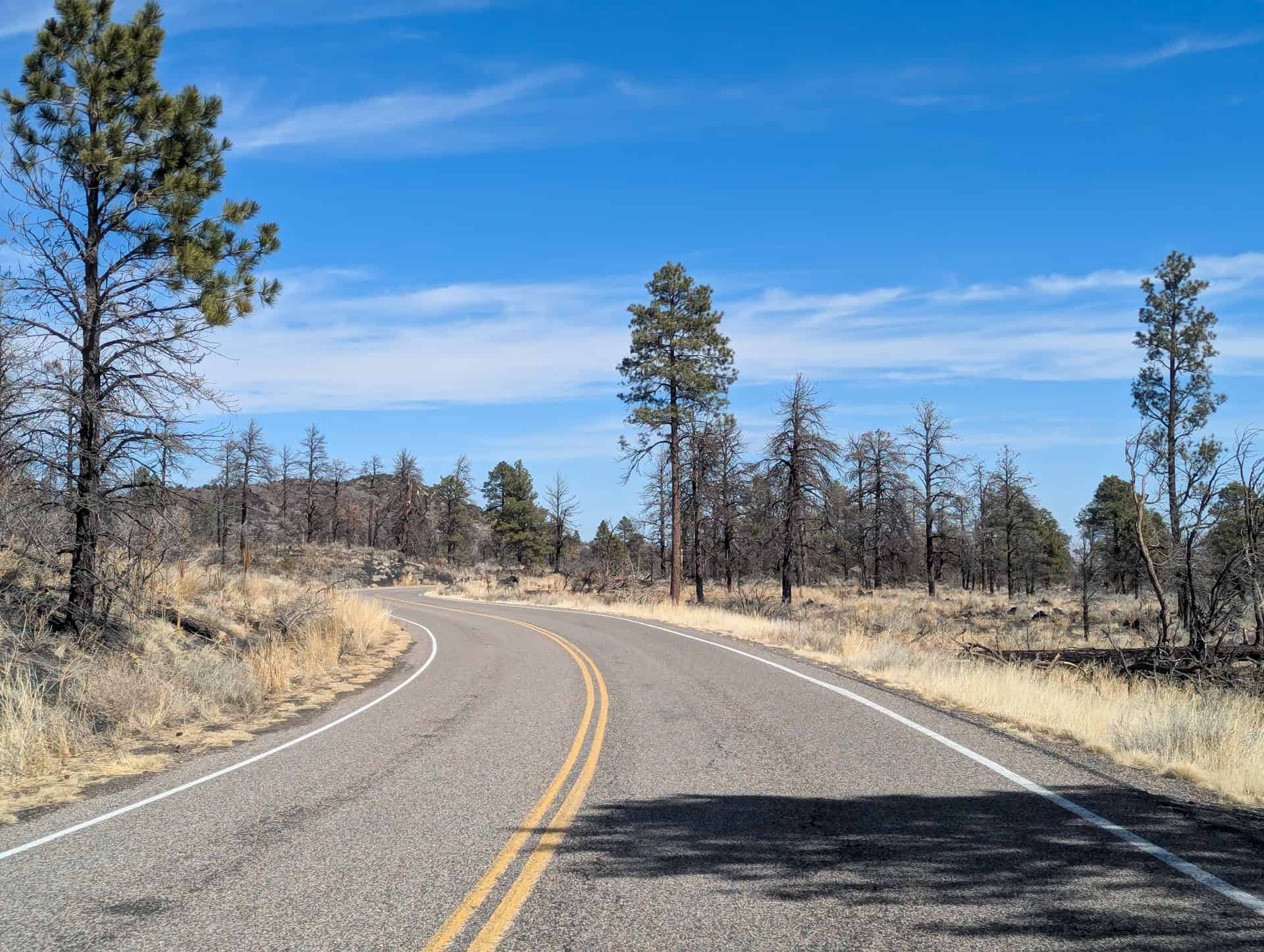
Drive the Scenic Loop Road
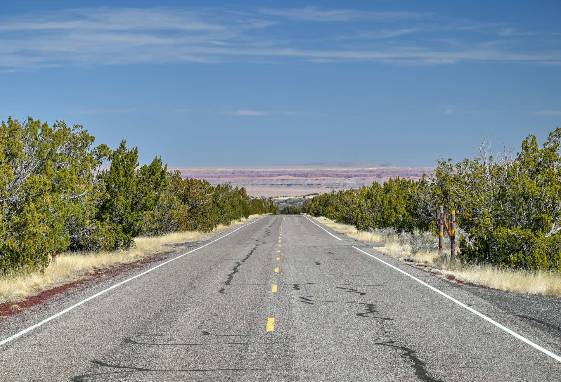
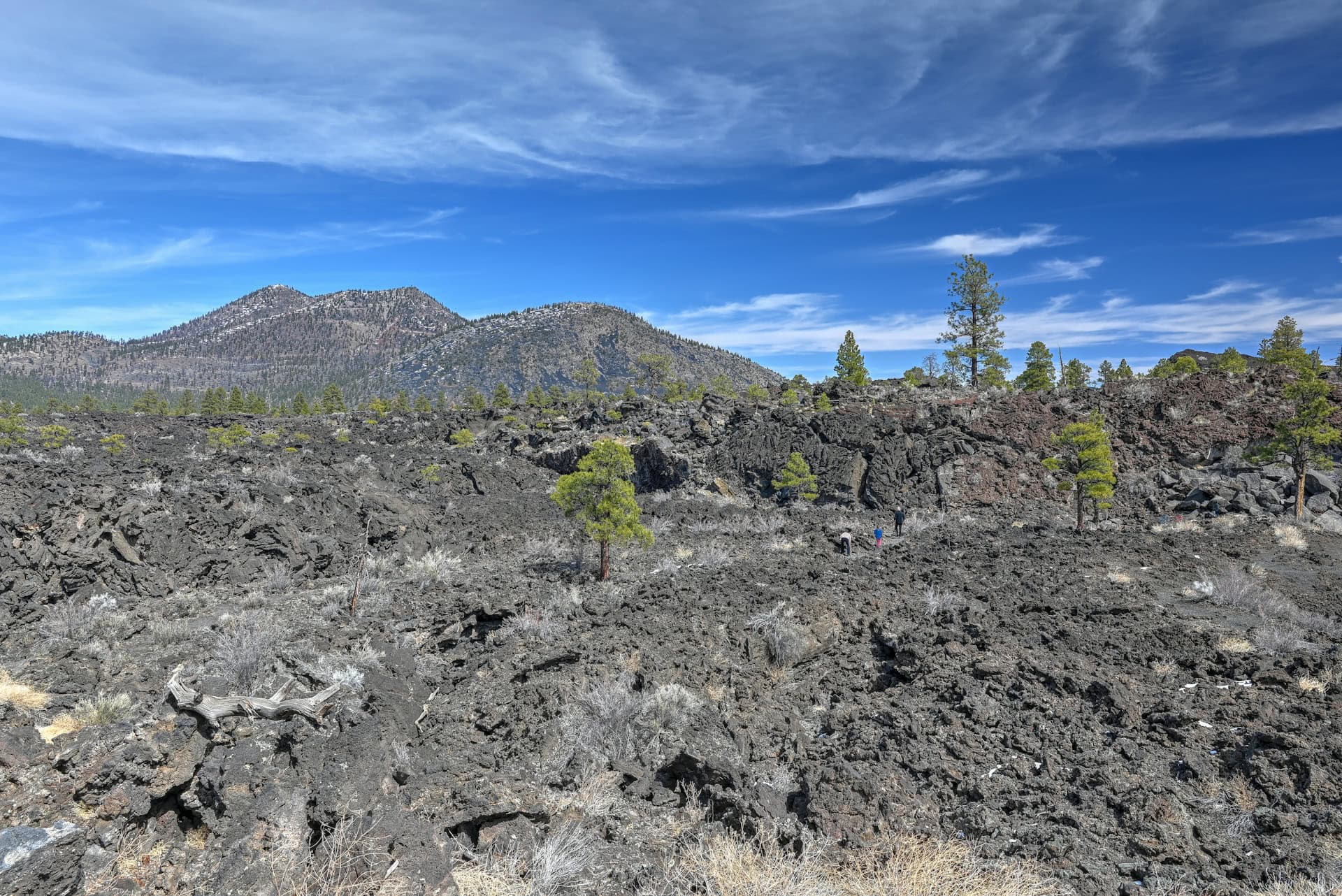
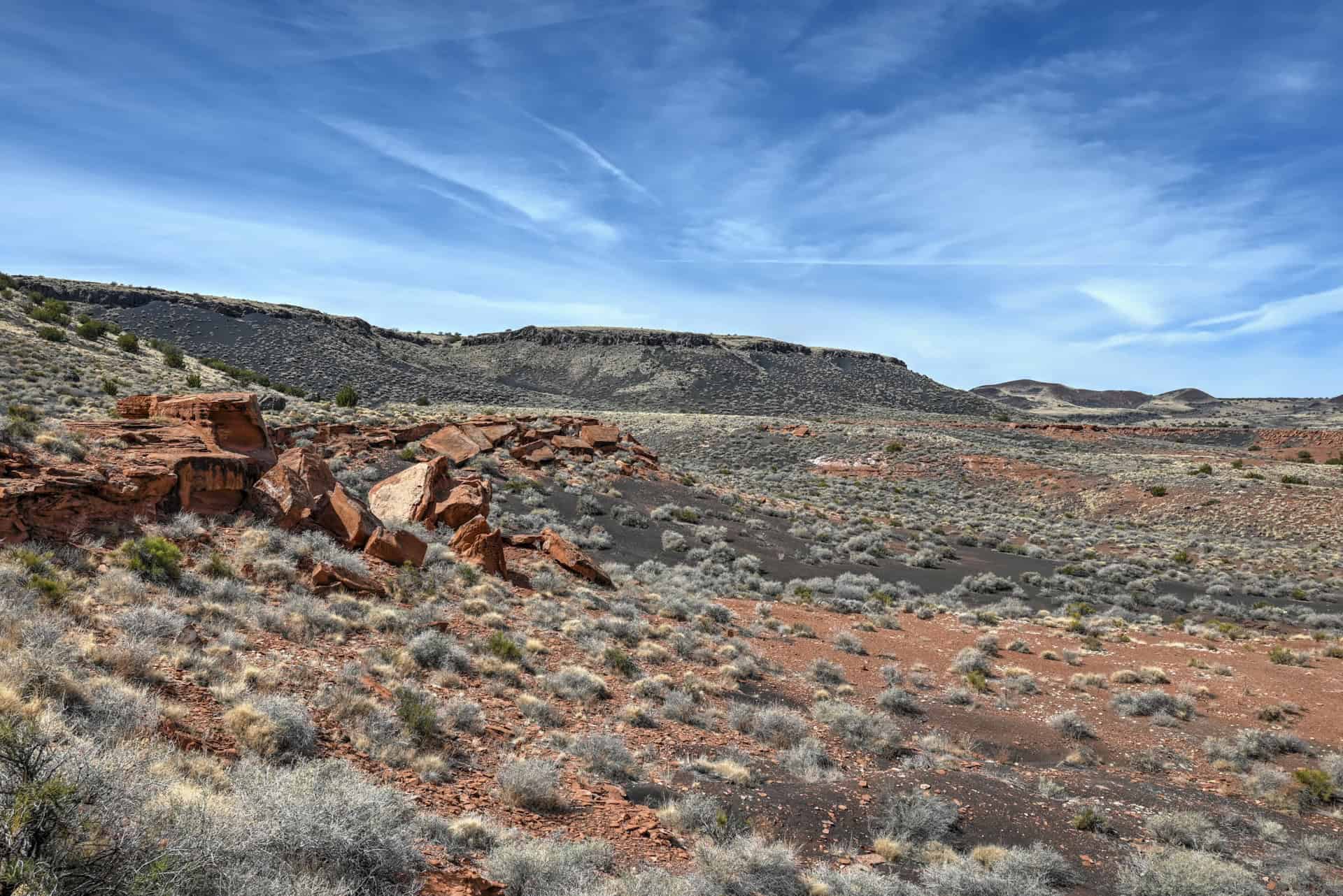
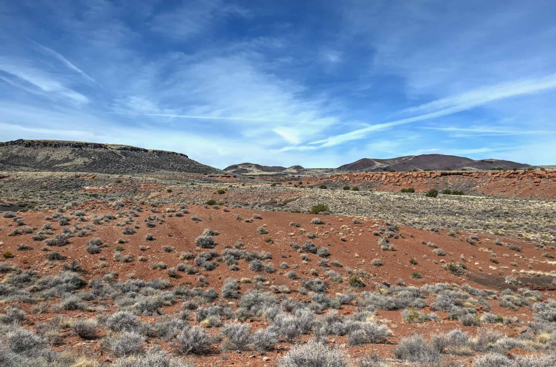
Even without stepping out of the car, the 35-mile (56 km) Loop Road connecting Sunset Crater Volcano and Wupatki National Monuments is one of northern Arizona’s most scenic drives. Starting amid black volcanic cinders and jagged lava flows, the road gradually transitions into wide-open grasslands and red desert mesas.


The shift in color and terrain is striking: from the charcoal-black slopes of Sunset Crater to the fiery sandstone landscapes surrounding the ancient pueblos of Wupatki. It’s an unforgettable microcosm of the Colorado Plateau’s geological diversity.


Allow at least 45 minutes to an hour for the drive itself, more if you plan to stop for photos or short walks (we will provide suggestions on how much time to spend in Sunset Crater Volcano National Monument based on your interests further below).
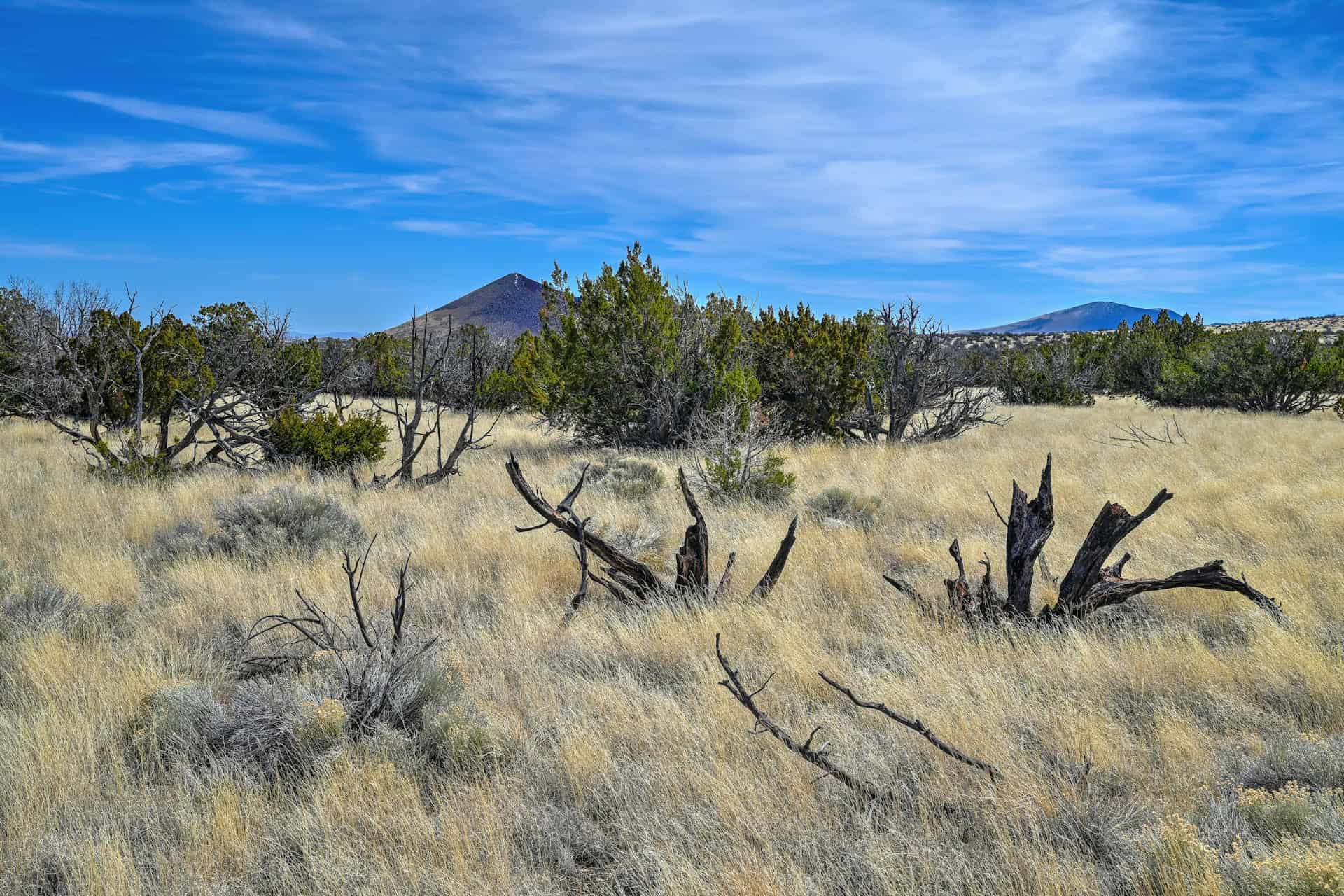

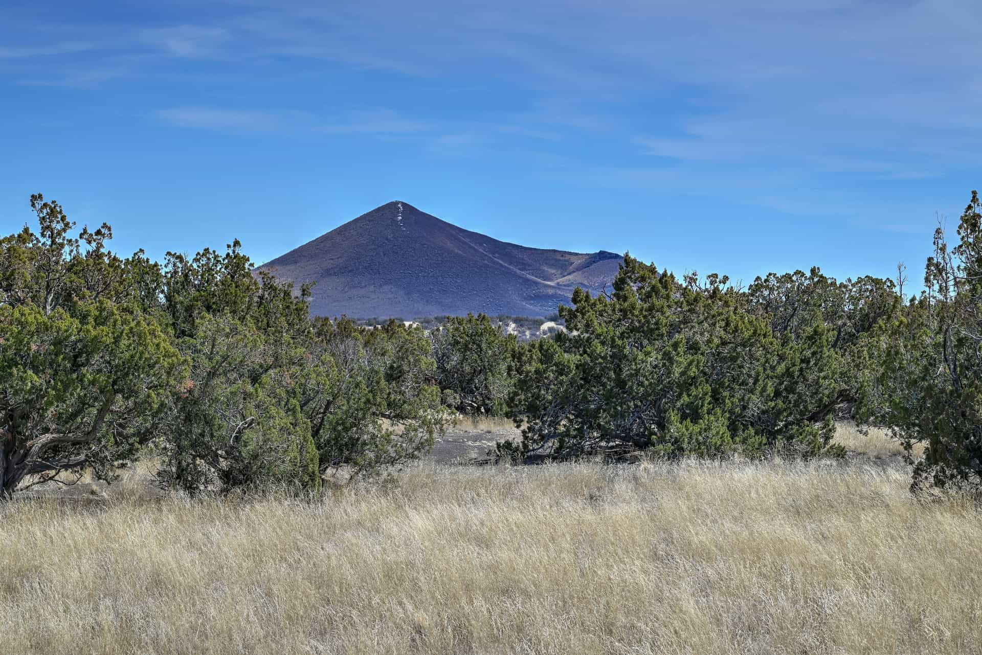
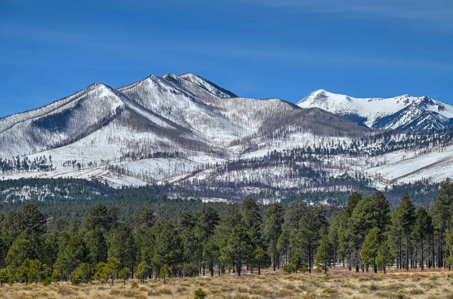
Early Pullout: Views of the San Francisco Peaks
Shortly after entering the loop from the southern (Highway 89) entrance, a scenic pullout (link to Google Maps) near the Bonito Park Meadow offers one of the best panoramic views of the San Francisco Peaks, the tallest mountains in Arizona. Rising above the ponderosa forest at over 12,600 feet (3,840 m), the peaks are the remnants of an ancient volcano that dwarfed Sunset Crater in scale. On clear mornings or at sunset, the light on the mountains and the surrounding cinder cones is particularly beautiful.
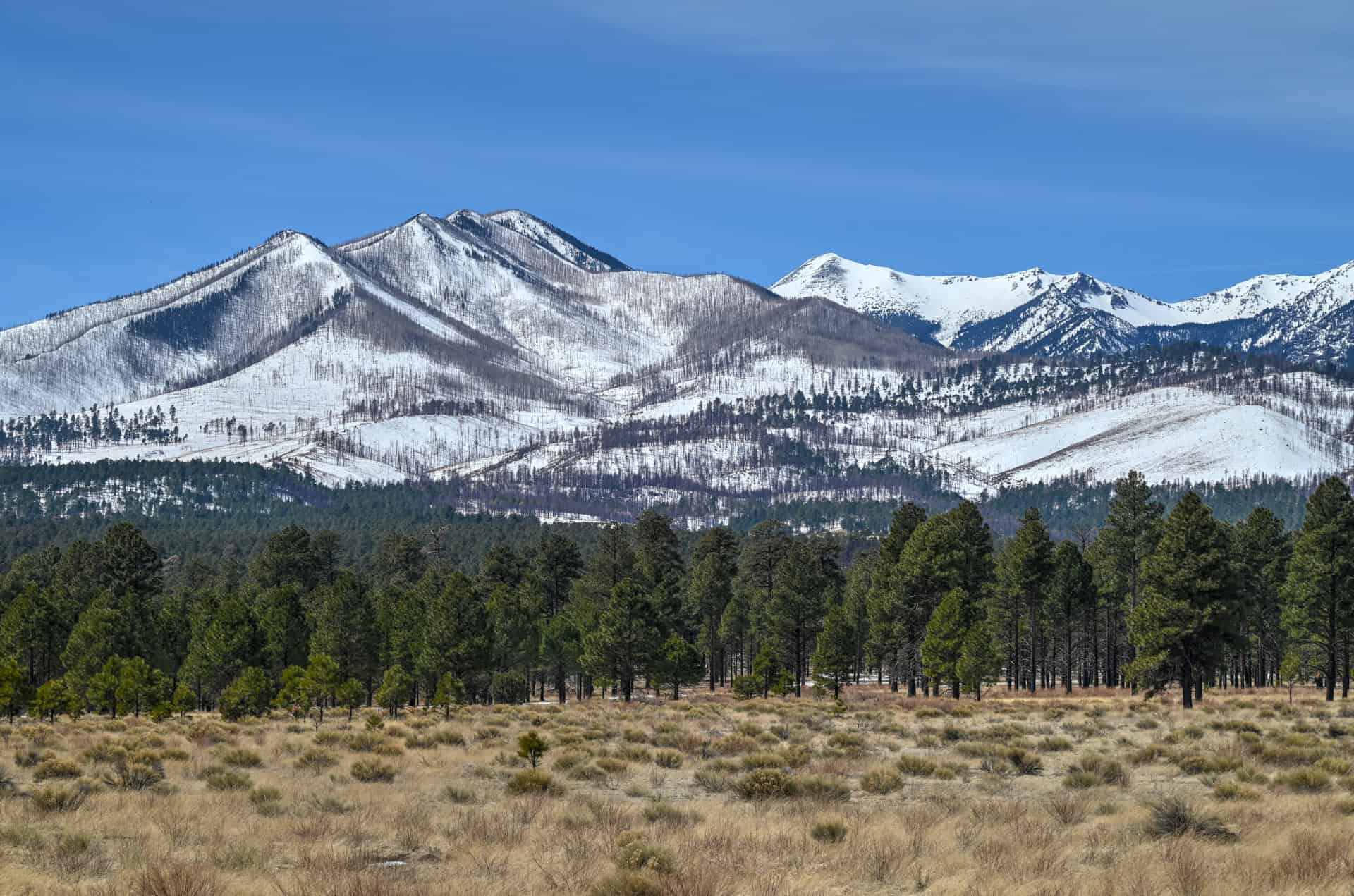
From the same viewpoint, turn around to enjoy a sublime view of Sunset Crater as well.
Explore the Sunset Crater Trails
Three short trails near the Sunset Crater Visitor Center let you experience the area’s volcanic landscape up close.
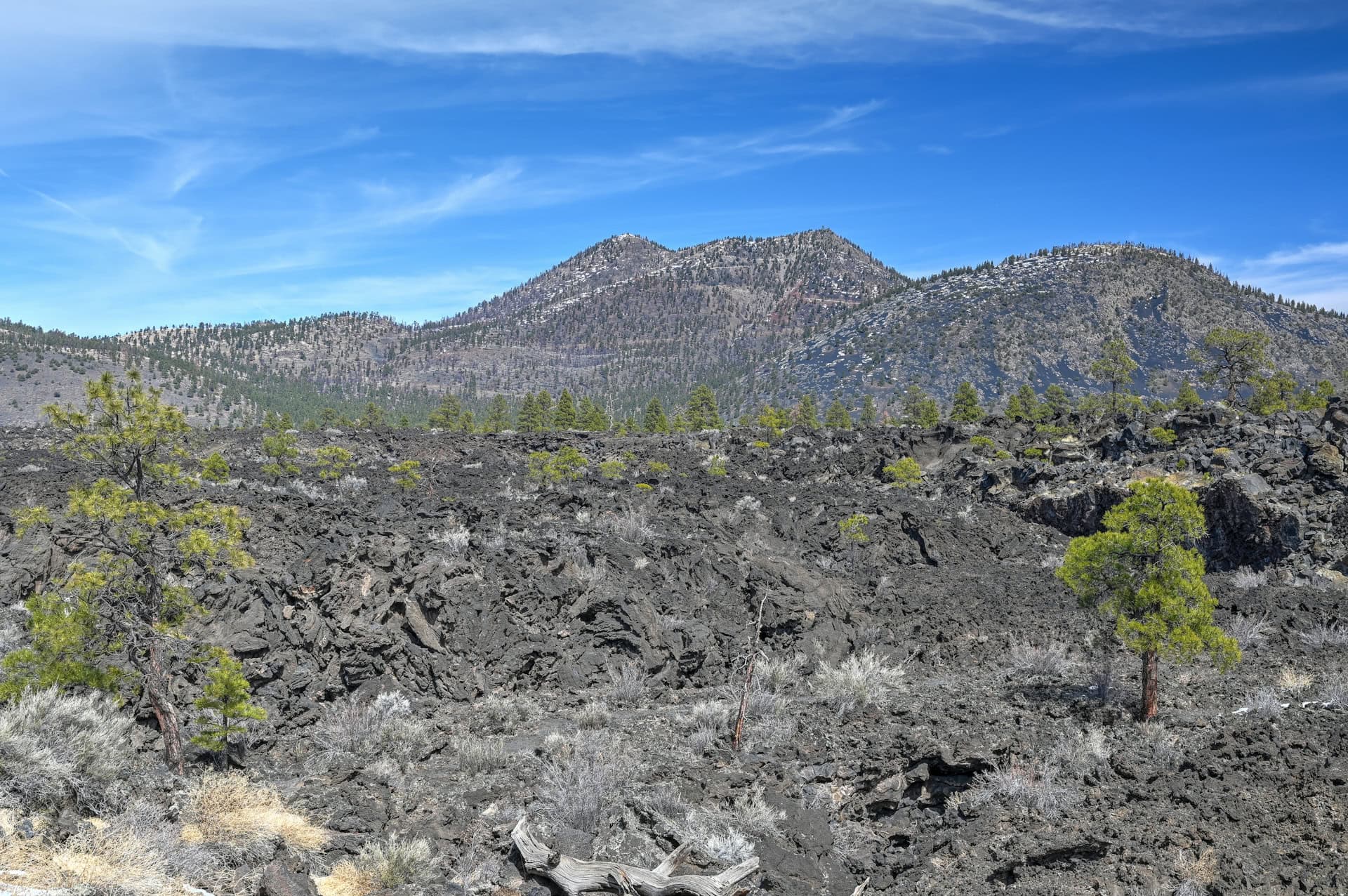
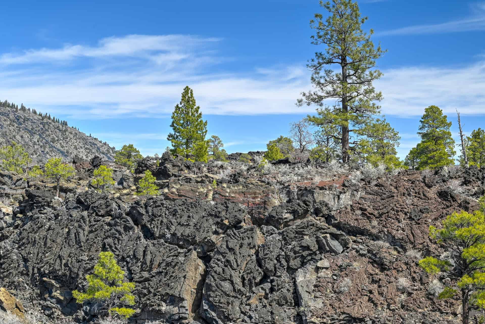
Lava Flow Trail: The park’s signature trail circles the base of Sunset Crater, winding through twisted lava fields and cinder mounds with interpretive signs explaining the eruption’s history. Part of the trail is paved, making it accessible for most visitors.
Distance: 0.8 miles (1.4 km)
Route Type: Loop
Elevation gain: 65 ft / 20 m (cumulative elevation gain)
AllTrails rating: 4.7, 1477 ratings (2025)
Duration: Most people complete the trail in 20-30 minutes.
A’a Trail: A short loop through jagged basalt formations, named for the Hawaiian word describing rough, clinkery lava. It’s an excellent quick stop to see how molten rock solidified into surreal textures.
Distance: 0.2 miles (0.3 km)
Route Type: Loop
Elevation gain: –
AllTrails rating: 4.6, 329 ratings (2025)
Duration: Most people complete the trail in 5-10 minutes
Lenox Crater Trail: A moderate climb up a nearby cinder cone offering sweeping views of the San Francisco Peaks, Sunset Crater, and the surrounding lava field.
Distance: 1.2 miles (1.8 km)
Route Type: Loop
Elevation gain: 280 ft / 85 m (cumulative elevation gain)
AllTrails rating: 4.7, 674 ratings (2025)
Duration: Most people complete the trail in 30-40 minutes.
All three trails start within a few minutes’ drive of each other, making it easy to visit them consecutively in about 1–1.5 hours.
Hiking Packing List
All Trails subscription – This comes in really handy for areas with little or no cell reception, as the annual subscription allows you to download trail maps for offline use.
External Battery – If you are using your phone to track your progress along the trail or to help with navigation, you certainly don’t want your phone to die on you. That’s especially true in the unlikely event that you might get hurt or need assistance.
Hiking poles – These can be particularly useful in steep trails or muddy/boggy trail conditions.
Water Filter Bottle – The Life Straw bottle is an advanced water bottle with a filter that not only improves water taste but more importantly filters out bacteria and parasites, chemicals and microplastics.
Headlamp – very practical and a smart choice if you plan to start your hike before sunrise or finish it after sunset.
Wupatki National Monument: Ancient Pueblos on the Red Desert
At the northern end of the loop, the landscape opens into vast desert plains dotted with ancestral Puebloan ruins. Wupatki National Monument preserves several of these remarkable stone dwellings built over 800 years ago, when ancient communities thrived in this once-active volcanic region.
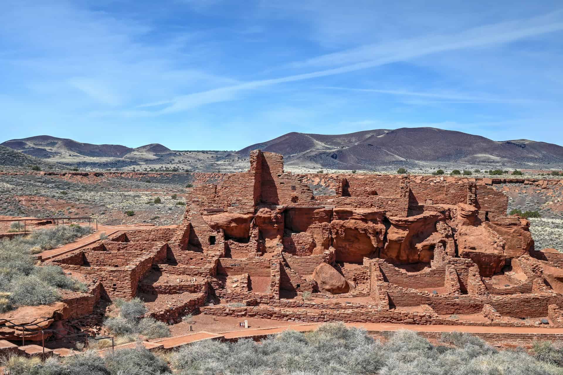
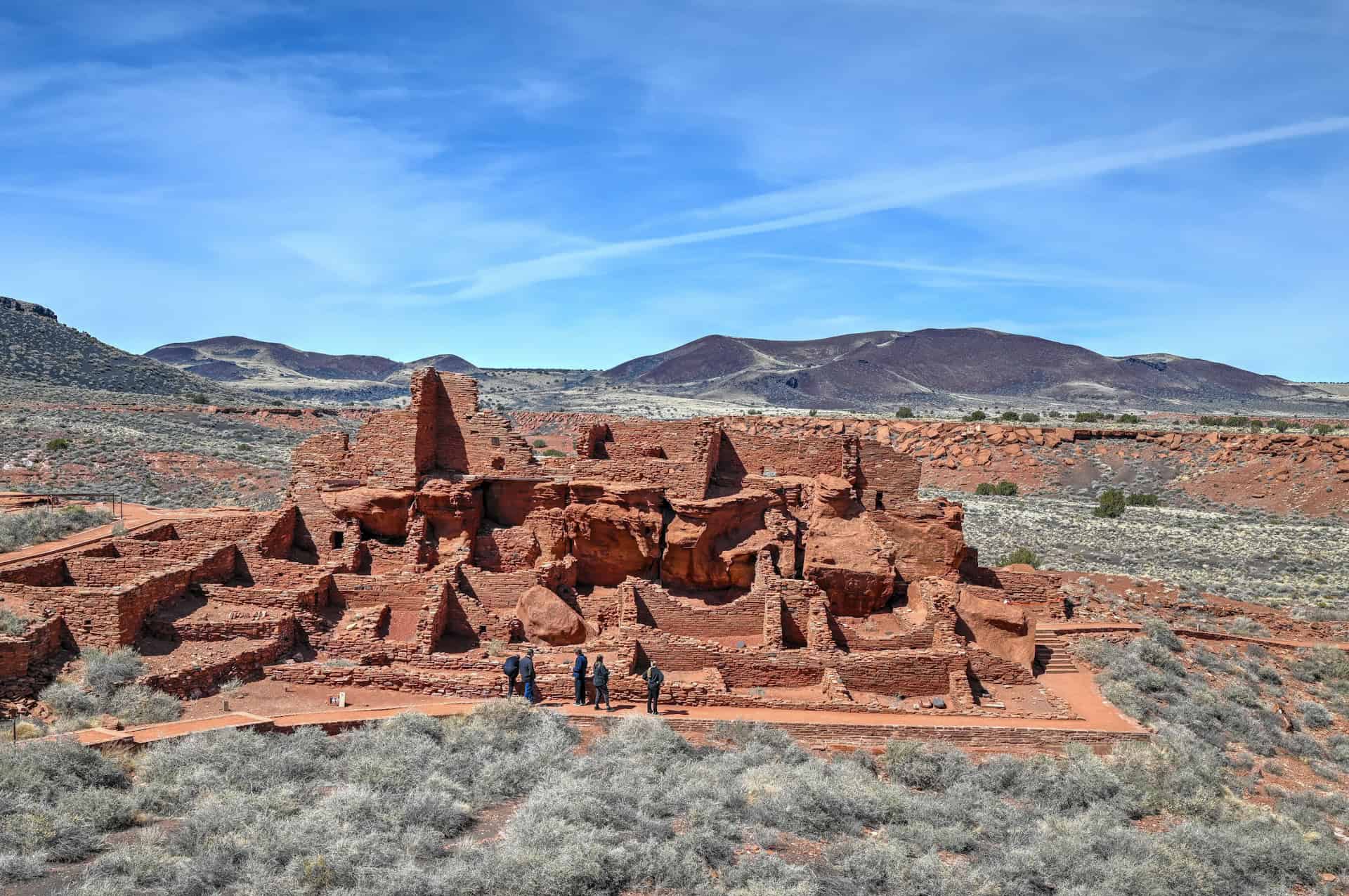
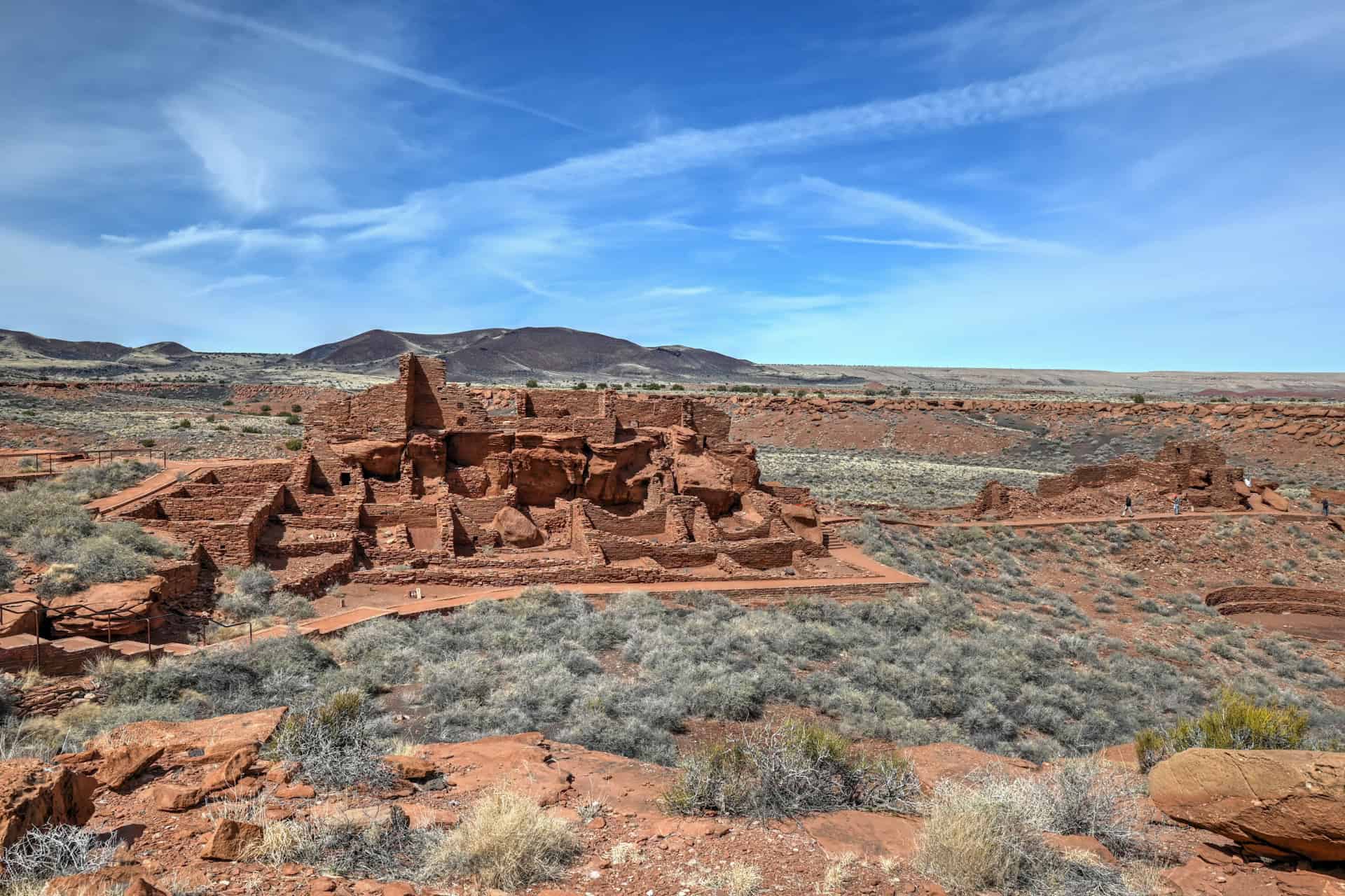
The most impressive site, Wupatki Pueblo, sits beside the visitor center and can be explored via a short 0.5-mile (0.8 km) interpretive trail. Along the walk, you’ll see the multi-story pueblo complex, a ball court, a circular kiva, and the famous Wupatki blowhole, a natural vent that exhales cool air from deep underground.


Optional Stops & Hidden Gems
Cinder Hills Overlook: A lesser-visited pullout midway along the loop with panoramic views across the black lava fields and cinder dunes (link to Google Maps).
A short Drive from the Wupatki Visitor Center, the Wukoki Pueblo Trail (0.2 miles / 0.3 km round-trip) leads to another beautifully preserved structure perched dramatically atop a sandstone outcrop (link to Google Maps).
If you want to climb more short hills, head to the Doney Mountain Trail (link to Google Maps), a short 1-mile out-and-back trail with 220 ft of elevation gain.
If you want to undertake a truly challenging hike, look no further than the O’Leary Peak Trail, a 10-mile (16 km) trail that has over 2000 ft (600 m) of elevation gain. It takes, on average, hikers 4h-5h to complete the hike (link to Google Maps; link to AllTrails)
How Much Time Should I Plan for a Visit to Sunset Crater and Wupatki?
You can experience the Sunset Crater–Wupatki Loop in as little as two hours or stretch it into most of a day if you enjoy photography, short hikes, and exploring the ancient pueblos. The 35-mile (56 km) loop drive itself takes about 45-50 minutes without stops, but it’s worth allowing more time to take in the scenery and short trails.
Short Stop (1h30–2 Hours)
Ideal for travellers passing through Flagstaff or heading to the Grand Canyon or Page.
Even a brief visit gives a strong sense of the area’s volcanic and cultural heritage.
- Lava Flow Trail: Walk the easy, partly paved 1-mile loop at the base of Sunset Crater to see jagged lava fields, cinder cones, and views of the San Francisco Peaks.
- Scenic Pullout: Stop early on the loop for a panoramic view of the San Francisco Peaks and the surrounding volcanic field.
- Loop Drive: Continue along the scenic road toward Wupatki for a taste of how dramatically the landscape changes from black lava to red desert.
Half-Day Visit (3–5 Hours)
Perfect for those who want to explore both monuments without rushing.
This allows time for short hikes, a few viewpoints, and a walk through one of the ancient pueblos.
- Morning: Begin at the Sunset Crater Visitor Center, then hike the Lava Flow and A’Ah Trails to experience the volcanic terrain up close.
- Early Afternoon: Continue to Wupatki National Monument, where you can explore the Wupatki Pueblo Trail and Blowhole near the visitor center.
- Optional: Add a quick stop at Wukoki Pueblo, just a short detour down a spur road, for one of the most photogenic ruins in the monument.
Longer Visit (5–7 Hours)
If you enjoy unhurried exploration, photography, and short scenic hikes, plan a longer visit and make a full loop at a relaxed pace.
- Morning: Begin early at Sunset Crater and tackle the Lenox Crater Trail for sweeping views of the San Francisco Peaks.
- Late Morning: Explore the Lava Flow and A’a Trails, then drive north, stopping often to admire the shifting terrain and light.
- Midday: Pack a picnic to enjoy at one of the scenic pullouts or at the Wupatki Visitor Center picnic area.
- Afternoon: Visit both Wupatki and Wukoki Pueblos, taking time to enjoy the views across the Painted Desert.
Important Things to Know Before Visiting Sunset Crater and Wupatki
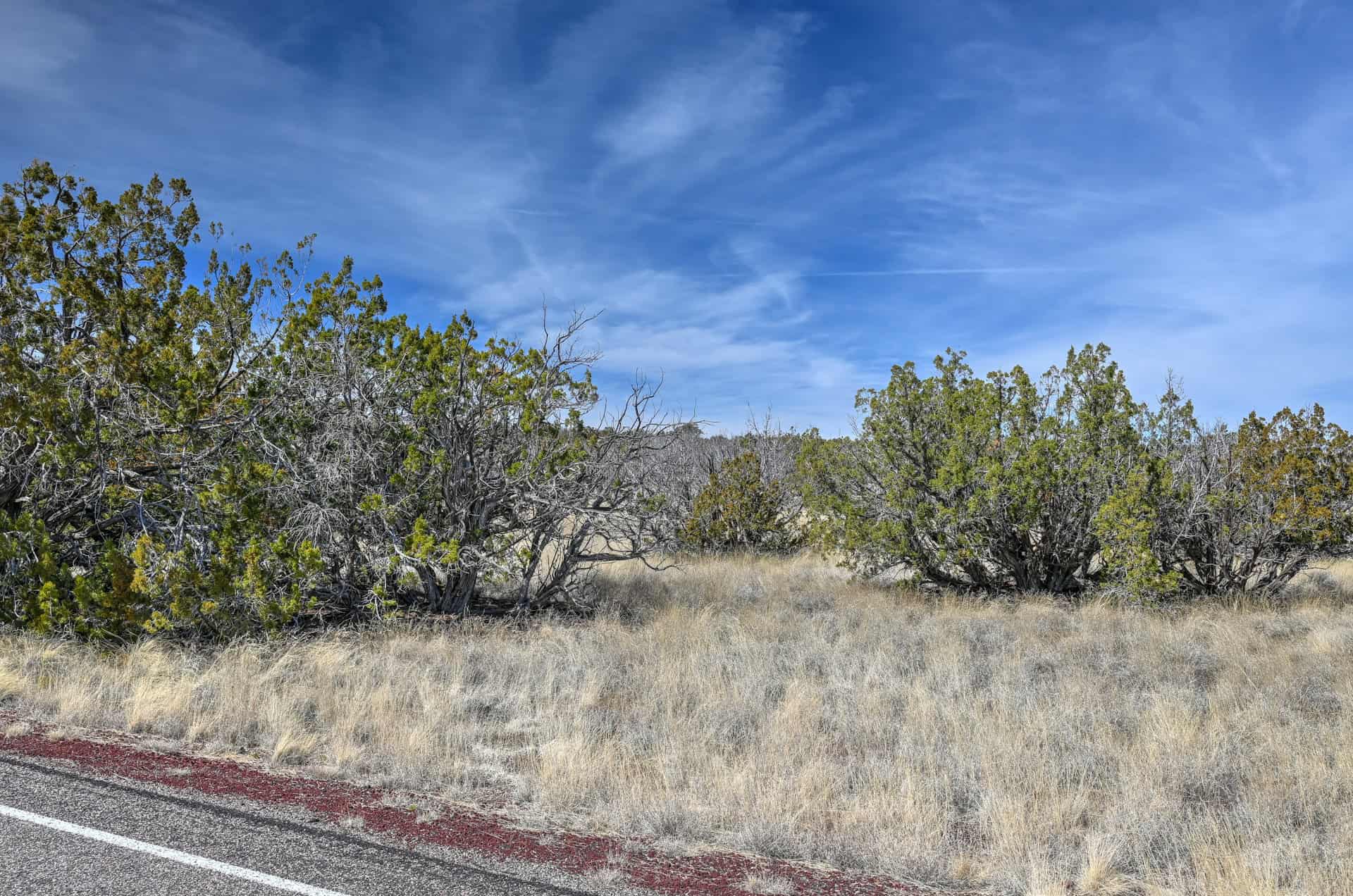
Trail conditions: Most trails at Sunset Crater are short but can be uneven, with loose cinders and rocky footing from the volcanic terrain. Closed-toe shoes with good traction are strongly recommended. The Lava Flow Trail is paved and accessible, while the Lenox Crater Trail is steep and can be slippery on the cinders. At Wupatki, trails are mostly flat but fully exposed to sun and wind, so bring a hat, sunscreen, and plenty of water.
Weather and safety: The area around Sunset Crater Volcano sits between 6,000 and 7,000 feet (1,800–2,100 m) in elevation, so weather can change quickly. Expect mild to warm days in spring and fall, cool mornings year-round, and potential snow or strong winds in winter. Summer temperatures can reach the 90s°F (mid-30s°C), but the black lava absorbs and radiates heat, making it feel much hotter on the ground.
Afternoon thunderstorms are common from July to September: avoid exposed high points during lightning activity.
In contrast, the Wupatki National Monument area lies at a lower elevation (around 5,000 ft / 1,520 m) with fewer trees and more open desert terrain, meaning temperatures there are noticeably warmer and sun exposure is stronger. Bring plenty of water, wear sun protection, and plan hikes early or later in the day during summer.
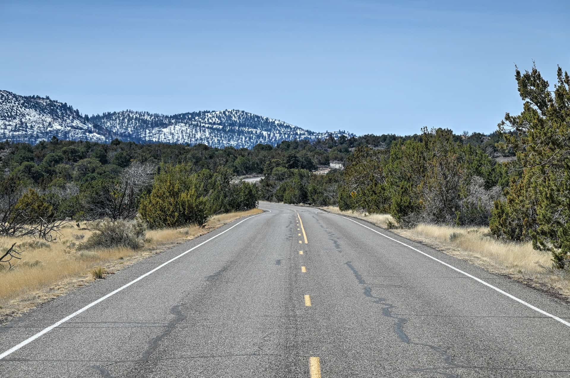
Access and Road Conditions: The Loop Road (Highway 395) connecting Sunset Crater and Wupatki is fully paved and suitable for all vehicles. It’s open year-round but may close temporarily in winter due to snow or ice; check the Sunset Crater Volcano National Monument Alerts page for current conditions.
Pets: Leashed pets are allowed on any paved road or parking lot in the monument and on the paved portion of the Lava Flow Trail. They are not permitted on the A’a Trail, Bonito Vista Trail, Lenox Crater Trail, or the unpaved outer loop of the Lava Flow Trail.
Cell service and facilities: Cell reception is spotty throughout much of the loop, especially between the two monuments. Restrooms, picnic areas, and water are available at both visitor centers. There are no food or gas stations inside the monuments, the nearest full services are in Flagstaff (25 miles south) or Cameron (25 miles north)
Best Time to Visit Sunset Crater and Wupatki
For comfortable temperatures, clear skies, and fewer crowds, April–May and September–October are the best months to explore both Sunset Crater and Wupatki.
Spring (March–May):
Spring is one of the best times to visit. Daytime temperatures are mild (60–75°F / 16–24°C), wildflowers bloom among the black lava flows, and skies are usually clear. This is also an ideal season for the full scenic loop drive before summer crowds arrive.
Summer (June–August):
Days can be warm to hot, especially on the exposed lava fields, where radiant heat makes it feel hotter than the air temperature. Afternoon thunderstorms are common during the July–September monsoon season, often bringing dramatic clouds and lightning. Start hikes early and seek shade midday.
Fall (September–October):
Another excellent time to visit. Temperatures cool off, the air is crisp, and aspen groves near the San Francisco Peaks glow golden by late September. The clear autumn light is ideal for photography across both monuments.
Winter (November–February):
Quiet and atmospheric, but cold, especially at Sunset Crater’s higher elevations. Snow occasionally blankets the lava fields, creating striking contrasts for photographers. The loop road sometimes closes temporarily due to ice or snow, so check conditions before travelling.
Next Attractions on Your Southwest Road Trip
North: Marble Canyon & Page
From the lava fields of Sunset Crater, Highway 89 leads north toward the red-rock canyons and turquoise waters of the Glen Canyon region. In less than two hours, you’ll reach Marble Canyon, where sheer cliffs frame the Colorado River and trails like Cathedral Wash and Spencer Trail reveal some of northern Arizona’s most dramatic desert scenery. Continue another 45 minutes to Page, a gateway to world-famous landmarks such as Horseshoe Bend, Antelope Canyon, and Lake Powell. Together, these sites showcase the full transition from volcanic highlands to the sculpted sandstone heart of the Colorado Plateau.


For a more comprehensive list of activities and attractions, see our full guide on the Best Things to See and Do Near Page, Arizona.
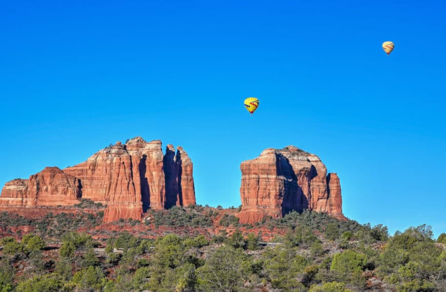
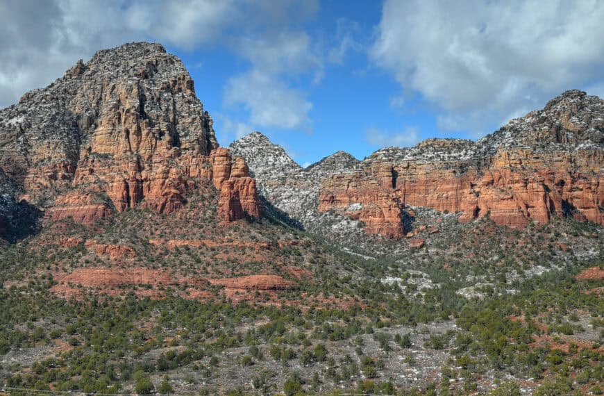
South: Sedona & Oak Creek Canyon
Heading south on Highway 89A from Flagstaff, the landscape shifts from cool ponderosa forest to crimson cliffs and sculpted mesas. The drive through Oak Creek Canyon is one of the most scenic in Arizona, descending through pine-lined switchbacks before opening onto Sedona’s glowing red-rock spires. Once there, explore short trails like Cathedral Rock or Bell Rock, enjoy panoramic viewpoints such as Airport Mesa, or simply wander Sedona’s vibrant art and café scene. With its mix of natural beauty and relaxed atmosphere, Sedona makes an ideal follow-up stop after exploring the volcanic terrain of Sunset Crater.


For a more comprehensive list of activities and attractions, see our full guide on the Best Things to See and Do in Sedona.
Sunset Crater & Wupatki – Frequently Asked Questions
Do you need a reservation to visit Sunset Crater or Wupatki?
No reservations are required. Both monuments are open daily year-round, and your entrance fee (or America the Beautiful Pass) covers access to both sites.
How long does it take to visit Sunset Crater and Wupatki?
Most visitors spend 2–3 hours exploring the main loop drive with short stops and short hikes. To explore more thoroughly, including all three Sunset Crater trails (Lava Flow, A’a, and Lenox Crater) and the Wupatki Pueblo site, plan for half a day.
Are pets allowed?
Leashed pets are permitted in parking areas and along paved roads, but not on the hiking trails or inside Wupatki ruins.
Are drones allowed?
No. The use of drones (unmanned aircraft systems) is strictly prohibited within both Sunset Crater Volcano and Wupatki National Monuments. This rule helps protect wildlife, archaeological sites, and the natural soundscape, and violators can face significant fines.
Can you climb Sunset Crater Volcano?
No. Climbing the volcano itself has been prohibited since 1973 to protect fragile soils and plant recovery. However, the nearby Lenox Crater Trail offers a similar climb and an excellent view toward the main cone and the San Francisco Peaks.
Are there restrooms or picnic areas?
Yes. Both monuments have restrooms at the visitor centers and several picnic pullouts along the scenic loop drive.
Do you need a 4WD vehicle for the Scenic Loop Drive?
No. the 35-mile (56 km) Loop Drive between Sunset Crater and Wupatki is fully paved and accessible by all vehicles, including RVs.
Is Sunset Crater Volcano worth visiting?
Absolutely. Sunset Crater offers one of the most striking contrasts in northern Arizona: a landscape where black lava fields, red cinder cones, and green pine forests meet. Combined with the ancient pueblos of nearby Wupatki, this route provides a vivid look at both the natural and cultural forces that have shaped the Colorado Plateau. Even if you only have a couple of hours, the loop drive and short trails make this one of the most rewarding side trips from Flagstaff, Page, or the Grand Canyon.
Explore More Arizona
Continue exploring Arizona with these detailed travel guides:
Best Things to See and Do in Sedona
Best Stops and Must-See Attractions Between Las Vegas and Sedona
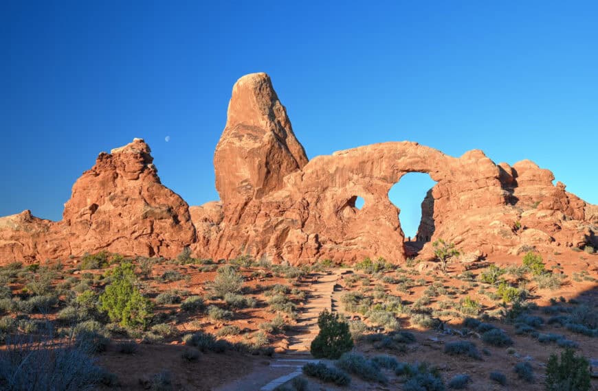
Monument Valley Travel Guide
Sunset Crater Volcano National Monument
Photography Gear
If you like our photography, you might be interested in some of the gear we use to shoot our travel and hiking destinations.
Camera Body – Nikon Z 6ii Fx-series Mirrorless Body
Main Lens – NIKON 24-120mm F/4G ED VR AF-S
Zoom Lens – Sigma 745-306 150-600mm f/5-6.3
Polarizing filters – Urth Circular Polarizing (CPL)
Camera Tripod – K&F Concept 64-inch Camera Tripod
Mini-tripod – Lammcou Flexible Camera Tripod
Camera/hiking backpack – Vanguard Alta Rise 48 Backpack
Universal Travel Adapter – VYLEE Universal International Power Travel Plug
Other Travel Essentials
Travel Insurance
SafetyWing is a travel insurance company that offers comprehensive coverage for travellers. Includes Medical Insurance and Travel Insurance. Primarily geared towards long-term travellers, digital nomads, and expats.
e-Sim cards
Airalo is the world’s first and largest eSIM store with eSIM plans for 200+ countries and regions worldwide. With Airalo eSIMs, travellers can get connected the moment they land at their destination and avoid nasty data roaming charges
eSIMS are a sustainable alternative to single-use SIM cards – they are 100% digital, require less energy to produce and be re-used rather than disposed of.
Car Rentals
Discover Cars is our go-to website for car rentals. We almost always find our preferred rate there.
Transfer from Airport
Welcome Pickups is our favourite private transfer service, which you can pre-book at a fixed price. Currently available in 220 cities all over the world (mostly in Europe, but with several major cities in Asia, the Middle East and the US).
Kiwitaxi is another private transfer service – we haven’t tried it yet, but it’s currently available in a few more countries (102 as of 2024).
Hotels and Accommodations (coming soon)
Photography Prints
If you found this blog useful, you can help support our blog by purchasing low-cost digital prints. Printed physical prints are also available for purchase.


—–
Well, that wraps it up! We hope you enjoyed our Guide for visiting Marble Canyon and that it will prove useful for planning your trip.
—–
You might also be interested in these related pages: