Located just minutes from Page in northern Arizona, the Beehive Trail, often referred to as the “New Wave”, is a short and rewarding loop through beautifully sculpted Navajo sandstone. This easy, slickrock walk brings you up close to beehive-shaped rock domes, swirling desert textures, and panoramic views toward Lake Powell and Glen Canyon, all without the crowds or permit requirements found at Page’s more famous attractions. Whether you’re hitting it at sunrise before a day of Antelope Canyon tours or enjoying a relaxed evening walk near camp, this is one of the best quick adventures in Page.
To help you plan your visit, we’ve put together this Beehive Trail hiking guide, covering everything from trail difficulty and estimated hiking time to what to expect along the route and the scenic viewpoints that make it such a fun and accessible adventure.
Beehive Trail (The New Wave) – At a Glance
A hidden gem near Page, Arizona – Located just minutes from Horseshoe Bend and Lake Powell, this short but fascinating hike explores swirling sandstone formations that resemble a miniature version of the famous Wave trail near Kanab (without the need for permits).
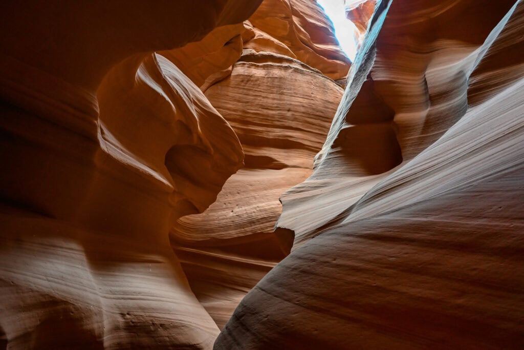
Striking geology up close – The trail leads through layered Navajo sandstone shaped by wind and water into beehive-like domes and flowing ridges. Photographers will love the textures, curves, and leading lines that light up at sunrise and sunset.
Easy, quick, and family-friendly – With minimal elevation gain and a route that’s easy to explore at your own pace, this is an excellent stop for all ages. You can wander freely among the formations, discovering unique viewpoints and angles along the way.
A perfect addition to your Page itinerary – Whether you’re visiting Antelope Canyon, Horseshoe Bend, or Glen Canyon Dam, this short detour offers a refreshing change of scenery and a chance to see stunning geology without the crowds.


Disclosure: This page (Beehive Trail – A Page Hiking Guide) may contain product affiliate links. At no additional cost to you, we may receive a commission for purchases made through these links. More details can be found on our disclosure and policies page.
Beehive Trail Location and Map
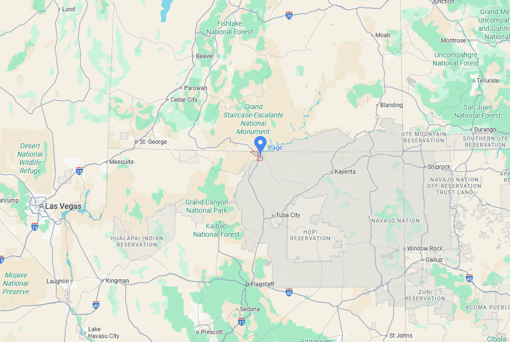
The Beehive Trail, also known as “The New Wave”, is located in Page, Arizona, just a few minutes from the Glen Canyon Dam and the southern shores of Lake Powell. The hike begins from a small roadside parking area near the Lake Powell Resort turnoff, making it quick and convenient to access. Despite its proximity to town, the trail immediately immerses you in a maze of sculpted sandstone waves and beehive-shaped formations characteristic of the Glen Canyon region.
About Page, Lake Powell & Glen Canyon
Where Desert Meets Water: Set against a backdrop of red sandstone cliffs, Page sits at the heart of Glen Canyon National Recreation Area, a landscape defined by the stunning blue waters of Lake Powell winding through sculpted canyon walls. The striking contrast of deep desert hues and shimmering reservoir makes this area one of the Southwest’s most unique destinations.
Gateway to Glen Canyon: Lake Powell was created after the completion of Glen Canyon Dam in 1963, flooding more than 180 miles (290 km) of the Colorado River. Today, the recreation area spans over 1.25 million acres of protected desert and waterways managed by the National Park Service. Scenic boat tours, slot canyon hikes, and kayaking routes reveal hidden arches, secluded coves, and towering canyon walls inaccessible by road.
A Hub of World-Famous Landmarks: Page is home to some of the region’s most iconic natural attractions: the sinuous curve of Horseshoe Bend, the glowing chambers of Antelope Canyon, and the sweeping viewpoints above the dam and river. Many travellers recognize these landscapes long before they arrive, thanks to their massive presence in travel photography and film.
Navajo Nation Culture & Connection: Much of the Page area, including Antelope Canyon and significant viewpoints, lies on Navajo Nation land. Visiting here offers a chance to learn from Navajo guides, explore sacred slot canyons responsibly, and appreciate the cultural traditions tied deeply to these landscapes.
Adventure by Water, Land & Sky: Whether you’re boating through canyons, hiking sandstone waves, paddling at sunrise, or stargazing under some of Arizona’s darkest skies, the region encourages exploration from every angle. From quick roadside viewpoints to multi-day canyon adventures, Page is the perfect base for discovering the wild beauty of the Colorado Plateau.
How to Get to the Beehive Trail (The New Wave) in Page, Arizona
The Beehive Trail is best reached by car, as there is no public transportation directly to the trailhead.
Driving times to Page, AZ
- Las Vegas, NV: 450 km / 280 mi – about 4.5–5 hours
- Phoenix, AZ: 450 km / 280 mi – about 4.5–5 hours
- Flagstaff, AZ: 200 km / 125 mi – about 2.5 hours
- Kanab, UT: 120 km / 75 mi – about 1.5 hours
- Monument Valley, UT/AZ: 195 km / 120 mi – about 2 hours
These times assume good weather and minimal stops.
If you need to book a rental vehicle for your hiking excursion, we highly recommend using Discover Cars to get the best rates on your rental in Utah, Nevada and Arizona.
We also highly recommend Airalo (eSIM card) for your connectivity needs when travelling abroad. Airalo is the world’s first and largest eSIM store with eSIM plans for 200+ countries and regions worldwide.
Nearest Gas Stations
Given the proximity to Page, there are several gas stations within 10 minutes of the trailhead.
Beehive Trail Access, Fees, and Parking
Trailhead location: The Beehive Trail begins from a small roadside parking area just off Highway 89, near the turnoff towards Lake Powell and immediately west of the Glen Canyon Dam (link to Google Maps). The final 200 feet leading to the parking area follow a smooth, well-graded gravel road.
Parking lot: There is a small car park right by the trail. Alternatively, there is a large lot just across the gravel road, adjacent to the Beehives Campground.
Facilities: Vault toilets are available by the campground parking, along with several picnic tables.
Trail opening Hours: Open daily 24/7.
Beehive Trail Entrance Fees
The Beehive Trail is located on public land within the Glen Canyon National Recreation Area near Page, Arizona, and there is no entrance fee to access the trail itself.
Beehive Trail Details and Map
Distance: 1.3 miles (2.1 km) (loop only); 2 miles (3.2 km) (loop+spur)
Route Type: Loop
Elevation change: 115 ft / 35 m (difference between trail high and low point)
Elevation gain: 230 ft / 70 m (cumulative elevation gain)
AllTrails rating (2025): (4.6, 2432 ratings (loop); (4.7, 1513 (w/ offshoot)
Duration: Most people complete the full trail with optional spur in 45 – 60 minutes.
Loop Only
Loop + optional spur (trail offshoot)
Not an AllTrails member yet? We highly recommend signing up for either their free or paid membership plans. The free plan allows you to find new trails and plan routes but it can only be used while hiking if you have access to mobile data. The paid membership plan (AllTrails+) allows you to download trail maps for offline use and provides live progress updates and off-route notifications.
If you are still uncertain – you should know that the All Trails mobile application was voted the 2023 iPhone App of the Year by Apple.
We find that AllTrails is a great tool to have when hiking, particularly for assisting with navigation when the trail is hard to locate and to help monitor your progress along the trail, which helps estimate how much time you’ll need to complete the trail.
Additional Trail Details
Canine companions: Dogs are allowed on the trail but must be kept on a leash at all times.
Summit: This trail doesn’t reach a formal summit. The highest point along the trail is at approximately 1,220 m / 4,000 ft.
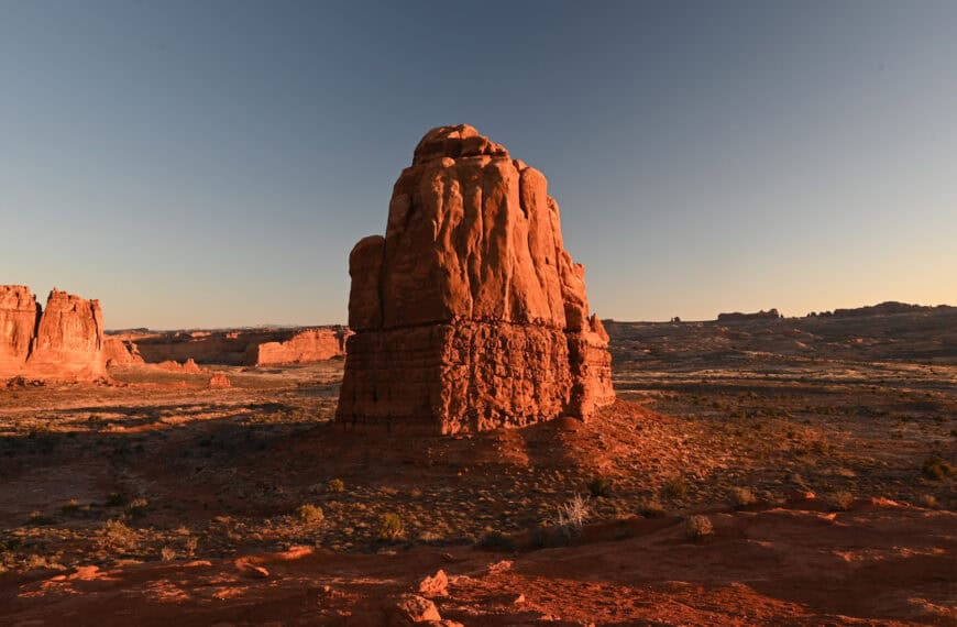
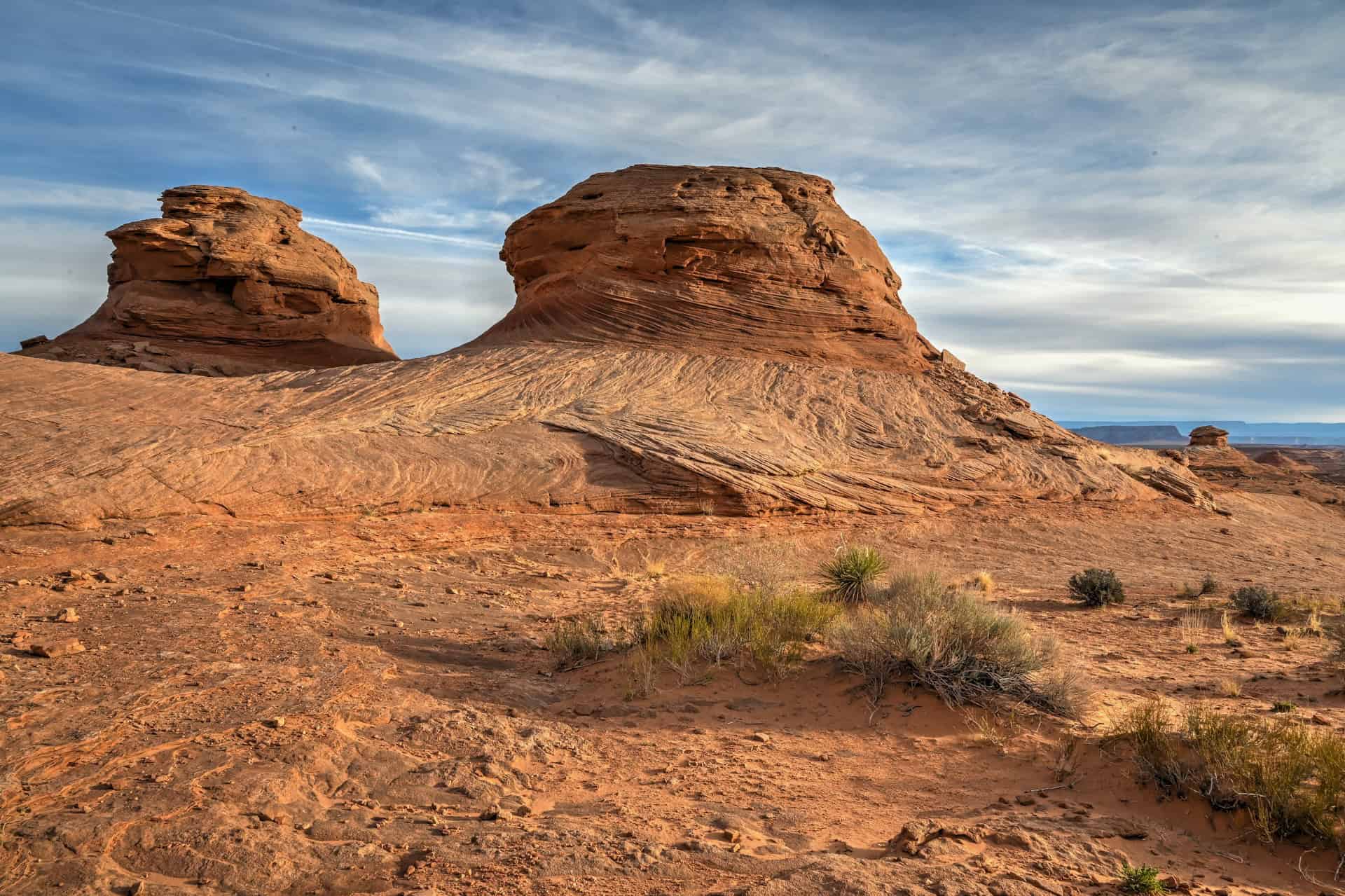
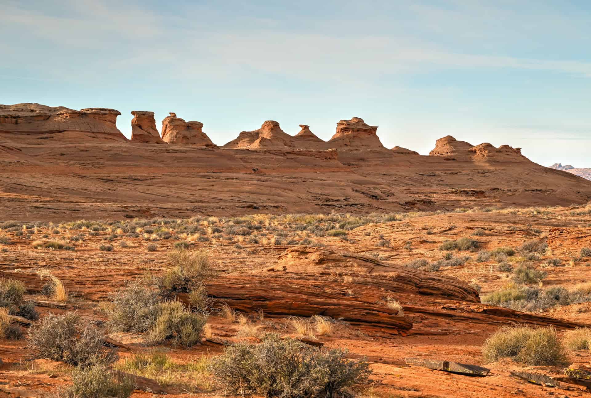
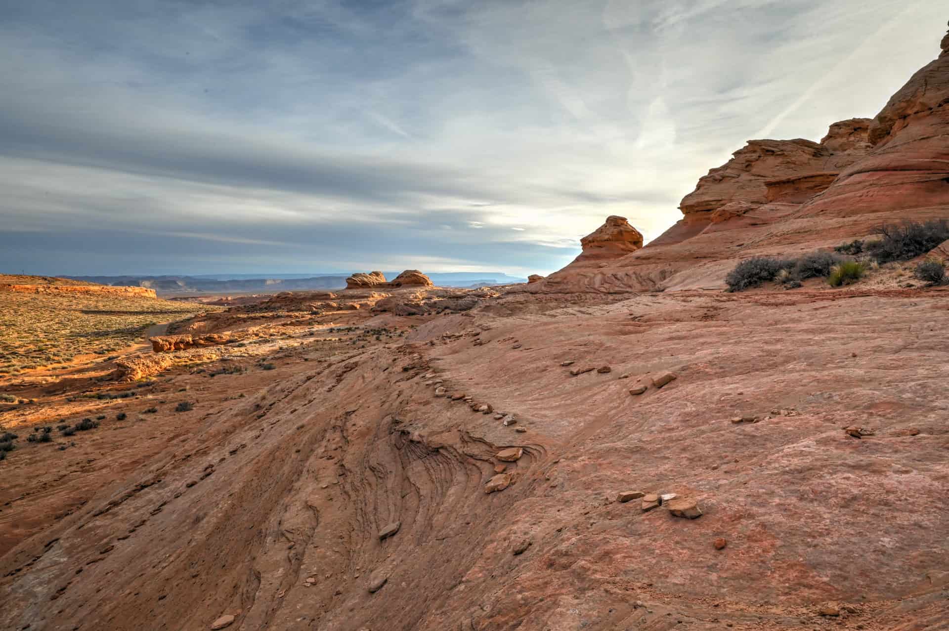
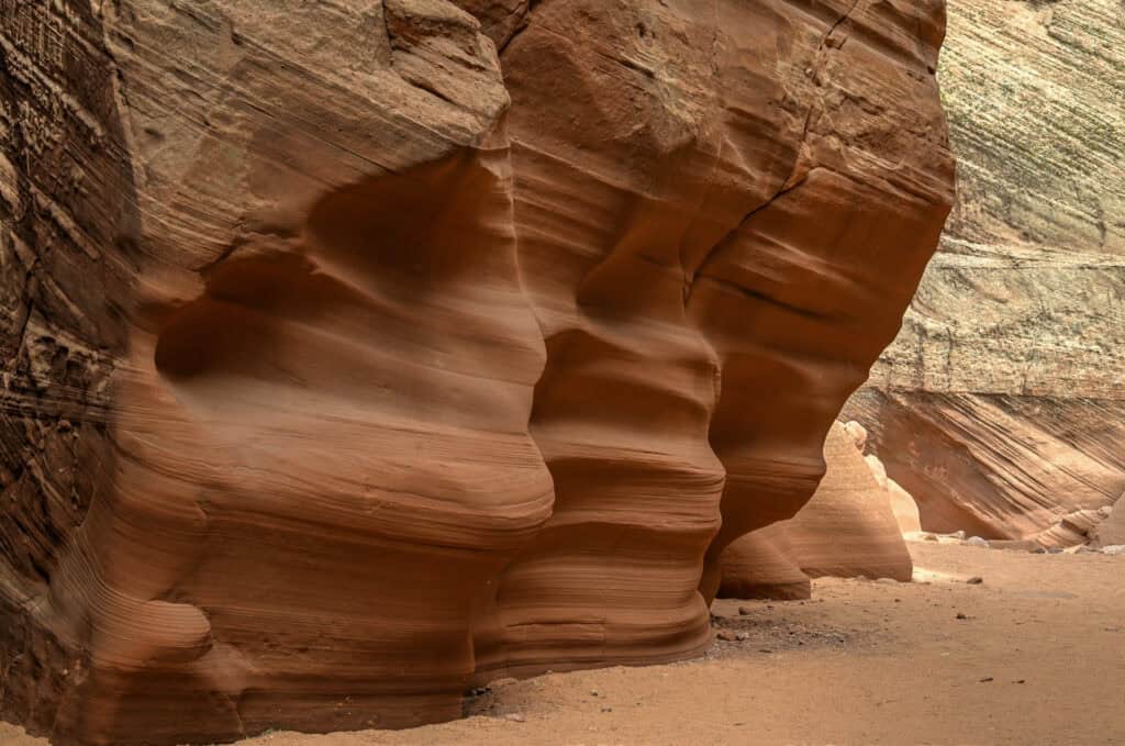
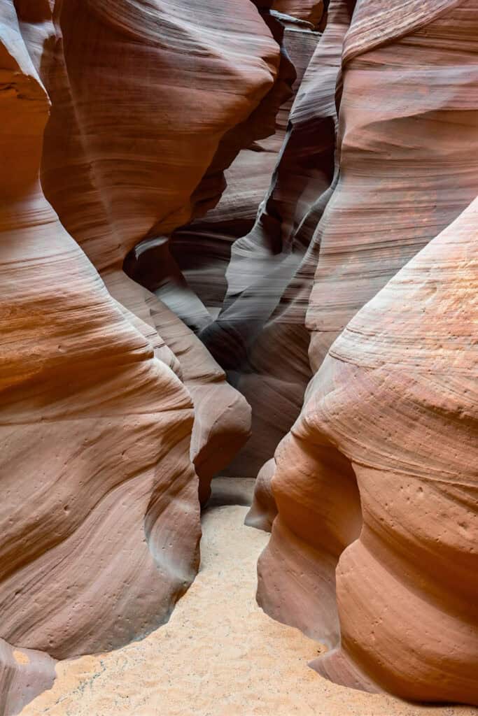
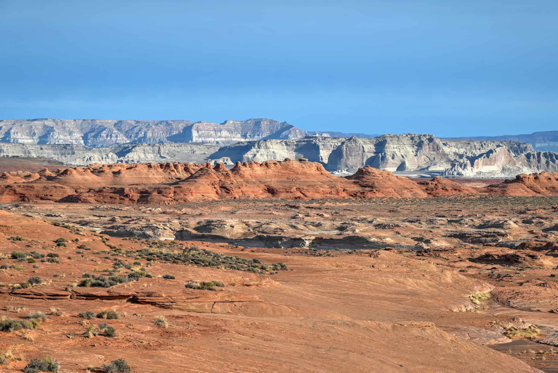
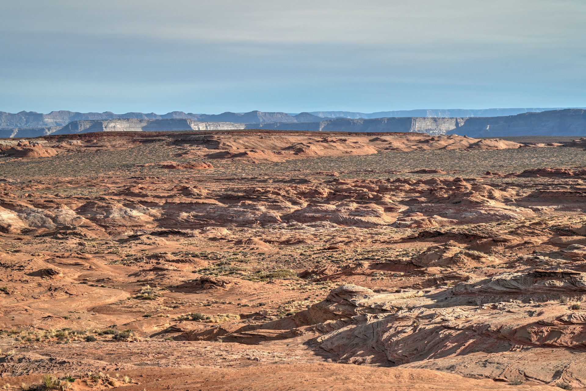
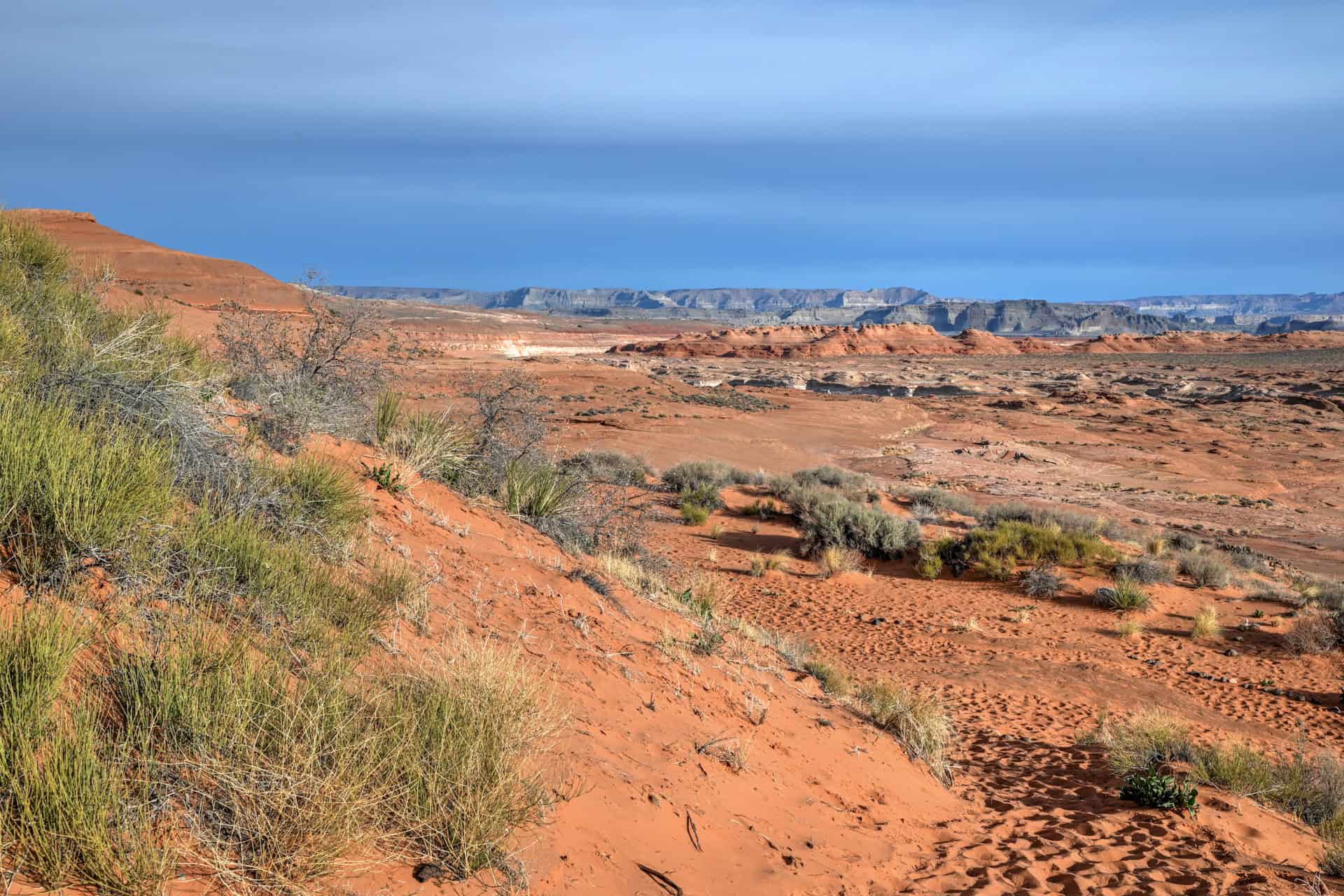
Trail environment – The Beehive Trail winds through sculpted Navajo sandstone formations, including the signature beehive-shaped domes and flowing wave-like ridges. The terrain is classic Glen Canyon desert: exposed slickrock, sparse vegetation, and expansive desert vistas. Shade is virtually nonexistent, so hikers should plan for sun exposure and carry plenty of water.
Route signage – Trail markers are sporadic at times, generally indicated by small cairns on the ground. Navigation is straightforward in good weather, but it’s easy to lose the path in areas where the slickrock patterns are confusing. Offline maps or GPS waypoints are recommended.
Trail surface / Technical aspects – The hike is non-technical but involves walking on smooth, sloping sandstone and loose sand in some sections. Footing can be uneven or slippery, especially on angled surfaces. No scrambling is required, making it suitable for casual hikers, though sturdy shoes with traction are strongly recommended.
Average trail slope grade: 4%, which is considered a very easy average incline.
Trail difficulty level assessment (based on our personal assessment, taking into account the trail length, slope grade and trail surface) :
Very Easy | Easy | Moderate | Moderately Challenging | Challenging
Overall, the Beehive Trail is relatively Easy. We would rate the distance and elevation gain as very easy; however, we have elevated the rating to Easy due to the regular occurrence of uneven footing along angled surfaces.
The Beehive Trail (New Wave) Description and Summary
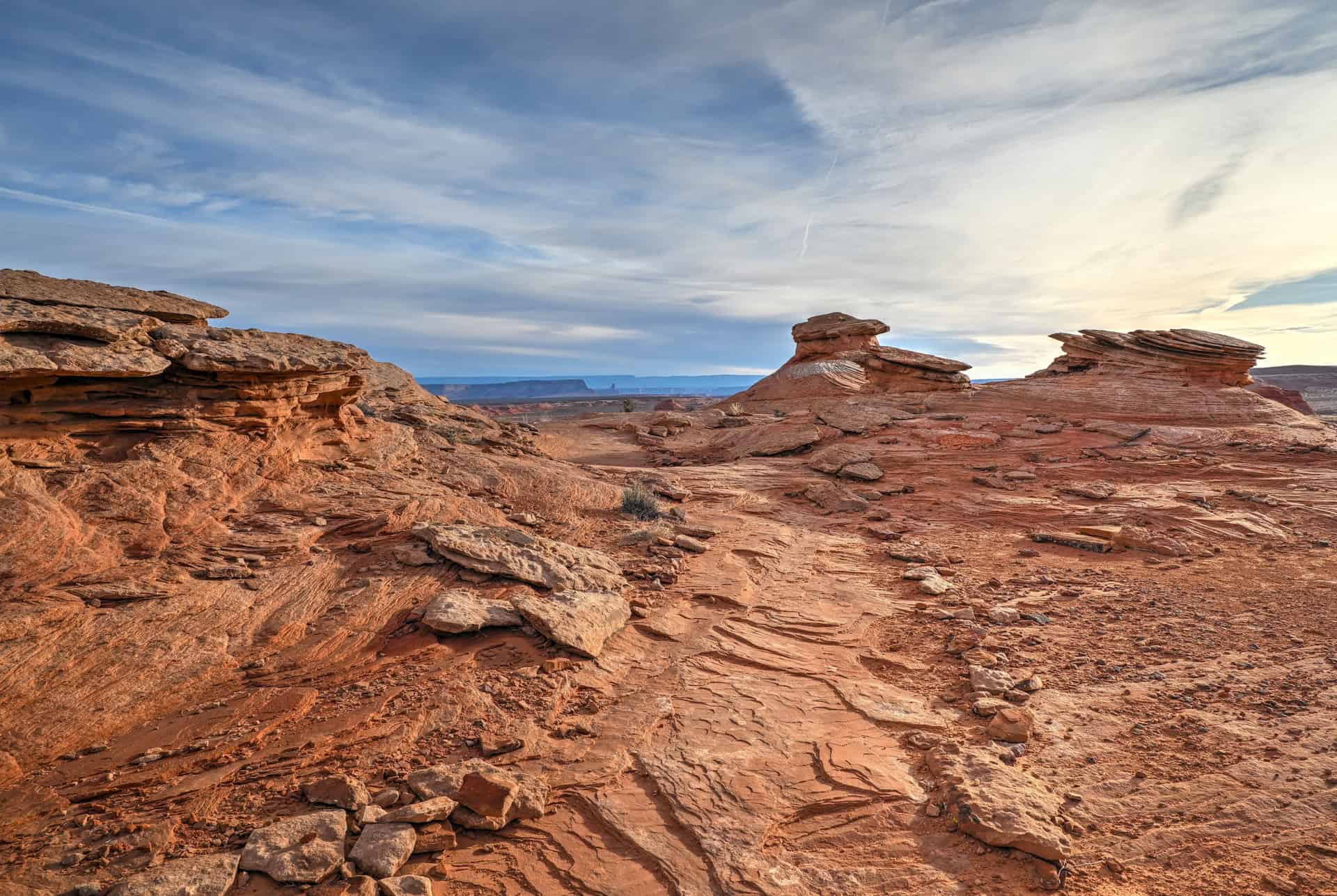
From the parking area, the trail begins with a short but steady climb over slickrock for the first 0.25 mile (0.4 km) as you work your way up to the loop section. Simply follow the small rock cairns marking the route. When you reach a Y-junction, you’ve arrived at the start of the loop.


You can hike it in either direction, but if you’re unsure whether you’ll include the optional spur to the western rock formations, head right and hike the loop counterclockwise, saving that choice for later in the route.
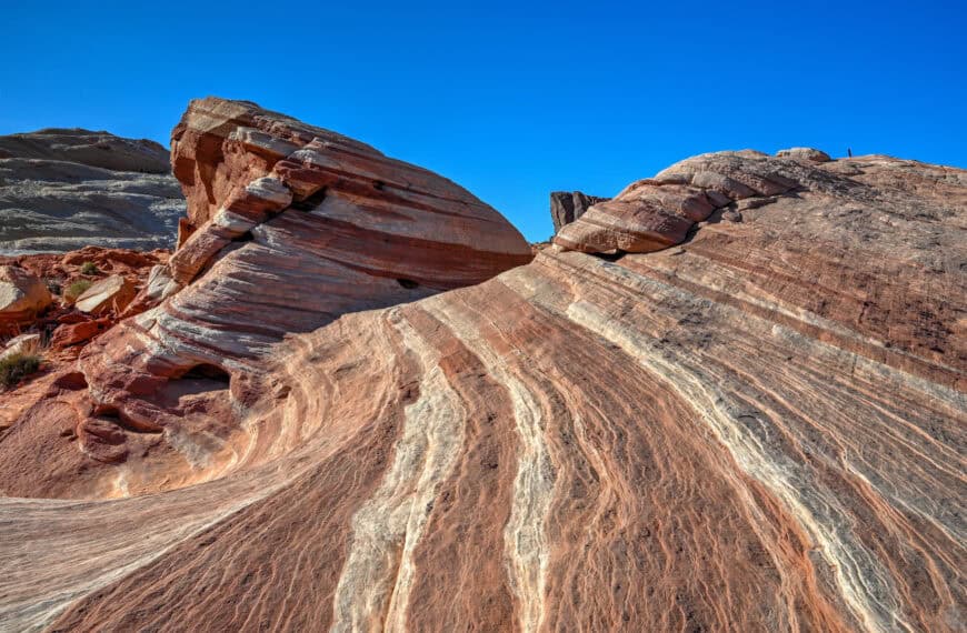
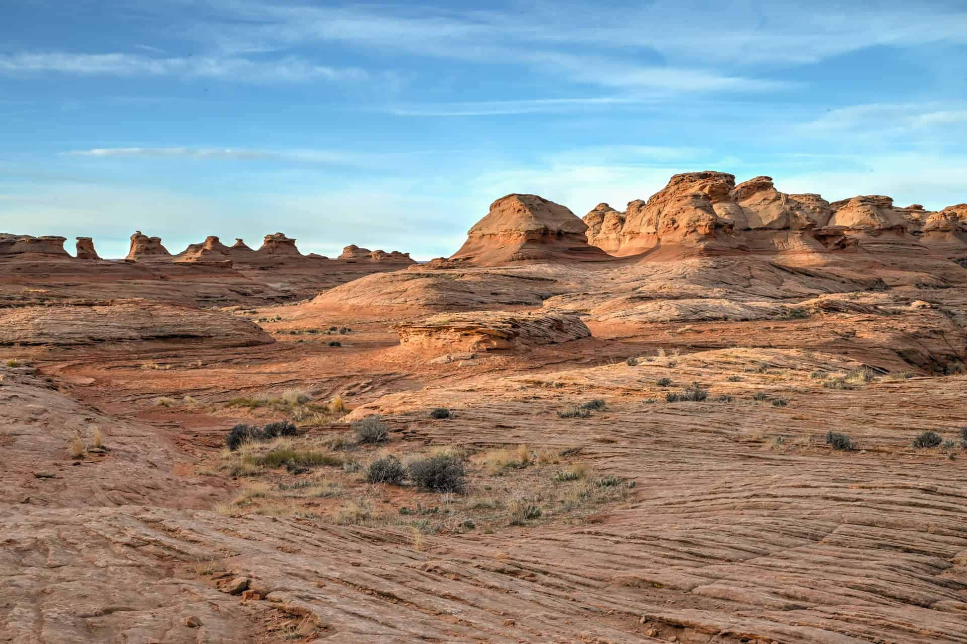
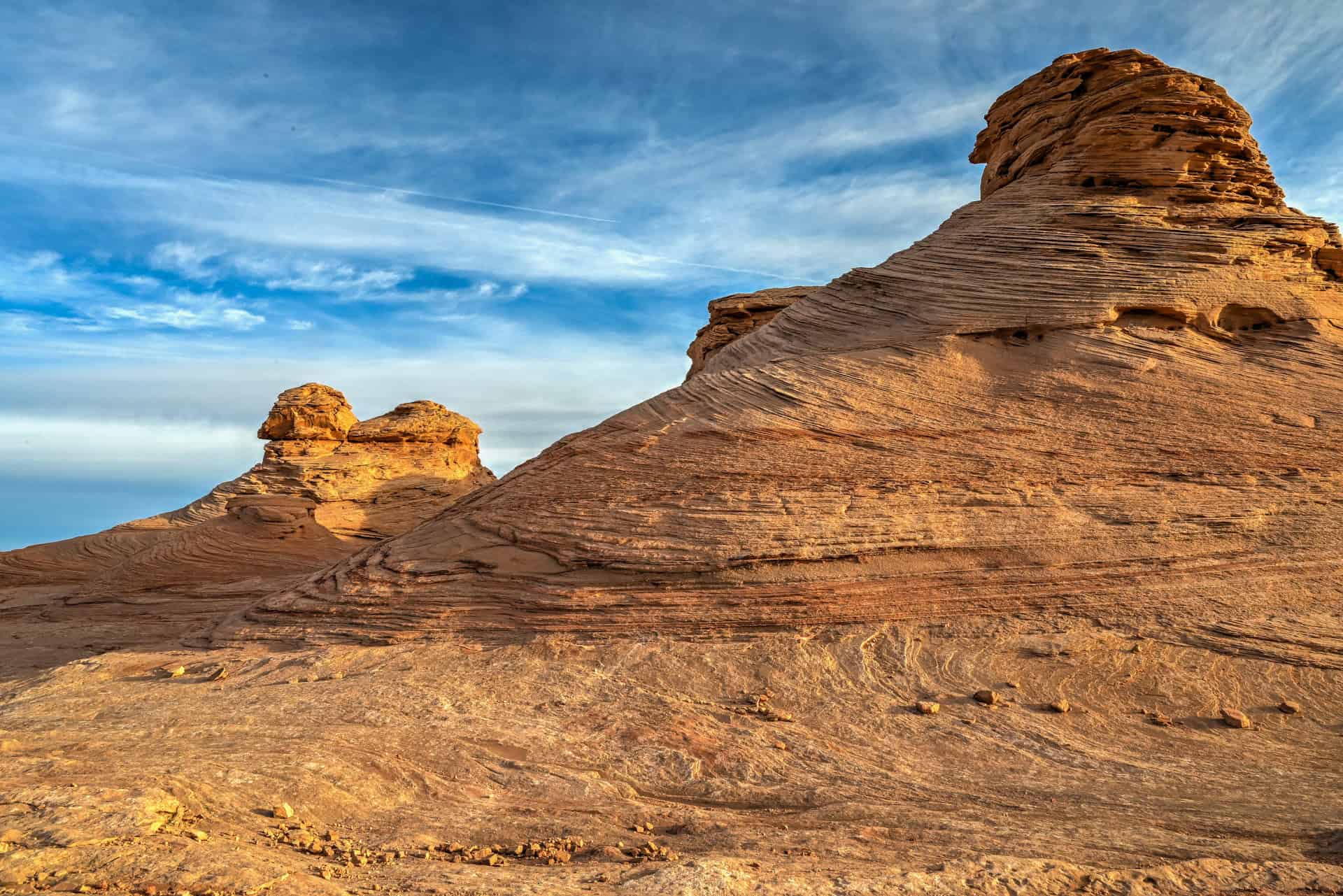
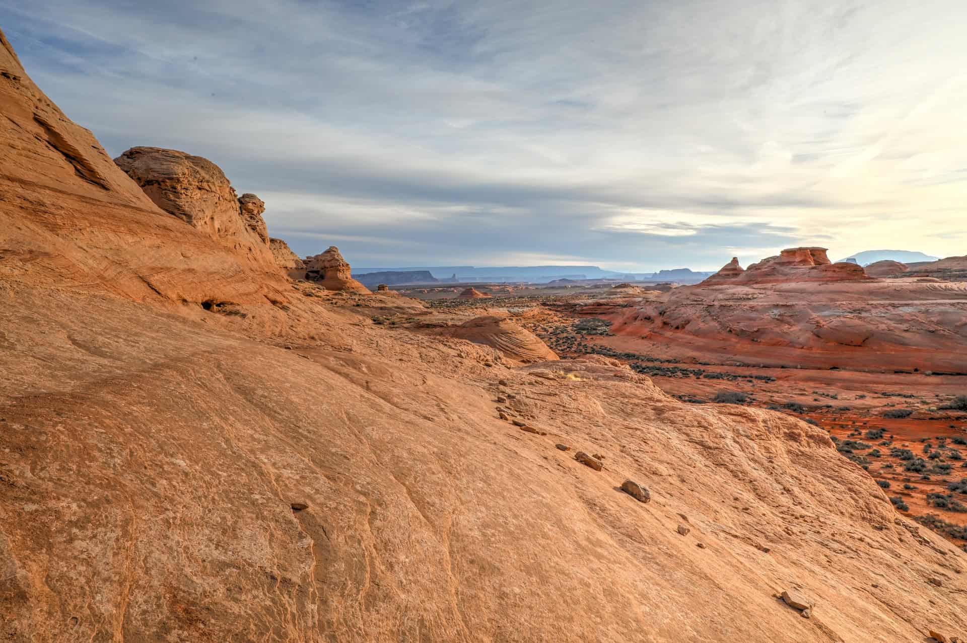
As soon as you enter the loop, you’re surrounded by beautifully sculpted Navajo sandstone. Rounded, cross-bedded formations create a scene reminiscent of The Wave, with swirling patterns, beehive textures, and striped rock folding into soft curves. It’s a remarkable landscape to explore without the need for a permit or a long hike.


Though the trail is short, the slickrock terrain demands attention. The surface can be angled and uneven, requiring careful footing, especially when stepping up and down shallow rock domes. Over the first 0.3 mile (0.5 km) or so, the path winds tightly between some of the most photogenic formations, giving you your first excellent opportunities to capture the rippling layers in warm light.


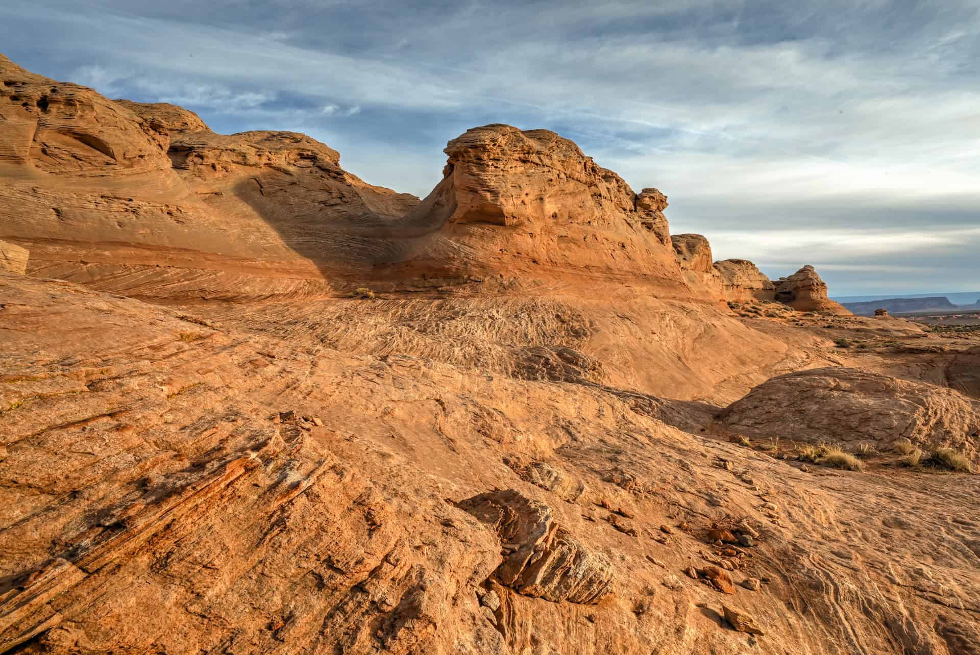
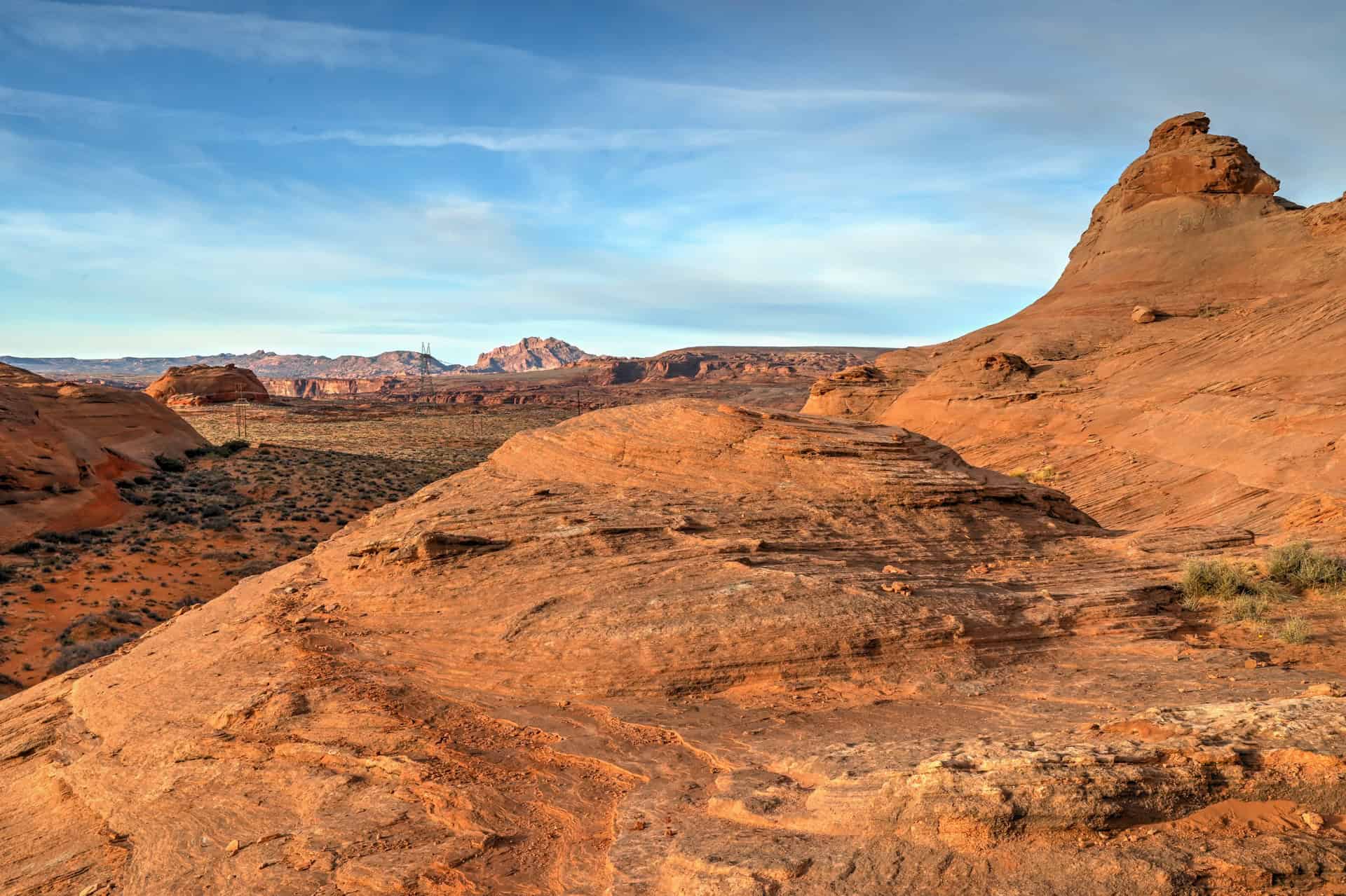
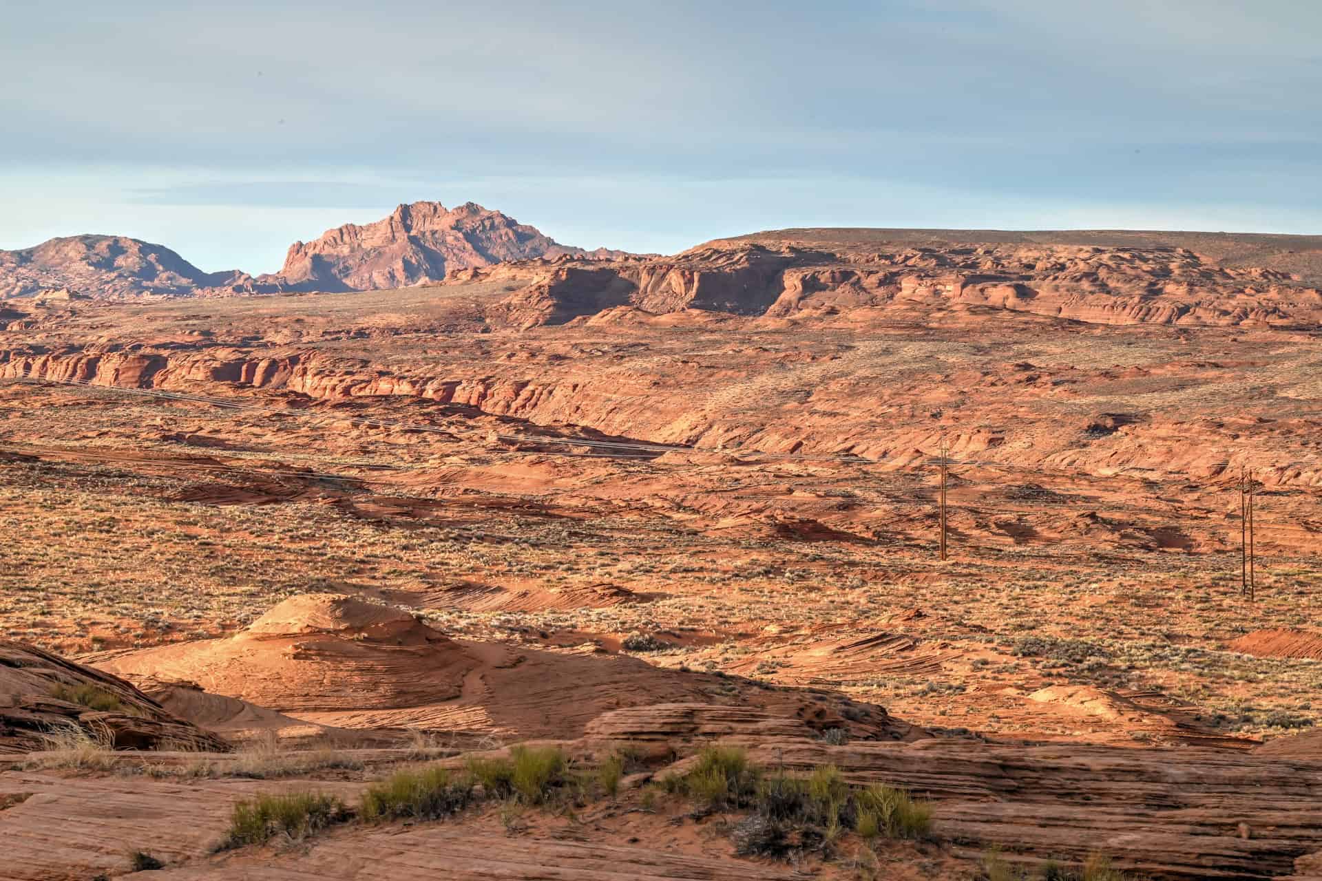
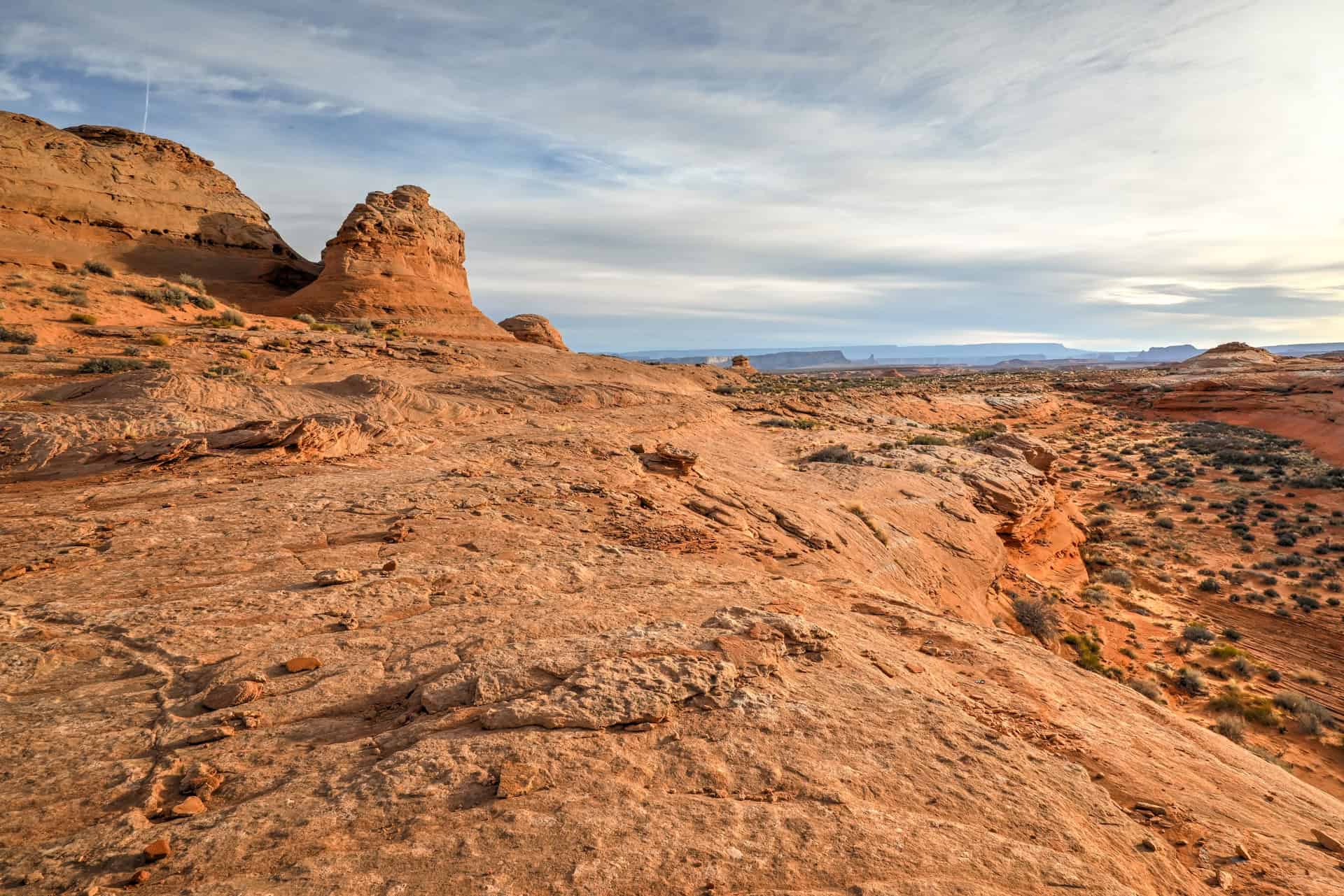
As you approach the southwestern edge of the loop, the scenery broadens dramatically. The landscape opens to sweeping views of the desert floor, the distant Vermilion Cliffs, and rugged mesas near the Arizona–Utah border. A few short ridges provide elevated vantage points with fantastic depth for wide-angle photography.


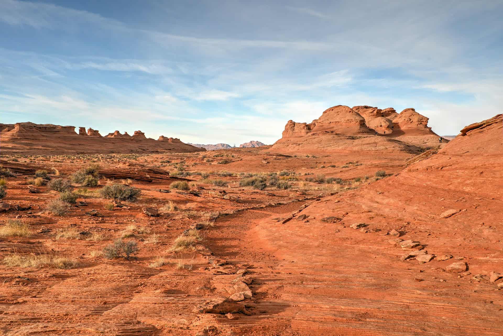
Cairns are present along most of the loop, but some markers are sparse or difficult to spot, especially after heavy wind or foot traffic. Stay alert for subtle depressions and naturally worn paths in the rock that trace the intended route, and avoid getting too close to exposed ledges near drop-offs.
Sunlight plays a big role here: the angle of the sun brings out dramatic contrasts between the red and orange sandstone layers. Take the time to wander respectfully, discovering shallow alcoves, mini-canyons, and small natural “windows” that create unique compositions.


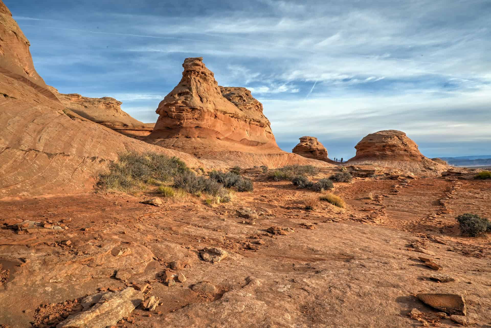
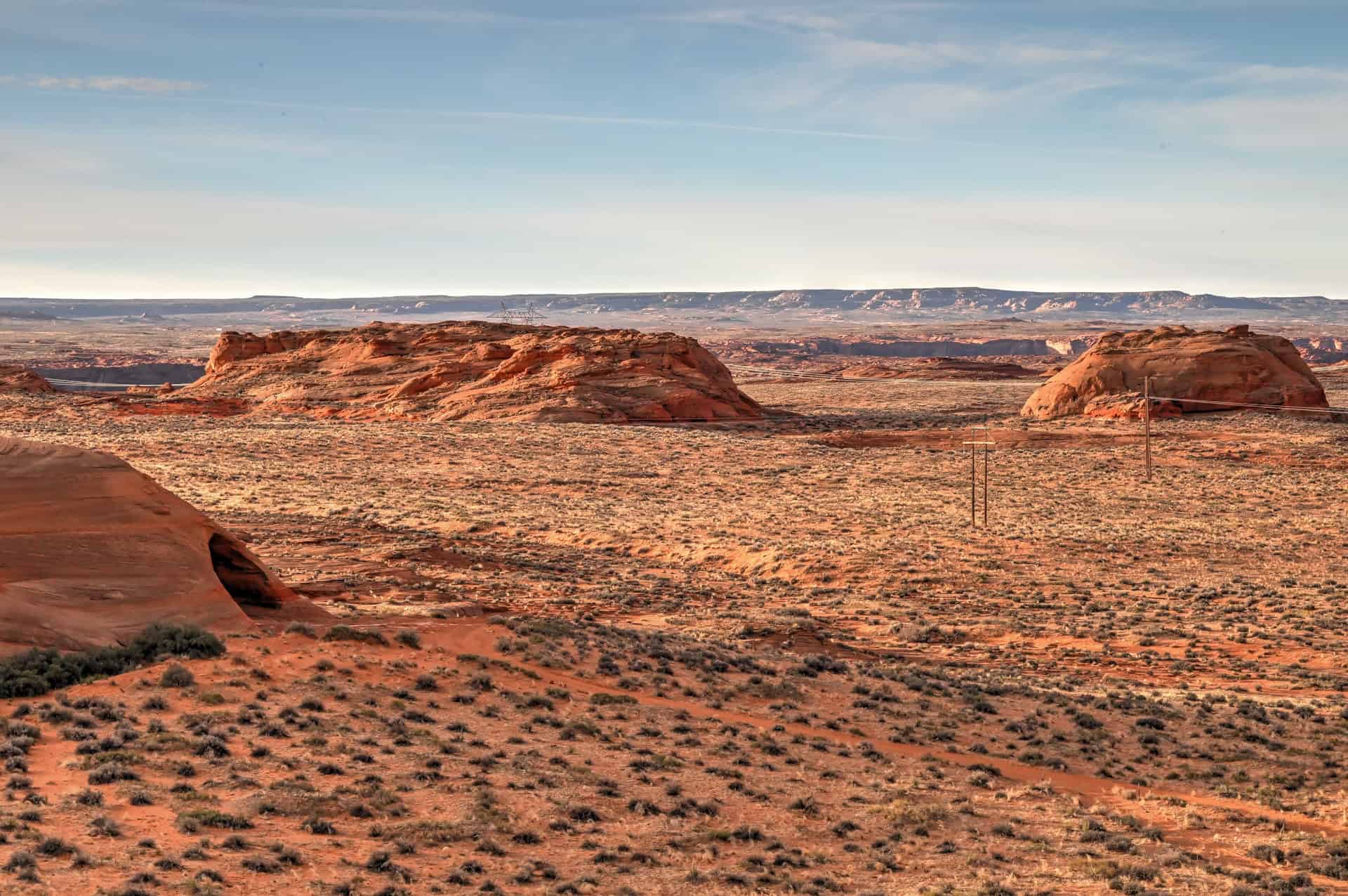
The final stretch curves gently back toward the trailhead, descending across smooth slickrock and patches of sandy wash. You’ll enjoy wide views back toward the behive formations, with glimpses of Lake Powell and Page’s sandstone mesas rising beyond.


Short, scenic, and easy to add to any Page itinerary, the Beehive Trail is a perfect complement to nearby highlights like Horseshoe Bend, Antelope Canyon, and Glen Canyon Dam, offering a rewarding chance to walk among the red-rock waves of northern Arizona.
Hiking Packing List
All Trails subscription – This comes in really handy for areas with little or no cell reception, as the annual subscription allows you to download trail maps for offline use.
External Battery – If you are using your phone to track your progress along the trail or to help with navigation, you certainly don’t want your phone to die on you. That’s especially true in the unlikely event that you might get hurt or need assistance.
Hiking poles – These can be particularly useful in steep trails or muddy/boggy trail conditions.
Water Filter Bottle – The Life Straw bottle is an advanced water bottle with a filter that not only improves water taste but more importantly filters out bacteria and parasites, chemicals and microplastics.
Headlamp – very practical and a smart choice if you plan to start your hike before sunrise or finish it after sunset.
Beehive Trail Hiking Tips
Hiking Experience
The Beehive Trail is short and relatively easy, with minimal elevation gain, but walking on smooth sandstone and loose sand can be deceptively tiring. Casual hikers, families, and first-time visitors will find it accessible, though sturdy shoes are recommended for traction on angled slickrock. The reward is a close-up experience of swirling Navajo sandstone formations and sweeping desert views, a “mini Wave” adventure without the crowds.
Cell Service
Cell coverage near the Beehive Trail is very limited. You may have a faint signal closer to Page, but don’t rely on it along the trail. Download offline maps and any trail guides beforehand, and let someone know your plans if hiking alone.
Leave No Trace
Stay on the established trail (as much as possible) and avoid climbing on sandstone formations. The rocks are fragile, and the surrounding desert ecosystem, including cryptobiotic soil that looks like dark, crusty patches, can take decades to recover from a single footprint. Respect the natural landscape and carry out all trash.
Bugs
Insects are rarely an issue at the Beehive Trail. Gnats or flies may appear in warmer months, particularly after rain, while mosquitoes are uncommon. Ticks are rare. Insect repellent is optional but usually unnecessary.
Equipment
No specialized gear is required, but wear shoes with good traction. Bring water, sunscreen, a hat, and sunglasses. Trekking poles are optional but can help on slick or angled sandstone surfaces.
Weather and Exposure
The trail is fully exposed with almost no shade. Summer temperatures can be high, so early morning or late afternoon is ideal for hiking. Winter brings cooler conditions and occasional strong winds that can blow sand across the trail. Always check the weather before heading out. The open desert provides stunning views but leaves hikers fully exposed to the elements.
Current Trail Conditions
Check the Glen Canyon Alerts page for updates on trail conditions or temporary closures.
Wildlife
Although the slickrock landscape around the Beehive Trail may look stark at first, it’s home to a surprising range of desert wildlife. Common sightings include side-blotched lizards, collared lizards, and chipmunks darting between shrubs or sunning on sandstone ledges.
Rattlesnakes and other desert snakes do inhabit the area, especially in warmer months. They typically avoid hikers, but always watch where you place your hands and feet on slickrock or near shady crevices.
Best Time to Hike the Trail
The Beehive Trail can be enjoyed year-round, but Page, Arizona, has a hot desert climate with extreme sun exposure and no shade. Choosing the right season and time of day can make a big difference.
Spring (March–May):
One of the best times to visit. Highs usually range from 65–85°F (18–30°C) with comfortable hiking conditions and crisp visibility over Lake Powell. Light winds are common in March, but the sandstone colors look fantastic in the low spring sun.
Summer (June–August):
Expect intense heat: temperatures often exceed 100°F (38°C), and the slickrock reflects heat back upward. Casual hikers often underestimate how quickly heat becomes a problem here. If visiting in summer:
-Start before 8 am
-Bring plenty of water
-Watch for monsoon storms (July–early Sept): lightning and flash flooding in washes can be dangerous.
Fall (September–October):
Another ideal period. Highs drop back into the 70–85°F (21–30°C) range with calmer winds and clear skies. Afternoon light creates deep shadows and fiery sandstone tones, excellent for photography.
Crowds typically lighten after Labor Day weekend.
Winter (November–February):
A quiet and beautiful time to explore. Daytime highs generally sit around 45–60°F (7–16°C), but mornings can be near freezing. Occasional light snow or frost makes the cross-bedded rock textures pop.
Expect possible icy patches on steep slickrock after storms.
Quick Summary – When to Visit
For the most enjoyable conditions, spring and fall are ideal. Summer is manageable if you start early and prepare for the heat. Winter offers solitude and striking scenery, though you’ll need to dress in layers and watch your footing.
Other Things to See and Do Near Page
Antelope Canyon
Just east of Page on Navajo Nation land, Antelope Canyon is one of the most famous slot canyons in the world. Its narrow sandstone corridors twist and curve like flowing waves, with beams of sunlight creating breathtaking shafts of light, especially in Upper Antelope Canyon around midday. Lower Antelope Canyon is narrower and requires navigating ladders, making it a slightly more adventurous option. All visits require a Navajo-authorized guide, and tours often sell out weeks in advance during peak travel seasons.
Antelope Canyon X is a newer and often less crowded alternative, offering a mix of tight slot sections and wider canyon chambers with beautiful textures and colors. It provides a similar experience at a more accessible price point, while still requiring a guided tour.


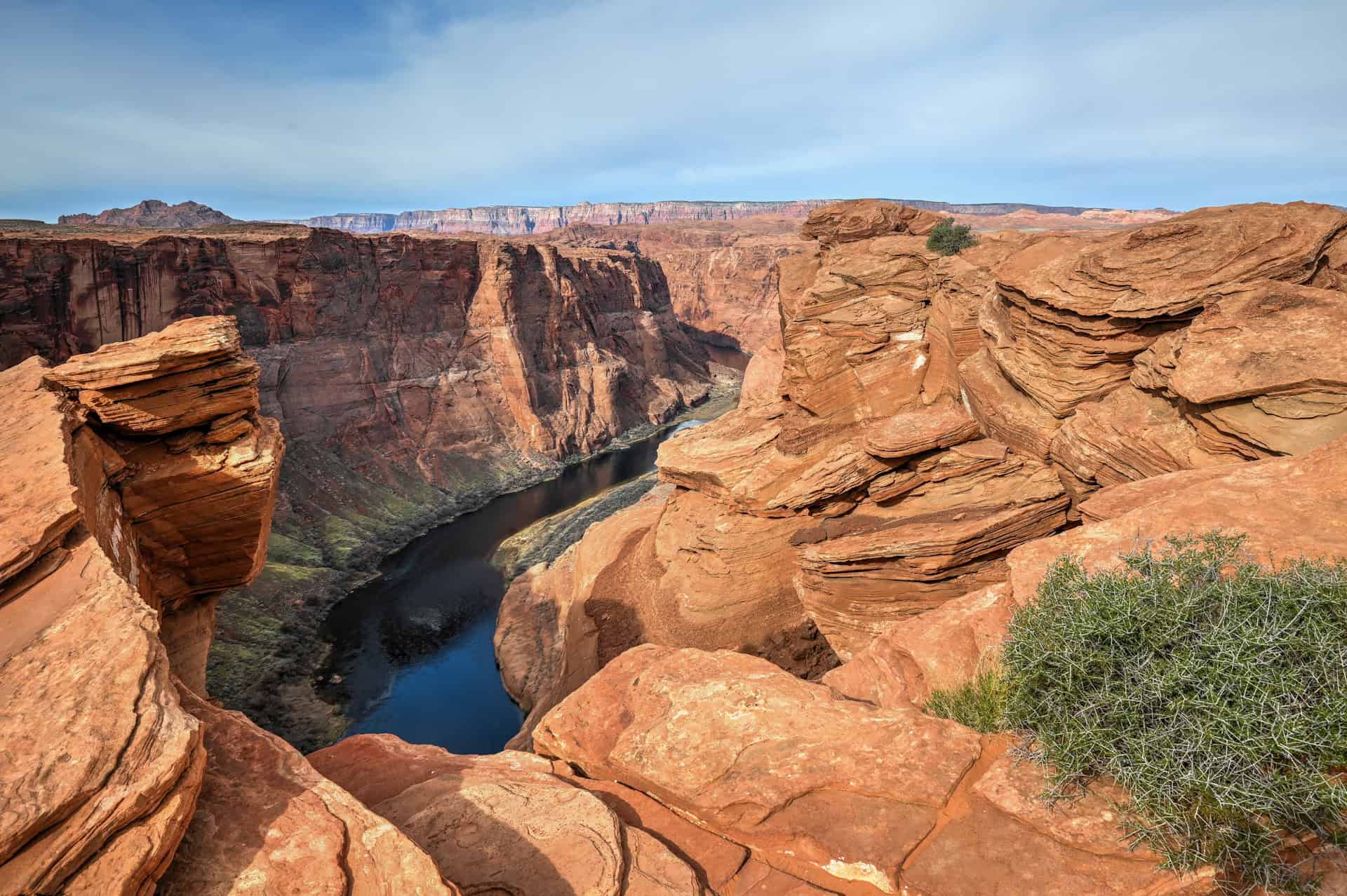
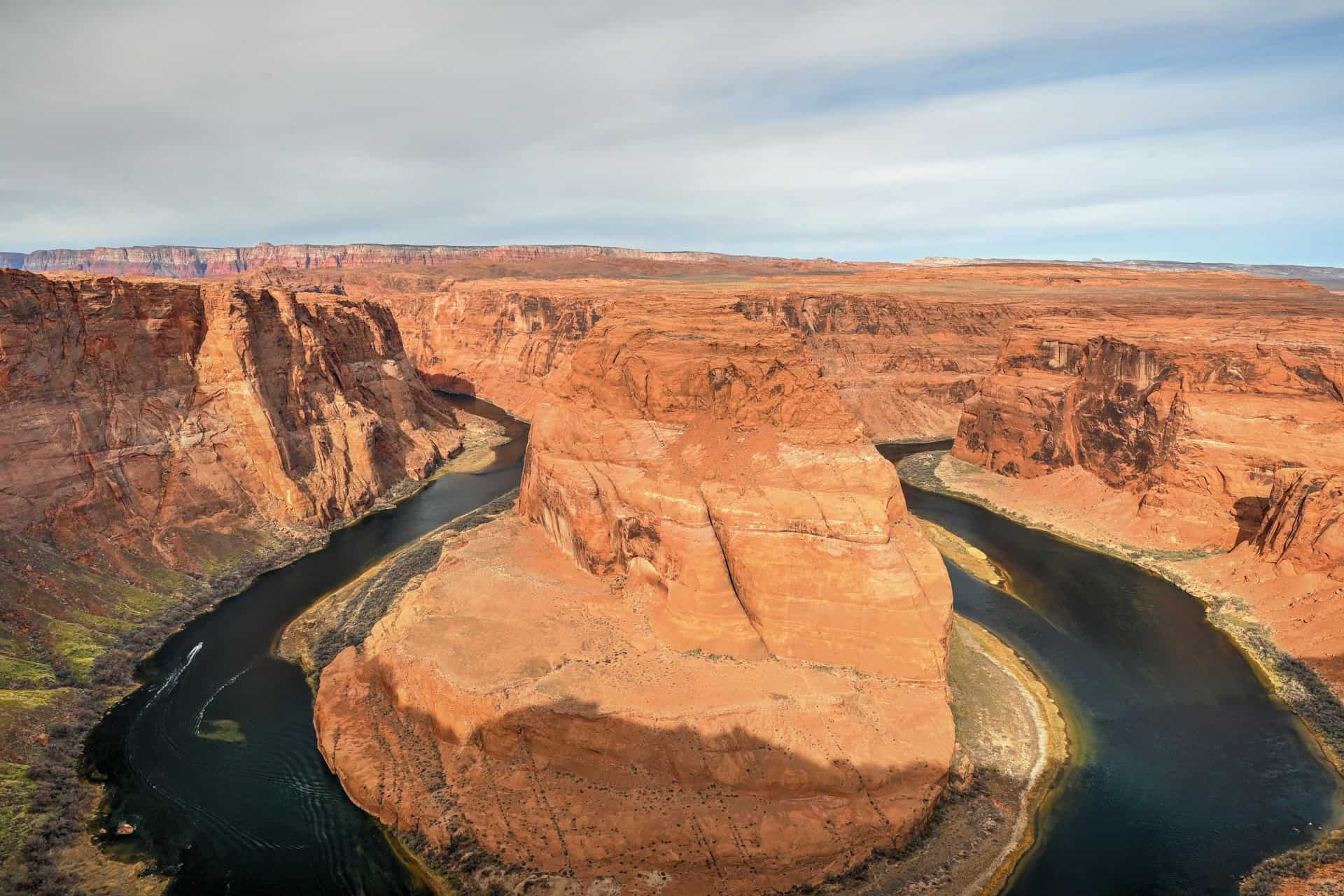
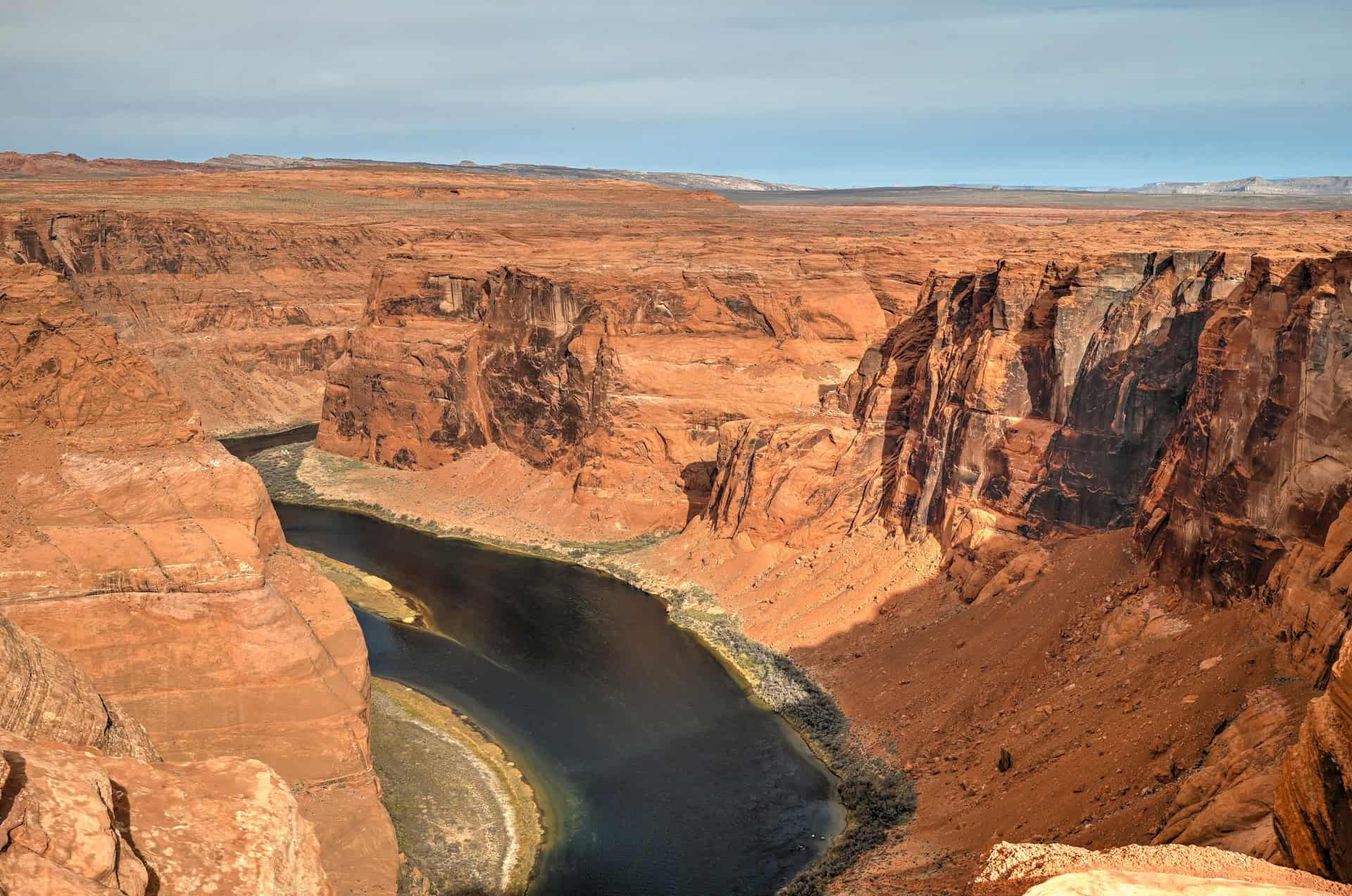
Horseshoe Bend
Only a few minutes southwest of Page, Horseshoe Bend is an iconic viewpoint that offers an unforgettable look at the Colorado River looping in a dramatic horseshoe-shaped curve 1,000 feet below the cliff edge. The walk to the overlook is short, about 1.5 miles round-trip, but expect full sun exposure and large crowds during the middle of the day. Sunrise and sunset offer cooler temperatures and more atmospheric lighting.


Hanging Garden Trail
If you’re looking to add another short and rewarding hike near Page, the Hanging Garden Trail is a fantastic option. This easy 1.2-mile (1.9 km) round-trip walk leads to a shaded alcove where lush vegetation thrives against the desert backdrop, fed by a natural seep spring tucked into the cliffs. It’s a quick adventure that pairs perfectly with the Beehive Trail.


For a more comprehensive list of activities and attractions, see our full guide on the Best Things to See and Do Near Page, Arizona.
Where to Stay Near the Beehive Trail
If you’re looking for comfortable, well-located lodging in Page without splurging on luxury, here are four of the best mid-range options in town. These hotels are all within easy reach of major attractions, including Horseshoe Bend, Antelope Canyon, and Lake Powell. All include free parking, free WiFi, and breakfast, making them solid bases for exploring the region.
Best Western Plus at Lake Powell
What sets it apart: Its walkable downtown location, near restaurants and shops.
A reliable and comfortable choice featuring hot breakfast, a seasonal outdoor pool and hot tub, and clean, spacious rooms. Ideal if you want to leave the car behind in the evenings.
Hyatt Place Page Lake Powell
What sets it apart: Newer and more modern than many competitors in town.
Contemporary rooms with separate sitting areas, plus amenities like a gym, bar/lounge, and outdoor pool. A great pick for families or those wanting a slightly elevated mid-range stay.
La Quinta Inn & Suites by Wyndham Page at Lake Powell
What sets it apart: Pet-friendly rooms with practical in-room amenities.
Offers hot breakfast, an outdoor pool, and guest rooms with a microwave and refrigerator, especially convenient for longer stays or travellers bringing a pet.
Wingate by Wyndham Page Lake Powell
What sets it apart: Excellent value with consistently high guest satisfaction.
Features an indoor pool and spa, fitness center, and comfortable modern rooms.
Booking Tip: Lodging near Page can fill up fast, especially during peak seasons (spring & fall) and weekends. Reserve early.
Beehive Trail – Frequently Asked Questions
Do I need a permit for the Beehive Trail?
No permit is required, unlike the original wave trail between Page and Kanab. Also, this trail is located outside the Navajo Nation boundaries, unlike Antelope Canyon.
Is this a good alternative to The Wave?
Yes! Many hikers visit the Beehive/New Wave area when they can’t get Wave permits, as it offers similar Navajo Sandstone textures on a smaller scale.
Is the Beehive Trail open year-round?
Yes. The trail is accessible year-round, though conditions vary by season. Spring and fall are ideal, with mild temperatures and clear skies. Summer can be very hot, often exceeding 95°F (35°C), so early morning or late afternoon hikes are recommended. Winter brings cooler temperatures and occasional wind, but the trail is usually snow-free and quiet.
How long does it take to hike the Beehive Trail?
Most visitors complete the full loop with the optional spur in about 45–60 minutes, depending on pace and photo stops. Allow extra time if you want to explore alcoves, take multiple photo angles, or enjoy the surrounding desert vistas.
How difficult is the trail?
The Beehive Trail is rated easy, but walking on angled sandstone and loose sand can be tiring. Challenges are sun exposure and uneven footing.
Is the Beehive trail easy to follow?
Route-finding is probably the biggest challenge here. There are scattered cairns, but slickrock sections can be confusing. We highly recommend downloading an offline map before starting, and pay attention to your surroundings.
What’s the best time of day to hike the Beehive Trail?
Early morning is ideal, with cooler temperatures and softer light that enhances the sandstone patterns. Late afternoon is also beautiful, as the setting sun casts deep shadows and warm hues across the formations. Avoid midday during summer when the sun is strongest.
Are drones allowed?
Yes. Currently there are no drone restrictions specific to this area. Still, be respectful of wildlife and other visitors.
Are dogs allowed on the Beehive Trail?
Yes, dogs are allowed but must be kept on a leash at all times. Be sure to bring water for your pet, as shade is very limited.
Can I explore off-trail?
To some extent. This route is more like an open exploration zone than a trail per se. But stepping on sensitive biological crust should be avoided, and care is needed near drop-offs. Also, avoid climbing on sandstone formations.
Can I hike at sunrise or sunset?
Yes, the trail can be enjoyed at sunrise or sunset. These times offer the best light for photography and softer temperatures.
Is this trail suitable for kids?
Yes, for most families. Kids love the sandstone “playground” terrain, but supervision is required near cliffs.
Explore More Arizona
Continue exploring Arizona with these detailed travel guides:
Best Things to See and Do in Sedona
Best Stops and Must-See Attractions Between Las Vegas and Sedona
Monument Valley Travel Guide
Sunset Crater Volcano National Monument
Photography Gear
If you like our photography, you might be interested in some of the gear we use to shoot our travel and hiking destinations.
Camera Body – Nikon Z 6ii Fx-series Mirrorless Body
Main Lens – NIKON 24-120mm F/4G ED VR AF-S
Zoom Lens – Sigma 745-306 150-600mm f/5-6.3
Polarizing filters – Urth Circular Polarizing (CPL)
Camera Tripod – K&F Concept 64-inch Camera Tripod
Mini-tripod – Lammcou Flexible Camera Tripod
Camera/hiking backpack – Vanguard Alta Rise 48 Backpack
Universal Travel Adapter – VYLEE Universal International Power Travel Plug
Other Travel Essentials
Travel Insurance
SafetyWing is a travel insurance company that offers comprehensive coverage for travellers. Includes Medical Insurance and Travel Insurance. Primarily geared towards long-term travellers, digital nomads, and expats.
e-Sim cards
Airalo is the world’s first and largest eSIM store with eSIM plans for 200+ countries and regions worldwide. With Airalo eSIMs, travellers can get connected the moment they land at their destination and avoid nasty data roaming charges
eSIMS are a sustainable alternative to single-use SIM cards – they are 100% digital, require less energy to produce and be re-used rather than disposed of.
Car Rentals
Discover Cars is our go-to website for car rentals. We almost always find our preferred rate there.
Transfer from Airport
Welcome Pickups is our favourite private transfer service, which you can pre-book at a fixed price. Currently available in 220 cities all over the world (mostly in Europe, but with several major cities in Asia, the Middle East and the US).
Kiwitaxi is another private transfer service – we haven’t tried it yet, but it’s currently available in a few more countries (102 as of 2024).
Hotels and Accommodations (coming soon)
Photography Prints
If you found this blog useful, you can help support our blog by purchasing low-cost digital prints. Printed physical prints are also available for purchase.


—–
Well, that wraps it up! We hope you enjoyed our Page Hiking Guide for the Beehive Trail and that it will prove useful for planning your hiking trip.
—–
You might also be interested in these related pages: