Snow Canyon State Park may fly under the radar compared to its famous Utah neighbours, but its trails offer some of the most rewarding—and uniquely diverse—landscapes in the region. Nowhere is this variety more apparent than in the trio of hikes clustered near the center of the park: the Lava Flow Trail, Butterfly Trail, and Petrified Dunes Trail. Together, these routes showcase the essence of Snow Canyon: ancient lava fields, rolling slickrock domes, winding desert washes, and views that stretch across fiery sandstone cliffs. Whether you hike them individually or link them into a longer circuit, they offer something for every explorer—casual strollers, adventurous families, and photographers chasing dramatic textures and glowing sunset light. This guide breaks down each trail in detail, explains how to combine them, and helps you choose the best route based on time, conditions, and hiking experience.
Snow Canyon Hiking Guide – At a Glance
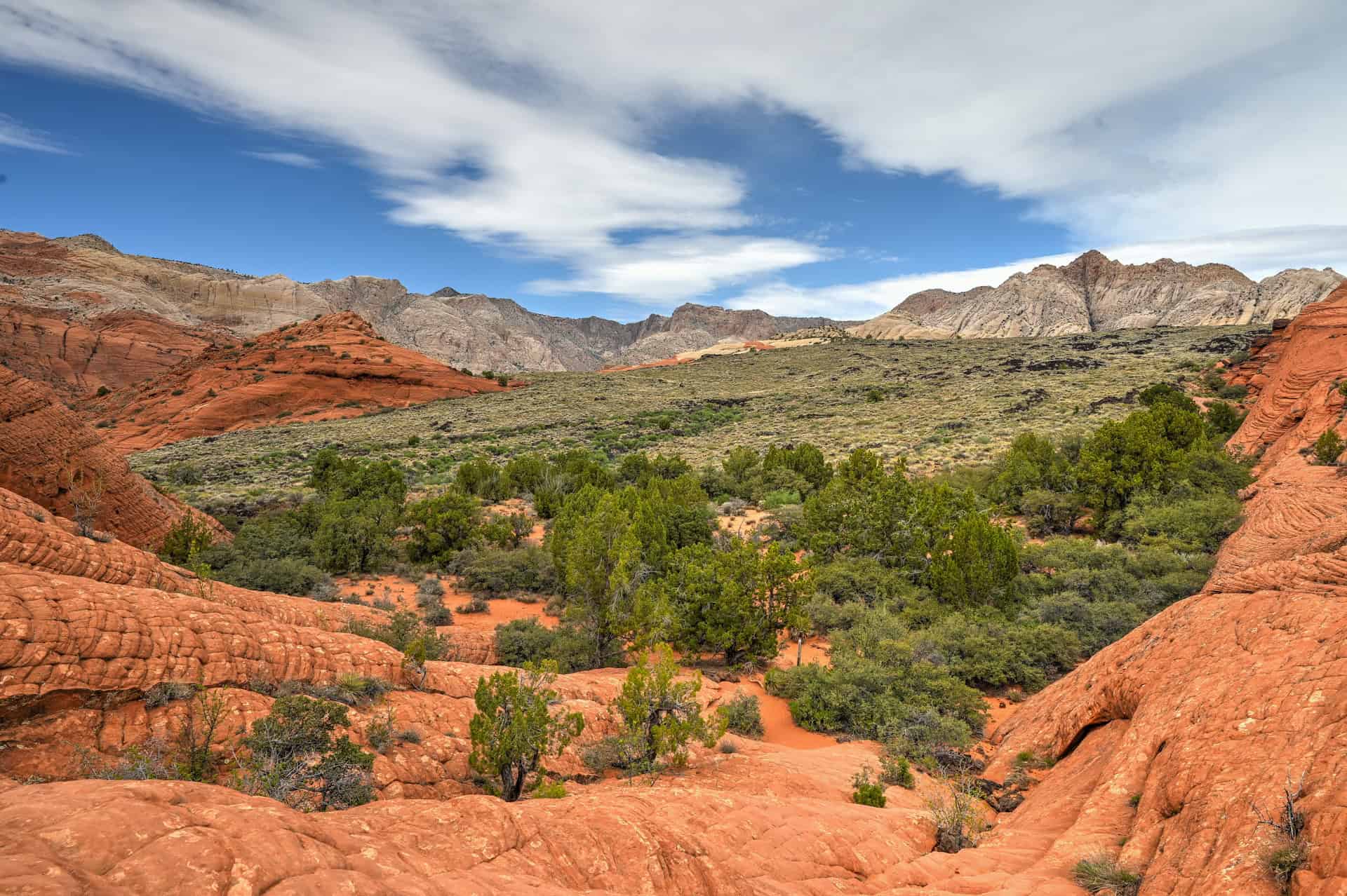
A playground of volcanic rock and sculpted sandstone – Snow Canyon blends two dramatically different landscapes in one compact area. The Lava Flow and Butterfly Trails weave across ancient basalt fields formed by now-silent volcanoes, while the Petrified Dunes Trail leads you over rolling waves of Navajo sandstone shaped by millions of years of erosion. Together, they offer an easy way to experience the park’s striking contrast between dark lava and glowing red rock.
Short trails with big variety – These hikes are relatively short and can easily be combined in a single visit, yet each offers something distinct: lava tubes you can enter, cracked basalt ridges, swirling rock fins, panoramic viewpoints, and wide open slickrock mounds perfect for wandering. If you want maximum diversity with minimal effort, these are the must-do routes in Snow Canyon.
Accessible adventure for all levels – None of these trails are overly strenuous. Most of the hiking is on packed dirt, basalt rock, or smooth sandstone, with occasional uneven footing near the lava tubes. They’re ideal for families, casual hikers, photographers, and anyone looking to explore the park without committing to long distances or steep terrain.
A photographer’s paradise – The contrast between jet-black lava and warm red sandstone is especially striking in early morning and late afternoon light. The Petrified Dunes glow at golden hour, while the texture of the lava fields comes alive with raking side-light.
A perfect sampler of Snow Canyon’s landscapes – Whether you have an hour or a half-day, these trails highlight everything that makes Snow Canyon unique: volcanic history, sculpted slickrock, desert vegetation, dramatic colors, and wide-open views. For first-time visitors, they’re the ideal introduction to one of Utah’s most underrated state parks.


Disclosure: This page (Best Hikes in Snow Canyon: Lava Flow, Butterfly & Petrified Dunes Trails Guide) may contain product affiliate links. At no additional cost to you, we may receive a commission for purchases made through these links. More details can be found on our disclosure and policies page.
Snow Canyon State Park – Location and Map
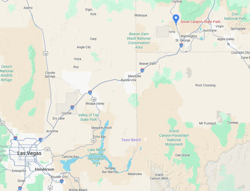
Snow Canyon State Park lies in southwestern Utah, just 15 minutes from downtown St. George (link to Google Maps), making it one of the most accessible and rewarding parks in the region. Despite being smaller and lesser-known than nearby Zion National Park, Snow Canyon packs in an impressive variety of landscapes: petrified sand dunes, black lava fields, narrow canyons, and soaring red rock cliffs.
Located along the scenic Snow Canyon Parkway, the park is easy to reach whether you’re visiting from St. George, passing through on a Utah road trip, or using it as a quieter alternative to Zion.
About Snow Canyon State Park
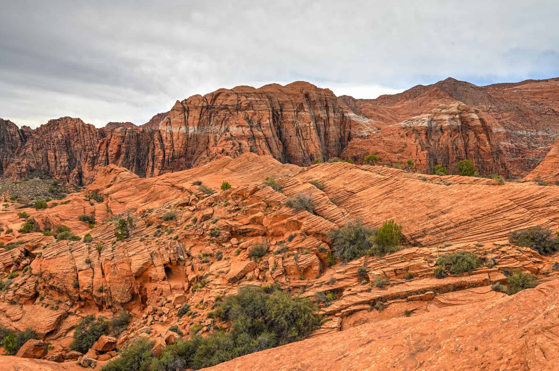
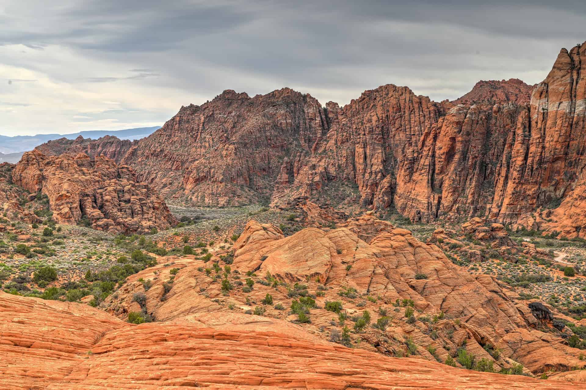
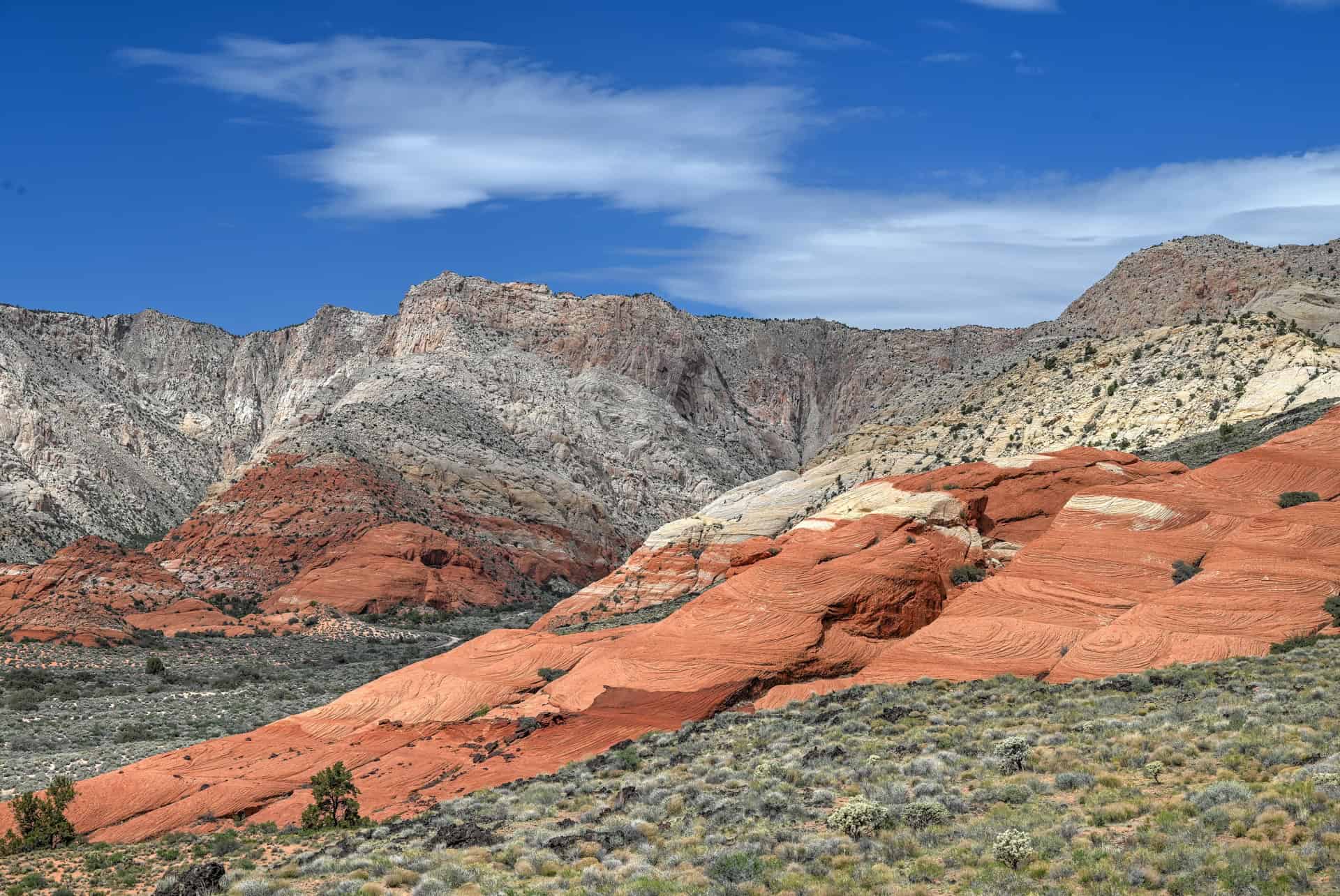
Utah’s Quiet Red-Rock Gem: Snow Canyon State Park lies just north of St. George, Utah, in the heart of the state’s famous red-rock country. Despite its dramatic scenery, it often flies under the radar compared to nearby Zion National Park, making it a peaceful alternative with equally striking landscapes. Towering sandstone cliffs, rolling lava fields, desert canyons, and vast petrified sand dunes shape a landscape that feels both intimate and immense.
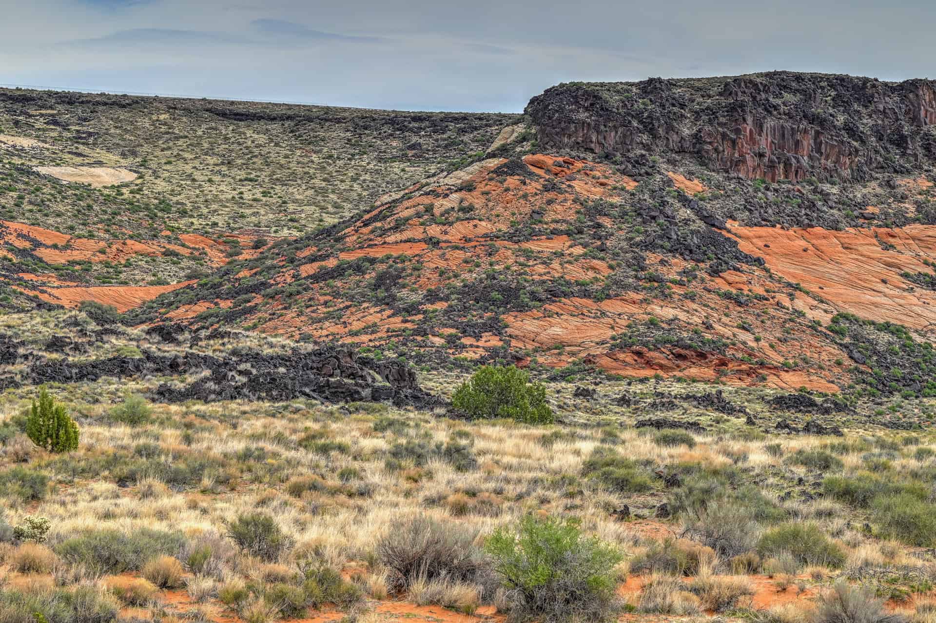
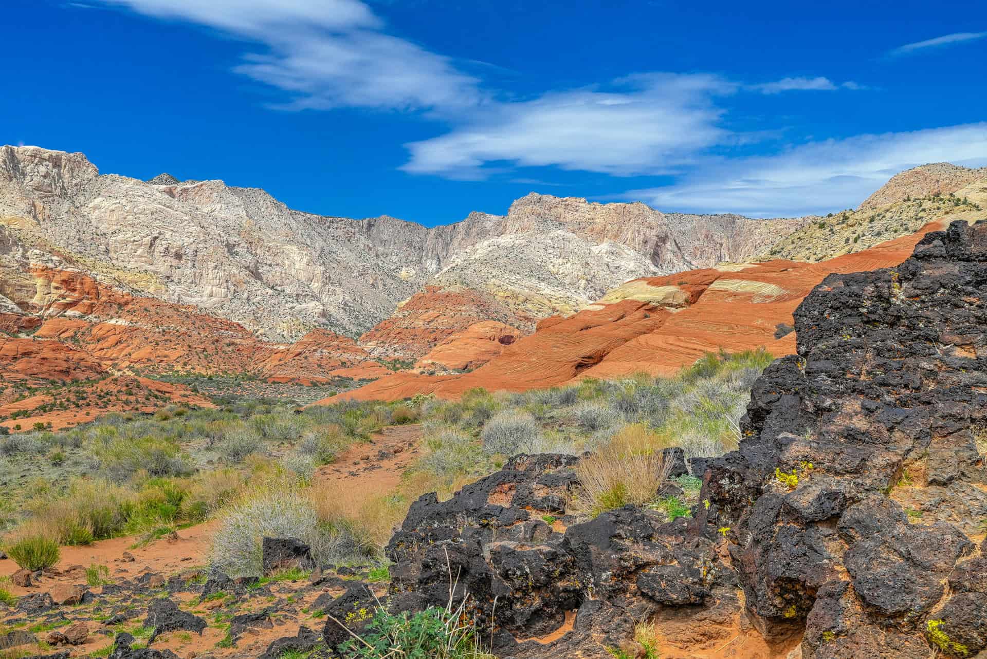
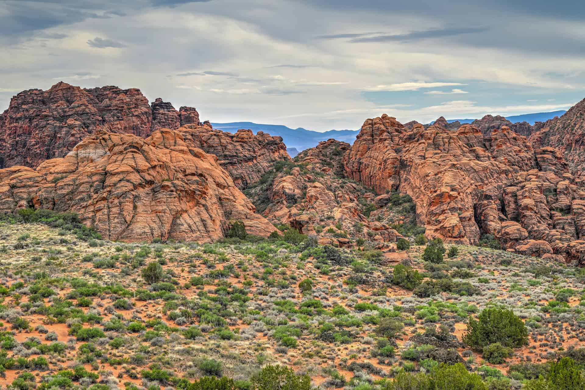
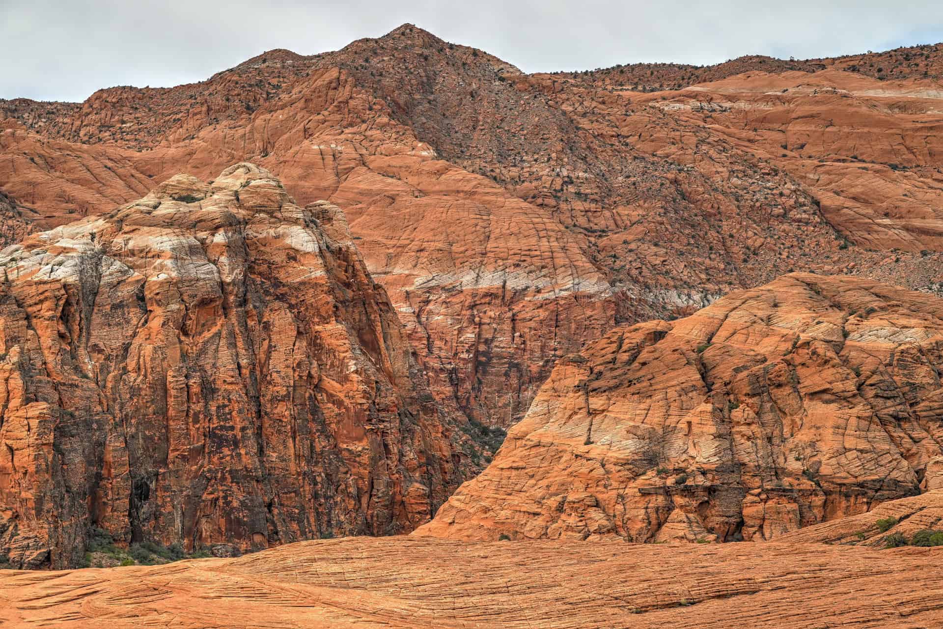
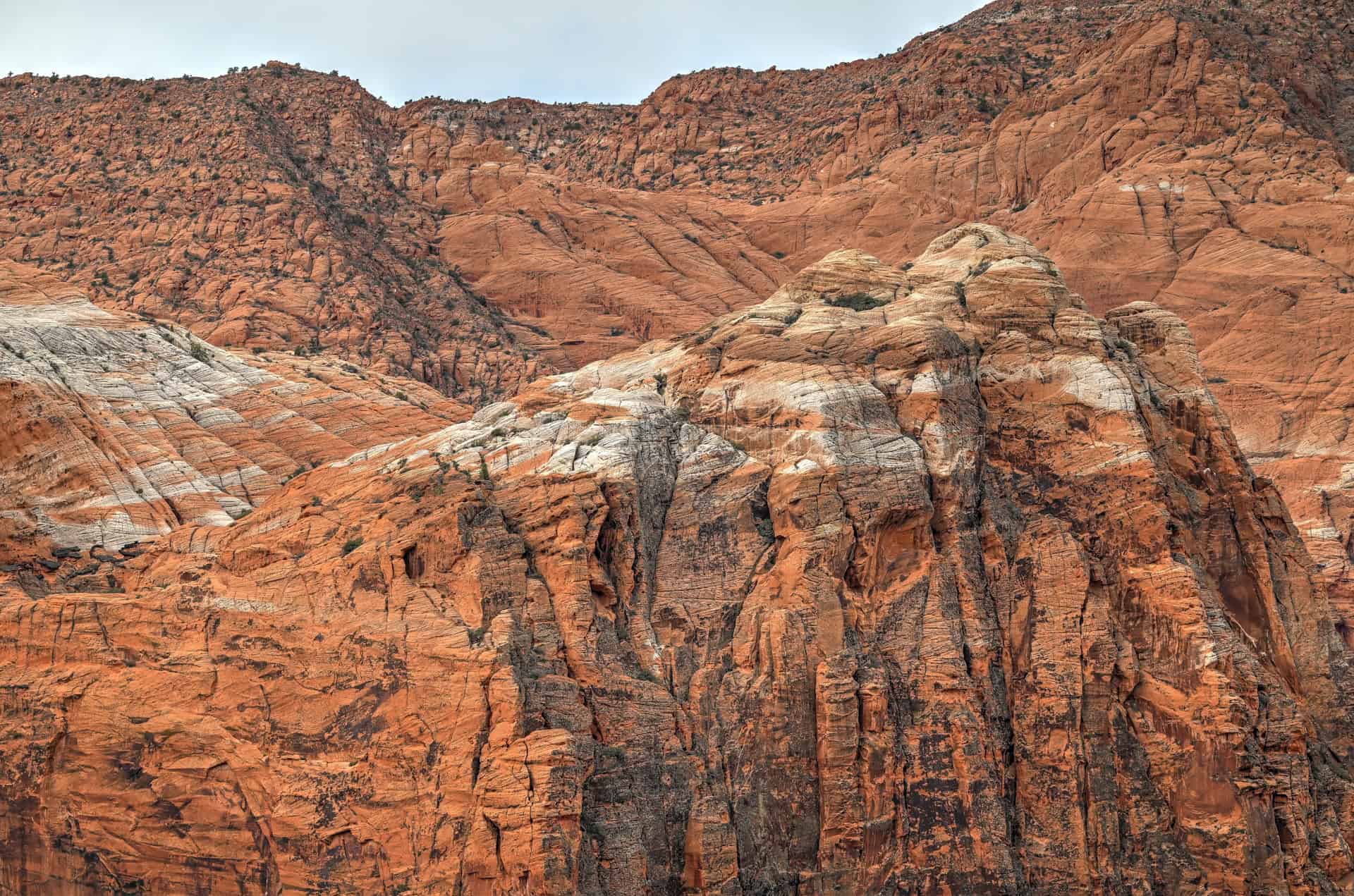
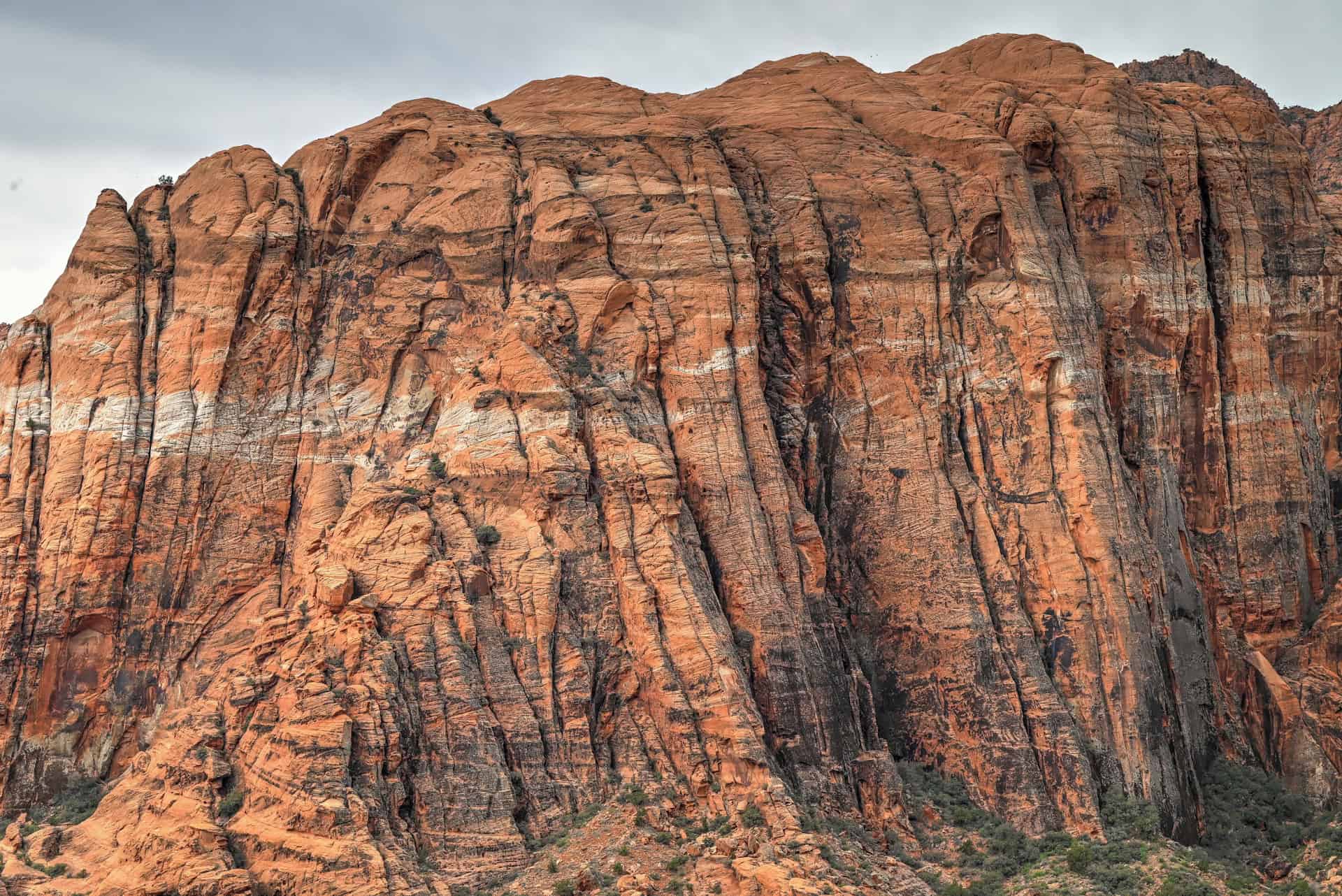
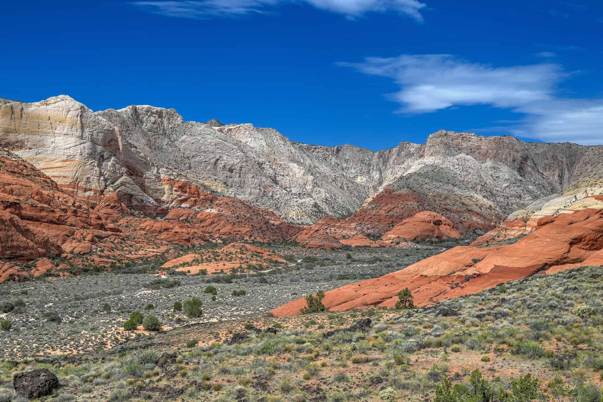
A Landscape Formed by Fire and Sand: Snow Canyon is a geological meeting point where ancient Navajo Sandstone, once part of a massive dune field, collides with relatively young volcanic activity. Over millions of years, wind sculpted the soft sandstone into domes, fins, and smooth slickrock; later, lava flows poured through the canyon, leaving behind black basalt ridges, lava tubes, and rugged fields of cooled rock. The contrast between white, red, and rust sandstone against deep black lava makes this park visually unique in the region.
A Haven for Short, Scenic Hikes: Snow Canyon is packed with trails that balance accessibility with impressive scenery. Routes like Lava Flow, Butterfly, and Petrified Dunes are ideal for families, casual hikers, and photographers, offering big views with minimal mileage. Whether you’re wandering across ancient dunes, climbing basalt-studded ridges, or exploring narrow desert passages, the park’s trail network delivers variety without requiring long distances or steep climbs.
Rich Cultural and Natural History: Long before it became a state park, Snow Canyon was home to Indigenous peoples, including the Southern Paiute, who left behind traces of their presence in the surrounding desert. The park also preserves a diversity of desert wildlife, from lizards and gopher snakes to peregrine falcons and mule deer. Its unique mix of habitats (lava flow, riparian corridor, and slickrock) supports an unusually rich ecological community for such a compact area.
Easy Access From Las Vegas: Just minutes from St. George and less than an hour from Zion National Park’s main entrance, Snow Canyon is one of southern Utah’s most convenient outdoor escapes. Scenic roads loop through the canyon’s center, offering quick access to trailheads, overlooks, picnic areas, and lava formations. Whether you’re visiting as a short detour, a half-day outing, or a quiet complement to a Zion trip, Snow Canyon delivers exceptional red-rock scenery with far fewer crowds.
How to Get to Snow Canyon State Park
Snow Canyon State Park is best reached by car, as there is no public transportation directly into the park.
Snow Canyon offers two main entrances, both fully paved and easy to access:
- South Entrance (via St. George / Ivins):
Best for visitors coming from Las Vegas, St. George, or destinations along highway I15. This is the primary and most commonly used entrance, providing quick access to popular trailheads such as Petrified Dunes, Butterfly, and Lava Flow. - North Entrance (via Highway 18):
Although the north entrance is technically closer to the trailheads in question, it doesn’t make much difference, as both entrances are less than 5 miles apart. This entrance is quieter and ideal for travellers arriving from northern Utah, Cedar City, or exploring the area via road SR18.
No matter which entrance you use, all park roads are paved and suitable for any vehicle, and distances within the park are short, making it easy to explore multiple trails in one visit.
Driving times to Valley of Fire State Park:
- St. George, UT (city center): 16 km / 10 mi — about 20 minutes
- Hurricane, UT: 40 km / 26 mi — about 40 minutes
- Zion National Park (Springdale, UT): 80 km / 50 mi — about 1h15
- Cedar City, UT: 95 km / 60 mi — about 1 hour
- Las Vegas, NV: 210 km / 130 mi — about 2 hours
- Page, AZ: 260 km / 160 mi — about 3 hours
These driving times assume normal conditions. Roads leading into the park are well-maintained year-round, and winter weather disruptions are uncommon compared to higher-elevation parks.
If you need to book a rental vehicle for your hiking excursion, we highly recommend using Discover Cars to get the best rates on your rental in Utah, Nevada and Arizona.
We also highly recommend Airalo (eSIM card) for your connectivity needs when travelling abroad. Airalo is the world’s first and largest eSIM store with eSIM plans for 200+ countries and regions worldwide.
Lava Flow, Butterfly, & Petrified Dunes Trails – Trailheads, Parking & Fees
Trailhead Locations: The Butterfly and Petrified Dunes trails share a single trailhead, which splits into separate paths shortly after the start. The Lava Flow Trail begins at the next parking area, approximately half a mile north of the Butterfly/Petrified Dunes lot.
Trailhead Parking:
- Butterfly & Petrified Dunes: A medium-sized paved lot with space for about 20 vehicles. It provides immediate access to both trails, and the split occurs just a few minutes into the hike. This lot fills quickly during weekends and peak spring and fall months (link to Google Maps).
- Lava Flow Trail: A separate paved lot located roughly half a mile north, accommodating around 30 vehicles. This lot is ideal if the first lot is full or if you want to start with the Lava Flow hike (link to Google Maps).
Facilities: The nearest vault toilets are located at the upper galoot picnic area, a quarter-mile south of the Butterly parking area (link to Google Maps).
Trail opening Hours: Snow Canyon State Park is generally open from 6 am to 10 pm. Trails are only accessible during park operating hours.
Entrance Fees for Snow Canyon State Park
Snow Canyon charges a per-vehicle entrance fee, payable at the park entrance station:
$20 per vehicle for out-of-state visitors
$15 per vehicle for Nevada residents
Fees must be paid before accessing the Scenic Drive or any trailheads, including the Fire Wave.
The park does not accept the America the Beautiful Pass, as it is a Utah State Park.
The Three Trails and Snow Canyon Map
As you can see on the map below, the Butterfly Trail (mixed blue) and the Petrified Sand Dunes Trail (yellow) share the same trailhead and parking lot before splitting in different directions. The Butterfly Trail eventually connects with the Lava Flow Trail (pink/yellow) near its endpoint.
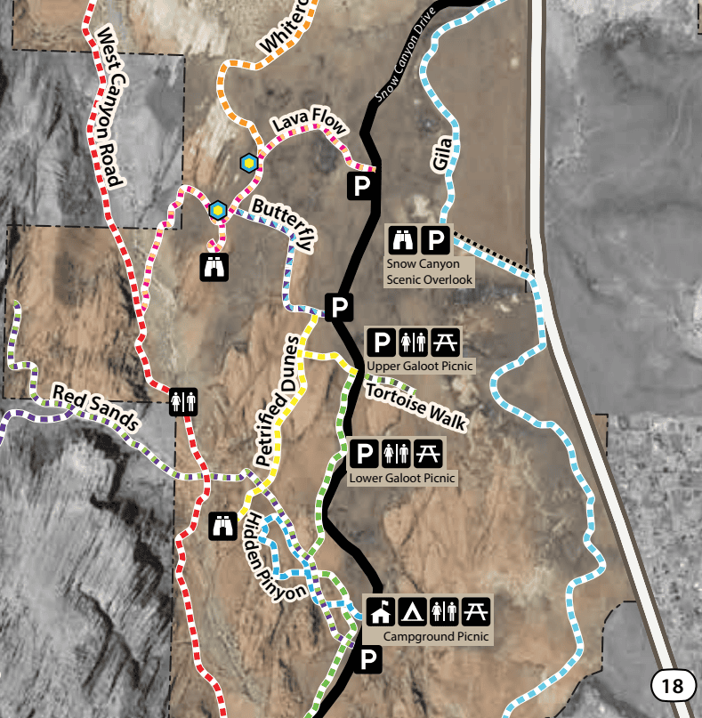
Because the Butterfly Trail links directly to the Lava Flow Trail’s main highlight—the lava tubes (shown by the blue-yellow hexagonal markers)—we recommend parking in the Butterfly/Petrified Dunes lot. From here, you can easily reach the lava tubes, hike the Butterfly Trail (a surprisingly scenic trail despite often being labelled as a connector), and explore the Petrified Dunes Trail, which is our favorite of the three.
To see all the highlights in one outing, you can choose between two approaches:
- 1) Do both the Butterfly and the Petrified Dunes Trails as separate out-and-backs. Hike the Butterfly Trail to the lava tubes, return to where the trails split near the parking lot, then do the Petrified Dunes Trail.
- 2) Create a longer loop by following: Butterfly Trail –> Lava Flow Trail –> West Canyon Road –> a short section of Red Sands Trail –> Petrified Dunes Trail, returning directly to the same trailhead and parking area.
Both options let you see the best features of all three trails: just choose based on how much time and distance you want to cover.
The Double Out & Back Option
Butterfly Trail + Lava Tubes
Distance: 2 miles (1.8 km)
Route Type: Loop
Elevation change: 200 ft / 15 m (difference between trail high and low point)
Elevation gain: 200 ft / 40 m (cumulative elevation gain)
AllTrails rating (2025): 4.8, 4005 ratings
Duration: Most people complete the full trail in 30-45 minutes.
Trail difficulty level assessment:
Very Easy | Easy | Moderate | Moderately Challenging | Challenging
Overall, the Butterly Trail is best described as Easy. The elevation gain rates as easy, the trail length is rated as very easy, and the terrain surface alternates between easy and moderate.
Petrified Dunes Trail
Distance: 2 miles (1.9 km)
Route Type: Out-and-back
Elevation change: 200 ft / 60 m (difference between trail high and low point)
Elevation gain: 200 ft / 70 m (cumulative elevation gain)
Duration: Most people complete the full trail in 30-45 minutes
Trail difficulty level assessment:
Very Easy | Easy | Moderate | Moderately Challenging | Challenging
Overall, the Petrified Dunes Trail is best described as Moderate. The cumulative elevation gain would rate as easy-to-moderate, the trail length rates as very easy-to-easy, and the terrain surface rates as moderate-to-moderately challenging in sections.
The combined out-and-back routes cover approximately 2.3 miles (3.7 km) with a cumulative elevation gain of 360 ft (110 m). Most hikers complete this option in 1 to 1.5 hours.
It’s important to note that the Butterfly Trail map on AllTrails does not include the short detour to the Lava Tubes, so you should plan for an additional 10–15 minutes to visit them.
Similarly, the Petrified Dunes AllTrails map does not include the final spur to the Hidden Pinyon Lookout, which we highly recommend for its elevated views. This adds another 5–10 minutes.
Including both of these worthwhile extensions—the Lava Tubes and the Hidden Pinyon Lookout—the total distance comes to about 5 km (3.1 miles), and most hikers finish in 1h15 to 1h45.
The Loop Option
Distance: 2 miles (4.8 km)
Route Type: Loop
Elevation change: 200 ft / 90 m (difference between trail high and low point)
Elevation gain: 200 ft / 127 m (cumulative elevation gain)
Duration: Most people complete the full trail in 1h15-1h45
Not an AllTrails member yet? We highly recommend signing up for either their free or paid membership plans. The free plan allows you to find new trails and plan routes but it can only be used while hiking if you have access to mobile data. The paid membership plan (AllTrails+) allows you to download trail maps for offline use and provides live progress updates and off-route notifications.
If you are still uncertain – you should know that the All Trails mobile application was voted the 2023 iPhone App of the Year by Apple.
We find that AllTrails is a great tool to have when hiking, particularly for assisting with navigation when the trail is hard to locate and to help monitor your progress along the trail, which helps estimate how much time you’ll need to complete the trail.
Which Itinerary Option to Choose?
Normally, we prefer loop trails since they offer fresh scenery the whole way. But in this case, we recommend the double out-and-back option. A large portion of the loop follows the West Canyon Road Trail, a flat gravel maintenance road that feels less adventurous and more exposed. Although the road is closed to most vehicle traffic, it is still shared with cyclists and horseback riders. Because this segment is less scenic and feels more like a connector than a true trail, the out-and-backs offer a much more enjoyable and adventurous experience overall.
Petrified Dunes Trail – Description & Summary
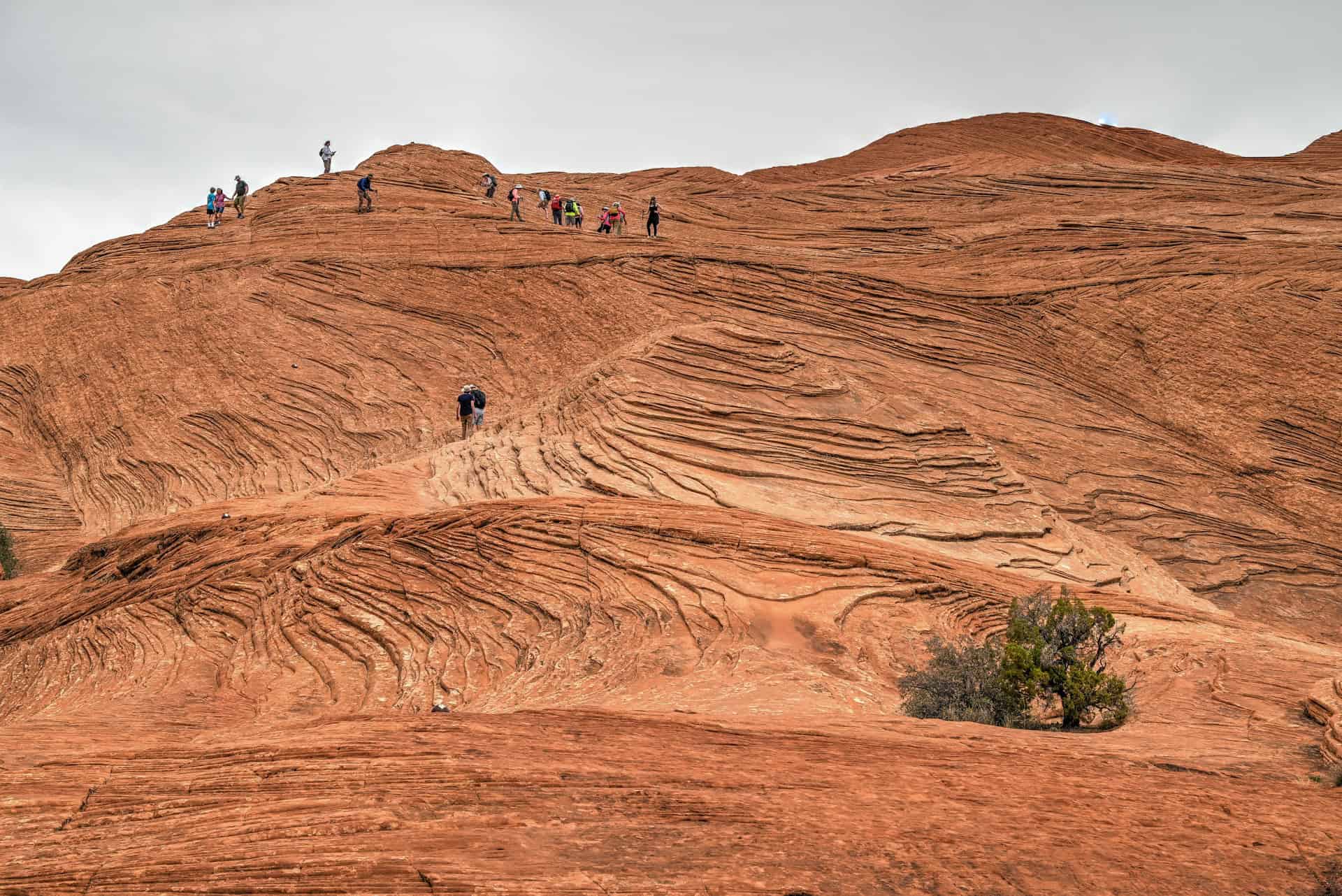
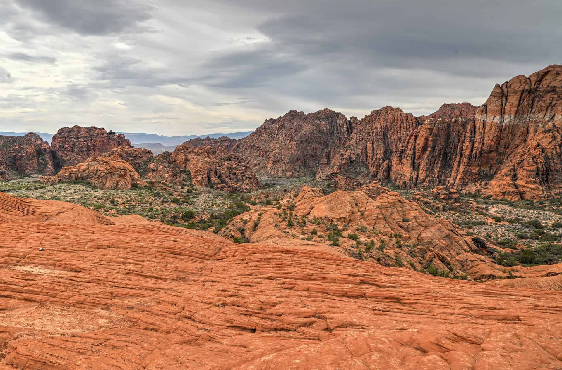
The Petrified Dunes Trail begins with a gentle, well-marked approach across open desert terrain, leading you toward the sweeping sandstone domes that define this hike. The trail is easy to follow at first, and staying on the established path helps protect the fragile desert vegetation surrounding the dunes.
From the get-go, the scenery surrounding you is quite spectacular.
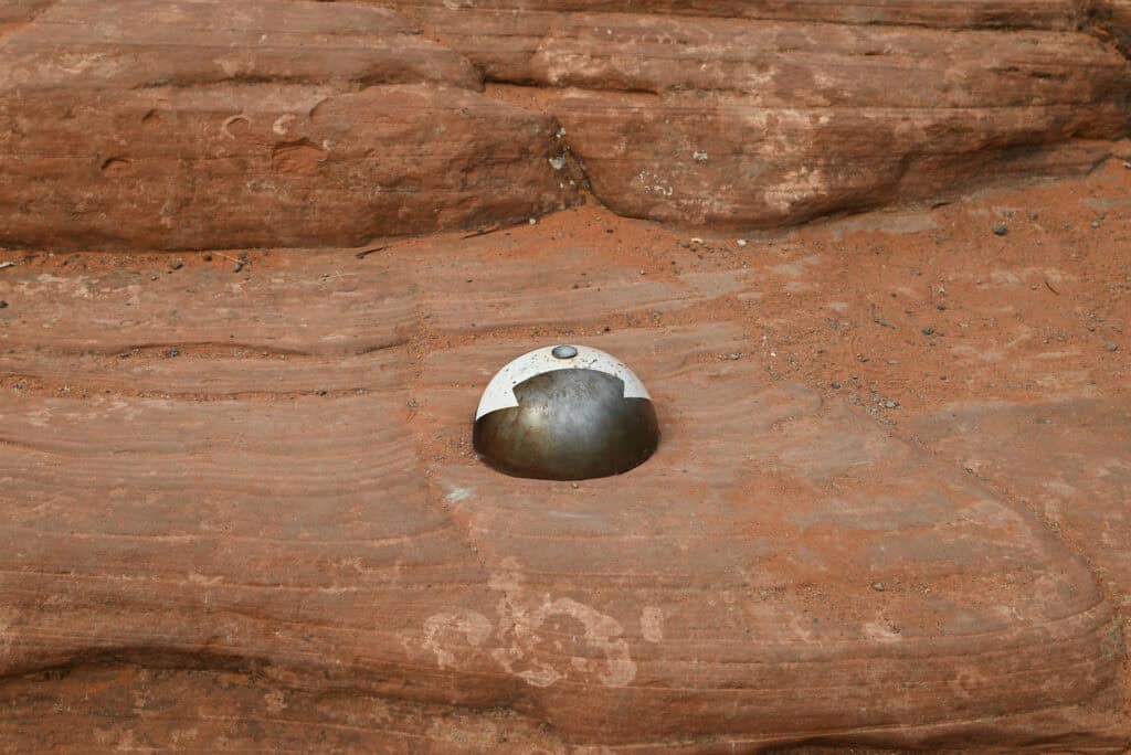
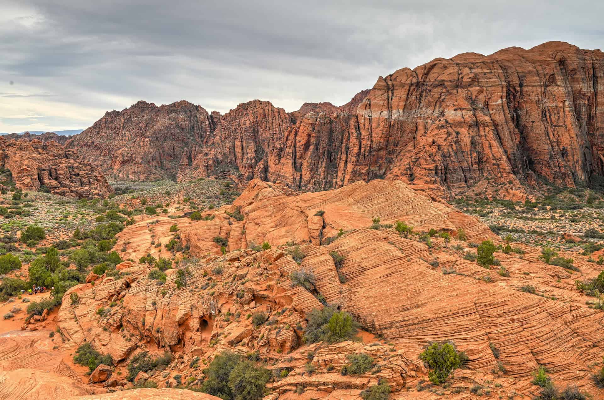
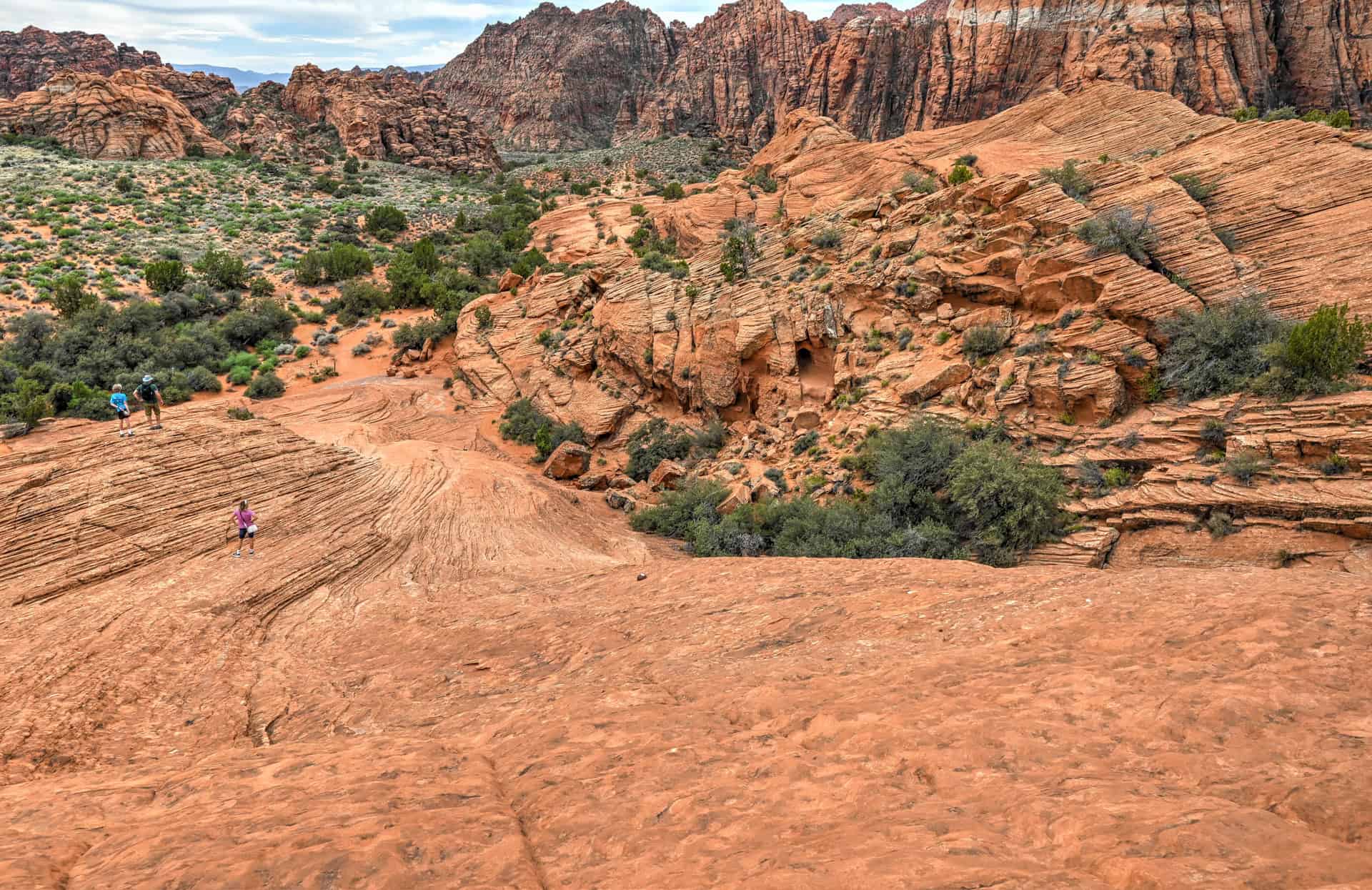
As you reach the base of the sandstone, you’ll notice a series of iron domes, each marked with arrows. These guide hikers along the mapped and most direct route across the dunes, moving from the northern end to the southern end while passing over the high point of the formation. The path is intuitive, but the domes make navigation especially easy, particularly for first-time visitors.
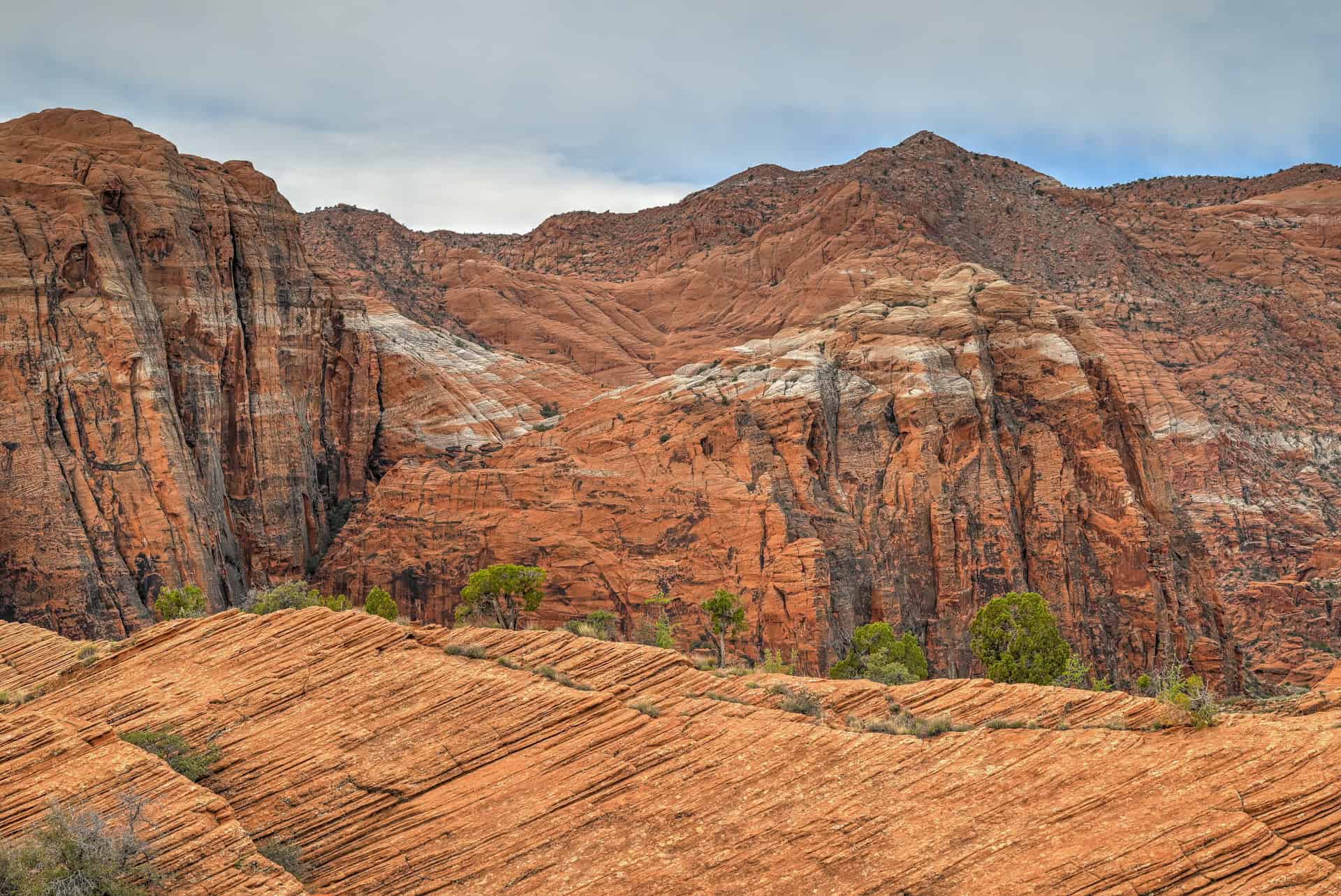
Near the third iron dome, a side trail from the Upper Galoot parking area joins from the left (east). From here, the route climbs steadily to the crest of the petrified dunes before descending a steeper sandstone slope toward the final dome at the southern edge. The views along this stretch are spectacular: rolling waves of red and tan sandstone framed by distant cliffs. The climb isn’t always straightforward due to the unveven nature of the terrain, but it doesn’t require any special climbing skills or scrambling. Good shoes with a good grip are more than sufficient, though hiking poles can help, especially when descending the petrified dunes.
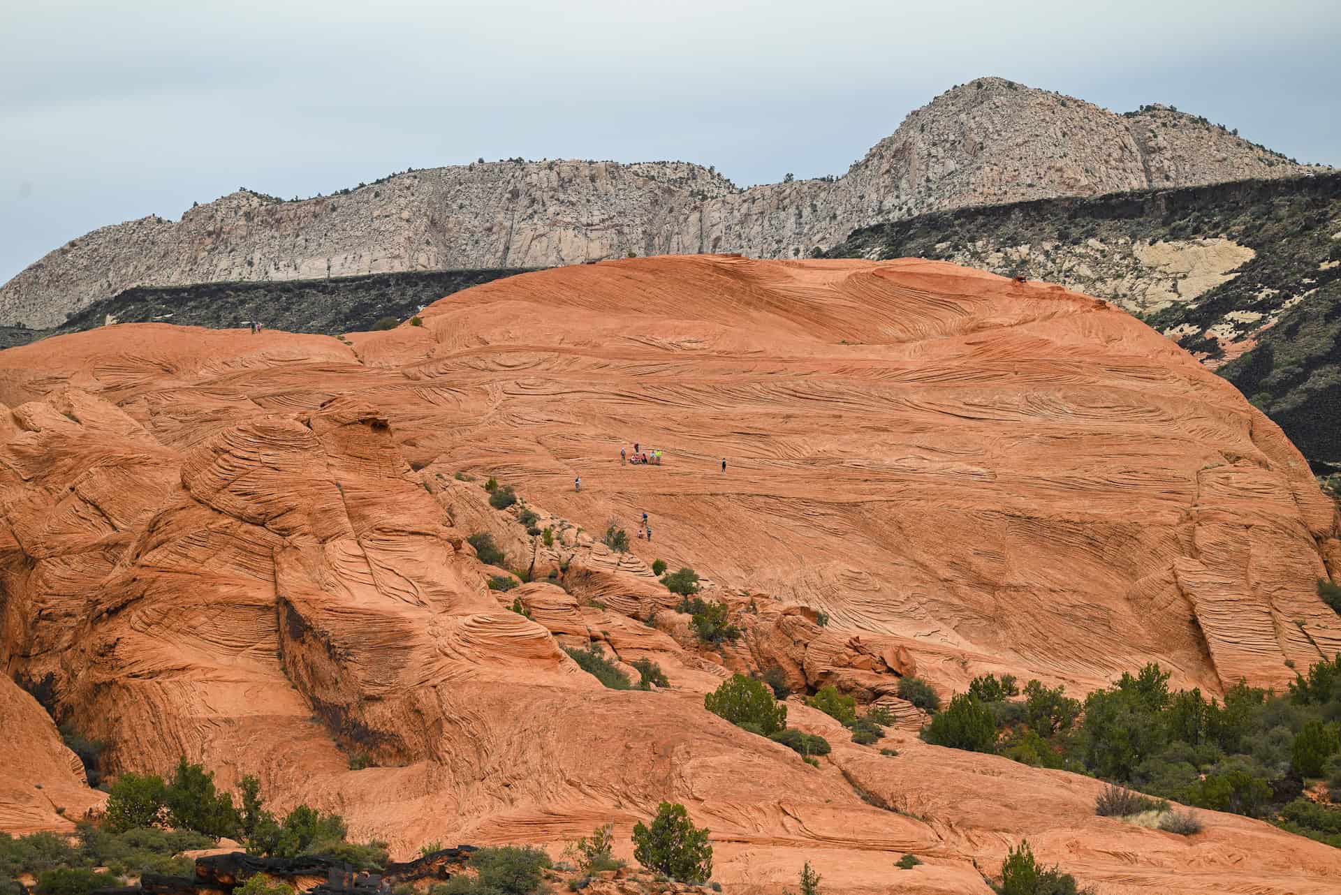
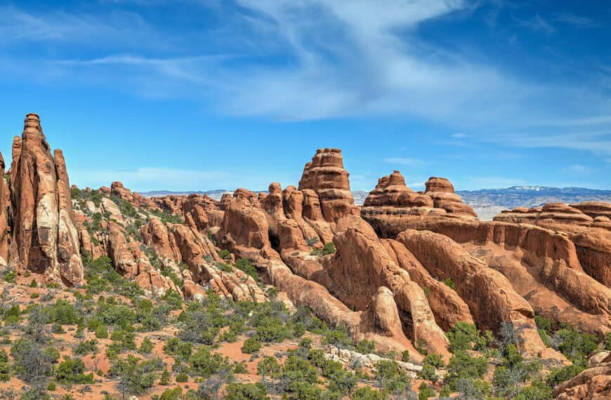
The dunes you’re walking on are actually ancient sand dunes from the Jurassic period, now turned to stone. Over millions of years, the shifting desert dunes were buried, compacted, and cemented into Navajo Sandstone, preserving the sweeping curves, cross-bedding, and wave-like forms you see today. Erosion later re-exposed the sandstone, sculpting the rounded domes and slopes that give the Petrified Dunes their iconic shape.
Although the iron domes mark the official route, hikers are free to explore anywhere across the sandstone surface. The open slickrock provides endless opportunities for discovering textures, patterns, and small geologic surprises. At the very top of the dunes and near the overlook, keep an eye out for moqui marbles—small, rounded iron-rich concretions formed by mineral precipitation within the ancient sand. The views from the top are spectacular.


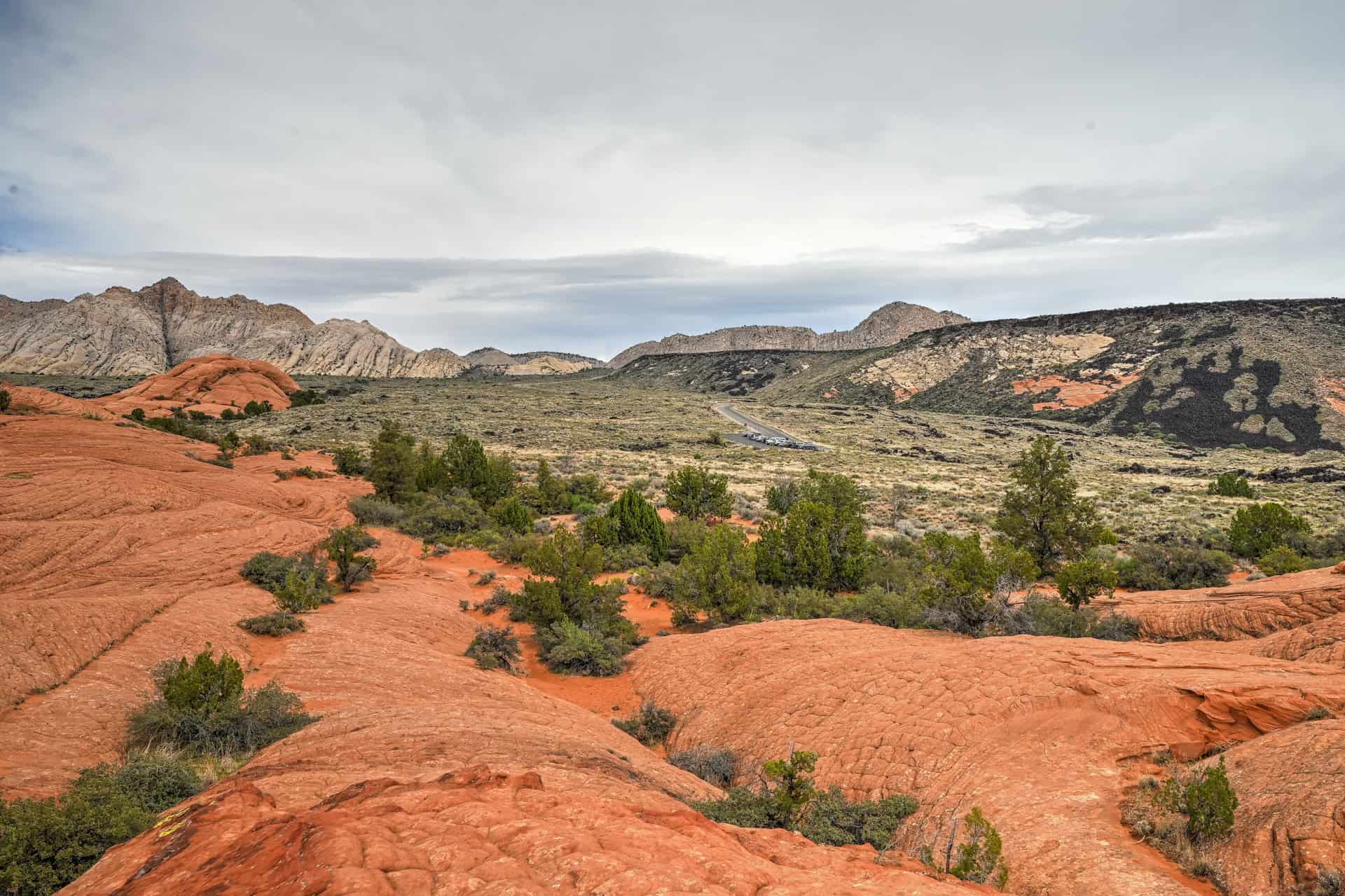
After descending the sandstone, the path transitions briefly to sand and arrives at a signed junction with the Red Sands Trail and the Hidden Pinyon Overlook Trail. Continuing straight (south) brings you up a short rise to a beautiful overlook with panoramic, spectacular views to the south.
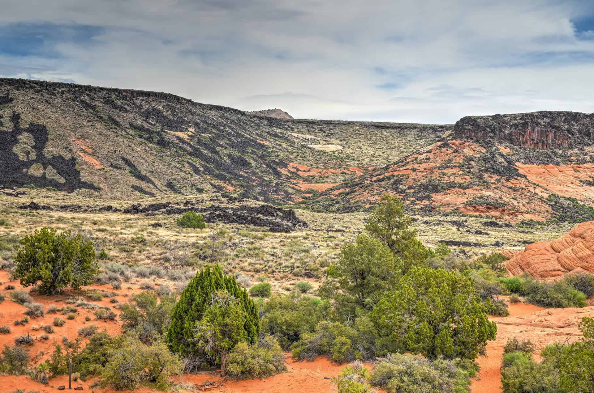
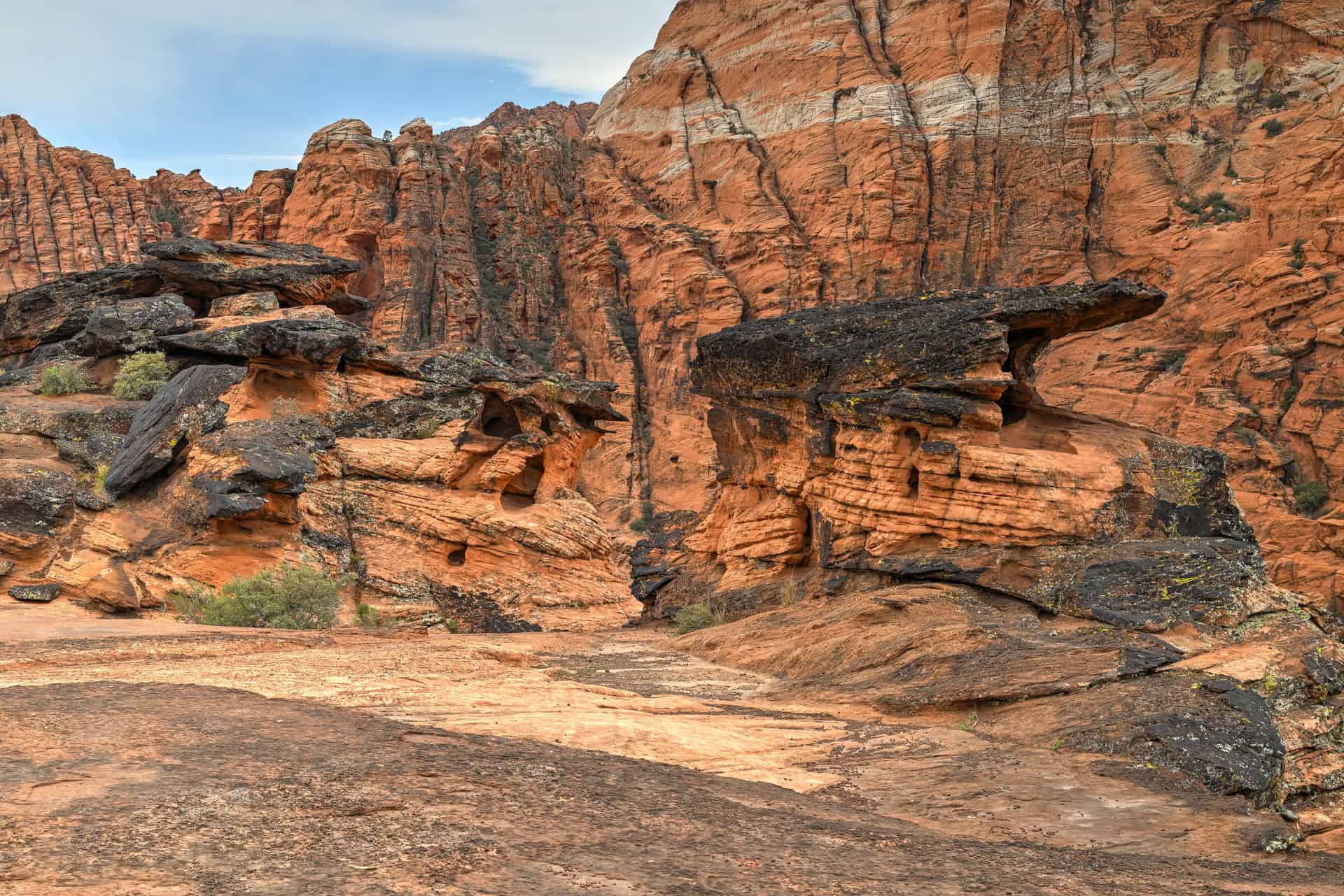
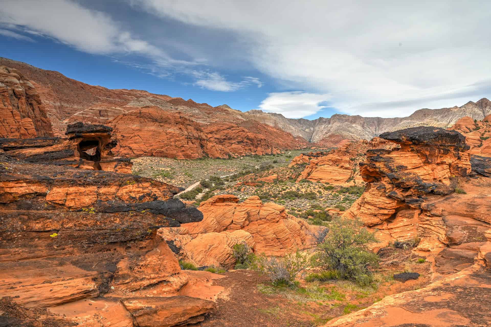
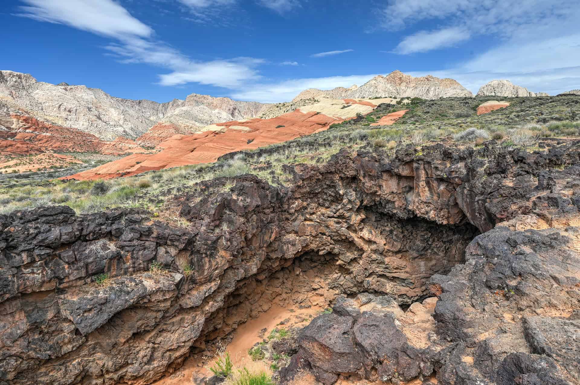
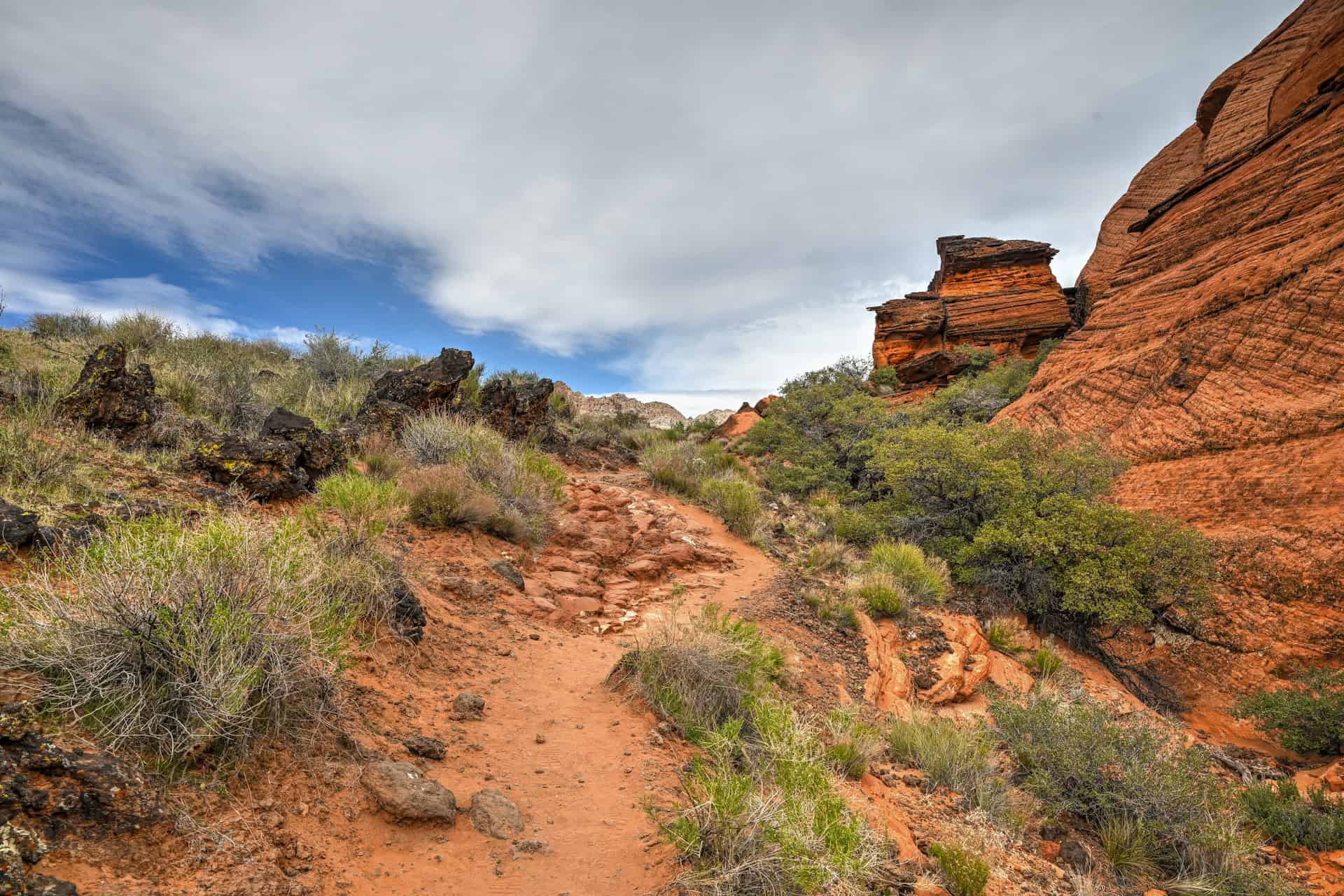
Along this final approach, you’ll also notice scattered black volcanic boulders mixed into the sandy terrain. These dark rocks are pieces of ancient basalt, remnants of long-extinct volcanic activity on the Santa Clara volcanic field to the west. They contrast sharply with the surrounding red and cream sandstone and are especially noticeable near the junction with the Hidden Pinyon Overlook Trail and along the rise toward the viewpoint.


Butterfly Trail + Lava Tubes – Description & Summary
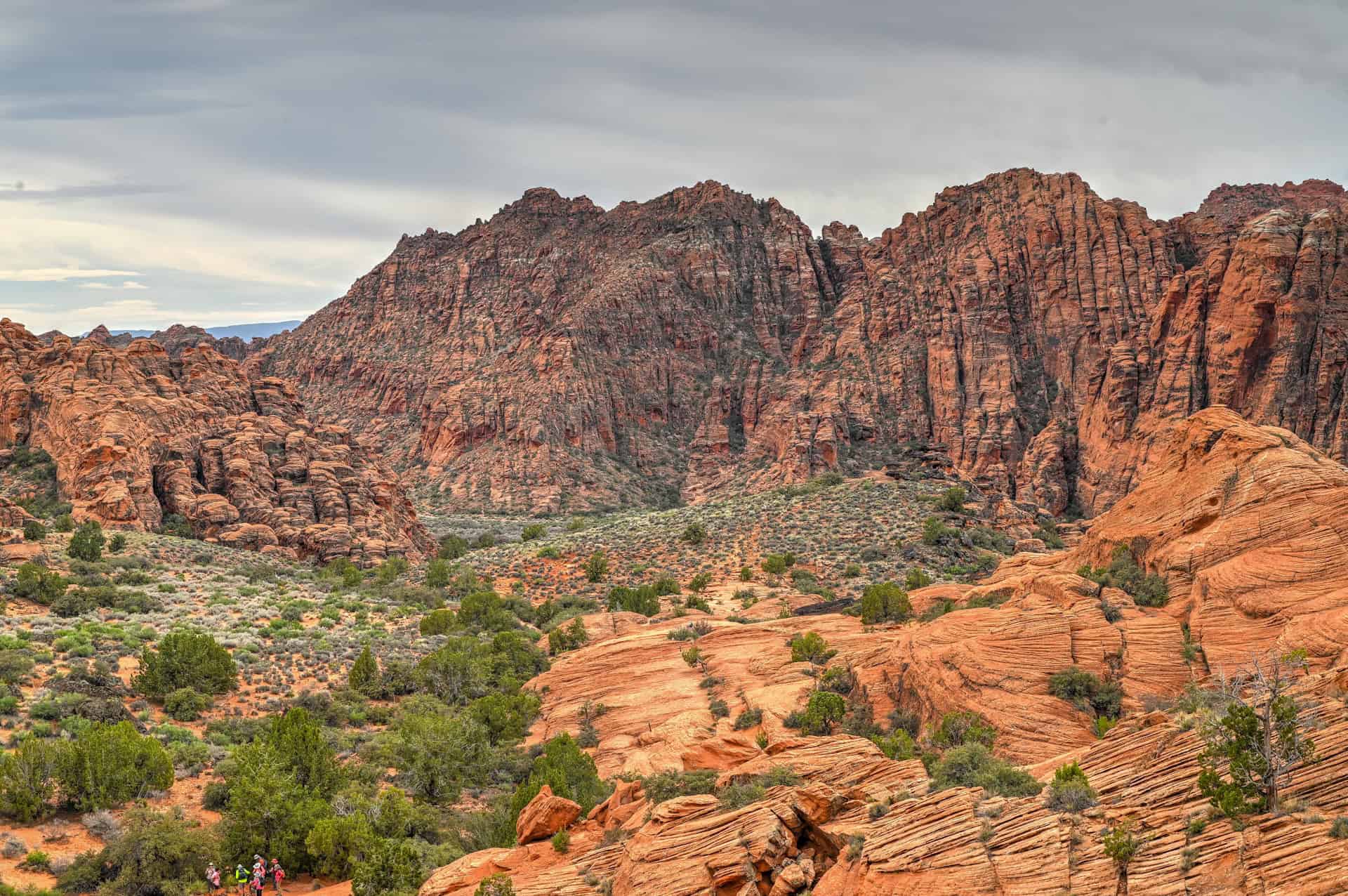
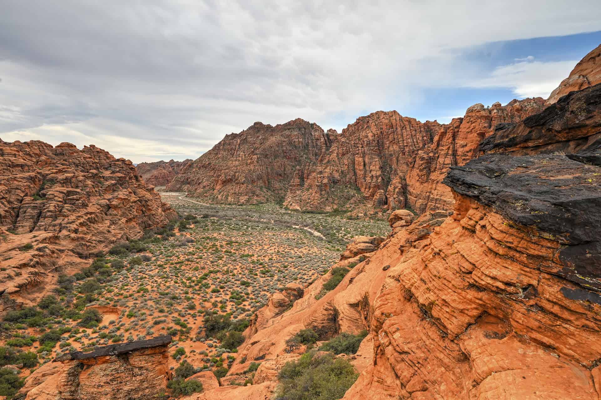
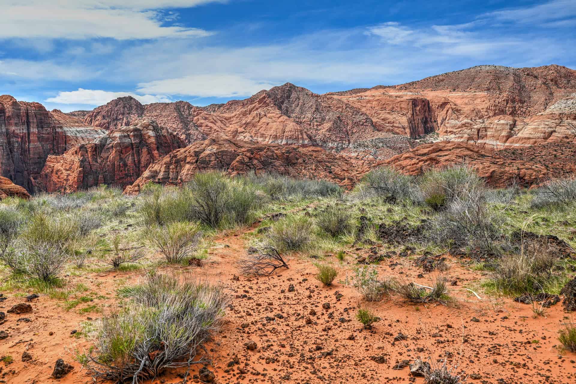
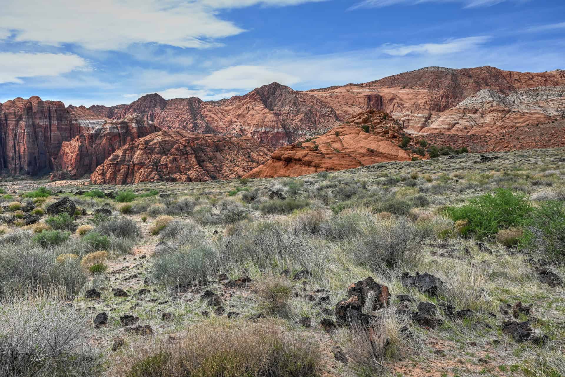
The Butterfly Trail begins as a mellow walk across classic Snow Canyon terrain, open desert dotted with juniper, pinyon pine, and scattered black lava boulders. As you head north, the trail gently rises toward a backdrop of towering red and white Navajo sandstone cliffs. The views open up quickly, offering wide panoramas of the canyon’s layered rock walls, the rippling Petrified Dunes to the west, and long stretches of ancient lava fields to the north.
Although sometimes described as a simple connector, the Butterfly Trail is far more scenic than its reputation suggests. The path alternates between firm desert soil, patches of slickrock, and pockets of wind-shaped sand, creating constant texture and color changes underfoot. The interplay between the vibrant sandstone, the dark volcanic rock, and the expansive sky makes this short hike feel surprisingly dramatic.


Near the end of the trail, you’ll reach its junction with the Lava Flow Trail, your gateway to the Snow Canyon Lava Tubes. Continuing a short distance beyond the official end of the Butterfly Trail brings you over rugged lava fields to the tube openings themselves. The landscape shifts noticeably here: jagged black basalt mounds, collapsed lava ceilings, and deep, shadowy caverns reveal the volcanic origins of the canyon. Adventurous hikers can descend into the tubes, but even staying aboveground provides impressive views into the lava chambers and across the stark, otherworldly terrain.


The return walk along the Butterfly Trail offers a new angle on the scenery, with sweeping vistas toward the sandstone cliffs and the petrified dunes glowing beautifully in late-afternoon or early-morning light.


Often overlooked in favor of the Petrified Dunes or the main Lava Flow Trail, the combined Butterfly + Lava Tubes route delivers a surprisingly rich mix of desert vegetation, volcanic geology, and classic red rock landscapes, making it one of the most diverse and rewarding short hikes in Snow Canyon State Park.
Additional Snow Canyon Trail Details and Tips
Canine companions: Dogs are permitted on most trails in Snow Canyon State Park but must remain leashed at all times.
Trail environment, weather, and exposure: Snow Canyon’s trails wind through an exceptional mix of sandstone cliffs, petrified dunes, lava fields, and desert washes. Most routes offer little natural shade, and the dark volcanic rock can amplify heat on sunny days. Even in cooler seasons, the sun can feel intense, so bring plenty of water and wear hats, sunscreen, and long sleeves for protection. Temperatures often climb quickly mid-day, while mornings and late afternoons tend to be far more comfortable for hiking.
Rain is less common but can create sudden, short-lived hazards—particularly on slickrock, where surfaces can become slippery, and in low-lying washes that may temporarily collect water.
Route signage and navigation: Most trails in Snow Canyon are well-marked with clear signage, junction markers, and periodic cairns across slickrock areas. Still, junctions can feel subtle, and some slickrock transitions aren’t immediately obvious. Downloading an offline map is recommended, especially for trails that intersect with broader networks like the Lava Flow, Butterfly, or Petrified Dunes areas.
Trail surface / Technical aspects: Snow Canyon’s varied terrain includes sandy washes, packed dirt, basalt rock, and slickrock slabs. None of the trails require technical climbing skills, but you may encounter short, moderately steep slickrock sections or uneven lava rock that demand careful footing. Sturdy footwear with good traction is essential. Trekking poles are optional—helpful in sand or on uneven basalt, but not required for most hikers.
Cell Service: Reception varies throughout Snow Canyon. Some open areas and higher viewpoints have a workable signal, while canyon corridors and lower washes often lose service entirely. Download your maps before entering the park, and consider informing someone of your hiking route if going solo.
Leave No Trace: Snow Canyon’s desert ecosystem is fragile. Stay on established trails to avoid damaging delicate desert soils and cryptobiotic crusts. Pack out all trash, avoid disturbing wildlife, and keep noise levels low to preserve the peaceful canyon environment. Refrain from climbing on unstable formations and avoid entering restricted or restoration areas.
Bugs: Insects are generally minimal along Snow Canyon trails. You might encounter gnats or small flies in warmer months, particularly after rain, but mosquitoes and ticks are uncommon. Most hikers find insect repellent optional.
Equipment: No technical climbing gear is required for Snow Canyon’s Lava Flow, Butterfly, or Petrified Dunes trails. Sturdy hiking shoes or trail runners with good traction are essential, especially on slickrock, sand washes, or angled sandstone slopes. Bring plenty of water, sun protection, a hat, and sunglasses. Trekking poles can be useful on sandier sections or uneven ground, but are generally unnecessary on the more exposed rocky areas.
Wildlife: Expect to see lizards, birds, and small mammals along the trail. Desert wildlife is most active early or late in the day. Rattlesnakes may be present during warmer months, so remain cautious around rock crevices and shaded areas.
Current Trail Conditions: Before heading out, check Snow Canyon State Park’s official alerts page for any updates on trail closures, maintenance, or extreme weather conditions. Conditions can change rapidly in the desert, so it’s best to plan ahead and confirm the trails are open.
Hiking Packing List
All Trails subscription – This comes in really handy for areas with little or no cell reception, as the annual subscription allows you to download trail maps for offline use.
External Battery – If you are using your phone to track your progress along the trail or to help with navigation, you certainly don’t want your phone to die on you. That’s especially true in the unlikely event that you might get hurt or need assistance.
Hiking poles – These can be particularly useful in steep trails or muddy/boggy trail conditions.
Water Filter Bottle – The Life Straw bottle is an advanced water bottle with a filter that not only improves water taste but more importantly filters out bacteria and parasites, chemicals and microplastics.
Headlamp – very practical and a smart choice if you plan to start your hike before sunrise or finish it after sunset.
Best Time to Hike the Trail
The Lava Flow, Butterfly, and Petrified Dunes trails in Snow Canyon State Park are generally best hiked outside of the peak summer months, when temperatures can soar above 100?°F (38?°C). Seasonal conditions vary, so plan accordingly:
Spring (March–mid May):
One of the most pleasant times to visit Snow Canyon. Daytime highs typically range from 65?85?°F (18?29?°C), with cooler mornings and late afternoons. Wildflowers may start to bloom, and the softer spring light enhances the reds, oranges, and whites of the sandstone and petrified dunes. Afternoon winds can occasionally pick up, especially across exposed rocky sections.
Fall (October–early November):
Another excellent season for visiting. Daytime temperatures generally range from 70?85?°F (21?29?°C), with cooler mornings and evenings. Fall light accentuates the vivid rock colors, and visitor numbers are typically lower than in spring, offering a more tranquil experience.
Winter (December–February):
Cooler and quiet, with daytime highs around 50?55?°F (10?13?°C) and nighttime lows that can dip to near freezing (around 30?°F / –1?°C). Mornings can feel especially chilly, particularly in shaded washes and on slickrock surfaces. Snow is rare but can dust higher elevations, creating striking photo opportunities.
Quick Summary – When to Visit
Spring and fall offer the best combination of comfortable temperatures, scenic lighting, and manageable crowds. Winter provides solitude and crisp air, though mornings can be cold. Summer is only advisable for early morning or late afternoon hikes due to extreme heat.
Want to Know More About Snow Canyon State Park?
If you’re planning a short visit to Snow Canyon—whether as a half-day adventure from St. George, Utah, or a scenic stop while travelling between Zion National Park and southern Utah destinations—you may want a broader overview than just the Lava Flow, Butterfly, and Petrified Dunes trails. We’ve created a dedicated Snow Canyon Visiting Guide that highlights the park’s top viewpoints, must-see short hikes, trail logistics, and practical tips for exploring the park efficiently. It’s the perfect companion for building a day trip, planning a quick stop, or fitting a few scenic hikes into a longer Utah road trip.
Explore More Utah National & State Park Guides
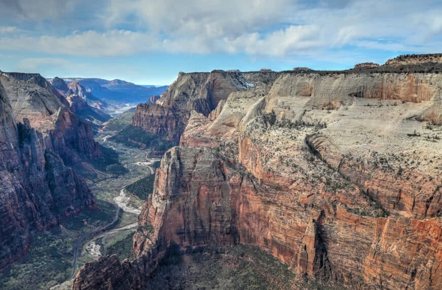
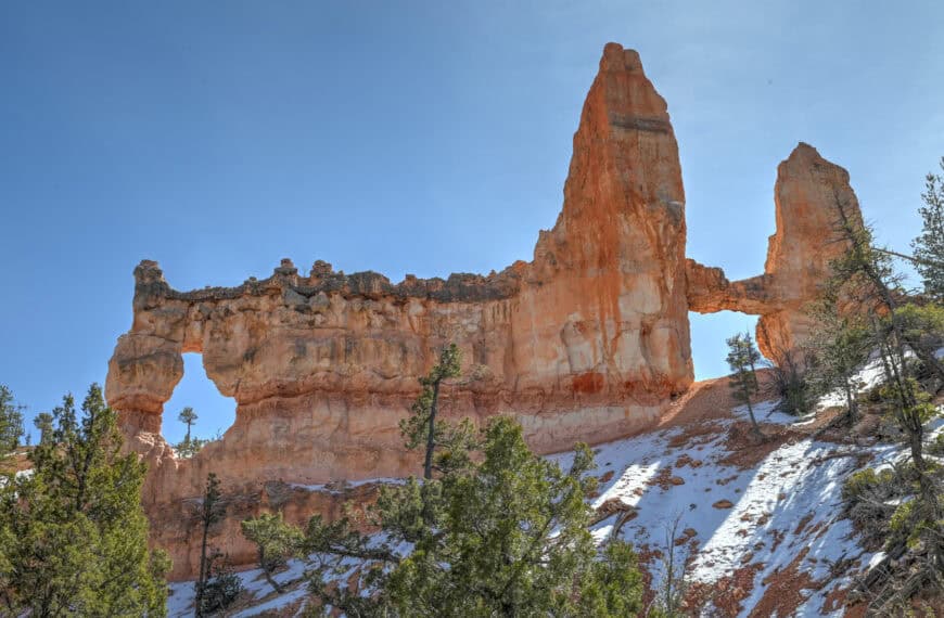
Bryce Canyon National Park Guide
Capitol Reef National Park Guide
Valley of Fire State Park Guide
Goblin Valley State Park Guide
Photography Gear
If you like our photography, you might be interested in some of the gear we use to shoot our travel and hiking destinations.
Camera Body – Nikon Z 6ii Fx-series Mirrorless Body
Main Lens – NIKON 24-120mm F/4G ED VR AF-S
Zoom Lens – Sigma 745-306 150-600mm f/5-6.3
Polarizing filters – Urth Circular Polarizing (CPL)
Camera Tripod – K&F Concept 64-inch Camera Tripod
Mini-tripod – Lammcou Flexible Camera Tripod
Camera/hiking backpack – Vanguard Alta Rise 48 Backpack
Universal Travel Adapter – VYLEE Universal International Power Travel Plug
Other Travel Essentials
Travel Insurance
SafetyWing is a travel insurance company that offers comprehensive coverage for travellers. Includes Medical Insurance and Travel Insurance. Primarily geared towards long-term travellers, digital nomads, and expats.
e-Sim cards
Airalo is the world’s first and largest eSIM store with eSIM plans for 200+ countries and regions worldwide. With Airalo eSIMs, travellers can get connected the moment they land at their destination and avoid nasty data roaming charges
eSIMS are a sustainable alternative to single-use SIM cards – they are 100% digital, require less energy to produce and be re-used rather than disposed of.
Car Rentals
Discover Cars is our go-to website for car rentals. We almost always find our preferred rate there.
Transfer from Airport
Welcome Pickups is our favourite private transfer service, which you can pre-book at a fixed price. Currently available in 220 cities all over the world (mostly in Europe, but with several major cities in Asia, the Middle East and the US).
Kiwitaxi is another private transfer service – we haven’t tried it yet, but it’s currently available in a few more countries (102 as of 2024).
Hotels and Accommodations (coming soon)
Photography Prints
If you found this blog useful, you can help support our blog by purchasing low-cost digital prints. Printed physical prints are also available for purchase.


—–
Well, that wraps it up! We hope you enjoyed our Snow Canyon State Park Hiking Guide for the Lava Flow, Butterfly, and Petrified Dunes Trails and that it will prove useful for planning your hiking trip.
—–
You might also be interested in these related pages: