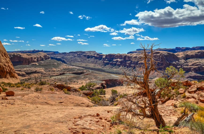
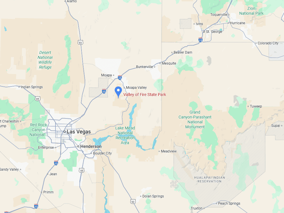
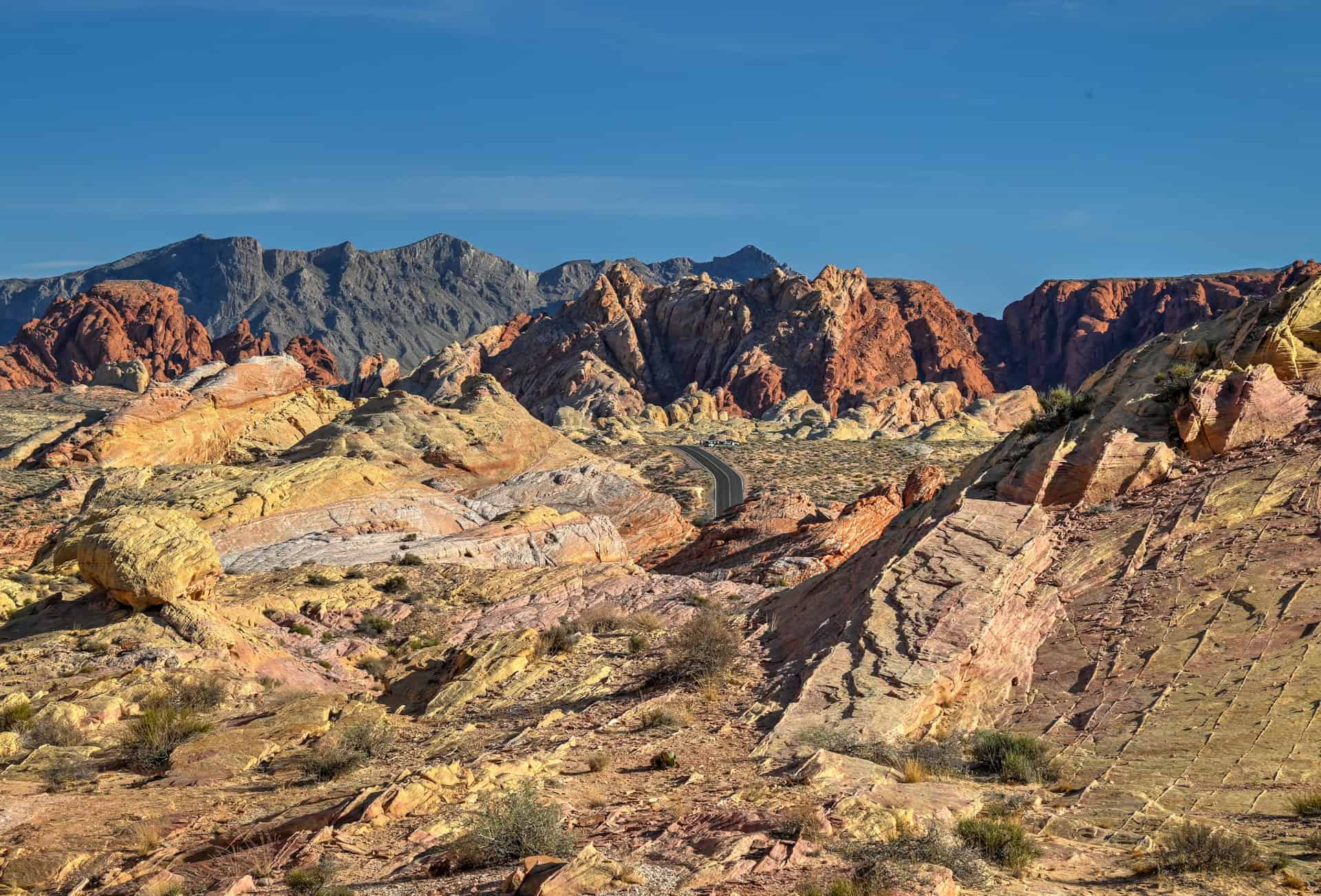
Just an hour northeast of Las Vegas, Valley of Fire State Park is Nevada’s oldest and largest state park, a striking desert landscape of fiery red sandstone formations shaped over millions of years. The park is famous for its dramatic rock arches, jagged cliffs, and petroglyphs carved by ancient peoples, creating a playground for hikers, photographers, and day-trippers alike. Smaller and more accessible than the region’s national parks, Valley of Fire offers a variety of trails where you can wander among towering fins, scramble over rocky outcrops such as the Fire Wave Trail, and discover scenic viewpoints like Elephant Rock and Atlatl Rock. Its vibrant terrain and easy proximity to the city make it an unforgettable spot for a day adventure. To help you plan your visit, we’ve put together this guide on how to spend one day in Valley of Fire State Park.
Valley of Fire Highlights – At a Glance
A playground of red rock – Towering sandstone formations, narrow canyons, and vibrant fins fill the park, inviting visitors to wander and explore. Trails like Fire Wave & Seven Wonders let you experience the park’s fiery landscapes up close, while viewpoints reward curiosity with stunning desert panoramas
Fire Wave & Seven Wonders Trail – A must-do loop that winds through the park’s signature red rock formations, including the undulating ridges of Fire Wave. It’s a perfect way to experience Valley of Fire’s surreal textures and colors.
Rainbow Vista Trail – This short hike offers panoramic views over multi-colored sandstone hills and sweeping desert vistas, making it ideal for photography or a quick scenic stroll.
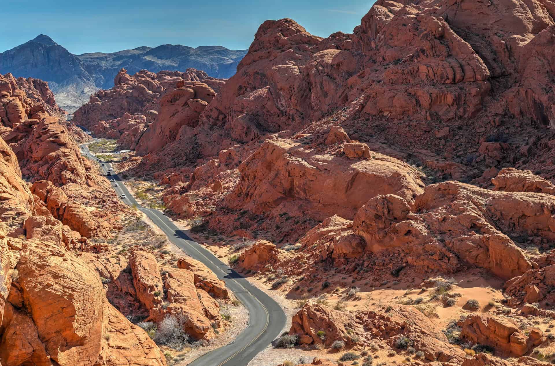
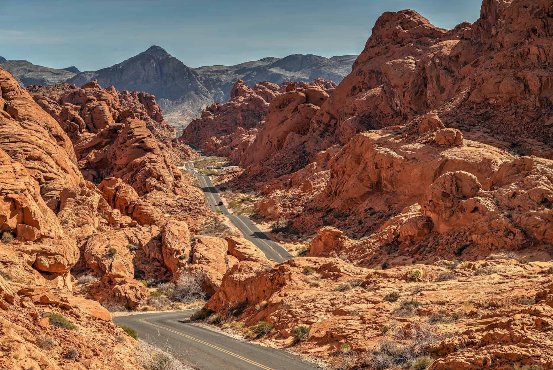
Mouse Tank Viewpoint – Just a short climb near the Rainbow Vista trailhead rewards visitors with a wide overlook of the road snaking through the red rock landscape, offering a classic Valley of Fire perspective without needing a full hike.
Fire Canyon Overlook – One of the park’s most dramatic viewpoints, where expansive canyon vistas stretch across bright red and orange rock layers—perfect for sunset or just soaking in the scale of the landscape.
Compact and accessible – Most of Valley of Fire’s highlights are close together, making it easy to see the park’s best scenery in a single day. Ideal for road-trippers coming from Las Vegas or exploring Nevada’s desert landscapes.


Disclosure: This page (Valley of Fire Guide – Best Hikes & One-Day Trip) may contain product affiliate links. At no additional cost to you, we may receive a commission for purchases made through these links. More details can be found on our disclosure and policies page.
Fire Valley State Park Location and Map
Valley of Fire State Park sits just an hour northeast of Las Vegas (link to Google Maps), in the heart of Nevada’s striking red rock desert. Though it’s a state park rather than a national park, many travellers consider it one of the Southwest’s most iconic landscapes, thanks to its fiery sandstone formations, dramatic fins, and colorful desert vistas. Conveniently located right off Interstate 15, it makes an easy and rewarding stop for a day trip from Las Vegas or as a scenic detour on the drive between Las Vegas and Zion National Park.
How to Get to Valley of Fire State Park
The simplest way to reach the Valley of Fire is by driving there, as there is no public transportation to the State Park.
Valley of Fire State Park has two main entrances, both accessible by paved roads:
- West Entrance (via Valley of Fire Highway):
Best for visitors coming from Las Vegas or other destinations in southern Nevada. This is the most commonly used entrance and offers the quickest, most direct access from the city. - East Entrance (via the Northshore Road / Lake Mead National Recreation Area):
Ideal for travellers arriving from Utah, Arizona, or the eastern side of Lake Mead, including St. George, Zion, Page, and other points east. This entrance offers a quieter, more scenic approach.
Regardless of which entrance you use, all main roads inside the park are paved and suitable for any vehicle.
Driving times to Valley of Fire State Park
- Las Vegas, NV: 85 km / 50 mi – about 1 hour
- St. George, UT: 150 km / 95 mi – about 1.5 hours
- Zion National Park (Springdale, UT): 185 km / 115 mi – about 2 hours
- Page, AZ: 435 km / 270 mi – about 4.5 hours
- Flagstaff, AZ: 420 km / 260 mi – about 4.5 hours
These times assume clear weather and normal traffic conditions.
If you need to book a rental vehicle for your roadtrip, we highly recommend using Discover Cars to get the best rates on your rental in Utah, Nevada and Arizona.
We also highly recommend Airalo (eSIM card) for your connectivity needs when travelling abroad. Airalo is the world’s first and largest eSIM store with eSIM plans for 200+ countries and regions worldwide.
Nearest Gas Station
The closest gas is in Overton, just 8 miles from the park’s east entrance, or the Moapa Paiute Travel Plaza, about 15 miles from the park’s west entrance.
Group Excursion from Vegas
Alternatively, if you don’t have a car and are staying in Las Vegas, you can still visit the Valley of Fire by joining an organized tour from the city. Several companies offer full-day or half-day excursions, including one that focuses on catching the park at sunset, and another that combines Valley of Fire and Red Rock Canyon into a single day trip. These are among the most popular options:
Valley of Fire State Park – Entry Fees
All visitors entering Valley of Fire State Park must pay an entrance fee, regardless of whether they plan to hike or simply explore the main valley viewpoint.
Valley of Fire charges a per-vehicle entrance fee, payable at the park entrance station:
$15 per vehicle for out-of-state visitors
$10 per vehicle for Nevada residents
Fees must be paid before accessing the Scenic Drive or any trailheads, including the Fire Wave.
The park does not accept the America the Beautiful Pass, as it is a Nevada State Park.
If you plan to visit several Nevada state parks during your trip, consider purchasing a Nevada State Parks Annual Day Use Pass, which provides unlimited entry to all Nevada state parks for 12 months, including Valley of Fire. For broader access—including camping and boating—an All Access Pass is also available. Passes can be purchased online through the Nevada State Parks website.
Note: Online pass purchases do not guarantee entry if the park is temporarily closed due to capacity limits.
Park Opening Hours: Valley of Fire State Park is open year-round, from sunrise to sunset. However, the visitor center is typically open 9:00 a.m. to 4:30 p.m. (closed on state holidays)
Seasonal Closure: Certain areas of Valley of Fire are closed during the hottest months for visitor safety. From May 15 to September 30, extreme heat can make hiking dangerous, so trails like Fire Wave, Seven Wonders Loop, and the surrounding areas along Mouse Tank Road north of the Visitor Center are off-limits. Visitors should plan their activities around these seasonal closures to stay safe and make the most of their visit.
For up-to-date information on hours and potential closures, see the park’s official website.
Valley of Fire State Park – Parking and Access
Park Navigation: Valley of Fire is easy to navigate via its main park road, the Valley of Fire Highway, which connects the east and west entrances. The Visitor Center sits roughly in the middle of the park, just off the main road on Mouse Tank Road, and offers exhibits on the geology, ecology, prehistory, and history of the park and the surrounding region.
Along the main road, several picnic areas and viewpoints are accessible, including Elephant Rock and Seven Sisters. Most of the park’s most popular attractions—like Rainbow Vista Trail, Fire Wave Trail, and White Domes Loop—are located along Mouse Tank Road, which runs perpendicular to the main highway.


Parking: Nearly all viewpoints and trailheads have dedicated parking lots, though they can fill up quickly on busy weekends and holidays. Planning ahead and arriving early is recommended for the best access, especially during peak season.
Picnicking/Day Use/Toilets: Shaded areas with restrooms are located at Atlatl Rock, Seven Sisters, the Cabins, near Mouse’s Tank Trailhead, and White Domes. Reservations are not required to visit the park for day use. Additional restrooms are located at the Visitor Center and campgrounds.
Camping: There are two campgrounds with a combined total of 72 units. Campsites are equipped with shaded tables, grills, water, and restrooms. A dump station and showers are available. All campsites are available by reservation. A camping limit of 14 days in a 30-day period is enforced.
Valley of Fire State Park – Some Quick Facts
Establishment: Designated Nevada’s first state park in 1935, created to protect its striking red Aztec sandstone formations and ancient cultural sites.
Visitor Numbers: Valley of Fire is one of Nevada’s most visited state parks, attracting over 300,000 visitors per year, with peak numbers during spring and fall.
Size: The park covers roughly 46,000 acres (18,615 hectares), making it much larger than most Utah state parks and offering a wide variety of landscapes and viewpoints.
Elevation: Valley of Fire sits between 1,500 and 3,000 feet (460–915 m) above sea level (its elevation varies significantly between its lower and higher points), giving it a true Mojave Desert climate with very hot summers and mild winters.
Geology: The park’s fiery red rock is primarily Aztec Sandstone, formed from massive sand dunes around 150 million years ago. Over time, wind, water, and shifting landscapes sculpted the dramatic fins, domes, and ridges seen today. The park also features ancient petrified wood and notable petroglyph panels left by the Ancestral Puebloans.
Valley of Fire State Park – Why You Should Visit
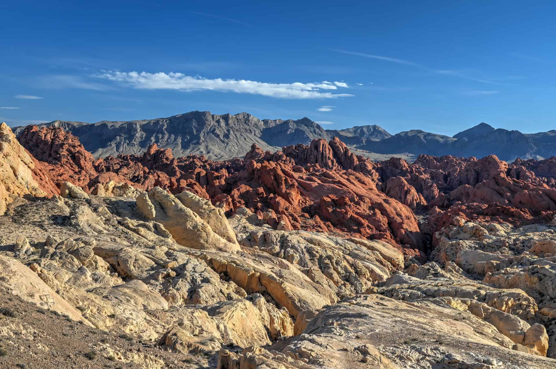
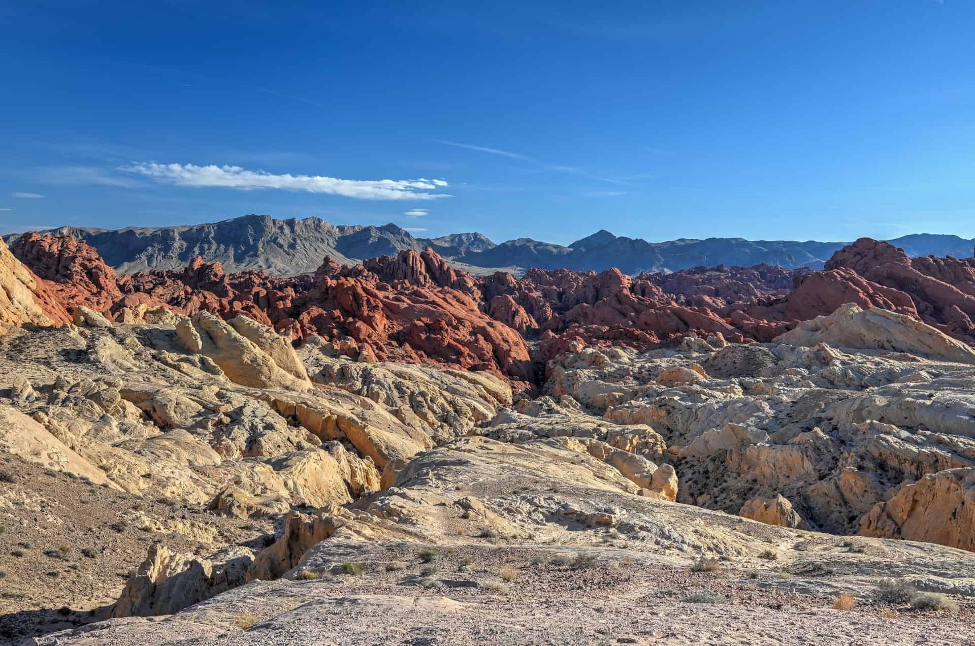
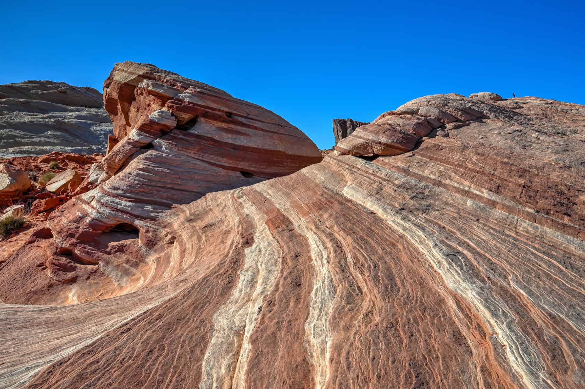
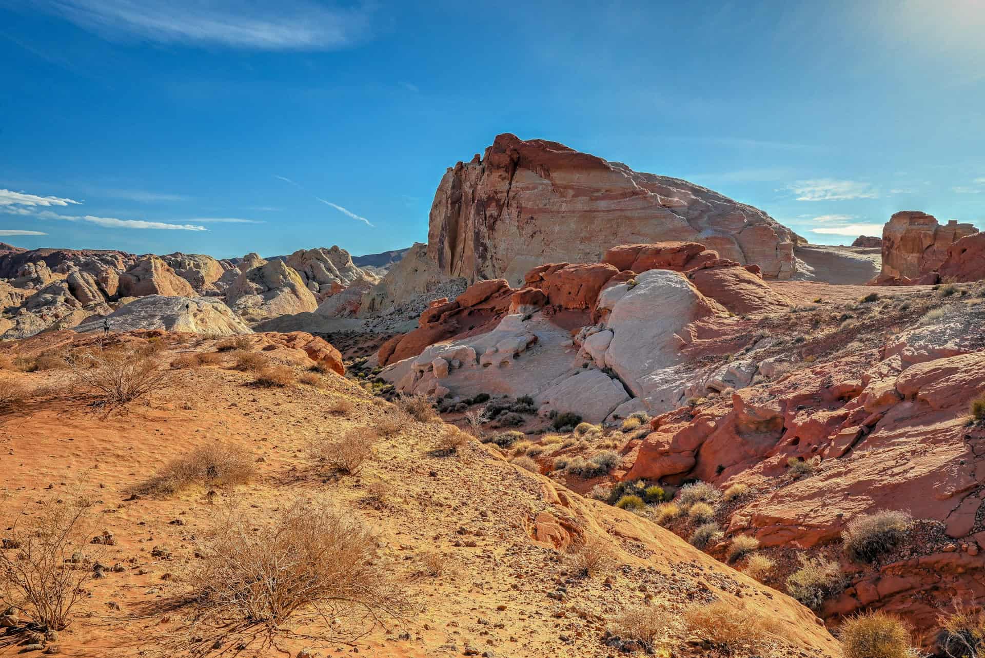
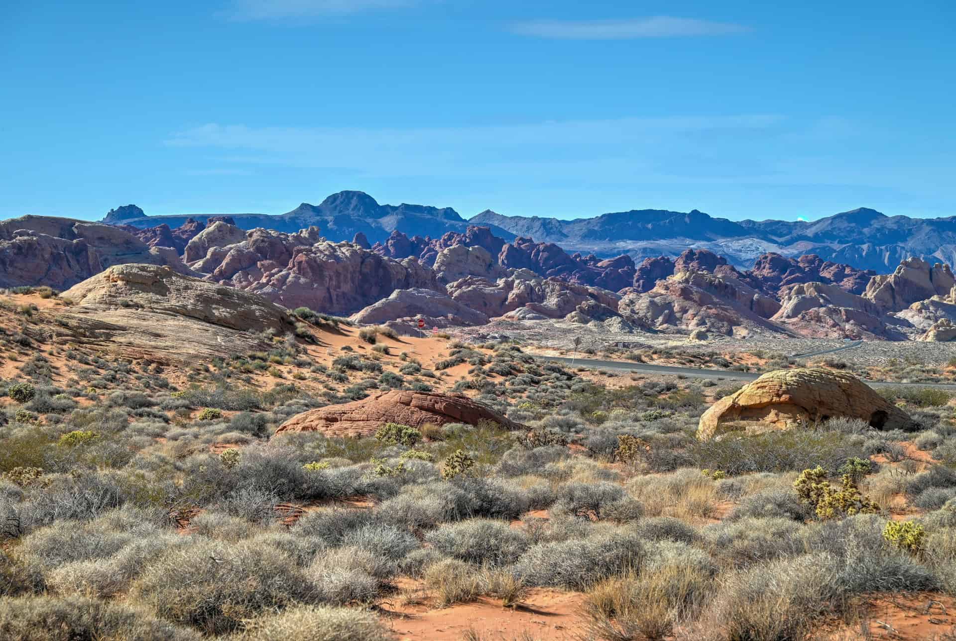
A Landscape Like No Other: Valley of Fire is famous for its blazing red Aztec sandstone, sculpted into sweeping fins, domes, slot canyons, and colorful striped formations. The park’s vibrant geology, especially around Fire Wave, Seven Wonders, and White Domes, creates one of the most visually striking desert landscapes in the American Southwest. Sunrise and sunset make the rocks glow an intense orange-red, giving the park its fiery name.
Iconic Trails and Viewpoints: With standout hikes like Fire Wave & Seven Wonders, Rainbow Vista, and White Domes Loop, plus viewpoints such as Fire Canyon and the overlooks near Mouse Tank Road, the park packs a huge amount of scenery into a relatively compact area. Many highlights are only a few minutes apart, making it easy to experience the park’s best spots in a single day.
Accessible and Easy to Explore: Located just one hour from Las Vegas and directly off Interstate 15, the park is extremely convenient for road-trippers. The main park road and Mouse Tank Road connect all major trailheads and viewpoints, and most hikes are short, family-friendly, and easy to access.
A Photographer’s Playground: Valley of Fire is one of the most photogenic state parks in the U.S., thanks to its swirling sandstone patterns, vibrant color bands, natural arches, and dramatic desert vistas. Whether you’re shooting landscapes, wildlife, or night skies, the park offers endless photo opportunities.
Ancient History and Rock Art: Beyond its geology, the Valley of Fire holds thousands of years of human history. Petroglyphs carved by the Ancestral Puebloans can be found along trails like Atlatl Rock and Mouse Tank, adding a cultural depth to the park’s already dramatic scenery.
One-Day Itinerary Considerations
Valley of Fire State Park is straightforward to explore in a single day, making it perfect for travellers coming from Las Vegas or stopping en route between Las Vegas and Zion National Park. Most of the park’s top attractions—such as Fire Wave & Seven Wonders, Rainbow Vista, White Domes Loop, and key viewpoints along Mouse Tank Road—are located within a short drive of one another, allowing you to see the highlights efficiently.
If Valley of Fire is a day trip or a quick stop on a longer road trip, plan to spend 3–5 hours here, depending on how much hiking, photography, and viewpoint hopping you want to do. The park is compact enough that even a shorter visit can be highly rewarding.
That said, timing matters. Summer temperatures can be extreme, and several trails along Mouse Tank Road are closed from May 15 to September 30 for safety. If you’re visiting during warmer months, focus on scenic drives and open trails, and aim for early morning to avoid the worst heat. In fall, winter, and spring, you’ll have far more flexibility—and the best conditions for both hiking and photography.
The One-Day Valley of Fire Itinerary – Main Attractions
Top Viewpoints
Fire Canyon Overlook & Silica Dome
One of the most dramatic overlooks in Valley of Fire, Fire Canyon gives you a sweeping view across a sea of red sandstone domes and rugged canyons. Just beside it, Silica Dome stands out with its pale, almost white rock — a sharp contrast to the surrounding deep reds. It’s an easy, rewarding stop with huge visual impact and zero effort.
Sci-fi fans will appreciate that scenes from Star Trek: Generations were filmed here, including the location often referred to as “Captain Kirk’s Grave”, which is a short (about a half mile each way) but steep walk along the Silica Dome trail departing from the fire canyon overlook car park.
Time required: 10–15 minutes (longer if hiking up Silica Dome
Location: At the very end of Fire Canyon Rd (link to Google Maps)
Mouse Tank Road Scenic Lookout
This unofficial overlook offers a rugged, elevated vantage point that requires a short scramble up the sandstone. The climb is easy for most visitors but involves using hands in a few spots. At the top, you’ll get an impressive view over layered rock, winding canyons, and vibrant red formations that typify the park’s landscape. It’s especially beautiful in late afternoon light.
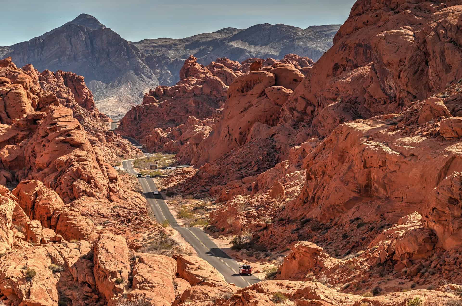
Time required: 10–15 minutes
Location: Start from the Rainbow Vista car park (link to Google Maps)
Best Hiking Trails
Fire Wave Trail
The most iconic hike in the park, Fire Wave leads you across rolling desert and onto a swirl of pink, red, and white striped sandstone reminiscent of a frozen wave. It’s short, easy, and spectacular in good light, but brutally hot in summer with no shade. Sunrise or late afternoon offers the best conditions and photographs.


Time required: 30-45 minutes
Location: At the very end of Mouse Tank Rd (link to Google Maps)
Fire Wave + Seven Wonders Trail
If you want a longer adventure, continue beyond Fire Wave onto the Seven Wonders Loop. Many visitors stop at the wave and turn back, but the loop adds slot-like canyons (like the popular Pink/Pastel Canyon, wind-sculpted fins, and colorful badlands that feel entirely different from the main viewpoint. It’s still moderate and manageable, just longer and more varied. It’s a great choice if you want a “best of” sampler of Valley of Fire.


Time required: 45-60 minutes
Location: At the very end of Mouse Tank Rd (link to Google Maps)
For information, details, and pictures, see our hiking guide for the Fire Wave and Seven Wonders Trail.
White Domes Loop
A fun, highly varied trail featuring a short slot canyon, film set remnants (from the 1965 film The Professionals), and striking white sandstone formations. The terrain changes constantly, making it one of the most engaging short hikes in the park. It can also be combined with the Fire Wave and Seven Wonders Trail for a longer loop.


Time required: 30-45 minutes
Location: At the very end of Mouse Tank Rd (link to Google Maps)
Rainbow Vista Trail
While the viewpoint at the end isn’t the most dramatic in the park, the trail itself is beautiful and adventurous in sections. It first winds through open desert over loose sand before navigating through an ondulating and narrow canyon.


Time required: 25-40 minutes
Location: Start from the Rainbow Vista car park (link to Google Maps)
For information, details, and pictures, see our hiking guide for the Rainbow Vista Trail.
Petroglyphs Sites
Atlatl Rock
The most famous and easily accessible petroglyph panel in the Valley of Fire. A stairway leads up to a viewing platform where you can see well-preserved images depicting animals, tools, and abstract symbols. It’s quick, well-interpreted, and one of the best cultural stops in the park.
Time required: 10–20 minutes
Location: Near the park’s western entrance and the Atlatl Campground (link to Google Maps)
Mouse Tank (short hike)
This short walk features some of the highest concentrations of petroglyphs in the park, etched into dark desert varnish along the canyon walls. The trail is sandy but easy, and you can spot dozens of carvings if you take your time. It’s one of the most rewarding “low-effort” activities in the Valley of Fire.
Time required: 20–30 minutes
Location: Along Mouse Tank Rd (link to Google Maps)
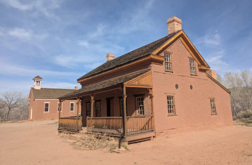
Historic Cabins
Built by the Civilian Conservation Corps in the 1930s, these stone cabins once served as overnight shelters for early travellers. Today, they’re preserved as a glimpse into the park’s early tourism history. They’re simple structures, but the location, surrounded by massive red rock, is photogenic and atmospheric.
Time required: 10–20 minutes
Location: Near the park’s eastern entrance (link to Google Maps)
Photogenic Rocks
Elephant Rock
A classic roadside stop where a natural arch resembles an elephant with a trunk touching the ground. It’s best photographed from the far side of the short loop trail, where the shape is most obvious.
Time required: 15-20 minutes
Location: Near the park’s eastern entrance (link to Google Maps)
Balancing Rock
Near the visitor center, this striking formation features a massive boulder perched improbably on a narrow pedestal. It’s an easy walk and a fun photo stop, perfect for when you’re short on time or looking for something impressive without hiking.
Time required: 10–15 minutes
Location: Trail starts from the Visitor Center (link to Google Maps)
Petrified Logs
Scattered throughout a fenced area, the petrified logs showcase ancient, fossilized wood remnants, evidence of a very different environment millions of years ago. They’re not flashy compared to the sandstone formations, but they add geological context to the park.
Time required: 10–15 minutes
Location: Near the park’s western entrance and the Atlatl Campground (link to Google Maps)
Arch Rock
A delicate sandstone arch reachable via a short walk from the road. You can’t climb on it due to erosion concerns, but you can get great photos by walking around to different angles. Early morning light is best, but it’s a worthwhile stop any time of day.
Time required: 10–15 minutes
Location: Near the park’s western entrance and the Atlatl Campground (link to Google Maps)
Beehives
The Beehives are clusters of conical sandstone formations shaped by layers of swirling, cross-bedded sediment. Their rounded, honeycomb-like texture makes them one of the most visually interesting roadside stops in the park.
Time required: 10–15 minutes
Location: Near the park’s western entrance and the Atlatl Campground (link to Google Maps)
Map of Valley of Fire State Park
This is an older map from the official Valley of Fire website; we find that the current map contains less. Although some information may be out-of-date, such as the visitor center hours, it provides a good idea of where the different attractions and trails are located in the park relative to one another.
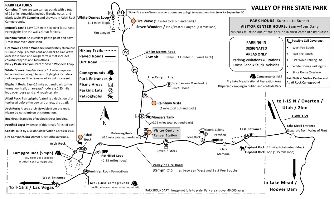
Note that White Domes Road is referred to as Mouse Tank Rd on Google Maps.
How Long Do You Need in Valley of Fire State Park?
The ideal amount of time in Valley of Fire really depends on how much hiking you want to do—and what the weather is like. In cooler months, you can comfortably explore more trails; in summer, shorter outings and scenic stops are the safest option.
If you stick to the main highlights, you can experience most of the park in under 3 hours. A “best of” visit might look like this:
Hike the Fire Wave + Seven Wonders Loop and Rainbow Vista Trail
Combined, these offer the park’s signature landscapes: striped sandstone, vibrant colors, and wide desert views. Plan for about 1h15–1h30.
Enjoy Two Top Viewpoints: Fire Canyon Overlook & Mouse Tank Viewpoint
A quick stop at Fire Canyon/Silica Dome and the short scramble to the Mouse Tank viewpoint add another 20–30 minutes.
Explore the Atlatl Rock Area
This compact cluster around the campground includes Atlatl petroglyphs, Arch Rock, Petrified Logs, and the Beehives. Plan for 30–45 minutes to see them all at an easy pace.
Best Time to Visit Valley of Fire State Park
Spring (March–May):
Spring is one of the best times to visit Valley of Fire. Temperatures are warm but comfortable (65–85°F / 18–29°C), making it ideal for hiking and photography. Wildflowers sometimes appear in March and April, adding splashes of color to the red sandstone.
Note: By mid-May, Valley of Fire begins its seasonal closure of the Fire Wave, Seven Wonders Loop, and surrounding areas (May 15–September 30), so visit early in the season if these trails are a priority.
Summer (June–August):
Summer is extremely hot, with temperatures often soaring above 105°F (40°C). Shade is minimal, and heat-related incidents are common. If you visit in summer, plan sunrise or sunset stops only.
During this period, the Fire Wave, Seven Wonders Loop, Pastel Canyon, and the entire northern section of Mouse Tank Road remain closed to hiking for visitor safety. Scenic drives are still open.
Fall (September–October):
Fall brings warm days, cooler evenings, and excellent conditions for photography. September can still be hot, but late September through October is one of the best times to visit.
Keep in mind that seasonal trail closures remain in effect until September 30—so early fall visitors won’t be able to hike the Fire Wave or Seven Wonders Loop. Once October arrives, all trails reopen and crowds begin to thin.
Winter (November–February):
Winter is peaceful, quiet, and very comfortable for hiking. Daytime temperatures usually range from 50–65°F (10–18°C), and crowds are minimal outside of holiday weekends. Occasional rain or rare dustings of snow create a beautiful contrast on the red rock. Early mornings can be cold, so dress in layers.
Quick Summary:
For comfortable weather, fewer crowds, and great light for photography, visit March–May or September–October. Summer can be rewarding if you time your visit carefully (early morning or late afternoon), while winter offers solitude and surreal beauty for those willing to brave cooler temperatures.
Quick Summary – When to Visit
- Best overall: March–early May and October–November
- Quietest: Winter
- If you want to hike Fire Wave / Seven Wonders: Visit October–May 14
Spring and fall offer the best balance of comfortable weather, open trails, and good lighting, while summer is best reserved for scenic drives or very short, early-morning visits. Winter rewards you with solitude and great hiking conditions.
What Else to See and Do in Valley of Fire State Park
If you’re continuing your road trip after exploring Valley of Fire, there are several worthwhile stops within easy driving distance, great additions depending on which direction you’re headed.
If You’re Heading Toward Las Vegas
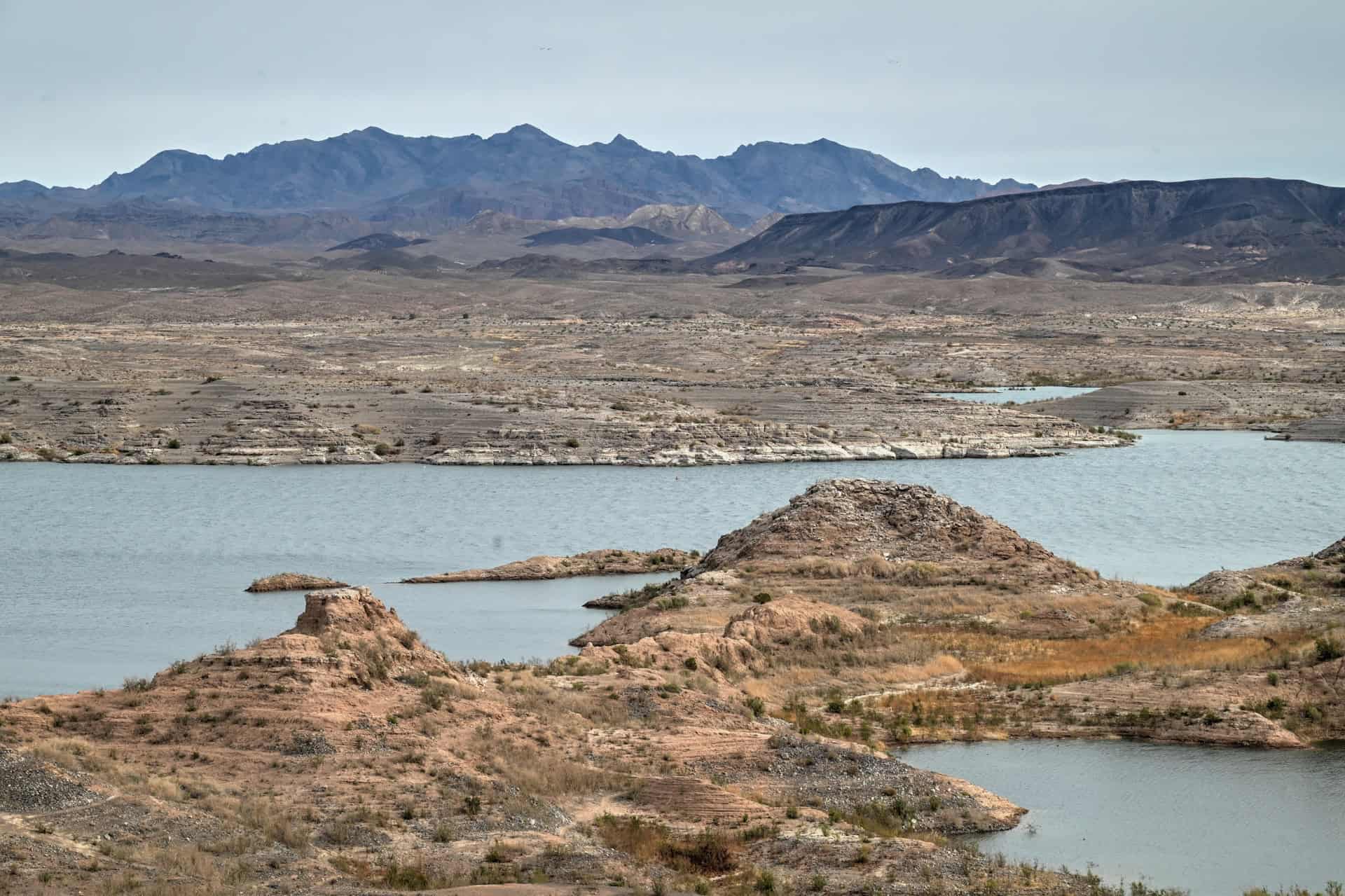
Lake Mead National Recreation Area – Just southwest of the park, Lake Mead offers scenic overlooks, swimming areas, picnic spots, and calm-water coves ideal for kayaking or paddleboarding. It’s a refreshing contrast to the desert landscape and a great place to cool off after a hot day in Valley of Fire.
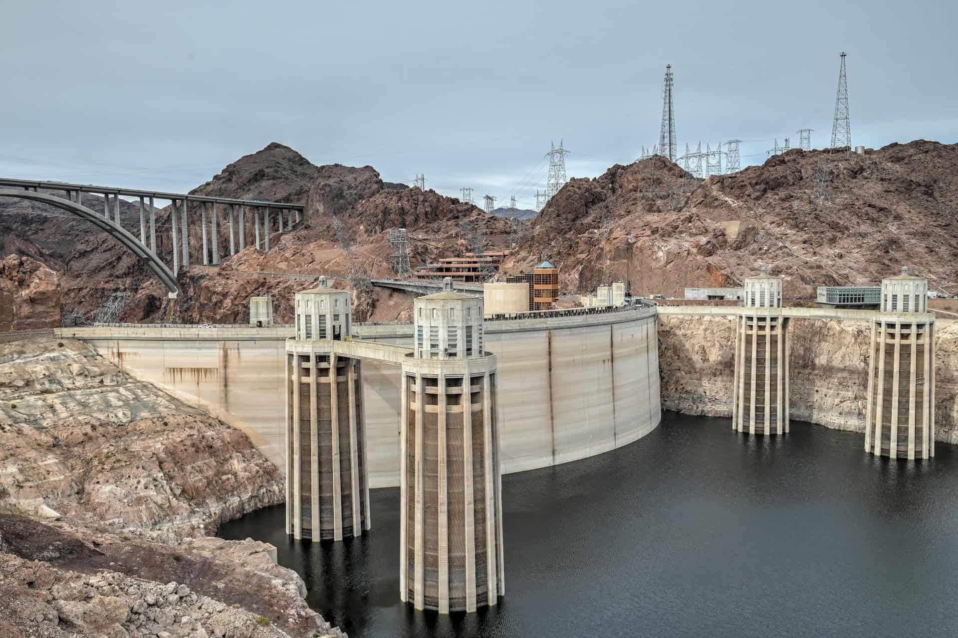
Hoover Dam – One of the most impressive engineering feats in the U.S., the Hoover Dam sits about an hour from Vegas and pairs perfectly with a Valley of Fire–to–Vegas drive. You can walk across the dam, take a guided tour inside, or view it from the spectacular Mike O’Callaghan–Pat Tillman Memorial Bridge overlook.
If You’re Heading East Toward Utah and Zion
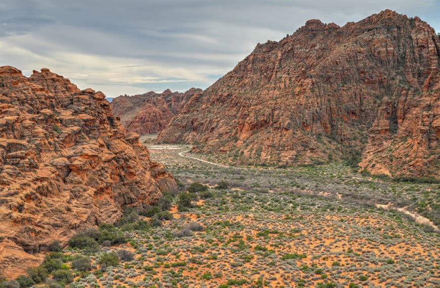
Snow Canyon State Park – Located just outside St. George, Snow Canyon is a lesser-known gem filled with red sandstone cliffs, lava flows, slot canyons, and short, family-friendly hikes like Petrified Dunes and Lava Flow. It’s often compared to a “mini Zion”—beautiful, uncrowded, and easy to explore in just a couple of hours. For travellers heading toward Zion National Park, it makes a perfect mid-journey stop.


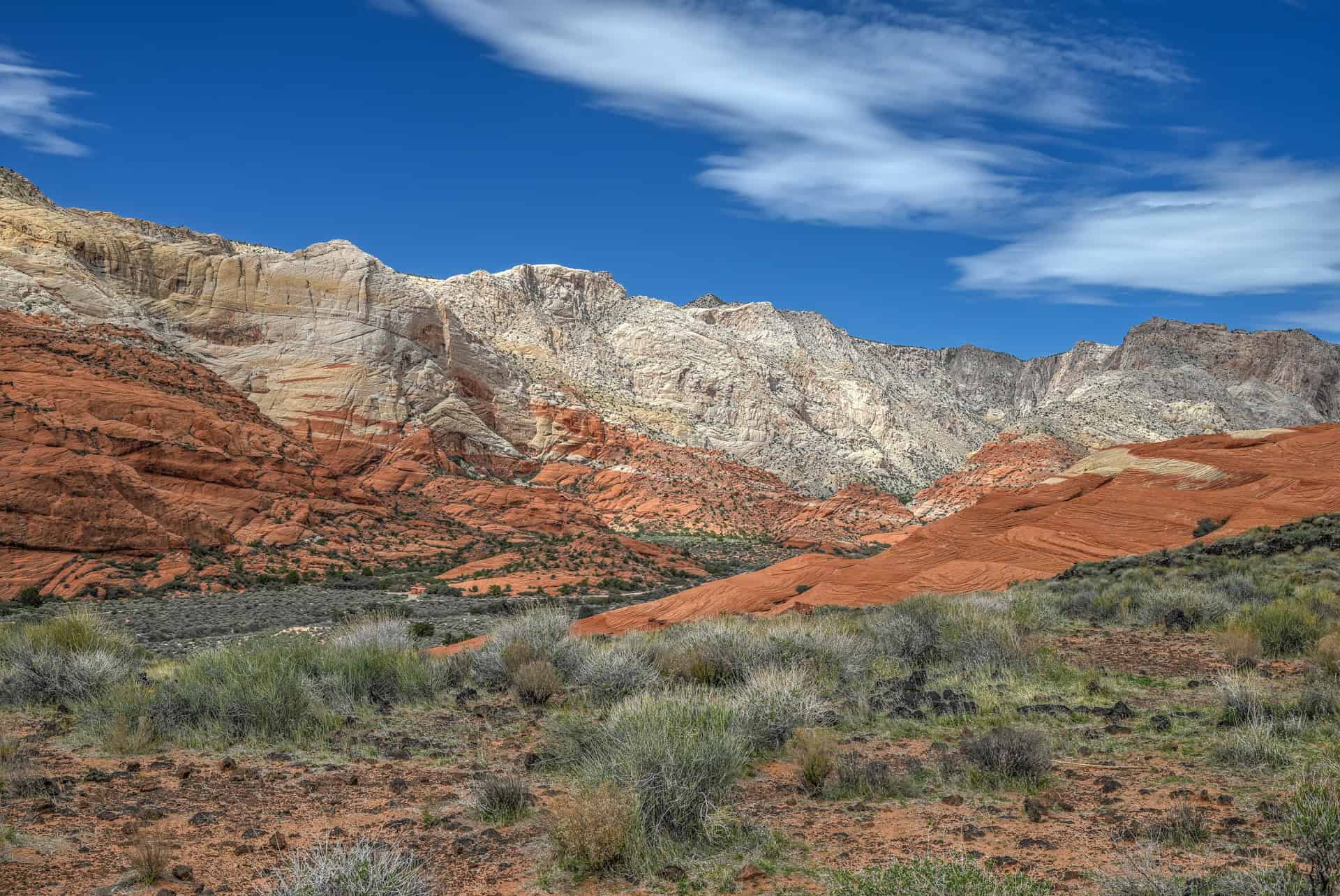
For more information and travel planning tips, see our detailed guide on Snow Canyon State Park.
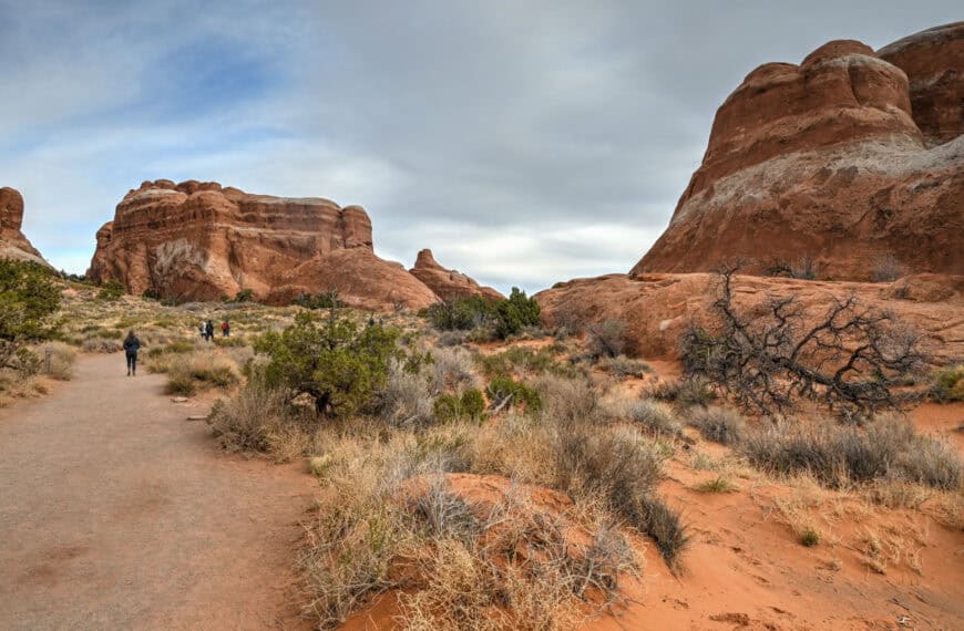
Zion National Park – Located roughly 1 hour northeast of Snow Canyon, Zion delivers a completely different scale of scenery, with towering sandstone cliffs, narrow slot canyons, and iconic hikes like The Narrows and Angels Landing. Don’t expect the same level of solitude you experienced at Snow Canyon—Zion receives an order of magnitude more visitors, and the main canyon can feel very busy, especially in peak seasons. That’s why some of our favorite hikes aren’t the most famous ones, but still deliver fantastic views and memorable terrain, such as Observation Point and the West Rim Trail.
For more information and planning tips, see our detailed guide on visiting Zion National Park.
Valley of Fire State Park – Frequently Asked Questions
Are dogs allowed?
Yes. Dogs are allowed on leash throughout the park, including on trails.
Keep in mind the extreme heat risk—summer pavement and sandstone can burn paws.
Are drones allowed?
No. Drones are not permitted anywhere in the park.
How long should I plan to spend in Valley of Fire?
You can see the major highlights in 2–3 hours with efficient planning.
Can regular vehicles access the park?
Yes. All major access roads are paved and suitable for standard passenger vehicles.
Is Valley of Fire worth visiting in summer?
Yes—but only with caution. Trail closures limit access, and the heat can be dangerous.
Stick to sunrise or sunset visits, focus on roadside viewpoints, and bring plenty of water.
Can you hike anywhere in the park?
Trails are designated, and off-trail exploring is limited in some areas to protect fragile terrain. Most viewpoints and short trails are well-marked and easily accessible.
Is there food or gas inside the park?
No.
Photography Gear
If you like our photography, you might be interested in some of the gear we use to shoot our travel and hiking destinations.
Camera Body – Nikon Z 6ii Fx-series Mirrorless Body
Main Lens – NIKON 24-120mm F/4G ED VR AF-S
Zoom Lens – Sigma 745-306 150-600mm f/5-6.3
Polarizing filters – Urth Circular Polarizing (CPL)
Camera Tripod – K&F Concept 64-inch Camera Tripod
Mini-tripod – Lammcou Flexible Camera Tripod
Camera/hiking backpack – Vanguard Alta Rise 48 Backpack
Universal Travel Adapter – VYLEE Universal International Power Travel Plug
Other Travel Essentials
Travel Insurance
SafetyWing is a travel insurance company that offers comprehensive coverage for travellers. Includes Medical Insurance and Travel Insurance. Primarily geared towards long-term travellers, digital nomads, and expats.
e-Sim cards
Airalo is the world’s first and largest eSIM store with eSIM plans for 200+ countries and regions worldwide. With Airalo eSIMs, travellers can get connected the moment they land at their destination and avoid nasty data roaming charges
eSIMS are a sustainable alternative to single-use SIM cards – they are 100% digital, require less energy to produce and be re-used rather than disposed of.
Car Rentals
Discover Cars is our go-to website for car rentals. We almost always find our preferred rate there.
Transfer from Airport
Welcome Pickups is our favourite private transfer service, which you can pre-book at a fixed price. Currently available in 220 cities all over the world (mostly in Europe, but with several major cities in Asia, the Middle East and the US).
Kiwitaxi is another private transfer service – we haven’t tried it yet, but it’s currently available in a few more countries (102 as of 2024).
Hotels and Accommodations (coming soon)
Photography Prints
If you found this blog useful, you can help support our blog by purchasing low-cost digital prints. Printed physical prints are also available for purchase.


—–
Well, that wraps it up! We hope you enjoyed our One Day in Goblin Valley State Park guide and that it will prove useful for planning your trip.
—–
You might also be interested in these related pages: