The drive from Las Vegas to Sedona is one of the most enjoyable road trips in the Southwest, blending desert lakes, iconic engineering landmarks, classic Route 66 nostalgia, and wide-open Arizona scenery. While it’s possible to make the journey in about half a day without stops, slowing down turns the route into a much richer experience, with opportunities to wander historic towns, sample quirky Americana, admire engineering marvels, and explore quiet corners of the Mojave Desert. This guide highlights the best scenic viewpoints, roadside attractions, historic sites, and short walking opportunities along the way. Whether you’re looking for photo stops, iconic Route 66 experiences, or a relaxed full-day journey with memorable detours, these are the places we think offer the most rewarding breaks between Las Vegas and Sedona.
Highlights Between Las Vegas and Sedona – At a Glance
Lake Mead National Recreation Area – Just east of Las Vegas, this vast reservoir offers a dramatic contrast to the surrounding desert: deep-blue water bordered by volcanic mountains, rugged coves, and multicolored badlands. Even a short detour provides memorable scenery: stop at overlooks like Boulder Beach or the Hemenway Harbor viewpoint to admire the lake, spot bighorn sheep, or simply take in the scale of the Colorado River basin. It’s a peaceful, easy start to the drive.
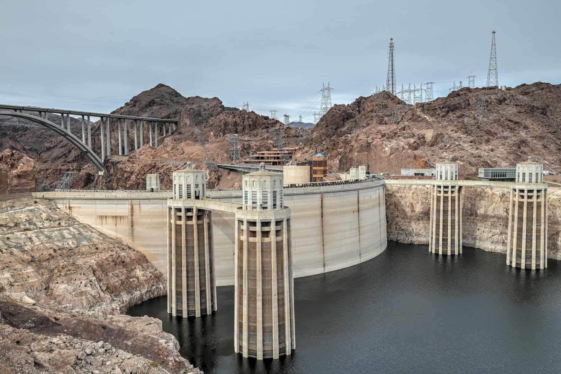
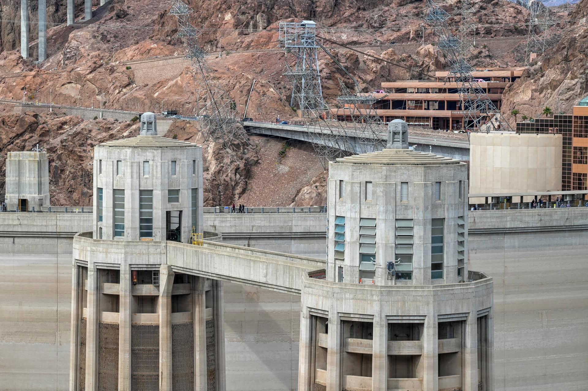
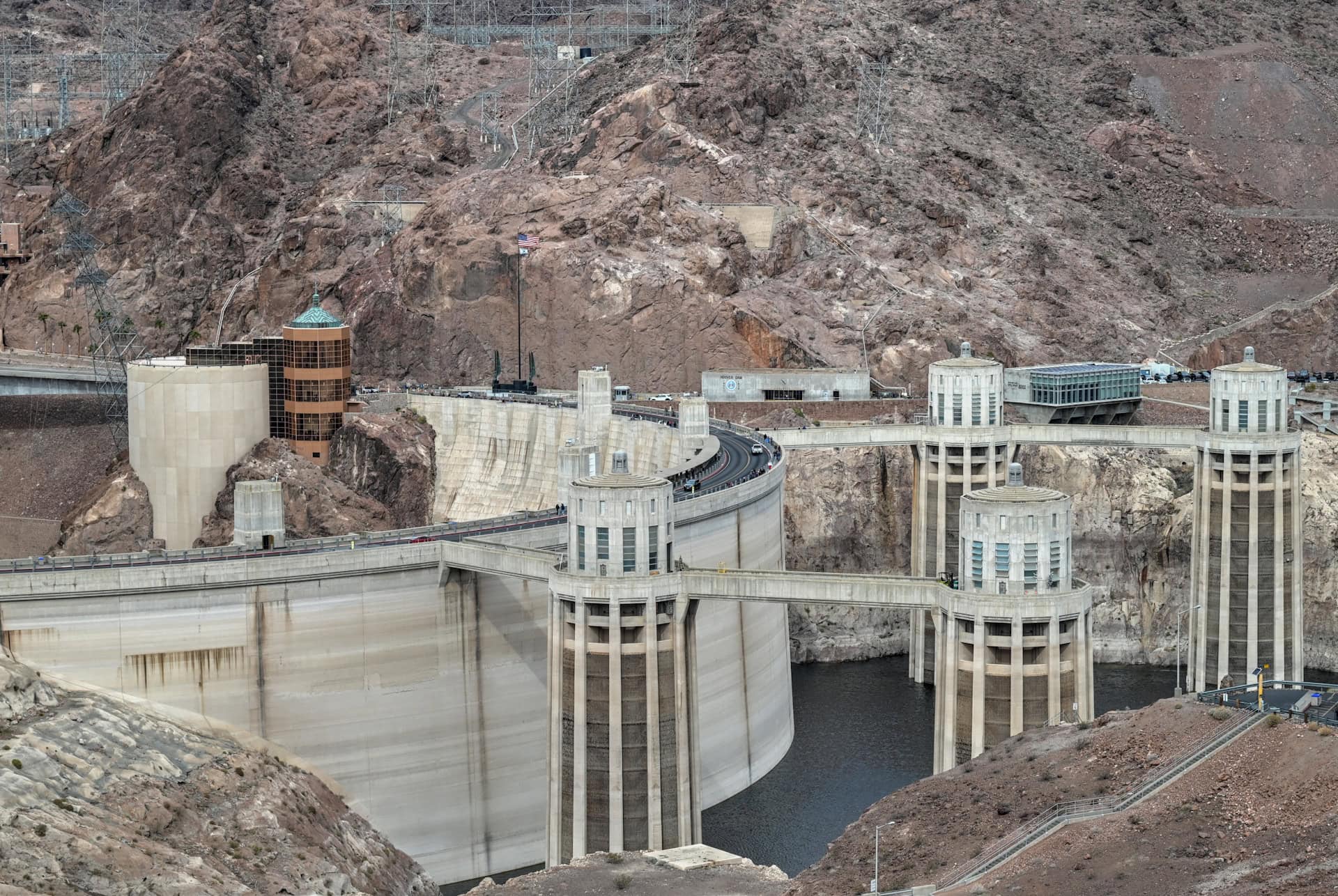
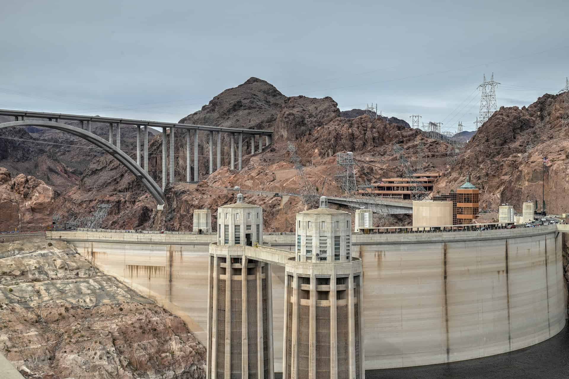
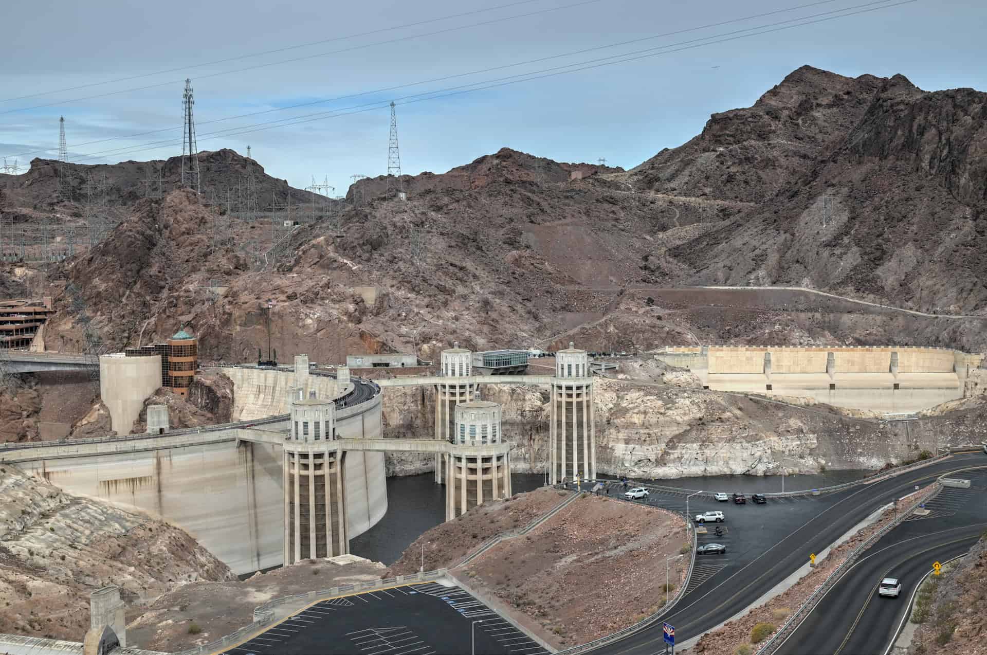
Hoover Dam – One of America’s greatest engineering achievements, Hoover Dam is both visually striking and historically fascinating. The short walk across the dam lets you stand on the Arizona–Nevada state line with sheer concrete walls dropping nearly 750 feet to the river below. Nearby, the Mike O’Callaghan–Pat Tillman Memorial Bridge offers a spectacular vantage point for photos of the dam and Black Canyon. Whether you spend 20 minutes or an hour, it’s an essential stop on the route.
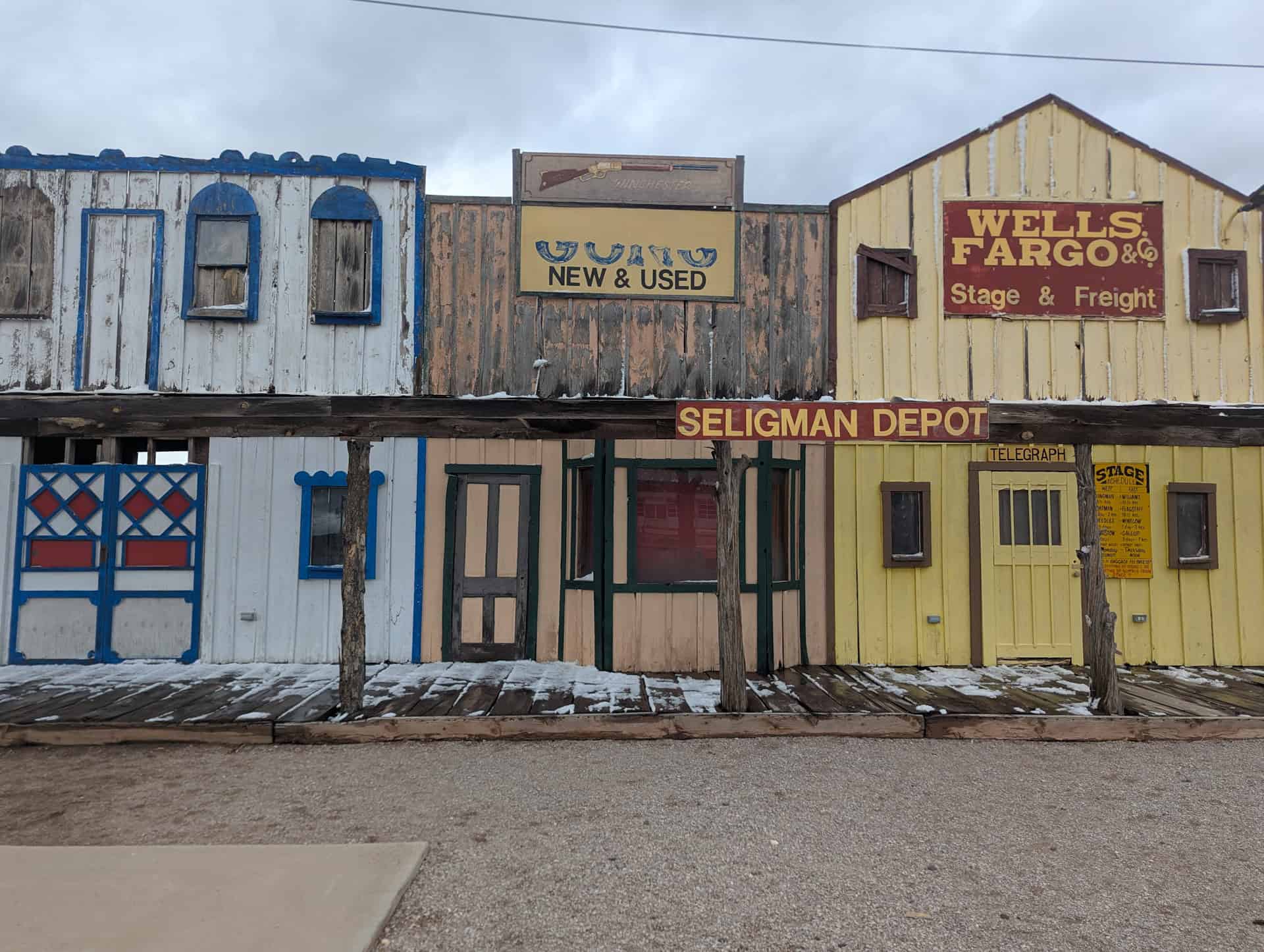
Seligman & Historic Route 66 – Often called the birthplace of the Route 66 revival, Seligman is a colorful, character-filled town where neon signs, retro storefronts, and classic cars line the main street. Stops like Delgadillo’s Snow Cap, Angel & Vilma’s Original Route 66 Gift Shop, and the town’s playful murals make it one of the most fun, and most nostalgic places between Las Vegas and Sedona. It’s the ideal final Route 66 experience before continuing east toward the red rocks of Sedona.
Hackberry General Store – A beloved Route 66 icon, Hackberry General Store feels like stepping straight into mid-century roadside America. The rustic storefront, overflowing with vintage gas pumps, rusted signs, classic cars, and quirky memorabilia, is one of the most photogenic stops on the entire route. Inside, you’ll find old postcards, retro décor, and a small museum-like collection that captures the charm of this historic road.


Disclosure: This page (Best Stops and Must-See Attractions Between Las Vegas and Sedona) may contain product affiliate links. At no additional cost to you, we may receive a commission for purchases made through these links. More details can be found on our disclosure and policies page.
How Long Is the Drive Between Las Vegas and Sedona?
If you drive straight from Las Vegas to Sedona via US-93, I-40, and AZ-89A, the trip covers roughly 300 miles (475 km) and typically takes 4½ to 5 hours without stops. It’s a fast and straightforward route, but driving directly means skipping some of the Southwest’s most memorable landscapes and classic Route 66 towns.
For a far more enjoyable and rewarding journey, we strongly recommend setting aside extra time for at least a few major highlights along the way: Lake Mead’s desert shores, the Hoover Dam overlook, historic Kingman, the photogenic Hackberry General Store, and colourful Seligman. These stops require minimal detours and showcase everything from vast reservoir views and Depression-era engineering to nostalgic roadside Americana.
With these highlights included, most travellers spend 7 to 10 hours total on the drive, allowing time for short walks, scenic overlooks, museum visits, and relaxed breaks along Route 66. Those who want to linger at Lake Mead, take a structured Hoover Dam tour, or explore more of Route 66’s quirky attractions may want to dedicate a full day to the Las Vegas-to-Sedona trip.
This guide to the best stops and must-see attractions between Las Vegas and Sedona is designed to help you experience the most scenic viewpoints, historic towns, and iconic Route 66 locations in a comfortable single-day itinerary. We’ll also point out optional detours and deeper explorations if you plan to take a more leisurely pace or return to the area in the future.
If you need to book a rental vehicle for your hiking excursion, we highly recommend using Discover Cars to get the best rates on your rental in Utah, Nevada and Arizona.
We also highly recommend Airalo (eSIM card) for your connectivity needs when travelling abroad. Airalo is the world’s first and largest eSIM store with eSIM plans for 200+ countries and regions worldwide.
Las Vegas to Sedona – Driving Considerations
Altitude (and Weather) Changes
The drive from Las Vegas to Sedona may begin in the Mojave Desert, but it crosses several distinct elevation zones: reservoir shoreline, high desert basins, volcanic plateaus, and finally the forested mountains above Sedona. These shifts can create noticeable changes in temperature, wind, and driving conditions, especially outside of summer.
Las Vegas sits at roughly 2,000 ft (610 m), while Lake Mead and Hoover Dam drop slightly lower into the desert basin. From there, US-93 climbs into the 3,000–4,000 ft (915–1,220 m) high desert around Kingman. Continuing east on I-40, elevations gradually rise toward 5,000–5,800 ft (1,525–1,770 m) near Seligman and Ash Fork. The final stretch toward Sedona via AZ-89 and AZ-89A brings you into the 6,500–7,000 ft (1,980–2,135 m) forests of the Coconino Plateau before descending dramatically through Oak Creek Canyon to Sedona at 4,350 ft (1,325 m).
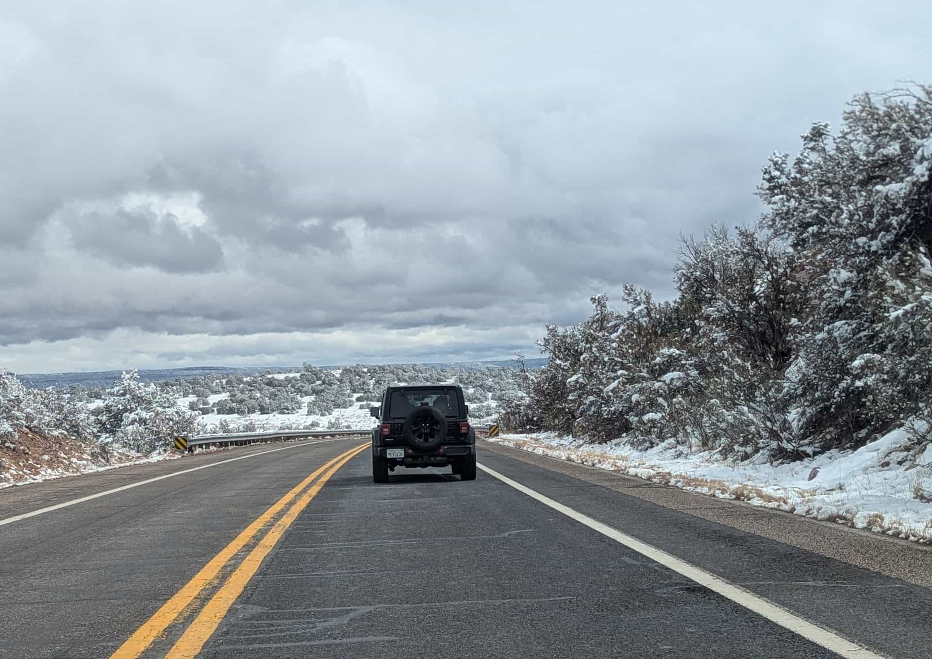
These elevation changes can result in temperature swings of 15–25°F (8–14°C) over a single drive. From November through early April, snow and icy patches are possible on the higher sections of AZ-89 and AZ-89A, even when conditions are mild around Las Vegas or Kingman.
Fuel Stops
Fuel is widely available along the Las Vegas –> Sedona corridor, but long, quiet stretches do appear, especially east of Kingman and between towns on Route 66.
Reliable fuel stops include:
- Las Vegas / Henderson – Many options before leaving the metro area.
- Boulder City – Your last convenient stop before Lake Mead and Hoover Dam.
- Kingman – Excellent place to top up; stations cluster along Stockton Hill Rd and Andy Devine Ave (Route 66).
- Seligman – A classic Route 66 stop with a couple of dependable stations.
- Ash Fork / Williams – Additional stations if needed.
- Sedona – Many gas stations in both West Sedona and the Village of Oak Creek.
Between Kingman and Seligman, a stretch of nearly 75 miles (120 km), services become limited if you take Route 66 instead of staying on I-40, so filling up in Kingman is recommended if you plan to explore Hackberry or other classic Route 66 stops.
Cell Service
Cell coverage is generally good near Las Vegas, Boulder City, and Kingman, but can drop out along:
- Some forested or canyon stretches on AZ-89A approaching Sedona
- Portions of US-93 between the Hoover Dam and Kingman
- Long rural sections of Route 66, including areas near Hackberry
A Note on Time Zone Changes
The Las Vegas–> Sedona drive can involve a surprising time shift depending on the season.
- Nevada (including Las Vegas) observes Pacific Time (PT) and follows Daylight Saving Time.
- Arizona, including Sedona, follows Mountain Standard Time (MST) year-round and does not observe Daylight Saving Time.
This means:
- From November to early March, Arizona and Las Vegas share the same time.
- From March to early November (DST in effect), Arizona is one hour ahead of Las Vegas.
Road Safety
All major roads between Las Vegas and Sedona are paved and well-maintained, but there are route-specific considerations:
- US-93 (Las Vegas –> Hoover Dam –> Kingman)
A fast, modern highway with heavy truck traffic and frequent high winds. Watch for sudden speed changes approaching the dam area. - I-40 (Kingman –> Seligman –> Ash Fork)
Wide, smooth, and generally easy driving, though strong crosswinds are common on the open desert stretches. - Route 66 (Kingman –> Hackberry –> Seligman)
Fully paved but narrower and more rural. Expect low shoulders, slower speeds, and occasional wildlife, especially near dawn or dusk. - AZ-89 / AZ-89A (Flagstaff area –> Sedona)
Scenic but winding roads, especially the descent through Oak Creek Canyon. Sharp turns, steep drop-offs, and limited passing zones make it a road where slower, cautious driving is key.
Night driving anywhere along the latter half of the route is not ideal due to wildlife crossings, limited lighting, and remote areas with no services.
Best Time of Year to Drive the Route
The Las Vegas to Sedona drive is enjoyable most of the year, but seasonal conditions can vary dramatically:
- Spring (March–May) – Often ideal: mild temperatures, good visibility, and comfortable conditions along most of the route.
- Fall (September–October) – Equally pleasant, with colourful foliage in the higher forests near Sedona.
- Summer (June–August) – Very hot near Las Vegas, Lake Mead, and Kingman; start early and bring plenty of water. Afternoon monsoon storms with brief heavy rain can occur.
- Winter (November–February) – Generally mild near Las Vegas but can bring snow or ice at higher elevations on AZ-89 and AZ-89A, especially near Flagstaff and the Coconino Plateau.
We’ve personally experienced the dramatic contrasts firsthand. On a mid-March trip, we left Las Vegas in cool 50°F weather, then drove the Route 66 stretch between Hackberry and Seligman, where snow still lined sections of the road. Continuing south toward Sedona, we descended into Oak Creek Canyon and again passed roadside snow in the higher, forested sections. It even briefly snowed during our time in Sedona, and although it melted quickly, the snow in Oak Creek Canyon was still present several days later when we departed Sedona.
Best Stops Between Las Vegas and Sedona
The following attractions are listed from west to east, in the order you’ll encounter them when travelling from Las Vegas toward Sedona via US-93, I-40, Route 66, and AZ-89A.
Nevada & Western Arizona
Lake Mead National Recreation Area
40 minutes from the Las Vegas strip/airport
Why stop here:
Lake Mead is one of those places that surprises people — a huge, shimmering blue-green reservoir tucked into a landscape of volcanic rock, desert hills, and sculpted cliffs. The moment you roll in from Las Vegas, the scenery shifts from city lights to wide-open desert and sweeping lake vistas. It’s a beautiful, peaceful change of pace and a perfect way to ease into the road-trip mindset before heading toward Hoover Dam and Route 66.


What you’ll find:
A series of roadside pullouts and overlooks (our favorite is located here), marinas and boat launches, restrooms, and plenty of desert viewpoints where you can admire the colors and contours of the landscape. The lake’s shoreline twists through canyons and coves, so even short stops offer great photo opportunities without much walking. Keep an eye out for the surrounding volcanic formations, dark ridges and jagged peaks that add dramatic contrast to the bright water.
Important to know:
Lake Mead has an entry fee of $25 per private vehicle (or you can use your America the Beautiful Pass if you already have one).
Time required:
15–45 minutes, depending on how many overlooks you stop at.
Lakeview Overlook (US-93 pullout)
1hr from Vegas (link to Google Maps)
Why stop here:
A quick, free overlook with a sweeping elevated view of Lake Mead. It’s ideal if you want a scenic photo without entering the official recreation area.


What you’ll find:
A simple paved pullout with interpretive panels and panoramic lake views.
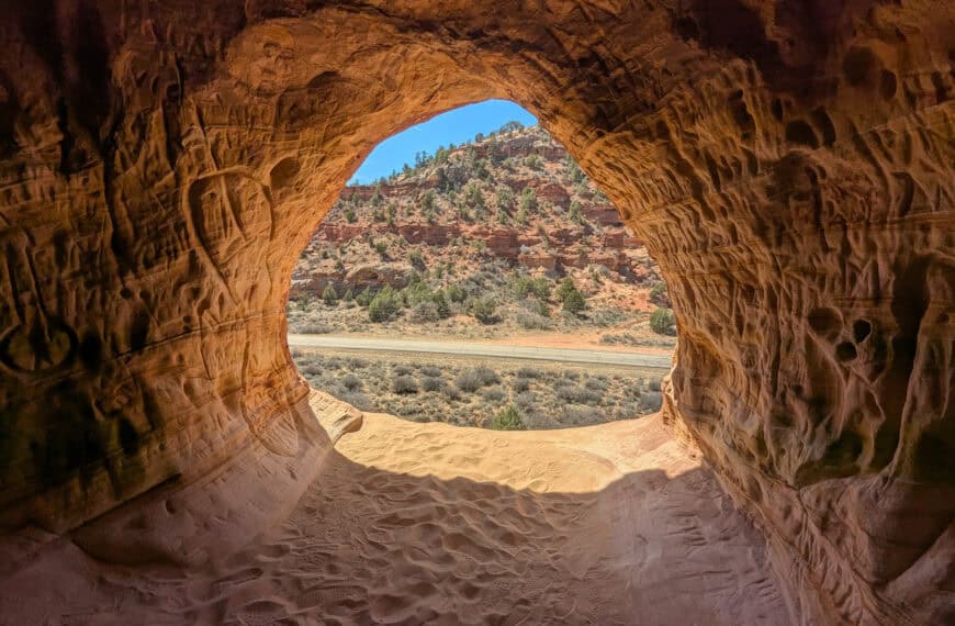
Just below the viewpoint, you can also spot a portion of the historic railroad trail that winds along the cliffs and passes through several old tunnels leading toward Boulder City.
Time required:
5–10 minutes.
Hoover Dam (and Hoover Dam Overlook)
5 minutes from the Lakeview Overlook (link to Google Maps)
Why stop here:
Hoover Dam isn’t just big: it’s one of the most iconic engineering achievements in U.S. history. Built during the Great Depression (construction began in 1931), the project employed thousands of workers and created what was then the tallest dam in the world. Standing here today, you can still feel that sense of ambition: the massive concrete face plunging into Black Canyon, the art-deco details, the turquoise Colorado River winding far below, and the sheer scale of the surrounding cliffs.
Whether you stroll across the top of the dam, peer over the spillways, or take in the sweeping view from the Mike O’Callaghan–Pat Tillman Memorial Bridge, every angle drives home just how monumental this structure really is.


What you’ll find:
Observation decks, restrooms, a visitor center with exhibits, and several short walking paths around and across the dam. You can explore viewpoints on both the Nevada and Arizona sides, walk the entire span of the dam, or climb up to the bridge overlook for one of the most dramatic views in the entire region. The mix of geology, engineering, and history makes this area unexpectedly fun to explore, even if you’ve been before.
Important to Know:
Hoover Dam has three main parking areas, each serving a different part of the experience. The free Boulder Dam Bridge parking lot on the Nevada side gives access to the Mike O’Callaghan–Pat Tillman Memorial Bridge via a 10-minute uphill walk (this is where you get the dramatic overlook above the dam). The paid parking garage and surface lots near the Visitor Center are best if you want to walk across the dam or join a guided tour (typically $30–$35, about 1 hour, including tunnels and powerplant areas). Finally, a few free pullouts on the Arizona side offer quick scenic views with minimal walking (where the pictures below were taken from).
Time required:
30-60 minutes to walk the dam and stop at a few viewpoints. Add another 30 to get up and back from the bridge, and another hour if you want the guided tour.
Willow Beach Scenic Overlook
20 minutes south of Hoover Dam on US-93 (link to Google Maps)
Why stop here:
A quieter and less-visited overlook with beautiful views over the Black Canyon section of the Colorado River. A nice contrast to the busy dam area.


What you’ll find:
A small parking pullout and a wide canyon vista with the river far below. No facilities.
Time required:
5–10 minutes.
Route 66 Section
Kingman (Route 66 Museum & Historic Downtown)
1 hour from Willow Beach Overllook (link to Google Maps)
Why stop here:
The town blends classic diners, neon motel signs, mid-century storefronts, and a genuinely interesting set of museums that tell the story of the highway’s evolution. It has that perfect mix of history and retro personality, making it an ideal place to stretch your legs before continuing toward Hackberry and Seligman.
What you’ll find:
The excellent Arizona Route 66 Museum (located inside the old Powerhouse building), a restored locomotive in Locomotive Park, walkable blocks of murals and vintage shops, and several throwback cafés if you’re craving a classic diner lunch. Parking is easy, and most of the highlights are within a short stroll of each other.
Time required:
30 minutes to 1 hour.
Hackberry General Store
40 minutes northeast of Kingman (link to Google Maps)
Why stop here:
Hackberry General Store is one of those Route 66 icons that feels frozen in time, in the best way possible. Originally a gas station and general stop for travellers in the mid-1900s, it became a beloved roadside landmark thanks to its quirky collection of vintage signs, weathered gas pumps, and classic cars. Walking around the property feels like stepping straight into a mid-century postcard or a movie set. Whether you’re into Americana, photography, or just love a good dose of roadside weirdness, Hackberry hits that perfect Route 66 sweet spot.


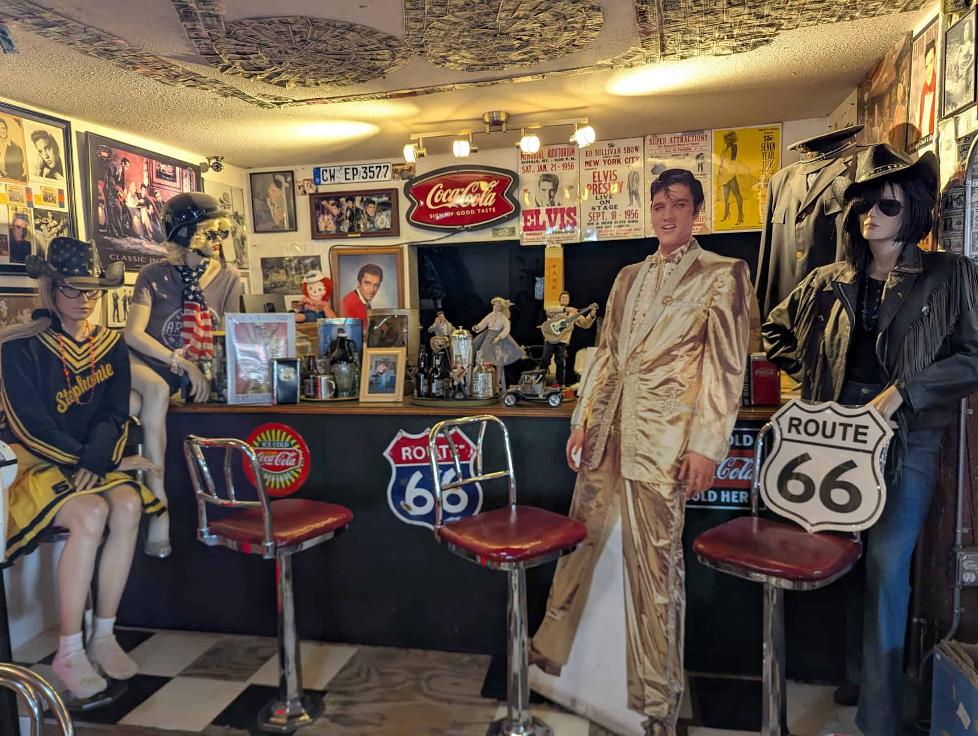
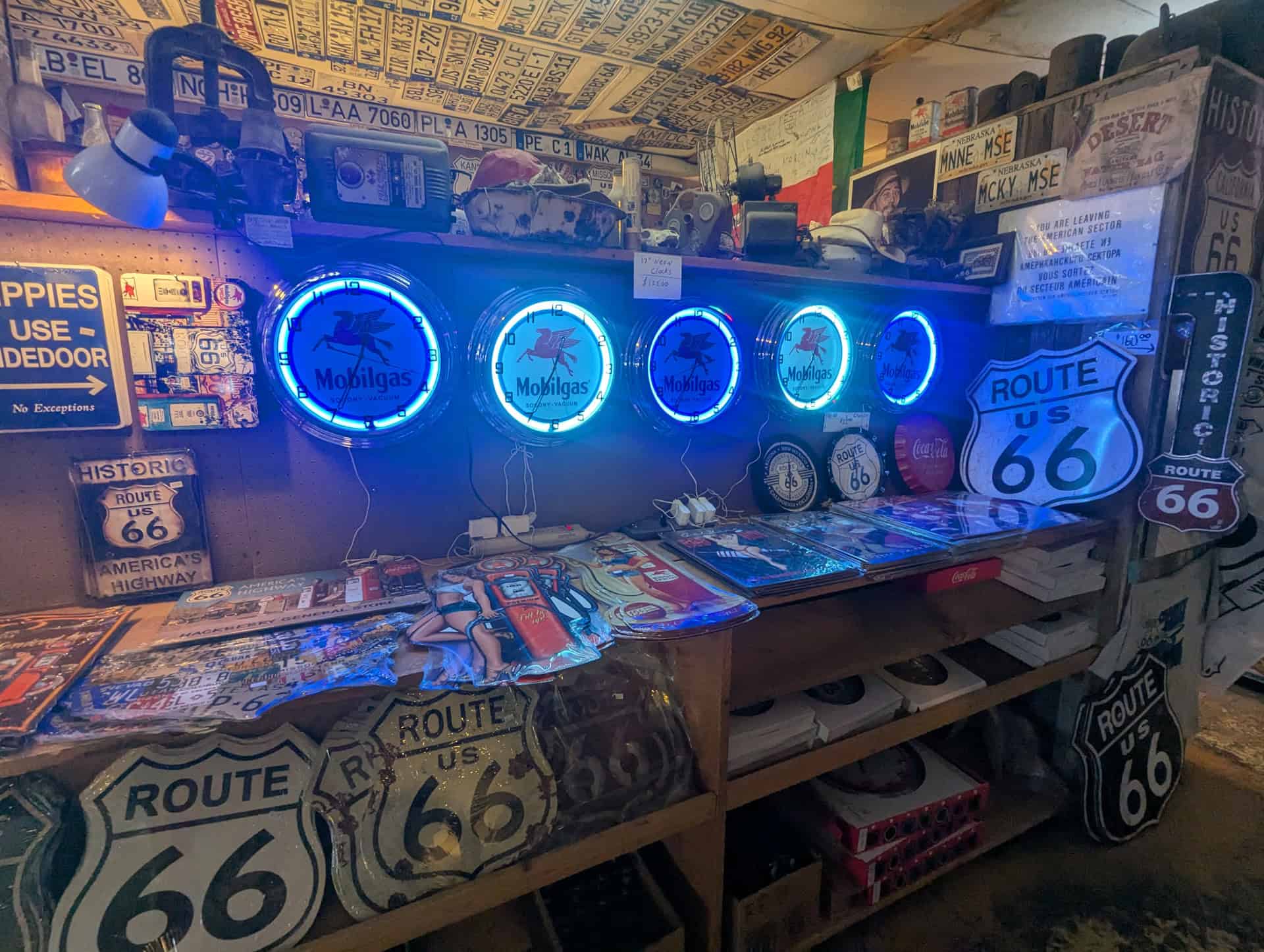
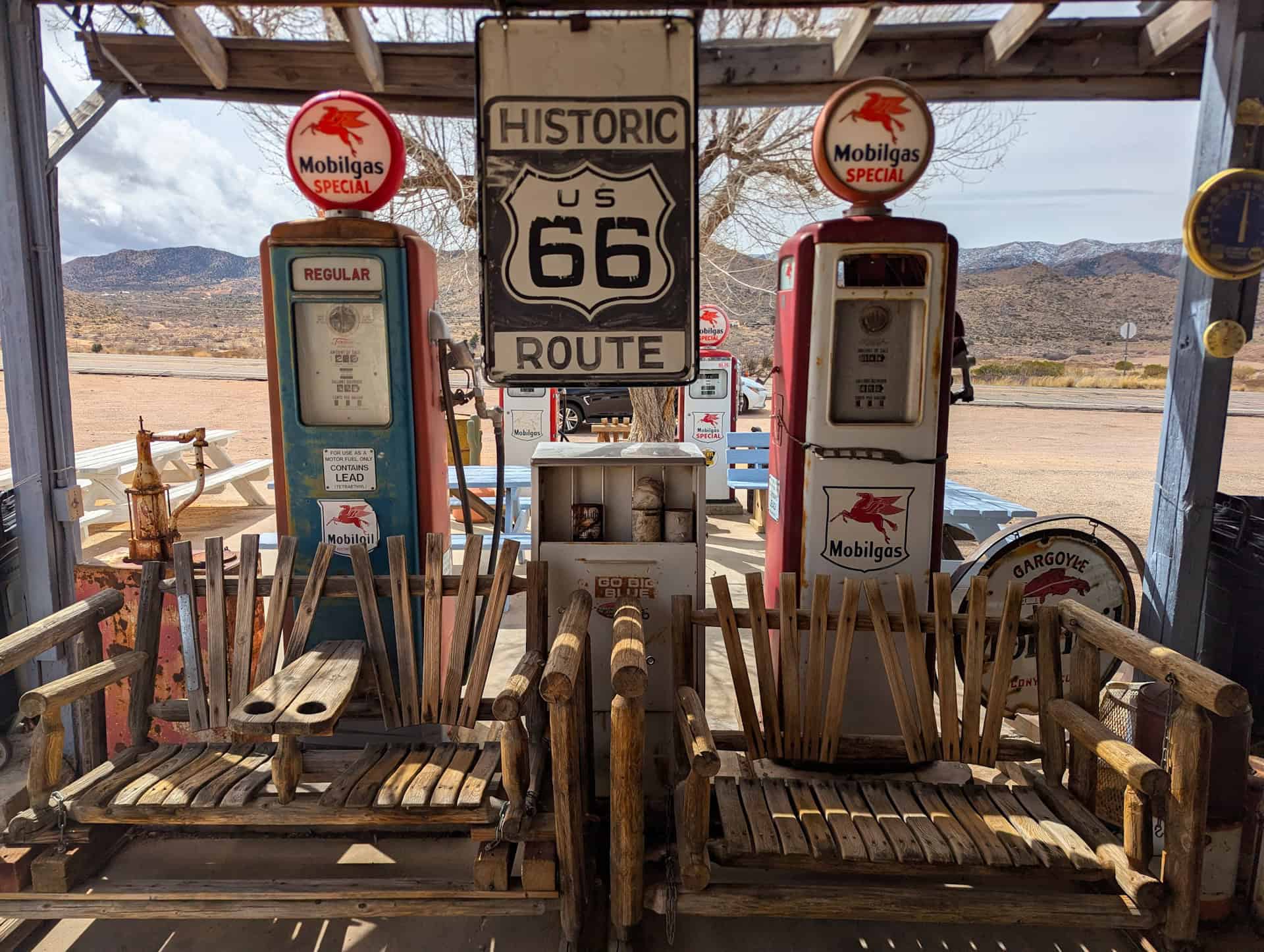
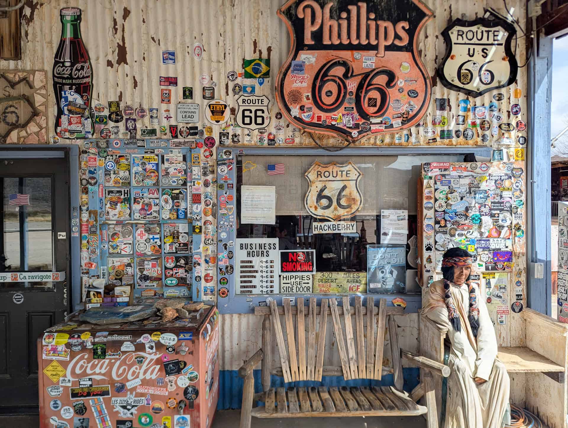


What you’ll find:
A tiny but fun gift shop stocked with Route 66 souvenirs, cold drinks, and local oddities. Outside, the grounds are crammed with nostalgic treasures: rusted automobiles, neon signs, old Coke machines, and an ever-growing collection of props that practically beg you to stop and explore. It’s one of the most photogenic stops on the entire route.
Time required:
10–20 minutes.
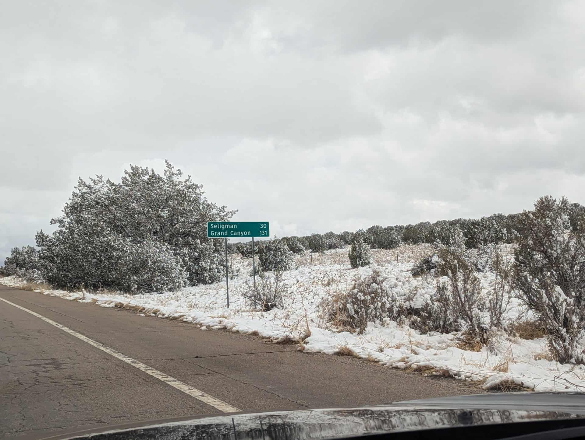
Seligman
60 minutes east of Hackberry (link to Google Maps)
Why stop here:
Seligman is arguably the heart of the Route 66 revival. In the 1980s, local barber Angel Delgadillo helped spark a movement to preserve the road’s legacy and the town has embraced that identity with full, joyful enthusiasm. Today, Seligman feels like a celebration of everything Route 66 stands for: neon signs, cheerful chaos, colorful storefronts, classic diners, and playful roadside kitsch that draws road-trippers from around the world.
It’s lively, bright, a little eccentric, and a perfect place to stretch your legs and soak in the spirit of the old highway.


What you’ll find:
Retro motels with vintage signs, hand-painted murals, classic cars staged along the sidewalks, and shops overflowing with Route 66 memorabilia. The main strip is very walkable, making it easy to browse, take photos, and grab lunch at local favorites like Delgadillo’s Snow Cap or Westside Lilo’s.
Time required:
20 minutes, but longer if you make this your lunch stop (see our suggested 1-day itinenary further below)
Ash Fork
20 minutes east of Seligman (link to Google Maps)
Why stop here:
Ash Fork is a quieter, more low-key Route 66 town. It’s the kind of place where you can still feel the old railroad-and-highway rhythm that once defined so many small desert communities. It’s known as the “Flagstone Capital of the World,” and its history is tied closely to the Santa Fe Railway, ranching, and early highway travel. While it doesn’t have the neon flash or quirky flare of Seligman, the town has an authentic, lived-in charm that gives you a glimpse of the “real” Route 66 beyond the tourist spots.
Why stop here:
A quieter Route 66 town known for its historic buildings, railroad heritage, and classic road-trip atmosphere.
What you’ll find:
A handful of small shops, vintage roadside signs, and the Ash Fork Route 66 Museum, which highlights the area’s history through old photographs, artifacts, and displays about the railroad and early highway days. The historic district is compact, making it easy for a quick wander or a brief photo stop.
Time required:
5–15 minutes (longer if visiting the museum)
Oak Creek Canyon Section
Slide Rock State Park
2 hours east of Seligman, north of Sedona on AZ-89A (link to Google Maps)
Why stop here:
One of northern Arizona’s most beloved swimming and sun-soaking spots. Natural sandstone ledges and smooth red-rock chutes create Oak Creek’s famous “water slides,” making it a fun stop for cooling off, taking photos, or just relaxing by the creek on warm days.
What you’ll find:
Creek access, short walking paths, shaded picnic tables, restrooms, and classic red-rock canyon scenery. It’s extremely popular in summer, so expect crowds and limited parking during peak hours.
Time required:
45 minutes to 2 hours.
Oak Creek Canyon Vista
15 minutes north of Slide Rock (link to Google Maps)
Why stop here:
A dramatic overlook perched above one of Arizona’s most beautiful mountain canyons. From the viewing deck, you can see the winding road, forested cliffs, and layered rock walls that make Oak Creek Canyon a scenic highlight of the Sedona-Flagstaff drive.
What you’ll find:
A paved viewpoint area with rail-side overlooks, seasonal Navajo craft stalls, restrooms, and wide-angle photo opportunities, especially nice in late-afternoon light.
Time required:
5–10 minutes.
Our Suggested One-Day Itinerary: From Las Vegas to Sedona
The following suggested stops create a relaxed, scenic, and varied day—enough to experience the best of Lake Mead, Hoover Dam, Route 66, and Oak Creek Canyon without rushing or stretching the drive too long.
Morning: Las Vegas –> Lake Mead –> Hoover Dam
Leave Vegas around 8:00–8:30 a.m.
Lake Mead Area – 30 minutes
Enjoy the sparkling turquoise water framed by volcanic and desert cliffs. Stop at one or two viewpoints along Lakeshore Road, with the Lakeview Overlook as the highlight. Quick photos and a short walk let you stretch your legs and admire the scenery.
Hoover Dam – 30 minutes
Next, head to Hoover Dam. Walk along the top or enjoy the views from the upper parking area. Even without a full tour, it’s one of America’s most impressive engineering feats and a perfect morning highlight.
Willow Beach Scenic Overlook – 5–10 minutes
A final quick stop before crossing into Arizona. This overlook provides views of the Colorado River and gives a taste of the desert river landscapes you’ll see throughout the day.
Late Morning: Route 66 Nostalgia
Kingman –> Hackberry –> Seligman
Hackberry General Store – 15–20 minutes
Step back in time at this quintessential Route 66 stop. Vintage gas pumps, neon signs, and roadside memorabilia make it perfect for photos and a short stroll.
Seligman – 45–75 minutes (lunch stop)
If you leave Las Vegas around 8:00 a.m. and follow our suggested stops, you’ll reach Seligman around 12:30 p.m. Start with lunch at Delgadillo’s Snow Cap or Westside Lilo (our personal favorite), then take time to wander through one of the most colorful towns on historic Route 66. Explore the murals, browse the quirky shops, and soak in the classic Americana atmosphere that makes Seligman a must-see stop on the drive.
Afternoon: Northern Arizona & Oak Creek Canyon
Oak Creek Canyon Vista – 5–10 minutes
Arrive in Arizona’s high country and pause at this elevated viewpoint overlooking the winding canyon below. The mix of forested slopes, red rock, and sparkling creek is a perfect transition from desert to Sedona.
Drive into Sedona – Depending on traffic, 15–20 minutes from the vista
Enjoy the final stretch through scenic Oak Creek Canyon, winding toward Sedona. You’ll arrive in time for a late afternoon check-in or a relaxed stroll through Uptown Sedona.
Total Time Estimate for the One-Day Itinerary
This suggested route creates a relaxed, scenic, and varied day—enough to experience Lake Mead, Hoover Dam, Route 66 towns, and Oak Creek Canyon without rushing or stretching the drive too long. Following this itinerary will take roughly 8-9 hours, which will coincide with the check-in times of most accommodation options in Sedona.
Optional Detours
While our suggested route highlights the key stops for a relaxed one-day drive from Las Vegas to Sedona, there are a few additional attractions that can add variety and interest—but usually require extra time or an overnight stay to enjoy fully.
Chloride Ghost Town – About 40 minutes northwest of Kingman, this historic silver-mining town offers a peek into Arizona’s Wild West past. Wandering its old streets, visiting the tiny museums, and seeing preserved mining equipment is fun for history buffs and photographers alike. However, the detour adds significant drive time, so it’s best reserved for those spending a night in Kingman or the surrounding area.
Oatman – Famous for its wild burros roaming the main street and Old West charm, Oatman is roughly an hour southwest of Kingman along Route 66. While it’s a quirky and photogenic stop, visiting requires a sizable detour off the most direct Las Vegas–Sedona route. It’s more feasible for travelers willing to spend a night in Kingman or Laughlin.
Grand Canyon West / Skywalk – Located about an hour north of Peach Springs, Arizona, this is the home of the Skywalk and other visitor attractions on the Hualapai Reservation. While spectacular, it’s difficult to fit into a single-day drive from Las Vegas to Sedona. The round-trip drive adds roughly 2 hours plus time to explore the viewpoints and facilities. For most travelers, a better approach is to plan an overnight near Peach Springs or along Route 66 and visit the Grand Canyon West region the following morning.


Sunset Crater Volcano National Monument – Just north of Flagstaff, this volcanic landscape offers striking black lava fields, cinder cones, and short interpretive trails. While it’s an easy detour from the Highway 89 route, exploring the area properly adds at least 2–2.5 hours, making it a better stop for travellers with more than a day or those planning to break the trip with an overnight near Flagstaff.


Grand Canyon South Rim – A classic must-see, but the South Rim is about 1 hour north of Williams. Visiting the main viewpoints, trails, and visitor centers near Grand Canyon Village can easily take 3–4 hours or more, making it difficult to fit into a single-day drive from Las Vegas to Sedona. If your schedule allows, consider an overnight in Williams or near the South Rim to fully experience the canyon.
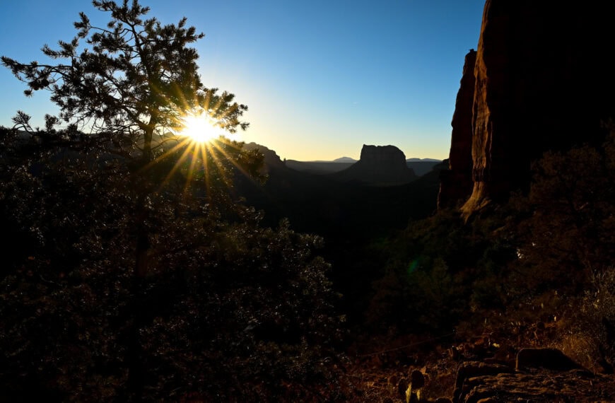
The Destination: Sedona
Sedona anchors the southern end of this route and makes an exceptional base for exploring northern Arizona. Known for its striking red rock formations, deep canyons, and expansive trail network, Sedona blends small-town comfort with easy access to world-class outdoor scenery. Whether you’re spending several nights here or using it as your launch point for the drive toward Page, the town offers a rare combination of convenience, beauty, and variety—great food, countless trailheads, scenic lookouts, and relaxing places to unwind at day’s end.


With more than 200 miles of trails, you’ll find everything from gentle walks to demanding climbs right at your doorstep. Classic routes like Cathedral Rock, Fay Canyon, and the Soldier Pass Trail provide stunning views without requiring a full day, while the Red Rock Scenic Byway and Chapel of the Holy Cross are perfect for lower-effort sightseeing. Sedona works just as well for travellers who want a relaxed half-day of exploration as it does for hikers looking to stack multiple trails across several days.
Sitting at roughly 4,350 feet (1,325 m), Sedona is noticeably cooler than lower-elevation desert destinations like Phoenix, especially in spring and fall.
For more information on exploring the area, see our Best Things to See and Do in Sedona Guide, where we highlight the best viewpoints, scenic drives, and short trails.
Explore More Arizona
Continue exploring Arizona with these detailed travel guides:
Best Things to See and Do in Page
Monument Valley Travel Guide
Sunset Crater Volcano National Monument
Marble Canyon Guide
Photography Gear
If you like our photography, you might be interested in some of the gear we use to shoot our travel and hiking destinations.
Camera Body – Nikon Z 6ii Fx-series Mirrorless Body
Main Lens – NIKON 24-120mm F/4G ED VR AF-S
Zoom Lens – Sigma 745-306 150-600mm f/5-6.3
Polarizing filters – Urth Circular Polarizing (CPL)
Camera Tripod – K&F Concept 64-inch Camera Tripod
Mini-tripod – Lammcou Flexible Camera Tripod
Camera/hiking backpack – Vanguard Alta Rise 48 Backpack
Universal Travel Adapter – VYLEE Universal International Power Travel Plug
Other Travel Essentials
Travel Insurance
SafetyWing is a travel insurance company that offers comprehensive coverage for travellers. Includes Medical Insurance and Travel Insurance. Primarily geared towards long-term travellers, digital nomads, and expats.
e-Sim cards
Airalo is the world’s first and largest eSIM store with eSIM plans for 200+ countries and regions worldwide. With Airalo eSIMs, travellers can get connected the moment they land at their destination and avoid nasty data roaming charges
eSIMS are a sustainable alternative to single-use SIM cards – they are 100% digital, require less energy to produce and be re-used rather than disposed of.
Car Rentals
Discover Cars is our go-to website for car rentals. We almost always find our preferred rate there.
Transfer from Airport
Welcome Pickups is our favourite private transfer service, which you can pre-book at a fixed price. Currently available in 220 cities all over the world (mostly in Europe, but with several major cities in Asia, the Middle East and the US).
Kiwitaxi is another private transfer service – we haven’t tried it yet, but it’s currently available in a few more countries (102 as of 2024).
Hotels and Accommodations (coming soon)
Photography Prints
If you found this blog useful, you can help support our blog by purchasing low-cost digital prints. Printed physical prints are also available for purchase.


—–
Well, that wraps it up! We hope you enjoyed our Best Stops Between Las Vegas and Sedona Travel Guide and that it will prove useful for planning your trip.
—–
You might also be interested in these related pages: