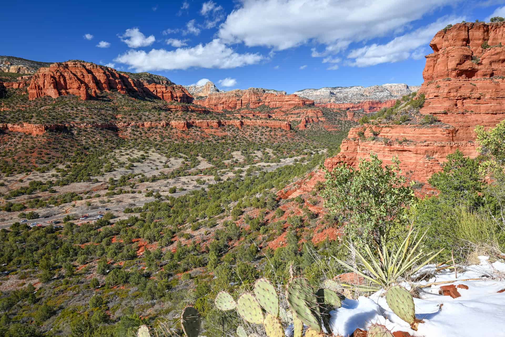
Rising just west of Sedona in northern Arizona, the Doe Mountain Trail is a local favorite that packs big views into a short, steady climb. The route ascends the side of a sandstone mesa to a broad, flat summit overlooking Boynton Canyon, Fay Canyon, and the distant Mogollon Rim. At only about 1.5 miles round-trip, it’s accessible yet scenic, the kind of trail that rewards you quickly with classic red-rock panoramas. Whether you come for a crisp morning walk or a golden-hour sunset, Doe Mountain offers one of the best high-perch viewpoints in Sedona’s red-rock country. To help you plan your visit, we’ve put together this Doe Mountain Trail hiking guide, covering everything from trail difficulty and estimated hiking time to what to expect along the route and the scenic viewpoints that make it such a fun and accessible adventure.
Doe Mountain Trail – At a Glance
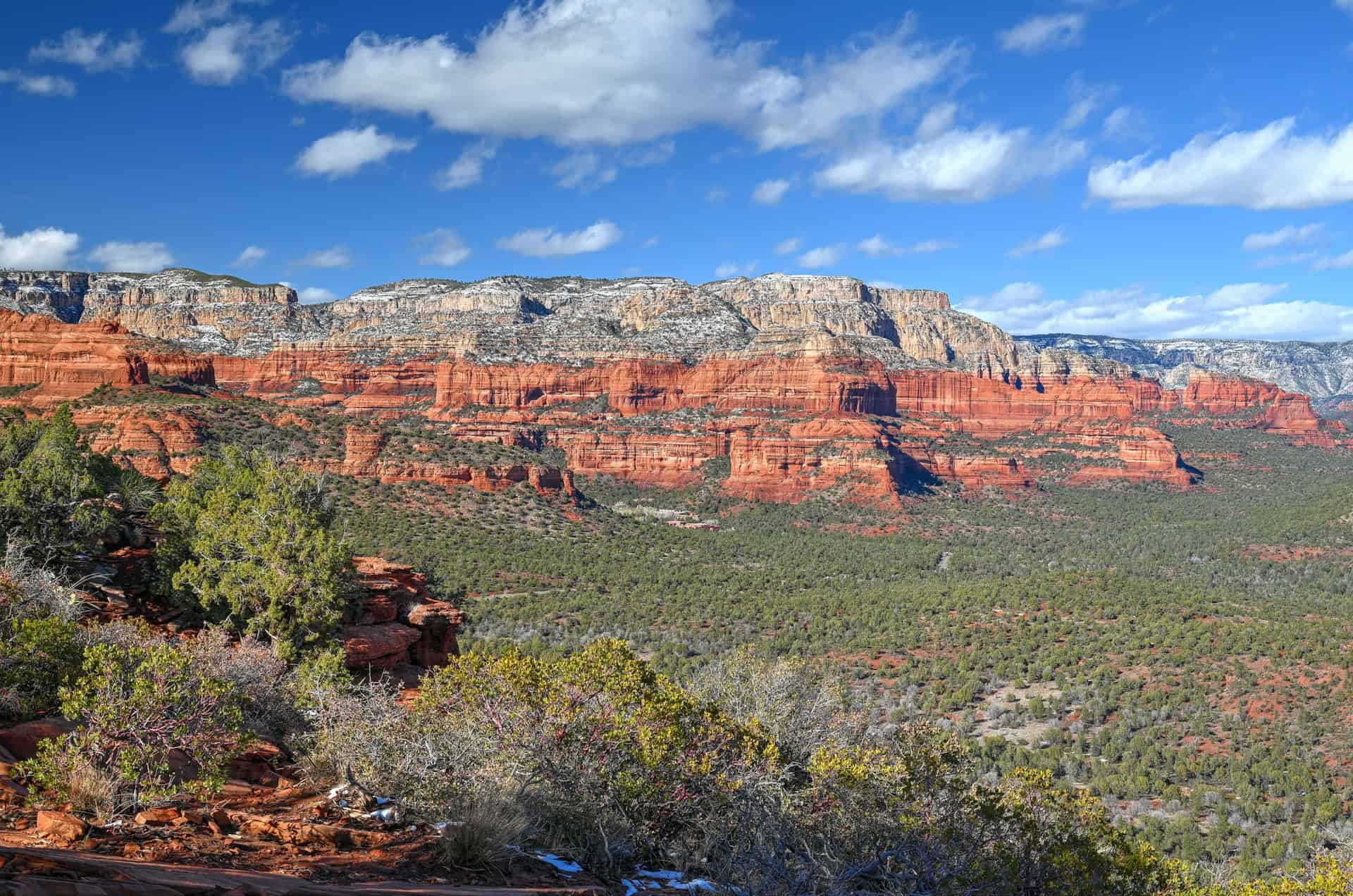
A classic Sedona mesa hike – Just a short drive from West Sedona, the Doe Mountain Trail climbs steadily to the top of a broad sandstone mesa overlooking some of Arizona’s most dramatic red-rock scenery. It’s a compact but incredibly rewarding hike that captures the essence of Sedona’s high desert landscape.
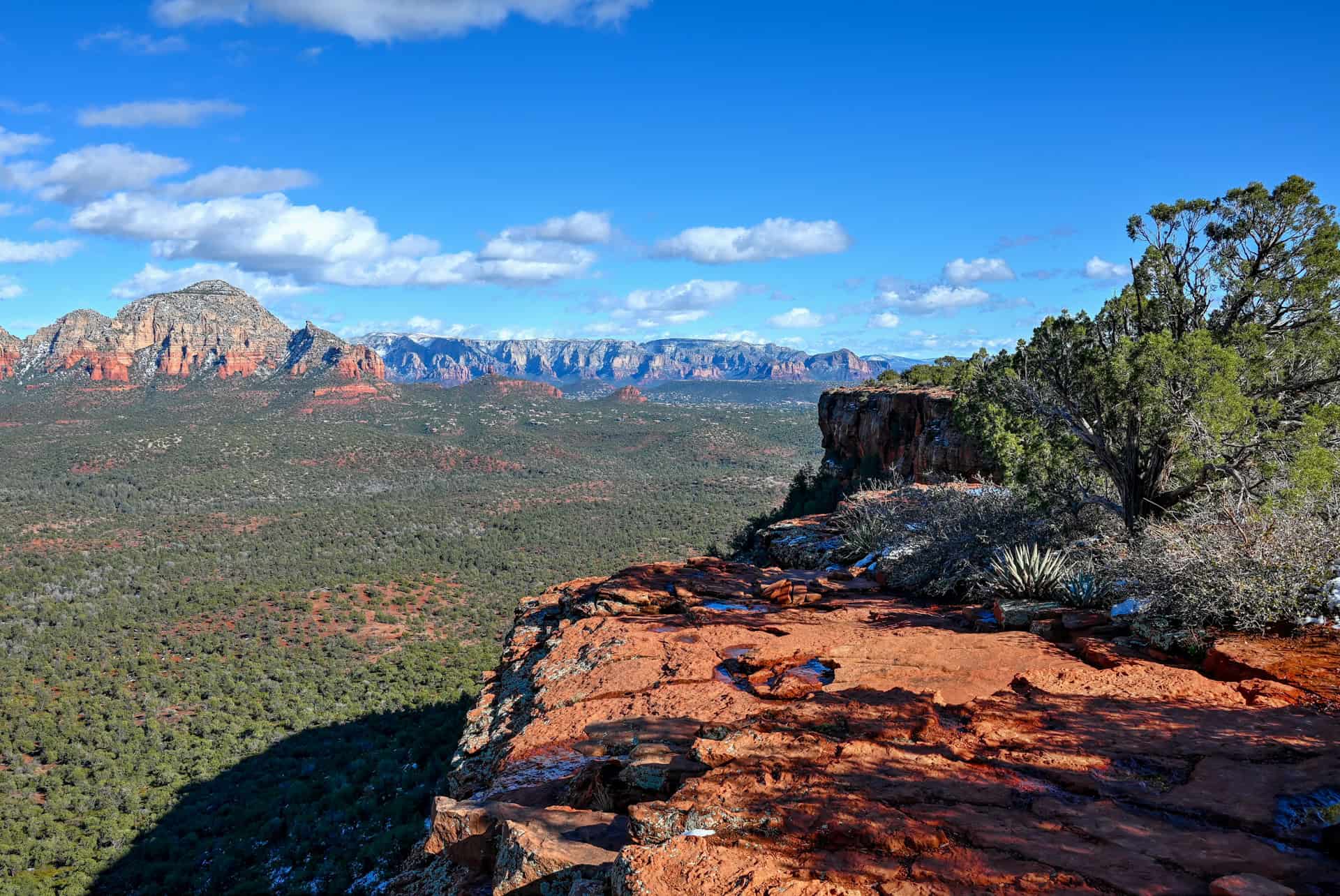
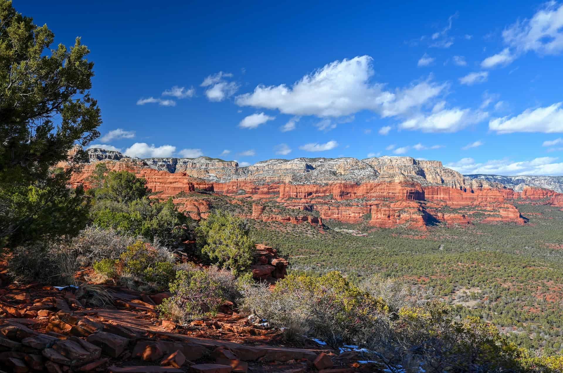
Sweeping panoramic views – From the summit, you’ll enjoy 360-degree vistas of Boynton Canyon, Fay Canyon, Capitol Butte, and the distant Mogollon Rim. The flat-topped mesa invites exploration: you can wander along the rim to find different viewpoints and watch the shifting light paint the cliffs in shades of orange and gold.
Short, moderate, and scenic – At roughly 1.5 miles (2.4 km) round-trip with about 500 feet (150 m) of elevation gain, the trail is easy to moderate but manageable for most hikers. The climb is steady but never extreme, and the payoff at the top comes surprisingly quickly — perfect for a sunrise, sunset, or quick afternoon adventure.
A must-do Sedona classic – Whether you’re tackling a few of Sedona’s shorter hikes or stringing together a full day of red-rock exploration, Doe Mountain is an easy addition to any itinerary. It delivers iconic views and a sense of solitude that’s increasingly rare in this popular Arizona destination.


Disclosure: This page (Doe Mountain Trail – A Sedona Hiking Guide) may contain product affiliate links. At no additional cost to you, we may receive a commission for purchases made through these links. More details can be found on our disclosure and policies page.
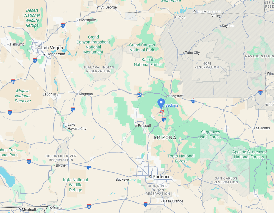
Doe Mountain Trail & Sedona: Location and Map
The Doe Mountain Trail is located in west Sedona, Arizona, within the beautiful Red Rock Secret Mountain Wilderness area.
How to Get to the Doe Mountain Trail in Sedona
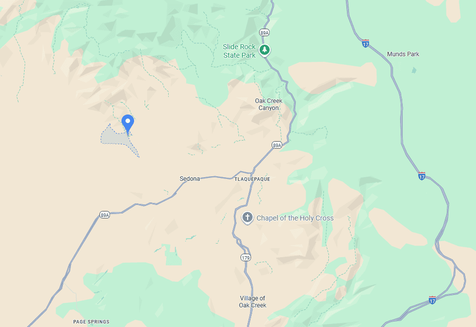
The Doe Mountain Trail is easily reached by car, located along Boynton Pass Road in West Sedona. There is no public transportation or shuttle service to this trailhead, so driving is the only practical option.
Driving times to Sedona, AZ
- Phoenix, AZ: 190 km / 120 mi – about 2 hours
- Flagstaff, AZ: 50 km / 30 mi – about 1 hour
- Grand Canyon (South Rim): 180 km / 110 mi – about 2.5 hours
- Prescott, AZ: 95 km / 60 mi – about 1.5 hours
- Page, AZ: 250 km / 160 mi – about 3 hours
- Las Vegas, NV: 475 km / 300 mi – about 5 hours
These times assume good weather and minimal stops.
If you need to book a rental vehicle for your hiking excursion, we highly recommend using Discover Cars to get the best rates on your rental in Utah, Nevada and Arizona.
We also highly recommend Airalo (eSIM card) for your connectivity needs when travelling abroad. Airalo is the world’s first and largest eSIM store with eSIM plans for 200+ countries and regions worldwide.
Doe Mountain Trail Access, Fees, and Parking
Trailhead location: The trailhead sits just off Boynton Pass Road, about 15 minutes from downtown Sedona and a short drive from popular spots like Boynton Canyon and Fay Canyon (link to Google Maps).
Parking lot: A small paved parking area, with space for about 25 cars, is located directly at the Doe Mountain Trailhead along Boynton Pass Road, shared with the Bear Mountain and Aerie Trail trailheads. Spaces are limited, so it’s best to arrive early in the morning or later in the afternoon, especially on weekends and holidays.
Facilities: Vault toilets are located at the trailhead.
Trail opening Hours: Open daily 24/7.
Doe Mountain Trail Entrance Fees
The trail lies within the Coconino National Forest, and a Red Rock Pass is required to park at the trailhead. Passes can be purchased at the parking kiosk, at visitor centers in Sedona, or online at recreation.gov (5$ for a daily pass, $15 for a weekly pass).
If purchasing online, your license plate will need to be entered; if purchasing a physical pass, it must be displayed while parked.
Holders of an America the Beautiful Pass can enter free of charge. You can purchase your pass ahead of time through the REI store.
Doe Mountain Trail Details and Map
Distance: 1.5 miles (2.3 km)
Route Type: Out & Back
Elevation change: 490 ft / 150 m (difference between trail high and low point)
Elevation gain: 490 ft / 150 m (cumulative elevation gain)
AllTrails rating (2025): 4.8, 2432 ratings
Duration: Most people complete the full trail in 1h-1h15
Not an AllTrails member yet? We highly recommend signing up for either their free or paid membership plans. The free plan allows you to find new trails and plan routes but it can only be used while hiking if you have access to mobile data. The paid membership plan (AllTrails+) allows you to download trail maps for offline use and provides live progress updates and off-route notifications.
If you are still uncertain – you should know that the All Trails mobile application was voted the 2023 iPhone App of the Year by Apple.
We find that AllTrails is a great tool to have when hiking, particularly for assisting with navigation when the trail is hard to locate and to help monitor your progress along the trail, which helps estimate how much time you’ll need to complete the trail.
Additional Trail Details
Canine companions: Dogs are allowed on the Doe Mountain Trail but must be kept on a leash at all times. The rocky terrain and exposed cliffs near the rim require extra caution for pets.
Summit: The trail climbs to the top of a flat-topped mesa rather than a pointed summit. The highest point on Doe Mountain is approximately 1,470 m / 4,820 ft, offering panoramic views in every direction once you reach the plateau.
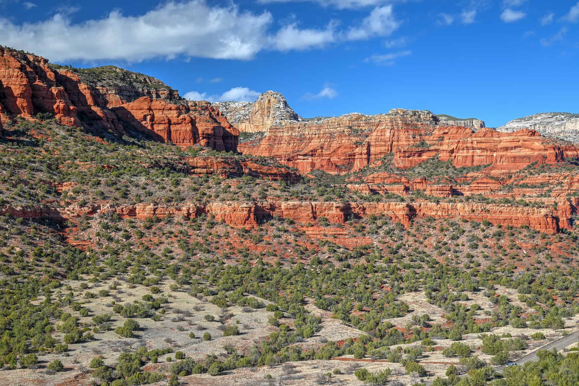
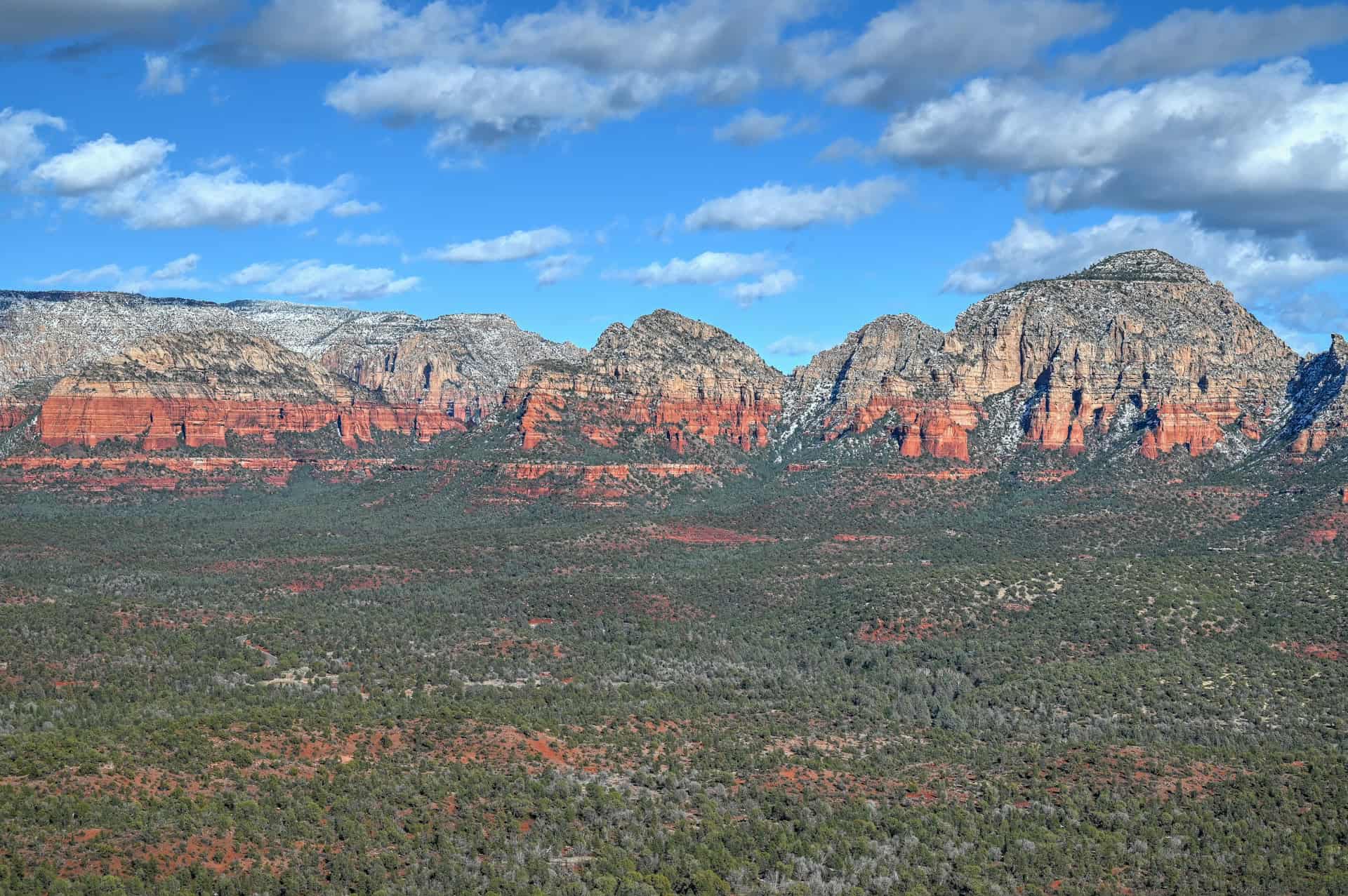
Trail environment – The trail begins in typical high-desert terrain, winding through juniper, prickly pear cactus, and manzanita before climbing the sandstone slope. Once on top, the environment shifts to open slickrock and patches of desert grasses with expansive 360° views of Sedona’s red rock formations, including Bear Mountain, Fay Canyon, and Capitol Butte. Shade is minimal, so plan for full sun exposure and bring plenty of water, especially in warmer months.
Route signage – The route is well-marked and easy to follow, with clear trail signs at the start and defined switchbacks leading to the mesa top. On the plateau, several faint social paths lead to different viewpoints along the rim, but navigation is simple and just retrace your steps back to the main trail for the descent.
Trail surface / Technical aspects – The trail is non-technical, consisting mostly of packed dirt, sandstone steps, and some loose rock on the switchbacks. A few short sections are rocky or uneven and might require some light scrambling. Once on the mesa, the terrain is mostly flat and easy to explore. We recommend sturdy footwear with good grip for the ascent and descent.
Average trail slope grade: 12%, which is considered a moderately steep incline, but a manageable climb over the trail’s short distance.
Trail difficulty level assessment (based on our personal assessment, taking into account the trail length, slope grade and trail surface) :
Very Easy | Easy | Moderate | Moderately Challenging | Challenging
Although the Doe Mountain Trail includes a moderate climb to the mesa top, its short length, clear route, and solid footing place it at the easier end of Sedona’s hiking spectrum — best described as an Easy-to-Moderate hike.
Regular or experienced hikers are likely to find it easy and rewarding, while less frequent hikers may find the short, steeper sections a bit more challenging.
Doe Mountain Trail Description and Summary
From the small parking area, the Doe Mountain Trail (Trail #60) quickly leaves the road behind, climbing toward the top of a flat-topped mesa that offers sweeping views of Sedona’s red rock country. Despite its easy access, the trail feels surprisingly quiet and wild once you begin the ascent.
Shortly after leaving the car park, the trail crosses two intersections with the Aerie Trail, a longer loop popular with both hikers and mountain bikers that circles the base of Doe Mountain and connects to nearby routes. The signage is clear, and it’s easy to stay on the main Doe Mountain route by following the signs.


From the very start, the red rock views set the tone. The trail winds gently through juniper and prickly pear before beginning a short but steady climb up the side of the mesa. The ascent follows a series of well-defined switchbacks carved into the sandstone slope.


While the climb can feel steep in sections, the footing is generally solid, with only a few rocky steps. As you gain elevation, the views open quickly toward Bear Mountain, Fay Canyon, and the greater Red Rock-Secret Mountain Wilderness.
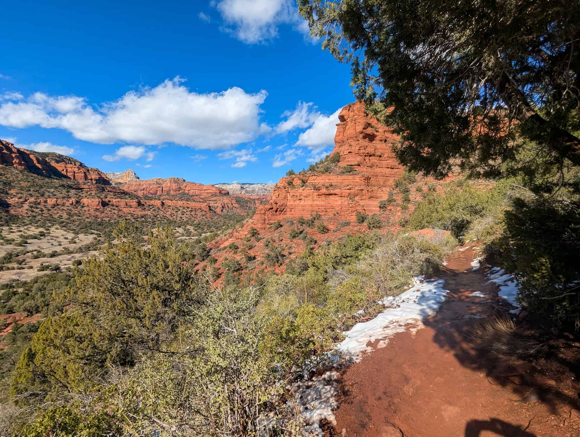


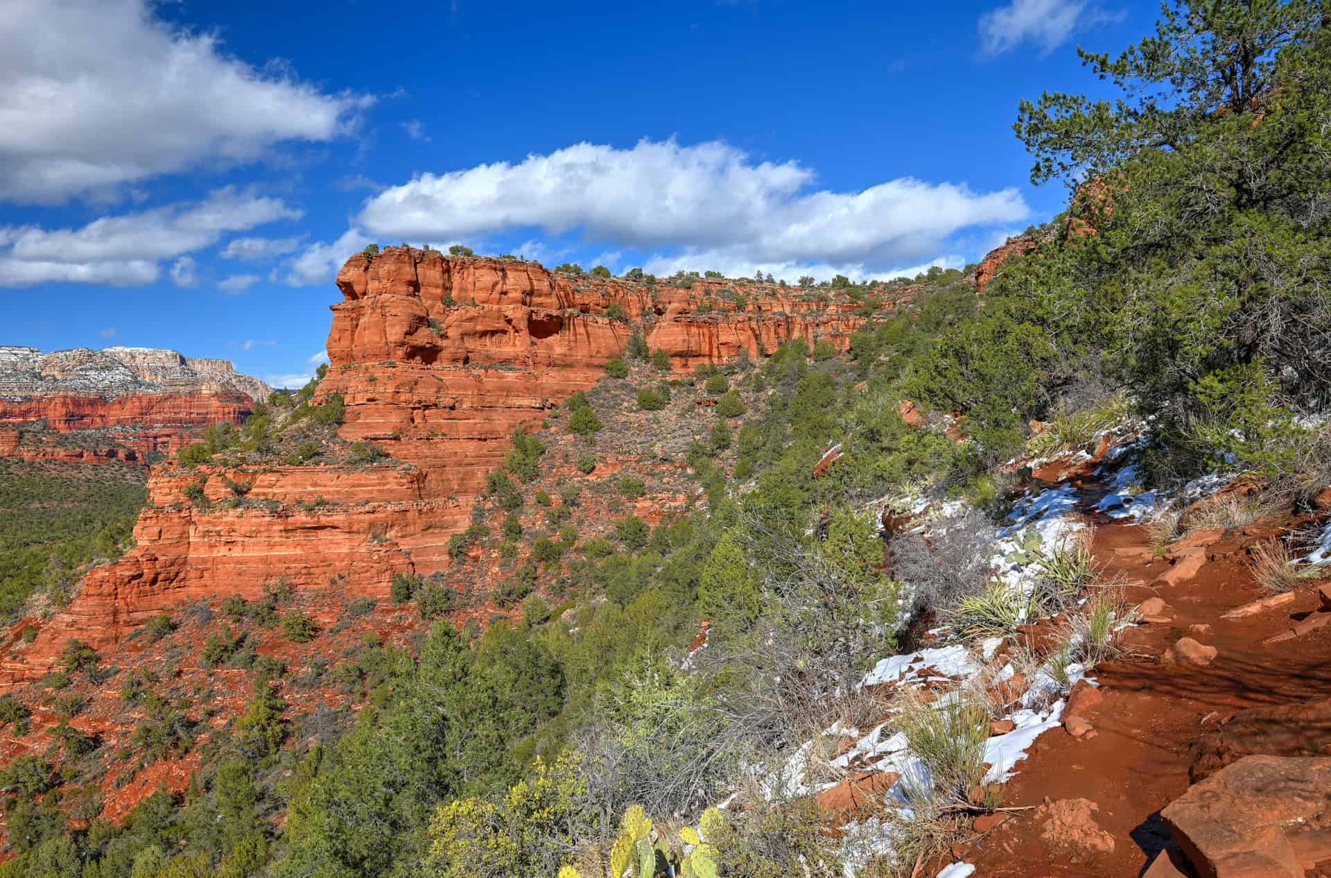
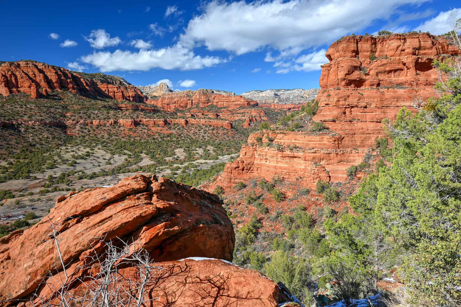
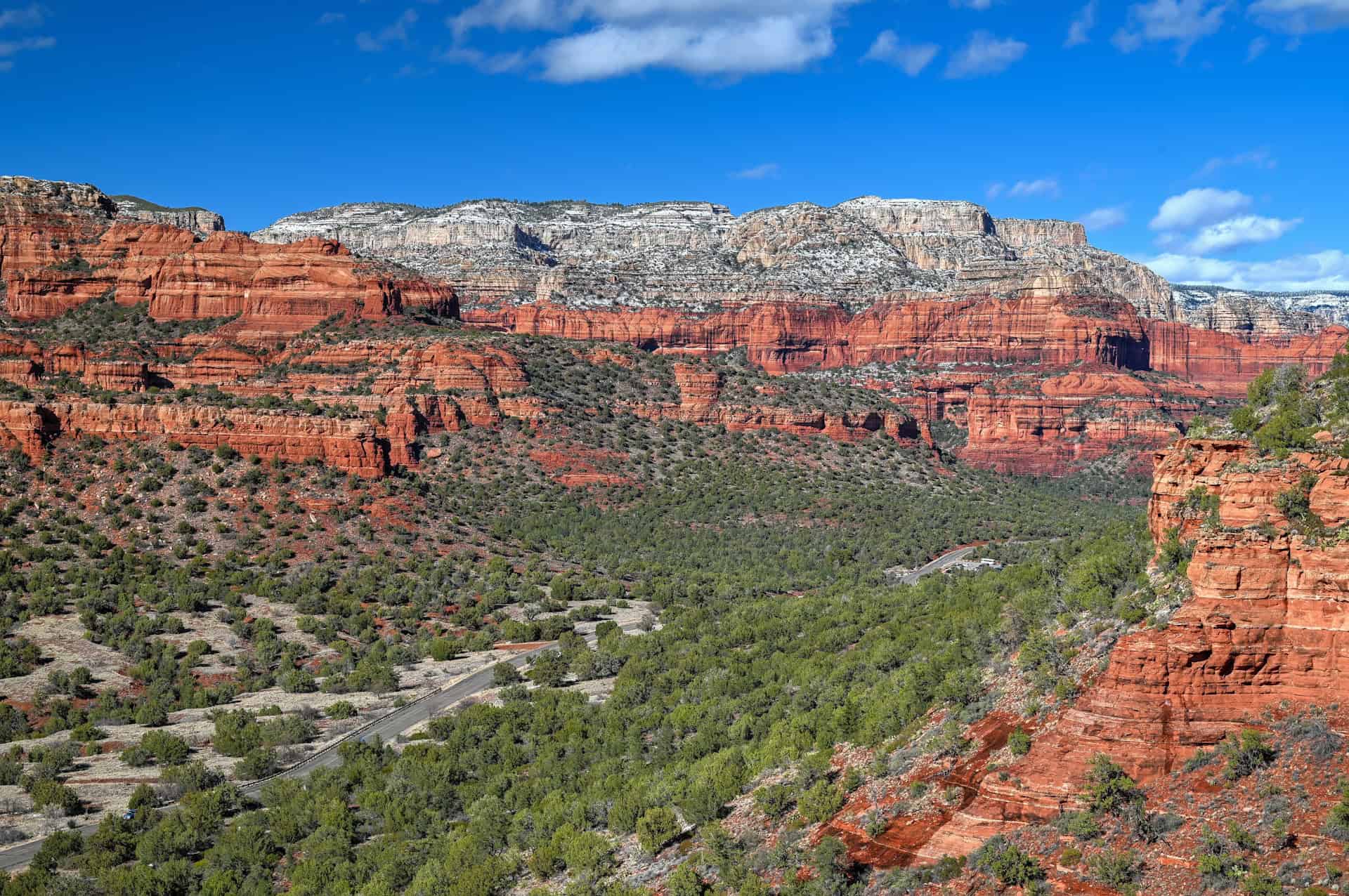
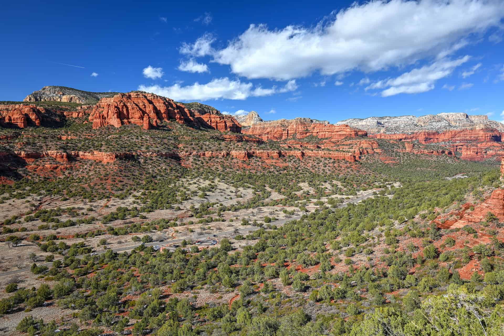
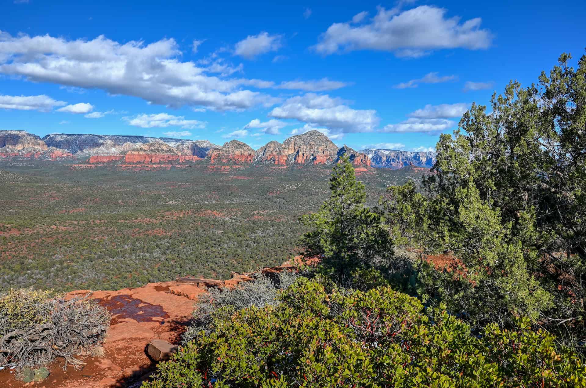
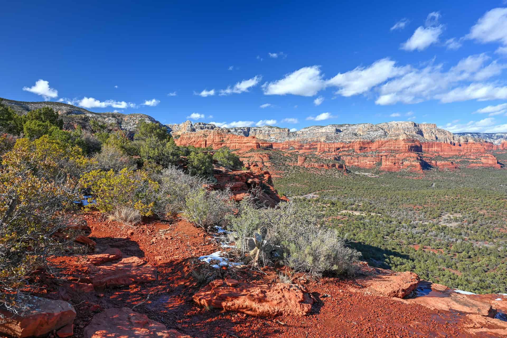
At the top, the trail emerges onto the broad, flat summit of Doe Mountain, which is more of a plateau than a peak. Here, the character of the hike changes entirely. The terrain levels out, allowing you to wander freely across the mesa’s rim. A network of faint social paths leads to several natural overlooks, each offering a slightly different perspective of Sedona’s sculpted red cliffs, mesas, and distant canyons.


The edges drop sharply in places, so use caution near the rim, especially if hiking with kids. Many visitors linger on top, taking time to enjoy a snack or capture photos as the light shifts across the landscape. Sunrise and late afternoon are especially beautiful, when the red rocks glow in soft, golden tones and long shadows define the contours of the terrain.
After soaking in the views, simply retrace your steps down the same route. The descent is much quicker and offers new vantage points of the scenery that was behind you on the way up.
All in all, Doe Mountain is one of Sedona’s best short summit hikes: a quick, rewarding climb that delivers panoramic views far beyond what you’d expect for its length and effort.
Doe Mountain Trail Variants and Add-Ons
Doe Mountain Loop Variant
Once you reach the top of Doe Mountain, most hikers follow the main path straight across the mesa to the central viewpoints before retracing their steps. However, an alternative is to create a scenic loop along the rim, circling the edge of the mesa instead of crossing it directly.
This unofficial loop uses a network of faint social trails that trace the rim’s perimeter. Following the rim gives you ever-changing perspectives of Sedona’s red rock formations, from Bear Mountain and Fay Canyon to Boynton Canyon and the Secret Mountain Wilderness. The full circuit around the plateau adds a bit of distance and exploration, but remains relatively flat and easy once you’re on top.
Navigation can be a bit confusing in some areas due to multiple interwoven footpaths, so it’s worth carrying an offline map or GPS app if you plan to complete the loop. Be cautious near the cliff edges, which drop sharply in several places.
Bear Mountain Trail (for a bigger challenge)
From the same parking area, you can also tackle the Bear Mountain Trail (Trail #54), one of Sedona’s most demanding but rewarding hikes. The trail climbs steeply up a rugged sandstone ridge across the road from Doe Mountain, gaining nearly 600 m / 2,000 ft in elevation over 2.5 miles (4 km) one way.
Unlike the gentle mesa top of Doe Mountain, Bear Mountain offers a strenuous, stair-step ascent with multiple false summits and sweeping views of Sedona’s red rock country, Mingus Mountain, and even the San Francisco Peaks near Flagstaff on a clear day.
Because both trailheads share the same parking lot, ambitious hikers sometimes combine Doe Mountain and Bear Mountain into one day, enjoying the easy panoramic walk atop Doe Mountain as a warm-up or cool-down to Bear’s steep climb.
Doe Mountain Trail Hiking Tips
Hiking Experience
The Doe Mountain Trail offers a short but rewarding climb with some moderate elevation gain to get your heart rate up without being overly strenuous. The ascent is steady, following well-defined switchbacks up the mesa’s sandstone slope before levelling out across the flat summit. While the climb is brief, the trail surface is rocky and uneven in places, so sturdy footwear with good grip is essential. Casual hikers and families with older children will find it very doable
Cell Service
Cell coverage around Doe Mountain is intermittent to weak, especially once you begin the climb. You may have some signal near the parking area, but expect spotty or no reception on top of the mesa. It’s best to download offline trail maps and let someone know your hiking plans if going solo.
Leave No Trace
Stay on the established trail, particularly near the top, where several informal social paths crisscross the mesa. Straying too close to the rim can cause erosion and damage fragile desert plants that cling to the thin soil. Avoid carving new paths, and pack out everything you bring in, including food scraps, which attract wildlife.
Bugs
Insects are generally minimal on Doe Mountain. You might encounter a few gnats or flies during warmer months, especially after rain, but mosquitoes and ticks are rare. Insect repellent is optional and typically not necessary except in late spring.
Equipment
No technical gear is required, but wear sturdy hiking shoes or boots with traction, as the trail includes rocky steps and loose gravel. Bring plenty of water, sun protection (hat, sunscreen, sunglasses), and consider trekking poles for stability on the descent.
Weather and Exposure
The trail is mostly exposed, with very limited shade — particularly on the ascent and the open mesa top. Sedona’s sun can be intense year-round, and temperatures rise quickly even in spring and fall.
- Monsoon season (July–September): Watch for lightning or fast-moving storms — the mesa top is an exposed area.
- Summer: Start early (before 8 a.m.) or go near sunset to avoid the heat.
- Winter: Expect crisp air and possibly icy spots on shaded rock surfaces.
Current Trail Conditions
Check the Coconino National Forest Alerts page for updates on trail conditions or temporary closures.
Wildlife
Doe Mountain is home to a variety of desert wildlife. You may spot lizards basking on rocks, ravens gliding along the cliffs, and occasionally mule deer grazing in the foothills. In warmer months, rattlesnakes and other desert reptiles are active, so keep an eye out near rocky ledges and underbrush. Wildlife tends to be most active around sunrise and sunset.
Best Time to Hike the Trail
Sedona’s high desert climate means the trail can be hiked year-round, but conditions vary dramatically by season:
Spring (March–May):
One of the best times to visit. Temperatures range from 60–80°F (15–27°C), wildflowers begin to bloom, and visibility is excellent. Afternoon winds are common in March and April.
Summer (June–August):
Hot and dry, with daytime highs often above 95°F (35°C). Early morning and late evening hikes are most comfortable. Always bring extra water and watch for monsoon storms in late July through early September.
Fall (September–October):
Another ideal season. Temperatures drop back into the 70s–80s°F (21–30°C), and the light creates rich red and golden hues on the cliffs. Crowds thin out slightly after October.
Winter (November–February):
Cool, quiet, and beautiful. Highs average 50–60°F (10–16°C), with cold mornings and occasional frost on the trail. Light snow on the red rocks can make for striking photos, just watch for slick sections on shaded rock.
Quick Summary – When to Visit
For the most comfortable conditions and best lighting, spring and fall are ideal.
Summer is manageable with an early or late start and proper sun protection.
Winter offers solitude and crisp air, but you’ll need to watch for icy spots on the descent.
Hiking Packing List
All Trails subscription – This comes in really handy for areas with little or no cell reception, as the annual subscription allows you to download trail maps for offline use.
External Battery – If you are using your phone to track your progress along the trail or to help with navigation, you certainly don’t want your phone to die on you. That’s especially true in the unlikely event that you might get hurt or need assistance.
Hiking poles – These can be particularly useful in steep trails or muddy/boggy trail conditions.
Water Filter Bottle – The Life Straw bottle is an advanced water bottle with a filter that not only improves water taste but more importantly filters out bacteria and parasites, chemicals and microplastics.
Headlamp – very practical and a smart choice if you plan to start your hike before sunrise or finish it after sunset.
About Sedona & Red Rock Country
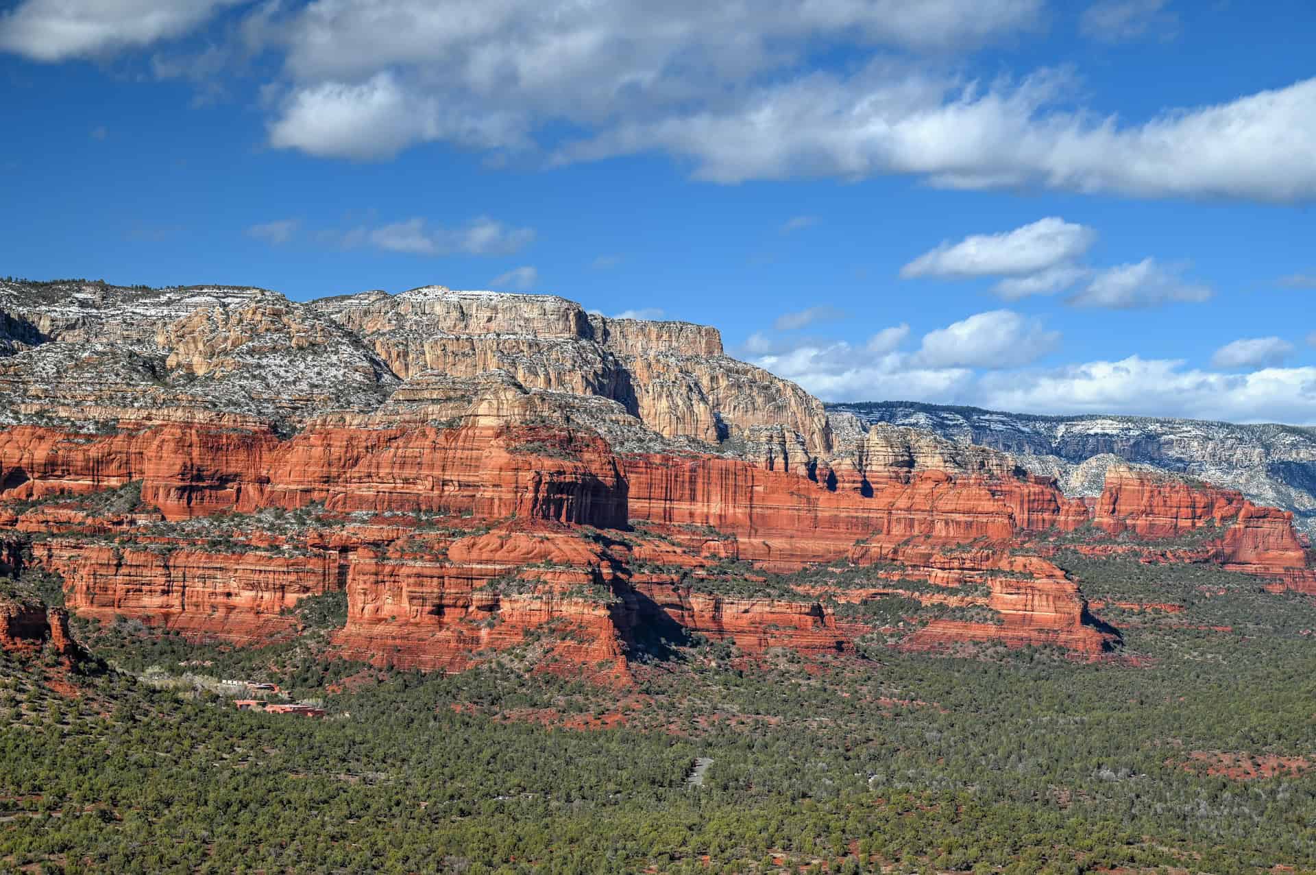
Where the Desert Meets the Pines: Nestled among Arizona’s iconic red rock formations, Sedona sits at the crossroads of desert and highland forest. Towering sandstone spires rise above juniper-covered plateaus, while oak-filled canyons hide cool streams and shaded trails. The contrast of vivid red cliffs against blue skies and green pines makes Sedona one of the most photogenic landscapes in the American Southwest.
A Landscape Shaped by Time: Sedona’s red rocks are part of the ancient Schnebly Hill Formation, layers of iron-rich sandstone sculpted by millions of years of erosion. The result is a wonderland of mesas, buttes, and cliffs that glow deep crimson at sunrise and sunset. This dramatic geology forms the heart of the Coconino National Forest and the Red Rock–Secret Mountain Wilderness, protecting hundreds of miles of hiking trails and viewpoints.
A Hub for Outdoor Adventure: From short, scenic walks to challenging summit climbs, Sedona offers hiking for every level. Iconic trails like Cathedral Rock, Devil’s Bridge, and Bell Rock draw visitors from around the world, while lesser-known routes such as Doe Mountain and Fay Canyon reveal quieter corners of the landscape. Beyond hiking, Sedona is a hub for mountain biking, jeep tours, and stargazing under some of Arizona’s clearest night skies.
A Spiritual and Cultural Destination: Long before it became a modern resort town, this region was home to the Yavapai and Apache peoples, whose history remains deeply tied to the land. Today, Sedona is also known for its vibrant arts community and its reputation as a place of renewal, with “energy vortexes” and meditation sites attracting visitors seeking connection and calm amid the red rocks.
Gateway to Northern Arizona: Located between Flagstaff and the Verde Valley, Sedona makes an ideal base for exploring the broader region, from the ancient cliff dwellings of Montezuma Castle to the scenic switchbacks of Oak Creek Canyon and the high desert plateaus beyond. Whether you’re here to hike, photograph, or simply take in the views, Sedona captures the essence of Arizona’s wild beauty.
Some of Our Other Nearby Favorite Trails
Fay Canyon Trail – Just a few minutes from the Doe Mountain Trailhead, Fay Canyon offers a gentle, shaded hike through a narrow red rock canyon framed by towering sandstone walls and desert vegetation. The main trail is easy and family-friendly, leading to a scenic alcove and a hidden natural arch near the end. For those seeking a bit more adventure, a short but steep scramble up the rocks at the canyon’s end reveals one of Sedona’s most rewarding secret viewpoints: a breathtaking panorama of the surrounding cliffs and red rock formations that few casual visitors take the time to see.


Teacup & Sugarloaf Loop – A local favorite that combines moderate climbing with panoramic views, this loop connects the Teacup and Sugarloaf trails right in the heart of Sedona. The short ascent up Sugarloaf Mountain rewards hikers with 360° views of Coffee Pot Rock, Thunder Mountain, and the greater Red Rock range.


Soldier Pass Trail – A must-do for those seeking a mix of natural landmarks, geological wonders, and classic Sedona red rock adventure. The trail begins in a scenic desert wash before climbing gradually into the rugged foothills of the Red Rock-Secret Mountain Wilderness. Along the way, you’ll encounter some of Sedona’s most iconic features: the dramatic collapse of Devil’s Kitchen Sinkhole, the reflective pools of Seven Sacred Pools, and towering cliffs of vibrant sandstone layered with desert vegetation.


For more hiking inspiration, check out our complete guide to Sedona’s Best Hiking Trails, featuring detailed descriptions, difficulty levels, and local tips for planning your adventures.
Where to Stay Near the Doe Mountain Trail
If you’re looking for comfortable, well-located lodging in Sedona without splurging on luxury, here are four of the best mid-range options. These hotels and resorts put you within easy reach of popular hiking trails, the Red Rock Scenic Byway, and Sedona’s shops and restaurants. Most include free WiFi, parking, and convenient amenities, making them solid bases for exploring the area.
GreenTree Inn Sedona
What sets it apart: affordable comfort with a quiet, convenient location near Uptown Sedona.
Clean, well-appointed rooms, complimentary breakfast, and friendly service make this a reliable choice for hikers and families alike. Its easy access to main roads ensures a quick drive to trailheads while still offering a peaceful stay.
Hilton Grand Vacations Club – Sedona Ridge
What sets it apart: Spacious suites ideal for families or longer stays.
Featuring full kitchens, separate living areas, and a resort-style outdoor pool, this property combines convenience with extra space. Guests can enjoy easy access to nearby trails and Sedona’s scenic viewpoints, making it perfect for those who want both comfort and flexibility.
Arabella Hotel Sedona
What sets it apart: Classic mid-range hotel with a touch of style and excellent amenities.
Offering outdoor pools, on-site dining, and clean, comfortable rooms, Arabella is an easy pick for travellers seeking a balance of affordability and quality. Its central location also makes it a convenient home base for exploring both Uptown Sedona and nearby Red Rock trails.
The Wilde Resort and Spa
What sets it apart: A modern, boutique-inspired option with a spa and scenic views.
The Wilde combines well-designed rooms with amenities like a hot tub, fitness center, and easy access to nearby hiking. Ideal for those who want a bit more flair without going full luxury.
Booking Tip: Sedona lodgings can fill up quickly, particularly in spring and fall when temperatures are ideal for hiking, as well as on weekends. Early reservations are strongly recommended to secure the best rates and rooms.
Doe Mountain Trail – Frequently Asked Questions
How long does it take to hike Doe Mountain?
Most hikers complete the out-and-back route in 1–1.5 hours, including time at the top. The mesa-top loop may add 30–45 minutes, depending on how much you explore the rim.
Is Doe Mountain suitable for kids or beginners?
Yes! The trail is short and mostly straightforward. Families and first-time hikers can enjoy it safely, and the steeper sections of the trail are relatively short-lived.
Are dogs allowed?
Yes, dogs are allowed on a leash. Bring water for your pet and be mindful of the exposed mesa top and rocky terrain.
When is the best time to hike Doe Mountain?
Spring and fall are ideal for moderate temperatures and excellent light. Early morning or late afternoon is best during summer to avoid the heat. Winter offers solitude and crisp views but requires layered clothing.
Do I need a permit?
Yes — a Red Rock Pass is required for parking at the trailhead. Daily and weekly passes can be purchased at the kiosk, visitor centers, or online. Holders of an America the Beautiful Pass are exempt.
Are drones allowed on Doe Mountain?
No — drone use is prohibited on Doe Mountain and throughout much of the Coconino National Forest Red Rock District. This is to protect wildlife, preserve the natural experience for all visitors, and comply with federal regulations in national forest and wilderness areas.
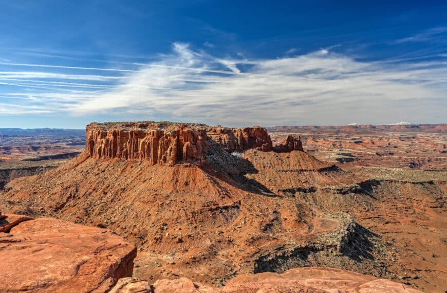
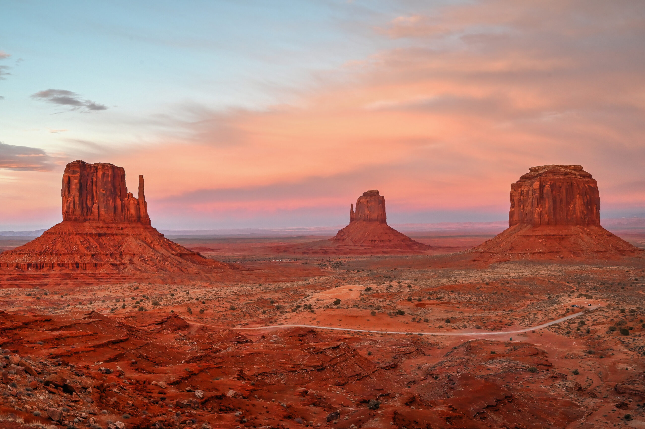
Explore More Arizona
Continue exploring Arizona with these detailed travel guides:
Best Things to See and Do in Page
Monument Valley Travel Guide
Sunset Crater Volcano National Monument
Photography Gear
If you like our photography, you might be interested in some of the gear we use to shoot our travel and hiking destinations.
Camera Body – Nikon Z 6ii Fx-series Mirrorless Body
Main Lens – NIKON 24-120mm F/4G ED VR AF-S
Zoom Lens – Sigma 745-306 150-600mm f/5-6.3
Polarizing filters – Urth Circular Polarizing (CPL)
Camera Tripod – K&F Concept 64-inch Camera Tripod
Mini-tripod – Lammcou Flexible Camera Tripod
Camera/hiking backpack – Vanguard Alta Rise 48 Backpack
Universal Travel Adapter – VYLEE Universal International Power Travel Plug
Other Travel Essentials
Travel Insurance
SafetyWing is a travel insurance company that offers comprehensive coverage for travellers. Includes Medical Insurance and Travel Insurance. Primarily geared towards long-term travellers, digital nomads, and expats.
e-Sim cards
Airalo is the world’s first and largest eSIM store with eSIM plans for 200+ countries and regions worldwide. With Airalo eSIMs, travellers can get connected the moment they land at their destination and avoid nasty data roaming charges
eSIMS are a sustainable alternative to single-use SIM cards – they are 100% digital, require less energy to produce and be re-used rather than disposed of.
Car Rentals
Discover Cars is our go-to website for car rentals. We almost always find our preferred rate there.
Transfer from Airport
Welcome Pickups is our favourite private transfer service, which you can pre-book at a fixed price. Currently available in 220 cities all over the world (mostly in Europe, but with several major cities in Asia, the Middle East and the US).
Kiwitaxi is another private transfer service – we haven’t tried it yet, but it’s currently available in a few more countries (102 as of 2024).
Hotels and Accommodations (coming soon)
Photography Prints
If you found this blog useful, you can help support our blog by purchasing low-cost digital prints. Printed physical prints are also available for purchase.


—–
Well, that wraps it up! We hope you enjoyed our Sedona Hiking Guide for the Doe Mountain Trail and that it will prove useful for planning your hiking trip.
—–
You might also be interested in these related pages: