Bryce Canyon National Park is uniquely suited to sightseeing by car. A single scenic drive runs along the rim, connecting a series of viewpoints that look directly into the park’s hoodoo-filled amphitheaters. With minimal walking required, it’s possible to experience much of Bryce’s most striking scenery in just a few hours.
This guide focuses on the best viewpoints along the Bryce Canyon Scenic Drive, explaining what makes each stop distinct, how they fit together, and which ones are worth prioritizing if time is limited. Whether you’re short on time, visiting in winter, or simply want to pair viewpoints with short walks, the scenic drive offers one of the most efficient ways to experience Bryce Canyon.
Best Viewpoints & Scenic Drive – At a Glance
Access to stunning scenery with minimal effort – The scenic drive connects Bryce Canyon’s main viewpoints, allowing you to see deep amphitheatres, dense hoodoo fields, and sweeping rim perspectives with little walking required.
Easy to customize route – You can stop briefly at a few viewpoints or take your time exploring many of them. Although the drive itself takes roughly an hour, for an ideal experience at a relaxed pace, plan for 2 to 4 hours, depending on how many viewpoints you want to stop at and whether you plan to undertake some of the short hiking/walking trails along the way.
Ideal for all seasons – The scenic drive works year-round, including winter when below-the-rim trails may be icy or closed. In Bryce Canyon, we find that snow often enhances the views rather than limiting them.
Great for first-time visitors – If you’re new to Bryce Canyon, the viewpoints along the drive provide the best overview of the park’s scale and geology.


Disclosure: This page (Best Viewpoints & Scenic Drive – Bryce Canyon National Park) may contain product affiliate links. At no additional cost to you, we may receive a commission for purchases made through these links. More details can be found on our disclosure and policies page.
Bryce Canyon National Park – Location, Map and How to Get There
Bryce Canyon National Park is located in southern Utah along the Paunsaugunt Plateau, with all major viewpoints and attractions accessed from a single park road that follows the rim of the main amphitheater. Unlike larger parks with multiple internal road systems, Bryce is compact and easy to navigate, making it especially well-suited to sightseeing by car.
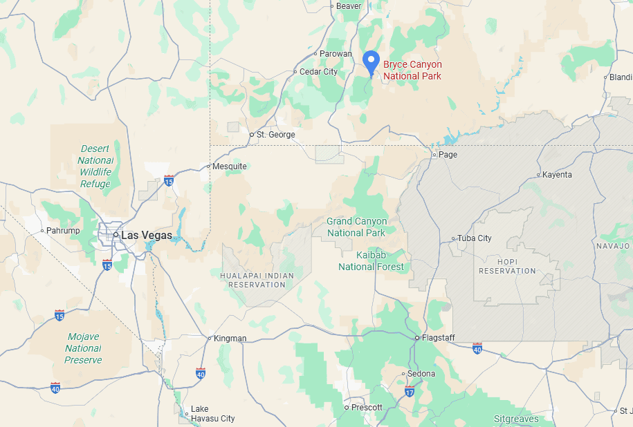
The park is best reached by car, as there is no long-distance public transportation that provides direct access. Once inside the park, the scenic drive connects all major viewpoints, trailheads, and overlooks, allowing visitors to move efficiently between stops without significant detours.
Approximate Driving Times to Bryce Canyon National Park
- Zion National Park: 135 km / 85 mi – about 2 hours
- St. George, UT: 240 km / 150 mi – about 3 hours
- Page, AZ: 240 km / 150 mi – about 3 hours
- Las Vegas, NV: 420 km / 260 mi – about 4.5 hours
- Salt Lake City, UT: 430 km / 270 mi – about 4.5 hours
These times assume clear weather and normal traffic conditions. Winter storms or summer congestion can add time, particularly on the final approach roads to Bryce.
If you need to book a rental vehicle for your hiking excursion, we highly recommend using Discover Cars to get the best rates on your rental in Utah, Nevada, and Arizona.
We also highly recommend Airalo (eSIM card) for your connectivity needs when travelling abroad. Airalo is the world’s first and largest eSIM store with eSIM plans for 200+ countries and regions worldwide.
Entrance Fees for Bryce Canyon National Park
Anyone visiting Bryce Canyon National Park, whether to hike, take a scenic drive, or simply enjoy the views, must pay the applicable entrance fee to the National Park Service.
Entrance Fees (per vehicle, valid 7 days)
Private vehicle: $35
Motorcycle: $30
Individual (on foot, bicycle, etc.): $20
Annual Pass Options
Bryce Canyon Annual Pass: $70 – unlimited entry for one year from the month of purchase.
America the Beautiful Pass: $80 – valid for one year at all U.S. National Parks and more than 2,000 federal recreation sites nationwide. This is the best value if you plan to visit multiple national parks within a year.
Passes can be purchased at the park entrance station, at the Visitor Center, or online through the USGS website or via the REI store.
—> Most visitors exploring Utah’s “Mighty 5” parks (Arches, Bryce Canyon, Canyonlands, Capitol Reef, and Zion) should strongly consider the America the Beautiful Pass: it saves money and avoids the hassle of buying separate entry fees at each park.
About Bryce Canyon National Park
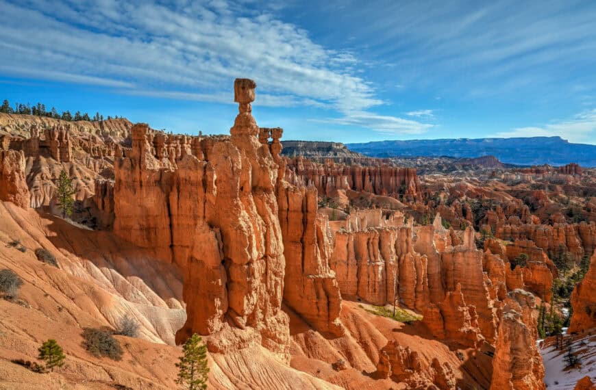
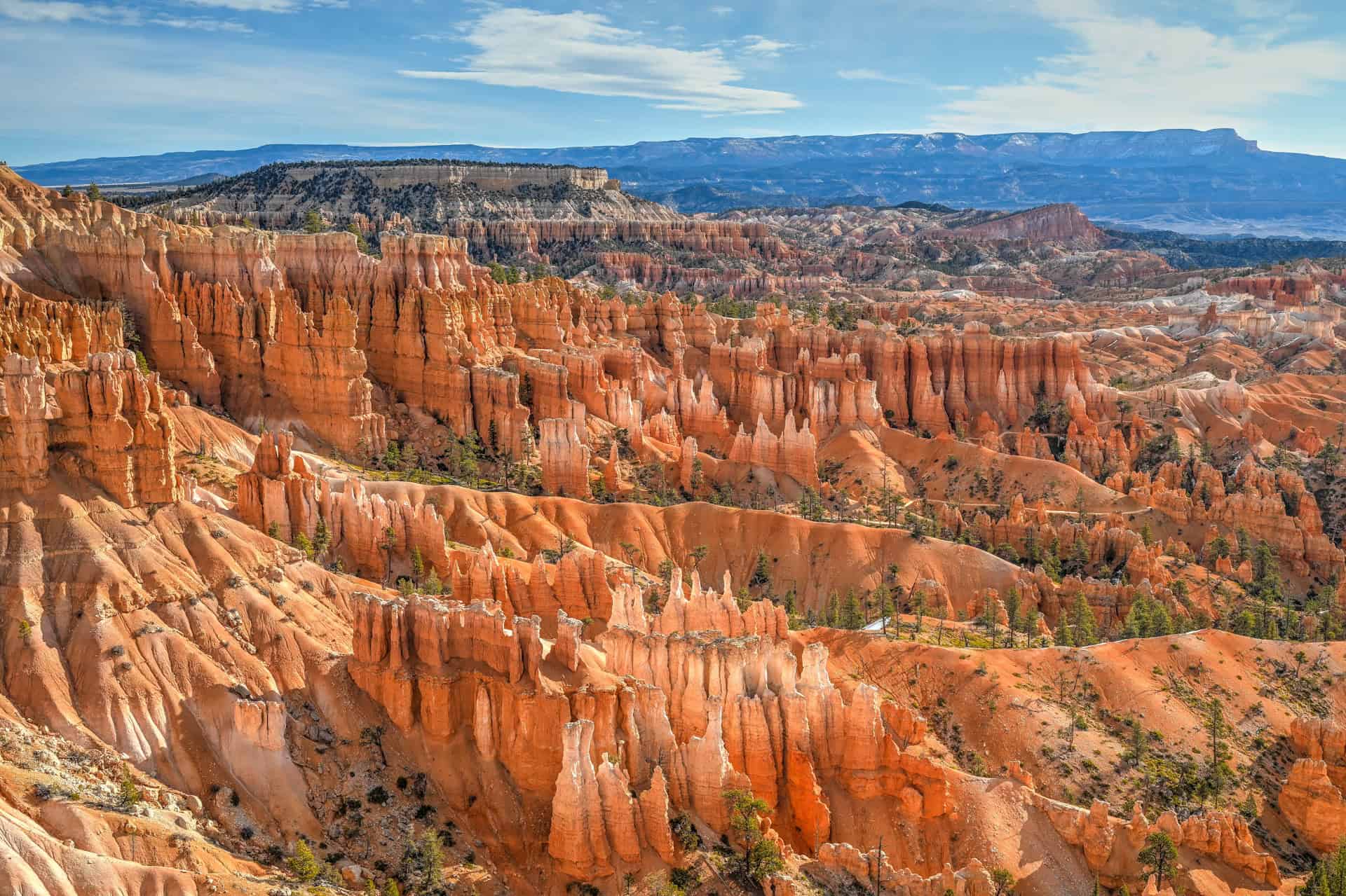
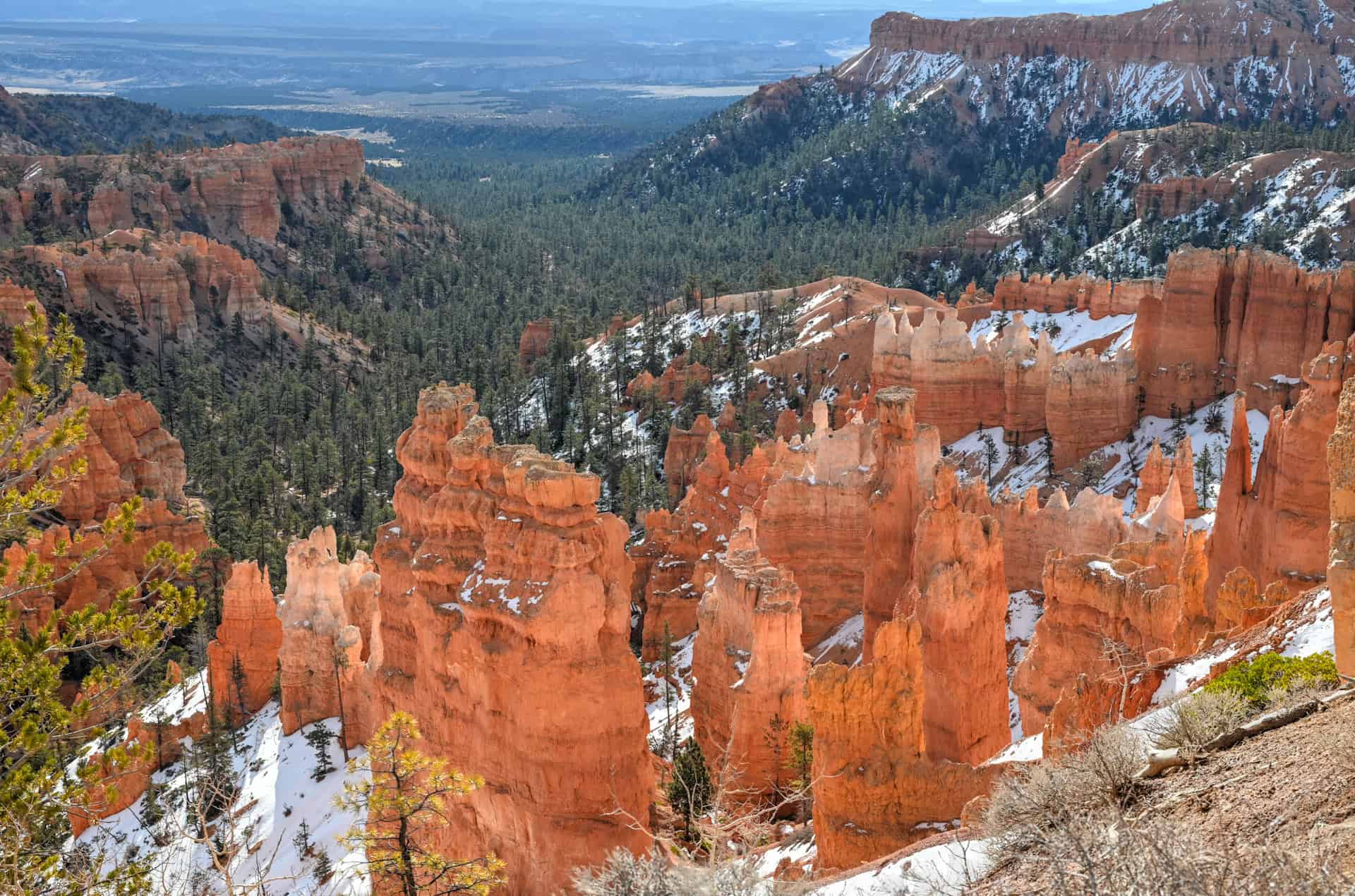
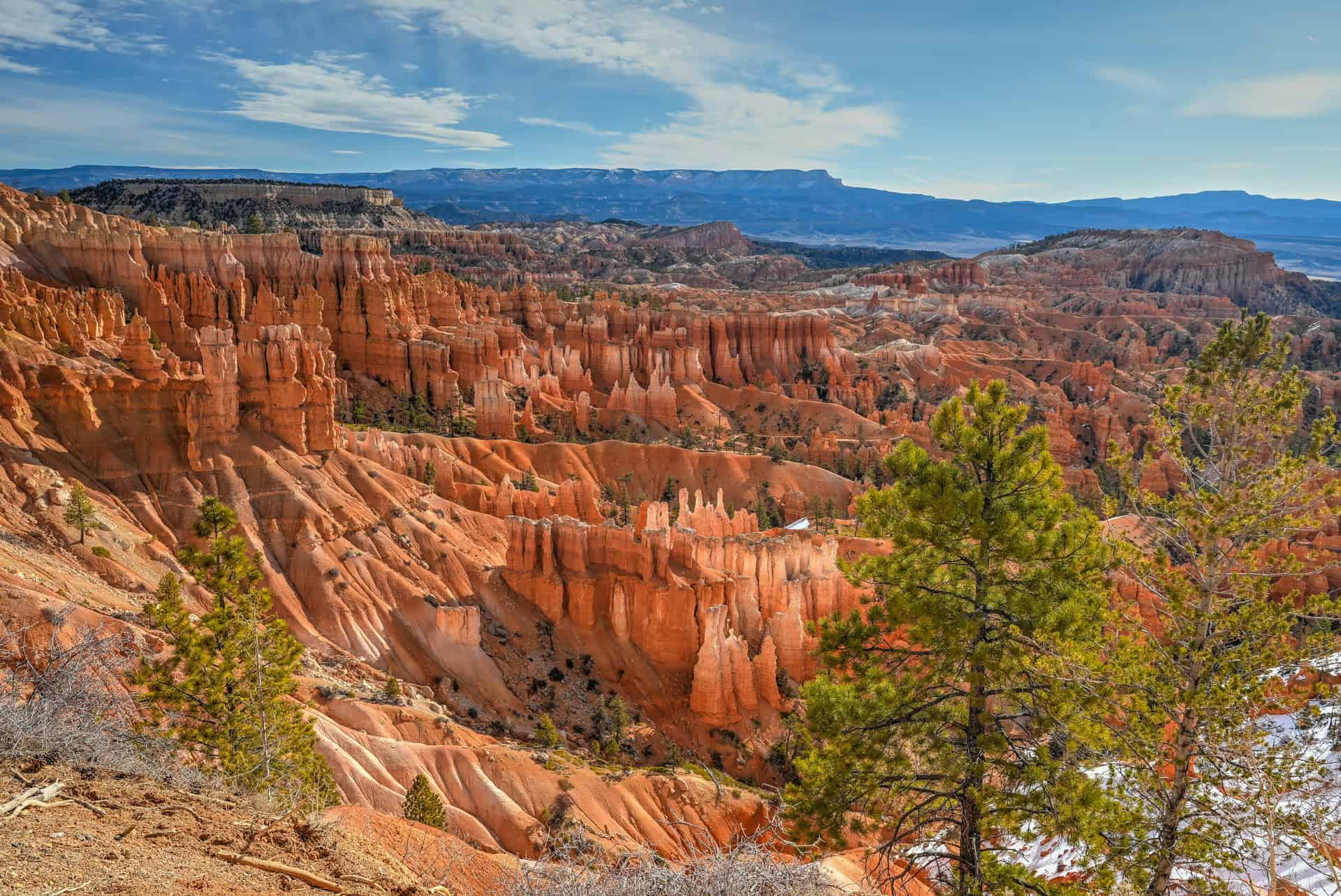
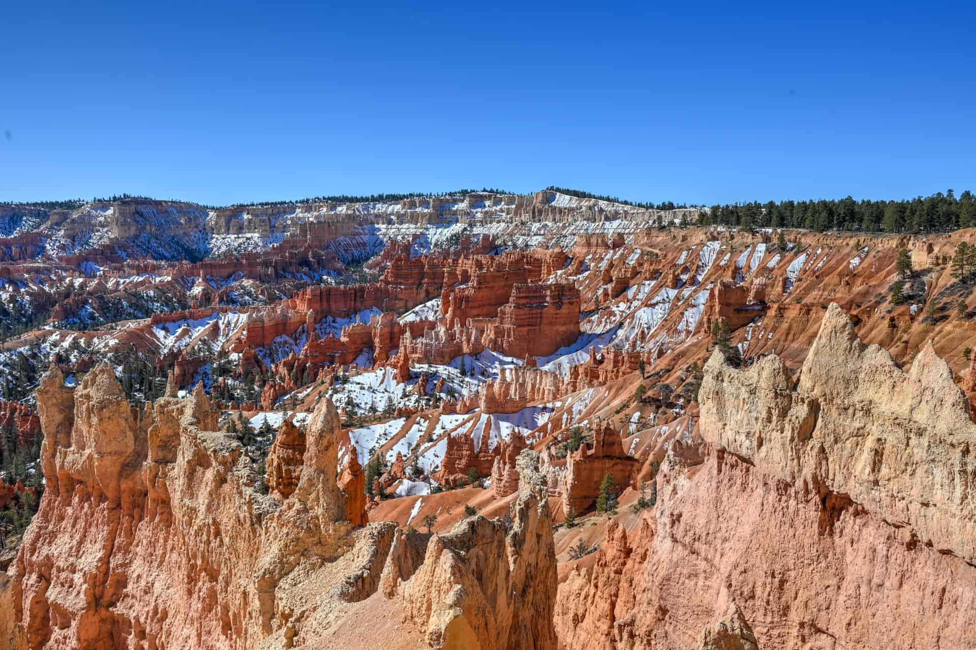
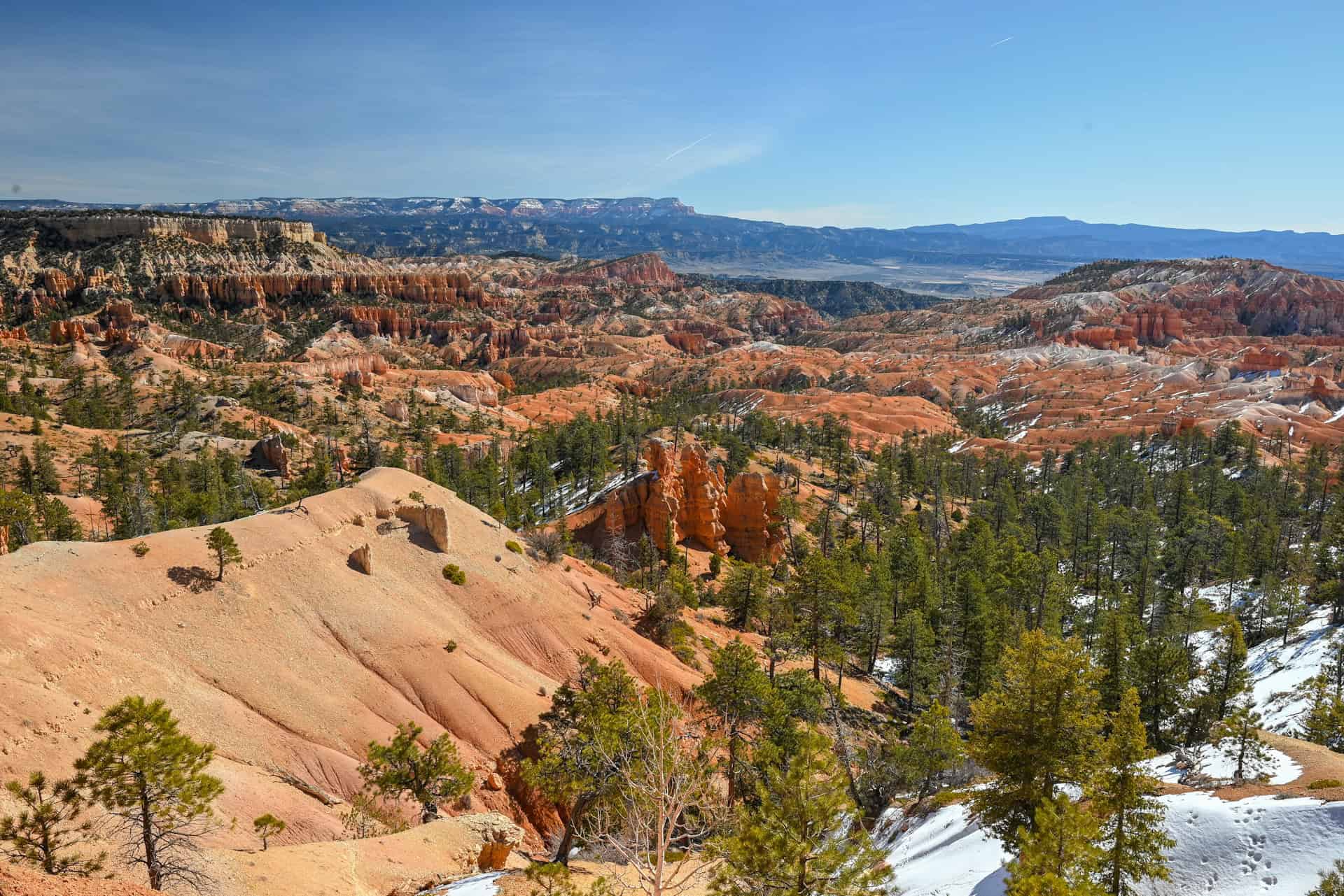
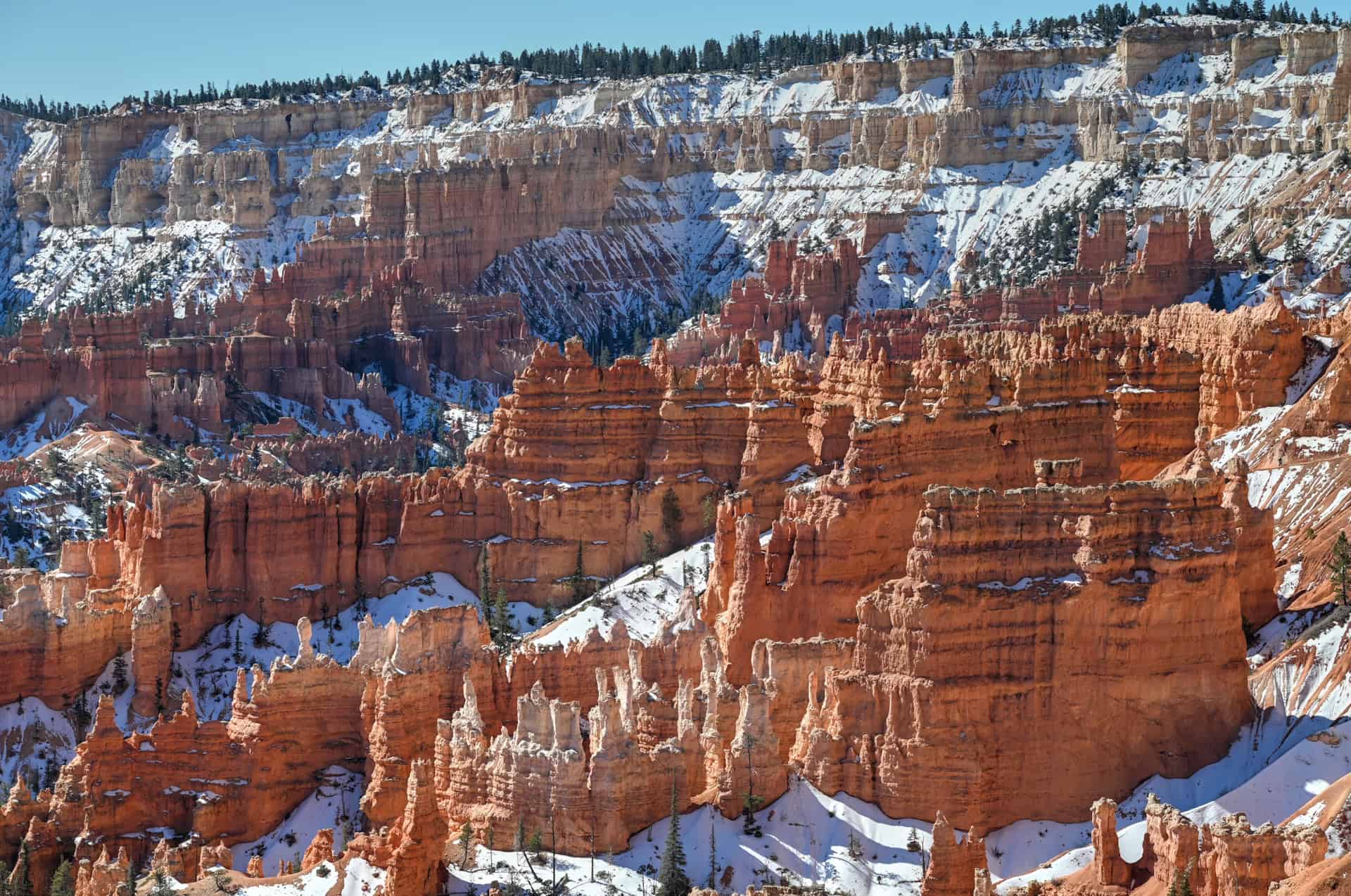
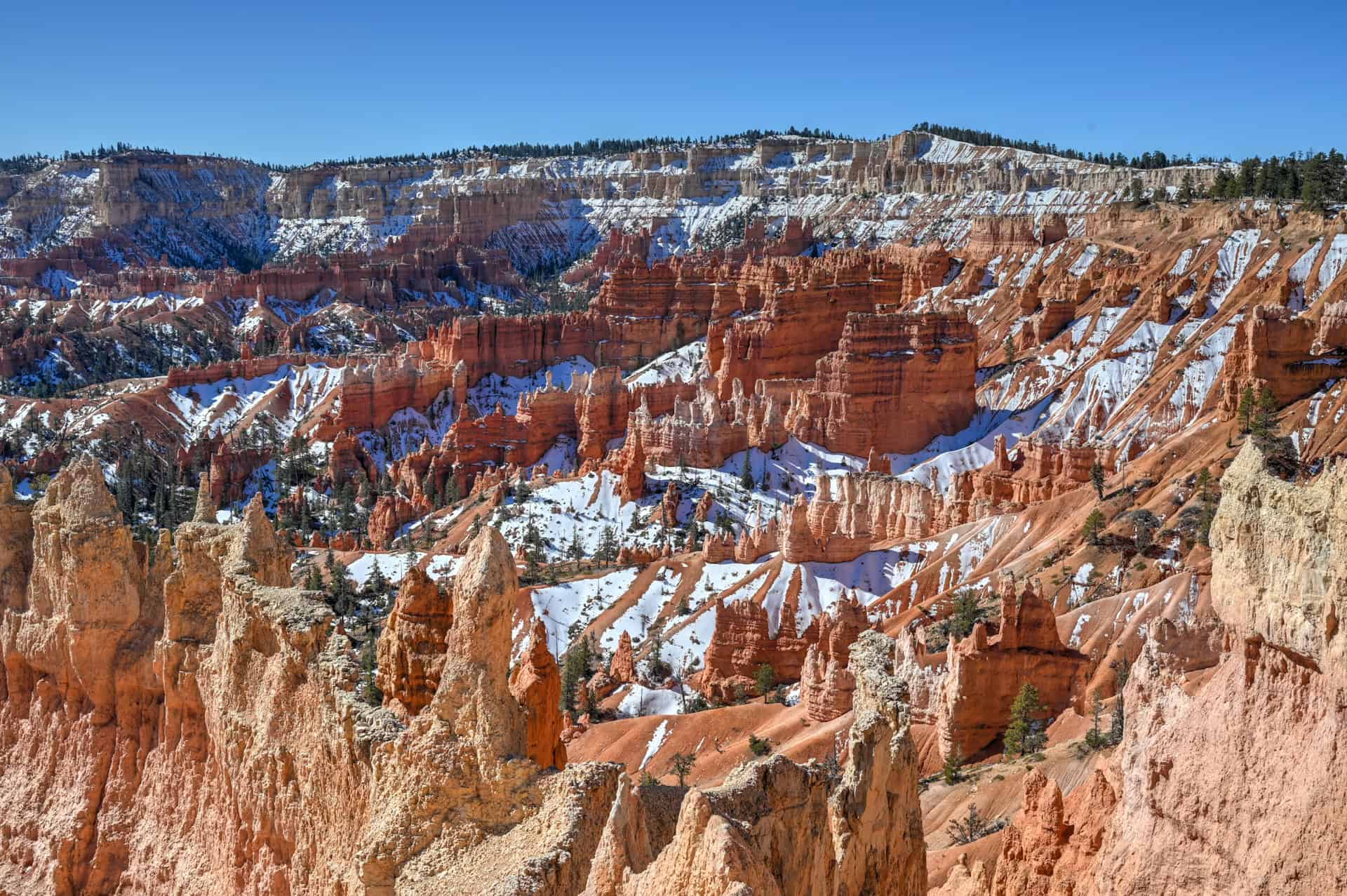
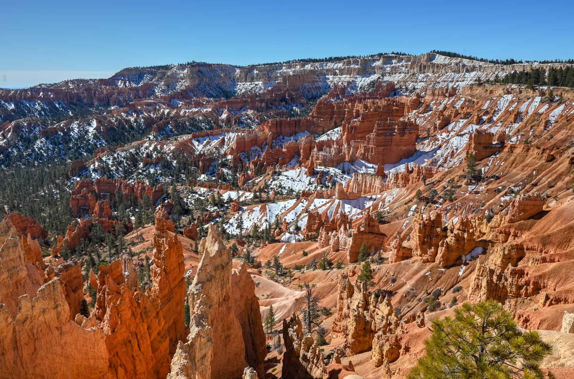
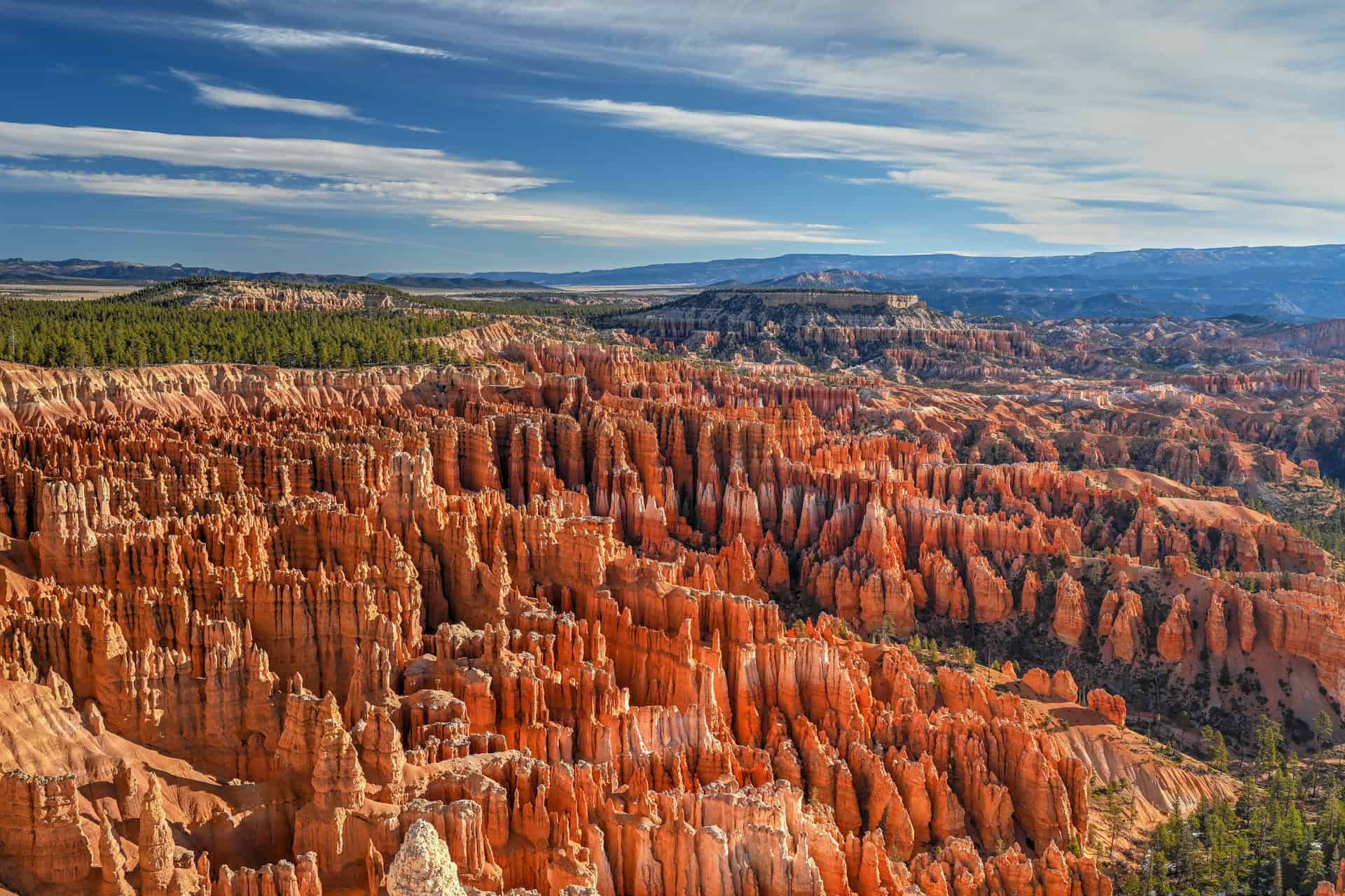
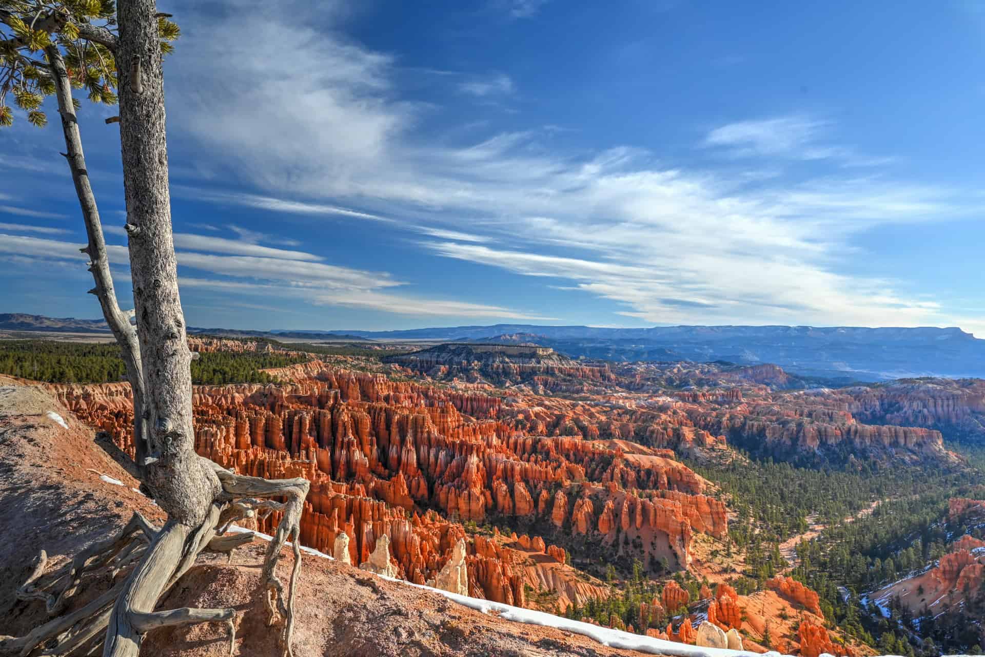
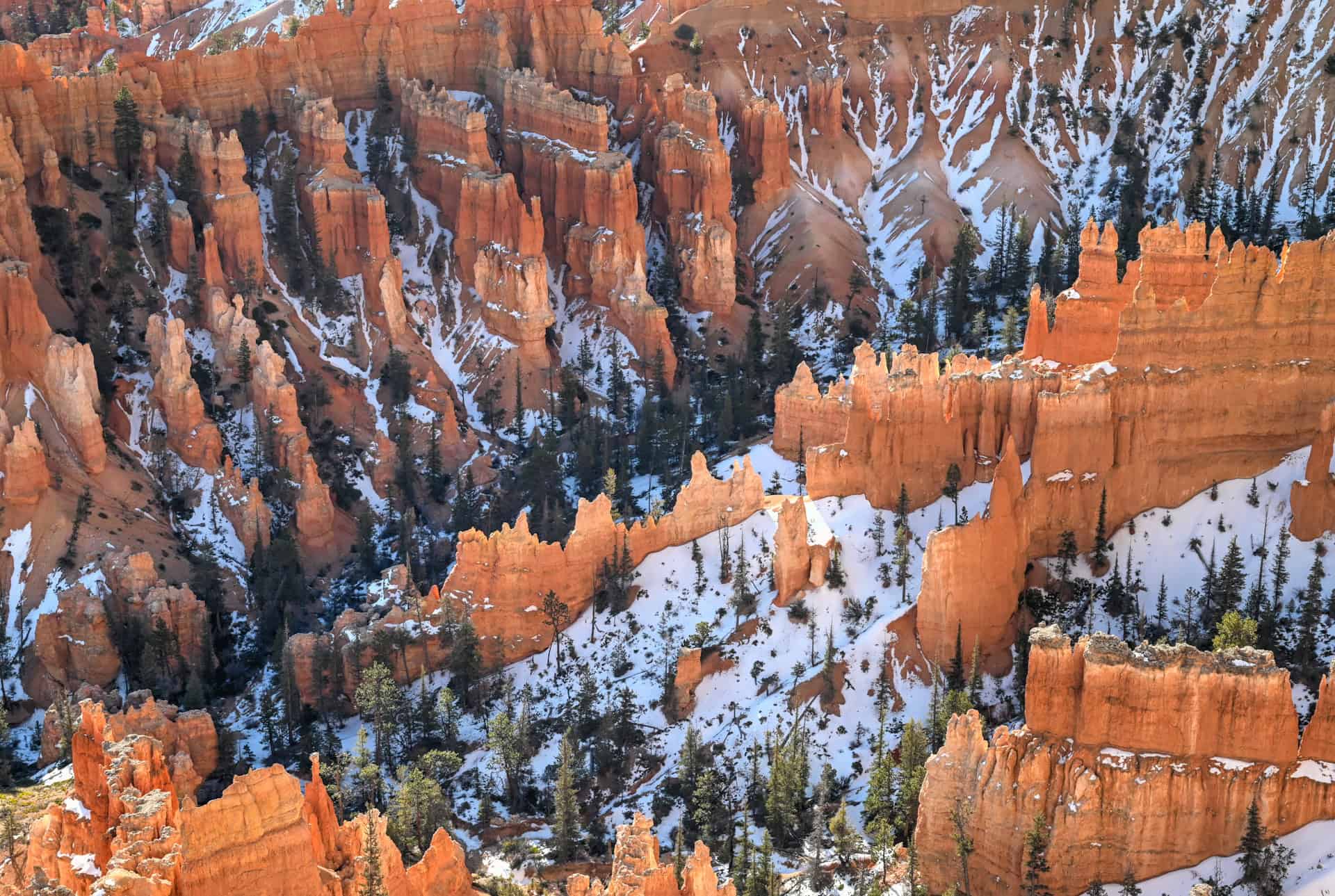
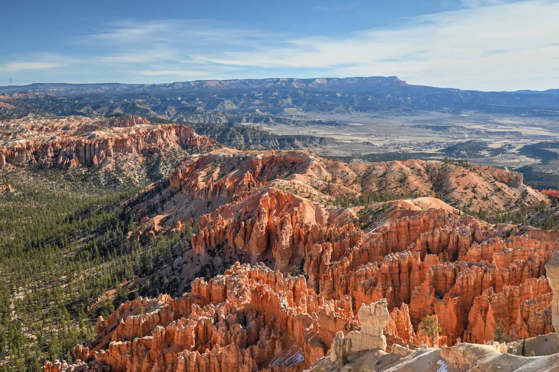
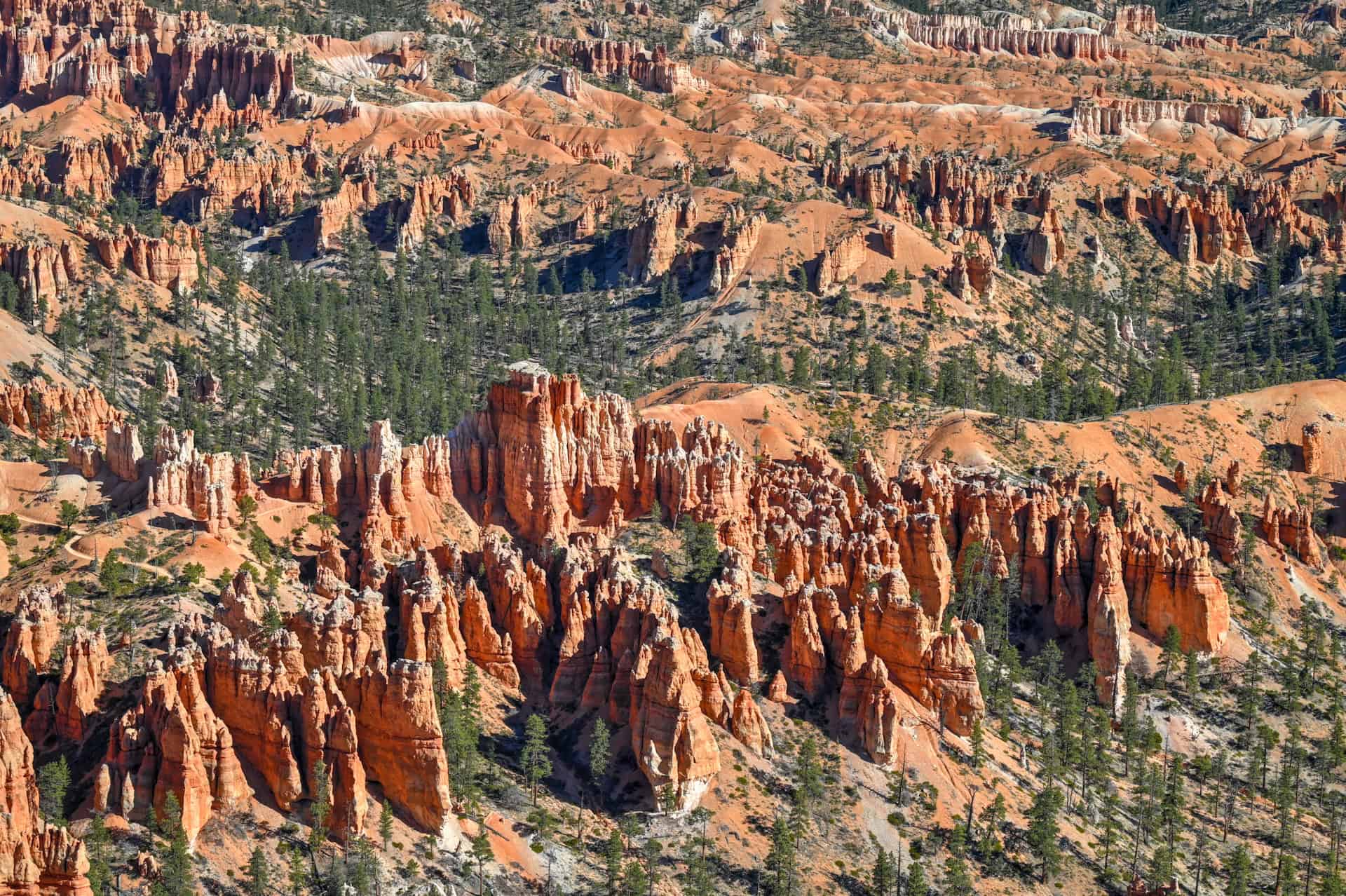
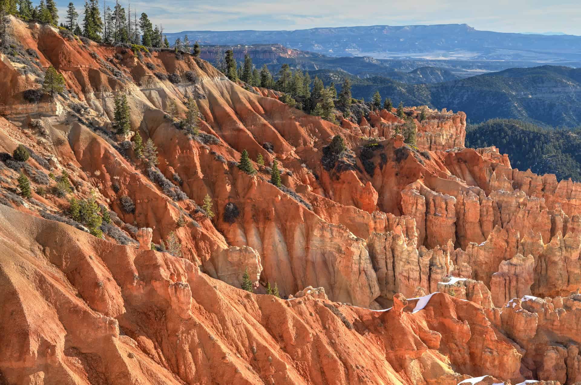
Utah’s Hoodoo Wonderland: Bryce Canyon National Park sits along the Paunsaugunt Plateau in southern Utah, where thousands of spire-shaped rock formations, known as hoodoos, rise from a series of natural amphitheaters. Rather than a single canyon, Bryce is defined by expansive bowl-shaped landscapes filled with tightly packed fins, pinnacles, and towers, creating one of the most surreal and instantly recognizable scenes in the American Southwest.
A Landscape Sculpted by Frost and Erosion: Unlike Zion’s river-carved canyons, Bryce’s formations are shaped primarily by freeze–thaw cycles and erosion. Rainwater seeps into cracks in the limestone and sandstone, freezes overnight, and expands, slowly prying the rock apart over thousands of years. This process has created Bryce’s delicate hoodoos, arches, and windows, with vivid red, orange, and pink hues that glow dramatically at sunrise and sunset.
Built for Viewpoints and Immersive Hikes: Bryce Canyon is uniquely suited to both casual sightseeing and more immersive hiking. A paved scenic drive connects a string of overlooks along the canyon rim, allowing visitors to experience breathtaking views with minimal effort. Below the rim, trails like the Navajo Loop, Queen’s Garden, and Tower Bridge descend directly into the hoodoos, offering a rare chance to walk among the formations rather than simply admire them from above.
Big Scenery in a Compact Park: Despite its relatively small size, Bryce Canyon delivers an outsized visual impact. Elevations range from about 8,000 to over 9,000 feet, providing cooler temperatures, expansive views, and some of the darkest night skies in the region. The park’s compact layout makes it easy to combine scenic overlooks, short hikes, and longer trail combinations in a single visit.
High Elevation, High Reward: Bryce’s accessibility via Highway 63 and its well-maintained infrastructure make it easy to visit, but the park’s elevation and popularity mean conditions can change quickly. Snow can linger into spring, summer thunderstorms are common, and trails can feel more strenuous due to thinner air. That said, Bryce remains one of the most rewarding parks to explore at a relaxed pace, with unforgettable views around nearly every corner.
Bryce Canyon Scenic Drive Overview
The Road
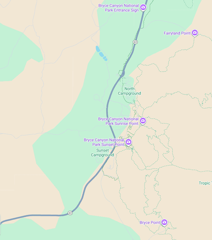
The Bryce Canyon Scenic Drive is a single out-and-back road that runs roughly north to south along the rim of the park. From the park entrance, it continues south all the way to Rainbow Point, the park’s southern terminus, and then returns the same way. There’s no loop, which keeps navigation simple and makes it easy to turn around at any point.
All major viewpoints are located on the eastern side of the road, overlooking the amphitheaters and hoodoo-filled basins below. Because of this layout, it’s generally recommended to drive straight to the southern end of the park first, then stop at viewpoints on the return drive, especially for overlooks beyond the main amphitheater, where parking is usually easier.
Time Required
The scenic drive is about 18 miles (29 km) one way and takes roughly 30–35 minutes to drive from the entrance to Rainbow Point without stops. In practice, most visitors should plan 2–4 hours to enjoy the drive properly, allowing time for viewpoints, short walks, and photo stops.
Viewpoint Locations
The most famous and frequently visited viewpoints are clustered near the main amphitheater, close to the entrance (northern section of the park). Farther south, viewpoints become more spread out, quieter, and broader in scale, offering a different perspective on the park’s landscape.
Because distances between stops are short and parking areas are clearly marked, the drive feels relaxed rather than rushed. Many viewpoints require only a short walk from the car, making it easy to tailor the experience to your schedule, weather conditions, and energy level.
How to Approach the Drive
Many of the most popular viewpoints near Bryce Canyon’s main amphitheater (northern section of the park—Sunset Point, Sunrise Point, and Inspiration Point) are close enough to be visited together on foot. These viewpoints are connected by short, mostly flat sections of the Rim Trail, making it easy to walk between them without moving your car.
If time allows, a good strategy is to park once near Sunset or Sunrise Point and explore this cluster on foot. Walking the Rim Trail between these viewpoints takes roughly 45 minutes to an hour, depending on pace and how often you stop for photos. Doing this early in the day helps avoid peak crowds and gives you a quieter introduction to Bryce’s core scenery (more details on this section further below).
After exploring the amphitheater viewpoints on foot, drive south toward Bryce’s southern terminus, Rainbow Point, then stop at the other overlooks on the return drive north. Viewpoints beyond the amphitheater are more spread out and typically less crowded, making them well-suited to short, individual stops as you head back.
We feel that this approach minimizes parking hassle, reduces backtracking, and lets you experience Bryce Canyon’s most concentrated scenery at a relaxed pace before moving on to the quieter southern viewpoints.
In the sections below, we walk through the main viewpoints along the scenic drive, explaining what each one offers and how to decide which stops are worth prioritizing for your visit.
Bryce Canyon’s Main Viewpoints Along the Scenic Drive
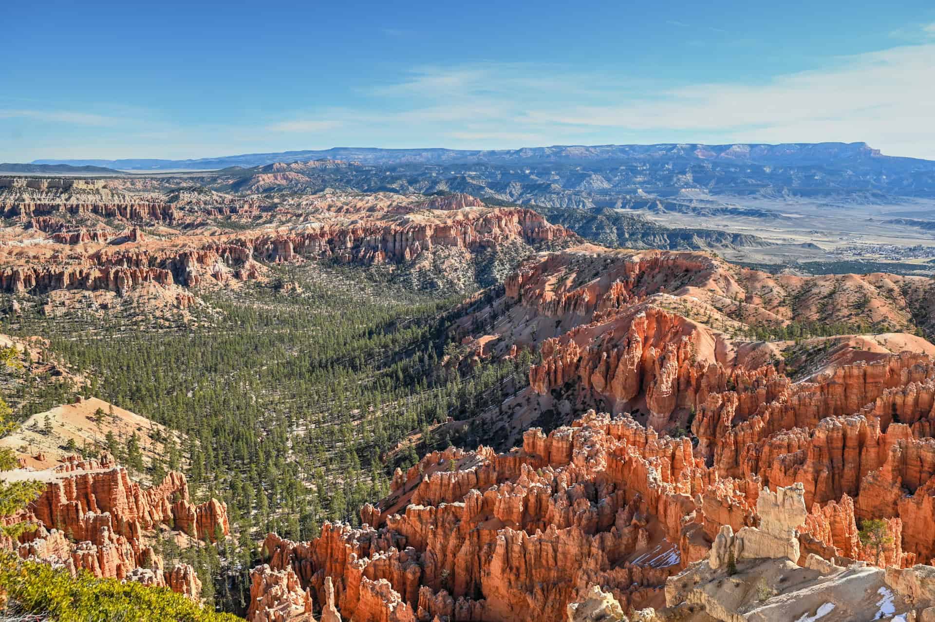
Bryce Canyon’s Main Amphitheater Viewpoints
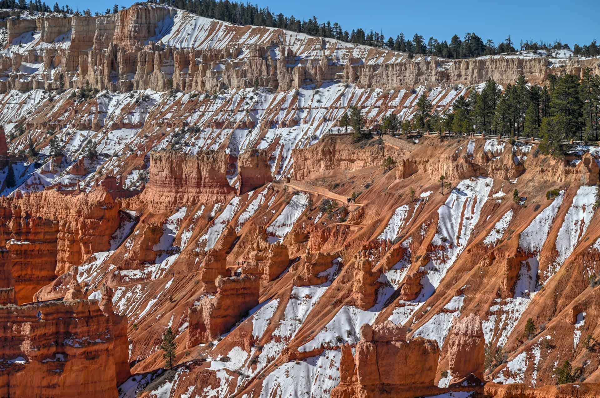
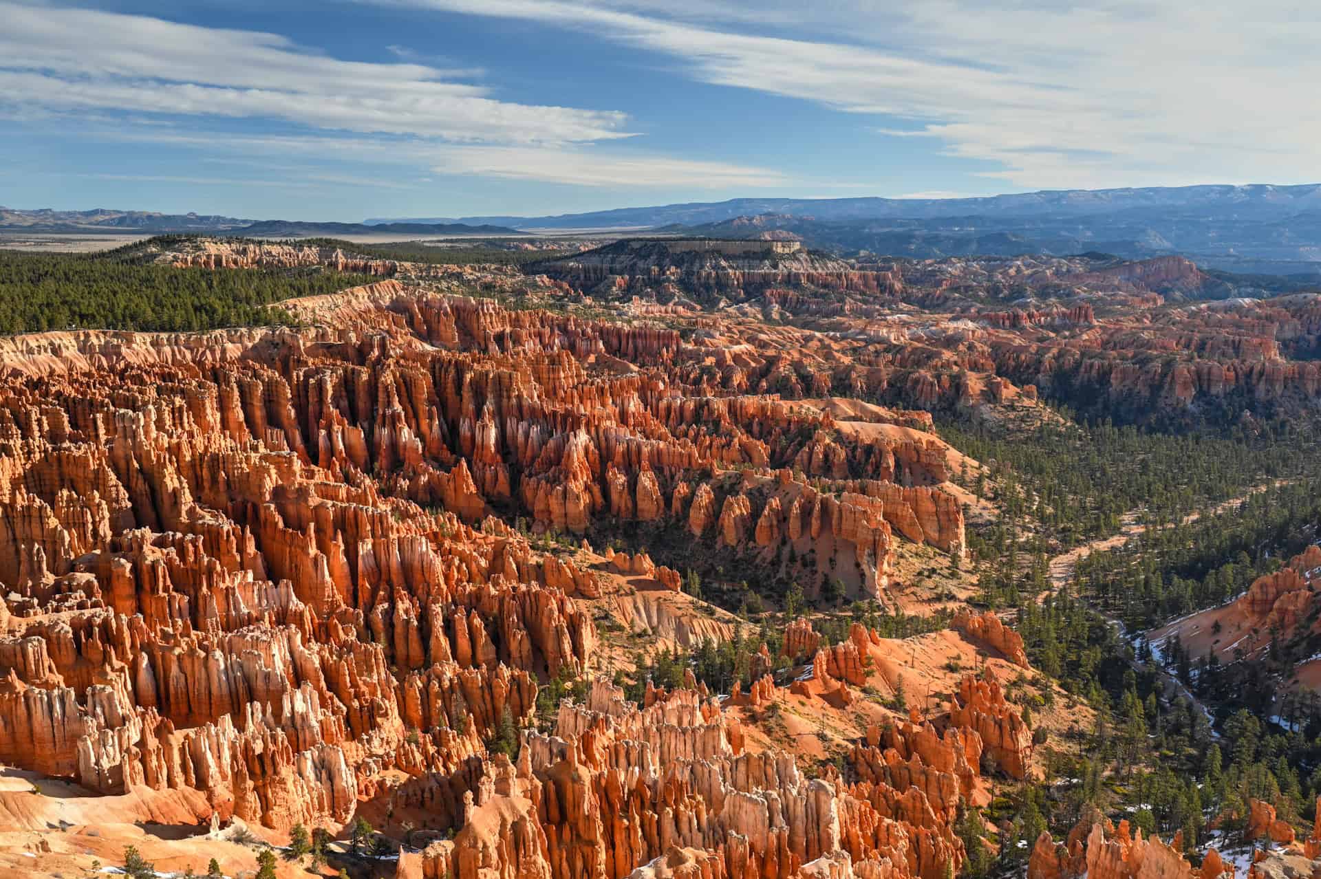
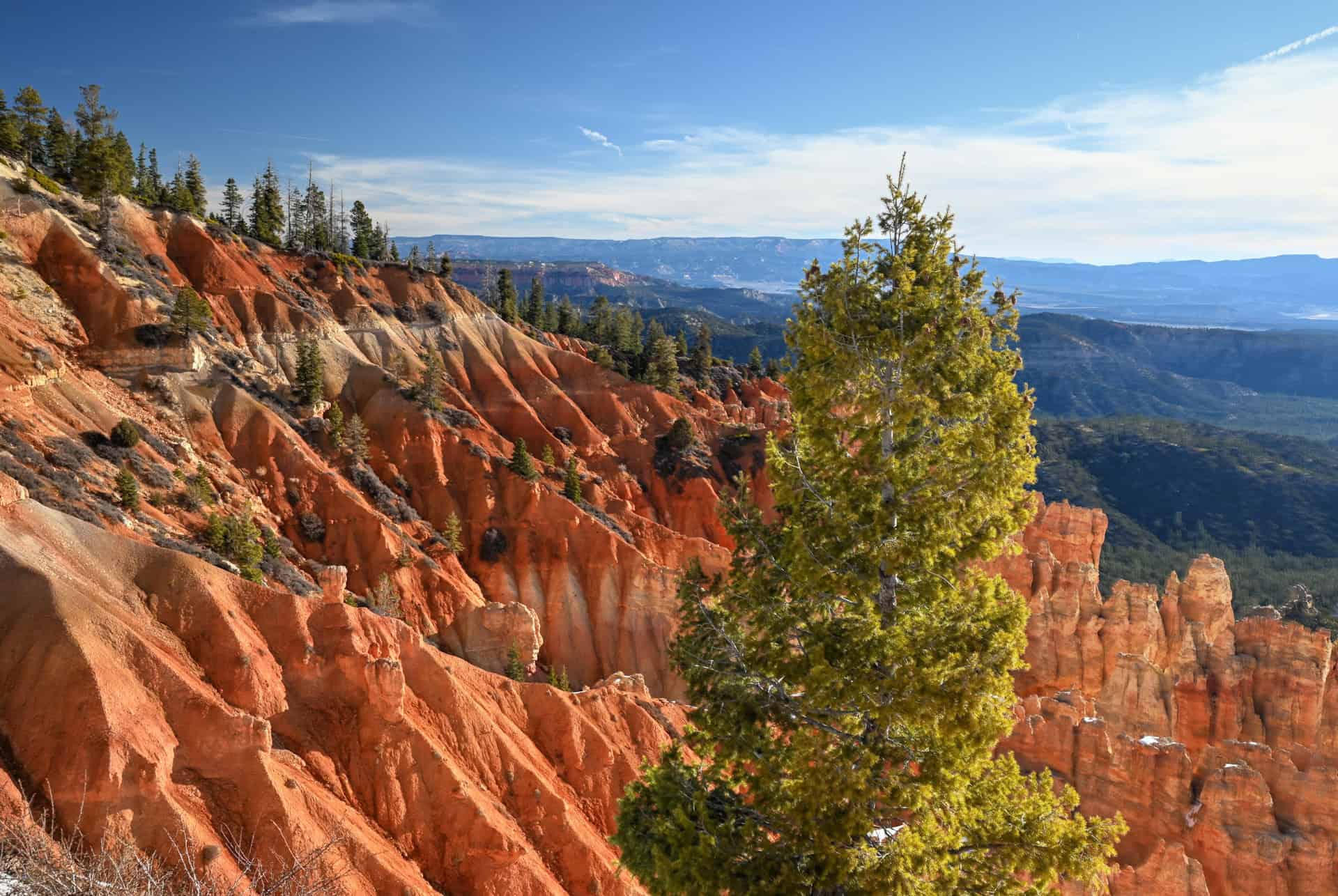
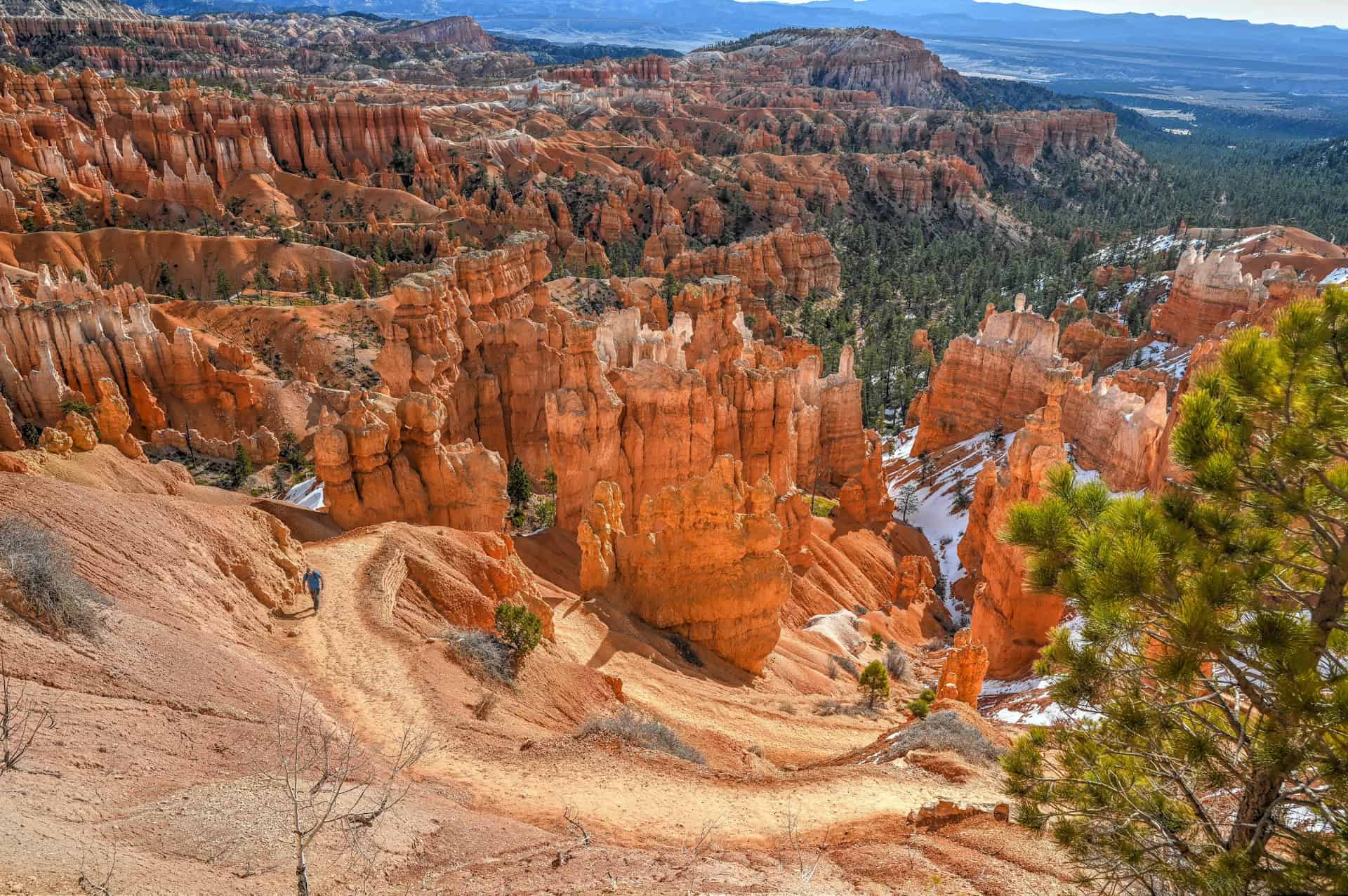
This cluster of viewpoints overlooks Bryce Canyon’s most iconic hoodoo-filled amphitheater and delivers the park’s most concentrated scenery. Because the first three are close together and connected by the Rim Trail, we think that they’re best explored on foot rather than as individual drive-up stops.
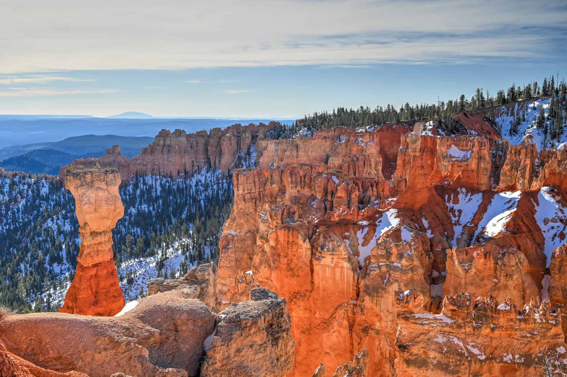
Sunset Point
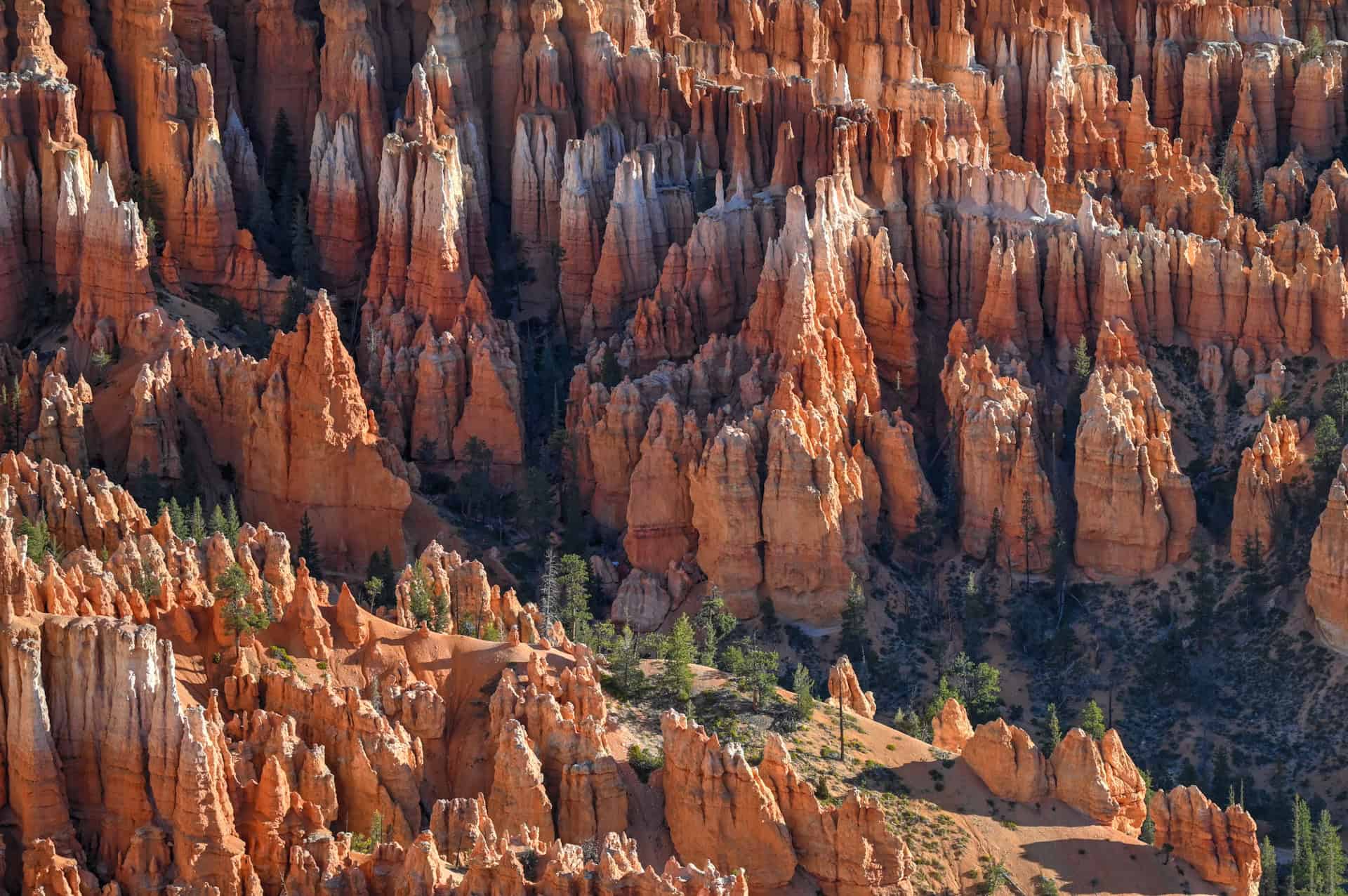
Often the first stop for many visitors, Sunset Point offers one of the most dramatic, immediate views into the amphitheater. From here, hoodoos appear tightly packed and layered, and the viewpoint also serves as a major trailhead for below-the-rim hikes like the Navajo Loop & Queen’s Garden, making it one of the busiest spots in the park.


Sunrise Point
Just a short walk from Sunset Point, Sunrise Point provides a slightly wider, more open perspective. The amphitheater spreads out here, with longer sightlines and a clearer sense of depth. Despite the name, it’s definitely worth visiting at any time of day.


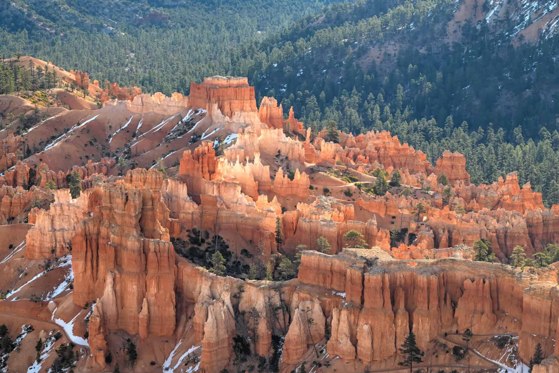
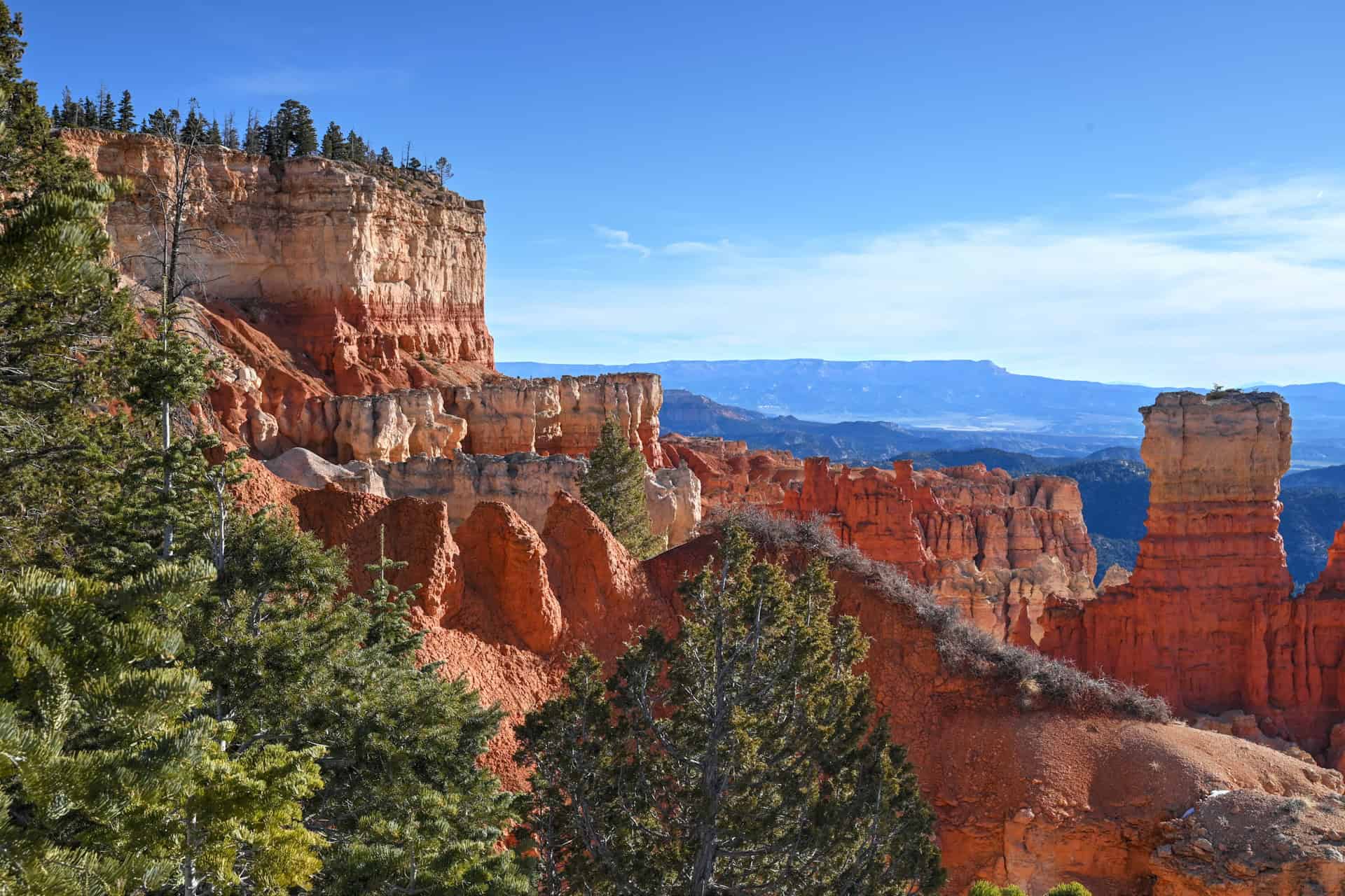
Inspiration Point
Inspiration Point is actually a series of overlooks: Lower, Middle, and Upper Inspiration Point, each offering a progressively higher vantage over the amphitheater. From the upper viewpoint, you get one of the best overall perspectives in the park, with sweeping views that show how vast and layered Bryce Canyon really is. It’s a short but uphill walk from the parking area, and well worth the extra effort.


Beyond Sunset Point, Sunrise Point, and Inspiration Point, there are two additional viewpoints overlooking the main amphitheater: Bryce Point and Fairyland Point. While both can be reached on foot via longer sections of the Rim Trail, we generally recommend driving to them if you’re short on time or if you’d rather save your energy for more immersive below-the-rim hikes such as the Navajo Loop or the Tower Bridge Trail.
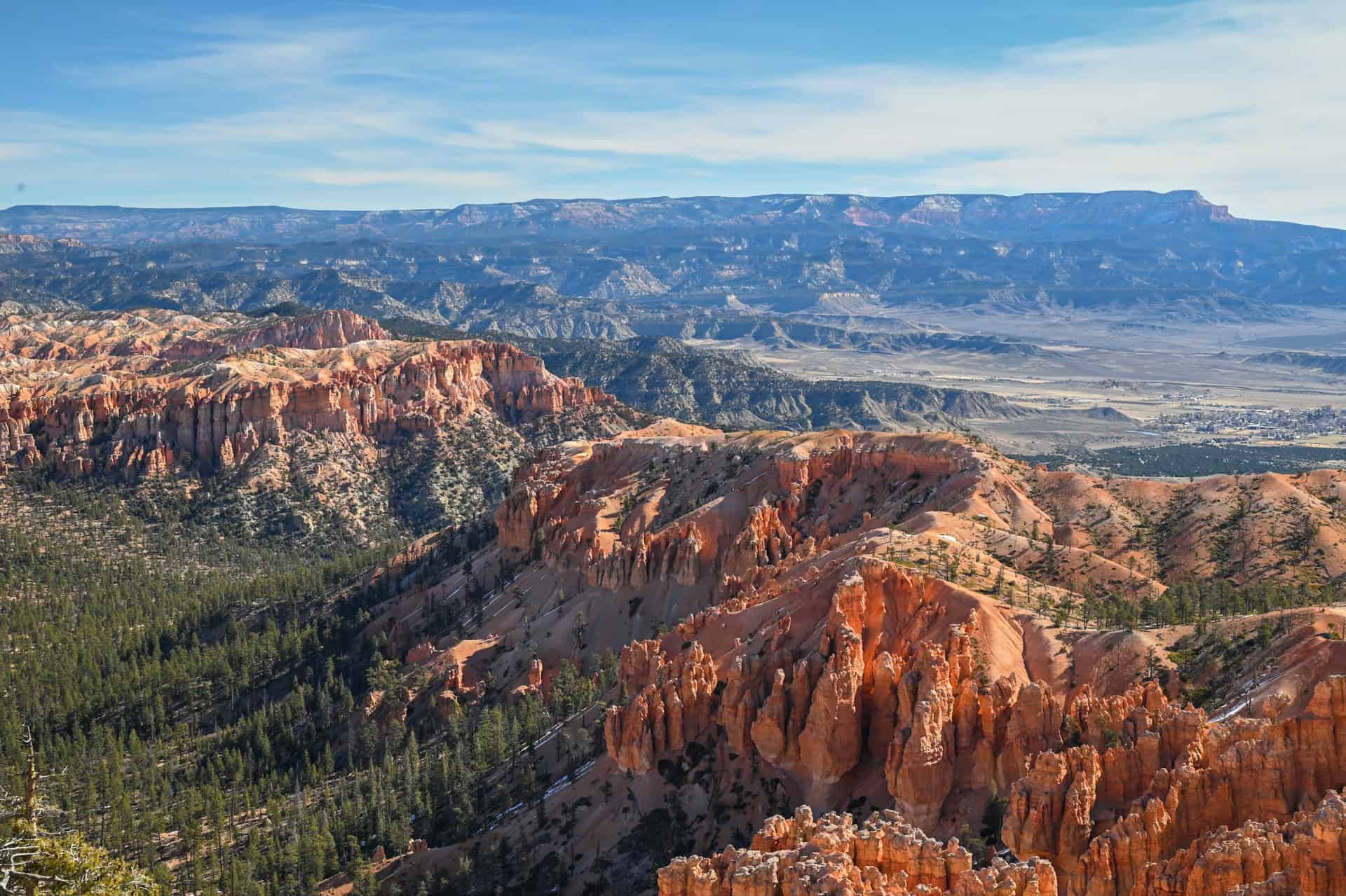
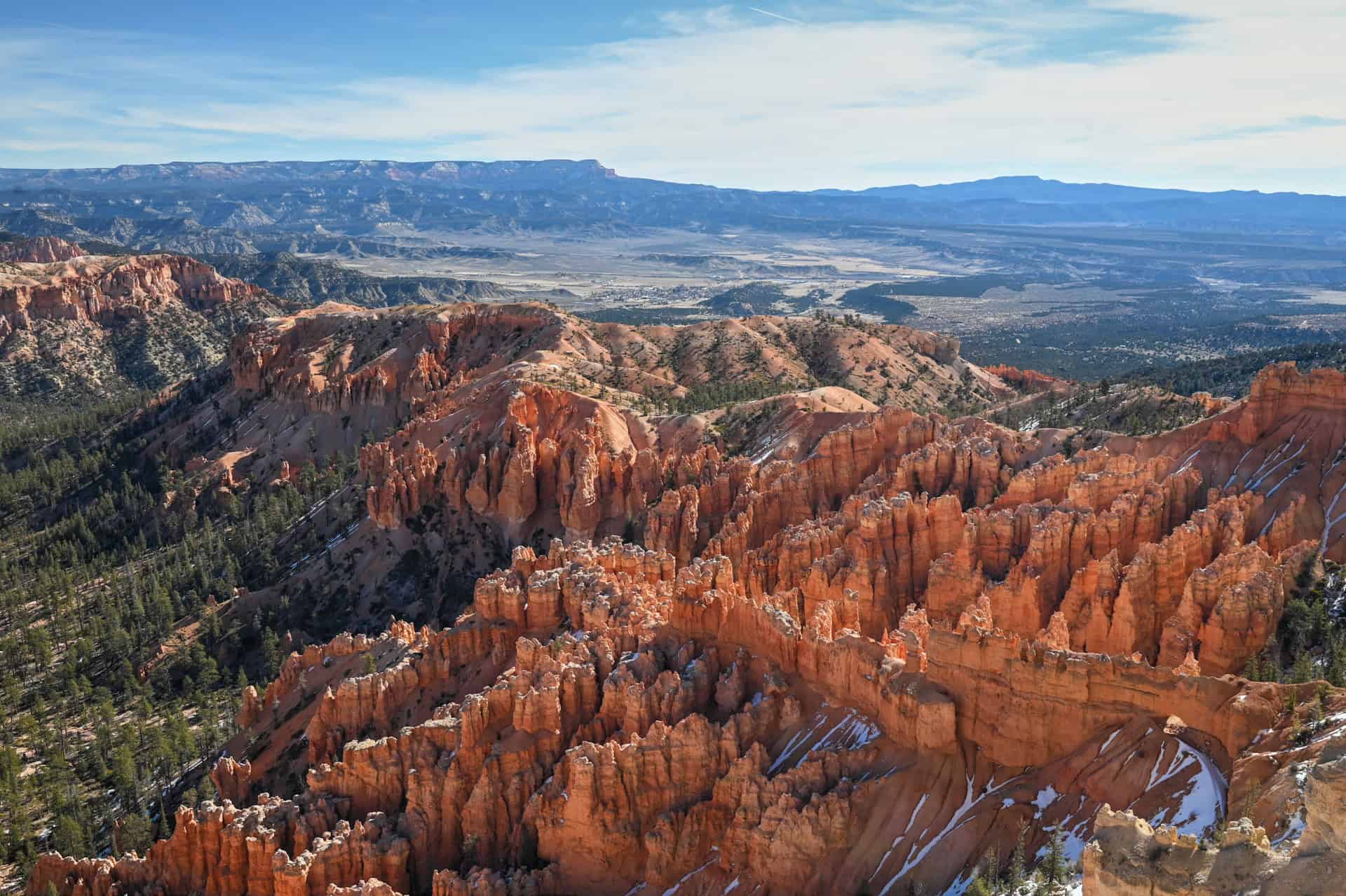
Bryce Point
Bryce Point offers one of the most expansive and dramatic views of the main amphitheater. Unlike most overlooks, which face east into the canyon, Bryce Point looks northward (towards the Sunrise and Sunset viewpoints), providing a different angle that highlights the sheer depth and scale of the hoodoo formations. The viewpoint requires a short detour off the main scenic road, but it’s well worth the extra few minutes. It’s also a popular sunrise spot and one of the best places to grasp the full layout of Bryce Canyon from above.


A short drive beyond Bryce Point brings you to Paria View, which faces south, away from the amphitheater. While it offers a wide, open landscape view, it’s skippable if you’re short on time and focused on amphitheater scenery.
Fairyland Point
Fairyland Point sits at the northern end of the amphitheater and offers a more partial, oblique view of it compared to the other main overlooks. The road to Fairyland Point is a short 1-mile (1.6 km) detour from the main scenic drive, but it’s often closed for much of the year (typically from December through May or early June, depending on snow conditions).
When open, the viewpoint provides a quieter, less crowded perspective and serves as one of the starting points for the Fairyland Loop Trail. However, if you’re limited on time or visiting during peak season, it’s not essential, especially if you plan to experience the amphitheater from inside the canyon.
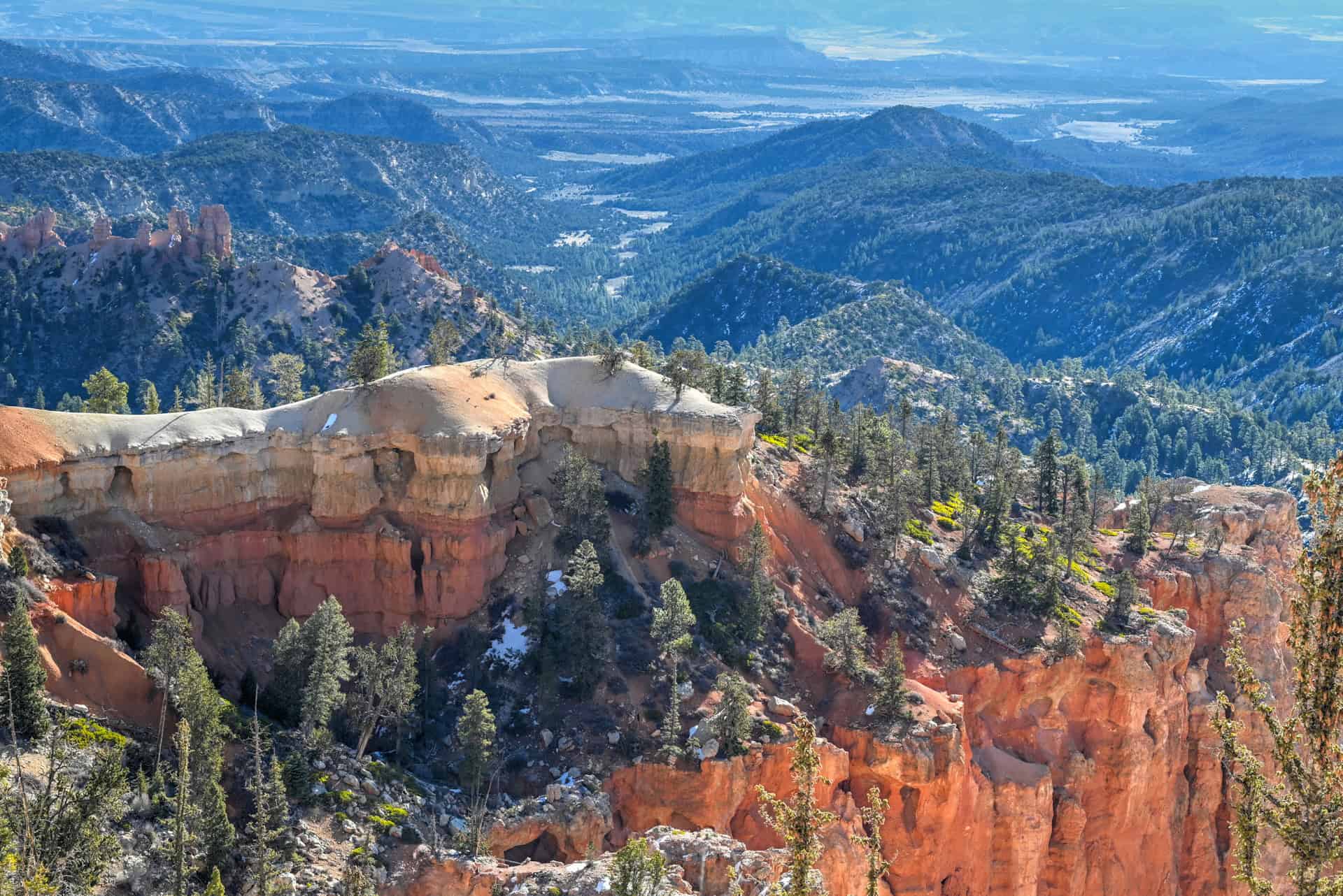
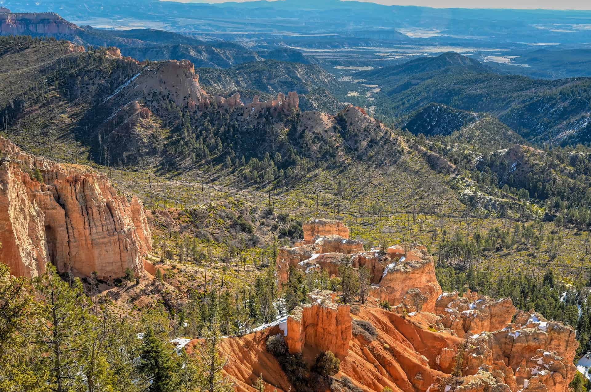
Southern Scenic Drive Viewpoints
South of the main amphitheater, the Bryce Canyon Scenic Drive becomes quieter and more spread out. Viewpoints are less tightly clustered, crowds thin noticeably, and the scenery shifts from dense hoodoo amphitheaters to broader vistas, isolated formations, and long views across southern Utah. These stops work best as drive-up viewpoints, with short walks rather than continuous rim hiking.
If you’re short on time, you can be selective here. If you have the time to continue south, these viewpoints add variety that complements the amphitheater views.
If you’re driving the Bryce Canyon Scenic Drive from end to end, the southern viewpoints are best experienced starting at the southern terminus and working your way north, stopping as you go. This approach keeps things simple, avoids backtracking, and lines up naturally with how the scenery unfolds: broad, distant views first, followed by increasingly detailed amphitheater perspectives as you head back toward the park entrance.
Below are the main southern viewpoints, listed in the order you’ll encounter them when starting from the south.
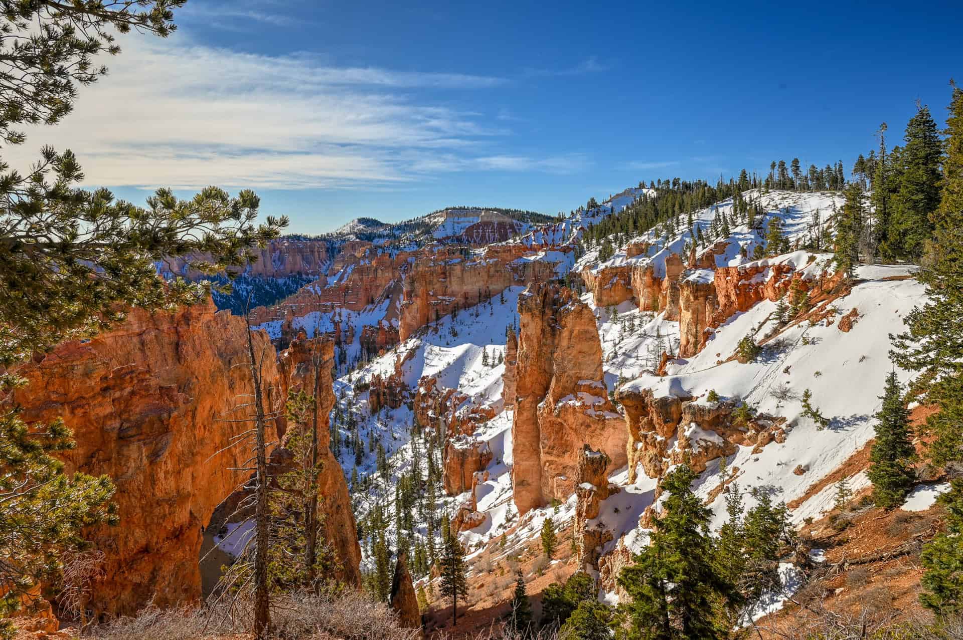
Rainbow Point (and Yovimpa Point)
Rainbow Point marks the southernmost stop on the scenic drive and sits at the park’s highest elevation (9,115 feet; 2,778 meters). From here, the view looks outward rather than down, stretching across forested plateaus and distant mountain ranges.


A short walk from the same parking area brings you to Yovimpa Point, which faces south and southwest and emphasizes Bryce’s broader geological context rather than hoodoos.


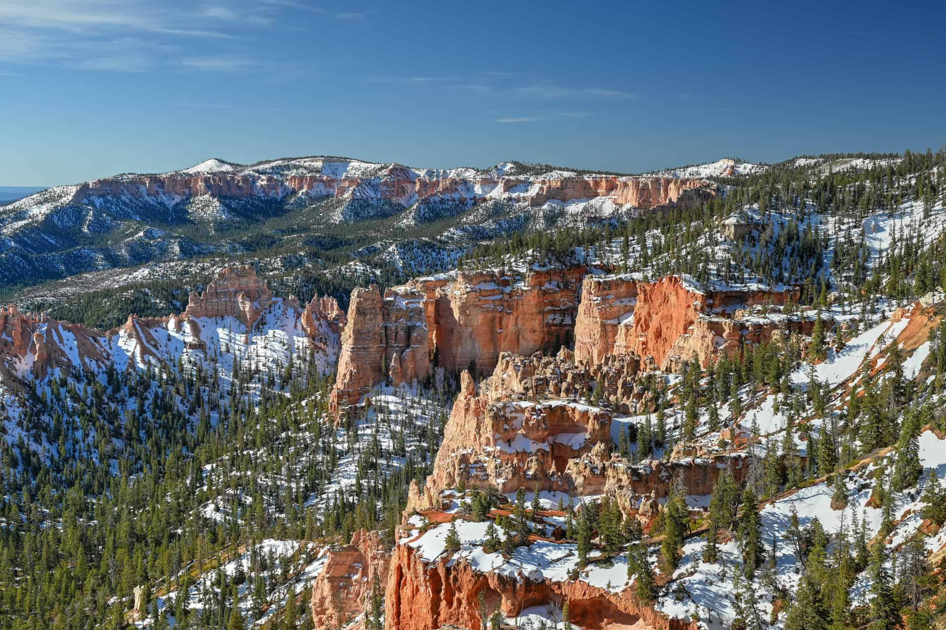
Black Birch Canyon
Black Birch Canyon offers a quieter, more subtle view into a narrow canyon filled with scattered hoodoos and dense forest. It’s a good example of how Bryce’s landscape changes as you move away from the main amphitheater: less dramatic at first glance, but more peaceful and uncrowded.


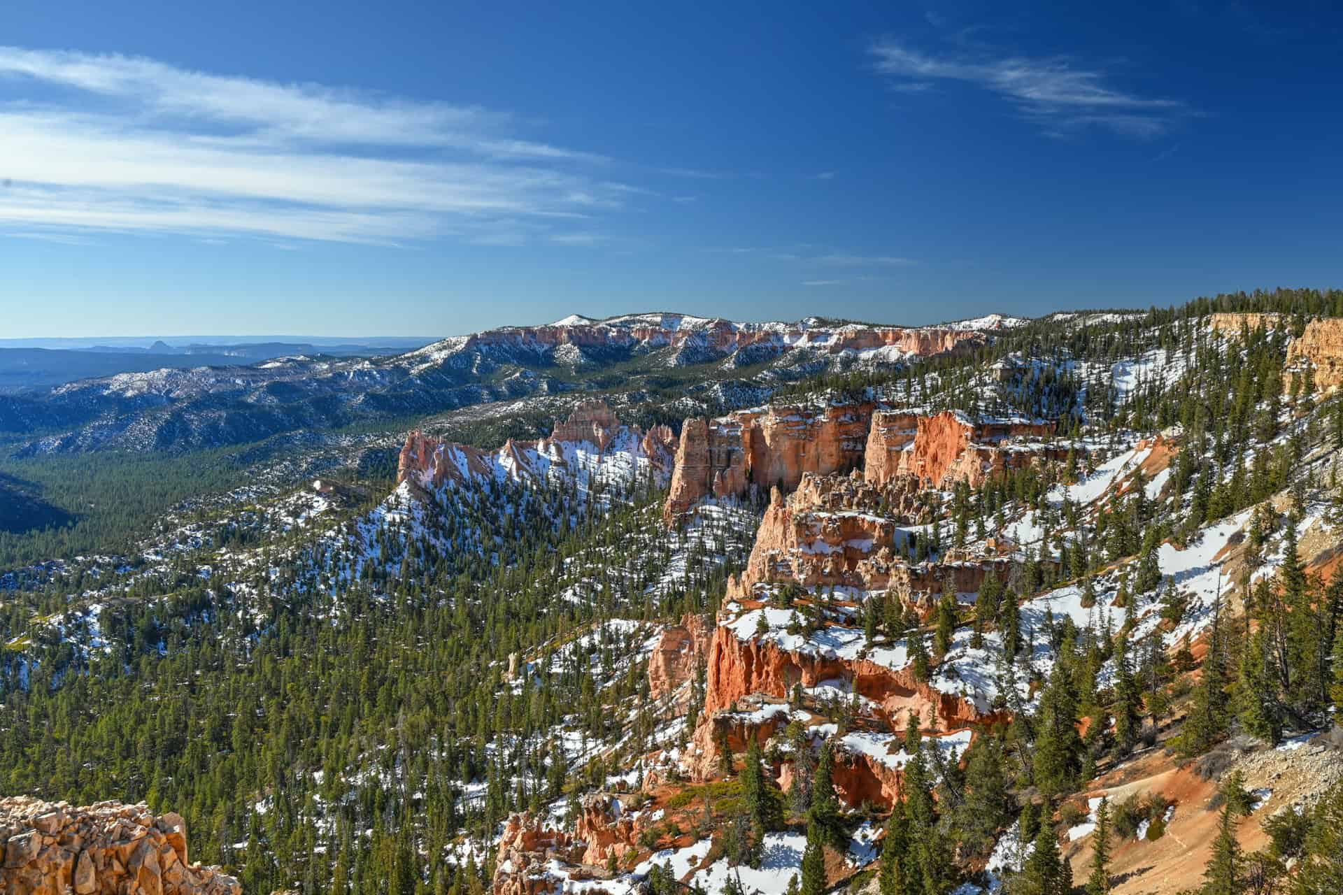
Ponderosa Canyon
Ponderosa Canyon is a broad overlook where hoodoos mix with forested slopes, creating a layered, open feel. This stop highlights the transition between Bryce’s hoodoo formations and the surrounding plateau, and it’s often overlooked by visitors rushing back toward the amphitheater. In our view, it’s a true hidden gem.


Agua Canyon
Agua Canyon provides one of the most striking views along the southern drive, with tall, well-defined hoodoos rising from a wide basin below. Crowds are usually lighter here than at the main amphitheater, making it a good place to linger and take in the details.


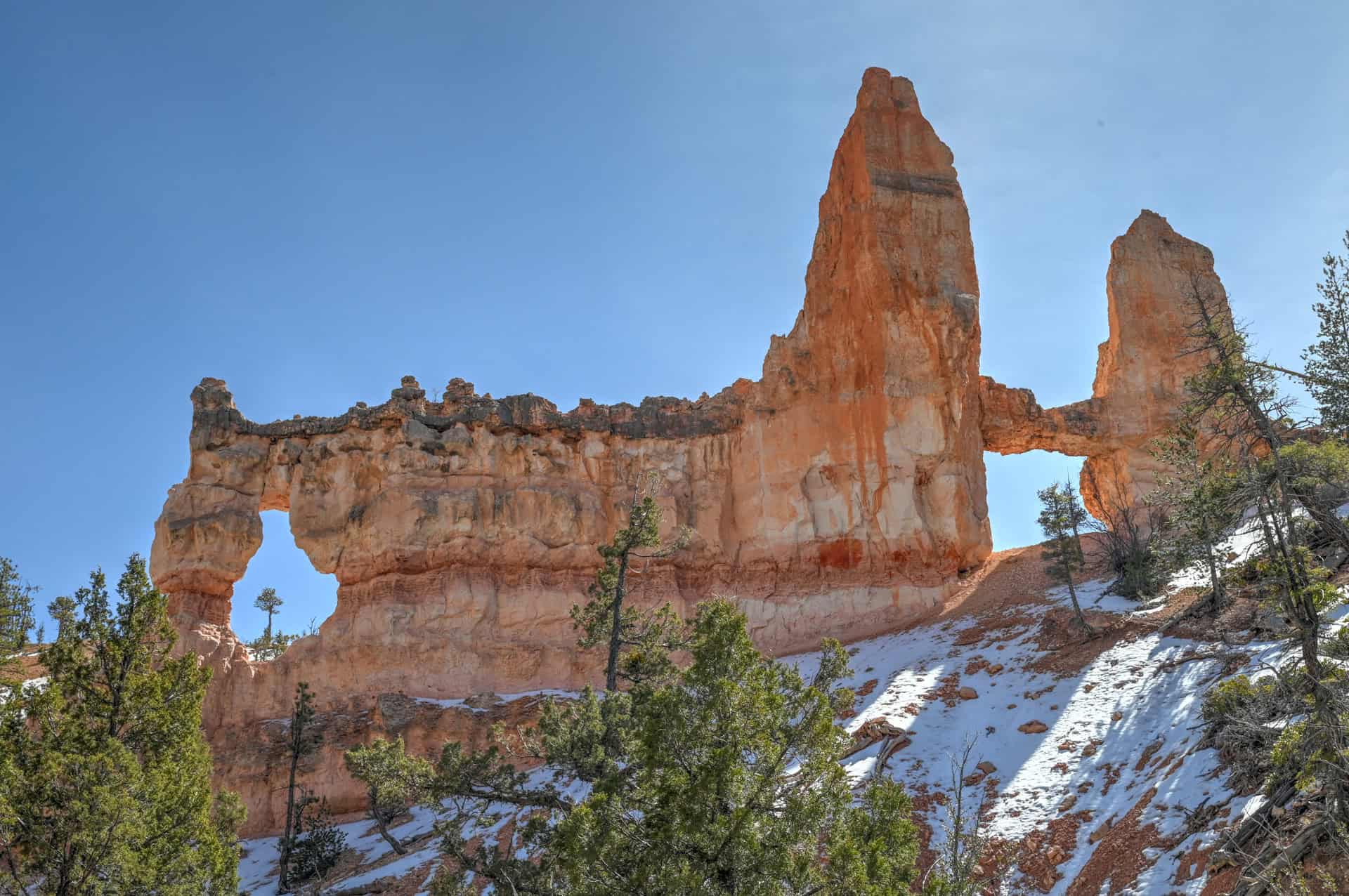
Natural Bridge
Natural Bridge is the final major southern viewpoint before returning to the amphitheater area. Despite its name, it’s a massive arch carved into the rock, spanning a forested bowl below the rim. It’s one of the most distinctive single features along the scenic drive and is well worth a stop, even on a tighter schedule.


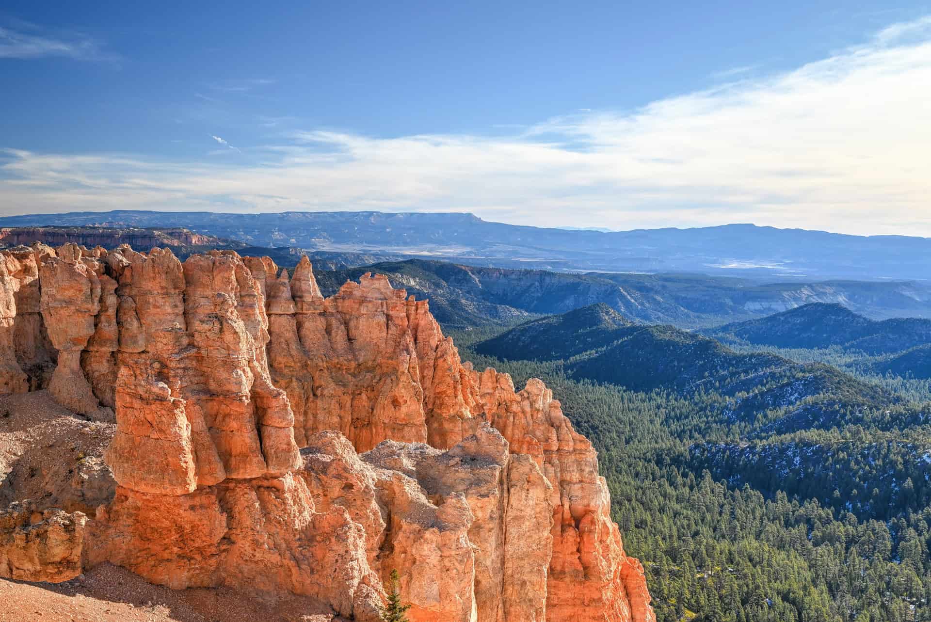
Farview Point
Farview Point shifts the focus away from the amphitheater and out across southern Utah, offering wide, open views that emphasize Bryce Canyon’s high-elevation setting rather than hoodoo density. From the rim, the landscape stretches toward distant plateaus and valleys, making it a good stop for appreciating the park’s broader geographic context. A short, easy trail from Farview Point leads to Piracy Point, a quieter overlook that provides a slightly different angle and is worth the brief walk if you have a few extra minutes.


Short on Time? Must-See Bryce Canyon Viewpoints
If you don’t have time to cover the entire scenic drive, these viewpoints give you the best overall sense of Bryce Canyon. Together, they balance iconic amphitheater views with standout southern overlooks.
Main Amphitheater (choose at least one):
– Sunrise Point, Sunset Point, or Inspiration Point – Any one of these delivers classic hoodoo-filled amphitheater views. If time allows, walking between all three via the Rim Trail is well worth it.
Bryce Point:
One of the most dramatic and expansive views of the main amphitheater, looking north rather than east. Definitely one of our favorites!
Natural Bridge:
The massive arch is a standout landmark, visually distinct from the rest of the park and easy to access, making it one of the best single stops outside the amphitheater.
Ponderosa Canyon:
A quieter overlook that shows the transition between dense hoodoos and forested plateau. Often overlooked, we felt it was a true hidden gem and a great contrast to the amphitheater viewpoints.
Farview Point:
A wide, open viewpoint that looks out across southern Utah rather than into the canyon. It’s a good place to appreciate Bryce’s broader landscape and sits conveniently along the drive north from Natural Bridge.
Rainbow Point:
The southern terminus of the scenic drive and the park’s highest viewpoint. While it’s less about hoodoos, it provides a strong sense of elevation and scale and works well as a turnaround point if you’re driving the full route.
Best Time of Day for Viewpoints & Scenic Drive
Timing makes a noticeable difference at Bryce Canyon. Particularly light direction and crowd levels can change how the viewpoints feel over the course of the day.
Early Morning
Early morning is the best overall time to explore Bryce Canyon’s viewpoints. Crowds are lighter, parking is easier, and the light is softer. This is also the best time to walk between Sunset, Sunrise, and Inspiration Points before foot traffic picks up.
Midday
Midday offers the most even lighting and clear visibility, but it’s also when Bryce Canyon is at its busiest, especially around the main amphitheater viewpoints. If you’re visiting during peak season, this is a good window to drive towards the southern section of the scenic drive, where viewpoints are more spread out, and crowds thin considerably. Southern overlooks like Ponderosa Canyon, Agua Canyon, and Natural Bridge tend to feel calmer even in the middle of the day.
Late Afternoon
Crowds often begin to taper off in late afternoon, where the light adds depth and shadow to the amphitheater, giving the hoodoos more texture and definition. This is a good time to revisit a favorite viewpoint or explore quieter southern stops if you skipped them earlier.
Sunset
Sunset Point is the obvious choice at sunset, but it’s also the most crowded time of day in the park. If you prefer a quieter experience, Inspiration Point or Bryce Point often provide equally dramatic views with a bit more breathing room. Keep in mind that temperatures drop quickly after sunset, even in summer.
Bottom Line
For the best balance of light, access, and crowd levels, early morning is ideal. If you’re visiting later in the day, focus on the southern scenic drive viewpoints first and save the amphitheater for early or late hours when possible.
Planning Your Time at Bryce Canyon
If you’re spending more than one day in Bryce Canyon, it often makes sense to separate viewpoints and hikes across different mornings rather than trying to fit everything into a single push.
The main amphitheater viewpoints (Sunrise, Sunset, Inspiration, and Bryce Point) benefit the most from early morning light, when colors are warmer, shadows add depth, and crowds are lighter. The southern scenic drive viewpoints also look best in the morning, but because they’re more spread out and less crowded, they’re easier to visit efficiently as a focused drive.
A good approach and our suggestion is to:
- Dedicate one morning to the main amphitheater viewpoints, walking the Rim Trail between viewpoints while parking only once. Plan for about 1h30-2h, including driving time from Bryce Canyon City.
- Use a different morning for the southern scenic drive, starting early and working your way north. For the southern viewpoints, plan for about 2h-2h30 (1h of driving + 1h of viewpoints and short walks).
- Save below-the-rim hikes (such as the Navajo Loop, Queen’s Garden, or Tower Bridge) for later in the morning and afternoon, when the sun is higher, and the amphitheatre is better illuminated from above.
If your time is limited to a single day, we recommend prioritizing the amphitheater viewpoints first, before moving on to the southern viewpoints.
Best Time of Year for the Scenic Drive & Viewpoints
Because Bryce Canyon’s main viewpoints are accessed by road, the scenic drive works well for much of the year. That said, day length, light quality, and seasonal road closures can all influence how complete the experience feels.
Spring and Fall:
These are generally the best overall seasons for exploring Bryce Canyon by car. Temperatures are comfortable, light is softer and more directional, and the hoodoos show stronger contrast throughout the day. Spring can bring lingering snow and occasional closures at higher elevations, while fall tends to be more stable but with shorter days later in the season.
Summer:
Summer offers the longest days, which makes it easier to start early and fit more stops into a single day. All scenic drive viewpoints are typically open, and weather disruptions are less common. Midday crowds can be heavy near the main amphitheater, but southern viewpoints remain relatively calm. Light is harsher around midday, though mornings and late afternoons still photograph well.
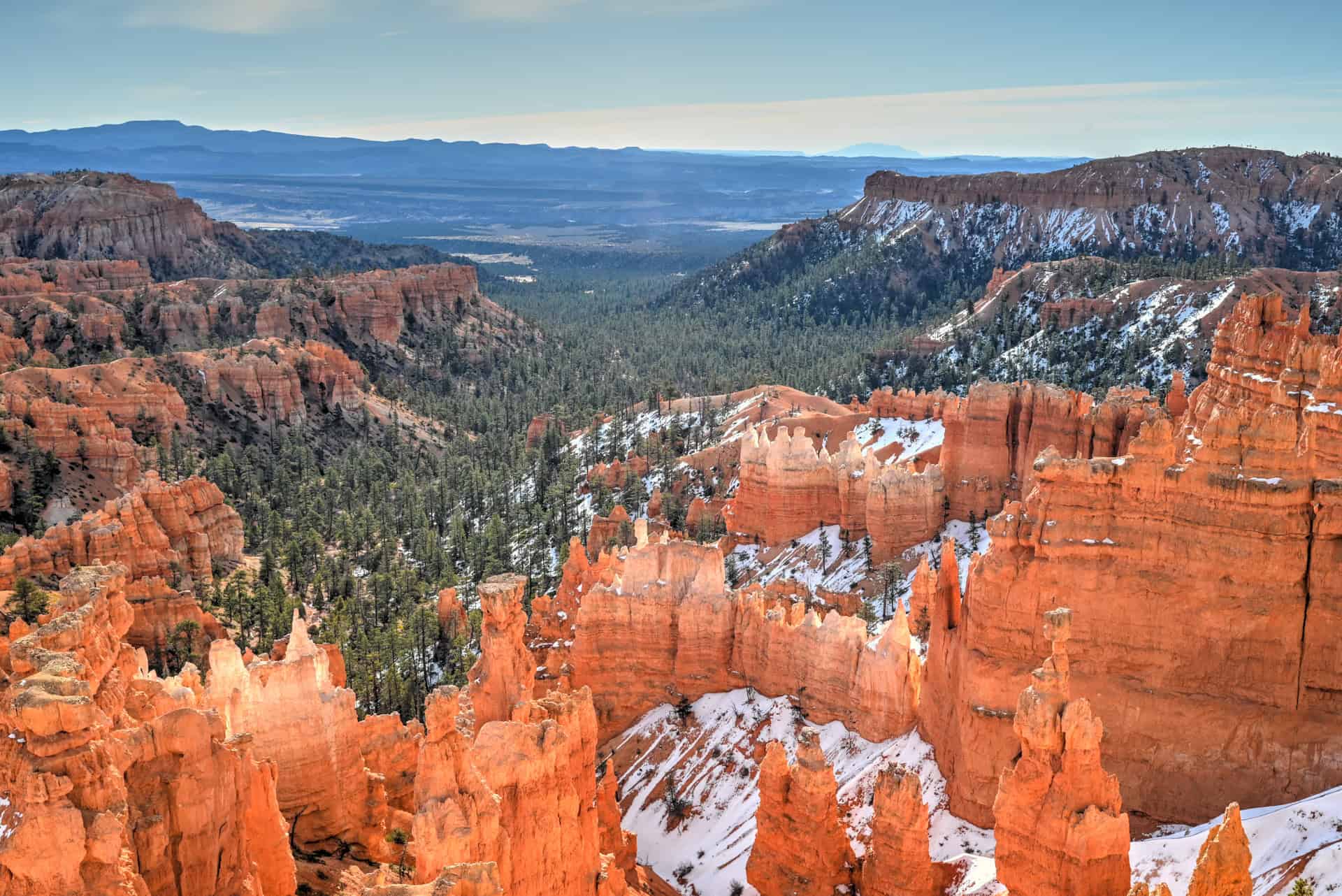
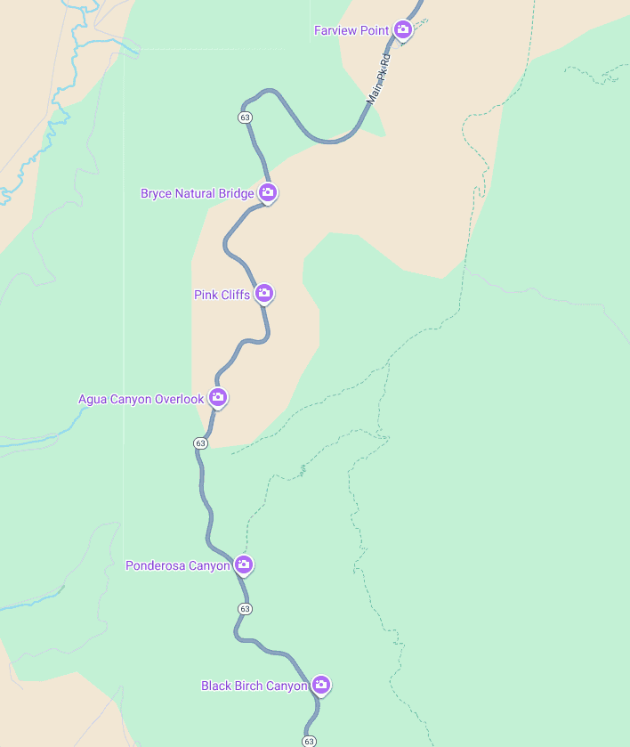
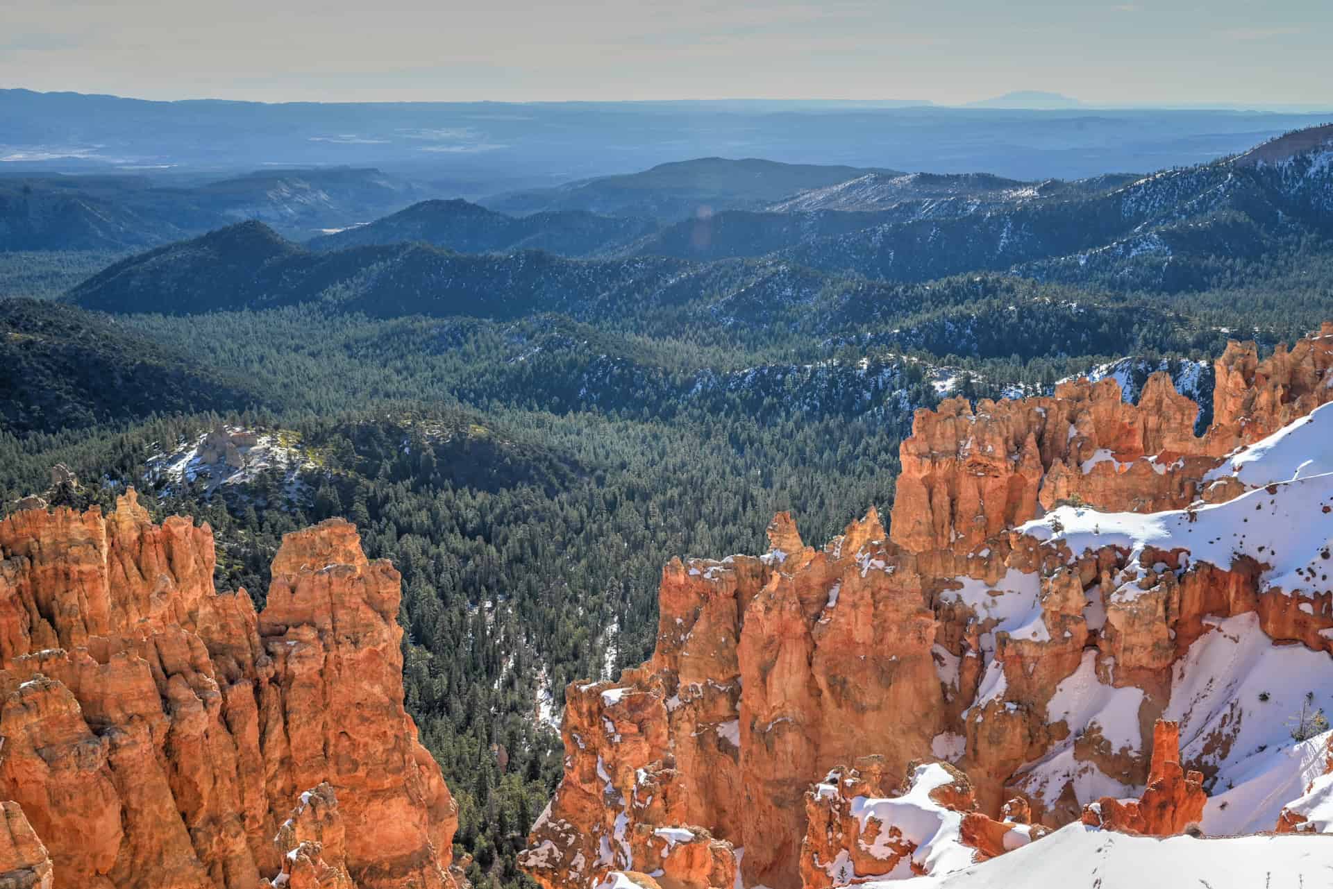
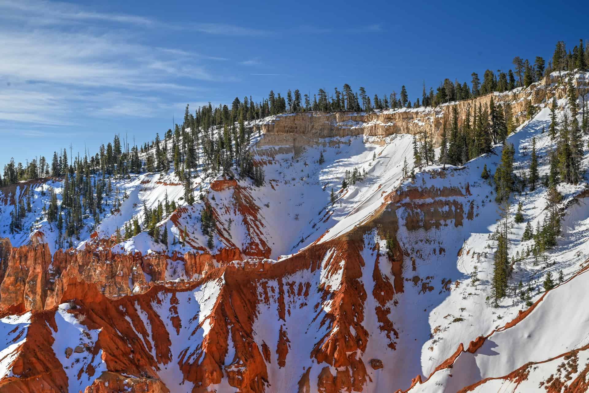
Winter:
Winter can be beautiful, especially after fresh snowfall, but it comes with tradeoffs. Some side roads, such as those to Fairyland Point and Paria View, are often closed for much of the season, and winter storms can temporarily close sections of the main scenic drive. That said, when roads are open, winter offers quiet viewpoints and striking contrasts between snow and red rock. Staying flexible is key to a winter visit.
Things to Keep in Mind:
- Spring and fall provide the most balanced light and viewing conditions
- Summer allows earlier starts and longer days for sightseeing
- Winter access depends heavily on weather and plowing schedules
Bottom line:
For most visitors, late spring through early fall offers the most reliable and complete scenic drive experience. Winter visits can be rewarding but require checking road conditions and adjusting expectations.
We visited the national park in late March, and while we had great weather during our stay, we got lucky with the timing, as a strong winter storm had passed through the area just a week prior, with some snow still lingering both in and around Bryce.
Is the Bryce Canyon Scenic Drive Worth It?
Absolutely! The scenic drive is one of the most efficient and rewarding ways to experience Bryce Canyon, especially if you’re short on time or visiting outside peak hiking conditions. With minimal effort, you gain access to sweeping amphitheater views and a clear sense of how the park’s landscape changes from north to south.
Even for visitors planning to hike below the rim, we feel that the scenic drive adds valuable context and varied scenery. Even if hiking isn’t a priority, the viewpoints alone are more than enough to justify a visit.
In our case, we kept the scenic drive to the southern viewpoints for our last morning in Bryce (having seen the amphitheater viewpoints in the prior days), which was the perfect way to close out our stay in the national park. Our final viewpoint was Bryce Point, and that was the ideal place to enjoy one final view of the park.
Want to Know More About Bryce National Park?
We’ve put together a dedicated Bryce Canyon National Park Guide that covers the park’s most iconic viewpoints, the scenic drive along the rim, and the best ways to experience the hoodoos both from above and below. It’s designed to help you plan a balanced visit, whether you’re stopping for a day or building Bryce into a longer southern Utah road trip. We’ve also created detailed hiking guides for two of Bryce’s most classic trails:
Tower Bridge Trail
The Tower Bridge Trail offers a quieter way to experience Bryce Canyon from below the rim, descending into a more open, less crowded section of the amphitheater. The trail leads to the striking Tower Bridge formation, a natural arch framed by tall hoodoos, and provides a different perspective than the park’s rim viewpoints. While it requires more effort than a rim walk, it rewards hikers with immersive scenery and fewer crowds than trails like Navajo Loop and Queen’s Garden. For route details, access information, and hiking tips, see our Tower Bridge Trail Hiking Guide.


Navajo Loop & Queen’s Garden Trail
Often considered Bryce Canyon’s signature hike, this loop descends directly into the heart of the amphitheater, weaving through dense clusters of hoodoos, narrow corridors, and towering rock walls. The combination of the steep Navajo Loop descent with the gentler Queen’s Garden exit creates a varied and immersive route that showcases Bryce at its most dramatic. It’s busier than Tower Bridge, but for many visitors, it’s the most memorable way to experience the park from below the rim. For route details and planning advice, see our Navajo Loop & Queen’s Garden Trail Hiking Guide.


Where to Stay Near Bryce Canyon National Park
If your goal is to maximize time in Bryce Canyon and keep logistics simple, staying just outside the park entrance is the most practical option. Lodging in this area allows for early starts, easy access to sunrise viewpoints, and minimal driving once you’re in the park—especially useful during busy months or when weather conditions change quickly.
Rather than spreading options across multiple towns, we recommend basing yourself as close to the entrance as possible.
Best Western Plus Ruby’s Inn
Best Western Plus Ruby’s Inn is located directly outside Bryce Canyon National Park’s main entrance, making it one of the most convenient places to stay. Rooms are comfortable and well-maintained, and the property includes a restaurant, general store, outdoor pool, and laundry facilities.
Its location makes early morning and late evening visits to the rim especially easy, whether you’re catching sunrise, returning after sunset, or timing hikes around changing weather. Ruby’s Inn also serves as a hub for Bryce Canyon’s shuttle system during the operating season, further simplifying access to viewpoints and trailheads.
Booking tip: Bryce Canyon accommodations are limited, and Ruby’s Inn fills quickly during peak season (late spring through fall). Reserving well in advance is strongly recommended, especially if you plan to visit during the summer or on weekends.
Bryce Canyon Scenic Drive – Frequently Asked Questions (FAQ)
How long does it take to drive the Bryce Canyon Scenic Drive?
The full drive is about 18 miles (29 km) one way and takes roughly 30–35 minutes without stops. With viewpoints and short walks, most visitors should plan 2–4 hours.
Do you have to drive the entire scenic drive?
No, you don’t have to. Many visitors focus only on the northern section near the main amphitheater. Driving to the southern viewpoints adds variety and is definitely worth it, but it isn’t a required must-see.
Is the scenic drive open year-round?
The main scenic drive is usually open year-round, but winter storms can temporarily close sections. Some side roads, such as those to Fairyland Point or Paria View, are often closed for much of the winter.
Is a shuttle required to access the viewpoints?
No. Unlike some national parks, private vehicles are allowed on the scenic drive. A shuttle operates seasonally, but it’s optional rather than mandatory, and only allows visitors to reach the amphitheater viewpoints, not the southern viewpoints.
Which viewpoints can be visited on foot?
Sunrise Point, Sunset Point, and Inspiration Point are connected by the Rim Trail and are best explored on foot as a group. Most southern viewpoints are accessed as individual drive-up stops, though short trails connect Farview Point with Piracy Point, and connect Rainbow Point with Yovimpa Point.
Is the scenic drive suitable in winter?
Yes, when roads are open. Snow can make the scenery especially striking, but conditions change quickly. Always check the current road status before heading out.
Are there restrooms along the scenic drive?
Restrooms are available near major viewpoints and facilities, including the Visitor Center and some developed stops along the drive, such as Sunset Point, Farview Point, and Rainbow Point.
Is the scenic drive worth it if you’re also hiking?
Definitely! Even if you’re planning hikes like the Navajo Loop or Tower Bridge, the scenic drive provides context, variety, and easy-access viewpoints that complement time spent below the rim.
Explore More Utah National & State Park Guides
Continue exploring Utah with these detailed guides:
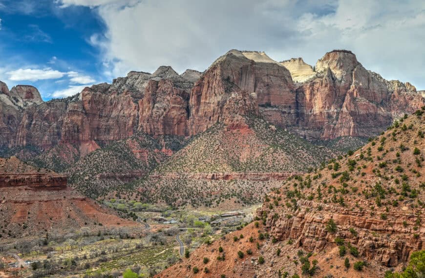
Zion National Park Guide
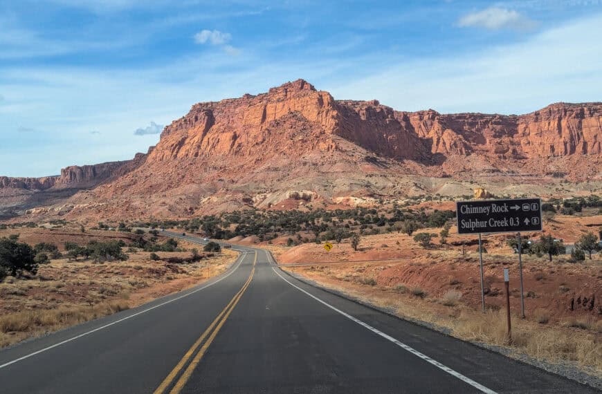
Capitol Reef National Park Guide
Snow Canyon State Park Guide
Goblin Valley State Park Guide
Monument Valley Guide
Arches National Park Guide
Photography Gear
If you like our photography, you might be interested in some of the gear we use to shoot our travel and hiking destinations.
Camera Body – Nikon Z 6ii Fx-series Mirrorless Body
Main Lens – NIKON 24-120mm F/4G ED VR AF-S
Zoom Lens – Sigma 745-306 150-600mm f/5-6.3
Polarizing filters – Urth Circular Polarizing (CPL)
Camera Tripod – K&F Concept 64-inch Camera Tripod
Mini-tripod – Lammcou Flexible Camera Tripod
Camera/hiking backpack – Vanguard Alta Rise 48 Backpack
Universal Travel Adapter – VYLEE Universal International Power Travel Plug
Other Travel Essentials
Travel Insurance
SafetyWing is a travel insurance company that offers comprehensive coverage for travellers. Includes Medical Insurance and Travel Insurance. Primarily geared towards long-term travellers, digital nomads, and expats.
e-Sim cards
Airalo is the world’s first and largest eSIM store with eSIM plans for 200+ countries and regions worldwide. With Airalo eSIMs, travellers can get connected the moment they land at their destination and avoid nasty data roaming charges
eSIMS are a sustainable alternative to single-use SIM cards – they are 100% digital, require less energy to produce and be re-used rather than disposed of.
Car Rentals
Discover Cars is our go-to website for car rentals. We almost always find our preferred rate there.
Transfer from Airport
Welcome Pickups is our favourite private transfer service, which you can pre-book at a fixed price. Currently available in 220 cities all over the world (mostly in Europe, but with several major cities in Asia, the Middle East and the US).
Kiwitaxi is another private transfer service – we haven’t tried it yet, but it’s currently available in a few more countries (102 as of 2024).
Hotels and Accommodations (coming soon)
Photography Prints
If you found this blog useful, you can help support our blog by purchasing low-cost digital prints. Printed physical prints are also available for purchase.


—–
Well, that wraps it up! We hope you enjoyed our Bryce Canyon National Park Hiking Guide for The Tower Bridge Trail and that it will prove useful for planning your trip.
—–
You might also be interested in these related pages: