Northern Arizona is one of the most varied landscapes in the Southwest: a place where red-rock canyons, volcanic craters, ancient pueblos, quiet desert highways, and towering sandstone monuments all exist within a half-day’s drive of each other. While the Grand Canyon is the region’s headline attraction, there’s far more to explore beyond its rim. From vibrant small towns and iconic Route 66 stops to slot canyons, panoramic overlooks, and some of the best road-trip scenery in the country, this travel guide highlights the must-see destinations that reveal Northern Arizona at its most surprising and spectacular.
Northern Arizona Highlights – At a Glance
Sedona – Red Rock and Scenic Drives
Few places in the Southwest blend dramatic scenery and easy accessibility like Sedona. Towering red buttes, pine-filled canyons, and winding stretches of Highway 89A create a backdrop that feels more like a national park than a small town. Whether you’re stopping at roadside viewpoints, exploring short trails, or simply enjoying the changing colors of the canyon walls, Sedona delivers classic Arizona landscapes right from the road.
Sunset Crater Volcano National Monument – Lava Fields & Ancient Eruptions
A short detour off Highway 89 brings you to a striking landscape of black cinder fields, twisted lava flows, and the colorful cinder cone of Sunset Crater. The easy overlooks and short trails reveal the area’s volcanic past and offer a fascinating contrast to the red rocks farther south. It’s a quick, worthwhile stop that adds unique geologic variety to the drive.
Wupatki National Monument – Ancient Pueblos on the Painted Desert
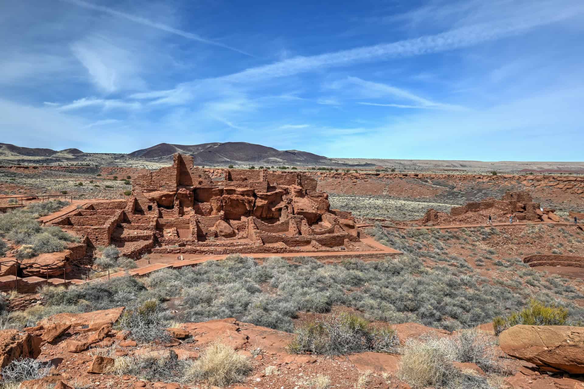
Just beyond Sunset Crater, the landscape transforms again, this time into wide-open desert dotted with ancient pueblos. The Wupatki Pueblo is the largest and most impressive: a 100-room red sandstone dwelling that once housed ancestral Puebloan people. A short, easy walk leads through the ruins, with sweeping views across the Painted Desert. Rich history and stunning solitude make this one of the best detours on the route.
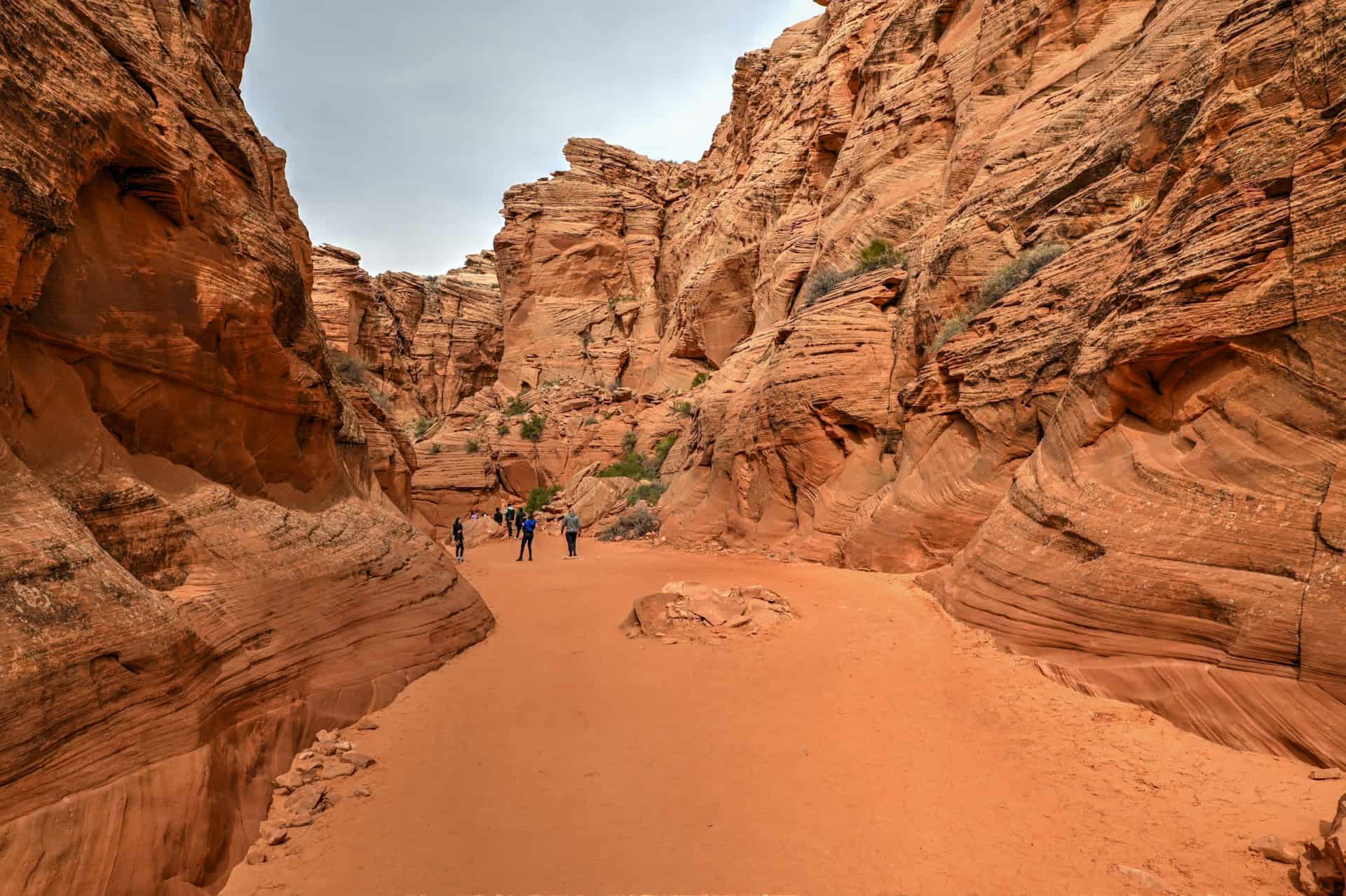
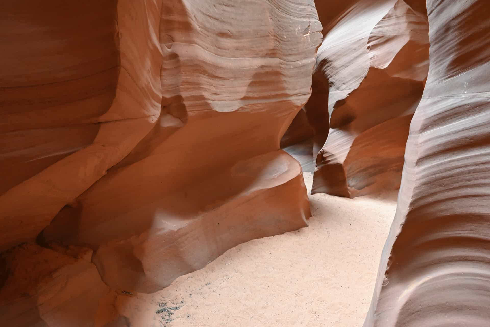
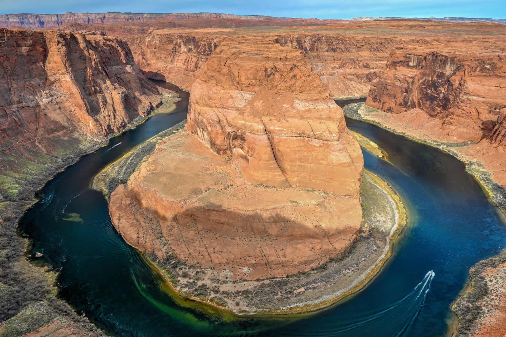
Page & Antelope Canyon – Slot Canyons, Lake Views, and Iconic Overlooks
Page offers some of the Southwest’s most photographed landscapes in a compact, easy-to-explore area. From the swirling sandstone passages of Antelope Canyon to the wide-open blue of Lake Powell and the famous curve of Horseshoe Bend, this region delivers one dramatic view after another. It’s the perfect hub for travelers who love short hikes, water views, and unforgettable photography.
Monument Valley – The Iconic Western Landscape
Straddling the Arizona–Utah border, Monument Valley’s towering sandstone buttes are instantly recognizable from classic films and modern photography alike. Driving the loop road or stopping at one of several viewpoints reveals a landscape that feels both timeless and cinematic. With its Navajo Nation heritage and unmatched silhouettes, Monument Valley is a must-see for anyone exploring Northern Arizona’s far-eastern reaches.
Marble Canyon – Colorado River Views & Navajo Bridge
Just southwest of Page, Marble Canyon offers one of the most intimate ways to experience the Colorado River from above. The historic Navajo Bridge spans sheer, red-walled cliffs, giving visitors a rare chance to stand directly over the river as it begins its journey toward the Grand Canyon. Quiet pullouts, a visitor center, and short nearby hikes make this an ideal scenic interlude between Page and Flagstaff or the Vermilion Cliffs.
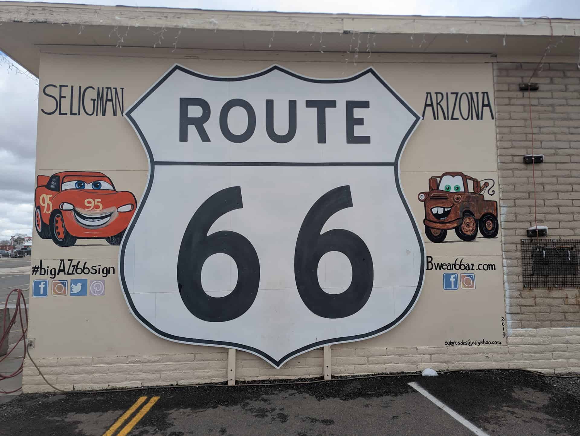
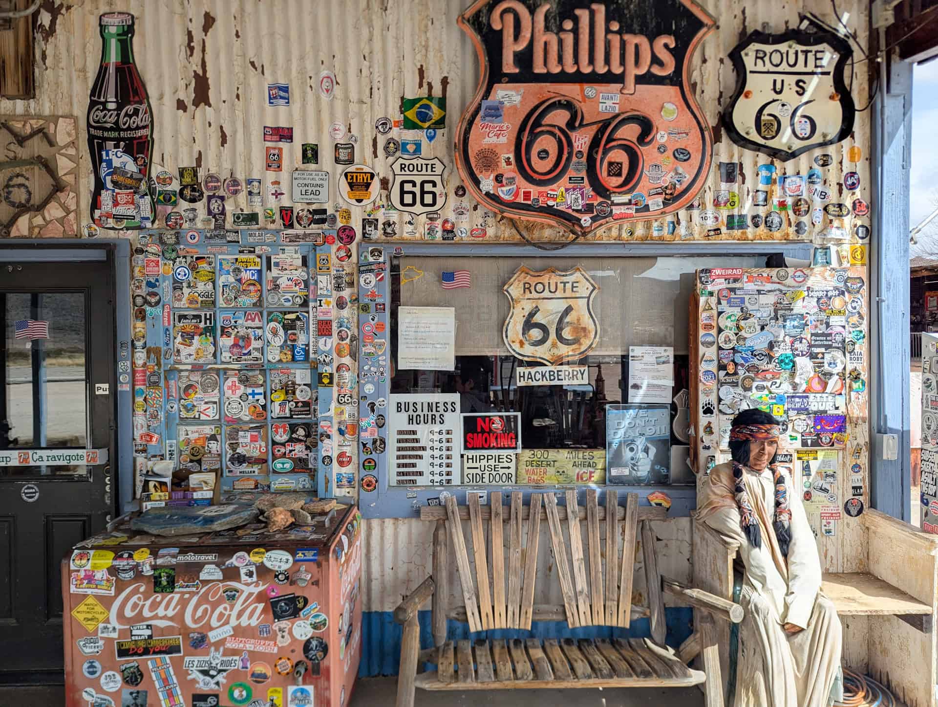
Historic Route 66 – Classic Americana & Small-Town Nostalgia
Northern Arizona is home to some of the best-preserved towns along historic Route 66, where neon signs, retro diners, and vintage gas stations recall the golden age of American road-tripping. Places like Seligman, Williams, and Winslow offer murals, photo stops, museums, and plenty of quirky charm. Whether you stay for a meal or simply cruise the main street, Route 66 adds a fun and nostalgic layer to any Northern Arizona itinerary.
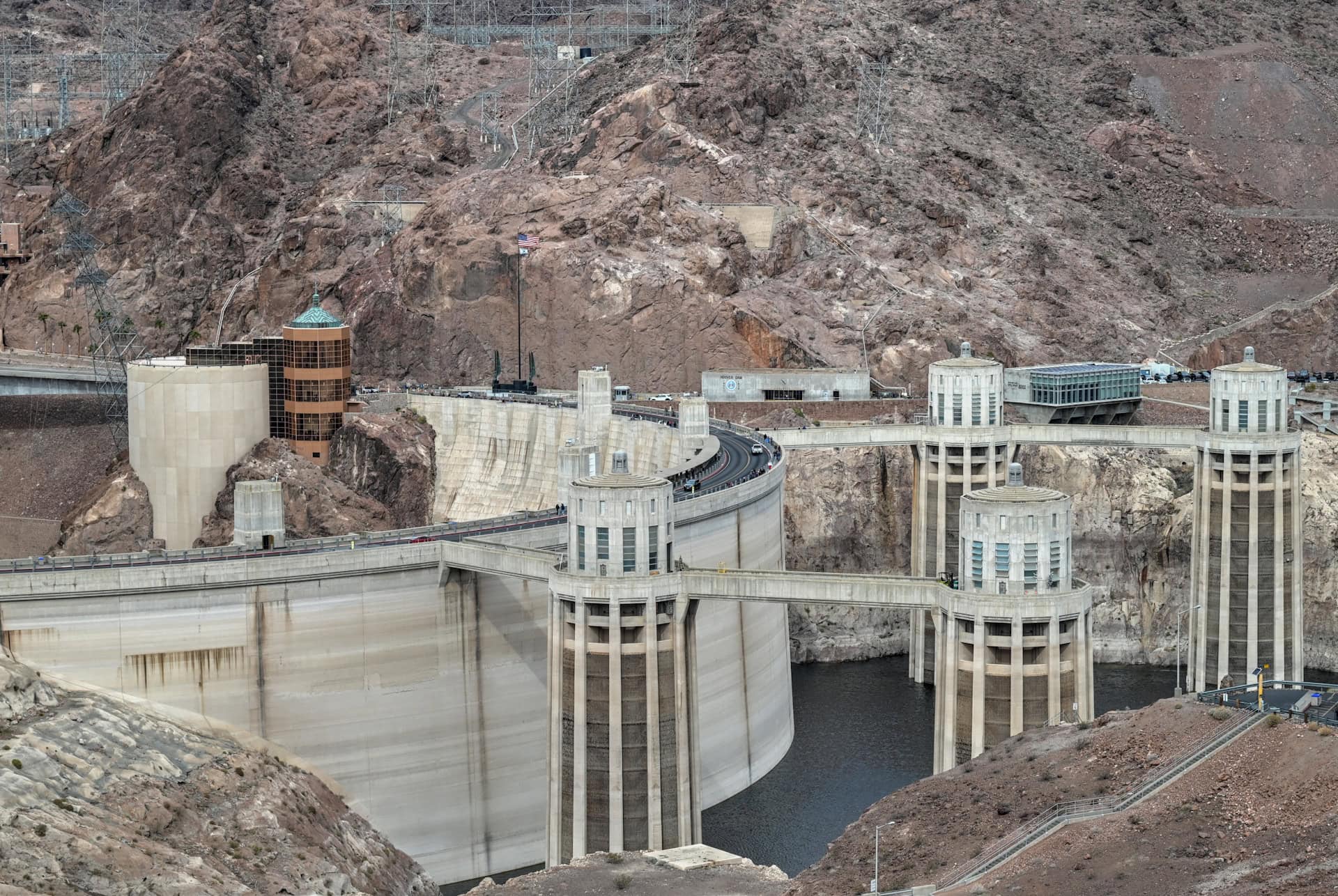
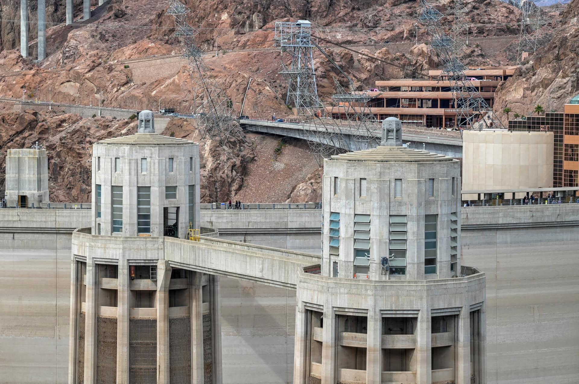
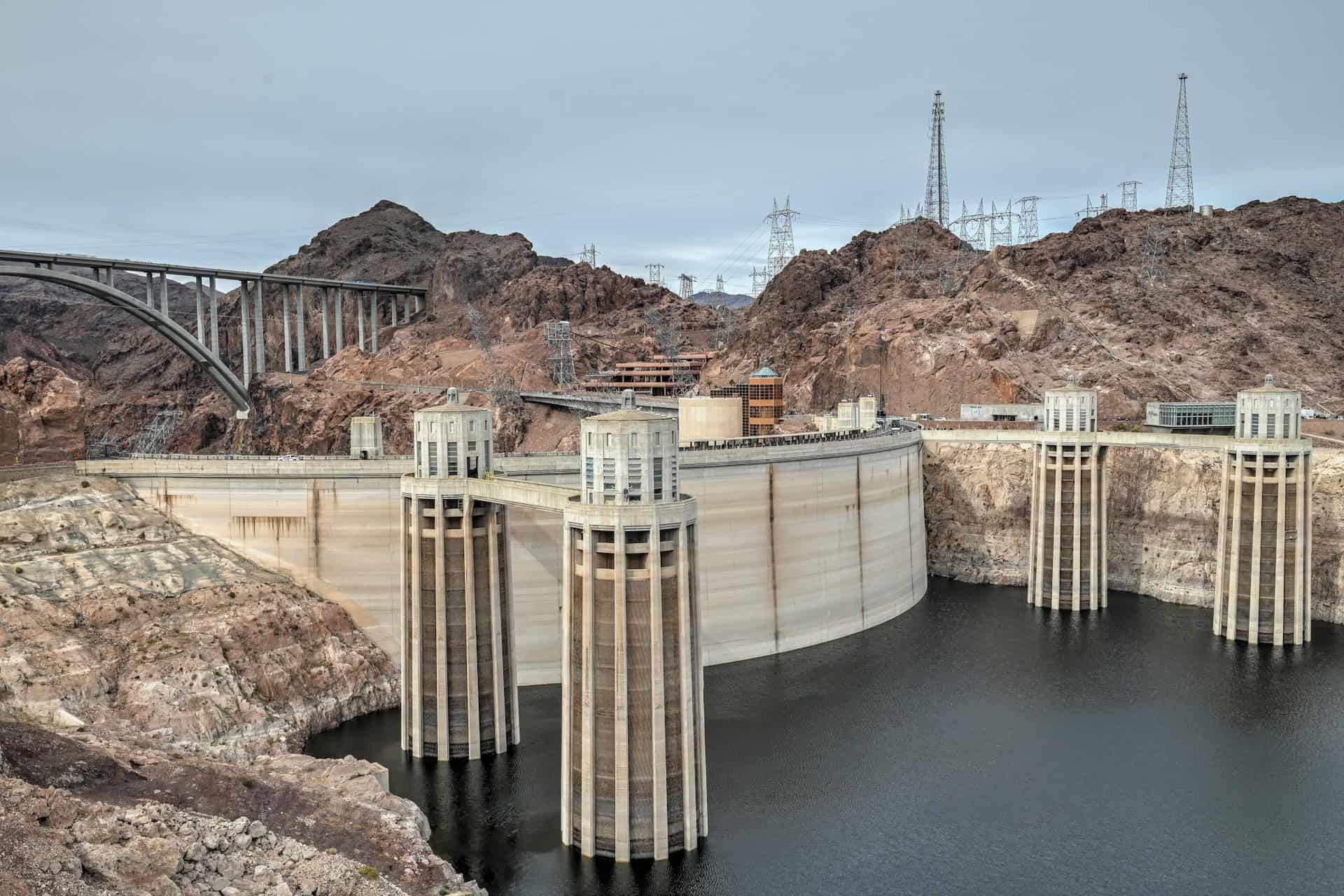
Hoover Dam – Engineering Wonder at the Gateway to Arizona
Although technically just outside the state line, Hoover Dam is the western gateway to a Northern Arizona road trip — and well worth a stop. This massive 1930s engineering feat forms Lake Mead and straddles the Nevada–Arizona border, offering sweeping views from both the dam itself and the pedestrian bridge high above it. It’s a dramatic, convenient introduction to the landscapes and history that await further east.


Disclosure: This page (Best Places to Visit in Northern Arizona) may contain product affiliate links. At no additional cost to you, we may receive a commission for purchases made through these links. More details can be found on our disclosure and policies page.
Best Places to Visit in Northern Arizona
Northern Arizona is packed with extraordinary landscapes, but not every stop is equally rewarding. So in this guide, we’ve focused on the places that truly stand out. These are the viewpoints, short hikes, cultural sites, and scenic detours that deliver the biggest “worth the drive” payoff: jaw-dropping vistas, unique geology, manageable but adventurous trails, and easy-access overlooks for all travellers. You’ll find a mix of iconic highlights and lesser-known gems that offer the perfect blend of scenery, variety, and practicality.
You may notice that the Grand Canyon is omitted here. That’s intentional: not only is it vast enough to deserve its own dedicated guide (with multiple rims, entrances, and activities), but it’s also among the best-documented destinations in the Southwest. This guide instead highlights other spectacular places across northern Arizona that offer equally memorable scenery and experiences, each one chosen for being especially rewarding, accessible, and worth the journey.
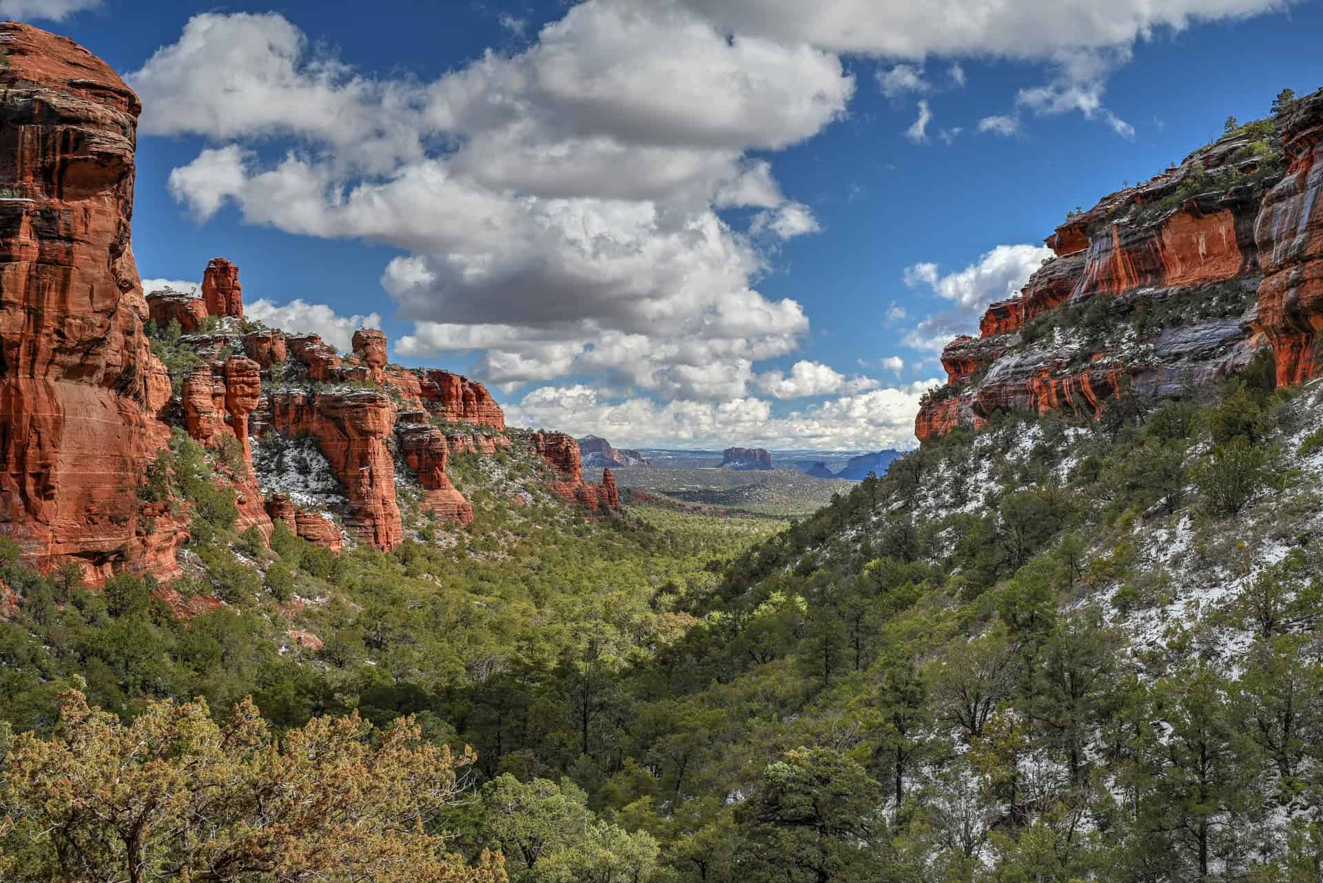
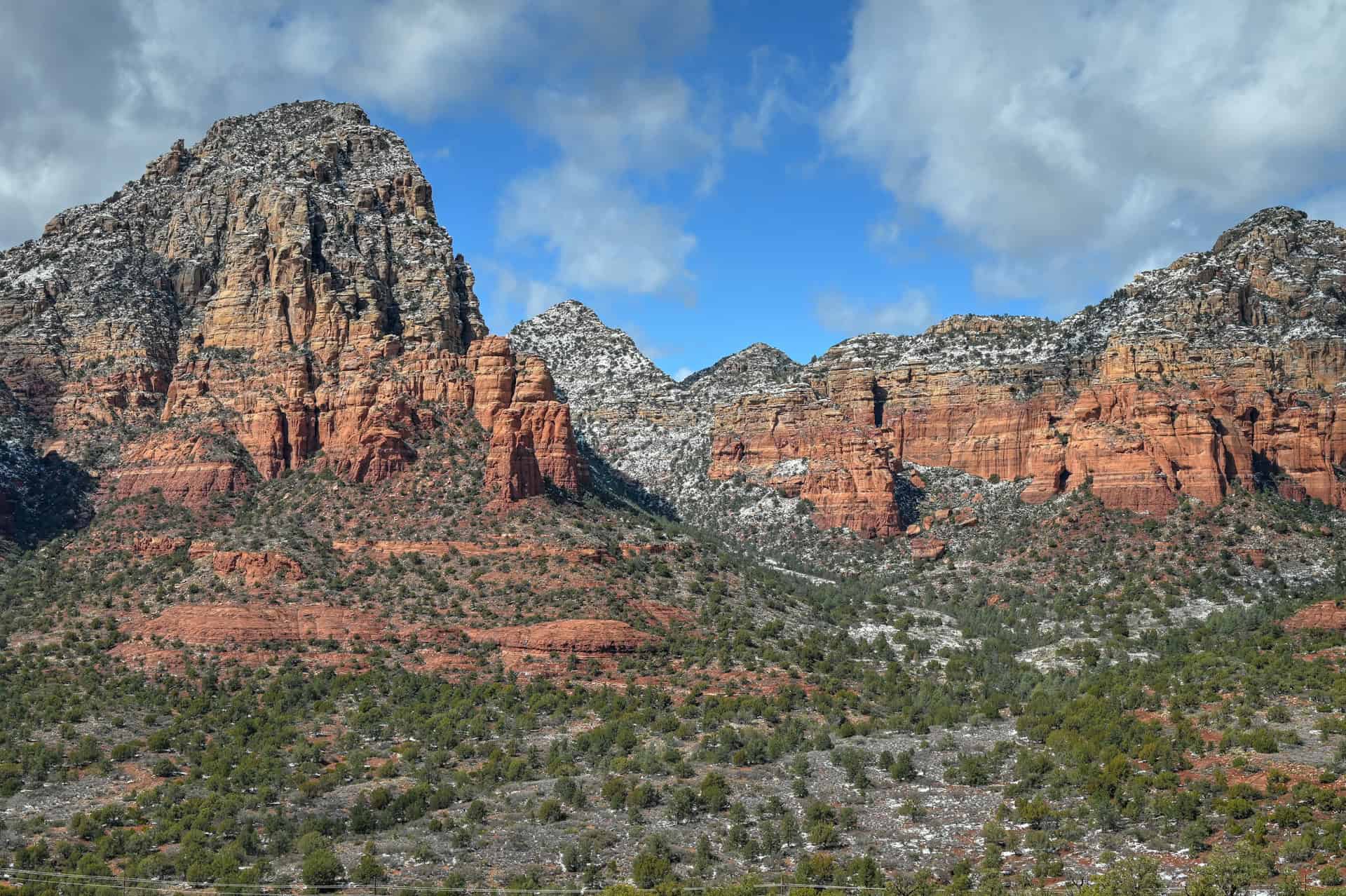
Sedona
Sedona anchors the southern end of our list and makes an exceptional base for exploring some of northern Arizona’s most spectacular scenery. Known for its striking red rock formations, deep canyons, and expansive trail network, Sedona blends small-town comfort with easy access to world-class outdoor scenery. Whether you’re spending several nights here or using it as your launch point for the drive toward Page, the town offers a rare combination of convenience, beauty, and variety: great food, countless trailheads, scenic lookouts, and relaxing places to unwind at day’s end.


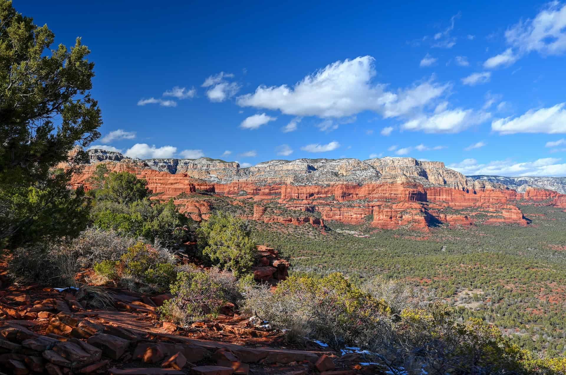
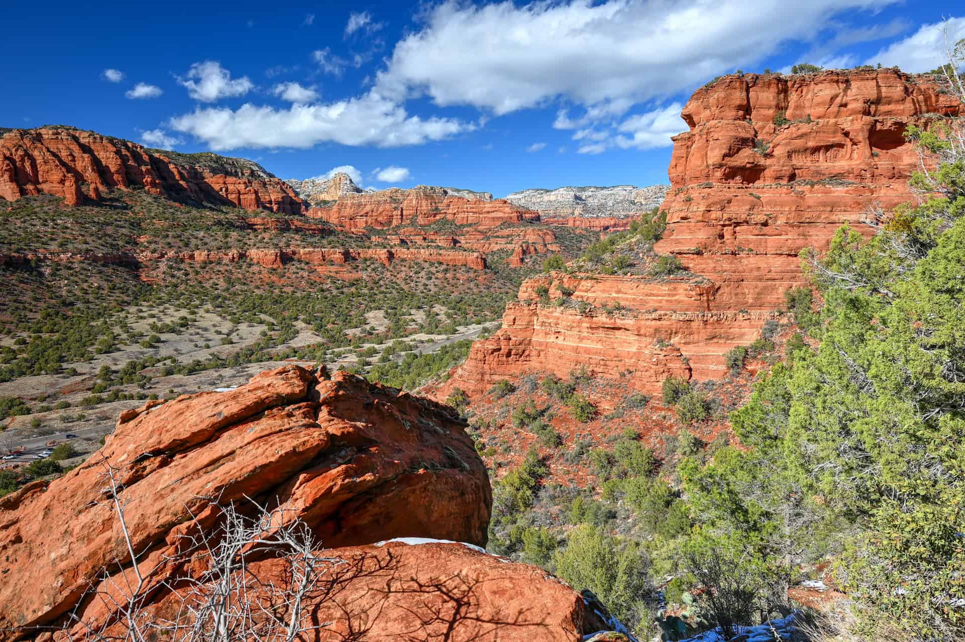
With more than 200 miles of trails, you’ll find everything from gentle walks to demanding climbs right at your doorstep. Classic routes like Cathedral Rock, Fay Canyon, and the Soldier Pass Trail provide stunning views without requiring a full day, while the Red Rock Scenic Byway and Chapel of the Holy Cross are perfect for lower-effort sightseeing. Sedona works just as well for travellers who want a relaxed half-day of exploration as it does for hikers looking to stack multiple trails across several days.
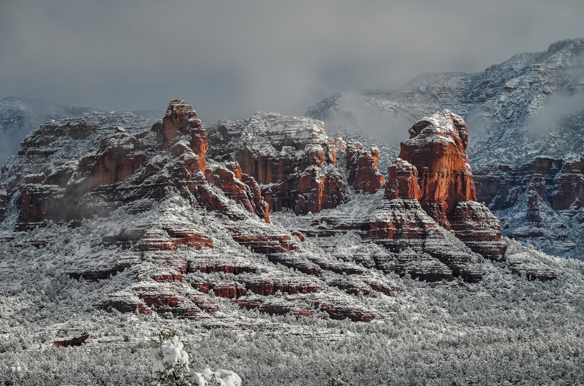
Sitting at roughly 4,350 feet (1,325 m), Sedona is noticeably cooler than lower-elevation desert destinations like Phoenix, especially in spring and fall.
For more information on exploring the area, see our Best Things to See and Do in Sedona Guide, where we highlight the best viewpoints, scenic drives, and short trails.
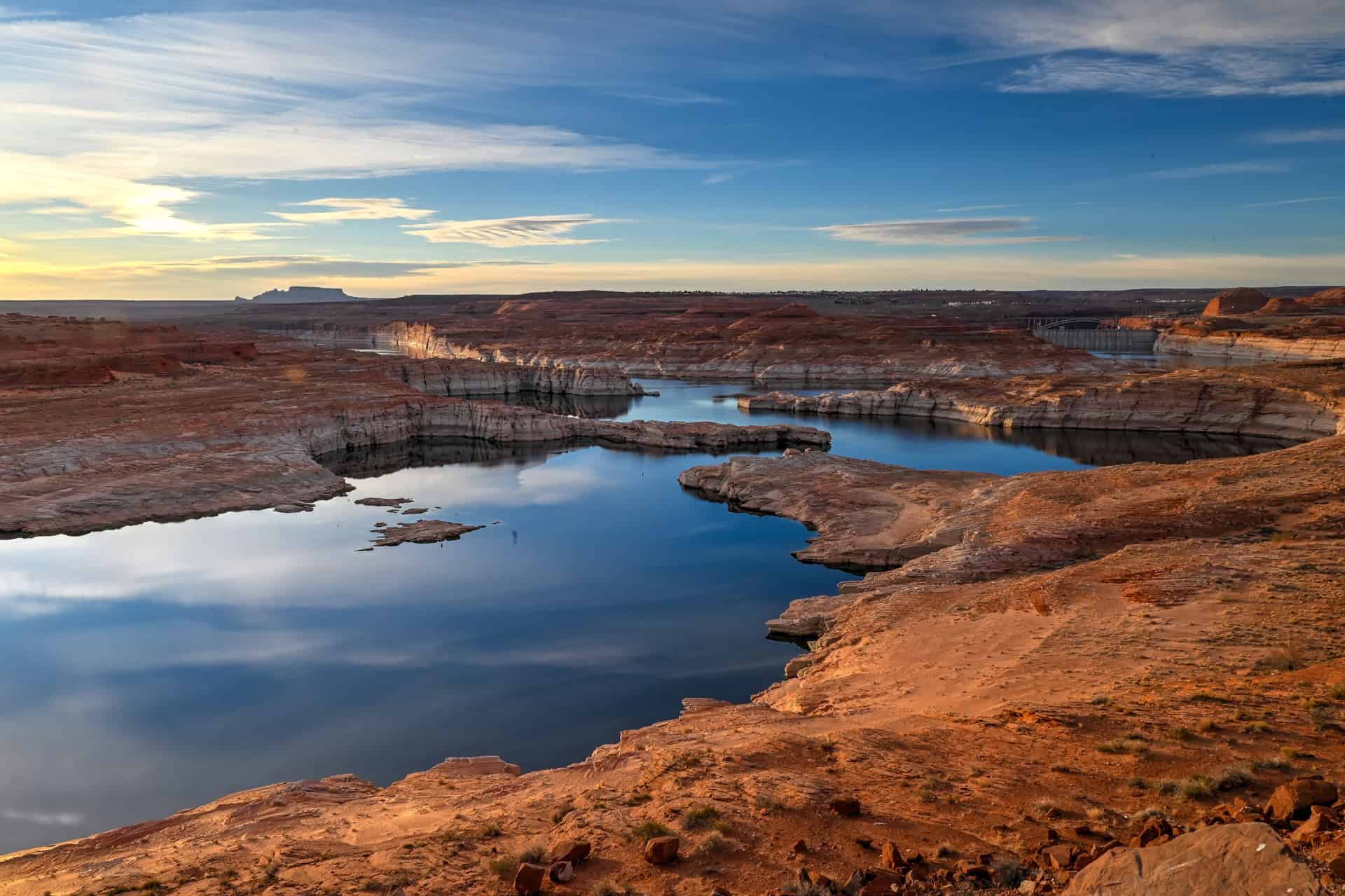
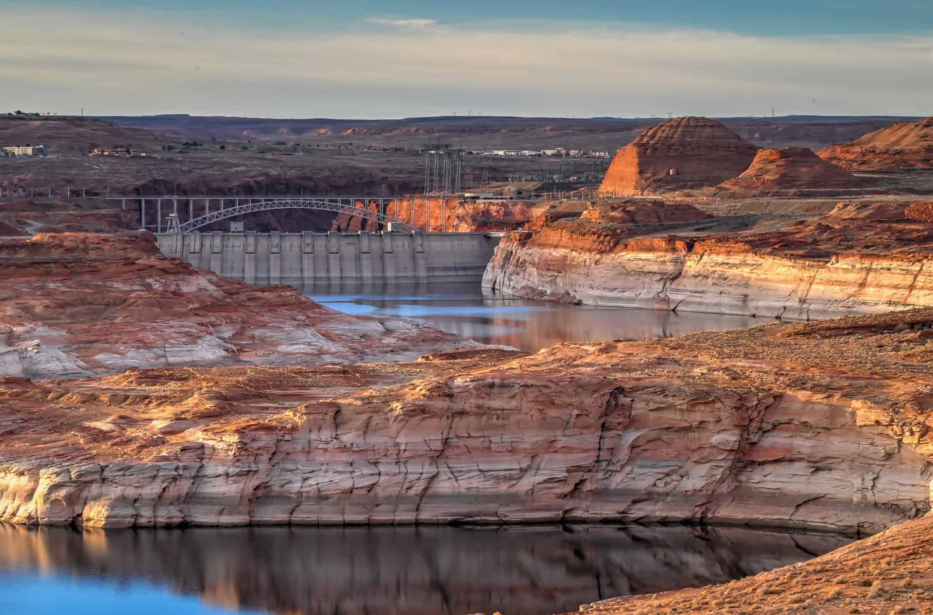
Page (incl. Lake Powell, Horseshoe Bend & Antelope Canyon)
At the northern end of the region is Page, a small but activity-packed town perched above the Glen Canyon area. It’s an ideal base for exploring the superb landscapes and geological features of the area.


Highlights within minutes of town include:
- Beehive (New Wave Trail), a short but incredibly photogenic loop near Glen Canyon Dam, offers sweeping views of sculpted sandstone fins, swirling orange rock, and Lake Powell’s blue water in the distance.
- Antelope Canyon, located on Navajo land and accessible only by guided tour. Depending on your interests, you can visit the photogenic Upper Canyon, the narrower Lower Canyon, or lesser-known options like Secret or Canyon X.
- Horseshoe Bend – Just a few minutes south of Page along Highway 89, this iconic viewpoint showcases a dramatic 270° curve in the Colorado River carved into towering Navajo Sandstone cliffs.
- Glen Canyon Dam Overlook and the Wahweap / Lake Powell area, where you’ll find marinas, boat tours, beaches, and sunset viewpoints.
For more details on planning your visit, see our Best Things to See and Do in Page Guide, which covers the area’s top attractions, tours, and short hikes.
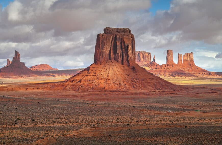
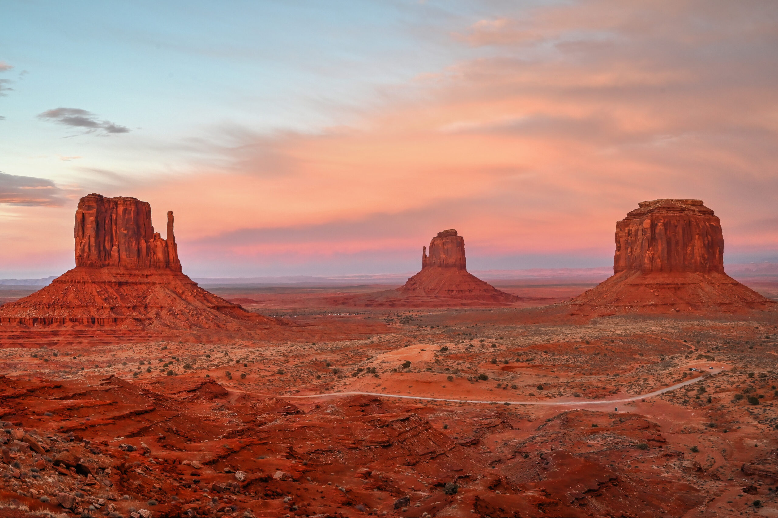
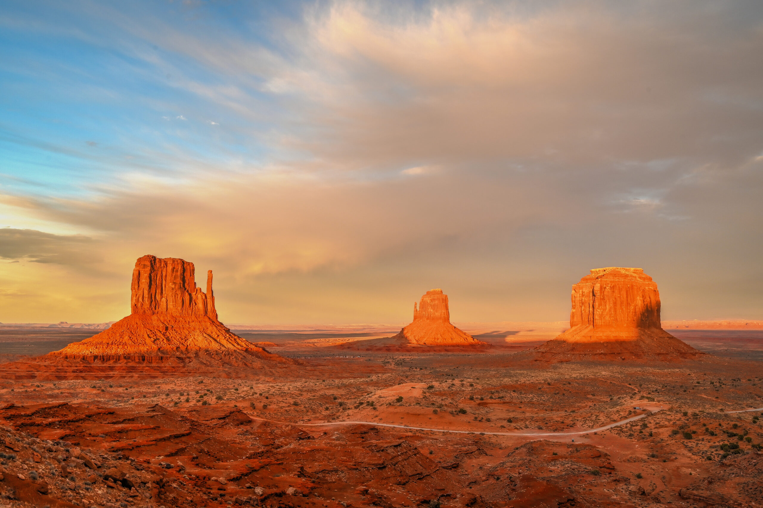
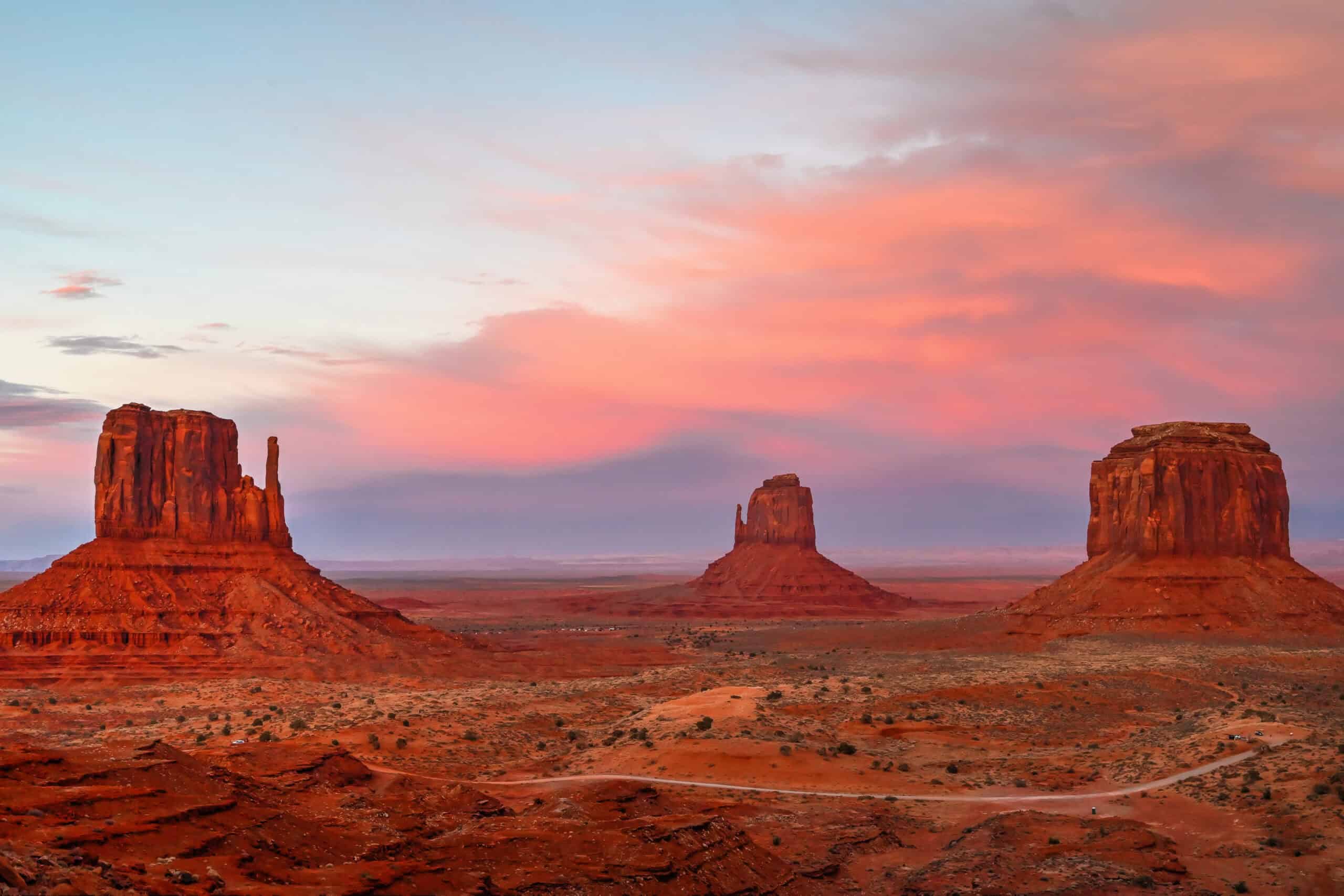
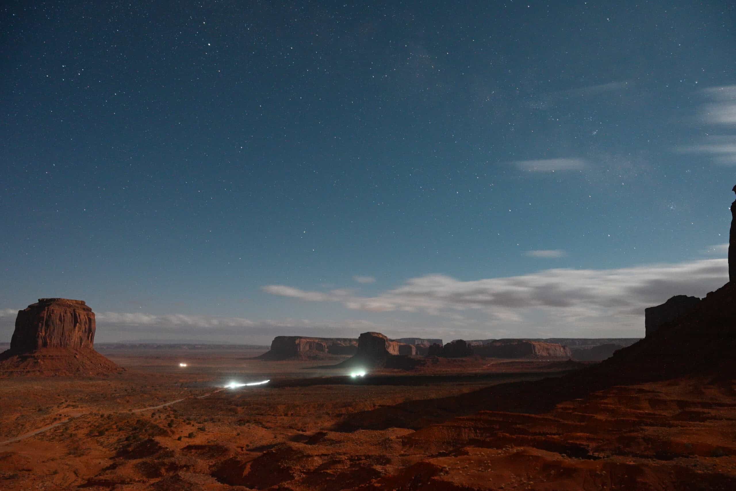
Monument Valley
Straddling the Arizona-Utah border, Monument Valley is instantly recognizable for its towering sandstone buttes, vast desert expanses, and cinematic Western landscapes that have defined countless films and commercials. Despite its remote location, the area rewards visitors with breathtaking scenery at every turn. Whether you drive the 17-mile scenic loop, join a guided Navajo tour, hike the Wildcat trail, or simply pause at one of the many viewpoints, the valley feels larger than life and unforgettable.


Sunrise and sunset are especially magical, as the low-angle light sets the red rock aglow and transforms familiar formations like the Mittens or John Ford’s Point into surreal, almost otherworldly vistas. Even a quick stop to take in the view leaves a lasting impression and offers plenty of photo opportunities.
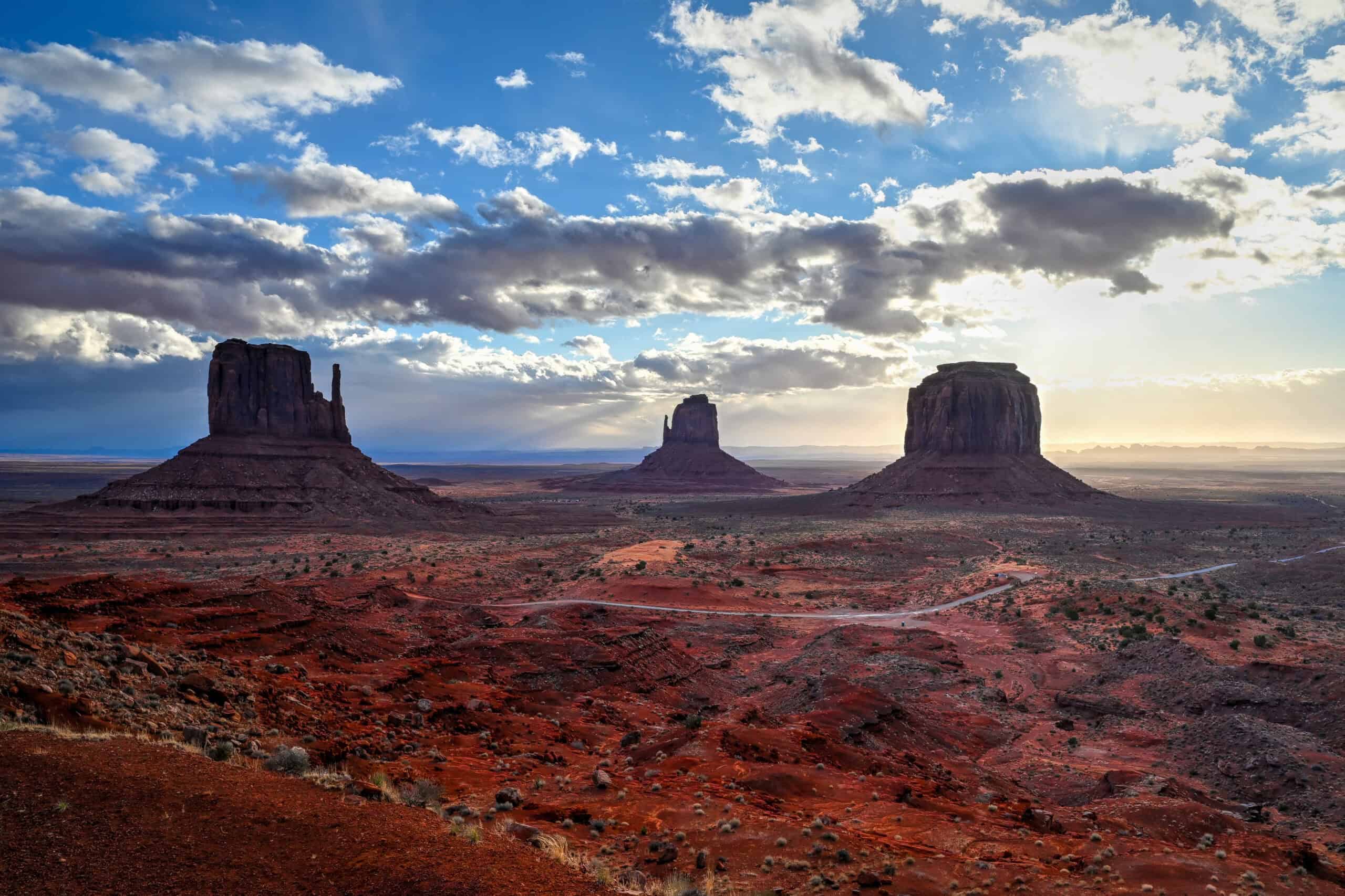
For more information, see our Monument Valley Guide, which highlights the best viewpoints, photo stops, and tour options. Because Monument Valley sits on Navajo Nation land, it’s important to check local hours and tour availability ahead of time
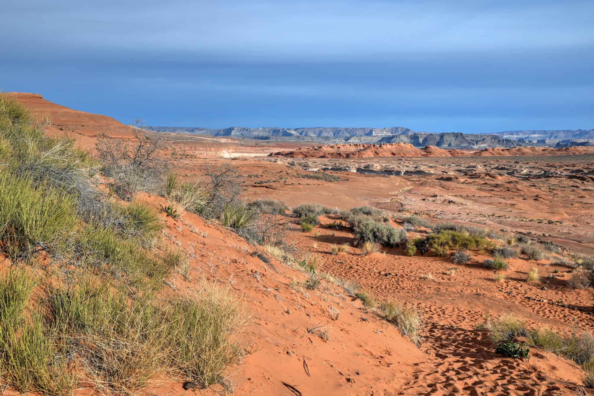
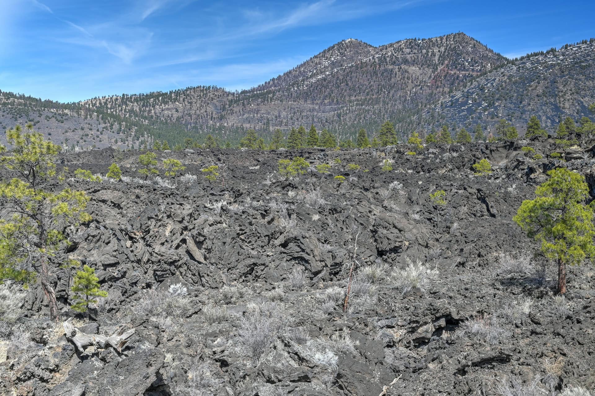
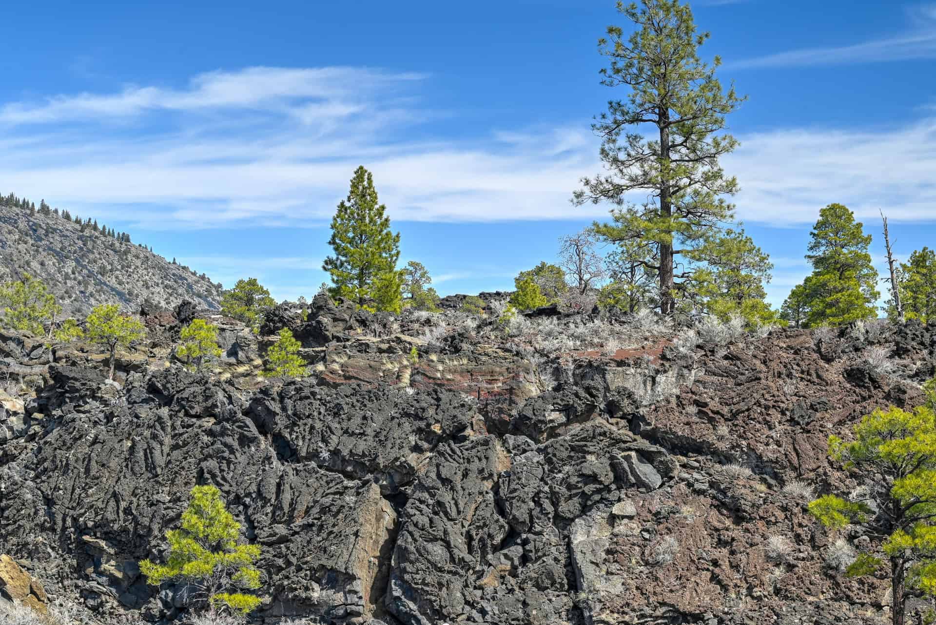
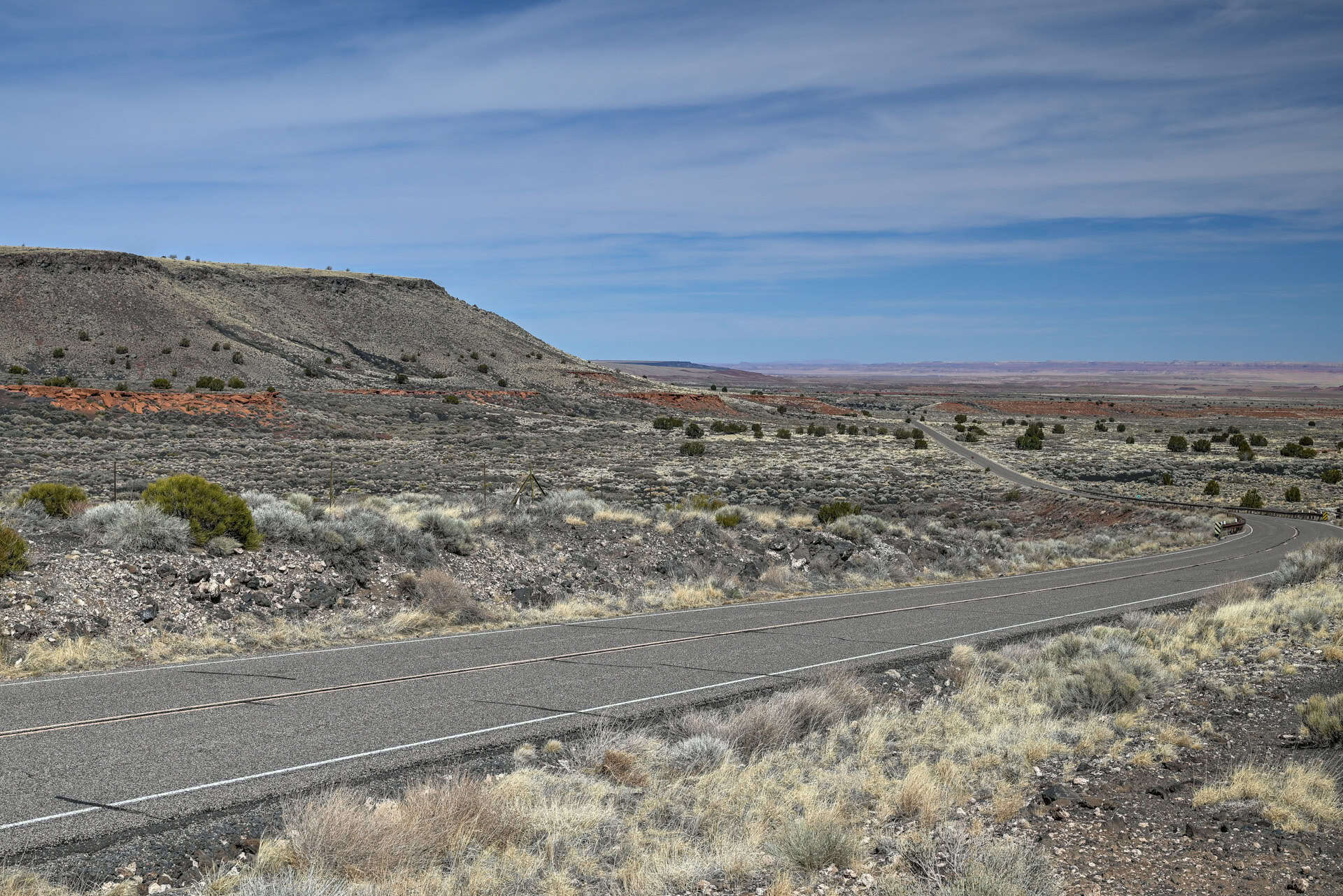
Sunset Crater Volcano National Monument
Located just north of Flagstaff, Sunset Crater Volcano offers a fascinating window into northern Arizona’s volcanic past. Roughly 900 years ago, this cinder cone erupted, leaving behind dramatic black lava flows and cinder fields that stand in stark contrast to the surrounding red rock and lush pine forests. It’s a striking reminder of the region’s dynamic geological history.


Visitors can take a leisurely drive along the scenic loop road, stop at overlooks, or explore short interpretive trails that bring the volcanic landscape to life. Whether you linger at the crater itself or simply enjoy the sweeping vistas of the surrounding terrain, this is a quick yet highly rewarding detour that adds a unique geological twist to a northern Arizona adventure.
For a deeper dive into the area, see our Sunset Crater Volcano Guide, which details trail options, viewpoints, and ways to combine this stop with nearby Wupatki National Monument.
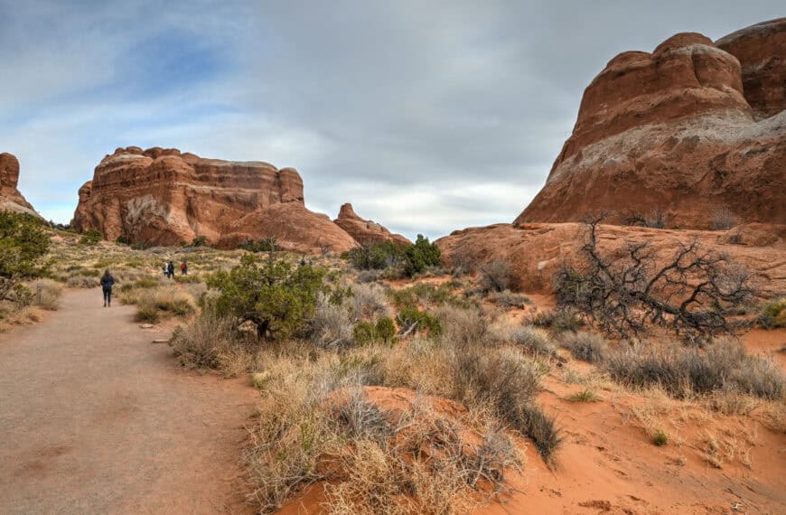
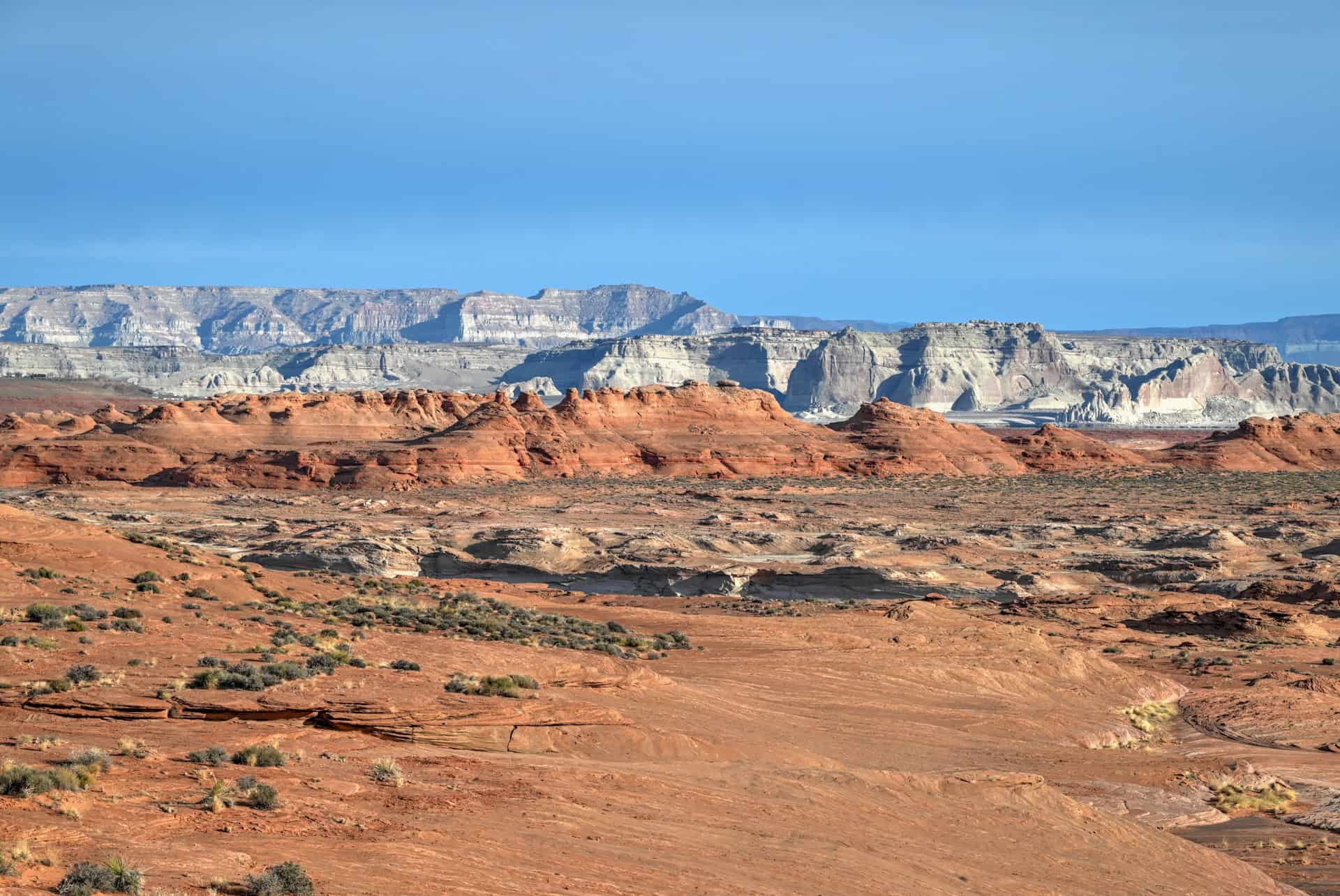
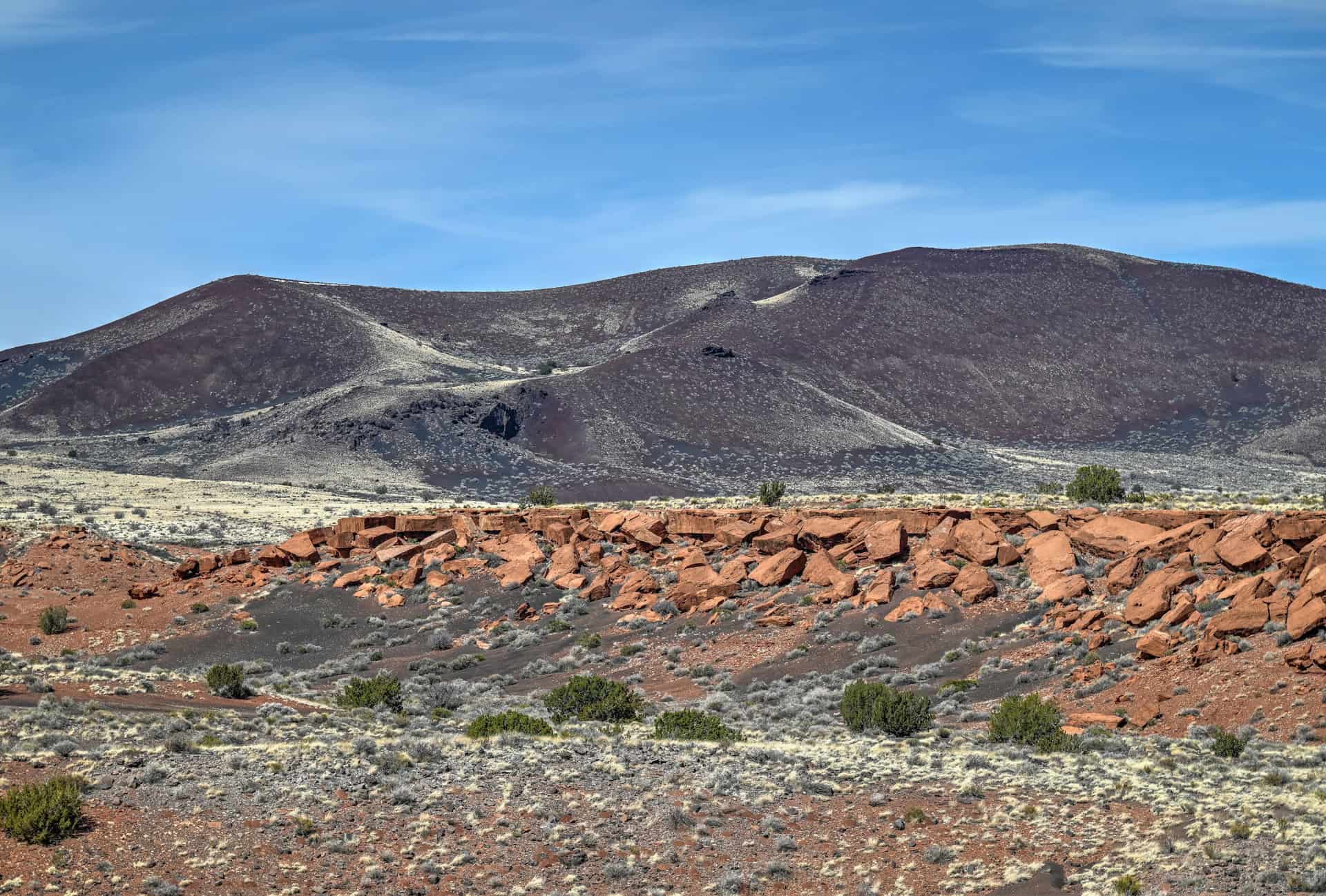
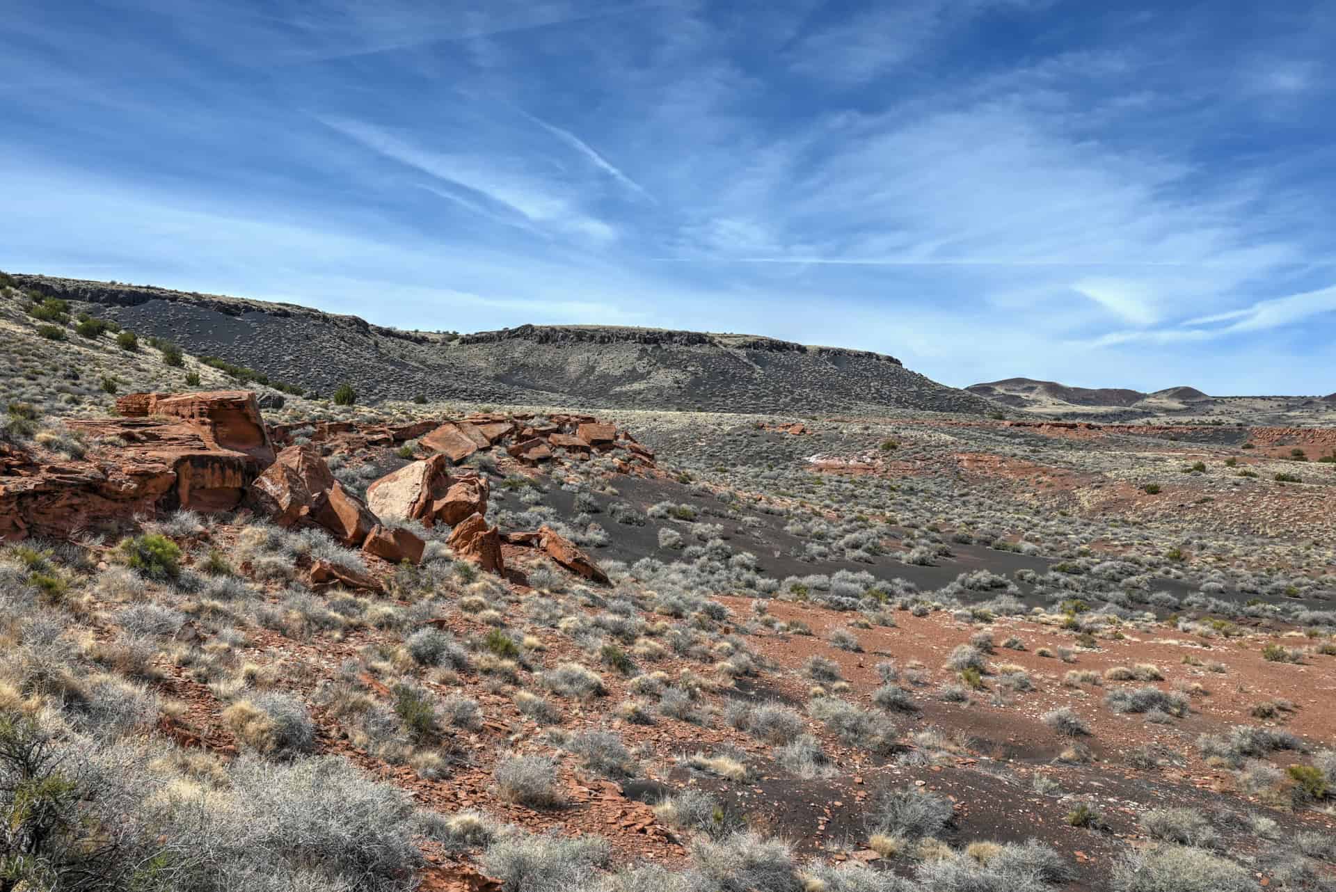
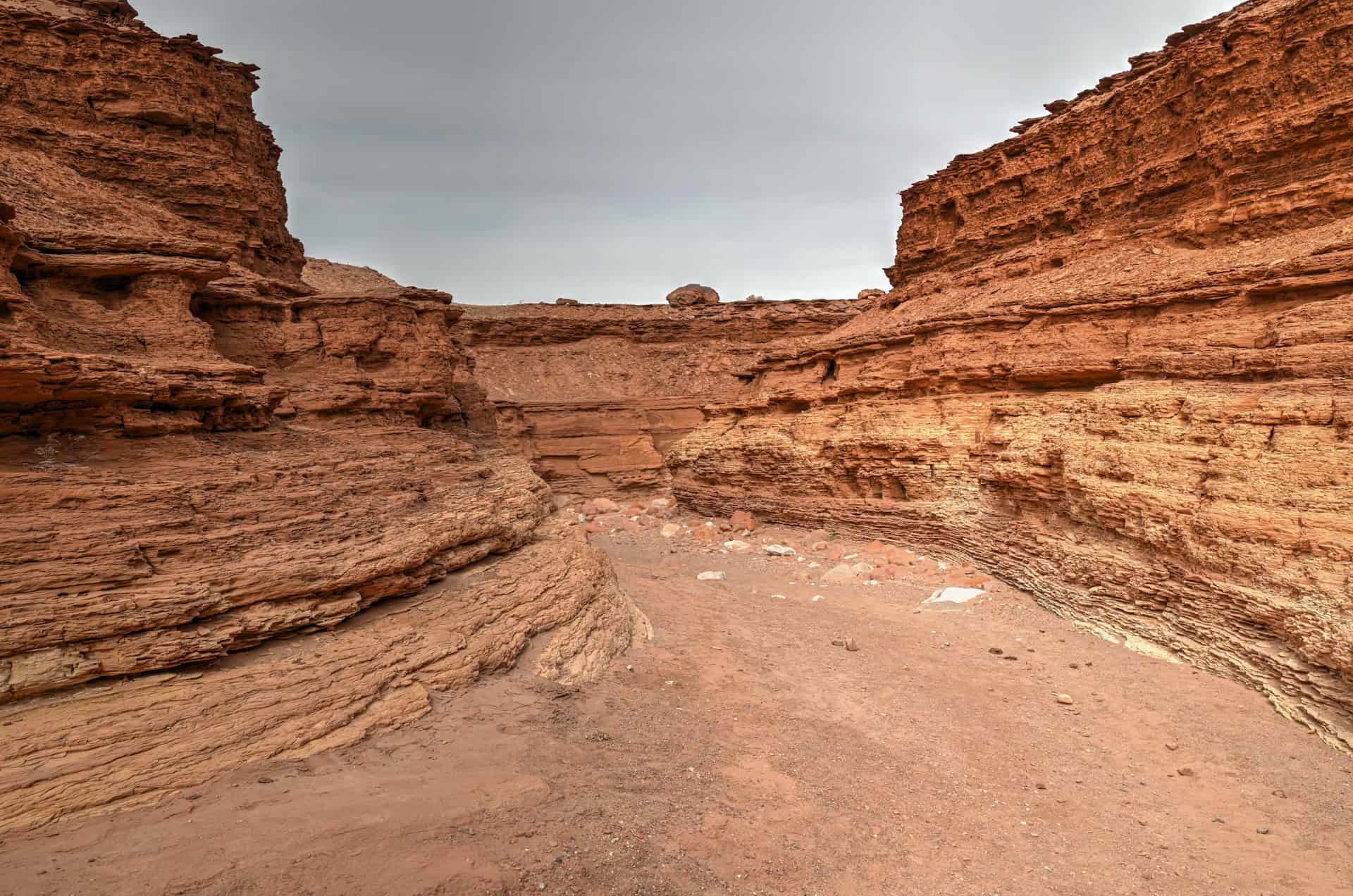
Wupatki National Monument
Just beyond Sunset Crater, the high desert opens up to the ancient pueblos of Wupatki, where history rises out of the red sand and stone. The largest, Wupatki Pueblo, once housed hundreds of Ancestral Puebloan people, and walking the short, easy trails past the ruins provides a rare, tangible connection to life in this arid landscape centuries ago.


Interpretive signage and scenic overlooks give context and perspective, while the quiet desert vistas offer a reflective, almost timeless atmosphere. Visiting Wupatki alongside Sunset Crater creates a fascinating contrast between volcanic forces and human ingenuity, highlighting how early communities adapted to northern Arizona’s dramatic landscapes.
For more information, see our Sunset Crater and Wupatki National Monument Guide, which covers trails, highlights, and practical visiting tips.
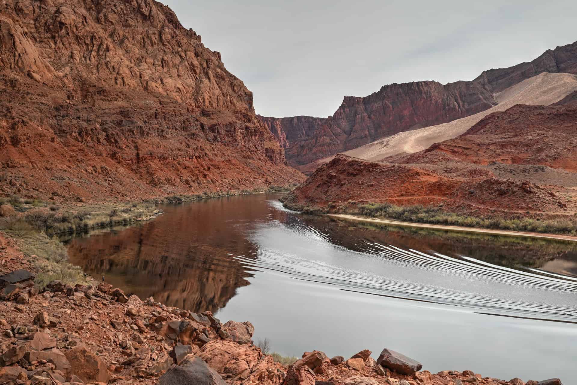
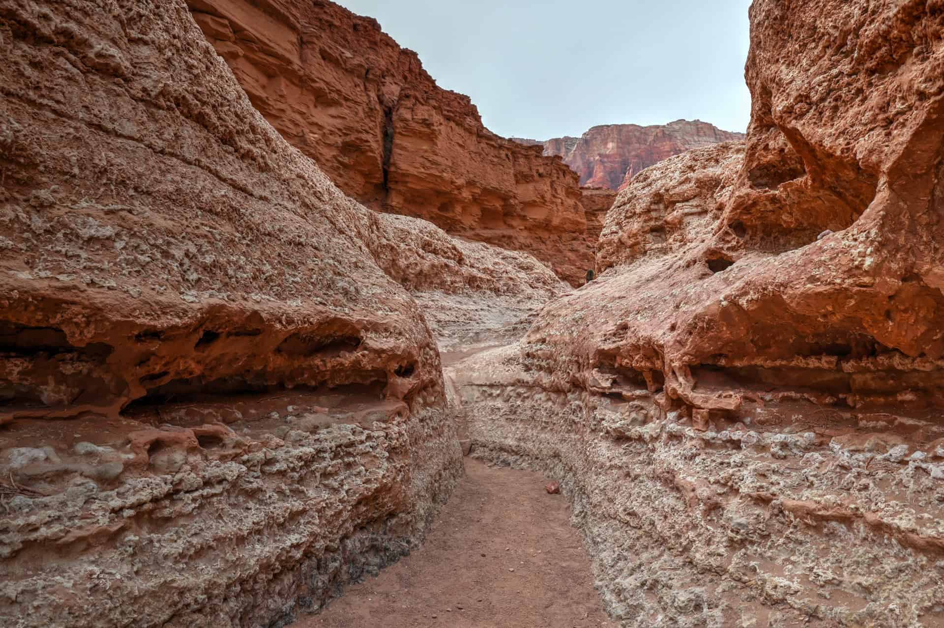
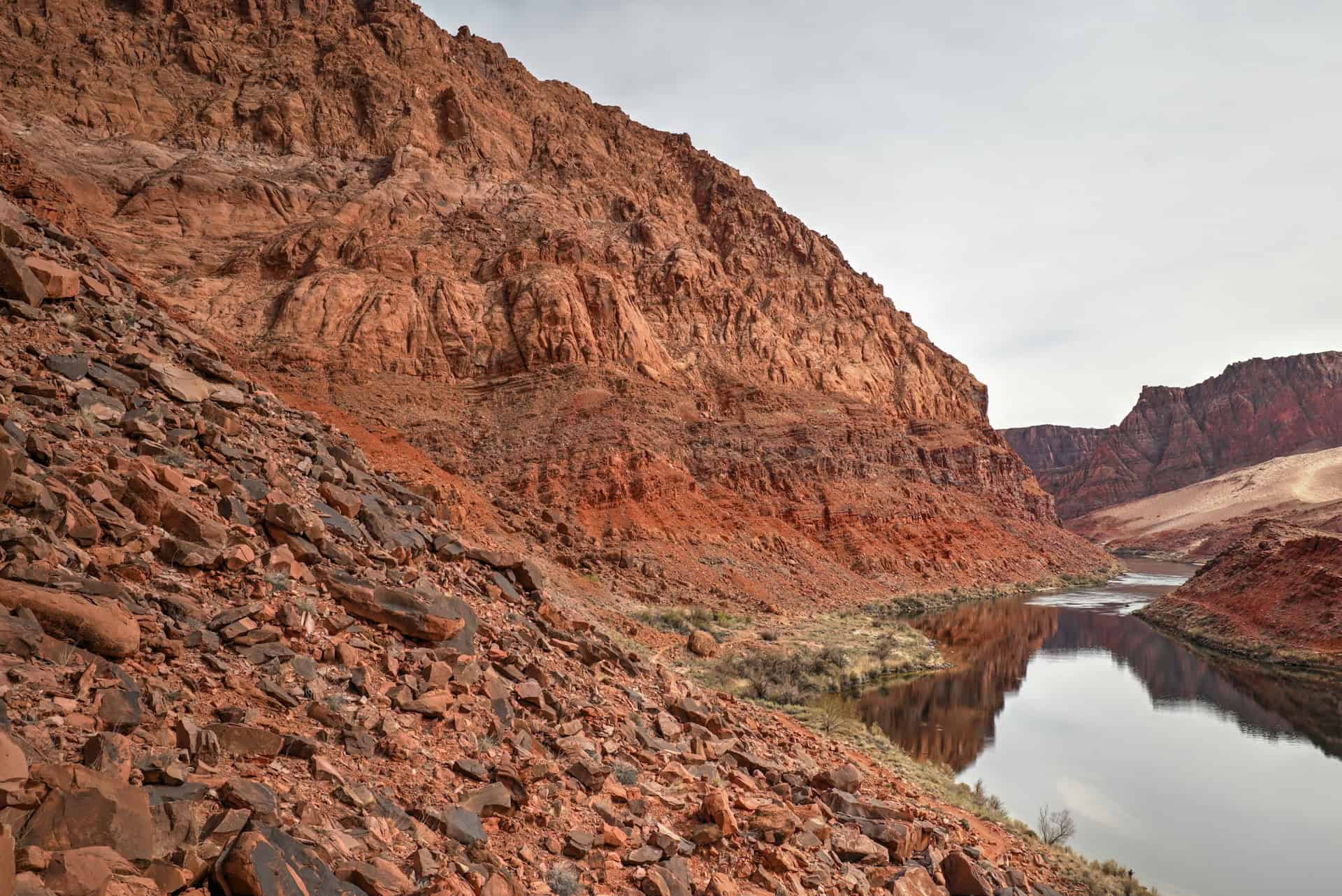
Marble Canyon
Carved by the Colorado River as it begins its journey into the Grand Canyon, Marble Canyon is one of northern Arizona’s most striking yet often overlooked landscapes. Towering red-rock walls, sweeping desert views, and the graceful span of the historic Navajo Bridge make this narrow corridor feel both dramatic and peaceful. Whether you’re crossing the bridge, stopping at roadside viewpoints, or exploring the riverbanks below, the scenery here delivers an immediate “wow” factor without requiring a long detour.


The highlight of any visit is the pair of Navajo Bridges (one historic, one modern), which sit high above the turquoise Colorado River. From the pedestrian walkway, you can often spot California condors soaring overhead or perched along the canyon walls. The area also offers a visitors’ center, access points to Lees Ferry (the start of the Grand Canyon’s river trips), and hiking trails with excellent photo angles, including Cathedral Wash and the Spencer Trail. It’s a fun and rewarding stop that breaks up the drive between Flagstaff, Page, and Monument Valley, and it can also easily be visited from Page.
For more details, see our Marble Canyon Guide, which covers the best viewpoints, short walks, and practical tips for planning your visit.
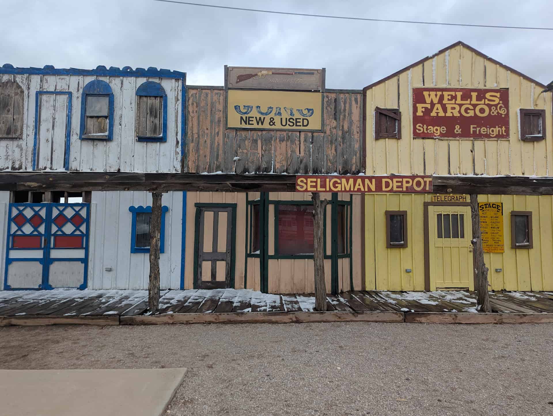
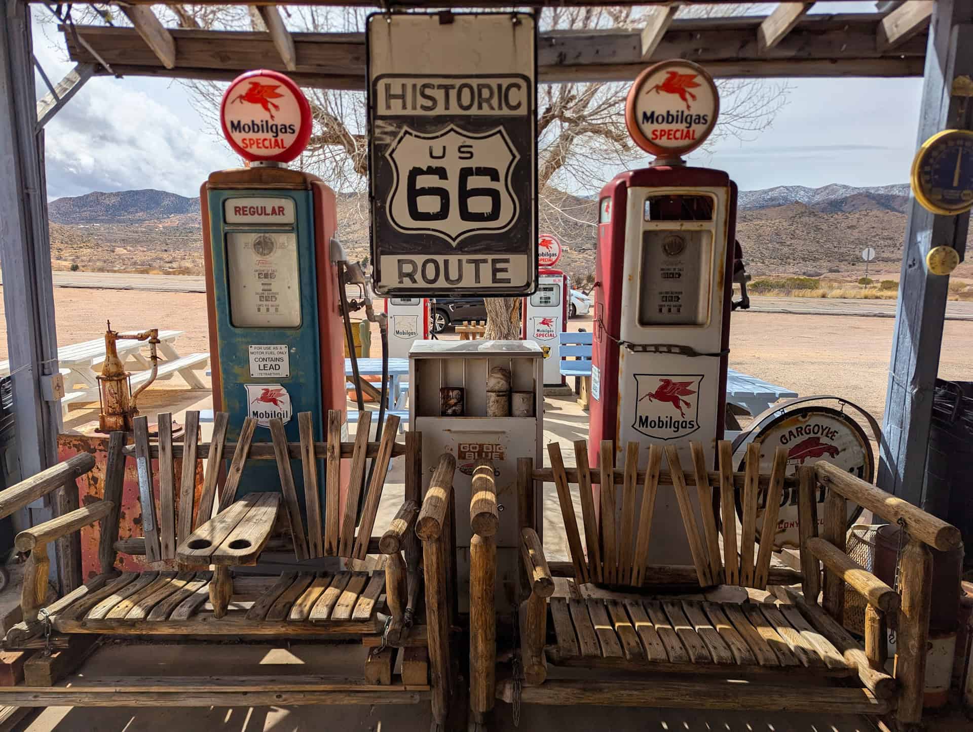
Historic Route 66
Winding across northern Arizona, Route 66 is more than just a highway: it’s a journey through Americana, nostalgia, and quirky roadside culture. Towns like Kingman, Hackberry, Seligman, and Ash Fork are peppered with neon signs, vintage cars, classic diners, and colorful murals, each stop telling a story of the “Mother Road” at its mid-century heyday.


Whether you’re grabbing a quick photo of retro gas pumps at Hackberry, enjoying a leisurely lunch at Delgadillo’s Snow Cap in Seligman, or strolling the walkable streets of Kingman’s historic downtown, the route offers a fun and lively mix of history, kitsch, and charm. Even brief stops capture the spirit of the open road and provide a welcome break between scenic drives.
For more information, see our Guide on the Best Stops Between Las Vegas and Sedona, which highlights the most photogenic towns, roadside attractions, and practical tips for planning your drive.
Hoover Dam
Straddling the Nevada-Arizona border, Hoover Dam is one of America’s most iconic engineering feats, and a must-see if you’re heading west from northern Arizona. Built during the Great Depression, this massive concrete arch-gravity dam tames the Colorado River and provides hydroelectric power, water storage, and a striking photo backdrop for travelers.


Visitors can walk across the top of the dam, peek into the powerplant tunnels, or take in the panoramic views from the nearby Mike O’Callaghan–Pat Tillman Memorial Bridge, which offers a dramatic perspective high above the turquoise river. There are multiple parking areas depending on your focus: free access to the bridge overlook, paid lots for walking the dam and joining guided tours (typically $30–$35, around 1 hour), and quick pullouts for scenic snapshots.
For more information, see our Guide on the Best Stops Between Las Vegas and Sedona, which covers parking, tours, and viewing tips.
Travel Tips & Driving Considerations
Suggested Driving Routes & Scenic Detours
From/To Phoenix:
- Sedona (2–4 days) – Begin your Northern Arizona adventure in the red-rock landscapes of Sedona, with hiking, vortex sites, and scenic Oak Creek Canyon.
- Sunset Crater & Wupatki (en route) – On the way north, detour to these volcanic and ancient pueblo landscapes for short trails, scenic overlooks, and rich history.
- Marble Canyon (en route, or from Page) – Continue north with a stop at Navajo Bridge for panoramic views of the Colorado River, a great mid-route break.
- Page (2–3 days) – Explore Antelope Canyon, Horseshoe Bend, and Glen Canyon National Recreation Area; ideal base for river and slot-canyon adventures.
- Monument Valley (1–2 days) – Finish with dramatic desert vistas and iconic sandstone formations on Navajo Tribal Land.
From/To Las Vegas:
- Hoover Dam & Lake Mead (en route) – Just outside Las Vegas, take in sweeping desert lake views and one of America’s engineering marvels.
- Historic Route 66 towns (en route) – Seligman, Kingman, Ash Fork, and Hackberry provide colorful, nostalgic stops along the way to Northern Arizona’s high country.
- Sedona –> Sunset Crater –> Marble Canyon –> Page –> Monument Valley – From the Route 66 corridor, follow the same loop as the Phoenix route to continue north, blending natural wonders with cultural landmarks.
If you need to book a rental vehicle for your hiking excursion, we highly recommend using Discover Cars to get the best rates on your rental in Utah, Nevada and Arizona.
We also highly recommend Airalo (eSIM card) for your connectivity needs when travelling abroad. Airalo is the world’s first and largest eSIM store with eSIM plans for 200+ countries and regions worldwide.
Seasonal Weather & Driving Notes
Northern Arizona’s varied elevations create dramatic temperature swings. It’s common to experience 20–30°F (10–15°C) differences between desert valleys like Page or Lake Mead and high-elevation stops such as Flagstaff, Sunset Crater, or Oak Creek Canyon.
Before Summer (Spring & Early Summer) or Fall:
- Expect mild to warm temperatures in the lower desert areas, but cooler, sometimes chilly conditions at higher elevations.
- Snow can linger in the high country (Oak Creek Canyon, San Francisco Peaks, Sunset Crater) into March, and sudden cold snaps are possible.
Summer:
- Desert areas like Page and Lake Mead can exceed 100°F (38°C), while Flagstaff and Sedona remain cooler by 10–20°F.
- Early departures for hikes and drives are highly recommended to avoid peak heat.
Winter:
- Snow and icy patches are possible at higher elevations; roads such as Highway 89A through Oak Creek Canyon and north of Flagstaff may require extra caution.
- Lower-elevation stops (Page, Marble Canyon) usually remain dry, but wind and sunshine can make temperatures feel cooler than the forecast.
Pro Tip: Always check the local weather forecast before heading out, particularly in spring or fall, as conditions can change quickly across elevations. Layering, sunscreen, and plenty of water are key to a comfortable and safe Northern Arizona road trip.
Fuel Stops & Limited Service Areas
Northern Arizona has long stretches with few services, especially between Flagstaff and Page or near Marble Canyon. Plan ahead to avoid running low:
- Sedona / Oak Creek Canyon: Several stations in Uptown and West Sedona.
- Flagstaff: Plenty of gas stations along Route 66, Milton Road, and near the Highway 89 junction.
- Cameron: About 50 minutes north of Flagstaff; good for refuelling and grabbing a snack.
- Page: Ample fuel options upon arrival.
- Route 66 note: Gas stations along the historic Route 66 towns (Kingman, Seligman, Ash Fork) are available, but service is more limited and may close early, so it’s best to fill up before leaving Flagstaff or Kingman if following a Route 66 detour.
- The stretch between Cameron and Page is roughly 80 miles (130 km) with limited services. Filling up in Cameron is strongly recommended.
Cell Coverage & Offline Maps
Expect spotty or nonexistent cell coverage on certain stretches, particularly along Highway 89 between Cameron and Page, around Marble Canyon, and the Navajo Nation backcountry.
Tips for staying connected:
- Download offline maps (Google Maps, Maps.me, or a GPS device) before leaving.
- Save any tour confirmations (Antelope Canyon, Horseshoe Bend shuttles, Monument Valley guides) locally on your device.
- Consider a paper map as a backup; some areas are very remote.
Time Zones & Changes
One often overlooked detail when driving in Northern Arizona is time zone shifts, especially when crossing the Navajo Nation, which observes Daylight Saving Time (DST), unlike most of Arizona.
- Navajo Nation: Unlike most of Arizona, the Navajo Nation observes Daylight Saving Time (MDT). From March through early November, towns like Cameron, Sunset Crater, and Wupatki are 1 hour ahead of Sedona, Flagstaff, and Page (which stay on MST).
- Highway 89 (between Flagstaff and Page) passes in and out of the Navajo Nation, so your phone, smartwatch, and car clock may jump forward or back multiple times.
- Heading into Utah: Routes toward Monument Valley or the northern Navajo Nation cross into Utah, which also observes DST. During summer, Utah is 1 hour ahead of Arizona time (MST).
- Heading into Nevada: Travelling west toward Hoover Dam or Las Vegas crosses into Pacific Time. During summer, Nevada is 1 hour behind Arizona time (MST).
- Tip for summer travel: Utah and the Navajo Nation are one hour ahead of most of Arizona, which itself is one hour ahead of Nevada.
- Tip for winter travel: Everyone is on the same time, except Nevada is still one hour back.
Photography Gear
If you like our photography, you might be interested in some of the gear we use to shoot our travel and hiking destinations.
Camera Body – Nikon Z 6ii Fx-series Mirrorless Body
Main Lens – NIKON 24-120mm F/4G ED VR AF-S
Zoom Lens – Sigma 745-306 150-600mm f/5-6.3
Polarizing filters – Urth Circular Polarizing (CPL)
Camera Tripod – K&F Concept 64-inch Camera Tripod
Mini-tripod – Lammcou Flexible Camera Tripod
Camera/hiking backpack – Vanguard Alta Rise 48 Backpack
Universal Travel Adapter – VYLEE Universal International Power Travel Plug
Other Travel Essentials
Travel Insurance
SafetyWing is a travel insurance company that offers comprehensive coverage for travellers. Includes Medical Insurance and Travel Insurance. Primarily geared towards long-term travellers, digital nomads, and expats.
e-Sim cards
Airalo is the world’s first and largest eSIM store with eSIM plans for 200+ countries and regions worldwide. With Airalo eSIMs, travellers can get connected the moment they land at their destination and avoid nasty data roaming charges
eSIMS are a sustainable alternative to single-use SIM cards – they are 100% digital, require less energy to produce and be re-used rather than disposed of.
Car Rentals
Discover Cars is our go-to website for car rentals. We almost always find our preferred rate there.
Transfer from Airport
Welcome Pickups is our favourite private transfer service, which you can pre-book at a fixed price. Currently available in 220 cities all over the world (mostly in Europe, but with several major cities in Asia, the Middle East and the US).
Kiwitaxi is another private transfer service – we haven’t tried it yet, but it’s currently available in a few more countries (102 as of 2024).
Hotels and Accommodations (coming soon)
Photography Prints
If you found this blog useful, you can help support our blog by purchasing low-cost digital prints. Printed physical prints are also available for purchase.


—–
Well, that wraps it up! We hope you enjoyed our Best Places to Visit in Northern Arizona (Beyond the Grand Canyon) Travel Guide and that it will prove useful for planning your trip.
—–
You might also be interested in these related pages: