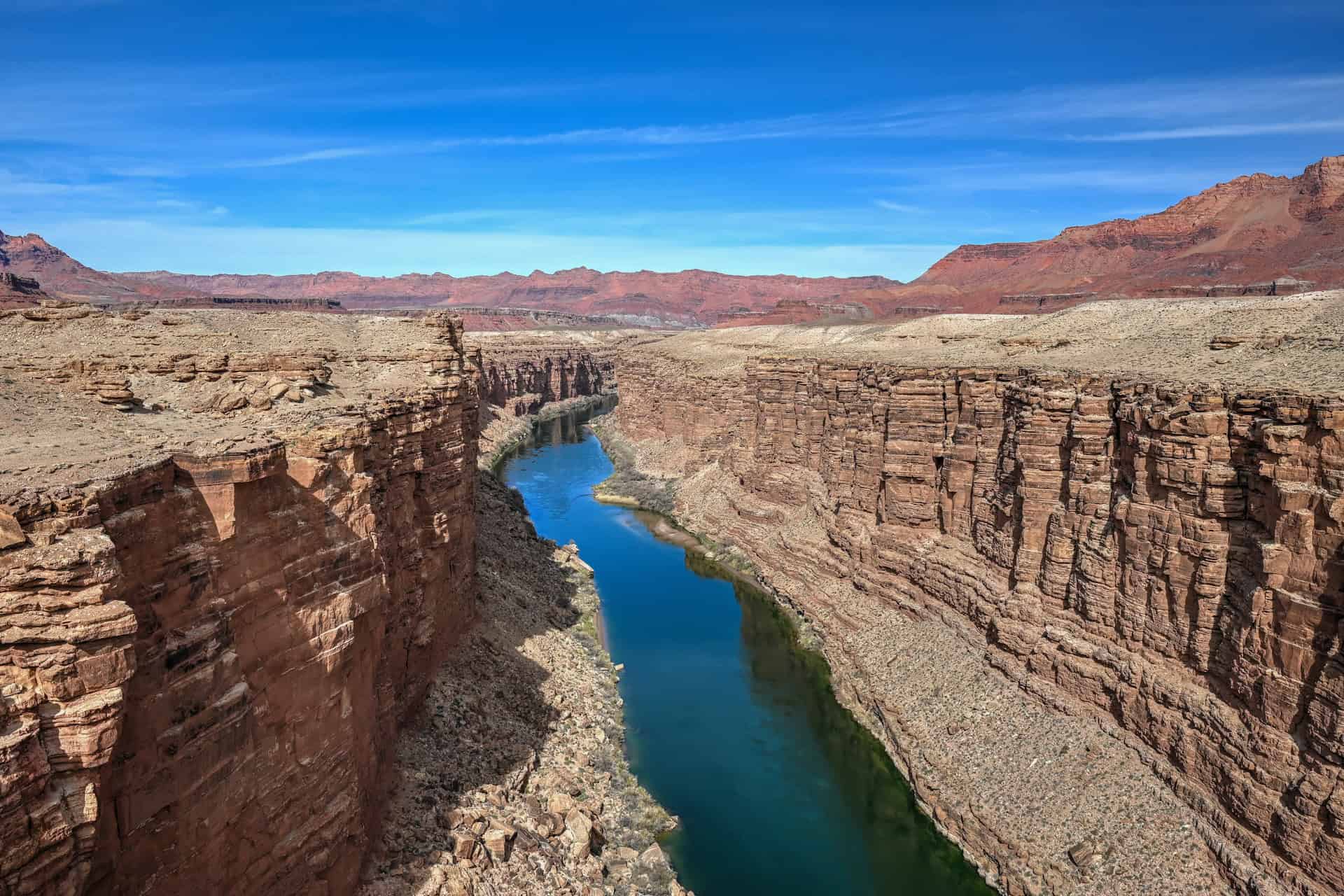
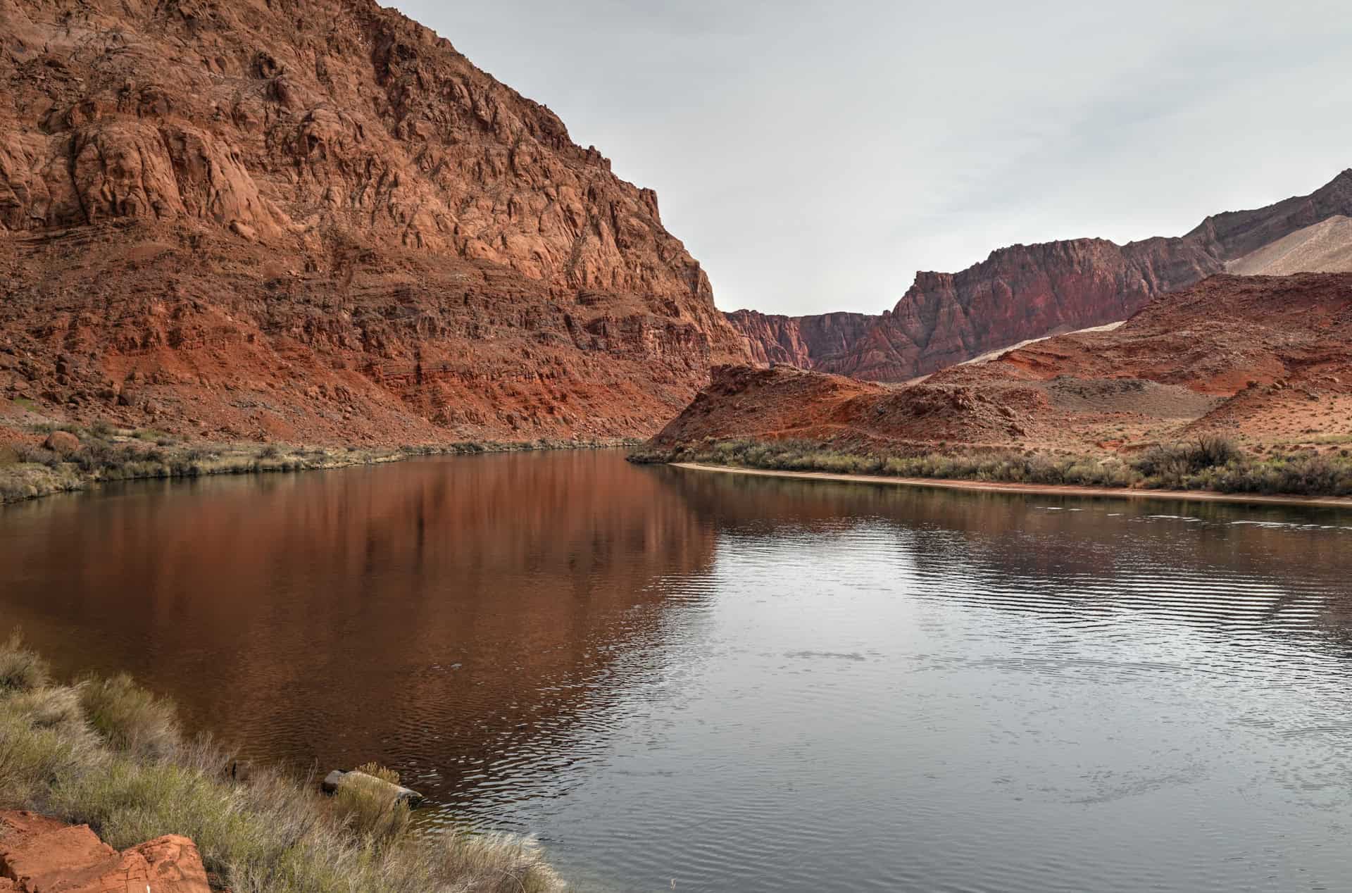
Just downstream from Lake Powell and tucked along the Colorado River, Marble Canyon offers a quieter, more contemplative counterpart to the popular overlooks around Page. Here, sheer red cliffs rise abruptly from the water’s edge, the graceful Navajo Bridge spans the gorge, and desert trails wind through sandstone and sage toward sweeping river views. Hikes like Cathedral Wash, which descends through a twisting canyon to the Colorado, and the steep but rewarding Spencer Trail, offering panoramic views high above Lees Ferry, reveal the raw beauty and scale of the landscape. Whether you’re after dramatic viewpoints, a scenic riverside walk, or a peaceful stop between Page and the North Rim, this guide will walk you through how to reach Marble Canyon, what to expect once you’re there, and the scenic spots that make it one of northern Arizona’s most underrated destinations.
Marble Canyon Guide – At a Glance
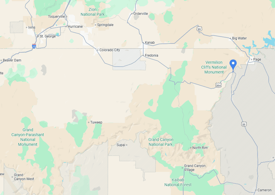
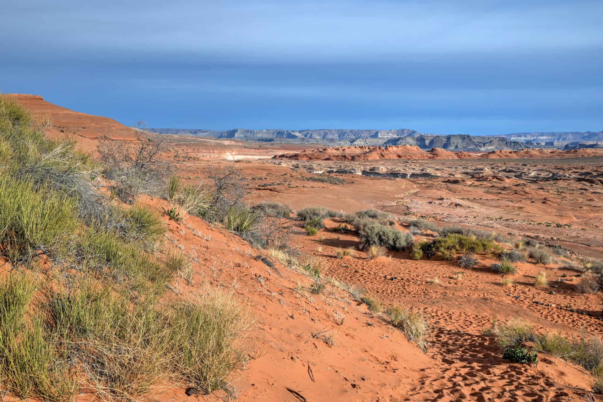
A hidden gem between Page and the Grand Canyon – Marble Canyon and Lees Ferry form one of northern Arizona’s most scenic and overlooked regions, located about 45 minutes southwest of Page. This area marks the transition between Glen Canyon and the Grand Canyon, where the Colorado River slices through sheer red cliffs and begins its epic downstream journey.
Rich history and river heritage – At Lees Ferry, you can walk along the same riverbank used by early pioneers to cross the Colorado in the 19th century. The nearby Lonely Dell Ranch Historic Site preserves stone buildings, orchards, and remnants of pioneer life — a peaceful stop that feels frozen in time.
Spectacular viewpoints and bridges – Just upstream, the Navajo Bridge offers breathtaking views 467 feet (142 m) above the Colorado River, with a pedestrian walkway and interpretive displays explaining the region’s history and geology.
Hiking highlights – The Cathedral Wash Trail follows a sculpted sandstone canyon from the desert rim to the river, offering a mix of easy walking and mild scrambling through colorful rock layers. For a more challenging adventure, the Spencer Trail climbs steeply above Lees Ferry to a jaw-dropping overlook of Marble Canyon.
Peaceful, easy to explore, and full of variety – With its blend of history, geology, hiking, and river views, Marble Canyon makes an ideal half-day or full-day excursion from Page — or a memorable stop on the drive toward the North Rim of the Grand Canyon. It’s quieter than the nearby hotspots yet every bit as photogenic.
Despite being easy to reach and just off a major highway, the area feels surprisingly remote and tranquil, offering an immediate sense of solitude and connection to the desert landscape.


Disclosure: This page (Marble Canyon Guide) may contain product affiliate links. At no additional cost to you, we may receive a commission for purchases made through these links. More details can be found on our disclosure and policies page.
Marble Canyon Location and Map
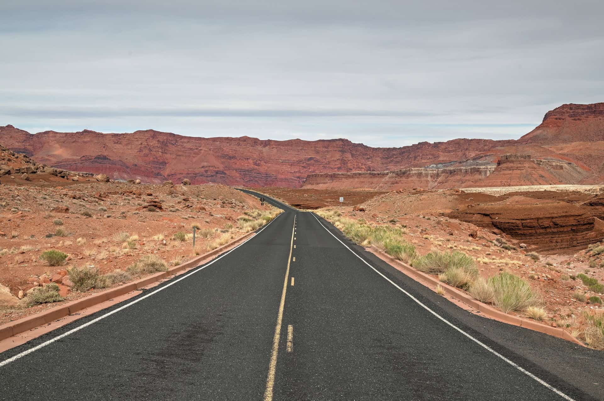
Marble Canyon and Lees Ferry (link to Google Maps) are located about 45 minutes southwest of Page, Arizona, along Highway 89A — the scenic route that connects Page with the North Rim of the Grand Canyon. The area sits at the eastern edge of Vermilion Cliffs National Monument, where the Colorado River carves a deep, glowing corridor through layers of Navajo sandstone.
About Marble Canyon & Lees Ferry
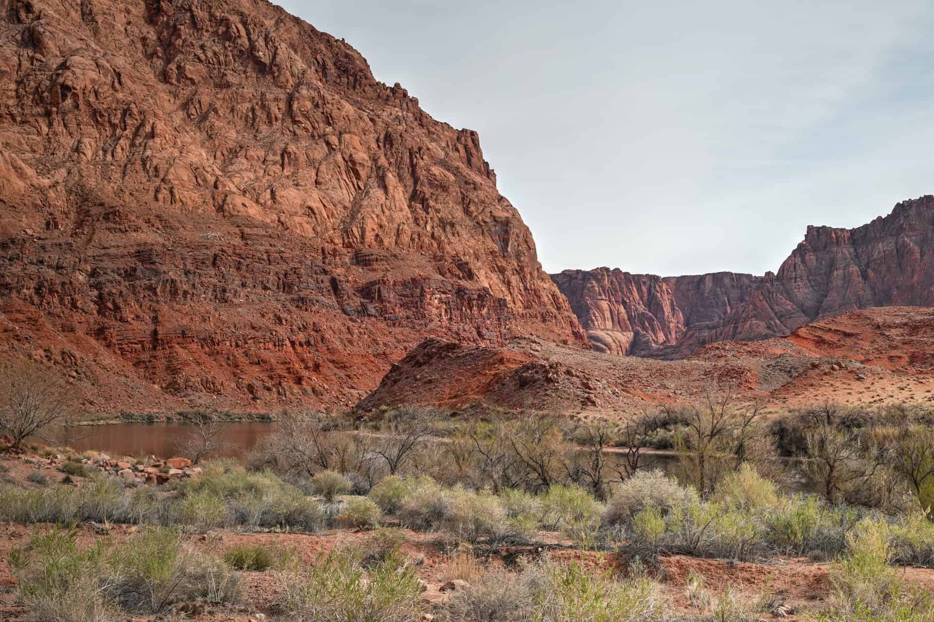
Where the Grand Canyon Begins: Marble Canyon marks the official start of the Grand Canyon, where the Colorado River first cuts into the red sandstone of the Colorado Plateau. Despite its name, the canyon’s walls are made not of marble but of polished Navajo sandstone that glows in deep shades of crimson and gold. Standing at the rim or hiking down to the river, you can see the moment the landscape transforms — from the broad open desert of northern Arizona to the steep, sculpted walls that define one of the world’s greatest gorges.
A Crossroads of History and Exploration: This area has long been a crucial crossing point of the Colorado River. In the late 1800s, John D. Lee established Lees Ferry, where pioneers, miners, and explorers used boats to traverse the river long before any bridges existed. The historic Lonely Dell Ranch, where Lee and later settlers lived in near isolation, still stands today as a beautifully preserved homestead under the cottonwoods. Walking its trails and orchards feels like stepping back in time to the frontier era of the American Southwest.
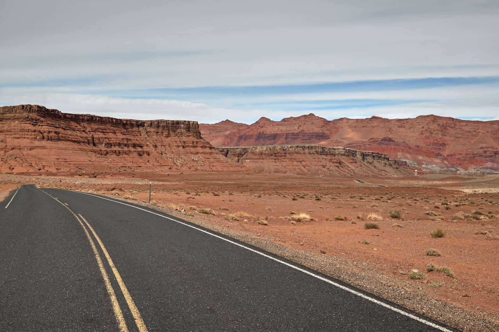
Gateway to the Vermilion Cliffs: Marble Canyon sits at the eastern gateway to Vermilion Cliffs National Monument, a land of sheer red escarpments, hidden canyons, and surreal formations like The Wave and White Pocket. The views along Highway 89A are some of the most breathtaking in Arizona, with the towering Vermilion Cliffs to one side and the shimmering ribbon of the Colorado River far below.
Adventure on Foot and by River: Several of the region’s best short hikes begin right here — from the Cathedral Wash Trail, which leads through a twisting canyon to the river, to the Spencer Trail, a steep climb that rewards hikers with panoramic views over Lees Ferry and Marble Canyon. This is also a popular launch point for Grand Canyon river trips, with outfitters departing on multi-day expeditions down the Colorado.
Connecting the Canyonlands: Spanning the gorge just upstream is the striking Navajo Bridge, completed in 1929 and replaced by a modern twin in 1995. Today, visitors can walk across the historic bridge for dramatic views 467 feet above the river, often spotting California condors soaring between the cliffs. The bridge connects the Navajo Nation to the high plateaus of the Kaibab — making Marble Canyon both a geographical and cultural crossroads of the Southwest.
How to Get to Marble Canyon
Marble Canyon is best reached by car, as there is no public transportation directly to the area.
Driving times to Marble Canyon
- Page, AZ: 65 km / 40 mi – about 45 minutes
- Las Vegas, NV: 450 km / 280 mi – about 4.5–5 hours
- Phoenix, AZ: 450 km / 280 mi – about 4.5–5 hours
- Flagstaff, AZ: 200 km / 125 mi – about 2.5 hours
- Kanab, UT: 120 km / 75 mi – about 1.5 hours
- Monument Valley, UT/AZ: 255 km / 160 mi – about 2h30
These times assume good weather and minimal stops.
If you need to book a rental vehicle for your hiking excursion, we highly recommend using Discover Cars to get the best rates on your rental in Utah, Nevada and Arizona.
We also highly recommend Airalo (eSIM card) for your connectivity needs when travelling abroad. Airalo is the world’s first and largest eSIM store with eSIM plans for 200+ countries and regions worldwide.
Nearest Gas Stations
There are many stations in Page, a 45-minute drive away. There is ONE station just beyond the turnoff into Marble Canyon along highway 89A.
Marble Canyon Access, Fees, and Parking
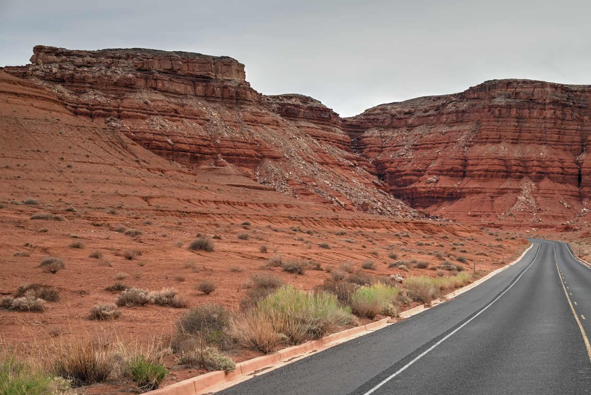
Access: The main access point to Marble Canyon and Lees Ferry is via Lees Ferry Road, which branches off Highway 89A just west of the Navajo Bridge. This short but spectacular paved road descends toward the Colorado River through a landscape of crimson cliffs, sandstone domes, and sculpted desert terrain. Along the way, you’ll pass several key stops — including Cathedral Wash, Balanced Rock, Lonely Dell Ranch, the Spencer Trailhead, and the Lees Ferry boat ramp.


Parking: There are several convenient parking areas along Lees Ferry Road, depending on what you plan to visit:
– Navajo Bridge Interpretive Center: A medium-sized paved lot just off Highway 89A, near the bridge overlook and visitor displays.
– Cathedral Wash Trailhead: Small roadside pull-out directly opposite the trailhead entrance (no facilities).
– Balanced Rock: Roadside lay-by with space for a few vehicles, located along Lees Ferry Road.
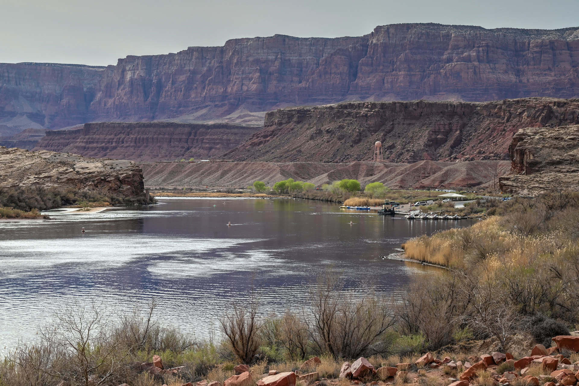
– Lees Ferry Area: Large parking lot serving the Lees Ferry boat launch, Spencer Trailhead, and Lonely Dell Ranch. Suitable for cars, RVs, and trailers.
Facilities: Restrooms are available at the Lees Ferry campground, near the boat launch area, and inside the Navajo Bridge Interpretive Center (open seasonally). Picnic tables and shaded areas can be found near the river access points.
Hours: Marble Canyon and Lees Ferry are open 24 hours a day, year-round, though the Navajo Bridge Interpretive Center has seasonal operating hours (typically spring through fall).
Marble Canyon Access Fees
Lees Ferry and Marble Canyon lie within Glen Canyon National Recreation Area, managed by the National Park Service.
Entrance Fee: $30 per vehicle (valid for 7 days), which also covers access to other areas within Glen Canyon NRA, including Lake Powell and Lone Rock Beach.
Holders of an America the Beautiful Pass can enter free of charge. You can purchase your pass ahead of time through the REI store.
Best Things to See and Do In Mable Canyon
Navajo Bridge & Interpretive Center
Best for: Scenic views, history, photography
Spanning the Colorado River at the gateway to Marble Canyon, Navajo Bridge offers one of the most striking viewpoints in northern Arizona (link to Google Maps). The original bridge (built in 1929) now serves as a pedestrian walkway, running parallel to the newer highway bridge. From the middle, you’ll enjoy breathtaking views 467 feet (142 m) above the turquoise river.
The Navajo Bridge Interpretive Center (open seasonally) provides exhibits on the bridge’s construction, the geology of Marble Canyon, and local wildlife. It’s also a great place to spot condors, especially in the cooler morning hours.


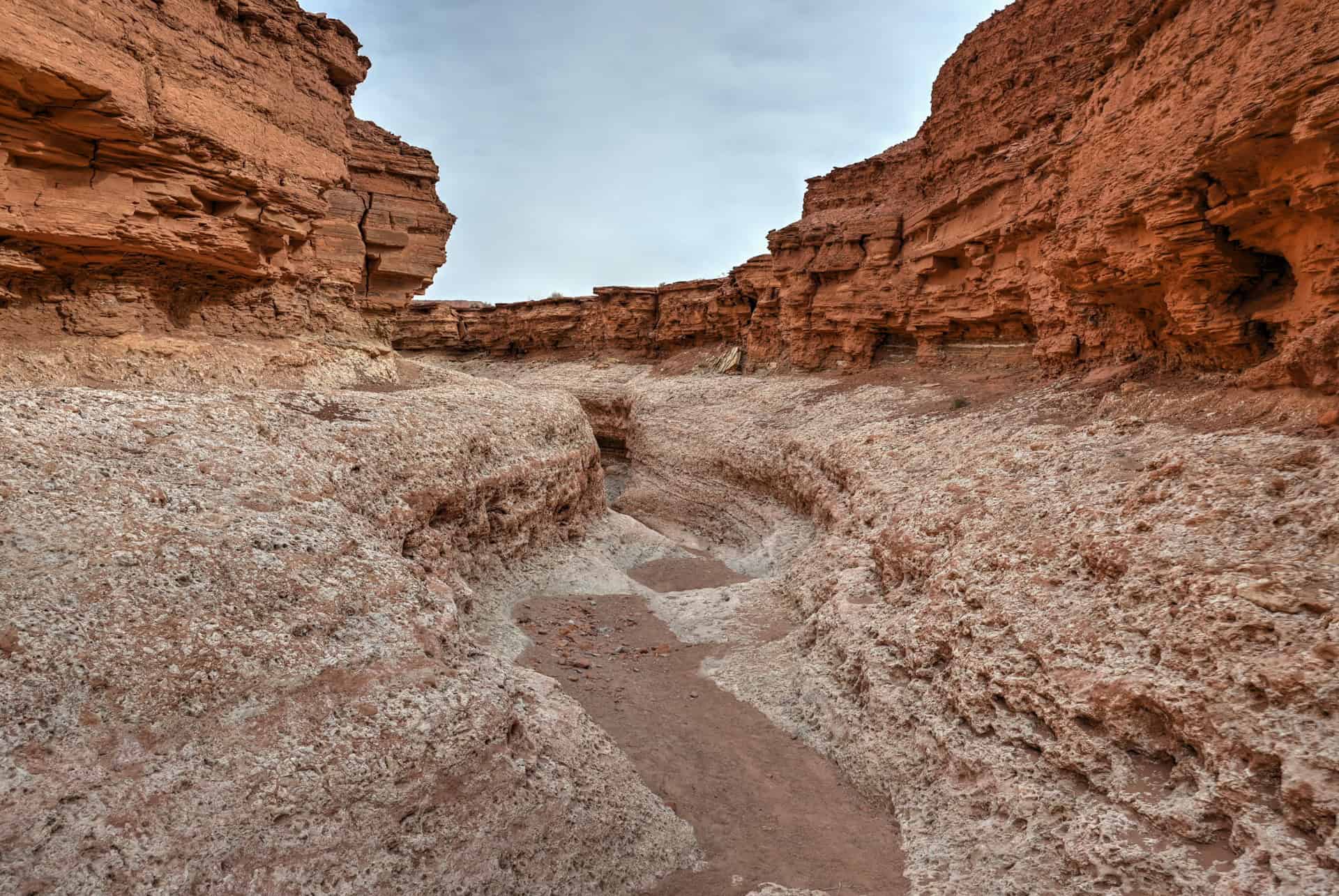
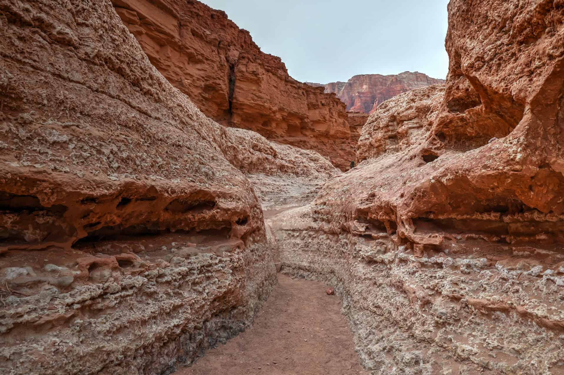
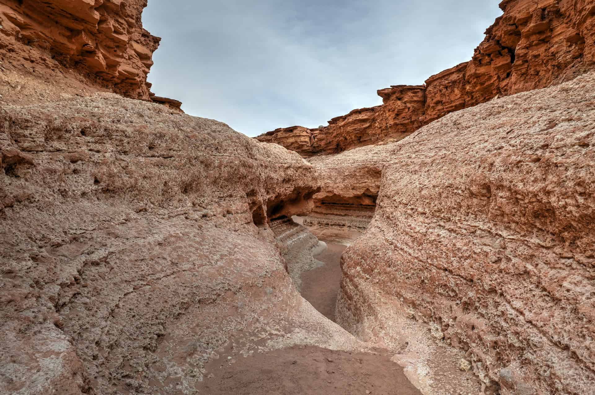
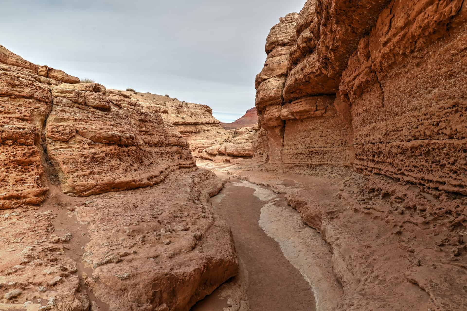
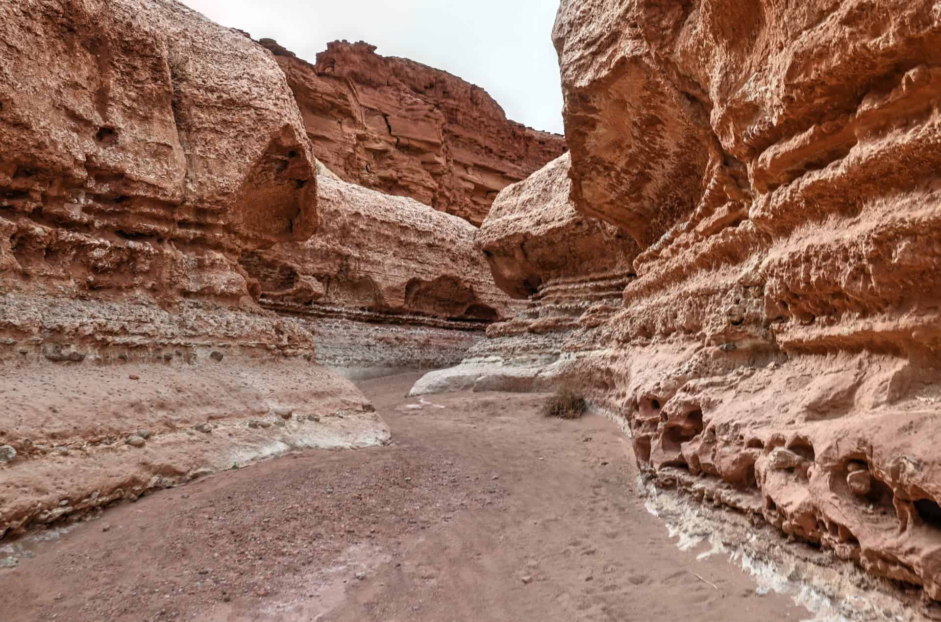
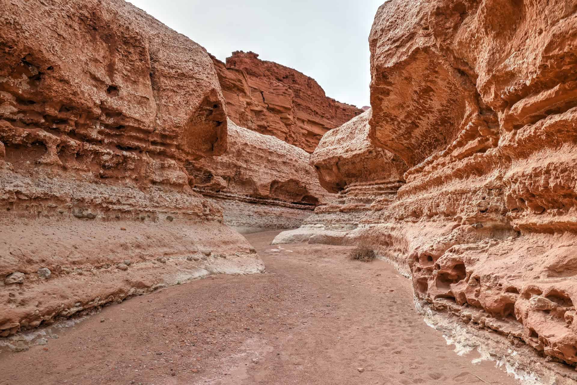
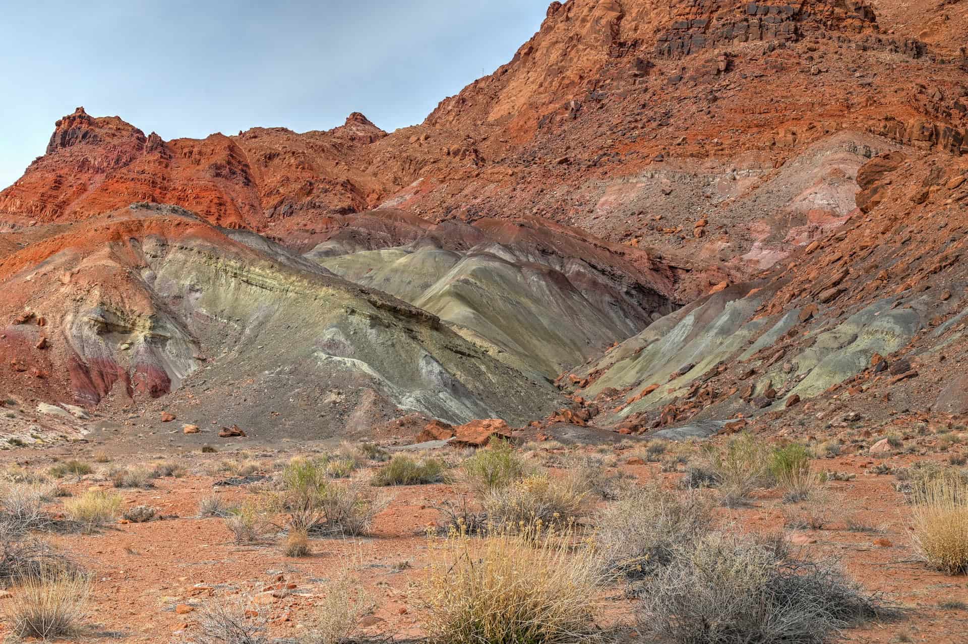
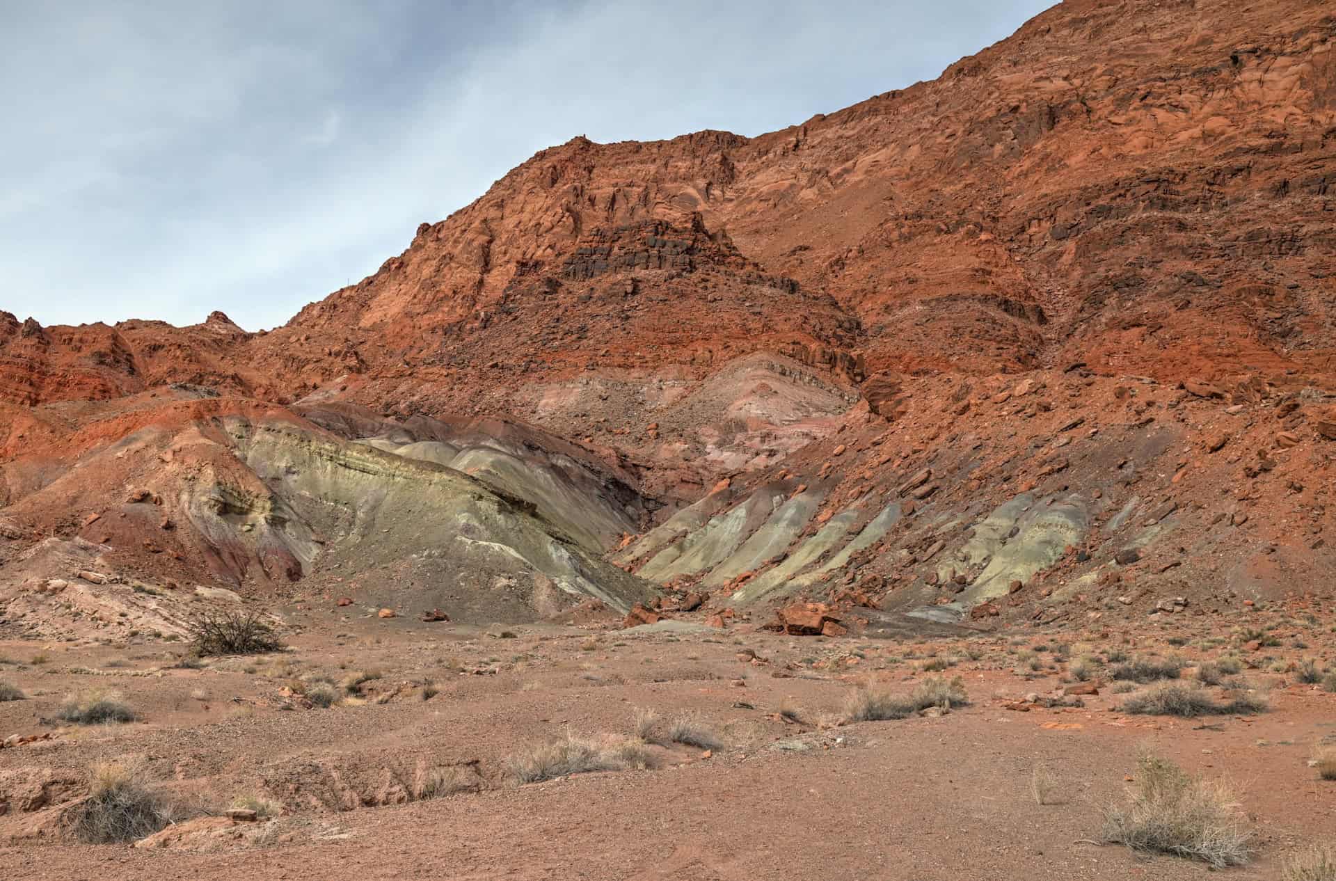
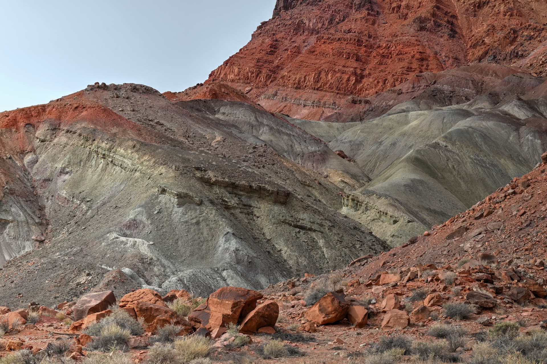
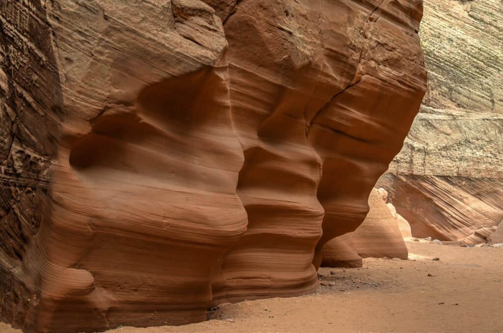
Cathedral Wash Trail
Best for: Adventure hiking, geology, photography
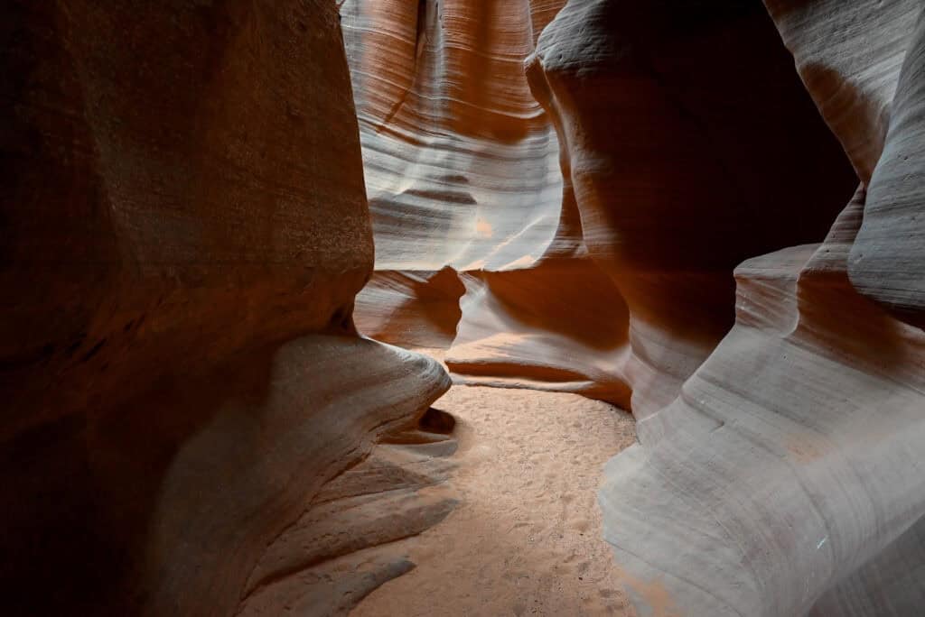
Just a short drive down Lees Ferry Road, the Cathedral Wash Trail follows a dry wash that cuts through beautifully sculpted red and white Navajo sandstone before reaching the Colorado River (link to Google Maps). To reach the trail, you’ll descend a short staircase near the roadside car park and cross under the road via a tunnel.
The route involves light scrambling over smooth rock ledges and boulders, but no technical climbing. The canyon walls grow taller and narrower as you descend, creating superb photographic compositions and a cool, shaded escape from the sun. Avoid hiking after heavy rain, as flash floods are possible.


Trail Details
Distance: 3.3 miles (5.3 km)
Route Type: Out and Back
Elevation change: 330 ft / 100 m (difference between trail high and low point)
Elevation gain: 380 ft /116 m (cumulative elevation gain)
AllTrails rating (2025): 4.8 (2558 ratings)
Duration: Most people complete the trail in 1h30-2h
Not an AllTrails member yet? We highly recommend signing up for either their free or paid membership plans. The free plan allows you to find new trails and plan routes but it can only be used while hiking if you have access to mobile data. The paid membership plan (AllTrails+) allows you to download trail maps for offline use and provides live progress updates and off-route notifications.
If you are still uncertain – you should know that the All Trails mobile application was voted the 2023 iPhone App of the Year by Apple.
We find that AllTrails is a great tool to have when hiking, particularly for assisting with navigation when the trail is hard to locate and to help monitor your progress along the trail, which helps estimate how much time you’ll need to complete the trail.
Lees Ferry Historic District & Lonely Dell Ranch
Best for: History, photography, short walks
At the end of Lees Ferry Road lies the Lees Ferry Historic District, where early Mormon pioneers established a crossing on the Colorado River in the late 1800s. Lonely Dell Ranch (link to Google Maps), the original homestead of ferry operator John D. Lee, still stands.


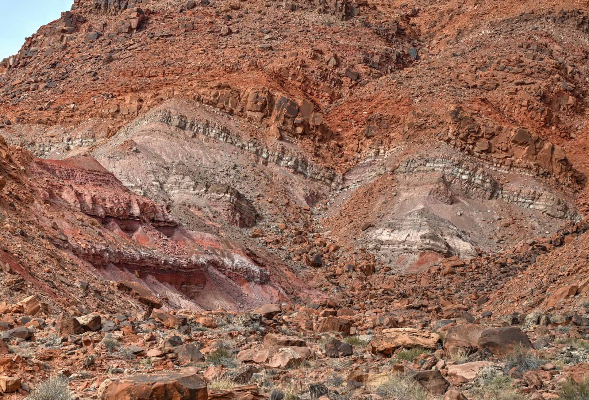
You can stroll among the preserved cabins, barns, and irrigation ditches, with interpretive signs explaining how settlers survived in this remote desert. Even a brief walk offers excellent photo opportunities: the ranch buildings are beautifully framed by the surrounding banded cliffs, which display vivid rainbow-like layers of red, orange, yellow, and pale purple sandstone. These colorful formations are especially striking in morning or late afternoon light, when the low sun enhances the contrast and saturation of the rock layers.


Lees Ferry Boat Launch & Colorado River Access
Best for: River scenery, picnicking, rafting access
Just beyond the ranch lies the Lees Ferry boat ramp (link to Google Maps), one of the few places where you can easily reach the Colorado River by car. It serves as the starting point for rafting trips through Marble Canyon and the Grand Canyon, but it’s also a scenic spot to relax by the water, dip your toes, or watch boats and kayaks launch.
Spencer Trail
Best for: Panoramic views, challenging hike
Rising directly from the Lees Ferry parking area, the Spencer Trail is one of northern Arizona’s most rewarding — and strenuous — short hikes (link to Google Maps). The trail climbs to a breathtaking overlook of Lees Ferry, the Colorado River, and Marble Canyon’s sheer red walls.
The trail is steep and exposed, with loose rock in sections, so come prepared with sturdy shoes, water, and sun protection. The effort is worth it: the summit offers a sweeping bird’s-eye view across the river corridor. Even if you don’t hike the full trail, the view is spectacular. The first quarter-mile is flat and follows the riverside, only to sharply ascend a series of intense switchbacks.


Trail Details
Distance: 4 miles (6.4 km)
Route Type: Out and back
Elevation change: 1540 ft / 470 m (difference between trail high and low point)
Elevation gain: 1640 ft / 500 m (cumulative elevation gain)
AllTrails rating: 4.8, 1037 ratings (2025)
Duration: Most people complete the trail in 2h30-3h
Hiking Packing List
All Trails subscription – This comes in really handy for areas with little or no cell reception, as the annual subscription allows you to download trail maps for offline use.
External Battery – If you are using your phone to track your progress along the trail or to help with navigation, you certainly don’t want your phone to die on you. That’s especially true in the unlikely event that you might get hurt or need assistance.
Hiking poles – These can be particularly useful in steep trails or muddy/boggy trail conditions.
Water Filter Bottle – The Life Straw bottle is an advanced water bottle with a filter that not only improves water taste but more importantly filters out bacteria and parasites, chemicals and microplastics.
Headlamp – very practical and a smart choice if you plan to start your hike before sunrise or finish it after sunset.
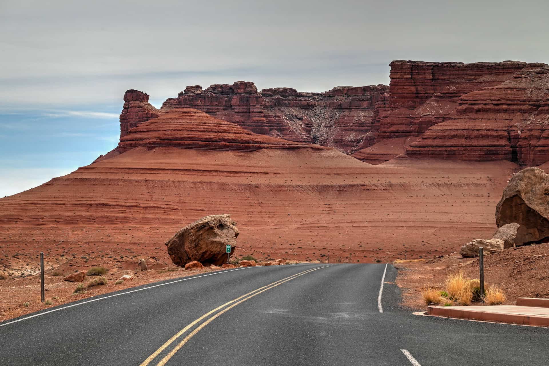
Balanced Rock
Best for: Quick stop, photos, geology
About halfway down Lees Ferry Road stands Balanced Rock (link to Google Maps), a striking hoodoo perched atop a narrow pedestal of eroded sandstone. It’s visible from the road and accessible via a short, easy walk from a roadside pull-out. The formation glows deep red in late afternoon light and makes for a perfect stop between Cathedral Wash and Lees Ferry.

Paria Beach & Paria River Confluence
Best for: Relaxing, riverside scenery
If you have extra time, follow the short trail near the boat launch to Paria Beach (link to Google Maps), a sandy stretch along the Colorado River near the confluence with the Paria River. It’s a peaceful place to unwind, skim stones, or enjoy a picnic with canyon walls rising dramatically on all sides.
How Much Time Should I Plan for a Visit to Marble Canyon?
Marble Canyon can be enjoyed in as little as an hour or explored in depth over the course of a full day — it all depends on how much hiking you’d like to do. Most of the highlights lie within a short 5-mile (8 km) stretch along Lees Ferry Road, making it easy to tailor your visit to the time you have.
Short Stop (1–2 Hours)
Perfect for travellers passing through on Highway 89A or combining Marble Canyon with Horseshoe Bend or Vermilion Cliffs.
- Navajo Bridge: Walk across the pedestrian span for sweeping views of the Colorado River far below, and check for California condors often seen roosting on the bridge supports.
- Balanced Rock: A quick roadside stop for photos of this massive boulder teetering on a narrow sandstone base.
- Cathedral Wash: Even without a full hike, a brief stroll from the parking area provides excellent views down into the wash and surrounding cliffs. If time is limited and you don’t want anything too demanding, hike just the first mile or so (about 2 miles round trip). This section is fairly flat and still showcases beautiful layered rock and desert scenery.
Half-Day Visit (3–4 Hours)
Great for travellers who want to explore beyond the overlooks but don’t need a full day.
- Begin at Navajo Bridge in the morning for the best light on the river and Vermilion Cliffs.
- Hike the Cathedral Wash Trail
- Drive down Lees Ferry Road and stop at Balanced Rock for a quick look on your way to Lees Ferry.
- Continue to Lonely Dell Ranch, a shady oasis where historic cabins and orchards tell the story of early settlers at Lees Ferry.
Full-Day Visit (6–8 Hours)
For those wanting the complete Marble Canyon experience, plan a full day to explore its trails, history, and viewpoints at a relaxed pace.
- Morning: Start early with the Spencer Trail, best tackled before midday heat.
- Midday: Descend to Lonely Dell Ranch for a shaded picnic and short walk among the historic buildings and cottonwood trees, then visit the nearby Lees Ferry river access to relax along the water.
- Afternoon: Continue to Cathedral Wash (and stop at the Balanced Rock along the way) hiking as far down as conditions and time allow. The route follows a dramatic sandstone canyon toward the river, with sculpted rock walls glowing in late-day light.
- Sunset: End your day back at Navajo Bridge, where the cliffs of Marble Canyon ignite in red and gold as the sun sets over the Colorado Plateau.
Important Things to Know Before Visiting Marble Canyon
Trail conditions: Most trails in the area are unshaded and exposed, with sandy or rocky terrain. Sturdy shoes, sun protection, and carrying lots of water are essential, even for short walks. Spencer Trail involves steep drop-offs and loose footing — not recommended for small children or those uncomfortable with heights.
Check the Glen Canyon Alerts page for updates on trail conditions or temporary closures.
Weather and safety: Conditions can change quickly in this part of the desert. Expect intense heat in summer (often over 100°F / 38°C) and cold mornings in winter. Thunderstorms between July and September can trigger flash floods in Cathedral Wash or other canyons — never enter a wash if storms are forecast.
Pets: Leashed pets are allowed throughout the Marble Canyon sites described above.
Cell service and facilities: Mobile coverage is limited once you leave Highway 89A. Restrooms and picnic areas are available near Lees Ferry campground and the Navajo Bridge Interpretive Center, but services are minimal beyond that — plan accordingly.
Best Time to Visit Marble Canyon
Marble Canyon can be enjoyed year-round, but the experience varies dramatically with the seasons. From the golden light of spring and fall to the quiet solitude of winter, each time of year highlights a different side of this dramatic desert landscape.
Spring (March–May):
Spring is one of the best times to visit Marble Canyon. Daytime highs range from 65–85°F (18–30°C), perfect for hiking Cathedral Wash, exploring Lonely Dell Ranch, or tackling the steep Spencer Trail before the summer heat sets in. Wildflowers bloom along the riverbanks and near Lees Ferry, and the light at sunrise and sunset beautifully accentuates the deep reds of the cliffs. Expect moderate crowds as the weather draws in travellers heading toward the North Rim and Lake Powell.
Summer (June–August):
Expect intense heat, often exceeding 100°F (38°C) by midday. Early mornings and evenings are the most comfortable times for exploring. Always carry plenty of water, wear a hat, and use sunscreen — there’s virtually no shade on most trails. This is also monsoon season (typically late July through early September), when sudden thunderstorms can trigger flash floods in Cathedral Wash or nearby slot canyons. However, the summer sky can be incredibly photogenic, with dramatic cloud formations over the Vermilion Cliffs.
Fall (September–October):
Fall rivals spring as the ideal season for hiking and photography. Temperatures gradually cool to 70–85°F (21–30°C), and the air is crisp with fewer visitors. It’s a great time to hike Cathedral Wash or climb the Spencer Trail for expansive views of the Colorado River as it winds through Marble Canyon. Late-afternoon sunlight casts a golden glow across the cliffs — perfect for photographers.
Winter (November–February):
Winter offers quiet, solitude, and stunning clarity. Highs range from 45–60°F (7–16°C), and while mornings can be frosty, the lack of haze gives incredible visibility across the canyon walls. Snow occasionally dusts the Vermilion Cliffs, creating a striking contrast against the red rock. This is the best time for travellers seeking peaceful exploration without crowds, though be prepared for chilly starts and early sunsets.
Quick Summary – When to Visit
Best overall: Spring and fall — mild weather, best lighting, ideal hiking conditions.
Quietest and most peaceful: Winter.
Avoid midday in summer due to extreme heat and limited shade.
Other Things to See and Do Near Page
Antelope Canyon
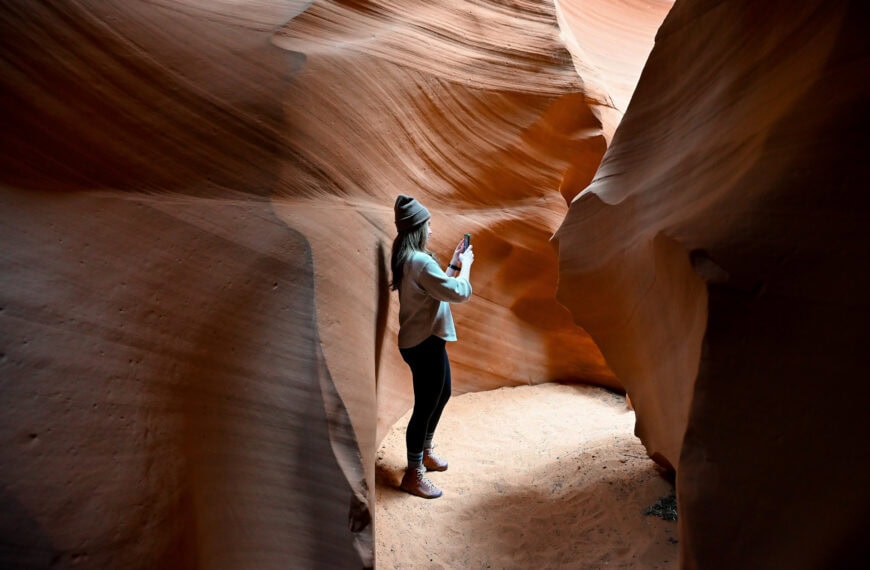
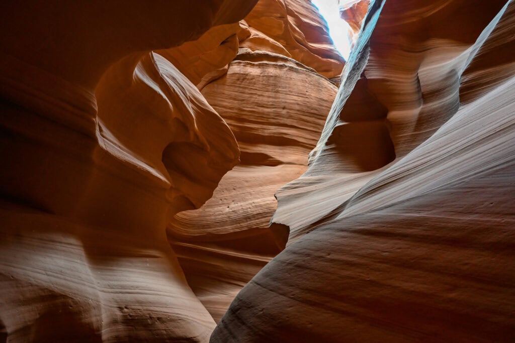
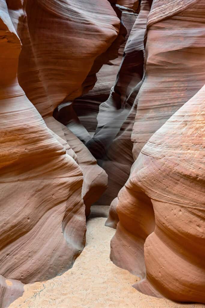
Just east of Page on Navajo Nation land, Antelope Canyon is one of the most famous slot canyons in the world. Its narrow sandstone corridors twist and curve like flowing waves, with beams of sunlight creating breathtaking shafts of light—especially in Upper Antelope Canyon around midday. Lower Antelope Canyon is narrower and requires navigating ladders, making it a slightly more adventurous option. All visits require a Navajo-authorized guide, and tours often sell out weeks in advance during peak travel seasons.
Antelope Canyon X is a newer and often less crowded alternative, offering a mix of tight slot sections and wider canyon chambers with beautiful textures and colors. It provides a similar experience at a more accessible price point, while still requiring a guided tour.


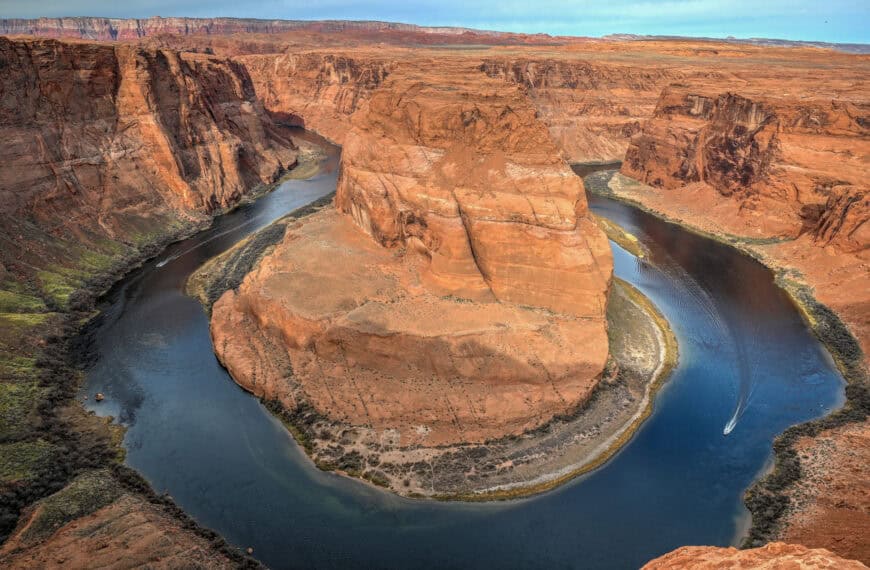
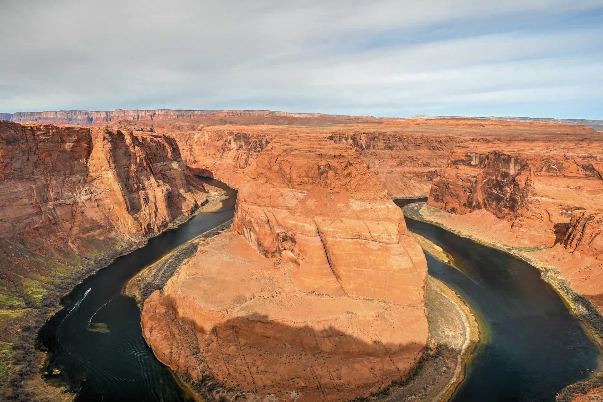
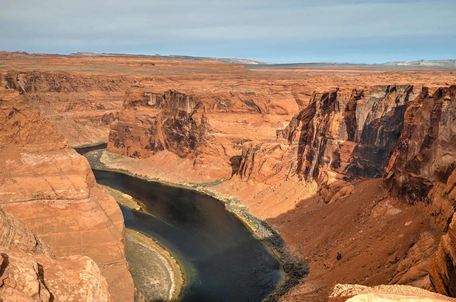
Horseshoe Bend
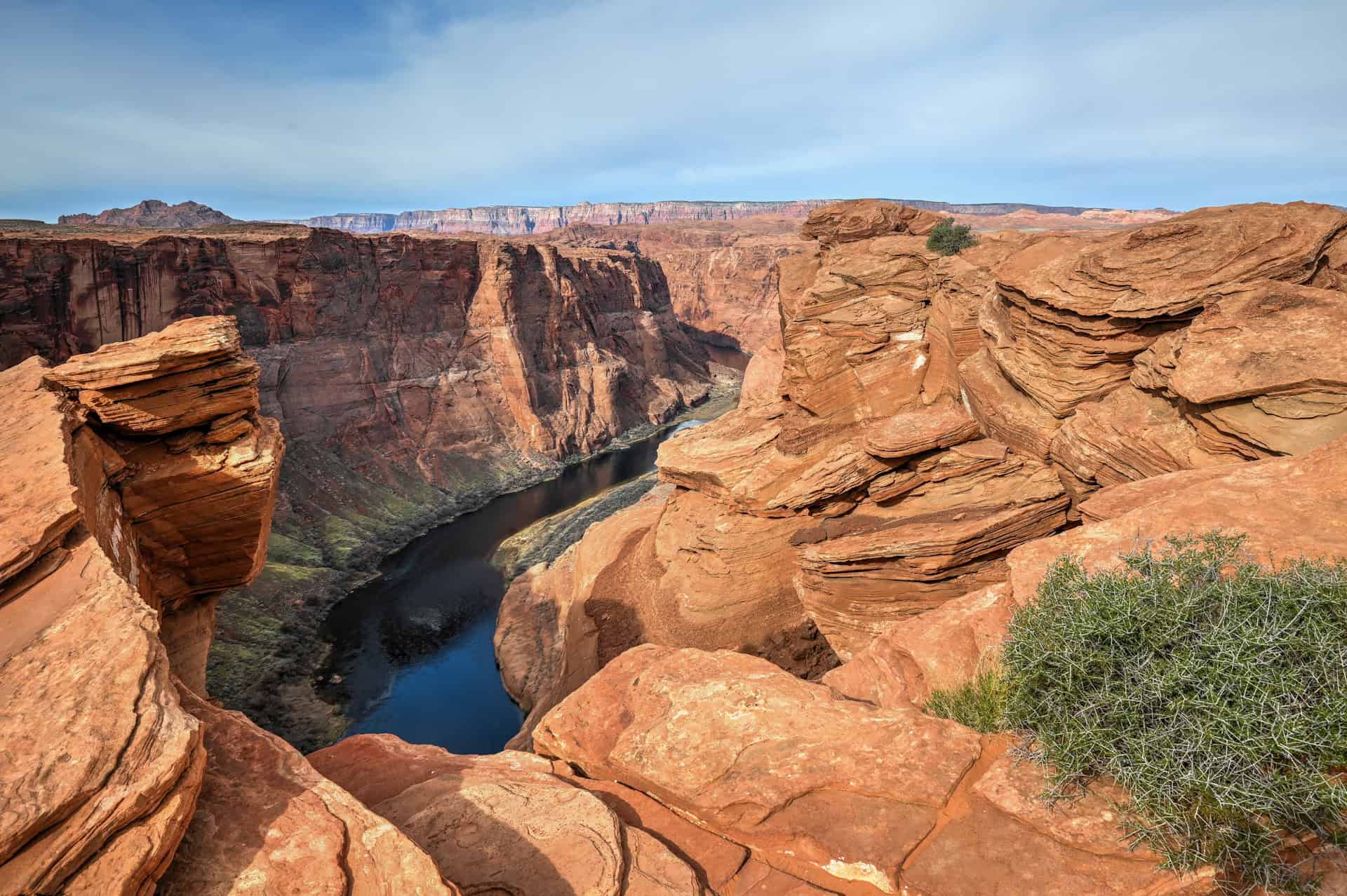
Only a few minutes southwest of Page, Horseshoe Bend is an iconic viewpoint that offers an unforgettable look at the Colorado River looping in a dramatic horseshoe-shaped curve 1,000 feet below the cliff edge. The walk to the overlook is short—about 1.5 miles round-trip—but expect full sun exposure and large crowds during the middle of the day. Sunrise and sunset offer cooler temperatures and more atmospheric lighting.


Hanging Garden Trail
If you’re looking for a short and rewarding hike near Page, the Hanging Garden Trail is a fantastic option. This easy 1.2-mile (1.9 km) round-trip walk leads to a shaded alcove where lush vegetation thrives against the desert backdrop, fed by a natural seep spring tucked into the cliffs. It’s a quick adventure that pairs perfectly with the Beehive Trail.


For a more comprehensive list of activities and attractions, see our full guide on the Best Things to See and Do Near Page, Arizona.
Where to Stay Near Marble Canyon
If you’re looking for comfortable, well-located lodging in Page without splurging on luxury, here are four of the best mid-range options in town. These hotels are all within easy reach of major attractions, including Horseshoe Bend, Antelope Canyon, and Lake Powell. All include free parking, free WiFi, and breakfast, making them solid bases for exploring the region.
Best Western Plus at Lake Powell
What sets it apart: Its walkable downtown location, near restaurants and shops.
A reliable and comfortable choice featuring hot breakfast, a seasonal outdoor pool and hot tub, and clean, spacious rooms. Ideal if you want to leave the car behind in the evenings.
Hyatt Place Page Lake Powell
What sets it apart: Newer and more modern than many competitors in town.
Contemporary rooms with separate sitting areas, plus amenities like a gym, bar/lounge, and outdoor pool. A great pick for families or those wanting a slightly elevated mid-range stay.
La Quinta Inn & Suites by Wyndham Page at Lake Powell
What sets it apart: Pet-friendly rooms with practical in-room amenities.
Offers hot breakfast, an outdoor pool, and guest rooms with a microwave and refrigerator—especially convenient for longer stays or travelers bringing a pet.
Wingate by Wyndham Page Lake Powell
What sets it apart: Excellent value with consistently high guest satisfaction.
Features an indoor pool and spa, fitness center, and comfortable modern rooms.
Booking Tip: Lodging near Page can fill up fast — especially during peak seasons (spring & fall) and weekends. Reserve early.
Marble Canyon – Frequently Asked Questions
Where exactly is Marble Canyon?
Marble Canyon lies between Vermilion Cliffs National Monument and Glen Canyon National Recreation Area, along Highway 89A in northern Arizona. It stretches from the Navajo Bridge area down to Lees Ferry, roughly 45 minutes southwest of Page and 1 hour north of the Grand Canyon’s South Rim (via Desert View Drive).
Is there an entrance fee?
Yes. Marble Canyon and Lees Ferry are part of Glen Canyon National Recreation Area, which requires a $30 vehicle entrance fee (valid for 7 days). You can also use an America the Beautiful Pass or a Glen Canyon Annual Pass.
Are pets allowed?
Yes, leashed pets are permitted in most areas
Are drones allowed?
No. Drones are strictly prohibited within Glen Canyon National Recreation Area, which includes Marble Canyon, Lees Ferry, and the surrounding river corridor.
Can I swim in the Colorado River?
It’s not recommended. The river remains around 47°F (8°C) year-round and has strong currents, even near the shore. Instead, enjoy walking along the riverbank or wading in shallow sections near the boat launch.
Is there food or gas nearby?
Limited services are available at Marble Canyon Lodge (restaurant, gas pump, small store). For a wider selection, head to Page (45 minutes east) or Kanab (1 hour north).
Is Marble Canyon part of the Grand Canyon?
Yes — geologically speaking, Marble Canyon marks the beginning of the Grand Canyon. The Colorado River flows through this section before entering the deeper main canyon near the Paria River confluence. Many Grand Canyon rafting trips launch from Lees Ferry, at the downstream end of Marble Canyon.
Is Marble Canyon worth visiting?
Absolutely — Marble Canyon is one of northern Arizona’s most underrated destinations. While many visitors rush between Horseshoe Bend and the Grand Canyon, this stretch of the Colorado River offers an incredible mix of scenery, history, and solitude that rivals the region’s more famous sites. Marble Canyon is absolutely worth a detour — especially if you appreciate wide-open desert landscapes, geology, and peaceful river views.
Explore More Arizona
Continue exploring Arizona with these detailed travel guides:
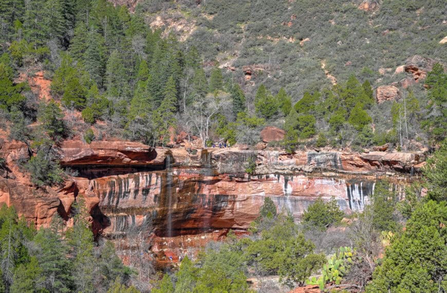
Best Things to See and Do in Sedona
Best Stops and Must-See Attractions Between Las Vegas and Sedona
Monument Valley Travel Guide
Sunset Crater Volcano National Monument
Photography Gear
If you like our photography, you might be interested in some of the gear we use to shoot our travel and hiking destinations.
Camera Body – Nikon Z 6ii Fx-series Mirrorless Body
Main Lens – NIKON 24-120mm F/4G ED VR AF-S
Zoom Lens – Sigma 745-306 150-600mm f/5-6.3
Polarizing filters – Urth Circular Polarizing (CPL)
Camera Tripod – K&F Concept 64-inch Camera Tripod
Mini-tripod – Lammcou Flexible Camera Tripod
Camera/hiking backpack – Vanguard Alta Rise 48 Backpack
Universal Travel Adapter – VYLEE Universal International Power Travel Plug
Other Travel Essentials
Travel Insurance
SafetyWing is a travel insurance company that offers comprehensive coverage for travellers. Includes Medical Insurance and Travel Insurance. Primarily geared towards long-term travellers, digital nomads, and expats.
e-Sim cards
Airalo is the world’s first and largest eSIM store with eSIM plans for 200+ countries and regions worldwide. With Airalo eSIMs, travellers can get connected the moment they land at their destination and avoid nasty data roaming charges
eSIMS are a sustainable alternative to single-use SIM cards – they are 100% digital, require less energy to produce and be re-used rather than disposed of.
Car Rentals
Discover Cars is our go-to website for car rentals. We almost always find our preferred rate there.
Transfer from Airport
Welcome Pickups is our favourite private transfer service, which you can pre-book at a fixed price. Currently available in 220 cities all over the world (mostly in Europe, but with several major cities in Asia, the Middle East and the US).
Kiwitaxi is another private transfer service – we haven’t tried it yet, but it’s currently available in a few more countries (102 as of 2024).
Hotels and Accommodations (coming soon)
Photography Prints
If you found this blog useful, you can help support our blog by purchasing low-cost digital prints. Printed physical prints are also available for purchase.


—–
Well, that wraps it up! We hope you enjoyed our Guide for visiting Marble Canyon and that it will prove useful for planning your trip.
—–
You might also be interested in these related pages: