The drive from Zion National Park to Bryce Canyon National Park may look short on a map, but it’s one of those routes where the Utah scenery changes so quickly that it’s worth slowing down and savoring the journey. While you could drive between both National parks in under two hours without stopping, taking your time transforms the trip into a highlight of its own. Along the way, you can wander through the sculpted red cliffs of Red Canyon, walk the rolling dunes of Coral Pink Sand Dunes State Park, or explore the Moqui Sand Caves: man-made sandstone caverns that have become one of the region’s most photogenic quick stops.
This guide highlights the best viewpoints, short hikes, roadside pullouts, and unique geological detours between Zion and Bryce. Whether you’re after classic red-rock scenery, a few memorable leg-stretching trails, or a relaxed full-day drive packed with rewarding stops, these are the places we think offer the most scenic and enjoyable breaks along the route.
Highlights Between Zion and Bryce Canyon – At a Glance
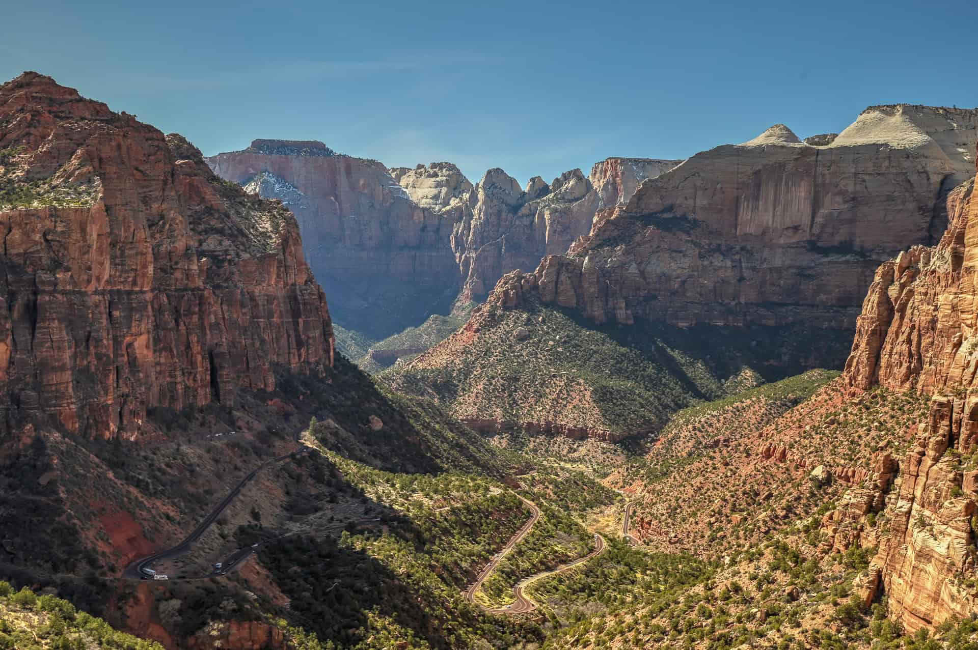
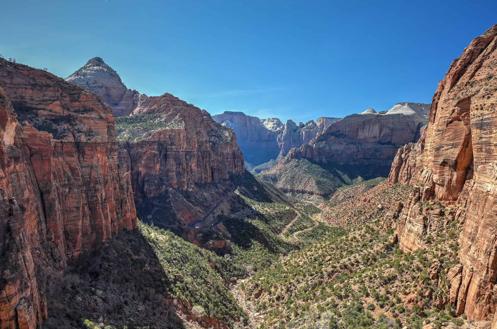
Canyon Overlook Trail (Zion National Park) – If you want a short, high-impact hike before leaving Zion, this is the spot. The Canyon Overlook Trail is only 1 mile round-trip, yet it delivers one of the park’s most iconic views: a sweeping panorama over Pine Creek Canyon and the lower Zion-Mount Carmel corridor. With dramatic cliffs, carved switchbacks, and a cliffside walkway, this trail is a perfect “big reward for little effort” stop that fits seamlessly into the drive toward Bryce since the trail lies outside the main Zion Canyon.
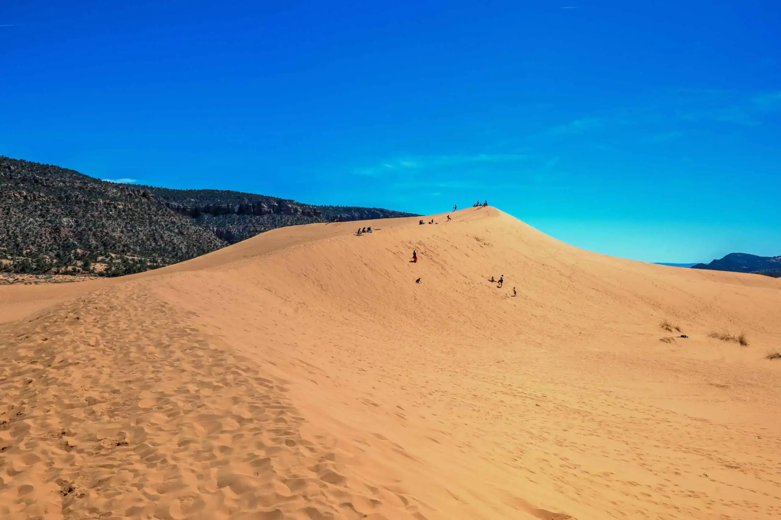
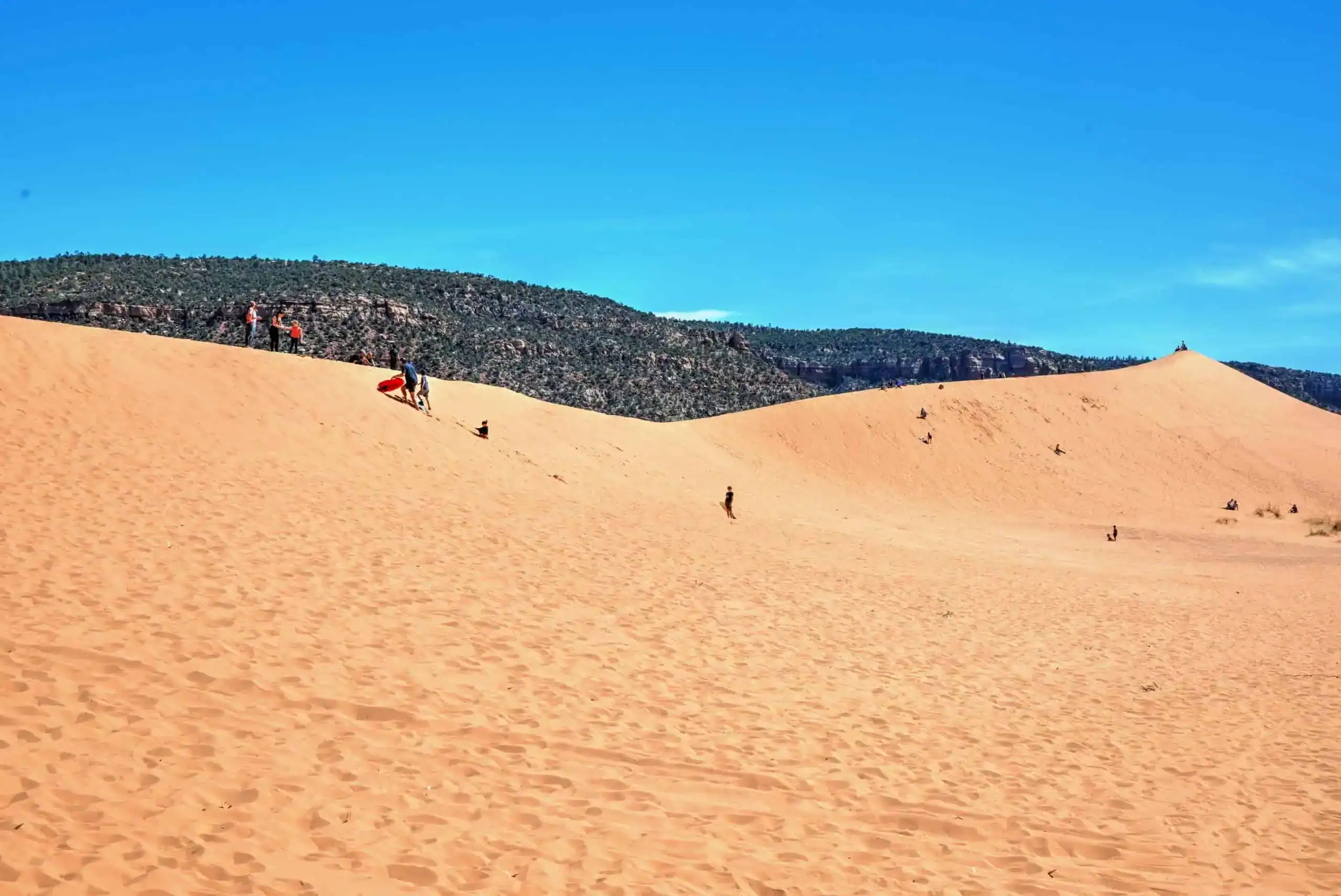
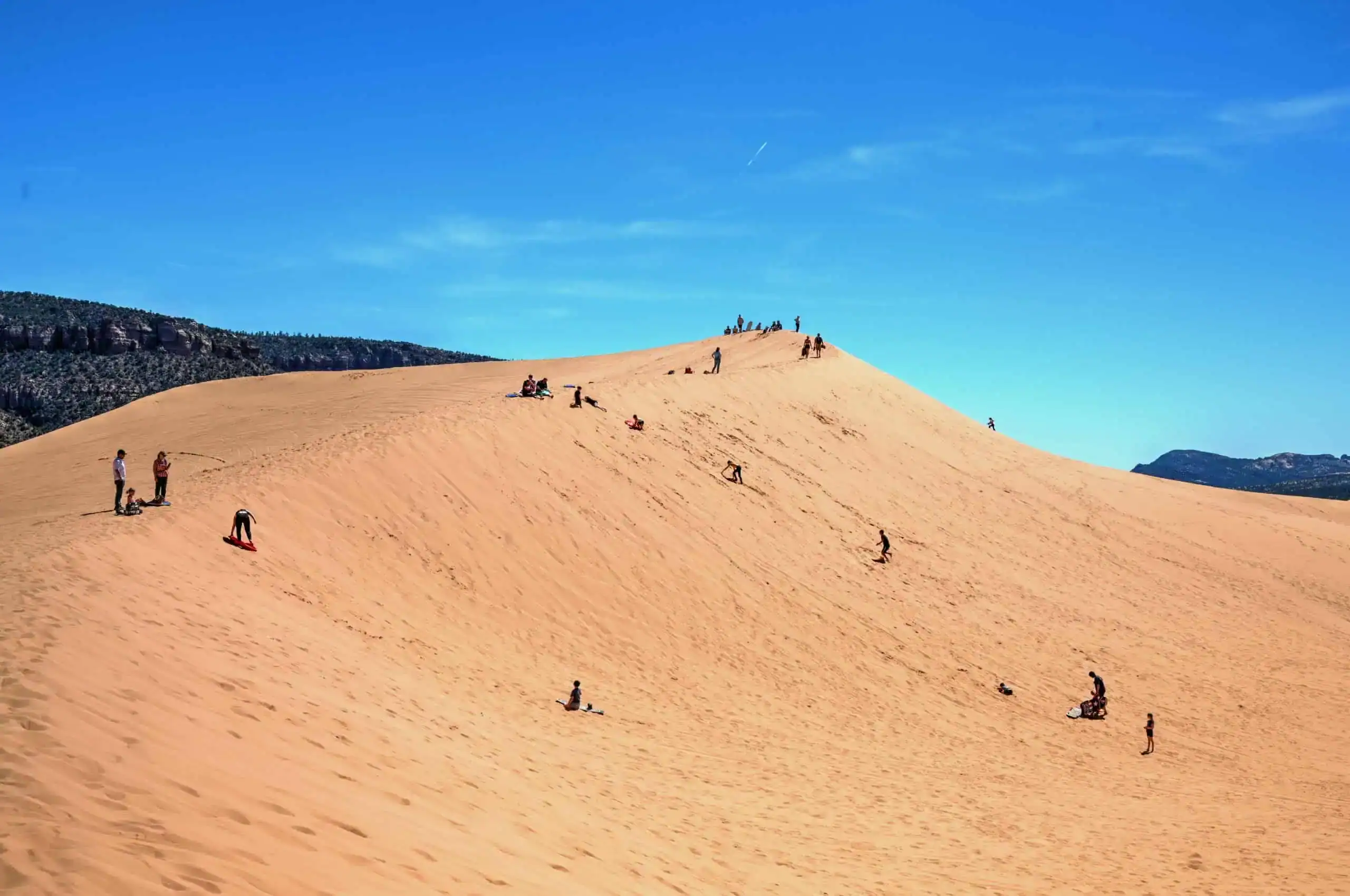
Coral Pink Sand Dunes State Park – Just 30 minutes east of Zion, this state park offers rolling sand dunes tinted a soft, warm coral color, especially striking in morning or late-afternoon light. It’s an easy, peaceful place to wander for a few minutes or walk a short distance into the dunes for wide-open desert views. Whether you’re snapping photos, stretching your legs, or looking for a unique landscape you won’t find near Zion or Bryce, Coral Pink Sand Dunes is one of the best quick detours along the route.
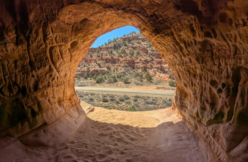
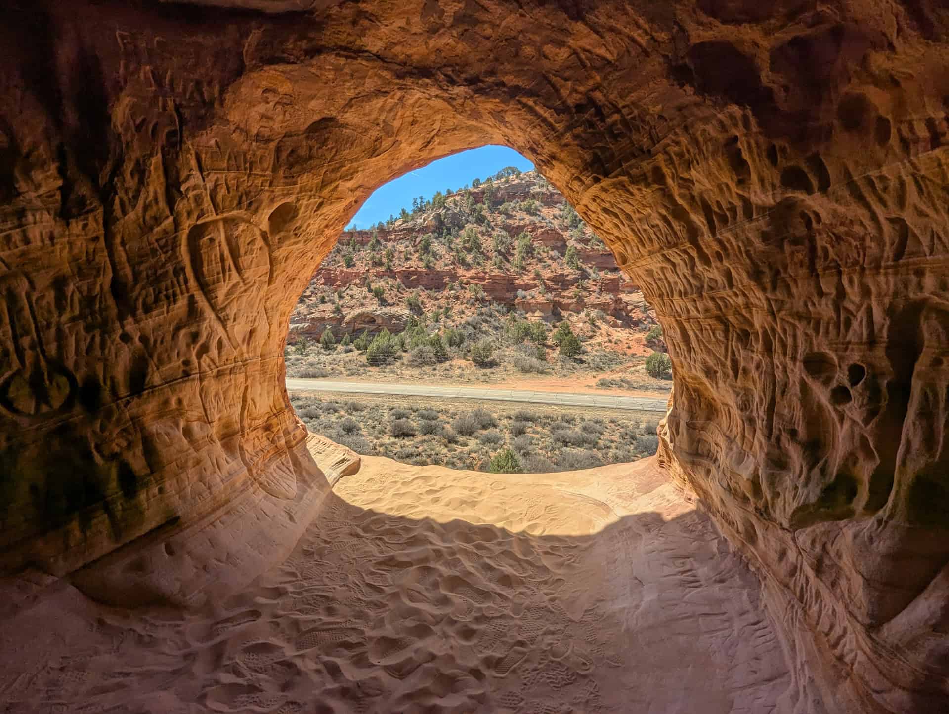
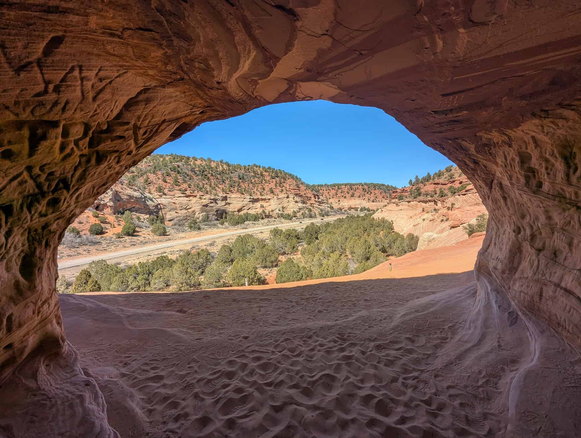
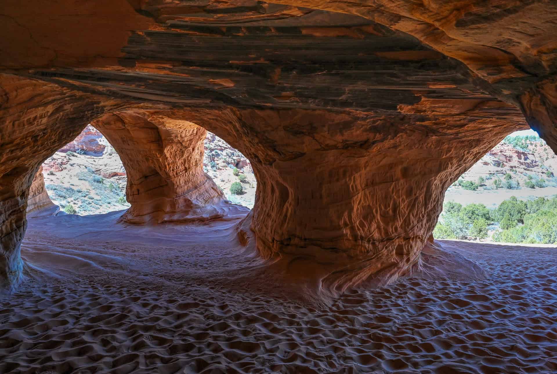
Moqui Sand Caves (Sand Caves) – Located right off Highway 89 near Kanab, the Moqui Sand Caves are man-made caverns carved into a smooth sandstone cliff, and have become a popular stop for photography and quick exploration. A short, steep scramble up the sandstone slope brings you into the caves where soft light filters through openings and frames views of the surrounding desert. It’s a fast, fun stop that offers a different kind of scenery than the typical red-rock overlooks.
Orderville – A small town along Highway 89, Orderville is a convenient midpoint between Zion and Bryce with a handful of local eateries, craft shops, and easy access to nearby trails and slot canyons. It’s a great place to pause for snacks, lunch, or gas before heading into the quieter stretches of road north of Kanab. The town’s relaxed pace and scenic surroundings make it a simple but worthwhile stop.
Red Canyon – Just minutes before reaching Bryce Canyon, Red Canyon announces your arrival in hoodoo country with vivid red cliffs, sandstone towers, and natural arches rising on both sides of the highway. Even a quick pullout gives you a dramatic preview of the formations you’ll see in Bryce. For a short leg-stretch, trails like Pink Ledges and Photo Point offer big scenery in under 20 minutes—making Red Canyon one of the most photogenic and easily accessible stops on the entire drive.


Disclosure: This page (Best Stops and Must-See Attractions Between Zion and Bryce Canyon National Parks) may contain product affiliate links. At no additional cost to you, we may receive a commission for purchases made through these links. More details can be found on our disclosure and policies page.
How Long Is the Drive Between Zion National Park and Bryce Canyon?
Driving straight from Zion National Park to Bryce Canyon via UT-9 and US-89 covers roughly 85 miles (135 km) and typically takes about 1 hour 45 minutes to 2 hours without stops. It’s a short, easy drive, but going directly means passing right by some of southern Utah’s most unique landscapes: sandstone caves, coral-colored dunes, and the hoodoo-filled preview of Red Canyon.
For a far more scenic and rewarding trip, we strongly recommend allowing extra time for at least a few standout highlights along the way, such as the stunning Canyon Overlook Trail inside Zion, the shifting dunes at Coral Pink Sand Dunes State Park, the photogenic Moqui Sand Caves, the local eateries and small-town charm of Orderville, and the dramatic red cliffs and hoodoo formations of Red Canyon just before Bryce. These stops require only minimal detours and showcase everything from desert viewpoints and short trails to unique geological formations you won’t see elsewhere.
This guide to the best stops and must-see attractions between Zion and Bryce is designed to help you experience the route’s most rewarding viewpoints, short trails, and natural wonders at a comfortable pace. We’ll also highlight optional detours and deeper-exploration opportunities for travelers who want to build a slower, more photography-focused drive.
If you need to book a rental vehicle for your hiking excursion, we highly recommend using Discover Cars to get the best rates on your rental in Utah, Nevada and Arizona.
We also highly recommend Airalo (eSIM card) for your connectivity needs when travelling abroad. Airalo is the world’s first and largest eSIM store with eSIM plans for 200+ countries and regions worldwide.
Zion to Bryce Canyon – Driving Considerations
Altitude (and Weather) Changes
The drive from Zion National Park to Bryce Canyon crosses several dramatic elevation zones, which can significantly affect temperatures, wind, and road conditions—especially outside the summer months.
Zion’s main canyon floor sits at roughly 4,000 ft (1,220 m). As you head east on the Zion–Mount Carmel Highway (UT-9), the road quickly climbs through switchbacks and passes through the famous tunnel before emerging onto higher plateaus around 5,000–6,000 ft (1,520–1,830 m). This section is often noticeably cooler and can hold patches of snow or ice in winter and early spring, especially in shaded bends.
From Mt. Carmel Junction north to Orderville and Glendale, US-89 generally sits around 5,200–6,100 ft (1,585–1,860 m). This stretch is relatively consistent but can still experience significant winter weather.
Approaching Bryce Canyon, the elevation increases sharply. Bryce Canyon’s rim rises to 8,000–9,100 ft (2,440–2,775 m), making it the highest national parks in the region. Here, temperatures can be 15–30°F (8–17°C) cooler than Zion. Frost, icy roads, and snow are possible from late fall through early spring, with winter storms occasionally causing temporary delays or closures on local roads.
Expect major temperature swings throughout the year from start to finish. Even in summer, mornings and evenings near Bryce can be surprisingly chilly.
Fuel Stops
Fuel is generally easy to find along the Zion –> Bryce corridor, but there are notable rural stretches, especially between Mt. Carmel Junction and Bryce Canyon, and if you detour to Coral Pink Sand Dunes or the Moqui Sand Caves.
Reliable fuel stops include:
- Springdale – Last major services before leaving Zion.
- Mt. Carmel Junction – Convenient stop immediately after exiting Zion via the east entrance.
- Orderville – A small but reliable midpoint with fuel, food, and services.
- Glendale – Limited but useful for top-ups before heading toward Bryce.
- Bryce Canyon City – Full services near the park entrance.
If you plan to explore Coral Pink Sand Dunes, Kanab is another excellent full-service fuel option (10–15 minutes from the dunes).
Cell Service
Coverage on this route varies widely. Expect a reliable signal in towns but intermittent or nonexistent service in rural and high-elevation stretches.
Common weak or no-service areas include:
- Inside Zion, especially along the switchbacks and near the canyon walls
- Between Mt. Carmel Junction and Glendale
- Coral Pink Sand Dunes State Park
- Portions of the Moqui Sand Caves area
- Scenic stretches approaching Bryce Canyon, especially between Red Canyon and the park entrance
Downloading maps before you leave Zion is highly recommended.
Road Safety
All major roads between Zion and Bryce Canyon are paved, well-maintained, and open year-round, but each segment has its own considerations:
UT-9 (Zion –> Mt. Carmel Junction)
A stunning but slow, winding section with tight switchbacks, steep drop-offs, and the narrow Zion–Mt. Carmel Tunnel. Oversized vehicles require special escort permits. Winter brings icy patches in shaded corners.
US-89 (Mt. Carmel Junction –> Orderville –> Glendale –> Bryce turnoff)
Wide, smooth, and generally easy to drive. Expect occasional wildlife crossings, moderate truck traffic, and some curving mountain terrain.
Coral Pink Sand Dunes Road (optional detour)
Fully paved but narrow in places. Sand can sometimes blow onto the roadway during high winds.
Highway 12 / Scenic Byway 12 (Red Canyon –> Bryce Canyon)
Beautiful, lightly winding highway with changing grades and photogenic rock formations close to the road. Watch for cyclists, wildlife, and visitors pulling over unexpectedly for photos.
Inside Bryce Canyon
High altitude means potential winter conditions, even when Zion is sunny and mild. Roads can close temporarily after storms.
Driving at Night
Night driving is not ideal on this route due to limited lighting, wildlife crossings (especially deer), and long stretches without services. Red Canyon’s dark, winding sections and the curves on US-89 can be challenging after dusk.
If possible, plan your drive during daylight for scenery and safety.
Best Time of Year to Drive the Route
The Zion –> Bryce Canyon drive is enjoyable year-round, but conditions may vary with each season:
Spring (March–May)
One of the best times to make the trip. Zion warms up early, Bryce remains cool, and wildflowers bloom along US-89 and Red Canyon. Occasional late snow possible at Bryce.
Fall (September–October)
Another excellent period: crisp canyon air, pleasant temperatures, and golden foliage in the higher elevations. This is one of the most photogenic times of year.
Summer (June–August)
Hot in Zion, mild at mid-elevations, and refreshingly cool at Bryce. Afternoon thunderstorms (“monsoon season”) are common in July and August, especially near Bryce’s rim.
Winter (November–February)
Zion is generally mild, but Bryce can be extremely cold, snowy, and icy. Roads are usually plowed quickly, but temporary closures or traction-control requirements are possible. Layers, winter tires (or AWD), and caution are key.
Best Stops Between Las Vegas and Zion National Park
The following attractions are listed from west to east, in the order you’ll encounter them when traveling from Zion National Park toward Bryce Canyon via UT-9, US-89, and UT-12.
Zion Canyon Overlook (Zion East Entrance)
Less than 5 minutes from the Zion–Mt. Carmel Tunnel (link to Google Maps)
Why stop here:
Zion Canyon Overlook is one of the most rewarding short hikes in the entire park. Perched high above Pine Creek Canyon, it offers a sweeping, elevated view across Zion’s sandstone cliffs, towering mesas, and the mouth of the main canyon. It’s the perfect “farewell viewpoint” as you exit Zion toward Bryce.
It also makes more sense to hike this trail when leaving the park rather than during your stay in Springdale. The overlook sits right at the east entrance, well beyond the shuttle-serviced areas, so doing it on your way out (or when arriving if you are doing this itinerary in reverse) saves you a long backtrack drive through the tunnel later. For many travellers, it fits seamlessly into the transition day and helps avoid peak traffic and limited parking during busy hours.
What you’ll find:
A short round-trip trail with moderate elevation and some uneven, rocky ledges protected by railings. The payoff is a wide, dramatic overlook that feels like a full-scale viewpoint despite the short effort.
Important to know:
Parking is extremely limited, especially in late morning and early afternoon. Early starts or off-peak times offer the best chance to grab a spot.
Time required:
30-45 minutes.
For more details and planning tips, see our detailed Zion Canyon Overlook Hiking Guide.


Coral Pink Sand Dunes State Park
30 minutes from Zion’s east entrance / 25 minutes from Orderville (link to Google Maps)
Why stop here:
Coral Pink Sand Dunes State Park is one of southern Utah’s most unique landscapes: a vast field of peach-colored sand sculpted into rippling dunes by wind, time, and the surrounding sandstone cliffs. The dunes glow especially vibrantly in morning and late-afternoon light, creating a dreamlike scene that looks completely different from the red-rock canyons you’ve just left behind in Zion. It’s an easy, memorable stop that offers big scenery without a major time commitment.
What you’ll find:
A sweeping expanse of shifting dunes that covers roughly 3,000 acres, with the tallest formations reaching up to 50 feet (15 m). The park’s distinctive color comes from the erosion of Navajo sandstone cliffs, where a perfect mix of wind direction, humidity, and topography funnels grains of sand into this concentrated pocket. Over thousands of years, a natural “wind gap” between the Moquith and Moccasin Mountains has created a Venturi effect—accelerating the wind and continually feeding the dune field.
You’ll find easy access to the dune field, viewpoints, picnic areas, and optional rentals for sandboarding or OHV experiences. Even a 10–15 minute walk out onto the dunes delivers huge views and a sense of quiet desert solitude.


If you want to skip the logistics and enjoy a ready-made experience, you can book a 2-hour Highlights Package with ROAM Adventure Center at Coral Pink Sand Dunes. It includes a one-hour UTV ride across the dunes, 30 minutes of sandboarding, and a 30-minute guided walk—an easy, all-in-one way to experience the park’s best features without planning each activity yourself:
Important to know:
The America the Beautiful Pass is not accepted here.
Summer heat can be intense–>bring water.
Time required:
30–45 minutes for viewpoints and a short walk. Up to two hours if you explore deeper into the dunes or try sandboarding.
Moqui Sand Caves
10 min from Kanab / 20 min from Orderville / 20 min from Coral Pink Dunes (link to Google Maps)
Why stop here:
Carved into a sandstone cliff overlooking US-89, the Moqui Sand Caves make a fun and easy stop between Zion and Bryce. Though often mistaken for ancient dwellings, these caves were actually created in the mid-20th century during silica mining operations. Today, they’re a scenic, cool, and highly photogenic roadside detour.
What you’ll find:
A short but adventurous trail winds across slickrock, sandy washes, and narrow passageways, making it an ideal half-day hike for families, photographers, and outdoor enthusiasts alike. Right next door is Moqui Cave, a privately owned museum featuring minerals, fossils, and local history exhibits.
Important to know:
Free to access the hiking trail.
Time required:
30–60 minutes.
For more details and planning tips, see our detailed Moqui Sand Cave Hiking Guide.


Orderville
20 minutes from the east gate of Zion (link to Google Maps)
Orderville is a small but scenic town that makes a convenient place to break up the drive, grab snacks or gas, and enjoy views of the surrounding cliffs. The town sits along the East Fork of the Virgin River, with easy access to slot canyon adventures, local diners, and artisan shops. It’s a practical stop with a local, laid-back feel.
The area is also known for its abundance of rock shops, many of which feature locally sourced minerals, polished stones, fossils, crystals, and unique desert finds you won’t see in typical tourist stores. It’s a great place to browse, cool off, and pick up a memorable (and often surprisingly affordable) keepsake from your Southwest road trip.
What you’ll find:
Fuel, food, restrooms, and a handful of small eateries. If you need road-trip supplies or want a quick bite along the road, this is your best straightforward option between Zion and Bryce. We can particularly recommend Archie’s Food to Die For, a popular casual spot known for its made-to-order food, especially praised for its amazing crispy chicken sandwiches and French dips, offering fresh flavors in a simple setting with outdoor tables.
Time required:
30-60 minutes with a quick lunch stop.


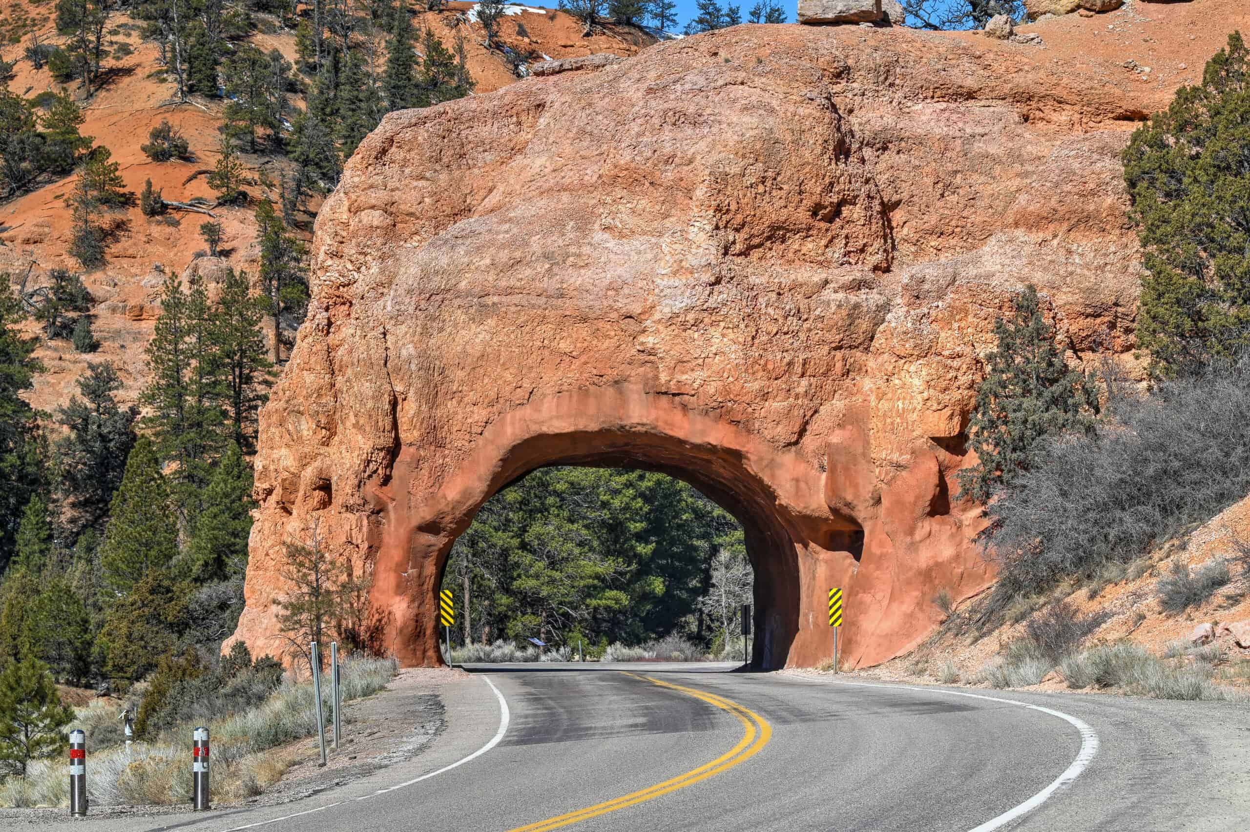
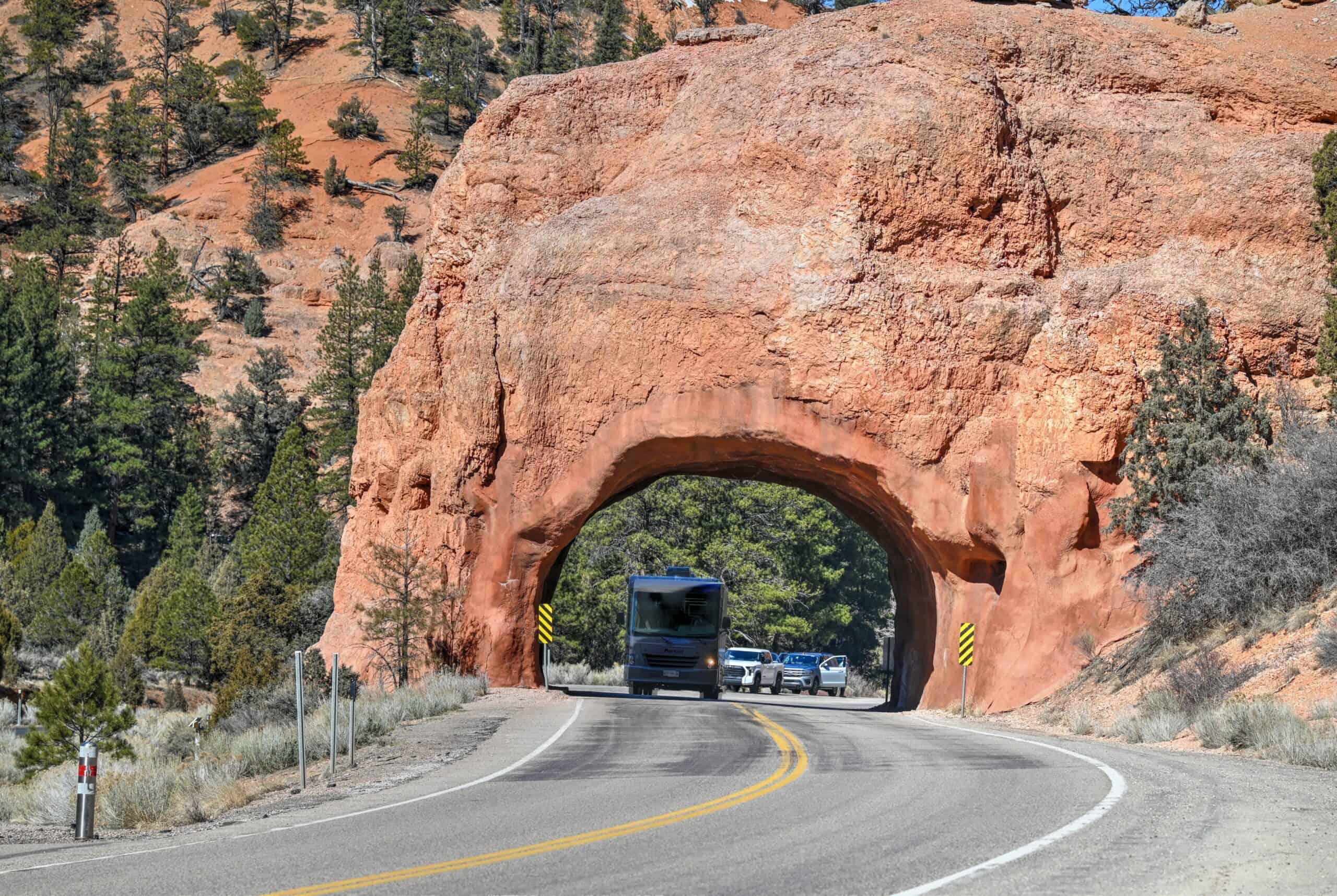
Red Canyon (Dixie National Forest)
Just before Bryce Canyon on UT-12 (link to Google Maps)
Red Canyon is one of the most scenic stretches of the entire drive: towering orange hoodoos and sculpted cliffs rise directly above the highway, and two rock tunnels cut straight through glowing red sandstone. It feels like a preview of Bryce Canyon but with fewer crowds and effortless roadside access.
What you’ll find:
Viewpoints, pullouts, picnic areas, and several short trails ideal for quick exploration: the Pink Ledges Trail, Birdseye Trail, and Tunnel Trail all deliver big scenery in under an hour.
Time required:
15–60 minutes, depending on how much hiking you want to do.
Our Suggested One-Day Itinerary: From Zion to Bryce
The following itinerary creates a relaxed, scenic, and varied day—perfect for experiencing the best viewpoints, landscapes, and small-town stops along the Zion-to-Bryce corridor without feeling rushed.
Morning: Zion –> Canyon Overlook Trail –> Coral Pink Sand Dunes
Leave Zion (Springdale) around 8:00 a.m.
Zion Canyon Overlook Trail – 20 min drive from Springdale – spend 45 min
Start your day by driving up the Zion–Mount Carmel Highway before traffic builds. The trailhead sits immediately east of the Zion–Mount Carmel Tunnel, making it the perfect stop as you exit the park. Short, accessible, and incredibly rewarding, the trail leads to one of the best elevated viewpoints of Zion without requiring a strenuous hike.
Coral Pink Sand Dunes State Park – 45 min drive from overlook – spend 45 min to 2 hours
Continue into this unique sea of shifting, rose-colored sand. The dunes are formed by high winds funneled through the Moquith Mountains, gradually depositing a massive field of soft, rolling hills that stretches across more than 1,000 acres. Boardwalk overlooks, gentle walking paths, and wide open dunes make the park easy to explore at your own pace—whether you want a short wander or a longer adventure.
Afternoon: Coral Pink Sand Dunes –> Orderville –> Moqui Sand Caves
Orderville – 25 min from Coral Pink Sand Dunes – spend 30–60 minutes (lunch)
Orderville makes a convenient and low-key lunch stop thanks to several local cafés and eateries. After eating, take a few minutes to explore the town’s cluster of rock shops—many family-run and stocked with regional minerals, fossils, crystals, and polished stones. It’s one of the best places along the Zion–Bryce corridor to pick up unique souvenirs.
Moqui Sand Caves – 15 min from Orderville – spend 45–60 minutes
While it’s technically quicker to stop at the Moqui Sand Caves before returning to Orderville, it makes for a smoother, more enjoyable day to have lunch first—even if it requires a small amount of backtracking. Reaching the caves involves a short but sandy uphill climb from the roadside pullout (plan on ~20 minutes each way). Inside, the man-made caverns open into wide, arch-like chambers where soft light glows across the bright sandstone, creating atmospheric photo opportunities and a fun place to explore.
Red Canyon – 1h from Sand Caves – spend 15-20 minutes
As you continue toward Bryce Canyon, the scenery shifts dramatically as US-89 meets the vibrant red hoodoos and pine forests of Red Canyon. While there are several short trails here, for this itinerary, we suggest simply pulling over at one or two viewpoints for quick photos before continuing onward. The formations are spectacular enough that even a brief stop gives you a striking preview of the landscapes that define Bryce.
From Red Canyon, you’re only a 20-minute drive from Bryce Canyon National Park.
Total Time Estimate for the One-Day Itinerary
This suggested route creates a relaxed, scenic, and varied day, enough to experience the highlights without rushing or stretching the drive too long. Following this itinerary will take roughly 7-9 hours, which will coincide with the check-in times of most accommodation options around Bryce Canyon.
Optional Detours
While the main route between Zion and Bryce Canyon already includes standout stops like Zion Canyon Overlook, Coral Pink Sand Dunes, Red Canyon, and Orderville, several additional attractions nearby can add variety and depth to your journey. Most require extra drive time or a small reroute, so they’re best suited for travelers with a flexible schedule or those planning an overnight in the area.
Belly of the Dragon – Located between the Moqui Sand Caves and Orderville, this man-made tunnel carved beneath Highway 89 offers a fun, family-friendly walk through sculpted orangey sandstone. The hike is brief but photogenic, especially when soft light filters through the rippled walls. The road to the trailhead is quite bumpy but usually passable for most vehicles and is only about a quarter mile long.
Moqui Museum – Right next to the Moqui Sand Caves, you’ll find the Moqui Museum, a private collection of Native American artifacts, fossils, minerals, and geological specimens. It’s a fascinating stop for history buffs, geology enthusiasts, or families curious about the region’s natural and cultural heritage. Visiting takes only a short time, but the exhibits provide a deeper understanding of southern Utah’s landscapes and history.
Best Friends Animal Sanctuary – Five minutes beyond the museum is a tiny but peaceful refuge. This quiet stop offers short boardwalk trails, desert springs, and bird-watching opportunities. It also offers guided tours, scenic drives through its expansive property, and opportunities to interact with rescued animals. It’s a gentle, low-effort detour ideal for nature lovers, though keep in mind that the refuge has limited hours.
Kanab – Although visiting requires an additional detour from the main Zion-Bryce route, Kanab itself is worth a quick stroll or meal break. Known as “Little Hollywood” for its movie history, the town offers cafés, small restaurants, and local shops. It’s also a convenient place to fuel up or pick up travel essentials before tackling the high plateaus near Bryce.
Once Upon A Time In America Museum – A short drive east of Kanab, the museum is a unique film-history stop celebrating Hollywood’s Western era. The museum showcases props, memorabilia, and stories from classic movies shot in the Kanab region. It’s a fun way to connect Kanab’s landscape to its cinematic past.
Peekaboo Slot Canyon (via 4 x 4 road) – This gorgeous, Navajo Sandstone slot canyon requires navigating a deep-sand road that typically demands a high-clearance 4×4. Guided tours are common and recommended for most visitors. The slot itself is beautiful—similar to Antelope Canyon but far less crowded.
If you don’t have a 4×4 vehicle, you can join a UTV guided tour to reach the canyon:
The Destinations
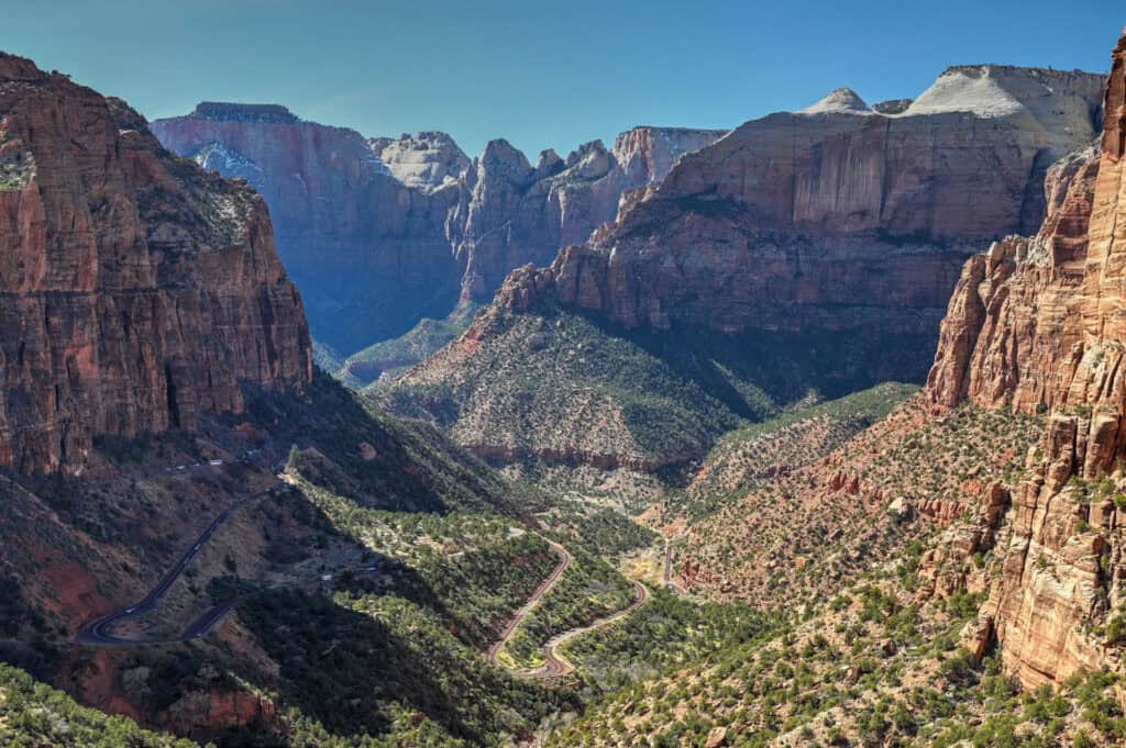
Zion National Park
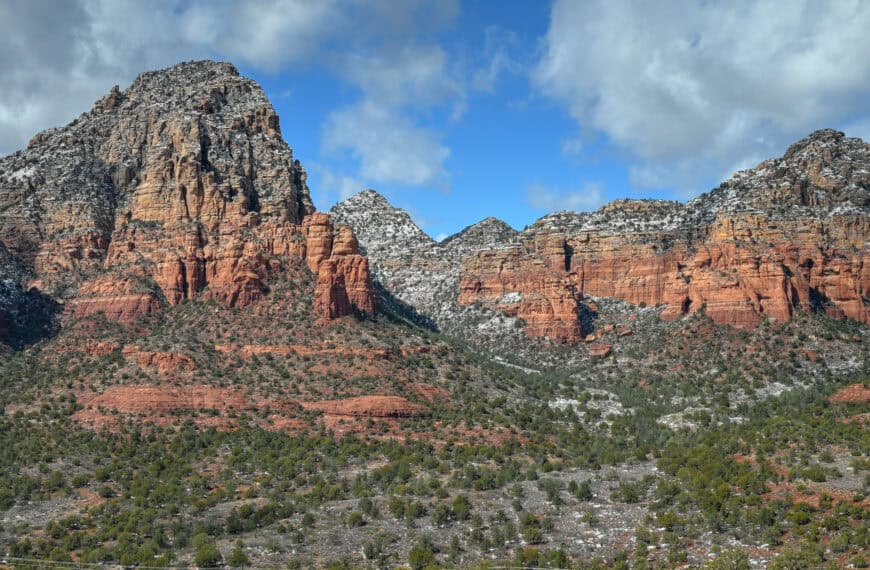
Located roughly an hour northeast of Snow Canyon, Zion marks a dramatic shift in scale, scenery, and energy. The moment you enter the main canyon, the landscape rises thousands of feet around you: massive sandstone cliffs, narrow river-carved corridors, hanging gardens, and canyon walls that glow gold and orange in the late-afternoon light. It’s one of the most iconic national parks in the American Southwest, and for many travellers, it’s a bucket-list destination.
Zion offers an incredible range of hikes, from gentle riverside walks to steep canyon ascents. While world-famous routes like The Narrows and Angels Landing draw the biggest crowds, some of our favorite trails lie slightly off the main tourist radar yet deliver equally unforgettable views. Routes such as Observation Point and sections of the West Rim Trail give you wide-open panoramas, quieter stretches of trail, and a stronger sense of Zion’s wild side, all without the shoulder-to-shoulder congestion that can define the park’s most popular routes.


For more information and planning tips, see our detailed guide on visiting Zion National Park.
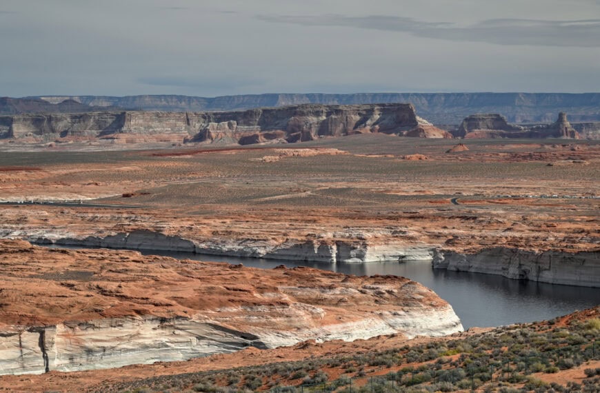
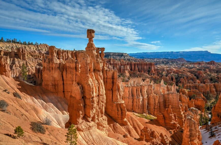
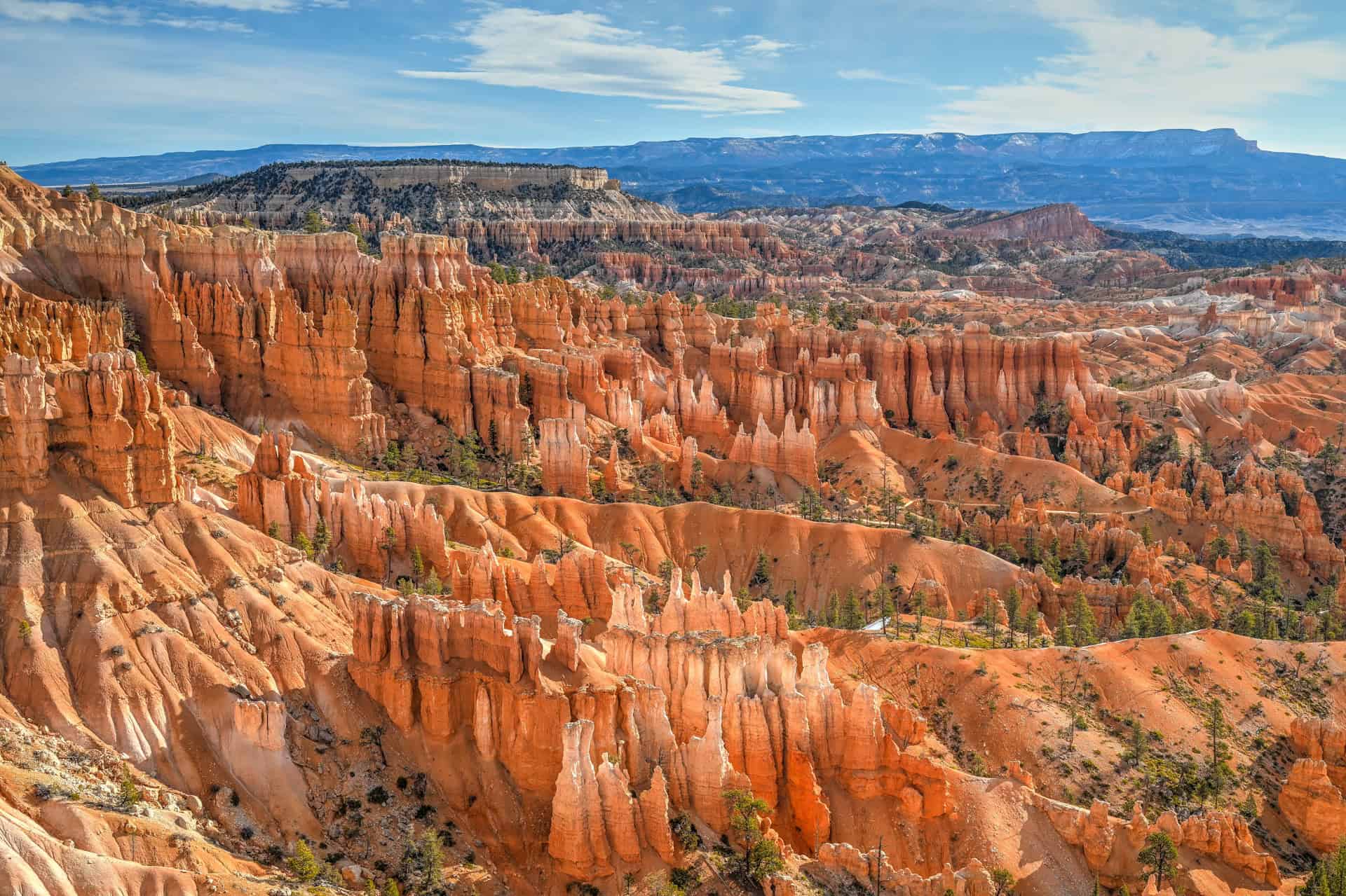
Bryce Canyon National Park
Bryce Canyon unfolds as an entirely different kind of landscape, one defined not by towering canyon walls but by thousands of delicately sculpted hoodoos rising in clustered amphitheaters. Despite its name, Bryce isn’t a true “canyon” but a long series of natural amphitheaters carved by frost, erosion, and time. This unique geology makes it one of the most visually distinctive national parks in the United States. Where Zion is immersive and towering, Bryce is panoramic, airy, and almost cathedral-like, offering sweeping views that change dramatically with each overlook.
Bryce receives a steady flow of visitors throughout the year, but its experience differs from Zion’s in several key ways. The park is smaller, easier to navigate, and centered around a scenic rim drive where every viewpoint feels like a showstopper. Hiking opportunities are also exceptionally varied. Short rim strolls provide effortless views, while iconic trails such as Queen’s Garden/Navajo Loop and the Tower Bridge Trail bring you down among the hoodoos for a more immersive perspective. The elevation here, hovering around 8,000 to 9,000 feet, means cooler temperatures, crisp air, and a slower, more contemplative pace.


For more information and planning tips, see our detailed guide to visiting Bryce Canyon National Park.
Explore More Utah Roadtrip Guides
Continue exploring Utah with these detailed guides:
Best Stops and Attractions Between Vegas and Zion
Best Stops and Attractions Between Bryce and Moab
Best Stops and Attractions Between Moab and Monument Valley
Photography Gear
If you like our photography, you might be interested in some of the gear we use to shoot our travel and hiking destinations.
Camera Body – Nikon Z 6ii Fx-series Mirrorless Body
Main Lens – NIKON 24-120mm F/4G ED VR AF-S
Zoom Lens – Sigma 745-306 150-600mm f/5-6.3
Polarizing filters – Urth Circular Polarizing (CPL)
Camera Tripod – K&F Concept 64-inch Camera Tripod
Mini-tripod – Lammcou Flexible Camera Tripod
Camera/hiking backpack – Vanguard Alta Rise 48 Backpack
Universal Travel Adapter – VYLEE Universal International Power Travel Plug
Other Travel Essentials
Travel Insurance
SafetyWing is a travel insurance company that offers comprehensive coverage for travellers. Includes Medical Insurance and Travel Insurance. Primarily geared towards long-term travellers, digital nomads, and expats.
e-Sim cards
Airalo is the world’s first and largest eSIM store with eSIM plans for 200+ countries and regions worldwide. With Airalo eSIMs, travellers can get connected the moment they land at their destination and avoid nasty data roaming charges
eSIMS are a sustainable alternative to single-use SIM cards – they are 100% digital, require less energy to produce and be re-used rather than disposed of.
Car Rentals
Discover Cars is our go-to website for car rentals. We almost always find our preferred rate there.
Transfer from Airport
Welcome Pickups is our favourite private transfer service, which you can pre-book at a fixed price. Currently available in 220 cities all over the world (mostly in Europe, but with several major cities in Asia, the Middle East and the US).
Kiwitaxi is another private transfer service – we haven’t tried it yet, but it’s currently available in a few more countries (102 as of 2024).
Hotels and Accommodations (coming soon)
Photography Prints
If you found this blog useful, you can help support our blog by purchasing low-cost digital prints. Printed physical prints are also available for purchase.


—–
Well, that wraps it up! We hope you enjoyed our Travel Guide on the Best Stops and Must-See Attractions Between Zion and Bryce Canyon National Parks, and that it will prove useful for planning your trip.
—–
You might also be interested in these related pages: