The drive between Sedona and Page is one of Northern Arizona’s most varied and photogenic routes—transitioning from the lush, forested walls of Oak Creek Canyon to the wide-open desert landscapes that define the Navajo Nation. With so many viewpoints, short hikes, historic sites, and natural wonders scattered along the way, it’s well worth slowing down and treating the journey as part of the adventure. This guide highlights the best stops, detours, and must-see attractions to help you plan the perfect road trip between Sedona and Page, whether you’re driving it in a few hours or stretching it into a full day of exploring.
Highlights Between Sedona and Page – At a Glance
Slide Rock State Park & Oak Creek Canyon Vista – Just north of Sedona, this scenic stretch of Highway 89A winds through one of Arizona’s most beautiful river canyons. Slide Rock State Park is known for its natural red-rock water slide and photogenic swimming holes, while the Oak Creek Canyon Vista offers a dramatic overlook of the canyon’s emerald forest and steep sandstone walls. It’s a perfect early stop to enjoy cooler temperatures and classic Sedona scenery.
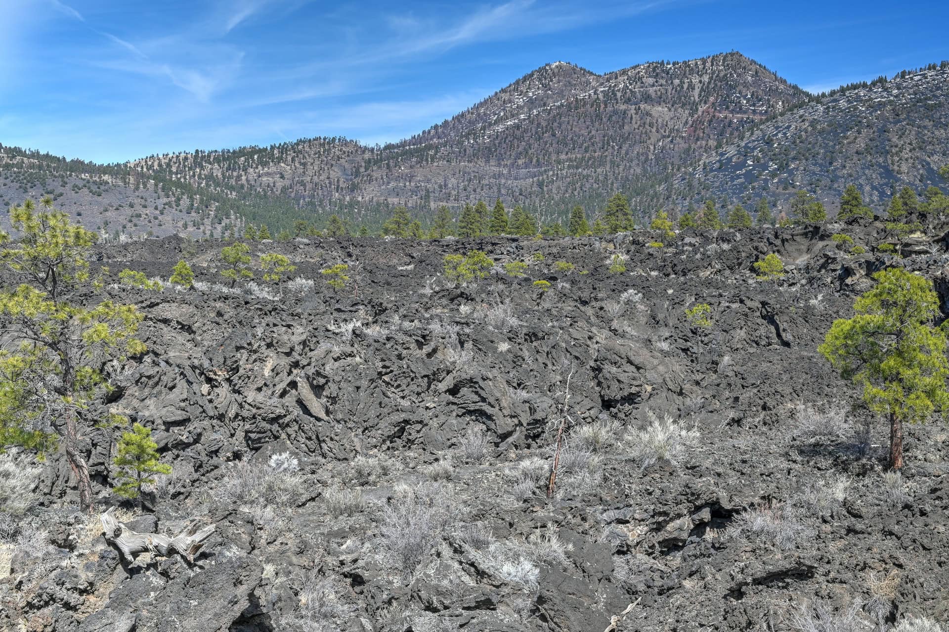
Sunset Crater Volcano National Monument – A short detour off Highway 89 brings you to a striking landscape of black cinder fields, twisted lava flows, and the colorful cinder cone of Sunset Crater. The easy overlooks and short trails reveal the area’s volcanic past and offer a fascinating contrast to the red rocks farther south. It’s a quick, worthwhile stop that adds unique geologic variety to the drive.
Wupatki National Monument (Wupatki Pueblo) – Just beyond Sunset Crater, the landscape transforms again, this time into wide-open desert dotted with ancient pueblos. The Wupatki Pueblo is the largest and most impressive: a 100-room red sandstone dwelling that once housed ancestral Puebloan people. A short, easy walk leads through the ruins, with sweeping views across the Painted Desert. Rich history and stunning solitude make this one of the best detours on the route.
Marble Canyon – As you approach the Glen Canyon region, the highway crosses the towering red cliffs of Marble Canyon. Stop at the historic Navajo Bridge for panoramic views of the Colorado River far below; it’s one of the few places where you can stand directly above the canyon. With roadside viewpoints, a visitors’ center, and easy access to the river, Marble Canyon makes an excellent mid-route break.
Horseshoe Bend – One of Arizona’s most famous viewpoints, Horseshoe Bend is a dramatic 270-degree curve in the Colorado River carved into thousand-foot Navajo Sandstone cliffs. A short, paved 1.5-mile round-trip walk leads to the overlook, where the river’s emerald water contrasts vividly against the red rock. Whether it’s your first or tenth time, the view never fails to impress and serves as a spectacular finale before reaching Page.


Disclosure: This page (Best Stops and Must-See Attractions Between Sedona and Page) may contain product affiliate links. At no additional cost to you, we may receive a commission for purchases made through these links. More details can be found on our disclosure and policies page.
How Long Is the Drive Between Sedona and Page?
If you drive directly from Sedona to Page via Highway 89A and Highway 89, the trip covers about 160 miles (260 km) and typically takes 2¾ to 3¼ hours without stops. This is the most efficient route and the one most travellers take, but driving straight through means missing some of Northern Arizona’s most fascinating landscapes, from volcanic fields and ancient pueblos to the deep gorges of the Colorado River.
For a more rewarding journey, we strongly recommend planning extra time for at least a few major stops along the way, such as Slide Rock State Park, Sunset Crater Volcano, Wupatki Pueblo, and Marble Canyon, each of which requires minimal detours from the main route. These sites showcase an impressive range of scenery, from lush canyon forests to black lava fields, desert mesas, and the dramatic cliffs of Glen Canyon.
With these highlights included, and more, most travellers spend 7 to 10 hours total on the drive, allowing time for short walks, scenic overlooks, and photo stops. Those who want to explore the archaeological sites at Wupatki more fully or enjoy a longer break at Marble Canyon may want to dedicate a full day to the Sedona-to-Page journey.
This guide on the best stops and attractions between Sedona and Page is designed for travellers who want to experience the best viewpoints and short detours along the route in a relaxed, single-day itinerary. We’ll also point out optional stops that require more time or longer side trips, in case you’re planning to stretch the drive across two days or return to the area on a future trip.
If you need to book a rental vehicle for your hiking excursion, we highly recommend using Discover Cars to get the best rates on your rental in Utah, Nevada and Arizona.
We also highly recommend Airalo (eSIM card) for your connectivity needs when travelling abroad. Airalo is the world’s first and largest eSIM store with eSIM plans for 200+ countries and regions worldwide.
Highways 163 & 191 – Driving Considerations
Altitude (and Weather) Changes
The route between Sedona and Page via Highways 89A and 89 may be shorter than some of the Southwest’s epic scenic drives, but it still features significant elevation changes and shifting ecosystems—from forested canyons to volcanic fields to high desert plateaus. These changes can noticeably affect weather and driving conditions, especially outside of summer.
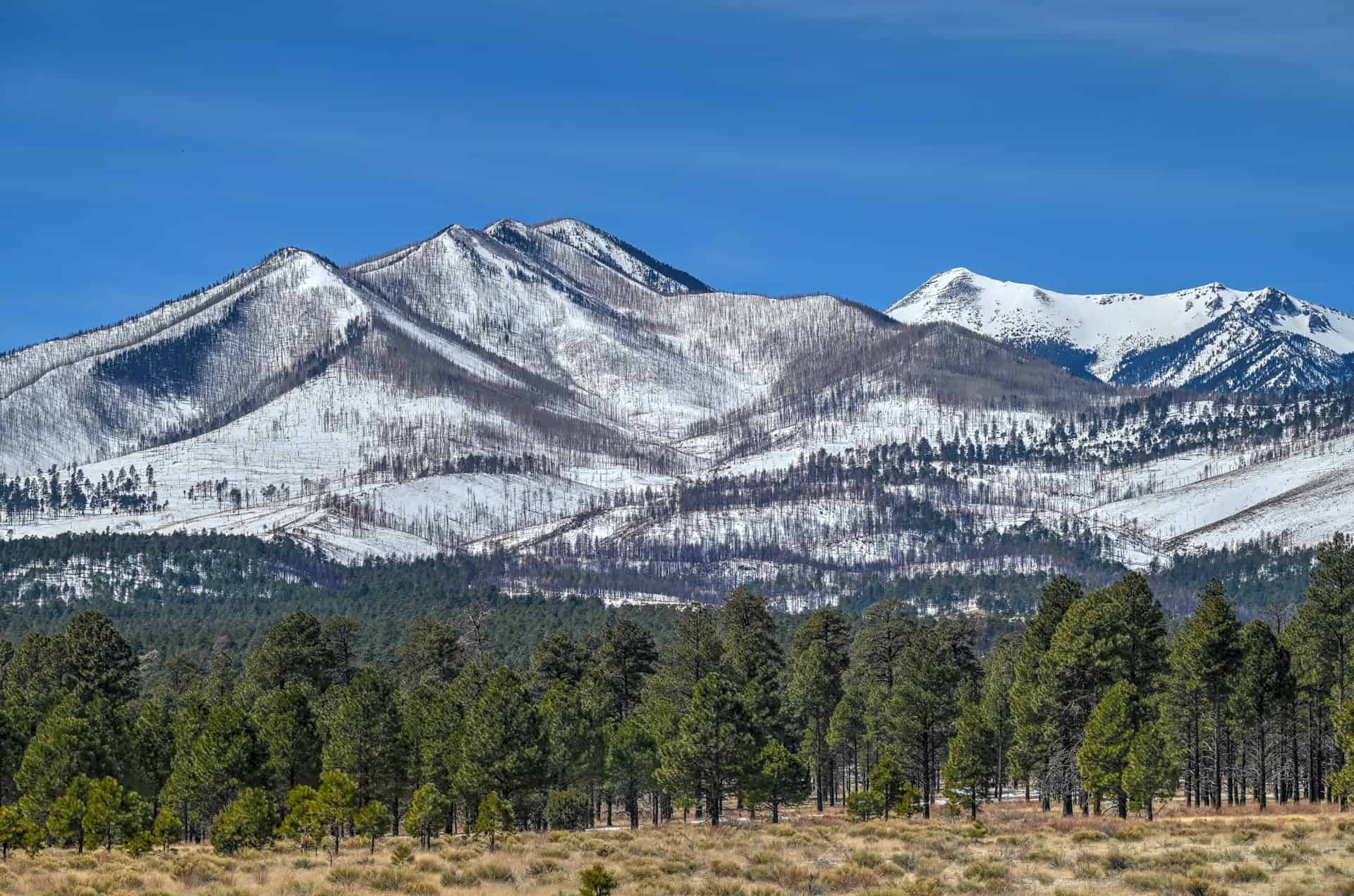
Sedona sits at about 4,350 ft (1,325 m), but the climb out of town toward Oak Creek Canyon quickly takes you to roughly 6,400 ft (1,950 m) near the canyon rim. From here, the route drops into the rolling terrain north of Flagstaff before rising again toward the Sunset Crater–Wupatki loop, where elevations range from 6,000 to 7,000 ft. After this, the landscape gradually descends toward Page at around 4,300 ft, but the environment becomes increasingly arid, windy, and exposed as you approach the Glen Canyon region.
This means you can easily experience temperature differences of 10–20°F (5–10°C) within a single drive. Snow and icy patches are not uncommon on the upper sections of Highway 89A near Oak Creek Canyon and north of Flagstaff from November through early April, even when conditions are mild in Sedona or Page. Conversely, late spring and summer bring heat, strong sun, and gusty winds as you approach Page.
Fuel Stops
Gas stations are relatively frequent between Sedona and Flagstaff, but become more spread out farther north. It’s best to top up before committing to the long, quiet stretches through the Navajo Nation.
Reliable fuel stops include:
- Sedona – Several stations in West Sedona and Uptown.
- Flagstaff – Many stations along Milton Road, Route 66, and near the Highway 89 junction.
- Cameron – A convenient stop 50 minutes north of Flagstaff at the Cameron Trading Post.
- Page – Plentiful fuel options once you reach town.
Between Cameron and Page (a stretch of nearly 80 miles / 130 km), services are limited, so filling up in Cameron is recommended.
Cell Service
Expect spotty to nonexistent cell coverage across long stretches of Highway 89 between Cameron and Page, especially around the Echo Cliffs and the Navajo Nation backcountry.
Download offline maps or directions before leaving Sedona or Flagstaff, and keep any reservation info (Antelope Canyon, Horseshoe Bend shuttle, etc.) saved locally on your device.
A Note on Time Zone Changes
One easily overlooked aspect of the drive between Sedona and Page is the time zone shift you may experience when passing through the Navajo Nation, which observes Daylight Saving Time, unlike most of Arizona.
From March to early November, this means:
- Sedona, Flagstaff, and Page stay on Mountain Standard Time (MST).
- The Navajo Nation (including Cameron and the Wupatki area) switches to Mountain Daylight Time (MDT) — one hour ahead.
Because Highway 89 passes in and out of Navajo Nation land, your phone, smartwatch, and car clock may jump forward or backward an hour multiple times as they attempt to auto-adjust.
If you’re driving in summer, it’s safest to treat all activity times in Page as Arizona time (MST). Most Page-based tours — even those led or organized by Navajo groups — operate on Page time, not Navajo Nation time.
Road Safety
Highways 89A and 89 are fully paved and generally well-maintained, but each section has its own considerations:
- Highway 89A through Oak Creek Canyon is narrow and winding, with tight turns and steep drop-offs. Drive slowly and expect traffic delays during peak season.
- Highway 89 north of Flagstaff is wide and smooth, but can be exposed to high winds.
- Night driving is not ideal due to limited lighting, wildlife crossings, and the remoteness of the area.
Side routes such as the Sunset Crater–Wupatki Scenic Loop are paved and suitable for all vehicles, though some spur roads within the monuments may be gravel.
Best Time of Year to Drive the Route
This route is enjoyable year-round, but the most comfortable conditions are found in spring (March–May) and fall (September–October), when temperatures are mild, and visibility is typically excellent.
- Summer brings intense heat and bright sun in the Page area—plan early departures and bring ample water.
- Winter can bring icy roads and occasional snowstorms at the higher elevations near Oak Creek Canyon and Flagstaff. Conditions can change quickly at high elevation, even when Sedona and Page remain dry.
We’ve personally experienced how dramatic the contrasts can be. On a late-March trip, we left Sedona in sunny 60°F weather, climbed into Oak Creek Canyon where snow still lined the roadsides, all the way to Flagstaff and around the San Francisco Peaks. We eventually reached the Wupatki region under warm, dry skies, which continued until we arrived in Page.


Best Stops Between Sedona and Page
The following attractions are listed from south to north, in the order you’ll encounter them when travelling from Sedona toward Page along Highway 89A and Highway 89.
Slide Rock State Park
10–15 minutes north of Sedona on Highway 89A (link to Google Maps)
Why stop here:
One of northern Arizona’s most beloved swimming and sun-soaking spots. Natural sandstone ledges and smooth red-rock chutes create Oak Creek’s famous “water slides,” making it a fun stop for cooling off, taking photos, or just relaxing by the creek on warm days.
What you’ll find:
Creek access, short walking paths, shaded picnic tables, restrooms, and classic red-rock canyon scenery. It’s extremely popular in summer, so expect crowds and limited parking during peak hours.
Time required:
45 minutes to 2 hours, depending on whether you swim.
Oak Creek Canyon Vista
Another 15 minutes north of Slide Rock (link to Google Maps)
Why stop here:
A dramatic overlook perched above one of Arizona’s most beautiful mountain canyons. From the viewing deck, you can see the winding road, forested cliffs, and layered rock walls that make Oak Creek Canyon a scenic highlight of the Sedona-Flagstaff drive.
What you’ll find:
A paved viewpoint area with rail-side overlooks, seasonal Navajo craft stalls, restrooms, and wide-angle photo opportunities, especially nice in late-afternoon light.
Time required:
5–10 minutes.
Sunset Crater Volcano National Monument
Located off Highway 89, 15 minutes north of Flagstaff (link to Google Maps)
Why stop here:
A landscape frozen in time, and then slowly reclaimed. Sunset Crater was born from a dramatic volcanic eruption roughly 900 years ago, an event so powerful it reshaped the lives of the Indigenous communities who lived here. Today, black cinder fields, twisted lava flows, and colorful cinder cones create an otherworldly scene you’ll only find in northern Arizona. Driving or walking through the area feels like stepping onto another planet.


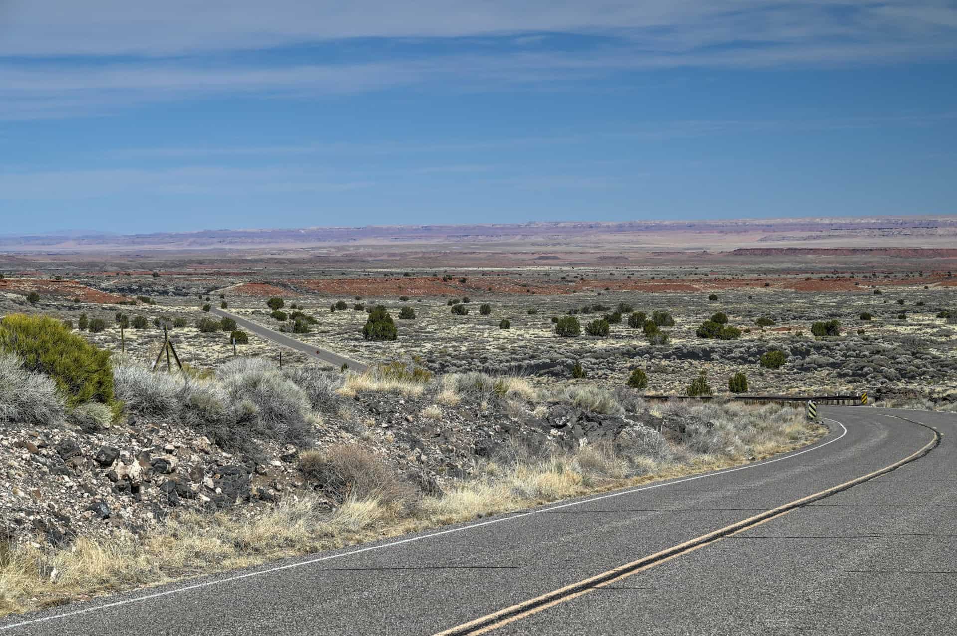
What you’ll find:
Short interpretive trails winding through lava fields, viewpoints overlooking the cinder cone, and access to the scenic loop road shared with Wupatki National Monument. The Lava Flow Trail is one of the park’s highlights, a quick walk that shows off the rugged textures and colors created by the eruption.
Time required:
You can spend nearly a full day here, but aim for about 2h – 2h30 (including a visit to the Wupatki Pueblo – see below) as part of your Sedona-Page transit.
For more information on visiting, see our Sunset Crater Volcano Guide, which highlights how to spend a few hours in the park.
Wupatki National Monument
Accessed via the same loop road as Sunset Crater (link to Google Maps)
Why stop here:
Just beyond the volcanic fields of Sunset Crater, the landscape suddenly opens into wide red desert badlands. And in the middle of it all, the stone villages of the Ancestral Puebloans rise from the earth. Wupatki was a thriving trading hub a millennium ago, home to multi-story dwellings, ceremonial rooms, and even a natural “blowhole” that channels air from underground. Standing here gives you a vivid sense of how people adapted to this dramatic landscape.


What you’ll find:
Easy walks to several beautifully preserved pueblos, including Wukoki (perched on a rock outcrop) and Wupatki Pueblo itself, the largest and most impressive site in the park. Expect interpretive signage, sweeping desert panoramas, and a deep sense of history.
Time required:
30 minutes for the site, about 2 hours for the loop with Sunset Crater.
The Painted Desert Project (Navajo Nation Roadside Art)
Found along Highway 89 between Cameron and Gray Mountain (link to Google Maps)
Why stop here:
This evolving public-art initiative transforms abandoned buildings into striking murals, adding vibrant splashes of color to the open desert landscape.
What you’ll find:
Just vibrant murals on old storefronts and buildings scattered along the roadside. No facilities — just art, sky, and desert.
Time required:
5–10 minutes per stop.
Little Colorado River Gorge Overlook (Highway 64)
Short detour from Highway 89 near Cameron (link to Google Maps)
Why stop here:
A dramatic, lesser-known canyon carved by the Little Colorado River — far quieter than the Grand Canyon’s South Rim but nearly as impressive.
What you’ll find:
A paved overlook area run by the Navajo Nation, with vendors selling crafts. Sheer-walled canyon viewpoints and minimal crowds.
Time required:
10–20 minutes.
Grand Canyon South Rim (Optional)
Significant detour; not recommended on a one-day Sedona — Page transit
Why stop here:
It’s the Grand Canyon — the region’s star attraction. But the South Rim village is a destination in itself, requiring several hours to experience properly. On a travel day, it can easily overwhelm your schedule.
Better quick-stop compromise:
If you must fit it in, consider Navajo Point (about 30 minutes from the junction with Highway 89- link to Google Maps), one of the first major viewpoints when approaching from the east. It offers a spectacular panorama with less walking and lighter traffic.
Time required:
Navajo Point: 10–15 minutes
Full South Rim visit: 4+ hours
Cameron Trading Post (and Cameron Old Bridge)
On Highway 89 at the junction with Highway 64 (link to Google Maps)
Why stop here:
A historic Navajo Nation trading post dating back to 1916, originally serving as a gathering and trading point for local communities. Today it remains a cultural landmark — part shop, part gallery, part restaurant — and a convenient rest stop on the drive north.
What you’ll find:
A large gift shop filled with Navajo rugs, jewelry, pottery, and crafts; a restaurant known for its Navajo tacos; clean restrooms; and the 1911 Cameron Suspension Bridge, a photogenic steel relic spanning the Little Colorado River.
Time required:
20–40 minutes.
Marble Canyon & Navajo Bridge
45 minutes southwest of Page via Highway 89A (link to Google Maps)
Why stop here:
A peaceful, wide-open slice of canyon country, far quieter than nearby Page’s main overlooks. The twin Navajo Bridges (one historic, one modern) stretch across Marble Canyon, offering breathtaking views straight down to the turquoise Colorado River. The surrounding area is a gateway to some of the region’s best, lesser-known hikes.


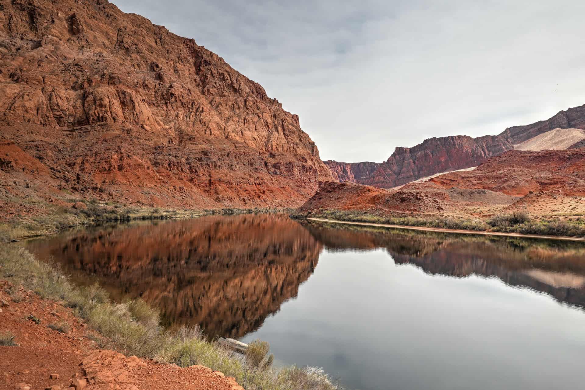
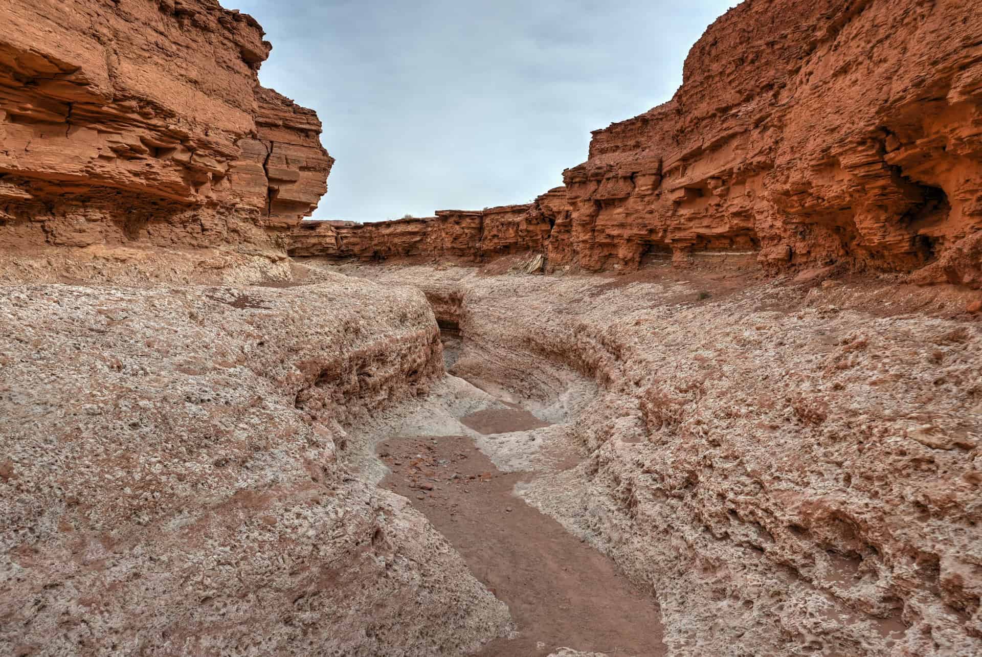
What you’ll find:
A visitor center, access to both the historic and modern bridges, and optional trails nearby. Hikes like Cathedral Wash, which descends through a twisting canyon to the Colorado, and the steep but rewarding Spencer Trail, offering panoramic views high above Lees Ferry, reveal the raw beauty and scale of the landscape
Time required:
15 minutes for the bridge; 1–3 hours if hiking.
For more information on visiting, see our Marble Canyon Visiting Guide, which highlights how to spend a few hours in the park.
Antelope Pass Vista
On Highway 89, 25 minutes south of Page (link to Google Maps)
Why stop here:
A quick, high-elevation pullout with huge views across the desert basin and distant cliffs, especially lovely near sunset when the light washes over the landscape
What you’ll find:
A paved pullout with an expansive, wide-angle view worthy of a quick photo stop.
Time required:
5–10 minutes.
Horseshoe Bend
4 miles south of Page along Highway 89 (link to Google Maps)
Why stop here:
One of the Southwest’s most iconic viewpoints: a dramatic 270° curve in the Colorado River framed by sheer sandstone cliffs. It’s touristy, yes, but undeniably spectacular.


Why consider visiting during the transit day:
You’ll naturally pass the trailhead before reaching Page, which can save time if you visit on your arrival day.
What you’ll find:
A large parking area (fee required), a 1.5-mile round-trip walk on a sandy path, and one of the most famous overlooks in the region.
Time required:
60-75 minutes.
For more information on visiting, see our Horseshoe Bend Visiting Guide.
Our Suggested One-Day Itinerary: From Sedona to Page
If you tried to see everything listed in this guide, you could easily spend several days exploring the region, as there’s that much to see along Highways 89A and 89. But for those with just a single day to make the journey, it’s still possible to experience some of northern Arizona’s most beautiful viewpoints, cultural sites, and desert landscapes without feeling rushed.
This itinerary highlights what we think are the most rewarding stops for a one-day trip from Sedona to Page, focusing on places that are scenic, accessible, and close to the main route. It follows the natural flow of the drive and works equally well in reverse if you’re starting in Page.
Morning: Sedona to Wupatki via Oak Creek Canyon & Sunset Crater Loop
Leave Sedona around 9:00–9:30 a.m. and begin the winding ascent through Oak Creek Canyon. This is one of the most scenic stretches of the entire drive, so try to enjoy the curves rather than rushing through them.
Your first quick stop is Oak Creek Vista, where a short walk leads to panoramic views back over the canyon you just climbed. It’s a perfect spot to grab a few photos and appreciate the transition from red rock to high pine forest.
Continue north toward Flagstaff and then turn onto the Sunset Crater–Wupatki Scenic Loop Road, one of the most diverse and rewarding detours along the entire route. Plan to spend 2h to 2h30 driving the loop and exploring the highlights:
- Walking a short segment of the Lava Flow Trail among ancient lava fields
- Pulling off at cinder cone viewpoints
- Visiting the Wupatki Visitor Center
- Exploring the impressive Wupatki Pueblo on a short trail
Lunch Options: Picnic or Cameron
Depending on your pace, you’ll likely wrap up the scenic loop around 12:00–12:30 p.m. and rejoin Highway 89 near Cameron.
You have two great lunch options:
Option 1 — Picnic
Bring lunch and enjoy it at one of the picnic areas inside the Sunset Crater/Wupatki National Monuments:
- Sunset Crater Visitor Center picnic area
- Lava Flow Trail picnic tables
- Painted Desert Vista picnic area
- The picnic zone near the Wupatki Visitor Center
Option 2 — Lunch in Cameron
If you prefer a restaurant, head to Cameron (about 20 minutes from the loop exit). Options include:
- Cameron Trading Post Restaurant
- HWY 89 Yummy Shack
- Blue Canyon Grill
- Burger King
Cameron is also a good place to refuel before continuing the trip.
Afternoon Option 1: Little Colorado River Gorge & Navajo Point (Grand Canyon South Rim)
After lunch, turn west onto Highway 64 toward the Grand Canyon South Rim’s East Entrance. This detour involves about 1 hour of driving, plus however long you spend at the viewpoints.
Your first stop is the Little Colorado River Gorge Overlook, a dramatic and often overlooked canyon managed by the Navajo Nation. From here, continue west to Navajo Point, one of the South Rim’s most spectacular viewpoints and the first major overlook when approaching from the east.
This option offers sweeping canyon views without requiring the time commitment of exploring Grand Canyon Village. It’s a perfect “taste” of the South Rim if you have never visited before.
Afternoon Option 2: Marble Canyon & Navajo Bridge
If you prefer quieter scenery and red-rock canyon views, continue north on Highway 89 and turn west onto Highway 89A toward Marble Canyon. The detour involves about 50 minutes of driving each way, plus however long you decide to explore.
Once in Marble Canyon, enjoy the classic viewpoints or take short walks at your own pace. If you want to stretch your legs without committing to long hikes, we recommend:
- Walking halfway down Cathedral Wash, which gives you a slot-canyon feel without requiring a full descent to the river.
- Climbing the lower portion of the Spencer Trail, just enough to reach an elevated viewpoint for a different perspective of Marble Canyon and the Colorado River
Following this plan, expect to spend 2 to 2½ hours in Marble Canyon before continuing toward Page.
Late Afternoon: Horseshoe Bend Before Reaching Page
As you approach Page, make one final stop at Horseshoe Bend, which you’ll pass before entering town. This timing is ideal: the late-afternoon light illuminates the canyon walls beautifully, whereas sunset often casts much of the bend into deep shadow.
The walk to the overlook is about 1.5 miles (round-trip) on a sandy, exposed trail, so bring water, even in cooler months.
On your way to Horseshoe Bend, you can also make a stop at Antelope Pass Vista, since it’s a quick photo stop along the main route into Page.
Total Time Estimate for the One-Day Itinerary
A full day between Sedona and Page typically takes 8 to 11 hours, depending on your chosen detours and how much time you spend at each stop. Here’s a rough breakdown:
- The main drive from Sedona to Page: 3h.
- Sunset Crater–Wupatki Loop: driving + stops = 2h -2h30
- Lunch: 30-60 minutes
- Afternoon Options (South Rim or Marble Canyon): driving + stops = 2h-2h30
- Horseshoe Bend: 45-60 minutes
- Oak Creek Vista & Antelope Pass Vista stops: 20 minutes
We think this makes the trip a comfortable and stress-free full-day journey with plenty of built-in time for photos, short walks, and scenic stops.
The Destinations: Sedona and Page
Sedona
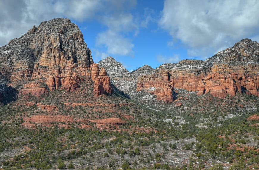
Sedona anchors the southern end of this route and makes an exceptional base for exploring northern Arizona. Known for its striking red rock formations, deep canyons, and expansive trail network, Sedona blends small-town comfort with easy access to world-class outdoor scenery. Whether you’re spending several nights here or using it as your launch point for the drive toward Page, the town offers a rare combination of convenience, beauty, and variety—great food, countless trailheads, scenic lookouts, and relaxing places to unwind at day’s end.


With more than 200 miles of trails, you’ll find everything from gentle walks to demanding climbs right at your doorstep. Classic routes like Cathedral Rock, Fay Canyon, and the Soldier Pass Trail provide stunning views without requiring a full day, while the Red Rock Scenic Byway and Chapel of the Holy Cross are perfect for lower-effort sightseeing. Sedona works just as well for travellers who want a relaxed half-day of exploration as it does for hikers looking to stack multiple trails across several days.
Sitting at roughly 4,350 feet (1,325 m), Sedona is noticeably cooler than lower-elevation desert destinations like Phoenix, especially in spring and fall.
For more information on exploring the area, see our guide on the Best Things to See and Do in Sedona, where we highlight the best viewpoints, scenic drives, and short trails.
Page (Horseshoe Bend, Antelope Canyon & Lake Powell)
At the northern end of this route lies Page, a small but activity-packed town perched above the Glen Canyon region. Page serves as the ideal base for exploring Horseshoe Bend, the world-famous slot canyons of Antelope Canyon, and the recreational waters of Lake Powell.


Highlights within minutes of town include:
- Beehive (New Wave Trail), a short but incredibly photogenic loop near Glen Canyon Dam, offers sweeping views of sculpted sandstone fins, swirling orange rock, and Lake Powell’s blue water in the distance.
- Antelope Canyon, located on Navajo land and accessible only by guided tour. Depending on your interests, you can visit the photogenic Upper Canyon, the narrower Lower Canyon, or lesser-known options like Secret or Canyon X.
- Glen Canyon Dam Overlook and the Wahweap / Lake Powell area, where you’ll find marinas, boat tours, beaches, and sunset viewpoints.
For more details on planning your visit, see our guide on the Best Things to See and Do in Page, which covers the area’s top attractions, tours, and short hikes.
Explore More Arizona
Continue exploring Arizona with these detailed travel guides:
Best Things to See and Do in Page
Monument Valley Travel Guide
Sunset Crater Volcano National Monument
Marble Canyon Guide
Photography Gear
If you like our photography, you might be interested in some of the gear we use to shoot our travel and hiking destinations.
Camera Body – Nikon Z 6ii Fx-series Mirrorless Body
Main Lens – NIKON 24-120mm F/4G ED VR AF-S
Zoom Lens – Sigma 745-306 150-600mm f/5-6.3
Polarizing filters – Urth Circular Polarizing (CPL)
Camera Tripod – K&F Concept 64-inch Camera Tripod
Mini-tripod – Lammcou Flexible Camera Tripod
Camera/hiking backpack – Vanguard Alta Rise 48 Backpack
Universal Travel Adapter – VYLEE Universal International Power Travel Plug
Other Travel Essentials
Travel Insurance
SafetyWing is a travel insurance company that offers comprehensive coverage for travellers. Includes Medical Insurance and Travel Insurance. Primarily geared towards long-term travellers, digital nomads, and expats.
e-Sim cards
Airalo is the world’s first and largest eSIM store with eSIM plans for 200+ countries and regions worldwide. With Airalo eSIMs, travellers can get connected the moment they land at their destination and avoid nasty data roaming charges
eSIMS are a sustainable alternative to single-use SIM cards – they are 100% digital, require less energy to produce and be re-used rather than disposed of.
Car Rentals
Discover Cars is our go-to website for car rentals. We almost always find our preferred rate there.
Transfer from Airport
Welcome Pickups is our favourite private transfer service, which you can pre-book at a fixed price. Currently available in 220 cities all over the world (mostly in Europe, but with several major cities in Asia, the Middle East and the US).
Kiwitaxi is another private transfer service – we haven’t tried it yet, but it’s currently available in a few more countries (102 as of 2024).
Hotels and Accommodations (coming soon)
Photography Prints
If you found this blog useful, you can help support our blog by purchasing low-cost digital prints. Printed physical prints are also available for purchase.


—–
Well, that wraps it up! We hope you enjoyed our Best Stops Between Sedona and Page Travel Guide and that it will prove useful for planning your trip.
—–
You might also be interested in these related pages: