Few viewpoints in the American Southwest are as instantly recognizable as Horseshoe Bend, where the Colorado River sweeps in a dramatic 270-degree curve beneath towering sandstone cliffs. Located just five minutes from Page, Arizona, this short, family-friendly hike leads to one of the most breathtaking panoramas in the region, and one of the most photographed. In this guide, you’ll find everything you need to plan your visit: the best times for light and photography, entrance and parking details, and practical tips to avoid crowds and heat while making the most of your time at this iconic overlook.
To help you plan your visit, we’ve put together this complete Horseshoe Bend guide, including how to reach the viewpoint, what to expect on the short hike, the best times for lighting and photography, and practical tips for avoiding crowds and heat while safely enjoying one of the Southwest’s most iconic landscapes.
Horseshoe Bend – At a Glance
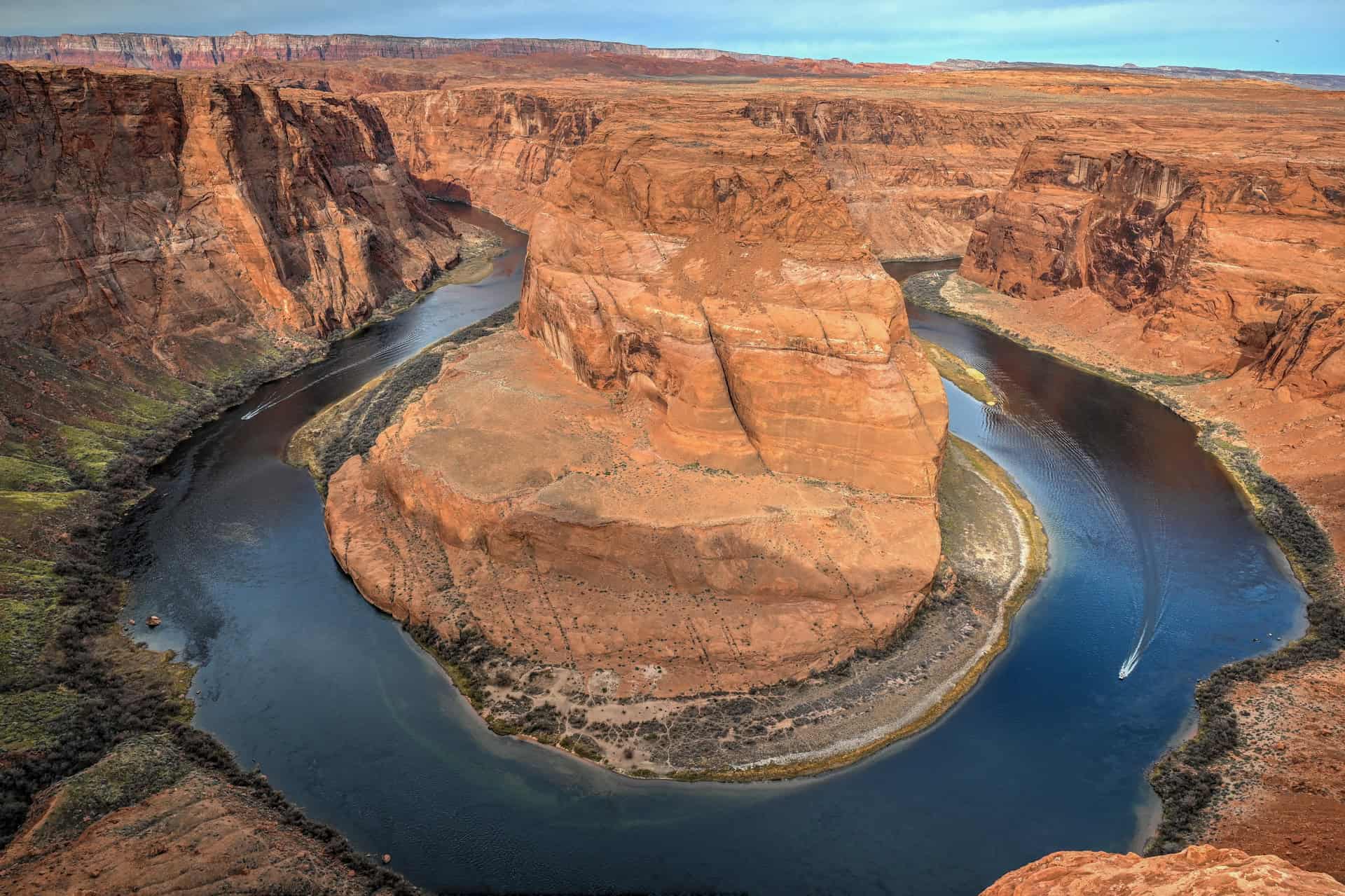
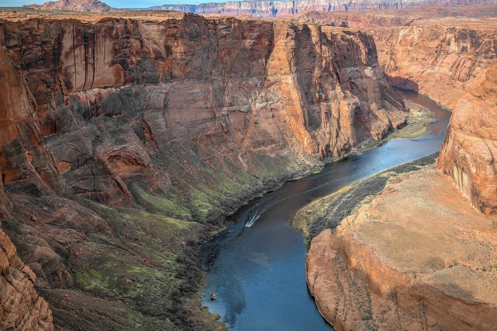
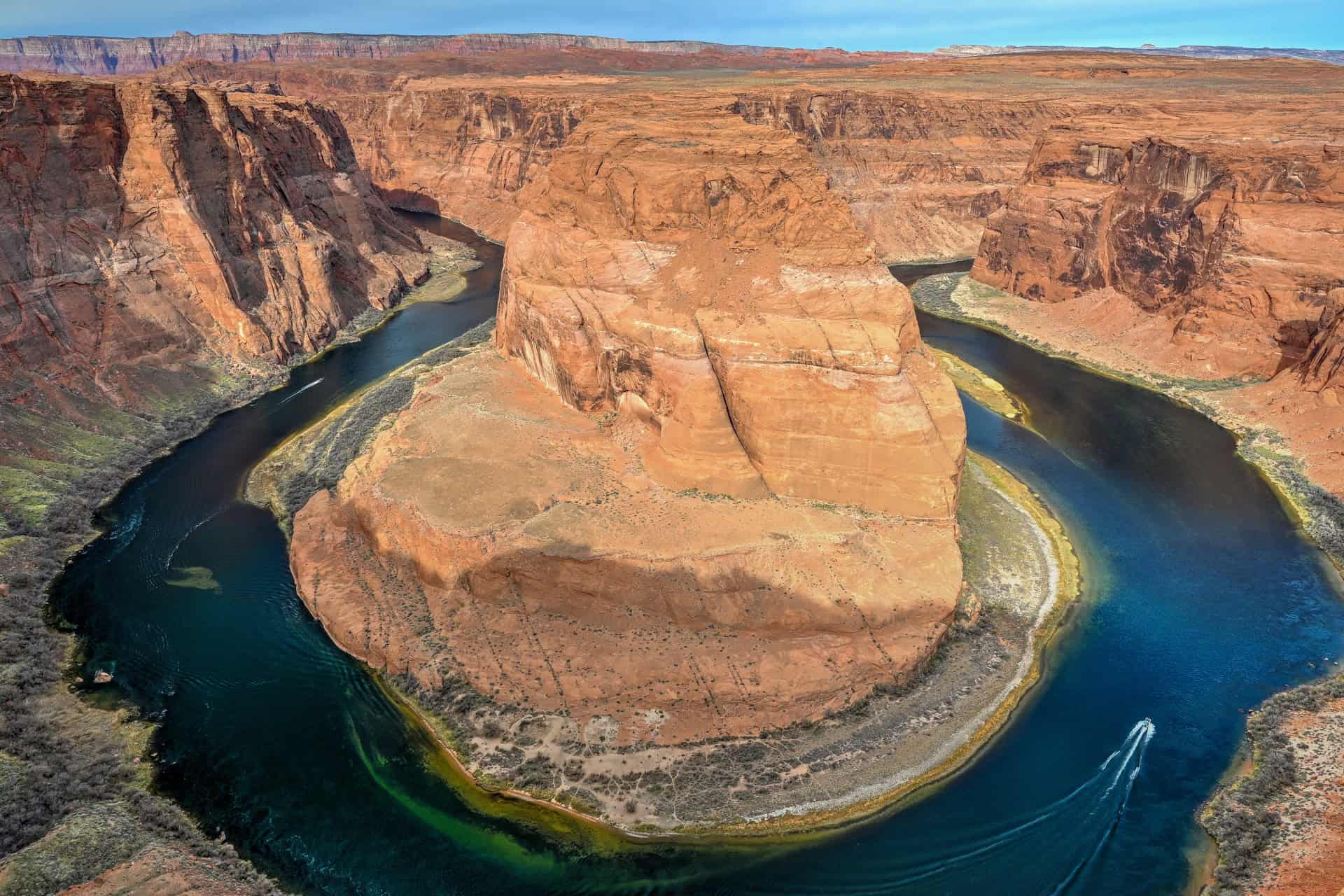
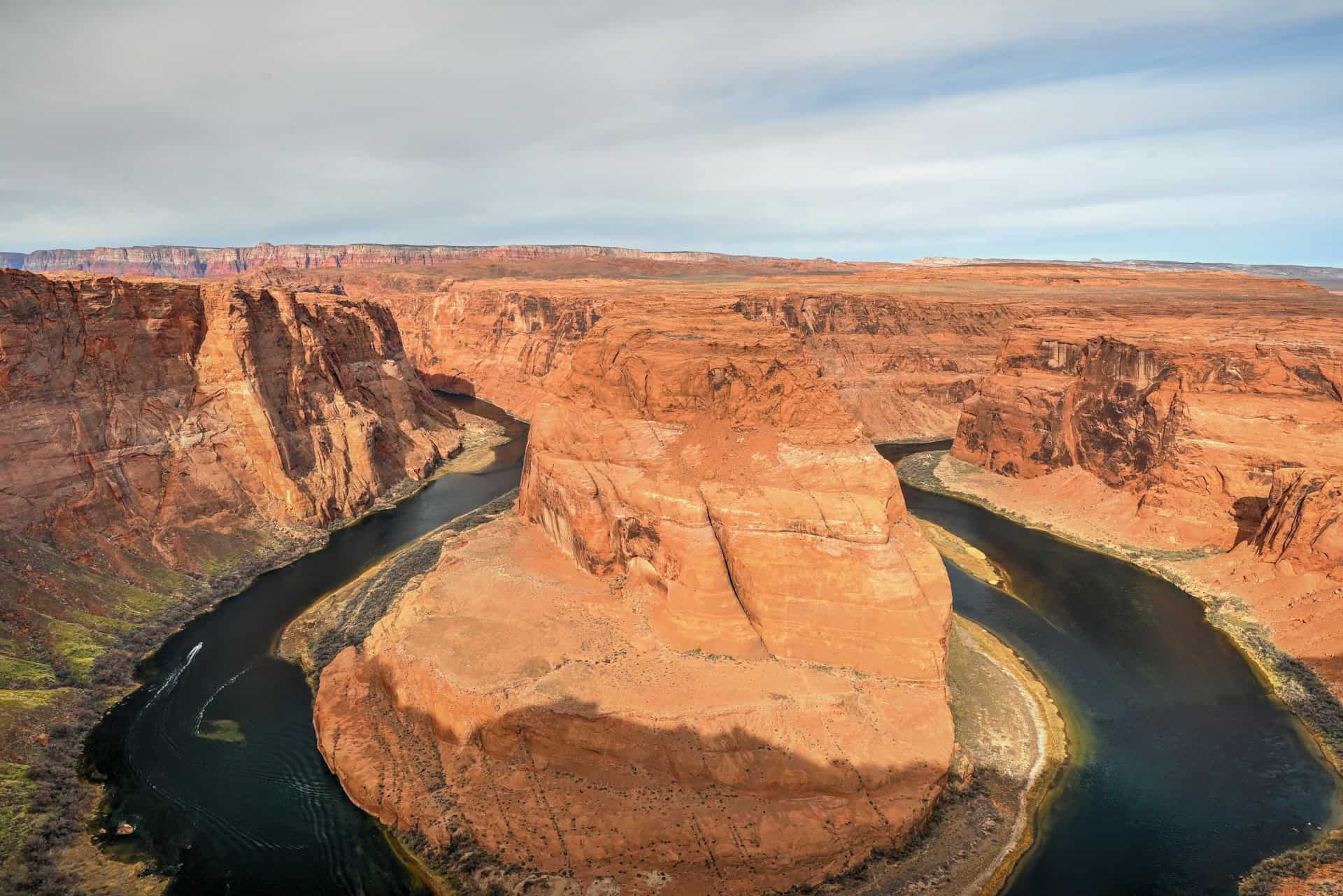
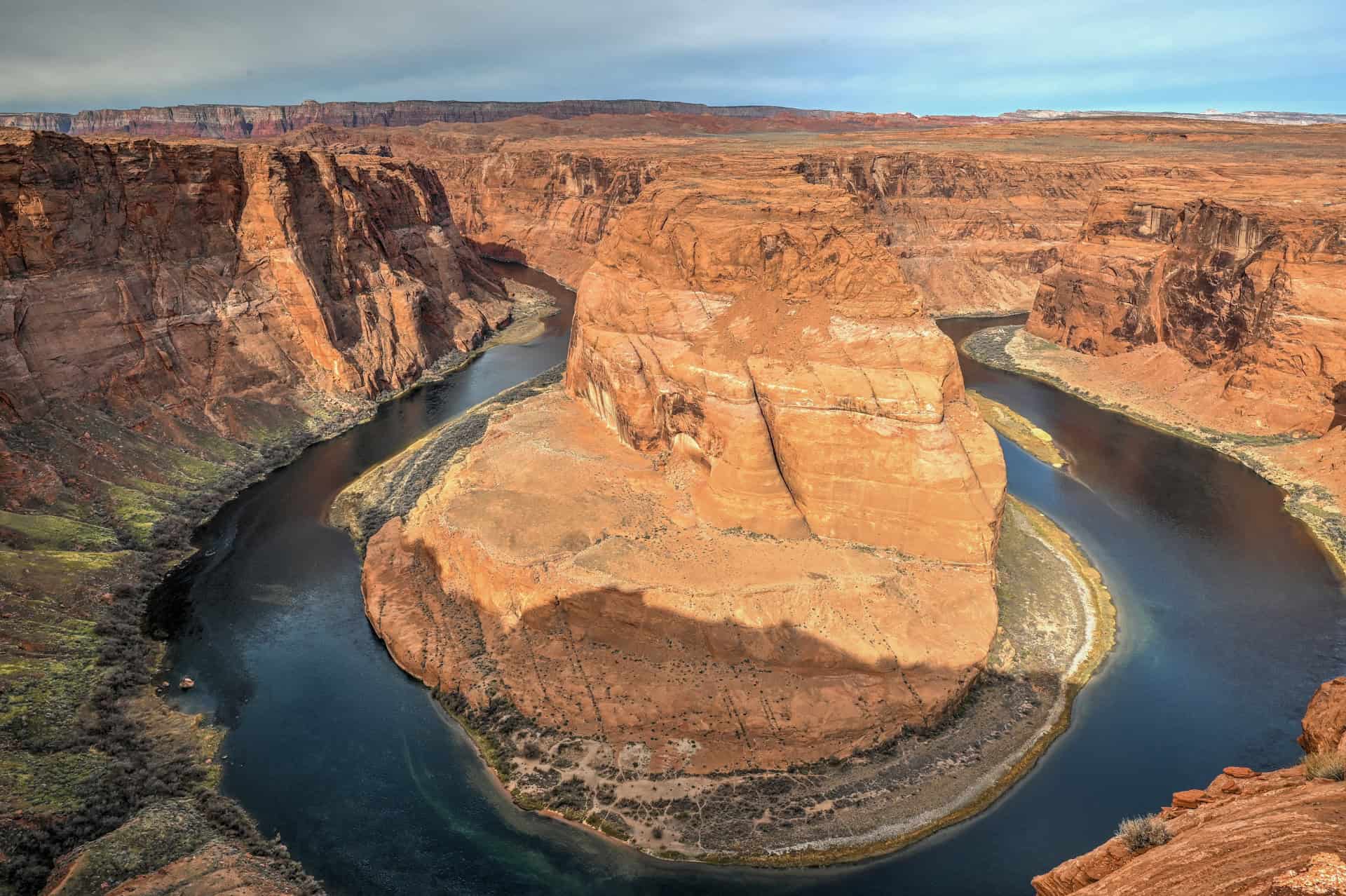
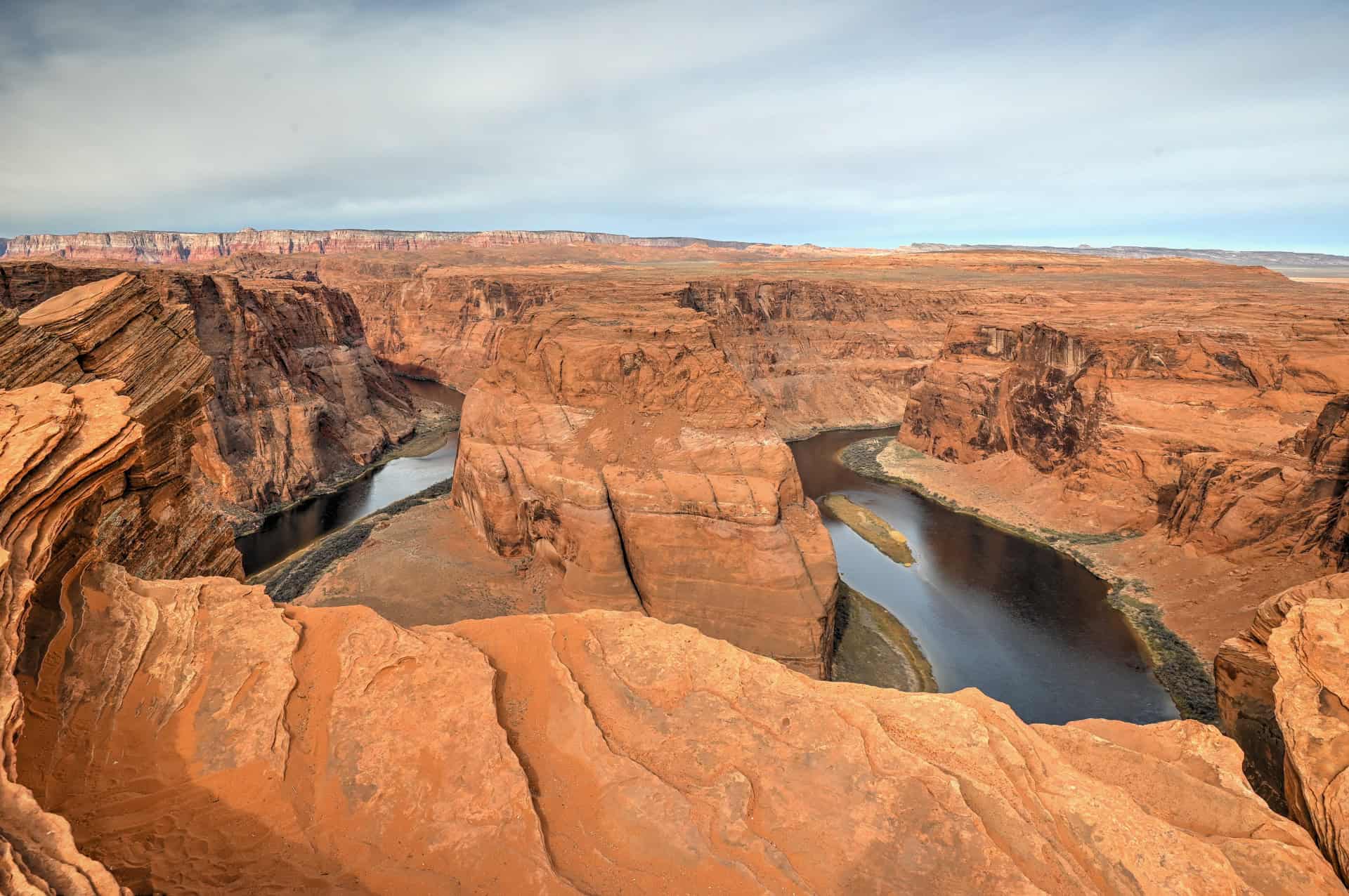
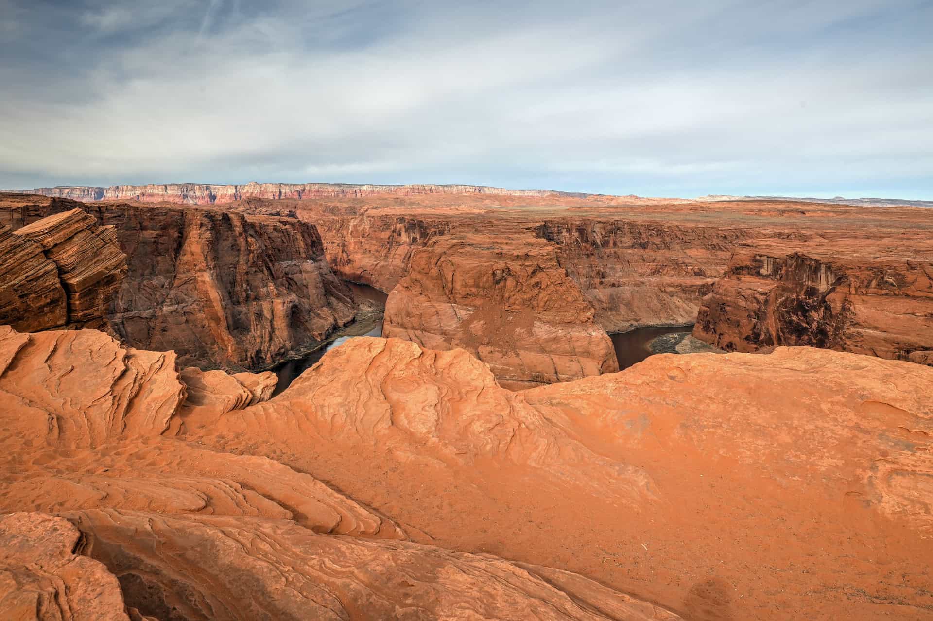
One of the Southwest’s most photographed landmarks – Just five miles south of Page, Arizona, Horseshoe Bend offers a jaw-dropping, 1,000-foot (300 m) view over a dramatic meander of the Colorado River. The overlook reveals the river looping in a perfect U-shape, framed by glowing red cliffs and endless desert skies.
A short, easy walk to a world-class viewpoint – The 1.5-mile (2.4 km) round-trip trail is mostly flat and well-maintained, with a gentle descent to the rim. It’s accessible for most visitors, though there’s little shade, so bring water, sun protection, and take your time on warmer days.
Stunning at sunrise, sunset, and every hour between – Early morning and late afternoon bring cooler temperatures, smaller crowds, and softer light. Sunset is the most popular time, when the cliffs glow in gold and crimson and the river mirrors the sky’s changing colors.
Safe and scenic – A sturdy viewing platform and railings now line the main overlook area, offering protection without compromising the view. Adventurous photographers can explore nearby rim sections (with caution) for alternative angles.
Easy to access, impossible to forget – Located right off U.S. Route 89 with a large paved parking area, Horseshoe Bend is one of the most convenient, yet most awe-inspiring, stops near Page and Glen Canyon. Whether you visit for a quick photo stop or linger to watch the sun dip below the horizon, it’s a must-see highlight of any Southwest road trip.


Disclosure: This page (Horseshoe Bend Guide) may contain product affiliate links. At no additional cost to you, we may receive a commission for purchases made through these links. More details can be found on our disclosure and policies page.
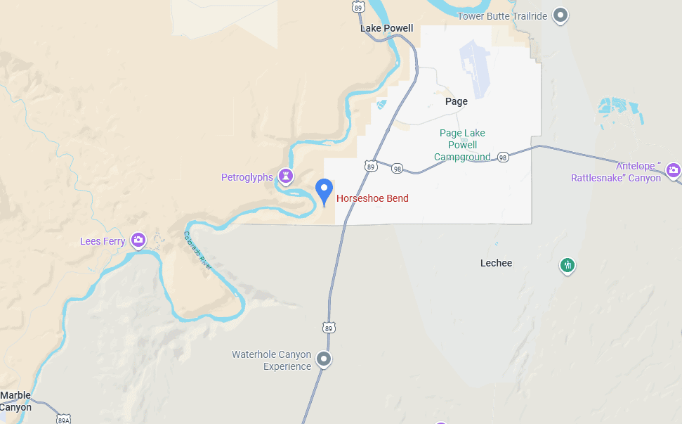
Horseshoe Bend – Location and Map
Horseshoe Bend is located just 5 miles (8 km) south of downtown Page, Arizona, along U.S. Route 89. The turnoff for the parking lot is clearly marked and sits about a 10-minute drive from the town center (link to Google Maps).
About Horseshoe Bend
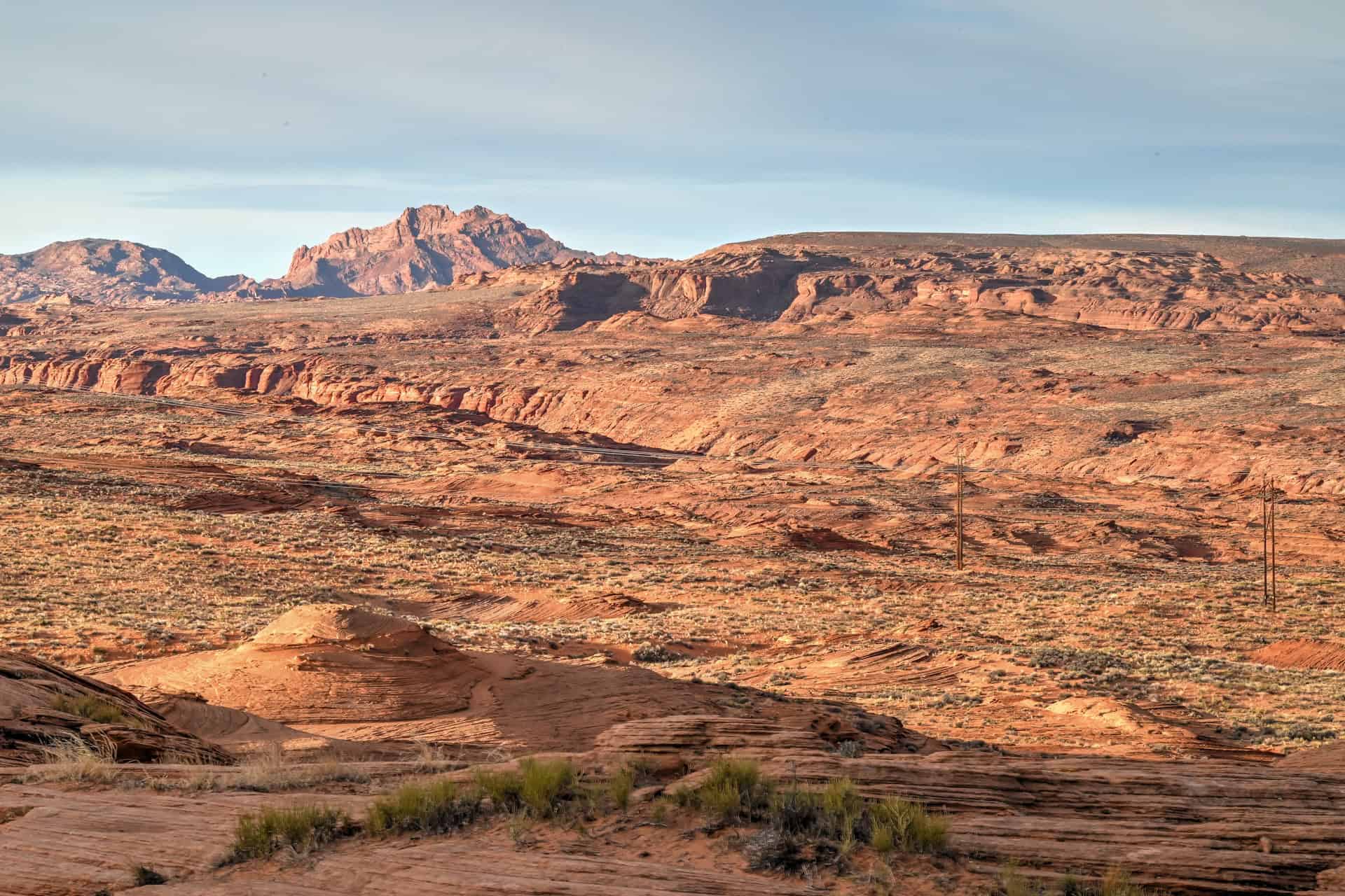
A Masterpiece of the Colorado River: Horseshoe Bend is one of the most recognizable natural landmarks in the American Southwest: a breathtaking meander where the Colorado River curves in a near-perfect horseshoe 1,000 feet (300 m) below the sandstone rim. Over millions of years, the river carved its way through layers of Navajo sandstone, creating this sweeping bend that perfectly captures the timeless power of erosion and water.
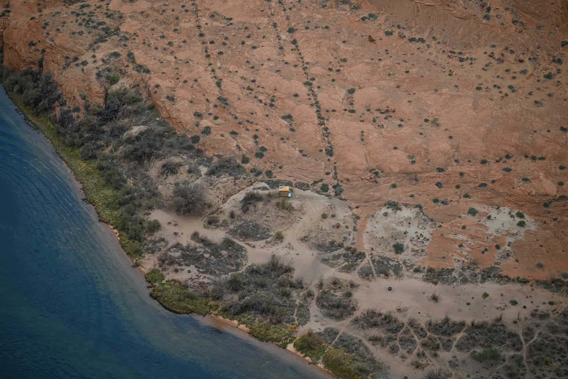
Part of Glen Canyon’s Story: Horseshoe Bend lies just downstream from Glen Canyon Dam and Lake Powell, forming the first major curve of the free-flowing Colorado River before it continues toward the Grand Canyon. Together, these landscapes tell the story of the river’s dual nature, both tamed and wild, shaped by geology, time, and human intervention.
A Must-See Stop on Any Page Itinerary: Horseshoe Bend pairs perfectly with nearby attractions like Antelope Canyon, Glen Canyon Dam, and Lake Powell. Its accessibility and cinematic beauty make it one of the most photographed spots in Arizona: a place that captures, in one sweeping view, the essence of the Colorado Plateau’s wild beauty.
How to Get to Horseshoe Bend in Page, Arizona
Horseshoe Bend is best reached by car, as there is no public transportation directly to the canyon.
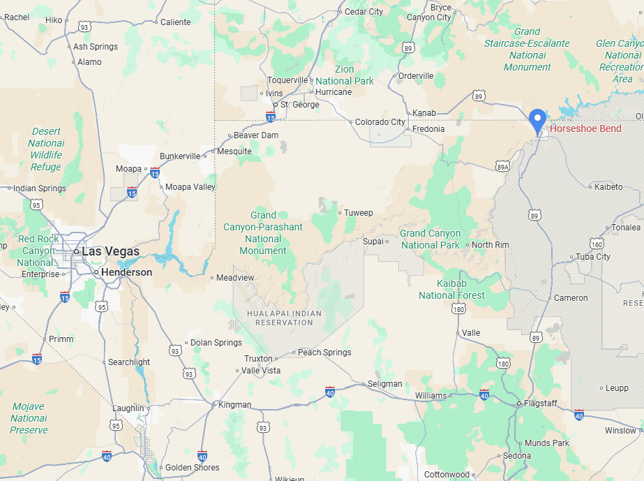
Driving times to Page, AZ
- Las Vegas, NV: 450 km / 280 mi – about 4.5–5 hours
- Phoenix, AZ: 450 km / 280 mi – about 4.5–5 hours
- Flagstaff, AZ: 200 km / 125 mi – about 2.5 hours
- Kanab, UT: 120 km / 75 mi – about 1.5 hours
- Monument Valley, UT/AZ: 195 km / 120 mi – about 2 hours
These times assume good weather and minimal stops.
If you need to book a rental vehicle for your hiking excursion, we highly recommend using Discover Cars to get the best rates on your rental in Utah, Nevada and Arizona.
We also highly recommend Airalo (eSIM card) for your connectivity needs when travelling abroad. Airalo is the world’s first and largest eSIM store with eSIM plans for 200+ countries and regions worldwide.
Nearest Gas Stations
Given the canyon’s proximity to Page, there are several gas stations within 15 minutes of the canyon entrance.
Group Tour Option
An alternative way to reach Horseshoe Bend is by joining an organized day trip group expedition from outside of town, although these involve a significant amount of time on the road.
This one departs from Vegas and includes round-trip transportation (about five hours each way) and stops at major highlights such as Horseshoe Bend, Glen Canyon Dam, and your choice of Antelope Canyon tour (Antelope Canyon X, Upper Antelope Canyon, or Lower Antelope Canyon): Antelope Canyon X is the least expensive option, and Upper Antelope Canyon is the most expensive:
There’s also a shorter but similar trip for those wanting to depart from Sedona or Flagstaff:
How to Visit Horseshoe Bend
Unlike Antelope Canyon, Horseshoe Bend does not require a guided tour; it’s a self-guided viewpoint that’s easily accessible to all visitors. The site is managed by the City of Page and sits just off Highway 89, about 10 minutes south of downtown. The short, scenic trail to the overlook makes it one of the most convenient and rewarding stops in northern Arizona.
Parking and Fees: There’s a large, well-maintained parking lot directly at the trailhead, managed by the city. Parking costs $10 per vehicle (cash or card), and oversized spaces are available for RVs, trailers, and buses.
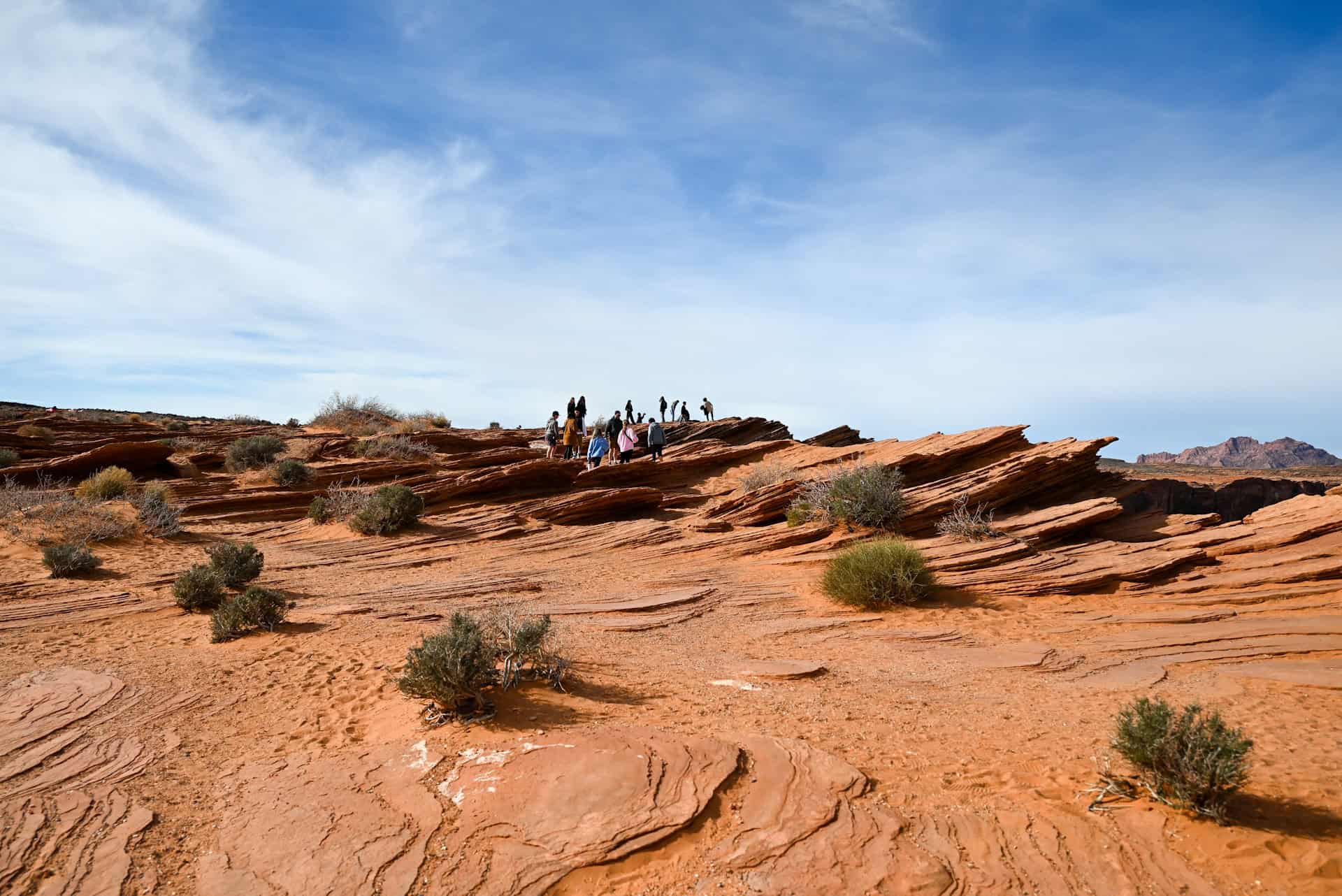
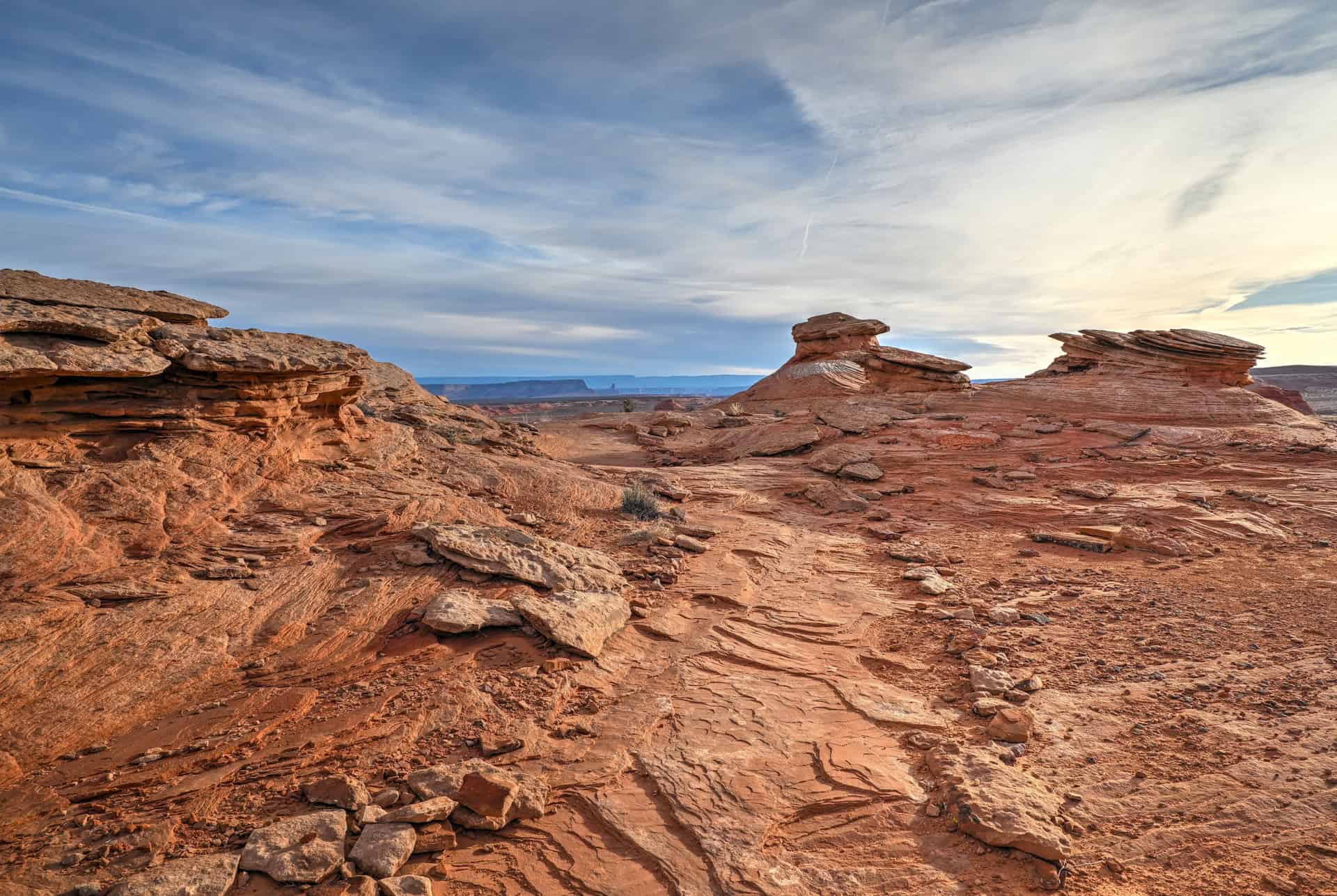
The Trail to the Viewpoint: From the lot, the hike to the overlook is 0.75 miles (1.2 km) each way, taking about 15–20 minutes at a relaxed pace, but the return trip tends to feel a bit longer, as it’s mostly uphill.. The trail is wide and well-graded, with a mix of compact sand and gravel.
From the car park, the path begins with a short, gentle climb, followed by a gradual 120-foot (37 m) descent toward the rim. While suitable for most visitors, there’s little to no shade along the way, and summer temperatures can be intense, so bring plenty of water, wear sun protection, and choose sturdy footwear. A few benches and shaded shelters are spaced along the trail for quick breaks and photo stops.


Opening Hours: Horseshoe Bend is open year-round from sunrise to sunset
Typical visit length: The amount of time you spend at Horseshoe Bend depends largely on how much photography you plan to do. Most visitors spend about 1h-1h15 at the site, including 15–20 minutes each way for the walk to and from the overlook.
Facilities: Several vault toilets are available along the parking lot.
Important Things to Know Before Visiting Horseshoe Bend
No reservations required: Unlike nearby Antelope Canyon, Horseshoe Bend does not require any advance booking or guided tour and you can visit freely at any time during daylight hours. Simply drive to the parking lot off U.S. Highway 89, pay the parking fee, and walk to the overlook.
Crowds and timing: Horseshoe Bend is one of the most visited viewpoints in the Southwest, drawing hundreds of visitors daily. Expect the largest crowds between 10 a.m. and 4 p.m. For smaller crowds and the best lighting, aim for sunrise or sunset. Early morning offers cooler conditions and soft, golden tones; sunset brings dramatic colors but also heavier crowds.
Photography tips: The best light for photography occurs mid-morning or late afternoon, when the sun sits high enough to illuminate the entire bend but not cast deep shadows.
Drone policy: Drones are strictly prohibited at Horseshoe Bend and throughout Glen Canyon National Recreation Area without a special use permit. Violations can result in significant fines.
Weather considerations: Strong winds are common near the rim, and blowing sand or dust can affect both comfort and camera gear. Thunderstorms, especially during the July–September monsoon season, can appear quickly, so always check the forecast before your visit and avoid the overlook during lightning activity.
Canine companions: Dogs are allowed on the trail if leashed, but not recommended at the overlook, as there are no barriers in some sections, and extreme heat can burn paws. Always bring water for your pet and avoid midday visits in summer if possible.
Horseshoe Bend – The Scenery & Viewpoint
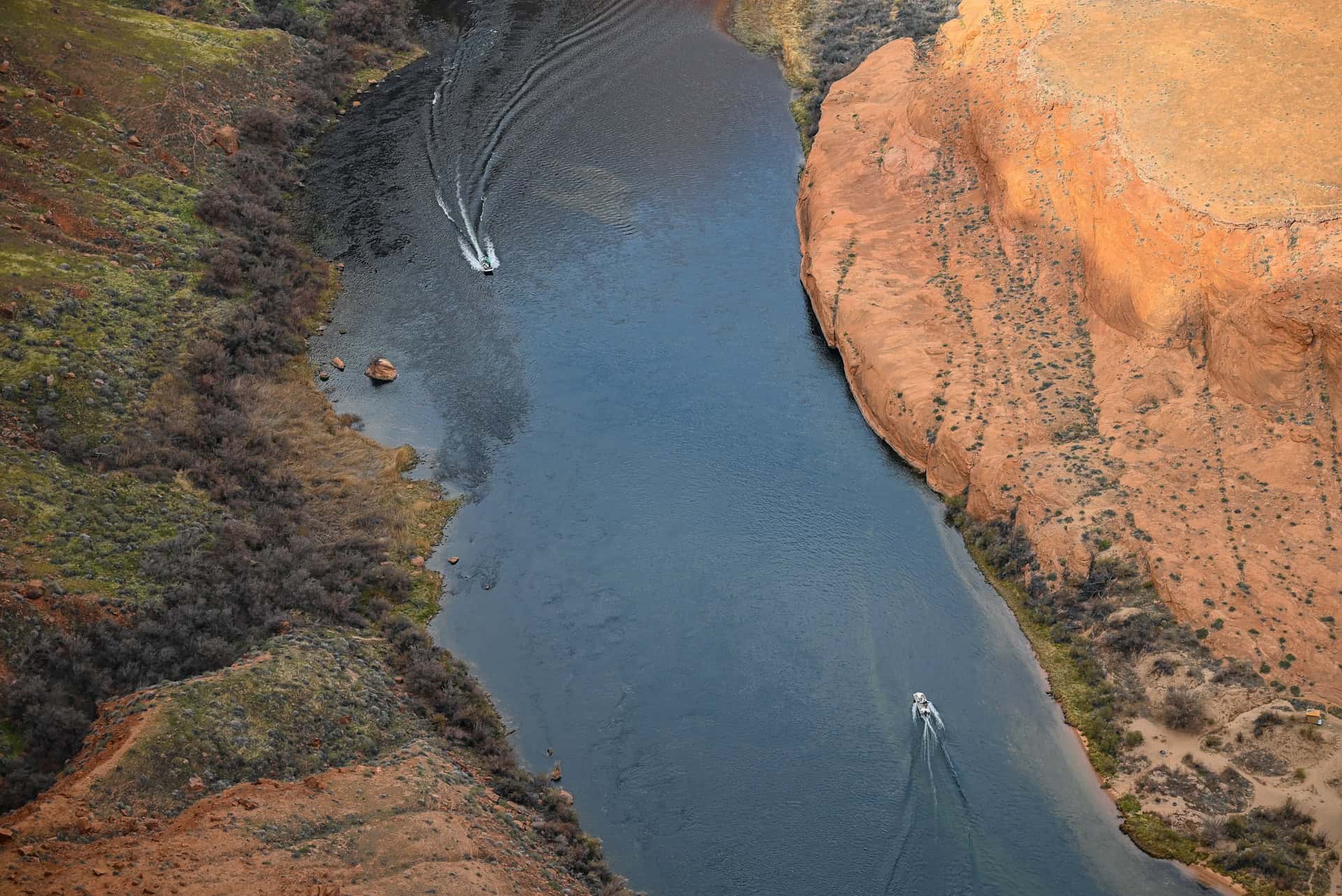
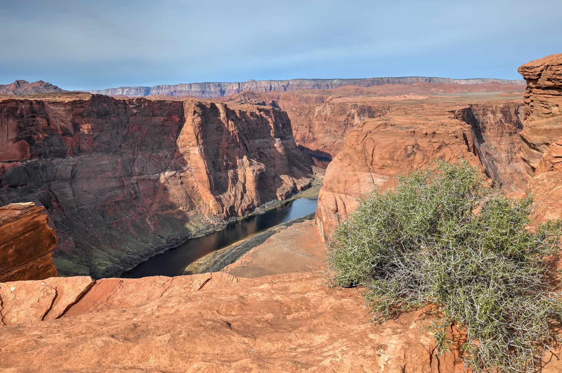
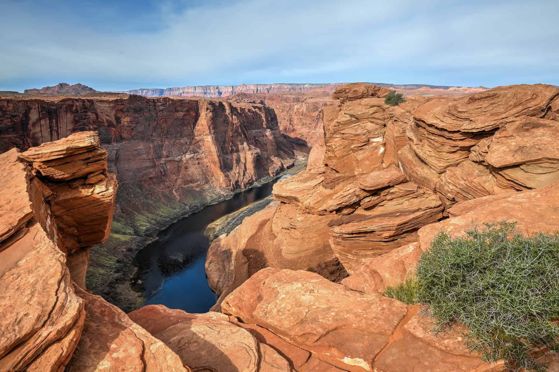
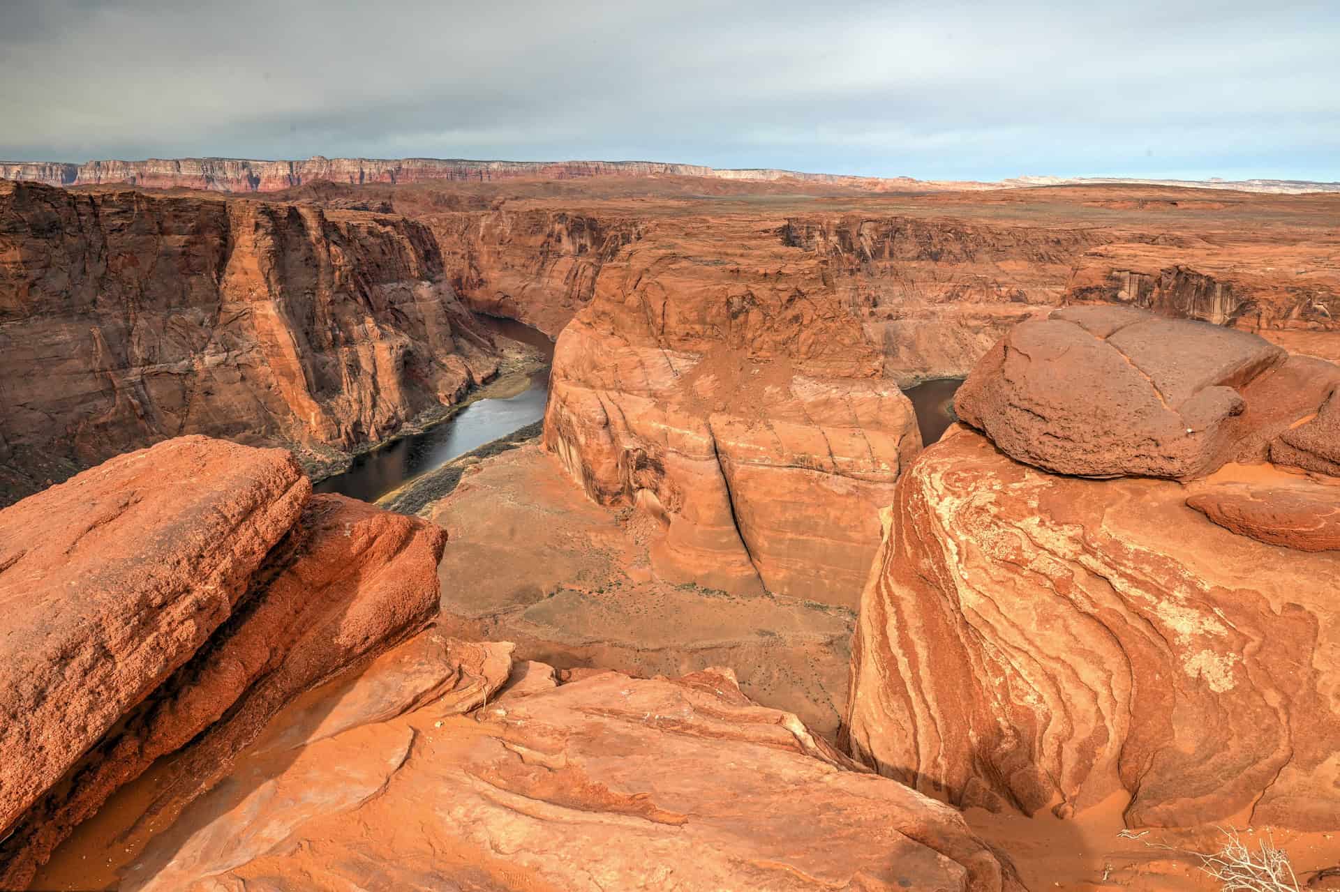
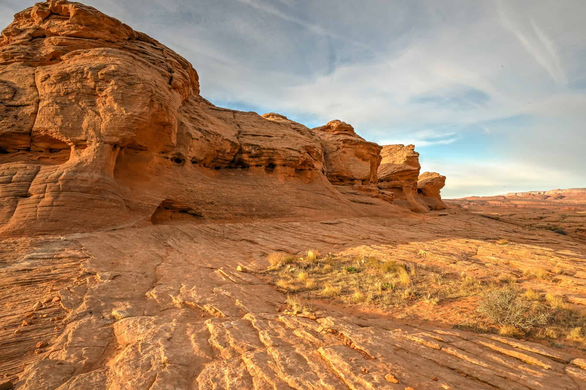
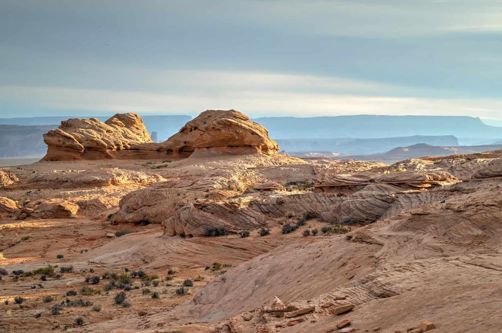
Horseshoe Bend is one of the most recognizable river meanders in the world, where the Colorado River loops in a near-perfect horseshoe around a towering sandstone mesa. From the rim, the river stretches 1,000 feet (300 meters) below, revealing the striking contrast of turquoise water against the deep reds, oranges, and browns of the surrounding Navajo sandstone cliffs. This dramatic landscape is a testament to millions of years of erosion, with the river cutting through ancient rock layers to create this breathtaking natural amphitheater.


Viewing Options:
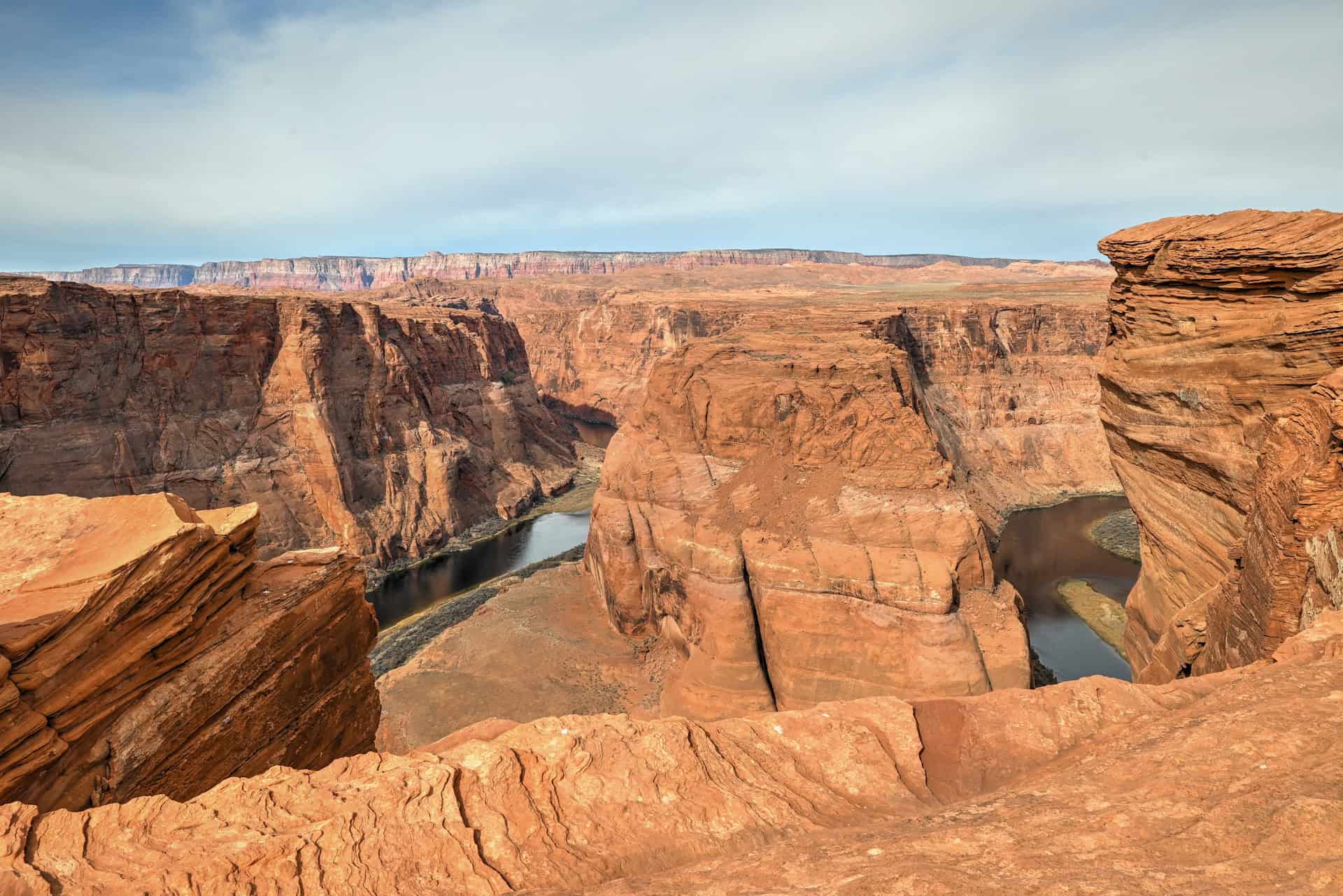
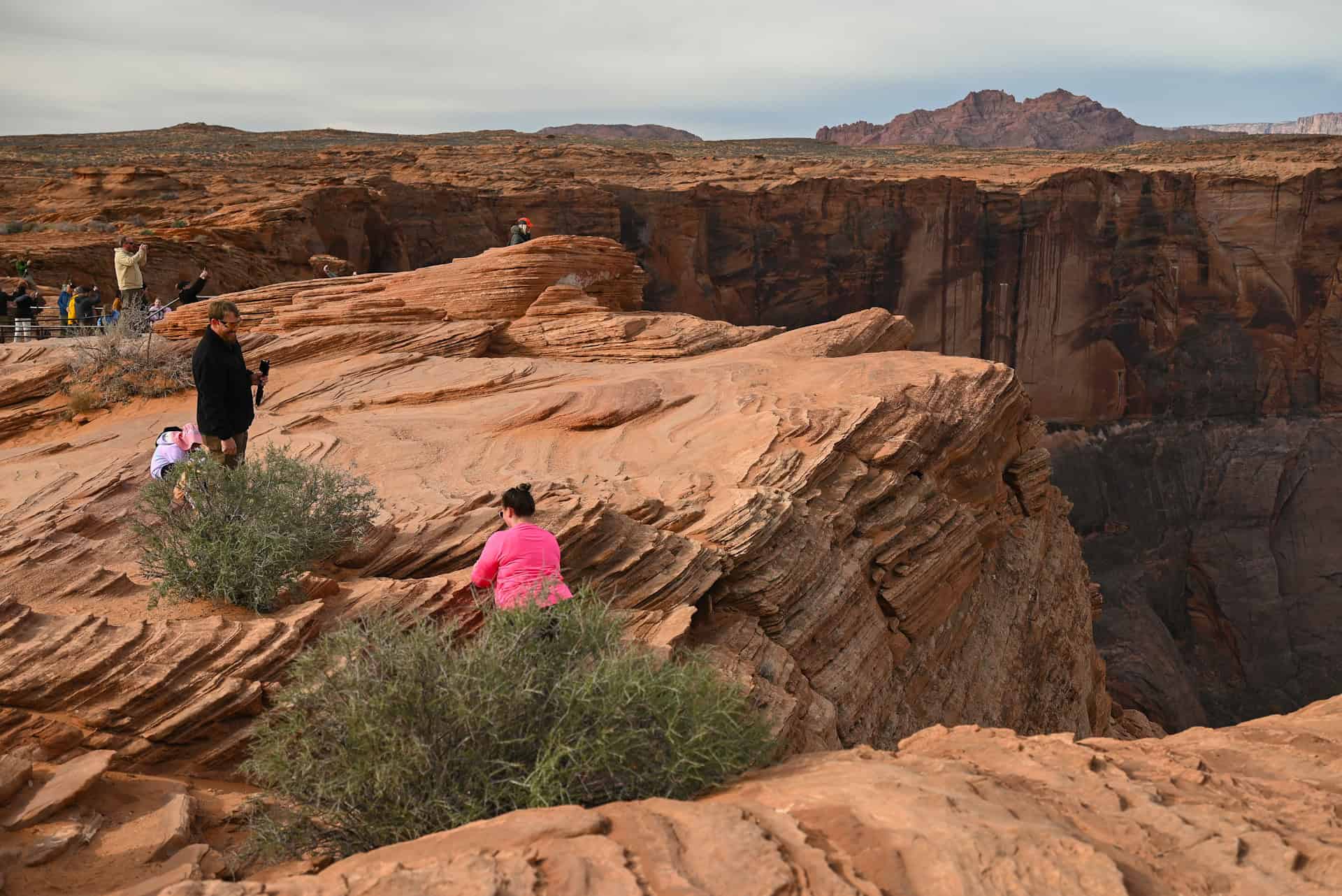
The main overlook (viewing deck) at the end of the trail provides a panoramic vantage point, allowing visitors to see the full horseshoe curve from a single location. The primary viewing platform is a broad, flat sandstone ledge with sturdy metal railings installed along the central section for safety, providing an unobstructed, picture-perfect perspective of the entire bend.

While most visitors stay near the main deck, you’re free to explore sections of the rim on either side. However, extreme caution is essential, as these areas are completely unfenced, uneven, and come right up to sheer vertical drop-offs. The sandstone can be loose and slippery in places, particularly after rain or windstorms.


For photographers, moving slightly away from the central platform can offer subtle variations in composition: elevated perspectives on the near and far sides of the river curve, and opportunities to frame the cliffs and water from unique angles.


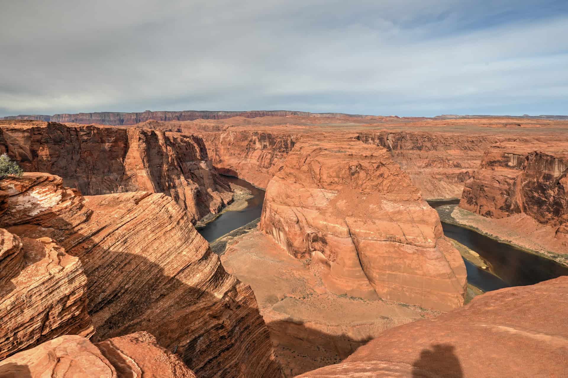
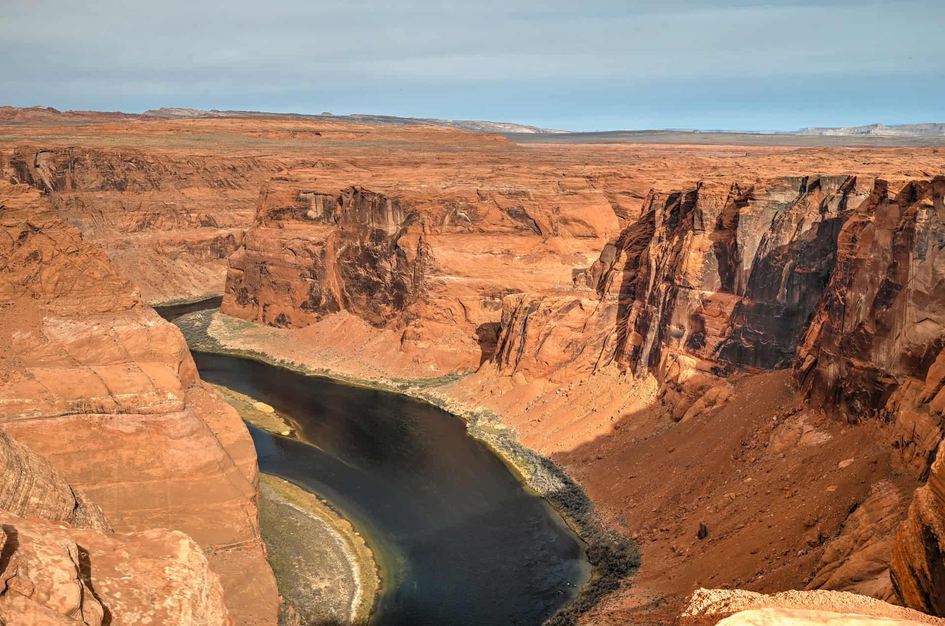
These side spots are often far less crowded, making them excellent places to quietly admire the scenery or take long-exposure shots at sunrise or sunset.
That said, it’s important to prioritize safety over scenery. Every year, visitors put themselves at serious risk by climbing down unstable rock ledges or edging out over cracks in the rim to get the “perfect shot”, like the people in the picture below. The sandstone is fragile, and one misstep can be fatal. Always stay on stable ground, avoid approaching the very edge, and respect all posted safety signs.
Best Time to Visit Antelope Canyon X
Horseshoe Bend can be visited year-round, but conditions and photographic opportunities vary with the seasons and the position of the sun. The dramatic river bend, towering sandstone cliffs, and shifting light make timing an important consideration for both comfort and capturing the best images.
Spring (March–May):
Spring is one of the most pleasant times to visit. Temperatures generally range from 65–85°F (18–30°C), and the desert air is crisp and clear, enhancing visibility across the Colorado River and surrounding mesas. Morning or late afternoon light casts warm, soft shadows on the cliffs, creating excellent conditions for photography. Spring is also ideal for avoiding the intense summer heat, though popular times like Easter weekend can bring larger crowds.
Summer (June–August):
Summer brings high desert heat, with daytime highs often exceeding 100°F (38°C). The sun is intense, and there is almost no shade along the trail or at the viewpoint, so early morning or late afternoon visits are strongly recommended. Midday light flattens the canyon colors but can still produce striking contrasts between the turquoise river and the red sandstone. Monsoon season (July–early September) can bring sudden thunderstorms and gusty winds, so always check the forecast before your visit.
Fall (September–October):
Fall offers comfortable temperatures, generally in the 70–85°F (21–30°C) range, with clear skies and softer light that accentuates the red-orange hues of the cliffs. The sun is lower in the sky than in summer, producing longer shadows that add depth and texture to photographs. Crowds also begin to thin after Labor Day, allowing for a quieter, more leisurely experience.
Winter (November–February):
Winter provides a serene and less crowded experience. Daytime highs typically sit between 45–60°F (7–16°C), and early mornings can be chilly. The low-angle winter sun casts soft, warm light across the cliffs, ideal for photographers looking for subtle color gradients and diffused shadows. Be aware that the trail can be slick or icy in shaded areas after frost or light snow, so wear appropriate footwear.
Quick Summary – When to Visit
Best overall: Spring and fall for comfortable temperatures, excellent lighting, and smaller crowds.
Early risers: Summer mornings offer cooler temperatures and dramatic river reflections.
Winter visitors: Enjoy solitude and soft, diffused light, though it may be chilly.
Best Time of Day to Visit Antelope Canyon X
The position of the sun plays a huge role in how Horseshoe Bend appears, both for viewing and photography.
Morning / Sunrise:
- The sun rises behind the main viewpoint (east), illuminating the front of the cliffs and the river.
- Soft, warm light creates even exposure and minimal shadows, ideal for wide-angle shots and capturing the river’s curve clearly.
- The morning is also quieter, with fewer visitors compared to midday and late afternoon.
Midday:
- The sun is high and slightly behind or overhead, depending on the season.
- This flattens shadows and reduces contrast, but the colors of the cliffs and river remain vibrant.
- Heat can be intense in summer, so bring water and sun protection.
Afternoon / Late Afternoon / Sunset:
- The sun moves toward the front of the viewpoint (west), casting dramatic shadows across the cliffs and emphasizing the curvature of the bend.
- Colors become richer and more saturated, creating striking contrast for photography.
- Direct sunlight can hit your frame if photographing toward the river, so consider angles carefully.
- Crowds tend to increase during this time, especially near sunset, so arrive early to secure a good spot.
Quick Tip for Photographers:
- For balanced light with minimal harsh shadows, aim for early (summer) to mid (fall/spring) morning visits.
- For warm, dramatic colors and striking shadows, late afternoon is best, though you may need patience to avoid crowds.
Other Things to See and Do Near Antelope Canyon
Antelope Canyon
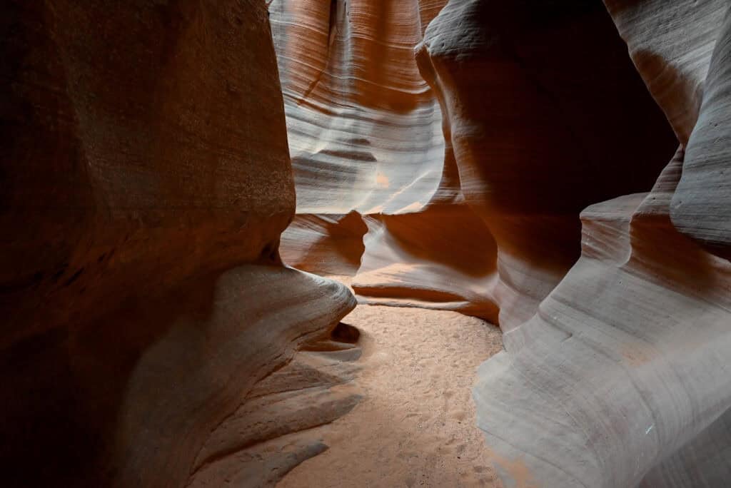
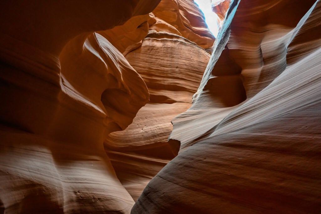
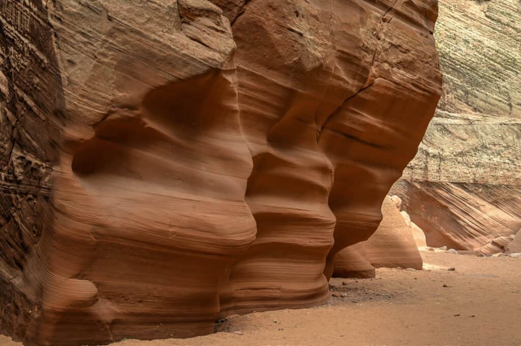
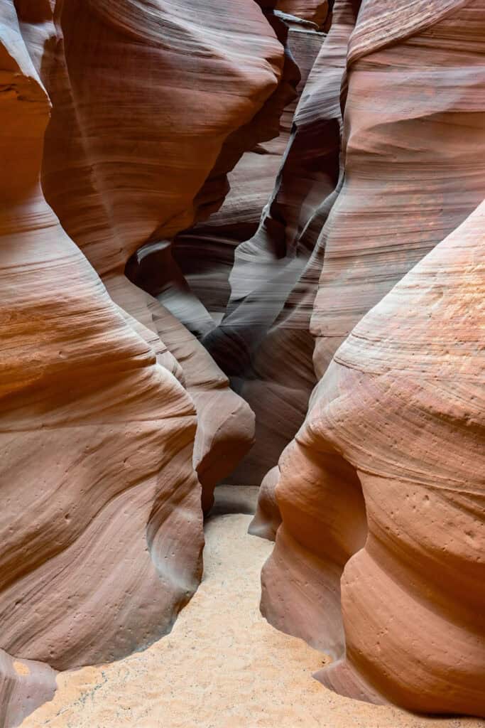
Just east of Page on Navajo Nation land, Antelope Canyon is one of the most famous slot canyons in the world. Its narrow sandstone corridors twist and curve like flowing waves, with beams of sunlight creating breathtaking shafts of light, especially in Upper Antelope Canyon around midday. Lower Antelope Canyon is narrower and requires navigating ladders, making it a slightly more adventurous option. All visits require a Navajo-authorized guide, and tours often sell out weeks in advance during peak travel seasons.
Antelope Canyon X is a newer and often less crowded alternative, offering a mix of tight slot sections and wider canyon chambers with beautiful textures and colours. It provides a similar experience at a more accessible price point, while still requiring a guided tour.


Beehive (New Wave) Trail
If you’re looking for a short and scenic hike near Page, the Beehive Trail (New Wave) is a fantastic option. Just a few minutes’ drive away, this easy loop winds through swirling Navajo sandstone formations that resemble a mini version of the famous Wave trail: offering dramatic red rock textures, photogenic ridges, and a “mini Wave” experience without the need for a permit.


For a more comprehensive list of activities and attractions, see our full guide on the Best Things to See and Do Near Page, Arizona.
Where to Stay Near the Horseshoe Bend
If you’re looking for comfortable, well-located lodging in Page without splurging on luxury, here are four of the best mid-range options in town. These hotels are all within easy reach of major attractions, including Horseshoe Bend, Antelope Canyon and Lake Powell. All include free parking, free WiFi, and breakfast, making them solid bases for exploring the region.
Best Western Plus at Lake Powell
What sets it apart: Its walkable downtown location near restaurants and shops.
A reliable and comfortable choice featuring hot breakfast, a seasonal outdoor pool and hot tub, and clean, spacious rooms. Ideal if you want to leave the car behind in the evenings.
Hyatt Place Page Lake Powell
What sets it apart: Newer and more modern than many competitors in town.
Contemporary rooms with separate sitting areas, plus amenities like a gym, bar/lounge, and outdoor pool. A great pick for families or those wanting a slightly elevated mid-range stay.
La Quinta Inn & Suites by Wyndham Page at Lake Powell
What sets it apart: Pet-friendly rooms with practical in-room amenities.
Offers hot breakfast, an outdoor pool, and guest rooms with a microwave and refrigerator, especially convenient for longer stays or travellers bringing a pet.
Wingate by Wyndham Page Lake Powell
What sets it apart: Excellent value with consistently high guest satisfaction.
Features an indoor pool and spa, fitness center, and comfortable modern rooms.
Booking Tip: Lodging near Page can fill up fast, especially during peak seasons (spring & fall) and weekends. Reserve early.
Horseshoe Bend – Frequently Asked Questions
Do I need a reservation to visit Horseshoe Bend?
No reservations are required. The overlook is accessible via a short, well-marked trail from the parking lot, and you can visit any time the site is open.
Is there an entrance fee?
Yes, there is a small parking/entry fee ($10 per vehicle (2025)) to access the trail and viewpoint. Fees are collected at the parking area.
How long does it take to walk to the viewpoint?
The trail is 0.75 miles (1.2 km) each way and generally takes 15–20 minutes at a relaxed pace. Expect slightly longer on the return as it’s mostly uphill.
How long should I plan to spend at Horseshoe Bend?
Most visitors spend about 1–1h15 hours total, including the walk to and from the parking lot and time at the viewpoint for photography or enjoying the scenery.
Is the trail difficult?
The trail is mostly well-graded sand and gravel, with a gentle elevation change of about 120 feet. It’s suitable for most visitors, but there is no shade along the way, so bring water, sunscreen, and sturdy shoes.
Can I take drones or other equipment?
Drone use is not allowed at Horseshoe Bend, as it is protected land managed by the Bureau of Land Management. Photography is limited to handheld cameras, phones, or monopods.
Are there restrooms or facilities?
Yes, vault toilets are available at the parking area. There are also benches and a few shade structures along the trail for rest stops.
Explore More Arizona
Continue exploring Arizona with these detailed travel guides:
Best Things to See and Do in Sedona
Best Stops and Must-See Attractions Between Las Vegas and Sedona
Monument Valley Travel Guide
Sunset Crater Volcano National Monument
Photography Gear
If you like our photography, you might be interested in some of the gear we use to shoot our travel and hiking destinations.
Camera Body – Nikon Z 6ii Fx-series Mirrorless Body
Main Lens – NIKON 24-120mm F/4G ED VR AF-S
Zoom Lens – Sigma 745-306 150-600mm f/5-6.3
Polarizing filters – Urth Circular Polarizing (CPL)
Camera Tripod – K&F Concept 64-inch Camera Tripod
Mini-tripod – Lammcou Flexible Camera Tripod
Camera/hiking backpack – Vanguard Alta Rise 48 Backpack
Universal Travel Adapter – VYLEE Universal International Power Travel Plug
Other Travel Essentials
Travel Insurance
SafetyWing is a travel insurance company that offers comprehensive coverage for travellers. Includes Medical Insurance and Travel Insurance. Primarily geared towards long-term travellers, digital nomads, and expats.
e-Sim cards
Airalo is the world’s first and largest eSIM store with eSIM plans for 200+ countries and regions worldwide. With Airalo eSIMs, travellers can get connected the moment they land at their destination and avoid nasty data roaming charges
eSIMS are a sustainable alternative to single-use SIM cards – they are 100% digital, require less energy to produce and be re-used rather than disposed of.
Car Rentals
Discover Cars is our go-to website for car rentals. We almost always find our preferred rate there.
Transfer from Airport
Welcome Pickups is our favourite private transfer service, which you can pre-book at a fixed price. Currently available in 220 cities all over the world (mostly in Europe, but with several major cities in Asia, the Middle East and the US).
Kiwitaxi is another private transfer service – we haven’t tried it yet, but it’s currently available in a few more countries (102 as of 2024).
Hotels and Accommodations (coming soon)
Photography Prints
If you found this blog useful, you can help support our blog by purchasing low-cost digital prints. Printed physical prints are also available for purchase.


—–
Well, that wraps it up! We hope you enjoyed our Guide for visiting Antelope Canyon X and that it will prove useful for planning your trip.
—–
You might also be interested in these related pages: